Grays Harbor Resilience Coalition - Access … Harbor Resilience Coalition 1 Project overview 1
22
Photo taken by Nicholas Carr Grays Harbor Resilience Coalition Project Report June 2017 Publication number 17-06-018
Transcript of Grays Harbor Resilience Coalition - Access … Harbor Resilience Coalition 1 Project overview 1
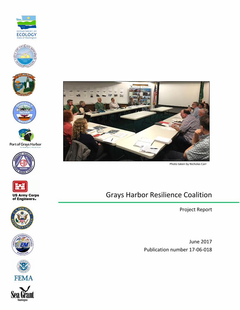
Photo taken by Nicholas Carr
Grays Harbor Resilience Coalition
Project Report
June 2017 Publication number 17-06-018

This page intentionally left blank

This report is available on the Department of Ecology’s website at http://www.ecy.wa.gov/programs/sea/czm/Grants.html http://www.ecy.wa.gov/programs/sea/czm/309-improv.html http://fortress.wa.gov/ecy/publications/summarypages/1706018.html For more information contact: Bobbak Talebi Coastal Planner Shorelands & Environmental Assistance Program P.O. Box 47600 Olympia, WA 98504-7600 [email protected] 360-407-6529
Washington State Department of Ecology - www.ecy.wa.gov o Headquarters, Olympia 360-407-6000 o Northwest Regional Office, Bellevue 425-649-7000 o Southwest Regional Office, Olympia 360-407-6300 o Central Regional Office, Yakima 509-575-2490 o Eastern Regional Office, Spokane 509-329-3400 To request ADA accommodation for disabilities, or printed materials in a format for the visually impaired, call Shorelands and Environmental Assistance Program at Ecology, 360-407-6600. Persons with impaired hearing may call Washington Relay Service at 711. Persons with speech disability may call TTY at 877-833-6341

Table of Contents
Grays Harbor Resilience Coalition ............................................................................................................. 1
Project overview ...................................................................................................................................... 1
Identifying community vulnerabilities ....................................................................................................... 3
What’s at risk? ......................................................................................................................................... 5
Ocean Shores ....................................................................................................................................... 5
Westport ............................................................................................................................................. 5
What if nothing is done? ....................................................................................................................... 6
Grays Harbor Resilience Coalition projects ................................................................................................ 6
Ocean Shores project options ............................................................................................................... 6
Westport project options ..................................................................................................................... 7
Grays Harbor Resilience Coalition recommendations ................................................................................. 7
Challenges ............................................................................................................................................... 8
Next steps ................................................................................................................................................ 9
Planned actions .................................................................................................................................. 10
Appendix A: Ocean Shores North Jetty rehabilitation project details ........................................................ 12
Project description ............................................................................................................................. 12
Public benefits of the project .............................................................................................................. 12
Economic benefit ............................................................................................................................... 13
Short- and long-term job creation ....................................................................................................... 13
Investments to date ........................................................................................................................... 13
Proposed funding strategy .................................................................................................................. 14
Appendix B: Westport Sand Placement Pilot Project Details .................................................................... 15
Project description ............................................................................................................................. 15
Project authority ................................................................................................................................ 16
Public benefits of the project .............................................................................................................. 16
Economic benefit ............................................................................................................................... 17
Short- and long-term job creation ....................................................................................................... 17
Investment to date ............................................................................................................................. 18
Proposed funding strategy .................................................................................................................. 18

1
Grays Harbor Resilience CoalitionCity of Ocean Shores City of Westport Federal Emergency Management Agency Grays Harbor County Emergency Management Port of Grays Harbor Quinault Indian Nation
Washington Military Department - Emergency Management Division Washington Sea Grant Washington State Department of Ecology U.S. Army Corps of Engineers U.S. Representative Derek Kilmer
Project overview Natural hazard threats are a growing reality for people living along Washington’s Pacific Coast. Beach erosion, flooding, and landslides are already causing significant impacts, and future climate conditions will intensify these hazards. Coastal communities also face the looming threat of a catastrophic earthquake and tsunami. Grays Harbor County is no exception. Coastal erosion and flooding risks have historically caused severe problems for the county and these factors continue to be significant concerns. Shoreline stability depends, in part, on the condition of the north and south jetties installed by the U.S. Army Corps of Engineers (USACE).1 These jetties tend to create artificially stable shoreline conditions, and communities often develop nearby with the expectation these structures will provide continual protection from erosion. However, coastal processes change as jetties degrade over time, which can lead to unintended and significant impacts to adjacent shorelines.
1 Coastal & Harbor Engineering: A Division of Mott MacDonald. 2016. Technical Report: North Jetty Repairs to Satisfy Stability of Ocean Shores Shoreline, Port of Grays Harbor, Washington.
Grays Harbor natural hazard facts
Landslides There are 332 buildings worth $43.6 million occupying landslide hazard zones. Coastal erosion Erosion threatens more than $275 million worth of residential structures and community assets. Flooding The likelihood is increasing that a 1 percent “Annual Chance Flood Event” will occur resulting in $160.8 million building dollar structural loss and $1.75 billion in total costs to the county. Earthquake and tsunami When a major Cascadia subduction zone earthquake occur, 15,000 buildings worth $1.9 billion will be affected. In addition, Washington needs $40 million to provide vertical evacuation and safe refuge for 18,450 people likely to be affected by a major quake.

2
Unfortunately, it is not a national priority for the USACE to rehabilitate jetties as a way to reduce damage from coastal storms to adjacent development. The USACE authorized the jetties in Grays Harbor County strictly to protect channel navigation for vessels. Therefore, rehabilitation of the jetties will only become a priority if navigation is affected. For Grays Harbor communities, this creates a difficult situation because the only option for restoring the jetty to prevent erosion requires an unfavorably large investment from a public cost-sharing partner. The costs, combined with the complexity and magnitude of coastal erosion problems, have overwhelmed existing resources. As a result, management decisions have largely gone unchanged while the problem has continued to get worse. However, the growing body of science and the adverse effects of several severe winters have raised community awareness that a more proactive, sustainable approach is needed. In January 2016, an alliance of local, tribal, state and federal partners formed the Grays Harbor Resilience Coalition (GHRC) to address both immediate and future natural hazards through collaborative research, planning, and investment in capital projects. The effort was spearheaded by Ocean Shores Mayor Crystal Dingler, with support from the state Department of Ecology (Ecology) and U.S. Rep. Derek Kilmer. With the additional support of state Rep. Steve Tharinger, the Washington Legislature included $200,000 in the state’s 2016-17 supplemental capital budget to support the GHRC effort. Ecology received an additional $25,000 from FEMA to support GHRC projects. The GHRC used the $225,000 to:
1. Collect data, create maps, and conduct an initial technical analysis of up to five potential project sites.
Brian Lynn (Washington Coastal Management Program Manager) highlights the importance of partnerships in Grays Harbor to address the range of planning needed to prepare, respond, and recover from coastal hazard events.
“These conversations really matter because it tries to figure out how, collectively, we can bring resources at the local level and at the federal level and coordination at the local level and the federal level to try to keep communities safe and to try to reduce the amount of damage associated with these challenges.”
- U.S Rep. Derek Kilmer

3
2. Convene the GHRC to develop, evaluate and prioritize a list of resilience projects and create a capital budget request for one or more projects for the state 2017-19 biennial budget.
This report captures the efforts of the coalition including summarizing scientific findings and decision-making results. This information can be used to determine and pursue necessary funding needed to address coastal hazards.
Identifying community vulnerabilities An important part of identifying vulnerabilities and evaluating risks is understanding the dynamics of shorelines and threats from natural hazards. Reliable information forms the basis for planning strategies that avoid and minimize the negative effects on coastal communities and important natural resources. However, communities often lack the funding and expertise to obtain information at a scale that is helpful and appropriate for decision making. State and federal funding and staffing are needed to:
• Conduct scientific research and analysis to help communities understand and evaluate risk
• Provide tailored assistance to design solutions that protect communities and natural resources
Ecology is responsible for gathering and providing information about how the state’s coastal shorelines are changing. The primary source of shoreline change information for Washington State is Ecology’s Coastal Monitoring & Analysis Program (CMAP). CMAP staff travel hundreds of miles along Washington’s coastline to map our beaches using GPS by foot as well as topographic LiDAR and multi-beam bathymetric sonar by a research vessel. In Grays Harbor County, this beach monitoring includes collecting 21 beach and dune profiles four times a year, two beach surface maps during winter (at Westport and Ocean Shores), seven surface maps during summer, and 93 nearshore bathymetry and beach topographic profiles during summer.
“Ecology’s George Kaminsky and the Coastal Monitoring & Analysis Program have provided us with invaluable information concerning our ongoing erosion problems. His continued engagement in our community process to address emergencies and support long-term strategies are critical to helping our community make resilient investments for our future. Without such data and assistance, we are operating blind.”
- Ocean Shores Mayor Dingler
4
Supplemental Budget support for CMAP allowed the group to conduct augmented data collection in focus hazard areas and participate in a local process to understand and apply that information in Grays Harbor. While staff started with five potential project sites, Ecology narrowed its scope to three for in-depth study: Ocean Shores, Westport, and the Quinault RV Park/Marina. As Ecology’s CMAP gathered scientific information about project sites, the GHRC decided to convene technical committees for each location. Committees were made up of staff representing local and tribal governments, local, state and federal elected officials, and technical experts from state and federal agencies. Over several months they met independently, analyzing and applying hazard information to determine potential short- and long-term solutions. This work included:
• Evaluating the technical feasibility and cost-effectiveness of various potential actions
• Sharing lessons learned and best practices
• Developing resilience project recommendations for the GHRC
While projects were developed for Ocean Shores and Westport, there were too many uncertainties surrounding the Quinault RV Park/Marina to determine next steps, other than continuing to support the GHRC forum to coordinate and collaborate.
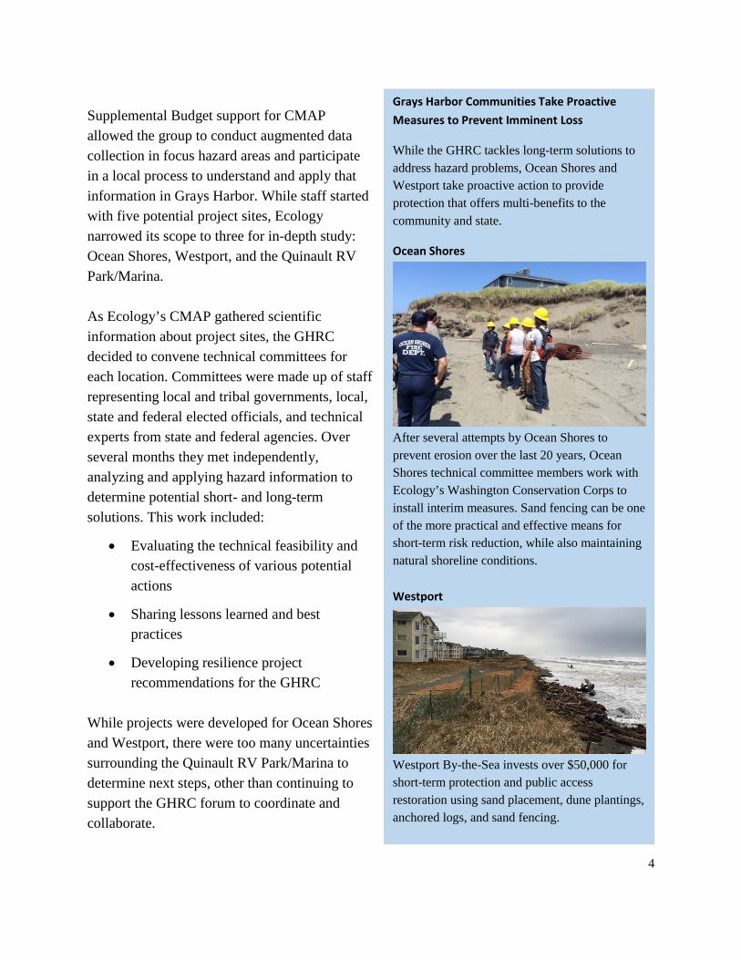
Grays Harbor Communities Take Proactive Measures to Prevent Imminent Loss
While the GHRC tackles long-term solutions to address hazard problems, Ocean Shores and Westport take proactive action to provide protection that offers multi-benefits to the community and state.
Ocean Shores
After several attempts by Ocean Shores to prevent erosion over the last 20 years, Ocean Shores technical committee members work with Ecology’s Washington Conservation Corps to install interim measures. Sand fencing can be one of the more practical and effective means for short-term risk reduction, while also maintaining natural shoreline conditions. Westport
Westport By-the-Sea invests over $50,000 for short-term protection and public access restoration using sand placement, dune plantings, anchored logs, and sand fencing.

5
What’s at risk? Ocean Shores At Ocean Shores, an erosion scarp runs for two miles, starting at the south end of the city’s North Jetty and toward the city center. The scarp is now a third of the overall length of Ocean Shores itself and has increased every year since 2009. This means that 20 percent of Ocean Shores’ property value is in jeopardy – $200 million of the city’s $1 billion valuation. Municipal infrastructure including sewer, water, roads and the city’s $24.8 million wastewater plant are all vulnerable to inundation. The cleanup from a massive flood that would break sewer lines and flood the plant’s sewage lagoons are beyond our ability to calculate. The GHRC has determined, however, that preventative measures would be far less expensive than cleanup after a catastrophic flood.
Westport At Westport, there is a dune erosion scarp that extends more than 1,500 feet south along the shoreline from the South Jetty. Every year, more than 63,000 cubic yards of sediment erodes from Westport beaches and dunes. Erosion currently threatens condominiums and houses. Continued erosion also threatens municipal utilities, including a sanitary sewer pump station affecting $50 million of assessed value within the city– about 25 percent of Westport’s assessed value and 20 percent of the city’s water and sewer utilities’ revenue.
Risks Associated with Reactive Emergency Response
Ocean Shores responded to the 1997-1998 El Niño by having two 300’ stacked geo-tubes installed along the vulnerable area of the shoreline most likely to breach. Nearby property owners also responded to erosion with massive rock revetments called wave-bumpers. Both interventions remained protective for more than 20 years. These wave-bumpers and geo-tubes withstood the 2009-2010 El Niño and survived until 2015 – when the next El Niño undermined the beach severely and caused the geo-tubes to break and the wave-bumpers to begin failing. Ocean Shores added geo-bags where the break had occurred, but local residents did not choose to reinforce their wave-bumpers. Ultimately, in January of 2016, the U.S. Army Corps of Engineers (USACE) placed rock in front of the geo-bags and geo-tubes as a last attempt to save the damaged dunes, after having tried placing sand on the beach twice for more natural protection. While this has provided a solution to the immediate threat, the rock also created new issues: permitting and financial challenges; exacerbated erosion to parcels further north; and environmental impacts. These efforts have cost the City approximately $370,000.
USACE Emergency Rock Revetment, Jan. 2016

6
What if nothing is done? Washington’s coastal areas are among the most diverse and unique in the country. Our coast plays a vital economic and social role for local communities and the state. Grays Harbor’s natural beauty makes it an attractive destination for tourism as well as a desired place to live. Many feel attached to the coast because it provides an important sense of place. Without state support to help communities protect these values, there will likely be adverse consequence and lasting impacts on the coast, including:
• Extending erosion to properties further along the shoreline and blocking onshore sources of sediment necessary for resupplying and maintaining a useable beach.
• Obstructing public access to and along the shoreline, which is to result in tourism losses, critical to our coastal economies.
• Harming plant and animal species listed under the Endangered Species Act (ESA) as well as reducing natural on-shore vegetation and increasing nearshore wave energy.
GHRC partners agree that harder shoreline armoring is not the desired result, however, it is difficult to prevent private projects without other feasible options for landowners and the cities to protect their investments.
Grays Harbor Resilience Coalition projects Technical committees used a basic set of criteria to identify the project costs and benefits, areas where local efforts could be directed, and where state support is needed to leverage local and federal resources.
Ocean Shores project options Project description Benefit Cost Impacts Years of
Protection Priority
Sand fence installation offers some ability to capture sand along the dune toe during spring through fall; may help increase resilience during subsequent winters.
High Low Low Low High
Rehabilitation of Grays Harbor North Jetty High High Low High High Remove geotube armor rock and install cobble dynamic revetment, or install dynamic revetment to transition from the armor rock to the eroding dune scarp to the north.
Medium High Medium Medium Low
Emergency dune nourishment High Medium Low Low Low

7
Westport project options Project description Benefit Cost Impacts Years of
Protection Priority
Sand fence installation offers some ability to capture sand along the dune toe during spring through fall and may help to increase resilience during the subsequent winters.
High Low Low Low High
Emergency sand dune nourishment High Medium Low Low High Beneficial sand placement (about 250,000 cubic yards)
High High Low High High
Installation of cobble dynamic revetment Medium High Medium Medium Low The GHRC received project recommendations from technical committees in November 2016. After careful analysis and collective deliberation, the GHRC agreed to:
• Prioritize the rehabilitation of the Ocean Shores North Jetty
• Pursue a beneficial sand placement project in Westport
Though these proposed projects have the highest expected costs among the variety of project options evaluated, they would also address the root causes of the respective problems – providing long-term protection with minimal negative impacts. Local officials are confident in their ability to obtain funds, but they cannot undertake the projects alone. State support is necessary to fund and implement these sustainable solutions. Project details are listed in Appendix A and Appendix B.
Grays Harbor Resilience Coalition recommendations In addition to resilience projects, the process also generated many broader recommendations that are important to future progress. The following recommendations outline key gaps and opportunities for additional action to enhance resilience in our coastal communities:
• Dedicated scientific and planning assistance – Scientific research and planning assistance is critical for helping communities understand their risk, select appropriate resilience actions, and gather the resources needed to implement actions. The success of this project was made possible by the added capacity and ongoing participation from experts in state and federal agencies. However, there are many unmet needs. Committed operational investment is critical to building coastal resilience and supporting community action.
• Regional sediment management planning – Keeping and placing sand on the beach or as close to the beach as possible protects vulnerable coastal areas from the effects of coastal storms, helps maintain beaches and dunes, and benefits important habitat. With

8
the growing number of erosion issues along our coast, a long-term strategy for Washington’s coasts could guide sediment management practices, serve as the basis for permitting a network of beneficial use sites, and secure and allocate federal and state appropriations effectively to finance ongoing research and monitoring.
• Work plan and project scoping for coast-wide tsunami refuge – The GHRC projects focused on erosion and flood risk because they are existing threats and immediate concerns, but the group and other communities along the coast recognize the catastrophic implications of a Cascadia subduction zone earthquake and tsunami. Project Safe Heaven provided key information and planning for necessary vertical evacuation, but follow-up investment is needed to develop a work plan and scope capital projects to provide vertical evacuation and safe refuge.
• Policy support for resilience activities – State and federal policies that have been barriers to resilience projects have been identified during the GHRC process such finding the least cost, most environmentally acceptable method for disposing dredged material consistent with the U.S. Army Corps of Engineer’s sound engineering practices. Coalition consensus could be influential in pursuing opportunities to shift problematic policies that restrict resilience activities.
• Explore a coast-wide resilience coalition – Other communities along Washington’s coast are facing threats similar to those in Grays Harbor. Groups such as the Willapa Erosion Control Alliance Now and the Dungeness Marine Nearshore Outreach Group have developed independently of the GHRC to address hazards and increase coastal resilience in their communities. Given the coast-wide scope of these issues and the shared interest in increasing the resilience of coastal communities, Ecology is funding the William D. Ruckelshaus Center at the University of Washington to conduct an organization assessment. The assessment is designed to explore opportunities to create a more inclusive and durable approach that meets the coast-wide need. Based on Ruckelshaus recommendations, there might be opportunities to expand GHRC efforts and generate more state and federal investment to support coast-wide needs.
Challenges The strong GHRC alliance created the potential for catalyzing meaningful action. Formed to help strengthen requests for assistance in Grays Harbor County by establishing a unified voice among several partners, the collation set the groundwork so separate jurisdictions could work together to establish county-wide priorities and support one another in legislative requests. While in theory, these jointly-supported requests would be more likely to succeed, it is an ongoing challenge that

9
this type of collaborative work is faced with the reality of limited state funding and the tension between the immediate needs of each community or organization. After the GHRC developed their list of resilience projects, funding constraints became more pronounced when Westport and Ocean Shores each submitted separate funding requests to state representatives. This occurred because GHRC members perceive there is only a limited portion of the state capital budget is dedicated to coastal communities. Thus one community's gain almost certainly equates to another's loss. Another challenge was overall time constraints. The GHRC had six months to collect and analyze data, generate creative resilience solutions with multi-benefits, and work through a process to agree on priority projects – all while simultaneously planning and implementing short-term measures to prepare for the following winter’s storms. These efforts require dedicated time and investment, but this initiative only added to the already limited financial and manpower capacity of GHRC members. These constraints left little time for strategic communication, community and stakeholder outreach, and generation of advocacy from those outside the region who benefit from the proposed projects. Despite these challenges, the GHRC remains supportive of a collective approach to solving hazards problems. Members recognize that there is more work to be done and difficult questions to address, but they are committed to meet and strive for common coastal resilience goals with the limited staff and resources available. There are also more opportunities to expand efforts and increase collective capacity through a more coast-wide approach.
Next steps At the beginning stages of the GHRC, staff from U.S. Rep. Kilmer’s office and Ecology contacted the William D. Ruckelshaus Center seeking independent facilitation services to meet the group’s objectives. Through a series of conversations, the Center suggested that while the GHRC may decide to continue pursuing a short-term budget request specific to Grays Harbor County, there also appears to interest in and an opportunity for multiple coastal communities to work together on a more durable coast-wide approach to hazards resilience. With support from the GHRC, the Ruckelshaus Center has conducted a coast-wide resilience assessment. This project was funded through a partnership: $25,000 from the $200,000 provided
“All the projects are important to the community, but the lack of local consensus for a cogent list of prioritized projects will weaken each of the projects’ likelihood for funding.”
- Randy Lewis: Port of Grays Harbor

10
by the legislature and an additional $28,832 from Ecology. FEMA supplemented the GHRC with $25,000 to Ecology’s CMAP to ensure technical objectives would still be met. The Ruckelshaus Center’s Washington State Coast Resilience Assessment2 conducted 104 interviews with coastal tribes, coastal residents, elected officials, federal, tribal, state, county, and city government agency staff, researchers, scientists, engineers, non-governmental organizations, and other interested parties. This assessment examines the dynamics, interests, challenges, and opportunities related to coastal resilience in Washington and provides a mechanism for the experiences and viewpoints of the participants to inform the next generation of strategies for enhancing coast-wide resilience. Participants’ definitions of “resilience” show that life safety, survival, and long-term economic stability are important to coastal communities, in addition to protection of infrastructure and property. The assessment offers a strategic approach. It collects the various efforts and creative solutions already occurring along the coast and recommends concrete “Key Leveraging Actions” intended to meet multiple objectives and create high impact for communities. Resilience recommendations emphasize that efforts should build upon what is already established, and this functional approach aligns with the goals and partnerships of the GHRC. There is strong interest among GHRC members in considering and potentially pursuing the recommendations made by the assessment in a collective manner, to find durable solutions to hazard problems that continue to threaten these communities. Planned actions
• The GHRC will convene a legislative briefing with state representatives to discuss lessons learned and get further guidance on opportunities to pursue.
2 The William D. Ruckelshaus Center. 2017. Washington State Coast Resilience Assessment Final Report: http://ruckelshauscenter.wsu.edu/projects/current-projects/
“As we’ve experienced in our resilience work, addressing the impacts associated with natural hazards is complex and wide-ranging, requiring action on multiple scales. This assessment helps coastal Washington operationalize its broad concepts of resilience, recommending on-the-ground steps that can be taken to enhance resilience right now. Using the report as a guide, we will continue to pursue resilience strategies with coastal communities and explore state investment to support identified opportunities.”
- Bobbak Talebi: Ecology

11
• Ecology will continue to explore prioritizing coastal hazards resilience at the state scale.
• Ecology will continue to work with the U.S. Army Corp of Engineers to connect coast-wide needs for beneficial use of dredge material projects and economies of scale to lower community contribution costs.
12
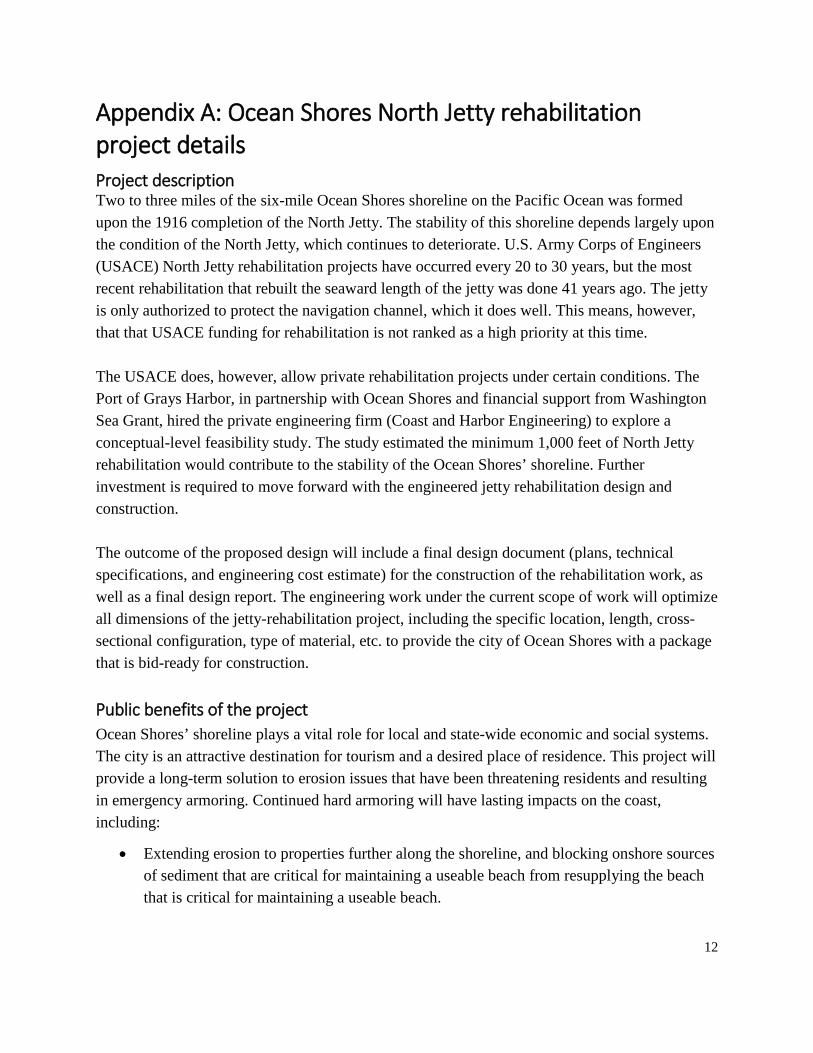
Appendix A: Ocean Shores North Jetty rehabilitation project details Project description Two to three miles of the six-mile Ocean Shores shoreline on the Pacific Ocean was formed upon the 1916 completion of the North Jetty. The stability of this shoreline depends largely upon the condition of the North Jetty, which continues to deteriorate. U.S. Army Corps of Engineers (USACE) North Jetty rehabilitation projects have occurred every 20 to 30 years, but the most recent rehabilitation that rebuilt the seaward length of the jetty was done 41 years ago. The jetty is only authorized to protect the navigation channel, which it does well. This means, however, that that USACE funding for rehabilitation is not ranked as a high priority at this time. The USACE does, however, allow private rehabilitation projects under certain conditions. The Port of Grays Harbor, in partnership with Ocean Shores and financial support from Washington Sea Grant, hired the private engineering firm (Coast and Harbor Engineering) to explore a conceptual-level feasibility study. The study estimated the minimum 1,000 feet of North Jetty rehabilitation would contribute to the stability of the Ocean Shores’ shoreline. Further investment is required to move forward with the engineered jetty rehabilitation design and construction. The outcome of the proposed design will include a final design document (plans, technical specifications, and engineering cost estimate) for the construction of the rehabilitation work, as well as a final design report. The engineering work under the current scope of work will optimize all dimensions of the jetty-rehabilitation project, including the specific location, length, cross-sectional configuration, type of material, etc. to provide the city of Ocean Shores with a package that is bid-ready for construction. Public benefits of the project Ocean Shores’ shoreline plays a vital role for local and state-wide economic and social systems. The city is an attractive destination for tourism and a desired place of residence. This project will provide a long-term solution to erosion issues that have been threatening residents and resulting in emergency armoring. Continued hard armoring will have lasting impacts on the coast, including:
• Extending erosion to properties further along the shoreline, and blocking onshore sources of sediment that are critical for maintaining a useable beach from resupplying the beach that is critical for maintaining a useable beach.

13
• Obstructing public access to and along the shoreline, likely decreasing the amount of tourism that communities can generate, which is critical to coastal economies.
Economic benefit Twenty percent of Ocean Shores’ property value is in jeopardy: $200 million of the city’s $1 billion valuation. The city’s infrastructure, including sewer and water, and roads, plus the city’s wastewater treatment plant which is located at the south end and vulnerable to inundation, is valued at $24.8 million. The clean-up from massive flooding in the south end necessary for sewer line breaks and the flooding of the lagoons at the wastewater treatment plant are beyond our ability to calculate. Home and property values have already fallen over 30 percent in the city. Short- and long-term job creation Short-term, jobs in Grays Harbor County will see a spike as the stone is quarried locally, and trucked, often individually, to the North Jetty for placement. Onsite jobs will also spike during the rebuilding effort as barge and crane operators work to place the rock. Local businesses will also benefit as workers purchase meals and goods. Long-term, the homes and condominiums will increase in value as the threat of erosion is delayed another 15-25 years. With higher prices comes remodeling, adding rooms and garages, and benefits to a variety of trades. Investments to date Ocean Shores’ response to the 1997-1998 El Niño was to have two 300’ stacked geo-tubes installed along the vulnerable area of the shoreline most likely to breach. Nearby property owners responded to the erosion with massive rock revetments called wave-bumpers. Both did well for some 20 years. The wave-bumpers and geo-tubes withstood the 2009-2010 El Niño and survived until 2015 – when the next El Niño undermined the beach severely and caused the geo-tubes to break and the wave-bumpers to begin failing. Ocean Shores added geo-bags where the break had occurred, but residents did not choose to reinforce the wave-bumpers. Ultimately, in January of 2016, the U.S. Army Corps of Engineers (USACE) placed rocks in front of the geo-bags and geo-tubes in a last effort to save the damaged dunes, after having tried placing sand on the beach twice for more natural protection. While this has provided a solution to the immediate threat, the rocks also created new issues: permitting and financial challenges; exacerbated erosion to parcels further north; and environmental impacts. These efforts have cost the city approximately $370,000.

14
Information and analysis conducted by Ecology’s Coastal Monitoring & Analysis Program (funded through the Supplemental Budget) concluded that the stability of the Ocean Shores shoreline depends largely upon the condition of the North Jetty. As such, the city (with financial support from Washington Sea Grant and technical assistance from Ecology) partnered with the Port of Grays Harbor who commissioned a Coast and Harbor Engineering conceptual-level feasibility study to estimate the minimum level of rehabilitation to satisfy stability of the Ocean Shores’ shoreline ($28,100). The study found that the North Jetty is years beyond its normal repair schedule. When it was completed in 1916, sand began to accrete behind the jetty, over time adding a large area of land to the peninsula that became the city of Ocean Shores. Each time the jetty began to fail, the USACE made repairs. Using the existing repair data from the prior repairs, the study has formulated a plan under which the repair of about 1,000 feet of the North Jetty will stabilize the shoreline another 15-25 years. Such stabilization will provide Ocean Shores and the USACE time to formulate a long-term strategy for the jetty and the homes and businesses it protects. The proposed project builds on this work and provides the funding needed for design, analysis, and reports prior to jetty rehabilitation, construction, and monitoring. In the meantime, the city has also placed a moratorium on any new building or substantial repairs/replacement on a one-mile stretch of the beach from the North Jetty going north. The moratorium has been extended while the area is under study and the mayor of Ocean Shores is seeking the help of Ocean Shores planning commission to look into a longer-term solution, including buyouts. All of the property along the coast is privately owned, except the North Jetty itself, which is owned by the Corps. Proposed funding strategy The North Jetty Rehabilitation project would total approximately $8 million. The Legislature’s Supplemental Budget would provide $4 million to cover the design, permitting, and a portion of the construction. The remaining funding will be developed through grants, local funding, and other available sources.
15
Appendix B: Westport Sand Placement Pilot Project Details Project description There is an opportunity to leverage upcoming federal hydraulic dredging contracts to reduce coastal storm damage risk to the city of Westport’s coast as well as along the Southwest Washington Coast. During the past 20 years, hydraulic dredges have been utilized to pump sand onto the beach in Ilwaco, Tokeland and Westport by the U.S. Army Corps of Engineers (USACE). The Benson Beach demonstration project, completed in 2010, serves as an example of a State and Federal partnership to beneficially utilize operations and maintenance dredge material in the nearshore. Potential upcoming federal beach nourishment projects include re-nourishment of the Shoalwater sand dune project in Tokeland and the Grays Harbor South Jetty Breach Fill area as early as 2018. Existing beneficial use sites and state-managed estuarine open-water disposal sites were used to place sand dredged from the federal navigation channel in 2015-2016. These approved disposal sites are across from or adjacent to the recent 80-foot width coastal erosion areas and are within one-half nautical mile of Westport Light State Park and the localized additional 50-foot width coastal erosion in front of buildings. This project proposes to create approved upland dredge disposal sites extending from the South Jetty upland disposal southerly along the city of Westport coastline and extending further southerly, as needed, to the Grays Harbor County line. The purpose of the approved upland disposal sites is to restore the eroded coastal beach berm along the city of Westport corporate limits as well as Grays Harbor County corporate limits. Much of this coastal beach length is within the jurisdiction of Washington State Parks and Recreation Commission within the city of Westport’s corporate boundary and southerly into Grays Harbor County. The beach is designated as a state highway patrolled by state park rangers. This beneficial use of dredged sand project would place approximately 250,000 cubic yards of clean dredged sand material from the Grays Harbor Navigation Channel in the nearshore region of Westport, just south of the Grays Harbor South Jetty. An estimated 250,000 cubic yards is based on 80-feet average width berm erosion restoration, minimum 25 cubic yards per square width, and up to 10,000 feet coastal length for initial restoration cubic yard estimates. The restored berm top elevation would be between 24 feet and 22 feet in elevation. The project will help offset chronic shoreline erosion, assist in maintaining the dune connection at the root of the South Jetty, supply sand to protect the State Park and threatened assets, and continue to provide habitat for Endangered Species Act (ESA) species, including Western snowy plover. State funds, estimated at $5 per cubic yard, would pay the incremental cost of $1,250,000 above the federal

16
standard disposal cost to place 250,000 cubic yards dredged material south of the South Jetty in the nearshore and upland berm regions. This would significantly reduce the capital cost associated with a state dredge mobilization. The sand will be pumped directly south of the Grays Harbor South Jetty at Westport Light State Park using a hydraulic dredge (hopper or cutterhead) and a pipeline onto the eroded beach-berm areas to be restored. The dredge will be stationed in the federal navigation channel north of South Jetty. A slurry of dredged material and water will be pumped one to three miles through the pipeline onto the beach. Ecology will conduct physical and biological monitoring during and after the project to fully determine beneficial sand placement according to approved plans and restoration plantings. Project authority S. Ret. 113-47 - ENERGY AND WATER DEVELOPMENT APPROPRIATIONS BILL, 2014. Beneficial Use of Dredge Material.--The Secretary is urged to conduct a pilot disposal and sediment project to determine the cost-effectiveness of pump-out disposal operations for hopper dredges involving the transportation of material to established disposal sites. A non-Federal sponsor must fund the additional cost in excess of the least cost method of dredge material disposal. No more than 1 year after the date of the selection of this pilot project, the Secretary shall submit to Congress a report that provides a comparison of the cost effectiveness of operations described above compared to the least cost disposal method generally used when and where the pilot project is selected. The report must describe the resultant environmental benefits of the operations, including ecosystem enhancement, wave attenuation, sediment retention, and storm surge reduction. The report must also provide a comparison of operations described above and district-wide operation and maintenance dredging activities, including an analysis of means, methods, quantities, and costs both cumulatively and for beneficial use.
Public benefits of the project Ocean beaches are like rivers of sand. Sand arrives on the beach (e.g., from sediments carried downstream by rivers) and then "flows" slowly over time along the shoreline. When the source of the sand disappears, beaches along the coast can erode, threatening public and private property and safety. Every year, approximately 2.5 million cubic yards of sand is dredged from Grays Harbor to keep the federal channel open. Approximately half of that sand is placed in estuarine dispersive disposal sites. The remaining half is disposed in two shallower beneficial use sites, allowing some (though not all) of the sand to stay in the nearshore system.

17
This project presents a pilot project and opportunity to take a more thoughtful, sustainable approach to sand management on our coast. Placing sand on the beach provides only benefits to the natural environment and will not result in navigational hazards. Keeping sand in the nearshore feeds the beaches, reduces erosion, protects critical ESA habitat, protects public and private property and infrastructure, and maintains important recreational opportunities. There are specific environmental, public health, local government, and community benefits from this project. This project will:
• Restore and protect Westport Light State Park and Westport beaches and supply sand to nourish the beaches along the northern Grayland Plains. Healthy beaches: A) protect public and private property and infrastructure from erosion and hazardous storms; and B) maintain viable recreational opportunities for Washington citizens and tourists.
• Provide information about the effectiveness of on-shore placement and develop a better understanding of the true costs of various sand disposal practices.
• Identify permitting criteria and interagency and intra-agency conflicts. Excessive monitoring costs in relationship to information gained would help reduce applicants’ overall cost of restoration implementation and research monitoring.
Economic benefit Low elevation land fronts condominiums and houses after the protective berms were eroded during the 2015 storms that included high westerly winds with higher waves during king tides. The city of Westport’s water and sanitary sewer utilities are being threatened, impacting some 144 residential units. Additional future erosion threatens loss of municipal utilities including a sanitary sewer pump station affecting $50,000,000 of assessed value within just the city of Westport, which is about 25 percent of city assessed value and 20 percent of water and sewer utilities revenue.
Short- and long-term job creation Short-term job creation includes employment of a consultant to negotiate reasonable environmental and agency permit conditions, leading to additional construction personnel and equipment operators to place the dredged sand onto an upland disposal area to restore the coastal eroded berms. Long-term job creation includes the full time employment of consultants and agency personnel with experience and knowledge to prepare, submit, and obtain permits for the upland beneficial

18
use of dredged sand. As more projects using dredged sand become approved, desire for hard scape (rock-concrete-metal) for erosion protection. Not all coastal projects would benefit entirely from “soft engineered” sand fill and biodegradable products. Breaking waves on harbor breakwaters and coastal groins may still benefit from large engineered armor rock designed by professionals and placed by licensed-experienced contractors.
Investment to date The city of Westport and the Homeowner Association (HOA) of the Westport By-the-Sea Condominiums have coordinated permit requirements and permit applications submitted for the HOA to proceed on an emergency restoration program toward restoration of a 50 feet wide by 85-foot long local gully erosion landward of the 80-foot average berm erosion during the 2015- 2016 winter storms that caused the coastal erosion. To date, the City of Westport has provided hundreds of biodegradable sand bags, some sand, and technical assistance. The permit applicant, the HOA, has prepared and submitted required permits needed and permit fees for emergency restoration. Subsequently, the HOA hired a local contractor to place 1000 cubic yards of clean sand and several thousand square feet of biodegradable coir mat at a cost of $80,000 to fill the localized gully erosion. The HOA subsequently placed 1500 grass plus and starters and sand fences within the restoration area. The larger coastal erosion length still needs to be addressed as is the intent of this pilot project program. The action agreed upon by the multitude of permitting agencies should be a permanent restoration program that restores the lost sand berms and provides the lost environmental environment. Doing nothing is not an option since everything, including citizens and nature’s flora and fauna, have missed an opportunity to enhance their environments. Proposed funding strategy Federal dredging such as that in Grays Harbor is conducted by the USACE and is driven by a "least-cost" placement policy. Under this policy, any disposal that costs more than the least-cost option (open water disposal at existing disposal sites in this case) requires a non-federal cost-share. A beneficial use placement of sand at Westport and State Parks Beach will cost approximately $1.25 million more than the least-cost disposal option (i.e., deep water). Additional funding will be needed to support design, permitting, and monitoring of the project.