Geolocation Les Cottrell – SLAC University of Helwan / Egypt, Sept 18 – Oct 3, 2010 Partially...
17
Geolocation Geolocation Les Cottrell – SLAC University of Helwan / Egypt, Sept 18 – Oct 3, 2010 Partially funded by DOE/MICS Field Work Proposal on Internet End-to-end Performance Monitoring (IEPM), also supported by IUPAP http://www.slac.stanford.edu/grp/scs/net/talk10/diagnosis.ppt SPACE Weather School: Basic theory & hands-on experience
-
date post
19-Dec-2015 -
Category
Documents
-
view
219 -
download
0
Transcript of Geolocation Les Cottrell – SLAC University of Helwan / Egypt, Sept 18 – Oct 3, 2010 Partially...

GeolocationGeolocation
Les Cottrell – SLACUniversity of Helwan / Egypt, Sept 18 – Oct 3, 2010
Partially funded by DOE/MICS Field Work Proposal on Internet End-to-end Performance Monitoring (IEPM), also supported by IUPAP
http://www.slac.stanford.edu/grp/scs/net/talk10/diagnosis.pptx
SPACE Weather School: Basic theory & hands-on experience
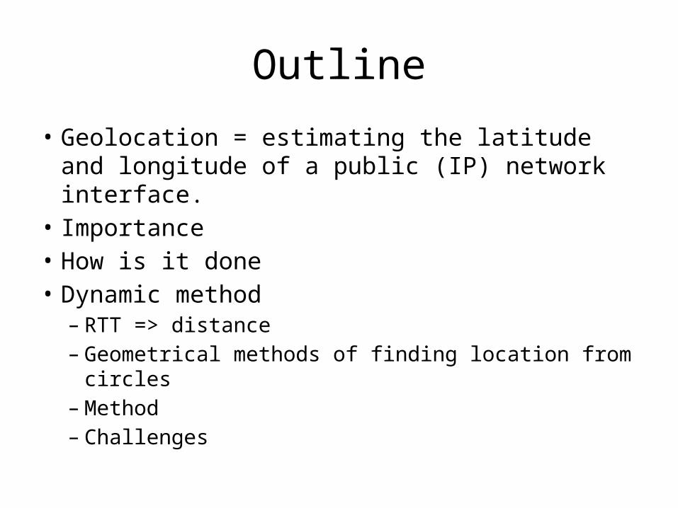
Outline
• Geolocation = estimating the latitude and longitude of a public (IP) network interface.
• Importance• How is it done• Dynamic method– RTT => distance – Geometrical methods of finding location from circles– Method– Challenges

Why is it important• Overlay network construction, • Determine where customers are so can use targeted advertising and
services– E.g. special offers from local stores
• Direct customer to the right site– E.g. Hotmail directs clients to appropriate replicated servers based on
clients location• Understand shopping or other patterns, consumer habits based on
location• Applying appropriate taxes, digital and territory rights• Locate servers or suspicious hosts• Language and currency choice & translations• Applications such as Visual Traceroute need to locate nodes on a
map
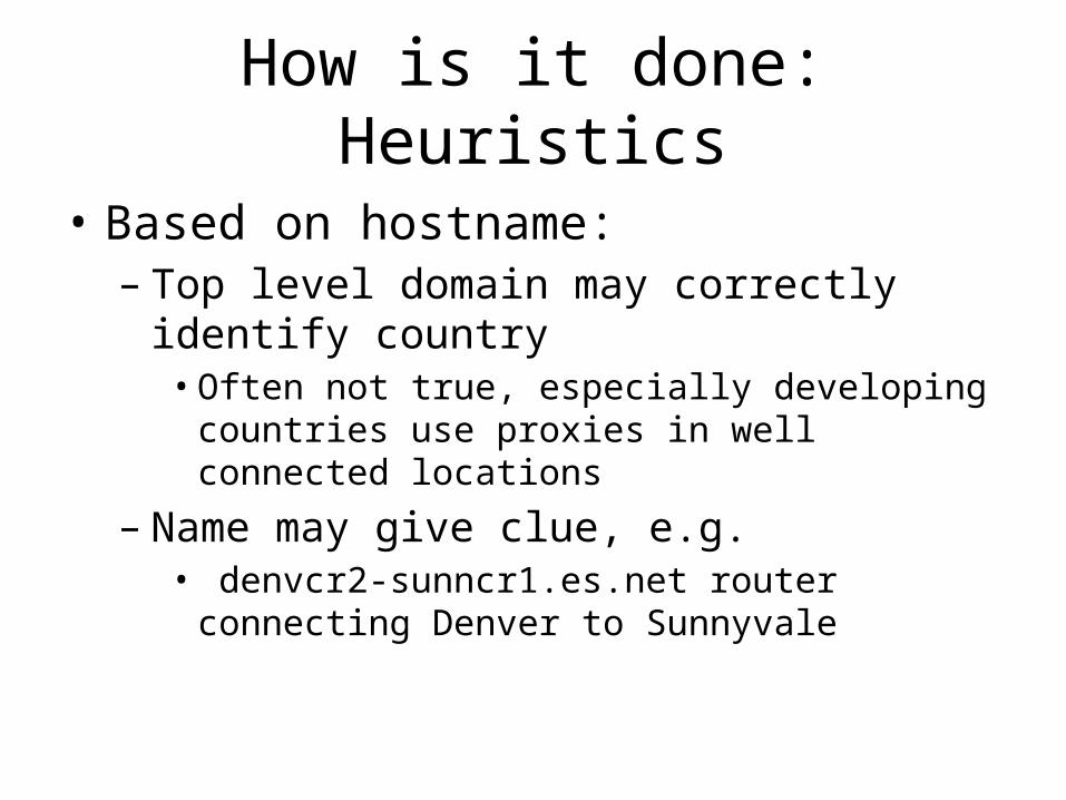
How is it done: Heuristics
• Based on hostname:– Top level domain may correctly identify country• Often not true, especially developing countries use
proxies in well connected locations
– Name may give clue, e.g.• denvcr2-sunncr1.es.net router connecting Denver to
Sunnyvale

How is it Done: Databases
• Given an IP address lookup the Autonomous System (AS) and see where it is located– Often gives the corporate HQ of AS not location of host
• Access to Internet registration databases (e.g. via whois) that may contain locations– Host locations are often not registered
• Specialized location databases, e.g.– http://www.ip2location.com/ – Lot of work to keep current– Maxmind is a database used by several services

How is it done: Dynamically• Measure Round Trip Time (RTT) from landmarks
at known locations• Convert RTT to distance d• Use geometrical method (e.g. trilateration) to
find intersection of circles with radius di (i=1..3)
– Trilateration, multilateration, Apollonius• Apply other constraints
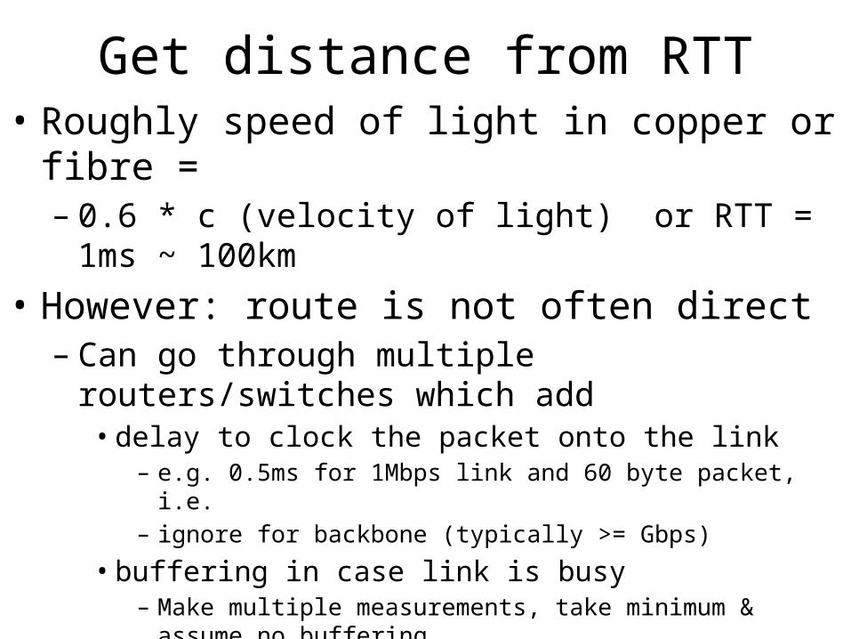
Get distance from RTT• Roughly speed of light in copper or fibre = – 0.6 * c (velocity of light) or RTT = 1ms ~ 100km
• However: route is not often direct– Can go through multiple routers/switches which add • delay to clock the packet onto the link
– e.g. 0.5ms for 1Mbps link and 60 byte packet, i.e. – ignore for backbone (typically >= Gbps)
• buffering in case link is busy– Make multiple measurements, take minimum & assume no buffering
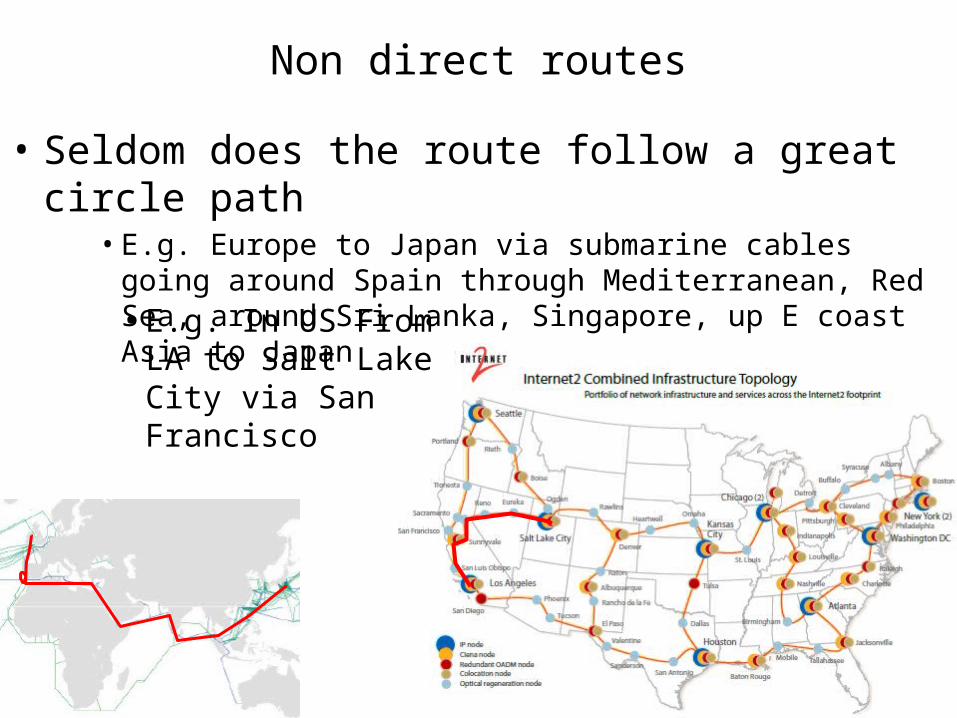
Non direct routes
• Seldom does the route follow a great circle path• E.g. Europe to Japan via submarine cables going around Spain
through Mediterranean, Red Sea, around Sri Lanka, Singapore, up E coast Asia to Japan • E.g. In US From LA to
Salt Lake City via San Francisco
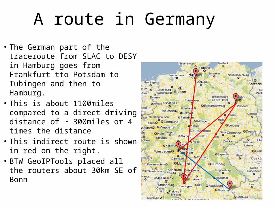
A route in Germany
• The German part of the traceroute from SLAC to DESY in Hamburg goes from Frankfurt tto Potsdam to Tubingen and then to Hamburg.
• This is about 1100miles compared to a direct driving distance of ~ 300miles or 4 times the distance
• This indirect route is shown in red on the right.
• BTW GeoIPTools placed all the routers about 30km SE of Bonn
Correction factor
• So use d = alpha * RTT * 100 km• alpha ~ 0.4 (km/ms)• May try and optimize depending on landmark
and target region
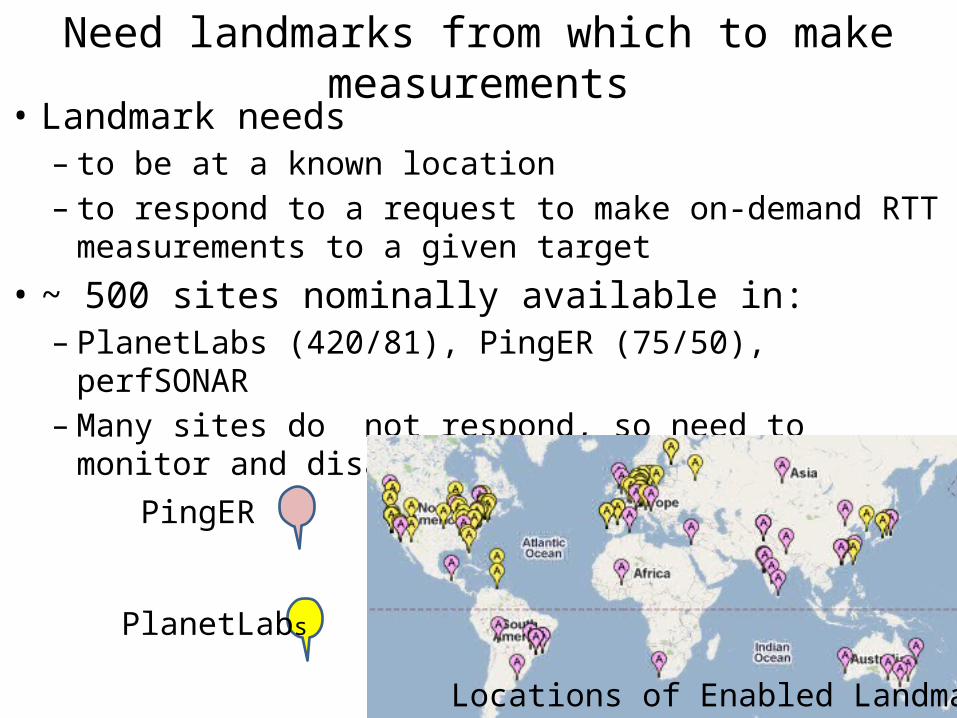
Need landmarks from which to make measurements
• Landmark needs – to be at a known location– to respond to a request to make on-demand RTT
measurements to a given target• ~ 500 sites nominally available in:– PlanetLabs (420/81), PingER (75/50), perfSONAR– Many sites do not respond, so need to monitor and
disable/enablePingER
PlanetLabs
Locations of Enabled Landmarks
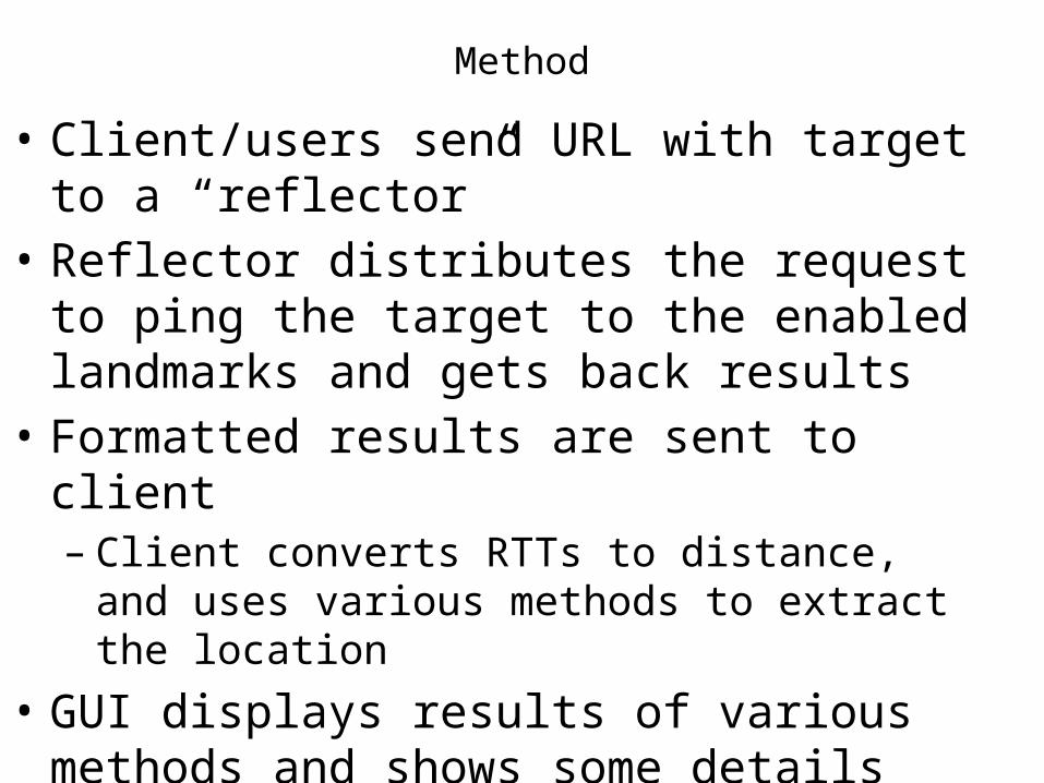
Method
• Client/users send URL with target to a “reflector”• Reflector distributes the request to ping the
target to the enabled landmarks and gets back results
• Formatted results are sent to client– Client converts RTTs to distance, and uses various
methods to extract the location• GUI displays results of various methods and
shows some details
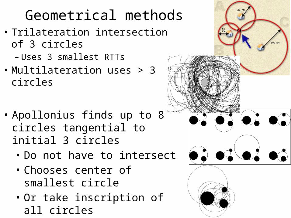
Geometrical methods• Trilateration intersection of 3
circles– Uses 3 smallest RTTs
• Multilateration uses > 3 circles
• Apollonius finds up to 8 circles tangential to initial 3 circles• Do not have to intersect• Chooses center of smallest
circle• Or take inscription of all circles
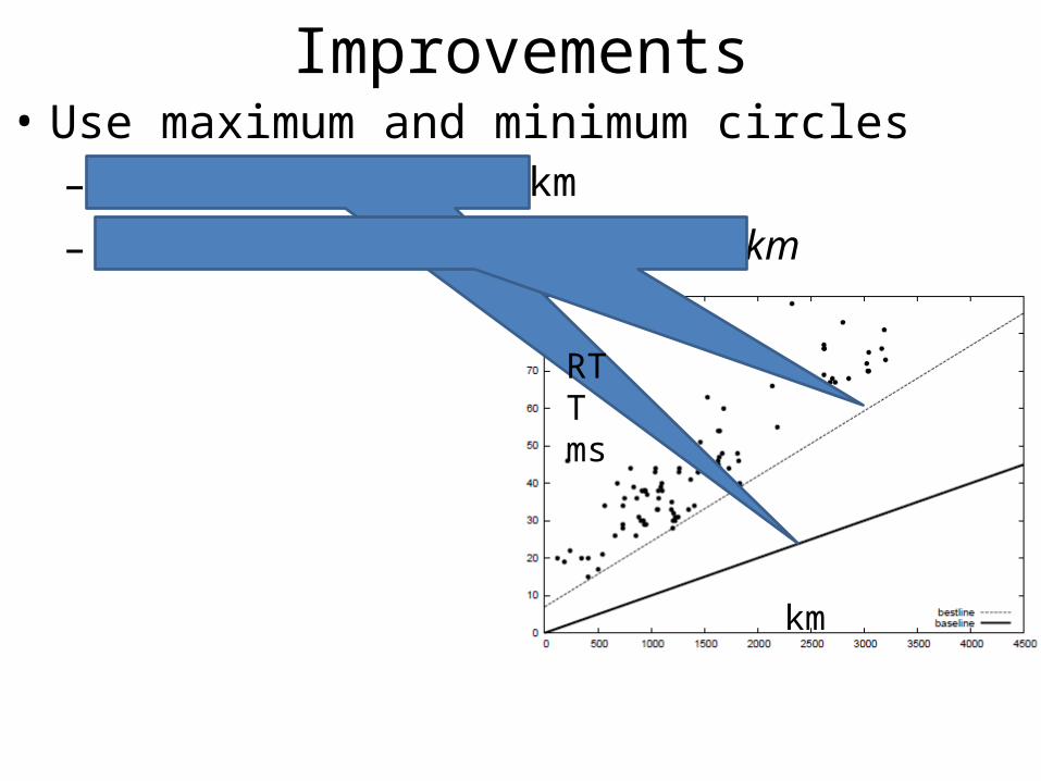
Improvements• Use maximum and minimum circles– dmax = 100 * RTT (ms) km
– dmin = alphamin * 100 * RTT (ms) + b km
km
RTT ms
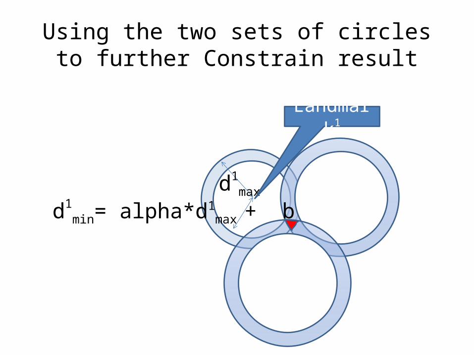
Using the two sets of circles to further Constrain result
d1max
d1min= alpha*d1
max + b
Landmark1

Challenges• Embedded circles may have no solution• Landmarks or targets connected via satellite fail• Accuracy depends on density and distribution of landmarks
– Works much better for targets in N. America and Europe– Need more landmarks but means more network traffic
• Typical accuracy only as good as 250km for 80% of the targets • Today database methods generally work better
– Fail for proxied hosts, – Fail often backbone routers owned by ISP– Replicated hosts, hotmail, Google, Yahoo etc– Mobile hosts
• So valuable cross check
Problems• Amount of traffic directed at target may look like a
DOS attack• Use tiering– Choose one or more landmarks representative of a
region• E.g. In center of region such as Chicago for N. America or
Geneva for Europe
– Use such tier0 landmarks to determine region of target– The use just the landmarks in that region to locate target