Geography of Great Britain Geographical Information Location : Western Europe, islands including the...
23
-
Upload
sharyl-lee -
Category
Documents
-
view
220 -
download
0
Transcript of Geography of Great Britain Geographical Information Location : Western Europe, islands including the...


Geography of Great Britain
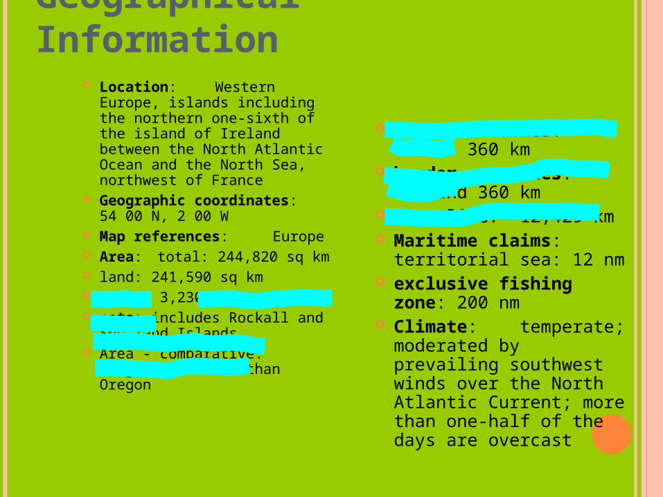
Geographical Information
Location: Western Europe, islands including the northern one-sixth of the island of Ireland between the North Atlantic Ocean and the North Sea, northwest of France
Geographic coordinates: 54 00 N, 2 00 W
Map references: Europe
Area: total: 244,820 sq km land: 241,590 sq km water: 3,230 sq km note: includes Rockall and
Shetland Islands Area - comparative:
slightly smaller than Oregon
Land boundaries: total: 360 km
border countries: Ireland 360 km
Coastline: 12,429 km Maritime claims:
territorial sea: 12 nm exclusive fishing
zone: 200 nm Climate:
temperate; moderated by prevailing southwest winds over the North Atlantic Current; more than one-half of the days are overcast
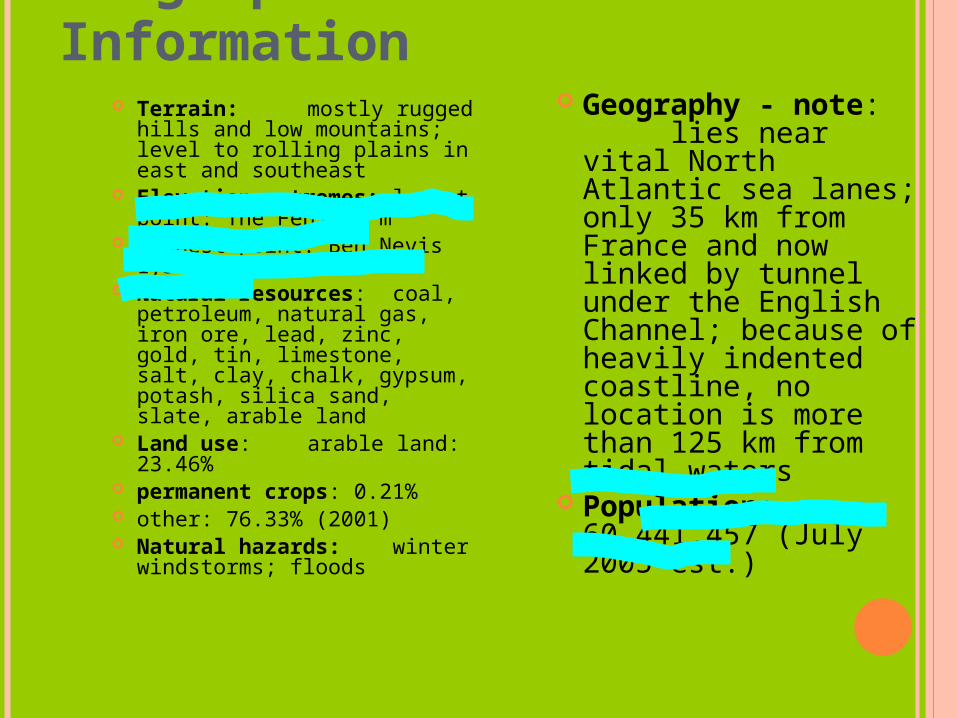
Geographical Information
Terrain: mostly rugged hills and low mountains; level to rolling plains in east and southeast
Elevation extremes: lowest point: The Fens -4 m
highest point: Ben Nevis 1,343 m
Natural resources: coal, petroleum, natural gas, iron ore, lead, zinc, gold, tin, limestone, salt, clay, chalk, gypsum, potash, silica sand, slate, arable land
Land use: arable land: 23.46%
permanent crops: 0.21% other: 76.33% (2001) Natural hazards:
winter windstorms; floods
Geography - note: lies near vital
North Atlantic sea lanes; only 35 km from France and now linked by tunnel under the English Channel; because of heavily indented coastline, no location is more than 125 km from tidal waters
Population: 60,441,457 (July 2005 est.)
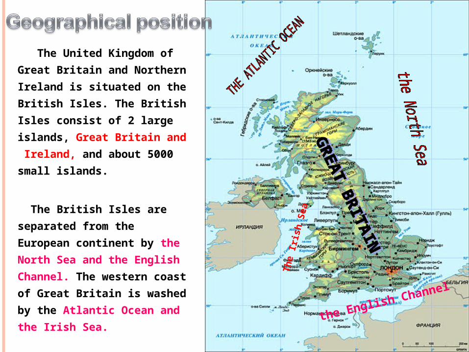
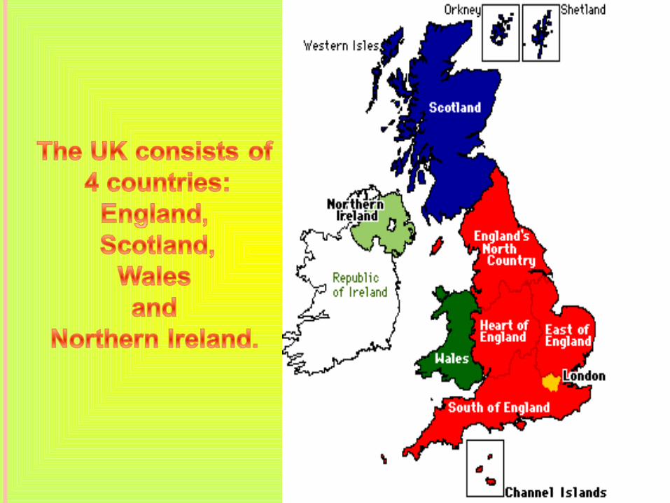
The United Kingdom of
Great Britain and Northern
Ireland is situated on the
British Isles. The British
Isles consist of 2 large
islands, Great Britain and
Ireland, and about 5000
small islands.
The British Isles are
separated from the
European continent by the
North Sea and the English
Channel. The western coast
of Great Britain is washed
by the Atlantic Ocean and
the Irish Sea.
The I
rish
Sea
the English Channel
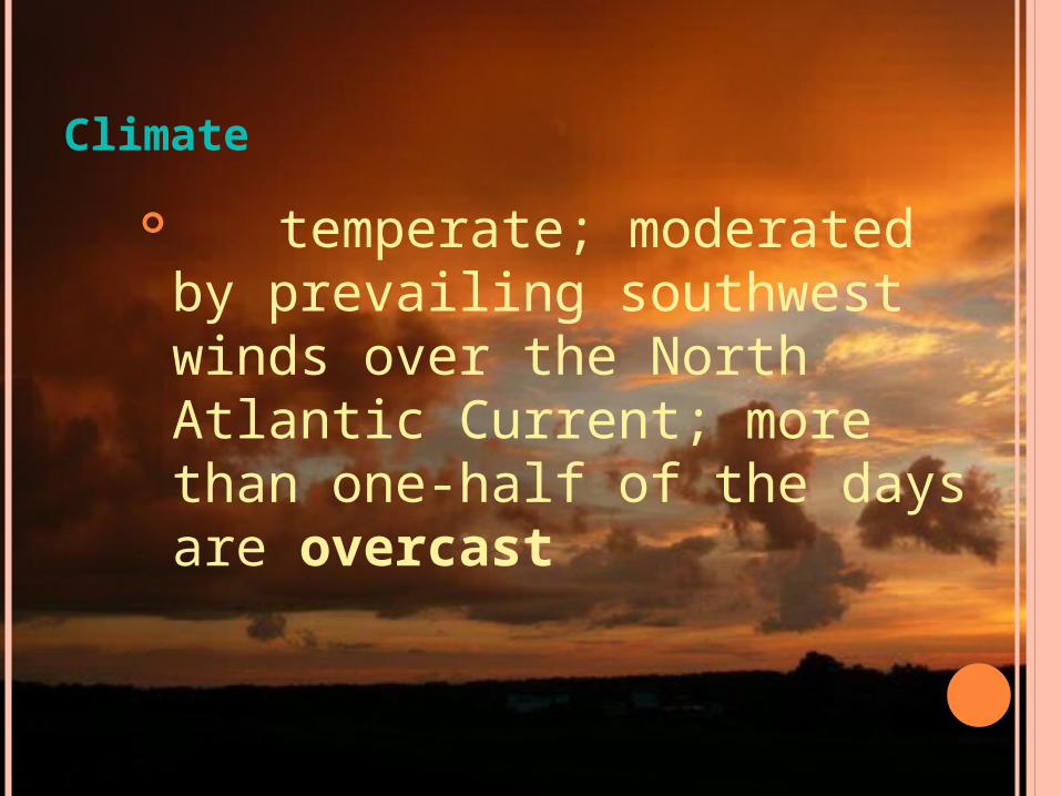
Climate
temperate; moderated by prevailing southwest winds over the North Atlantic Current; more than one-half of the days are overcast
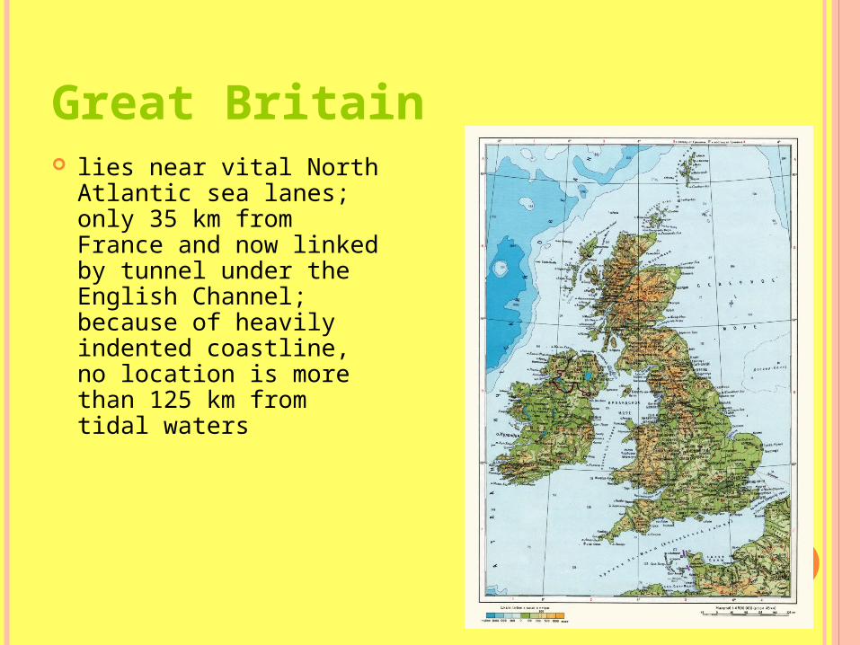
Great Britain lies near vital North
Atlantic sea lanes; only 35 km from France and now linked by tunnel under the English Channel; because of heavily indented coastline, no location is more than 125 km from tidal waters
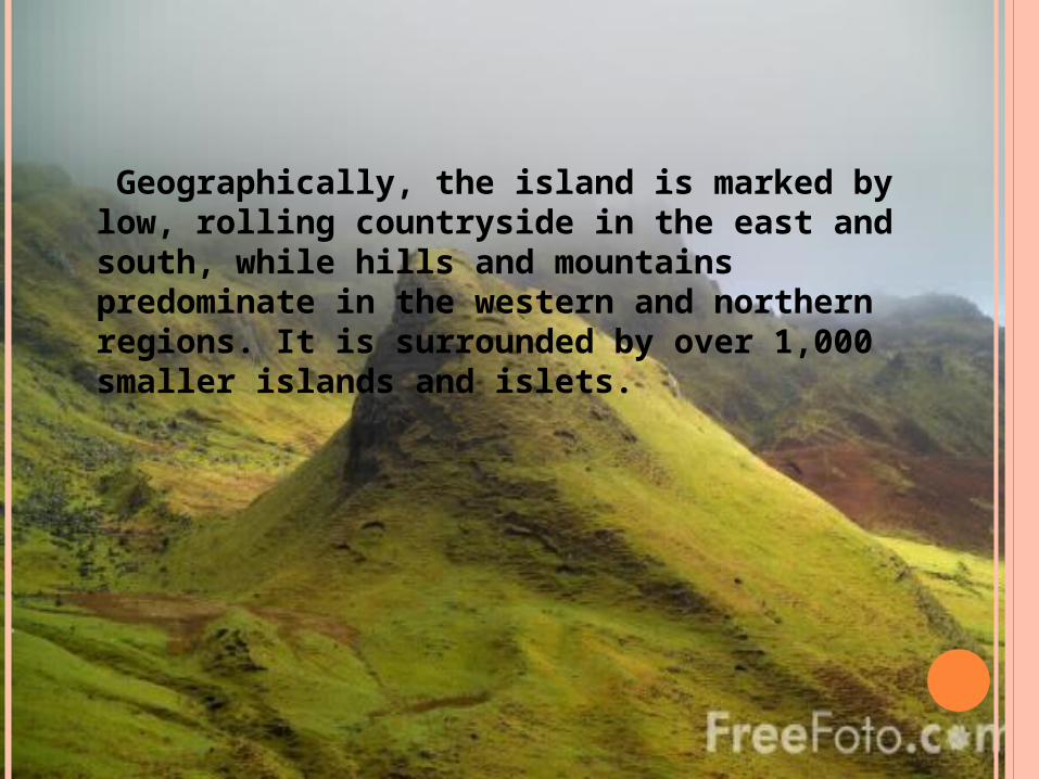
Geographically, the island is marked by low, rolling countryside in the east and south, while hills and mountains predominate in the western and northern regions. It is surrounded by over 1,000 smaller islands and islets.
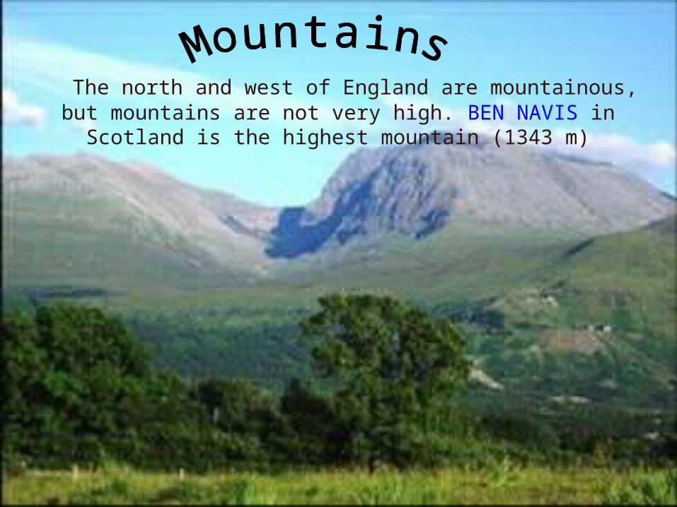
The north and west of England are mountainous, but mountains are not very high. BEN NAVIS in Scotland is the
highest mountain (1343 m)
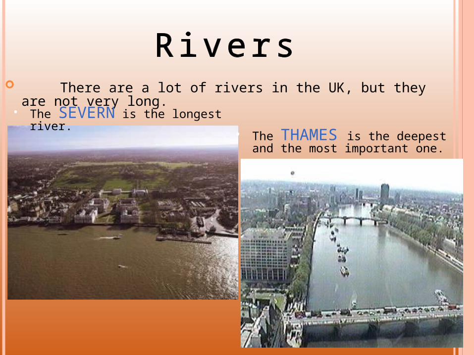
There are a lot of rivers in the UK, but they are not very long.
• The SEVERN is the longest river.
• The THAMES is the deepest and the most important one.
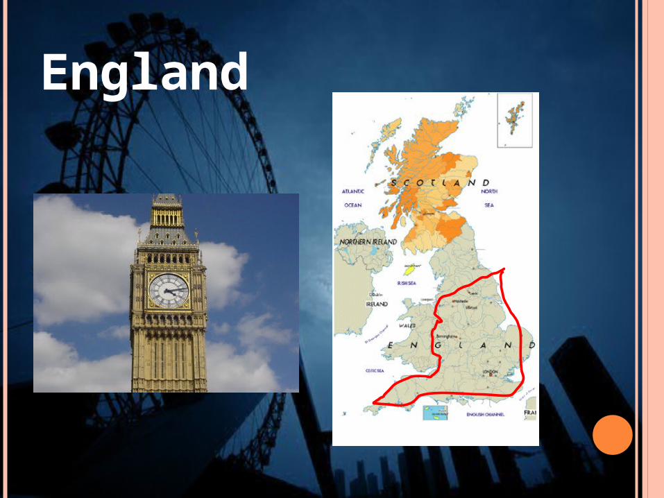
England
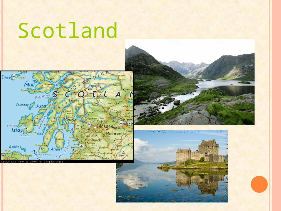
Scotland
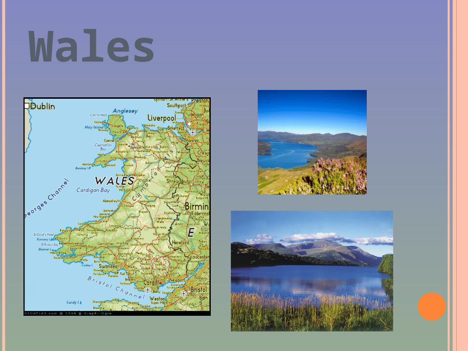
Wales

Northern Ireland

FLAGS
The UK
Scotland
Wales Northern Ireland
England

the symbol of England is the red the symbol of England is the red roserose
the symbol of Wales is the the symbol of Wales is the daffodildaffodil
the symbol of Scotland is the thistle
The symbol of Nothern Ireland is the shamrock

THE CAPITAL OF ENGLAND IS LONDON
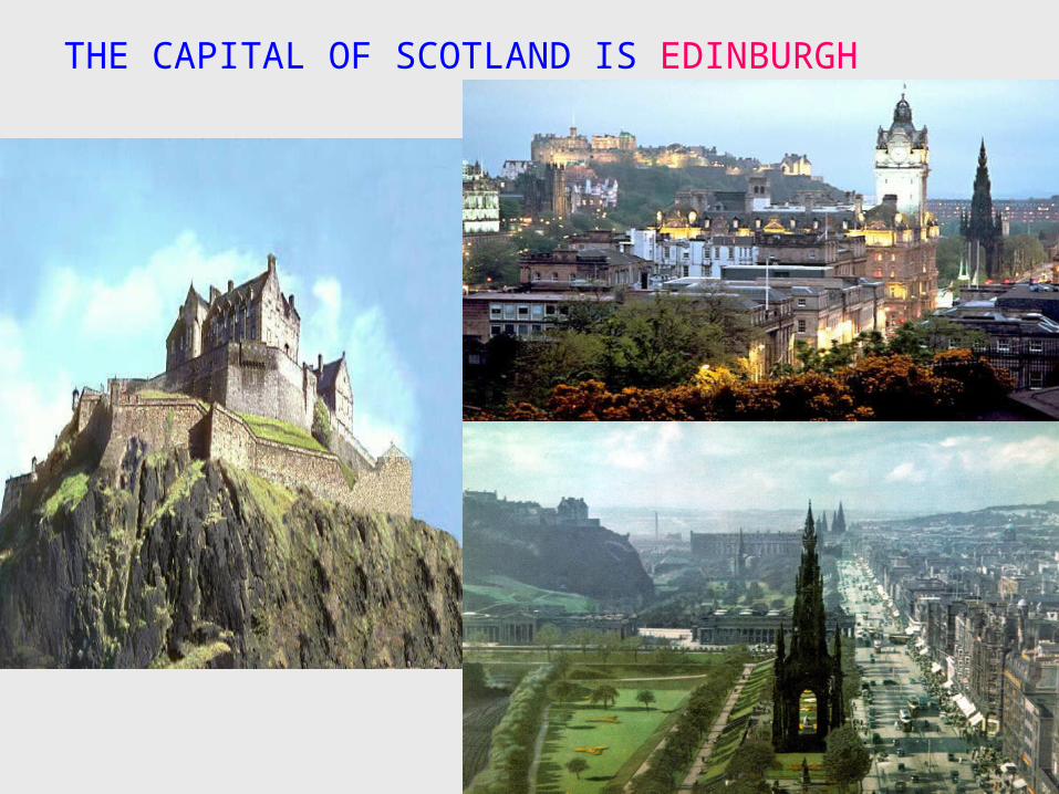
THE CAPITAL OF SCOTLAND IS EDINBURGH
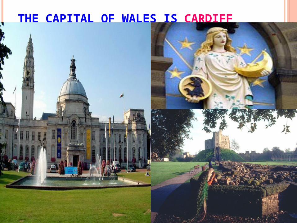
THE CAPITAL OF WALES IS CARDIFF
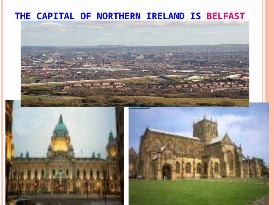
THE CAPITAL OF NORTHERN IRELAND IS BELFAST
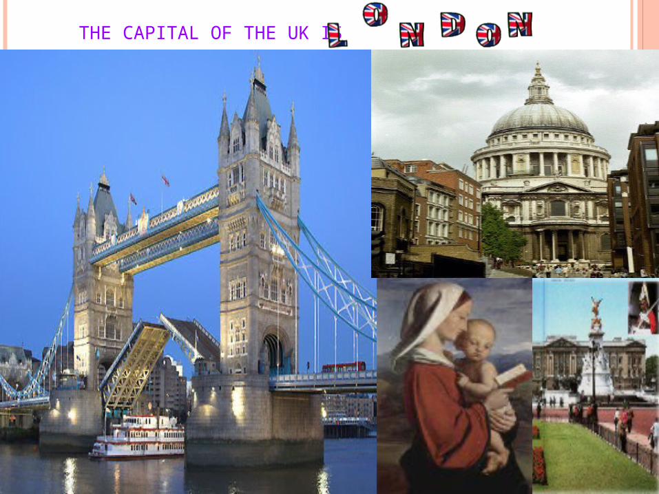
THE CAPITAL OF THE UK IS