Geodiversity action plans for the enhancement of geoheritage in
9
Geodiversity action plans for the enhancement of geoheritage in the Piemonte region (north-western Italy) Elena Ferrero * , Marco Giardino, Francesca Lozar, Enrico Giordano, Elena Belluso, Luigi Perotti Università di Torino, Dipartimento di Scienze della Terra, Torino, Italy ANNALS OF GEOPHYSICS, 55, 3, 2012; doi: 10.4401/ag-5527 ABSTRACT A geoethical approach to geodiversity allows better understanding of the value of abiotic nature and enhances its conservation and development. Our basic assumption is that even during an economical crisis, geoheritage sites can serve both public and private interests. A set of nine strategic geothematic areas were chosen to represent the geodiversity of the Piemonte region, north-western Italy, each of which is characterized by great potential for scientific studies, enhancement of public understanding of science, recreational activities, and economic support to the local communities. Specialized research teams individuated critical aspects to advance our knowledge of the geological history of the Piemonte region, through climate and environmental changes, natural hazards, soil processes, and georesources. The scientific concepts and techniques were coupled with geodiffusion actions and products: not only geosites, but also museum collections, evidence of mining and quarrying activities, science exhibitions, and nature trails. The preliminary results have allowed action plans to be developed with local partners, to assess the geoheritage management requirements. A series of investigations were carried out to improve the visual representation of the geological processes and the evolutionary scenarios. Further outcomes of the project will include didactic tools for educators, schools, and the public in general. 1. Introduction As a general view, geoethics is seen as the set of guidelines that pertain to human behavior that can affect larger planetary geophysical systems, including atmospheric, oceanic, geological, and biological systems [Cascio 2005]. This approach mainly refers to behavior that can result in long-term, widespread and/or hard-to-reverse changes in global systems; even if transient, local and superficial al- terations can be considered through the prism of geoethics. Indeed, other studies have considered geoethics as a new discipline (in both Earth sciences and applied ethics) [Martinez-Frias 2008, Nemec and Nemcova 2011]. Whenever ethical dilemmas occur in problems con- nected with the sustainable use of the Earth resources, geoethics helps decision makers to undertake scientifically based political decisions [Martinez-Frias 2011]. This view links geoethics to ‘geodiversity’, which is considered as “the range of rocks, fossils, minerals, landforms and soils that occur on our planet, along with the natural processes that shape the landscape” [Gray 2004]. By developing a geoethi- cal approach to geodiversity, we can understand the value of abiotic nature and devise the correct strategies to con- serve a legacy of geological assets. In a few words, we can enhance the ‘geoheritage’ of a region, i.e. the range of sites or areas of geological features with significant scientific, ed- ucational, cultural, or esthetic value [O’Halloran et al. 1994]. Moreover, the geoethical approach helps the potential of ge- ological heritage sites to be identified. These sites might have tourism and economic relevance as local and regional resources [Knudsen et al. 2008], or they might be identified as sites of historical and cultural value that are deserving of conservation (e.g., for the Piemonte region, the Langhian and Serravallian historical Global Stratotype Section and Point) [Mayer-Eymar 1858, Rio et al. 1997]. Knowledge of regional geodiversity is fundamental not only for the successful exploration of natural resources, but also for geohazard assessment and mitigation. Moreover, by developing the correct plans for geodiversity identification and management, a range of social, economic and envi- ronmental benefits can be delivered. Enhancement of ge- odiversity awareness can provide not only the opportunity to study the evidence of past environmental changes and evolutionary processes, but can also reveal information needed for more accurate prediction of future environmen- tal change and for adequate adaptation plans [Giardino and PROGEO-Piemonte Research Team 2011]. 2. Methods and stages of the ‘PROGEO-Piemonte’ research program From a geoethical perspective, the multidisciplinary research project known as ‘PROGEO-Piemonte’ (PROac- tive management of the GEOlogical heritage in the Article history Received December 21, 2011; accepted January 31, 2012. Subject classification: Geodiversity, Geoheritage, Geoethics, Education, Public issues, Geohazards. 487
Transcript of Geodiversity action plans for the enhancement of geoheritage in

Geodiversity action plans for the enhancement of geoheritagein the Piemonte region (north-western Italy)
Elena Ferrero*, Marco Giardino, Francesca Lozar, Enrico Giordano, Elena Belluso, Luigi Perotti
Università di Torino, Dipartimento di Scienze della Terra, Torino, Italy
ANNALS OF GEOPHYSICS, 55, 3, 2012; doi: 10.4401/ag-5527
ABSTRACT
A geoethical approach to geodiversity allows better understanding of thevalue of abiotic nature and enhances its conservation and development.Our basic assumption is that even during an economical crisis,geoheritage sites can serve both public and private interests. A set of ninestrategic geothematic areas were chosen to represent the geodiversity ofthe Piemonte region, north-western Italy, each of which is characterizedby great potential for scientific studies, enhancement of publicunderstanding of science, recreational activities, and economic supportto the local communities. Specialized research teams individuated criticalaspects to advance our knowledge of the geological history of thePiemonte region, through climate and environmental changes, naturalhazards, soil processes, and georesources. The scientific concepts andtechniques were coupled with geodiffusion actions and products: not onlygeosites, but also museum collections, evidence of mining and quarryingactivities, science exhibitions, and nature trails. The preliminary resultshave allowed action plans to be developed with local partners, to assess thegeoheritage management requirements. A series of investigations werecarried out to improve the visual representation of the geological processesand the evolutionary scenarios. Further outcomes of the project willinclude didactic tools for educators, schools, and the public in general.
1. IntroductionAs a general view, geoethics is seen as the set of
guidelines that pertain to human behavior that can affectlarger planetary geophysical systems, including atmospheric,oceanic, geological, and biological systems [Cascio 2005].This approach mainly refers to behavior that can result inlong-term, widespread and/or hard-to-reverse changes inglobal systems; even if transient, local and superficial al-terations can be considered through the prism ofgeoethics. Indeed, other studies have considered geoethics asa new discipline (in both Earth sciences and applied ethics)[Martinez-Frias 2008, Nemec and Nemcova 2011].
Whenever ethical dilemmas occur in problems con-nected with the sustainable use of the Earth resources,geoethics helps decision makers to undertake scientifically
based political decisions [Martinez-Frias 2011]. This viewlinks geoethics to ‘geodiversity’, which is considered as “therange of rocks, fossils, minerals, landforms and soils thatoccur on our planet, along with the natural processes thatshape the landscape” [Gray 2004]. By developing a geoethi-cal approach to geodiversity, we can understand the valueof abiotic nature and devise the correct strategies to con-serve a legacy of geological assets. In a few words, we canenhance the ‘geoheritage’ of a region, i.e. the range of sitesor areas of geological features with significant scientific, ed-ucational, cultural, or esthetic value [O’Halloran et al. 1994].Moreover, the geoethical approach helps the potential of ge-ological heritage sites to be identified. These sites mighthave tourism and economic relevance as local and regionalresources [Knudsen et al. 2008], or they might be identifiedas sites of historical and cultural value that are deserving ofconservation (e.g., for the Piemonte region, the Langhianand Serravallian historical Global Stratotype Section andPoint) [Mayer-Eymar 1858, Rio et al. 1997].
Knowledge of regional geodiversity is fundamental notonly for the successful exploration of natural resources, butalso for geohazard assessment and mitigation. Moreover, bydeveloping the correct plans for geodiversity identificationand management, a range of social, economic and envi-ronmental benefits can be delivered. Enhancement of ge-odiversity awareness can provide not only the opportunityto study the evidence of past environmental changes andevolutionary processes, but can also reveal informationneeded for more accurate prediction of future environmen-tal change and for adequate adaptation plans [Giardinoand PROGEO-Piemonte Research Team 2011].
2. Methods and stages of the ‘PROGEO-Piemonte’research program
From a geoethical perspective, the multidisciplinaryresearch project known as ‘PROGEO-Piemonte’ (PROac-tive management of the GEOlogical heritage in the
Article historyReceived December 21, 2011; accepted January 31, 2012.Subject classification:Geodiversity, Geoheritage, Geoethics, Education, Public issues, Geohazards.
487

Piemonte region) aims to define a new comprehensiveconceptual and operational procedure to promote geodi-versity knowledge, assess regional geoheritage, and sup-port geoconservation activities in the Piemonte region(north-western Italy). The scientific background derivesfrom both the geological and geomorphological literatureof the area (see below), and from methodological studiesrelating to the development of techniques for the identifi-cation of geodiversity and for the management of geo-heritage [Serrano and Ruiz-Flano 1995, Ellis et al. 1996,Erikstad 1999, Wimbledon et al. 1999].
The geoethical management of geoheritage requiresa balance to be reached between the protection strategiesof georesources and the legitimate needs for fruition by thelocal population or by visitors. This approach was introducedby the European Working Group for Earth Sciences Con-servation that was created on 1988. Then in 1993, thistransformed into the PROGEO Association, which is de-voted to geodiffusion activities and to establishment of aninternational network for geosite inventory and conserva-tion [PROGEO 2011]. Following this approach, a ‘PRO-
GEO-Piemonte’ multidisciplinary research group (Earthsciences, biology, economics, informatics, social sciences, en-gineering) was created, which involved 58 participantsfrom eight academic research and administrative institu-tions in the Piemonte region.1 Our assumption was thateven during economic crisis, geoheritage sites (‘geosites’)can serve both public and private interests.
The basic principles of geoconservation have been ap-plied in several projects throughout the world. In Italy, wefound a gap between the acceptance of this conceptualframework and the application of geodiversity action plans.This is why we consider the application of a balanced mix-ing of ICT (Information and Communications Technology)instruments and geoethical principles innovative in therecognition of geodiversity, for the promotion of geologi-cal knowledge, the preparation of functional guidelines forthe management of the geoheritage, and the support ofgeoconservation activities. The preliminary activities startedduring 2010. Then, after a long evaluation process by an in-ternational committee, the project received financial sup-port from university and regional bank foundations.2
FERRERO ET AL.
488
Figure 1. ‘Visual’ approach of the PROGEO-Piemonte project (see text for description). a. The Piemonte region. b. A representation of the Piemonteregional geodiversity (lithological map by Arpa-Piemonte: http://webgis.arpa.piemonte.it/geoportale/). c. The ‘disassembled Rubik cube’ analogy.d. The operating selections of the Rubik cube analogy. e. the ‘re-assembled’ Rubik cube of the geological and geographical components of thePiemonte region.
a b
d e
c

489
The main stages of the PROGEO-Piemonte researchprogram are:
(a) Analysis of Piemonte geodiversity at a regionalscale, through a comparative study of past and present ge-ological and geomorphological environments.
(b) Identification of ‘symbols’ for the Piemonte geo-heritage, the outstanding scientific and didactic values ofwhich are coupled with the high potential for attractingtourists.
(c) Advanced scientific research on selected geositesand related geothematic areas, to provide a basis for dis-semination of regional Earth sciences knowledge.
(d) Experimentation on innovative didactic tools andvisual representations of geological processes, and evolutionof landscapes, for the enhancement of awareness of thenatural resources and hazards.
(e) Promotion of geosites as valuable products, notonly as material resources, but also as cultural and geot-ourism assets that can bring enjoyment to individuals andthat are deserving of protection.
(f ) Elaboration of strategies for promotion of eco-nomic support for local communities responsible for geo-heritage management and protection.
3. Preliminary results on selected geothematic areasThe application of these methods by specialized re-
search teams from different scientific backgrounds (struc-tural geology, sedimentary geology, paleontology,petrography, mineralogy, physical geography, geomor-phology, lichenology, geoscience education) produced apreliminary report on the Piemonte geodiversity at a re-gional scale. Studies of the geodiversity contents are basedon scientific knowledge that was either produced by theparticipants of this project, or was obtained from the lit-erature. ‘Hot topics’ for advancing our knowledge on thegeological history of Piemonte were analyzed, includingclimate and environmental change, natural hazards, soilprocesses, and georesources. As a preliminary result, sev-eral geosites were located to symbolize these differentthemes of Piemonte geodiversity.
A selection then had to be defined, both to enhancethe individuality of different provinces of Piemonte (Fig-ure 1a), and for the recognition of new strategic areas to bestudied in the region. We applied a visual/conceptual ap-proach to this problem that was based on geographical andgeological criteria. Earth scientists used different colors tohighlight different geological units. The geothematic mapof Figure 1b shows the Piemonte regional geodiversity, theanalog of which can be individuated in the planar view ofa ‘disassembled’ Rubik cube (Figure 1c). Here, each solidcolor represents a different geological unit, in term of dis-tinct processes, materials and structural settings. We con-sidered the analogy between this three-dimensional
mechanical puzzle and an idealized crustal block, with su-perficial, shallow and deep geoenvironments as a key foroperating selections (Figure 1d) and for the ‘re-assembly’(Figure 1e) of geological and geographical components ofthe Piemonte region.
This exercise offered different solutions that we eval-uated in terms of geothematic contents and geographicaldistribution. Our choices were addressed to the obtainingof a balanced sample of Piemonte territories, and an (al-most) complete representation of its geodiversity. As a re-sult, we identified nine geothematic research themes(‘geothemes’; Figure 2, 1 to 9) where we considered the‘symbols’ of the Piemonte geoheritage, which was alsouseful for the enhancement of the cultural awareness ofthe Earth science topics, and for the promotion of geot-ourism throughout the region.
Each geotheme represents a distinctive geodiversityfeature of the Piemonte region that is deserving of ad-vanced research, and that has particular management andprotection needs. Proactive management of these scien-tific themes (both as diffusion and protection) is now inprogress, according to the following four interdisciplinarythematic actions:
(a) Geomatic applications for evaluation and man-agement of Piemonte geoheritage [Ghiraldi et al. 2011].
(b) Visual representation of geological environmentsand processes.
(c) Geodiversity action plans for dissemination activities.(d) Tool-integrated management of a geosite: appli-
cation of a Territorial Integrated Quality ManagementSystem (TIQMS).
Our innovative approach to the Piemonte geodiver-
GEODIVERSITY ACTION PLANS IN THE PIEMONTE REGION
Figure 2. The ‘disassembled Rubik cube’ analogy for the descriptionof the geothematic areas of the PROGEO-Piemonte project.

sity received approval from an international committee,and it is now available to the Regional administration forthe assessment and management of the geoheritage. Thesame visual/conceptual approach is useful to spreadawareness of geoheritage among the general public. Abetter understanding of the complexity of regional geo-diversity and its interactions with human activities and ter-ritories can promote the correct selection of geositesaccording to geothematic contents and targeted manage-ment activities. This can result in a balanced approach, be-tween geoheritage protection issues and the needs of localpopulations and of visitors.
The preliminary findings of the PROGEO-Piemonteresearch groups for both the study of the regional geot-hemes and in the interdisciplinary thematic actions are an-alyzed and commented upon in the following sections.
4. Analysis of symbols of the Piemonte geoheritage Piemonte is very rich in geological symbols that can
be used to open people’s hearts and minds to the mag-nificence of Nature and to the need for her conservationfor the enjoyment of future generations. Here, two ex-amples are presented to provide an understanding of therole of geodiversity in the environmental dynamics of thePiemonte region and of its geoheritage as a cultural asset.
The first example is the Belvedere Glacier (north-east-ern face of Mt. Rosa; Figure 2, geothematic area 6; Figure 3),the view of which offers a spectacular analog of the Pleis-tocene glacial ages, very far from the anthropogenic spread.Here, the most extensive Piemonte glacier has changed itsappearance rapidly in the last few years as a consequenceof the temperature increases that are affecting the Western
Alps [Haeberli et al. 2002, Gianotti et al. 2011]. From aneducational point of view, the comparison of the presentand past geomorphological landscapes allows us to un-derstand the Earth surface processes and these environ-mental dynamics.
The variations, extent and thickness of the glacier,and its landform changes and mass wasting processes, canbe used as lessons to show the effects of climate changeand natural hazards [Haeberli et al. 2002]. These can beused to analyze the possible interactions between humanactivities and the environment. A better understanding ofthese processes will favor respectful attitudes toward geo-logical assets.
As an example, the putting together of a movie se-quence of thousands of images of glaciers that weretaken through the temporal window of the last hundredyears can provide very convincing evidence of a climate-driven dynamic process for a wider public and will be auseful tool for didactic activities. Moreover, it is a possibletool to widen the consensus on environmental problems,and a way to reach broader adherence and participationin certain choices for the protection of our georesources.Widespread awareness in the general public leads and in-fluences the choices of managers towards the correctmanagement of our georesources.
Another example among the Piemonte geo-symbolsis the mining district of Brosso and Traversella (Figure 2,geothematic theme 7) [Costa et al. 2011]. This area has beenwell known since prehistoric times, when our ancestorsbegan to extract iron, as the ‘resistant and strong’ materialthat was useful to produce artisan tools for hunting andworking the fields. In ancient times, the local people under-
went impositions and abusesby foreign conquerors andlocal potentates, with pres-sure to increase the amountof extracted minerals. Inmore modern times, themining activities allowed thelocal people to enjoy greatereconomic wealth, until theclosures of the Brosso andTraversella mines (in 1964and 1971, respectively). So,the mining trails, the forgesspread throughout the area,the extraction tunnels, themortuary chapels where‘white deaths’ were criedover, and the yellow to redsulfur-rich veins all remindus of the hard but fruitfulwork humans can do. Also,
FERRERO ET AL.
490
Figure 3. The Belvedere Glacier (photo: Gnemmi).

491
the remains of this activity and witnessing the world of theold miners teaches our generation, and future generations,of the need to reduce the human environmental impact andto enhance the safety of the workers.
5. From scientific knowledge to diffused Geo-awarenessGeological literacy has a strategic role for the im-
provement of our awareness of Earth science topics thatimpact on human affairs. The PROGEO-Piemonte pro-ject conceived geothematic themes (Figure 2) to aid in thediffusion of the knowledge of ‘hot’ Earth science topics,such as:
– Long-term climate change through past geologicaltimes (Figure 2, geothematic theme 3), to show its effectson the ecosystem (population and habitat) and geosystem(environmental and landscape changes) [Dela Pierre et al.2011a, 2011b];
– Time scales of geological processes (stratigraphic andtectonic combined in an orogenic succession) (Figure 2,geothematic theme 2), to reveal long-lasting impacts onour planet, and to show their possible interactions withhuman activities and on our future [Bertok et al. 2011,d’Atri et al. 2011];
– Limitation of the available georesources (Figure 2, ge-othematic theme 7) and is influences on the lifestyle of an-cient and future generations [Costa et al. 2011].
Up-to-date scientific research on these themes is es-sential to address the correct management of geore-sources, and the adaptation for remedial measures forhazardous geological processes.
Accurate dating of paleoclimatic and tectonic eventscan clarify: (a) how long climate change has lasted in com-parison to the human and geological time scales; (b) howthese events have impacted on life and the geosystem; and(c) if and when the biome recovered after these events. Asan example, new data on this debated topic have been re-alized through recent studies on the Messinian successionof the Tertiary Piemonte Basin (Figure 2, geothematictheme 3) [Dela Pierre et al. 2011a]. An understanding ofthe major environmental changes that occurred around 6million years ago during a short time span (compared toEarth history) is useful, to improve our knowledge of therelated modifications to biological communities and theenvironment.
Improvements in the interpretation of the regionalstructural settings, stratigraphic and metamorphic char-acters, and seismo-tectonic activity of the Western Alps(Figure 2, geothematic themes 1 and 2) [d’Atri et al. 2011,Rolfo et al. 2011] are legacies to future generations, be-cause they can help in a better assessment of the geore-sources and geohazards of the Piemonte mountains.These are other valuable products of the project: they sup-port the idea that geology is an array of ongoing processes
that primarily involve the everyday life of our and futuregenerations. Eventually, this newly achieved awarenesswill strengthen the general idea that continuous Earth sci-ence education can improve our life style and our place onEarth [Belluso et al. 2011].
With respect to the educational goals of the project,our strategy is to develop the cognitive aspects of theteaching/learning processes of Earth sciences, while en-hancing the sensory and emotional aspects that conditionthe acquisition of this knowledge [Orion 2007]. Educa-tional materials should create moments of wonder andsurprise, including positive feelings related to the mo-ments of discovery. Also, sometimes, they should promotea sense of distress, with the realization of the existence of‘problems’ and the personal inadequacy to deal with them[King 2008, p. 197]. All of these sensations and feelings arepart of people’s emotional intelligence, and they becomea powerful stimulus for:
(a) keeping the focus on not-intuitive issues, whichare sometimes abstract and rarely explored by direct ex-perience;
(b) motivating personal knowledge improvement,such as looking for visual documents, broadening anddeepening the range of interest, repeating the experiencein the same place, or in different ones.
According to the suggestions of a holistic approachfor science education [Orion 2007], we believe that learn-ing in nonformal educational situations provides an ex-cellent opportunity for the students [King 2008, p. 201]. Itmakes it easier to perform participatory actions, to pro-duce positive sensations through active personal involve-ment, with the association of the enjoyment withrecreational activities and with feelings of satisfaction forthe conquest of a ‘goal’.
6. Geo-resources and geohazardsFollowing the International Decade for Natural Dis-
aster Reduction (INDNR 1990-2000), many projects havebeen carried out on different scales (national, regional,local) to provide better understanding of natural hazards.Then the International Year of Planet Earth (2007-2009)[IYPE 2008, UNESCO 2008] promoted a global view ofgeoheritage and georesources. In this perspective, ourproject aims to:
(i) enhance a geo-ethical approach to these funda-mental fields;
(ii) increase the competence of local administratorsand educators for their understanding of the value of localgeoresources, and their sustainable exploitation;
(iii) mitigate risks related to hazardous Earth processes.Three of the geothematic themes of the PROGEO-
Piemonte project (Figure 2) offer significant enhancementsfor the awareness of geohazards and geoheritage:
GEODIVERSITY ACTION PLANS IN THE PIEMONTE REGION
1) The interactions of geological processes andhuman activities in the Monferrato Hills (Figure 2, geo-theme 4) show that the cultural heritage of this land andthe economic value of its worldwide-known vineyard ter-rain have deep roots on its ancient and recent geologicalhistory. Earth sciences knowledge of this area is funda-mental for the protection of the local resources from geo-hazards, and PROGEO-Piemonte promotes the correctassessment and mitigation of local accelerated erosionand slope instabilities [Van den Eeckaut et al. 2010, Mas-ciocco et al. 2011].
2) Studies on the Quaternary evolution of the landscapeand the local climates have been used to offer a compre-hensive view of the interactions of major geomorpho-logical systems within geothematic theme 5 (Figure 2),where glacial, fluvial and anthropic processes are relevantfor local georesources and hazards [Ajassa et al. 2011].
3) As a result of the systematic review of geoscienceand natural hazards information, the Middle Susa Valley(Figure 2, geothematic theme 8) has become a strategicarea for the enhancing of public understanding of naturalhazard studies; the achievement of these objectives wasmade easier by the recreational and didactic activities thatare supported by the local communities. Visual represen-tations and digital evolutionary models of large slope in-stabilities (Cassas landslide and Serre la Voute deep-seatedgravitational slope deformation) have popularized scien-tific results of the recent stages of local geological history,the effects of climate and environmental change and nat-ural hazards, and the related risk management practicesin the Susa Valley [Borgogno Mondino et al. 2009, Lom-bardo et al. 2010, Giardino et al. 2011].
7. Geosites as cultural and geotourism assetsGeothemes 1, 3, 4 and 9 of Figure 2 have offered ex-
cellent opportunities to illustrate multiple aspects of Earthsciences, due to the variety of geological and geomor-phological phenomena they represent. Each of thesethemes also differs from the others in term of territorial andenvironmental context: they contain a variety of locationswith respect to settlements, infrastructure and manufactur-ing activities, and different possible accessibility of geositesin relation to the seasonal conditions and the type of public.A coherent and comprehensive selection of geosites makesthe geoheritage a valuable cultural resource that can pro-vide local and regional economic benefits as tourist desti-nations.
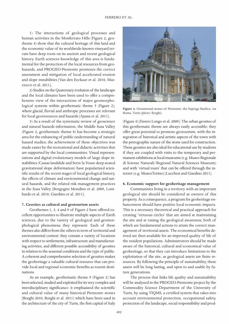
As an example, geothematic theme 9 (Figure 2) hasbeen selected, studied and exploited for its very complex andinterdisciplinary significance: it emphasized the scientificand cultural value of many historical Piemonte stones[Borghi 2010, Borghi et al. 2011] which have been used inthe architecture of the city of Turin, the first capital of Italy
(Figure 4) [Favero Longo et al. 2009]. The urban geosites ofthis geothematic theme are always easily accessible; theyoffer great potential to promote geotourism, with the in-tegration of historical and artistic aspects of the town withthe petrographic nature of the stone used for construction.These geosites are also ideal for educational use by studentsif they are coupled with visits to the temporary and per-manent exhibitions at local museums (e.g. Museo Regionaledi Scienze Naturali/Regional Natural Sciences Museum)and with ‘virtual tours’ that can be offered through the in-ternet (e.g. MuseoTorino) [Lucchesi and Giardino 2011].
8. Economic support for geoheritage managementCommunities living in a territory with an important
geological site should be considered as owners of thisproperty. As a consequence, a program for geoheritage en-hancement should have positive local economic impacts.This is a necessary theoretical and practical approach forcreating ‘virtuous circles’ that are aimed at maintainingthe site and at raising the geological awareness, both ofwhich are fundamental actions to attain the correct man-agement of territorial assets. The economical benefits de-rived are then available for an improved quality of life ofthe resident populations. Administrators should be madeaware of the historical, cultural and economical value ofgeoheritage, so that they can introduce limitations to theexploitation of the site, as geological assets are finite re-sources. By following the principle of sustainability, theseassets will be long lasting, and open to and usable by fu-ture generations.
The process that links life quality and sustainabilitywill be analyzed in the PROGEO-Piemonte project by theCommodity Science Department of the University ofTurin, by using TIQMS, a certified system that takes intoaccount environmental protection, occupational safety,protection of the landscape, social responsibility and prod-
FERRERO ET AL.
492
Figure 4. Ornamental stones of Piemonte: the Superga Basilica, viaRoma, Turin (photo: Borghi).
493
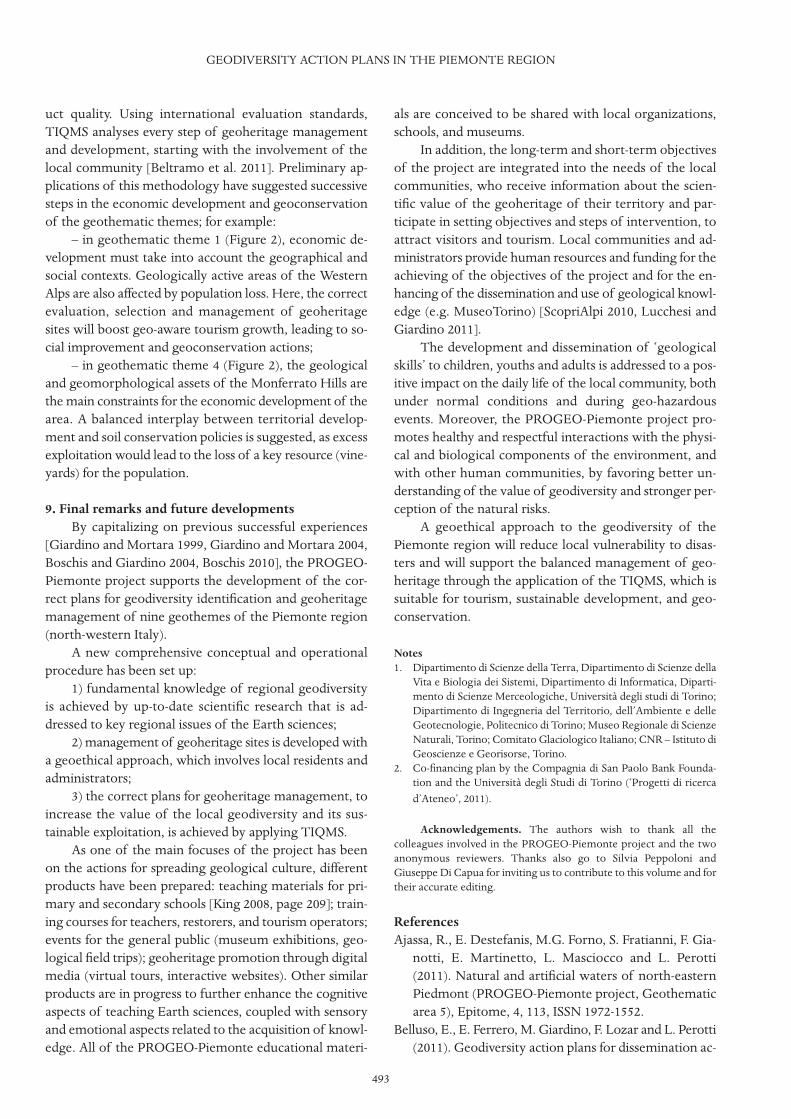
uct quality. Using international evaluation standards,TIQMS analyses every step of geoheritage managementand development, starting with the involvement of thelocal community [Beltramo et al. 2011]. Preliminary ap-plications of this methodology have suggested successivesteps in the economic development and geoconservationof the geothematic themes; for example:
– in geothematic theme 1 (Figure 2), economic de-velopment must take into account the geographical andsocial contexts. Geologically active areas of the WesternAlps are also affected by population loss. Here, the correctevaluation, selection and management of geoheritagesites will boost geo-aware tourism growth, leading to so-cial improvement and geoconservation actions;
– in geothematic theme 4 (Figure 2), the geologicaland geomorphological assets of the Monferrato Hills arethe main constraints for the economic development of thearea. A balanced interplay between territorial develop-ment and soil conservation policies is suggested, as excessexploitation would lead to the loss of a key resource (vine-yards) for the population.
9. Final remarks and future developmentsBy capitalizing on previous successful experiences
[Giardino and Mortara 1999, Giardino and Mortara 2004,Boschis and Giardino 2004, Boschis 2010], the PROGEO-Piemonte project supports the development of the cor-rect plans for geodiversity identification and geoheritagemanagement of nine geothemes of the Piemonte region(north-western Italy).
A new comprehensive conceptual and operationalprocedure has been set up:
1) fundamental knowledge of regional geodiversityis achieved by up-to-date scientific research that is ad-dressed to key regional issues of the Earth sciences;
2) management of geoheritage sites is developed witha geoethical approach, which involves local residents andadministrators;
3) the correct plans for geoheritage management, toincrease the value of the local geodiversity and its sus-tainable exploitation, is achieved by applying TIQMS.
As one of the main focuses of the project has beenon the actions for spreading geological culture, differentproducts have been prepared: teaching materials for pri-mary and secondary schools [King 2008, page 209]; train-ing courses for teachers, restorers, and tourism operators;events for the general public (museum exhibitions, geo-logical field trips); geoheritage promotion through digitalmedia (virtual tours, interactive websites). Other similarproducts are in progress to further enhance the cognitiveaspects of teaching Earth sciences, coupled with sensoryand emotional aspects related to the acquisition of knowl-edge. All of the PROGEO-Piemonte educational materi-
als are conceived to be shared with local organizations,schools, and museums.
In addition, the long-term and short-term objectivesof the project are integrated into the needs of the localcommunities, who receive information about the scien-tific value of the geoheritage of their territory and par-ticipate in setting objectives and steps of intervention, toattract visitors and tourism. Local communities and ad-ministrators provide human resources and funding for theachieving of the objectives of the project and for the en-hancing of the dissemination and use of geological knowl-edge (e.g. MuseoTorino) [ScopriAlpi 2010, Lucchesi andGiardino 2011].
The development and dissemination of ‘geologicalskills’ to children, youths and adults is addressed to a pos-itive impact on the daily life of the local community, bothunder normal conditions and during geo-hazardousevents. Moreover, the PROGEO-Piemonte project pro-motes healthy and respectful interactions with the physi-cal and biological components of the environment, andwith other human communities, by favoring better un-derstanding of the value of geodiversity and stronger per-ception of the natural risks.
A geoethical approach to the geodiversity of thePiemonte region will reduce local vulnerability to disas-ters and will support the balanced management of geo-heritage through the application of the TIQMS, which issuitable for tourism, sustainable development, and geo-conservation.
Notes1. Dipartimento di Scienze della Terra, Dipartimento di Scienze della
Vita e Biologia dei Sistemi, Dipartimento di Informatica, Diparti-mento di Scienze Merceologiche, Università degli studi di Torino;Dipartimento di Ingegneria del Territorio, dell’Ambiente e delleGeotecnologie, Politecnico di Torino; Museo Regionale di ScienzeNaturali, Torino; Comitato Glaciologico Italiano; CNR – Istituto diGeoscienze e Georisorse, Torino.
2. Co-financing plan by the Compagnia di San Paolo Bank Founda-tion and the Università degli Studi di Torino (‘Progetti di ricercad’Ateneo’, 2011).
Acknowledgements. The authors wish to thank all thecolleagues involved in the PROGEO-Piemonte project and the twoanonymous reviewers. Thanks also go to Silvia Peppoloni andGiuseppe Di Capua for inviting us to contribute to this volume and fortheir accurate editing.
ReferencesAjassa, R., E. Destefanis, M.G. Forno, S. Fratianni, F. Gia-
notti, E. Martinetto, L. Masciocco and L. Perotti(2011). Natural and artificial waters of north-easternPiedmont (PROGEO-Piemonte project, Geothematicarea 5), Epitome, 4, 113, ISSN 1972-1552.
Belluso, E., E. Ferrero, M. Giardino, F. Lozar and L. Perotti(2011). Geodiversity action plans for dissemination ac-
GEODIVERSITY ACTION PLANS IN THE PIEMONTE REGION
tivities of PROGEO-Piemonte project (Interdiscipliaryresearch area “C”), Epitome, 4, 278, ISSN 1972-1552.
Beltramo, R., E. Vesce, S. Duglio and M. Giardino (2011).Tool-integrated management of a geosite: application ofTIQ (Territorial Integrated Quality) for the PROGEO-Piemonte project (Interdiscipliary research area “D”),Epitome, 4, 112, ISSN 1972-1552.
Bertok, C., L. Martire, E. Perotti, A. d’Atri and F. Piana(2011). Middle-Late Jurassic syndepositional tectonicsrecorded in the Ligurian Brianconnais succession (Mar-guareis-Mongioie area, Ligurian Alps, NW Italy), SwissJ. Geosci., 104, 237-255.
Borghi, A. (2010). Bacini estrattivi italiani di interessestorico: i materiali lapidei delle Alpi Occidentali, In: Attidella Scuola estiva “I materiali lapidei: tra georisorse eBeni Culturali”. Letture di Georisorse, II, 39-51.
Borghi, A., D. Castelli, E. Costa, A. d’Atri, S. Favero-Longo,S. Ferrando, M. G. Forno, F. Gianotti, C. Groppo, L.Martire, R. Piervittori, F. Rolfo, P. Rossetti and G.Vaggelli (2011). Turin: the foundation stones of geo-logical heritage in the Piemonte region (PROGEO-Piemonte project, Geothematic area 9), Epitome, 4,291, ISSN 1972-1552.
Borgogno Mondino, E., M. Giardino and L. Perotti (2009).A neural network method for analysis of hyperspec-tral imagery with application to the Cassas landslide(Susa Valley, NW Italy), Geomorphology, 110, 20-27.
Boschis, G., and M. Giardino (eds.) (2004). I monti nati dalmare, Progr. Interreg III.
Boschis, G. (ed.) (2010). Geologia e turismo in Provincia diCuneo, i Meridiani, 3 vols.
Cascio, J. (2005). Terraforming Earth, Part III: GeoethicalPrinciples, http://www.worldchanging.com/archives/003189.html.
Costa, E., P. Benna, F. Camara Artigas, G. Dino, M. Fornaro,A. Giuliani, P. Rossetti and M. Rubbo (2011). Geoma-terials as a resource for mankind development: the Tra-versella and Brosso mining areas in the framework ofthe PROGEO-Piemonte project (Geothematic area 7),Epitome, 4, 132, ISSN 1972-1552.
d’Atri, A., L. Barale, C. Bertok, L. Martire, F. Piana and B.Vigna (2011). Pages of the Earth history book recordedin the successions of the Marguareis area (PROGEO-Piemonte project - Geothematica area 2), Epitome, 4,133, ISSN 1972-1552.
Dela Pierre, F., E. Bernardi, S. Cavagna, P. Clari, R. Gen-nari A. Irace F. Lozar, S. Lugli V. Manzi M. Natalicchio,M. Roveri and D. Violanti (2011a). The record of theMessinian salinity crisis in the Tertiary Piedmont Basin(NW Italy): The Alba section revisited, Paleogeogr. Pa-leocl. Paleoecol., 310, 238-255.
Dela Pierre, F., E. Bernardi, S. Cavagna, P. Clari, F. Lozar,E. Martinetto, M. Natalicchio, D. Violanti, P. Benna,
M. Rubbo and E. Zanella (2011b). Climate variabilityand past environmental changes: lessons from theMessinian record of the Tertiary Piedmont Basin(PROGEO-Piemonte project, Geothematic area 3),Epitome, 4, 134, ISSN 1972-1552.
Ellis, N. V., D.Q. Bowen, S. Campbell, J.L. Knill, A.P.McKirdy, C.D. Prosser, M.A. Vincent and R.C.L. Wil-son (1996). An introduction to the geological conser-vation review, In: Geological Conservation Review n.1,N.V. Ellis (ed.), Joint Nature Conservation Committee,English nature, Scottish nature heritage.
Erikstadt L. (1999). A holistic approach to secure geocon-servation in local physical planning, In: Towards theBalanced Management and Conservation of the Geo-logical Heritage in the New Millennium, D. Barettino,M. Vallejo and E. Gallego (eds.), Sociedad Geologicade España, Madrid, 69-72.
Favero-Longo, S.E., A. Borghi, M. Tretiach and M. Piervit-tori (2009). In-vitro receptivity of carbonate rocks toendolithic lichen-forming aposymbionts, Mycol. Res.,113, 1216-1227, ISSN: 0953-7562; doi:10.1016/j.mycres.2009.08.006.
Ghiraldi, L., M. Giardino, L. Perotti, P. Cadoppi, G. Bale-stro and E. Giordano (2011). Geomatic applications forevaluation and management of Piemonte geoheritage(PROGEO-Piemonte, interdisciplinary research area“A”), Epitome, 4, 264, ISSN 1972-1552.
Gianotti, F., M. G. Forno, R. Ajassa, F. Camara Artigas, C.Cigolini, S. Ferrando, M. Giardino, G. Mortara, L.Motta, M. Motta and P. Rossetti (2011). Glaciation anddeglaciation: geomorphic signatures on morainic am-phitheatres of Ivrea and Belvedere (PROGEO-Piemonte project- Geothematica area 6), Epitome, 4,134, ISSN 1972-1552.
Giardino, M., and G. Mortara (1999). La valorizzazionedei beni geomorfologici: uno studio di geositi nelParco Nazionale del Gran Paradiso, Riv. ValdôtaineHist. Nat., 53. ISSM 1120-1371.
Giardino, M., and G. Mortara (eds.) (2004). I geositi nelpaesaggio della Provincia di Torino, Prov. Torino, 2 vols.
Giardino, M., M. Bacenetti, L. Perotti, F. Piana, S. Fratianni,R. Piervittori and S.E. Favero Longo (2011). Under-standing geoenvironmental dynamics and risks: theCassas landslide and the large slope instabilities of themiddle Susa valley (PROGEO-Piemonte project – Geo-thematica area 8), Epitome, 4, 55, ISSN 1972-1552.
Giardino, M., and the PROGEO-Piemonte Research Team(2011). PROGEO-Piemonte: a multidisciplinary re-search project for developing a proactive managementof geological heritage in the Piemonte region, Epito-me, 4, 132, ISSN 1972-1552.
Gray, M. (2004). Geodiversity: valuing and conserving abi-otic nature, Chichester, Wiley.
FERRERO ET AL.
494

495
Haeberli, W., A. Kääb, F. Paul, M. Chiarle, G. Mortara, A.Mazza, P. Deline and S. Richardson (2002). Surge-typemovement at Ghiacciaio del Belvedere and a develop-ing slope instability in the east face of Monte Rosa,Macugnaga, Italian Alps, Norw. J. Geogr., 56, 104-111.
King, C. (2008). Geoscience education: an overview, Stud-ies Sci. Educ., 44, 187-222.
Knudsen, D.C., A.K. Soper and M.M. Metro-Roland (2008).Landscape, Tourism, and Meaning, Ashgate.
Lombardo, V., F. Nunnari, D. Di Giannantonio, J. Landiand R. Damiano (2010). MESH, Mise èn Scene Helper,http://www.edu.vrmmp.it/mesh/.
Lucchesi, S., and M. Giardino (2011). The role of geolo-gists in cultural and human progress, Epitome, 4, 276,ISSN 1972-1552.
Martinez-Frias, J. (2008). Geoethics: proposal of a geo-sciences-oriented formal definition and future plane-tary perspectives. TIERRA: Spanish Thematic Networkof Earth and Planetary Sciences, http://tierra.rediris.es. RedIris. Documentos, 1.
Martinez-Frias, J. (2011). Geosciences: An open-accessjournal on Earth and planetary sciences and their in-terdisciplinary approaches, Geosciences, 1, 1-2.
Masciocco, L., R. Ajassa, S. Bonetto, S. Cavagna, C.Cigolini, P. Clari, C. Comina, F. Dela Pierre, E. Deste-fanis, M.G. Forno, S. Fratianni, M. Gattiglio, F. Lozar,G. Mandrone, L. Martire and F. Piana (2011). Geolog-ical processes and their relation with human activities,exemplified in a hilly vineyard area of central Piedmont(PROGEO-Piemonte project, Geothematic area 4),Epitome, 4, 86, ISSN 1972-1552.
Mayer-Eymar, K. (1858). Versuch einer neuen Klassifica-tion der Tertiär gebilde Europa’s, Verhandl. der Allge-meinen Schweiz. Ges. f. gesammt. Naturwissensch.,Trogen, 165-199.
Nemec, V., and L. Nemcova (2011). Developing geoethicalinfrastructure, http://slon.diamo.cz/hpvt/2005/geoetika/ga_1.htm.
O’Halloran, D., C. Green, M. Harley, M. Stanley and J. Knil(eds.) (1994). Geological and Landscape Conservation,Proceedings of the Malvern International Conference1993, Geological Society, London, UK.
Orion, N. (2007). A holistic approach for science educationfor all, Eurasia J. Math. Sci. Technol. Educ., 3, 111-118.
ProGEO (2011). Conserving our shared geoheritage – aprotocol on geoconservation principles, sustainable siteuse, management, fieldwork, fossil and mineral col-lecting, 10 pp; http://www.progeo.se/progeo-protocol-definitions-20110915.pdf.
Rio, D., M.B. Cita, S. Iaccarino, R. Gelati and M. Gnaccoli-ni (1997). Langhian, Serravallian and Tortonian histor-ical stratotypes, In: Miocene Stratigraphy: an IntegratedApproach, A. Montanari, G.S. Odin and R. Coccioni
(eds.), Devel. Palaeontol. Stratigr., 15, 57-87.Rolfo, F., P. Cadoppi, G. Balestro, E. Belluso, P. Benna, A.
Borghi, F. Camara Artigas, D. Castelli, S. Favero-Longo,S. Ferrando, A. Festa, M. G. Forno, M. Gattiglio, F. Gi-anotti, M. Giardino, C. Groppo, P. Mosca, R. Piervit-tori and P. Rossetti (2011). The Monviso Massif and theCottian Alps as symbols of the Alpine chain in theframework of the PROGEO-Piemonte project (Geo-thematic area 1), Epitome, 4, 133, ISSN 1972-1552.
ScopriAlpi (2010). ScopriAlpi. Alla scoperta del GeoParcodelle Alpi Cozie, brochure; available at http://www.regione.piemonte.it/museoscienzenaturali/mostre/temporanee/dwd/ Scoprialpi_Pieghevole.pdf.
Serrano, E., and P. Ruiz-Flano (1995). Geodiversity, a the-oretical and applied concept, Geographia Elvetica, 62,140-147.
Van Den Eeckhaut, M., A. Marre and J. Poesen (2010).Comparison of two landslide susceptibility assess-ments in the Champagne-Ardenne region (France),Geomorphology, 115, 141-155.
Wimbledon, W.A.P., S. Andersen, C.J. Cleal, J.W. Clowie,L. Erikstadt, G.P. Gongrjip, C.E. Johansson, L.O. Karisand V. Suominen (1999). Geological world heritage:geosites, a global site inventory to enable prioritizationfor conservation. Mem. Descr. Carta Geol. It., 54, 45-60.
WebsitesIYPE (2008). International Year of Planet Earth (2007-2009):
http://www.yearofplanetearth.org/.UNESCO (2008). International Year of Planet Earth (2007-
2009): http://portal.unesco.org/science/en/ev.php-URL_ID=6318&URL_DO=DO_TOPIC&URL_SECTION=201.html.
Corresponding author: Elena Ferrero,Università di Torino, Dipartimento di Scienze della Terra,Torino, Italy; email: [email protected].
© 2012 by the Istituto Nazionale di Geofisica e Vulcanologia. Allrights reserved.
GEODIVERSITY ACTION PLANS IN THE PIEMONTE REGION