Geodetic Survey Modernisation activities 2014 ISV Surveying Expo
26
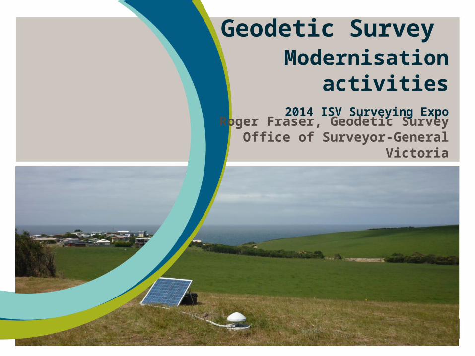
Geodetic Survey Modernisation activities 2014 ISV Surveying Expo Roger Fraser, Geodetic Survey Office of Surveyor-General Victoria
-
Upload
cole-frank -
Category
Documents
-
view
52 -
download
0
description
Geodetic Survey Modernisation activities 2014 ISV Surveying Expo. Roger Fraser, Geodetic Survey Office of Surveyor-General Victoria. Outline. Geodetic Strategy Consultation Draft New version of SMES Re-adjustment of Victoria’s GDA94 and AHD survey control networks - PowerPoint PPT Presentation
Transcript of Geodetic Survey Modernisation activities 2014 ISV Surveying Expo

Geodetic Survey Modernisation activities
2014 ISV Surveying Expo
Roger Fraser, Geodetic SurveyOffice of Surveyor-General Victoria

Outline
Geodetic Strategy Consultation Draft
New version of SMES
Re-adjustment of Victoria’s GDA94 and AHD survey control networks
Progress towards datum modernisation
2
Geodetic Strategy
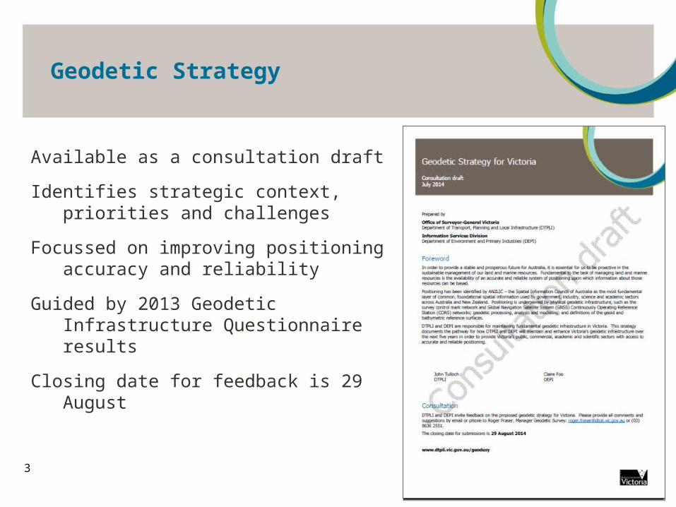
3
Available as a consultation draft
Identifies strategic context, priorities and challenges
Focussed on improving positioning accuracy and reliability
Guided by 2013 Geodetic Infrastructure Questionnaire results
Closing date for feedback is 29 August
Geodetic Strategy
4
Geodetic Strategy
5
Geodetic Strategy
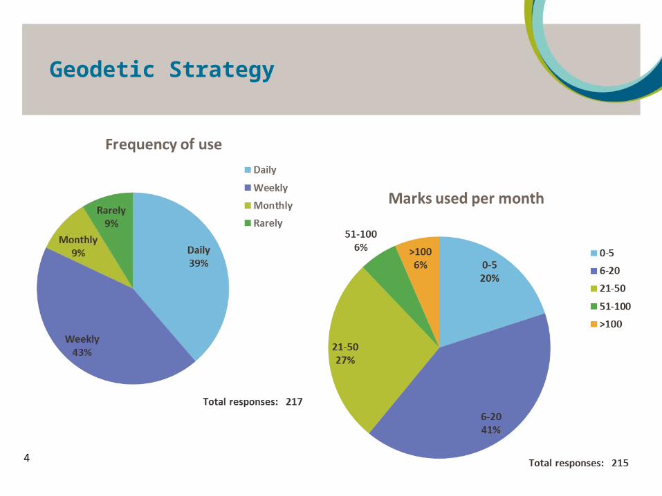
6Total responses: 217
Geodetic Strategy
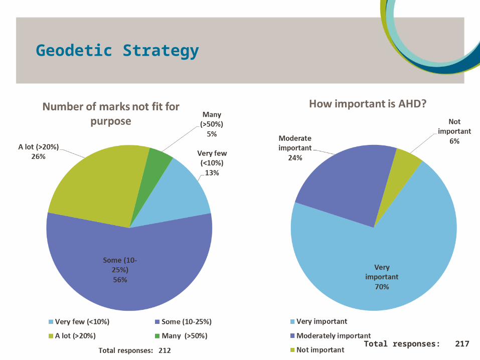
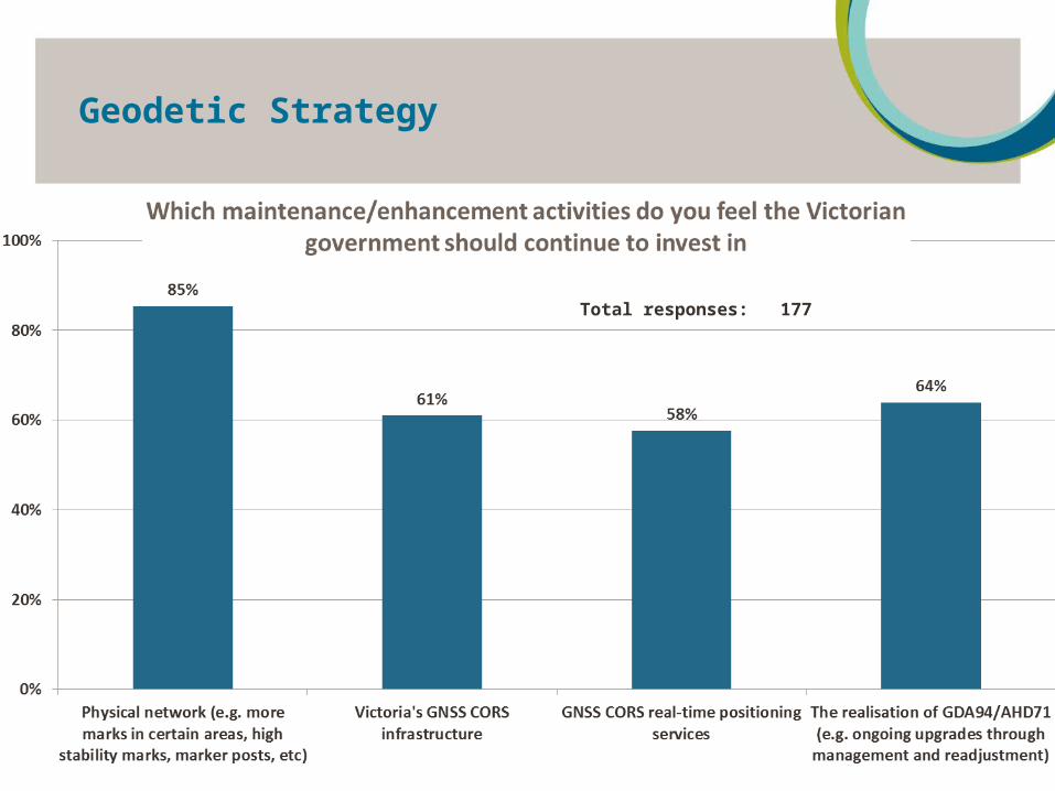
7
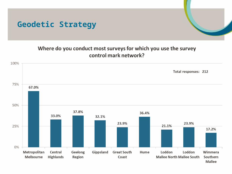
Total responses: 177

New version of SMES
8
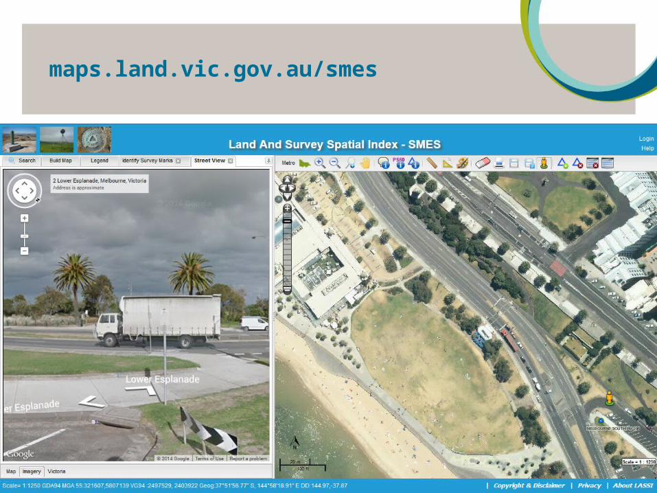
New interface with updated VicMap data, Google street view
Revised survey control mark categories and symbols
Flexible search options and several download format options
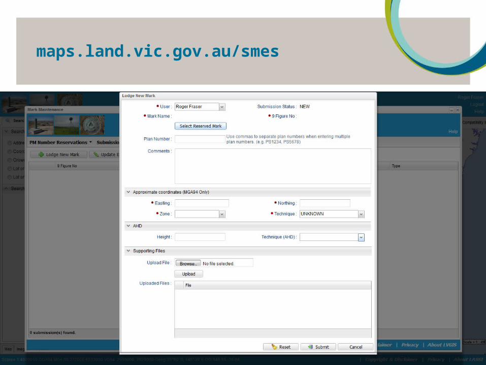
Online submission of sketch plans and raw survey measurements
New geodetic measurements database
Rigorous network adjustment system for processing of Victoria’s GDA94 coordinates and AHD heights
Open Web Services to support location based services applications
New version of SMES
9
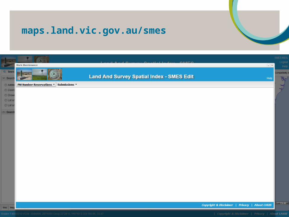
maps.land.vic.gov.au/smes

New version of SMES
10
Legend Description
SCN Mark. PM with adjusted GDA94 coordinates, no AHD height
SCN Mark. PCM with adjusted GDA94 coordinates, no AHD height
SCN Mark. PM with estimated GDA94 coordinates, levelled AHD height
Non-SCN Mark. PM or PCM with estimated GDA94 coordinates, no AHD height
Non-SCN Mark. PM or PCM with estimated GDA94 coordinates, estimated AHD height
SCN Mark. PM with adjusted GDA94 coordinates, levelled AHD height
SCN Mark. PM with adjusted GDA94 coordinates, estimated AHD height
Defective PM or PCM
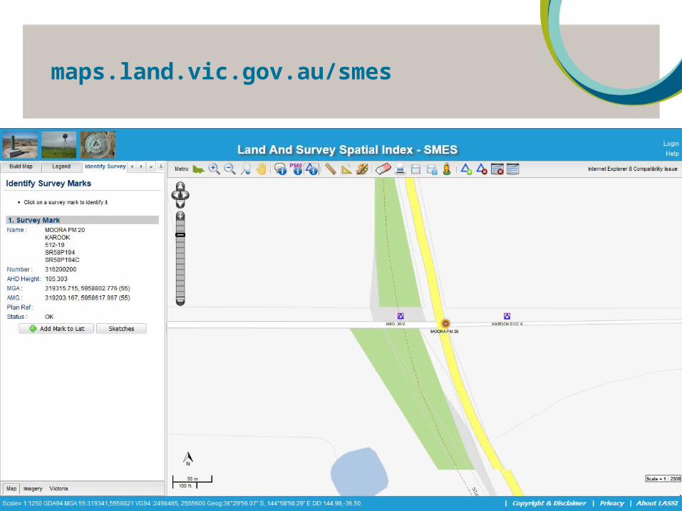
maps.land.vic.gov.au/smes
11
maps.land.vic.gov.au/smes
12

maps.land.vic.gov.au/smes
13
maps.land.vic.gov.au/smes
14
maps.land.vic.gov.au/smes
15
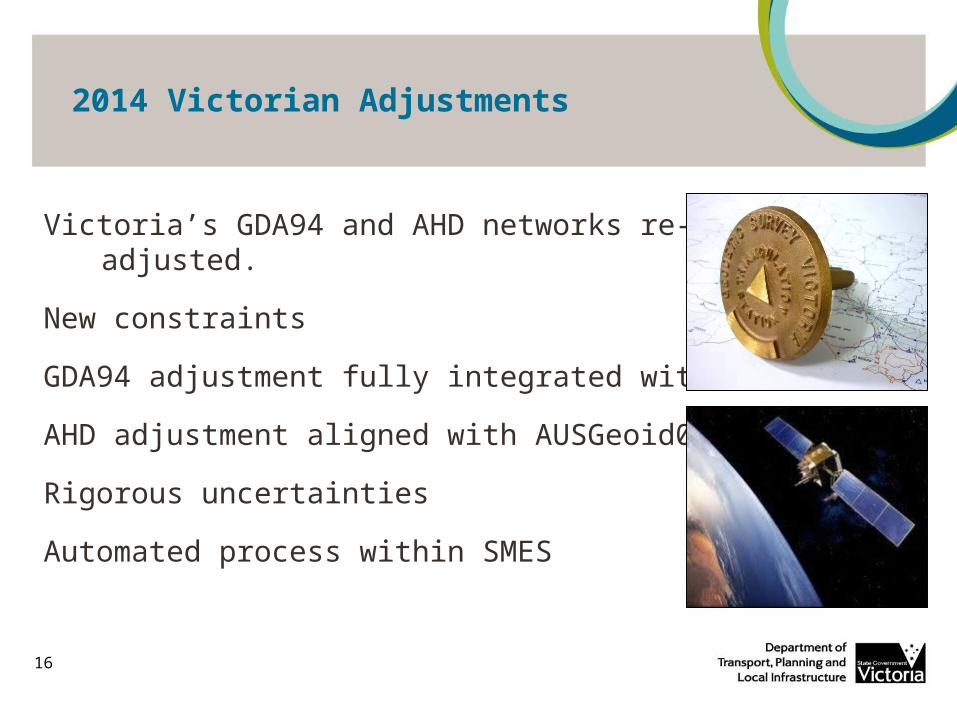
2014 Victorian Adjustments
16
Victoria’s GDA94 and AHD networks re-adjusted.
New constraints
GDA94 adjustment fully integrated with GPSnet
AHD adjustment aligned with AUSGeoid09
Rigorous uncertainties
Automated process within SMES
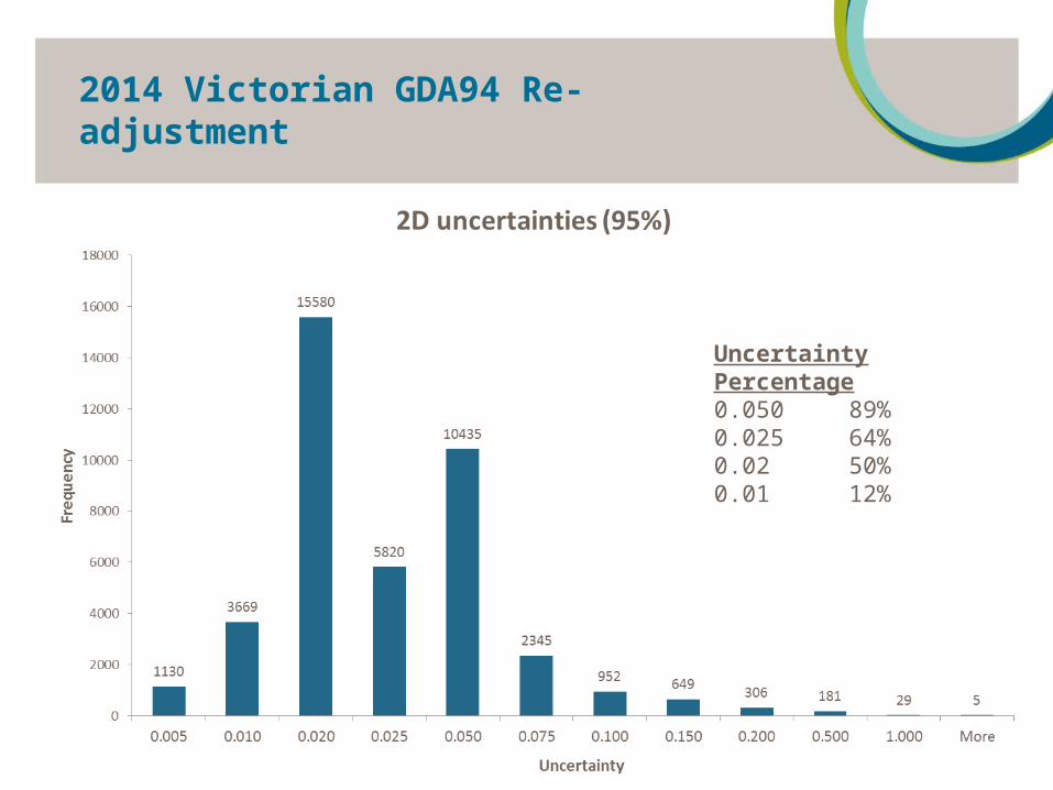
2014 Victorian GDA94 Re-adjustment
17
Uncertainty Percentage0.050 89% 0.025 64% 0.02 50% 0.01 12%
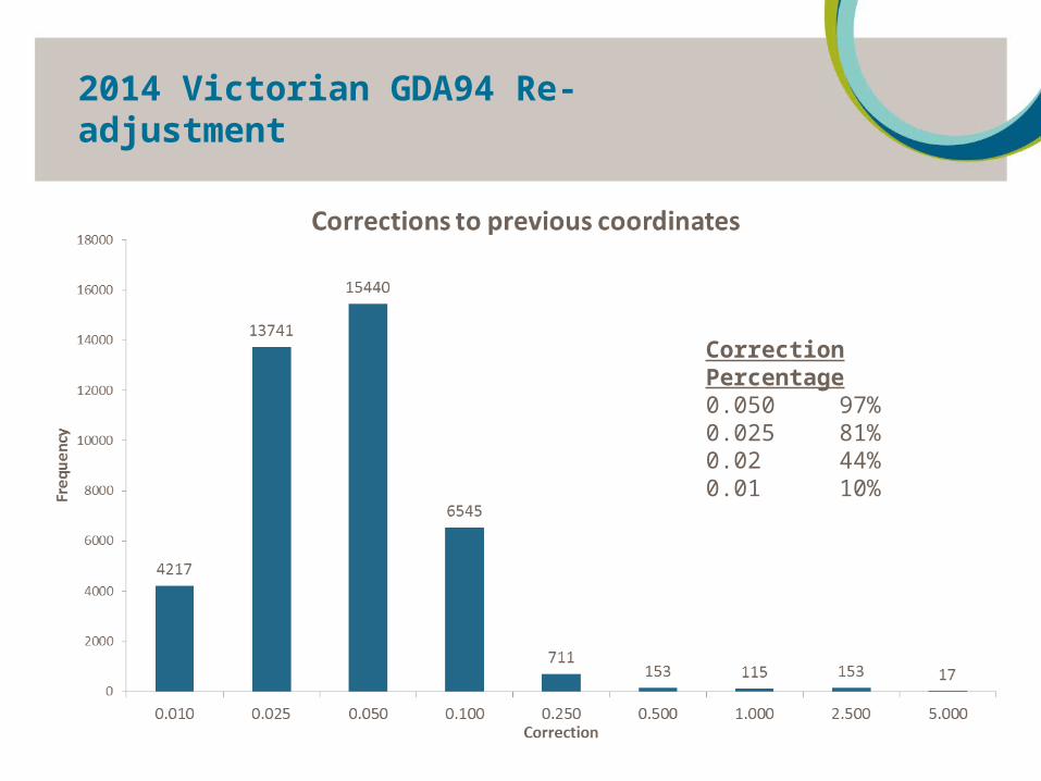
2014 Victorian GDA94 Re-adjustment
18
Correction Percentage0.050 97% 0.025 81% 0.02 44% 0.01 10%
2014 Victorian AHD71 Re-adjustment
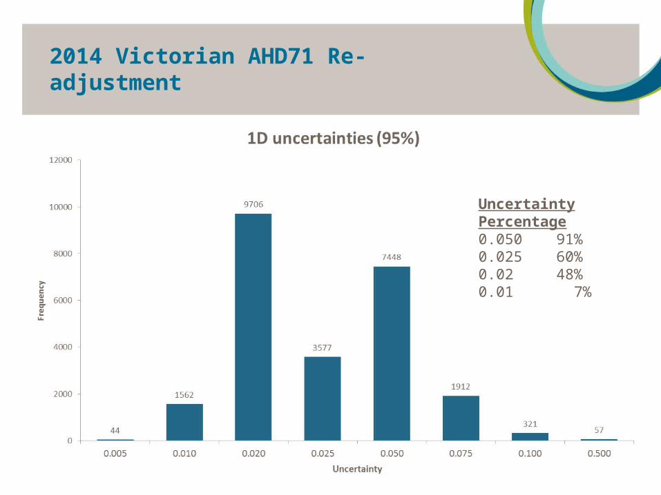
19
Uncertainty Percentage0.050 91% 0.025 60% 0.02 48% 0.01 7%

GDA94 - initial establishment
20 GDA94 constraintsGDA94 constraints
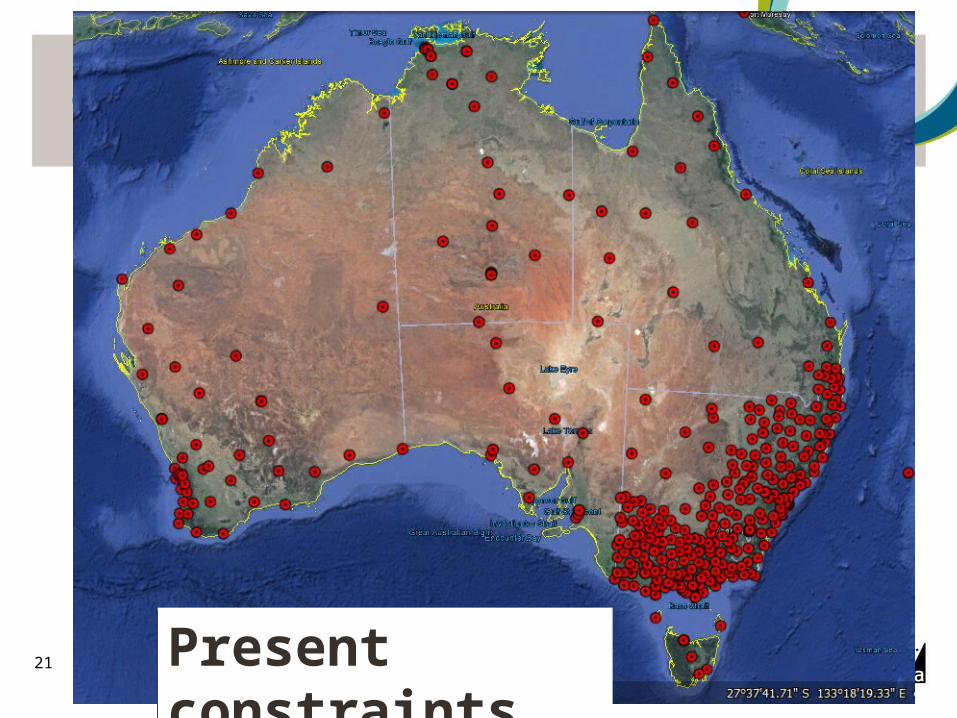
GDA94 – Present foundation
21 Present constraintsPresent constraints
Progress towards datum modernisation
23
Revised constraints (AuScope and GNSS CORS)
National geodetic networks assembled
Reprocessing of all old GNSS data
Rigorous adjustment software run on ANU supercomputer
Research into best approach for handling deformation and uncertainty
Business plan and communication strategy

Progress towards datum modernisation
24
1994 2000 2010 2020
GDA94Established
Continuously realised
2012Update
National re-adjustment2015
Victorian re-adjustment2014
Divergence of GDA94 from ITRF (metres) 7cm per year
GDA94Adopted
0 0.4 1.1 1.4 1.8

ITRF velocity model
25

Progress towards datum modernisation
26
New datum based on 2020 epoch (1.8m difference)
Continuously realised frame, and a static realisation
New tools and procedures
Stakeholder consultations being run to identify issues, implications and best transition approach
ICSM PCG and OSGV to provide leadership and assistance to surveying and spatial information stakeholders
Geodetic Survey Modernisation activities
2014 ISV Surveying Expo
Roger Fraser, Geodetic SurveyOffice of Surveyor-General Victoria