Flora of Usery Mountain Regional Park and Pass … · i ABSTRACT This study was designed to produce...
99
Flora of Usery Mountain Regional Park and Pass Mountain Region of Tonto National Forest, Arizona and Distribution of Saguaro (Carnegiea gigantea) on Pass Mountain in Southern Tonto National Forest by Laura Lee Marshall A Thesis Presented in Partial Fulfillment of the Requirements for the Degree Masters of Science Approved April 2011 by the Graduate Supervisory Committee: Kelly P. Steele, Chair William H. Miller Eddie J. Alford ARIZONA STATE UNIVERSITY May 2011
Transcript of Flora of Usery Mountain Regional Park and Pass … · i ABSTRACT This study was designed to produce...

Flora of Usery Mountain Regional Park and Pass Mountain Region of Tonto
National Forest, Arizona and Distribution of Saguaro (Carnegiea gigantea) on
Pass Mountain in Southern Tonto National Forest
by
Laura Lee Marshall
A Thesis Presented in Partial Fulfillment
of the Requirements for the Degree
Masters of Science
Approved April 2011 by the
Graduate Supervisory Committee:
Kelly P. Steele, Chair
William H. Miller
Eddie J. Alford
ARIZONA STATE UNIVERSITY
May 2011

i
ABSTRACT
This study was designed to produce a comprehensive flora of Usery
Mountain Regional Park and Pass Mountain of the Tonto National Forest. A total
of 168 vascular plant species representing 46 families and 127 genera were
collected or documented at this study area. Sixteen species were not native to the
flora of Arizona and represent 9.5% of the flora. Nevertheless, the study area does
not appear to be significantly damaged or degraded in spite of its historical and
current land use. The location and types of invasive species recorded in this study
will assist with implementing preventative measures to prevent further spreading
of certain species. The complete list of all vascular species recorded in this study
will provide a valuable tool for land management decisions and future restoration
projects that may occur at this area or similar sites and invasive species control.
The distribution of the saguaro (Carnegiea gigantea) population on Pass
Mountain was documented through the measurement of saguaros by random
sampling. ArcGIS was used to generate 50 random points for sampling the
saguaro population. Analysis to determine saguaro habitat preferences based on
the parameters of aspect, slope and elevation was conducted through ArcGIS. The
saguaro population of Pass Mountain significantly favored the southern aspects
with the highest concentration occurring in the southwest aspects at an average
density of 42.66 saguaros per hectare. The large numbers of saguaros recorded in
the younger size classes suggests a growing populations.

ii
ACKNOWLEDGMENTS
I want to acknowledge my Graduate Supervisory Committee for their
support and expertise; committee chair Dr. Kelly P. Steele for sharing her vast
knowledge and love of plants with me in the classroom and out in the field,
committee member Dr. William H. Miller for his expertise and guidance in GIS
and statistical analysis, and committee member Dr. Eddie J. Alford with his
background of the Sonoran Desert and Tonto National Forest area and experience
with saguaro research.
I appreciate Dr. Douglas Green, Chair of the Department of Applied
Sciences and Mathematics, for supporting my efforts as both a student and an
employee during this research project. Dr. Les Landrum, ASU Herbarium
Curator, was instrumental in both the selection of my study area and training I
received on the process of creating voucher specimens. Robert Wilson, State
Resources Soil Scientist for NRCS, provided information and resources for my
research project.
Usery Mountain Regional Park Supervisor Jennifer Johnston granted
permission for off-trail access and issued a letter allowing me to collect plants for
this study. Park Ranger Brennan Basler was available as needed for interviews
and historical information. Tonto National Forest Mesa Ranger District office
provided the documentation required for plant collecting within their boundaries.
Most of all, special thanks to my children; Tasha, Jake, Josh, Zach and
Jordan Marshall. They unconditionally supported me as a full time student and
assisted me with a majority of the field work required for this research project.

iii
TABLE OF CONTENTS
Page
LIST OF TABLES ................................................................................................. vi
LIST OF FIGURES .............................................................................................. vii
CHAPTER 1 ............................................................................................................1
FLORA OF USERY MOUNTAIN REGIONAL PARK AND PASS
MOUNTAIN REGION OF TONTO NATIONAL FOREST, ARIZONA .............1
INTRODUCTION ...................................................................................................2
Rationale for Study and Location ........................................................................2
Geology ............................................................................................................5
Climate. ............................................................................................................6
Vegetation. .......................................................................................................9
Land Use Impacts. .........................................................................................10
Hohokam. .......................................................................................................11
Mining. ...........................................................................................................12
Grazing. ..........................................................................................................12
Heber-Reno Sheep Driveway. .......................................................................13
Homesteading ................................................................................................15
Recreational Use. ...........................................................................................15
MATERIALS AND METHODS ...........................................................................18
Remote Sensing .................................................................................................18
Frequency of Invasive Species...........................................................................19
Herbarium searches ............................................................................................20

iv
Page
Plant Collection ..................................................................................................21
Plant Identification .............................................................................................22
RESULTS ..............................................................................................................24
DISCUSSION ........................................................................................................30
Land Use Impacts ..............................................................................................30
Invasive Species .................................................................................................31
Species of Interest ..............................................................................................37
Comparison with the Flora of South Mountains ................................................40
CHAPTER 2 ..........................................................................................................43
DISTRIBUTION OF SAGUARO (CARNEGIEA GIGANTEA) ON PASS
MOUNTAIN IN SOUTHERN TONTO NATIONAL FOREST ..........................43
INTRODUCTION .................................................................................................44
Saguaro (Carnegiea gigantea [Engelm.] Britton & Rose) ................................44
Current Study .....................................................................................................50
MATERIALS AND METHODS ...........................................................................52
Study Area .........................................................................................................52
Climate ...............................................................................................................53
Sample Point Identification................................................................................53
Location of Plots ................................................................................................55
Field Data Collection .........................................................................................56
GIS Derived Data ...............................................................................................57
Statistical Analyses ............................................................................................57

v
Page
RESULTS ..............................................................................................................59
DISCUSSION ........................................................................................................62
Directions for Future Research ..........................................................................67
REFERENCES ......................................................................................................69
APPENDIX A ........................................................................................................75
CATALOGUE OF THE VASCULAR PLANTS OF USERY MOUNTAIN
REGIONAL PARK AND PASS MOUNTAIN OF CENTRAL ARIZONA ....75

vi
LIST OF TABLES
Table Page
1. Thirty Year (1971-2000) Mean Annual Temperature and Precipitation
Data for the UMRP Study Area (WRCC, 2011) ..........................................7
2. Number of Genera and Species in Largest Families and Number of
Species in Largest Genera (2005 to 2010) .................................................25
3. Taxonomic Composition of the UMRP Study Area (2005 to 2010) .........26
4. Species not Encountered During this Study (2005 to 2010) ......................27
5. Species Observed but not Collected During this Study (2005 to 2010) ....27
6. Non-native Species Within the UMRP Study Area (2005 to 2010) ..........28
7. Non-native Species Present Along Pass Mountain Trail in 2010 ..............28
8. Comparison of Location Information with the Flora of UMRP (2005 to
2010) and the Flora of the South Mountains Study Area (1985) ...............29
9. Comparison of Number of Vegetation Types between the Flora of UMRP
(2005 to 2010) and the Flora of South Mountains Study Areas (1985) .....29
10. Thirty Year (1971-2000) Minimum Average Temperature and Mean
Annual Precipitation of the Pass Mountain Study Area ............................53
11. Chi Square Test of Saguaro Habitat Suitability Based on Aspect, Elevation
and Slope for the Pass Mountain Study Area ............................................61
12. Mean Density (Saguaros/ha) by Size Class per Aspect in the Pass
Mountain Study Area (2009 to 2010) ........................................................62
13. Abundance Scale for Listed Specis Found in the UMRP Study Area .......82
14. Acronyms of Previous Collectors of the UMRP Study Area ....................82

vii
LIST OF FIGURES
Figure Page
1. Boundary and Topography of the UMRP Study Area as Displayed on
USGS Buckhorn and Apache Junction 7.5 min Quadrangle Maps. ..... 4
2. Photo of Pass Mountain Located in the Southern Portion of the Tonto
National Forest and the Northern Portion of the UMRP Study Area ... 6
3. Average Monthly Precipitation and Temperatures of Granite Reef
Dam Weather Station Located Northwest of the UMRP Study Area ... 8
4. Average Monthly Precipitation and Temperatures of Stewart Mountain
Dam Located Northeast of the UMRP Study Area ............................... 8
5. Average Monthly Precipitation and Temperatures of Apache Junction
Weather Station Located East of the UMRP Study Area ..................... 8
6. Average Monthly Precipitation and Temperatures of Falcon Field
Weather Station Located Southwest of the UMRP Study Area ........... 9
7. Route of Heber-Reno Sheep Drive through Central Arizona in
Relation to the UMRP Study Area (Hacker, 2007). ........................... 14
8. Usery Mountain Regional Park Map, Maricopa County Parks and
Recreation (2009)................................................................................ 17
9. ArcGIS Map of Pass Mountain Trail Within the UMRP Study Area
Recorded by GPS in May 2010 .......................................................... 20
10. Number of Specimens Collected by Month at the UMRP Study Area
(2005 to 2010) .................................................................................... 24

viii
Figure Page
11. Families Represented in Flora of the UMRP Study Area (2005 to
2010) ................................................................................................... 25
12. Comparison of Vascular Plant Families Between the Flora of UMRP
(2005 to 2010) and the Flora of South Mountains (1985) .................. 42
13. Map of Saguaro Distribution Created by SEINet with Markers Linked
to Saguaro Specimens That Have Been Collected and Documented . 45
14. Map of Sonoran Desert Subdivisions (Shreve, 1951) ......................... 46
15. Boundary of the Pass Mountain Study Area Within the UMRP used
for the Evaluation of Saguaro Distribution (2009 to 2010) ................ 52
16. ArcGIS Map of the 50 Random Points for the Saguaro Plots Joined
With an Aspect Layer of the Pass Mountain Study Area ................... 54
17. A Photo Point of a Saguaro Plot Located on the West Side of Pass
Mountain Taken on April 17th
2009 ................................................... 56
18. Relative Density (Saguaros/ha) of Live Saguaros per Aspect Within
the Pass Mountain Study Area During 2009-2010 ............................. 63
19. Saguaro Density (Saguaros/ha) by Size Class in the Pass Mountain
Study Area 2009-2010 ........................................................................ 63
20. Elevation in Feet of Cities from the Border of the United States and
Mexico North into Central Arizona .................................................... 66
21. Relative Density (Saguaros/ha) of Dead Saguaros per Aspect Within
the Pass Mountain Study Area During 2009-2010 ............................. 67

1
CHAPTER 1
FLORA OF USERY MOUNTAIN REGIONAL PARK AND PASS
MOUNTAIN REGION OF TONTO NATIONAL FOREST, ARIZONA

2
INTRODUCTION
A flora is a comprehensive, systematic account of all the plant species of a
given area (FNA, 2008). A flora provides a baseline database of vascular plant
species and a tool for assessing changes over time, management decisions and
restoration projects. They create a collection of plant specimens that are pressed,
dried, mounted and referenced in space and time then deposited in herbaria (ASU,
2011). The Society of Ecological Restoration International recommends that
species list and herbarium specimens be used as a reference for restoration
projects occurring in the same area or similar sites (SER, 2004). Information
about indigenous plant species is important for the management of ecosystems to
preserve biodiversity and to monitor invasive species, which threaten native
plants (FNA, 2008).
Rationale for Study and Location
There are a number of reasons for the choice of Usery Mountain Regional
Park (UMRP) and Pass Mountain as the location for this flora. Previous surveys
were not extensive, but lists of species observed were available and some
specimens were present in the Arizona State University herbaria (ASU). This
information provided a foundation for the current study. The impact of recreation
and the proximity to an urban area on native vegetation is of interest to land
managers in the central Arizona region. Recreation occurs in the forms of hiking,
horse riding, mountain biking, picnicking and camping at UMRP and Pass
Mountain where they receive an average of 200,000 visitors a year. The peaks of
Pass Mountain rise high above the desert floor and may provide a habitat for

3
species that typically occur in higher latitudes and elevations, analogous to the
“sky island” mountains of southeastern Arizona (Perez-Alquicira et al., 2010). In
addition, there are several other floras from central Arizona (SEINet, 2011) whose
species composition can be compared to that of the UMRP with regard to, for
example, the presence of certain introduced species.
The study area for this flora includes all of UMRP and an adjacent
southern portion of the Tonto National Forest and comprises approximately 6,400
acres (10 square miles) in all (Figure 1). It falls between the latitude boundaries
of 33.490 N to the north and 33.44
0 N to the south with the longitude boundaries
of 111.620 W to the west and 111.58
0 W to the east. Elevation ranges from a
maximum of 945 m (3,100 ft) to a minimum of 549 m (1,800 ft). The southern
portion of the study area is the UMRP section located east of Usery Pass road.
The park is in the northeast corner of the city of Mesa in Maricopa County with
residential neighborhoods of Mesa bordering the south and east sides of UMRP.
The entire park is 3,648 acres, set at the western end of the Goldfield Mountains
between Usery and Pass Mountain. The park is adjacent to the Tonto National
Forest along the north border and to Pinal County on the east border. The
northern portion of the study site is located on approximately three sections of the
adjacent Tonto National Forest. Several trails from UMRP cross over onto the
Tonto National Forest where Pass Mountain is located.

4
Figure 1. Boundary and Topography of the UMRP Study Area as Displayed on
USGS Buckhorn and Apache Junction 7.5 min Quadrangle Maps.

5
Geology. The Sonoran Desert is within the Basin and Range Geologic
Province where mountain ranges are low to mid-elevation and generally trend
northwest-southeast and parallel one another (Rowland, 2000). The landscape at
the study area is dominated by the mountains and rock outcrops of the Goldfield
range. The mountains are igneous, composed of granitic rocks and extractive
basalt consisting of andesite, rhyolite, andesitic tuff, rhyolitic tuff and schist
(Robert Wilson, NRCS, pers. com.). The base of Pass Mountain (Figure 2) was
formed during the Precambrian Period approximately 1.2 billion years ago. It is
comprised of granite, an intrusive rock high in silica and low in iron and
magnesium, consisting of low temperature minerals. The distinct lighter yellow
colored cliffs about two thirds up the slopes of Pass Mountain is made up of
Geronimo Head Tuff, a layer of compacted volcanic ash that flowed out over the
surrounding landscape when the Goldfield Caldera collapsed about 15–16 million
years ago. The peak of Pass Mountain has been classified as basaltic, an extrusive
rock low in silica and high in iron and magnesium, consisting of high temperature
minerals and forming approximately 12-14 million years ago (Nations & Stump,
1996). One of the more popular features of the park is the 2.4 km (1.5 mile) trail
to the Wind Cave which is formed at the boundary between the granite base and
volcanic tuff layer on Pass Mountain at 2,840 foot elevation (Maricopa County,
2010). The flats and lower slopes surrounding Pass Mountain are largely
comprised of decomposed granite. A soil survey of UMRP was obtained online
from the Natural Resource Conservation Service (NRCS) Web Soil Survey with
the study site outlined as the Area of Interest (AOI) (NRCS, 2010). The data was

6
acquired from the soil map titled, Aguila-Carefree Area, Arizona, Parts of
Maricopa and Pinal Counties (AZ645). Pinamt-Tremant complex soil comprised
29.2% of the area surveyed within the park with Gunsight-Cipriano complex and
Tremant-Rillito complex both at 8% and Ebon very gravelly loam at 7% of the
area (NRCS, 2010).
Figure 2. Photo of Pass Mountain Located in the Southern Portion of the Tonto
National Forest and the Northern Portion of the UMRP Study Area.
Climate. The study area is located within the Arizona Upland subdivision
on the eastern and northern portions of the Sonoran Desert and has the highest
elevation and lowest temperatures, sometimes referred to as an arboreal desert
(Brown, 1982). Precipitation in the Sonoran Desert falls in a bimodal pattern with
a definite period of winter rains and a period of late summer rains. A severe
drought is common in late spring and a more moderate drought occurs in the fall.
Winter rains tend to be steady, moderate rainfall while during the summer rainy
season all of the season’s precipitation may be received in an hour or so, resulting
in flash floods (Ives, 1949). Temperature and precipitation data from four
weather stations (Table 1) that surround the study area were available from the
Western Regional Climate Center (2010). Thirty year average (1971 to 2000) of

7
maximum, average and minimum annual temperatures and average annual
precipitation were available. The four weather stations are; Granite Reef #023621
(Figure 3) located at latitude 33.520 N and longitude 111.70
0 W at 403 m (1,322
ft) elevation, approximately 8.9 km (5.5 miles) northwest of UMRP; Stewart
Mountain #028214 (Figure 4) located at latitude 33.550 N and longitude 111.53
0
W at 432.8 m (1,420 ft) elevation, approximately 10.5 km (6.5 miles) northeast of
UMRP; Apache Junction #020288 (Figure 5) located at latitude 33.450 N and
longitude 111.470 W at 630.9 m (2,070 ft) elevation, approximately 9.7 km (6
miles) east of the UMRP; and Falcon Field #022927 (Figure 6) located at latitude
33.43 0 N and longitude 111.73
0 W at 409 m (1,342 ft) elevation located
approximately 13.7 km (8.5 miles) southwest of UMRP.
Table 1
Thirty Year (1971-2000) Mean Annual Temperature and Precipitation Data for
the UMRP Study Area (WRCC, 2010).
Weather
Station
Distance/Direction
From Study Area
Mean Annual
Temperature
Mean Annual
Precipitation
Granite Reef
Dam 5.5 mi/Northwest 69.8
0 F 9.1”
Stewart
Mountain 6.5 mi/Northeast 69.4
0 F 12.5”
Apache
Junction 6 mi/East 71.6
0 F 12.3”
Falcon Field 8.5 mi/Southwest 67.60 F 7.9”

8
Figure 3. Average Monthly Precipitation and Temperatures of Granite Reef Dam
Weather Station Located Northwest of the UMRP Study Area.
Figure 4. Average Monthly Precipitation and Temperatures of Stewart Mountain
Dam Located Northeast of the UMRP Study Area.
Figure 5. Average Monthly Precipitation and Temperatures of Apache Junction
Weather Station Located East of the UMRP Study Area.

9
Figure 6. Average Monthly Precipitation and Temperatures of Falcon Field
Weather Station Located Southwest of the UMRP Study Area.
Vegetation. The vegetation of the Arizona Upland subdivision of the
Sonoran desert often takes on the appearance of a low woodland or scrubland
(Brown, 1982). Some of the signature species of this area include the saguaro
(Carnegia gigantea), yellow palo verde (Parkinsonia microphylla), blue palo
verde (Parkinsonia florida), creosote bush (Larrea tridentata), prickly pear
(Opuntia spp.), several species of cholla (Cylindropuntia spp.), and brittle bush
(Encelia farinosa) (Brown, 1982).
Annual and perennial plant species that populate this ecosystem are
dependent on rainfall events to trigger growth and reproduction. The bimodal
pattern of rainfall results in two distinct pulses of vegetation growth
corresponding to the two seasons of precipitation in late spring-early summer and
then the monsoon rainfall in late-summer early fall (Notaro et al., 2010), resulting
in rich species diversity.
Non-native plant species, largely of Mediterranean origin, have entered
the region over time. Red brome (Bromus rubens) and Asian mustard (Brassica
tournefortii), often referred to as Sahara mustard, are two of several species

10
present at this study site. Non-natives species can reduce the density of native
species by competing for resources and some create a cover of fine fuels that can
increase fire frequency and severity (Bowers et al., 2006).
Sky islands are mountains with a steep vegetation gradient that exist in the
Sonoran Desert of the southwestern United States and northern Mexico (Davison
et al., 2011). Their base is surrounded with desert scrub but the mountain top may
be home to species typically found in other biomes. These islands are thought to
be the consequence of climate change 11,000 years ago that resulted in drier,
warmer conditions resulting in isolation of some mountain top communities
where the climate can still sustain them (Perez-Alquicira et al., 2010). They are
of interest for studying the effects of isolation on both plant and animal species.
Historical and Current Land Use
Land Use Impacts. The potential impact of pre-historic, historic and
current land use upon the local vegetation and species composition was of great
interest in this study. It takes several decades for desert vegetation to recover
from human impacts (Guo, 2004) thus effects of past land use may be apparent in
the study area. Early on the Hohokam designed canal systems, some of which are
still visible today in the surrounding Salt River Valley, to support their agriculture
(Palacios-Fest, 1997). Tailings from mine shafts and open pit mines from the
nineteenth and twentieth centuries scar the landscape. Roads and trails created in
arid environments for mining access remove vegetation, cause habitat
fragmentation and compact the soil. Increased water runoff from the compacted
soil or surfaces of roads and trails facilitate the producing of flowers and fruits by

11
roadside plants while plants further away are not able to produce (Jansen et al.,
2009), somewhat altering the function of the local ecosystem. Heavy grazing
often decreases the diversity and abundance of herbaceous species (Guo, 2004)
and can alter the composition of the local vegetation. Recreational activities can
cause damage in a variety of forms if not contained within designated areas.
Disturbance to an ecosystem resulting from human activities can often facilitate
the establishment of invasive species (SER, 2004).
Hohokam. The Hohokam began occupying the Salt River Valley
sometime between 1 - 300 ADD It is still unclear whether they migrated to the
area or if they were indigenous hunters and gatherers who learned agriculture.
The Hohokam developed the most complex irrigation system known in North
America with over 800 km (497 miles) of canals (Palacios-Fest, 1997). The study
area is over 122 m (400 ft) above the elevation of the Salt River and does not
contain any evidence of canals probably due to the incline nor is there any
evidence of cultivated agave gardens. According to Brennan Basler, a park ranger
at UMRP, shards of Hohokam pottery, stone projectiles such as arrowheads and
spearheads, and the remains of a degraded pit house have been found within the
park (Brennan Basler, UMRP Ranger, pers. com.). The Hohokam constructed the
pit houses by digging a single room approximately two feet into the ground to
help stay cool. The framework was built with tree branches and the roof with
saguaro or ocotillo spines. The structure was then covered with brush and
plastered with mud (Gregonis & Reinhard, 1979). In the 1200’s the society had
an ambitious agricultural system, but by the 1450’s the Hohokam population was

12
only one tenth of what it had been. Possible causes of the disappearance of their
civilization include salinization of the soil along with over-population (Palacios-
Fest, 1997).
Mining. There is no record of Pass Mountain itself having been mined
although extensive mining occurred in other mountains of the Goldfield range and
the Superstition Mountains (Arizona Historical Foundation, 1963). On the east
side below Pass Mountain a shallow pit mine was seen during the study and a
coke oven was noted along the park and forest boundary built in the late 1800’s.
Coke ovens were built to slowly burn and reduce mesquite wood to coke, a hotter
burning fuel for use in smelting ore (Digital West Media, 2010). Dry pan mining
was quite common in the area up until the park was established in 1967 at which
time mining activities were no longer allowed (Brennan Basler, UMRP Ranger,
pers. com.).
Grazing. The entire area has been subject to grazing from the 1870’s to
the late 1940’s. Usery Mountain, located northwest of Pass Mountain, is named
for the cattleman King Usery who ran livestock in the area during the late 1870’s
and early 1880’s. James E. Bark used the area for grazing from the mid 1880’s
through the 1920’s. A grazing lease was issued to R. K. Gibson in 1927.
According to the records of the USDA Tonto National Forest Range Appraisal
Atlas, the study site was part of grazing allotment 75. Other permittees recorded
in the Range Appraisal Atlas in 1927 for this allotment included Barkley &
Steward, Fred Weeks & Son and Geo. D. Weeks (TNF, 1927). The next recorded
lease within the park area was to Edward Mathisson between the years of 1945

13
and 1947. He utilized all of Sec. 12, the south ½ of Sec. 2 and the east ½ of Sec.
16, T1N, R7E for grazing cattle (Arizona Historical Foundation, 1963).
Heber-Reno Sheep Driveway. In 1890 the Heber-Reno sheep driveway
became a designated driveway according to U.S. Forest documents (TNF, 1916a).
This trail is approximately 370 km (230 miles) with the northern end point in the
White Mountains near Sun Rise Ski Resort and the southern end of the trail
entering the east side of the Salt River Valley though Mesa into Chandler for
winter grazing (Hacker, 2007). Men riding donkeys drive the sheep north with
the assistance of sheep dogs once the snow melts in the spring. The sheep spend
the summer in cooler weather foraging and mating before returning south to the
East Valley when the temperatures drop (Grado, 2009). Usery Pass Road
(referred to as Bush Highway on some maps), which currently borders the east
side of the park, originally began as a section of the historical sheep trail that
crossed between Usery and Pass mountains as the starting/gathering and
ending/dispersal point (TNF, 1916a). The historic Reno-Heber Sheep trail was in
use at the time the park was established in 1967 and is considered the most
interesting historical feature of Usery Mountain Park (Van Cleve, 1967). A parcel
of State Land, the North half of Section 2, T1N, R7E was leased by the Arizona
Wool Growers Assoc. as a holding ground for the sheep drive. The proposed area
for Usery Mountain Regional Park surrounded this half section on three sides with
the Tonto National Forest on the fourth. Consultants were instructed to include
this half section in the master plan with the hope it could be acquired (Van Cleve,
1967). The Heber-Reno sheep driveway is still in use today by the Sheep Springs

14
Sheep Co. located in Chandler, Arizona (Figure 7). In 2009 about 4,000 sheep
were moved up north through Heber in April and then back down south entering
the East Valley the last week of September and early October (Grado, 2009). The
flock did not cross into the UMRP boundaries although a sheep camp further
north is located on the Tonto National Forest just outside of the UMRP study
area.
Figure 7. Route of the Heber-Reno Sheep Drive through Central Arizona in
Relation to the UMRP Study Area (Hacker, 2007).

15
Homesteading. Three people sought to claim a homestead within the
boundaries of what is now UMRP. It is recorded by the Bureau of Land
Management that only Chester A. McGill of Mesa succeeded in obtaining a patent
in 1932 to his claim of 160 acres located in the NE ¼ of Section 1, T1N, R7E.
This parcel changed hands many times up to 1953 when it was purchased by
Irwin F. Barlow who began selling small portions of it in 1955 (Arizona
Historical Foundation, 1963).
Recreational Use. The Maricopa County park system began in 1954 to
preserve the mountain areas surrounding the valley of metropolitan Phoenix for
future generations to enjoy. A federal act called the Recreation and Public
Purposes Act allowed the county to acquire thousands of acres of parkland from
the Bureau of Land Management at $2.50 an acre (Maricopa County, 2010). In
1965 a survey of the proposed UMRP and surrounding area was conducted. A
master plan for Usery Mountain Semi-Regional Park was prepared by Van Cleve
Associates, Consulting Planners in 1967. The Maricopa County Parks and
Recreation Commission and the Executive Park Committee unanimously adopted
the document as the official plan for development of the park on July 5th
, 1967.
The master plan provided approximately 13 km (8 miles) of horse riding trails and
about 26 km (16 miles) of hiking trails (Van Cleve, 1967) Today UMRP (Figure
8) offers over 47 km (29 miles) of trails for hiking, mountain biking and
horseback riding, most are multi-use. The Archery Range at UMRP is the only
"Five Star" rated archery range in Arizona and hosts over 30 tournaments
annually (Maricopa County, 2010). The 1967 master plan provided for about 170
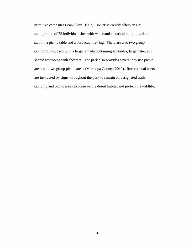
16
primitive campsites (Van Cleve, 1967). UMRP currently offers an RV
campground of 73 individual sites with water and electrical hook-ups, dump
station, a picnic table and a barbecue fire ring. There are also two group
campgrounds, each with a large ramada containing six tables, large patio, and
shared restrooms with showers. The park also provides several day use picnic
areas and two group picnic areas (Maricopa County, 2010). Recreational users
are instructed by signs throughout the park to remain on designated trails,
camping and picnic areas to preserve the desert habitat and protect the wildlife.

17
Figure 8. Usery Mountain Regional Park Map, Maricopa County Parks and
Recreation (2009).

18
MATERIALS AND METHODS
Remote Sensing
Remote sensing images were used to examine the study area’s topography
and to locate washes. Desert washes create a microhabitat that will often support
plant growth during drier periods of the year. An image taken by the USGS
Landsat 5 satellite was downloaded into ERDAS IMAGINE geospatial data
authoring software. The satellite’s Thematic Mapper (TM) sensor collects
spectral reflectance in seven bands ranging from 360nm to 14,500nm (USGS,
2010). The image that covered the study area was located on Path 37, Row 37.
An unsupervised classification with a maximum of 20 classes and 20 iterations
was preformed. A subset to the area of interest for the study site was created and
an edge enhancement preformed with a 3 x 3 mean convolution to bring out
image contrast and enhance the topography, making the washes more distinct.
Two additional datasets were downloaded from the seamless USGS website from
the Landscape Fire and Resource Management Planning Tools Project known as
LANDFIRE. A Landfire NED image provided raster digital data of the elevation
and a Landfire Existing Vegetation Cover image provided canopy cover types
and urban development of the study site. These spatial layers were overlaid with
the vegetation layer set at 40% transparency allowing the elevation to show
through. With these two spatial layers the urbanized areas at the park boundaries
and Pass Mountain were very distinct. A layer was created of the UTM
coordinate points for each plant specimen collected was overlaid on the above
spatial layers. This provided a visual tool to track the plant collecting process, the

19
distribution of the collection locations and showed areas within the study area that
had not yet been collected to ensure sampling throughout the entire site. In
addition, by performing an inquiry on each point one could acquire the exact
elevation, slope and aspect at which that plant specimen was collected.
Frequency of Invasive Species
To estimate the abundance of invasive species within the UMRP study
area, the presence of selected species were recorded along the Pass Mountain trail.
The trail is located on the Tonto National Forest and is the longest hiking trail of
the park. Pass Mountain trail is an approximately 11 km (7 miles) loop around
the base of Pass Mountain. A Magellan Meridian Gold GPS unit was used to map
the entire trail by recording the UTM coordinates from 5 to 20 meter increments
depending on direction change of the trail. A map was created in ArcGIS with a
shape file of the trail overlaid on a Digital Elevation Map (DEM) of Pass
Mountain (Fig. 9). In between each point that a coordinate was taken the
presence or absence of select invasive species was recorded. The species
recorded were Avena fatua, Bromus rubens, Pennisetum ciliare, Pennisetum
setaceum, Brassica tournefortii and Sisymbrium irio. The number of points at
which the species were present was then divided by the total number of points
(314) collected to calculate a percent presence for each species along the Pass
Mountain trail.

20
Figure 9. ArcGIS Map of Pass Mountain Trail Within the UMRP Study Area
Recorded by GPS in May 2010.
Herbarium searches
A herbarium stores collections of pressed and mounted plant specimens
referenced in space and time (ASU, 2011). Most plants collected from the study
area prior to this flora are at the Arizona State University Vascular Plant

21
Herbarium (ASU) with some at the University of Arizona Herbarium located in
Tucson, Arizona (ARIZ). Lists of plants that had been previously collected at
Usery Mountain Regional Park were reviewed on the Southwest Environmental
Information Network (SEINet) website throughout the collection process. The
species checklists available on this site were compiled using a combination of
voucher specimens, photo observations and survey projects (SEINet, 2011).
Plant Collection
A collecting permit was received from the Mesa Ranger District office for
collecting in the Tonto National Forest portion of the study area and the park
supervisor of UMRP sent an email granting permission to collect and remove
plants within the park boundaries for this study. Collection began in March of
2005 and continued through May of 2010 for a total of 54 days. This does not
include the days spent at the study area when either no new species were found to
collect or the plants were not in flower or fruit. Most collecting took place in the
spring months of March, April and May after the winter rains. Very little
collecting took place during June and July, but after the monsoon rains the
number of collections increased during August and September, but relatively little
collecting took place October through February. Numerous visits were made to
the study area every month throughout the year at the beginning of the study and
then as most species had been collected the visits were concentrated more around
the flowering and fruiting periods shortly after rain events.
Field notes that include a collection number, UTM coordinates, date,
location details, terrain, and associated species were recorded with each specimen

22
at the time of collection. Characteristics of the plant such as flower color were
recorded due to color changes associated with the drying process. For grasses and
forbs the entire plant was removed from the ground with roots attached if
possible. Clippings were taken of shrub and tree species that included flowers or
fruit. Three species of cactus were collected with either fruit or flower. Due to
the difficult process of collecting and preparation required to press cactus
specimens, I listed the remaining cactus species at the study area as, “observed
but not collected.”
Plant Identification
All plants collected had flowers, fruits or both as is standard for voucher
specimens. Each specimen was arranged, pressed and dried in a plant press as
soon as possible after being collected. Dried specimens were then examined,
compared to other specimens, and dissected under a microscope if necessary to
determine the exact species. The following references were used in the
identification process; Arizona Flora (Kearney & Peebles, 1960), the United
States Department of Agriculture PLANTS Database (USDA & NRCS, 2011) and
the online version of the Flora Of North America (FNA, 2008). Nomenclature
throughout the text follows United States Department of Agriculture PLANTS
database (USDA & NRCS, 2011).
Identified plant specimens were mounted on herbarium grade paper with a
label identifying the family, genus and species of the specimen, date and location
of collection, name of the collector and other information such as the terrain and
associated species. An envelope was attached to capture and store any seeds or

23
other parts of the specimen that may come loose. The plant specimens from this
study were deposited at the ASU herbarium as a permanent record. A duplicate
set of specimens was donated to UMRP for their use.
A comparison was made between this flora of the UMRP study area and
the flora of the mountain ranges within South Mountain Park (Daniel &
Butterwick, 1992). The study areas for both these floras border the Phoenix
metropolitan area in central Arizona and are located approximately 30 miles
across the Salt River valley from each other. They each contain a public park
within its boundaries.

24
RESULTS
Figure 10 indicates the number of specimens collected by month for the
period March 2005 to May 2010. The highest percentage of plants collected
within a month during this study was 40% in March, with 24% collected in April
and 10% in May. Up to twenty-one species were collected within a single day on
March 16, 2005. Only two specimens were collected for 1% in June and one
specimen for 1% in July during this study. After the monsoon rains, collections
rose to 7% in August and 9% in September. October dropped back to 1% percent
while collecting rose slightly in November to 3%. No specimens were collected
in December or January but 4% of the specimens were collected in February.
Figure 10. Number of Specimens Collected by Month at the UMRP Study Area
(2005 to 2010).
A total of 168 species representing 46 families and 127 genera have been
collected or documented at this study area. The largest family is Asteraceae
representing 18% of the flora with 30 species (Table 2). The Poaceae are the

25
second largest family with 17 species at 10% and Fabaceae with 13 species
represents 8% of the flora for this study. Other large families are: Boraginaceae,
with nine species; Cactaceae, with eight species; Euphorbiaceae, with seven
species; Brassicaceae, with six species; Malvaceae, with six species and
Polygonaceae with five species. The rest of the 35 families combined contain 67
species and represent 40% of the entire flora as shown below in Figure 11.
Figure 11. Families Represented in Flora of the UMRP Study Area (2005 to
2010).
Table 2
Number of Genera and Species in Largest Families and Number of Species in
Largest Genera (2005 to 2010).
Largest
Families
Genera/Species Largest Genera Species
Asteraceae 25/30 Ambrosia 4 Poaceae 12/17 Bromus 3
Fabaceae 9/13 Lotus 3

26
The major taxonomic categories of the flora are summarized in Table 3.
The three divisions used are: Pteridophyta, which contains the Pteridaceae (fern)
family; Gnetophyta which contains the Ephedraceae (Mormon tea) family and
Magnoliophyta, which contains the two classes of Liliopsida (monocots) with the
Poaceae and Liliaceae family; and Magnoliopsida (dicots), which contains the
remaining 42 families represented in the flora. A total of 16 species that have
been documented or previously collected at this study area were not encountered
during this study (Table 4). Seven of the species were observed but not collected
due to either the difficulty or inability to collect the species during fruiting or
flowering (Table 5). Sixteen of the species recorded were non-native to the flora
of Arizona and accounted for 9.5% of species observed (Table 6). The origin of
these non-native species include Europe, the Mediterranean region, Asia, and
Africa. Six of the non-native species were observed along the Pass Mountain trail
system (Table 7). For prospective purpose the UMRP physical characteristics and
flora were compared with of South Mountain Municipal Park (Table 8 and 9).
Table 3
Taxonomic Composition of the UMRP Study Area (2005 to 2010).
Division Class Families Genera Species
Pteridophyta Filicopsida 1 2 3 Gnetophyta Gnetopsida 1 1 1
Magnoliophyta Liliopsida 2 13 18
Magnoliophyta Magnoliopsida 34 112 147
Total 46 127 168

27
Table 4
Species not Encountered During this Study (2005 to 2010).
Species Common Name
Abutilon abutiloides (Jacq.) Garcke ex Hochr. Shrubby Indian mallow Amsinckia tessellata A. Gray Bristly fidleneck
Anemone tuberosa Rydb. Tuber Anemone
Argemone gracilenta Greene Sonoran Pricklypoppy
Aristolochia watsonii Woot. & Standl. Watson’s Dutchman’s
pipe Chaenactis stevioides Hook. & Arn. Esteve’s pincishion
Cryptantha barbigera (A. Gray) Greene Bearded cryptantha
Cynanchum arizonicum (A. Gray) Shinners Arizona swallow-wort
Eriogonum palmerianum Reveal Palmer’s Buckwheat
Eriogonum thomasii Torr. Thomas’ Buckwheat
Lepidium lasiocarpum Nutt. Shaggyfruit pepperweed
Lotus humistratus Greene Foothill deervetch
Lotus rigidus (Benth.) Greene Shrubby deervetch
Machaeranthera pinnatifida (Hook.) Shinners Lacy tansyaster
Muhlenbergia porteri Scribn. ex Beal Bush muhly
Pterostegia drymariodes Fisch. & C.A. Mey. Woodland Pterostegia
Table 5
Species Observed but Not Collected During This Study (2005 to 2010).
Species Common Name
Carnegia gigantica (Engelm.) Britton & Rose Saguaro Cylindropuntia bigelovii (Engelm.) F.M. Kunth Teddybear cholla
Cylindropuntia fulgida (Engelm.) F.M. Kunth Chainfruit cholla
Datura stramonium L. Sacred Datura
Echinocereus engelmannii (Parry ex Engelm.) Lem. Englemann’s hedgehog
Fouquieria splendens Engel. Ocotillo
Mammillaria grahamii Engelm. Graham’s nipplecactus

28
Table 6
Non-Native Species Within the UMRP Study Area (2005 to 2010).
Species Common Name
Arctotis stoechadifolia P.J. Bergius African daisy Avena fatua L. Wild oat
Brassica tournefortii Gouan Asian mustard
Bromus diandrus Roth. Ripgut brome
Bromus rubens L. Red brome
Cynodon dactylon (L.) Pers. Bermudagrass
Erodium cicutarium (L.) L'Hér. ex Aiton Redstem stork’s beak
Malva parviflora L. Cheeseweed mallow
Oncosiphon piluliferum (L.F.) Källersjö Stinknet
Pennisetum ciliare (L.) Link Bufflegrass
Pennisetum setaceum (Forssk.) Chiov. Fountaingrass
Schismus arabicus Nees Arabian schismus
Schismus barbatus (Loefl. ex L.) Thell. Common Mediterranean
Sisymbrium irio L. London rocket
Sonchus oleraceus L. Common Sowthistle
Sorghum bicolor (L.) Moench Sorghum
Table 7
Non-native Species Present Along Pass Mountain Trail in 2010.
Non-Native Species Form % Presence
Avena fatua L. Grass <1% Brassica tournefortii Gouan Forb 9%
Bromus rubens L. Grass 46%
Pennisetum ciliare (L.) Link Grass 1%
Pennisetum setaceum (Forssk.) Chiov. Grass <1%
Sisymbrium irio L. Forb 5%

29
Table 8
Comparison of Location Information with the Flora of UMRP and the Flora of the
South Mountains Study Area.
Location Information
Flora of UMRP Flora of S. Mtn.
Area 6,400 acres 17,920 acres
Slope Range 0% - 70% 15% - 45%
Elevation Min. 549 m 366 m
Elevation Max. 945 m 820 m
Elevation Range 396 m 454 m
Mountain Ranges Goldfield Ma Ha Tauk, Gila
& Guadalupe
Park Est. 1967 1924
Administration Maricopa Co.
Parks & Rec.
City of Phoenix
Parks & Rec.
Avg. Visitors 200,000/ yr 3,000,000/ yr
Trails 47 km 67 km
Table 9
Comparison of Number of Vegetation Types between the Flora of UMRP (2005
to 2010) and the Flora of South Mountains Study Areas (1985).
Vegetation types
Flora of UMRP Flora of S. Mtn.
Tree 6 12
Shrub 31 84
Cactus 9 11
Forb 92 143
Vine 7 9
Grass 17 34
Fern 3 8
Aquatic 0 2
Total Species 168 287
Non-natives 16 / 9.5% 28 / 10%

30
DISCUSSION
Land Use Impacts
The UMRP study area does not appear to be significantly damaged or
degraded in spite of its historic and current land use. There was no evidence of
canals or cultivated agave from the Hohokam, more than likely due to the distance
and steady incline from the Salt River to the study area. An open pit mine was
observed on the Tonto National Forest northwest of Pass Mountain but it was
quite shallow from filling in over the years and overgrown with native vegetation.
Remnants of old roads and trails that were blocked off when the park was
established are now overgrown and merge with the local vegetation. There was a
relatively low density of most introduced species throughout the study area. On
the Tonto National Forest side of the UMRP study a few saguaros were observed
with multiple bullet holes from target shooting but the wounds appeared to be
quite old and no fresh damage was observed. There is a camp area used for the
Heber Reno sheep drive that is just outside of the study area to the north on the
Tonto National Forest. It is approximately 30 meters in diameter and is clear of
most vegetation with a few campfire rings. Just north of the UMRP study area is
the Bulldog Canyon Off-highway vehicle area, but legal travel is only permitted
on designated routes (USFS, 2010b); none of these trails cross over into the study
area.
The lack of apparent damage to the UMRP vegetation may be due to
several factors. Park visitors encountered during this study seemed quite
respectful and appreciative of the surrounding desert. UMRP offers several

31
classes and guided tours every month educating its visitors on the local vegetation
and wildlife. The Maricopa County Parks and Recreation current park rules
consider the damaging or removing of any of vegetation vandalism. The rules
also prohibit park users from leaving designated trails (Maricopa County, 2010).
UMRP employs a staff member specifically to maintain their trails by ensuring
they are well marked for visitor use and to create barriers that help prevent soil
erosion (Brennan Basler, UMRP Ranger, pers. com.). Many of the park trails
utilize gravelly washes as part of the trail, minimizing impact on surrounding
vegetation. The presence of invasive species was documented in the study area,
but they are not currently a significant problem. A few potential problem species
are discussed below. UMRP does not have any specific plan for invasive species
control in place, but the park supervisor is very interested in learning the location
and types of invasive species recorded in this study to implement preventative
measures (Jennifer Johnston, UMRP Supervisor, pers. com.).
Invasive Species
Invasive species can irreversibly change natural ecosystems but a lack of
historical information on their distribution makes it difficult to determine the rate
of spreading (Bower et al., 2006). Floras provide a reference in space and time
that can be used as a tool for future tracking of the invasive species documented
within them. A total of nine introduced grasses were documented and collected in
the UMRP study area and are discussed in order from the most frequently
encountered to those rarely encountered during this study. A total of seven
invasive herbaceous dicot species were collected and are discussed in a similar

32
order. Only the three following invasive species were previously recorded within
the study area; Red brome grass (Bromus rubens), London rocket (Sisymbrium
irio) and Common sowthistle (Sonchus oleraceus) (SEINet, 2011).
These introduced grass species; Red brome, Arabian schismus, and
Common Mediterranean grass are very common in the Sonoran desert and in the
study area. These species are unlikely to be eradicated from the park, but the
remaining species could be.
Red brome grass (Bromus rubens) is native to the Mediterranean region
and is a cool season annual adapted to warm temperatures (Northam & Meyer,
2010). Red brome will germinate with less rainfall and lower temperatures than
most native species require. In the Sonoran Desert, dead and dry red brome easily
ignites and fuels fast moving surface fires, promoting fires in areas where fire was
previously infrequent due to insufficient fuels and shortens fire return intervals
(USFS, 2010a). Red brome was considered the major catalyst in the Cave Creek
fire of 2005 that burned 248,310 acres approximately 56 km (35 miles) northwest
of this study area (Dugan, 2010). Red brome is the most common of all invasive
species throughout the study area and has a 46% presence recorded along Pass
Mountain trail. It is even more abundant in some of the flatter areas of the study
area.
Two species in the genus of Schismus, Arabian schismus (S. arabicus) and
Common Mediterranean grass (S. barbatus), are native to Africa, Asia and
Europe. By the 1970’s they were present within all of the desert counties of
Arizona (Halvorson & Guertin, 2003b). In the Lower Colorado River Valley and

33
Arizona Upland subdivisions of the Sonoran Desert both species are currently
listed among the most abundant of annual plant species (Halvorson & Guertin,
2003b). The Desert Laboratory in Tucson, Arizona recorded S. arabicus and S.
barbatus together with a 39.8% increase in their survey (Bower et al., 2006).
Both species were observed throughout the current study area.
Bufflegrass (Pennisetum ciliare) is native to Africa, Asia, and the Middle
East. It is extremely drought tolerant and reestablishes and spreads quickly after
fires (Northam & Meyer, 2010). Bufflegrass was introduced in the late 1930’s for
erosion control and livestock forage in southern Arizona. By the 1980’s it had
spread to Organ Pipe Cactus national monument north of Lukeville, Arizona and
the Saguaro national monument outside Tucson, Arizona (Dugan, 2010).
Bufflegrass is also becoming more common further north, for example, the Tonto
National Forest had a bufflegrass removal in November 2010 in Superior, Arizona
(Dugan, 2010). Bufflegrass is listed as both a prohibited noxious weed (PNW)
and a regulated noxious weed (RGNW) for the state of Arizona. The Desert
Laboratory in Tucson, Arizona showed an alarming several thousand fold
increase of bufflegrass in their study area from just a few plants in 1983 to
hundred of plants along their transects in 2005 (Bower et al., 2006). This species
had a 1% presence recorded along Pass Mountain trail on the east side and was
observed near the roadside along the east boundary of the park.
Fountaingrass (Pennisetum setaceum) originated in Africa, southwest
Asia, and the Middle East. Its low palatability facilitates competition with native
species (Northam & Meyer, 2010). There is one large bunch of Fountaingrass

34
growing along the roadside inside the park at the intersection of Usery Park Road
and Wind Cave Drive. In addition and much more worrisome, it is growing in a
wash on the opposite side of Pass Mountain above and below the Pass Mountain
Trail, approximately 5 km around the trail away from any other known
population. Thus, it is in a good location to invade relatively undisturbed habitat.
It currently has less than 1% presence recorded on the east side of Pass Mountain,
but this is likely to change. The species is increasing in other areas of Arizona as
well, the Desert Laboratory in Tucson, Arizona had no Fountaingrass in their
study area in 1983 but recorded it at 33 locations along their transects in 2005
(Bowers et al., 2006).
Ripgut brome (Bromus diandrus) is native to Europe and North Africa and
is known to cause eye and nose injury to grazing animals with its long stiff awns
(Whitson et al., 2006). It was only observed a few times during this study in the
lower elevations of UMRP along the banks of washes and was not present along
the Pass Mountain trail.
Wild Oats (Avena fatua) is native to Europe and can be distinguished from
domestic oats by its twisted awn that bends at a right angle (Whitson et al., 2006).
Seeds of Wild oats are listed as "restricted noxious-weed seed" in Arizona. This
law limits the amount of Wild oats seed to 100 seeds allowed per pound in
commercial planting seed (Parker & Hamilton, 1958). Wild oats had a presence
of less than 1% along Pass Mountain trail and was observed occasionally along
the roadside near boundaries of the study area.

35
Bermudagrass (Cynodon dactylon) is native to Africa and has become
established in the warmer regions of the Southwest where it is used as lawn and
pasture grass (Whitson et al., 2006). It was only observed near the roadside on
the east boundary of the park along Meridian Road during this study in narrow
patches one to two meters in length.
A single specimen of Sorghum (Sorghum bicolor) was encountered and
collected from a wash near the north trailhead of Merkle Hill Trail inside the park
during this study. Sorghum is a warm season, annual grain crop grown in the
lower elevations of Arizona (Ottman & Olsen, 2009). A seed may have been
dropped by a bird or washed down from a multi-use trail where horseback riding
occurred.
London rocket (Sisymbrium irio) is a European native (Whitson et al.,
2006). It was first collected in Arizona in 1909 and abundant in the Phoenix area
in 1933 (Halvorson & Guertin, 2003c). The Desert Laboratory in Tucson, Arizona
showed a 20.5% increase of London rocket in their survey from 1983 to 2005
(Bowers et al., 2006). It was observed throughout the study area and had a 5%
presence along Pass Mountain trail.
Asian mustard (Brassica tournefortii), locally referred to as Sahara
mustard, originates from the Mediterranean region, the Middle East, and North
Africa. The seeds are “sticky” and are easily spread by animals, humans and
vehicles. It flourishes in wet winters below 1067 km (3,500 ft) elevation
(Northam & Meyer, 2010). Seeds of Asian mustard are listed as "restricted
noxious-weed seed" in Arizona. This law limits the amount of Brassica spp. seed

36
to 300 allowed per pound in commercial planting seed (Parker & Hamilton,
1958). The Desert Laboratory in Tucson, Arizona showed a 144% increase of
Asian mustard in their survey from 1983 to 2005 (Bowers et al., 2006). Asian
mustard had a 9% presence along the Pass Mountain trail, primarily on the
southeastern side of Pass Mountain.
Cheeseweed mallow (Malva parviflora) originated from the
Mediterranean region, Asia and northern Africa. It was established in California
by 1824 and was present in Tucson, Arizona by 1891 (Halvorson & Guertin,
2003a). It was most often observed along washes in the study area and was not
observed on the Pass Mountain Trail survey.
Redstem stork’s beak (Erodium cicutarium) is a native of Asia and Europe
that is now common world-wide (Whitson et al., 2006). It was much more
common than the native Texas stork’s beak (Erodium texanum) throughout the
study area. Redstem stork’s beak seemed to prefer flatter sites and was especially
common in disturbed areas around picnic and restroom facilities.
Stinknet (Oncosiphon piluliferum), is a native to South Africa. Locally
referred to as Globe chamomile, this species is very common on the west side of
the Phoenix metropolitan area and is now starting to appear on the east side of the
valley. This species was not encountered until the last two years of the study.
One specimen was first observed and collected in April of 2008 on the east side of
the study area at the trail head off of Meridian Road that leads to Pass Mountain
Trail. In 2010 approximately a dozen plants were observed in the same area.

37
Because it is not yet common this species would be a good candidate to target for
monitoring and removal with a goal of eradication.
Common sowthistle (Sonchus oleraceus) is native to the Mediterranean
region of Africa, Europe and Asia. It requires a reasonable amount of water and
is a riparian zone species but can be found in other areas during wet years
(Halvorson & Guertin, 2003d). It is a winter or summer annual and harbors pests
that threaten fruit and vegetable crops (Stand et al., 2010). Common sowthistle
was only observed once during this study on the Tonto National Forest near Usery
Pass Road and the fence that borders UMRP.
The African Daisy (Arctotis stoechadifolia) is a native of South Africa and
it has naturalized throughout much of the southwest. It is commonly used as an
ornamental plant (USDA, 2010). Only two were encountered and collected
during this study. This species is new to Arizona; it is not recorded in the Flora of
Arizona nor is it mentioned in the supplement (Kearney & Peebles, 1960).
However, this species has been collected near Ajo, AZ and in Tucson, AZ
(SEINet, 2011).
Species of Interest
There are several native species collected during this study that were only
observed once and listed as rare in the study area. Only the three following rare
species were previously recorded within the study area; starry bedstraw (Galium
stellatum), brittlestem (Mabrya acerifolia) and fringed amaranth (Amaranthus
fimbriatus) (SEINet, 2011). The four following species were located on the
northern side of Pass Mountain. Wright’s beebush (Aloysia wrightii) was only

38
observed during this study alongside the Pass Mountain trail (collected August,
2006). At low elevations Wright’s beebush grows on the northern slopes while at
higher elevations it prefers the southern slopes (Kearney & Peebles, 1960).
Miner’s lettuce (Claytonia perfoliata) was located under the edge of a large
boulder that protruded out over the trail on the north side of Pass Mountain
(collected April 2008). Its range covers the western United States and in Arizona
it is often found in moist hollows (Miller, 1978). Parish’s larkspur (Delphinium
parishii) was only observed in flower once during the time of the study after
substantial rains in the spring of 2010. Starry bedstraw (Galium stellatum) was
also located in a shaded area of the Pass Mountain trail (collected April 2006).
These four species represent elements of a more northern or higher elevation flora
and so were found only in wetter years and/or in the more mesic habitats of the
study area.
Another species listed as rare was found on the southwest side of Pass
Mountain. A single shrub of Rough mendora (Menodora scabra) was observed
on the southwest side of Pass Mountain about two thirds of the way up the slope
along the Wind Cave trail, just below the stripe of light colored tuff. The range of
Rough mendora extends from northern Mexico up through southern Utah and
Nevada from 1,500 to over 6,000 ft elevation (Kerney & Peebles, 1960) but this
species is likely to be found at more northern latitudes or higher elevations to the
south. It was found along a section of the trail where it is in shadow morning and
evening.

39
Brittlestem (Mabrya acerifolia) is a species of special interest at UMRP
and grows in the Wind Cave itself. Plants with small cream colored flowers grow
suspended from the roof and walls of the cave. This is its only location in the
UMRP study area and it is believed to be at the west end of its range (SEINet,
2011). There are only a few populations of Brittlestem recorded within its small
range in central Arizona (Elisens & Crawford, 1988). The nearest specimens
were collected in the Superstition Wilderness area which is located approximately
10 km (6.2 miles) to the east of UMRP study area while farthest specimen
recorded was collected in Pinal county near Superior, Arizona approximately 55
km (34 miles) to the east of UMRP study area (SEINet, 2011). All known
populations occur on north and east facing cliff and canyon walls where shade
and water seepage are common (Elisens & Crawford, 1988). Brittlestem
specimens from the Superstition Wilderness area were collected from rock face in
shaded areas and canyons (SEINet, 2011), thus the habitat for the species is
similar in both locations. It was not recorded in the flora of the South Mountains
(Daniel &Butterwick, 1992).
The remaining uncommon species were all located within UMRP in
generally flat areas in habitats that are uncommon in the study area. The fringed
amaranth (Amaranthus fimbriatus) was found in the gravel parking lot of the
horse staging area under a tree the first spring of the study (May 2005). Repeated
trips were made to the area each year until 2010 but it was not observed again.
Woolly tidestromia (Tidestromia lanuginosa) was located along a trail in a small
sandy area. Sandy soil is not typical for the study area which is mostly composed

40
of decomposed granite. Fourwing saltbush (Atriplex canescens) and Rose
globemallow (Sphaeralcea ambigua ssp. rosacea) were located only a few meters
away from each other on top of the levee bank which runs along the south side of
the UMRP. The levee runs east and west parallel with McKellips Road to capture
and divert runoff from entering the residential area just south of UMRP and
McKellips Road. Fingerleaf gourd (Cucurbita digita) vine was found in a wash
just north of the levee.
Comparison with the Flora of South Mountains
The flora of the South Mountains study area contains the mountain ranges
of Ma Ha Tauk, Gila and Guadalupe (Table 8) which are comprised of both
metamorphic and igneous rock. They are within the lower Colorado valley
subdivision of the Sonoran desert. The UMRP and the Goldfield mountain range
that includes Pass Mountain is 38 km (24 miles) northeast of the South Mountain
study area, is comprised of igneous rock and lies within the Arizona upland
subdivision of the Sonoran desert. There are 14 families in the South Mountain
flora not represented at the UMRP study area including; Aizoaceae, Burseraceae,
Campanulaceae, Gentianaceae, Juncaceae, Martyniaceae, Orobanchaceae,
Primulaceae, Rhamnaceae, Salicaceae, Simaroubaceae, Sterculiaceae,
Tamaricaceae, and Typhaceae. Major washes within the South Mountains flora
area contained two wetland species Prosopis velutina and Populus fremontii in
spite of an absence of perennial streams. Several other riparian species
documented in the South Mountains flora were not present in the current study
area such as Tamarix ramosissima, Juncus bufonius, Samolus valerandi and

41
Typha domingensis. High numbers of non-native species present at the South
Mountains were considered to be due to proximity to major urban and agricultural
regions (Daniel & Butterwick, 1992).
Both floras share the same families of Asteraceae, Poaceae, Fabaceae and
Boraginaceae with the largest number of species (Figure 12). However, the
largest differences between families represented in both locations are as follows:
Chenopodiaceae with only one species at UMRP and eight in the South Mountain
flora; Malvaceae with six species at UMRP and 11 in the South Mountain flora;
and Solanaceae has four species at UMRP and 13 in the South Mountains flora.
However, UMRP included some species which were not present in the South
Mountain flora such as Aristolochia watsonii and Simmondsia chinensis for
example.
The South Mountain flora study area contains habitats which support
wetland species and has a lower elevation overall the than UMRP study area.
These factors combined with the metamorphic along with igneous parent material
of the soil may contribute to the larger variety of vascular plant species at the
South Mountain flora study area than that present at the UMRP study area.
Comparison of the UMRP flora with other floras of southern and central
Arizona would also be of interest. To the north the Arizona Uplands subdivision
transitions into the interior chaparral community of Arizona and a detailed
comparison between the flora of UMRP and the flora of Mount Ord (Price, 2008)
would be of interest, investigating the difference in species and vegetation
composition at a somewhat more northern latitude and a higher elevation.

42
Figure 12. Comparison of Vascular Plant Families Between the Flora of UMRP
(2005 to 2010) and the Flora of South Mountains (1985).

43
CHAPTER 2
DISTRIBUTION OF SAGUARO (CARNEGIEA GIGANTEA) ON PASS
MOUNTAIN IN SOUTHERN TONTO NATIONAL FOREST

44
INTRODUCTION
Saguaro (Carnegiea gigantea [Engelm.] Britton & Rose)
The saguaro, a large columnar cactus, is the largest cactus in the state of
Arizona, capable of reaching a height of more than 15 meters (50 ft) with as many
as 50 arms branching from its erect truck (Kearney & Peebles, 1960). The
saguaro is considered a keystone species of the Sonoran Desert due to its
importance in the ecosystem with many species of insects, birds and mammals
relying on it for survival (Danzer & Drezner, 2010). The Sonoran Desert is
shaped by its climate with bi-seasonal winter and summer precipitation separated
by spring and fall drought periods that result in drought adapted flora and fauna
(Brown, 1982). The drought-tolerant saguaro is a massive succulent (Nobel,
1980) with a great capacity for water storage. It requires soils that are well
drained (Kearney & Peebles, 1960). Historically the saguaro provided
subsistence for the Pima and Papago Indians as a food source with its fruit eaten
fresh or preserved and the seeds ground into a type of butter while the ribs of the
saguaro were used as shelter materials (Kearney & Peebles, 1960). Today the
saguaro is protected and the Arizona Department of Agriculture requires the
purchase of a Blue Seal Permit for moving or salvaging any saguaro over four feet
tall on private as well as public lands (ADA, 2011).
Saguaros are located within the Sonoran Desert from sea level up to
approximately 1,220 m (4,000 ft) in elevation but do not grow in all parts of the
Sonoran Desert. They range from central Arizona down through the arid portions
of Sonora, Mexico (Figure 13) and marginally in southeastern California
(Kearney & Peebles, 1960, Turner et al., 1966). In Arizona they are best

45
represented in the Arizona Upland subdivision (Figure 14) but are also present in
the Lower Colorado Valley subdivision (Brown, 1982).
Figure 13. Map of Saguaro Distribution Created by SEINet with Markers Linked
to Saguaro Specimens That Have Been Collected and Documented (2011).

46
Figure 14. Map of Sonoran Desert Subdivisions (Shreve, 1951).

47
In Mexico saguaros are present in the Arizona Upland, Lower Colorado
Valley and into the Central Gulf Coast subdivision along the eastern coast of the
Gulf of California but do not grow in the Baja California portion of the Sonoran
Desert. In the Vizcaino Region of the Baja California Peninsula the large
columnar cactus Cadon (Pachycereus pringlei) takes the place of the Saguaro
(Brown, 1982).
Brown (1982) mapped and defined the biotic communities of the
American Southwest in the United States and Mexico and noted that while there
is climatic variation throughout the Sonoran Desert, a unifying factor is the short
duration of freezing temperatures. The saguaro is listed as one of the dominant
perennial species within the Sonoran Desertscrub biotic community. Its
distribution is influenced by both temperature and precipitation (Drezner, 2008).
Its range is confined to arid portions with bimodal rainfall within Arizona,
California and Mexico (Turner et al., 1966). In the northern Sonoran Desert
average winter temperatures lower as Sonoran Desertscrub transitions to a
chaparral community and the saguaro drops out. In the southern Sonoran Desert
the vegetation increases in density and stature until it merges with the tropical
biome of Sinaloan Thornscrub where summer storms dominate with increased
precipitation (Brown, 1982) and the arid climate required by the saguaro is no
longer present. These saguaros at the southern end of their range tend to favor
north facing slopes, perhaps they create a rain shadow effect that block some of
the precipitation from the storms moving up from the equator. To the east
Sonoran Desertscrub merges with semidesert grasslands and Chihuahuan

48
Desertscrub where precipitation also increases and mostly occurs in the summer
(Brown, 1982), but the saguaro disappears as night time temperatures drop below
freezing almost one third of the year because most of it lies above 1,220 m (4,000
ft) elevation (CDRI, 2011). To the west precipitation decreases and mostly occurs
in the winter while temperatures remain high and succulents including the saguaro
are replaced with drought deciduous shrubs and annuals (Gurevitch et al., 2002).
In Arizona the saguaro is at the northern end of its range and they favor south-
facing slopes while further south into Mexico, at the southern end of the saguaro’s
range, they are found primarily on north-facing slopes (Cohn, 1996). Studies
conducted in the early 1900’s at the Desert Laboratory on Tumamoc Hill in
Tucson, Arizona reported the saguaro’s strong preference for south-facing aspects
(Peirson & Turner, 1998). Aspect is known to affect soil temperature and
moisture, for example, a study conducted on mountains of southwestern Texas
recorded soil temperatures up to 200
F warmer at depths of two inches on south-
facing slopes than on north-facing slopes (Hasse, 1970).
The saguaro is particularly limited by freezing temperatures during
establishment and throughout its life (Drezner, 2007). Frost damage can occur on
saguaros in the northern latitudes of their distribution and those at high-elevations
in more southern latitudes (Nobel, 1980). Freezing events are the greatest threat
to the survival of the saguaro during the first critical years and can drastically thin
the population (Drezner, 2008). Nobel (1980) suggested that low temperature
extremes have a limiting effect on saguaro recruitment and growth at the northern
extents of their distribution. One way to help prevent frost injury to the apical

49
meristem of the saguaros may be to increase diameter of the mature stems (Nobel,
1980). Observations have indicated that the diameters of mature stems on
saguaros increase toward the northern part of its range. At a central Arizona
location (33.560 N, 112. 55
0 W) the average mid-height diameter of saguaros was
41.0 cm. At a southern Arizona location near Tucson (31.970 N, 112.80
0 W) the
average mid-height diameter of saguaros was 36.2 cm (Nobel, 1980).
Saguaro establishment often occurs beneath desert trees and shrubs,
termed nurse plants, and not in the open areas between woody plants (Turner et
al., 1966). The canopy of a nurse plant provides a microhabitat with reduced day
time temperatures in the summer and increased night time temperatures in the
winter (Drezner, 2007) which extends the northern range of saguaros (Drezner &
Garrity, 2003). The shade induces more favorable soil temperatures and lower
transpiration rates (Turner et al., 1966). Once the cactus grows large enough it no
longer requires the protection of the nurse plant and often displaces the tree or
shrub by outcompeting it for water (Gurevitch et al., 2002).
An uneven distribution among size classes within a saguaro population
suggests that establishment occurred in pulses (Godinez-Alvarez et al., 2003).
Regeneration does not occur evenly every year, but only in years with the right
conditions (Drezner, 2004). Favorable conditions for germination and
establishment require the right combination of precipitation and temperature
(Godinez-Alvarez et al., 2003). Saguaros establish during summer rain seasons
which provide adequate amounts of precipitation and reduced temperatures due to
cloud cover (Drezner, 2004). A saguaro population structure in which the number

50
of individuals decreases with increased age suggests a growing populations with
constant regeneration (Godinez-Alvarez et al, 2003). A saguaro population near
Tucson, Arizona exhibited decline from the 1800s up to early 1900s but current
records show it to be recovering (Drezner, 2006).
As saguaros age the growth rates varies from one population to the next
based primarily on the water availability of their location (Drezner, 2008).
However, the shape of the growth curves remains similar between different
populations (Drezner, 2003). A study conducted by Drezner (2008) compared
four different populations of saguaro within Arizona to determine the height at
which reproduction occurs. In the Usery Mountain area, just east of the study
area for the current research, with an average annual precipitation of 20.1 cm (7.9
inches) (WRCC, Falcon Field #022927) the average height at which the saguaro
began producing flowers was 2.73 meters at an average age of 80 years old
(Drezner, 2008). On the other hand in Saguaro National Park near Tucson with a
higher average annual precipitation of 32.5 cm (12.8 inches) (WRCC, Tucson 17
NW #022927) the average height at which flower production began was only 2.44
meters with an average age of 52 years old (Drezner, 2008). The average life
span of the saguaro is 125 – 175 years with the potential to live over 200 years
(Pierson & Turner, 1998).
Current Study
This study was conducted to determine the influence of aspect upon the
density and height distribution of saguaro (Carnegiea gigantea) populations in
central Arizona. An earlier study conducted by Pierson and Turner (1998) near

51
Tucson, Arizona has shown that the relative abundance of saguaros is higher on
south and east aspects. Data collected by Pierson and Turner (1998) indicated that
aspect strongly influenced recruitment and survival of young saguaros. My
hypothesis is that the distribution and abundance pattern of saguaro found in the
Pass Mountain study area, located in the southern portion of Tonto National
Forest in central Arizona, will be similar to that reported by Pierson & Turner
(1998).

52
MATERIALS AND METHODS
Study Area
The study area is located within the Tonto National Forest section of the
UMRP study area and is exclusive to the area around Pass Mountain and is within
the northern part of the range of the saguaro (Figure 15. Boundary of the Pass
Mountain Study Area Within the UMRP used for the Evaluation of Saguaro
Distribution (2009 to 2010).). It falls between the latitude boundaries of 33.49090
N to the north and 33.46890 N to the south with the longitude boundaries of
111.60420 W to the west and 111.5868
0 W to the east. It is comprised of
approximately 2560 acres (4 square miles) with a maximum elevation of 945 m
(3,100 ft) to a minimum of 658 m (2,159 ft).
Figure 15. Boundary of the Pass Mountain Study Area Within the UMRP used
for the Evaluation of Saguaro Distribution (2009 to 2010).

53
Climate
Weather at Pass Mountain study area can be estimated by comparison of
information from four weather stations in the surrounding area with the minimum
average annual temperature, minimum average temperature of January (the
coldest month) and the mean annual precipitation (Table 10).
Table 10
Thirty Year (1971-2000) Minimum Average Temperature and Mean Annual
Precipitation of the Pass Mountain Study Area (WRCC, 2010).
Station Distance/Direction
From Study Site
Min. Avg.
Annual Temp.
Min. Avg. Jan.
Temp.
Mean Annual
Precipitation
Granite Reef 5.5 mi/Northwest 54.1 F 38.20 F 9.1”
Stewart Mtn. 6.5 mi/Northeast 53.80 F 37.6
0 F 12.5”
Apache Junction 6.0 mi/East 57.30 F 42.2
0 F 12.3”
Falcon Field 8.5 mi/Southwest 50.50 F 34.9
0 F 7.9”
Sample Point Identification
Using ArcGIS (version 9.3.1) software Pass Mountain was masked out
from the Tonto National Forest portion of the study area. An initial 200 random
points on Pass Mountain were identified using a random location generator in
ArcGIS. From this dataset, 50 locations, homogenously distributed across all
available aspects, were selected to extract information on slope and aspect using
the surface analysis tools based on a digital elevation model (DEM) input layer
(Figure 16). Stein’s two-stage test was used to determine the sample size required
for testing the spatial variation of saguaro density and fifty plots was found to be
adequate.

54
Figure 16. ArcGIS Map of the 50 Random Points for the Saguaro Plots Joined
With an Aspect Layer of the Pass Mountain Study Area.

55
Location of Plots
Each of the 50 points were located in the field using a Magellan Meridian
Gold GPS unit based on the UTM coordinates of the point. If a specific point was
inaccessible it was replaced from a list of alternative points to maintain the 50
point sample size. At each field location a randomly oriented 0.5 ha (50m x
100m) plot was established centered on the point. The direction of the plot was
determined using the second hand on a watch with 12 equivalent to north, and six
to south. The width of the plot was established by stretching a 25 m piece of
nylon rope perpendicular to the long axis of the plot. From each side of the point
a flag was placed to mark the width of the plot. Next, using the compass for
accuracy, the 25 m rope was stretched from the point and marked. This process
was repeated three more times to measure out the 100 meter length of the plot.
The flags marking the 50 meter width were moved as needed to keep the
boundaries in sight. The slope of the plot was measured with a clinometer from
the initial point in the direction recorded from the compass. All information was
recorded on a whiteboard and placed as a maker in a photo point for each of the
50 plots (Figure 17).

56
Figure 17. A Photo Point of a Saguaro Plot Located on the West Side of Pass
Mountain Taken on April 17th 2009.
Field Data Collection
All saguaro cacti within each plot were counted and the height estimated
in meters. The nearest shrub, tree or cactus was recorded along with its estimated
height, width and distance from the saguaro. Dead saguaro were also noted
within each transect to determine if the population is increasing or declining, but

57
the plant nearest to those saguaros was not recorded. The dead saguaros were
included in the total saguaro counts of each plot. The collected information listed
above was uploaded into ArcGIS and attached to each corresponding point to
determine the influence of slope and aspect upon the density and size class
distribution of the saguaro population of Pass Mountain. Any noticeable scars on
saguaros hypothesized to be due to fire or significant landmarks within each
transect were noted but that information was not uploaded into ArcGIS.
GIS Derived Data
The information recorded for the plot at each of the 50 points was
uploaded into ArcGIS to create a shapefile layer. This shapefile of the 50 points
was then joined with a digital elevation map (DEM) of the Pass Mountain study
area (Fig 16). Slope and aspect distribution within the Pass Mountain area were
derived from the DEM using ArcGIS surface tools. Slope, aspect and elevation
were then joined to each of the saguaro sample locations. This data derived from
ArcGIS was then used to determine saguaro habitat preference based on these
physical parameters. Due to the orientation of canyons and ridges it was possible
to have a point with a southwest aspect on the north side of Pass Mountain.
Statistical Analyses
For calculations and for display of results, aspect was divided into eight
cardinal directions (clockwise from north, northeast, east, southeast, south,
southwest, west, and northwest). Saguaro height was estimated in 0.25 m
increments out in the field and converted into size classes for analysis. Eight size
classes were created with saguaros less than 2 m for the first class of <2 m, 2 m

58
up to 3.75 m for the second class of 2 m, up through 14 m and greater in the last
class of 14 m. Saguaro counts per 0.5 ha. (50 m x 100 m) were converted into
density (saguaros/ha). The hypothesis of no differences in the distribution of
saguaro as influenced by aspect, elevation or slope within the Pass Mountain
study area was tested using chi-square likelihood analysis (Zar, 2006). Any
significant chi-square values were further analyzed using test of proportion
analysis to determine the nature of that significance (Zar, 2006). Observed values
for these analyzes were based on the count of the number of individuals observed
within each category of aspect, elevation and slope (n=647). The expected values
were based on the availability of each category as derived from surface analysis
of the elevation data using ArcGIS. The sample size for the expected for all three
traits were based on the number of 30m x 30m cells within the Pass Mountain
study area (n=5640).
The densities of saguaro as influenced by size class and aspect were
investigated using the hypothesis that aspect and/or size class had no influence in
saguaro density within the Pass Mountain study area. This hypothesis was tested
using a two factor factorial analysis of variance with aspect and size class as the
factors (Zar, 2006). In the event of a significant F-value, significant means were
identified using a Tukey’s mean separation test (Zar, 2006). All analyzes were
performed at P=0.05 using R (version 2.11.1) statistical computing software.

59
RESULTS
Using chi-square analysis the locations of the 647 live saguaros recorded
in this study were compared with the 5640 points of available habitat to determine
habitat suitability based on aspect, elevation and slope (Table 11). Saguaro were
found in numbers significantly greater than expected on southwest and west
aspects, while in significantly fewer numbers than expected on northwest, north,
east and south aspects and in numbers equal to expected on northeast and
southeast aspects. Saguaros were present in numbers greater than expected at
elevations of <660m and from 700 to 740 m, for elevations 660 to 700 m and 740
to 780 m, observed numbers were equal to expected, and for elevations >780
fewer were observed than expected. Slopes with <150 of slope had significantly
greater numbers than expected, while slopes of 15-300 were as expected, and
slopes >300 had significantly fewer saguaro than expected (Table 11).
The 2-factor factorial analysis of variance was performed to look at the
saguaro distribution on Pass Mountain as a function of both aspect and size class.
The model was highly significant among aspects in the distribution of the Pass
Mountain saguaro population. There was no significant difference among the size
classes of the saguaro population based on aspect.

60
Table 11
Chi Square Test of Saguaro Habitat Suitability Based on Aspect, Elevation and
Slope for the Pass Mountain Study Area.
Aspect # of
Saguaros
Available
Habitat Z Value
Habitat
Suitability
N 9% 11% 1.35395 NS
NE 10% 16% 3.88297 Unsuitable
E 8% 13% 3.25135 Unsuitable
SE 16% 7% 8.00742 Suitable S 13% 8% 4.15586 Suitable
SW 20% 15% 3.40131 Suitable
W 11% 19% 4.72802 Unsuitable
NW 13% 12% 0.39347 NS
Total Chi Sqr = 159.6632
Elevation (m) # of
Saguaros
Available
Habitat Z Value
Habitat
Suitability
< 660 3% 1% 8.03091 Suitable
660-680 2% 3% 2.38457 NS
680-700 18% 17% 0.02474 NS
700-720 35% 15% 13.14438 Suitable
720-740 16% 11% 3.87306 Suitable
740-760 6% 9% 2.09801 NS
760-780 9% 7% 1.88354 NS
>780 9% 37% 13.29972 Unsuitable
Total Chi Sqr = 360.4199
Slope (%) # of
Saguaros
Available
Habitat Z Value
Habitat
Suitability
< 5 17% 7% 8.43376 Suitable
5-10 13% 21% 4.54028 Unsuitable
10-15 29% 17% 7.39981 Suitable
15-20 15% 13% 0.93539 NS
20-25 10% 13% 2.18217 NS
25-30 13% 11% 1.71782 NS
30-35 2% 8% 5.65874 Unsuitable
35-40 0% 6% 6.13510 Unsuitable
40-45 2% 3% 1.38199 NS
> 45 0% 2% 3.13761 Unsuitable
Total Chi Sqr = 256.1721

61
The average density (saguaros/ha) in each of the eight size classes for each
aspect are listed below (Table 12). The last column is the average density
(saguaros/ha) of all size classes that were recorded for each aspect. The overall
saguaro population of Pass Mountain shows that the smaller saguaro size classes
have the largest number of individuals, and that there are smaller numbers of
individuals in the larger size classes.
Table 12
Mean Density (Saguaros/ha) by Size Class per Aspect in the Pass Mountain Study
Area (2009 to 2010).
Aspect <2m
d/ha
2m
d/ha
4m
d/ha
6m
d/ha
8m
d/ha
10m
d/ha
12m
d/ha
14m
d/ha
Total
d/ha
N 4.50 5.50 2.00 2.00 4.00 1.50 0.50 0.00 20.00c
NE 5.82 4.00 3.28 4.36 2.54 0.72 0.18 0.18 21.10c
E 4.34 2.34 3.34 3.34 3.00 0.66 0.34 0.00 17.34 c
SE 9.34 6.00 3.34 4.66 2.00 5.34 0.66 1.34 32.66a
S 9.00 7.00 2.00 4.00 4.00 1.00 0.00 2.00 29.00 a
SW 9.00 4.34 5.34 8.00 7.34 4.34 1.34 3.00 42.66 a
W 6.14 4.72 6.42 3.00 2.28 1.86 0.42 0.58 25.42 b
NW 4.00 8.00 6.50 3.00 3.00 1.50 0.50 1.00 27.50 b
Size Class
Totals 52.1
d 41.9
e 32.2
f 32.4
f 28.2
g 16.9
h 3.9
i 8.1
j
a-c values in rows with the same letter are not significantly different at P < 0.05.
d-j values in columns with the same letter are not significantly different at P < 0.05.

62
DISCUSSION
The saguaros on Pass Mountain were more abundant on the southern
aspects just as Pierson and Turner (1998) found for populations in the northern
part of the saguaro range. But unlike the study in Tucson where saguaros also
favored east aspects (Pierson &Turner, 1998) the saguaros at Pass Mountain had a
significantly larger presence on the western aspects than the eastern (Table 12,
Figure 18).
Figure 18. Relative Density (Saguaros/ha) of Live Saguaros per Aspect Within
the Pass Mountain Study Area During 2009-2010.
In this study there is no significant variation among saguaro size classes
by aspect, but the overall age structure of the Pass Mountain saguaro population
suggests a growing populations with constant regeneration (Godinez-Alvarez et
al, 2003). The relatively large numbers of saguaros recorded in the smaller size
classes (Table 12) indicate recruitment is continuing in the Pass Mountain study
North9%
Northeast10%
East8%
Southeast15%
South13%
Southwest20%
West12%
Northwest13%
Relative Density of Live Saguaros per Aspect

63
area. Saguaro populations that show a large spike among the youngest
individuals are considered healthy and growing (Drezner, 2004). Figure 19
illustrates the monotonic decrease of the size class distribution in the Pass
Mountain saguaro population.
Figure 19. Saguaro Density (Saguaros/ha) by Size Class in the Pass Mountain
Study Area 2009-2010.
At the Pass Mountain study area there are less than expected number of
saguaros on the north facing aspects (Table 12). Yet, on the mountains further
south around Tucson, Arizona it has been observed that the north facing aspects
had significantly fewer saguaros than the north facing slopes of Pass Mountain.
The distribution at Pass Mountain is similar to that expected from populations
closer to the middle of the saguaro range rather than the northern part of the range
which includes all populations in Arizona. For example, saguaros are visibly
denser on the south slopes than on the north facing slopes of the mountains near
Tucson, Arizona with an elevation around 732 m (2,400 ft) approximately 188 km
(118 miles) south of the study area. The average lows in Tucson are in the 30 F0
0
1
2
3
4
5
6
7
<2m 2m 4m 6m 8m 10m 12m 14m
Density (Saguaro/ha) by Size Class

64
range from November through March with a minimum average annual
temperature of 51.20 F (WRCC, Tucson #028796). Northern slopes would be
more prone to prolonged freezing temperatures reducing the establishment of
young saguaros. Saguaros are limited to elevations and latitudes where freezing
temperatures do not persist for 24 hours (Nobel, 1980) and mean annual
temperature typically declines with increased latitude (Molles, 2005). Although
Pass Mountain is further north in latitude than Tucson, the lower elevation at the
base of Pass Mountain of 549 m (1,800 ft) creates a milder climate with a
minimum average annual temperature in the mid 500 F
range. January is the only
month to have a minimum average temperature in the 300 F range (Table 10)
allowing the saguaro to germinate and survive on a larger variety of aspects than
the study area near Tucson, Arizona.
The northern range of the saguaro was further considered by graphing the
elevation of cities in Arizona from the border of the United States and Mexico
north and noting the location and elevation of the study area (Figure 20). Cities
were used because they are known locations and their elevations are easy to
obtain. Just north from the border of the United States and Mexico Nogales is at
1,085 m (3,560 ft) then the elevation steadily decreases to approximately 372 m
(1,220 ft) in Chandler, which located about 25 km (15 miles) southwest of the
study area. At the southern base of Pass Mountain, elevation rises from the valley
to 549 m (1,800 ft) then rise to 945 m (3,100 ft) at the peak of Pass Mountain. In
Fountain Hills, approximately 20 km (12 miles) north of the study area, the
elevation decreases to 489m (1,604 ft) then increases to approximately 1,150 m

65
(3,771 ft) in Sunflower which is located near the northern limit of the saguaro
range. The variation of Arizona elevation could potentially produce a variation of
habitat suitability based on the parameter of aspect among the northern saguaro
populations.
The relative density, saguaros/hectare, of dead saguaro per aspect (Figure
21) closely matched the relative density of live saguaro per aspect (18) indicating
that the distribution of the saguaro population by aspect has remained somewhat
consistent on Pass Mountain for well over a hundred years. Dead saguaros are
more abundant on the southern aspects but had a stronger presence on the eastern
aspects than the current living population. Dead saguaros averaged an overall
density of 2.20 in the Pass Mountain study area with the highest presence on
southwest aspects at a density of 4.34 and the lowest presence on north aspects at
Figure 20. Elevation in Feet of Cities from the Border of the United States and
Mexico North into Central Arizona.

66
a density of 0.50. Winter rains in the spring of 2010 saturated the ground and
were followed by strong wind gusts after which I observed a number of large
saguaros that went down in the study area during the spring of 2010.
Figure 21. Relative Density (Saguaros/ha) of Dead Saguaros per Aspect Within
the Pass Mountain Study Area During 2009-2010.
The aspect of a slope will impact the amount of solar energy that area will
receive throughout the day. Aspect changes with topographical features such as
mountains and valleys creating microclimates by shading parts of the landscape.
In the northern hemisphere the south-facing aspects face the equator and receive
more solar energy (Molles, 2005), however, the warmest and driest aspect is not
south but southwest (Hasse, 1970). Although solar radiation is evenly distributed
both before and after noon, morning heat primarily dries surfaces while afternoon
North3%
Northeast9%
East4%
Southeast23%
South11%
Southwest25%
West8%
Northwest17%
Relative Density of Dead Saguaro per Aspect

67
solar energy heats up the soil (Hasse, 1970). In the current study at Pass
Mountain, 20% of the saguaros were on southwest aspects with 13% on south
aspects but saguaros with 16% on southeast slopes (Figure 18).
Directions for Future Research
Observations and data collected during this study have raised additional
questions that would be of interest for further research. The 50 plots recorded for
this study would be a good foundation for long term research of the saguaro
population of Pass Mountain. A baseline formula has been established to estimate
saguaro age for different populations by recording the growth rate of any size
saguaro for two years within the population of interest (Drezner, 2003). This
formula for estimating saguaro age was used by Drezner in an earlier study for a
saguaro population close to the UMRP area (2008). This information would be
interesting to match with the climate of the establishment time frame of the
different size classes and to compare with the growth rate of other saguaro
populations throughout its range.
Scars thought to be due to fire were recorded on saguaros within the plots
and would be useful for mapping out the possible fire history of the area and
comparing with the records of the Tonto National Forest. Most of the saguaros
recorded with scars were in the larger size classes. The few smaller saguaros with
scars may be older than their size would indicate, but perhaps their growth had
been stunted by a fire due to the extent of the apparent damage.
The role of nurse plants is a widely discussed and debated topic that could
be further analyzed with the data from this study and additional data. The nearest

68
plant recorded for each may be the original nurse plant that particular saguaro
established under, or a plant that grew years after for larger saguaros. I observed
that some of the smaller saguaros apparently established next to boulders in this
study area and were not located near or under the canopy a living nurse plant.
The frequency of this situation could be quantified with greater sampling.
There is a distinct difference in soil properties and the rate of weathering
of the granite, basalt and other parent materials with aspect. South-facing slopes
were unstable with thin soils and decomposed granite and rocks that appeared
solid crumbled on contact. North-facing slopes soils were deeper with more
ground cover vegetation and rocks were stable. Soil analysis of the 50 plots
examined in the current study to investigate the effect of aspect on soil
development would be of interest for further research (Rob Wilson, NRCS pers.
com.).

69
REFERENCES
ADA. (2001). Arizona Department of Agriculture. Retrieved from
http://www.asda.gov.
Arizona Historical Foundation. (1963). An historical survey of Usery Mountain
regional park. Phoenix, AZ.
ASU. 2011. Arizona State University Vascular Plant Herbarium. Retrieved from
http://nhc.asu.edu/vpherbarium/.
Bowers, Janice E., Bean, Travis M., Turner, Raymond M. 2006. Two decades of
change in distribution of exotic plants at the Desert Laboratory, Tucson.
Arizona Madrono, 53 (3), 252-263.
Brown, David E. 1982. Biotic Communities of the American Southwest-United
States and Mexico. Desert Plants, 4, 1-4.
Chihuahuan Desert Research Institute (CDRI). (2011). Chihuahuan Desert Nature
Center. Retrieved from http://cdri.org/.
Cohn, Jeffrey P. 1996. The Sonoran Desert. BioScience 46 (2), 84.
Daniel, Thomas F., Butterwick, Mary L. 1992. Flora of the South Mountains of
South-Central Arizona. Desert Plants, 10 (3), 99-119.
Davison, Jennifer E., Breshears, David D., Van Leeuwen, Willem J. D., Casady,
Grant M. 2011. Remotely sensed vegetation phenology and productivity
along a climatic gradient: on the value of incorporating the dimensin of
woody plant cover. Global Ecology and Biogeography, 20, 101-113.
Dazner, Shelly, Drezner, Taly Dawn. 2010. Demographics of more than 12,000
individuals of a keystone species in the northern Sonoran Desert since the
mid-1800s. International Journal of Plant Science, 171 (5), 538-546.
Digital West Media, Inc. (1996). Desert USA. Retrieved from http://www.
desertmuseum.org.
Drezner, Taly Dawn. 2003. Saguaro (Carnegiea gigantea, Cactaceae) age-height
relationships and growth: the development of a general growth curve.
American Journal of Botany, 90 (6), 911-914.
Drezner, Taly Dawn. 2004. Saguaro recruitment over their American range: a
separation and comparison of summer temperature and rainfall. Journal of
Arid Environments, 56, 509-524.

70
Drezner, Taly Dawn. 2006. Regeneration of Carnegiea gigantea (Cactacea) since
1850 in three populations in the northern Sonoran Desert. ACTA
Oecologica, 29, 178-186.
Drezner, Taly Dawn. 2007. An analysis of winter temperature and dew point
under the canopy of a common Sonoran Desert nurse and the implications
for positive plant interactions. Journal of Arid Environments, 69, 554-568.
Drezner, Taly Dawn. 2008. Variation in age and height of onset of reproduction in
the saguaro catus (Carnegiea gigantea) on the Sonoran Desert. Plant
Ecology, 194, 223-229.
Drezner, Taly Dawn, Garrity, Colleen M. 2003. Saguaro distribution under nurse
plants in Arizona’s Sonoran desert: Directional and microclimate
influences. Professional Geographer, 55 (4), 505-512.
Dugan, Ron. (2010, November 6). Desert battles a growing threat: Bufflegrass.
The Arizona Republic.
Elisens, Wayne J., Crawford, Daniel J. 1988. Genetic variation and
differentiation in the genus Mabrya (Scophulariaceae-antirrhineae):
Systematic and evolutionary inferences. American Journal of Botany, 75
(1), 85-96.
FNA Association. (2008). Flora Of North America. Retrieved from http://www.
fna.org/administration.
Godinez-Alvarez, Hector, Valverde, Teresa, Ortega-Baes, Pablo. 2003.
Demographic trends in the cactaceae. Botanical Review, 69 (2), 173-203.
Grado, Gary. (2009, October 1). Deal allows sheep drive to continue – for now.
East Valley Tribune.
Gregonis, Linda M., Reinhard, Karl J. 1979. Hohokam Indians of the Tucson
basin. Tucson, AZ: University of Arizona Press.
Guo, Qinfeng. 2004. Slow recovery in desert perennial vegetation following
prolonged human disturbance. Journal of Vegetation Science, 15 (6),
757-62.
Gurevitch, Jessica., Scheiner, Samuel M., Fox, Gordon A. 2002. The Ecology of
Plants. Sunderland, MA: Sinauer Associates Inc.
Hacker, Tim. (2007, October 6). Ewe ready? Time for sheep to come home. East
Valley Tribune.

71
Halvorson, William L., Guertin, Patricia. 2003a. Factsheet for: Malva parviflora
L. U.S. Geological Survey. Tucson:University of Arizona.
Halvorson, William L., Guertin, Patricia. 2003b. Factsheet for: Schismus
arabicus Nees . U.S. Geological Survey. Tucson:University of Arizona.
Halvorson, William L., Guertin, Patricia. 2003c. Factsheet for: Sisymbrium irio
L. U.S. Geological Survey. Tucson:University of Arizona.
Halvorson, William L., Guertin, Patricia. 2003d. Factsheet for: Sonchus L. spp.
U.S. Geological Survey. Tucson:University of Arizona.
Hasse, Edward F. 1970. Environmental fluctuations on south-facing slopes in
the Santa Catalina mountains of Arizona. Ecology, 51 (6), 959-974.
Ives, Ronald L. 1949. Climate of the Sonoran Desert Region. Annals of the
Association of American Geographers, 39 (3), 143-187.
Jansen, Brain D., Krausman, paul R., Bristow, James R., Heffelfinger, James R.,
DeVos, James C. Jr. 2009. Surface mining and ecology of desert bighorn
sheep. Southwest Naturalist, 54 (4), 430-438.
Kearney, Thomas H., Peebles, Robert H. 1960. Arizona flora. Berkeley, CA:
University of California Press, LTD.
Maricopa County. (2010). Maricopa County Parks and Recreation. Retrieved
from http://www.maricopa.gov/parks/.
Miller, John M. 1978. Phenotypic variation, distribution and relationships of
diploid and tetraploid populations of Claytonia perfoliata complex
(Portulacaceae). American Society of Plant Taxonomists, 3 (3), 322-341.
Molles, Manuel C. Jr. 2005. Ecology and concepts applications (3rd
ed.). New
York, NY: McGraw-Hill Companies Inc.
Nations, Dale J., Stump, Edmund.1996. Geology of Arizona (2nd
ed.). Dubuque,
IA: Kendall/Hunt.
Nobel, Park S. 1980. Morphology, surface temperatures, and northern limits of
columnar cacti in the Sonoran Desert. Ecology, 61, 1-7.
Northam, Ed., Meyer, Walter. 2001. Non-native invasive plants of Arizona.
Tucson, AZ: University of Arizona Cooperative Extension.

72
Notaro, Michael, Lui, Zhengyu, Gallimore, robert G., Williams, John W., Gutzler,
David S., Collins, Scott. 2010. Complex seasonal cycle of ecohydrology in
the Southwest United States. Journal of Geophysical Research, 115, 1-20
NRCS. (2010). Web Soil Survey. Retrieved from http://websoilsurvey.
nrcs.usda.gov/app/HomePage.htm.
Ottman, Mike., Olsen, Mary. 2009. Growing grain sorghum in Arizona. Tucson,
AZ: University of Arizona.
Palacios-Fest, Manuel R. 1997. Continental ostracode paleoecology from the
Hohokam pueblo blanco area, central Arizona. Journal of
Archaeological Science, 24, 965-983.
Parker, Kittie F., Hamilton, Lucretia B. (1958). An illustrated guide to Arizona
weeds. Retrieved from http://www.uapress.arizona.edu/onlinebks/weeds
general.htm.
Perez-Alquicira, J., Molina-Freaner, F. E., Weller, S. G., Martinez-Meyers, E.,
Rozas, J., Dominguez, C. A. 2010. The role of historical factors and
natural selection in the evolution of breeding systems of Oxalis alpina in
the Sonoran desert “Sky Islands”. Journal of Evolutionary Biology, 10,
2163-2175.
Pierson, Elizabeth A., Turner, Raymond M. 1998. An 85-year study of saguaro
(Carnegiea gigantea) demography. Ecology, 79 (8), 2676-2693.
Price, Theresa. 2008. Flora of Mount Ord and habitat characteristics of
Fremontodendron californicum (Masters thesis). Arizona State
University. Tempe, AZ.
Rowland, Paul. (2000). Arizona roadside environments. Retrieved from http://
www.nau.edu/~envsci/ naeerc/meresi/index.html.
Saguaro National Park. (2010). The saguaro cactus. Retrieved from http://
www.nps.gov/ archive/sagu/guides/saguarocactus.pdf.
SEINet. (2011). Southwest environmental information network. Retrieved from
http://swbiodiversity.org /seinet/index.php.
Society for Ecological Restoration (SER). 2004. The SER international primer on
ecological restoration (2nd
ed.). Washington D.C.: Society for Ecological
Restoration International.
Shreve, Forrest. 1951. Vegetation of the Sonoran Desert. Washington, D.C.:
Carnegie Institute of Washington Publication, 591, Map 1.

73
Strand, Joyce., Dreyer, Buz., Shiffman, Adam. (1979). Integrated Pest
Management Program (IPM). Retrieved from http://www.ipm.
ucdavis.edu/PMG/WEEDS/ annual_sowthistle.html.
Tonto National Forest (TNF). 1916a. Land Status Book. Phoenix, AZ.
Tonto National Forest (TNF). 1916b. Extensive Land Classification. Phoenix, AZ.
Tonto National Forest (TNF). 1927. Range Appraisal Atlas. Phoenix, AZ.
Turner, Raymond M., Alcorn, Stanley M., Olin, George, Booth, John A. 1966.
The influence of shade, soil, and water on saguaro seedling establishment.
Botanical Gazette, 127(2-3), 95-102.
United States Department of Agriculture (USDA). (2010). National Plant
Germplasm System (GRIN). Retrieved from http://www.ars-grin.
gov/npgs/index/html.
United States Department of Agriculture, Natural Resources Conservation Service
(USDA, NRCS). (2011). The PLANTS Database. National Plant Data
Center. Retrieved from http://plants.usda.gov/.
United States Forest Service (USFS). (2010a). National Forest Service Library.
Retrieved from http://www.fs.fed.us/library.
United States Forest Service (USFS). (2010b). Tonto National Forest. Retrieved
from http://www.fs.fed.us/r3/tonto/home.shtml.
United States Geological Survey (USGS). (2010). Landsat Missions. Retrieved
from http://landsat.usgs.gov/.
United States Geological Survey (USGS). (2005). Seamless. Retrieved from
http://seamless.usgs.gov/.
Van Cleve, Paul W. 1967. Master plan for Usery Mountain semi-regional park.
Scottsdale, AZ: Van Cleve Assoc.
Western Regional Climate Center. (2010). Average Monthly Precipitation and
Temperature Graphs. Retrieved from http://www.wrcc.dri.edu/index.html.
Whitson, Tom D., Burrill, Larry C., Dewey, Steven A., Cudney, David W.,
Nelson, B. E., Lee, Richard D., Parker, Robert. 2006. Weeds of the
west (9th
ed.). Las Cruces, NM: Western Society of Weed Science.
Zar, Jerrold H., 2006. Biostatistical Analysis (5th
ed.). Saddle river, NJ: Prentice
Hall.

74
APPENDIX A
CATALOGUE OF THE VASCULAR PLANTS OF USERY MOUNTAIN
REGIONAL PARK AND PASS MOUNTAIN OF CENTRAL ARIZONA

75
Species are first arranged by the divisions Polypodiophyta and Magnoliophyta
following the classification of Cronquist (1981). Magnoliophyta is further divided
into the classes of Magnoliopsida (dicots) and Liliopsida (monocots). Taxa are
then arranged alphabetically by families, genera, species and infraspecific taxa.
Nomenclature follows the USDA PLANTS database, with synonyms from the
Flora of North America (FNA, 1993) and the Arizona Flora (Kerney & Peeples,
1960). Common names are derived from the USDA PLANTS database. Each
species is accompanied by the following information:
A. Common name
B. Synonyms from FNA and Kerney & Peebles
C. Plant duration:
pr = perennial; ann = annual
D. Growth form (habit):
grass – grass or grass-like; vine – twining, climbing plant; fern – lacks
seed and flower, reproduces by spores; forb – without significant woody
tissue; shrub – multi-stemmed woody plant; cactus – succulents with
spines in place of leaves; tree – woody plant with trunk exceeding 4
meters in height (USDA, NRCS, 2011).
E. Abundance within the study area boundaries. Table 13 lists abundance
terms and definitions used in this study.

76
F. Specimen information. Collections made during this study are listed by
collection number. Species observed during this study but not collected
are listed as, Not Col. For collections other than those made during this
study, collection numbers are preceded by the initials of the collector
(Table 14).
Table 13
Abundance Scale for Listed Species Found in the UMRP Study Area.
Density Description
Abundant Dominant or co-dominant throughout study
area
Frequent Easily found throughout study area but not
dominant or co-dominant
Occasional Widely scattered but not difficult to find
Infrequent Only a few individuals but found in several
locations
Rare Limited to one or very few locations within
the study area
Not Seen Not found during this study but found in a
previous survey from the same site
Table 14
Acronyms of Previous Collectors of the UMRP Study Area.
Name Acronym
David J. Keil DK
L. R. Landrum LL
Elinor Lehto EL
D.J. Pinkava DP
Betty Walden BW

77
Taxon
Duration Habit Origin Abund. Col. #
Division Gnetophyta
Class Gnetopsida
EPHEDRACEAE
Ephedra trifurca Torr. ex S. Watson
longleaf jointfir (EPTR) pr shrub native occasional 40,77
Division Pteridophyta
Class Filicopsida
PTERIDACEA K&P = Polypodiaceae
Cheilanthes parryi (D.C. Eaton) Domin
parry’s lipfern (CHPA4) pr fern native infrequent 120
Notholaena standleyi Maxon
star cloak fern (NOST) pr fern native occasional 129
Notholaena californica D.C. Eaton
california cloak fern (NOCA) pr fern native infrequent 172
Division Magnoliophyta
Class Lilliopsida - Monocotyledons
LILLIACEAE
Dichelostemma capitatum (Benth.) Alph. Wood
bluedicks (DICA14) pr forb native infrequent 2,233
POACEAE K&P = Gramineae
Aristida adscensionis L.
sixweeks threeawn (ARAD) ann grass native frequent 17
Aristida purpurea Nutt. var. parishii
parish’s threeawn (ARPUP5) pr grass native frequent 68
K&P = Aristida parishii
Avena fatua L.
wild oat (AVFA) ann grass invasive rare 216
Bromus arizonicus (Shear) Stebbins
arizona brome (BRAR4) ann grass native infrequent 42
Bromus diandrus Roth.
ripgut brome (BRDI3) ann/pr grass invasive infrequent 357

78
Taxon Duration Habit Origin Abund. Col. #
Bromus rubens L.
red brome (BRRU2) ann grass invasive frequent 18, 24
Cynodon dactylon (L.) Pers.
bermudagrass (CYDA) pr grass invasive rare 209
Dasyochloa pulchella (Kunth) Willd. ex Rydb.
low woollygrass (DAPU7) pr grass native rare 187
Hilaria belangeri Steud.) Nash
curly-mesquite (HIBE) pr grass native occasional 356
Leptochloa panicea (Retz.) Ohwi sspbrachiata(Steud.) N. Snow
mucronate sprangletop (LEPA6) ann/pr grass native occasional 183
Muhlenbergia porteri Scribn. ex Beal
bush muhly (MUPO2) pr grass native not seen DK 828
Pennisetum ciliare (L.) Link
bufflegrass (PECI) pr grass invasive infrequent 118, 208
Pennisetum setaceum (Forssk.) Chiov.
fountaingrass (PESE3) pr grass invasive rare 69
Pleuraphis rigida Thurb.
big galleta (PLRI3) pr grass native infrequent 119
Schismus arabicus Nees
arabian schismus (SCAR) ann grass invasive frequent 25, 207
Schismus barbatus (Loefl. ex L.) Thell.
common mediterranean grass (SCBA) ann grass invasive frequent 19
Sorghum bicolor (L.) Moench
sorghum (SOBI2) ann grass invasive rare 188
Class Magnoliopsida - dicotyledons
ACANTHACEAE
Justicia californica (Benth.) D. Gibson
belaperone (JUCA8) pr shrub native frequent 29,105

79
Taxon
Duration Habit Origin Abund. Col. #
AMARANTHACEAE
Amaranthus fimbriatus (Torr.) Benth. ex S. Watson
fringed amaranth (AMFI) ann forb native rare 65
Amaranthus obcordatus (A. Gray) Standl.
trans-pecos amaranth (AMOB) ann forb native infrequent 165,167
Amaranthus palmeri S. Watson
carelessweed (AMPA) ann forb native infrequent 186
Tidestromia lanuginosa (Nutt.) Standl.
woolly tidestromia (TILA2) ann forb native rare 180
APIACEAE
Bowlesia incana Ruiz & Pav.
hoary bowlesia (BOIN3) ann forb native occasional 13,123
Daucus pusillus Michx.
american wild carrot (DAPU3) ann forb native occasional 7,50
Spermolepis echinata (Nutt. ex DC.) A. Heller
bristly scaleseed (SPEC2) ann forb native occasional 218
ARISTOLOCHIACEAE
Aristolochia watsonii Woot. & Standl.
watson’s dutchman’s pipe pr vine native not seen DK 794
ASCLEPIADACEAE
Asclepias subulata Decne. 57,179
rush milkweed (ASSU) pr forb native occasional 355
Cynanchum arizonicum (A. Gray) Shinners
arizona swallow-wort (CYAR12) pr vine native not seen LL 5328
Funastrum cynanchoides (Decne.) Schltr. ssp. Cynanchoides
fringed twinevine pr vine native occasional 184
K&P = Sarcostemma cynanchoides
ASTERACEAE
Compositae
K&P = Compositae
Adenophyllum porophylloides (A. Gray) Strother
san felipe dogweed pr subshrub native frequent 138,217
K&P = Dyssodia porophylloides

80
Taxon Duration Habit Origin Abund. Col. #
Ambrosia ambrosioides (Cav.) Payne 48,199,
ambrosia leaf bur ragweed (AMAM2) pr shrub native occasional 336
Ambrosia confertiflora DC.
weakleaf bur ragweed (AMCO3) pr forb native infrequent 175
Ambrosia deltoidea (Torr.) Payne
triangle bur ragweed (AMDE4) pr shrub native abundant 20
Ambrosia dumosa (A. Gray) Payne
burrobush (AMDU2) pr shrub native occasional 349
Arctotis stoechadifolia P.J. Bergius
african daisy (ARST2) pr forb invasive rare 236,352
Baccharis sarothroides A. Gray
desertbroom (BASA2) pr shrub native frequent 74,75
Baileya pleniradiata Harv. & A. Gray ex A. Gray
woolly desert marigold (BAPL3) ann/pr forb native frequent 26
K&P = Baileya multiradiata
Bebbia juncea (Benth.) Greene
sweetbush (BEJU) pr shrub native occasional 58
Brickellia coulteri A. Gray 45,131,
coulter’s brickellbush (BRCO) pr shrub native frequent 178
Chaenactis stevioides Hook. & Arn.
esteve’s pincushion (CHST) ann forb native not seen DP 2-5
Encelia farinosa A. Gray ex Torr.
brittlebush (ENFA) pr shrub native abundant 27
Eriophyllum lanosum (A. Gray) Rydb.
white easterbonnets (ANLA7) ann forb native occasional 240,245
Eriophyllum pringlei A. Gray
pringle’s woolly sunflower (ERPR4) ann forb native infrequent 334
Isocoma acradenia (Greene) Greene var. acradenia
alkali goldenbush (ISACA2) pr shrub native infrequent 173,191

81
Taxon Duration Habit Origin Abund. Col. #
Lasthenia californica DC. ex Lindl. spp. californica
california goldfields (LACAC2) ann forb native occasional 326
Layia glandulosa (Hook.) Hook. & Arn. 310,
whitedaisy tidytips (LAGL5) ann forb native occasional 324,351
Logfia arizonica (A. Gray) Holub BW 27*
Arizona cottonrose (LOAR12) ann forb native occasional 305
K&P = Filago arizonica
Machaeranthera juncea (Greene) Shinners
rush bristleweed (MAJU) pr forb native frequent 343
Machaeranthera pinnatifida (Hook.) Shinners
lacy tansyaster (MAPI) pr forb native not seen DK 830
Monoptilon bellioides (A. Gray) H.M. Hall
Mojave desertstar (MOBE2) ann forb native occasional 239
Oncosiphon piluliferum (L.F.) Källersjö
stinknet (ONPI) ann forb invasive rare 338
Pectis papposa Harv. & A. Gray
manybristle cinchweed (PEPA2) ann forb native infrequent 174
Perityle emoryi Torr.
emory’s rockdaisy (PEEM) ann forb native infrequent 344
Rafinesquia californica Nutt.
California plumeseed (RACA) ann forb native occasional 309,320
Sonchus oleraceus L.
common sowthistle (SOOL) ann forb invasive rare 328
Stephanomeria pauciflora (Torr.) a. Nelson
brownplume wirelettuce (STPA4) pr shrub native occasional 189
Trixis californica Kellogg
american threefold (TRCA8) pr shrub native frequent 11
*BW 27 – This sheet contained a mix collection that also listed Filago californica but specimen was not present (SEINet, 2011).

82
Taxon Duration Habit Origin Abund. Col. #
Microseris lindleyi (DC.) A. Gray
lindley’s silverpuffs (MILI5) ann forb native infrequent 329
K&P = Uropappus lindleyi
Viguiera parishii Greene
parish’s goldeneye (VIPA14) pr shrub native occasional 76,24
BORAGINACEAE
Amsinckia menziesii (Lehm.) A. Nelson & J.F. Macb. var. intermedia (Fisch. & C.A. Mey.)
common fiddleneck (AMME12) ann forb native frequent 202,223
K&P = Amsinckia intermedia
Amsinckia tessellata A. Gray
bristly fiddleneck (AMTE3) ann forb native not seen DP 2
Cryptantha barbigera (A. Gray) Greene
bearded cryptantha (CRBA5) ann forb native not seen DK 821
Cryptantha decipiens (M.E. Jones) A. Heller
gravelbar cryptantha (CRDE) ann forb native occasional 143
Cryptantha pterocarya (Torr.) Greene
wingnut cryptantha (CRPT) ann forb native occasional 352
Plagiobothrys arizonicus (A. Gray) Greene ex A. Gray
arizona popcornflower (PLAR) ann forb native occasional 244
Pectocarya platycarpa (Munz & I.M. Johnst.) Munz & I.M. Johnst.
broadfruit combseed (PEPL) ann forb native occasional 147,229
Pectocarya recurvata I.M. Johnst. 38,111,
curvenut combseed (PERE) ann forb native occasional 115,144
BRASSICACEAE
Brassica tournefortii Gouan
asian mustard (BRTO) ann forb invasive occasional 203
Lepidium virginicum L. var. medium (Greene) C. L. Hitchc. 10,201
intermediate pepperweed (LEVIM) ann/bi/pr forb native occasional 315,316

83
Taxon Duration Habit Origin Abund. Col. #
Lepidium lasiocarpum Nutt. var. lasiocarpum
shaggyfruit pepperweed (LELAL) ann/bi forb native not seen DP 5737
Lesquerella tenella A. Nelson
moapa bladderpod (LETE3) ann forb native infrequent 233
K&P = Physaria tenella
Sisymbrium irio L.
london rocket (SIIR) ann forb invasive frequent 107,139
Thysanocarpus curvipes Hook.
sand fringepod (THCU) ann forb native occasional 116,228
CACTACEAE
Carnegiea gigantea (Engelm.) Britton & Rose
saguaro (CAGI10) pr cactus native abundant Not Col.
Cylindropuntia acanthocarpa (Engelm. & Bigelow) F.M. Knuth
buckhorn Cholla (CYAC8) pr cactus native abundant 221
K&P = Opuntia acanthocarpa
Cylindropuntia bigelovii (Engelm.) F.M. Knuth
teddybear cholla (CYBI9) pr cactus native frequent Not Col.
K&P = Opuntia bigelovii
Cylindropuntia fulgida (Engelm.) F.M. Knuth
jumping cholla (CYFU10) pr cactus native frequent Not Col.
K&P = Opuntia fulgida
Cylindropuntia leptocaulis (D.C.) F.M. Knuth
christmas cactus (CYLE8) pr cactus native occasional 220
K&P = Opuntia leptocaulis
Echinocereus engelmannii (Parry ex Engelm.) Lem.
engelmann’s hedgehog cactus (ECEN) pr cactus native occasional DK 803
Mammillaria grahamii Engelm.
graham’s nipple cactus (MAGR9) pr cactus native occasional DK 839
Opuntia englemannii Salom-Dyck ex Engelm. var. engelmannii
cactus apple (OPENE) pr cactus native frequent 222

84
Taxon Duration Habit Origin Abund. Col. #
CARYOPHYLLACEAE
Silene antirrhina L.
sleepy silene (SIAN2) ann forb native infrequent 15,300
CHENAPODIACEAE
Atriplex canescens (Prush) Nutt.
fourwing saltbush (ATCA2) pr shrub native rare 190
CRASSULACEAE
Crassula connata (Ruiz & Pav.) A. Berger
sand pygmyweed (CRCO34) ann forb native infrequent 301
CROSSOSOMATACEAE
Crossosoma bigelovii S. Watson
ragged rockflower (CRBI2) pr shrub native infrequent 109
CUCURBITACEAE
Cucurbita digita A. Gray
fingerleaf gourd (CUDI) pr vine native rare 342
EUPHORBIACEAE
Argythamnia lanceolata (Benth.) Müll. Arg. 39,72,
narrowleaf silverbush (ARLA12) pr forb native infrequent 132,136
Argythamnia neomexicana Müll. Arg.
new mexico silverbush (ARNE2) ann/pr forb native infrequent 135,150
Bernardia myricifolia (Scheele) S. Watson
mouse’s eye (BEMY) pr shrub native infrequent 164
Chamaesyce albomarginata (Torr. & A. Gray) Small
whitemargin sandmat (CHAL11) pr forb native frequent 71
Chamaesyce ambramsiana (L.C. Wheeler) Koutnik
abram’s sandmat (CHAB2) ann forb native frequent 154,177
Chamaesyce polycarpa (Benth.) Millsp. ex Parish
smallseed sandmat (CHPO12) ann/pr forb native occasional 153
Euphorbia eriantha Benth.
beetle spurge (EUER2) ann forb native infrequent 171,181

85
Taxon Duration Habit Origin Abund. Col. #
FABACEAE K&P = Leguminosea
Acacia greggii A. Gray var. greggii
catclaw acacia (ACGRG3) pr shrub native frequent 60,137
Astragalus nuttallianus DC.
smallflowered milkvetch (ASNU4) ann/pr forb native infrequent 234
Calliandra eriophylla Benth.
fairy duster (CAER) pr shrub native frequent 21,36
Lotus humistratus Greene
foothill deervetch (LOHU2) ann forb native not seen BW 18
Lotus rigidus (Benth.) Greene
shrubby deervetch pr forb native not seen DK 836
Lotus strigosus (Nutt.) Greene var. tomentellus (Greene) Isely
strigose bird’s-foot trefoil (LOSTT) ann forb native occasional 200
Lupinus arizonicus (S. Watson) S. Watson
arizona lupine (LUAR4) ann forb native infrequent 215,327
Lupinus sparsiflorus Benth. spp. mohavensis Dziekanowski & D. Dunn
coulter’s Lupine (LUSPM) ann forb native occasional 35,232
Marina parryi (Torr. & A. Gray) Barneby
Parry’s false prairie-clover (MAPA7) pr shrub native infrequent 46
Olneya tesota A. Gray
desert ironwood (OLTE) pr tree native frequent 62
Parkinsonia microphylla Torr.
yellow paloverde (PAMI5) pr tree native frequent 61
K&P = Cercidium microphyllum
Parkinsonia florida (Benth. ex A. Gray) S. Watson
blue paloverde (PAFL6) pr tree native infrequent 149,151
K&P = Cercidium floridum
Senna covesii (A. Gray) Irwin & Barneby
coues’ cassia (SECO10) pr forb native frequent 33,66

86
Taxon Duration Habit Origin Abund. Col. #
FOUQUIERIACEAE
Fouquieria splendens Engel.
ocotillo (FOSP2) pr shrub native frequent Not Col.
GERANIACEAE
Erodium cicutarium (L.) L'Hér. ex Aiton ssp. cicutarium
redstem stork’s bill (ERCIC) ann/bi forb invasive frequent 308
Erodium texanum A. Gray
texas stork’s bill (ERTE13) ann/bi forb native infrequent 232
HYDROPHYLLACEAE
Emmenanthe penduliflora Benth. var. penduliflora
whisperingbells (EMPEP) ann forb native rare 340
Eucrypta chrysanthemifolia (Benth.) Greene var. bipinnatifida (Torr.) Constance 14,100
spotted hideseed (EUCHB) ann forb native frequent 194,304
Phacelia distans Benth.
distant phacelia (PHDI) ann/pr forb native frequent 49
Phacelia neomexicana Thurb. ex Torr.
new mexico phacelia (PHNE3) ann forb native occasional 106
Pholistoma auritum (Lindl.) Lilja
blue fiestaflower (PHAU4) ann vine native infrequent 5
KRAMERIACEAE
Krameria erecta Willd.ex Schult.
littleleaf ratany (KRER) pr shrub native frequent 4
Krameria grayi Rose & Painter
white ratant (KRGR) pr shrub native frequent 224
LAMIACEAE
Hyptis emoryi Torr.
desert lavender (HYEM) pr shrub native occasional 22
Salvia columbariae Benth. var. columbariae
chia (SACOC) ann forb native occasional 9

87
Taxon Duration Habit Origin Abund. Col. #
LOASACEAE
Mentzelia involucrata S. Watson
whitebract blazingstar (MEIN5) ann forb native rare 360
MALPIGHIACEAE
Cottsia gracilis A. Gray
slender janusia (JAGR) pr vine native frequent 70,110,
K&P = Janusia gracilis 157,161
MALVACEAE
Abutilon abutiloides (Jacq.) Garcke ex Hochr.
shrubby Indian mallow (ABAB) pr forb native not seen
Abutilon incanum (Link) Sweet 101,162,
pelotazo (ABIN) pr shrub native occasional 182
Hibiscus denudatus Benth.
paleface (HIDE) pr shrub native infrequent 108
Malva parviflora L.
cheeseweed mallow (MAPA5) ann/pr forb invasive occasional 227
Sphaeralcea ambigua A. Gray
desert globemallow (SPAM2) pr shrub native occasional 28
Sphaeralcea ambigua A. Gray ssp. rosacea (Munz & I.M. Johnst.) Kearney
rose globemallow (SPAMR) pr shrub native rare 206,225
NYCTAGINACEAE
Mirabilis laevis (Benth.) Curran var. villosa (Kellogg) Spellenb.
wishbone-bush (MILAV) pr forb native frequent 31,312
OLEACEAE
Menodora scabra A. Gray 113,133
rough menodora (MESC) pr shrub native rare 354,358
ONOGRACEAE
Camissonia californica (Nutt. ex Torr. & A. Gray) P.H. Raven
California suncup (CACA32) ann/pr forb native occasional 47
Camissonia micrantha (Hornem.ex Spreng.) P.H. Raven
miniature suncup (CAMI22) ann forb native occasional 30

88
Taxon
Duration Habit Origin Abund. Col. #
PAPAVERACEAE
Argemone gracilenta Greene
sonoran pricklypoppy (ARGR3) pr forb native not seen DK 818
Argemone munita Durand & Hilg. ssp. rotundata (Rydb.) G.B. Ownbey
flatbud pricklypoppy (ARMUR) ann/pr forb native infrequent 166
Argemone pleiacantha Greene
southwestern pricklypoppy (ARPL3) pr forb native occasional 59
Eschscholzia californica Cham.
california poppy (ESCA2) ann/pr forb native frequent 52
PLANTAGINACEAE
Plantago patagonica Jacq.
woolly plantain (PLPA2) ann forb native occasional 350
Plantago ovata Forssk.
desert Indianwheat (PLOV) ann forb native infrequent 141,238
POLEMONIACEAE
Eriastrum diffusum (A. Gray) H. Mason
miniature woollystar (ERDI2) ann forb native occasional 54,142
Gila flavocincta A. Nelson ssp. flavocincta
lesser yellowthroat gilia (GIFLF) ann forb native occasional 313,341
Linanthus bigelovii (A. Gray) Greene
bigelow’s linanthus (LIBI2) ann forb native occasional 227,306
POLYGANACEAE
Chorizanthe brevicornu Torr. 148,323
brittle spineflower (CHBR) ann forb native infrequent 339
Eriogonum fasciculatum Benth. var. foliolosum (Nutt.) S. Stokes ex Abrams
Eastern Mojave buckwheat (ERFAF2) pr shrub native frequent 3,204
Eriogonum palmerianum Reveal
Palmer’s buckwheat (ERPA11) ann forb native not seen DK 823
Eriogonum thomasii Torr.
Thomas’ buckwheat ann forb native not seen DP 5720

89
Taxon
Duration Habit Origin Abund. Col. #
Pterostegia drymariodes Fisch. & C.A. Mey.
woodland pterostegia (PTDR) ann forb native not seen EL17561
PORTULACEAE
Calandrinia ciliata (Ruiz & Pav.) DC.
fringed redmaids (CACI2) ann forb native infrequent 117
Claytonia perfoliata Donn ex Wild.
miner’s lettuce (CLPE) ann forb native rare 335
RANUNCULACEAE
Anemone tuberosa Rydb.
tuber anemone (ANTU) pr forb native absent EL 5772
Delphinium parishii A. Gray ssp. parishii
parish’s larkspur (DEPAP3) pr forb native rare 353
K&P = Delphinium amabile
RUBIACEAE
Galium stellatum Kellogg
starry bedstraw (GAST) pr shrub native rare 114,330
SCROPHULARIACEAE
Castilleja densiflora (Benth.) T.I. Chuang & Heckard ssp. densiflora
Indian paintbrush (CADAD3) ann forb native occasional 322
Mabrya acerifolia (Pennell) Elisens
brittlestem (MAAC3) pr vine native rare 103
SIMMONDSIACEAE
Simmondsia chinensis (Link) C.K. Schneid.
jojoba (SICH) pr shrub native abundant 43,73
SOLANACEAE
Datura stramonium L.
jimsonweed (DAST) ann forb native rare not col.
Lycium exsertum A. Gray
arizona desert-thorn (LYEX) pr shrub native frequent 160
Nicotiana obtusifolia M. Martens & Galeotti
desert tobacco (NIOB) ann/pr forb native occasional 56

90
Taxon Duration Habit Origin Abund. Col. #
Physalis crassifolia Benth.
yellow groundcherry (PHCR4) ann/pr forb native infrequent 159
ULMACEAE
Celtis ehrenbergiana (Klotzsch) Liebm.
spiny hackberry (CEEH) pr shrub native occasional 145
Celtis laevigata Wild. var. reticulata (Torr.) L.D. Benson
netleaf hackberry (CELAR) pr shrub native occasional 185
URTICACEAE
Parietaria hespera Hinton var. hespera 193,196
rillita pellitory (PAHEH) pr forb native frequent 318
VERBENACEAE
Aloysia wrightii (A. Gray) A. Heller
wright’s beebrush (ALWR) pr shrub native rare 163
VISCACEAE
Phoradendron californicum Nutt.
mesquite mistletoe (PHCA8) pr shrub native frequent 130,146
ZYGOPHYLLACEAE
Larrea tridentata (DC.) Coville var. tridentata
creosote bush (LATRT) pr shrub native abundant 32,226