Expansion of Santos Operations Centre, 300 Yarrie Lake ...
182
rpsgroup.com.au Expansion of Santos Operations Centre, 300 Yarrie Lake Road, Narrabri Statement of Environmental Effects Prepared by: RPS AUSTRALIA EAST PTY LTD Level 9, 17 York Street GPO Box 4401 SYDNEY NSW 2001 T: +61 2 8270 8300 F: +61 2 8270 8399 E: [email protected] Client Manager: Belinda Lewis Report Number: PR114501 Version / Date: Rev B/ February 2013 Prepared for: SANTOS Level 16, 40 Creek Street BRISBANE QLD 4000
Transcript of Expansion of Santos Operations Centre, 300 Yarrie Lake ...

rpsgroup.com.au
Expansion of Santos Operations Centre, 300 Yarrie Lake Road, Narrabri
Statement of Environmental Effects
Prepared by:
RPS AUSTRALIA EAST PTY LTD
Level 9, 17 York Street GPO Box 4401 SYDNEY NSW 2001
T: +61 2 8270 8300 F: +61 2 8270 8399 E: [email protected]
Client Manager: Belinda Lewis
Report Number: PR114501
Version / Date: Rev B/ February 2013
Prepared for:
SANTOS
Level 16, 40 Creek Street BRISBANE QLD 4000
Expansion of Santos Operations Centre, 300 Yarrie Lake Road, Narrabri Statement of Environmental Effects
PR114501; Rev B; February 2013 Page i
IMPORTANT NOTE
Apart from fair dealing for the purposes of private study, research, criticism, or review as permitted under the Copyright Act, no part of this report, its attachments or appendices may be reproduced by any process without the written consent of RPS Australia East Pty Ltd. All enquiries should be directed to RPS Australia East Pty Ltd.
We have prepared this report for the sole purposes of SANTOS (“Client”) for the specific purpose of only for which it is supplied (“Purpose”). This report is strictly limited to the purpose and the facts and matters stated in it and does not apply directly or indirectly and will not be used for any other application, purpose, use or matter.
In preparing this report we have made certain assumptions. We have assumed that all information and documents provided to us by the Client or as a result of a specific request or enquiry were complete, accurate and up-to-date. Where we have obtained information from a government register or database, we have assumed that the information is accurate. Where an assumption has been made, we have not made any independent investigations with respect to the matters the subject of that assumption. We are not aware of any reason why any of the assumptions are incorrect.
This report is presented without the assumption of a duty of care to any other person (other than the Client) (“Third Party”). The report may not contain sufficient information for the purposes of a Third Party or for other uses. Without the prior written consent of RPS Australia East Pty Ltd:
(a) this report may not be relied on by a Third Party; and
(b) RPS Australia East Pty Ltd will not be liable to a Third Party for any loss, damage, liability or claim arising out of or incidental to a Third Party publishing, using or relying on the facts, content, opinions or subject matter contained in this report.
If a Third Party uses or relies on the facts, content, opinions or subject matter contained in this report with or without the consent of RPS Australia East Pty Ltd, RPS Australia East Pty Ltd disclaims all risk and the Third Party assumes all risk and releases and indemnifies and agrees to keep indemnified RPS Australia East Pty Ltd from any loss, damage, claim or liability arising directly or indirectly from the use of or reliance on this report.
In this note, a reference to loss and damage includes past and prospective economic loss, loss of profits, damage to property, injury to any person (including death) costs and expenses incurred in taking measures to prevent, mitigate or rectify any harm, loss of opportunity, legal costs, compensation, interest and any other direct, indirect, consequential or financial or other loss.
Document Status
Version Purpose of Document Orig Review Review Date
Rev A Draft for client review JU BL 8/02/2013
Rev B Draft for client review JU BL 14/02/2013
Approval for Issue
Name Signature Date

Expansion of Santos Operations Centre, 300 Yarrie Lake Road, Narrabri Statement of Environmental Effects
PR114501; Rev B; February 2013 Page ii
Contents 1.0 INTRODUCTION ...................................................................................................................................... 1
1.1 Applicant ....................................................................................................................................... 1
1.2 Consent Authority ........................................................................................................................ 1
1.3 Background .................................................................................................................................. 1
1.4 Structure of the Report ................................................................................................................ 2
2.0 SITE LOCATION AND DESCRIPTION ................................................................................................... 3
2.1 Site Description and Location .................................................................................................... 3
2.2 Existing Uses and Improvements .............................................................................................. 3
2.3 Surrounding Traffic and Access ................................................................................................ 3
2.4 Site Conditions ............................................................................................................................. 5
3.0 PROPOSED DEVELOPMENT ................................................................................................................. 6
3.1 Overview of the Proposal ............................................................................................................ 6
3.2 Activities ....................................................................................................................................... 6
3.2.1 Cement Bulk Storage and Blending Plant ...................................................................... 6
3.2.2 Drilling Fluids Treatment Facility .................................................................................... 6
3.3 Access and Parking ..................................................................................................................... 8
3.4 Servicing & Stormwater Management ....................................................................................... 9
3.5 Pollution Control .......................................................................................................................... 9
3.6 Staff and Hours of Operation ...................................................................................................... 9
3.7 Chemicals and Storage area ....................................................................................................... 9
3.8 Waste Management .................................................................................................................... 10
4.0 REGULATORY CONTEXT .................................................................................................................... 11
4.1 Commonwealth Legislation ...................................................................................................... 11
4.1.1 Environmental Protection and Biodiversity Conservation Act ...................................... 11
4.2 NSW Legislation ......................................................................................................................... 12
4.2.1 Environmental Planning and Assessment Act 1979 ..................................................... 12
4.2.2 Threatened Species Conservation Act 1995 ................................................................ 14
4.2.3 National Parks and Wildlife Act 1974 ........................................................................... 14
4.2.4 Heritage Act 1977 ......................................................................................................... 15
4.2.5 Protection of the Environment Operations Act 1997 .................................................... 15
4.3 Narrabri Local Environmental Plan 2012 ................................................................................. 16
4.4 Development Control Plans ...................................................................................................... 17
5.0 ENVIRONMENTAL EFFECTS ............................................................................................................... 19
5.1 Cultural Heritage ........................................................................................................................ 19
5.2 Flora and fauna .......................................................................................................................... 19
5.3 Traffic and Parking Impacts ...................................................................................................... 19

Expansion of Santos Operations Centre, 300 Yarrie Lake Road, Narrabri Statement of Environmental Effects
PR114501; Rev B; February 2013 Page iii
5.4 Dust and Noise ........................................................................................................................... 19
5.5 Fire ............................................................................................................................................... 19
5.6 Soils ............................................................................................................................................. 20
5.7 Section 79C (1) – Matters for Consideration ........................................................................... 20
6.0 CONCLUSION ....................................................................................................................................... 22

Expansion of Santos Operations Centre, 300 Yarrie Lake Road, Narrabri Statement of Environmental Effects
PR114501; Rev B; February 2013 Page iv
Tables Table 4-1 Matters of National Environmental Significance .......................................................................... 11
Table 4-2 Parking Rates .............................................................................................................................. 17
Figures Figure 2-1 Location ........................................................................................................................................ 4
Figure 3-1 FTF Process ................................................................................................................................. 8
Appendices Appendix 1 Survey
Appendix 2 Plans
Appendix 3 Ecological Assessment
Appendix 4 Cultural Heritage Due Diligence Assessment
Appendix 5 Chemical Additives
Appendix 6 Fluid Waste Management Plan
Expansion of Santos Operations Centre, 300 Yarrie Lake Road, Narrabri Statement of Environmental Effects
PR114501; Rev B; February 2013 Page 1
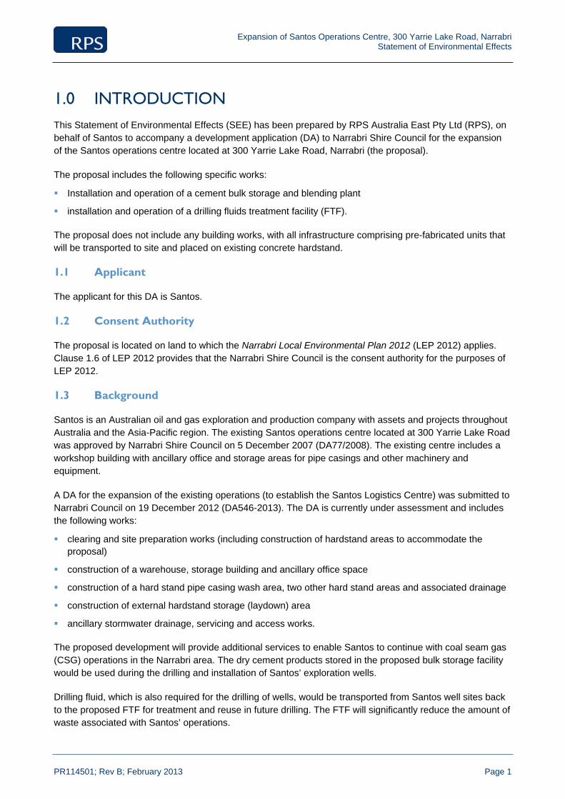
1.0 INTRODUCTION This Statement of Environmental Effects (SEE) has been prepared by RPS Australia East Pty Ltd (RPS), on behalf of Santos to accompany a development application (DA) to Narrabri Shire Council for the expansion of the Santos operations centre located at 300 Yarrie Lake Road, Narrabri (the proposal).
The proposal includes the following specific works:
Installation and operation of a cement bulk storage and blending plant
installation and operation of a drilling fluids treatment facility (FTF).
The proposal does not include any building works, with all infrastructure comprising pre-fabricated units that will be transported to site and placed on existing concrete hardstand.
1.1 Applicant
The applicant for this DA is Santos.
1.2 Consent Authority
The proposal is located on land to which the Narrabri Local Environmental Plan 2012 (LEP 2012) applies. Clause 1.6 of LEP 2012 provides that the Narrabri Shire Council is the consent authority for the purposes of LEP 2012.
1.3 Background
Santos is an Australian oil and gas exploration and production company with assets and projects throughout Australia and the Asia-Pacific region. The existing Santos operations centre located at 300 Yarrie Lake Road was approved by Narrabri Shire Council on 5 December 2007 (DA77/2008). The existing centre includes a workshop building with ancillary office and storage areas for pipe casings and other machinery and equipment.
A DA for the expansion of the existing operations (to establish the Santos Logistics Centre) was submitted to Narrabri Council on 19 December 2012 (DA546-2013). The DA is currently under assessment and includes the following works:
clearing and site preparation works (including construction of hardstand areas to accommodate the proposal)
construction of a warehouse, storage building and ancillary office space
construction of a hard stand pipe casing wash area, two other hard stand areas and associated drainage
construction of external hardstand storage (laydown) area
ancillary stormwater drainage, servicing and access works.
The proposed development will provide additional services to enable Santos to continue with coal seam gas (CSG) operations in the Narrabri area. The dry cement products stored in the proposed bulk storage facility would be used during the drilling and installation of Santos’ exploration wells.
Drilling fluid, which is also required for the drilling of wells, would be transported from Santos well sites back to the proposed FTF for treatment and reuse in future drilling. The FTF will significantly reduce the amount of waste associated with Santos’ operations.
Expansion of Santos Operations Centre, 300 Yarrie Lake Road, Narrabri Statement of Environmental Effects
PR114501; Rev B; February 2013 Page 2
1.4 Structure of the Report
This SEE describes the proposal in detail, together with an assessment of potential impact as required under the EP&A Act. This report is divided into five subsequent sections.
Section 2 describes the site, its location, ownership, existing conditions and key site issues
Section 3 describes the proposal
Section 4 assesses the planning context of the proposal by examining conformity with prevailing planning instruments
Section 5 summarises the potential environmental effects of the proposal
Section 6 concludes the statement of the environmental effects.
Expansion of Santos Operations Centre, 300 Yarrie Lake Road, Narrabri Statement of Environmental Effects
PR114501; Rev B; February 2013 Page 3
2.0 SITE LOCATION AND DESCRIPTION
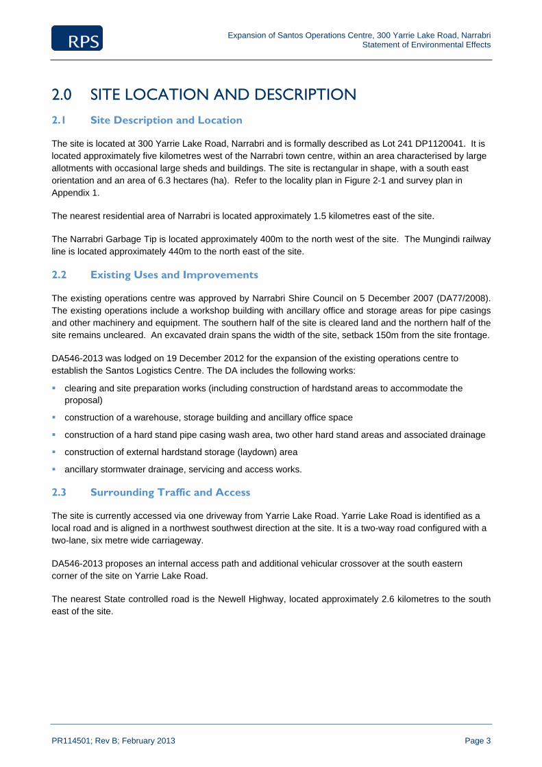
2.1 Site Description and Location
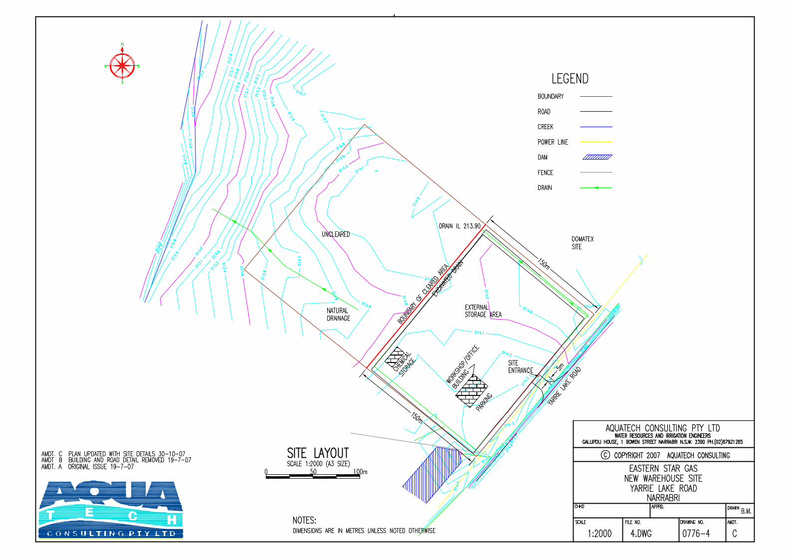
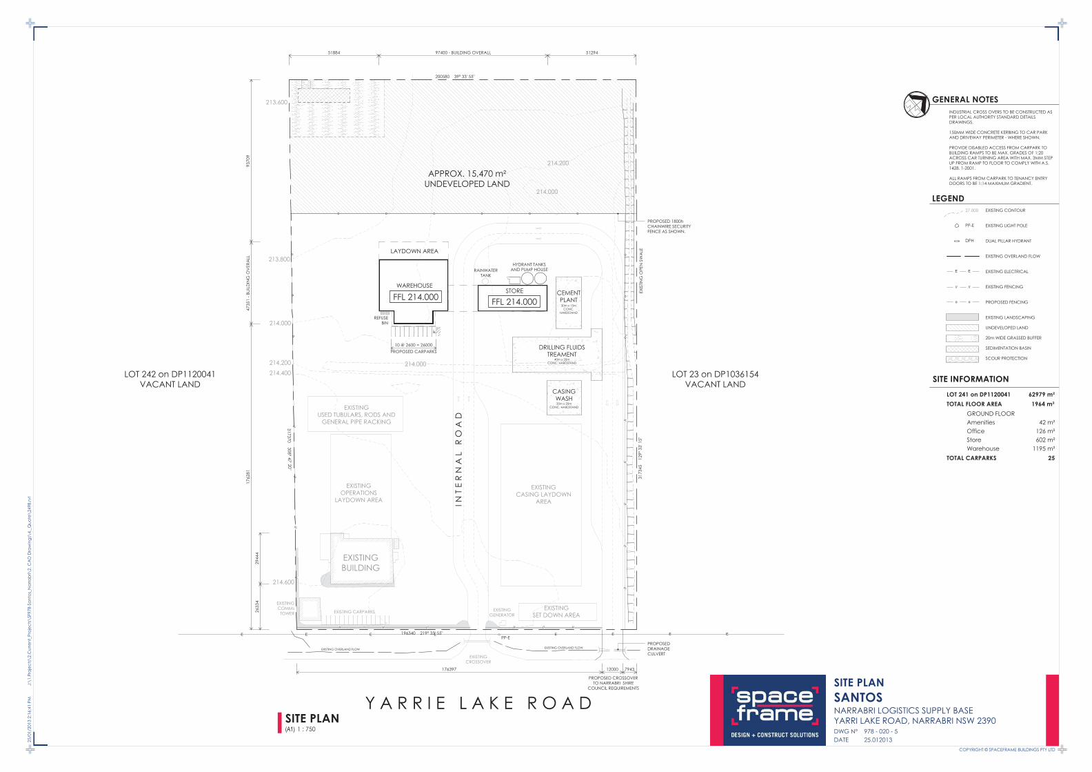
The site is located at 300 Yarrie Lake Road, Narrabri and is formally described as Lot 241 DP1120041. It is located approximately five kilometres west of the Narrabri town centre, within an area characterised by large allotments with occasional large sheds and buildings. The site is rectangular in shape, with a south east orientation and an area of 6.3 hectares (ha). Refer to the locality plan in Figure 2-1 and survey plan in Appendix 1.
The nearest residential area of Narrabri is located approximately 1.5 kilometres east of the site.
The Narrabri Garbage Tip is located approximately 400m to the north west of the site. The Mungindi railway line is located approximately 440m to the north east of the site.
2.2 Existing Uses and Improvements
The existing operations centre was approved by Narrabri Shire Council on 5 December 2007 (DA77/2008). The existing operations include a workshop building with ancillary office and storage areas for pipe casings and other machinery and equipment. The southern half of the site is cleared land and the northern half of the site remains uncleared. An excavated drain spans the width of the site, setback 150m from the site frontage.
DA546-2013 was lodged on 19 December 2012 for the expansion of the existing operations centre to establish the Santos Logistics Centre. The DA includes the following works:
clearing and site preparation works (including construction of hardstand areas to accommodate the proposal)
construction of a warehouse, storage building and ancillary office space
construction of a hard stand pipe casing wash area, two other hard stand areas and associated drainage
construction of external hardstand storage (laydown) area
ancillary stormwater drainage, servicing and access works.
2.3 Surrounding Traffic and Access
The site is currently accessed via one driveway from Yarrie Lake Road. Yarrie Lake Road is identified as a local road and is aligned in a northwest southwest direction at the site. It is a two-way road configured with a two-lane, six metre wide carriageway.
DA546-2013 proposes an internal access path and additional vehicular crossover at the south eastern corner of the site on Yarrie Lake Road.
The nearest State controlled road is the Newell Highway, located approximately 2.6 kilometres to the south east of the site.
Genanagie St
Selina
S t
Mck
enzi
e S
t
Kate St
Violet St
Lloyd St
Fras
er S
t
Goobar St
Railway St N
Coo
ma
St
Hunt St
Francis St
Gra
ce S
t
George St
Regent St
Huxley StDeran St
Kogil St
Railway St S
Meelee St
Maitland
St
Bowen St
Gould St
High
St
Barw
an S
tR
ailway
St
Spencer St
Doyle St
Hin
ds
St
Tibbereena S
t
Gu
est
St
Kelvin Vickery Av
Bur
igal
St
Maitland
St
Denison St
Gumbidguwa St
Narrabri Bingara Rd
Old Gunnedah Rd
Danga
r St
Wal
owa
St
Narrabri Maules Rd
Namoi St
Goldm
an S
t
Peele
St
Riverside Dr
Wee Waa Rd
Mooloobar St
Nandew
ar S
t
Balonne
St
Fitzroy StBarw
an S
t
Yarrie Lake
Rd
Ugoa St
Ba
iley
St
Narrabri G
unnedah
Rd
Maitland
St
Gun
Clu
b R
d
Gibbons
St
Pilliga Rd
Newell Hwy
Newell Hwy
Kamilaroi Hwy
NARRABRIGOLF COURSE
NARRABRIPARK
NARRABRIWEST PARK
PARK
NAMOI RIVER
NARRABRIWEST
NARRABRI
±
LegendHighway
Road
Railway
Project Area
Property Boundary
Tracking number: PR114501 13/12/2012
Source:Santos 2012RPS 2012
Client:
Date:
Approved by:
Santos
13/12/2012
Date:
Project:
o
Compiled by:
Locality Plan
Datum: GDA94
0 870 1,740435m
TWFigure 2-1
BL
Path: F:\TEMP\NewcastleforEdit\114501_Figure2-1_Locality_A4P_20121213.mxd
13/12/2012
Expansion of Santos Operations Centre, 300 Yarrie Lake Road, Narrabri Statement of Environmental Effects
PR114501; Rev B; February 2013 Page 5
2.4 Site Conditions
Detailed site assessments have been previously undertaken by RPS ecologists and archaeologists for DA546-2013. An Ecological Assessment and Aboriginal & European Cultural Heritage Due Diligence Assessment were lodged with the DA documentation (refer Appendices 3 and 4), the findings of which are summarised below.
No regionally significant or threatened flora species or populations listed under the Threatened Species Conservation Act 1995 (TSC Act) or Environment Protection and Biodiversity Conservation Act 1999 (EPBC Act) were detected within the study area during the survey period.
No threatened fauna species listed under the TSC Act and no primary koala feed trees listed under Schedule 2 of the State Environmental Planning Policy 44 (SEPP 44) were recorded during RPS (2012) surveys.
No Aboriginal objects or European (historic) heritage sites were identified within the site.

Expansion of Santos Operations Centre, 300 Yarrie Lake Road, Narrabri Statement of Environmental Effects
PR114501; Rev B; February 2013 Page 6
3.0 PROPOSED DEVELOPMENT
3.1 Overview of the Proposal
The proposal involves the expansion of uses at the existing Santos operations centre, including the following works:
installation of a cement bulk storage and blending plant
installation of a drilling fluids treatment facility.
The proposal does not include any building works, with all infrastructure comprising pre-fabricated units that will be transported to site and placed on existing concrete hardstand areas to be constructed as part of DA546-2013.
Details of the proposed works are provided below.
3.2 Activities
3.2.1 Cement Bulk Storage and Blending Plant
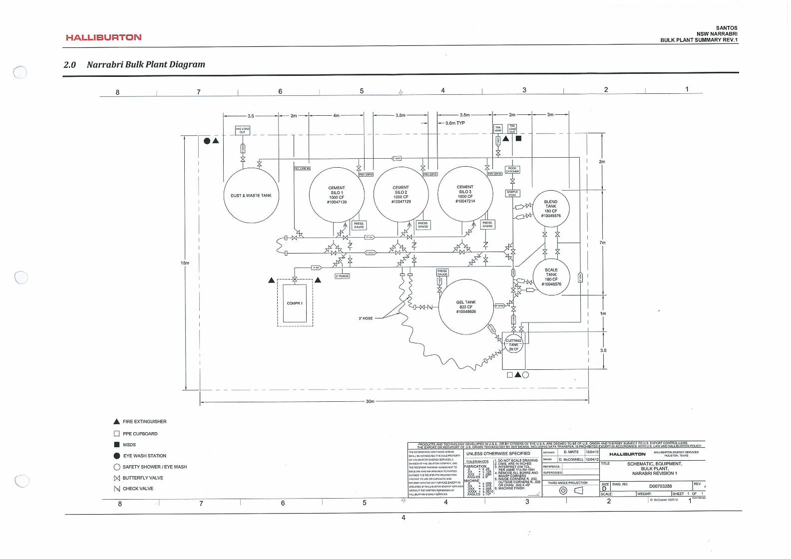
The proposed plant will be supplied and operated by Halliburton and incorporates four storage silos with a maximum capacity of 150 MT, and a maximum safe operating limit of 85% of the total capacity. The silos will be a maximum height of 8m. Schematic, equipment and bulk plant layout is provided at Appendix 2.
The cement bulk plant will receive Bulk Class-A (Construction Type) cement transported from Brisbane to Narrabri in special bulk trailers. The bulk cement will be transferred from the bulk trailers into the appropriate storage tanks. Chemical additives may be blended into the bulk cement on a batch by batch basis at the facility by the bulk operator. The operator will then distribute the appropriate amounts of bulk material and manually add any non-bulk goods into the scale tank. Blended powdered cement is then transported to the rig site where specialised pump units mix with water to cement the steel casing in place. This mixing will not occur at the operations centre.
The cement bulk storage and blending plant will be bunded and located on an existing 30m x 15m concrete hardstand pad in the northeast section of the site. The proposed equipment for the plant includes:
scale tanks
blend tank
admix hopper
storage tanks
dust collector
air compressor.
3.2.1.1 Cementing Additives
The plant will blend dry cement with a range of chemicals, which are listed in Appendix 5. The storage of these chemicals has been addressed in DA546-2013 and does not form part of the proposal.
3.2.2 Drilling Fluids Treatment Facility
The proposed FTF will mix, store and treat drilling fluids. The FTF will minimise the amount of waste drilling
Expansion of Santos Operations Centre, 300 Yarrie Lake Road, Narrabri Statement of Environmental Effects
PR114501; Rev B; February 2013 Page 7
fluid associated with Santos’ operations. Transporting the recycled drill fluid to a drill rig also reduces the amount of drilling fluid chemicals that would normally be kept at the rig site, reduces manual handling and the amount of waste generated at the rig site.
Fluids are to be transported to the various rigs operating at Santos well sites in the area via dedicated road transport bulk tankers. At the rig, the drill fluid will be transferred into the rigs’ specially designed drill fluid tanks. When the rig completes the well, the drill fluid will be transported back to the FTF where it will be treated and stored for reuse on future wells.
The FTF will be supplied and operated by a third party contractor – Rheochem. It will be bunded and located on an existing 20m x 40m concrete hardstand pad. All equipment will be a maximum of 3m in height.
The proposed equipment for the facility includes (refer Appendix 2 for facility layout):
six 65,000 litre drilling fluid storage tanks
flocculation unit
centrifuge
process water tank (100 bbls)
processed fluid tank (100 bbls)
polymer, coagulant and effluent tanks
mixing units
support skid
centrifugal pumps, dosing pumps and feed pump
drill cutting skips
generator (250kVA)
drainage sump.
Treatment of the drill fluid is required to adjust chemical and physical properties. The drilling fluid will be chemically treated prior to centrifugation, to obtain clear water and solid effluent.
Chemical treatment processes include the following:
(1) Dilution – water is added to reduce viscosity.
(2) Catch tank – water from the centrifuge is returned to the catch tank for use in the dilution process.
(3) pH adjustment – pH reduced to achieve flocculation.
(4) Coagulant and polymer additions – small additions of sulphates or chlorides and polymers to enable flocculation.
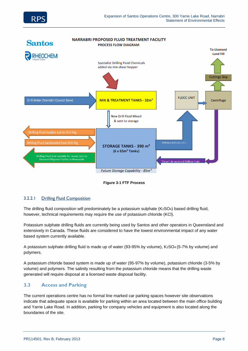
The facility will process up to 5,000m3 or tonnes of drilling fluid per year. While the six tanks proposed will have the capacity to store up to 390m3 of drill fluid at any one time, additional tanks may be installed in the future to enable a maximum storage capacity of 475m3. Refer to Figure 3-1 for an overview of the process.
Expansion of Santos Operations Centre, 300 Yarrie Lake Road, Narrabri Statement of Environmental Effects
PR114501; Rev B; February 2013 Page 8
Figure 3-1 FTF Process
3.2.2.1 Drilling Fluid Composition
The drilling fluid composition will predominately be a potassium sulphate (K2SO4) based drilling fluid, however, technical requirements may require the use of potassium chloride (KCl).
Potassium sulphate drilling fluids are currently being used by Santos and other operators in Queensland and extensively in Canada. These fluids are considered to have the lowest environmental impact of any water based system currently available.
A potassium sulphate drilling fluid is made up of water (93-95% by volume), K2SO4 (5-7% by volume) and polymers.
A potassium chloride based system is made up of water (95-97% by volume), potassium chloride (3-5% by volume) and polymers. The salinity resulting from the potassium chloride means that the drilling waste generated will require disposal at a licensed waste disposal facility.
3.3 Access and Parking
The current operations centre has no formal line marked car parking spaces however site observations indicate that adequate space is available for parking within an area located between the main office building and Yarrie Lake Road. In addition, parking for company vehicles and equipment is also located along the boundaries of the site.

Expansion of Santos Operations Centre, 300 Yarrie Lake Road, Narrabri Statement of Environmental Effects
PR114501; Rev B; February 2013 Page 9
A spot count of the car park was undertaken by GTA Consultants at 3:00pm on 19 September 2012. It indicates an existing on‐site car parking demand of up to 20 vehicles. It is also understood that peak parking demand during a busy period can see up 40 vehicles parked on‐site.
The previous proposal (DA546-2013) incorporated additional formal line marked on-site parking, including 10 spaces (including 1 disabled) at the front of the proposed office space. Additional hardstand area will also provide for informal parking, as required.
To improve safety and efficiency, access to the site via Yarrie Lake Road is proposed to be upgraded as part of DA546-2013. A two-lane one-way 12m wide circulation road to allow 25m B-double trucks to circulate within the site, and an additional 12m wide two-way vehicular crossover to provide an exit for the site are proposed. This works will service the proposal.
The proposal may generate up to approximately 75 vehicle trips during peak hour. During peak site operations, it is anticipated that the proposal may generate up to 22 truck movements per day.
3.4 Servicing & Stormwater Management
Access to all required services is available including electricity and water. These services would be augmented where required; noting that the FTF will be powered by its own generator and not from the grid.
Stormwater and drainage works are proposed as part of DA546-2013 and are sufficient to cater for the proposal.
3.5 Pollution Control
All tanks used in the fluid treatment process will be designed and constructed to minimise the risk of a spill. In addition, a Vacuum System (truck or portable) will be set up on site to immediately capture and contain drilling fluids in the event of a spill.
Both the cement blending and storage plant and the FTF will be located on impermeable concrete pads with gradual sloping cambers towards a central cellar. The cellars will be sealed, grated and contain a submersible pump to remove rainwater and any excess fluid that may be inadvertently spilt onto the concrete pad during wash down, cleaning and maintenance operations. The perimeters of the pads will have a bund wall of approximately 100mm on the outer edges with “rounded” entry and exit paths designed for service transport.
3.6 Staff and Hours of Operation
The proposal will require one additional full time operator and one contractor to be based at the site.
Access to the site will predominantly be between the hours of 6am and 6pm, however the site will be available to contractors 24 hours per day if required.
3.7 Chemicals and Storage area
DA546-2013, currently under assessment, proposes the storage of the chemicals associated with proposed FTF and cement facility. This does not form part of the proposal and is therefore are not addressed in this report.
Some storage of drill fluid chemicals will occur at the FTF. All drilling chemicals required at the site will be stored in fully enclosed trailers parked on a temporary bund. The drill fluid chemicals do not comprise

Expansion of Santos Operations Centre, 300 Yarrie Lake Road, Narrabri Statement of Environmental Effects
PR114501; Rev B; February 2013 Page 10
dangerous goods and do not contain BTEX.
3.8 Waste Management
Minor amounts of waste may be associated with sampling undertaken as part of the cement blending process. A sample is taken during the third transfer of the blending process. The sample is held for 30 days and then disposed of via an appropriate licensed provider.
Used drilling fluid is considered a liquid waste. Santos will gain the necessary licences to operate the proposed FTF (refer to section 4.2.5 for further discussion). During the fluid treatment process, fluids no longer required or unusable will be removed from site by a contractor licensed to transport trackable wastes, with the appropriate waste tracking certificates. Any such fluids will be disposed off site at an appropriately licensed waste facility. Drilling fluids that do not require treatment will be transported between drilling sites for reuse.
A copy of Santos’ Waste Management Plan is provided in Appendix 6. Wastes would be managed in accordance with this plan.
Expansion of Santos Operations Centre, 300 Yarrie Lake Road, Narrabri Statement of Environmental Effects
PR114501; Rev B; February 2013 Page 11
4.0 REGULATORY CONTEXT
4.1 Commonwealth Legislation
4.1.1 Environmental Protection and Biodiversity Conservation Act
The Environment Protection and Biodiversity Conservation Act 1999 (Cth) (EPBC Act) provides for the protection of certain Matters of National Environmental Significance (MNES) listed under the Act, which include:
World Heritage Areas
National Heritage Places
Ramsar wetlands of international importance
Commonwealth listed threatened species and ecological communities
listed migratory species
Commonwealth marine areas
Great Barrier Reef Marine Park
nuclear actions.
Under the EPBC Act, a proposed action that is likely to be a ‘controlled action’ must be referred to the
Minister for Sustainability, Environment, Water, Population and Communities (Commonwealth Minister) for a
determination as to whether the proposed action is a ‘controlled action’.
A "controlled action" is an action which is likely to have a significant impact on:
a MNES; or
Commonwealth land.
It also includes any action by the Commonwealth (or a Commonwealth agency) which is likely to have a
significant impact on the environment.
If the Commonwealth Minister determines that an action is a ‘controlled action’ then the action may not be undertaken without prior approval from the Commonwealth Minister under the EPBC Act.
An EPBC Act Protected Matters Search Report was generated for a 10 kilometre radius surrounding the site to determine whether any MNES would likely be affected the proposal. Search results can be located in Appendix 3.
The proposal is considered unlikely to impact on any MNES, as detailed in Table 4-1, or the environment on Commonwealth land and is not proposed to be taken by a Commonwealth agency. Therefore, the proposal is unlikely to constitute a controlled action and Santos does not propose to lodge a referral to the Minister.
Table 4-1 Matters of National Environmental Significance
MNES Overview
World Heritage Properties The proposal is not located in or within close proximity to a World Heritage area.
National Heritage Places The proposal is not located in or within close proximity to a National Heritage Place.
Wetlands protected by international treaty (the RAMSAR convention)
The proposal is not located within a RAMSAR listed wetland area.
Expansion of Santos Operations Centre, 300 Yarrie Lake Road, Narrabri Statement of Environmental Effects
PR114501; Rev B; February 2013 Page 12
MNES Overview
Nationally listed threatened species and ecological communities:
Twenty threatened species listed under the EPBC Act have been recorded within a 10 kilometre radius of the site.
None of the species listed were recorded during the field surveys. The likelihood of occurrence and potential impact of the abovementioned species was assessed in the Ecological Assessment. It is considered unlikely that the proposal would have a significant impact on any of the species.
No threatened Ecological Community listed under the EPBC Act was recorded on the site. These ecological communities were assessed in the Ecological Assessment. It is considered unlikely that the proposal would have a significant impact on any of the species.
Migratory species Ten migratory bird species listed under the EPBC Act were identified having the potential to occur on site. None of these species were identified during the field surveys. Impacts to these species are considered unlikely.
Commonwealth marine areas
The proposal would not impact any Commonwealth marine areas.
Great Barrier Reef Marine Park
The proposal would not impact the Great Barrier Reef Marine Park.
All nuclear actions The proposal does not involve a nuclear activity.
4.2 NSW Legislation
The proposal requires formal assessment under the EP&A Act. As discussed in section 4.3 below, the proposal is permissible with development consent. An application for development consent under Part 4 of the EP&A Act must be made to the consent authority, which in this case is Narrabri Shire Council.
4.2.1 Environmental Planning and Assessment Act 1979
4.2.1.1 Existing Uses
The subject site operates as an operations centre which was approved by Narrabri Shire Council on 5 December 2007 (DA77/2008). The existing operations include a workshop building with ancillary office and storage areas for pipe casings and other machinery and equipment.
DA546-2013 was lodged on 19 December 2012 for the expansion of the existing operations centre to establish the Santos Logistics Centre. The DA is currently under assessment for the following works:
clearing and site preparation works (including construction of hardstand areas to accommodate the proposal)
construction of a warehouse, storage building and ancillary office space
construction of a hard stand pipe casing wash area, two other hard stand areas and associated drainage
construction of external hardstand storage (laydown) area
ancillary stormwater drainage, servicing and access works.
Since the lodgement of DA546—2013, the Narrabri Local Environmental Plan 2012 (LEP 2012) has been gazetted. LEP 2012, gazetted on 21 December 2013, identifies the site within the RU1 zone. The current (and proposed) uses are non-conforming uses in the RU1 zone.
The current operation is considered an existing use. Under section 106 of the EP&A Act, an existing use is defined as:
(a) the use of a building, work or land for a lawful purpose immediately before the coming into force of an environmental planning instrument which would, but for Division 4 of

Expansion of Santos Operations Centre, 300 Yarrie Lake Road, Narrabri Statement of Environmental Effects
PR114501; Rev B; February 2013 Page 13
this Part, have the effect of prohibiting that use, and
(b) the use of a building, work or land:
(i) for which development consent was granted before the commencement of a provision of an environmental planning instrument having the effect of prohibiting the use, and
(ii) that has been carried out, within one year after the date on which that provision commenced, in accordance with the terms of the consent and to such an extent as to ensure (apart from that provision) that the development consent would not lapse.
The existing, lawful use was approved under DA77/2008. The LEP 2012 was gazetted in December 2012. Since this time, the existing use has not ceased to operate.
Clause 42 of the Environmental Planning and Assessment Regulation 2000 states that an existing use can be enlarged, expanded or intensified subject to development consent. The enlargement, expansion or intensification must be for the existing use and must be carried out only on the land on which the existing use was carried out.
The proposal seeks to expand and intensify the existing, lawful use. The addition of cement bulk storage and blending plant and FTF will provide additional facilities at the existing operations centre. The additional uses will be provided on the land of the existing use. Development consent for the proposal is therefore sought in accordance with clause 42 to the Environmental Planning and Assessment Regulation 2000.
4.2.1.2 State Environmental Planning Policy No 33 – Hazardous and Offensive Development
This policy presents a systematic approach to planning and assessing proposals for potentially hazardous and offensive development for the purpose of industry or storage.
In order to asses if the proposal is considered a hazardous or offensive development, the proposal must undertake a screening method. The screening method assists consent authorities in determining whether a proposal is potentially hazardous and thus affected by SEPP 33.
DA546-2013, currently under assessment, proposes the storage of chemicals associated with this proposal. This proposal does not increase the amount of storage for dangerous goods.
4.2.1.3 State Environmental Planning Policy No 44 – Koala Habitat Protection
The State Environmental Planning Policy No 44 – Koala Habitat (SEPP 44) applies to this proposal. Clause 5 of the SEPP Koala Habitat provides that the policy applies to the Narrabri LGA because it is listed in Schedule 1. Clause 6 of SEPP 44 provides that where development is proposed on land to which clause 5 applies, and the proposal is on land of more than one hectare, the SEPP 44 applies to the proposed development.
Before granting consent to carry out development on land to which the SEPP 44 applies, the Narrabri Shire Council must satisfy itself that the site is a koala habitat from information obtained by it, or from information provided by the proponent or from a person who is qualified and experienced in tree identification. If the council is satisfied that the land is a potential koala habitat, it must comply with clause 8 and determine whether the proposal will be carried out on core koala habitat. Council may only grant development consent on land which is found to be core koala habitat if it is satisfied that a plan of management is in place as provided by Part 3 of the SEPP 44.
No Koalas or traces of Koalas such as scats or scratches on tree trunks were observed within the site during the ecological field surveys (refer Appendix 3). As no Koalas, or signs of Koala occupation were observed on

Expansion of Santos Operations Centre, 300 Yarrie Lake Road, Narrabri Statement of Environmental Effects
PR114501; Rev B; February 2013 Page 14
the site and it lacked primary feed tree species, it has been determined that the site does not provide ‘Core’ or ‘Potential’ Koala habitat according to SEPP 44. Therefore, a Koala plan of management is not required.
4.2.1.4 State Environmental Planning Policy No 55 – Remediation of Land
This policy introduces state-wide planning controls for the remediation of contaminated land. It states that land must not be developed if it is unsuitable for a proposed use because it is contaminated. If the land is unsuitable, remediation must take place before the land is developed. The policy makes remediation permissible across the State, defines when consent is required, requires all remediation to comply with standards, ensures land is investigated if contamination is suspected, and requires councils to be notified of all remediation proposals.
The site currently operates as an existing operations centre. The proposal is to expand this use. As such it is unlikely that there would be any contamination that would render the site unsuitable for the proposed use. Notwithstanding, a search of the Environment and Heritage List of NSW contaminated sites and the Contaminated Land: Record of Notices was carried out on 13 December 2012 with no records pertaining to the subject site or surrounding land.
4.2.2 Threatened Species Conservation Act 1995
The Threatened Species Conservation Act 1995 (TSC Act) sets the framework for the listing of threatened species, populations and ecological communities, and key threatening processes in NSW, and the preparation and implementation of recovery plans and threat abatement plans.
The TSC Act also provides the mechanism for applying for and obtaining licences to take actions, which could result in harm to a threatened species, population or ecological community, or their habitat, or damage to critical habitat.
The previous field investigations undertaken over the site for DA546-2013 did not identify any threatened species, communities or habitat as occurring on the site. The proposal is therefore unlikely to impact a threatened species, population or ecological community, or their habitat, or damage critical habitat.
4.2.3 National Parks and Wildlife Act 1974
4.2.3.1 Threatened species
Part 8A of the National Parks and Wildlife Act 1974 (NPW Act) regulates the undertaking of activities, which may impact on threatened species, populations and ecological communities listed under the TSC Act and their habitats. The NPW Act provides that a person must not harm any animal that is a threatened species, population or ecological community, pick any plant which is part of a threatened species, population or ecological community, damage any critical habitat or damage any habitat of a threatened species, population or ecological community without a licence being obtained under the NPW Act or TSC Act or unless another exception applies.
As stated above, there were no threatened species or communities identified on the site and the proposal will not result in harm to any threatened species, populations or ecological communities.
4.2.3.2 Aboriginal cultural heritage
The NPW Act conserves places, objects and features of significance to Aboriginal people.
It is an offence under the NPW Act to:
Expansion of Santos Operations Centre, 300 Yarrie Lake Road, Narrabri Statement of Environmental Effects
PR114501; Rev B; February 2013 Page 15
harm or desecrate an object that the person knows is an Aboriginal object except in accordance with an Aboriginal heritage impact permit (AHIP)
harm or desecrate Aboriginal objects and Aboriginal places except in accordance with an Aboriginal heritage impact permit or where the person can show they exercised due diligence to reasonably determine that no Aboriginal object will be harmed.
Aboriginal Heritage Information Management System (AHIMS) searches and a site inspection was undertaken for the site. No Aboriginal objects or places were identified on the site. Therefore, there is no identified risk of harm to Aboriginal objects and an Aboriginal Heritage Impact Permit (AHIP) is not required for the proposal.
4.2.4 Heritage Act 1977
The main objective of the Heritage Act 1977 (Heritage Act) is to encourage the conservation of the heritage of NSW. The site is not listed on the State Heritage Register under the Heritage Act.
The Heritage Act also prevents impacts on ‘relics’, which are defined as:
any deposit, artefact, object or material evidence that:
(a) relates to the settlement of the area that comprises New South Wales, not being Aboriginal settlement, and
(b) is of State or local heritage significance.
Under the Heritage Act, it is an offence to disturb or excavate any land knowing or having reasonable cause to suspect that the disturbance or excavation will or is likely to result in a relic being discovered, exposed, moved, damaged or destroyed unless the disturbance or excavation is carried out in accordance with an excavation permit.
No items of heritage significance listed under either the LEP 2012 or on the NSW State Heritage Register occur on the site. A number of items of local and State heritage significance occur within the Narrabri LGA, however these are not located in close proximity to the site.
4.2.5 Protection of the Environment Operations Act 1997
The primary objective of the Protection of the Environment Operations Act 1997 (NSW) (POEO Act) is to ‘protect, restore and enhance the quality of the environment in New South Wales, having regard to the need to maintain ecologically sustainable development’. The POEO Act requires environmental protection licences (EPLs) be obtained for the carrying out of ‘scheduled activities’ or pollution of waters.
The proposal is likely to comprise a number of "scheduled activities" as defined in Schedule 2 of the POEO Act. These are outlined below and discussed further in Table 4-2:
Chemical storage
Waste processing (non-thermal treatment)
Waste storage.
An EPL for the relevant scheduled activities would be obtained prior to the commencement of the proposed development.

Expansion of Santos Operations Centre, 300 Yarrie Lake Road, Narrabri Statement of Environmental Effects
PR114501; Rev B; February 2013 Page 16
Table 4-2 Scheduled activities (POEO Act)
Scheduled Activity Relevant Criteria Proposal
Clause 9 Chemical storage
Chemical storage waste generation, meaning chemical substances storage that involves having on site any prescribed waste (that is, hazardous waste, restricted solid waste or liquid waste, or any combination of them).
involves having on site at any time more than 5 tonnes of prescribed waste, not including excluded material (where 1,000 litres of liquid is taken to weigh 1 tonne)
Up to 475m3 (475 tonnes) of liquid waste (which is a prescribed waste) may be stored on site at any one time.
Clause 41 Waste processing (non-thermal treatment)
Non-thermal treatment of liquid waste, meaning the receiving of liquid waste (other than waste oil) from off site and its processing otherwise than by thermal treatment.
involves having on site at any time more than 200 kilograms of liquid waste (other than clinical and related waste)
Up to 475m3 (475 tonnes) of liquid waste may be stored for treatment on site at any one time. Up to 5,000m3 of liquid waste may be treated per year.
42 Waste storage
Waste storage, meaning the receiving from off site and storing (including storage for transfer) of waste
more than 5 tonnes of hazardous waste, restricted solid waste, liquid waste, clinical or related waste or asbestos waste is stored on the premises at any time, or
Up to 475m3 (475 tonnes) of liquid waste may be stored on site at any one time.
4.3 Narrabri Local Environmental Plan 2012
The LEP 2012 is the principal environmental planning instrument applying to the proposal.
The general aims of the plan which are applicable to the proposed development are considered in the following table:
Table 4-3 Narrabri LEP 2012 Aims
LEP Aims Response
(a) to encourage the orderly management, development and conservation of resources by protecting, enhancing and conserving:
(i) land of significance for agricultural production, and
(ii) timber, minerals, soil, water and other natural resources, and
(iii) areas of high scenic or recreational value, and
(iv) native plants and animals including threatened species, populations and ecological communities, and their habitats, and
(v) places and buildings of heritage significance,
The proposed use of the site expands the existing operations at the site. The proposal provides for a treatment facility to recycle and reuse fluids to help conserve resources. The proposal does not impact on any native plants and animals or heritage significance.
(b) to provide a choice of living opportunities and types of settlements,
NA
(c) to facilitate development for a range of business enterprise and employment opportunities,
The proposed development facilitates employment opportunities within Narrabri LGA.
(d) to ensure that development is sensitive to both the economic and social needs of the community, including the provision of community facilities and land for public purposes.
NA
Zoning and Permissibility
Under the LEP 2012 the site is zoned RU1 Primary Production. The objectives of the RU1 zone are as follows:
Expansion of Santos Operations Centre, 300 Yarrie Lake Road, Narrabri Statement of Environmental Effects
PR114501; Rev B; February 2013 Page 17
To encourage sustainable primary industry production by maintaining and enhancing the natural resource base.
To encourage diversity in primary industry enterprises and systems appropriate for the area.
To minimise the fragmentation and alienation of resource lands.
To minimise conflict between land uses within this zone and land uses within adjoining zones.
To allow for non-agricultural land uses that will not restrict the use of other land in the locality for agricultural purposes.
The proposal is entirely consistent with the objectives of the zone. The site is currently occupied by a non-agricultural use and the proposal is an expansion of the existing lawful operations. It will not impact on the agricultural viability or productivity of the land, or any adjoining land, will not result in the fragmentation of resource lands or result in conflict with any adjoining zones. It is a non-agricultural use that will not restrict the use of other land in the locality for agricultural purposes.
Refer to section 4.2.1.1 for a discussion on permissibility of the proposal.
4.4 Development Control Plans
The following Development Control Plans (DCPs) are relevant to the proposal.
Parking Code
The Parking Code DCP was adopted by Narrabri Shire Council on 19 January 1993 and came into effect on 26 January, 1993.
Annexure 1 of the DCP provides the minimum requirements for parking relating to a range of developments. The following parking rates apply to the proposed use on the site.
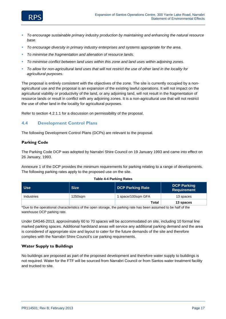
Table 4-4 Parking Rates
Use Size DCP Parking Rate DCP Parking Requirement
Industries 1250sqm 1 space/100sqm GFA 13 spaces
Total 13 spaces
*Due to the operational characteristics of the open storage, the parking rate has been assumed to be half of the warehouse DCP parking rate.
Under DA546-2013, approximately 60 to 70 spaces will be accommodated on site, including 10 formal line marked parking spaces. Additional hardstand areas will service any additional parking demand and the area is considered of appropriate size and layout to cater for the future demands of the site and therefore complies with the Narrabri Shire Council’s car parking requirements.
Water Supply to Buildings
No buildings are proposed as part of the proposed development and therefore water supply to buildings is not required. Water for the FTF will be sourced from Narrabri Council or from Santos water treatment facility and trucked to site.
Expansion of Santos Operations Centre, 300 Yarrie Lake Road, Narrabri Statement of Environmental Effects
PR114501; Rev B; February 2013 Page 18
Drainage to Buildings
The Drainage to Buildings DCP ensures that there is adequate provision for the control and disposal of roof waters; to specify the method of disposal of wastes from sanitary fittings; to ensure that Trade Wastes are adequately treated and to specify the method of disposal.
Roof water drainage does not apply to this proposal as no buildings are proposed. Sanitary drainage, effluent disposal and trade waste are addressed in the Fluid Waste Management Plan at Appendix 6.
Building Line
The objective of the building line DCP is to ensure the integrity of the streetscape through the provision of an appropriate building setback.
The DCP requires all buildings to be setback a minimum of 6m from the front boundary of an allotment. No works are proposed in front of the existing building on site, which complies with the control.

Expansion of Santos Operations Centre, 300 Yarrie Lake Road, Narrabri Statement of Environmental Effects
PR114501; Rev B; February 2013 Page 19
5.0 ENVIRONMENTAL EFFECTS The following sections discuss the potential environmental effects of the proposal and the proposed measures to minimise any impacts.
5.1 Cultural Heritage
As previously discussed, field inspections and desktop assessments undertaken over the site did not identify the presence of any Aboriginal objects or places.
5.2 Flora and fauna
As discussed in section 2.4, no regionally significant or threatened flora species or populations or threatened fauna listed under the TSC Act and/or the EPBC Act were detected on the site during the field investigations.
The proposal is unlikely to have a significant impact upon any threatened entities listed under the EPBC Act and/or the TSC Act.
5.3 Traffic and Parking Impacts
The proposal may generate up to approximately 75 vehicle trips during peak hour. During peak site operations, it is anticipated that the proposal may generate up to 22 truck movements per day.
The existing traffic volumes along the frontage of the site are approximately 60 vehicles in the AM peak hour and 75 in the PM peak hour. This includes traffic attending the existing operations centre. Against existing traffic volumes, the additional traffic generated by the proposed development would increase the volume of traffic on Yarrie Lake Road, however could not be expected to compromise the safety or function of the surrounding road network.
The intersection of Yarrie Lake Road and the site access is expected to operate with minimal delay and continue to operate at a level of service of A. Sight distances at the intersection are in excess of the requirements set out in Figure 3.3 in Australian Standard, Parking Facilities, Part 2: Off‐Street Commercial Vehicle Facilities (AS 2890.2:2002).
5.4 Dust and Noise
The site is located a significant distance from the Narrabri urban area. The establishment and operation of the proposal is not expected to cause any amenity issues for neighbours in relation to noise. No formal noise impact assessment was considered necessary for the proposal given the nature of the proposed operation.
There will be short periods of noise during installation of the plant and facilities, however this will be a temporary disturbance and will be managed through appropriate construction hours of operation and practices. It is therefore considered unlikely that there will be any adverse impacts in relation to noise as a result of the proposal.
5.5 Fire
All the works will comply with BCA standards. All potential fuel sources and potentially flammable materials will be contained within approved storage areas and located so as not to contribute to fire risk nor impede fire fighting efforts.

Expansion of Santos Operations Centre, 300 Yarrie Lake Road, Narrabri Statement of Environmental Effects
PR114501; Rev B; February 2013 Page 20
Access for fire fighting operations should they be required is of good quality and no impediments to the efficient entry and exit of fire fighting vehicles and personnel are apparent.
5.6 Soils
The proposed works are designed to ensure minimal risk of spill from the cement bulk storage and blending plant and the FTF.
The FTF will incorporate a Vacuum System (truck or portable) to immediately capture and contain drilling fluids in the event of a spill.
Both the plant and the facility will be located on a concrete pad with a bunded wall to protect the soil from spills.
5.7 Section 79C (1) – Matters for Consideration
Under the provisions of section 79C(1) of the EP&A Act, in determining a development application, a consent authority is to take into consideration the following matters as are of relevance to the development the subject of the development application.
(a) the provisions of:
(i) any environmental planning instrument
(ii) any draft environmental planning instrument that is or had been placed on public exhibition and details of which have been notified to the consent authority, and
(iii) any development control plan
(iiia) any planning agreement that has been entered into under section 93F, or any draft planning agreement that a developer has offered to enter into under section 93F
(iv) any matters prescribed by the regulations that applied to the land to which the development relates
(v) any coastal zone management plan (within the meaning of the Coastal Protection Act 1979)
The provisions of the relevant environmental planning instruments and development control plans have been addressed in section 4. There are no draft environmental planning instruments relevant to the proposal. There are no planning agreements or matters prescribed by the regulations that are relevant to the proposal. There is not a coastal zone management plan which applies to the site.
(b) the likely impacts of that development, including environmental impacts on both the natural and built environments, and social and economic impacts on the locality:
The impacts of the development have been considered in section 4 and further addressed in this section. This report demonstrates that the development is suitable and acceptable on the site and within the locality.
(c) the suitability of the site for the development
The following attributes of the site make it suitable for the development: its existing use as an operations centre
its isolated location
it is not encumbered by any heritage or natural areas of significance.
(d) any submissions made in accordance with this Act or the regulations
There have been no submissions.

Expansion of Santos Operations Centre, 300 Yarrie Lake Road, Narrabri Statement of Environmental Effects
PR114501; Rev B; February 2013 Page 21
(e) the public interest
As this application has considered and complies with the legislation and policy which has been established by the government in consultation with the community and on behalf of the public, it is considered that positive assessment of this application is in the public interest.

Expansion of Santos Operations Centre, 300 Yarrie Lake Road, Narrabri Statement of Environmental Effects
PR114501; Rev B; February 2013 Page 22
6.0 Conclusion This report has provided an assessment of the proposed expansion of the existing Santos operations centre at 300 Yarrie Lake Road, Narrabri.
The site was found to be unconstrained in terms of heritage, ecology or adjoining uses and is considered to be highly suitable for the proposed purpose. The potential environmental effects of this development are considered negligible.
The proposal represents an efficient and orderly development of the land and is consistent with State and local planning instruments and local planning controls.

Expansion of Santos Operations Centre, 300 Yarrie Lake Road, Narrabri Statement of Environmental Effects
PR114501; Rev B; February 2013
Appendix 1
Survey
Expansion of Santos Operations Centre, 300 Yarrie Lake Road, Narrabri Statement of Environmental Effects
PR114501; Rev B; February 2013
Appendix 2
Plans
// //
E E
o o
// //////
////
////
// ////
E EE E E EE E
////
////
oo
o
oo oooo
oo
o
PP-E
DPH
27.000
INDUSTRIAL CROSS OVERS TO BE CONSTRUCTED ASPER LOCAL AUTHORITY STANDARD DETAILSDRAWINGS.
150MM WIDE CONCRETE KERBING TO CAR PARKAND DRIVEWAY PERIMETER - WHERE SHOWN.
PROVIDE DISABLED ACCESS FROM CARPARK TOBUILDING RAMPS TO BE MAX. GRADES OF 1:20ACROSS CAR TURNING AREA WITH MAX. 3MM STEPUP FROM RAMP TO FLOOR TO COMPLY WITH A.S.1428. 1-2001.
ALL RAMPS FROM CARPARK TO TENANCY ENTRYDOORS TO BE 1:14 MAXIMUM GRADIENT.
GENERAL NOTES
LEGENDEXISTING CONTOUR
EXISTING LIGHT POLE
DUAL PILLAR HYDRANT
EXISTING OVERLAND FLOW
EXISTING ELECTRICAL
EXISTING FENCING
PROPOSED FENCING
EXISTING LANDSCAPING
UNDEVELOPED LAND
20m WIDE GRASSED BUFFER
SEDIMENTATION BASIN
SCOUR PROTECTION
Y A R R I E L A K E R O A D
CASINGWASH
EXISTINGBUILDING
EXISTINGCASING LAYDOWN
AREA
EXISTINGOPERATIONS
LAYDOWN AREA
EXISTINGUSED TUBULARS, RODS AND
GENERAL PIPE RACKING
EXISTINGSET DOWN AREA
EXISTINGCOMMs
TOWEREXISTING
GENERATOR
APPROX. 15,470 m²UNDEVELOPED LAND
3173
45
129
° 33'
15"
196340 219° 33' 55"
317370308 °47 ' 20"
200580 39° 33' 55"
WAREHOUSE
EXISTING CARPARKS
20m x 20mCONC. HARDSTAND
I N T
E R
N A
L
R O
A D
9370
947
351
- BUI
LDIN
G O
VER
ALL
1762
81
51884 97400 - BUILDING OVERALL 51294
REFUSEBIN
176397 12000 7943
PROPOSED CROSSOVERTO NARRABRI SHIRE
COUNCIL REQUIREMENTS
PP-E
EXISTING OVERLAND FLOW EXISTING OVERLAND FLOW
2944
426
334
HYDRANT TANKSAND PUMP HOUSE
EXIS
TING
OPE
N S
WA
LEPROPOSEDDRAINAGECULVERT
213.800
213.600
214.000
214.200
214.000
214.000214.200
214.400
214.600
EXISTINGCROSSOVER
LAYDOWN AREA
STORE
RAINWATERTANK
PROPOSED 1800hCHAINWIRE SECURITYFENCE AS SHOWN.
PROPOSED CARPARKS10 @ 2600 = 26000
FFL 214.000 FFL 214.000
LOT 242 on DP1120041VACANT LAND
LOT 23 on DP1036154VACANT LAND
CEMENTPLANT30m x 15m
CONC.HARDSTAND
DRILLING FLUIDSTREAMENT
40m x 20mCONC. HARDSTAND
DWG N°
COPYRIGHT © SPACEFRAME BUILDINGS PTY LTD
DATE25/0
1/20
13 2
:16:
41 P
MJ:
\1.P
roje
cts\
2.C
urre
nt_P
roje
cts\
SF97
8-Sa
ntos
_Nar
rabr
i\2.
CA
D D
raw
ings
\4._
Quo
te\2
498.
rvt
25.012013
SITE PLAN
978 - 020 - 5
NARRABRI LOGISTICS SUPPLY BASEYARRI LAKE ROAD, NARRABRI NSW 2390
SANTOS
SITE INFORMATION
TOTAL CARPARKS 25
TOTAL FLOOR AREA 1964 m²LOT 241 on DP1120041 62979 m²
GROUND FLOORAmenities 42 m²Office 126 m²Store 602 m²Warehouse 1195 m²
(A1) 1 : 750SITE PLAN


blewis
Typewritten Text


Expansion of Santos Operations Centre, 300 Yarrie Lake Road, Narrabri Statement of Environmental Effects
PR114501; Rev B; February 2013
Appendix 3
Ecological Assessment
Ecolo
Narra
Prepared by
RPS AUST
PO Box 428Hamilton NS
T: +61 2F: +61 2E: newc Client ManagReport NumbVersion / Dat
ogical
abri Lo
y:
TRALIA EA
8 SW 2303
2 4940 4200 2 4961 6794 castle@rpsgr
ger: Matt Dohber: PR1145te: Final / D
Asse
ogistics
AST PTY LT
roup.com.au
herty 01-3
December 201
essme
Centr
TD
2
ent
e
Prep
SAN
Leve40 CBRIS
T:F:E:W:
pared for:
NTOS
el 16 Creek StreetSBANE QLD
07 3838 307 3838 3Todd.Dunnwww.santo
D 4000
676 700 [email protected]
rpsgr
om
roup.com.au
u

Ecological Assessment Narrabri Logistics Centre
PR114501-3; Final / December 2012 Page ii
IMPORTANT NOTE
Apart from fair dealing for the purposes of private study, research, criticism, or review as permitted under the Copyright Act, no part of this report, its attachments or appendices may be reproduced by any process without the written consent of RPS Australia East Pty Ltd. All enquiries should be directed to RPS Australia East Pty Ltd.
We have prepared this report for the sole purposes of Santos Pty Ltd (“Client”) for the specific purpose of only for which it is supplied (“Purpose”). This report is strictly limited to the purpose and the facts and matters stated in it and does not apply directly or indirectly and will not be used for any other application, purpose, use or matter.
In preparing this report we have made certain assumptions. We have assumed that all information and documents provided to us by the Client or as a result of a specific request or enquiry were complete, accurate and up-to-date. Where we have obtained information from a government register or database, we have assumed that the information is accurate. Where an assumption has been made, we have not made any independent investigations with respect to the matters the subject of that assumption. We are not aware of any reason why any of the assumptions are incorrect.
This report is presented without the assumption of a duty of care to any other person (other than the Client) (“Third Party”). The report may not contain sufficient information for the purposes of a Third Party or for other uses. Without the prior written consent of RPS Australia East Pty Ltd:
(a) this report may not be relied on by a Third Party; and
(b) RPS Australia East Pty Ltd will not be liable to a Third Party for any loss, damage, liability or claim arising out of or incidental to a Third Party publishing, using or relying on the facts, content, opinions or subject matter contained in this report.
If a Third Party uses or relies on the facts, content, opinions or subject matter contained in this report with or without the consent of RPS Australia East Pty Ltd, RPS Australia East Pty Ltd disclaims all risk and the Third Party assumes all risk and releases and indemnifies and agrees to keep indemnified RPS Australia East Pty Ltd from any loss, damage, claim or liability arising directly or indirectly from the use of or reliance on this report.
In this note, a reference to loss and damage includes past and prospective economic loss, loss of profits, damage to property, injury to any person (including death) costs and expenses incurred in taking measures to prevent, mitigate or rectify any harm, loss of opportunity, legal costs, compensation, interest and any other direct, indirect, consequential or financial or other loss.
Document Status
Version Purpose of Document Orig Review Review Date
Draft Draft for Review AB MD 17-10-2012
Final Final for Issue AB MD 13-12-2012
Approval for Issue
Name Signature Date
Matt Doherty 13-12-2012

Ecological Assessment Narrabri Logistics Centre
PR114501-3; Final / December 2012 Page iii
Summary Introduction
Santos Limited (Santos), is investigating opportunities for expanding their existing operations centre at Narrabri to a larger logistics centre. RPS Australia East Pty Ltd (RPS) was engaged to undertake an ecological site inspection and produce reporting to inform a development application for assessment by Narrabri Council. The site inspection was carried out by an ecologist on the 3rd and 4th of September 2012, within Lot 241, DP 1120041, 300 Yarrie Lake Road, Narrabri, NSW. This location is hereafter referred to as the site and the proposed actions within the site are hereafter referred to as the proposal.
This assessment outlines the occurrence, or likely occurrence, of any threatened species, populations or ecological communities listed within the Threatened Species Conservation Act 1995 (TSC Act 1995). The report recognises the relevant requirements of the EP&A Act 1979 as amended by the Environmental Planning and Assessment Amendment Act 1997. Reporting is also made with regard to those threatened entities listed federally under the Environment Protection and Biodiversity Conservation Act 1999 (EPBC Act 1999).
Vegetation
Ground truthing of the site confirmed previous mapping was inaccurate and delineated one native vegetation community identified as occurring within the site, which is not commensurate with TECs listed under EPBC Act 1979 and/or NSW TSC Act 1995 (refer to Appendix 7). The Vegetation community present on site was mapped in accordance with Namoi CMA Vegetation Mapping being Rough-barked Apple - Blakely's Red Gum Riparian Grassy Woodlands, Brigalow Belt South and Nandewar
No threatened flora species listed under the TSC Act 1995 or EPBC Act 1999 were recorded within the Site during RPS surveys.
Habitat
The Vegetation identified on site as ‘Rough-barked Apple - Blakely's Red Gum Riparian Grassy Woodlands, Brigalow Belt South and Nandewar’ was in relatively poor condition. The habitat offers little in the form of mature canopy trees, hollows for nesting and dwelling, logs, rocks, understorey vegetation and vegetation diversity.
Fauna
The vegetation on site and the garbage tip in close proximity to the site attracted some 22 different bird species throughout various times of day. Horses appear to have access to the entirety of the site with their scats, tracks and grazing pressure being noted across the site. Therefore, this has resulted in increasing the level of disturbance through soil compaction, vegetation degradation and soil nutrient disturbance from faecal matter. There are no permanent water bodies present on site which could support native wildlife particularly amphibians.
Conclusions
The proposal is will result in the clearing of approximately 2.07ha of disturbed and previously cleared woodland which provides potential sub-optimal habitat for a number of threatened species. Assessment under the TSC Act and EPBC Act determined the proposal is unlikely to have a significant impact on threatened species, populations or ecological communities.

Ecological Assessment Narrabri Logistics Centre
PR114501-3; Final / December 2012 Page iv
Contents SUMMARY ........................................................................................................................................................ III
1.0 INTRODUCTION ...................................................................................................................................... 7
1.1 Site Particulars ............................................................................................................................. 7
1.1.1 Location .......................................................................................................................... 7
1.1.2 Site .................................................................................................................................. 7
1.1.3 Topography ..................................................................................................................... 7
1.2 Proposed Activity ......................................................................................................................... 7
1.3 Scope of the Study ....................................................................................................................... 8
1.4 Licensing and Certification ......................................................................................................... 8
2.0 LEGISLATIVE CONTEXT ...................................................................................................................... 11
2.1 Environmental Protection and Biodiversity Conservation Act 1999 .................................... 11
2.2 NSW State Legislation ............................................................................................................... 11
2.2.1 Environmental Planning and Assessment Act 1979 ..................................................... 11
2.2.2 Threatened Species Conservation Act 1995 ................................................................ 13
3.0 METHODS .............................................................................................................................................. 14
3.1 Desktop Assessment ................................................................................................................. 14
3.2 Field Assessment ....................................................................................................................... 14
3.2.1 Flora Survey ................................................................................................................. 14
3.2.2 Habitat Assessment ...................................................................................................... 14
3.2.3 Fauna Survey ............................................................................................................... 15
3.3 Survey Limitations ..................................................................................................................... 17
4.0 RESULTS ............................................................................................................................................... 18
4.1 Flora Desktop Assessment ....................................................................................................... 18
4.1.1 Threatened Ecological Communities ............................................................................ 18
4.1.2 Threatened Flora .......................................................................................................... 19
4.2 Fauna Desktop Assessment ..................................................................................................... 19
4.2.2 Migratory Species ......................................................................................................... 21
4.3 Field Surveys .............................................................................................................................. 21
4.3.1 Vegetation Communities ............................................................................................... 21
4.3.2 Targeted Flora Surveys ................................................................................................ 24
4.3.3 Weeds ........................................................................................................................... 24
4.4 Fauna ........................................................................................................................................... 24
4.4.1 Habitat ........................................................................................................................... 24
4.4.2 Observed Fauna ........................................................................................................... 24
4.4.3 Avifauna Survey ............................................................................................................ 24
4.4.4 Reptile Survey .............................................................................................................. 24
4.4.5 Frog Survey .................................................................................................................. 25

Ecological Assessment Narrabri Logistics Centre
PR114501-3; Final / December 2012 Page v
4.4.6 Koala Assessments ...................................................................................................... 25
4.4.7 Spotlighting ................................................................................................................... 25
4.4.8 Nocturnal Call Playback ................................................................................................ 25
4.4.9 Pests ............................................................................................................................. 25
5.0 ECOLOGICAL IMPACT ASSESSMENT ............................................................................................... 26
5.1 Potential Ecological Impacts .................................................................................................... 26
5.2 Matters of National Environmental Significance .................................................................... 26
5.3 NSW State Significance ............................................................................................................. 28
5.3.1 TSC Act ......................................................................................................................... 28
5.4 SEPP 44 (Koala Habitat Protection) ......................................................................................... 29
6.0 RECOMMENDATIONS .......................................................................................................................... 30
7.0 CONCLUSION ....................................................................................................................................... 31
8.0 BIBLIOGRAPHY .................................................................................................................................... 32
Tables Table 1 Potentially occurring threatened flora species (EPBC Act) ................................................................. 19
Table 2 Threatened Flora Species Recorded within 10km of the Site (TSC Act) ............................................ 19
Table 3 Potentially occurring threatened fauna species (EPBC Act). .............................................................. 20
Table 4 Threatened fauna species recorded within 10 Kilometres (TSC Act). ................................................ 20
Table 5 Potentially occurring migratory species within 10km (EPBC Act). ...................................................... 21
Table 6 Threatened Species assessed under 7-Part Tests ............................................................................. 28
Table 7 Critically endangered and endangered species - Significant Impact Criteria Assessment ................. 52 Vulnerable species – Significant Impact Criteria Assessment ................................................................................... 53
Figures Figure 1 Location ................................................................................................................................................ 9
Figure 2 Site Layout .......................................................................................................................................... 10
Figure 3 Fauna Survey Effort ........................................................................................................................... 16
Figure 4 Vegetation Community ....................................................................................................................... 23
Plates Plate 1 Rough-barked Apple - Blakely's Red Gum Riparian Grassy Woodlands, Brigalow Belt South and Nandewar ......................................................................................................................................................... 22

Ecological Assessment Narrabri Logistics Centre
PR114501-3; Final / December 2012 Page vi
Appendices Appendix 1 EPBC Protected Matters Report
Appendix 2 Flora Species List
Appendix 3 Fauna Species List
Appendix 4 Assessment of Likelihood of Occurrence, and Potential Level of Impact
Appendix 5 7-Part Test – TSC Act
Appendix 6 White Box, Yellow Box, Blakely’s Red Gum and Derived Grasslands TEC considerations.
Ecological Assessment Narrabri Logistics Centre
PR114501-3; Final / December 2012 Page 7
1.0 Introduction
Santos Limited (Santos), is investigating opportunities for expanding their existing operations centre at Narrabri to a larger logistics centre. RPS Australia East Pty Ltd (RPS) was engaged to undertake an ecological site inspection and produce reporting to inform a development application for assessement by Narrabri Council. The site inspection was carried out by an ecologist on the 3rd and 4th of September 2012, within Lot 241, DP 1120041, 300 Yarrie Lake Road, Narrabri, NSW. This location is hereafter referred to as the site and the proposed actions within the site are hereafter referred to as the proposal.
1.1 Site Particulars
1.1.1 Location
The site is located at 300 Yarrie Lakes Rd, approximately 2 kilometres north-west of the township of Narrabri, NSW (Figure 1). The site is within the Brigalow Belt South IBRA Bioregion, the Namoi Catchment Management Area (CMA) and Narrabri Local Government Area (LGA).
The Site is approximately 2.5 kilometres from Bohena Creek (to the west), which provides an ephemeral source of water. More permanent bodies of water nearby are Narrabri Lake, approximately 2.5 kilometres to the east and the Namoi River, which is approximately 2.5 kilometres to the north-east.
1.1.2 Site
The site is approximately 3.4ha in size (2.07ha of which is to be cleared as part of the proposal) and is currently unfenced and shows signs of rural uses including Horse grazing (Figure 2). The site is surrounded by vegetated land on the south-western, north-western and north-eastern boundaries owned by Council. The south-eastern boundary adjoins the existing Santos Narrabri Operations Centre.
1.1.3 Topography
The site is flat terrain on predominantly sandy and alluvial soils with moderate to low fertility.
1.2 Proposed Activity
Santos is proposing to expand its existing operations centre at 300 Yarrie Lake Road, Narrabri (the proposal). The proposal will include:
Operations, fibreglass and casing laydown areas;
A casing wash area;
A drilling fluids treatment plant;
Cement plant;
Chemical and dangerous goods storage areas;
Warehouse and office space;
Other ancillary storage and parking areas; and a
Sedimentation basin with an associated construction and maintenance access track.

Ecological Assessment Narrabri Logistics Centre
PR114501-3; Final / December 2012 Page 8
The entire site is approximately 170m by 200m (~3.4ha). The proposal will require clearing of an area of approximately 90m by 200m (~1.84ha) immediately adjoining the of the existing Santos Narrabri Operations Centre. An additional area of approximately 0.23 ha will be cleared along the north-western side of the site to accommodate a sedimentation basin (0.19ha) and an associated construction and maintenance access track (.04ha). Therefore, the total area of clearing is approximately 2.07ha and approximately 1.36ha of native vegetation will be retained as part of the proposal (Figure 2).
1.3 Scope of the Study
The objective of this assessment was to undertake an ecological assessment of the proposed proposal in order to identify ecological constraints of the proposed activities, and where relevant recommendations to minimise any ecological impacts. The specific scope of the assessment was to:
Conduct a background review of relevant environmental databases, maps and policies;
Verify the vegetation communities occurring on site;
Identify habitat values of the site;
Identify significant weed species;
Identify constraints associated with the ecological features of the site in relation to threatened species, populations and ecological communities known from the locality (10km radius from the site) listed under the Threatened Species Conservation Act 1995 and Environment Protection Act 1999 along with other relevant NSW legislation and policy; and
Recommendations to minimise potential ecological impacts.
1.4 Licensing and Certification
NSW National Parks and Wildlife Service Scientific Investigation Licence S100536 (Valid 31 December 2012);
Animal Research Authority (Trim File No: 01/1142) issued by NSW Agriculture (Valid 12 March 2013);
Animal Care and Ethics Committee Certificate of Approval (Trim File No: 01/1142) issued by NSW Agriculture (Valid 12 March 2013); and
Certificate of Accreditation of a Corporation as an Animal Research Establishment (Trim File No: 01/1522 & Ref No: AW2001/014) issued by NSW Agriculture (Valid 22 May 2014).

Genanagie St
Selina
S t
Mck
enzi
e S
t
Kate St
Violet St
Lloyd St
Fras
er S
t
Goobar St
Railway St N
Coo
ma
St
Hunt St
Francis St
Gra
ce S
t
George St
Regent St
Huxley StDeran St
Kogil St
Railway St S
Meelee St
Maitland
St
Bowen St
Gould St
High
St
Barw
an S
tR
ailway
St
Spencer St
Doyle St
Hin
ds
St
Tibbereena S
t
Gu
est
St
Kelvin Vickery Av
Bur
igal
St
Maitland
St
Denison St
Gumbidguwa St
Narrabri Bingara Rd
Old Gunnedah Rd
Danga
r St
Wal
owa
St
Narrabri Maules Rd
Namoi St
Goldm
an S
t
Peele
St
Riverside Dr
Wee Waa Rd
Mooloobar St
Nandew
ar S
t
Balonne
St
Fitzroy StBarw
an S
t
Yarrie Lake
Rd
Ugoa St
Ba
iley
St
Narrabri G
unnedah
Rd
Maitland
St
Gun
Clu
b R
d
Gibbons
St
Pilliga Rd
Newell Hwy
Newell Hwy
Kamilaroi Hwy
NARRABRIGOLF COURSE
NARRABRIPARK
NARRABRIWEST PARK
PARK
NAMOI RIVER
NARRABRIWEST
NARRABRI
±
Legend
Highway
Road
Railway
Project Area
Property Boundary
Tracking number: PR114501 13/12/2012
Source:Santos 2012RPS 2012
Client:
Date:
Approved by:
Santos
13/12/2012
Date:
Project:
o
Compiled by:
Locality Plan
Datum: GDA94
0 870 1,740435m
TWFigure 1
BL
Path: F:\TEMP\NewcastleforEdit\114501_Figure2-1_Locality_A4P_20121213.mxd
13/12/2012

// //
E E
o o
// //////
////
////
// ////
E EE E E EE E
////
////
oo
o
oo oooo
oo
o
PP-E
DPH
27.000
INDUSTRIAL CROSS OVERS TO BE CONSTRUCTED ASPER LOCAL AUTHORITY STANDARD DETAILSDRAWINGS.
150MM WIDE CONCRETE KERBING TO CAR PARKAND DRIVEWAY PERIMETER - WHERE SHOWN.
PROVIDE DISABLED ACCESS FROM CARPARK TOBUILDING RAMPS TO BE MAX. GRADES OF 1:20ACROSS CAR TURNING AREA WITH MAX. 3MM STEPUP FROM RAMP TO FLOOR TO COMPLY WITH A.S.1428. 1-2001.
ALL RAMPS FROM CARPARK TO TENANCY ENTRYDOORS TO BE 1:14 MAXIMUM GRADIENT.
GENERAL NOTES
LEGENDEXISTING CONTOUR
EXISTING LIGHT POLE
DUAL PILLAR HYDRANT
EXISTING OVERLAND FLOW
EXISTING ELECTRICAL
EXISTING FENCING
PROPOSED FENCING
EXISTING LANDSCAPING
UNDEVELOPED LAND
20m WIDE GRASSED BUFFER
SEDIMENTATION BASIN
SCOUR PROTECTION
Y A R R I E L A K E R O A D
CASINGWASH
EXISTINGBUILDING
EXISTINGCASING LAYDOWN
AREA
EXISTINGOPERATIONS
LAYDOWN AREA
EXISTINGUSED TUBULARS, RODS AND
GENERAL PIPE RACKING
EXISTINGSET DOWN AREA
EXISTINGCOMMs
TOWEREXISTING
GENERATOR
APPROX. 15,470 m²UNDEVELOPED LAND
3173
45
129
° 33'
15"
196340 219° 33' 55"
317370308 °47 ' 20"
200580 39° 33' 55"
WAREHOUSE
EXISTING CARPARKS
20m x 20mCONC. HARDSTAND
I N T
E R
N A
L
R O
A D
9370
947
351
- BUI
LDIN
G O
VER
ALL
1762
81
51884 97400 - BUILDING OVERALL 51294
REFUSEBIN
176397 12000 7943
PROPOSED CROSSOVERTO NARRABRI SHIRE
COUNCIL REQUIREMENTS
PP-E
EXISTING OVERLAND FLOW EXISTING OVERLAND FLOW
2944
426
334
HYDRANT TANKSAND PUMP HOUSE
EXIS
TING
OPE
N S
WA
LEPROPOSEDDRAINAGECULVERT
213.800
213.600
214.000
214.200
214.000
214.000214.200
214.400
214.600
EXISTINGCROSSOVER
LAYDOWN AREA
STORE
RAINWATERTANK
PROPOSED 1800hCHAINWIRE SECURITYFENCE AS SHOWN.
PROPOSED CARPARKS10 @ 2600 = 26000
FFL 214.000 FFL 214.000
LOT 242 on DP1120041VACANT LAND
LOT 23 on DP1036154VACANT LAND
CEMENTPLANT30m x 15m
CONC.HARDSTAND
DRILLING FLUIDSTREAMENT
40m x 20mCONC. HARDSTAND
DWG N°
COPYRIGHT © SPACEFRAME BUILDINGS PTY LTD
DATE25/0
1/20
13 2
:16:
41 P
MJ:
\1.P
roje
cts\
2.C
urre
nt_P
roje
cts\
SF97
8-Sa
ntos
_Nar
rabr
i\2.
CA
D D
raw
ings
\4._
Quo
te\2
498.
rvt
25.012013
SITE PLAN
978 - 020 - 5
NARRABRI LOGISTICS SUPPLY BASEYARRI LAKE ROAD, NARRABRI NSW 2390
SANTOS
SITE INFORMATION
TOTAL CARPARKS 25
TOTAL FLOOR AREA 1964 m²LOT 241 on DP1120041 62979 m²
GROUND FLOORAmenities 42 m²Office 126 m²Store 602 m²Warehouse 1195 m²
(A1) 1 : 750SITE PLAN
blewis
Typewritten Text
FIGURE 2
blewis
Typewritten Text
blewis
Typewritten Text
blewis
Typewritten Text

Ecological Assessment Narrabri Logistics Centre
PR114501-3; Final / December 2012 Page 11
2.0 Legislative Context
2.1 Environmental Protection and Biodiversity Conservation Act 1999
The Environment Protection and Biodiversity Conservation Act 1999 (Cth) (EPBC Act) provides that a person proposing to take an action that the person thinks may be a "controlled action" must refer the proposal to the Minister for Sustainability, Environment, Water, Population and Communities (Minister). A "controlled action" is an action that:
will have or is likely to have a significant impact on
» World heritage properties
» National heritage places
» Wetlands of international importance
» Great Barrier Reef Marine Parks
» Commonwealth marine areas
» Commonwealth listed threatened species
» Commonwealth listed threatened ecological communities
» Commonwealth listed migratory species
Is undertaken by the Commonwealth and will have or is likely to have a significant impact on the environment;
Is undertaken by any person on Commonwealth land and will have or is likely to have a significant impact on the environment; or
Is a nuclear action.
These are referred to as "matters of national environmental significance" (MNES). The EPBC Act sets out the process for identifying and listing the MNES including listed threatened species and listed migratory species.
If the Minister decides that the proposed action is a controlled action via a referral under Part 7 of the EPBC Act, then the approval of the Minister is required under Part 9 of the EPBC Act.
2.2 NSW State Legislation
2.2.1 Environmental Planning and Assessment Act 1979
The Environmental Planning and Assessment Act 1979 (NSW) (EP&A Act) regulates development carried out in New South Wales. The carrying out of development is regulated under Part 4 of the EP&A Act.
Development is required to be assessed under Part 4 of the EP&A Act if the relevant environmental planning instruments provided that the development does not require consent or is not exempt development and the development is either carried out by a determining authority or requires the approval of a determining authority.

Ecological Assessment Narrabri Logistics Centre
PR114501-3; Final / December 2012 Page 12
The objectives of the Environmental Planning and Assessment Act 1979 include:
(a) To encourage:
(i) the proper management, development and conservation of natural and artificial resources, including agricultural land, natural areas, forests, minerals, water, cities, towns and villages for the purpose of promoting the social and economic welfare of the community and a better environment,
(ii) the promotion and co-ordination of the orderly and economic use and development of land,
(iii) the protection, provision and co-ordination of communication and utility services,
(iv) the provision of land for public purposes,
(v) the provision and co-ordination of community services and facilities, and
(vi) the protection of the environment, including the protection and conservation of native animals and plants, including threatened species, populations and ecological communities, and their habitats, and
(vii) ecologically sustainable development, and
(viii) the provision and maintenance of affordable housing, and
(b) To promote the sharing of the responsibility for environmental planning between the different levels of government in the State, and
(c) To provide increased opportunity for public involvement and participation in environmental planning and assessment.
SEPP No. 44 – Koala Habitat Protection
State Environmental Planning Policy No. 44 – Koala Habitat Protection (SEPP 44) aims "to encourage the proper conservation and management of areas of natural vegetation that provide habitat for koalas to ensure a permanent free-living population over their present range and reverse the current trend of koala population decline".
Schedule 1 of SEPP 44, which lists the LGAs to which SEPP 44 applies, includes the Narrabri LGA. SEPP 44 applies to local councils determining development applications under Part 4 of the EP&A Act. Although SEPP 44 does not apply in relation to the assessment of development under Part 5 of the EP&A Act, it has been considered in the preparation of this ecological assessment.
SEPP 44 requires that before granting development consent under Part 4 of the EP&A Act for development on land over 1 hectare in area, a consent authority must form a view as to whether the land is "potential"’ and "core" koala habitat. Potential koala habitat is defined as:
areas of native vegetation where the trees of the types listed in Schedule 2 constitute at least 15% of the total number of trees in the upper or lower strata of the tree component.
Core koala habitat is defined as:
an area of land with a resident population of koalas, evidenced by attributes such as breeding females (that is, females with young) and recent sightings of and historical records of a population.
Where core koala habitat is found to occur, SEPP 44 requires that a koala plan of management be prepared for the site.

Ecological Assessment Narrabri Logistics Centre
PR114501-3; Final / December 2012 Page 13
2.2.2 Threatened Species Conservation Act 1995
The objectives the Threatened Species Conservation Act 1995 (NSW) (TSC Act) include:
To conserve biological diversity and promote ecologically sustainable development;
Prevent the extinction and promote the recovery of threatened species, populations and ecological communities;
To protect the critical habitat of those threatened species, populations and ecological communities that are endangered; and
To ensure that the impact of any action prevents the extinction and promotes recovery of threatened species, populations and ecological communities.
The TSC Act provides the procedure for the listing of threatened species, populations and ecological communities and key threatening processes in New South Wales and the preparation and implementation of recovery plans and threat abatement plans.
The TSC Act also provides the mechanism for applying for and obtaining licences to take actions which will or are likely to result in harm to any animal that is a threatened species, population or ecological community, the picking of any plant which is part of a threatened species, population or ecological community, damage to critical habitat or damage to habitat of a threatened species, population or ecological community where such actions require a license to be obtained.
Key Threatening Processes
A key threatening process is defined under the TSC Act as ‘a process that threatens, or that may threaten, the survival or evolutionary development of a species, population or ecological community. Threatening processes that adversely affect threatened species, populations or ecological communities, or possibly cause others that are not currently threatened; to become threatened may be eligible for listing as a key threatening process (KTP).
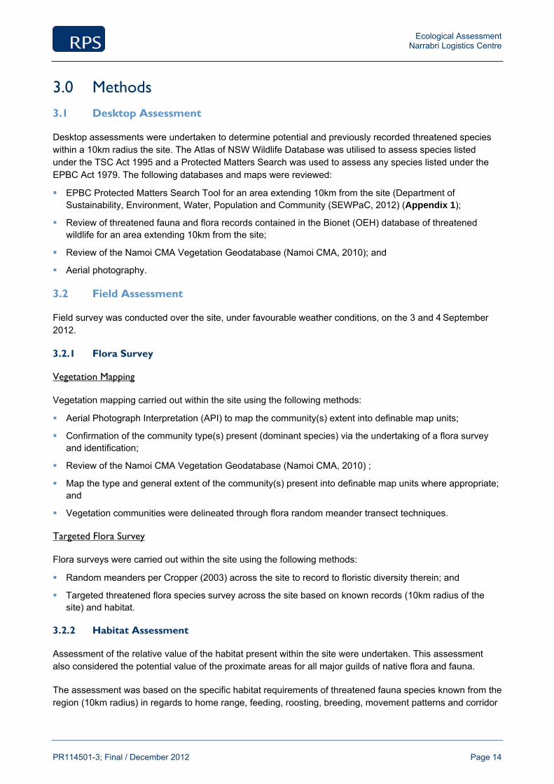
Ecological Assessment Narrabri Logistics Centre
PR114501-3; Final / December 2012 Page 14
3.0 Methods
3.1 Desktop Assessment
Desktop assessments were undertaken to determine potential and previously recorded threatened species within a 10km radius the site. The Atlas of NSW Wildlife Database was utilised to assess species listed under the TSC Act 1995 and a Protected Matters Search was used to assess any species listed under the EPBC Act 1979. The following databases and maps were reviewed:
EPBC Protected Matters Search Tool for an area extending 10km from the site (Department of Sustainability, Environment, Water, Population and Community (SEWPaC, 2012) (Appendix 1);
Review of threatened fauna and flora records contained in the Bionet (OEH) database of threatened wildlife for an area extending 10km from the site;
Review of the Namoi CMA Vegetation Geodatabase (Namoi CMA, 2010); and
Aerial photography.
3.2 Field Assessment
Field survey was conducted over the site, under favourable weather conditions, on the 3 and 4 September 2012.
3.2.1 Flora Survey
Vegetation Mapping
Vegetation mapping carried out within the site using the following methods:
Aerial Photograph Interpretation (API) to map the community(s) extent into definable map units;
Confirmation of the community type(s) present (dominant species) via the undertaking of a flora survey and identification;
Review of the Namoi CMA Vegetation Geodatabase (Namoi CMA, 2010) ;
Map the type and general extent of the community(s) present into definable map units where appropriate; and
Vegetation communities were delineated through flora random meander transect techniques.
Targeted Flora Survey
Flora surveys were carried out within the site using the following methods:
Random meanders per Cropper (2003) across the site to record to floristic diversity therein; and
Targeted threatened flora species survey across the site based on known records (10km radius of the site) and habitat.
3.2.2 Habitat Assessment
Assessment of the relative value of the habitat present within the site were undertaken. This assessment also considered the potential value of the proximate areas for all major guilds of native flora and fauna.
The assessment was based on the specific habitat requirements of threatened fauna species known from the region (10km radius) in regards to home range, feeding, roosting, breeding, movement patterns and corridor
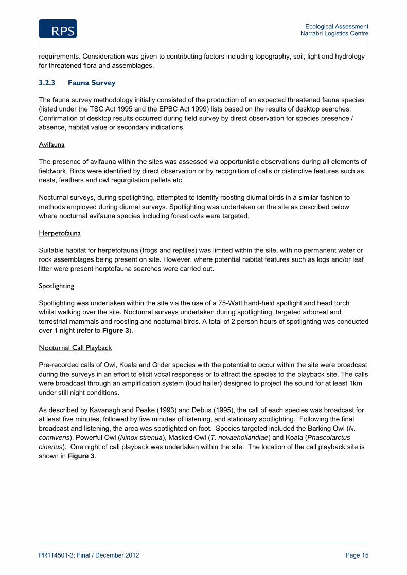
Ecological Assessment Narrabri Logistics Centre
PR114501-3; Final / December 2012 Page 15
requirements. Consideration was given to contributing factors including topography, soil, light and hydrology for threatened flora and assemblages.
3.2.3 Fauna Survey
The fauna survey methodology initially consisted of the production of an expected threatened fauna species (listed under the TSC Act 1995 and the EPBC Act 1999) lists based on the results of desktop searches. Confirmation of desktop results occurred during field survey by direct observation for species presence / absence, habitat value or secondary indications.
Avifauna
The presence of avifauna within the sites was assessed via opportunistic observations during all elements of fieldwork. Birds were identified by direct observation or by recognition of calls or distinctive features such as nests, feathers and owl regurgitation pellets etc.
Nocturnal surveys, during spotlighting, attempted to identify roosting diurnal birds in a similar fashion to methods employed during diurnal surveys. Spotlighting was undertaken on the site as described below where nocturnal avifauna species including forest owls were targeted.
Herpetofauna
Suitable habitat for herpetofauna (frogs and reptiles) was limited within the site, with no permanent water or rock assemblages being present on site. However, where potential habitat features such as logs and/or leaf litter were present herptofauna searches were carried out.
Spotlighting
Spotlighting was undertaken within the site via the use of a 75-Watt hand-held spotlight and head torch whilst walking over the site. Nocturnal surveys undertaken during spotlighting, targeted arboreal and terrestrial mammals and roosting and nocturnal birds. A total of 2 person hours of spotlighting was conducted over 1 night (refer to Figure 3).
Nocturnal Call Playback
Pre-recorded calls of Owl, Koala and Glider species with the potential to occur within the site were broadcast during the surveys in an effort to elicit vocal responses or to attract the species to the playback site. The calls were broadcast through an amplification system (loud hailer) designed to project the sound for at least 1km under still night conditions.
As described by Kavanagh and Peake (1993) and Debus (1995), the call of each species was broadcast for at least five minutes, followed by five minutes of listening, and stationary spotlighting. Following the final broadcast and listening, the area was spotlighted on foot. Species targeted included the Barking Owl (N. connivens), Powerful Owl (Ninox strenua), Masked Owl (T. novaehollandiae) and Koala (Phascolarctus cinerius). One night of call playback was undertaken within the site. The location of the call playback site is shown in Figure 3.
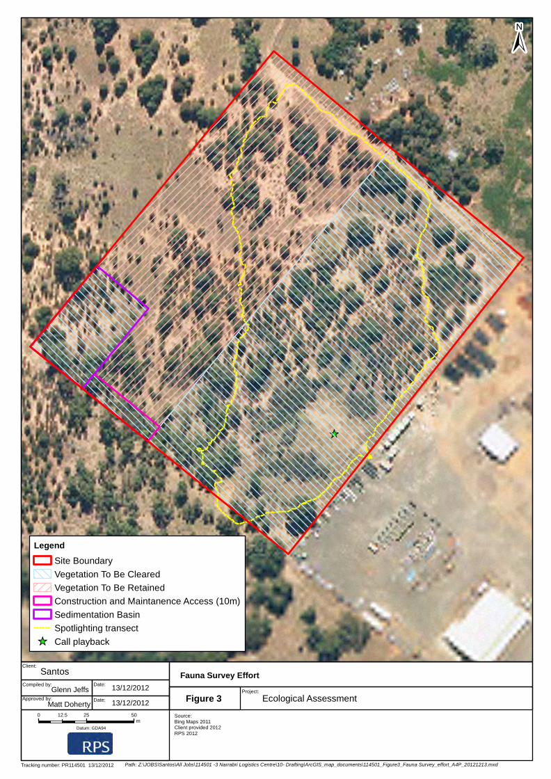
_̂
±
Legend
Site Boundary
Vegetation To Be Cleared
Vegetation To Be Retained
Construction and Maintanence Access (10m)
Sedimentation Basin
Spotlighting transect
_̂ Call playback
Tracking number: PR114501 13/12/2012
Source:Bing Maps 2011Client provided 2012RPS 2012
Client:
Date:
Approved by:
Santos
13/12/2012
Date:
Project:
Ecological Assessment
Compiled by:
Fauna Survey Effort
Datum: GDA94
0 25 5012.5m
Glenn JeffsFigure 3
Matt Doherty
Path: Z:\JOBS\Santos\All Jobs\114501 -3 Narrabri Logistics Centre\10- Drafting\ArcGIS_map_documents\114501_Figure3_Fauna Survey_effort_A4P_20121213.mxd
13/12/2012
Ecological Assessment Narrabri Logistics Centre
PR114501-3; Final / December 2012 Page 17
Koala Assessments
The wooded areas within the entire site (3.4ha) were found to contain four individual Blakely’s Red Gums (Eucalyptus Blakelyi) which are a secondary feed tree species as listed under SEPP 44. These trees were searched for signs of the species presence through means such as identification of scats, scratches, and individuals or their vocalisations (including eliciting response through call playback).
Secondary Indications and Incidental Observations
Opportunistic sightings of secondary indications (scratches, scats, diggings, tracks etc.) of resident fauna were noted within the site. Such indicators included:
Distinctive scats left by mammals. Any scats unable to be positively identified in the field were collected for further analysis, and scats of predator species containing fur / bones were sent for analysis if appropriate;
Scratch marks made by various types of arboreal animals;
Nests made by various guilds of birds;
Scats and / or scratches consistent with Koalas;
Tracks left by animals in sand;
Carcasses and bones;
Feeding scars on Eucalyptus trees made by Gliders; and
Whitewash, regurgitation pellets and prey remains from Owls.
Any other incidental observations of fauna were recorded during all phases of fieldwork.
3.3 Survey Limitations
It should be noted that the detectability of flora and fauna and the ability to accurately identify plants to species level may vary greatly with the time of year, prevailing climatic conditions and the presence of reproductive material (e.g. flowers, fruit, and seed capsules). Consequently, the survey conducted for the site should not be regarded as conclusive evidence that certain protected species do not occur within the site; however, efforts have been made to detect these species in habitats that were considered suitable.
In response to the abovementioned limitations the precautionary approach has been adopted; as such ‘assumed presence’ of known and expected threatened species, populations and ecological communities has been made where relevant to ensure a holistic assessment.

Ecological Assessment Narrabri Logistics Centre
PR114501-3; Final / December 2012 Page 18
4.0 Results
4.1 Flora Desktop Assessment
4.1.1 Threatened Ecological Communities
EPBC Act
Seven Threatened Ecological Communities listed under the EPBC Act were identified as potentially occurring within the locality of the site as part of the EPBC Protected Matters Search Tool, including:
Brigalow (Acacia harpophylla dominant and co-dominant);
Coolibah - Black Box Woodlands of the Darling Riverine Plains and the Brigalow Belt South Bioregions;
Grey Box (Eucalyptus microcarpa) Grassy Woodlands and Derived Native Grasslands of South-eastern Australia;
Natural grasslands on basalt and fine-textured alluvial plains of northern New South Wales and southern Queensland;
Semi-evergreen Vine Thicket in the Brigalow Belt South and Nandewar Bioregions;
Weeping Myall Woodlands; and
White Box-Yellow Box-Blakely's Red Gum Grassy Woodland and Derived Native Grassland.
TSC Act
No TECs listed within the TSC Act were identified as occurring within the site, based on known or predicted communities occurring in the Namoi Catchment Management Area Sub-region. However, of the above seven EPBC listed communities, all are commensurate with communities listed under the TSC Act and therefore, have the potential to occur. In addition to this a Wildlife Atlas Community Search provided two communities which are only listed under the TSC Act. These include:
Brigalow within the Brigalow Belt South, Nandewar and Darling Riverine Plains Bioregions;
Coolibah - Black Box Woodlands of the Darling Riverine Plains and the Brigalow Belt South Bioregions;
Inland Grey Box Woodland in the Riverina, NSW South Western Slopes, Cobar Peneplain, Nandewar and Brigalow Belt South Bioregions;
Native Vegetation on Cracking Clay Soils of the Liverpool Plains;
Myall Woodland in the Darling Riverine Plains, Brigalow Belt South, Cobar Peneplain, Murray-Darling Depression, Riverina and NSW South western Slopes bioregions;
White Box-Yellow Box-Blakely's Red Gum Grassy Woodland;
Cadellia pentastylis (Ooline) community in the Nandewar and Brigalow Belt South Bioregions;
Fuzzy Box Woodland on alluvial Soils of the South Western Slopes, Darling Riverine Plains and Brigalow Belt South Bioregions; and
Semi-evergreen Vine Thicket in the Brigalow Belt South and Nandewar Bioregions.
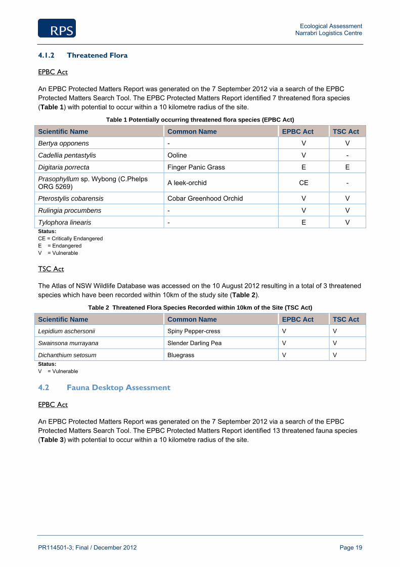
Ecological Assessment Narrabri Logistics Centre
PR114501-3; Final / December 2012 Page 19
4.1.2 Threatened Flora
EPBC Act
An EPBC Protected Matters Report was generated on the 7 September 2012 via a search of the EPBC Protected Matters Search Tool. The EPBC Protected Matters Report identified 7 threatened flora species (Table 1) with potential to occur within a 10 kilometre radius of the site.
Table 1 Potentially occurring threatened flora species (EPBC Act)
Scientific Name Common Name EPBC Act TSC Act
Bertya opponens - V V
Cadellia pentastylis Ooline V -
Digitaria porrecta Finger Panic Grass E E
Prasophyllum sp. Wybong (C.Phelps ORG 5269) A leek-orchid CE -
Pterostylis cobarensis Cobar Greenhood Orchid V V
Rulingia procumbens - V V
Tylophora linearis - E V Status: CE = Critically Endangered E = Endangered V = Vulnerable
TSC Act
The Atlas of NSW Wildlife Database was accessed on the 10 August 2012 resulting in a total of 3 threatened species which have been recorded within 10km of the study site (Table 2).
Table 2 Threatened Flora Species Recorded within 10km of the Site (TSC Act)
Scientific Name Common Name EPBC Act TSC Act
Lepidium aschersonii Spiny Pepper-cress V V
Swainsona murrayana Slender Darling Pea V V
Dichanthium setosum Bluegrass V V
Status: V = Vulnerable
4.2 Fauna Desktop Assessment
EPBC Act
An EPBC Protected Matters Report was generated on the 7 September 2012 via a search of the EPBC Protected Matters Search Tool. The EPBC Protected Matters Report identified 13 threatened fauna species (Table 3) with potential to occur within a 10 kilometre radius of the site.
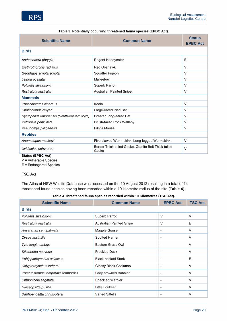
Ecological Assessment Narrabri Logistics Centre
PR114501-3; Final / December 2012 Page 20
Table 3 Potentially occurring threatened fauna species (EPBC Act).
Scientific Name Common Name Status
EPBC Act
Birds
Anthochaera phrygia Regent Honeyeater E
Erythrotriorchis radiatus Red Goshawk V
Geophaps scripta scripta Squatter Pigeon V
Leipoa ocellata Malleefowl V
Polytelis swainsonii Superb Parrot V
Rostratula australis Australian Painted Snipe V
Mammals
Phascolarctos cinereus Koala V
Chalinolobus dwyeri Large-eared Pied Bat V
Nyctophilus timoriensis (South-eastern form) Greater Long-eared Bat V
Petrogale penicillata Brush-tailed Rock Wallaby V
Pseudomys pilligaensis Pilliga Mouse V
Reptiles
Anomalopus mackayi Five-clawed Worm-skink, Long-legged Wormskink V
Uvidicolus sphyrurus Border Thick-tailed Gecko, Granite Belt Thick-tailed Gecko V
Status (EPBC Act): V = Vulnerable Species E = Endangered Species
TSC Act
The Atlas of NSW Wildlife Database was accessed on the 10 August 2012 resulting in a total of 14 threatened fauna species having been recorded within a 10 kilometre radius of the site (Table 4).
Table 4 Threatened fauna species recorded within 10 Kilometres (TSC Act).
Scientific Name Common Name EPBC Act TSC Act
Birds
Polytelis swainsonii Superb Parrot V V
Rostratula australis Australian Painted Snipe V E
Anseranas semipalmata Magpie Goose - V
Circus assimilis Spotted Harrier - V
Tyto longimembris Eastern Grass Owl - V
Stictonetta naevosa Freckled Duck - V
Ephippiorhynchus asiaticus Black-necked Stork - E
Calyptorhynchus lathami Glossy Black-Cockatoo - V
Pomatostomus temporalis temporalis Grey-crowned Babbler - V
Chthonicola sagittata Speckled Warbler - V
Glossopsitta pusilla Little Lorikeet - V
Daphoenositta chrysoptera Varied Sittella - V

Ecological Assessment Narrabri Logistics Centre
PR114501-3; Final / December 2012 Page 21
Scientific Name Common Name EPBC Act TSC Act
Mammals
Phascolarctos cinereus Koala V V
Reptiles
Hoplocephalus bitorquatus Pale-headed Snake - V Status (TSC/EPBC Act): V = Vulnerable Species E = Endangered Species
4.2.2 Migratory Species
Ten species listed as migratory under the EPBC Act have the potential to occur on site. Table 5 lists all potentially occurring migratory species.
Table 5 Potentially occurring migratory species within 10km (EPBC Act).
Scientific Name Common Name EPBC Act TSC Act
Apus pacificus Fork-tailed Swift M
Ardea alba Great Egret M
Ardea ibis Cattle Egret M
Haliaeetus leucogaster White-bellied Sea-Eagle M
Hirundapus caudacutus White-throated Needletail M
Leipoa ocellata Malleefowl V, M E
Merops ornatus Rainbow Bee-eater M
Anthochaera phrygia Regent Honeyeater E, M CE
Gallinago hardwickii Latham's Snipe M
Rostratula australis Australian Painted Snipe V, M E Status (TSC/EPBC Act): V = Vulnerable Species E = Endangered Species CE = Critically Endangered Species M = Migratory
4.3 Field Surveys
4.3.1 Vegetation Communities
One vegetation community was observed within the site being Rough-barked Apple - Blakely's Red Gum Riparian Grassy Woodlands, Brigalow Belt South and Nandewar.
A description of this community is provided below, while the location and extent is outlined in Figure 4. A detailed flora species list for the site is included in Appendix 2.

Ecological Assessment Narrabri Logistics Centre
PR114501-3; Final / December 2012 Page 22
Rough-barked Apple - Blakely's Red Gum Riparian Grassy Woodlands
Plate 1 Rough-barked Apple - Blakely's Red Gum Riparian Grassy Woodlands, Brigalow Belt South and
Nandewar
Description: The site was dominated by Rough-barked Apple (Angophora floribunda) and White Cypress Pine (Callitris glaucophylla) with four individual Blakely’s Red Gums (Eucalyptus Blakelyi) occurring throughout the entire site (3.4ha). This community lacked diversity in the understorey. The shrub layer was comprised of Deane’s Wattle (Acacia deanei), Appressed Bossiaea (Bossiaea rhombifolia) and African Boxthorn (Lycium formosum). The ground cover consisted mostly of native grasses including Cane Grass (Eragrostis australasica, Purple Wiregrass (Aristida ramosa) Hairy Panic (Panicum effusum) and Slender Bamboo (Austrostipa verticillata). Herbs and forbes in this community were scarce however, some Tufted Bluebell (Wahlenbergia communis), Common Everlasting (Chrysocephalum apiculatum) and Glycine clandestina were observed.
Condition: The overall condition of this community was relatively poor throughout the site. This area of woodland exhibits a low floristic diversity this is as a result of a moderate level of disturbance from rural usage including Horse grazing. A moderate level of weed infestation by African Boxthorn (Lycium formosum) and Prickly Pear (Opuntia stricta*) was evident and the ground layer is largely a monoculture of only a few grass species further demonstrating a history or disturbance.
Classification: It was determined that this community is not commensurate with any TEC listed under the under the State (TSC Act 1995) and Commonwealth (EPBC Act 1999) legislative framework.(Appendix 7

±
Legend
Site Boundary
Vegetation To Be Cleared
Vegetation To Be Retained
Construction and Maintanence Access (10m)
Sedimentation Basin
Rough-barked Apple - Blakely's Red Gum Riparian Grassy Woodlands, Brigalow Belt South and Nandewar
Tracking number: PR114501 13/12/2012
Source:Bing Maps 2011Client provided 2012RPS 2011
Client:
Date:
Approved by:
Santos
13/12/2012
Date:
Project:
Ecological Assessment
Compiled by:
Vegetation community
Datum: GDA94
0 25 5012.5m
Glenn JeffsFigure 4
Matt Doherty
Path: Z:\JOBS\Santos\All Jobs\114501 -3 Narrabri Logistics Centre\10- Drafting\ArcGIS_map_documents\114501_Figure4_vegetation community_A4P_20121213.mxd
13/12/2012

Ecological Assessment Narrabri Logistics Centre
PR114501-3; Final / December 2012 Page 24
4.3.2 Targeted Flora Surveys
Targeted searches did not confirm the presence of any threatened flora species (listed under the TSC act or the EPBC Act) within the site. A full list of the flora species is compiled in Appendix 2. An assessment of likelihood of occurrence was completed for the threatened flora species listed in Tables 1 & 2 and is included in Appendix 4.
4.3.3 Weeds
Several exotic flora species were recorded on site and two of which are listed weed species. These two species, namely Prickly Pear (Opuntia stricta) and African Boxthorn (Lycium formosum, are considered to be a noxious weeds in NSW (DPI, 2012). Under the provisions of the Noxious Weeds Act 1993, Prickly Pears (except Opuntia ficus-indica) and African Boxthorn (Lycium formosum*) are classified as Class 4 weeds. This means that the growth and spread of the plant must be controlled according to the measure specified in a management plan published by the local control authority and the plant may not be sold, propagated or knowingly distributed.
The remaining species are grasses or herbs that are not considered noxious in NSW. A complete flora list is compiled in Appendix 2.
4.4 Fauna
4.4.1 Habitat
The vegetation community within the site was identified as ‘Rough-barked Apple - Blakely's Red Gum Riparian Grassy Woodlands, Brigalow Belt South and Nandewar’. This relatively small are of vegetation (3.4ha) offers little habitat in the form of mature canopy trees, hollows for nesting and dwelling, logs, rocks, understorey vegetation and vegetation diversity. There are no permanent water bodies present on site which could support native wildlife particularly amphibians.
The sparse vegetation on site and the garbage tip in close proximity to the site provide suitable foraging habitat for many common bird species throughout various times of day. The site has experienced some visible signs of clearing and grazing which has led to degradation of many ecological attributes. Horses appear to have access to the entirety of the site with their scats, tracks and grazing pressure being noted across the site. This has resulted in increasing the level of disturbance through soil compaction, vegetation degradation and soil nutrient disturbance from faecal matter.
4.4.2 Observed Fauna
Opportunistic searches and spotlight lighting/call playback methods during field surveys did not confirm the presence of any threatened fauna species (listed under the TSC act or the EPBC Act) within the site. A full list of the fauna species is compiled in Appendix 3. An assessment of likelihood of occurrence was completed for the threatened fauna species listed in Tables 3 & 4 and is included in Appendix 4.
4.4.3 Avifauna Survey
A total of 22 bird species were recorded within the site during the survey period. A full list of bird species observed within the site is provided in Appendix 3.
4.4.4 Reptile Survey
Opportunistic surveys were conducted across the site for reptiles, however, only one common reptile species was recorded within the site namely a Garden Sun Skink (Lampropholis delicata.)
Ecological Assessment Narrabri Logistics Centre
PR114501-3; Final / December 2012 Page 25
4.4.5 Frog Survey
Opportunistic surveys were conducted for amphibians within the site. However, no amphibian species were recorded within the site.
4.4.6 Koala Assessments
No Koalas (Phascolarctos cinereus), or signs of their presence, were recorded during the surveys. No primary koala feed trees listed under Schedule 2 of the SEPP 44 were recorded on site, only secondary Koala feed trees were present.
4.4.7 Spotlighting
A total of two person hours of spotlighting across the site as described in Section 3.2.3 failed to locate and identify any faunal species within the site.
4.4.8 Nocturnal Call Playback
A nocturnal call playback within the site as described in Section 3.2.3 failed to locate and identify any faunal species within the site.
4.4.9 Pests
Three pest species, namely the Fox (Vulpes vulpes), Horse (Equus ferus caballus) and Rabbit (Oryctolagus cuniculus) were all recorded on site via visual observations or signs of presence through scats, tracks or carcasses.
Ecological Assessment Narrabri Logistics Centre
PR114501-3; Final / December 2012 Page 26
5.0 Ecological Impact Assessment
5.1 Potential Ecological Impacts
The proposal is likely to result in the clearing of approximately 2.07ha of disturbed woodland which provides potential sub-optimal habitat for a number of threatened entities. Based on the field survey and results an assessment of potential impacts on threatened species, populations and ecological communities from the locality (10km radius of the site) has been undertaken.
Blakely’s Red Gums (Eucalyptus Blakelyi) were observed within the vegetation community on site, therefore, there is potential for White Box, Yellow Box, Blakely’s Red Gum and Derived Grasslands TEC to occur. Further preliminary assessment has been undertaken, with reference to DEH (2006) and NPWS (2002) (see Appendix 7) to determine the likelihood of TEC presence based on site, situation and floristic structure. Specifically, the site contains a low abundance Blakelyi’s Red Gum (Eucalyptus Blakelyi) and it is not considered a dominant or characteristic canopy species. Therefore, the assessment in Appendix 7 concluded that the vegetation community within the site is not commensurate with the TEC determination under the State (TSC Act 1995) and Commonwealth (EPBC Act 1999) legislative framework.
Initially a consideration for likelihood of occurrence was carried out for both TSC Act and EPBC Act listed species in Appendix 4. Those threatened species, populations and ecological communities considered to have the potential to occur and/or impacted upon as result of the proposal were assessed further under a 7-Part Test for the threatened entities listed under the TSC Act (Appendix 6). Similarly, an Assessment of Significance (AoS) was conducted for the threatened entities and listed migratory species listed under the EPBC Act (Appendix 5).
5.2 Matters of National Environmental Significance
The EPBC Act focuses Commonwealth interests on matters of National Environmental Significance (NES) including integrated biodiversity conservation and the management of important protected areas. The matters of NES as identified in the Act which require assessment and approval to be addressed by the Commonwealth include:
World Heritage Properties;
National Heritage Places;
Wetlands of International Importance;
Great Barrier Reef Marine Parks;
Commonwealth Marine areas;
Nationally Threatened Species;
Nationally Threatened Ecological Communities;
Migratory Species;
The assessment and approval process applies to any action that has, will have or is likely to have a significant impact on a matter of NES. An ‘action’ is defined as a project, development, undertaking or an activity or series of activities.
The matter of NES and site-specific responses are as follows.

Ecological Assessment Narrabri Logistics Centre
PR114501-3; Final / December 2012 Page 27
World Heritage Properties:
The Site is not World Heritage Property, and is not in close proximity to any such property.
Wetlands of International Importance (RAMSAR convention):
The Site is not part of any Wetland of International Importance, and is not in close proximity to any such area.
Great Barrier Reef Marine Parks;
The Site is not part of any Great Barrier Reef Marine Park, and is not in close proximity to any such park.
Commonwealth Marine Areas
The proposal will not have a significantly adverse effect on any Commonwealth Marine area, as there are no such marine areas within the region.
Nationally Listed Threatened Species:
Threatened species listed under the EPBC Act, which occur, or have the potential to occur within the locality (10km radius) have been assessed for their potential to occur within the site (Appendix 4). Those threatened species that were considered to have potential to occur and subsequently may be impacted by the proposal is as follows:
Those EPBC listed threatened species considered to have potential to occur are:
Pterostylis cobarensis Cobar Greenhood Orchid V
Rulingia procumbens V
Tylophora linearis E
Phascolarctos cinereus Koala V
Leipoa ocellata Malleefowl V
Polytelis swainsonii Superb Parrot V
The site and the proposed location of the development footprint exists, as a previously disturbed site (~3.4 ha) and the proposal will impact upon a small area of sub-optimal habitat (~ 2.07ha of disturbed woodland habitat). This site is within close proximity to superior areas of habitat (Jacks Creek State Forest ~ 7.7km to the South (2,195ha) and Killarney State Conservation Area ~13.5km to the North-east (~1,850ha)) which would be suitable for supporting populations of the potentially occurring above listed threatened species. The small area to be impacted upon is unlikely to be essential to the survival of populations of these listed species.
Nationally Listed Threatened Ecological Communities:
No Threatened Ecological Community (TEC), nationally listed under the EPBC Act were recorded during field surveys. However, one TEC was considered for its likelihood to occur (Appendix 4). As no TEC’s are considered likely to occur there is no potential for impacts upon any listed TEC’s.
Nationally Listed Migratory Species:
Those EPBC listed Migratory species considered to have potential to occur are:
Circus assimilis Spotted Harrier
Apus pacificus Fork-tailed Swift
Ecological Assessment Narrabri Logistics Centre
PR114501-3; Final / December 2012 Page 28
Leipoa ocellata Malleefowl
Ardea ibis Cattle Egret
Merops ornatus Rainbow Bee-eater
The proposed location of the development footprint exists, as a previously disturbed site with a low diversity of habitat features. The site and the proposed location of the development footprint exists, as a previously disturbed site (~3.4 ha) and the proposal will impact upon a small area of sub-optimal habitat (~ 2.07ha of disturbed woodland habitat). This site is within close proximity to superior areas of habitat (Jacks Creek State Forest ~ 7.7km to the South (2,195ha) and Killarney State Conservation Area ~13.5km to the North-east (~1,850ha)) which would be suitable for supporting populations of the potentially occurring above listed threatened species. The small area to be impacted upon is unlikely to be essential to the survival of populations of these listed species.
This site is surrounded by superior areas of habitat, which would be suitable for the above listed Migratory species. Due to the extensive tracts of vegetation within the Pilliga State Forest, supporting the populations of the potentially occurring above species, the small area to be impacted upon is unlikely to be essential to the survival of populations of these species.
5.3 NSW State Significance
5.3.1 TSC Act
Section 5A of the EP&A Act lists seven factors that must be taken into account in the determination of the significance of potential impacts proposed activities on ‘threatened species, populations or ecological communities (or their habitats)’ listed under the NSW TSC Act. The Assessment of Significance (7-part test) is used to determine whether activities are ‘likely’ to cause ‘a significant impact’ on threatened biota. Appendix 6 contains the assessment for the following species listed in Table 6.
Table 6 Threatened Species assessed under 7-Part Tests
Fauna Species Flora Species
Spotted Harrier Dichanthium setosum
Grey-crowned Babbler Digitaria porrecta
Koala Rulingia procumbens
Pale-headed Snake Pterostylis cobarensis
Malleefowl Tylophora linearis
Superb Parrot
Speckled Warbler
Little Lorikeet
Varied Sittella
Eastern Grass Owl
The assessment determined that no significant impacts such that a local extinction would be likely to occur as a result of the proposal.

Ecological Assessment Narrabri Logistics Centre
PR114501-3; Final / December 2012 Page 29
5.4 SEPP 44 (Koala Habitat Protection)
This policy aims to encourage the proper conservation and management of areas of natural vegetation that provide habitat for koalas to ensure a permanent free-living population over their present range and reverse the current trend of Koala population decline.
First Consideration – Is the Land ‘Potential Koala Habitat’?
Schedule 2 of State Environmental Planning Policy (SEPP) No. 44 – ‘Koala Habitat Protection’ lists 10 tree species that are considered indicators of ‘Potential Koala Habitat’. The presence of any of the species listed on a site proposed for development triggers the requirement for an assessment for ‘Potential Koala Habitat’. SEPP 44 defines potential Koala Habitat as:
“areas of native vegetation where the trees of the types listed in Schedule 2 constitute at least 15% of the total number of trees in the upper or lower strata of the tree component“.
The wooded areas within the entire site (3.4ha) were found to contain four individual Blakely’s Red Gums (Eucalyptus Blakelyi) which are a secondary feed tree species. However, the site was dominated by Rough-barked Apple (Angophora floribunda) and White Cypress Pine (Callitris glaucophylla) which are neither primary nor secondary feed tree species. No primary feed trees listed under Schedule 2 of the SEPP 44 were detected within the site. No Koalas or traces of Koalas such as scats or scratches on tree trunks were observed within the site during the surveys. As no Koalas, or signs of Koala occupation were observed on the site and it lacked primary feed tree species, it has been determined that the site does not provide ‘Core’ or ‘Potential’ Koala habitat according to SEPP 44. Therefore, further assessment under SEPP 44 is not required.
Ecological Assessment Narrabri Logistics Centre
PR114501-3; Final / December 2012 Page 30
6.0 Recommendations The proposal has been assessed as being likely to have minimal ecological impacts, however to prevent and reduce potential for impact on ecological features within the site during the construction and operation phases of this project, the following management procedures are recommended.
Vehicular traffic during the construction and operation phase are to avoid retained vegetation on site;
Prevent the spread of exotic weed species through appropriate vehicle and personnel hygiene protocols during the construction phase.
Vehicle speed should be minimised at all times on site to reduce dust levels and reduce the risk of fauna strike;
Declared Noxious weeds (including Prickly Pear/ Tiger Pear) should be managed in accordance with local and state guidelines. In the absence of these reference shall be made to the Noxious Weeds Act; and
Appropriate measures should be employed to ensure that construction and operations machinery are clean from materials potentially containing Phytophthora cinnamomi, as part of ongoing environmental stewardship.

Ecological Assessment Narrabri Logistics Centre
PR114501-3; Final / December 2012 Page 31
7.0 Conclusion RPS has been commissioned by Santos Pty Ltd to prepare an Ecological Assessment for the expansion of its existing Santos Narrabri Operations Centre at 300 Yarrie Lake Road, Narrabri (the proposal).
The proposal is will result in the clearing of approximately 2.07ha of disturbed woodland which provides potential sub-optimal habitat for a number of threatened entities. Based on the field survey and results an assessment of potential impacts on threatened species, populations and ecological communities from the locality (10km radius of the site) has been undertaken.
Assessment under the TSC Act found that the proposal is unlikely to have a signification impact on threatened species, populations or ecological communities known from the region.
Assessment under the EPBC Act found that the proposal was unlikely to have an impact on Matters of NES
No Koalas or traces of Koalas such as scats or scratches on tree trunks were observed within the site during the surveys. As no Koalas, or signs of Koala occupation were observed on the site and it lacked primary feed tree species, it has been determined that the site does not provide ‘Core’ or ‘Potential’ Koala habitat according to SEPP 44. Therefore, a Koala plan of management is not required.
The proposal has been assessed as being likely to have minimal ecological impacts, however to prevent and reduce potential for impact on ecological features within the site during the construction and operation phases of this project, the following management procedures are recommended.
Vehicular traffic during the construction and operation phase are to avoid retained vegetation on site;
Prevent the spread of exotic weed species through appropriate vehicle and personnel hygiene protocols during the construction phase.
Vehicle speed should be minimised at all times on site to reduce dust levels and reduce the risk of fauna strike;
Declared Noxious weeds (including Prickly Pear/ Tiger Pear) should be managed in accordance with local and state guidelines. In the absence of these reference shall be made to the Noxious Weeds Act; and
Appropriate measures should be employed to ensure that construction and operations machinery are clean from materials potentially containing Phytophthora cinnamomi, as part of ongoing environmental stewardship.

Ecological Assessment Narrabri Logistics Centre
PR114501-3; Final / December 2012 Page 32
8.0 Bibliography
Birdlife (2012) Australian Painted Snipe. [Online] Available from: http://www.birdlife.org.au/bird-profile/australian-painted-snipe
Birdlife (2012b) Rufous Fantail. [Online] Available from: http://www.birdlife.org.au/bird-profile/rufous-fantail
Brooker, M. I. H. and Leinig, D. A. (1999) Field Guide to Eucalypts - Volume 1 South-eastern Australia. Blooming Books Publishing, Victoria.
Charman, P. E. V. and Murphy. B. W. (1991) Soils: Their Properties and Management. Oxford University Press, Australia.
Churchill, S. (2008) Australian Bats 2nd Ed. Allen and Unwin, Australia.
Cunningham, G. M., Mulham, W. E., Milthorpe, P. L. and Leigh, J. H. (2011) Plants of Western New South
Wales. CSIRO Publishing, Victoria.
Department of Sustainability, Environment, Water, Population and Communities (SEWPAC) (2012). EPBC Act 1999 Protected Matters Search – Flora and Fauna Database. Accessed September 2012.
Forshaw, M. J. and Cooper T. W. (1991) Australian Parrots. Ure Smith Press, Willoughby, NSW.
Fox, B. J. and Briscoe D.A. (1980) Pseudomys pilligaensis, a new species of murid rodent from the Pilliga Scrub, northern New South Wales. Australian Mammalogy 3:109–126.
Griffiths. K. (2006) Frogs & Reptiles of the Sydney Region. New Holland Publishers, Sydney.
Harden, G. (ed) (2002) Flora of New South Wales, Volume 2. Revised Edition. University of New South Wales Press Ltd, Sydney.
Harden, G. (ed) (2000) Flora of New South Wales, Volume 1. Revised edition. University of New South Wales Press Ltd, Sydney.
Harden, G. (ed) (1992) Flora of New South Wales, Volume 3. University of New South Wales Press Ltd, Sydney.
Harden, G. (ed) (1993) Flora of New South Wales, Volume 4. University of New South Wales Press Ltd, Sydney.
Higgins, P. J. (ed.) (1999) Handbook of Australian, New Zealand and Antarctic Birds. Volume Four - Parrots
to Dollarbird. Melbourne: Oxford University Press.
Lester, N. C. (2008) Woodland to Weeds: Southern Queensland and Brigalow Belt. Copy Right Publishing, Brisbane.
Marchant, S. and Higgins, P. J., eds. (1990) The Handbook of Australian, New Zealand and Antarctic Birds,
Volume 1 Part a - Rattites to Petrels. Melbourne, Victoria: Oxford University Press.
Ecological Assessment Narrabri Logistics Centre
PR114501-3; Final / December 2012 Page 33
Marchant, S. and Higgins, P. J. (1993) (eds) Handbook of Australian, New Zealand and Antarctic Birds
Volume 2 Raptors to Lapwings, Oxford University Press, Melbourne.
Morcombe, M. (2000) Field Guide to Australian Birds, Steve Parish Publishing, Archerfield.
Namoi CMA (2010) Extant vegetation mapping in the Namoi CMA. This dataset was compiled by Eco Logical Australia for the Namoi Catchment Management Authority.
NSW Department of Environment and Climate Change (NSW DECC) (2005) NSW Threatened Species -
Pilliga Mouse - profile. [Online]. Available from: http://www.threatenedspecies.environment.nsw.gov.au/tsprofile/profile.aspx?id=10690.
New South Wales Government (2003) NSW Native Vegetation Act. [Online]. Accessed from: http://corrigan.austlii.edu.au/au/legis/nsw/consol_act/nva2003194/
New South Wales Government (2012) NSW Native Vegetation Regulation. [Online]. Accessed from: http://www.environment.nsw.gov.au/resources/nativeveg/NativeVegetationRegulation2012.pdf
New South Wales Government (1993) NSW Noxious Weeds Act. [Online]. Accessed from: http://www.austlii.edu.au/au/legis/nsw/consol_act/nwa1993182/
New South Wales Government (1974) NSW National Parks and Wildlife Act. [Online]. Accessed from: http://www.austlii.edu.au/au/legis/nsw/consol_act/npawa1974247/
New South Wales Government (1979) Environmental Planning and Assessment Act. [Online]. Accessed from: http://www.austlii.edu.au/au/legis/nsw/consol_act/epaaa1979389/
New South Wales Government (1995) State Environmental Planning Policy No 44- Koala Habitat Protection. [Online] Accessed from: http://www.austlii.edu.au/au/legis/nsw/consol_reg/seppn44hp603/
NSW Scientific Committee (2011) Native vegetation on cracking clay soils of the Liverpool Plains - endangered ecological community listing. [Online]. Available from: http://www.environment.nsw.gov.au/determinations/NativeVegetationCrackingClayEndComListing.htm
Office of Environment and Heritage (OEH) (2012) Atlas of NSW Wildlife – Flora and Fauna Database and Threatened Species Profiles. Accessed September 2012.
Pizzey, G. and Knight. F. (2007) Field to Guide to the birds of Australia 8th Ed. Harper Collins, Sydney.
Richardson, F. J., Richardson, R. G. and Shepherd, R. C. H. (2011) Weeds of the South-East: An
Identification Guide for Australia 2nd Ed. R. G and F. J Publishing, Victoria.
Robinson, L. (2003) Field Guide to the Native Plants of Sydney 3rd Ed. Kangaroo Press, Sydney Australia.
Simpson, K and Day, N. (2012) Field Guide to the Birds of Australia 8th Ed. Penguin Books, Australia.
Strahan, R. (Ed) (2008) The Mammals of Australia 3rd Ed. Reed Books, Chatswood, NSW.
Ecological Assessment Narrabri Logistics Centre
PR114501-3; Final / December 2012 Page 34
Tokushuma, H., S.W. Green and P.J. Jarman (2008) Ecology of the rare but irruptive Pilliga mouse (Pseudomys pilligaensis). I. Population fluctuation and breeding season. Australian Journal of Zoology 56:363–373.
Tyler, M. J. and Knight, F. (2011) Field Guide to the Frogs of Australia. CSIRO Publishing, Australia.
Woinarski, J. C. Z., Fisher, A., Brennan, K., Morris. I. and Chatto, R. (2001) Patterns of bird species richness and composition on islands off Arnhem Land, Northern Territory, Australia. Austral Ecology 26:1–13.
Ecological Assessment Narrabri Logistics Centre
PR114501-3; Final / December 2012
Appendix 1
EPBC Protected Matters Report
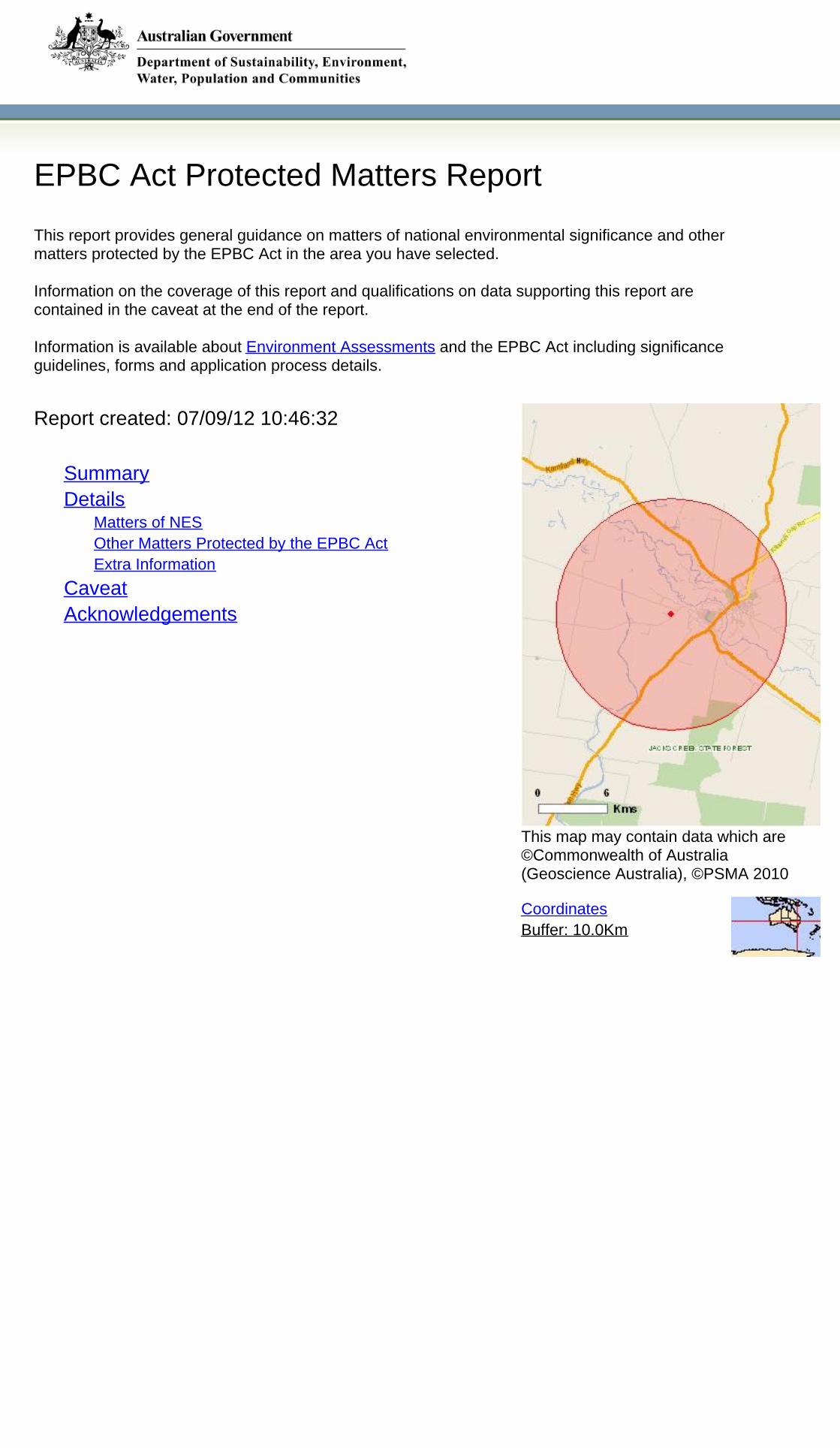
EPBC Act Protected Matters Report
This report provides general guidance on matters of national environmental significance and othermatters protected by the EPBC Act in the area you have selected.
Information on the coverage of this report and qualifications on data supporting this report arecontained in the caveat at the end of the report.
Information is available about Environment Assessments and the EPBC Act including significanceguidelines, forms and application process details.
Other Matters Protected by the EPBC Act
Acknowledgements
Buffer: 10.0Km
Matters of NES
Report created: 07/09/12 10:46:32
Coordinates
This map may contain data which are©Commonwealth of Australia(Geoscience Australia), ©PSMA 2010
CaveatExtra Information
DetailsSummary
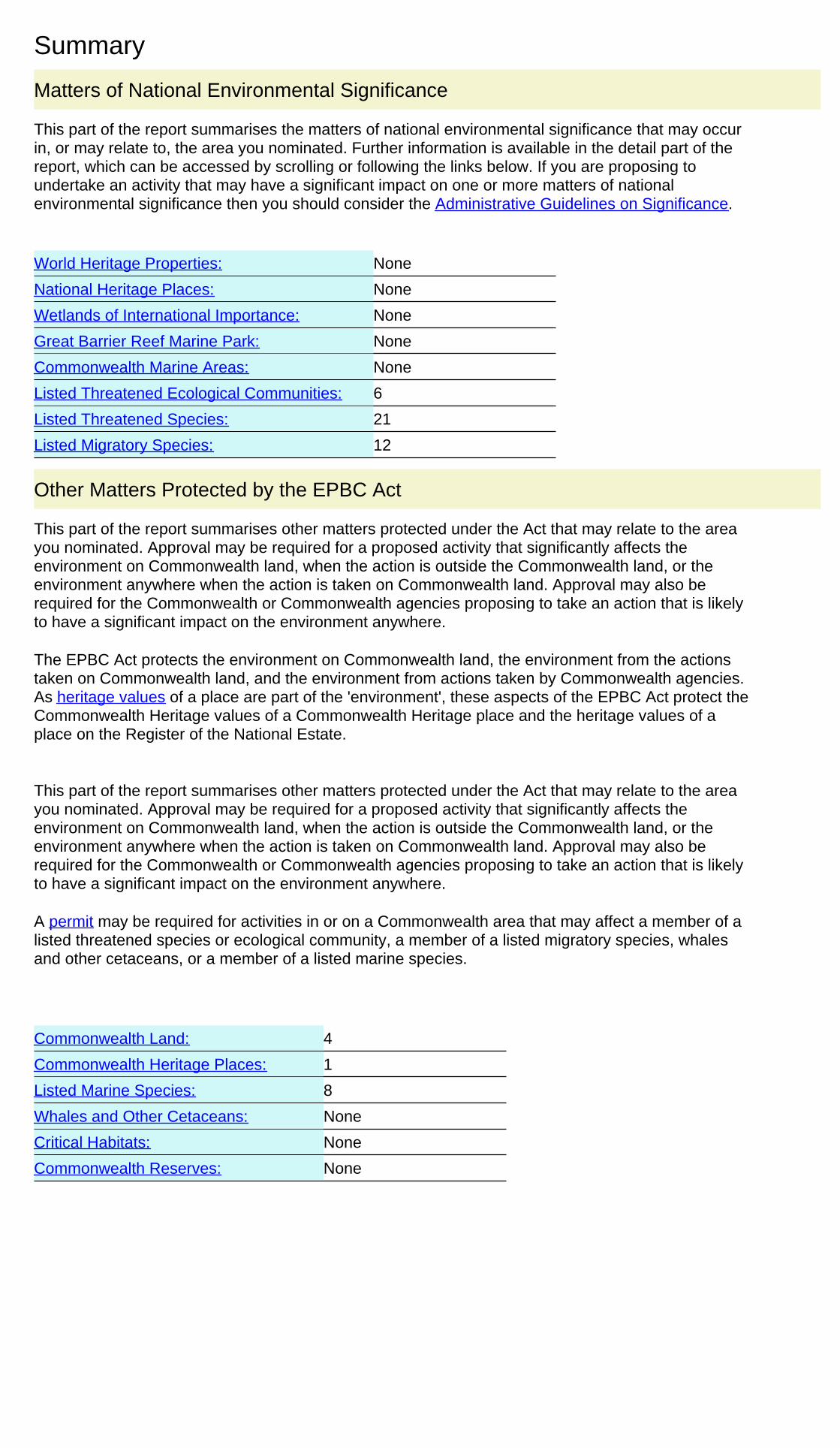
Summary
This part of the report summarises the matters of national environmental significance that may occurin, or may relate to, the area you nominated. Further information is available in the detail part of thereport, which can be accessed by scrolling or following the links below. If you are proposing toundertake an activity that may have a significant impact on one or more matters of nationalenvironmental significance then you should consider the Administrative Guidelines on Significance.
Matters of National Environmental Significance
Listed Threatened Ecological Communities:
Listed Migratory Species:
6
Great Barrier Reef Marine Park:
Wetlands of International Importance:
Listed Threatened Species:
None
21
None
None
National Heritage Places:
Commonwealth Marine Areas:
World Heritage Properties:
None
None
12
This part of the report summarises other matters protected under the Act that may relate to the areayou nominated. Approval may be required for a proposed activity that significantly affects theenvironment on Commonwealth land, when the action is outside the Commonwealth land, or theenvironment anywhere when the action is taken on Commonwealth land. Approval may also berequired for the Commonwealth or Commonwealth agencies proposing to take an action that is likelyto have a significant impact on the environment anywhere.
The EPBC Act protects the environment on Commonwealth land, the environment from the actionstaken on Commonwealth land, and the environment from actions taken by Commonwealth agencies.As heritage values of a place are part of the 'environment', these aspects of the EPBC Act protect theCommonwealth Heritage values of a Commonwealth Heritage place and the heritage values of aplace on the Register of the National Estate.
This part of the report summarises other matters protected under the Act that may relate to the areayou nominated. Approval may be required for a proposed activity that significantly affects theenvironment on Commonwealth land, when the action is outside the Commonwealth land, or theenvironment anywhere when the action is taken on Commonwealth land. Approval may also berequired for the Commonwealth or Commonwealth agencies proposing to take an action that is likelyto have a significant impact on the environment anywhere.
A permit may be required for activities in or on a Commonwealth area that may affect a member of alisted threatened species or ecological community, a member of a listed migratory species, whalesand other cetaceans, or a member of a listed marine species.
Other Matters Protected by the EPBC Act
None
None
None
Listed Marine Species:
Whales and Other Cetaceans:
8
Commonwealth Heritage Places:
4
1
Critical Habitats:
Commonwealth Land:
Commonwealth Reserves:
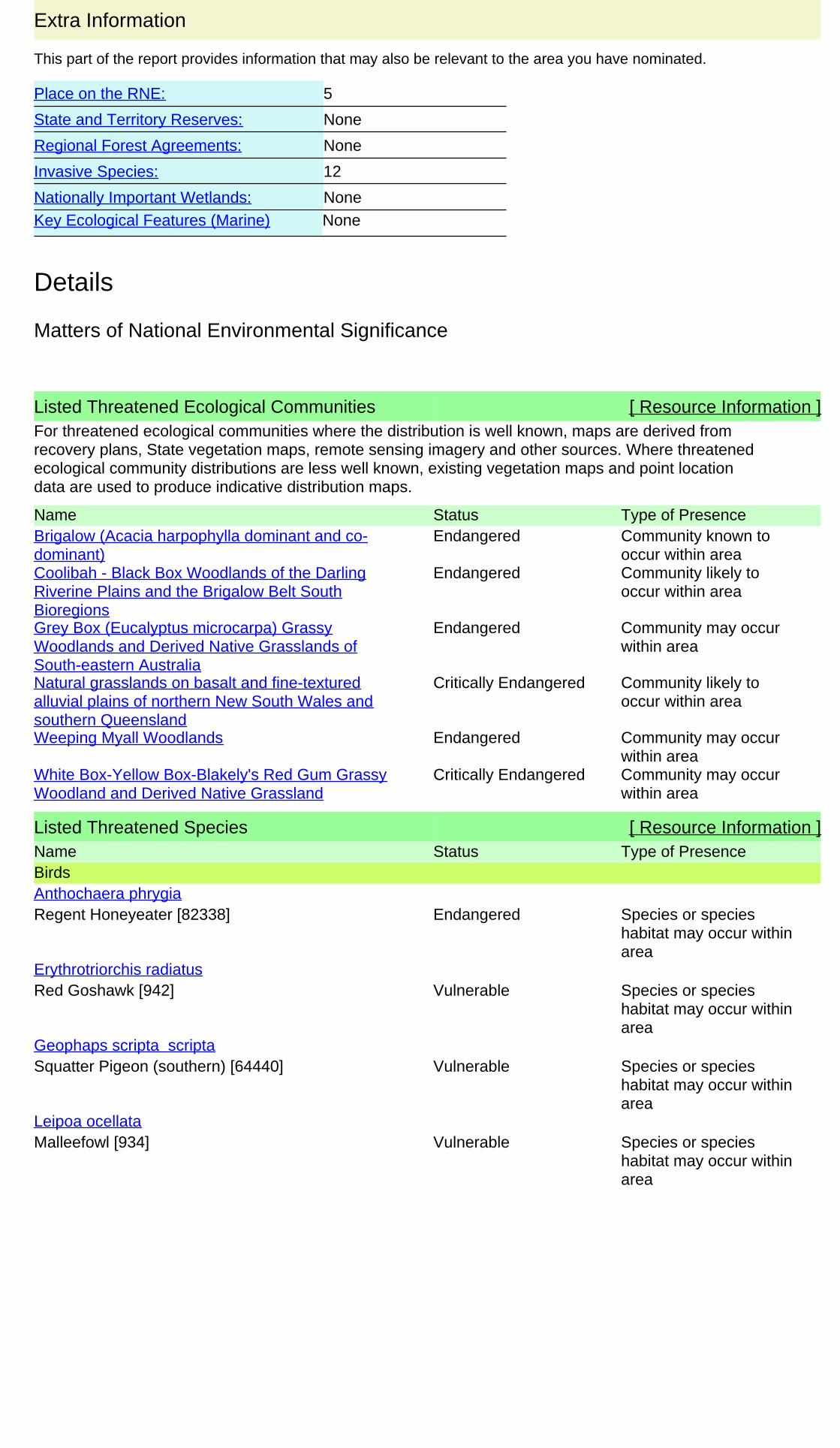
This part of the report provides information that may also be relevant to the area you have nominated.
Extra Information
Regional Forest Agreements:
12
Place on the RNE:
None
None
Invasive Species:
None
Nationally Important Wetlands:
State and Territory Reserves:
5
Key Ecological Features (Marine) None
Details
Listed Threatened Species [ Resource Information ]Name Status Type of PresenceBirds
Regent Honeyeater [82338] Endangered Species or specieshabitat may occur withinarea
Anthochaera phrygia
Red Goshawk [942] Vulnerable Species or specieshabitat may occur withinarea
Erythrotriorchis radiatus
Squatter Pigeon (southern) [64440] Vulnerable Species or specieshabitat may occur withinarea
Geophaps scripta scripta
Malleefowl [934] Vulnerable Species or specieshabitat may occur withinarea
Leipoa ocellata
For threatened ecological communities where the distribution is well known, maps are derived fromrecovery plans, State vegetation maps, remote sensing imagery and other sources. Where threatenedecological community distributions are less well known, existing vegetation maps and point locationdata are used to produce indicative distribution maps.
Listed Threatened Ecological Communities [ Resource Information ]
Name Status Type of PresenceBrigalow (Acacia harpophylla dominant and co-dominant)
Endangered Community known tooccur within area
Coolibah - Black Box Woodlands of the DarlingRiverine Plains and the Brigalow Belt SouthBioregions
Endangered Community likely tooccur within area
Grey Box (Eucalyptus microcarpa) GrassyWoodlands and Derived Native Grasslands ofSouth-eastern Australia
Endangered Community may occurwithin area
Natural grasslands on basalt and fine-texturedalluvial plains of northern New South Wales andsouthern Queensland
Critically Endangered Community likely tooccur within area
Weeping Myall Woodlands Endangered Community may occurwithin area
White Box-Yellow Box-Blakely's Red Gum GrassyWoodland and Derived Native Grassland
Critically Endangered Community may occurwithin area
Matters of National Environmental Significance
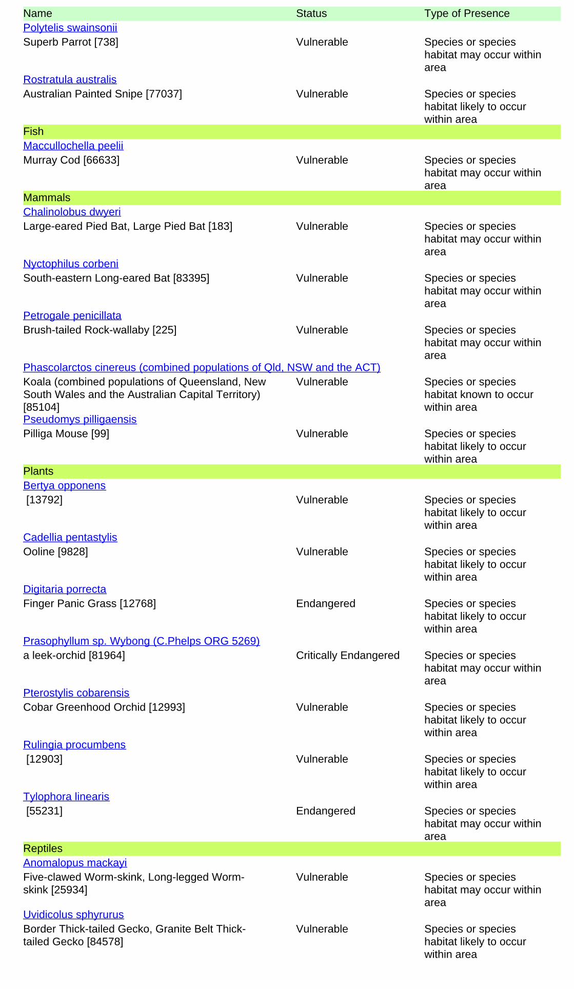
Name Status Type of Presence
Superb Parrot [738] Vulnerable Species or specieshabitat may occur withinarea
Polytelis swainsonii
Australian Painted Snipe [77037] Vulnerable Species or specieshabitat likely to occurwithin area
Rostratula australis
Fish
Murray Cod [66633] Vulnerable Species or specieshabitat may occur withinarea
Maccullochella peelii
Mammals
Large-eared Pied Bat, Large Pied Bat [183] Vulnerable Species or specieshabitat may occur withinarea
Chalinolobus dwyeri
South-eastern Long-eared Bat [83395] Vulnerable Species or specieshabitat may occur withinarea
Nyctophilus corbeni
Brush-tailed Rock-wallaby [225] Vulnerable Species or specieshabitat may occur withinarea
Petrogale penicillata
Koala (combined populations of Queensland, NewSouth Wales and the Australian Capital Territory)[85104]
Vulnerable Species or specieshabitat known to occurwithin area
Phascolarctos cinereus (combined populations of Qld, NSW and the ACT)
Pilliga Mouse [99] Vulnerable Species or specieshabitat likely to occurwithin area
Pseudomys pilligaensis
Plants
[13792] Vulnerable Species or specieshabitat likely to occurwithin area
Bertya opponens
Ooline [9828] Vulnerable Species or specieshabitat likely to occurwithin area
Cadellia pentastylis
Finger Panic Grass [12768] Endangered Species or specieshabitat likely to occurwithin area
Digitaria porrecta
a leek-orchid [81964] Critically Endangered Species or specieshabitat may occur withinarea
Prasophyllum sp. Wybong (C.Phelps ORG 5269)
Cobar Greenhood Orchid [12993] Vulnerable Species or specieshabitat likely to occurwithin area
Pterostylis cobarensis
[12903] Vulnerable Species or specieshabitat likely to occurwithin area
Rulingia procumbens
[55231] Endangered Species or specieshabitat may occur withinarea
Tylophora linearis
Reptiles
Five-clawed Worm-skink, Long-legged Worm-skink [25934]
Vulnerable Species or specieshabitat may occur withinarea
Anomalopus mackayi
Border Thick-tailed Gecko, Granite Belt Thick-tailed Gecko [84578]
Vulnerable Species or specieshabitat likely to occurwithin area
Uvidicolus sphyrurus
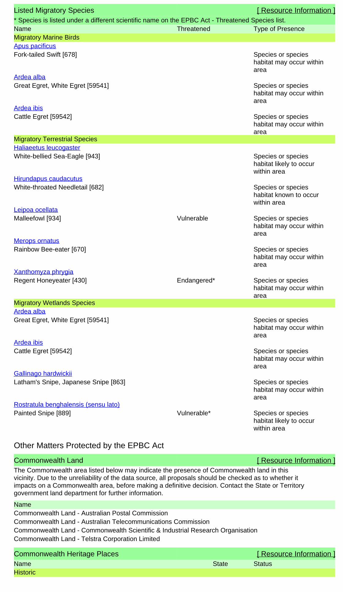
Listed Migratory Species [ Resource Information ]* Species is listed under a different scientific name on the EPBC Act - Threatened Species list.Name Threatened Type of PresenceMigratory Marine Birds
Fork-tailed Swift [678] Species or specieshabitat may occur withinarea
Apus pacificus
Great Egret, White Egret [59541] Species or specieshabitat may occur withinarea
Ardea alba
Cattle Egret [59542] Species or specieshabitat may occur withinarea
Ardea ibis
Migratory Terrestrial Species
White-bellied Sea-Eagle [943] Species or specieshabitat likely to occurwithin area
Haliaeetus leucogaster
White-throated Needletail [682] Species or specieshabitat known to occurwithin area
Hirundapus caudacutus
Malleefowl [934] Vulnerable Species or specieshabitat may occur withinarea
Leipoa ocellata
Rainbow Bee-eater [670] Species or specieshabitat may occur withinarea
Merops ornatus
Regent Honeyeater [430] Endangered* Species or specieshabitat may occur withinarea
Xanthomyza phrygia
Migratory Wetlands Species
Great Egret, White Egret [59541] Species or specieshabitat may occur withinarea
Ardea alba
Cattle Egret [59542] Species or specieshabitat may occur withinarea
Ardea ibis
Latham's Snipe, Japanese Snipe [863] Species or specieshabitat may occur withinarea
Gallinago hardwickii
Painted Snipe [889] Vulnerable* Species or specieshabitat likely to occurwithin area
Rostratula benghalensis (sensu lato)
Commonwealth Land [ Resource Information ]The Commonwealth area listed below may indicate the presence of Commonwealth land in thisvicinity. Due to the unreliability of the data source, all proposals should be checked as to whether itimpacts on a Commonwealth area, before making a definitive decision. Contact the State or Territorygovernment land department for further information.
NameCommonwealth Land - Australian Postal CommissionCommonwealth Land - Australian Telecommunications CommissionCommonwealth Land - Commonwealth Scientific & Industrial Research OrganisationCommonwealth Land - Telstra Corporation Limited
Commonwealth Heritage Places [ Resource Information ]Name StatusStateHistoric
Other Matters Protected by the EPBC Act

Listed Marine Species [ Resource Information ]* Species is listed under a different scientific name on the EPBC Act - Threatened Species list.Name Threatened Type of PresenceBirds
Fork-tailed Swift [678] Species or specieshabitat may occur withinarea
Apus pacificus
Great Egret, White Egret [59541] Species or specieshabitat may occur withinarea
Ardea alba
Cattle Egret [59542] Species or specieshabitat may occur withinarea
Ardea ibis
Latham's Snipe, Japanese Snipe [863] Species or specieshabitat may occur withinarea
Gallinago hardwickii
White-bellied Sea-Eagle [943] Species or specieshabitat likely to occurwithin area
Haliaeetus leucogaster
White-throated Needletail [682] Species or specieshabitat known to occurwithin area
Hirundapus caudacutus
Rainbow Bee-eater [670] Species or specieshabitat may occur withinarea
Merops ornatus
Painted Snipe [889] Vulnerable* Species or specieshabitat likely to occurwithin area
Rostratula benghalensis (sensu lato)
Name StatusStateListed placeNarrabri Post Office and former Telegraph Office NSW
Extra Information
Places on the RNE [ Resource Information ]
Note that not all Indigenous sites may be listed.
Name StatusStateHistoric
Indicative PlaceCollins Park Grandstand NSWRegisteredNarrabri Gaol (former) NSWRegisteredNarrabri Post Office and former Telegraph Office NSWRegisteredNarrabri Public School NSWRegisteredPolice Residence NSW
Invasive Species [ Resource Information ]Weeds reported here are the 20 species of national significance (WoNS), along with other introducedplants that are considered by the States and Territories to pose a particularly significant threat tobiodiversity. The following feral animals are reported: Goat, Red Fox, Cat, Rabbit, Pig, Water Buffaloand Cane Toad. Maps from Landscape Health Project, National Land and Water Resouces Audit,2001.
Name Status Type of PresenceFrogs
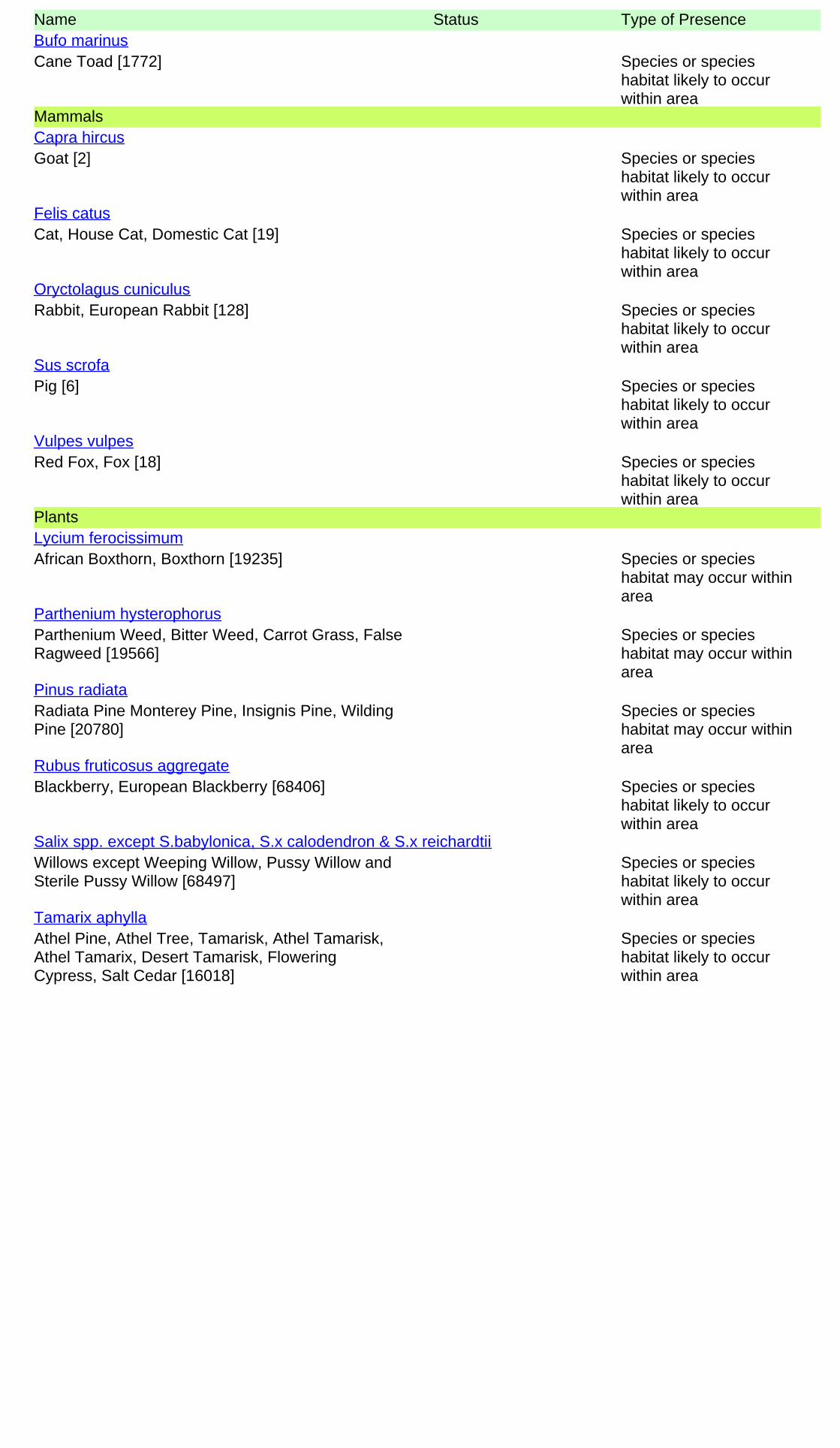
Name Status Type of Presence
Cane Toad [1772] Species or specieshabitat likely to occurwithin area
Bufo marinus
Mammals
Goat [2] Species or specieshabitat likely to occurwithin area
Capra hircus
Cat, House Cat, Domestic Cat [19] Species or specieshabitat likely to occurwithin area
Felis catus
Rabbit, European Rabbit [128] Species or specieshabitat likely to occurwithin area
Oryctolagus cuniculus
Pig [6] Species or specieshabitat likely to occurwithin area
Sus scrofa
Red Fox, Fox [18] Species or specieshabitat likely to occurwithin area
Vulpes vulpes
Plants
African Boxthorn, Boxthorn [19235] Species or specieshabitat may occur withinarea
Lycium ferocissimum
Parthenium Weed, Bitter Weed, Carrot Grass, FalseRagweed [19566]
Species or specieshabitat may occur withinarea
Parthenium hysterophorus
Radiata Pine Monterey Pine, Insignis Pine, WildingPine [20780]
Species or specieshabitat may occur withinarea
Pinus radiata
Blackberry, European Blackberry [68406] Species or specieshabitat likely to occurwithin area
Rubus fruticosus aggregate
Willows except Weeping Willow, Pussy Willow andSterile Pussy Willow [68497]
Species or specieshabitat likely to occurwithin area
Salix spp. except S.babylonica, S.x calodendron & S.x reichardtii
Athel Pine, Athel Tree, Tamarisk, Athel Tamarisk,Athel Tamarix, Desert Tamarisk, FloweringCypress, Salt Cedar [16018]
Species or specieshabitat likely to occurwithin area
Tamarix aphylla

-30.336 149.73
Coordinates
- non-threatened seabirds which have only been mapped for recorded breeding sites
- migratory species that are very widespread, vagrant, or only occur in small numbers
- some species and ecological communities that have only recently been listed
Not all species listed under the EPBC Act have been mapped (see below) and therefore a report is a generalguide only. Where available data supports mapping, the type of presence that can be determined from thedata is indicated in general terms. People using this information in making a referral may need to considerthe qualifications below and may need to seek and consider other information sources.
For threatened ecological communities where the distribution is well known, maps are derived fromrecovery plans, State vegetation maps, remote sensing imagery and other sources. Where threatenedecological community distributions are less well known, existing vegetation maps and point location dataare used to produce indicative distribution maps.
- seals which have only been mapped for breeding sites near the Australian continentSuch breeding sites may be important for the protection of the Commonwealth Marine environment.
For species where the distributions are well known, maps are digitised from sources such as recovery plansand detailed habitat studies. Where appropriate, core breeding, foraging and roosting areas are indicatedunder 'type of presence'. For species whose distributions are less well known, point locations are collatedfrom government wildlife authorities, museums, and non-government organisations; bioclimaticdistribution models are generated and these validated by experts. In some cases, the distribution maps arebased solely on expert knowledge.
The information presented in this report has been provided by a range of data sources as acknowledged atthe end of the report.
Caveat
- migratory and
The following species and ecological communities have not been mapped and do not appear in reportsproduced from this database:
- marine
This report is designed to assist in identifying the locations of places which may be relevant in determiningobligations under the Environment Protection and Biodiversity Conservation Act 1999. It holds mappedlocations of World Heritage and Register of National Estate properties, Wetlands of InternationalImportance, Commonwealth and State/Territory reserves, listed threatened, migratory and marine speciesand listed threatened ecological communities. Mapping of Commonwealth land is not complete at thisstage. Maps have been collated from a range of sources at various resolutions.
- threatened species listed as extinct or considered as vagrants
- some terrestrial species that overfly the Commonwealth marine area
The following groups have been mapped, but may not cover the complete distribution of the species:
Only selected species covered by the following provisions of the EPBC Act have been mapped:
-Department of the Environment, Climate Change, Energy and Water-Birds Australia-Australian Bird and Bat Banding Scheme
-Department of Environment and Conservation, Western Australia
Acknowledgements
-Department of Environment, Climate Change and Water, New South Wales
-Department of Primary Industries, Parks, Water and Environment, Tasmania
-Parks and Wildlife Service NT, NT Dept of Natural Resources, Environment and the Arts-Environmental and Resource Management, Queensland
-Department of Sustainability and Environment, Victoria
-Australian National Wildlife Collection
-Department of Environment and Natural Resources, South Australia
This database has been compiled from a range of data sources. The department acknowledges thefollowing custodians who have contributed valuable data and advice:
-Australian Museum
-National Herbarium of NSW
-State Forests of NSW-Australian Government, Department of Defence
-State Herbarium of South Australia
The Department is extremely grateful to the many organisations and individuals who providedexpert advice and information on numerous draft distributions.
-Natural history museums of Australia
-Queensland Museum
-Australian National Herbarium, Atherton and Canberra
-Royal Botanic Gardens and National Herbarium of Victoria
-Geoscience Australia
-Ocean Biogeographic Information System
-Online Zoological Collections of Australian Museums-Queensland Herbarium
-Western Australian Herbarium
-Tasmanian Herbarium
-Northern Territory Herbarium
-SA Museum
-Museum Victoria
-University of New England
-CSIRO-Other groups and individuals
© Commonwealth of Australia
+61 2 6274 1111
Canberra ACT 2601 Australia
GPO Box 787
Department of Sustainability, Environment, Water, Population and Communities
Please feel free to provide feedback via the Contact Us page.

Ecological Assessment Narrabri Logistics Centre
PR114501-3; Final / December 2012
Appendix 2
Flora Species List
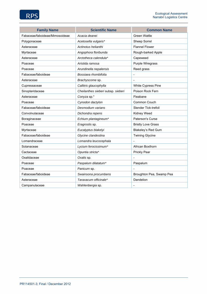
Ecological Assessment Narrabri Logistics Centre
PR114501-3; Final / December 2012
Family Name Scientific Name Common Name
Fabaceae/faboideae/Mimosoideae Acacia deanei Green Wattle
Polygonaceae Acetosella vulgaris* Sheep Sorrel
Asteraceae Actinotus helianthi Flannel Flower
Myrtaceae Angophora floribunda Rough-barked Apple
Asteraceae Arctotheca calendula* Capeweed
Poaceae Aristida ramosa Purple Wiregrass
Poaceae Arundinella nepalensis Reed grass
Fabaceae/faboideae Bossiaea rhombifolia -
Asteraceae Brachyscome sp. -
Cupressaceae Callitris glaucophylla White Cypress Pine
Sinopteridaceae Cheilanthes sieberi subsp. sieberi Poison Rock Fern
Asteraceae Conyza sp.* Fleabane
Poaceae Cynodon dactylon Common Couch
Fabaceae/faboideae Desmodium varians Slender Tick-trefoil
Convolvulaceae Dichondra repens Kidney Weed
Boraginaceae Echium plantagineum* Paterson's Curse
Poaceae Eragrostis sp. Bristly Love Grass
Myrtaceae Eucalyptus blakelyi Blakeley’s Red Gum
Fabaceae/faboideae Glycine clandestina Twining Glycine
Lomandraceae Lomandra leucocephala -
Solanaceae Lycium ferocissimum* African Boxthorn
Cactaceae Opuntia stricta* Prickly Pear
Oxalidaceae Oxalis sp. -
Poaceae Paspalum dilatatum* Paspalum
Poaceae Panicum sp. -
Fabaceae/faboideae Swainsona procumbens Broughton Pea, Swamp Pea
Asteraceae Taraxacum officinale* Dandelion
Campanulaceae Wahlenbergia sp. -
Ecological Assessment Narrabri Logistics Centre
PR114501-3; Final / December 2012
Appendix 3
Fauna Species List

Ecological Assessment Narrabri Logistics Centre
PR114501-3; Final / December 2012
Family Name Scientific Name Common Name
Avifauna
Accipitridae Elanus scriptus Letter-winged Kite
Accipitridae Milvus migrans Black Kite
Cacatuidae Eolophus roseicapillus Galah
Cacatuidae Cacatua galerita Sulphur-crested Cockatoo
Halcyonidae Dacelo novaeguineae Laughing Kookaburra
Maluridae Malurus cyaneus Superb Fairy-wren
Acanthizidae Acanthiza reguloides Buff-rumped Thornbill
Pardalotidae Pardalotus punctatus Spotted Pardalote
Pardalotidae Pardalotus striatus Striated Pardalote
Meliphagidae Lichenostomus penicillatus White-plumed Honeyeater
Meliphagidae Philemon corniculatus Noisy Friarbird
Campephagidae Coracina novaehollandiae Black-faced Cuckoo-shrike
Pachycephalidae Pachycephala rufiventris Rufous Whistler
Pachycephalidae Colluricincla harmonica Grey Shrike-thrush
Artamidae Cracticus tibicen Australian Magpie
Rhipiduridae Rhipidura albiscapa Grey Fantail
Rhipiduridae Rhipidura leucophrys Willie Wagtail
Corvidae Corvus coronoides Australian Raven
Monarchidae Grallina cyanoleuca Magpie-lark
Corcoracidae Corcorax melanorhamphos White-winged Chough
Megaluridae Cincloramphus mathewsi Rufous Songlark
Estrildidae Taeniopygia bichenovii Double-barred Finch
Mammals
Equidae Equus ferus caballus * Horse
Canidae Vulpes vulpes* Fox
Leporidae Oryctolagus cuniculus* Rabbit
Reptile
Scincidae Lampropholis delicata Garden Sun Skink

Ecological Assessment Narrabri Logistics Centre
PR114501-3; Final / December 2012
Appendix 4
Assessment of Likelihood of Occurrence, and Potential Level of Impact
Ecological Assessment Narrabri Logistics Centre
PR114501-3; Final / December 2012
Those threatened flora and fauna species (listed under the TSC Act and the EPBC Act) that have been gazetted / recorded from within the locality have been considered in the following tables. TEC’s and Endangered Populations known from the broader area have also been addressed. Each species / community / population is considered for its potential to occur within the site and the likely level of impact as a result of the proposed activities. The following tables deal with each species / community / population separately and identifies the ecological parameters of significance associated with the proposed activities.
‘Species’ or ‘TEC / Population’ – Lists each threatened species / TEC / population known from the vicinity of the site. The status of each threatened species under the TSC Act and EPBC Act is also provided.
‘Habitat’ – Provides a brief account of the species / community / population and the preferred habitat attributes required for the existence / survival of each species / community / population.
‘Likelihood of Occurrence’– Assesses the likelihood of each species / community / population to occur within the site in terms of the aforementioned habitat description and taking into account local habitat preferences, results of recent field investigations, data gained from various sources and previously gained knowledge via fieldwork undertaken within other ecological assessments in the locality.
‘Potential for Impact’ – Through consideration of the likely level / significance of impacts to each species / community / population that would result from the proposed activities, taking into account both short and long-term impacts, a decision has been made whether further assessment is required. This assessment is largely based on the chance of occurrence of each species / community with due recognition to other parameters such as home range, habitat use, connectivity etc. It also considers the scope of the proposed activities.
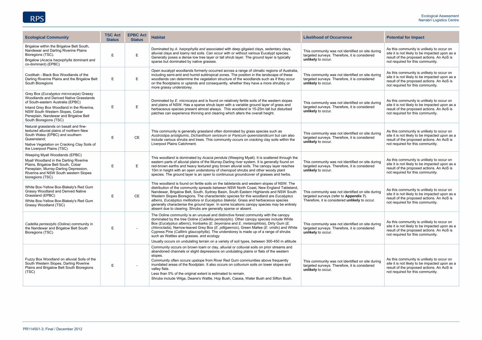
Ecological Assessment Narrabri Logistics Centre
PR114501-3; Final / December 2012
Ecological Community TSC Act Status
EPBC Act Status
Habitat Likelihood of Occurrence Potential for Impact
Brigalow within the Brigalow Belt South, Nandewar and Darling Riverine Plains Bioregions (TSC). Brigalow (Acacia harpophylla dominant and co-dominant) (EPBC)
E E
Dominated by A. harpophylla and associated with deep gilgaied clays, sedentary clays, alluvial clays and loamy red soils. Can occur with or without various Eucalypt species. Generally poses a dense low tree layer or tall shrub layer. The ground layer is typically sparse but dominated by native grasses.
This community was not identified on site during targeted surveys. Therefore, it is considered unlikely to occur.
As this community is unlikely to occur on site it is not likely to be impacted upon as a result of the proposed actions. An AoS is not required for this community.
Coolibah - Black Box Woodlands of the Darling Riverine Plains and the Brigalow Belt South Bioregions
E E
Open eucalypt woodlands formerly occurred across a range of climatic regions of Australia, including semi-arid and humid subtropical zones. The position in the landscape of these woodlands can determine the vegetation structure of the woodlands such as if they occur on the floodplains or uplands and consequently, whether they have a more shrubby or more grassy understorey.
This community was not identified on site during targeted surveys. Therefore, it is considered unlikely to occur.
As this community is unlikely to occur on site it is not likely to be impacted upon as a result of the proposed actions. An AoS is not required for this community.
Grey Box (Eucalyptus microcarpa) Grassy Woodlands and Derived Native Grasslands of South-eastern Australia (EPBC) Inland Grey Box Woodland in the Riverina, NSW South Western Slopes, Cobar Peneplain, Nandewar and Brigalow Belt South Bioregions (TSC)
E E
Dominated by E. microcarpa and is found on relatively fertile soils of the western slopes and plains of NSW. Has a sparse shrub layer with a variable ground layer of grass and herbaceous species present almost always. This woodland is 15-25m tall but disturbed patches can experience thinning and clearing which alters the overall height.
This community was not identified on site during targeted surveys. Therefore, it is considered unlikely to occur.
As this community is unlikely to occur on site it is not likely to be impacted upon as a result of the proposed actions. An AoS is not required for this community.
Natural grasslands on basalt and fine-textured alluvial plains of northern New South Wales (EPBC) and southern Queensland; Native Vegetation on Cracking Clay Soils of the Liverpool Plains (TSC)
E CE
This community is generally grassland often dominated by grass species such as Austrostipa aristiglumis, Dichanthium sericeum or Panicum queenslandicum but can also include various shrubs and trees. This community occurs on cracking clay soils within the Liverpool Plains Catchment.
This community was not identified on site during targeted surveys. Therefore, it is considered unlikely to occur.
As this community is unlikely to occur on site it is not likely to be impacted upon as a result of the proposed actions. An AoS is not required for this community.
Weeping Myall Woodlands (EPBC) Myall Woodland in the Darling Riverine Plains, Brigalow Belt South, Cobar Peneplain, Murray-Darling Depression, Riverina and NSW South western Slopes bioregions (TSC)
E E
This woodland is dominated by Acacia pendula (Weeping Myall). It is scattered through the eastern parts of alluvial plains of the Murray-Darling river system. It is generally found on red-brown earths and heavy textured grey brown alluvial soils. The canopy layer reaches 10m in height with an open understorey of chenopod shrubs and other woody plant species. The ground layer is an open to continuous groundcover of grasses and herbs.
This community was not identified on site during targeted surveys. Therefore, it is considered unlikely to occur.
As this community is unlikely to occur on site it is not likely to be impacted upon as a result of the proposed actions. An AoS is not required for this community.
White Box-Yellow Box-Blakely's Red Gum Grassy Woodland and Derived Native Grassland (EPBC) White Box-Yellow Box-Blakely's Red Gum Grassy Woodland (TSC)
E CE
This woodland is found on fertile soils on the tablelands and western slopes of NSW. The distribution of the community spreads between NSW North Coast, New England Tableland, Nandewar, Brigalow Belt, South, Sydney Basin, South Eastern Highlands and NSW South Western Slopes Bioregions. The characteristic species for this woodland are Eucalyptus albens, Eucalyptus melliodora or Eucalyptus blakelyi. Grass and herbaceous species generally characterise the ground layer. In some locations canopy species may be entirely absent due to clearing. Shrubs are generally sparse or absent.
This community was not identified on site during targeted surveys (refer to Appendix 7). Therefore, it is considered unlikely to occur.
As this community is unlikely to occur on site it is not likely to be impacted upon as a result of the proposed actions. An AoS is not required for this community.
Cadellia pentastylis (Ooline) community in the Nandewar and Brigalow Belt South Bioregions (TSC)
E -
The Ooline community is an unusual and distinctive forest community with the canopy dominated by the tree Ooline (Cadellia pentastylis). Other canopy species include White Box (Eucalyptus albens), Ironbarks (E. beyeriana and E. melanophloia), Dirty Gum (E. chloroclada), Narrow-leaved Grey Box (E. pilligaensis), Green Mallee (E. viridis) and White Cypress Pine (Callitris glaucophylla). The understorey is made up of a range of shrubs such as Wattles and grasses. and ecology Usually occurs on undulating terrain on a variety of soil types, between 300-450 m altitude
This community was not identified on site during targeted surveys. Therefore, it is considered unlikely to occur.
As this community is unlikely to occur on site it is not likely to be impacted upon as a result of the proposed actions. An AoS is not required for this community.
Fuzzy Box Woodland on alluvial Soils of the South Western Slopes, Darling Riverine Plains and Brigalow Belt South Bioregions (TSC)
E -
Community occurs on brown loam or clay, alluvial or colluvial soils on prior streams and abandoned channels or slight depressions on undulating plains or flats of the western slopes. Community often occurs upslope from River Red Gum communities above frequently inundated areas of the floodplain. It also occurs on colluvium soils on lower slopes and valley flats. Less than 5% of the original extent is estimated to remain. Shrubs include Wilga, Deane's Wattle, Hop Bush, Cassia, Water Bush and Sifton Bush.
This community was not identified on site during targeted surveys. Therefore, it is considered unlikely to occur.
As this community is unlikely to occur on site it is not likely to be impacted upon as a result of the proposed actions. An AoS is not required for this community.
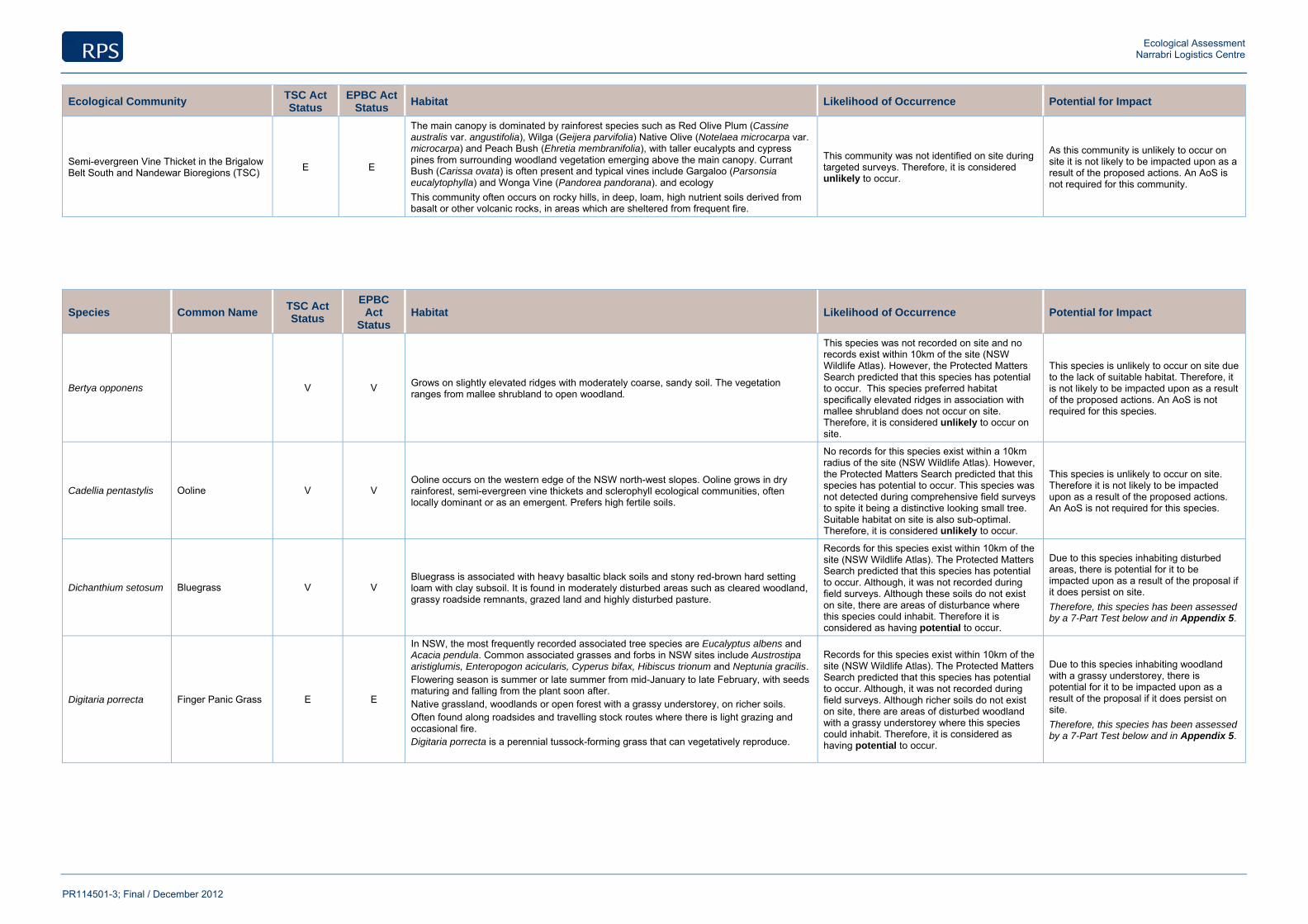
Ecological Assessment Narrabri Logistics Centre
PR114501-3; Final / December 2012
Ecological Community TSC Act Status
EPBC Act Status
Habitat Likelihood of Occurrence Potential for Impact
Semi-evergreen Vine Thicket in the Brigalow Belt South and Nandewar Bioregions (TSC) E E
The main canopy is dominated by rainforest species such as Red Olive Plum (Cassine australis var. angustifolia), Wilga (Geijera parvifolia) Native Olive (Notelaea microcarpa var. microcarpa) and Peach Bush (Ehretia membranifolia), with taller eucalypts and cypress pines from surrounding woodland vegetation emerging above the main canopy. Currant Bush (Carissa ovata) is often present and typical vines include Gargaloo (Parsonsia eucalytophylla) and Wonga Vine (Pandorea pandorana). and ecology This community often occurs on rocky hills, in deep, loam, high nutrient soils derived from basalt or other volcanic rocks, in areas which are sheltered from frequent fire.
This community was not identified on site during targeted surveys. Therefore, it is considered unlikely to occur.
As this community is unlikely to occur on site it is not likely to be impacted upon as a result of the proposed actions. An AoS is not required for this community.
Species Common Name TSC Act Status
EPBC Act
Status Habitat Likelihood of Occurrence Potential for Impact
Bertya opponens V V Grows on slightly elevated ridges with moderately coarse, sandy soil. The vegetation ranges from mallee shrubland to open woodland.
This species was not recorded on site and no records exist within 10km of the site (NSW Wildlife Atlas). However, the Protected Matters Search predicted that this species has potential to occur. This species preferred habitat specifically elevated ridges in association with mallee shrubland does not occur on site. Therefore, it is considered unlikely to occur on site.
This species is unlikely to occur on site due to the lack of suitable habitat. Therefore, it is not likely to be impacted upon as a result of the proposed actions. An AoS is not required for this species.
Cadellia pentastylis Ooline V V Ooline occurs on the western edge of the NSW north-west slopes. Ooline grows in dry rainforest, semi-evergreen vine thickets and sclerophyll ecological communities, often locally dominant or as an emergent. Prefers high fertile soils.
No records for this species exist within a 10km radius of the site (NSW Wildlife Atlas). However, the Protected Matters Search predicted that this species has potential to occur. This species was not detected during comprehensive field surveys to spite it being a distinctive looking small tree. Suitable habitat on site is also sub-optimal. Therefore, it is considered unlikely to occur.
This species is unlikely to occur on site. Therefore it is not likely to be impacted upon as a result of the proposed actions. An AoS is not required for this species.
Dichanthium setosum Bluegrass V V Bluegrass is associated with heavy basaltic black soils and stony red-brown hard setting loam with clay subsoil. It is found in moderately disturbed areas such as cleared woodland, grassy roadside remnants, grazed land and highly disturbed pasture.
Records for this species exist within 10km of the site (NSW Wildlife Atlas). The Protected Matters Search predicted that this species has potential to occur. Although, it was not recorded during field surveys. Although these soils do not exist on site, there are areas of disturbance where this species could inhabit. Therefore it is considered as having potential to occur.
Due to this species inhabiting disturbed areas, there is potential for it to be impacted upon as a result of the proposal if it does persist on site. Therefore, this species has been assessed by a 7-Part Test below and in Appendix 5.
Digitaria porrecta Finger Panic Grass E E
In NSW, the most frequently recorded associated tree species are Eucalyptus albens and Acacia pendula. Common associated grasses and forbs in NSW sites include Austrostipa aristiglumis, Enteropogon acicularis, Cyperus bifax, Hibiscus trionum and Neptunia gracilis. Flowering season is summer or late summer from mid-January to late February, with seeds maturing and falling from the plant soon after. Native grassland, woodlands or open forest with a grassy understorey, on richer soils. Often found along roadsides and travelling stock routes where there is light grazing and occasional fire. Digitaria porrecta is a perennial tussock-forming grass that can vegetatively reproduce.
Records for this species exist within 10km of the site (NSW Wildlife Atlas). The Protected Matters Search predicted that this species has potential to occur. Although, it was not recorded during field surveys. Although richer soils do not exist on site, there are areas of disturbed woodland with a grassy understorey where this species could inhabit. Therefore, it is considered as having potential to occur.
Due to this species inhabiting woodland with a grassy understorey, there is potential for it to be impacted upon as a result of the proposal if it does persist on site. Therefore, this species has been assessed by a 7-Part Test below and in Appendix 5.

Ecological Assessment Narrabri Logistics Centre
PR114501-3; Final / December 2012
Species Common Name TSC Act Status
EPBC Act
Status Habitat Likelihood of Occurrence Potential for Impact
Prasophyllum sp. Wybong (C.Phelps ORG 5269)
A Leek-orchid CE
A perennial orchid, appearing as a single leaf over winter and spring. Flowers in spring and dies back to a dormant tuber over summer and autumn. Known to occur in open eucalypt woodland and grassland.
This species was not recorded within 10km of the site (NSW Wildlife Atlas). However, the Protected Matters Search predicted that this species has potential to occur. The field surveys were conducted during the flowering season and it was not detected during field surveys. Eucalypt woodland in which this species can occur do exist within the site. Therefore, it is considered as having potential to occur.
This species is considered to have potential to occur on site. Therefore, it has potential to be impacted upon as a result of the proposed actions. As there is potential for impact upon this species it is assessed in Appendix 5.
Lepidium aschersonii Spiny Pepper-cress V V
Spiny Peppercress is endemic to mainland southern Australia, where it is widely but patchily distributed from north-eastern New South Wales to Western Australia. There are currently thought to be about 30 populations of Spiny Peppercress with only 14 population records existing within NSW. Occurs in periodically wet sites such as gilgai depressions and the margins of freshwater and saline marshes and shallow lakes, usually on heavy cracking clay soil.
This species has been recorded 18 times within 10km of the site (NSW Wildlife Atlas) and the Protected Matters Search predicted that this species has potential to occur. However, it was not detected during field surveys. No periodically wet habitat or heavy cracking clay soils exist on site. Therefore, it is considered as having unlikely to occur.
This species is unlikely to occur on site. Therefore it is not likely to be impacted upon as a result of the proposed actions. An AoS is not required for this species.
Pterostylis cobarensis Cobar Greenhood Orchid V V
Cobar Greenhood Orchid is known chiefly from the Nyngan–Cobar–Bourke district in the far western plains of NSW. Grows among rocks on low hills and on slopes above streams. Inhabits eucalypt woodland, open mallee, or Callitris shrubland on low stony ridges and slopes with skeletal sandy-loam soils.
This species was not recorded within 10km of the site (NSW Wildlife Atlas). However, the Protected Matters Search predicted that this species has potential to occur. Although it was not detected during field surveys. The surveys were not conducted within the flowering period for this cryptic species. Eucalypt woodland in which this species can occur and associated species including Callitris glaucophylla, do exist within the site. Therefore, it is considered as having potential to occur.
This species is considered to have potential to occur on site. Therefore, it has potential to be impacted upon as a result of the proposed actions. As there is potential for impact upon this species it is assessed by a 7-Part Test(Appendix 6) and in Appendix 5.
Rulingia procumbens V V
Endemic to NSW and is known from the Dubbo–Medooran–Gilgandra region, the Cobar region, and the upper Hunter Valley. Populations of this species have been recorded in Goonoo State Forest (SF), Mt Kaputar National Park, and Pilliga Nature Reserve. Occurs in sandy soils, often in disturbed habitats such as road verges, quarry boundaries, gravel stockpiles, and power line easements.
No records for this species exist within 10km of the site (NSW Wildlife Atlas). However, the Protected Matters Search predicted that this species has potential to occur. Although it was not detected during field surveys. Sandy soils which this species prefers are present and the site is currently in a disturbed state. It is therefore, considered as having potential to occur.
The disturbed area in which this species could occur is being cleared and hence impacted upon. For this reason there is potential for the proposal to impact upon this species if it does occur on site. Therefore, this species has been assessed by a 7-Part (Appendix 6) and in Appendix 5
Swainsona murrayana
Slender Darling Pea V V
Found in grassland, herbland, and open Black-box woodland, often in depressions. This species grows in heavy grey or brown clay, loam, or red cracking clays. It is often associated with low chenopod shrubs (Maireana spp.), wallaby-grass (Austrodanthonia spp), and spear grass (Austrostipa spp.).
This species has been recorded within 10km of the site. (NSW Wildlife Atlas). However, the Protected Matters Search predicted that this species has potential to occur. It was not detected during field surveys and suitable habitats with the appropriate soils do not occur on site. Therefore, it is considered unlikely to occur.
This species is unlikely to occur, therefore is unlikely to be impacted upon as a result of the proposal. An AoS is not required for this species.
Tylophora linearis V E
Tylophora linearis has rarely been collected and is known from eight localities in the Dubbo area and Mt Crow near Barraba in NSW. Grows in dry scrub, open forest and woodlands associated with Melaleuca uncinata, Eucalyptus fibrosa, E. sideroxylon, E. albens, Callitris endlicheri, C. glaucophylla, Allocasuarina luehmannii, Acacia hakeoides, A. lineata, Myoporum spp., and Casuarina spp.
This species has not been recorded within 10km of the site (NSW Wildlife Atlas). However, the Protected Matters Search predicted that this species has potential to occur. Although, it was not detected during field surveys. However, some sub-optimal habitat does occur on site therefore, it is considered to have potential to occur on site.
This species is considered to have potential to occur on site. Therefore, it has potential to be impacted upon as a result of the proposed actions. As there is potential for impact upon this species it is assessed by a 7-Part Test (Appendix 6) and in Appendix 5.
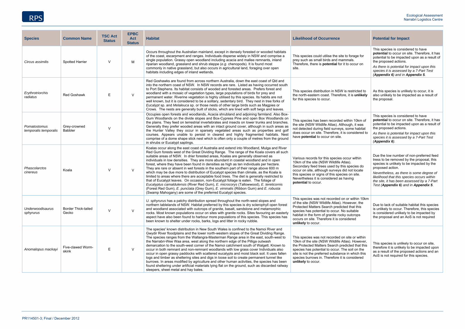
Ecological Assessment Narrabri Logistics Centre
PR114501-3; Final / December 2012
Species Common Name TSC Act Status
EPBC Act
Status Habitat Likelihood of Occurrence Potential for Impact
Circus assimilis Spotted Harrier V M
Occurs throughout the Australian mainland, except in densely forested or wooded habitats of the coast, escarpment and ranges. Individuals disperse widely in NSW and comprise a single population. Grassy open woodland including acacia and mallee remnants, inland riparian woodland, grassland and shrub steppe (e.g. chenopods). It is found most commonly in native grassland, but also occurs in agricultural land, foraging over open habitats including edges of inland wetlands.
This species could utilise the site to forage for prey such as small birds and mammals. Therefore, there is potential for it to occur on site.
This species is considered to have potential to occur on site. Therefore, it has potential to be impacted upon as a result of the proposed actions. As there is potential for impact upon this species it is assessed by a 7-Part Test (Appendix 6) and in Appendix 5.
Erythrotriorchis radiatus
Red Goshawk E V
Red Goshawks are found from across northern Australia, down the east coast of Qld and into the northern coast of NSW. In NSW records are rare. Listed as having occurred south to Port Stephens. Its habitat consists of wooded and forested areas. Prefers forest and woodland with a mosaic of vegetation types, large populations of birds for prey and permanent water. Riverine vegetation is highly utilised by this species. Its habits are not well known, but it is considered to be a solitary, sedentary bird. They nest in tree forks of Eucalypt sp. and Melaleuca sp. or those nests of other large birds such as Magpies or Crows. The nests are generally built of sticks, which are lined with soft twigs and leaves.
This species distribution in NSW is restricted to the north-eastern coast. Therefore, it is unlikely for this species to occur.
As this species is unlikely to occur, it is also unlikely to be impacted as a result of the proposal.
Pomatostomus temporalis temporalis
Grey-crowned Babbler V
Occupies open forests and woodlands, Acacia shrubland and adjoining farmland. Also Box-Gum Woodlands on the divide slopes and Box-Cypress Pine and open Box Woodlands on the plains. They feed on terrestrial invertebrates and insects on lower trunks and branches. Generally they prefer wooded areas with an intact ground cover, although in such areas as the Hunter Valley they occur in sparsely vegetated areas such as properties and golf courses. Appears unable to persist in cleared and highly fragmented habitats. Nest comprise of a dome shape stick nest which is often only a couple of metres from the ground in shrubs or Eucalypt saplings.
This species has been recorded within 10km of the site (NSW Wildlife Atlas). Although, it was not detected during field surveys, some habitat does occur on site. Therefore, it is considered to have potential to occur on site.
This species is considered to have potential to occur on site. Therefore, it has potential to be impacted upon as a result of the proposed actions. As there is potential for impact upon this species it is assessed by a 7-Part Test (Appendix 6).
Phascolarctos cinereus
Koala V V
Koalas occur along the east coast of Australia and extend into Woodland, Mulga and River Red Gum forests west of the Great Dividing Range. The range of the Koala covers all such suitable areas of NSW. In drier forested areas, Koalas are generally observed as individuals in low densities. They are more abundant in coastal woodland and in open forest, where they have been found in densities as high as ten individuals per hectare. They are rare or absent in wet forests in the southern part of their range above 600 m which may be due more to distribution of Eucalypt species than climate, as the Koala is limited to areas where there are acceptable food trees. The diet is generally restricted to that of Eucalypt leaves. On occasion, non-Eucalypt foliage is eaten. The foliage of Eucalyptus camaldulensis (River Red Gum), E. microcorys (Tallowwood), E. tereticornis (Forest Red Gum), E. punctata (Grey Gum), E. viminalis (Ribbon Gum) and E. robusta (Swamp Mahogany) are some of the preferred Eucalypt species.
Various records for this species occur within 10km of the site (NSW Wildlife Atlas). Secondary feed trees used by this species do occur on site, although surveys did not locate this species or signs of this species on site. Nevertheless it is considered as having potential to occur.
Due the low number of non-preferred feed tress to be removed by the proposal, this species is unlikely to be impacted by the proposed action. Nevertheless, as there is some degree of likelihood that this species occurs within the site, it has been assessed by a 7-Part Test (Appendix 6) and in Appendix 5.
Underwoodisaurus sphyrurus
Border Thick-tailed Gecko V V
U. sphyrurus has a patchy distribution spread throughout the north-west slopes and northern tablelands of NSW. Habitat preferred by this species is dry sclerophyll open forest and woodland associated with outcrops of granite, basalt, sandstone and metamorphic rocks. Most known populations occur on sites with granite rocks. Sites favouring an easterly aspect have also been found to harbour more populations of this species. This species has been known to shelter under rocks, barks, logs and litter in rocky rubble.
This species was not recorded on or within 10km of the site (NSW Wildlife Atlas). However, the Protected Matters Search predicted that this species has potential to occur. No suitable habitat in the form of granite rocky outcrops occurs on site. Therefore it is considered unlikely to occur.
Due to lack of suitable habitat this species is unlikely to occur. Therefore, this species is considered unlikely to be impacted by the proposal and an AoS is not required
Anomalopus mackayi Five-clawed Worm-skink E V
The species' known distribution in New South Wales is confined to the Namoi River and Gwydir River floodplains and the lower north-western slopes of the Great Dividing Range. The species ranges from the Wallangra-Masterman Range area in the east, south-west to the Narrabri-Wee Waa area, west along the northern edge of the Pilliga outwash demarcation to the south-west corner of the Namoi catchment south of Walgett. Known to occur in both remnant and non-remnant woodlands with low grass cover Individuals also occur in open grassy paddocks with scattered eucalypts and moist black soil. It uses fallen logs and timber as sheltering sites and digs in loose soil to create permanent tunnel like burrows. In areas modified by agriculture and other human activities, the species has been found sheltering under artificial materials lying flat on the ground, such as discarded railway sleepers, sheet metal and hay bales.
This species was not recorded on site or within 10km of the site (NSW Wildlife Atlas). However, the Protected Matters Search predicted that this species has potential to occur. The soil on the site is not the preferred substance in which this species burrows in. Therefore it is considered unlikely to occur.
This species is unlikely to occur on site, therefore it is unlikely to be impacted upon as a result of the proposed actions and an AoS is not required for this species.

Ecological Assessment Narrabri Logistics Centre
PR114501-3; Final / December 2012
Species Common Name TSC Act Status
EPBC Act
Status Habitat Likelihood of Occurrence Potential for Impact
Hoplocephalus bitorquatus
Pale-headed Snake V
Found mainly in dry eucalypt forests and woodlands, cypress woodland and occasionally in rainforest or moist eucalypt forest. Favours streamside areas, particularly in drier habitats. Shelter during the day between loose bark and tree-trunks, or in hollow trunks and limbs of dead trees. The main prey is tree frogs although lizards and small mammals are also taken.
This species has been recorded within 10km of the site (NSW Wildlife Atlas). Although, it was not detected during field surveys, some sub-optimal habitat does occur on site. Therefore, it is considered to have potential to occur on site.
This species is considered to have potential to occur on site. Therefore, it has potential to be impacted upon as a result of the proposed actions. As there is potential for impact upon this species it is assessed by a 7-Part Test (Appendix 6).
Anthochaera phrygia Regent Honeyeater CE E, M
Nomadic Honeyeater that disperses to non-breeding areas, including the coast, in winter, where flowering trees are sought. Within the region, mostly recorded in Box-Ironbark Eucalypt associations along creek flats, river valleys and foothills. Coastal swamp forests in Lower Hunter are used when more western resources fail. The main feed tree for coastal areas is Eucalyptus robusta (Swamp Mahogany). Hunter records are more common in near coastal areas such as Cessnock LGA. Feed trees in this region are Corymbia maculata (Spotted Gum), E. fibrosa (Broad-leaved Ironbark), E. crebra (Narrow-leaved Ironbark) and various stringybark sp.. Nests mainly west of the divide, although local breeding attempts have occurred at Quorrobolong.
This species has not been recorded within 10km of the site (NSW Wildlife Atlas). However, the Protected Matters Search predicted that this species has potential to occur. Although it was not recorded during field surveys. Flowering Eucalypt blossoms are scarce (4 individual trees) within the site in which this species could potentially forage. Therefore, due to the scarcity of habitat and the lack of records in the vicinity, it is considered unlikely to occur.
This species is unlikely to occur on site, therefore it is unlikely to be impacted upon as a result of the proposed actions and an AoS is not required for this species.
Geophaps scripta scripta
Squatter Pigeon E V
Occurs on the inland slopes of the Great Dividing Range with a distribution that extends from the Burdekin-Lynd divide in central Queensland, west to Charleville and Longreach, east to the coast from Prosperine to Port Curtis, and south to scattered sites in south-eastern Queensland. Inhabits grassy woodlands and open forests that are dominated by eucalypts. No confirmed records have been made since the 1970s.
No records exist within 10km of the site (NSW Wildlife Atlas). However, the Protected Matters Search predicted that this species has potential to occur. Although, it was not detected during field surveys. No records have been made since the late 1970s, therefore, it is considered unlikely to occur.
This species was considered unlikely to occur. Therefore it is unlikely to be impacted upon as a result of the proposed actions. An AoS is not required for this species.
Leipoa ocellata Malleefowl E V, M
Inhabits semi-arid regions of southern Australia. In New South Wales, it typically occurs west of the Great Dividing Range. Extends from Pilliga south-west to the districts of Griffith and Wentworth. The extent of occurrence is known to be decreasing. The distribution of the Malleefowl was formerly more extensive, extending over a large proportion of mainland southern Australia, including the south-western region of the Northern Territory. Occupies shrublands and low woodlands that are dominated by mallee vegetation. It also occurs in other habitat types including eucalypt or native pine Callitris woodlands, acacia shrublands, Broombush Melaleuca uncinata vegetation or coastal heathlands.
No records exist within 10km of the site for this species (NSW Wildlife Atlas). However, the Protected Matters Search predicted that this species has potential to occur. Callitris and Acacia woodlands do persist on site and they provide sub-optimal habitat. Therefore, it is considered to have potential to occur on site.
This species is considered to have potential to occur on site. Therefore it has potential to be impacted upon as a result of the proposed actions. As there is potential for impact upon this species it is assessed by a 7-Part Test (Appendix 6) and in Appendix 5.
Polytelis swainsonii Superb Parrot V V
The Superb Parrot occurs only in south-eastern Australia. The Superb Parrot is found in NSW and northern Victoria, where it occurs on the inland slopes of the Great Divide and on adjacent plains, especially along the major river-systems; vagrants have also been recorded in southern Queensland. Mainly inhabits forests and woodlands dominated by eucalypts, especially River Red Gums (Eucalyptus camaldulensis) and box eucalypts such as Yellow Box (Eucalyptus melliodora) or Grey Box (E. microcarpa). The species also seasonally occurs in box-pine (Callitris) and Boree (Acacia pendula) woodland.
This species has been recorded within 10km of the (NSW Wildlife Atlas) and the Protected Matters Search predicted that this species has potential to occur. Suitable eucalypt species (four individual trees) and Callitris (which provides seasonal habitat) do exist on site in which this species could forage. Therefore, it is considered as having potential to occur.
This species is unlikely to be impacted upon as a result of the proposed actions. Nevertheless, as there is some degree of likelihood that this species occurs seasonally within the site, it has been assessed by a 7-Part Test (Appendix 6) and in Appendix 5.
Rostratula australis Australian Painted Snipe E V, M A small freshwater and estuarine wader, which prefers fringes of swamps, dams and
nearby marshy areas where there is a cover of grasses, lignum, low scrub or open timber. No suitable habitat exists on site for this species. Therefore it is considered unlikely to occur.
This species is unlikely to occur on site. Therefore it is not likely to be impacted upon as a result of the proposed actions. An AoS is not required for this species.
Chalinolobus dwyeri Large-eared Pied Bat V V
This species forages in tall open forests and the edges of rainforest. It roosts in mine shafts and similar structures. Roosts in caves (near their entrances), crevices in cliffs, old mine workings and in the disused, bottle-shaped mud nests of Hirundo ariel (Fairy Martin), frequenting low to mid-elevation dry open forest and woodland close to these features.
No records for this species exist within 10km of the site (NSW Wildlife Atlas) and suitable habitat is not present. It is therefore, considered unlikely to occur.
This species is unlikely to occur on site. Therefore it is not likely to be impacted upon as a result of the proposed actions. An AoS is not required for this species.
Nyctophilus timoriensis (South-eastern form)
Greater Long-eared Bat V V
This species has not been recorded within 10km of the site. Its distribution is limited to the Murray-Darling Basin and records are scattered within this region. Occurs in a range of inland woodland vegetation types, including box, ironbark and cypress pine woodlands. An insectivorous species that commonly feeds on moths, beetles and crickets.
This species has not been recorded within 10km of the site and records are rare. Sub-optimal habitat occurs on site for this species. It is considered unlikely to occur on site.
This species is unlikely to occur on site. Therefore it is not likely to be impacted upon as a result of the proposed actions. An AOS is not required for this species.

Ecological Assessment Narrabri Logistics Centre
PR114501-3; Final / December 2012
Species Common Name TSC Act Status
EPBC Act
Status Habitat Likelihood of Occurrence Potential for Impact
Petrogale penicillata Brush-tailed Rock Wallaby E V
Occurs in forests and woodlands along the Great Divide and on the western slopes in escarpment country with rocky outcrops, steep rocky slopes, gorges, boulders and isolated rocky areas. The majority of populations favour north-facing aspects, but some southern aspects have been recorded. Apart from the critical rock structure Petrogale penicillata also requires adjacent vegetation types, associated types include, dense rainforest, wet sclerophyll, vine thicket, dry sclerophyll forest and open forest.
No records for this species exist within 10km of the site (NSW Wildlife Atlas). However, the Protected Matters Search predicted that this species has potential to occur. No suitable habitat in the form of rocky outcrops exists on site. Therefore, it is considered unlikely to occur on site.
This species is unlikely to occur on site. Therefore it is not likely to be impacted upon as a result of the proposed actions. An AoS is not required for this species.
Pseudomys pilligaensis
Pilliga Mouse V V
This species is known only from the Pilliga region of NSW including the Pilliga state forest and Pilliga nature reserve. A defined habitat for this species is hard to characterise as the vegetation type in which this species has been found varies. Eucalypt, Callitris and Acacia woodlands are vegetation types in which this species has been found. It has been found mostly in gullies that have experienced recent fire events. Habitat features that appear to be preferential for this species include a moderate to high low-shrub cover; site moisture retention; and groundcover of plants, litter and fungi. Topography of sites where this species is found include rolling landscapes with low relief on sandy soil and sandstone ridges.
Records for this species do not exist within 10km of the site (NSW Wildlife Atlas) and the site is outside of this species’ known range (the ‘Pilliga’ region). Therefore, it is considered unlikely to occur.
This species is unlikely to occur on site. Therefore it is not likely to be impacted upon as a result of the proposed actions. An AoS is not required for this species.
Anseranas semipalmata
Magpie Goose V
Often seen in trios or flocks of 100 to 5,000, on shallow wetlands (especially those with a dense growth of rushes or sedges), drying ephemeral swamps, wet grasslands and floodplains, often roosting in fringing Paperbarks (Melaleuca spp.). The diet of this species is composed of grass seeds and sedge rhizomes.
Records for this species exist within 10km of the site (NSW Wildlife Atlas). Suitable habitat in the form of wetlands and swamps do not occur on site. Therefore, it is unlikely to occur.
This species is unlikely to occur on site. Therefore it is not likely to be impacted upon as a result of the proposed actions. An AoS is not required for this species.
Calyptorhynchus lathami
Glossy Black-Cockatoo V
Calyptorhynchus lathami (Glossy Black-Cockatoo) is sparsely distributed along the east coast and immediate inland districts from western Victoria to Rockhampton in Queensland. In NSW, the species is found as far west as Cobar to Hillston and Griffith in isolated mountain range. The inland distribution of the species is restricted by the occurrence of the various Casuarinaceae spp. C. lathami characteristically inhabits forests on sites with low soil-nutrients status, reflecting the distribution of key Allocasuarina spp. The drier forest types with intact and less rugged landscapes are preferred by the species. It prefers highlands towards the north but may be found closer to the coast where conditions are suitable. In the south they are widespread in lowland coastal forests, dense mountain forests, semi-arid woodland and trees bordering water courses.
Records for this species exist within 10km of the site (NSW Wildlife Atlas). However, suitable habitat in the form of Casuarinaceae spp. do not occur on site. Therefore, it is unlikely to occur.
This species is unlikely to occur on site. Therefore it is not likely to be impacted upon as a result of the proposed actions. An AoS is not required for this species.
Chthonicola sagittata Speckled Warbler V
Speckled Warbler ranges in South-Eastern Australia, from South-West Victoria through eastern New South Wales to Central Queensland, mostly on the western slopes and tablelands of the Great Dividing Range, and in the drier areas of coast. They live in a wide range of Eucalypt dominated vegetation that has a grassy and shrubby understorey often on rocky ridges or gullies. It is a sedentary species with a home range that varies from 6-12 hectares. This species appears to be extinct from areas without vegetation fragments larger than 48.2ha. Prefers woodland areas where ground cover consists of shrubs, grass, fallen leaves and bark. This ground foraging bird feeds on insects, insect larvae and small seeds.
Records for this species exist within 10km of the site (NSW Wildlife Atlas), but it was not detected during field surveys. Suitable habitat in the form of open woodlands on site for this species. Therefore, it is considered as having potential to occur.
This species is considered to have potential to occur on site. Therefore, it has potential to be impacted upon as a result of the proposed actions. As there is potential for impact upon this species it is assessed by a 7-Part Test (Appendix 6).
Glossopsitta pusilla Little Lorikeet V
This species is more commonly encountered in near coastal habitats and on the divide. Habitat is mainly dry, open sclerophyll forests and woodlands, usually dominated by Eucalyptus, sometimes in plantations of Eucalyptus cladocalyx (Sugar Gum). They can be found in large flocks of hundreds of birds spread out across blossoming eucalypts. Movements of Little Lorikeets are largely unknown, but the belief is that they follow abundant blossom. Some areas they are sedentary and move within the local area in response to blossom. Nesting of G. pusilla consists of holes, including knotholes, in bend, top or side of limb, usually living or in main trunk of tree, occasionally over water, recorded in Eucalyptus camaldulensis (River Red Gum), Eucalyptus grandis (Flooded Gum) and Casuarina cunninghamiana (River Oak).
Records for this species exist within 10km of the site (NSW Wildlife Atlas). Suitable foraging habitat occurs on site Suitable eucalypt species (four individual trees) do exist on site in which this species could forage. Therefore it is considered as having potential to occur.
This species is considered to have potential to occur on site. Therefore it has potential to be impacted upon as a result of the proposed actions. As there is potential for impact upon this species it is assessed by a 7-Part Test (Appendix 6).
Daphoenositta chrysoptera
Varied Sittella V
The Varied Sittella can be reasonably common in some areas and also nomadic in others, where as they also can be sedentary. Habitat across the varying races is similar, although they can be found in a wide range of habitats. Open eucalypt forests and woodlands are the preferred habitat, but this species may also be found in mallee, coastal tea-tree scrubs, inland acacia communities, golf courses orchards and scrubby gardens. The nest of the Varied Sittella consists of deep cup of bark which is well camouflaged with spider’s web and lichen. They favour the use of tree species for nesting such as Eucalypts, paperbarks, she-oaks and tea-trees.
Records for this species exist within 10km of the site (NSW Wildlife Atlas), but it was not detected on site during surveys. Suitable foraging habitat occurs on site Suitable eucalypt species (four individual trees) do exist on site in which this species could forage. Therefore it is considered as having potential to occur.
This species is considered to have potential to occur on site. Therefore it has potential to be impacted upon as a result of the proposed actions. As there is potential for impact upon this species it is assessed by a 7-Part Test (Appendix 6).
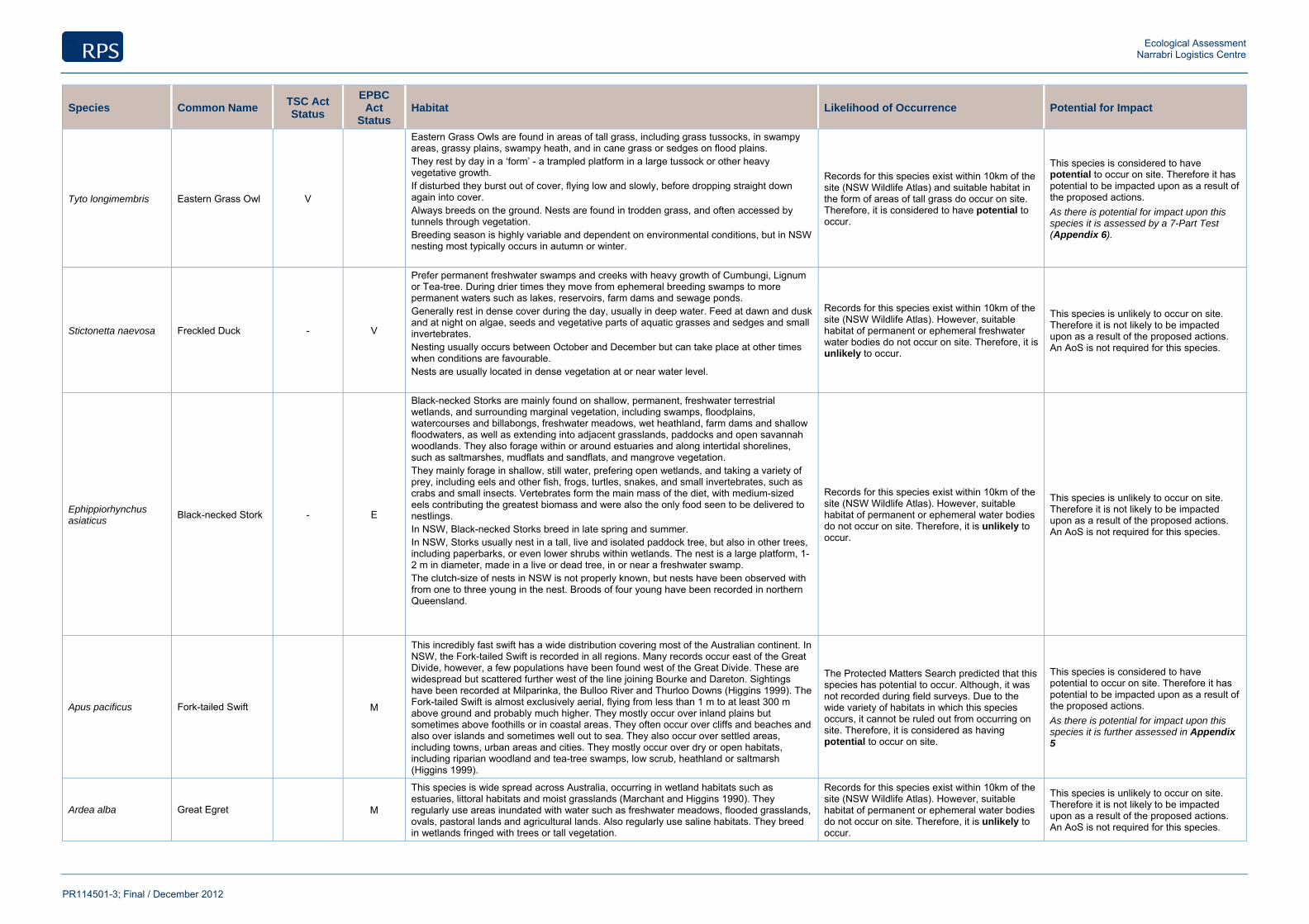
Ecological Assessment Narrabri Logistics Centre
PR114501-3; Final / December 2012
Species Common Name TSC Act Status
EPBC Act
Status Habitat Likelihood of Occurrence Potential for Impact
Tyto longimembris Eastern Grass Owl V
Eastern Grass Owls are found in areas of tall grass, including grass tussocks, in swampy areas, grassy plains, swampy heath, and in cane grass or sedges on flood plains. They rest by day in a ‘form’ - a trampled platform in a large tussock or other heavy vegetative growth. If disturbed they burst out of cover, flying low and slowly, before dropping straight down again into cover. Always breeds on the ground. Nests are found in trodden grass, and often accessed by tunnels through vegetation. Breeding season is highly variable and dependent on environmental conditions, but in NSW nesting most typically occurs in autumn or winter.
Records for this species exist within 10km of the site (NSW Wildlife Atlas) and suitable habitat in the form of areas of tall grass do occur on site. Therefore, it is considered to have potential to occur.
This species is considered to have potential to occur on site. Therefore it has potential to be impacted upon as a result of the proposed actions. As there is potential for impact upon this species it is assessed by a 7-Part Test (Appendix 6).
Stictonetta naevosa Freckled Duck - V
Prefer permanent freshwater swamps and creeks with heavy growth of Cumbungi, Lignum or Tea-tree. During drier times they move from ephemeral breeding swamps to more permanent waters such as lakes, reservoirs, farm dams and sewage ponds. Generally rest in dense cover during the day, usually in deep water. Feed at dawn and dusk and at night on algae, seeds and vegetative parts of aquatic grasses and sedges and small invertebrates. Nesting usually occurs between October and December but can take place at other times when conditions are favourable. Nests are usually located in dense vegetation at or near water level.
Records for this species exist within 10km of the site (NSW Wildlife Atlas). However, suitable habitat of permanent or ephemeral freshwater water bodies do not occur on site. Therefore, it is unlikely to occur.
This species is unlikely to occur on site. Therefore it is not likely to be impacted upon as a result of the proposed actions. An AoS is not required for this species.
Ephippiorhynchus asiaticus
Black-necked Stork - E
Black-necked Storks are mainly found on shallow, permanent, freshwater terrestrial wetlands, and surrounding marginal vegetation, including swamps, floodplains, watercourses and billabongs, freshwater meadows, wet heathland, farm dams and shallow floodwaters, as well as extending into adjacent grasslands, paddocks and open savannah woodlands. They also forage within or around estuaries and along intertidal shorelines, such as saltmarshes, mudflats and sandflats, and mangrove vegetation. They mainly forage in shallow, still water, prefering open wetlands, and taking a variety of prey, including eels and other fish, frogs, turtles, snakes, and small invertebrates, such as crabs and small insects. Vertebrates form the main mass of the diet, with medium-sized eels contributing the greatest biomass and were also the only food seen to be delivered to nestlings. In NSW, Black-necked Storks breed in late spring and summer. In NSW, Storks usually nest in a tall, live and isolated paddock tree, but also in other trees, including paperbarks, or even lower shrubs within wetlands. The nest is a large platform, 1-2 m in diameter, made in a live or dead tree, in or near a freshwater swamp. The clutch-size of nests in NSW is not properly known, but nests have been observed with from one to three young in the nest. Broods of four young have been recorded in northern Queensland.
Records for this species exist within 10km of the site (NSW Wildlife Atlas). However, suitable habitat of permanent or ephemeral water bodies do not occur on site. Therefore, it is unlikely to occur.
This species is unlikely to occur on site. Therefore it is not likely to be impacted upon as a result of the proposed actions. An AoS is not required for this species.
Apus pacificus Fork-tailed Swift M
This incredibly fast swift has a wide distribution covering most of the Australian continent. In NSW, the Fork-tailed Swift is recorded in all regions. Many records occur east of the Great Divide, however, a few populations have been found west of the Great Divide. These are widespread but scattered further west of the line joining Bourke and Dareton. Sightings have been recorded at Milparinka, the Bulloo River and Thurloo Downs (Higgins 1999). The Fork-tailed Swift is almost exclusively aerial, flying from less than 1 m to at least 300 m above ground and probably much higher. They mostly occur over inland plains but sometimes above foothills or in coastal areas. They often occur over cliffs and beaches and also over islands and sometimes well out to sea. They also occur over settled areas, including towns, urban areas and cities. They mostly occur over dry or open habitats, including riparian woodland and tea-tree swamps, low scrub, heathland or saltmarsh (Higgins 1999).
The Protected Matters Search predicted that this species has potential to occur. Although, it was not recorded during field surveys. Due to the wide variety of habitats in which this species occurs, it cannot be ruled out from occurring on site. Therefore, it is considered as having potential to occur on site.
This species is considered to have potential to occur on site. Therefore it has potential to be impacted upon as a result of the proposed actions. As there is potential for impact upon this species it is further assessed in Appendix 5
Ardea alba Great Egret M
This species is wide spread across Australia, occurring in wetland habitats such as estuaries, littoral habitats and moist grasslands (Marchant and Higgins 1990). They regularly use areas inundated with water such as freshwater meadows, flooded grasslands, ovals, pastoral lands and agricultural lands. Also regularly use saline habitats. They breed in wetlands fringed with trees or tall vegetation.
Records for this species exist within 10km of the site (NSW Wildlife Atlas). However, suitable habitat of permanent or ephemeral water bodies do not occur on site. Therefore, it is unlikely to occur.
This species is unlikely to occur on site. Therefore it is not likely to be impacted upon as a result of the proposed actions. An AoS is not required for this species.
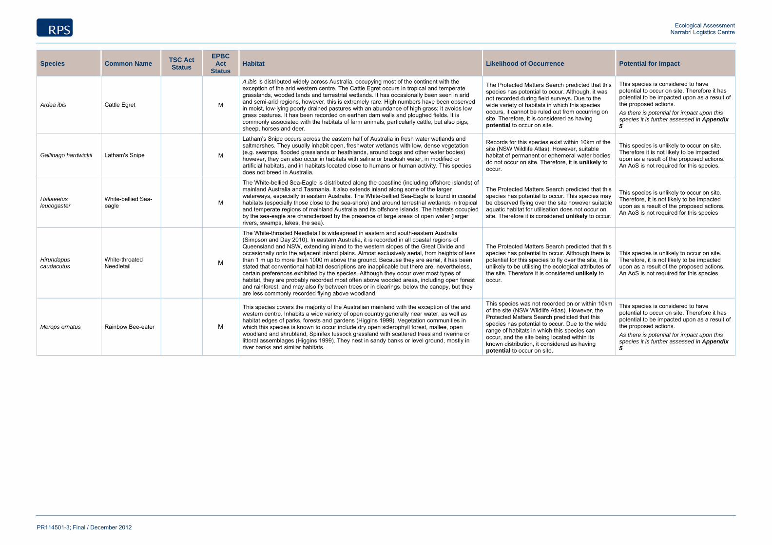
Ecological Assessment Narrabri Logistics Centre
PR114501-3; Final / December 2012
Species Common Name TSC Act Status
EPBC Act
Status Habitat Likelihood of Occurrence Potential for Impact
Ardea ibis Cattle Egret M
A.ibis is distributed widely across Australia, occupying most of the continent with the exception of the arid western centre. The Cattle Egret occurs in tropical and temperate grasslands, wooded lands and terrestrial wetlands. It has occasionally been seen in arid and semi-arid regions, however, this is extremely rare. High numbers have been observed in moist, low-lying poorly drained pastures with an abundance of high grass; it avoids low grass pastures. It has been recorded on earthen dam walls and ploughed fields. It is commonly associated with the habitats of farm animals, particularly cattle, but also pigs, sheep, horses and deer.
The Protected Matters Search predicted that this species has potential to occur. Although, it was not recorded during field surveys. Due to the wide variety of habitats in which this species occurs, it cannot be ruled out from occurring on site. Therefore, it is considered as having potential to occur on site.
This species is considered to have potential to occur on site. Therefore it has potential to be impacted upon as a result of the proposed actions. As there is potential for impact upon this species it is further assessed in Appendix 5
Gallinago hardwickii Latham's Snipe M
Latham’s Snipe occurs across the eastern half of Australia in fresh water wetlands and saltmarshes. They usually inhabit open, freshwater wetlands with low, dense vegetation (e.g. swamps, flooded grasslands or heathlands, around bogs and other water bodies) however, they can also occur in habitats with saline or brackish water, in modified or artificial habitats, and in habitats located close to humans or human activity. This species does not breed in Australia.
Records for this species exist within 10km of the site (NSW Wildlife Atlas). However, suitable habitat of permanent or ephemeral water bodies do not occur on site. Therefore, it is unlikely to occur.
This species is unlikely to occur on site. Therefore it is not likely to be impacted upon as a result of the proposed actions. An AoS is not required for this species.
Haliaeetus leucogaster
White-bellied Sea-eagle M
The White-bellied Sea-Eagle is distributed along the coastline (including offshore islands) of mainland Australia and Tasmania. It also extends inland along some of the larger waterways, especially in eastern Australia. The White-bellied Sea-Eagle is found in coastal habitats (especially those close to the sea-shore) and around terrestrial wetlands in tropical and temperate regions of mainland Australia and its offshore islands. The habitats occupied by the sea-eagle are characterised by the presence of large areas of open water (larger rivers, swamps, lakes, the sea).
The Protected Matters Search predicted that this species has potential to occur. This species may be observed flying over the site however suitable aquatic habitat for utilisation does not occur on site. Therefore it is considered unlikely to occur.
This species is unlikely to occur on site. Therefore, it is not likely to be impacted upon as a result of the proposed actions. An AoS is not required for this species
Hirundapus caudacutus
White-throated Needletail M
The White-throated Needletail is widespread in eastern and south-eastern Australia (Simpson and Day 2010). In eastern Australia, it is recorded in all coastal regions of Queensland and NSW, extending inland to the western slopes of the Great Divide and occasionally onto the adjacent inland plains. Almost exclusively aerial, from heights of less than 1 m up to more than 1000 m above the ground. Because they are aerial, it has been stated that conventional habitat descriptions are inapplicable but there are, nevertheless, certain preferences exhibited by the species. Although they occur over most types of habitat, they are probably recorded most often above wooded areas, including open forest and rainforest, and may also fly between trees or in clearings, below the canopy, but they are less commonly recorded flying above woodland.
The Protected Matters Search predicted that this species has potential to occur. Although there is potential for this species to fly over the site, it is unlikely to be utilising the ecological attributes of the site. Therefore it is considered unlikely to occur.
This species is unlikely to occur on site. Therefore, it is not likely to be impacted upon as a result of the proposed actions. An AoS is not required for this species
Merops ornatus Rainbow Bee-eater M
This species covers the majority of the Australian mainland with the exception of the arid western centre. Inhabits a wide variety of open country generally near water, as well as habitat edges of parks, forests and gardens (Higgins 1999). Vegetation communities in which this species is known to occur include dry open sclerophyll forest, mallee, open woodland and shrubland, Spinifex tussock grassland with scattered trees and riverine or littoral assemblages (Higgins 1999). They nest in sandy banks or level ground, mostly in river banks and similar habitats.
This species was not recorded on or within 10km of the site (NSW Wildlife Atlas). However, the Protected Matters Search predicted that this species has potential to occur. Due to the wide range of habitats in which this species can occur, and the site being located within its known distribution, it considered as having potential to occur on site.
This species is considered to have potential to occur on site. Therefore it has potential to be impacted upon as a result of the proposed actions. As there is potential for impact upon this species it is further assessed in Appendix 5

Ecological Assessment Narrabri Logistics Centre
PR114501-3; Final / December 2012
Appendix 5 Assessment of Significance - EPBC Act

Ecological Assessment Narrabri Logistics Centre
PR114501-3; Final / December 2012
The EPBC Act focuses Commonwealth interests on matters of National Environmental Significance (NES) including integrated biodiversity conservation and the management of important protected areas. The matters of NES as identified in the Act which require assessment and approval to be addressed by the Commonwealth include:
World Heritage Properties;
National Heritage Places;
Wetlands of International Importance;
Great Barrier Reef Marine Parks;
Commonwealth Marine areas;
Nationally Threatened Species;
Nationally Threatened Ecological Communities;
Migratory Species;
The assessment and approval process applies to any action that has, will have or is likely to have a significant impact on a matter of NES. An ‘action’ is defined as a project, development, undertaking or an activity or series of activities.
The matter of NES and site-specific responses are as follows.
World Heritage Properties:
The Site is not World Heritage Property, and is not in close proximity to any such property.
Wetlands of International Importance (RAMSAR convention):
The Site is not part of any Wetland of International Importance, and is not in close proximity to any such area.
Great Barrier Reef Marine Parks;
The Site is not part of any Great Barrier Reef Marine Park, and is not in close proximity to any such park.
Commonwealth Marine Areas
The proposal will not have a significantly adverse effect on any Commonwealth Marine area, as there are no such marine areas within the region.
Nationally Listed Threatened Species:
Threatened species listed under the EPBC Act, which occur, or have the potential to occur within the locality (10km radius) have been assessed for their potential to occur within the site (Appendix 4). Those threatened species that were considered to have potential to occur and subsequently may be impacted by the proposal is as follows:
Those EPBC listed threatened species considered to have potential to occur are:
Pterostylis cobarensis Cobar Greenhood Orchid V
Rulingia procumbens V
Tylophora linearis E
Phascolarctos cinereus Koala V
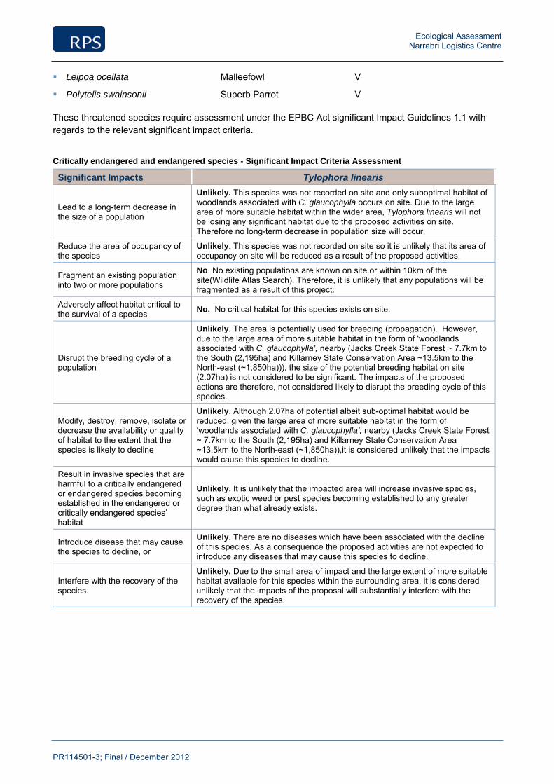
Ecological Assessment Narrabri Logistics Centre
PR114501-3; Final / December 2012
Leipoa ocellata Malleefowl V
Polytelis swainsonii Superb Parrot V
These threatened species require assessment under the EPBC Act significant Impact Guidelines 1.1 with regards to the relevant significant impact criteria.
Critically endangered and endangered species - Significant Impact Criteria Assessment
Significant Impacts Tylophora linearis
Lead to a long-term decrease in the size of a population
Unlikely. This species was not recorded on site and only suboptimal habitat of woodlands associated with C. glaucophylla occurs on site. Due to the large area of more suitable habitat within the wider area, Tylophora linearis will not be losing any significant habitat due to the proposed activities on site. Therefore no long-term decrease in population size will occur.
Reduce the area of occupancy of the species
Unlikely. This species was not recorded on site so it is unlikely that its area of occupancy on site will be reduced as a result of the proposed activities.
Fragment an existing population into two or more populations
No. No existing populations are known on site or within 10km of the site(Wildlife Atlas Search). Therefore, it is unlikely that any populations will be fragmented as a result of this project.
Adversely affect habitat critical to the survival of a species No. No critical habitat for this species exists on site.
Disrupt the breeding cycle of a population
Unlikely. The area is potentially used for breeding (propagation). However, due to the large area of more suitable habitat in the form of ‘woodlands associated with C. glaucophylla’, nearby (Jacks Creek State Forest ~ 7.7km to the South (2,195ha) and Killarney State Conservation Area ~13.5km to the North-east (~1,850ha))), the size of the potential breeding habitat on site (2.07ha) is not considered to be significant. The impacts of the proposed actions are therefore, not considered likely to disrupt the breeding cycle of this species.
Modify, destroy, remove, isolate or decrease the availability or quality of habitat to the extent that the species is likely to decline
Unlikely. Although 2.07ha of potential albeit sub-optimal habitat would be reduced, given the large area of more suitable habitat in the form of ‘woodlands associated with C. glaucophylla’, nearby (Jacks Creek State Forest ~ 7.7km to the South (2,195ha) and Killarney State Conservation Area ~13.5km to the North-east (~1,850ha)),it is considered unlikely that the impacts would cause this species to decline.
Result in invasive species that are harmful to a critically endangered or endangered species becoming established in the endangered or critically endangered species’ habitat
Unlikely. It is unlikely that the impacted area will increase invasive species, such as exotic weed or pest species becoming established to any greater degree than what already exists.
Introduce disease that may cause the species to decline, or
Unlikely. There are no diseases which have been associated with the decline of this species. As a consequence the proposed activities are not expected to introduce any diseases that may cause this species to decline.
Interfere with the recovery of the species.
Unlikely. Due to the small area of impact and the large extent of more suitable habitat available for this species within the surrounding area, it is considered unlikely that the impacts of the proposal will substantially interfere with the recovery of the species.
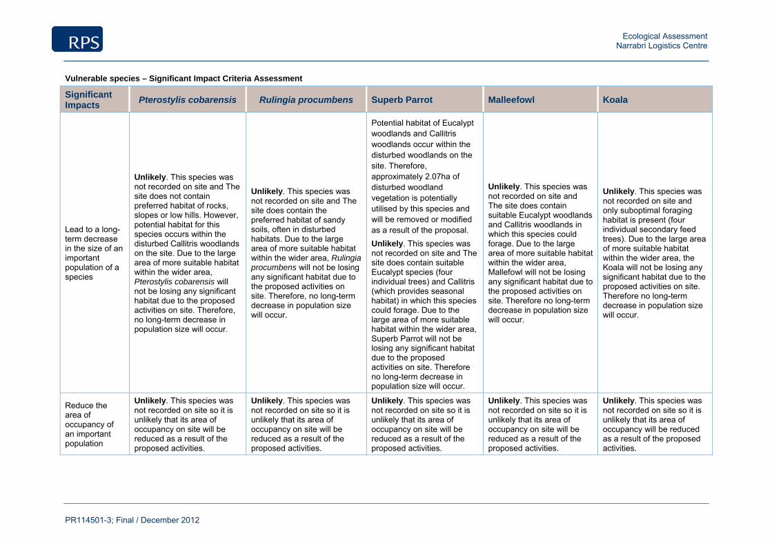
Ecological Assessment Narrabri Logistics Centre
PR114501-3; Final / December 2012
Vulnerable species – Significant Impact Criteria Assessment
Significant Impacts
Pterostylis cobarensis Rulingia procumbens Superb Parrot Malleefowl Koala
Lead to a long-term decrease in the size of an important population of a species
Unlikely. This species was not recorded on site and The site does not contain preferred habitat of rocks, slopes or low hills. However, potential habitat for this species occurs within the disturbed Callitris woodlands on the site. Due to the large area of more suitable habitat within the wider area, Pterostylis cobarensis will not be losing any significant habitat due to the proposed activities on site. Therefore, no long-term decrease in population size will occur.
Unlikely. This species was not recorded on site and The site does contain the preferred habitat of sandy soils, often in disturbed habitats. Due to the large area of more suitable habitat within the wider area, Rulingia procumbens will not be losing any significant habitat due to the proposed activities on site. Therefore, no long-term decrease in population size will occur.
Potential habitat of Eucalypt woodlands and Callitris woodlands occur within the disturbed woodlands on the site. Therefore, approximately 2.07ha of disturbed woodland vegetation is potentially utilised by this species and will be removed or modified as a result of the proposal. Unlikely. This species was not recorded on site and The site does contain suitable Eucalypt species (four individual trees) and Callitris (which provides seasonal habitat) in which this species could forage. Due to the large area of more suitable habitat within the wider area, Superb Parrot will not be losing any significant habitat due to the proposed activities on site. Therefore no long-term decrease in population size will occur.
Unlikely. This species was not recorded on site and The site does contain suitable Eucalypt woodlands and Callitris woodlands in which this species could forage. Due to the large area of more suitable habitat within the wider area, Mallefowl will not be losing any significant habitat due to the proposed activities on site. Therefore no long-term decrease in population size will occur.
Unlikely. This species was not recorded on site and only suboptimal foraging habitat is present (four individual secondary feed trees). Due to the large area of more suitable habitat within the wider area, the Koala will not be losing any significant habitat due to the proposed activities on site. Therefore no long-term decrease in population size will occur.
Reduce the area of occupancy of an important population
Unlikely. This species was not recorded on site so it is unlikely that its area of occupancy on site will be reduced as a result of the proposed activities.
Unlikely. This species was not recorded on site so it is unlikely that its area of occupancy on site will be reduced as a result of the proposed activities.
Unlikely. This species was not recorded on site so it is unlikely that its area of occupancy on site will be reduced as a result of the proposed activities.
Unlikely. This species was not recorded on site so it is unlikely that its area of occupancy on site will be reduced as a result of the proposed activities.
Unlikely. This species was not recorded on site so it is unlikely that its area of occupancy will be reduced as a result of the proposed activities.
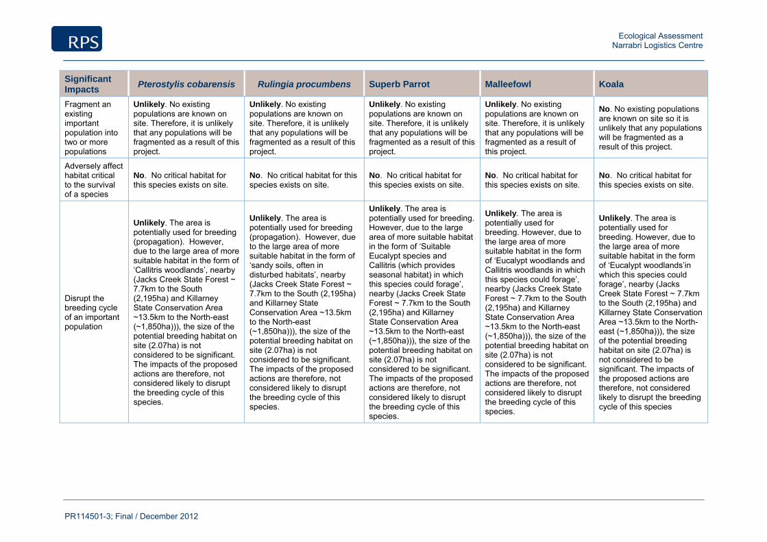
Ecological Assessment Narrabri Logistics Centre
PR114501-3; Final / December 2012
Significant Impacts
Pterostylis cobarensis Rulingia procumbens Superb Parrot Malleefowl Koala
Fragment an existing important population into two or more populations
Unlikely. No existing populations are known on site. Therefore, it is unlikely that any populations will be fragmented as a result of this project.
Unlikely. No existing populations are known on site. Therefore, it is unlikely that any populations will be fragmented as a result of this project.
Unlikely. No existing populations are known on site. Therefore, it is unlikely that any populations will be fragmented as a result of this project.
Unlikely. No existing populations are known on site. Therefore, it is unlikely that any populations will be fragmented as a result of this project.
No. No existing populations are known on site so it is unlikely that any populations will be fragmented as a result of this project.
Adversely affect habitat critical to the survival of a species
No. No critical habitat for this species exists on site.
No. No critical habitat for this species exists on site.
No. No critical habitat for this species exists on site.
No. No critical habitat for this species exists on site.
No. No critical habitat for this species exists on site.
Disrupt the breeding cycle of an important population
Unlikely. The area is potentially used for breeding (propagation). However, due to the large area of more suitable habitat in the form of ‘Callitris woodlands’, nearby (Jacks Creek State Forest ~ 7.7km to the South (2,195ha) and Killarney State Conservation Area ~13.5km to the North-east (~1,850ha))), the size of the potential breeding habitat on site (2.07ha) is not considered to be significant. The impacts of the proposed actions are therefore, not considered likely to disrupt the breeding cycle of this species.
Unlikely. The area is potentially used for breeding (propagation). However, due to the large area of more suitable habitat in the form of ‘sandy soils, often in disturbed habitats’, nearby (Jacks Creek State Forest ~ 7.7km to the South (2,195ha) and Killarney State Conservation Area ~13.5km to the North-east (~1,850ha))), the size of the potential breeding habitat on site (2.07ha) is not considered to be significant. The impacts of the proposed actions are therefore, not considered likely to disrupt the breeding cycle of this species.
Unlikely. The area is potentially used for breeding. However, due to the large area of more suitable habitat in the form of ‘Suitable Eucalypt species and Callitris (which provides seasonal habitat) in which this species could forage’, nearby (Jacks Creek State Forest ~ 7.7km to the South (2,195ha) and Killarney State Conservation Area ~13.5km to the North-east (~1,850ha))), the size of the potential breeding habitat on site (2.07ha) is not considered to be significant. The impacts of the proposed actions are therefore, not considered likely to disrupt the breeding cycle of this species.
Unlikely. The area is potentially used for breeding. However, due to the large area of more suitable habitat in the form of ‘Eucalypt woodlands and Callitris woodlands in which this species could forage’, nearby (Jacks Creek State Forest ~ 7.7km to the South (2,195ha) and Killarney State Conservation Area ~13.5km to the North-east (~1,850ha))), the size of the potential breeding habitat on site (2.07ha) is not considered to be significant. The impacts of the proposed actions are therefore, not considered likely to disrupt the breeding cycle of this species.
Unlikely. The area is potentially used for breeding. However, due to the large area of more suitable habitat in the form of ‘Eucalypt woodlands’in which this species could forage’, nearby (Jacks Creek State Forest ~ 7.7km to the South (2,195ha) and Killarney State Conservation Area ~13.5km to the North-east (~1,850ha))), the size of the potential breeding habitat on site (2.07ha) is not considered to be significant. The impacts of the proposed actions are therefore, not considered likely to disrupt the breeding cycle of this species

Ecological Assessment Narrabri Logistics Centre
PR114501-3; Final / December 2012
Significant Impacts
Pterostylis cobarensis Rulingia procumbens Superb Parrot Malleefowl Koala
Modify, destroy, remove or isolate or decrease the availability or quality of habitat to the extent that the species is likely to decline
Unlikely. Although 2.07ha of potential albeit sub-optimal habitat would be reduced, given the large area of more suitable habitat in the form of ‘Callitris woodlands’, nearby (Jacks Creek State Forest ~ 7.7km to the South (2,195ha) and Killarney State Conservation Area ~13.5km to the North-east (~1,850ha)), it is considered unlikely that the impacts would cause this species to decline.
Unlikely. Although 2.07ha of potential albeit sub-optimal habitat would be reduced, given the large area of more suitable habitat in the form of ‘sandy soils, often in disturbed habitats’, nearby (Jacks Creek State Forest ~ 7.7km to the South (2,195ha) and Killarney State Conservation Area ~13.5km to the North-east (~1,850ha)), it is considered unlikely that the impacts would cause this species to decline.
Unlikely. Although 2.07ha of potential albeit sub-optimal habitat would be reduced, given the large area of more suitable habitat in the form of ‘Suitable Eucalypt species and Callitris (which provides seasonal habitat) in which this species could forage’, nearby (Jacks Creek State Forest ~ 7.7km to the South (2,195ha) and Killarney State Conservation Area ~13.5km to the North-east (~1,850ha)), it is considered unlikely that the impacts would cause this species to decline.
Unlikely. Although 2.07ha of potential albeit sub-optimal habitat would be reduced, given the large area of more suitable habitat in the form of ‘Eucalypt woodlands and Callitris woodlands’ in which this species could forage, nearby (Jacks Creek State Forest ~ 7.7km to the South (2,195ha) and Killarney State Conservation Area ~13.5km to the North-east (~1,850ha)), it is considered unlikely that the impacts would cause this species to decline.
Unlikely. Although 2.07ha of potential albeit sub-optimal habitat would be reduced, given the large area of more suitable habitat in the form of ‘Eucalypt woodlands’ in which this species could forage, nearby (Jacks Creek State Forest ~ 7.7km to the South (2,195ha) and Killarney State Conservation Area ~13.5km to the North-east (~1,850ha)), it is considered unlikely that the impacts would cause this species to decline..
Result in invasive species that are harmful to a vulnerable species becoming established in the vulnerable species’ habitat
Unlikely. It is unlikely that the impacted area will increase invasive species, such as exotic weed or pest species becoming established to any greater degree than what already exists.
Unlikely. It is unlikely that the impacted area will increase invasive species, such as exotic weed or pest species becoming established to any greater degree than what already exists.
Unlikely. It is unlikely that the impacted area will increase invasive species, such as exotic weed or pest species becoming established to any greater degree than what already exists.
Unlikely. It is unlikely that the impacted area will increase invasive species, such as exotic weed or pest species becoming established to any greater degree than what already exists.
Unlikely. It is unlikely that the impacted area will increase invasive species, such as foxes or cats becoming established to any greater degree than what already exists.
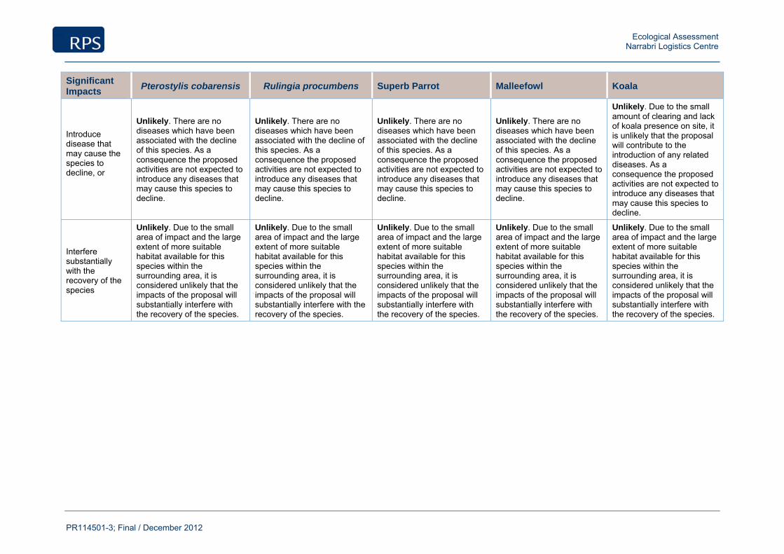
Ecological Assessment Narrabri Logistics Centre
PR114501-3; Final / December 2012
Significant Impacts
Pterostylis cobarensis Rulingia procumbens Superb Parrot Malleefowl Koala
Introduce disease that may cause the species to decline, or
Unlikely. There are no diseases which have been associated with the decline of this species. As a consequence the proposed activities are not expected to introduce any diseases that may cause this species to decline.
Unlikely. There are no diseases which have been associated with the decline of this species. As a consequence the proposed activities are not expected to introduce any diseases that may cause this species to decline.
Unlikely. There are no diseases which have been associated with the decline of this species. As a consequence the proposed activities are not expected to introduce any diseases that may cause this species to decline.
Unlikely. There are no diseases which have been associated with the decline of this species. As a consequence the proposed activities are not expected to introduce any diseases that may cause this species to decline.
Unlikely. Due to the small amount of clearing and lack of koala presence on site, it is unlikely that the proposal will contribute to the introduction of any related diseases. As a consequence the proposed activities are not expected to introduce any diseases that may cause this species to decline.
Interfere substantially with the recovery of the species
Unlikely. Due to the small area of impact and the large extent of more suitable habitat available for this species within the surrounding area, it is considered unlikely that the impacts of the proposal will substantially interfere with the recovery of the species.
Unlikely. Due to the small area of impact and the large extent of more suitable habitat available for this species within the surrounding area, it is considered unlikely that the impacts of the proposal will substantially interfere with the recovery of the species.
Unlikely. Due to the small area of impact and the large extent of more suitable habitat available for this species within the surrounding area, it is considered unlikely that the impacts of the proposal will substantially interfere with the recovery of the species.
Unlikely. Due to the small area of impact and the large extent of more suitable habitat available for this species within the surrounding area, it is considered unlikely that the impacts of the proposal will substantially interfere with the recovery of the species.
Unlikely. Due to the small area of impact and the large extent of more suitable habitat available for this species within the surrounding area, it is considered unlikely that the impacts of the proposal will substantially interfere with the recovery of the species.
Ecological Assessment Narrabri Logistics Centre
PR114501-3; Final / December 2012
The site and the proposed location of the development footprint exists, as a previously disturbed site (~3.4 ha) and the proposal will impact upon a small area of sub-optimal habitat (~ 2.07ha of disturbed woodland habitat). This site is within close proximity to superior areas of habitat (Jacks Creek State Forest ~ 7.7km to the South (2,195ha) and Killarney State Conservation Area ~13.5km to the North-east (~1,850ha)) which would be suitable for supporting populations of the potentially occurring above listed threatened species. The small area to be impacted upon is unlikely to be essential to the survival of populations of these listed species.
Nationally Listed Threatened Ecological Communities:
No Threatened Ecological Community (TEC), nationally listed under the EPBC Act were recorded during field surveys. However, one TEC was considered for its likelihood to occur (Appendix 4). As no TEC’s are considered likely to occur there is no potential for impacts upon any listed TEC’s.
Nationally Listed Migratory Species:
Those EPBC listed Migratory species considered to have potential to occur are:
Circus assimilis Spotted Harrier
Apus pacificus Fork-tailed Swift
Leipoa ocellata Malleefowl
Ardea ibis Cattle Egret
Merops ornatus Rainbow Bee-eater
The proposed location of the development footprint exists, as a previously disturbed site with a low diversity of habitat features. The site and the proposed location of the development footprint exists, as a previously disturbed site (~3.4 ha) and the proposal will impact upon a small area of sub-optimal habitat (~ 2.07ha of disturbed woodland habitat). This site is within close proximity to superior areas of habitat (Jacks Creek State Forest ~ 7.7km to the South (2,195ha) and Killarney State Conservation Area ~13.5km to the North-east (~1,850ha)) which would be suitable for supporting populations of the potentially occurring above listed threatened species. The small area to be impacted upon is unlikely to be essential to the survival of populations of these listed species.
This site is surrounded by superior areas of habitat, which would be suitable for the above listed Migratory species. Due to the extensive tracts of vegetation within the surrounding area, supporting the populations of the potentially occurring above species, the small area to be impacted upon is unlikely to be essential to the survival of populations of these species.

Ecological Assessment Narrabri Logistics Centre
PR114501-3; Final / December 2012
Appendix 6
7-Part Test – TSC Act
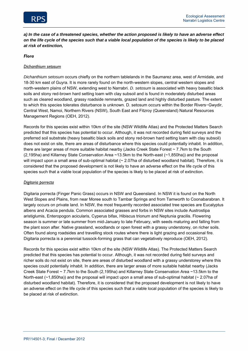
Ecological Assessment Narrabri Logistics Centre
PR114501-3; Final / December 2012
a) In the case of a threatened species, whether the action proposed is likely to have an adverse effect on the life cycle of the species such that a viable local population of the species is likely to be placed at risk of extinction,
Flora
Dichanthium setosum
Dichanthium setosum occurs chiefly on the northern tablelands in the Saumarez area, west of Armidale, and 18-30 km east of Guyra. It is more rarely found on the north-western slopes, central western slopes and north-western plains of NSW, extending west to Narrabri. D. setosum is associated with heavy basaltic black soils and stony red-brown hard setting loam with clay subsoil and is found in moderately disturbed areas such as cleared woodland, grassy roadside remnants, grazed land and highly disturbed pasture. The extent to which this species tolerates disturbance is unknown. D. setosum occurs within the Border Rivers−Gwydir, Central West, Namoi, Northern Rivers (NSW), South East and Fitzroy (Queensland) Natural Resources Management Regions (OEH, 2012).
Records for this species exist within 10km of the site (NSW Wildlife Atlas) and the Protected Matters Search predicted that this species has potential to occur. Although, it was not recorded during field surveys and the preferred soil substrate (heavy basaltic black soils and stony red-brown hard setting loam with clay subsoil) does not exist on site, there are areas of disturbance where this species could potentially inhabit. In addition, there are larger areas of more suitable habitat nearby (Jacks Creek State Forest ~ 7.7km to the South (2,195ha) and Killarney State Conservation Area ~13.5km to the North-east (~1,850ha)) and the proposal will impact upon a small area of sub-optimal habitat (~ 2.07ha of disturbed woodland habitat). Therefore, it is considered that the proposed development is not likely to have an adverse effect on the life cycle of this species such that a viable local population of the species is likely to be placed at risk of extinction.
Digitaria porrecta
Digitaria porrecta (Finger Panic Grass) occurs in NSW and Queensland. In NSW it is found on the North West Slopes and Plains, from near Moree south to Tambar Springs and from Tamworth to Coonabarabran. It largely occurs on private land. In NSW, the most frequently recorded associated tree species are Eucalyptus albens and Acacia pendula. Common associated grasses and forbs in NSW sites include Austrostipa aristiglumis, Enteropogon acicularis, Cyperus bifax, Hibiscus trionum and Neptunia gracilis. Flowering season is summer or late summer from mid-January to late February, with seeds maturing and falling from the plant soon after. Native grassland, woodlands or open forest with a grassy understorey, on richer soils. Often found along roadsides and travelling stock routes where there is light grazing and occasional fire. Digitaria porrecta is a perennial tussock-forming grass that can vegetatively reproduce (OEH, 2012).
Records for this species exist within 10km of the site (NSW Wildlife Atlas). The Protected Matters Search predicted that this species has potential to occur. Although, it was not recorded during field surveys and richer soils do not exist on site, there are areas of disturbed woodland with a grassy understorey where this species could potentially inhabit. In addition, there are larger areas of more suitable habitat nearby (Jacks Creek State Forest ~ 7.7km to the South (2,195ha) and Killarney State Conservation Area ~13.5km to the North-east (~1,850ha)) and the proposal will impact upon a small area of sub-optimal habitat (~ 2.07ha of disturbed woodland habitat). Therefore, it is considered that the proposed development is not likely to have an adverse effect on the life cycle of this species such that a viable local population of the species is likely to be placed at risk of extinction.
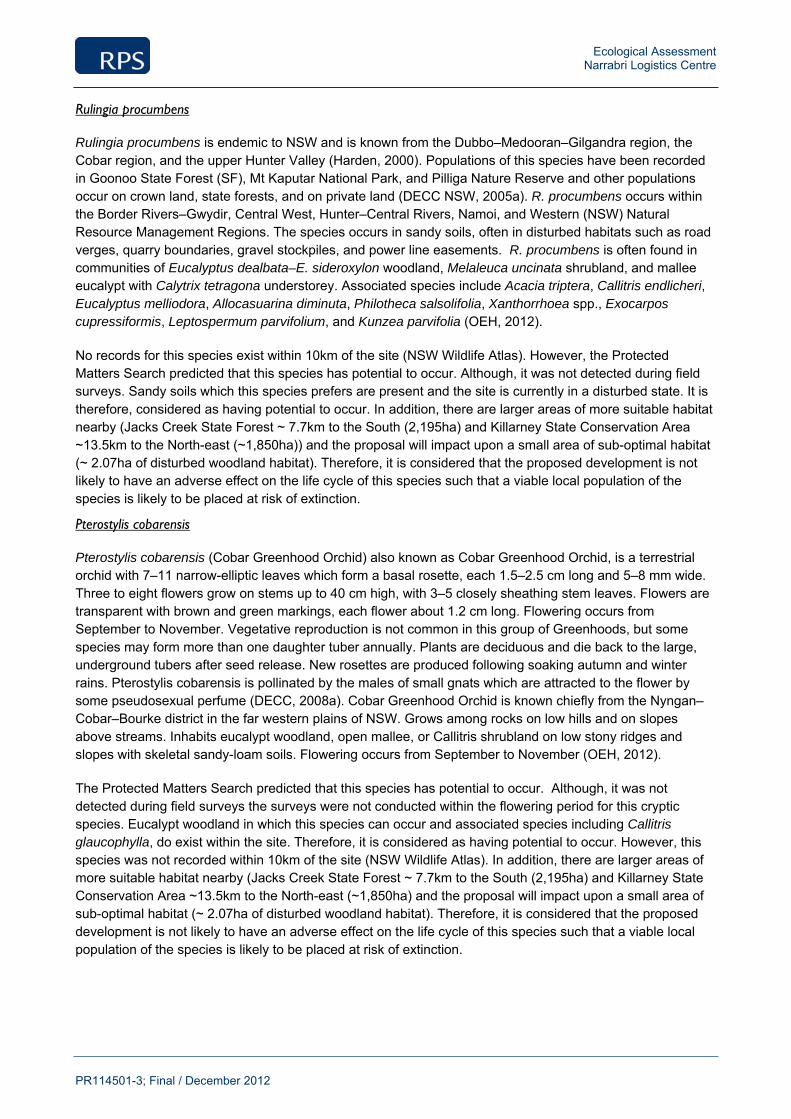
Ecological Assessment Narrabri Logistics Centre
PR114501-3; Final / December 2012
Rulingia procumbens
Rulingia procumbens is endemic to NSW and is known from the Dubbo–Medooran–Gilgandra region, the Cobar region, and the upper Hunter Valley (Harden, 2000). Populations of this species have been recorded in Goonoo State Forest (SF), Mt Kaputar National Park, and Pilliga Nature Reserve and other populations occur on crown land, state forests, and on private land (DECC NSW, 2005a). R. procumbens occurs within the Border Rivers–Gwydir, Central West, Hunter–Central Rivers, Namoi, and Western (NSW) Natural Resource Management Regions. The species occurs in sandy soils, often in disturbed habitats such as road verges, quarry boundaries, gravel stockpiles, and power line easements. R. procumbens is often found in communities of Eucalyptus dealbata–E. sideroxylon woodland, Melaleuca uncinata shrubland, and mallee eucalypt with Calytrix tetragona understorey. Associated species include Acacia triptera, Callitris endlicheri, Eucalyptus melliodora, Allocasuarina diminuta, Philotheca salsolifolia, Xanthorrhoea spp., Exocarpos cupressiformis, Leptospermum parvifolium, and Kunzea parvifolia (OEH, 2012).
No records for this species exist within 10km of the site (NSW Wildlife Atlas). However, the Protected Matters Search predicted that this species has potential to occur. Although, it was not detected during field surveys. Sandy soils which this species prefers are present and the site is currently in a disturbed state. It is therefore, considered as having potential to occur. In addition, there are larger areas of more suitable habitat nearby (Jacks Creek State Forest ~ 7.7km to the South (2,195ha) and Killarney State Conservation Area ~13.5km to the North-east (~1,850ha)) and the proposal will impact upon a small area of sub-optimal habitat (~ 2.07ha of disturbed woodland habitat). Therefore, it is considered that the proposed development is not likely to have an adverse effect on the life cycle of this species such that a viable local population of the species is likely to be placed at risk of extinction.
Pterostylis cobarensis
Pterostylis cobarensis (Cobar Greenhood Orchid) also known as Cobar Greenhood Orchid, is a terrestrial orchid with 7–11 narrow-elliptic leaves which form a basal rosette, each 1.5–2.5 cm long and 5–8 mm wide. Three to eight flowers grow on stems up to 40 cm high, with 3–5 closely sheathing stem leaves. Flowers are transparent with brown and green markings, each flower about 1.2 cm long. Flowering occurs from September to November. Vegetative reproduction is not common in this group of Greenhoods, but some species may form more than one daughter tuber annually. Plants are deciduous and die back to the large, underground tubers after seed release. New rosettes are produced following soaking autumn and winter rains. Pterostylis cobarensis is pollinated by the males of small gnats which are attracted to the flower by some pseudosexual perfume (DECC, 2008a). Cobar Greenhood Orchid is known chiefly from the Nyngan–Cobar–Bourke district in the far western plains of NSW. Grows among rocks on low hills and on slopes above streams. Inhabits eucalypt woodland, open mallee, or Callitris shrubland on low stony ridges and slopes with skeletal sandy-loam soils. Flowering occurs from September to November (OEH, 2012).
The Protected Matters Search predicted that this species has potential to occur. Although, it was not detected during field surveys the surveys were not conducted within the flowering period for this cryptic species. Eucalypt woodland in which this species can occur and associated species including Callitris glaucophylla, do exist within the site. Therefore, it is considered as having potential to occur. However, this species was not recorded within 10km of the site (NSW Wildlife Atlas). In addition, there are larger areas of more suitable habitat nearby (Jacks Creek State Forest ~ 7.7km to the South (2,195ha) and Killarney State Conservation Area ~13.5km to the North-east (~1,850ha) and the proposal will impact upon a small area of sub-optimal habitat (~ 2.07ha of disturbed woodland habitat). Therefore, it is considered that the proposed development is not likely to have an adverse effect on the life cycle of this species such that a viable local population of the species is likely to be placed at risk of extinction.
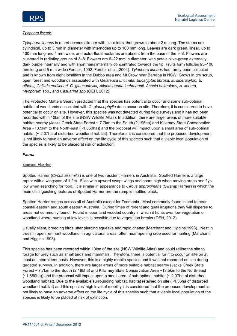
Ecological Assessment Narrabri Logistics Centre
PR114501-3; Final / December 2012
Tylophora linearis
Tylophora linearis is a herbaceous climber with clear latex that grows to about 2 m long. The stems are cylindrical, up to 3 mm in diameter with internodes up to 100 mm long. Leaves are dark green, linear, up to 100 mm long and 4 mm wide, and extra-floral nectaries are absent from the base of the leaf. Flowers are clustered in radiating groups of 3–8. Flowers are 6–22 mm in diameter, with petals olive-green externally, dark purple internally and with short hairs internally concentrated towards the tip. Fruits form follicles 95–100 mm long and 5 mm wide (Forster, 1992; Forster et al., 2004). Tylophora linearis has rarely been collected and is known from eight localities in the Dubbo area and Mt Crow near Barraba in NSW. Grows in dry scrub, open forest and woodlands associated with Melaleuca uncinata, Eucalyptus fibrosa, E. sideroxylon, E. albens, Callitris endlicheri, C. glaucophylla, Allocasuarina luehmannii, Acacia hakeoides, A. lineata, Myoporum spp., and Casuarina spp (OEH, 2012).
The Protected Matters Search predicted that this species has potential to occur and some sub-optimal habitat of woodlands associated with C. glaucophylla does occur on site. Therefore, it is considered to have potential to occur on site. However, this species was not detected during field surveys and it has not been recorded within 10km of the site (NSW Wildlife Atlas). In addition, there are larger areas of more suitable habitat nearby (Jacks Creek State Forest ~ 7.7km to the South (2,195ha) and Killarney State Conservation Area ~13.5km to the North-east (~1,850ha)) and the proposal will impact upon a small area of sub-optimal habitat (~ 2.07ha of disturbed woodland habitat). Therefore, it is considered that the proposed development is not likely to have an adverse effect on the life cycle of this species such that a viable local population of the species is likely to be placed at risk of extinction.
Fauna
Spotted Harrier
Spotted Harrier (Circus assimilis) is one of two resident Harriers in Australia. Spotted Harrier is a large raptor with a wingspan of 1.2m. Flies with upward swept wings and soars high when moving areas and flys low when searching for food. It is similar in appearance to Circus approximans (Swamp Harrier) in which the main distinguishing features of Spotted Harrier are the rump is mottled black.
Spotted Harrier ranges across all of Australia except for Tasmania. Most commonly found inland to near coastal eastern and south eastern Australia. During times of rodent and quail irruptions they will disperse to areas not commonly found. Found in open and wooded country in which it hunts over low vegetation or woodland where hunting at low levels is possible due to vegetation breaks (OEH, 2012).
Usually silent, breeding birds utter piercing squeaks and rapid chatter (Marchant and Higgins 1993). Nest in trees in open remnant woodland, in agricultural areas, often near ripening crop used for hunting (Marchant and Higgins 1993).
This species has been recorded within 10km of the site (NSW Wildlife Atlas) and could utilise the site to forage for prey such as small birds and mammals. Therefore, there is potential for it to occur on site on at least an intermittent basis. However, this is a highly mobile species and it was not recorded on site during targeted surveys. In addition, there are larger areas of more suitable habitat nearby (Jacks Creek State Forest ~ 7.7km to the South (2,195ha) and Killarney State Conservation Area ~13.5km to the North-east (~1,850ha)) and the proposal will impact upon a small area of sub-optimal habitat (~ 2.07ha of disturbed woodland habitat). Due to the available surrounding habitat, habitat retained on site (~1.36ha of disturbed woodland habitat) and this species’ high level of mobility it is considered that the proposed development is not likely to have an adverse effect on the life cycle of this species such that a viable local population of the species is likely to be placed at risk of extinction.
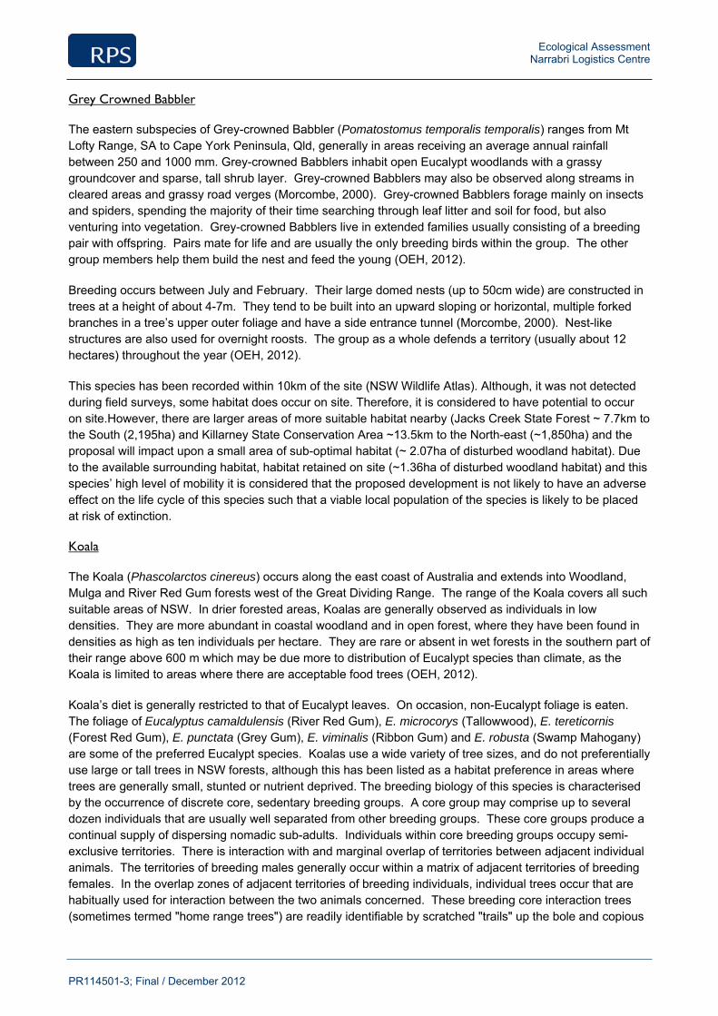
Ecological Assessment Narrabri Logistics Centre
PR114501-3; Final / December 2012
Grey Crowned Babbler
The eastern subspecies of Grey-crowned Babbler (Pomatostomus temporalis temporalis) ranges from Mt Lofty Range, SA to Cape York Peninsula, Qld, generally in areas receiving an average annual rainfall between 250 and 1000 mm. Grey-crowned Babblers inhabit open Eucalypt woodlands with a grassy groundcover and sparse, tall shrub layer. Grey-crowned Babblers may also be observed along streams in cleared areas and grassy road verges (Morcombe, 2000). Grey-crowned Babblers forage mainly on insects and spiders, spending the majority of their time searching through leaf litter and soil for food, but also venturing into vegetation. Grey-crowned Babblers live in extended families usually consisting of a breeding pair with offspring. Pairs mate for life and are usually the only breeding birds within the group. The other group members help them build the nest and feed the young (OEH, 2012).
Breeding occurs between July and February. Their large domed nests (up to 50cm wide) are constructed in trees at a height of about 4-7m. They tend to be built into an upward sloping or horizontal, multiple forked branches in a tree’s upper outer foliage and have a side entrance tunnel (Morcombe, 2000). Nest-like structures are also used for overnight roosts. The group as a whole defends a territory (usually about 12 hectares) throughout the year (OEH, 2012).
This species has been recorded within 10km of the site (NSW Wildlife Atlas). Although, it was not detected during field surveys, some habitat does occur on site. Therefore, it is considered to have potential to occur on site.However, there are larger areas of more suitable habitat nearby (Jacks Creek State Forest ~ 7.7km to the South (2,195ha) and Killarney State Conservation Area ~13.5km to the North-east (~1,850ha) and the proposal will impact upon a small area of sub-optimal habitat (~ 2.07ha of disturbed woodland habitat). Due to the available surrounding habitat, habitat retained on site (~1.36ha of disturbed woodland habitat) and this species’ high level of mobility it is considered that the proposed development is not likely to have an adverse effect on the life cycle of this species such that a viable local population of the species is likely to be placed at risk of extinction.
Koala
The Koala (Phascolarctos cinereus) occurs along the east coast of Australia and extends into Woodland, Mulga and River Red Gum forests west of the Great Dividing Range. The range of the Koala covers all such suitable areas of NSW. In drier forested areas, Koalas are generally observed as individuals in low densities. They are more abundant in coastal woodland and in open forest, where they have been found in densities as high as ten individuals per hectare. They are rare or absent in wet forests in the southern part of their range above 600 m which may be due more to distribution of Eucalypt species than climate, as the Koala is limited to areas where there are acceptable food trees (OEH, 2012).
Koala’s diet is generally restricted to that of Eucalypt leaves. On occasion, non-Eucalypt foliage is eaten. The foliage of Eucalyptus camaldulensis (River Red Gum), E. microcorys (Tallowwood), E. tereticornis (Forest Red Gum), E. punctata (Grey Gum), E. viminalis (Ribbon Gum) and E. robusta (Swamp Mahogany) are some of the preferred Eucalypt species. Koalas use a wide variety of tree sizes, and do not preferentially use large or tall trees in NSW forests, although this has been listed as a habitat preference in areas where trees are generally small, stunted or nutrient deprived. The breeding biology of this species is characterised by the occurrence of discrete core, sedentary breeding groups. A core group may comprise up to several dozen individuals that are usually well separated from other breeding groups. These core groups produce a continual supply of dispersing nomadic sub-adults. Individuals within core breeding groups occupy semi-exclusive territories. There is interaction with and marginal overlap of territories between adjacent individual animals. The territories of breeding males generally occur within a matrix of adjacent territories of breeding females. In the overlap zones of adjacent territories of breeding individuals, individual trees occur that are habitually used for interaction between the two animals concerned. These breeding core interaction trees (sometimes termed "home range trees") are readily identifiable by scratched "trails" up the bole and copious
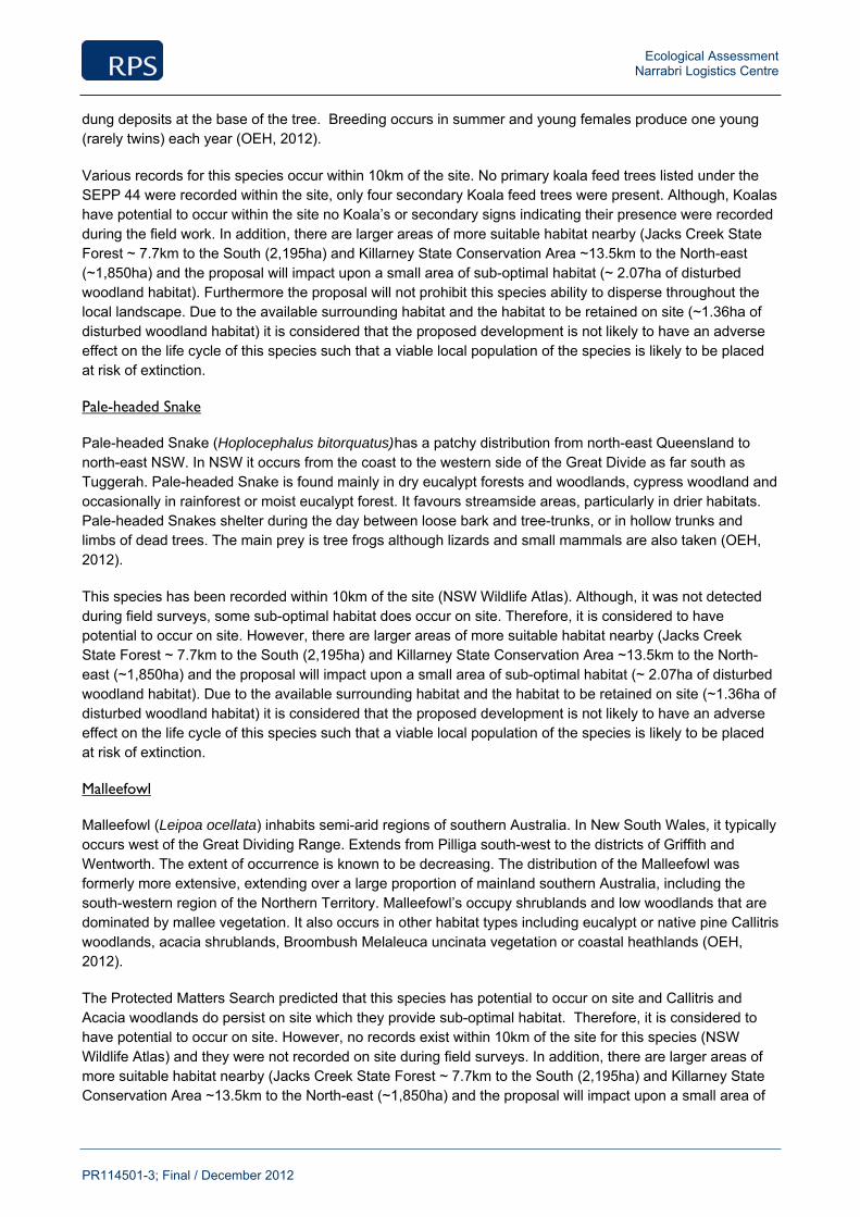
Ecological Assessment Narrabri Logistics Centre
PR114501-3; Final / December 2012
dung deposits at the base of the tree. Breeding occurs in summer and young females produce one young (rarely twins) each year (OEH, 2012).
Various records for this species occur within 10km of the site. No primary koala feed trees listed under the SEPP 44 were recorded within the site, only four secondary Koala feed trees were present. Although, Koalas have potential to occur within the site no Koala’s or secondary signs indicating their presence were recorded during the field work. In addition, there are larger areas of more suitable habitat nearby (Jacks Creek State Forest ~ 7.7km to the South (2,195ha) and Killarney State Conservation Area ~13.5km to the North-east (~1,850ha) and the proposal will impact upon a small area of sub-optimal habitat (~ 2.07ha of disturbed woodland habitat). Furthermore the proposal will not prohibit this species ability to disperse throughout the local landscape. Due to the available surrounding habitat and the habitat to be retained on site (~1.36ha of disturbed woodland habitat) it is considered that the proposed development is not likely to have an adverse effect on the life cycle of this species such that a viable local population of the species is likely to be placed at risk of extinction.
Pale-headed Snake
Pale-headed Snake (Hoplocephalus bitorquatus) has a patchy distribution from north-east Queensland to north-east NSW. In NSW it occurs from the coast to the western side of the Great Divide as far south as Tuggerah. Pale-headed Snake is found mainly in dry eucalypt forests and woodlands, cypress woodland and occasionally in rainforest or moist eucalypt forest. It favours streamside areas, particularly in drier habitats. Pale-headed Snakes shelter during the day between loose bark and tree-trunks, or in hollow trunks and limbs of dead trees. The main prey is tree frogs although lizards and small mammals are also taken (OEH, 2012).
This species has been recorded within 10km of the site (NSW Wildlife Atlas). Although, it was not detected during field surveys, some sub-optimal habitat does occur on site. Therefore, it is considered to have potential to occur on site. However, there are larger areas of more suitable habitat nearby (Jacks Creek State Forest ~ 7.7km to the South (2,195ha) and Killarney State Conservation Area ~13.5km to the North-east (~1,850ha) and the proposal will impact upon a small area of sub-optimal habitat (~ 2.07ha of disturbed woodland habitat). Due to the available surrounding habitat and the habitat to be retained on site (~1.36ha of disturbed woodland habitat) it is considered that the proposed development is not likely to have an adverse effect on the life cycle of this species such that a viable local population of the species is likely to be placed at risk of extinction.
Malleefowl
Malleefowl (Leipoa ocellata) inhabits semi-arid regions of southern Australia. In New South Wales, it typically occurs west of the Great Dividing Range. Extends from Pilliga south-west to the districts of Griffith and Wentworth. The extent of occurrence is known to be decreasing. The distribution of the Malleefowl was formerly more extensive, extending over a large proportion of mainland southern Australia, including the south-western region of the Northern Territory. Malleefowl’s occupy shrublands and low woodlands that are dominated by mallee vegetation. It also occurs in other habitat types including eucalypt or native pine Callitris woodlands, acacia shrublands, Broombush Melaleuca uncinata vegetation or coastal heathlands (OEH, 2012).
The Protected Matters Search predicted that this species has potential to occur on site and Callitris and Acacia woodlands do persist on site which they provide sub-optimal habitat. Therefore, it is considered to have potential to occur on site. However, no records exist within 10km of the site for this species (NSW Wildlife Atlas) and they were not recorded on site during field surveys. In addition, there are larger areas of more suitable habitat nearby (Jacks Creek State Forest ~ 7.7km to the South (2,195ha) and Killarney State Conservation Area ~13.5km to the North-east (~1,850ha) and the proposal will impact upon a small area of
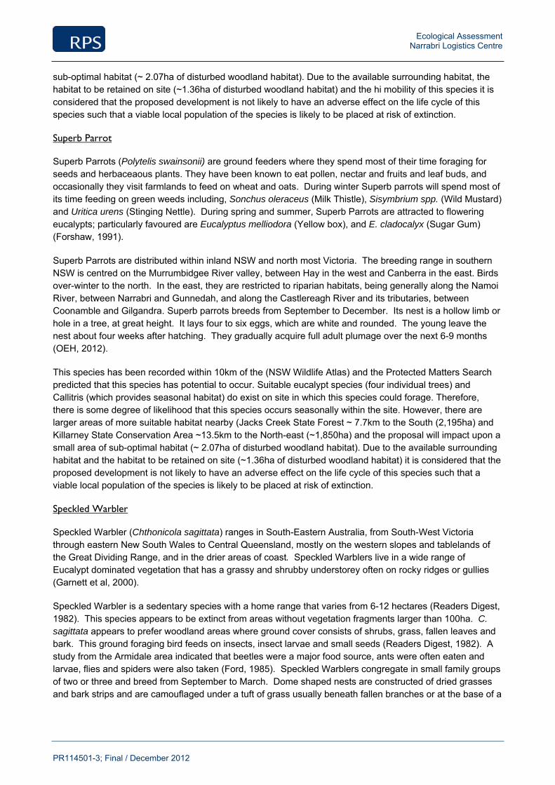
Ecological Assessment Narrabri Logistics Centre
PR114501-3; Final / December 2012
sub-optimal habitat (~ 2.07ha of disturbed woodland habitat). Due to the available surrounding habitat, the habitat to be retained on site (~1.36ha of disturbed woodland habitat) and the hi mobility of this species it is considered that the proposed development is not likely to have an adverse effect on the life cycle of this species such that a viable local population of the species is likely to be placed at risk of extinction.
Superb Parrot
Superb Parrots (Polytelis swainsonii) are ground feeders where they spend most of their time foraging for seeds and herbaceaous plants. They have been known to eat pollen, nectar and fruits and leaf buds, and occasionally they visit farmlands to feed on wheat and oats. During winter Superb parrots will spend most of its time feeding on green weeds including, Sonchus oleraceus (Milk Thistle), Sisymbrium spp. (Wild Mustard) and Uritica urens (Stinging Nettle). During spring and summer, Superb Parrots are attracted to flowering eucalypts; particularly favoured are Eucalyptus melliodora (Yellow box), and E. cladocalyx (Sugar Gum) (Forshaw, 1991).
Superb Parrots are distributed within inland NSW and north most Victoria. The breeding range in southern NSW is centred on the Murrumbidgee River valley, between Hay in the west and Canberra in the east. Birds over-winter to the north. In the east, they are restricted to riparian habitats, being generally along the Namoi River, between Narrabri and Gunnedah, and along the Castlereagh River and its tributaries, between Coonamble and Gilgandra. Superb parrots breeds from September to December. Its nest is a hollow limb or hole in a tree, at great height. It lays four to six eggs, which are white and rounded. The young leave the nest about four weeks after hatching. They gradually acquire full adult plumage over the next 6-9 months (OEH, 2012).
This species has been recorded within 10km of the (NSW Wildlife Atlas) and the Protected Matters Search predicted that this species has potential to occur. Suitable eucalypt species (four individual trees) and Callitris (which provides seasonal habitat) do exist on site in which this species could forage. Therefore, there is some degree of likelihood that this species occurs seasonally within the site. However, there are larger areas of more suitable habitat nearby (Jacks Creek State Forest ~ 7.7km to the South (2,195ha) and Killarney State Conservation Area ~13.5km to the North-east (~1,850ha) and the proposal will impact upon a small area of sub-optimal habitat (~ 2.07ha of disturbed woodland habitat). Due to the available surrounding habitat and the habitat to be retained on site (~1.36ha of disturbed woodland habitat) it is considered that the proposed development is not likely to have an adverse effect on the life cycle of this species such that a viable local population of the species is likely to be placed at risk of extinction.
Speckled Warbler
Speckled Warbler (Chthonicola sagittata) ranges in South-Eastern Australia, from South-West Victoria through eastern New South Wales to Central Queensland, mostly on the western slopes and tablelands of the Great Dividing Range, and in the drier areas of coast. Speckled Warblers live in a wide range of Eucalypt dominated vegetation that has a grassy and shrubby understorey often on rocky ridges or gullies (Garnett et al, 2000).
Speckled Warbler is a sedentary species with a home range that varies from 6-12 hectares (Readers Digest, 1982). This species appears to be extinct from areas without vegetation fragments larger than 100ha. C. sagittata appears to prefer woodland areas where ground cover consists of shrubs, grass, fallen leaves and bark. This ground foraging bird feeds on insects, insect larvae and small seeds (Readers Digest, 1982). A study from the Armidale area indicated that beetles were a major food source, ants were often eaten and larvae, flies and spiders were also taken (Ford, 1985). Speckled Warblers congregate in small family groups of two or three and breed from September to March. Dome shaped nests are constructed of dried grasses and bark strips and are camouflaged under a tuft of grass usually beneath fallen branches or at the base of a
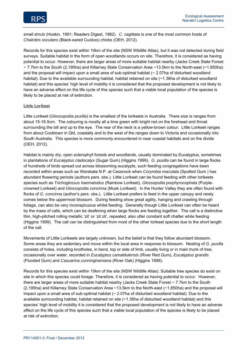
Ecological Assessment Narrabri Logistics Centre
PR114501-3; Final / December 2012
small shrub (Hoskin, 1991; Readers Digest, 1982). C. sagittata is one of the most common hosts of Chalcites osculans (Black-eared Cuckoo) chicks (OEH, 2012).
Records for this species exist within 10km of the site (NSW Wildlife Atlas), but it was not detected during field surveys. Suitable habitat in the form of open woodlands occurs on site. Therefore, it is considered as having potential to occur. However, there are larger areas of more suitable habitat nearby (Jacks Creek State Forest ~ 7.7km to the South (2,195ha) and Killarney State Conservation Area ~13.5km to the North-east (~1,850ha) and the proposal will impact upon a small area of sub-optimal habitat (~ 2.07ha of disturbed woodland habitat). Due to the available surrounding habitat, habitat retained on site (~1.36ha of disturbed woodland habitat) and this species’ high level of mobility it is considered that the proposed development is not likely to have an adverse effect on the life cycle of this species such that a viable local population of the species is likely to be placed at risk of extinction.
Little Lorikeet
Little Lorikeet (Glossopsitta pusilla) is the smallest of the lorikeets in Australia. There size is ranges from about 15-16.5cm. The colouring is mostly all a lime green with bright red on the forehead and throat surrounding the bill and up to the eye. The rear of the neck is a yellow-brown colour. Little Lorikeet ranges from about Cooktown in Qld, coastally and to the west of the ranges down to Victoria and occasionally into South Australia. This species is more commonly encountered in near coastal habitats and on the divide (OEH, 2012).
Habitat is mainly dry, open sclerophyll forests and woodlands, usually dominated by Eucalyptus, sometimes in plantations of Eucalyptus cladocalyx (Sugar Gum) (Higgins 1999). G. pusilla can be found in large flocks of hundreds of birds spread out across blossoming eucalypts, such feeding congregations have been recorded within areas such as Werekata N.P. at Cessnock when Corymbia maculata (Spotted Gum ) has abundant flowering periods (authors pers. obs.). Little Lorikeet can be found feeding with other lorikeets species such as Trichoglossus haematodus (Rainbow Lorikeet), Glossopsitta porphyrocephala (Purple-crowned Lorikeet) and Glossopsitta concinna (Musk Lorikeet). In the Hunter Valley they are often found with flocks of G. concinna (author’s pers. obs.). Little Lorikeet prefers to feed in the upper canopy and rarely comes below the uppermost blossom. During feeding show great agility, hanging and crawling through foliage, can also be very inconspicuous whilst feeding. Generally though Little Lorikeet can often be heard by the mass of calls, which can be deafening when large flocks are feeding together. The call is a distinctive thin, high-pitched rolling metallic ‘zit’ or ‘zit zit’, repeated, also utter constant soft chatter while feeding (Higgins 1999). The call can be distinguished from most of the other lorikeet species due to the short length of the call.
Movements of Little Lorikeets are largely unknown, but the belief is that they follow abundant blossom. Some areas they are sedentary and move within the local area in response to blossom. Nesting of G. pusilla consists of holes, including knotholes, in bend, top or side of limb, usually living or in main trunk of tree, occasionally over water, recorded in Eucalyptus camaldulensis (River Red Gum), Eucalyptus grandis (Flooded Gum) and Casuarina cunninghamiana (River Oak) (Higgins 1999).
Records for this species exist within 10km of the site (NSW Wildlife Atlas). Suitable tree species do exist on site in which this species could forage. Therefore, it is considered as having potential to occur. However, there are larger areas of more suitable habitat nearby (Jacks Creek State Forest ~ 7.7km to the South (2,195ha) and Killarney State Conservation Area ~13.5km to the North-east (~1,850ha) and the proposal will impact upon a small area of sub-optimal habitat (~ 2.07ha of disturbed woodland habitat). Due to the available surrounding habitat, habitat retained on site (~1.36ha of disturbed woodland habitat) and this species’ high level of mobility it is considered that the proposed development is not likely to have an adverse effect on the life cycle of this species such that a viable local population of the species is likely to be placed at risk of extinction.
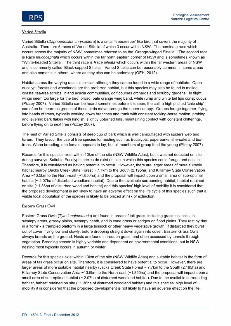
Ecological Assessment Narrabri Logistics Centre
PR114501-3; Final / December 2012
Varied Sittella
Varied Sittella (Daphoenositta chrysoptera) is a small ‘treecreeper’ like bird that covers the majority of Australia. There are 5 races of Varied Sittella of which 3 occur within NSW. The nominate race which occurs across the majority of NSW, sometimes referred to as the ‘Orange-winged Sittella’. The second race is Race leucocephala which occurs within the far north eastern corner of NSW and is sometimes known as ‘‘White-headed Sittella’. The third race is Race pileata which occurs within the far western areas of NSW and is commonly called ‘Black-capped Sittella’. Varied Sittella can be reasonably common in some areas and also nomadic in others, where as they also can be sedentary (OEH, 2012).
Habitat across the varying races is similar, although they can be found in a wide range of habitats. Open eucalypt forests and woodlands are the preferred habitat, but this species may also be found in mallee, coastal tea-tree scrubs, inland acacia communities, golf courses orchards and scrubby gardens. In flight, wings seem too large for the bird: broad, pale orange wing band, white rump and white tail tips conspicuous (Pizzey 2007). Varied Sittella can be heard sometimes before it is seen, the call, a high pitched ‘chip chip’ can often be heard as groups of these birds move through the upper canopy. Groups forage together, flying into heads of trees, typically working down branches and trunk with constant rocking-horse motion, probing and levering bark flakes with longish, slightly upturned bills, maintaining contact with constant chitterings, before flying on to next tree (Pizzey 2007).
The nest of Varied Sittella consists of deep cup of bark which is well camouflaged with spiders web and lichen. They favour the use of tree species for nesting such as Eucalypts, paperbarks, she-oaks and tea-trees. When breeding, one female appears to lay, but all members of group feed the young (Pizzey 2007).
Records for this species exist within 10km of the site (NSW Wildlife Atlas), but it was not detected on site during surveys. Suitable Eucalypt species do exist on site in which this species could forage and nest in. Therefore, it is considered as having potential to occur. However, there are larger areas of more suitable habitat nearby (Jacks Creek State Forest ~ 7.7km to the South (2,195ha) and Killarney State Conservation Area ~13.5km to the North-east (~1,850ha) and the proposal will impact upon a small area of sub-optimal habitat (~ 2.07ha of disturbed woodland habitat). Due to the available surrounding habitat, habitat retained on site (~1.36ha of disturbed woodland habitat) and this species’ high level of mobility it is considered that the proposed development is not likely to have an adverse effect on the life cycle of this species such that a viable local population of the species is likely to be placed at risk of extinction.
Eastern Grass Owl
Eastern Grass Owls (Tyto longimembris) are found in areas of tall grass, including grass tussocks, in swampy areas, grassy plains, swampy heath, and in cane grass or sedges on flood plains. They rest by day in a ‘form’ - a trampled platform in a large tussock or other heavy vegetative growth. If disturbed they burst out of cover, flying low and slowly, before dropping straight down again into cover. Eastern Grass Owls always breeds on the ground. Nests are found in trodden grass, and often accessed by tunnels through vegetation. Breeding season is highly variable and dependent on environmental conditions, but in NSW nesting most typically occurs in autumn or winter.
Records for this species exist within 10km of the site (NSW Wildlife Atlas) and suitable habitat in the form of areas of tall grass occur on site. Therefore, it is considered to have potential to occur. However, there are larger areas of more suitable habitat nearby (Jacks Creek State Forest ~ 7.7km to the South (2,195ha) and Killarney State Conservation Area ~13.5km to the North-east (~1,850ha) and the proposal will impact upon a small area of sub-optimal habitat (~ 2.07ha of disturbed woodland habitat). Due to the available surrounding habitat, habitat retained on site (~1.36ha of disturbed woodland habitat) and this species’ high level of mobility it is considered that the proposed development is not likely to have an adverse effect on the life
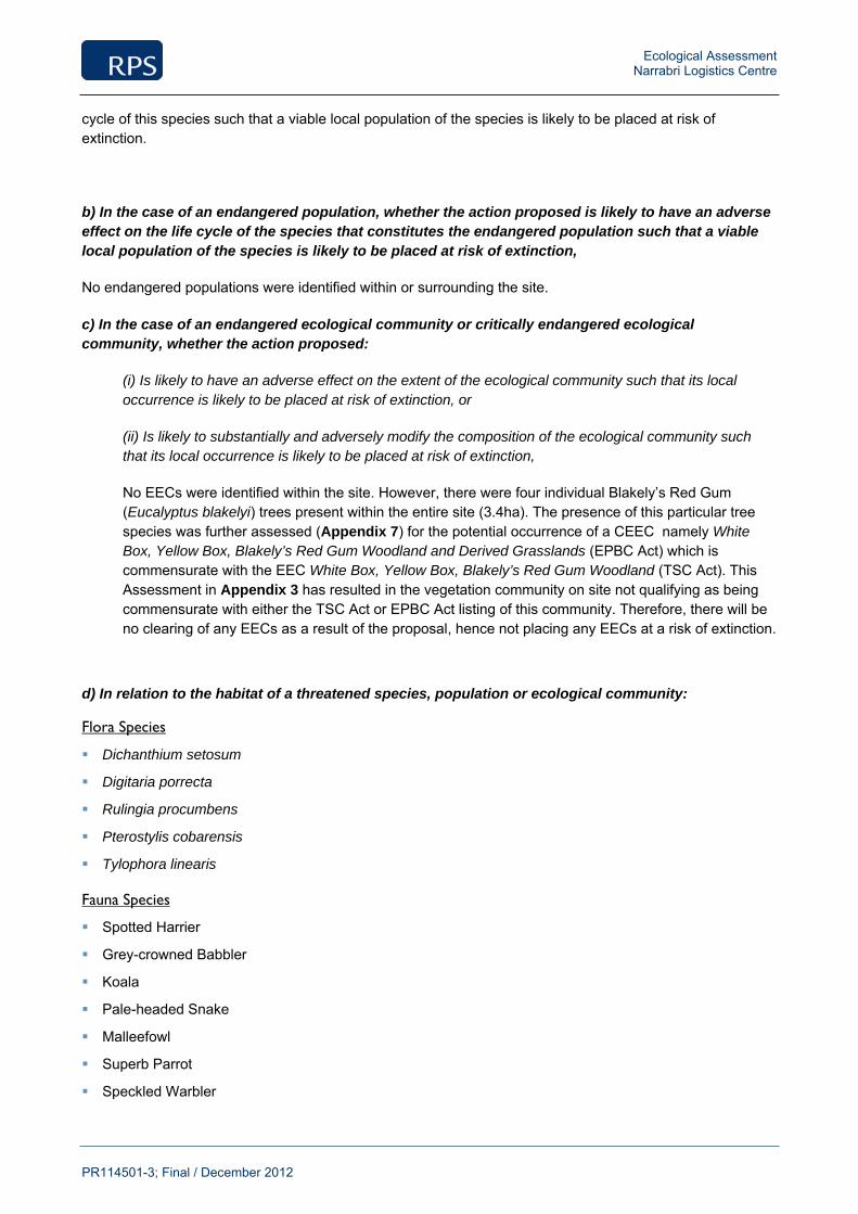
Ecological Assessment Narrabri Logistics Centre
PR114501-3; Final / December 2012
cycle of this species such that a viable local population of the species is likely to be placed at risk of extinction.
b) In the case of an endangered population, whether the action proposed is likely to have an adverse effect on the life cycle of the species that constitutes the endangered population such that a viable local population of the species is likely to be placed at risk of extinction,
No endangered populations were identified within or surrounding the site.
c) In the case of an endangered ecological community or critically endangered ecological community, whether the action proposed:
(i) Is likely to have an adverse effect on the extent of the ecological community such that its local occurrence is likely to be placed at risk of extinction, or
(ii) Is likely to substantially and adversely modify the composition of the ecological community such that its local occurrence is likely to be placed at risk of extinction,
No EECs were identified within the site. However, there were four individual Blakely’s Red Gum (Eucalyptus blakelyi) trees present within the entire site (3.4ha). The presence of this particular tree species was further assessed (Appendix 7) for the potential occurrence of a CEEC namely White Box, Yellow Box, Blakely’s Red Gum Woodland and Derived Grasslands (EPBC Act) which is commensurate with the EEC White Box, Yellow Box, Blakely’s Red Gum Woodland (TSC Act). This Assessment in Appendix 3 has resulted in the vegetation community on site not qualifying as being commensurate with either the TSC Act or EPBC Act listing of this community. Therefore, there will be no clearing of any EECs as a result of the proposal, hence not placing any EECs at a risk of extinction.
d) In relation to the habitat of a threatened species, population or ecological community:
Flora Species
Dichanthium setosum
Digitaria porrecta
Rulingia procumbens
Pterostylis cobarensis
Tylophora linearis
Fauna Species
Spotted Harrier
Grey-crowned Babbler
Koala
Pale-headed Snake
Malleefowl
Superb Parrot
Speckled Warbler
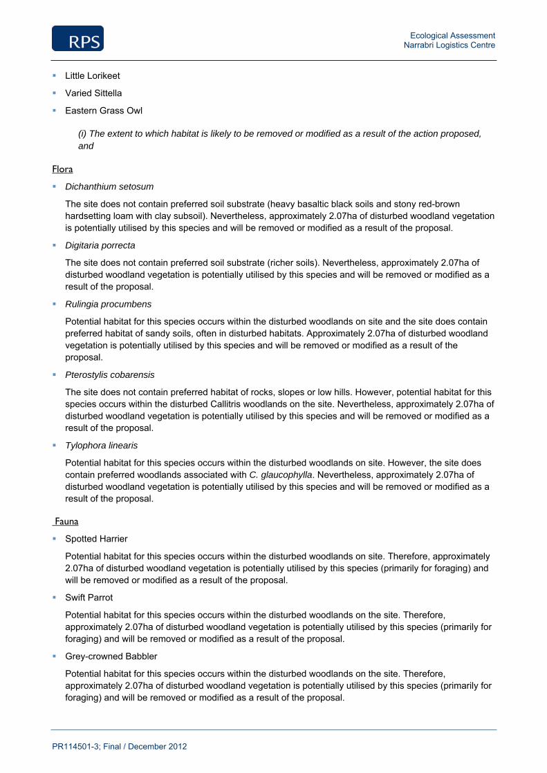
Ecological Assessment Narrabri Logistics Centre
PR114501-3; Final / December 2012
Little Lorikeet
Varied Sittella
Eastern Grass Owl
(i) The extent to which habitat is likely to be removed or modified as a result of the action proposed, and
Flora
Dichanthium setosum
The site does not contain preferred soil substrate (heavy basaltic black soils and stony red-brown hardsetting loam with clay subsoil). Nevertheless, approximately 2.07ha of disturbed woodland vegetation is potentially utilised by this species and will be removed or modified as a result of the proposal.
Digitaria porrecta
The site does not contain preferred soil substrate (richer soils). Nevertheless, approximately 2.07ha of disturbed woodland vegetation is potentially utilised by this species and will be removed or modified as a result of the proposal.
Rulingia procumbens
Potential habitat for this species occurs within the disturbed woodlands on site and the site does contain preferred habitat of sandy soils, often in disturbed habitats. Approximately 2.07ha of disturbed woodland vegetation is potentially utilised by this species and will be removed or modified as a result of the proposal.
Pterostylis cobarensis
The site does not contain preferred habitat of rocks, slopes or low hills. However, potential habitat for this species occurs within the disturbed Callitris woodlands on the site. Nevertheless, approximately 2.07ha of disturbed woodland vegetation is potentially utilised by this species and will be removed or modified as a result of the proposal.
Tylophora linearis
Potential habitat for this species occurs within the disturbed woodlands on site. However, the site does contain preferred woodlands associated with C. glaucophylla. Nevertheless, approximately 2.07ha of disturbed woodland vegetation is potentially utilised by this species and will be removed or modified as a result of the proposal.
Fauna
Spotted Harrier
Potential habitat for this species occurs within the disturbed woodlands on site. Therefore, approximately 2.07ha of disturbed woodland vegetation is potentially utilised by this species (primarily for foraging) and will be removed or modified as a result of the proposal.
Swift Parrot
Potential habitat for this species occurs within the disturbed woodlands on the site. Therefore, approximately 2.07ha of disturbed woodland vegetation is potentially utilised by this species (primarily for foraging) and will be removed or modified as a result of the proposal.
Grey-crowned Babbler
Potential habitat for this species occurs within the disturbed woodlands on the site. Therefore, approximately 2.07ha of disturbed woodland vegetation is potentially utilised by this species (primarily for foraging) and will be removed or modified as a result of the proposal.
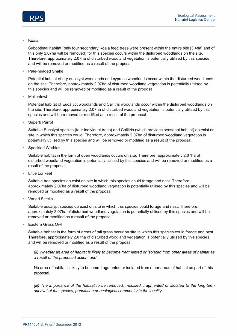
Ecological Assessment Narrabri Logistics Centre
PR114501-3; Final / December 2012
Koala
Suboptimal habitat (only four secondary Koala feed trees were present within the entire site [3.4ha] and of this only 2.07ha will be removed) for this species occurs within the disturbed woodlands on the site. Therefore, approximately 2.07ha of disturbed woodland vegetation is potentially utilised by this species and will be removed or modified as a result of the proposal.
Pale-headed Snake
Potential habitat of dry eucalypt woodlands and cypress woodlands occur within the disturbed woodlands on the site. Therefore, approximately 2.07ha of disturbed woodland vegetation is potentially utilised by this species and will be removed or modified as a result of the proposal.
Malleefowl
Potential habitat of Eucalypt woodlands and Callitris woodlands occur within the disturbed woodlands on the site. Therefore, approximately 2.07ha of disturbed woodland vegetation is potentially utilised by this species and will be removed or modified as a result of the proposal.
Superb Parrot
Suitable Eucalypt species (four individual trees) and Callitris (which provides seasonal habitat) do exist on site in which this species could. Therefore, approximately 2.07ha of disturbed woodland vegetation is potentially utilised by this species and will be removed or modified as a result of the proposal.
Speckled Warbler
Suitable habitat in the form of open woodlands occurs on site. Therefore, approximately 2.07ha of disturbed woodland vegetation is potentially utilised by this species and will be removed or modified as a result of the proposal.
Little Lorikeet
Suitable tree species do exist on site in which this species could forage and nest. Therefore, approximately 2.07ha of disturbed woodland vegetation is potentially utilised by this species and will be removed or modified as a result of the proposal.
Varied Sittella
Suitable eucalypt species do exist on site in which this species could forage and nest. Therefore, approximately 2.07ha of disturbed woodland vegetation is potentially utilised by this species and will be removed or modified as a result of the proposal.
Eastern Grass Owl
Suitable habitat in the form of areas of tall grass occur on site in which this species could forage and nest. Therefore, approximately 2.07ha of disturbed woodland vegetation is potentially utilised by this species and will be removed or modified as a result of the proposal.
(ii) Whether an area of habitat is likely to become fragmented or isolated from other areas of habitat as a result of the proposed action, and
No area of habitat is likely to become fragmented or isolated from other areas of habitat as part of this proposal.
(iii) The importance of the habitat to be removed, modified, fragmented or isolated to the long-term survival of the species, population or ecological community in the locality.
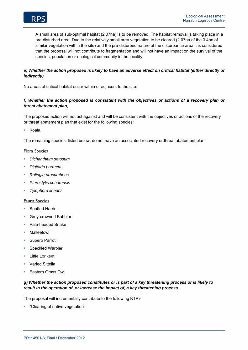
Ecological Assessment Narrabri Logistics Centre
PR114501-3; Final / December 2012
A small area of sub-optimal habitat (2.07ha) is to be removed. The habitat removal is taking place in a pre-disturbed area. Due to the relatively small area vegetation to be cleared (2.07ha of the 3.4ha of similar vegetation within the site) and the pre-disturbed nature of the disturbance area it is considered that the proposal will not contribute to fragmentation and will not have an impact on the survival of the species, population or ecological community in the locality.
e) Whether the action proposed is likely to have an adverse effect on critical habitat (either directly or indirectly),
No areas of critical habitat occur within or adjacent to the site.
f) Whether the action proposed is consistent with the objectives or actions of a recovery plan or threat abatement plan,
The proposed action will not act against and will be consistent with the objectives or actions of the recovery or threat abatement plan that exist for the following species:
Koala.
The remaining species, listed below, do not have an associated recovery or threat abatement plan.
Flora Species
Dichanthium setosum
Digitaria porrecta
Rulingia procumbens
Pterostylis cobarensis
Tylophora linearis
Fauna Species
Spotted Harrier
Grey-crowned Babbler
Pale-headed Snake
Malleefowl
Superb Parrot
Speckled Warbler
Little Lorikeet
Varied Sittella
Eastern Grass Owl
g) Whether the action proposed constitutes or is part of a key threatening process or is likely to result in the operation of, or increase the impact of, a key threatening process.
The proposal will incrementally contribute to the following KTP’s:
“Clearing of native vegetation”
Ecological Assessment Narrabri Logistics Centre
PR114501-3; Final / December 2012
A small area of sub-optimal habitat (2.07ha) is to be removed. The habitat removal is taking place in a pre-disturbed area. Given that there is a relatively small area of vegetation to be cleared (2.07ha of the 3.4ha of similar vegetation within the site) and the pre-disturbed nature of the disturbance area it is considered that the proposal it is not expected to significantly increase the impact on native flora and fauna. Therefore, it is considered that this KTP will not have a significant impact to the overall extent of similar adjoining native vegetation within the locality.
“Anthropogenic Caused Climate Change”
The proposal is likely to contribute to the Key Threatening Process “Anthropogenic Caused Climate Change” as a result of clearing a small amount of native vegetation. The extent to which the proposal could contribute to this process is considered unlikely to be significant. Apart from the direct impacts to vegetation, which are considered likely to result in a negligible increase to Climate Change impacts,
“Infection of native plants by Phytophthora cinnamomi”
The proposed development has the potential to result in the importation of this fungus. Cleaning protocols for vehicles and machinery should be implemented for the low-level above-ground activities. It is considered that with the correct hygiene protocols in place, the project is unlikely to contribute to this process.
“Invasion of native plant communities by exotic perennial grasses” The proposed development is considered unlikely to significantly contribute to this process due to the comparatively low level of surface disturbance that is proposed.
“Removal of dead wood and dead trees”
The proposed development will require the removal of ground debris in above-ground areas of disturbance. Reptiles, frogs and ground foraging birds may be affected by the removal of this Habitat. However, these form a minor component of the overall works and the vast majority of this habitat will be retained in-situ. It is not expected that the proposal will significantly contribute to this process.
“Introduction and establishment of exotic rust fungus of the order Puccinales pathogenic on plants of the family Myrtaceae”
The proposed development has the potential to result in the importation of the Myrtle Rust fungus, an species recently discovered in Australia that can have lethal effects on plants from the family Myrtaceae. Cleaning protocols for vehicles and machinery should be implemented for the low-level above-ground activities. It is considered that with the correct hygiene protocols in place, the project is unlikely to contribute to this process.
Ecological Assessment Narrabri Logistics Centre
PR114501-3; Final / December 2012
Appendix 7
White Box, Yellow Box, Blakely’s Red Gum and Derived Grasslands TEC considerations.

Ecological Assessment Narrabri Logistics Centre
PR114501-3; Final / December 2012
TSC Act 1995 Considerations
Under the TSC Act, White Box Yellow Box Blakely's Red Gum Woodland EEC can exist in a number of states. Intact stands that contain diverse upper and mid-storeys and ground layers are rare. Modified sites include the following:
Areas where the main tree species are present ranging from an open woodland formation to a forest structure, and the ground layer is predominantly composed of exotic species; and
Sites where the trees have been removed and only the grassy ground layer and some herbs remain.
Identification guidelines have been provided for this community (NPWS 2002). The area of vegetation, which the site is located within, has been assessed against these guidelines in the table below.
TSC Act Box Gum Woodland Listing Criteria
Box Gum Woodland NPWS Comment Answer
1. The site is in the NSW North Coast, New England Tableland, Nandewar, Brigalow Belt South, Sydney Basin, South Eastern Highlands or NSW South Western Slopes Bioregions – proceed to 2.
1. The site is located within the Brigalow Belt South Bioregion.
1* The site is outside the above bioregions Not Box Gum Woodland
2. There are no native species in the understorey, and the site is unlikely to respond to assisted natural regeneration
Not Box Gum Woodland
2* The site is otherwise – proceed to 3 Native species present in the understorey
3. The site has trees – proceed to 4. Yes
3* The site is treeless, but is likely to have supported White Box, Yellow Box or Blakely’s Red Gum prior to clearing – proceed to 5
4. White Box, Yellow Box or Blakely’s Red Gum, or a combination of these species, are or were characteristic tree species.
Blakelyi’s Red Gums are present. However, there are only four individual trees within the entire site (3.4ha) and they are not considered to be characteristic of this community.
4* White Box, Yellow Box or Blakely’s Red Gum have never been present
Not Box Gum Woodland
5. The site is predominantly grassy Is Box Gum Woodland Yes
5* The understorey of the site is dominated by shrubs excluding pioneer species
Not Box Gum Woodland No
In reference to the NSW NPWS Identification Guidelines for White Box Yellow Box Blakely’s Red Gum Woodland EEC, the results of the field survey determined that the area of vegetation, does not fit the NSW Scientific Committee Final Determination of this EEC because the canopy is dominated by Rough-barked Apple (Angophora floribunda) and White Cypress Pine (Callitris glaucophylla) and the four Blakely’s Red Gums (Eucalyptus Blakelyi) are not considered to be characteristic tree species.
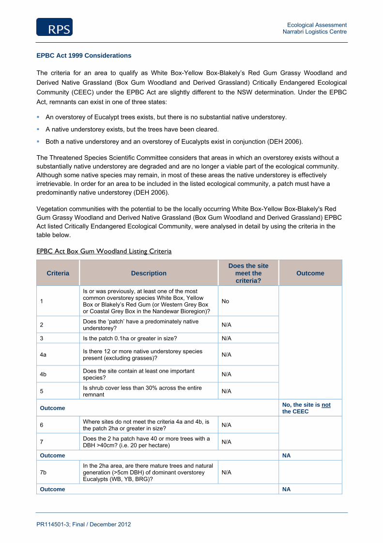
Ecological Assessment Narrabri Logistics Centre
PR114501-3; Final / December 2012
EPBC Act 1999 Considerations
The criteria for an area to qualify as White Box-Yellow Box-Blakely’s Red Gum Grassy Woodland and Derived Native Grassland (Box Gum Woodland and Derived Grassland) Critically Endangered Ecological Community (CEEC) under the EPBC Act are slightly different to the NSW determination. Under the EPBC Act, remnants can exist in one of three states:
An overstorey of Eucalypt trees exists, but there is no substantial native understorey.
A native understorey exists, but the trees have been cleared.
Both a native understorey and an overstorey of Eucalypts exist in conjunction (DEH 2006).
The Threatened Species Scientific Committee considers that areas in which an overstorey exists without a substantially native understorey are degraded and are no longer a viable part of the ecological community. Although some native species may remain, in most of these areas the native understorey is effectively irretrievable. In order for an area to be included in the listed ecological community, a patch must have a predominantly native understorey (DEH 2006).
Vegetation communities with the potential to be the locally occurring White Box-Yellow Box-Blakely's Red Gum Grassy Woodland and Derived Native Grassland (Box Gum Woodland and Derived Grassland) EPBC Act listed Critically Endangered Ecological Community, were analysed in detail by using the criteria in the table below.
EPBC Act Box Gum Woodland Listing Criteria
Criteria Description Does the site
meet the criteria?
Outcome
1
Is or was previously, at least one of the most common overstorey species White Box, Yellow Box or Blakely’s Red Gum (or Western Grey Box or Coastal Grey Box in the Nandewar Bioregion)?
No
2 Does the ‘patch’ have a predominately native understorey? N/A
3 Is the patch 0.1ha or greater in size? N/A
4a Is there 12 or more native understorey species present (excluding grasses)? N/A
4b Does the site contain at least one important species? N/A
5 Is shrub cover less than 30% across the entire remnant N/A
Outcome No, the site is not the CEEC
6 Where sites do not meet the criteria 4a and 4b, is the patch 2ha or greater in size? N/A
7 Does the 2 ha patch have 40 or more trees with a
DBH >40cm? (i.e. 20 per hectare) N/A
Outcome NA
7b In the 2ha area, are there mature trees and natural generation (>5cm DBH) of dominant overstorey Eucalypts (WB, YB, BRG)?
N/A
Outcome NA
Ecological Assessment Narrabri Logistics Centre
PR114501-3; Final / December 2012
In consideration of the above criteria, the Box Gum Woodland identified in the site does not fit the EPBC Act criteria for White Box-Yellow Box-Blakely's Red Gum Grassy Woodland and Derived Native Grassland. This is because the canopy is dominated by Rough-barked Apple (Angophora floribunda) and White Cypress Pine (Callitris glaucophylla (Criteria 1)).
Expansion of Santos Operations Centre, 300 Yarrie Lake Road, Narrabri Statement of Environmental Effects
PR114501; Rev B; February 2013
Appendix 4
Cultural Heritage Due Diligence Assessment
rpsgroup.com.au
Aboriginal & European Cultural Heritage Due
Diligence Report
Santos Logistics Centre
Yarrie Lake Road, Narrabri NSW
Prepared by:
RPS AUSTRALIA EAST PTY LTD
Level 12
92 Pitt Street
Sydney NSW 2000
T: +61 2 8270 8300
F: +61 2 8270 8399
W: rpsgroup.com.au
Client Manager: Sarah Ward
Report Number: PR114501-2
Version / Date: Rev 0, 13 December 2012
Prepared for:
SANTOS LIMITED
Level16
40 Creek Street
Brisbane Qld 4000
T: +61 7 3838 5702
M: +61 438 720 766
W: santos.com
Aboriginal & European Cultural Heritage Due Diligence Report Narrabri Logistics Centre, Yarrie Lake Road, Narrabri NSW
PR114501-2; Rev 0, 13 December 2012 Page ii
RPS Document Control Sheet
Originating Office: RPS Sydney CBD
Address: Level 12 92 Pitt Street
Sydney NSW 2000
Telephone: + 61 2 9870 8300 Facsimile: + 61 2 9870 8309 Email: [email protected]
Web rpsgroup.com.au ACN: 44 140 292 762
Job Number: PR114501-2
Job Name: Narrabri Logistics Centre Client Manager: Sarah Ward
Document Title: Aboriginal and European Cultural Heritage Due Diligence Report.
Author: Sarah Ward
Client: Santos Limited Client Contact: Todd Dunn
Synopsis: Results of an Aboriginal and European Cultural Heritage
Due Diligence Assessment
REVISION / CHECKING HISTORY
Revision No. Author Reviewer
1. Sarah Ward Darrell Rigby
2.
APPROVAL FOR ISSUE
Name Signature Date
Sarah Ward
15/10/2012

Aboriginal & European Cultural Heritage Due Diligence Report Narrabri Logistics Centre, Yarrie Lake Road, Narrabri NSW
PR114501-2; Rev 0, 13 December 2012 Page iii
IMPORTANT NOTE
Apart from fair dealing for the purposes of private study, research, criticism, or review as permitted under the Copyright
Act, no part of this report, its attachments or appendices may be reproduced by any process without the written consent
of RPS Australia East Pty Ltd. All enquiries should be directed to RPS Australia East Pty Ltd.
We have prepared this report for the sole purposes of Santos Limited (“Client”) for the specific purpose of only for
which it is supplied (“Purpose”). This report is strictly limited to the purpose and the facts and matters stated in it and
does not apply directly or indirectly and will not be used for any other application, purpose, use or matter.
In preparing this report we have made certain assumptions. We have assumed that all information and documents
provided to us by the Client or as a result of a specific request or enquiry were complete, accurate and up-to-date. Where
we have obtained information from a government register or database, we have assumed that the information is
accurate. Where an assumption has been made, we have not made any independent investigations with respect to the
matters the subject of that assumption. We are not aware of any reason why any of the assumptions are incorrect.
This report is presented without the assumption of a duty of care to any other person (other than the Client) (“Third
Party”). The report may not contain sufficient information for the purposes of a Third Party or for other uses. Without the
prior written consent of RPS Australia East Pty Ltd:
(a) this report may not be relied on by a Third Party; and
(b) RPS Australia East Pty Ltd will not be liable to a Third Party for any loss, damage, liability or claim arising out of
or incidental to a Third Party publishing, using or relying on the facts, content, opinions or subject matter
contained in this report.
If a Third Party uses or relies on the facts, content, opinions or subject matter contained in this report with or without the
consent of RPS Australia East Pty Ltd, RPS Australia East Pty Ltd disclaims all risk and the Third Party assumes all risk
and releases and indemnifies and agrees to keep indemnified RPS Australia East Pty Ltd from any loss, damage, claim
or liability arising directly or indirectly from the use of or reliance on this report.
In this note, a reference to loss and damage includes past and prospective economic loss, loss of profits, damage to
property, injury to any person (including death) costs and expenses incurred in taking measures to prevent, mitigate or
rectify any harm, loss of opportunity, legal costs, compensation, interest and any other direct, indirect, consequential or
financial or other loss.
Aboriginal & European Cultural Heritage Due Diligence Report Narrabri Logistics Centre, Yarrie Lake Road, Narrabri NSW
PR114501-2; Rev 0, 13 December 2012 Page iv
Contents
EXECUTIVE SUMMARY .............................................................................................................................. 1
1.0 INTRODUCTION ................................................................................................................................ 3
1.1 The Project Area ...................................................................................................................... 3
1.2 The Proposed Activity............................................................................................................. 3
1.3 Authorship and Acknowledgements ...................................................................................... 3
2.0 LEGISLATIVE CONTEXT ................................................................................................................... 4
2.1 National Parks & Wildlife Act 1974 ......................................................................................... 4
2.2 National Parks and Wildlife Regulation 2009 ......................................................................... 5
2.3 Due Diligence and Codes of Practice ..................................................................................... 5
2.3.1 Due Diligence Code of Practice for the Protection of Aboriginal Objects in New South Wales (DECCW 2010) ................................................................................................ 5
2.3.2 Aboriginal Community Consultation ............................................................................ 6
2.4 Heritage Act 1977 .................................................................................................................... 6
3.0 ENVIRONMENTAL AND HERITAGE CONTEXT ................................................................................ 8
3.1 Local Environment .................................................................................................................. 8
3.1.1 Geology and Soils ...................................................................................................... 8
3.1.2 Topography and Hydrology ........................................................................................ 8
3.1.3 Climate ....................................................................................................................... 8
3.1.4 Flora and Fauna ......................................................................................................... 9
3.1.5 Synthesis of Environmental Context ........................................................................... 9
4.0 HERITAGE CONTEXT...................................................................................................................... 10
4.1 Aboriginal Cultural Heritage ................................................................................................. 10
4.1.1 Aboriginal Heritage Information Management System (AHIMS) ................................ 10
4.1.1 Archaeology and Cultural Heritage Literature Review ............................................... 10
4.1.2 Synthesis of Aboriginal Heritage Context .................................................................. 11
4.2 European Heritage Context .................................................................................................. 12
4.2.1 World Heritage ......................................................................................................... 12
4.2.2 National Heritage...................................................................................................... 12
4.2.3 Commonwealth Heritage .......................................................................................... 12
4.2.4 State Heritage .......................................................................................................... 13
4.2.5 Local Heritage .......................................................................................................... 13
4.2.6 Synthesis of European Heritage Context .................................................................. 13
5.0 VISUAL INSPECTION AND FIELD RESULTS ................................................................................. 14
6.0 IMPACT ASSESSMENT ................................................................................................................... 15
7.0 RECOMMENDATIONS ..................................................................................................................... 16
8.0 REFERENCES ................................................................................................................................. 17
9.0 PLATES ........................................................................................................................................... 21

Aboriginal & European Cultural Heritage Due Diligence Report Narrabri Logistics Centre, Yarrie Lake Road, Narrabri NSW
PR114501-2; Rev 0, 13 December 2012 Page v
10.0 TERMS, DEFINITIONS, AND ABBREVIATIONS .............................................................................. 23
Tables
Table 1 Narrabri Logistics Centre (NLC) Project Area Corner Locations (MGA55) ....................................... 14
Figures
Figure 1 Narrabri Logistics Centre Project Area ............................................................................................. 7
Plates
Plate 1 Looking west across the Project Area from the north east corner of the existing Operations Centre compound. .................................................................................................................................................. 21
Plate 2 Brigalow Woodland observed to the north of the Project Area. ......................................................... 21
Plate 3 Looking 301o North West across the Project Area from the existing Operations Centre. ................... 22
Plate 4 Looking 186 o
south towards the existing Operations Centre from the north east corner of the Project Area............................................................................................................................................................ 22
Appendices
Appendix 1 Legislative Requirements
Appendix 2 AHIMS Search Results
Aboriginal & European Cultural Heritage Due Diligence Report Narrabri Logistics Centre, Yarrie Lake Road, Narrabri NSW
PR114501-2; Rev 0, 13 December 2012 Page 1
Executive Summary
RPS has been engaged by Santos Limited to prepare an Aboriginal and European Cultural Heritage Due
Diligence Assessment for the proposed expansion of the existing Narrabri Logistics Centre at 300 Yarrie
Lake Road, Narrabri, New South Wales in the Narrabri Local Government Area (LGA).
This assessment has been undertaken in accordance with the Due Diligence Code of Practice for the
Protection of Aboriginal Objects (DECCW 2010) which requires reasonable and practicable steps be taken
to: identify whether or not Aboriginal objects are, or are likely to be, present in an area; determine whether or
not their activities are likely to harm Aboriginal objects (if present); and determine if an Aboriginal Heritage
Impact Assessment is required (DECCW 2010:2).
Investigations under the code have included the following:
a search of the Aboriginal Heritage Information Management System (AHIMS) database which identified
that there were no Aboriginal objects or Aboriginal places in the Project Area;
this report has considered specific sensitive landforms: within 200m of water; within dune systems; on
ridge tops and headlands; and immediately above or below cliff faces and/or rockshelters/cave. These
landforms were not identified in the Project Area;
desktop assessment included a review of previous archaeological and heritage studies in the vicinity of
the Project Area; and
a visual inspection of the Project Area was undertaken and no Aboriginal objects were identified.
RECOMMENDATIONS
General mitigations have been provided for undertaking the proposed activity/works which set out
contingency procedures should unexpected Aboriginal objects, skeletal remains or suspected additional
European cultural heritage material be identified.
No Aboriginal objects or places have been identified within the Narrabri Logistics Centre Project Area. As
there are no identified Aboriginal objects in the Project Area, it is assessed that there is no identified
risk of harm to Aboriginal objects and an AHIP is not required for the proposed activity. The proposed
works can proceed within the Project Area as planned.
No European (historic) heritage sites have been identified within Narrabri Logistics Centre Project Area. As
such there is no identified impact to European (historic) heritage and therefore a Statement of
Heritage Impact is not required.
Recommendation A
All relevant Santos Limited staff and contractors should be made aware of their statutory obligations for
heritage under NSW National Parks and Wildlife Act 1974 and the NSW Heritage Act 1977, which may be
implemented as a heritage induction.
Recommendation B
This due diligence report must be kept by Santos Limited so that it can be presented, if needed, as a
defence from prosecution.

Aboriginal & European Cultural Heritage Due Diligence Report Narrabri Logistics Centre, Yarrie Lake Road, Narrabri NSW
PR114501-2; Rev 0, 13 December 2012 Page 2
Recommendation C
If Aboriginal object/s are identified in the Project Area during works, then all works in the immediate area
must cease and the area cordoned off. The Office of Environment and Heritage must be notified by ringing
the Enviroline 131 555 so that the site can be adequately assessed and managed.
Recommendation D
In the event that skeletal remains are uncovered, work must cease immediately in that area and the area
cordoned off. Santos Limited must contact the NSW Police with no further action taken until written advice is
provided by the Police. If the remains are determined to be of Aboriginal origin, the Office of Environment
and Heritage must be notified by ringing the Enviroline 131 555 and a management plan prior to works re-
commencing must developed in consultation with the relevant Aboriginal stakeholders.
Recommendation E
If, during the course of development works, suspected European cultural heritage material is uncovered,
work should cease in that area immediately. The Heritage Branch, Office of Environment and Heritage
(Enviroline 131 555) should be notified and works only recommence when an approved management
strategy developed.
Aboriginal & European Cultural Heritage Due Diligence Report Narrabri Logistics Centre, Yarrie Lake Road, Narrabri NSW
PR114501-2; Rev 0, 13 December 2012 Page 3
1.0 Introduction
RPS has been engaged by Santos Limited (the proponent) to prepare an Aboriginal and European Cultural
Heritage Due Diligence Report. The purpose of a due diligence report is to demonstrate that reasonable and
practicable measures were taken to prevent harm to an Aboriginal object or place and has been undertaken
in accordance with the Due Diligence Code of Practice for the Protection of Aboriginal Objects in New South
Wales (2010) (“Due Diligence Code”).
The assessment contained in this report goes beyond the requirements of the Due Diligence Code to
consider any potential impact on identified European (historic) heritage items within the Project Area.
This report has considered the relevant environmental and archaeological information, landforms,
disturbances and the nature of the proposed activity in addition to formulating appropriate recommendations.
1.1 The Project Area
This due diligence report has been prepared for the area subject to the proposed activity, herein referred to
as the “Project Area.” The Project Area is located at 300 Yarrie Lake Road, Narrabri, in the Narrabri Local
Government Area (LGA). The Project Area is approximately 2.5 kilometres from the town of Narrabri and
approximately 6.298 hectares in size (Figure 1).
1.2 The Proposed Activity
The proposed activity is the upgrade of the existing Santos Operations Centre (Plate 1) at 300 Yarrie Lake
Road to a larger logistics centre (the proposal). The proposal will include: warehouse and office space, a
storage building, laydown areas, a casing wash area; and other ancillary works and parking areas.
Ground disturbance works will include the excavation of soil, the construction of buildings, plant and
machinery and the potential impact of heavy machinery being used for excavation and construction
purposes. A due diligence assessment is therefore required under S1 and S2a of the Due Diligence Code
(DECCW 2010:11).
1.3 Authorship and Acknowledgements
This report was prepared by RPS Senior Archaeologist, Sarah Ward with contributions from RPS Senior
Spatial Analyst, Thomas Wilson and RPS Planning Manager, Belinda Lewis. Assistance with report
production was provided by Karyn Virgin, RPS Graduate Archaeologist and Audrey Churm, RPS Business
Support Manager.
The report was reviewed by RPS Technical Director Cultural Heritage, Darrell Rigby.
Fieldwork was undertaken by RPS Senior Archaeologist, Sarah Ward in conjunction with RPS Ecologist,
Arne Bishop.

Aboriginal & European Cultural Heritage Due Diligence Report Narrabri Logistics Centre, Yarrie Lake Road, Narrabri NSW
PR114501-2; Rev 0, 13 December 2012 Page 4
2.0 Legislative Context
The following overview of the legal framework is provided solely for information purposes for the client, it
should not be interpreted as legal advice. RPS will not be liable for any actions taken by any person, body or
group as a result of this general overview, and recommend that specific legal advice be obtained from a
qualified legal practitioner prior to any action being taken as a result of the summary below.
Although there are a number Acts protecting and managing cultural heritage in New South Wales (see
Appendix 1) the primary ones which apply to this report include:
National Parks & Wildlife Act 1974
National Parks & Wildlife Regulation 2009
Heritage Act 1977
In brief, the National Parks & Wildlife Act 1974 protects Aboriginal heritage (places and objects) within NSW;
the National Parks and Wildlife Regulation 2009 provides a framework for undertaking activities and
exercising due diligence; whilst the Heritage Act 1977 protects European (Historic) heritage.
2.1 National Parks & Wildlife Act 1974
The National Parks & Wildlife Act 1974 (NPW Act) protects Aboriginal heritage within NSW. Protection of
Aboriginal heritage is outlined in s86 of the Act, as follows:
“A person must not harm or desecrate an object that the person knows is an Aboriginal object” s86(1);
“A person must not harm an Aboriginal object” s86(2); and
“A person must not harm or desecrate an Aboriginal place” s86(4).
Penalties apply for harming an Aboriginal object or place. The penalty for knowingly harming an Aboriginal
object (s86[1]) and/or an Aboriginal place (s86[4]) is up to $550,000 for an individual and/or imprisonment for
2 years; and in the case of a corporation the penalty is up to $1.1 million. The penalty for a strict liability
offence (s86[2]) is up to $110,000 for an individual and $200,000 for a corporation.
Harm
Under the NPW Act, harm is defined as any act that: destroys defaces or damages the object; moves the
object from the land on which it has been situated; and/or causes or permits the object to be harmed.
However, it is a defence from prosecution if the proponent can demonstrate: 1) that harm was authorised
under an Aboriginal Heritage Impact Permit (AHIP) (and the permit was properly followed); or 2) that the
proponent exercised due diligence in respect to Aboriginal heritage. The ‘due diligence’ defence (s87(2)),
states that if a person or company has exercised due diligence to ascertain that no Aboriginal object was
likely to be harmed as a result of the activities proposed for the Project Area (subject area of the proposed
activity); then liability from prosecution under the NPW Act will be removed or mitigated if it later transpires
that an Aboriginal object was harmed.
Notification of Aboriginal Objects
Under section 89A of the NPW Act Aboriginal objects (and sites) must be reported to the Director-General
(now Chief Executive) of OEH within a reasonable time (unless it has previously been recorded and
submitted to AHIMS). Penalties of $11,000 for an individual and $22,000 for a corporation may apply for
each object not reported.
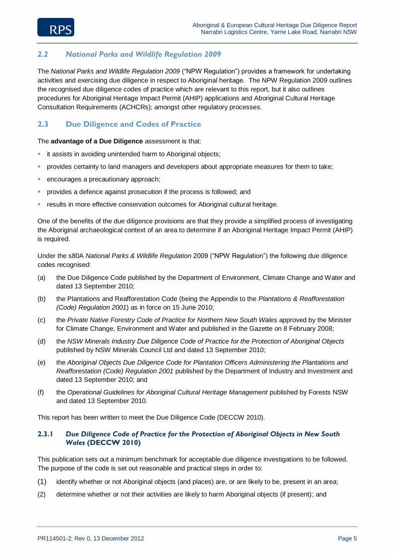
Aboriginal & European Cultural Heritage Due Diligence Report Narrabri Logistics Centre, Yarrie Lake Road, Narrabri NSW
PR114501-2; Rev 0, 13 December 2012 Page 5
2.2 National Parks and Wildlife Regulation 2009
The National Parks and Wildlife Regulation 2009 (“NPW Regulation”) provides a framework for undertaking
activities and exercising due diligence in respect to Aboriginal heritage. The NPW Regulation 2009 outlines
the recognised due diligence codes of practice which are relevant to this report, but it also outlines
procedures for Aboriginal Heritage Impact Permit (AHIP) applications and Aboriginal Cultural Heritage
Consultation Requirements (ACHCRs); amongst other regulatory processes.
2.3 Due Diligence and Codes of Practice
The advantage of a Due Diligence assessment is that:
it assists in avoiding unintended harm to Aboriginal objects;
provides certainty to land managers and developers about appropriate measures for them to take;
encourages a precautionary approach;
provides a defence against prosecution if the process is followed; and
results in more effective conservation outcomes for Aboriginal cultural heritage.
One of the benefits of the due diligence provisions are that they provide a simplified process of investigating
the Aboriginal archaeological context of an area to determine if an Aboriginal Heritage Impact Permit (AHIP)
is required.
Under the s80A National Parks & Wildlife Regulation 2009 (“NPW Regulation”) the following due diligence
codes recognised:
(a) the Due Diligence Code published by the Department of Environment, Climate Change and Water and
dated 13 September 2010;
(b) the Plantations and Reafforestation Code (being the Appendix to the Plantations & Reafforestation
(Code) Regulation 2001) as in force on 15 June 2010;
(c) the Private Native Forestry Code of Practice for Northern New South Wales approved by the Minister
for Climate Change, Environment and Water and published in the Gazette on 8 February 2008;
(d) the NSW Minerals Industry Due Diligence Code of Practice for the Protection of Aboriginal Objects
published by NSW Minerals Council Ltd and dated 13 September 2010;
(e) the Aboriginal Objects Due Diligence Code for Plantation Officers Administering the Plantations and
Reafforestation (Code) Regulation 2001 published by the Department of Industry and Investment and
dated 13 September 2010; and
(f) the Operational Guidelines for Aboriginal Cultural Heritage Management published by Forests NSW
and dated 13 September 2010.
This report has been written to meet the Due Diligence Code (DECCW 2010).
2.3.1 Due Diligence Code of Practice for the Protection of Aboriginal Objects in New South
Wales (DECCW 2010)
This publication sets out a minimum benchmark for acceptable due diligence investigations to be followed.
The purpose of the code is set out reasonable and practical steps in order to:
(1) identify whether or not Aboriginal objects (and places) are, or are likely to be, present in an area;
(2) determine whether or not their activities are likely to harm Aboriginal objects (if present); and
Aboriginal & European Cultural Heritage Due Diligence Report Narrabri Logistics Centre, Yarrie Lake Road, Narrabri NSW
PR114501-2; Rev 0, 13 December 2012 Page 6
(3) determine whether an AHIP application is required. (DECCW 2010:2).
Investigations under the code include the following:
a search of the Aboriginal Heritage Information Management System (AHIMS) database to identify if
there are previously recorded Aboriginal objects or places in the Project area;
identification of landscape features including land within 200 metres of water, dune systems, ridge tops,
headlands, land immediately above or below cliff faces and/or rockshelters/caves;
desktop assessment including a review of previous archaeological and heritage studies and any other
relevant material;
visual inspection of the Project Area to identify if there are Aboriginal objects present; and
assessment as to whether an AHIP is required.
This report has complied with the requirements of the code listed above. Other requirements under the code
are outlined below.
Aboriginal consultation is not required for an investigation under the Due Diligence Code (DECCW
2010:3). However, if the due diligence investigation shows that the activities proposed for the area are likely
to harm objects or likely objects within the landscape, then an Aboriginal Heritage Impact Permit will be
required with full consultation.
A record of the due diligence procedure followed must be kept to ensure it can be used as a defence from
prosecution (DECCW 2010:15).
Following a due diligence assessment (where an AHIP application was not required), such as this, an activity
must proceed with caution. If any Aboriginal objects are identified during the activity, then works should
cease in that area and OEH notified (DECCW 2010:13). The due diligence defence does not authorise
continuing harm.
2.3.2 Aboriginal Community Consultation
Aboriginal community consultation is not a formal requirement of the due diligence process (DECCW
2010:3); therefore the proponent is not obliged to undertake Aboriginal community consultation.
Aboriginal community consultation was not undertaken for this due diligence report.
2.4 Heritage Act 1977
This Act protects the natural and European cultural history of NSW with emphasis on non-Aboriginal ‘historic’
cultural heritage (such as place, building, works, relic, moveable object, precinct, historic shipwreck, or
archaeological site) of State or local significance, through protection provisions and the establishment of a
Heritage Council and a State Heritage Register. Additionally, Government agencies have special obligations
under the Heritage Act 1977 (NSW). Agencies are required to compile a register of heritage assets (known
as a Section 170 Heritage and Conservation Register) and look after their assets on behalf of the
community.
Although Aboriginal objects and places of significance are primarily protected by the NPW Act, if an
Aboriginal site, object or place is of State or local significance, it may be protected by a heritage order issued
by the Minister subject to advice by the Heritage Council. Penalties of up to $1.1 million are in place for
breeches of the Heritage Act and its Regulations.
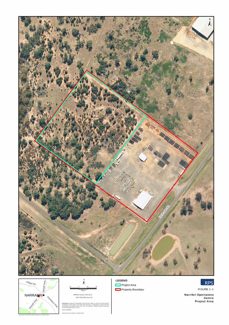
Yarri
e La
ke R
d
DATA SOURCES
APPROX SCALE 2,500 @ A4
Point features located in field by GPS.
Disclaimer: While all reasonable care has been taken to ensure the informationcontained on this map is up to date and accurate, no guarantee is given that theinformation portrayed is free from error or omission. Please verify the accuracyof all information prior to use.
GDA 1994 MGA Zone 56
FIGURE 1-1!NARRABRI
New
ell H
wy
New
ell H
wy
Kamilaroi Hwy
Pilliga Rd
LEGENDProject Area
Property Boundary
±20 0 20 40
Meters
Tracking ID: PR114502-2-001b Compiled: 15 October 2012
±
Narribri OpertaionsCentre
Project Area

Aboriginal & European Cultural Heritage Due Diligence Report Narrabri Logistics Centre, Yarrie Lake Road, Narrabri NSW
PR114501-2; Rev 0, 13 December 2012 Page 8
3.0 Environmental and Heritage Context
Aboriginal heritage due diligence requires that available knowledge and information is considered and forms
part of the desktop assessment required under S4 of the Due Diligence Code (DECCW 2010:12-13). The
purpose of reviewing the relevant environmental and heritage information is to assist in identifying whether
Aboriginal objects or places are present within the Project Area.
3.1 Local Environment
An understanding of environmental context is important for the predictive modelling of Aboriginal sites and
their interpretation. The local environment is understood to have provided natural resources for Aboriginal
people, such as stone (for manufacturing stone tools), food and medicines, wood and bark (for implements
such as shields, spears, canoes, bowls, shelters, amongst others), along with areas for camping and other
activities. The nature of Aboriginal occupation and resource procurement is related to the local environment
and it therefore needs to be considered as part of the cultural heritage assessment process. The Project
Area is in the Pilliga sub-region of the Brigalow Belt South Bioregion (NSW National Parks and Wildlife
Service 2003: 137).
3.1.1 Geology and Soils
The Project Area is predominantly located on the Jurassic Pilliga Sandstone landscape evidenced by
horizontal Jurassic quartz sandstone, conglomerate and claystone with limited shale, tertiary basalt caps and
the sediments derived from these rocks (Wallis 1971). The landscape is characterised by stepped sandstone
ridges with low cliff faces with a high proportion of rock outcrop and long gentle outwash slopes intersected
by sandy stream beds and prior stream channels, interspersed with patches of heavy clay.
The soils in the Project Area are typically shallow black earths and red loams on basalts. Extensive harsh-
texture contrast duplex soils appear with cracking clay sub-soils. These soils are typical of those derived
from the Pilliga Sandstone and are described as highly siliceous. They are characterised by the dense
growth of trees and shrubs and high species diversity (Norris 1996).
The geology and soils of the Project Area demonstrate that the landscape prior to European contact was
capable of supporting Aboriginal resources suitable for habitation.
3.1.2 Topography and Hydrology
The Project Area is located on relatively level (flat) land currently partly utilised for commercial purposes. At
its closest, the Namoi River is approximately 1.5 kilometres to the north-east of the Project Area, Narrabri
Lake is three (3) kilometres north/north-east of the Project Area, Bohena Creek is approximately 3.5
kilometres to the west and Narrabri Creek is approximately 4 kilometres north-east of the Project Area. All
would have provided a permanent source of water, as would Yarrie Lake, approximately 20 kilometres to the
south-west of the Project Area. The Project Area is on slightly elevated land of approximately 220 metres
Australian Height Datum (AHD) (Geological Survey of NSW 2009: Online).
The topography and hydrology of the Project Area demonstrate that the surrounding landscape would have
provided sufficient water resources and been fertile enough to sustain human habitation.
3.1.3 Climate
During the last glacial maximum (approximately 30,000-19,000 years ago), large ice sheets covered high
latitude Europe and North America and the Antarctic ice sheet was more extensive than today. Sea levels
Aboriginal & European Cultural Heritage Due Diligence Report Narrabri Logistics Centre, Yarrie Lake Road, Narrabri NSW
PR114501-2; Rev 0, 13 December 2012 Page 9
stood some 120-130 metres lower than today (Lambeck et al 2002:343) and the earth’s climate was distinctly
different from that of the present interglacial conditions. As the ice began to melt climatic conditions began to
alter (Lambeck et al 2002:343). This affected the movement and behaviour of past populations within their
environs. Sea levels started to rise, with a corresponding increase in rainfall and temperature. Short’s
(2000:19-21) research suggests the change in climatic conditions reached its peak about 6,000 years ago.
Up until 1,500 years ago, temperatures decreased slightly and then stabilised about 1,000 years ago
producing similar temperatures to that currently experienced. Consequently, the climate of the Project Area
for the past 1,000 years would probably have been much the same as present day, providing a year round
habitable environment.
New South Wales is described as being in the temperate zone, although the climate undergoes large
variations depending on proximity to the coast and mountains (OEH 2012a: Online; SEWPC 2011: 146).
The Project Area is located within the eastern sub-humid region of Australia (NSW NPWS 2000b: 3).
Mean annual rainfall at Rosewood Farm, Narrabri, is 693 millimetres. Rainfall is highest in the summer
months, with the highest mean rainfall in December (101.5 millimetres) (BOM 2012b: Online) and the lowest
during the autumn months, with April recording the lowest mean of 25.5 millimetres (BOM 2012b: Online).
Temperatures are at their highest in January, with a monthly mean maximum temperature of 33.8 degrees
Celsius. February records a monthly mean maximum temperature of 33.2 degrees Celsius. The coldest
month is July, with a monthly mean maximum temperature of 18.0 degrees Celsius. This is closely followed
by June with a monthly mean maximum temperature of 18.7 degrees Celsius (BOM 2012c: Online). An
annual mean maximum of 26.5 degrees Celsius is recorded at the closest station, Narrabri West Post Office
(BOM 2012c: Online).
3.1.4 Flora and Fauna
Keith (2006: 140-141) suggests that native vegetation in the vicinity of the Project Area is remnant Pilliga
Outwash Dry Schlerophyl Forest dominated by box, red gum and iron bark eucalypts and interspersed with a
prominent sub-canopy of smaller trees such as Acacia, Casuarina (Sheoak) and Callitris glaucophyllia (White
Cyprus Pine). Vegetation within the Project Area, however, was observed (Plate 1) to be Pilliga Box – White
Cypress Pine Grassy Open Woodland on Alluvial loams, with remnant Brigalow Woodland (Plate 2) in
places. Blakeley’s Red Gum and Ironbark Woodland (Plate 3; Plate 4) were also observed within the Project
Area. Other than kangaroo and several unidentified species of birds, no fauna was observed by the
archaeologist on site.
A full ecological assessment has been prepared by RPS Ecology (Bishop 2012) as a companion to this
report.
3.1.5 Synthesis of Environmental Context
A review of environmental data indicates that, despite the landscape being highly disturbed by commercial
and agricultural pursuits, prior to European occupation there would have been bountiful food, water and
other resources available for exploitation by Aboriginal people and in sufficient quantities to sustain a local
population.
This synthesis would suggest the presence of Aboriginal cultural heritage sites within the Narrabri Operations
Centre Project Area; however this does not appear to the case. The lack of Aboriginal sites and places in
the vicinity of the Project Area recorded in AHIMS (Section 4.1.1) is understood to be a result of European
occupation of the area, the high level of disturbance caused as a result of agricultural and commercial
activities and the limited previous archaeological/cultural heritage work undertaken in the Project Area.
Aboriginal & European Cultural Heritage Due Diligence Report Narrabri Logistics Centre, Yarrie Lake Road, Narrabri NSW
PR114501-2; Rev 0, 13 December 2012 Page 10
4.0 Heritage Context
Heritage consists of those objects, sites and places that will be inherited by future generations. Australia has
many rich and varied historic places and landscapes, both urban and rural. Identifying and understanding
their particular qualities, and what these add to our lives, is central to our engagement with our history and
culture.
NSW’s heritage is diverse and includes buildings, objects, monuments, Aboriginal places, gardens, bridges,
landscapes, archaeological sites, shipwrecks, relics, bridges, streets, industrial structures and conservation
precincts.
4.1 Aboriginal Cultural Heritage
Aboriginal and Torres Strait Islander heritage is an important part of Australian heritage. Evidence of the
occupation of Australia by Aboriginal and Torres Strait Islander peoples dates to approximately 40,000 to
60,000 years ago (Dorey 2012: Online).
Aboriginal cultural heritage objects, sites and places provide valuable information about one of the world’s
oldest living cultures. It has continuing significance, creating and maintaining continuous links with the
people and the land.
4.1.1 Aboriginal Heritage Information Management System (AHIMS)
A search was undertaken of the Aboriginal Heritage Information Management System (AHIMS) on 21 August
2012 in accordance with the Due Diligence Code (DECCW 2010:11). The searches were conducted over
the parcels of land described as Lot 241, DP 1120041 with a 200 metre and a one (1) kilometre buffer
(DECCW 2012a: Online; DECCW 2012b: Online).
The searches revealed that there are no previously recorded Aboriginal sites and no previously declared
Aboriginal places in, or within, one (1) kilometre of the Project Area.
4.1.1 Archaeology and Cultural Heritage Literature Review
A review of previous archaeological and heritage reports is required as part of the desktop assessment and
has been undertaken in accordance with the code (DECCW 2010:13). The most relevant publications are
outlined below.
Appleton, J. (2009), Narrabri Longwall Stage 2 Project: Aboriginal Heritage Assessment. Whitehaven Coal: Sydney.
This investigation was conducted pursuant to an extension to the Narrabri Coal Mine by Whitehaven Coal,
located approximately 28 kilometres south of Narrabri, adjacent to the Kamilaroi Highway. The investigation
entailed a desktop assessment and a survey over four (4) main areas comprising the impact zones.
The survey identified a total of 121 sites across the four (4) survey areas. The majority of sites were
identified in the longwall panels 8-26 (69), followed by the area comprising longwall 1-7. The longwall
locations were on a variety of landscapes, but mostly on the eastern slopes of the Pilliga Forest. This area is
fed by numerous ephemeral and permanent watercourses, including Pine Creek and Kurrajong Creek.
Overall, the sites comprised low density artefact scatters, with scatters of higher densities being associated
with confluences of water courses. A scarred tree and a hearth were also identified in the longwall 1-7 area.

Aboriginal & European Cultural Heritage Due Diligence Report Narrabri Logistics Centre, Yarrie Lake Road, Narrabri NSW
PR114501-2; Rev 0, 13 December 2012 Page 11
Trindall, E. (2007), Narrabri Coal Seam Gas Utilisation Project: Aboriginal Heritage Assessment, Santos Limited:
Sydney.
This investigation was conducted ahead of the proposed construction of a gas gathering system, gas flow
line and expansion of Wilga Park Power Station. The impact area of that project totalled approximately 36
hectares in the Pilliga East State Forest and open farmland in Narrabri Shire.
The investigation comprised a desktop assessment and a field survey to assess the impact of the proposed
operations on the Aboriginal cultural heritage resource. Previous disturbances were variable, with the
farmland being moderately disturbed, whilst the Pilliga Forest area had been subjected to varying levels of
forestry, fires, grazing and mining exploration.
The survey identified one (1) site, a scarred tree located between Dog Fence Road and Pilliga Forest Way.
The tree was a Pilliga Box, one (1) of less than 10 in the vicinity of the area surveyed. It was recommended
that this tree be avoided by the proposed works.
Silcox, R. & Bowdler, S. (1982). An Archaeological Survey of a Proposed 132 Kv Transmission Line Route from
Walgett to Narrabri Part 1. A Report to the National Parks and Wildlife Service of N.S.W. on behalf of the
Electricity Commission of N.S.W. unpublished.
This investigation covered the physical examination (visual inspection) of a proposed 132 kilovolt (kv)
transmission line route from Walgett to Narrabri. This report covers the first 87 kilometres of the 180
kilometre total route, which is proposed to contain an easement 45 metres wide. The second report,
containing the Narrabri sector of the route was unable to be accessed.
Eight (8) sites and seven (7) isolated finds were identified during the course of the survey with visibility
averaging 50%. The sites consisted of four scarred trees (two dead both ring barked (WN1 & WN2); two
alive, standing, not ring barked (WN3 & WN4)), two surface campsites and two scatters of baked clay ‘lumps’
(WN7 & WN8). The authors initially suggested that these were from hearths, however conceded later in the
report that they were likely the result of European clearing and burning of timber.
4.1.2 Synthesis of Aboriginal Heritage Context
A review of the AHIMS data and previous archaeological work in the vicinity of the Project Area suggests that
the Project Area may have been utilised by past Aboriginal communities. This is in part due to the ready
availability of food, water and other resources; the availability of water being a crucial factor in the frequency
of occupation, as rivers and creeks are markers of community identity, traditional meeting places and the
chosen location of settlements (NSW NPWS 2000s:36).
Trindall (2007: 5-11) observed the paucity of sites within the Pilliga Forest as being a direct consequence of
the lack of reliable water, whilst sites outside the Pilliga, such as the proposed Narrabri Logistics Centre,
which is closer to permanent water, contained a variety of site types. However, the potential for sites
remaining must be tempered with the previous land disturbances noted above.
The literature review suggests that artefact sites, such as artefact scatters, isolated finds and non-specified
artefact sites appear to be the most frequent site type encountered in the broader region. This is borne out
by the Appleton survey, which found the majority of sites being artefact sites, although the AHIMS data has
returned a nil result within one (1) kilometre of the Project Area. Appleton also observed the connection
between site density/complexity and availability of reliable water which would suggest previous occupation
within the Project Area; however, this cannot be confirmed.
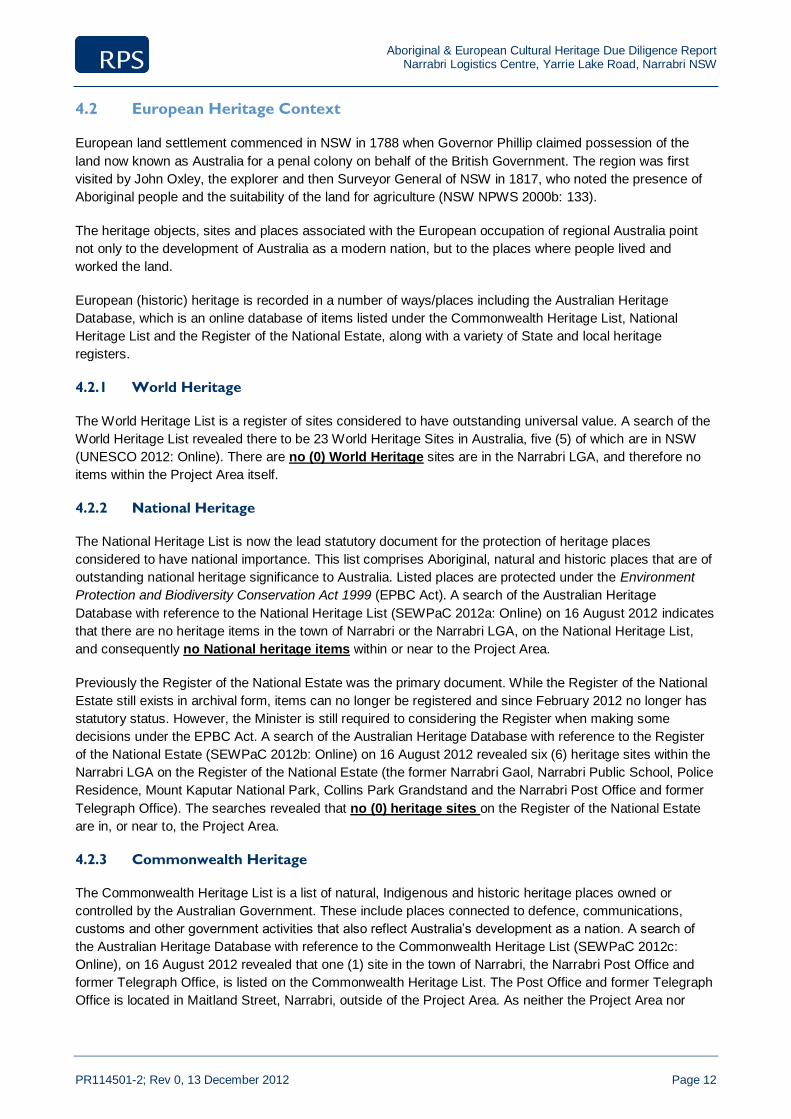
Aboriginal & European Cultural Heritage Due Diligence Report Narrabri Logistics Centre, Yarrie Lake Road, Narrabri NSW
PR114501-2; Rev 0, 13 December 2012 Page 12
4.2 European Heritage Context
European land settlement commenced in NSW in 1788 when Governor Phillip claimed possession of the
land now known as Australia for a penal colony on behalf of the British Government. The region was first
visited by John Oxley, the explorer and then Surveyor General of NSW in 1817, who noted the presence of
Aboriginal people and the suitability of the land for agriculture (NSW NPWS 2000b: 133).
The heritage objects, sites and places associated with the European occupation of regional Australia point
not only to the development of Australia as a modern nation, but to the places where people lived and
worked the land.
European (historic) heritage is recorded in a number of ways/places including the Australian Heritage
Database, which is an online database of items listed under the Commonwealth Heritage List, National
Heritage List and the Register of the National Estate, along with a variety of State and local heritage
registers.
4.2.1 World Heritage
The World Heritage List is a register of sites considered to have outstanding universal value. A search of the
World Heritage List revealed there to be 23 World Heritage Sites in Australia, five (5) of which are in NSW
(UNESCO 2012: Online). There are no (0) World Heritage sites are in the Narrabri LGA, and therefore no
items within the Project Area itself.
4.2.2 National Heritage
The National Heritage List is now the lead statutory document for the protection of heritage places
considered to have national importance. This list comprises Aboriginal, natural and historic places that are of
outstanding national heritage significance to Australia. Listed places are protected under the Environment
Protection and Biodiversity Conservation Act 1999 (EPBC Act). A search of the Australian Heritage
Database with reference to the National Heritage List (SEWPaC 2012a: Online) on 16 August 2012 indicates
that there are no heritage items in the town of Narrabri or the Narrabri LGA, on the National Heritage List,
and consequently no National heritage items within or near to the Project Area.
Previously the Register of the National Estate was the primary document. While the Register of the National
Estate still exists in archival form, items can no longer be registered and since February 2012 no longer has
statutory status. However, the Minister is still required to considering the Register when making some
decisions under the EPBC Act. A search of the Australian Heritage Database with reference to the Register
of the National Estate (SEWPaC 2012b: Online) on 16 August 2012 revealed six (6) heritage sites within the
Narrabri LGA on the Register of the National Estate (the former Narrabri Gaol, Narrabri Public School, Police
Residence, Mount Kaputar National Park, Collins Park Grandstand and the Narrabri Post Office and former
Telegraph Office). The searches revealed that no (0) heritage sites on the Register of the National Estate
are in, or near to, the Project Area.
4.2.3 Commonwealth Heritage
The Commonwealth Heritage List is a list of natural, Indigenous and historic heritage places owned or
controlled by the Australian Government. These include places connected to defence, communications,
customs and other government activities that also reflect Australia’s development as a nation. A search of
the Australian Heritage Database with reference to the Commonwealth Heritage List (SEWPaC 2012c:
Online), on 16 August 2012 revealed that one (1) site in the town of Narrabri, the Narrabri Post Office and
former Telegraph Office, is listed on the Commonwealth Heritage List. The Post Office and former Telegraph
Office is located in Maitland Street, Narrabri, outside of the Project Area. As neither the Project Area nor

Aboriginal & European Cultural Heritage Due Diligence Report Narrabri Logistics Centre, Yarrie Lake Road, Narrabri NSW
PR114501-2; Rev 0, 13 December 2012 Page 13
adjacent areas are owned by the Commonwealth, it is understood that there are no Commonwealth
heritage items in the Project Area. The searches confirm this.
4.2.4 State Heritage
European heritage items in NSW may be registered as important at the State level and/or at the local level.
The Heritage Council has developed a set of seven (7) criteria to help determine whether a heritage item is
of State or local significance to the people of New South Wales. Items are assessed by the Heritage Council
of NSW and if deemed eligible for listing, i.e. are of State significance, they are referred to the Minister for
Heritage for a decision to list on the State Heritage Register, a statutory register of heritage items created by
the NSW Heritage Act 1977.
The NSW Heritage Inventory database is maintained by the Heritage Branch, Office of Environment and
Heritage and lists items that have been identified as of State and/or local heritage significance throughout
NSW. A search of the State Heritage Register (OEH 2012c: Online) on 16 August 2012 revealed one (1)
item of State Heritage Significance listed on the NSW State Heritage Register (Narrabri Gaol and Residence,
Bowen Street, Narrabri) in the Narrabri LGA. The item is outside of the Project Area and therefore there are
no heritage items of State Significance in, or near to the Project Area.
The searches also revealed no heritage items in the Narrabri LGA subject to an Interim, or Authorised
Interim Heritage Order (OEH 2012d,e: Online); no heritage items subject to a s136 order (OEH 2012f:
Online); and no historic shipwrecks in the Narrabri LGA (OEH 2012g: Online), and therefore no heritage
items in, or near to the Project Area.
4.2.5 Local Heritage
Searches of the Heritage Branch, OEH State Heritage Inventory with reference to the Narrabri Local
Environmental Plan No. 2 (current version for 20 April 2012 to date) were undertaken on 16 August 2012.
The searches reveal nine (9) local heritage items listed on the LEP (Narrabri Shire Council 2012: Online). A
search of the Heritage Branch, OEH State Heritage Inventory on the same day (OEH 2012h: Online) reveals
twenty-three items of local significance in the Narrabri LGA, including the nine (9) LEP items. Of these
twenty-three (23) local heritage items, no heritage items are in or near to the Project Area.
4.2.6 Synthesis of European Heritage Context
Although the Narrabri region has been settled for almost 200 years, the search results indicate that there are
no known (i.e. reported, recorded or identified) European (Historic) heritage items within or near to the
Project Area. It is therefore considered that there are no European (Historic) heritage constraints
associated with the project.
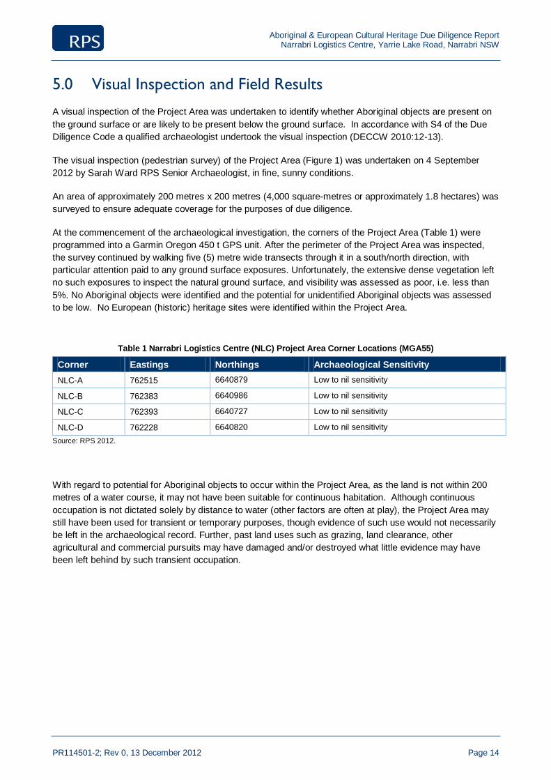
Aboriginal & European Cultural Heritage Due Diligence Report Narrabri Logistics Centre, Yarrie Lake Road, Narrabri NSW
PR114501-2; Rev 0, 13 December 2012 Page 14
5.0 Visual Inspection and Field Results
A visual inspection of the Project Area was undertaken to identify whether Aboriginal objects are present on
the ground surface or are likely to be present below the ground surface. In accordance with S4 of the Due
Diligence Code a qualified archaeologist undertook the visual inspection (DECCW 2010:12-13).
The visual inspection (pedestrian survey) of the Project Area (Figure 1) was undertaken on 4 September
2012 by Sarah Ward RPS Senior Archaeologist, in fine, sunny conditions.
An area of approximately 200 metres x 200 metres (4,000 square-metres or approximately 1.8 hectares) was
surveyed to ensure adequate coverage for the purposes of due diligence.
At the commencement of the archaeological investigation, the corners of the Project Area (Table 1) were
programmed into a Garmin Oregon 450 t GPS unit. After the perimeter of the Project Area was inspected,
the survey continued by walking five (5) metre wide transects through it in a south/north direction, with
particular attention paid to any ground surface exposures. Unfortunately, the extensive dense vegetation left
no such exposures to inspect the natural ground surface, and visibility was assessed as poor, i.e. less than
5%. No Aboriginal objects were identified and the potential for unidentified Aboriginal objects was assessed
to be low. No European (historic) heritage sites were identified within the Project Area.
Table 1 Narrabri Logistics Centre (NLC) Project Area Corner Locations (MGA55)
Corner Eastings Northings Archaeological Sensitivity
NLC-A 762515 6640879 Low to nil sensitivity
NLC-B 762383 6640986 Low to nil sensitivity
NLC-C 762393 6640727 Low to nil sensitivity
NLC-D 762228 6640820 Low to nil sensitivity
Source: RPS 2012.
With regard to potential for Aboriginal objects to occur within the Project Area, as the land is not within 200
metres of a water course, it may not have been suitable for continuous habitation. Although continuous
occupation is not dictated solely by distance to water (other factors are often at play), the Project Area may
still have been used for transient or temporary purposes, though evidence of such use would not necessarily
be left in the archaeological record. Further, past land uses such as grazing, land clearance, other
agricultural and commercial pursuits may have damaged and/or destroyed what little evidence may have
been left behind by such transient occupation.
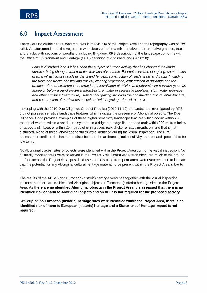
Aboriginal & European Cultural Heritage Due Diligence Report Narrabri Logistics Centre, Yarrie Lake Road, Narrabri NSW
PR114501-2; Rev 0, 13 December 2012 Page 15
6.0 Impact Assessment
There were no visible natural watercourses in the vicinity of the Project Area and the topography was of low
relief. As aforementioned, the vegetation was observed to be a mix of native and non-native grasses, trees
and shrubs with sections of woodland including Brigalow. RPS description of the landscape conforms with
the Office of Environment and Heritage (OEH) definition of disturbed land (2010:18):
Land is disturbed land if it has been the subject of human activity that has changed the land's
surface, being changes that remain clear and observable. Examples include ploughing, construction
of rural infrastructure (such as dams and fences), construction of roads, trails and tracks (including
fire trails and tracks and walking tracks), clearing vegetation, construction of buildings and the
erection of other structures, construction or installation of utilities and other similar services (such as
above or below ground electrical infrastructure, water or sewerage pipelines, stormwater drainage
and other similar infrastructure), substantial grazing involving the construction of rural infrastructure,
and construction of earthworks associated with anything referred to above.
In keeping with the 2010 Due Diligence Code of Practice (2010:11-12) the landscape investigated by RPS
did not possess sensitive landscape features which indicate the presence of Aboriginal objects. The Due
Diligence Code provides examples of these higher sensitivity landscape features which occur: within 200
metres of waters; within a sand dune system; on a ridge top, ridge line or headland; within 200 metres below
or above a cliff face; or within 20 metres of or in a cave, rock shelter or cave mouth; on land that is not
disturbed. None of these landscape features were identified during the visual inspection. The RPS
assessment confirms the land to be disturbed and the archaeological sensitivity and research potential to be
low to nil.
No Aboriginal places, sites or objects were identified within the Project Area during the visual inspection. No
culturally modified trees were observed in the Project Area. Whilst vegetation obscured much of the ground
surface across the Project Area, past land uses and distance from permanent water sources tend to indicate
that the potential for any Aboriginal cultural heritage material to be present within the Project Area is low to
nil.
The results of the AHIMS and European (historic) heritage searches together with the visual inspection
indicate that there are no identified Aboriginal objects or European (historic) heritage sites in the Project
Area. As there are no identified Aboriginal objects in the Project Area it is assessed that there is no
identified risk of harm to Aboriginal objects and an AHIP is not required for the proposed activity.
Similarly, as no European (historic) heritage sites were identified within the Project Area, there is no
identified risk of harm to European (historic) heritage and a Statement of Heritage Impact is not
required.

Aboriginal & European Cultural Heritage Due Diligence Report Narrabri Logistics Centre, Yarrie Lake Road, Narrabri NSW
PR114501-2; Rev 0, 13 December 2012 Page 16
7.0 Recommendations
This report has considered the available environmental and archaeological information for the Project Area,
the land condition, as well as, the nature of the proposed activities.
RECOMMENDATIONS
General mitigations have been provided for undertaking the proposed activity/works as they set out
contingency procedures should unexpected Aboriginal objects, skeletal remains or suspected additional
European cultural heritage material be identified during the proposed works.
Recommendation A
All relevant Santos Limited staff and contractors should be made aware of their statutory obligations for
heritage under NSW National Parks and Wildlife Act 1974 and the NSW Heritage Act 1977, which may be
implemented as a heritage induction.
Recommendation B
This due diligence report must be kept by Santos Limited so that it can be presented, if needed, as a
defence from prosecution.
Recommendation C
If Aboriginal object/s are identified in the Project Area during works, then all works in the immediate area
must cease and the area cordoned off. The Office of Environment and Heritage must be notified by ringing
the Enviroline 131 555 so that the site can be adequately assessed and managed.
Recommendation D
In the event that skeletal remains are uncovered, work must cease immediately in that area and the area
cordoned off. Santos Limited must contact the NSW Police with no further action taken until written advice is
provided by the Police. If the remains are determined to be of Aboriginal origin, the Office of Environment
and Heritage must be notified by ringing the Enviroline 131 555 and a management plan prior to works re-
commencing must developed in consultation with the relevant Aboriginal stakeholders.
Recommendation E
If, during the course of development works, suspected European cultural heritage material is uncovered,
work should cease in that area immediately. The Heritage Branch, Office of Environment and Heritage
(Enviroline 131 555) should be notified and works only recommence when an approved management
strategy developed.

Aboriginal & European Cultural Heritage Due Diligence Report Narrabri Logistics Centre, Yarrie Lake Road, Narrabri NSW
PR114501-2; Rev 0, 13 December 2012 Page 17
8.0 References
Appleton, J. (2009), Narrabri Longwall Stage 2 Project: Aboriginal Heritage Assessment, Whitehaven Coal:
Sydney, [Online], Availalbe:
http://www.whitehaven.net.au/operations/documents/67417_Part5_AboriginalHeritageReportandApp
endicesi-iv-A.pdf, [Accessed 9 August 2012].
Australian Goverment Bureau of Meterology (BOM) (2012a), Monthly Rainfall Narrabri (Bohena Creek),
[Online], Available:
http://www.bom.gov.au/jsp/ncc/cdio/weatherData/av?p_nccObsCode=139&p_display_type=dataFile
&p_stn_num=053098, [Accessed 16 August 2012].
Australian Goverment Bureau of Meterology (BOM) (2012b), Monthly Rainfall Narrabri (Rosewood Farm),
[Online], Available:
http://www.bom.gov.au/jsp/ncc/cdio/weatherData/av?p_nccObsCode=139&p_display_type=dataFile
&p_stn_num=053103, [Accessed 16 August 2012].
Australian Goverment Bureau of Meterology (BOM) (2012c), Mean Monthly Maximum Temperature (Narrabri
West Post Office), [Online], Available:
http://www.bom.gov.au/jsp/ncc/cdio/weatherData/av?p_nccObsCode=36&p_display_type=dataFile&
p_stn_num=053030, [Accessed 16 August 2012].
Australian Government Department of Sustainability, Environment, Water, Population and Communities
(SEWPaC) (2012a), Australian Heritage Database: National Heritage List, [Online], Available:
http://www.environment.gov.au/heritage/ahdb/index.html, [Accessed: 16 August 2012].
Australian Government Department of Sustainability, Environment, Water, Population and Communities
(SEWPaC) (2012b), Australian Heritage Database: Register of the National Estate, [Online],
Available: http://www.environment.gov.au/heritage/ahdb/index.html, [Accessed: 16 August 2012].
Australian Government Department of Sustainability, Environment, Water, Population and Communities
(SEWPaC) (2012c), Australian Heritage Database: Commonwealth Heritage List, [Online], Available:
http://www.environment.gov.au/heritage/ahdb/index.html, [Accessed: 16 August 2012].
Australian Government Department of Sustainability, Environment, Water, Population and Communities
(SEWPaC) (2011), Australia: State of the Environment 2011, [Online], Available:
http://www.environment.gov.au/soe/2011/index.html, [Accessed: 16 August 2012].
Bishop, A. & Vanderwyk, L. 2012, DRAFT Ecological Assessment: Stage I Leewood Narrabri, RPS:
Newcastle.
Department of Environment Climate Change & Water NSW (DECCW) (2010a). Due Diligence Code of
Practice for the Protection of Aboriginal Objects in New South Wales, [Online], Available:
http://www.environment.nsw.gov.au/resources/cultureheritage/ddcop/10798ddcop.pdf, [Accessed 13
August 2012], DECCW: Hurstville.
Department of Environment Climate Change & Water NSW (DECCW) (2010b). Code of Practice for
Archaeological Investigation of Aboriginal Objects in New South Wales: Part 6 National Parks and
Wildlife Act 1974, [Online], Available:
http://www.environment.nsw.gov.au/resources/cultureheritage/10783FinalArchCoP.pdf, [Accessed
13 August 2012], DECCW: Hurstville.

Aboriginal & European Cultural Heritage Due Diligence Report Narrabri Logistics Centre, Yarrie Lake Road, Narrabri NSW
PR114501-2; Rev 0, 13 December 2012 Page 18
Department of Environment Climate Change & Water NSW (DECCW) (2010c). Aboriginal Cultural Heritage
Consultation Requriements for Proponents 2010: Part 6 National Parks and Wildlife Act 1974,
[Online], Available:
http://www.environment.nsw.gov.au/resources/cultureheritage/ddcop/10798ddcop.pdf, [Accessed 13
August 2012], DECCW: Hurstville.
Department of Environment Climate Change & Water NSW(DECCW) (2009). Guide to Determining and
Issuing Aboriginal Heritage Impact Permits, [Online], Available:
http://www.environment.nsw.gov.au/resources/cultureheritage/09121AHIPGuide.pdf, [Accessed 13
August 2012], DECCW: Hurstville.
Department of Environment Climate Change & Water NSW (DECCW) (2008), Private Native Forestry Code
of Practice for Northern NSW, [Online], Available: http://www.environment.nsw.gov.au/resources/
pnf/0837copnorth.pdf, [Accessed: 15 August 2012].
Dorey, F (2012), The Spread of People to Australia, Australian Museum, [Online], Available:
http://australianmuseum.net.au/The-spread-of-people-to-Australia/, [Accessed 16 August 2012].
Keith, D. (2006) Ocean Shores to Desert Dunes: The Native Vegetation of New South Wales and the ACT,
National Parks & Wildlife Service: Sydney.
Lambeck, K., Yokoyama, Y., & Purcell, T.(2002), ‘Into and out of the Last Glacial Maximum: sea-level
change during Oxygen Isotope Stages 3 and 2’, Quaternary Science Reviews, 21: pp. 343–360.
Narrabri Shire Council (2012), Comprehensive Local Environmental Plans (LEP), [Online], Available:
http://www.legislation.nsw.gov.au/scanview/inforce/s/1/?EPITITLE=%22Narrabri%20Local
%20Environmental%20Plan%20No%202%22&nohits=y and
http://www.narrabri.nsw.gov.au/index.cfm?page_id=1217, [Accessed 16 August 2012].
Norris, E. (1996) A Study of the Soil and Vegetation Patterns Within Part of the Pilliga Forests and an
Evaluation of the Impact of European Settlement on the Vegetation, MSC Submission, Macquarie
University: Ryde.
NSW National Parks and Wildlife Service (NPWS) (2003), ‘The Brigalow Belt South Bioregion’, The
Bioregions of New South Wales – their biodiversity, conservation and history, Chapter 11, [Online],
Available: http://brg.cma.nsw.gov.au/uploads/brigalow_belt.pdf, [Accessed 13 August 2012].
NSW Minerals Council Ltd (2010), The NSW Minerals Industry Due Diligence Code of Practice for the
Protection of Aboriginal Objects, [Online], Available:
http://www.nswmin.com.au/ArticleDocuments/57/NSWMC_Due-Diligence-Code-of-
Practice_Sep2010_FINAL.pdf.aspx, [Accessed 15 August 2012].
NSW Government (2012a), Heritage Act 1977, [Online], Availble:
http://www.austlii.edu.au/au/legis/nsw/consol_act/ha197786/, [Accessed 4 August 2012].
NSW Government (2012b), National Parks and Wildlife Act 1974, [Online], Available:
http://www.austlii.edu.au/au/legis/nsw/consol_act/npawa1974247/, [Accessed 10 August 2012].
NSW Government (2012c), National Parks and Wildlife Regulation 2009, [Online], Available:
http://www.austlii.edu.au/au/legis/nsw/consol_reg/npawr2009338/, [Accessed 10 August 2012].
NSW Government (2012d), Plantations and Reafforestation (Code) Regulation 2001, [Online], Available:
http://www.austlii.edu.au/au/legis/nsw/consol_reg/parr2001438/, [Accessed: 15 August 2012].

Aboriginal & European Cultural Heritage Due Diligence Report Narrabri Logistics Centre, Yarrie Lake Road, Narrabri NSW
PR114501-2; Rev 0, 13 December 2012 Page 19
NSW Government Office of Environment and Heritage (OEH) (2012a), NSW State of the Environment
Report 2009, [Online], Available: http://www.environment.nsw.gov.au/soe/soe2009/, [Accessed 16
August 2012].
NSW Government Office of Environment and Heritage (OEH) (2012b), Aboriginal Heritage Information
Management System (AHIMS), [Online], Available:
http://www.environment.nsw.gov.au/awssapp/login.aspx, [Accessed 10 August 2012].
NSW Government Office of Environment and Heritage (OEH) (2012c), State Heritage Register Search:
Narrabri, [Online], Available: http://www.heritage.nsw.gov.au/07_subnav_04_1.cfm, [Accessed 16
August 2012].
NSW Government Office of Environment and Heritage (OEH) (2012d), Authorised Interim Heritage Orders:
Narrabri, [Online], Available: http://www.heritage.nsw.gov.au/07_subnav_04_1.cfm, [Accessed 16
August 2012].
NSW Government Office of Environment and Heritage (OEH) (2012e), Interim Heritage Orders: Narrabri,
[Online], Available: http://www.heritage.nsw.gov.au/07_subnav_04_1.cfm, [Accessed 16 August
2012].
NSW Government Office of Environment and Heritage (OEH) (2012f), s136 Orders: Narrabri, [Online],
Available: http://www.heritage.nsw.gov.au/07_subnav_04_1.cfm, [Accessed 16 August 2012].
NSW Government Office of Environment and Heritage (OEH) (2012g), NSW Maritime Heritage Online,
[Online], Available: http://maritime.heritage.nsw.gov.au/public/search_results_ship.cfm, [Accessed
16 August 2012].
NSW Government Office of Environment and Heritage (OEH) (2012h), Local Environmental Plan: Narrabri,
[Online], Available: http://www.heritage.nsw.gov.au/07_subnav_04_1.cfm, [Accessed 16 August
2012].
NSW National Parks and Wildlife Service (NPWS) (2000a), Aboriginal Cultural Heritage Assessment –
Preliminary Report Brigalow Belt South (Stage 1), NSW Western Regional Assessments, Resource
and Conservation Assessment Council (RACC), Planning NSW: Sydney.
NSW National Parks and Wildlife Service (2000b), Preliminary Overview of the Brigalow Belt South Bioregion
(Stage 1), NSW Western Regional Assessments, September, [Online], Available:
http://www.environment.nsw.gov.au/resources/forestagreements/BBSoverviewfinal.pdf, [Accessed
13 August 2012].
NSW Trade and Investment (2012), ESG2: Environmental Impact Assessment Guidelines, Mineral
Resources Environmental Sustainability Unit: Maitland, [Online], Available:
http://www.dpi.nsw.gov.au/__data/assets/pdf_file/0007/427444/2012-03-05-ESG2-Environmental-
Impact-Assessment-Guidelines-FINAL.pdf [Accessed 13 August 2012].
NSW Trade and Investment (2012), Aboriginal Objects Due Diligence Code for Plantation Officers
Administering the Plantations and Reafforestation (Code) Regulation 2001, [Online], Available:
http://www.environment.nsw.gov.au/resources/cultureheritage/ddcop/ddcop-DII.pdf, [Accessed: 15
August 2012].
Forests NSW (2010), Operational Guidelines for Aboriginal Cultural Heritage Management (A Due Diligence
Code of Practice), [Online], Available: Accessed 15 August 2012].
Aboriginal & European Cultural Heritage Due Diligence Report Narrabri Logistics Centre, Yarrie Lake Road, Narrabri NSW
PR114501-2; Rev 0, 13 December 2012 Page 20
Geological Survey of NSW (2009), Digital Elevation Map of New South Wales 1:1500000, Geological Survey
of NSW: Maitland, [Online], Available: http://www.resources.nsw.gov.au/geological/geological-
maps/statewide/elevation-map-of-nsw, [Accessed 13 August 2012].
Short, A. (2000), ‘Sydney’s Dynamic Landscapes’ in Connell, J. Sydney: Emergence of a World City: Oxford
University Press: South Melbourne.
Silcox, R. & Bowdler, S. (1982). An Archaeological Survey of a Proposed 132 Kv Transmission Line Route
from Walgett to Narrabri Part 1. A Report to the National Parks and Wildlife Service of N.S.W. on
behalf of the Electricity Commission of N.S.W. unpublished.
Trindall, E. (2007), Narrabri Coal Seam Gas Utilisation Project: Aboriginal Heritage Assessment, Santos
Limited, Sydney, [Online], Available:
http://www.santos.com/library/NSW_CSG_Narrabri_22_Environmental_Assessment_Specialist_Rep
ort_5_Heritage.pdf, [Accessed 10 August 2012].
United Nations Education Scientific and Cutlural Organisation (UNESCO) (2012), World Heritage List:
Australia, [Online], Available:
http://whc.unesco.org/en/list/?search=Australia&searchSites=&search_by_country=&search_yearins
cribed=&type=&themes=&media=®ion=&criteria_restrication=&order, [Accessed 16 August
2012].
Wallis, G R (1971), Narrabri 1:250 000 Geological Sheet SH-55-12, 1st ed, Geological Survey of NSW,
Sydney.
Webb, D. (2012a), Santos Leewood Pond Design – Geotechnical Investigation Scope, 25 July, Golder
Associates: Richmond, unpublished.
Webb, D. (2012b), Santos Leewood Pond Design – Stage 2 Geotechnical Investigation, 25 July, Golder Associates: Richmond, unpublished.

Aboriginal & European Cultural Heritage Due Diligence Report Narrabri Logistics Centre, Yarrie Lake Road, Narrabri NSW
PR114501-2; Rev 0, 13 December 2012 Page 21
9.0 Plates
Plate 1 Looking west across the Project Area from the north east corner of the existing Operations Centre
compound.
Plate 2 Brigalow Woodland observed to the north of the Project Area.

Aboriginal & European Cultural Heritage Due Diligence Report Narrabri Logistics Centre, Yarrie Lake Road, Narrabri NSW
PR114501-2; Rev 0, 13 December 2012 Page 22
Plate 3 Looking 301
o North West across the Project Area from the existing Operations Centre.
Plate 4 Looking 186
o south towards the existing Operations Centre from the north east corner of the Project
Area.

Aboriginal & European Cultural Heritage Due Diligence Report Narrabri Logistics Centre, Yarrie Lake Road, Narrabri NSW
PR114501-2; Rev 0, 13 December 2012 Page 23
10.0 Terms, Definitions, and Abbreviations
Abbreviation/ Term
Meaning
Aboriginal Object
“any deposit, object or material evidence (not being a handicraft made for sale) relating to the Aboriginal habitation of the area that comprises NSW, being habitation before or concurrent with (or both) the occupation of that area by persons of non-Aboriginal extraction, and includes Aboriginal remains” (DECCW 2010:18).
Aboriginal Place “a place declared under s.84 of the NPW Act that, in the opinion of the Minister, is or was of special significance to Aboriginal culture” (DECCW 2010:18). Aboriginal places have been gazetted by the minister.
Aboriginal Culturally Modified Tree
“means a tree that, before or concurrent with (or both) the occupation of the area in which the tree is located by persons of non-Aboriginal extraction, has been scarred, carved or modified by an Aboriginal person by: (a) the deliberate removal, by traditional methods, of bark or wood from the tree; or (b) the deliberate modification, by traditional methods, of the wood of the tree” NPW Regulation 80B (3). Culturally Modified trees are sometimes referred to as scarred trees.
Activity A project, development, or work (this term is used in its ordinary meaning and is not restricted to an activity as defined by Part 5 EP&A Act 1979).
AHIMS Aboriginal Heritage Information Management System
AHIP Aboriginal Heritage Impact Permit
cal. years BP Calibrated years before present, indicates a radiocarbon date has been calibrated using the dendrochronology curves, making the date more accurate than an uncalibrated date.
DECCW Department of Environment, Climate Change and Water (is now the Office of Environment and Heritage – OEH)
Disturbed Land “Land is disturbed if it has been the subject of a human activity that has changed the land’s surface, being changes that remain clear and observable.” (DECCW 2010:18).
Due Diligence “taking reasonable and practical steps to determine whether a person’s actions will harm an Aboriginal object and, if so, what measures can be taken to avoid that harm” (DECCW 2010:18)
EIA Environmental Impact Assessment
EIS Environmental Impact Statement
EP&A Act Environmental Planning and Assessment Act 1979 (NSW)
GDA Geodetic Datum Australia
GIS Geographic Information System
Harm “destroy, deface, damage an object, move an object from the land on which it is situated, cause or permit an object to be harmed.” (DECCW 2010:18)
LALC Local Aboriginal Land Council
LEP Local Environment Plan
NPWS National Parks and Wildlife Service
NPW Act National Parks and Wildlife Act 1974 (NSW)
NPW Regulation National Parks and Wildlife Regulation 2009 (NSW)
OEH Office of Environment and Heritage (formerly DECCW)
PAD Potential Archaeological Deposit
Project Area Project Area is the area subject to the proposed activity
REP Regional Environment Plan
REF Review of Environmental Factors

Aboriginal & European Cultural Heritage Due Diligence Report Narrabri Logistics Centre, Yarrie Lake Road, Narrabri NSW
PR114501-2; Rev 0, 13 December 2012
Appendix 1
Legislative Requirements

Aboriginal & European Cultural Heritage Due Diligence Report Narrabri Logistics Centre, Yarrie Lake Road, Narrabri NSW
PR114501-2; Rev 0, 13 December 2012
Summary of Statutory Controls
The following overview of the legal framework is provided solely for information purposes for the client, it
should not be interpreted as legal advice. RPS will not be liable for any actions taken by any person, body or
group as a result of this general overview, and recommend that specific legal advice be obtained from a
qualified legal practitioner prior to any action being taken as a result of the summary below.
COMMONWEALTH
Aboriginal & Torres Strait Islander Heritage Protection Act 1984 (ATSIHIP Act)
The purpose of this Act is to preserve and protect all heritage places of particular significance to Aboriginal
and Torres Strait Islander people. This Act applies to all sites and objects across Australia and in Australian
waters (s4).
It would appear that the intention of this Act is to provide national baseline protection for Aboriginal places
and objects where Stage legislation is absent. It is not to exclude or limit State laws (s7(1)). Should State
legislation cover a matter already covered in the Commonwealth legislation, and a person contravenes that
matter, that person may be prosecuted under either Act, but not both (s7(3)).
The Act provides for the preservation and protection of all Aboriginal objects and places from injury and/or
desecration. A place is construed to be injured or desecrated if it is not treated consistently with the manner
of Aboriginal tradition or is or likely to be adversely affected (s3).
Australian Heritage Commission Act 1975
The Australian Heritage Commission Act (1975) established the Australian Heritage Commission which
assesses places to be included in the National Estate and maintains a register of those places. Places
maintained in the register are those which are significant in terms of their association with particular
community or social groups and they may be included for social, cultural or spiritual reasons. The Act does
not include specific protective clauses.
The Australian Heritage Council Act 2003, together with the Environment Protection & Biodiversity
Conservation Act 1999, includes a National Heritage List of places of National heritage significance,
maintains a Commonwealth Heritage List of heritage places owned or managed by the Commonwealth and
ongoing management of the Register of the National Estate.
STATE
It is incumbent on any land manager to adhere to state legislative requirements that protect Aboriginal
Cultural heritage. The relevant legislation is NSW includes but is not limited to the summary below.
National Parks and Wildlife Act 1974 (NPW Act)
The NPW Act provides statutory protection for all Aboriginal heritage, places and objects (not being a
handicraft made for sale), with penalties levied for breaches of the Act. This legislation is overseen by the
Office of Environment and Heritage (OEH), and specifically the Chief Executive (formerly the Director-
General) of OEH. Part 6 of this Act is the relevant part concerned with Aboriginal objects and places, with
Section 86 and Section 90 being the most pertinent. In 2010, this Act was substantially amended,
particularly with respect to Aboriginal cultural heritage requirements. Relevant sections include:
Aboriginal & European Cultural Heritage Due Diligence Report Narrabri Logistics Centre, Yarrie Lake Road, Narrabri NSW
PR114501-2; Rev 0, 13 December 2012
Section 86
This section now lists four major offences:
(4) A person must not harm an object that the person knows is an Aboriginal object;
(5) A person must not harm and Aboriginal object;
(6) For the purposes of s86, “circumstances of aggravation” include:
(g) The offence being committed during the course of a commercial activity; or
(h) That the offence was the second or subsequent offence committed by the person; and
(7) A person must not harm or desecrate an Aboriginal place.
Offences under s86 (2) and (4) are now strict liability offences, i.e. knowledge that the object or place
harmed was an Aboriginal object or place needs to be proven. Penalties for all offences under Part 6 of this
Act have also been substantially increased, depending on the nature and severity of the offence.
Section 87
This section now provides defences to the offences of s86. These offences chiefly consist of having an
appropriate Aboriginal Heritage Impact Permit (AHIP), not contravening the conditions of the AHIP or
demonstrating that due diligence was exercised prior to the alleged offence.
Section 87A & 87B
These sections provide exemptions from the operation of s86; Section 87A for authorities such as the Rural
Fire Service, State Emergency Services and officers of the National Parks & Wildlife Service in the
performance of their duties, and s87B for Aboriginal people performing traditional activities.
Section 89A
If a person knows of the location of an Aboriginal object or place that has not been previously registered and
does not advise the Director-General (now Chief Executive) of that object or place within a reasonable period
of time, then that person is guilty of an offence under this Section of the Act.
Section 90
This section authorises the Director-General (now Chief Executive) to issue and AHIP.
Section 90A-90R
These sections govern the requirements relating to applying for an AHIP. In addition to the amendments to
the Act, OEH have issued three new policy documents clarifying OEH’s requirements with regards to
Aboriginal archaeological investigations: Aboriginal Cultural Heritage Consultation Requirements for
Proponents 2010, Due Diligence Code of Practice for the Protection of Aboriginal Objects in NSW and Code
of Practice for Archaeological Investigations in NSW. The Consultation Requirements formalise the
consultation with Aboriginal community groups into four main stages, and includes details regarding the
parties required to be consulted, advertisements inviting Aboriginal community groups to participate in the
consultation process, requirements regarding the provision of methodologies, draft and final reports to the
Aboriginal stakeholders and timetables for the four stages. The Due Diligence Code of Practice sets out the
minimum requirements for investigation, with particular regard as to whether an AHIP is required. The Code
of Practice for Archaeological Investigation sets out the minimum requirements for archaeological
investigation of Aboriginal sites.

Aboriginal & European Cultural Heritage Due Diligence Report Narrabri Logistics Centre, Yarrie Lake Road, Narrabri NSW
PR114501-2; Rev 0, 13 December 2012
Aboriginal Heritage Impact Permits (AHIP)
OEH encourages consultation with relevant Aboriginal stakeholders for all Aboriginal Heritage Assessments.
However, if an Aboriginal Heritage Impact Permit (AHIP) is required for an Aboriginal site, then specific OEH
guidelines are triggered for Aboriginal consultation.
Aboriginal Cultural Heritage Consultation Requirements for Proponents
In 2010, the Aboriginal Cultural Heritage Consultation Requirements for Proponents (ACHCR’s) were issued
by OEH (12th April 2010). These consultation requirements replace the previously issued Interim
Community Consultation Requirements (ICCR) for Applicants (Dec 2004). These guidelines apply to all
AHIP applications prepared after 12th April 2010; for projects commenced prior to 12th April 2010,
transitional arrangements have been stipulated in a supporting document, Questions and Answers 2:
Transitional Arrangements.
The ACHCR’s 2010 include a four stage Aboriginal consultation process and stipulate specific timeframes for
each state. Stage 1 requires that Aboriginal people who hold cultural information are identified, notified and
invited to register an expression of interest in the assessment. Stage 1 includes the identification of
Aboriginal people who may have an interest in the Project Area and hold information relevant to determining
the cultural significance of Aboriginal objects or places. This identification process should draw on
reasonable sources of information including: the relevant OEH EPRG regional office, the relevant Local
Aboriginal Land Council(s), the Registrar of Aboriginal Owners, Aboriginal Land Rights Act (1983), the Native
Title Tribunal, Native Title Services Corporation Limited, the relevant local council(s), and the relevant
catchment management authority. The identification process should also include an advertisement placed in
a local newspaper circulating in the general location of the Project Area. Aboriginal organisations and/or
individuals identified should be notified of the project and invited to register an expression of inters (EoI) for
Aboriginal consultation. Once a list of Aboriginal stakeholders has been compiled from the EoI’s, they need
to be consulted in accordance with ACHCR’s Stages 2, 3 and 4.
Environmental Planning & Assessment Act 1979 (EP&A Act)
This Act regulates a system of environmental planning and assessment for New South Wales. Land use
planning requires that environmental impacts are considered, including the impact on cultural heritage and
specifically Aboriginal heritage. Within the EP&A Act, Parts 3, 4 and 5 relate to Aboriginal heritage.
Part 3 regulates the preparation of planning policies and plans. Part 4 governs the manner in which consent
authorities determine development applications and outlines those that require an environmental impact
statement. Part 5 regulates government agencies that act as determining authorities for activities conducted
by that agency or by authority from the agency. The National Parks & Wildlife Service is a Part 5 authority
under the EP&A Act.
In brief, the NPW Act provides protection for Aboriginal objects or places, while the EP&A Act ensures that
Aboriginal cultural heritage is properly assessed in land use planning and development.

Aboriginal & European Cultural Heritage Due Diligence Report Narrabri Logistics Centre, Yarrie Lake Road, Narrabri NSW
PR114501-2; Rev 0, 13 December 2012
Heritage Act 1977
This Act protects the natural and cultural history of NSW with emphasis on non-indigenous cultural heritage
through protection provisions and the establishment of a Heritage Council. Although Aboriginal heritage
sites and objects are primarily protected by the National Parks & Wildlife Act 1974, if an Aboriginal site,
object or place is of great significance, it may be protected by a heritage order issued by the Minister subject
to advice by the Heritage Council.
Other legislation of relevance to Aboriginal cultural heritage in NSW includes the NSW Local Government Act 1993. Local planning instruments also contain provisions relating to indigenous heritage and development conditions of consent.

Aboriginal & European Cultural Heritage Due Diligence Report Narrabri Logistics Centre, Yarrie Lake Road, Narrabri NSW
PR114501-2; Rev 0, 13 December 2012
Appendix 2
AHIMS Search Results
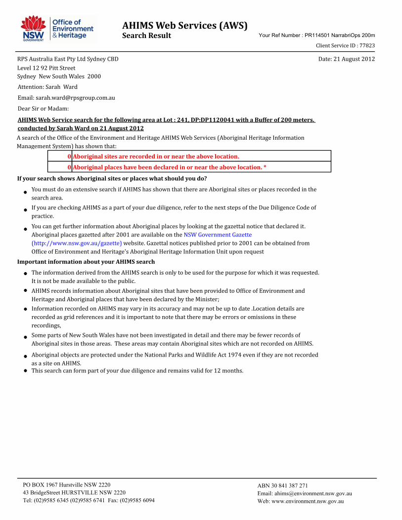
AHIMS Web Services (AWS)Search Result Your Ref Number : PR114501 NarrabriOps 200m
Client Service ID : 77823
Date: 21 August 2012RPS Australia East Pty Ltd Sydney CBD
Sydney New South Wales 2000
Level 12 92 Pitt Street
AHIMS Web Service search for the following area at Lot : 241, DP:DP1120041 with a Buffer of 200 meters.
conducted by Sarah Ward on 21 August 2012
Dear Sir or Madam:
Attention: Sarah Ward
Email: [email protected]
Aboriginal places have been declared in or near the above location. * 0
Aboriginal sites are recorded in or near the above location. 0
A search of the Office of the Environment and Heritage AHIMS Web Services (Aboriginal Heritage Information
Management System) has shown that:
Important information about your AHIMS search
If your search shows Aboriginal sites or places what should you do?
You can get further information about Aboriginal places by looking at the gazettal notice that declared it.
Aboriginal places gazetted after 2001 are available on the NSW Government Gazette
(http://www.nsw.gov.au/gazette) website. Gazettal notices published prior to 2001 can be obtained from
Office of Environment and Heritage's Aboriginal Heritage Information Unit upon request
Aboriginal objects are protected under the National Parks and Wildlife Act 1974 even if they are not recorded
as a site on AHIMS.
You must do an extensive search if AHIMS has shown that there are Aboriginal sites or places recorded in the
search area.
If you are checking AHIMS as a part of your due diligence, refer to the next steps of the Due Diligence Code of
practice.
AHIMS records information about Aboriginal sites that have been provided to Office of Environment and
Heritage and Aboriginal places that have been declared by the Minister;
Information recorded on AHIMS may vary in its accuracy and may not be up to date .Location details are
recorded as grid references and it is important to note that there may be errors or omissions in these
recordings,
Some parts of New South Wales have not been investigated in detail and there may be fewer records of
Aboriginal sites in those areas. These areas may contain Aboriginal sites which are not recorded on AHIMS.
This search can form part of your due diligence and remains valid for 12 months.
The information derived from the AHIMS search is only to be used for the purpose for which it was requested.
It is not be made available to the public.
PO BOX 1967 Hurstville NSW 2220
43 BridgeStreet HURSTVILLE NSW 2220
Tel: (02)9585 6345 (02)9585 6741 Fax: (02)9585 6094
ABN 30 841 387 271
Email: [email protected]
Web: www.environment.nsw.gov.au

AHIMS Web Services (AWS)Search Result Your Ref Number : PR114501-2 NarrabriOps 1k
Client Service ID : 77822
Date: 21 August 2012RPS Australia East Pty Ltd Sydney CBD
Sydney New South Wales 2000
Level 12 92 Pitt Street
AHIMS Web Service search for the following area at Lot : 241, DP:DP1120041 with a Buffer of 1000 meters.
conducted by Sarah Ward on 21 August 2012
Dear Sir or Madam:
Attention: Sarah Ward
Email: [email protected]
Aboriginal places have been declared in or near the above location. * 0
Aboriginal sites are recorded in or near the above location. 0
A search of the Office of the Environment and Heritage AHIMS Web Services (Aboriginal Heritage Information
Management System) has shown that:
Important information about your AHIMS search
If your search shows Aboriginal sites or places what should you do?
You can get further information about Aboriginal places by looking at the gazettal notice that declared it.
Aboriginal places gazetted after 2001 are available on the NSW Government Gazette
(http://www.nsw.gov.au/gazette) website. Gazettal notices published prior to 2001 can be obtained from
Office of Environment and Heritage's Aboriginal Heritage Information Unit upon request
Aboriginal objects are protected under the National Parks and Wildlife Act 1974 even if they are not recorded
as a site on AHIMS.
You must do an extensive search if AHIMS has shown that there are Aboriginal sites or places recorded in the
search area.
If you are checking AHIMS as a part of your due diligence, refer to the next steps of the Due Diligence Code of
practice.
AHIMS records information about Aboriginal sites that have been provided to Office of Environment and
Heritage and Aboriginal places that have been declared by the Minister;
Information recorded on AHIMS may vary in its accuracy and may not be up to date .Location details are
recorded as grid references and it is important to note that there may be errors or omissions in these
recordings,
Some parts of New South Wales have not been investigated in detail and there may be fewer records of
Aboriginal sites in those areas. These areas may contain Aboriginal sites which are not recorded on AHIMS.
This search can form part of your due diligence and remains valid for 12 months.
The information derived from the AHIMS search is only to be used for the purpose for which it was requested.
It is not be made available to the public.
PO BOX 1967 Hurstville NSW 2220
43 BridgeStreet HURSTVILLE NSW 2220
Tel: (02)9585 6345 (02)9585 6741 Fax: (02)9585 6094
ABN 30 841 387 271
Email: [email protected]
Web: www.environment.nsw.gov.au

Expansion of Santos Operations Centre, 300 Yarrie Lake Road, Narrabri Statement of Environmental Effects
PR114501; Rev B; February 2013
Appendix 5
Chemical Additives

Expansion of Santos Operations Centre, 300 Yarrie Lake Road, Narrabri Statement of Environmental Effects
PR114501; Rev B; February 2013
Appendix 6
Fluid Waste Management Plan

“Uncontrolled Copy When Printed” Date printed: 16/11/2012
ENSW D&C WMP – Revision 2 Page 1 of 21
Drilling and Completions
Revision 2
08/08/2012
Waste Management Plan
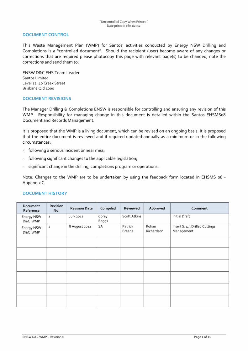
“Uncontrolled Copy When Printed” Date printed: 16/11/2012
ENSW D&C WMP – Revision 2 Page 2 of 21
DOCUMENT CONTROL
This Waste Management Plan (WMP) for Santos’ activities conducted by Energy NSW Drilling and Completions is a “controlled document”. Should the recipient (user) become aware of any changes or corrections that are required please photocopy this page with relevant page(s) to be changed, note the corrections and send them to:
ENSW D&C EHS Team Leader Santos Limited Level 12, 40 Creek Street Brisbane Qld 4000
DOCUMENT REVISIONS
The Manager Drilling & Completions ENSW is responsible for controlling and ensuring any revision of this WMP. Responsibility for managing change in this document is detailed within the Santos EHSMS08 Document and Records Management.
It is proposed that the WMP is a living document, which can be revised on an ongoing basis. It is proposed that the entire document is reviewed and if required updated annually as a minimum or in the following circumstances:
› following a serious incident or near miss;
› following significant changes to the applicable legislation;
› significant change in the drilling, completions program or operations.
Note: Changes to the WMP are to be undertaken by using the feedback form located in EHSMS 08 - Appendix C.
DOCUMENT HISTORY
Document Reference
Revision No.
Revision Date Compiled Reviewed Approved Comment
Energy NSW D&C WMP
1 July 2012 Corey Beggs
Scott Atkins Initial Draft
Energy NSW D&C WMP
2 8 August 2012 SA Patrick Breene
Rohan Richardson
Insert S. 4.3 Drilled Cuttings Management
“Uncontrolled Copy When Printed” Date printed: 16/11/2012
ENSW D&C WMP – Revision 2 Page 3 of 21
ENDORSEMENT AND APPROVALS
This WMP has been reviewed and endorsed by Santos and is approved for use by Energy NSW D&C operations.
Reviewed by:
Scott Atkins EHS Team Leader, Energy NSW Drilling & Completions
Signature Date
Patrick Breene Drilling Superintendent, Energy NSW Drilling & Completions
Signature Date
Approved by:
Rohan Richardson Manager, Drilling & Completions Energy NSW
Signature Date

“Uncontrolled Copy When Printed” Date printed: 16/11/2012
ENSW D&C WMP – Revision 2 Page 4 of 21
CONTENTS
1. INTRODUCTION ......................................................................................................... 5 1.1 PURPOSE ........................................................................................................................... 5 1.2 SCOPE ............................................................................................................................... 5 1.3 DOCUMENT OWNERSHIP ...................................................................................................... 5 1.4 DOCUMENT REVIEW ............................................................................................................ 6 1.5 LEGISLATION ...................................................................................................................... 6 1.6 LICENSES ........................................................................................................................... 8 1.7 OTHER REFERENCES ............................................................................................................ 8
2. RESPONSIBILITY ....................................................................................................... 9 2.1 ENSW D&C CONTACT LIST ............................................................................................... 10
3. ENVIRONMENT HEALTH AND SAFETY MANAGEMENT SYSTEM ................................. 10
4. WASTE MANAGEMENT PROCESSES ......................................................................... 11 4.1 WASTE TYPES & INVENTORY .............................................................................................. 11 4.2 WASTE FACILITIES ............................................................................................................. 11 4.3 DRILLED CUTTINGS MANAGEMENT ...................................................................................... 12 4.4 MONITORING .................................................................................................................... 12
5. WASTE TRANSPORT AND TRACKING ........................................................................ 13 5.1 REGULATED WASTE ........................................................................................................... 13 5.2 WHEN REGULATED WASTE TRACKING IS NOT REQUIRED .......................................................... 14 5.3 GENERAL WASTE ............................................................................................................... 14
6. INCIDENT MANAGEMENT, AUDITS AND INSPECTIONS.............................................. 14 6.1 INCIDENT NOTIFICATION .................................................................................................... 14 6.2 AUDITS AND INSPECTIONS .................................................................................................. 14
7. EMERGENCY PREPAREDNESS .................................................................................. 15
APPENDIX B – FLUID MANAGEMENT PROCESS FLOWCHART ............................................ 16
APPENDIX C – ENSW NSW D&C WASTE INVENTORY ......................................................... 17

“Uncontrolled Copy When Printed” Date printed: 16/11/2012
Waste Management Plan 120808 Rev 2.Docx Page 5 of 21
1. Introduction
Santos is an Australian oil and gas exploration and production company with assets and projects throughout Australia and the Asia-Pacific region. Santos conducts its business activities in a manner that aims to prevent injury or illness and lightens our environmental footprint. Santos strives for the highest standard of environmental management and is committed to lightening the footprint of our activities.
Santos generates waste from drilling and completion activities in the ENSW Drilling and Completion (ENSW D&C) Opeartions. This waste management plan (WMP) has been developed to:
› minimise the risk of causing harm to the environment that may arise due to waste management;
› minimise waste volumes;
› improve operational efficiency; and
› improve environmental performance.
1.1 Purpose
The purpose of the WMP is to:
› provide a framework for addressing relevant aspects of waste management including waste minimisation, waste management, recycling, and reporting; and
› ensure waste management practices are supportive of sustainable development and comply with Santos policies, industry standards, legislative obligations and licence conditions. .
1.2 Scope
This plan is the ENSW Drilling and Completion Waste Management Plan (WMP) and is the overall coordination document for waste management at Santos’ ENSW D&C operations
The scope of the WMP encompasses the management of wastes from generation to formally handing over the waste for collection, segregation, transport, treatment and/or disposal.
The WMP identifies:
› types of waste generated
› waste management processes and procedures
› waste transport requirements
› monitoring requirements
› audit and inspection requirements
› record keeping reporting requirements
1.3 Document Ownership
The ENSW D&C Manager is responsible for ensuring that the WMP is implemented appropriately via:
› procedures (refer to Section 4 and Appendix C)
› waste tracking (refer to Section 0)

“Uncontrolled Copy When Printed” Date printed: 16/11/2012
Waste Management Plan 120808 Rev 2.Docx Page 6 of 21
› inspections and audits (refer to Section 6.2)
1.4 Document Review
The performance of the WMP shall be reviewed by the EHS Team Leader annually. The relevant Environmental Adviser shall be part of this review. Issues to be considered during this review include:
› amendments to legislation and conditions of licence
› review of the relevant SHRR/s
› inspection and audit findings
› waste related incidents, near misses or hazards
The ENSW D&C Manager shall ensure that any recommended changes to WMP are made after the review. Reviews and changes to the WMP will be:
› listed at the front of this document
› Communicated to relevant Santos personnel and contracts.
1.5 Legislation
Santos ENSW D&C will undertake the petroleum activities including exploration, appraisal, completion and abandonment of Coal Seam Gas wells within NSW.
Within NSW the Petroleum (Onshore) Act 1991 covers onshore exploration and production of petroleum. It creates exploration and production titles and also addresses environmental protection, royalties and compensation. The Petroleum (Onshore) Regulations 2007 requires all exploration or other activity carried out under the authority of a petroleum title is to be carried out in conformity with the Schedule of Onshore Petroleum Exploration and Production Safety Requirements 1992 published by the Department.
Within NSW there are six waste classes:
› Special waste;
› Liquid waste;
› Hazardous waste;
› Restricted solid waste;
› General solid waste (putrescible); and
› General solid waste (non-putrescible).
The following legislation relating to minimising environmental impacts from waste management applies to ENSW D&C:
› Protection of Environment Operations Act 1997
› Protection of Environment Operations (Waste) Regulation 2005
Other Acts and Guidelines, include:
› Environmental Planning and Assessment Act, 1979 and Regulations;
› NSW Radiation Control Act, 1990 and Regulations;

“Uncontrolled Copy When Printed” Date printed: 16/11/2012
Waste Management Plan 120808 Rev 2.Docx Page 7 of 21
› APPEA (2008) Code of Environmental Practice.
This plan has been developed to demonstrate that Santos will ensure:
› We comply with relevant legislation, Australian Standards, Codes of Practice and good oilfield practices;
› We design, construct and operate equipment and facilities to safe standards which meet accepted standards of the hydrocarbon, exploration, production and processing industries;
› We consult with employees and their representatives, as appropriate, on matters that may affect their health, safety and wellbeing;
› We have identified potential major hazards and risks arising from intended operations and ensured that appropriate controls are in place; and
› Effective emergency response plans are in place and periodically tested for appropriateness and effectiveness to enable response to foreseeable emergencies arising from our operations.
1.5.1 Protection of Environment Operations Act 1997
The objective of this Act is to protect the environment and reduce environmental degradation. Requirements applicable to ENSW D&C operations include:
› Do not carry out a waste-related activity, or perform development work for the purpose of allowing such an activity, unless in accordance with an EPA licence or exemption.
1.5.2 Protection of Environment Operations (Waste) Regulation 2005
Requirements applicable to ENSW include:
› If storing any waste on premises, do so in an environmentally safe manner.
› As the consignor of waste to which waste-tracking obligations apply, obtain a consignment authorisation and complete the relevant parts of a transport certificate before consigning the waste. For further details, see the Protection of the Environment Operations (Waste) Regulation 2005 clause 22.
› As a facility occupier, consignor, transporter or receiver of waste to which waste-tracking obligations apply, keep transport certificates for at least 4 years. For further details, see the Protection of the Environment Operations (Waste) Regulation 2005 clauses 32 to 37.
1.5.3 Commonwealth National Environment Protection (Movement of Controlled Waste between States and Territories) Measure.
The National Environment Protection (Movement of Controlled Waste between States and Territories) Measure (NEPM) aims to ensure that controlled wastes which are moved between States and Territories are properly identified, transported and handled in an environmentally sound manner, and that they reach licensed or approved facilities for treatment, recycling, storage and/or disposal. The NEPM provides a framework for developing and integrating systems for the movement of controlled waste between States and Territories which includes:
› tracking systems, which provide information to assist agencies and emergency services and ensure that controlled wastes are directed to appropriate facilities
› prior notification systems, which provide participating States and Territories with access to information to assess the appropriateness of proposed movements of controlled wastes in terms of transportation and facility selection

“Uncontrolled Copy When Printed” Date printed: 16/11/2012
Waste Management Plan 120808 Rev 2.Docx Page 8 of 21
› systems for licensing transporters and the regulating generators and facilities so that tracking and notification functions are compatible between States and Territories
› Provision for mutual recognition by States and Territories of each other’s transport licences.
1.5.4 Australian Code for the Transport of Dangerous Goods by Road and Rail (6th Ed)
The Australian Code for the Transport of Dangerous Goods Code by Road and Rail (6th Ed.) sets out technical requirements and guidelines for the transport of dangerous goods by road and rail and is implemented for roads in New South Wales by the Transport Operations (Road Use Management - Dangerous Goods) Regulation 1998. The requirements of the Code do not apply to waste products and other environmentally hazardous substances unless those products or substances are also Dangerous Goods within the meaning of the Code. Where wastes that constitute Dangerous Goods (e.g. flammable liquids/solids, corrosives, oxides, acute poisonous and toxic materials) are to be transported from site, the transporter must comply with all the requirements of the Code and Regulation, including the requirements for placarding.
1.6 Licenses
Santos does not currently hold any licences which refer to conditions regarding the management of waste within its ENSW D&C operations
1.7 Other references
Together with this WMP, ENSW D&C will utilse an number of of the reference documents, including:
› ENSW D&C Emergency Response Plan
› ENSW D&C Operational Environmental Management Plan
› ENSW D&C Safety Management Plan
› ENSW D&C Significant Hazard Risk Register
› Santos EHSMS Index
› Santos EHS04 Waste Management
› Santos EHSMS15 Incident & Non-Conformance Investigation, Corrective and Preventative Action
› Santos audit tool, Audit and Inspection Manager (AIM)
› Advisory Committee on the Transport of Dangerous Goods / National Transport Commission publication, Australian Code for the Transport of Dangerous Goods Code by Road and Rail (6th Ed.) (Cwth)
› National Environment Protection (Movement of Controlled Waste between States and Territories) Measure (Cwth)
› The Guidelines on Resource Recovery Exemptions (Land Application) http://www.environment.nsw.gov.au/resources/waste/08232resrecoverexempts.pdf
› The Waste Classification Guidelines Part1: Classifying Waste, http://www.environment.nsw.gov.au/resources/waste/08202classifyingwaste.pdf
› The Waste Classification Guidelines Part 2: Immobilization of Waste http://www.environment.nsw.gov.au/resources/waste/08203immobilisationwaste.pdf
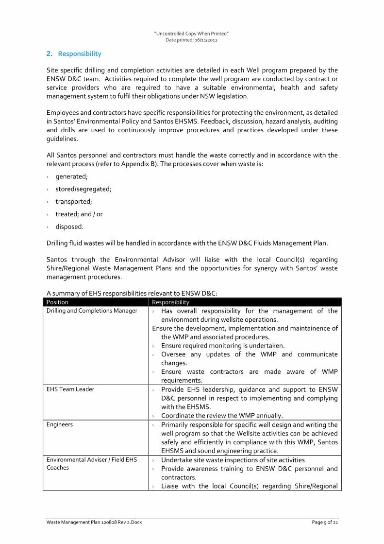
“Uncontrolled Copy When Printed” Date printed: 16/11/2012
Waste Management Plan 120808 Rev 2.Docx Page 9 of 21
2. Responsibility
Site specific drilling and completion activities are detailed in each Well program prepared by the ENSW D&C team. Activities required to complete the well program are conducted by contract or service providers who are required to have a suitable environmental, health and safety management system to fulfil their obligations under NSW legislation.
Employees and contractors have specific responsibilities for protecting the environment, as detailed in Santos’ Environmental Policy and Santos EHSMS. Feedback, discussion, hazard analysis, auditing and drills are used to continuously improve procedures and practices developed under these guidelines.
All Santos personnel and contractors must handle the waste correctly and in accordance with the relevant process (refer to Appendix B). The processes cover when waste is:
› generated;
› stored/segregated;
› transported;
› treated; and / or
› disposed.
Drilling fluid wastes will be handled in accordance with the ENSW D&C Fluids Management Plan.
Santos through the Environmental Advisor will liaise with the local Council(s) regarding Shire/Regional Waste Management Plans and the opportunities for synergy with Santos’ waste management procedures.
A summary of EHS responsibilities relevant to ENSW D&C: Position Responsibility
Drilling and Completions Manager › Has overall responsibility for the management of the environment during wellsite operations.
Ensure the development, implementation and maintainence of the WMP and associated procedures.
› Ensure required monitoring is undertaken. › Oversee any updates of the WMP and communicate
changes. › Ensure waste contractors are made aware of WMP
requirements. EHS Team Leader › Provide EHS leadership, guidance and support to ENSW
D&C personnel in respect to implementing and complying with the EHSMS.
› Coordinate the review the WMP annually. Engineers › Primarily responsible for specific well design and writing the
well program so that the Wellsite activities can be achieved safely and efficiently in compliance with this WMP, Santos EHSMS and sound engineering practice.
Environmental Adviser / Field EHS Coaches
› Undertake site waste inspections of site activities › Provide awareness training to ENSW D&C personnel and
contractors. › Liaise with the local Council(s) regarding Shire/Regional

“Uncontrolled Copy When Printed” Date printed: 16/11/2012
Waste Management Plan 120808 Rev 2.Docx Page 10 of 21
Position Responsibility
Waste Management Plans and the opportunities for synergy with Santos’ waste management procedures.
› Engage consultant upon completion of the well to have sampling done and once waste classification is decided, work with relevant disposal facility.
› Report regulated waste transfers to EPA. › Be part of WMP review.
Onsite Company Representive › Oversee wellsite activities including providing onsite guidance, monitoring, coordinating and auditing of operations.
› Ensure wellsite activities are completed and documented through adherence to good oilfield practice, EHSMS and the implementation of the WMP on site.
› To advise when rig will be released and site handed over to Development and Opeations Team.
Santos personnel and contractors › Undertake all activites in accordance with the WMP. Superintendent › Responsible for coordinating operational and wellsite
activities in a manner that complies with this WMP and the Santos EHSMS.
2.1 ENSW D&C Contact List
The contacts for sites covered by the WMP are: Title Phone Number
ENSW Incident Management Plan – Duty Manager 0400 847 126
Manager Drilling & Completions 0427 500 017
Drilling Superintendent 0400 834 096
EHS Team Leader 0448 011 237
Environmental Advisor (07) 3838 5417
Field EHS Advisor 0418 546 490
Completions Superintendent 0419 520 137
Senior Drilling Engineer 0408 961 379
Drilling Engineer 0427 199 543
Logistics Coordinator 0419 963 259
Narrabri Field Supervisor (02) 6792 3400
Santos Crisis Management Team 0419 169 254
Narrabri Operations Centre (02) 6792 3400
Gunnedah Office (02) 6741 5100
3. Environment Health and Safety Management System
The Santos Environment Health and Safety Management System (EHSMS) provides the framework within which all aspects of the Santos’ environmental, health and safety responsibilities are managed1.
EHS04 Waste Management is the standard that specifically manages waste. This standard requires that any Santos operation or activity that generates, handles, stores, transports or disposes of
1 More information about the EHSMS can be found via the link to the EHSMS Index found on the
front page of The Well.

“Uncontrolled Copy When Printed” Date printed: 16/11/2012
Waste Management Plan 120808 Rev 2.Docx Page 11 of 21
waste is required to have a WMP. This WMP has been developed following the guidance provided in this standard.
The waste management hierarchy has been considered whilst developing this WMP and related procedures. The waste management hierarchy comprises the following steps (with avoid being most preferable through to disposal being least preferable):
› Avoid Choose a process so as to avoid the production of the waste
› Reduce Review the process and raw materials to reduce the production of the waste
› Reuse Reuse as much as possible in the process to minimise the waste
› Recycle Use the waste stream as a raw material in a different process or as an alternative source of energy/fuel
› Treatment Destruction, detoxification, and/or neutralisation of residues
› Disposal Responsible disposal of wastes using appropriate methods.
4. Waste Management Processes
The flowchart in Appendix A provides an overview waste types and sources an lists the specific management requirements for wastes generated by activities undertaken by ENSW D&C.
4.1 Waste Types & Inventory
In accordance with the NSW Waste Classification Guidelines Part 1: Classifying Waste2 and in line with EHS04 Waste Management. Santos D&C activities generate a wide range of wastes, however they can be classified into two general areas:
› Regulated Waste: wastes that require specific controls or actions as defined by legislation. Special, Liquid, Hazardous, Restricted wastes typically have unique handling and disposal requirements in order to manage specific hazards associated with them.
› Regulated waste generated by ENSW D&C may include:
o Waste drilling fluids and drilled cuttings;
o Waste oil;
o Oil & water mixtures or emulsions;
o Formation water (if not transported by a pipeline); and
o Sewage sludge & septic tank sludge.
› General Solid Waste: wastes not defined as regulated waste under legislation. General wastes comprise two main waste streams: putrescibles (easily decomposed) and non-putrescibles (not easily decomposed).
A full description of waste types and sources is included in Appendix B.
4.2 Waste Facilities
Santos does not operate waste disposal facilities within ENSW D&C operations.
2 Department of Environment and Climate Change NSW (2009), Waste Classification Guidelines
Part 1: Classifying Waste.

“Uncontrolled Copy When Printed” Date printed: 16/11/2012
Waste Management Plan 120808 Rev 2.Docx Page 12 of 21
Wastes requiring on-site storage are placed within the Waste Transfer Station (WTS) located at each well site prior to transportation for disposal.
Regulated waste is collected by licensed contractors for off-site disposal.
General and recyclable waste is transported to local council landfill and recycling facilities.
4.3 Drilled Cuttings Management
Drilled cuttings are produced during the drilling process. The drilling fluid (drilling mud) transports the drilled cuttings from the well bore. The drilled cuttings are screened over shale shakers (mechanical vibrating screens) to separate the solid cuttings from the drilling mud. The drilled cuttings will be collected in metal bins or a cuttings sump. The drilling fluid is recycled back through the well bore. Drilled cuttings are to be managed as an excavated natural material*. The Screening process will ensure that the cuttings are at least 90% (by weight) dry. Sampling of the cuttings will be undertaken in accordance with Australian Standard 1141 Methods of Sampling and Testing Aggregates. The cuttings will be appropriately stored until characterisation test results for mix-cover-reuse have been validated. Where drill cuttings have been suitably characterised for mix-cover-reuse, the process will be documented, will follow Santos EHSMS procedures and meet all land holder approvals. If the sampling of the drilled cuttings shows they do not meet designated chemical and other material properties; (see Table 2 – Protection of the Environment Operations (Waste) Regulation 2005. General Exemption under Part 6, Clause 51 and 51A) they will be transported to a designated Licenced Disposal Facility. Transport of the drilled cuttings to the designated Licensed Disposal Facility will be managed as a regulated waste via the requirements set out in the ENSW D&C Waste Management Plan. http://www.environment.nsw.gov.au/resources/waste/ex08ENM.pdf *Excavated material is naturally occurring rock and soil (included but not limited to materials
such as Sandstone, Shale, Clay and Soils) that has
a. Been excavated from the ground and
b. Contains at least 98% (by weight) natural materials and
c. Does not meet the definition of Virgin Excavated Natural Material
4.4 Monitoring
The following is monitored within ENSW D&C:
› General waste volumes and type;
› Recycle waste volumes and type; and
› Regulated waste volume and type (via waste tracking certificates, Section 0)
The OCR shall ensure that monitoring is undertaken in accordance with Section 5.1 and 5.3.
Monitoring and inventory data is reported in accordance with the requirements in Section 5.1.1.
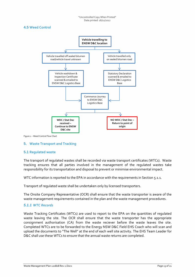
“Uncontrolled Copy When Printed” Date printed: 16/11/2012
Waste Management Plan 120808 Rev 2.Docx Page 13 of 21
4.5 Weed Control
Figure 1 – Weed Control Flow Chart
5. Waste Transport and Tracking
5.1 Regulated waste
The transport of regulated wastes shall be recorded via waste transport certificates (WTCs). Waste tracking ensures that all parties involved in the management of the regulated wastes take responsibility for its transportation and disposal to prevent or minimise environmental impact.
WTC information is reported to the EPA in accordance with the requirements in Section 5.1.1.
Transport of regulated waste shall be undertaken only by licensed transporters.
The Onsite Company Representative (OCR) shall ensure that the waste transporter is aware of the waste management requirements contained in the plan and the waste management procedures.
5.1.1 WTC Records
Waste Tracking Certificates (WTCs) are used to report to the EPA on the quantities of regulated waste leaving the site. The OCR shall ensure that the waste transporter has the appropriate consignment authorisation (CA) from the waste reciever before the waste leaves the site. Completed WTCs are to be forwarded to the Energy NSW D&C Field EHS Coach who will scan and upload the documents to “The Well” at the end of each well site activity. The EHS Team Leader for D&C shall use these WTCs to ensure that the annual waste returns are completed.
Vehicle travelled off sealed bitumen road/vehicle travel unknown
Vehicle travelling to ENSW D&C location
Statutory Declaration scanned & emailed to ENSW D&C Logistics
Base
Vehicle travelled only on sealed bitumen road
Vehicle washdown & Inspection Certificate scanned & emailed to
ENSW D&C Logistics Base
Commence Journey to ENSW D&C Logistics Base
WDC / Stat Dec received –
Continue to ENSW D&C site
NO WDC / Stat Dec – Return to point of
origin
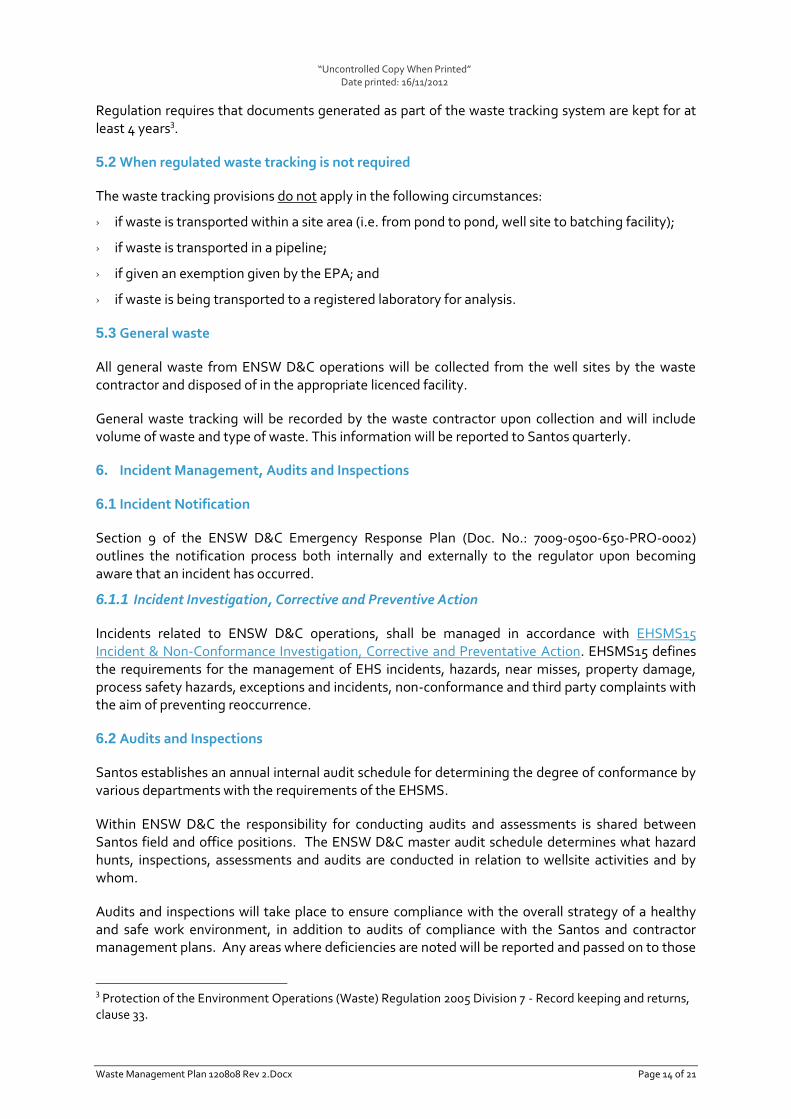
“Uncontrolled Copy When Printed” Date printed: 16/11/2012
Waste Management Plan 120808 Rev 2.Docx Page 14 of 21
Regulation requires that documents generated as part of the waste tracking system are kept for at least 4 years3.
5.2 When regulated waste tracking is not required
The waste tracking provisions do not apply in the following circumstances:
› if waste is transported within a site area (i.e. from pond to pond, well site to batching facility);
› if waste is transported in a pipeline;
› if given an exemption given by the EPA; and
› if waste is being transported to a registered laboratory for analysis.
5.3 General waste
All general waste from ENSW D&C operations will be collected from the well sites by the waste contractor and disposed of in the appropriate licenced facility.
General waste tracking will be recorded by the waste contractor upon collection and will include volume of waste and type of waste. This information will be reported to Santos quarterly.
6. Incident Management, Audits and Inspections
6.1 Incident Notification
Section 9 of the ENSW D&C Emergency Response Plan (Doc. No.: 7009-0500-650-PRO-0002) outlines the notification process both internally and externally to the regulator upon becoming aware that an incident has occurred.
6.1.1 Incident Investigation, Corrective and Preventive Action
Incidents related to ENSW D&C operations, shall be managed in accordance with EHSMS15 Incident & Non-Conformance Investigation, Corrective and Preventative Action. EHSMS15 defines the requirements for the management of EHS incidents, hazards, near misses, property damage, process safety hazards, exceptions and incidents, non-conformance and third party complaints with the aim of preventing reoccurrence.
6.2 Audits and Inspections
Santos establishes an annual internal audit schedule for determining the degree of conformance by various departments with the requirements of the EHSMS.
Within ENSW D&C the responsibility for conducting audits and assessments is shared between Santos field and office positions. The ENSW D&C master audit schedule determines what hazard hunts, inspections, assessments and audits are conducted in relation to wellsite activities and by whom.
Audits and inspections will take place to ensure compliance with the overall strategy of a healthy and safe work environment, in addition to audits of compliance with the Santos and contractor management plans. Any areas where deficiencies are noted will be reported and passed on to those
3 Protection of the Environment Operations (Waste) Regulation 2005 Division 7 - Record keeping and returns,
clause 33.
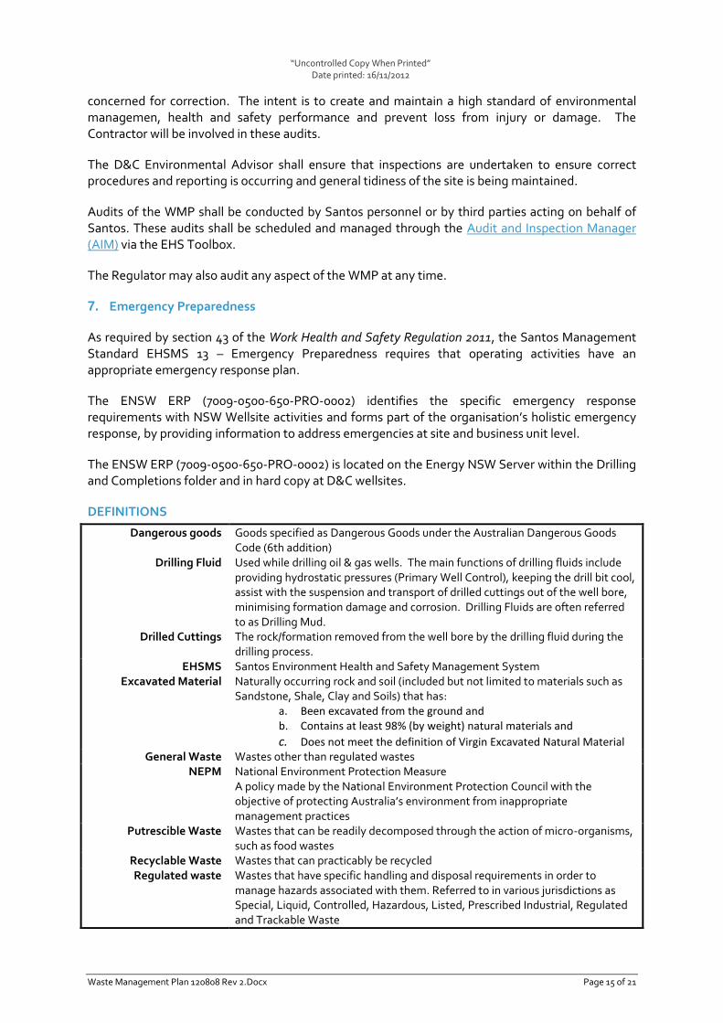
“Uncontrolled Copy When Printed” Date printed: 16/11/2012
Waste Management Plan 120808 Rev 2.Docx Page 15 of 21
concerned for correction. The intent is to create and maintain a high standard of environmental managemen, health and safety performance and prevent loss from injury or damage. The Contractor will be involved in these audits.
The D&C Environmental Advisor shall ensure that inspections are undertaken to ensure correct procedures and reporting is occurring and general tidiness of the site is being maintained.
Audits of the WMP shall be conducted by Santos personnel or by third parties acting on behalf of Santos. These audits shall be scheduled and managed through the Audit and Inspection Manager (AIM) via the EHS Toolbox.
The Regulator may also audit any aspect of the WMP at any time.
7. Emergency Preparedness
As required by section 43 of the Work Health and Safety Regulation 2011, the Santos Management Standard EHSMS 13 – Emergency Preparedness requires that operating activities have an appropriate emergency response plan.
The ENSW ERP (7009-0500-650-PRO-0002) identifies the specific emergency response requirements with NSW Wellsite activities and forms part of the organisation’s holistic emergency response, by providing information to address emergencies at site and business unit level.
The ENSW ERP (7009-0500-650-PRO-0002) is located on the Energy NSW Server within the Drilling and Completions folder and in hard copy at D&C wellsites.
DEFINITIONS
Dangerous goods
Drilling Fluid
Drilled Cuttings
Goods specified as Dangerous Goods under the Australian Dangerous Goods Code (6th addition) Used while drilling oil & gas wells. The main functions of drilling fluids include providing hydrostatic pressures (Primary Well Control), keeping the drill bit cool, assist with the suspension and transport of drilled cuttings out of the well bore, minimising formation damage and corrosion. Drilling Fluids are often referred to as Drilling Mud. The rock/formation removed from the well bore by the drilling fluid during the drilling process.
EHSMS Excavated Material
Santos Environment Health and Safety Management System Naturally occurring rock and soil (included but not limited to materials such as Sandstone, Shale, Clay and Soils) that has:
a. Been excavated from the ground and b. Contains at least 98% (by weight) natural materials and
c. Does not meet the definition of Virgin Excavated Natural Material General Waste Wastes other than regulated wastes
NEPM National Environment Protection Measure A policy made by the National Environment Protection Council with the objective of protecting Australia’s environment from inappropriate management practices
Putrescible Waste Wastes that can be readily decomposed through the action of micro-organisms, such as food wastes
Recyclable Waste Wastes that can practicably be recycled Regulated waste Wastes that have specific handling and disposal requirements in order to
manage hazards associated with them. Referred to in various jurisdictions as Special, Liquid, Controlled, Hazardous, Listed, Prescribed Industrial, Regulated and Trackable Waste

“Uncontrolled Copy When Printed” Date printed: 16/11/2012
Waste Management Plan 120808 Rev 2.Docx Page 16 of 21
Segregation Separation of wastes into non-recyclable and at least one recyclable waste streams e.g. segregate waste metal, plastic, glass, cardboard and paper from other general waste
Third party Non-Santos organisation For the purposes of this standard, third parties may be other oil and gas companies who seek to utilise Santos waste management facilities
Waste Includes any solid, liquid or gas (or combination thereof) that is left over, surplus or an unwanted by-product (whether of value or not)
Waste management facility
A facility for the recycling, reprocessing, treatment, storage, incineration, conversion to energy or disposal of waste.
Waste generator Any activity or operation that produces or stores waste and arranges for this waste to be sent for storage, recycling, treatment or disposal at another location
Waste receiver A waste management facility that receives waste for recycling, treatment, storage or disposal
Waste Transfer Station Location controlled by a waste generator where waste is stored before collection by a waste transporter
Waste transporter Anyone who transports waste from its place of production or storage to another location.
WMP Waste Management Plan Provides details on the management of waste from the time of generation to the time of ultimate treatment and/or disposal. A WMP should provide the framework for addressing aspects of waste management, including but not limited to waste collection, transport, reuse, recycling, treatment and disposal (in line with the principles of the waste hierarchy)
APPENDICES
Appendix A - Waste Types, Sources And Management Process Flowchart
Appendix B – Fluid Management Process Flowchart

“Uncontrolled Copy When Printed” Date printed: 16/11/2012
Energy NSW D&C WMP – Revision2 Page 17 of 21
Appendix C – ENSW NSW D&C Waste Inventory
Waste Name Regulated / Trackable
Y/N Generator Responsibility
On-site storage and collection
Off-site Disposal (in order of preference) Waste
Contractor HSE Issues
1. Re-use 2. Recycle 3. Landfill
Chemicals
Chemical wastes Y Return to supplier wherever possible. Triple rinse containers and empty for recycling.
Veolia WTC Required.
Contaminated soils
Contaminated soils – hydrocarbons
Y Contact Environmental Advisor for advice
Case dependent WTC Required.
Contaminated soil – other Y Contact Environmental Advisor for advice
Case dependent WTC Required.
Drilling Wastes
Drill Cuttings N/Y4 Store onsite, sample and classify for disposal options.
Store in sump/metal bin for mix and reuse and/or licenced disposal.
Sampled prior to disposal. Appropriate Farm Management Agreement required for onsite beneficial reuse.
Drill Fuids – K2SO4 Based Y Store onsite and transfer to mud batching facility for re-use on the Drill Rig.
Stored in 80m3 Tanks for tranpsort to batching facility for re-use and/or licenced disposal
WTC Required. Sampled prior to disposal for classification.
Drill Fuids – KCl Based Y Store onsite and transfer to mud batching facility for re-use on the Drill Rig.
Stored in 80m3 Tanks for tranpsort to batching facility for re-use or licenced disposal
WTC Required. Sampled prior to disposal for classification.
Electrical and Electronic
Electrical - batteries - dry Y Place in recycling container at WTS
WTC Required. Batteries need to be stored in a secure location due to the dangers of lead and any potential leaking of battery acid. Batteries need to be properly cleaned and sealed for their collection.
Electrical – batteries – wet Y Place in recycling container at WTS
WTC Required. Batteries need to be stored in a secure
4 If KCL based mud system used during the drilling program.
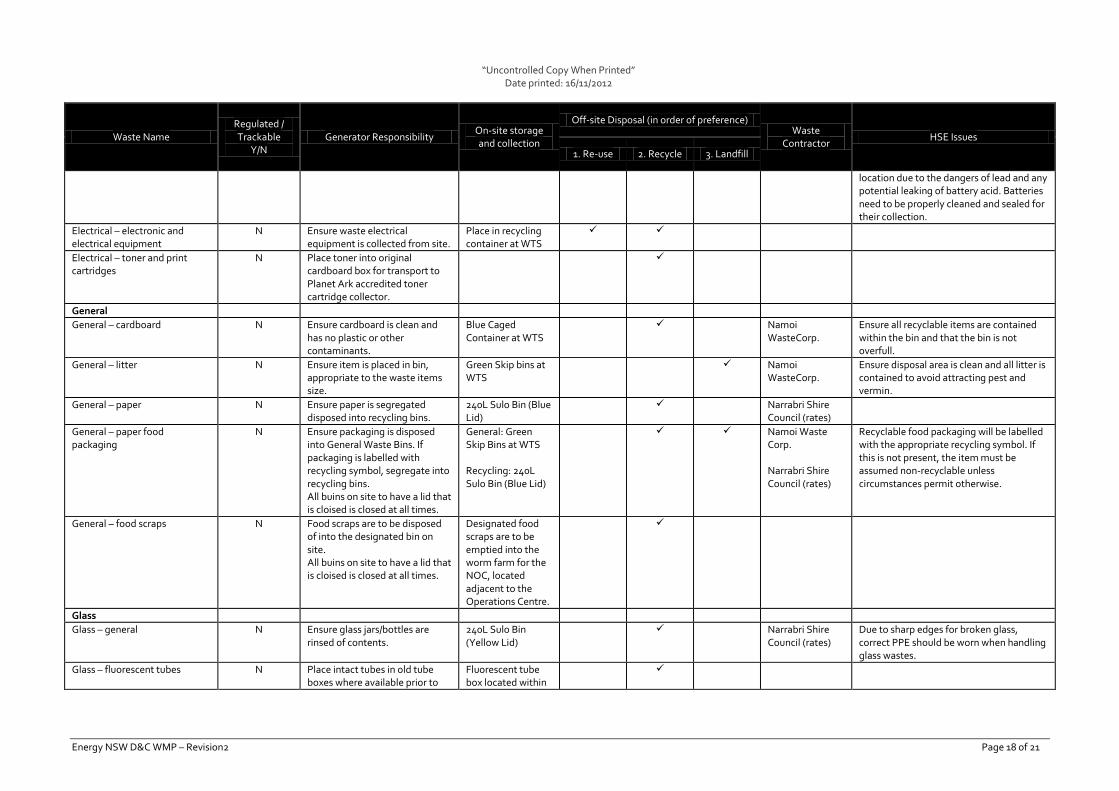
“Uncontrolled Copy When Printed” Date printed: 16/11/2012
Energy NSW D&C WMP – Revision2 Page 18 of 21
Waste Name Regulated / Trackable
Y/N Generator Responsibility
On-site storage and collection
Off-site Disposal (in order of preference) Waste
Contractor HSE Issues
1. Re-use 2. Recycle 3. Landfill
location due to the dangers of lead and any potential leaking of battery acid. Batteries need to be properly cleaned and sealed for their collection.
Electrical – electronic and electrical equipment
N Ensure waste electrical equipment is collected from site.
Place in recycling container at WTS
Electrical – toner and print cartridges
N Place toner into original cardboard box for transport to Planet Ark accredited toner cartridge collector.
General
General – cardboard N Ensure cardboard is clean and has no plastic or other contaminants.
Blue Caged Container at WTS
Namoi WasteCorp.
Ensure all recyclable items are contained within the bin and that the bin is not overfull.
General – litter N Ensure item is placed in bin, appropriate to the waste items size.
Green Skip bins at WTS
Namoi WasteCorp.
Ensure disposal area is clean and all litter is contained to avoid attracting pest and vermin.
General – paper N Ensure paper is segregated disposed into recycling bins.
240L Sulo Bin (Blue Lid)
Narrabri Shire Council (rates)
General – paper food packaging
N Ensure packaging is disposed into General Waste Bins. If packaging is labelled with recycling symbol, segregate into recycling bins. All buins on site to have a lid that is cloised is closed at all times.
General: Green Skip Bins at WTS Recycling: 240L Sulo Bin (Blue Lid)
Namoi Waste Corp. Narrabri Shire Council (rates)
Recyclable food packaging will be labelled with the appropriate recycling symbol. If this is not present, the item must be assumed non-recyclable unless circumstances permit otherwise.
General – food scraps N Food scraps are to be disposed of into the designated bin on site. All buins on site to have a lid that is cloised is closed at all times.
Designated food scraps are to be emptied into the worm farm for the NOC, located adjacent to the Operations Centre.
Glass
Glass – general N Ensure glass jars/bottles are rinsed of contents.
240L Sulo Bin (Yellow Lid)
Narrabri Shire Council (rates)
Due to sharp edges for broken glass, correct PPE should be worn when handling glass wastes.
Glass – fluorescent tubes N Place intact tubes in old tube boxes where available prior to
Fluorescent tube box located within
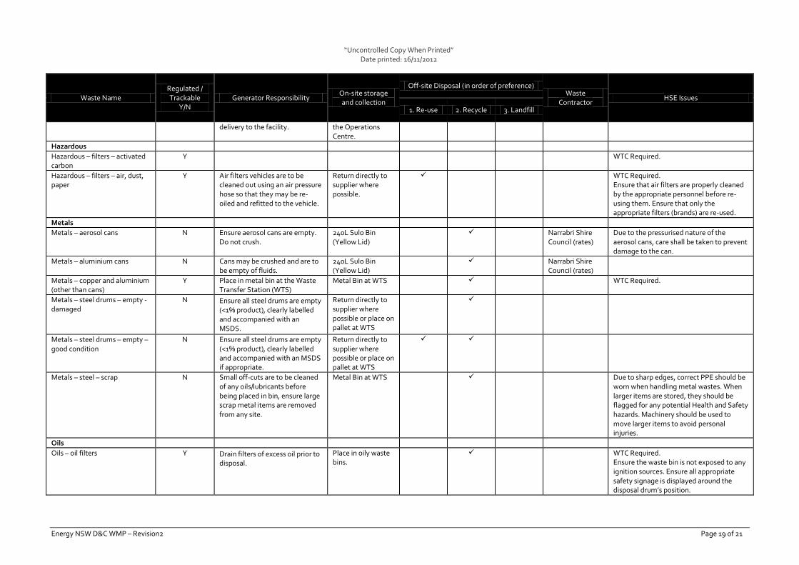
“Uncontrolled Copy When Printed” Date printed: 16/11/2012
Energy NSW D&C WMP – Revision2 Page 19 of 21
Waste Name Regulated / Trackable
Y/N Generator Responsibility
On-site storage and collection
Off-site Disposal (in order of preference) Waste
Contractor HSE Issues
1. Re-use 2. Recycle 3. Landfill
delivery to the facility. the Operations Centre.
Hazardous
Hazardous – filters – activated carbon
Y WTC Required.
Hazardous – filters – air, dust, paper
Y Air filters vehicles are to be cleaned out using an air pressure hose so that they may be re-oiled and refitted to the vehicle.
Return directly to supplier where possible.
WTC Required. Ensure that air filters are properly cleaned by the appropriate personnel before re-using them. Ensure that only the appropriate filters (brands) are re-used.
Metals
Metals – aerosol cans N Ensure aerosol cans are empty. Do not crush.
240L Sulo Bin (Yellow Lid)
Narrabri Shire Council (rates)
Due to the pressurised nature of the aerosol cans, care shall be taken to prevent damage to the can.
Metals – aluminium cans N Cans may be crushed and are to be empty of fluids.
240L Sulo Bin (Yellow Lid)
Narrabri Shire Council (rates)
Metals – copper and aluminium (other than cans)
Y Place in metal bin at the Waste Transfer Station (WTS)
Metal Bin at WTS WTC Required.
Metals – steel drums – empty - damaged
N Ensure all steel drums are empty (<1% product), clearly labelled and accompanied with an MSDS.
Return directly to supplier where possible or place on pallet at WTS
Metals – steel drums – empty – good condition
N Ensure all steel drums are empty (<1% product), clearly labelled and accompanied with an MSDS if appropriate.
Return directly to supplier where possible or place on pallet at WTS
Metals – steel – scrap N Small off-cuts are to be cleaned of any oils/lubricants before being placed in bin, ensure large scrap metal items are removed from any site.
Metal Bin at WTS Due to sharp edges, correct PPE should be worn when handling metal wastes. When larger items are stored, they should be flagged for any potential Health and Safety hazards. Machinery should be used to move larger items to avoid personal injuries.
Oils
Oils – oil filters Y Drain filters of excess oil prior to disposal.
Place in oily waste bins.
WTC Required. Ensure the waste bin is not exposed to any ignition sources. Ensure all appropriate safety signage is displayed around the disposal drum’s position.
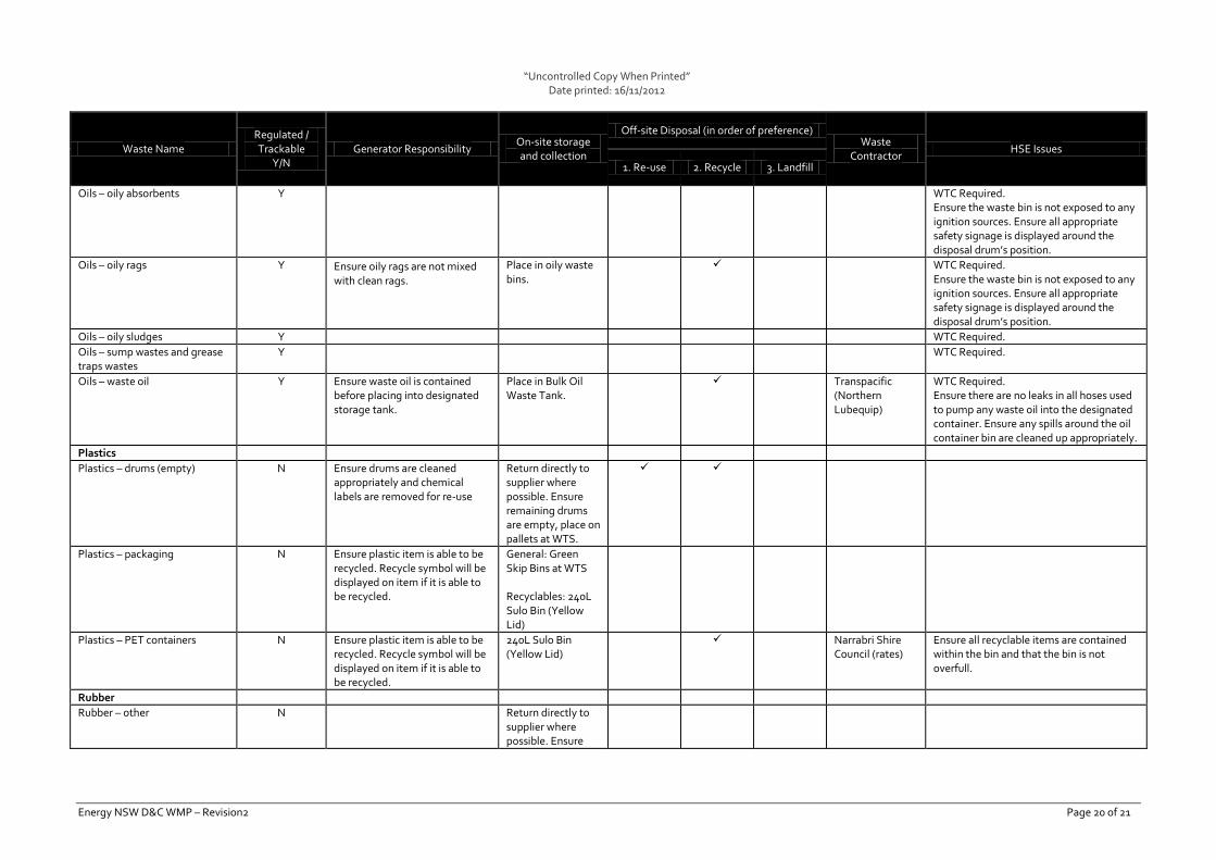
“Uncontrolled Copy When Printed” Date printed: 16/11/2012
Energy NSW D&C WMP – Revision2 Page 20 of 21
Waste Name Regulated / Trackable
Y/N Generator Responsibility
On-site storage and collection
Off-site Disposal (in order of preference) Waste
Contractor HSE Issues
1. Re-use 2. Recycle 3. Landfill
Oils – oily absorbents Y WTC Required. Ensure the waste bin is not exposed to any ignition sources. Ensure all appropriate safety signage is displayed around the disposal drum’s position.
Oils – oily rags Y Ensure oily rags are not mixed with clean rags.
Place in oily waste bins.
WTC Required. Ensure the waste bin is not exposed to any ignition sources. Ensure all appropriate safety signage is displayed around the disposal drum’s position.
Oils – oily sludges Y WTC Required.
Oils – sump wastes and grease traps wastes
Y WTC Required.
Oils – waste oil Y Ensure waste oil is contained before placing into designated storage tank.
Place in Bulk Oil Waste Tank.
Transpacific (Northern Lubequip)
WTC Required. Ensure there are no leaks in all hoses used to pump any waste oil into the designated container. Ensure any spills around the oil container bin are cleaned up appropriately.
Plastics
Plastics – drums (empty) N Ensure drums are cleaned appropriately and chemical labels are removed for re-use
Return directly to supplier where possible. Ensure remaining drums are empty, place on pallets at WTS.
Plastics – packaging N Ensure plastic item is able to be recycled. Recycle symbol will be displayed on item if it is able to be recycled.
General: Green Skip Bins at WTS Recyclables: 240L Sulo Bin (Yellow Lid)
Plastics – PET containers N Ensure plastic item is able to be recycled. Recycle symbol will be displayed on item if it is able to be recycled.
240L Sulo Bin (Yellow Lid)
Narrabri Shire Council (rates)
Ensure all recyclable items are contained within the bin and that the bin is not overfull.
Rubber
Rubber – other N Return directly to supplier where possible. Ensure

“Uncontrolled Copy When Printed” Date printed: 16/11/2012
Energy NSW D&C WMP – Revision2 Page 21 of 21
Waste Name Regulated / Trackable
Y/N Generator Responsibility
On-site storage and collection
Off-site Disposal (in order of preference) Waste
Contractor HSE Issues
1. Re-use 2. Recycle 3. Landfill
remaining rubber items are placed in container at WTS.
Rubber – tyres and tubes Y Ensure that un-usable tyres are taken to retailer who will then look after the disposal of the tyres.
Return directly to supplier where possible. Ensure remaining tyres are placed on pallets at WTS.
Namoi Valley Tyres
WTC Required.
Sewerage
Septic waste Y Ensure effluent is stored in sealed and appropriate tanks.
Solids and grey water removed by licenced contractor.
Narrabri Septic Services
WTC Required. Monitoring should be conducted to ensure there are no leaks in any septic tanks.
Wood and Garden Waste
Wood/garden – garden waste N
Wood/garden – wood – general N Place in recycling area at WTS
Wood/garden – wood – pallets N Return directly to supplier where possible. Ensure remaining pallets are stored at WTS.
Other
Other – concrete and ceramics N
Other – personal protective equipment
N Place in general waste bins on site.
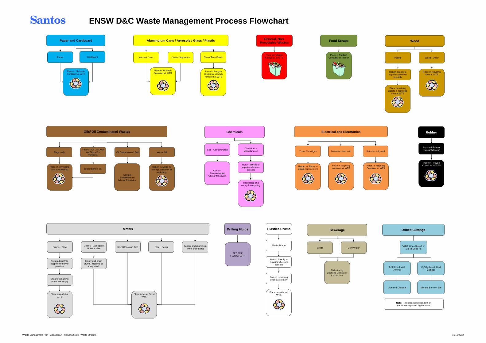
Santos ENSW D&C Waste Management Process Flowchart
Paper and Cardboard
Cardboard Paper
Place in Rubbish Container at WTS
General, Non-Recyclable Wastes
Place in Rubbish Container at WTS
Chemicals
Chemicals - Miscellaneous
Soil – Contaminated
Contact Environmental
Advisor for advice.
Return directly to supplier wherever
possible
Triple rinse and empty for recycling
Plastics Drums
Return directly to supplier wherever
possible
Plastic Drums
Ensure remaining drums are empty
Place on pallets at WTS
Electrical and Electronics
Batteries - dry cell Batteries - lead acid Toner Cartridges
Place in recycling container at WTS
Return to Stores to obtain replacement
Place in recycling Container at WTS
Wood
Pallets Wood - Other
Return directly to supplier wherever
possible
Place remaining pallets in recycling
area at WTS
Place in recycling area at WTS
Assorted Rubber (Hoses/Belts etc)
Rubber
Place in Recycle Container at WTS
Clean/ Dirty Plastic
Place in Recycle Container with lids removed at WTS
Aluminuium Cans / Aerosols / Glass / Plastic
Clean/ Dirty Glass
Place in Rubbish Container at WTS
Aerosol Cans
Food Scraps
Place in Rubbish Container in Kitchen
Oils/ Oil Contaminated Wastes
Filters – Oil ( Oil And Air Filters For
Vehicles). Rags - oily
Place in oily waste bins at workshop Drain filters of oil.
Oil Contaminated Soil Waste Oil
Return to waste oil storage container at
workshop. Contact
Environmental Advisor for advice.
Place in Metal Bin at WTS
Metals
Drums - Damaged / Unreturnable
Drums – Steel Steel - scrap Steel Cans and Tins Copper and aluminium (other than cans)
Return directly to supplier wherever
possible
Ensure remaining drums are empty
Place on pallet at WTS
Empty and crush drums. Recycle as
scrap steel.
Drilling Fluids
SEE FMP FLOWCHART
Sewerage
Grey Water Solids
Collected by Licenced Contractor
for Disposal
Note: Final disposal dependent on Farm Management Agreements
Drilled Cuttings
Drill Cuttings Stored on Site in Lined Pit
KCl Based Mud Cuttings
Licenced Disposal Mix and Bury on Site
K2SO4 Based Mud Cuttings
Waste Management Plan - Appendix A - Flowchart.xlsx Waste Streams 16/11/2012
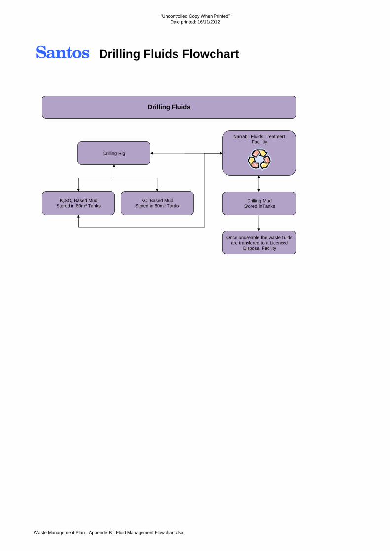
“Uncontrolled Copy When Printed”
Date printed: 16/11/2012
Santos Drilling Fluids Flowchart
Drilling Fluids
Narrabri Fluids Treatment Facilitiy
K2SO4 Based Mud Stored in 80m3 Tanks
KCl Based Mud Stored in 80m3 Tanks
Drilling Rig
Once unuseable the waste fluids are transfered to a Licenced
Disposal Facility
Drilling Mud Stored inTanks
Waste Management Plan - Appendix B - Fluid Management Flowchart.xlsx