Examine this image of a Canadian forest. Imagine you have suddenly been placed in this environment,...
42
Examine this image of a Canadian forest. Imagine you have suddenly been placed in this environment, and you must survive there for a year. On a blank piece of paper under Bellringers, describe the shelter you would build, the clothing you would make to protect yourself from the elements, and the tools you would create to acquire food. Tell why you designed the items the way you did. Mention the 08/2 1 08/2 2
-
Upload
anthony-atkinson -
Category
Documents
-
view
213 -
download
0
Transcript of Examine this image of a Canadian forest. Imagine you have suddenly been placed in this environment,...

Examine this image of a Canadian forest. Imagine you have suddenly been placed in this environment, and you must survive there for a year.
On a blank piece of paper under Bellringers, describe the shelter you would build, the clothing you would make to protect yourself from the elements, and the tools you would create to acquire food.
Tell why you designed the items the way you did. Mention the natural resources you would use.
08/2108/22
Bellringer
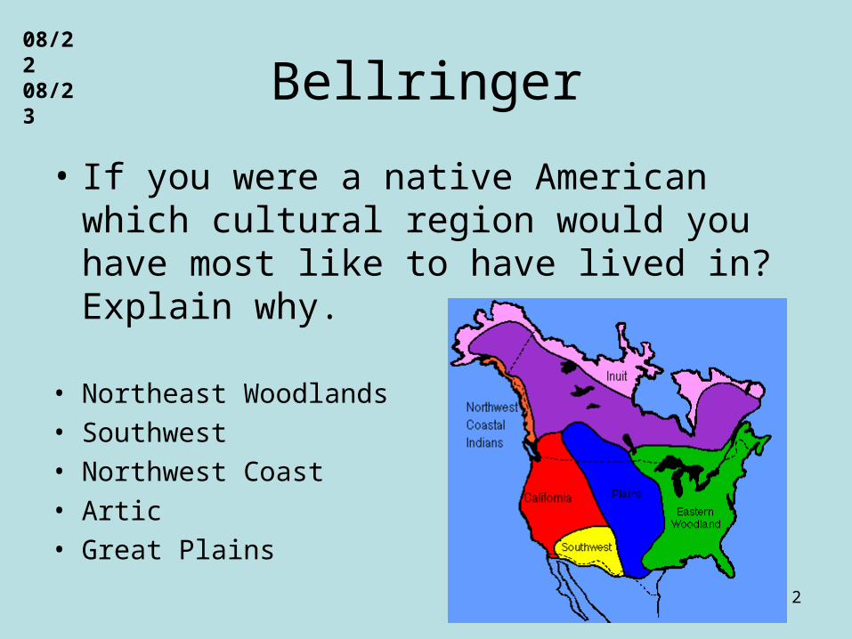
• If you were a native American which cultural region would you have most like to have lived in? Explain why.
• Northeast Woodlands• Southwest• Northwest Coast• Artic• Great Plains
2
08/2208/23


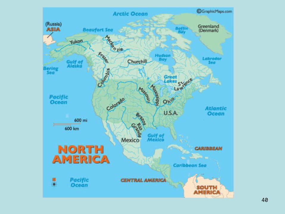
The Eastern Woodland Area is located from Canada in the north to the Gulf of Mexico in the south and from the Atlantic Ocean in the east to the Mississippi River in the west.
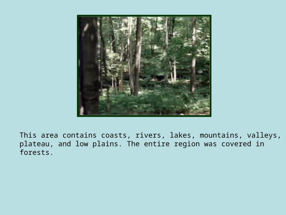
This area contains coasts, rivers, lakes, mountains, valleys, plateau, and low plains. The entire region was covered in forests.

•Algonquian and Great Lake Tribes
•Iroquois
•Creek Confederacy
The people were divided into 3 groups:

The Algonquian group lived in the northeast. They were mostly hunters, but did some farming. They made clothes from elk and deer hides.
They loved to make dreamcatchers.
The Algonquian grouplived in wigwams.

The Great Lake Tribes were in the northeast. They were hunters, farmers, and ate wild rice. Their clothes were made from elk and deer hides. The Indians in the Great Lake region lived in wigwams.
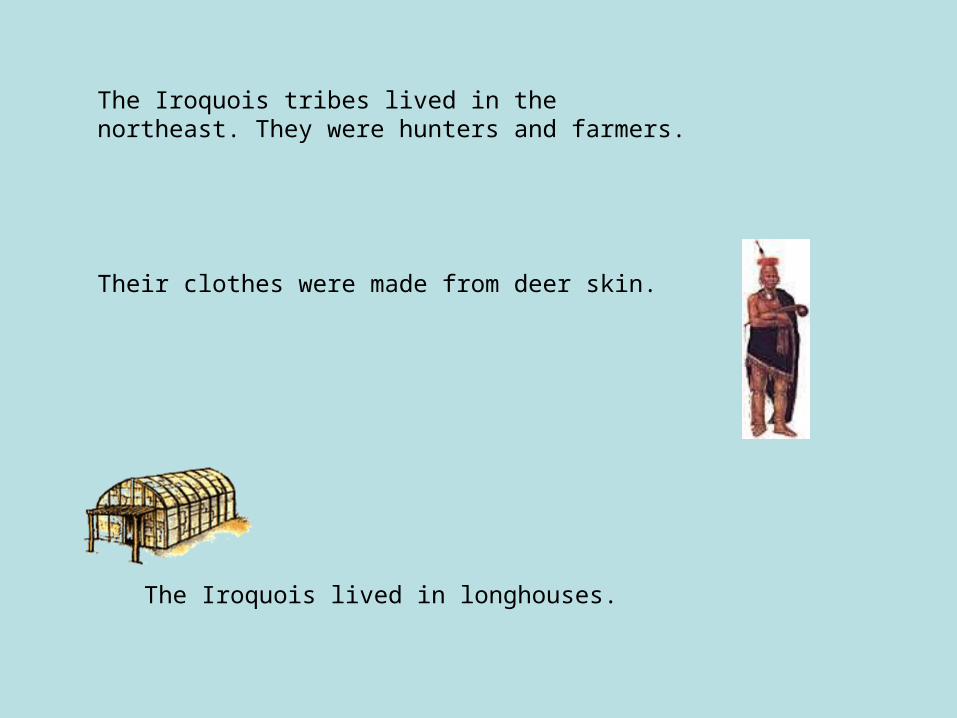
The Iroquois tribes lived in the northeast. They were hunters and farmers.
The Iroquois lived in longhouses.
Their clothes were made from deer skin.

The Cherokee and Seminole Indians belonged to the group called the Creek Confederacy. They lived in the southeast and were farmers and hunters.
Their clothes were made from hides and plant fibers.
They lived in homes made of wood and/or thatch.


The Southwest region covered the area which in now Utah and Colorado through Arizona and New Mexico into parts of Texas and California. This area contained steep-walled canyons, plateaus, and sandy deserts. To the south were mountains. Four rivers run through this area: the Rio Grande, Colorado, Gila, and Salt.

The Pueblos lived in the southwest. They were farmers growing mostly corn.
They lived in pueblos. These were a type of apartment building made of clay.
Their clothes made from cotton.
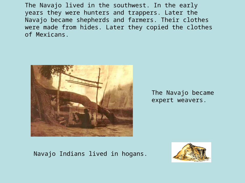
The Navajo lived in the southwest. In the early years they were hunters and trappers. Later the Navajo became shepherds and farmers. Their clothes were made from hides. Later they copied the clothes of Mexicans.
Navajo Indians lived in hogans.
The Navajo became expert weavers.
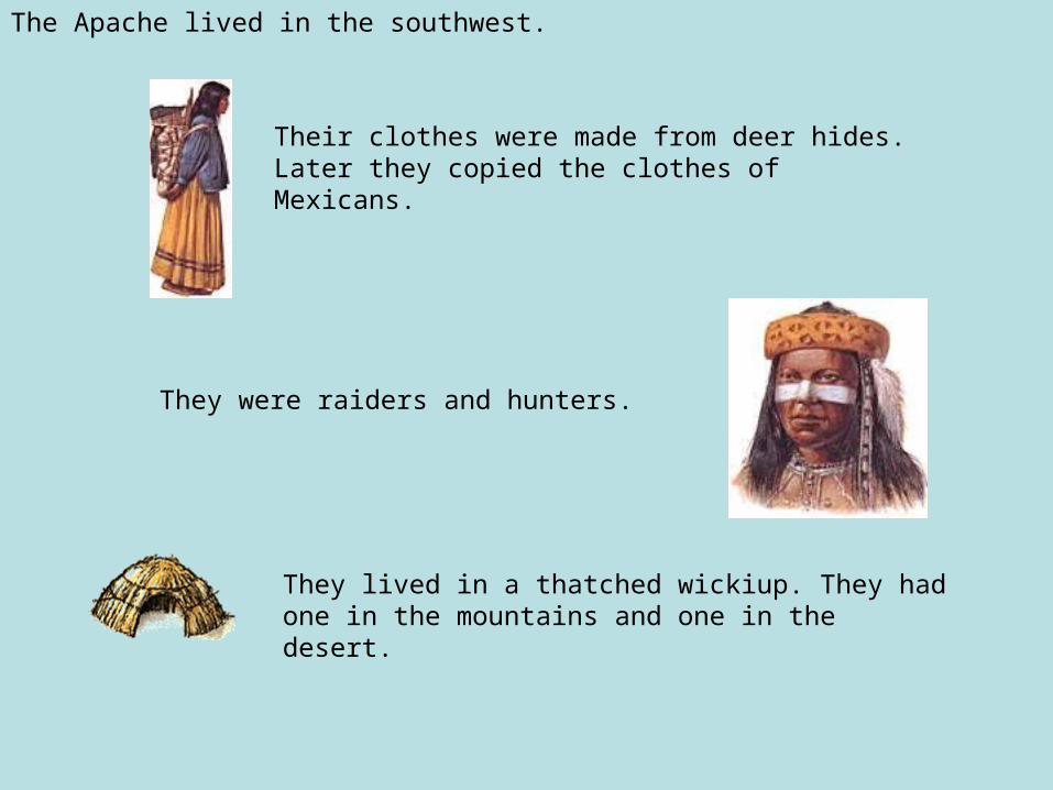
The Apache lived in the southwest.
Their clothes were made from deer hides. Later they copied the clothes of Mexicans.
They lived in a thatched wickiup. They had one in the mountains and one in the desert.
They were raiders and hunters.

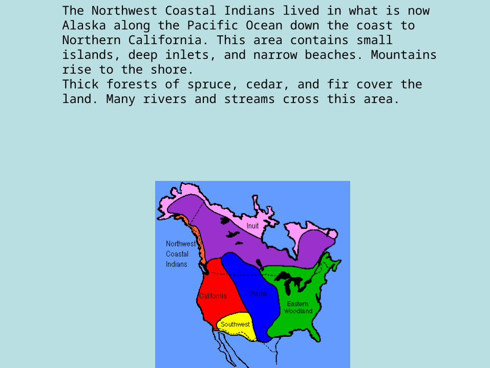
The Northwest Coastal Indians lived in what is now Alaska along the Pacific Ocean down the coast to Northern California. This area contains small islands, deep inlets, and narrow beaches. Mountains rise to the shore. Thick forests of spruce, cedar, and fir cover the land. Many rivers and streams cross this area.

The Northwest Coastal Indians lived in the northwest. They were fishermen, hunters and gathered food from the forests.
The Northwest Indians lived in plank homes. They placed totem poles in front of their homes.
Little clothing was wore in the summer. In the winter they made clothing from fiber, and skins, and basket hats.

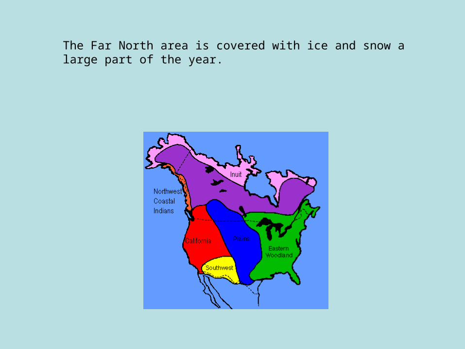
The Far North area is covered with ice and snow a large part of the year.

The Inuit people(Eskimos)lived in far north. They made their clothes from seal and caribou hides.
They were fishermen and hunters.
Inuit people made igloos when out hunting. Their more permanent homes were built of stone and earth.

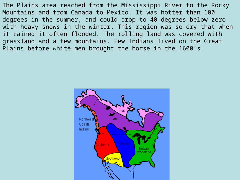
The Plains area reached from the Mississippi River to the Rocky Mountains and from Canada to Mexico. It was hotter than 100 degrees in the summer, and could drop to 40 degrees below zero with heavy snows in the winter. This region was so dry that when it rained it often flooded. The rolling land was covered with grassland and a few mountains. Few Indians lived on the Great Plains before white men brought the horse in the 1600’s.

The Plains Indians lived in the middle of North America.
They hunted buffalo.
Their clothes were made from buffalo hides.
Plains Indians lived in teepees.


26
Native Americans:
What does the geography tell you about the people?

27
George Catlin painting, Rocky Mountains, 1850
The History Companion. Insturctor Companion. Maps, Images, and
Multimedia for US History. 2005, Houghton Mifflin Company.
28
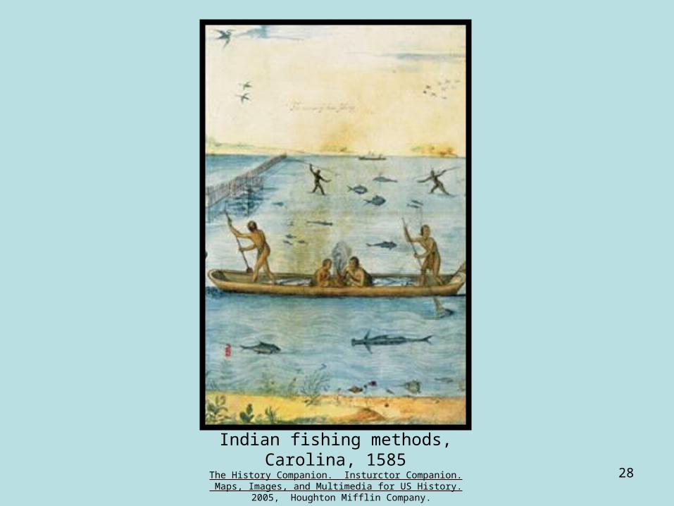
Indian fishing methods, Carolina, 1585
The History Companion. Insturctor Companion. Maps, Images, and Multimedia for US History. 2005, Houghton
Mifflin Company.

29Reconstructed Iroquian VillageThe History Companion. Insturctor Companion. Maps,
Images, and Multimedia for US History. 2005, Houghton Mifflin Company.

30
King Philip--Metacomet, 19th cent.The History Companion. Insturctor Companion. Maps, Images, and Multimedia for US History. 2005, Houghton
Mifflin Company.
31
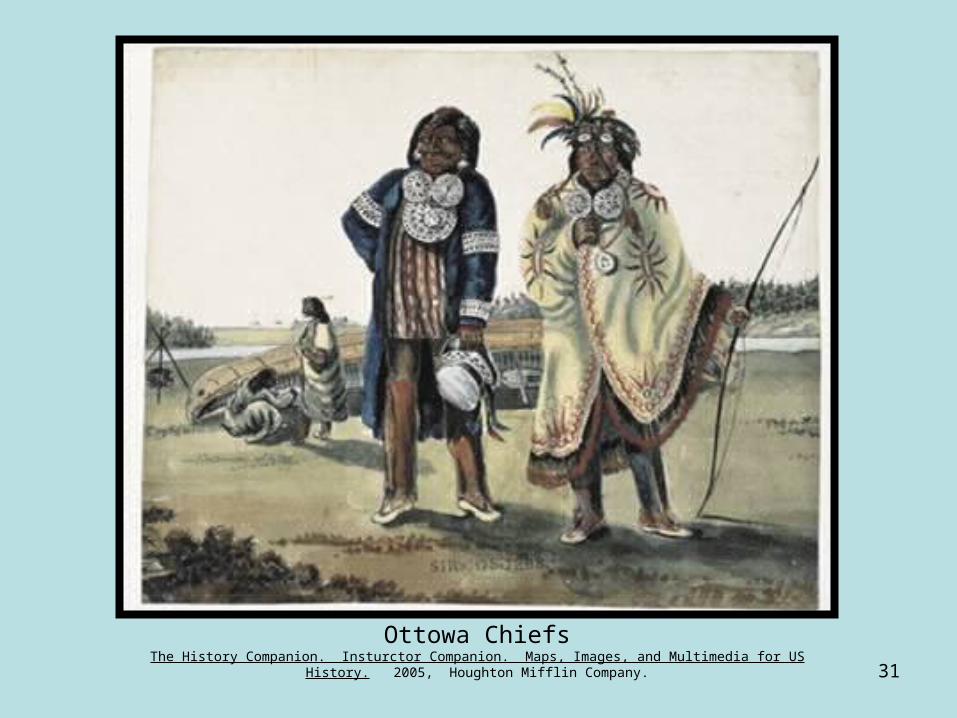
Ottowa ChiefsThe History Companion. Insturctor Companion. Maps, Images, and Multimedia for US History. 2005, Houghton
Mifflin Company.
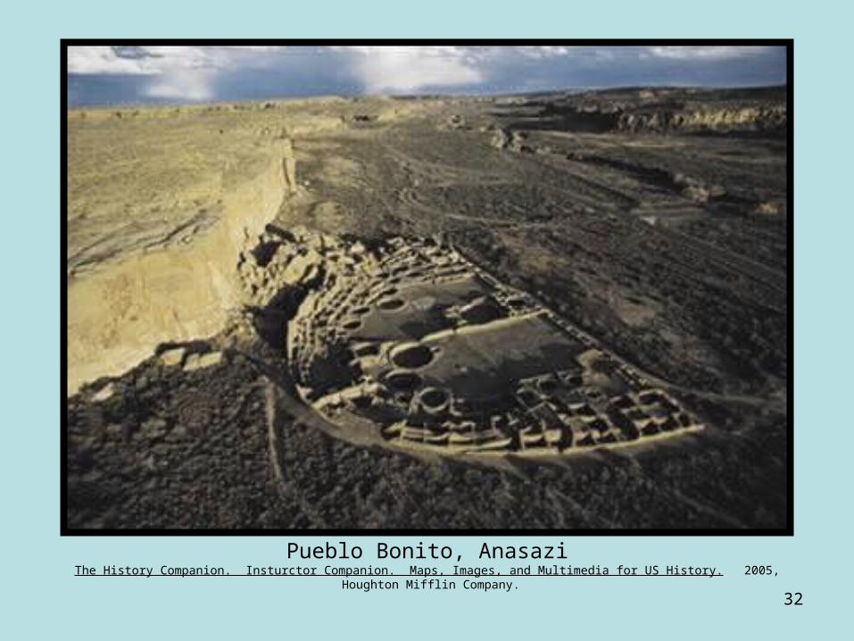
32
Pueblo Bonito, AnasaziThe History Companion. Insturctor Companion. Maps, Images, and Multimedia for US History. 2005, Houghton Mifflin Company.

33
Tokouo, Cherokee Settlement, 1790’s.The History Companion. Insturctor Companion. Maps, Images, and Multimedia for US History. 2005, Houghton Mifflin
Company.

34
Trading with English, Martha's Vinyard, 1634.The History Companion. Insturctor Companion. Maps, Images, and Multimedia for US History. 2005, Houghton Mifflin Company.
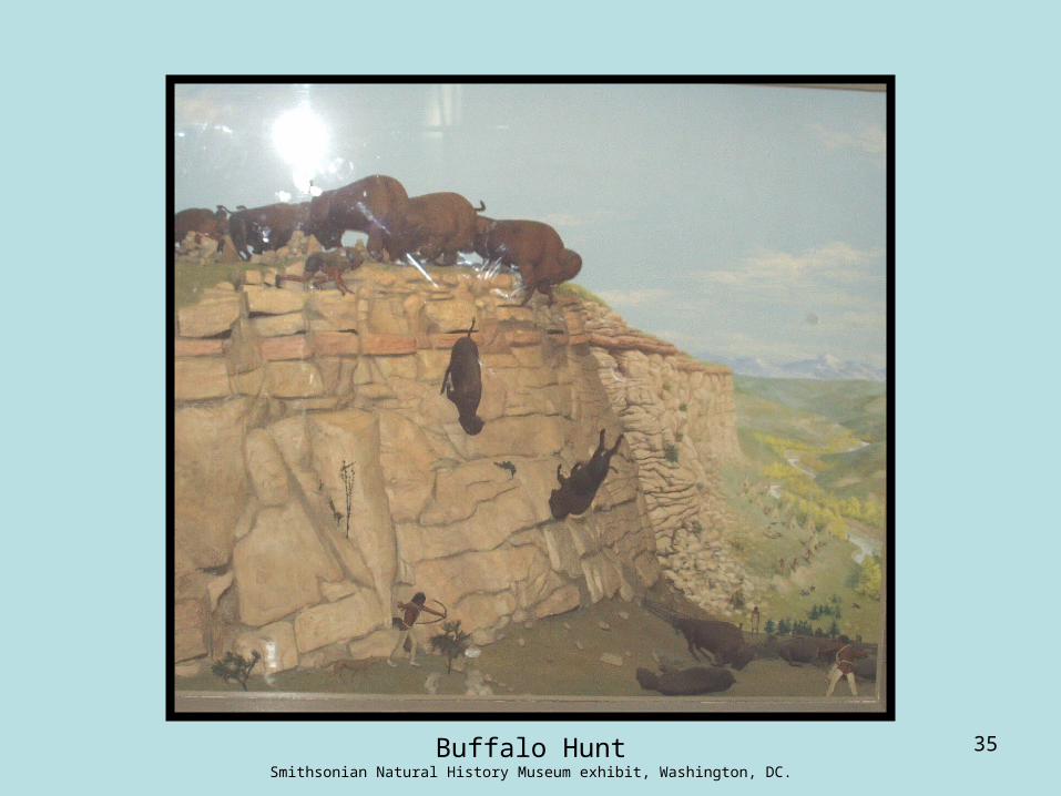
35Buffalo HuntSmithsonian Natural History Museum exhibit, Washington, DC.

36
Shores of Nootka Sound, Northwest Coast.Northwestern University Library, Edward S. Curtis's 'The North American Indian': the Photographic Images, 2001.

37
Tlingit house with painting and totem pole, deserted Cape Fox village, Alaska, 1899.
University of Washington Libraries, Harriman Alaska Expedition Collection no. 333.

38
Woman collecting mussels, Northwest Coast.Northwestern University Library, Edward S. Curtis's 'The North American Indian': the Photographic Images, 2001.
39
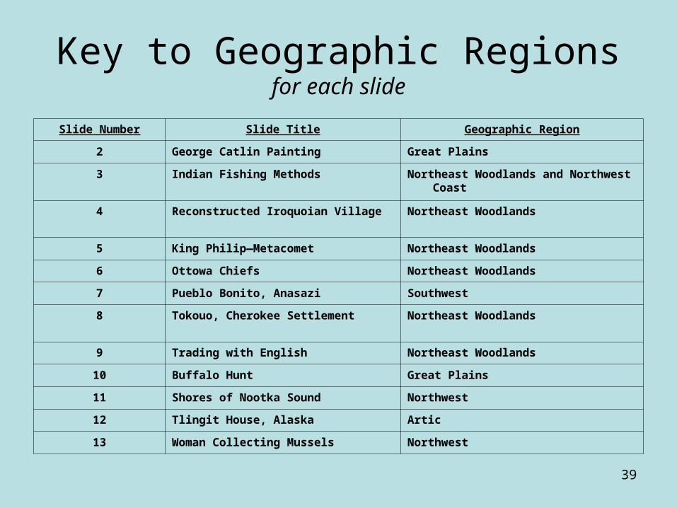
Key to Geographic Regionsfor each slide
Slide Number Slide Title Geographic Region
2 George Catlin Painting Great Plains
3 Indian Fishing Methods Northeast Woodlands and Northwest Coast
4 Reconstructed Iroquoian Village Northeast Woodlands
5 King Philip—Metacomet Northeast Woodlands
6 Ottowa Chiefs Northeast Woodlands
7 Pueblo Bonito, Anasazi Southwest
8 Tokouo, Cherokee Settlement Northeast Woodlands
9 Trading with English Northeast Woodlands
10 Buffalo Hunt Great Plains
11 Shores of Nootka Sound Northwest
12 Tlingit House, Alaska Artic
13 Woman Collecting Mussels Northwest
40

41

42
BA
CD
E F
G
H