Edward Prochon - CRC Mining - Geophysical logging for underground inseam drilling (CRCMining...
38
1 CRCMINING TRANSFORMING MINING Advanced Logging Tool Edward Prochon
-
Upload
informa-australia -
Category
Business
-
view
570 -
download
1
Transcript of Edward Prochon - CRC Mining - Geophysical logging for underground inseam drilling (CRCMining...
1
CRCMINING
TRANSFORMING MINING
Advanced Logging Tool
Edward Prochon
2
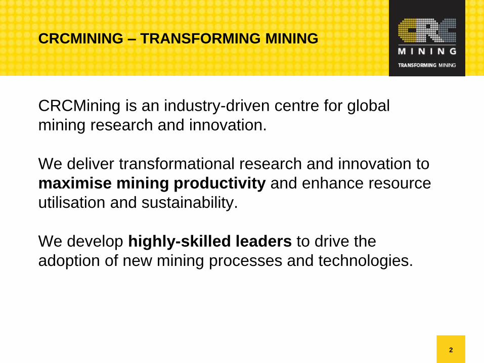
CRCMINING – TRANSFORMING MINING
CRCMining is an industry-driven centre for global
mining research and innovation.
We deliver transformational research and innovation to
maximise mining productivity and enhance resource
utilisation and sustainability.
We develop highly-skilled leaders to drive the
adoption of new mining processes and technologies.

3
BREAKTHROUGH SOLUTIONS
Shaping the Mining Industry
EdanSafe – Smart Cap operator
fatigue monitoring technology
A baseball cap that monitors and
analyses the wearer’s brainwaves to
determine state of fatigue.
Ezymine Automation
Automation of digging machines,
particularly large electric rope
shovels.
Acumine Collision Avoidance
System
Provides proximity detection
capabilities between haul trucks, light
vehicles and personnel.
Odyssey Technology –
oscillating disc cutter (ODC)
Novel technology for cutting very
hard rock with lightweight mining
equipment, significantly reducing
rock breakage forces.
Commercialised with Joy Global.
Mineware – Pegasys and Argus
Pegasys accurately measures the
performance of dragline operations.
The Argus Shovel Monitor advanced
monitoring system manages shovel
payload, real-time truck loading,
operator performance, and machine
positioning.
Geomole Borehole radar systems
Detects fracture zones at distances as
far as 30 meters or more from the
borehole in electrically resistive rocks.
Tight Radius Drilling (TRD)
Unique water jet drilling technology
with vastly superior performance for
extracting methane gas from coal
seams.
Universal Dig and Dump (UDD)
dragline technology
Increases dragline payloads and
productivity by 15-25 percent.
Pulsed Water Jet technology
Innovative pulsed water jet system for
rapid breakage of oversize rocks at draw
points, ore-passes and sizers.
Cave Tracking technology
Revolutionary technology monitoring the
material flow in block caves in real-time.
Shovel Load Assist Program (SLAP)
Operator assistance technologies for
electric mining shovels.
TruckShield: Prevents collisions between
the shovel and truck.
AutoLoad: Automates the swing, dump
and return phases of the shovel loading
cycle.
Fibre Optic Sensing TECHNOLOGY
In seam gas drainage monitoring.
Conveyor condition monitoring.
Shape sensing.
Underground environment monitoring.

4
INTRODUCTION
5
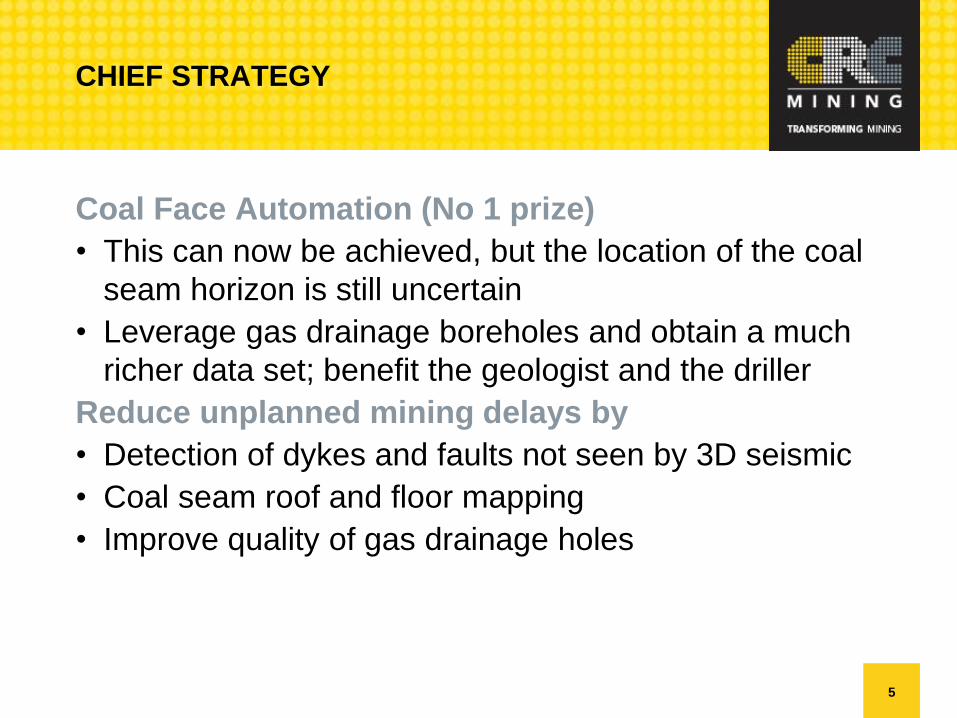
CHIEF STRATEGY
Coal Face Automation (No 1 prize)
• This can now be achieved, but the location of the coal
seam horizon is still uncertain
• Leverage gas drainage boreholes and obtain a much
richer data set; benefit the geologist and the driller
Reduce unplanned mining delays by
• Detection of dykes and faults not seen by 3D seismic
• Coal seam roof and floor mapping
• Improve quality of gas drainage holes
6
PRESENTATION OVERVIEW
• Describe industry challenges
• Overview of current methods
• Geo-steering
• Mapping of the coal seam for horizon control
• Overview CRCMining’s work
• Conclusion
7
OVERVIEW OF EXISTING CHALLENGES
8
EXISTING CHALLENGES
Underground Inseam Drilling
• Drilling blind (with orientation data only) is slow and
unproductive due to lack of geological information.
• Surface to Inseam (SIS) survey tools are not certified for
underground (ANZEx) and sometimes oversized.
• In Australia geo-sensing tools for coal interface detection
have not been embraced• Short effective depth of investigation.
• Cost of equipment in borehole becomes high.
• Increased risk profile.
• Cost of data interpretation service.

9
EXISTING CHALLENGES
As a result of the existing limitations, frequent roof touches
and branching has become the accepted practice for
checking where you are inside the seam; despite adding to
borehole instability.
10
EXISTING CHALLENGES
Longwall Planning & Automation
• Automation demands accurate roof and floor topography
and seam tomography ahead of the mining face• At the face (requires high confidence, and highest level of
accuracy)
• 10-20m ahead (0.5m accuracy)
• Coal seam imaging methods such as 3D seismic & RIM
lack resolution
• Inseam imaging tools have the resolution but have a
limited depth of investigation.

11
MAPPING THE SEAM - REQUIREMENTS
A technology is required that can do two things:
• Accurately detect the roof and floor at sufficient range
to assist with drilling.• Drilling straighter holes,
• Eliminate roof and floor touches and branching
• Stay at a target distance from either the roof or the floor.
• Accurately map the coal seam 10-20m head of mining.• Ultimate target is to accurately map the contour of the roof and floor
• Identify fault throws that can not be detected by 3D seismic.
• Identify dykes and other anomalies.
12
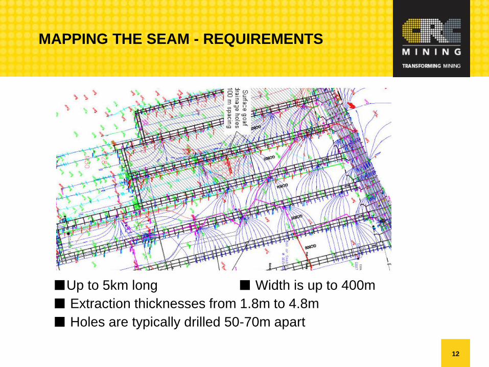
MAPPING THE SEAM - REQUIREMENTS
■Up to 5km long ■Width is up to 400m
■ Extraction thicknesses from 1.8m to 4.8m
■ Holes are typically drilled 50-70m apart

13
MAPPING THE COAL SEAM
14
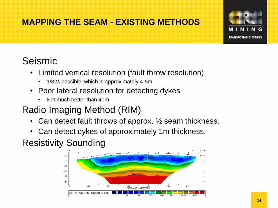
MAPPING THE SEAM - EXISTING METHODS
Seismic• Limited vertical resolution (fault throw resolution)
• 1/32λ possible; which is approximately 4-5m
• Poor lateral resolution for detecting dykes• Not much better than 40m
Radio Imaging Method (RIM)• Can detect fault throws of approx. ½ seam thickness.
• Can detect dykes of approximately 1m thickness.
Resistivity Sounding

15
MAPPING THE SEAM - EXISTING METHODS
Online monitoring at the face
• Laser analysis (LIBS)
• Infra read seam tracking (LASC automation)
• Radar
• Ultra sound
16
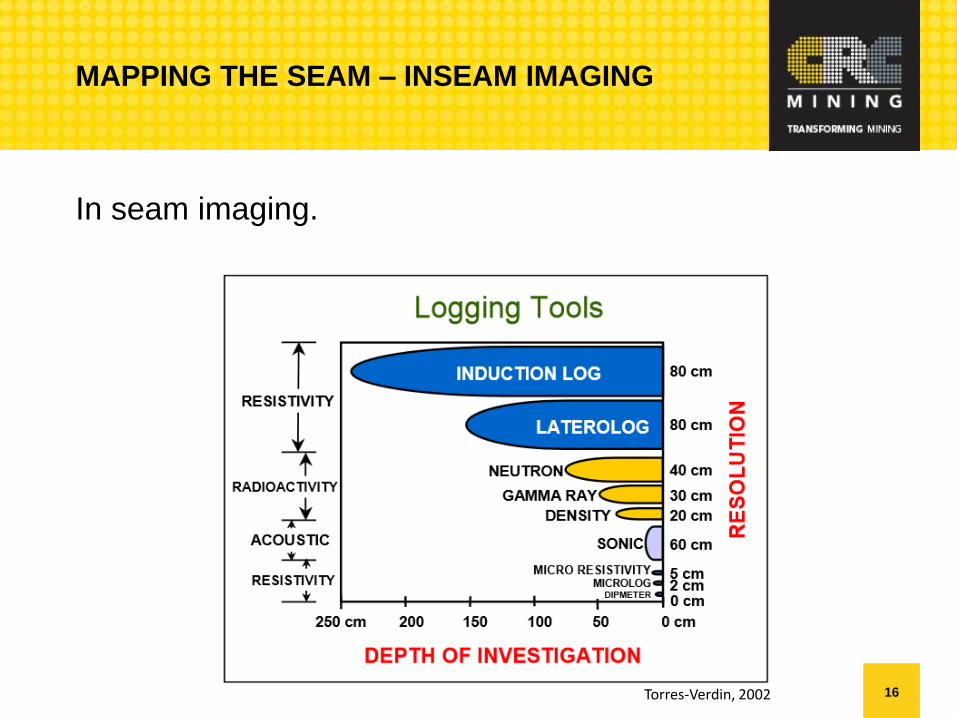
MAPPING THE SEAM – INSEAM IMAGING
In seam imaging.
Torres-Verdin, 2002

17
Resistivity – Wave Propagation (pros)
• Up to 3m depth of investigation
• Works well in both high and low resistivity muds.
• Multiple attenuation and phase shift measurements with
angled receiver coils provide localization information
EXISTING METHODS
18
Resistivity – Wave Propagation (cons)
• The measurement is very complex, and has a reduced
range.
• Collar style tools have technical compromises and lack
the measurement quality of wireline tools.
• Would be technically challenging to design in a short
slimline sub
• We were quoted >$1M for a slimline prototype.
EXISTING METHODS
19
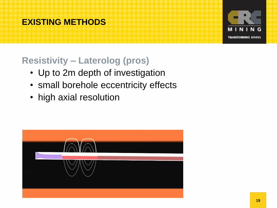
Resistivity – Laterolog (pros)
• Up to 2m depth of investigation
• small borehole eccentricity effects
• high axial resolution
EXISTING METHODS
20
Resistivity – Laterolog (cons)
• An ANZEx design may have limited power/current
available for effective excitation and control of the field.
• For maximum effectiveness, electrode sub length of up
to 8m is required.
EXISTING METHODS

21
GEOSTEERING

22
Geosteering with directional resistivity and/or near bit
gamma is used in the oil and gas industries as well as in
coal mining SIS drilling.• These technologies are used for geosteering in lateral boreholes
and have been deployed in complex carbonates, shale-gas, shale-
oil, and coal-bed methane formations.
For Underground In-Seam (UIS) drilling, the MECCA DGS
provides a gamma option.
COAL INTERFACE DETECTION – EXISTING
TECHNOLOGIES
23
GEOSTEERING
• Drilling to a target line with an orientation unit is actually
quite easy. This is not geo-steering.
• In its simplest form geo-steering involves maintaining the
bit inside the target formation by either• Detecting and following a marker band
• Detecting and steering away from the roof and floor.
• In less complex geology it will not be difficult to geo-steer
to maintain the tool on target.
24
GEOSTEERING
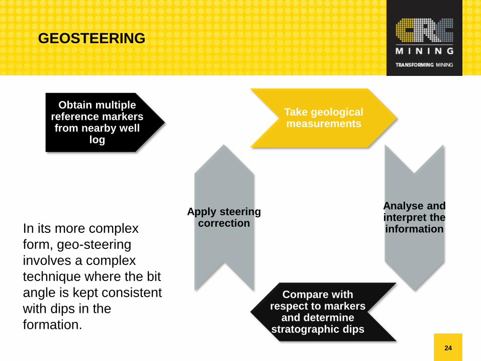
Take geological measurements
Apply steering correctionIn its more complex
form, geo-steering
involves a complex
technique where the bit
angle is kept consistent
with dips in the
formation.
Compare with respect to markers
and determine stratographic dips
Analyse and interpret the information
Obtain multiple reference markers from nearby well
log

25
CRCMINING’S SOLUTION

26
CRCMINING’S SOLUTION
Coal seam imaging from within the borehole
• Geo-sensing whilst drilling for detecting the roof and floor
of the coal seam is no longer a novel technique.
• Directional resistivity for coal interface detection (CID)
1m+ depth of investigation and resolution < 30cm.
• Directional gamma or micro resistivity for imaging and
correlation.

27
CRCMINING’S SOLUTION
Directional Resistivity
28
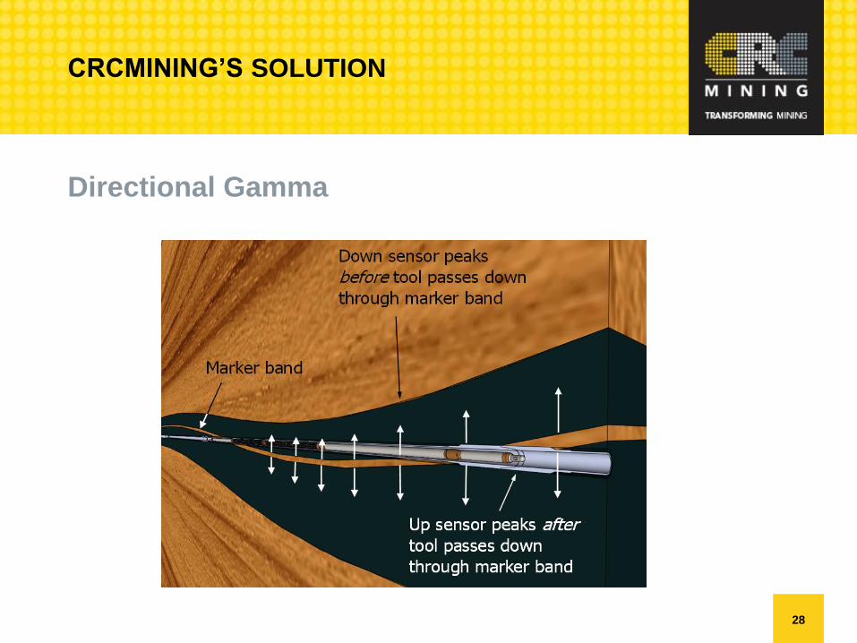
CRCMINING’S SOLUTION
Directional Gamma
29
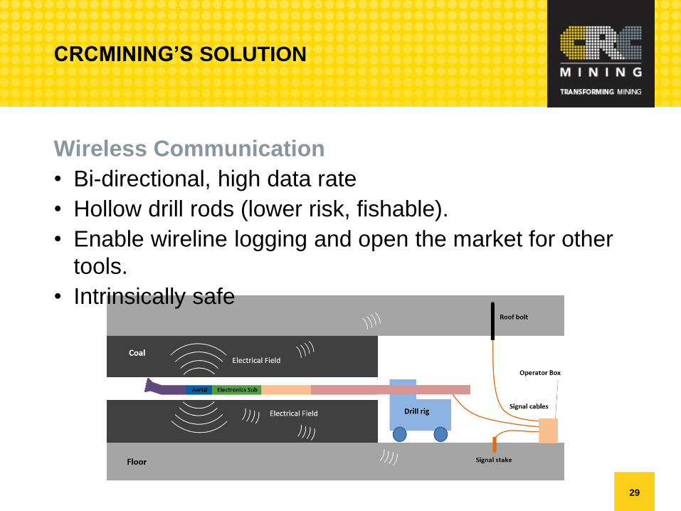
CRCMINING’S SOLUTION
Wireless Communication
• Bi-directional, high data rate
• Hollow drill rods (lower risk, fishable).
• Enable wireline logging and open the market for other
tools.
• Intrinsically safe
30
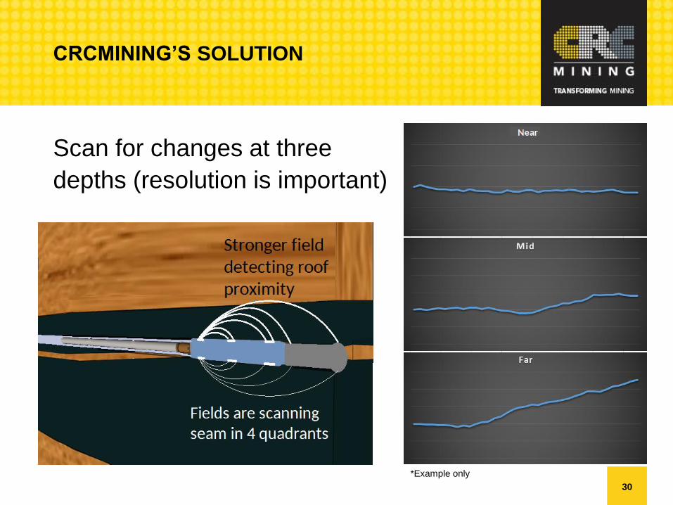
CRCMINING’S SOLUTION
Scan for changes at three
depths (resolution is important)
*Example only
31
CRCMINING’S SOLUTION
Our technical target
• The resistivity data will provide feedback on roof and floor
proximity and direction.
• The gamma will provide imaging for more accurate
delineation and for continuously calculating the dip angle
of the seam.
• The tools will also detect dykes and faults that were not
picked up by 3D seismic.
• When you pass through a fault, the sensors will identify
the direction of the coal seam (within a maximum
distance).

32
PROJECT OVERVIEW
33
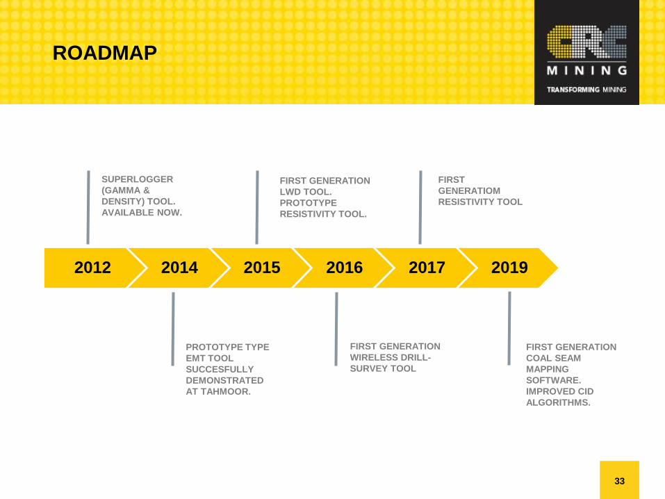
2012 2014 2015 2016 2017 2019
SUPERLOGGER
(GAMMA &
DENSITY) TOOL.
AVAILABLE NOW.
PROTOTYPE TYPE
EMT TOOL
SUCCESFULLY
DEMONSTRATED
AT TAHMOOR.
FIRST GENERATION
WIRELESS DRILL-
SURVEY TOOL
FIRST
GENERATIOM
RESISTIVITY TOOL
FIRST GENERATION
COAL SEAM
MAPPING
SOFTWARE.
IMPROVED CID
ALGORITHMS.
ROADMAP
FIRST GENERATION
LWD TOOL.
PROTOTYPE
RESISTIVITY TOOL.

34
ALT PHASE 1 – DIRECTIONAL GAMMA (2012)
ACARP C16018 completed 2012.
• Directional gamma
• Directional density
• Logs to memory
• Designed to ANZ Exd
• Available now.
• Deployed on wireline in
two 1350m SIS
boreholes
• Resolution surpasses
capabilities of existing
shuttle tools used in
Australia.
35
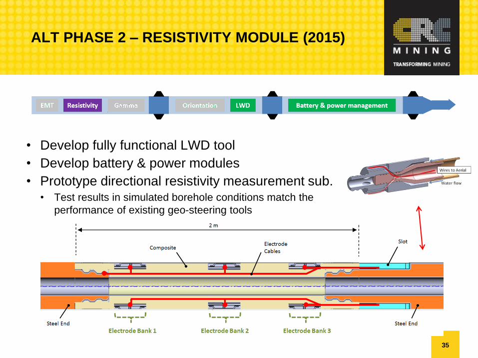
ALT PHASE 2 – RESISTIVITY MODULE (2015)
• Develop fully functional LWD tool
• Develop battery & power modules
• Prototype directional resistivity measurement sub.• Test results in simulated borehole conditions match the
performance of existing geo-steering tools

36
WIRELESS DRILL SURVEY TOOL (2016)
37
CONCLUSION
38
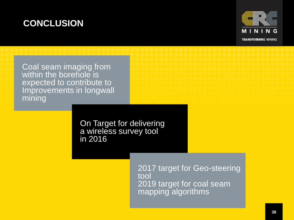
Coal seam imaging from within the borehole is expected to contribute to Improvements in longwallmining
CONCLUSION
On Target for deliveringa wireless survey toolin 2016
2017 target for Geo-steeringtool2019 target for coal seam mapping algorithms