Drought Early Warning Systems
30
Mark Svoboda, Climatologist Monitoring Program Area Leader National Drought Mitigation Center School of Natural Resources University of Nebraska-Lincoln Drought Early Warning Systems Inter-Regional Workshop on Indices and Early Warning Systems for Drought Lincoln, NE December 8-11, 2009
Transcript of Drought Early Warning Systems

Mark Svoboda, Climatologist Monitoring Program Area Leader
National Drought Mitigation Center School of Natural Resources
University of Nebraska-Lincoln
Drought Early Warning Systems
Inter-Regional Workshop on Indices and Early Warning Systems for DroughtLincoln, NE December 8-11, 2009

Individually, many nations will be unable to improve their drought coping capacity.
Collectively, through global, regional, and national partnerships, we can share information and experiences to reduce the impacts of drought.
Global Drought Preparedness Network

Potential Regional Networks
West Asia NetworkMediterranean Network
Eastern and Central European Network
South American Network
North American Network
Sub-Saharan African Network
Asian Network

……..the rapid onset of National Drought Centers/Strategies
AustraliaSouth AfricaCanadaUnited StatesSlovenia/Southeast EuropeSpainEU/JRCPortugalSouth KoreaChinaIndiaPakistanMoroccoSyriaBrazil (Sao Paulo state)JordanIran

The Importance of Drought Early Warning Systems (DEWS)
allows for early drought detectionimproves response (proactive)“triggers” actions within a drought plan a critical mitigation actionfoundation of a drought plan

Components of a Drought Early Warning System
Monitoring AND ForecastingSynthesis/analysis of data used to “trigger” setactions within a drought planEfficient dissemination/communication (WWW, media, extension, education, etc.)Drought risk planning

Potential DEWS System Products and Reports
Historical analysis (drought climatology, impacts, magnitude, frequency)Operational assessment (cooperative data, SPI and other indices, automated networks, satellite and soil moisture data, media and official requests)Predictions/Projections (SPI and other indices, soil moisture, streamflow, seasonal forecasts, SST’s)

NIDIS ObjectivesNIDIS ObjectivesCreating a drought early warning information system
• Coordinating national drought monitoring and forecasting system
• Providing an interactive drought information clearinghouse and delivery system for products and services—including an internet portal and standardized products (databases, forecasts, Geographic Information Systems (GIS), maps, etc)
• Designing mechanisms for improving information to support coordinated preparedness and planning

Drought Monitoring State of the Science:Where are we now?
Heightened awareness as a result of IPCC AR4An explosion of good work/tools/products out there over the past 5 yearsImpediments remain
Lack of coordinationLack of trigger ties to any drought plansResourcesLack of data/long-term dataLack of institutional cooperationLack of drought “mitigation” plans

Drought Monitoring State of the Science:Where are we now?
WCC-3,GDPN/GEOSS is a way to learn/leverage from one another
Canada/Mexico/United StatesUN/WMO/others
Many regions/countries are working together to better monitor droughtMonitoring of impacts globally is virtually non-existentEarly warning/monitoring just one key: THEN WHAT? Need linkages to risk/vulnerability assessment and planning for adaptationMany indicators don’t reflect reality in various regions, or for various season(s)……or for both!

Future Opportunities/ChallengesClimate changePublic health issuesTransboundary issuesFood security and water
Global Water Institute/Water for Food
Risk managementMitigation applicationsPlanning activitiesImproved monitoring and predictionDecision support
National Integrated Drought Information SystemGlobal Integrated Drought Information SystemGlobal “Drought Services” (GFCS)
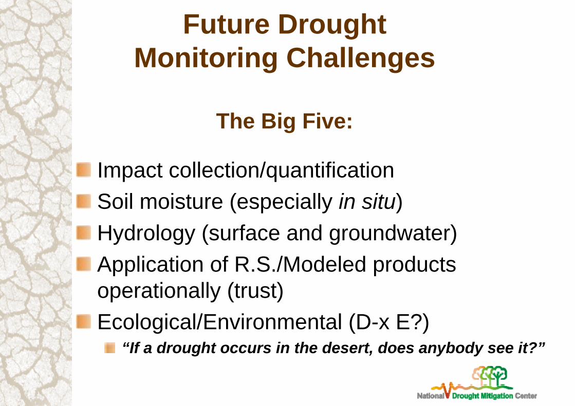
Future DroughtMonitoring Challenges
The Big Five:
Impact collection/quantificationSoil moisture (especially in situ)Hydrology (surface and groundwater)Application of R.S./Modeled products operationally (trust)Ecological/Environmental (D-x E?)
“If a drought occurs in the desert, does anybody see it?”

Any Questions?
Please contact me at:Mark Svoboda
National Drought Mitigation Center402-472-8238
Thank You!

Future Challenges in Water Resources Management
Population growthPopulation migrationTransboundary issues
Climate change and variability
Reallocation of water supplies
Institutional fragmentation
Regional conflicts/war–Water use and consumption trendsLand degradation
Few water development projects

66%
40%
28%
26%
31%
30%21%
20%
23%20%

Mitigation
PlanningMonitoring/Early WarningSupply augmentation
Infrastructure improvements
Demand reductionEducationCommunicationCoordinationLegislation

Components of Successful Drought Mitigation Plans
Monitoring, early warning, and predictionFoundation of a drought mitigation planIndices/indicators linked to impacts and triggers
Risk and impact assessmentWho and what is at risk and why?
Mitigation and responsePro-active programs and actions to reduce risksSafety net/programs
Most drought plans contain only the monitoring and response components.

Importance of Drought IndicesSimplify complex relationships and provide a good communication tool for diverse audiencesQuantitative assessment of anomalous climatic conditions
IntensityDurationSpatial extent
Historical reference (probability of recurrence)
Planning and design applications

Indicators & Triggers Definitions
Indicators: Variables to describe drought conditions.Examples: precipitation, streamflows, groundwater, reservoir levels, soil moisture, Palmer indices, …
Triggers: Specific values of the indicator that initiate and terminate each level of a drought plan, and associated management responses.
Example: precipitation below the 5th percentile for two consecutive months Level 4 Drought.
(From GA State Plan)

Considerations in Choosing Indicators / Triggers
Proper and Timely Detection of Drought Spatial and Temporal SensitivitySupplies and DemandsDrought In / Drought OutComposite and Multiple IndicatorsData Availability, Validity, and ClarityEase of Implementation
(From GA State Plan)

The National Integrated Drought Information System (NIDIS): What is it? What does it do?Mark Svoboda (NDMC), Climatologist, Monitoring Program Area Leader, NIDIS Implementation Team
Roger Pulwarty (NOAA-NPO Director) and Jim Verdin (USGS-Assistant NPO Director) NIDIS Program Office NOAA/ESRL, Boulder, Colorado

NIDIS VISION and GOALSNIDIS VISION and GOALS
““A dynamic and accessible drought A dynamic and accessible drought informationinformationsystem that provides users with the ability to system that provides users with the ability to determine the potential impacts of drought and determine the potential impacts of drought and the associated risks they bring, and the decision the associated risks they bring, and the decision support tools needed to support tools needed to better prepare for and better prepare for and mitigate the effects of drought.mitigate the effects of drought.”” Public Law 109Public Law 109--430 (Signed by the President December 2006) 430 (Signed by the President December 2006)
((www.drought.govwww.drought.gov))

Early Warning System componentsEarly Warning System components
•• Monitoring and forecastingMonitoring and forecasting
•• Risk assessment: Indicators and triggersRisk assessment: Indicators and triggers
•• Drought risk planning and preparednessDrought risk planning and preparedness
•• Drought PortalDrought Portal
•• Communication and EducationCommunication and Education

Key issuesKey issues• What climate and drought-related triggers are
used for management and response seasonal operations, long-term planning (watershed, industry, state, county)?
• How can we most effectively develop and coordinate information for early warning (onset, duration, demise, impacts) into drought plans? (e.g. Exceptional Drought Operation Plan, Interim Operating Plan, Power needs etc?)
• Proposed NIDIS Pilots: Partnerships to maintain a regional dialog on drought, climate and water resources

Current U.S. Drought Portal //drought.gov

RISAs, universities, and labs
Integrating knowledge and products (CDC, ETL, RCCs, RFCs, SCs)
Operational(RCCs, NCDC, CPC, WFOs, SCs,other private sector)R
egio
nal O
vers
ight
and
Eva
luat
ion
OTH
ER N
ON
-NO
AA
PA
RTN
ERS
new or enhanced regional products information delivery technology
sustained & systematic communication and feedback
RESEARCH
&
DEVELOPMENT&
PROTOTYPING
&
SERVICES
National Climate Service: National Climate Service: Information services in support of adaptationInformation services in support of adaptation

What is GEOSS?: The Global Earth Observation System of Systems
The Global Earth Observation System of Systems will provide decision-support tools to a wide variety of users. As with the Internet, GEOSS will be a global and flexible network of content providers allowing decision makers to access an extraordinary range of information at their desk.
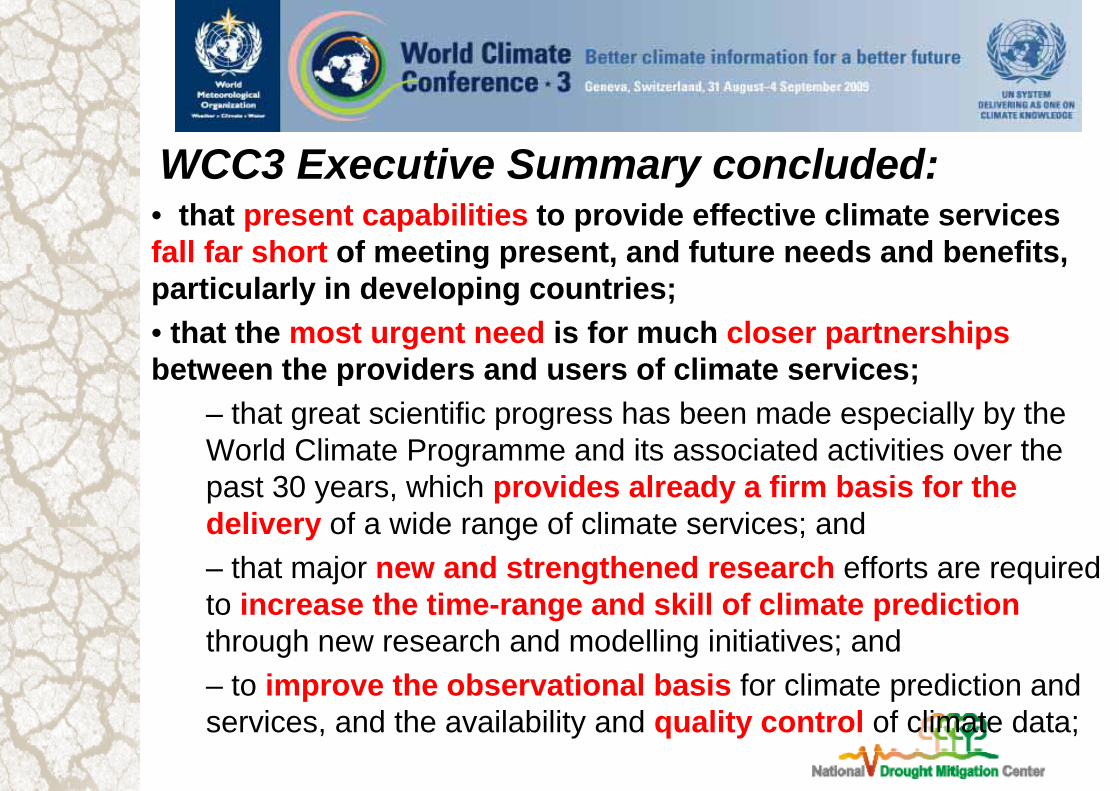
WCC3 Executive Summary concluded:• that present capabilities to provide effective climate services fall far short of meeting present, and future needs and benefits, particularly in developing countries;• that the most urgent need is for much closer partnerships between the providers and users of climate services;
– that great scientific progress has been made especially by the World Climate Programme and its associated activities over the past 30 years, which provides already a firm basis for the delivery of a wide range of climate services; and– that major new and strengthened research efforts are required to increase the time-range and skill of climate prediction through new research and modelling initiatives; and – to improve the observational basis for climate prediction and services, and the availability and quality control of climate data;

• called for major strengthening of the essential elements of a global framework for climate services:
– The Global Climate Observing System and all its components and associated activities; and – provision of free and unrestricted exchange and access to climate data;– The World Climate Research Programme, underpinned by adequate computing resources and increased interaction with other global climate relevant research initiatives.– Climate services information systems taking advantage of enhanced existing national and international climate service arrangements in the delivery of products, including sector-oriented information to support adaptation activities;– Climate user interface mechanisms focused on building linkages and integrating information, at all levels, between theproviders and users of climate services; and– Efficient and enduring capacity building through education, training, and strengthened outreach and communication.
• supported the development of the proposed Global Framework for Climate Services.