Docslide.com.Br Analise de Tuneis Com Power Rail Track
12
© 2012 Bentley Systems, Inc. Análise de Túnel com Bentley Power Rail Track Carlos Galeano [email protected]
description
análise de túneis com power track
Transcript of Docslide.com.Br Analise de Tuneis Com Power Rail Track
© 2
01
2 B
en
tley S
yste
ms,
Inc.
Análise de Túnel com Bentley Power Rail TrackCarlos [email protected]
PowerCivil Fundamentals
© 2
01
2 B
en
tley S
yste
ms,
Inc.
2 | Geospatial, Transportation & Local Infrastructure
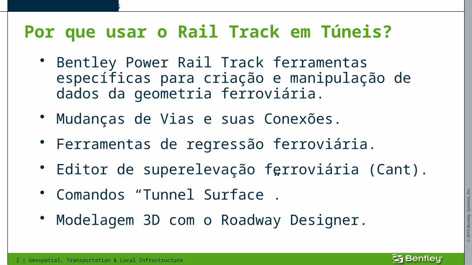
Por que usar o Rail Track em Túneis?
• Bentley Power Rail Track ferramentas específicas para criação e manipulação de dados da geometria ferroviária.
• Mudanças de Vias e suas Conexões.
• Ferramentas de regressão ferroviária.
• Editor de superelevação ferroviária (Cant).
• Comandos “Tunnel Surface”.
• Modelagem 3D com o Roadway Designer.
PowerCivil Fundamentals
© 2
01
2 B
en
tley S
yste
ms,
Inc.
3 | Geospatial, Transportation & Local Infrastructure
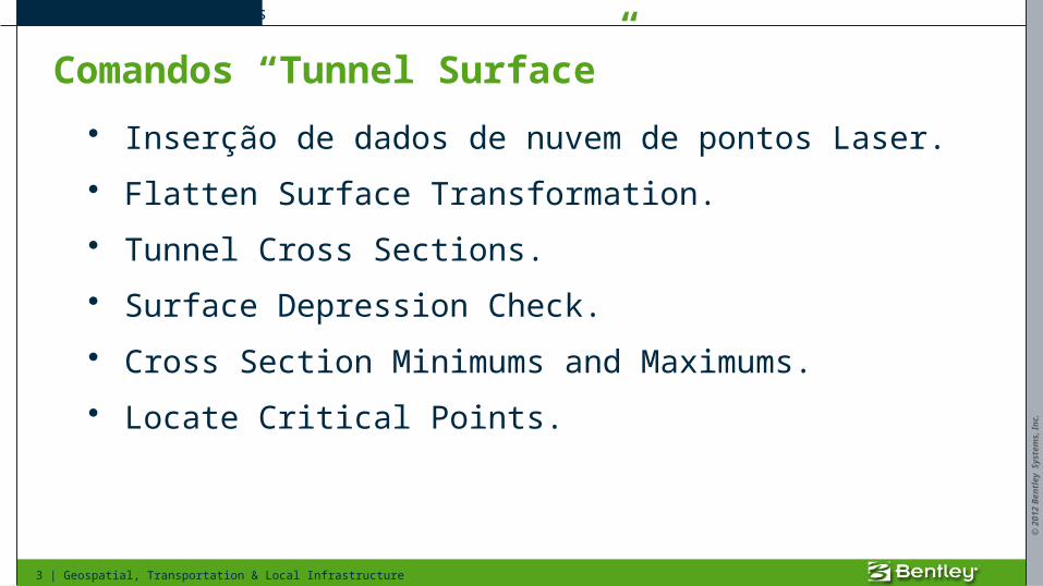
Comandos “Tunnel Surface”
• Inserção de dados de nuvem de pontos Laser.
• Flatten Surface Transformation.
• Tunnel Cross Sections.
• Surface Depression Check.
• Cross Section Minimums and Maximums.
• Locate Critical Points.
PowerCivil Fundamentals
© 2
01
2 B
en
tley S
yste
ms,
Inc.
4 | Geospatial, Transportation & Local Infrastructure
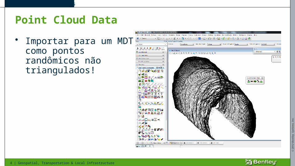
Point Cloud Data
• Importar para um MDT como pontos randômicos não triangulados!
PowerCivil Fundamentals
© 2
01
2 B
en
tley S
yste
ms,
Inc.
5 | Geospatial, Transportation & Local Infrastructure
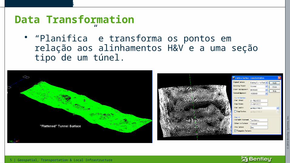
Data Transformation
• “Planifica” e transforma os pontos em relação aos alinhamentos H&V e a uma seção tipo de um túnel.
PowerCivil Fundamentals
© 2
01
2 B
en
tley S
yste
ms,
Inc.
6 | Geospatial, Transportation & Local Infrastructure
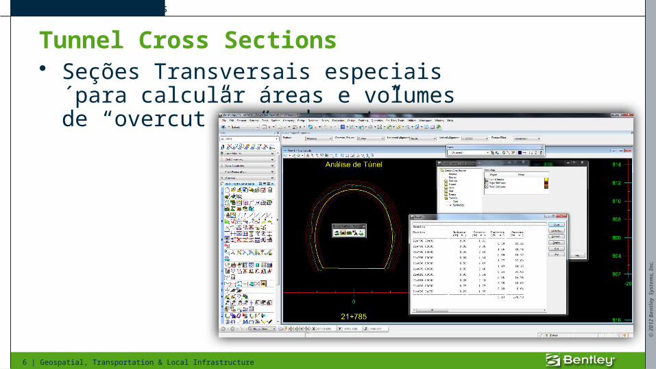
Tunnel Cross Sections• Seções Transversais especiais´para
calcular áreas e volumes de “overcut” e “undercut”.
PowerCivil Fundamentals
© 2
01
2 B
en
tley S
yste
ms,
Inc.
7 | Geospatial, Transportation & Local Infrastructure
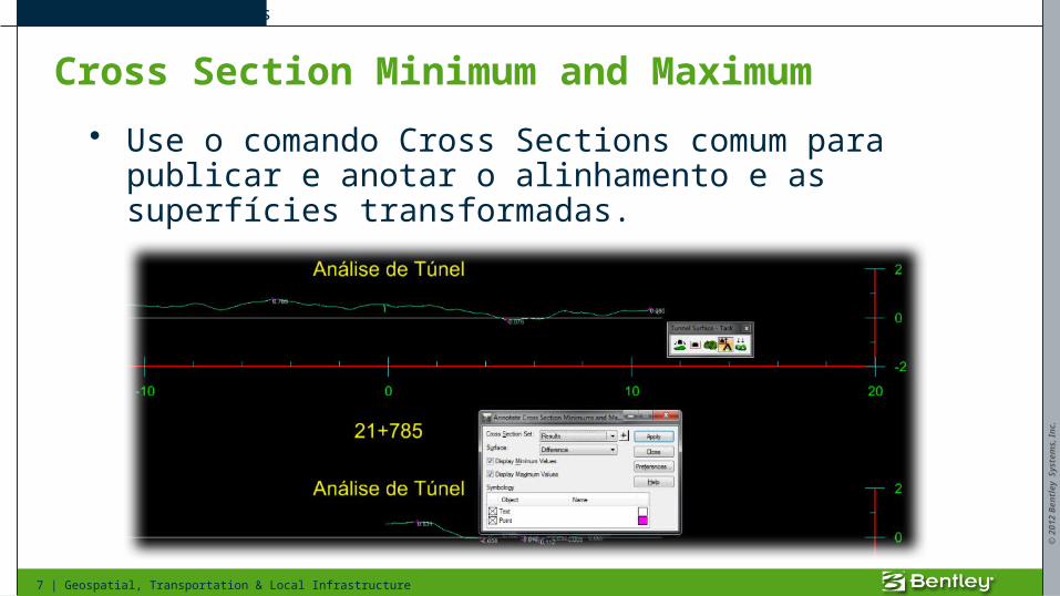
Cross Section Minimum and Maximum
• Use o comando Cross Sections comum para publicar e anotar o alinhamento e as superfícies transformadas.
PowerCivil Fundamentals
© 2
01
2 B
en
tley S
yste
ms,
Inc.
8 | Geospatial, Transportation & Local Infrastructure
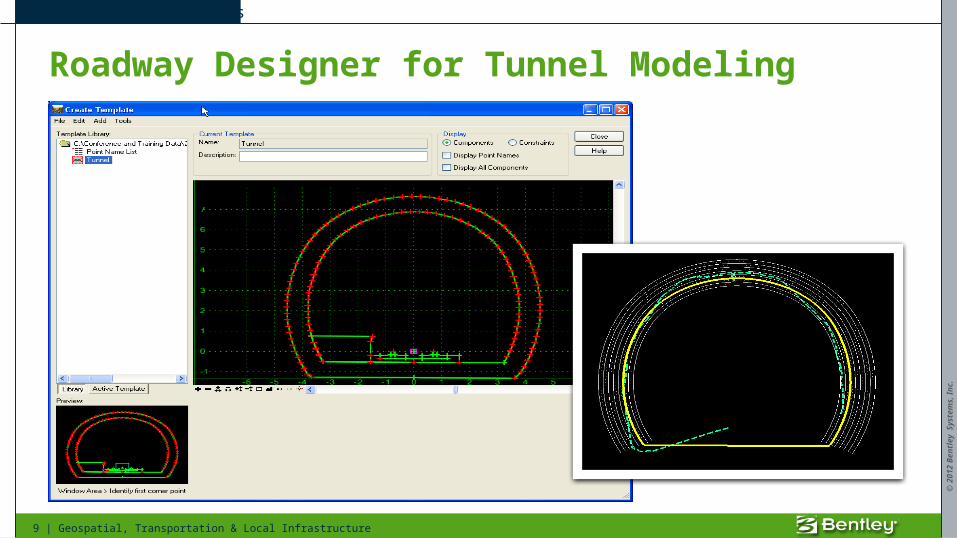
Modelagem 3D com o Roadway Designer
• Use uma seção tipo comum e componentes para a modelagem.
• Template com restrições específicas para os compoenetes rígidos (Trilhos).
• A superelevação ferroviária (Cant) é aplicada via Point Controls.
PowerCivil Fundamentals
© 2
01
2 B
en
tley S
yste
ms,
Inc.
9 | Geospatial, Transportation & Local Infrastructure
Roadway Designer for Tunnel Modeling
PowerCivil Fundamentals
© 2
01
2 B
en
tley S
yste
ms,
Inc.
10 | Geospatial, Transportation & Local Infrastructure
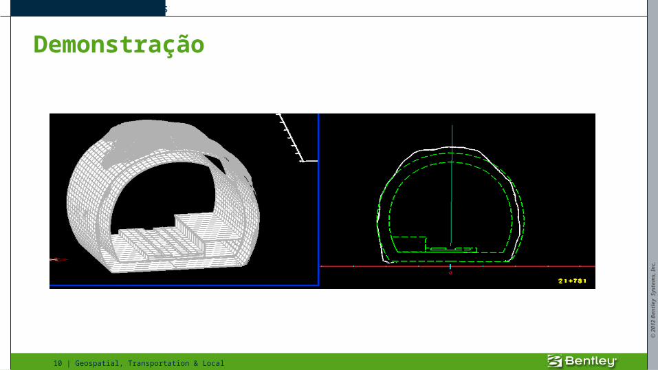
Demonstração
PowerCivil Fundamentals
© 2
01
2 B
en
tley S
yste
ms,
Inc.
11 | Geospatial, Transportation & Local Infrastructure
Conclusão
• O Bentley Power Rail Track é usado para criar e analizar com precisão conteúdos de modelos 3D.
• O Roadway Designer é usado para criar o túnel proposto e exibir as seções transversais.
• Excelente apresentação e visualização.
PowerCivil Fundamentals
© 2
01
2 B
en
tley S
yste
ms,
Inc.
12 | Geospatial, Transportation & Local Infrastructure