
DIGITAL TAX MAP - NJ Geographic Information …...DIGITAL TAX MAP COMMITTEE • 80% - 90% of all...
91
DIGITAL TAX MAP COMMITTEE
Transcript of DIGITAL TAX MAP - NJ Geographic Information …...DIGITAL TAX MAP COMMITTEE • 80% - 90% of all...

DIGITAL TAX MAP
COMMITTEE

DIGITAL TAX MAP
COMMITTEE
The mission of the Committee is to help New
Jersey governments create a digital parcel
foundation that is reliable, available, and
current to support government operations
and facilitate the sharing of core land
information.
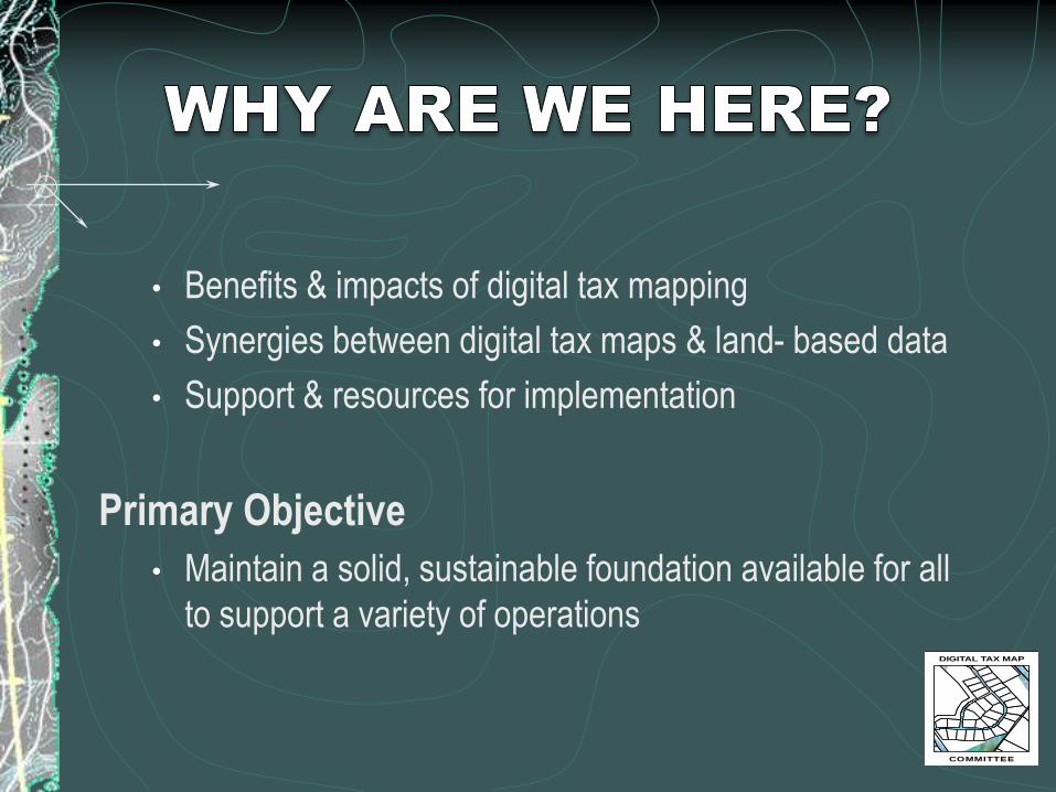
• Benefits & impacts of digital tax mapping
• Synergies between digital tax maps & land- based data
• Support & resources for implementation
Primary Objective
• Maintain a solid, sustainable foundation available for all
to support a variety of operationsDIGITAL TAX MAP
COMMITTEE
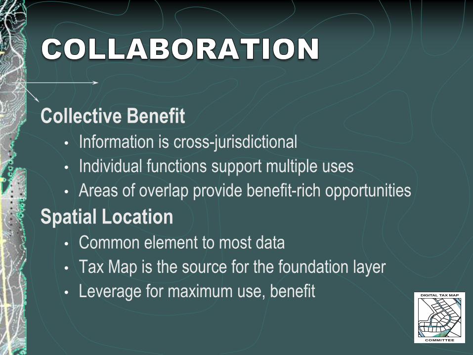
Collective Benefit
• Information is cross-jurisdictional
• Individual functions support multiple uses
• Areas of overlap provide benefit-rich opportunities
Spatial Location
• Common element to most data
• Tax Map is the source for the foundation layer
• Leverage for maximum use, benefit DIGITAL TAX MAP
COMMITTEE

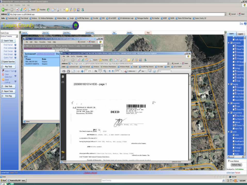
Spatial “Click” yields a wealth of information:
• Tax Data
• Photos
• Property Survey
• Deed
• Utility Plans
• Architectural Plans
• Resolutions, etc.

Lewis H. Conley Jr., PLS & PP, Vice President, van note-harveyassociates, pc
Sam DiDonato, CTA, Supervisor Tax Map section, NJ Division of Taxation
Kelly Heppe, County Tax Administrator, Camden County
David Kunz, GISP, GIS Manager, Sussex County
Patricia Leidner, GISP, Coordinator, Geographic Information Systems, Hunterdon County
Patrick McDonald, GISP, Senior CAD/GIS Specialist, Montgomery Twp
Mary Mastro, CTA, SCGREA , Assessor -Franklin Twp, Lebanon Twp, and Readington Twp, in Hunterdon County
Dana Max, Office of Treasury Technology, NJ Dept. of Treasury
Richard Rehmann, GISP, Vice President, Civil Solutions
Andrew Rowan, PhD, GISP, Director of the Office of GIS, OIT, State of NJ
Donald Walby, PLS & PP, Chief of Survey, KS Engineers, PC.
Lyna Wiggins, PhD, Professor, Bloustein School of Planning and
Public Policy, Rutgers University
DIGITAL TAX MAP
COMMITTEE
DIGITAL TAX MAP
COMMITTEE
• 80% - 90% of all government data information relating to a
geographic location – such as street address and block/lot
• Provide a powerful tool to manage & analyze resources
and improve decision making
• Streamline current procedures by replacing manual
procedures with automated ones
• Reduce or eliminate duplication of effort between offices
and agencies
• Improve quality & timeliness of service and information to
the public
• Protect against the loss of valuable maps and
records due to a natural disaster

DIGITAL TAX MAP
COMMITTEE

Needed to account for all improvements to
properties to improve the accuracy of property
assessments.
Used GIS in combination with digital
orthophotography to detect unreported new
construction.
Added revenue equal to approximately
5% of the annual tax base from
unrecorded property improvements.DIGITAL TAX MAP
COMMITTEE
Needed to automate map and data maintenance.
Traditional methods required separate maps with
varying scales for property, zoning, and land use.
The map and property database were coordinated,
resulting in decreasing map production from 5-7
hours to 30 minutes, with an overall
productivity increase of 90%
DIGITAL TAX MAP
COMMITTEE
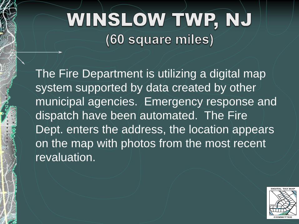
The Fire Department is utilizing a digital map
system supported by data created by other
municipal agencies. Emergency response and
dispatch have been automated. The Fire
Dept. enters the address, the location appears
on the map with photos from the most recent
revaluation.
DIGITAL TAX MAP
COMMITTEE


The system has led to a substantial
improvement in operations and efficiency,
with fewer staff personnel.
DIGITAL TAX MAP
COMMITTEE

By coordinating the tax map, Assessor’s
database, and building permit information-
approximately $206 million in added
assessments, and $531 million in
additional in-lieu assessments were
identified over the past 5 years.
DIGITAL TAX MAP
COMMITTEE
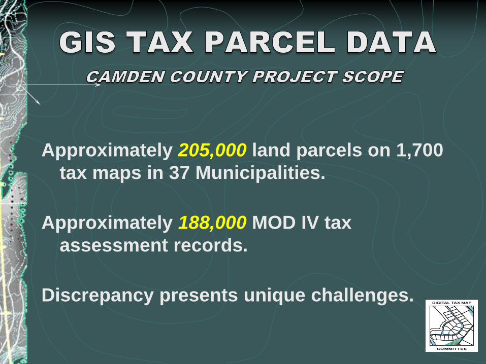
Approximately 205,000 land parcels on 1,700
tax maps in 37 Municipalities.
Approximately 188,000 MOD IV tax
assessment records.
Discrepancy presents unique challenges.DIGITAL TAX MAP
COMMITTEE
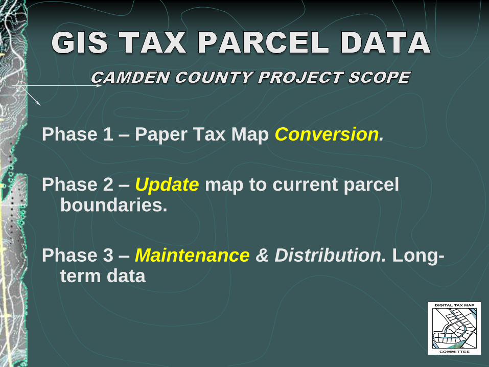
Phase 1 – Paper Tax Map Conversion.
Phase 2 – Update map to current parcel boundaries.
Phase 3 – Maintenance & Distribution. Long-term data
DIGITAL TAX MAP
COMMITTEE
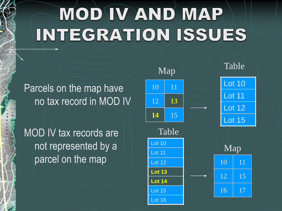
Parcels on the map have
no tax record in MOD IV
MOD IV tax records are
not represented by a
parcel on the map
Lot 10
Lot 11
Lot 12
Lot 15
13
10
12
15
11
14
Map
10
1512
17
11
16
Lot 10
Lot 11
Lot 12
Lot 13
Lot 14
Lot 15
Lot 16
Map
Table
Table

“Golden Triangle”
Municipal
Planning Board
Municipal
Tax Assessor
Parcel Data
maintenance
process must
be in the loop
to keep map
current!!
Land Surveyor
DIGITAL TAX MAP
COMMITTEE

Camden County is experiencing extremely
high “match rates”:
Haddonfield 99.26% 95.54%
Haddon Twp. 98.14% 98.54%
Merchantville 96.40% 92.10%
Waterford 97.63% 97.65%
Winslow 97.20% 98.67%
matched
parcels
matched
tax records
DIGITAL TAX MAP
COMMITTEE

Public Safety – 911
Prosecutors Office
Health Department
Economic Development
Legal Counsel
Many Municipalities
Election Board
Tax BoardDIGITAL TAX MAP
COMMITTEE
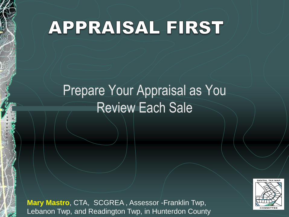
Prepare Your Appraisal as You
Review Each Sale
DIGITAL TAX MAP
COMMITTEE
Mary Mastro, CTA, SCGREA , Assessor -Franklin Twp,
Lebanon Twp, and Readington Twp, in Hunterdon County
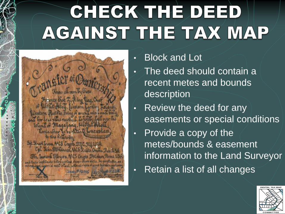
• Block and Loted how the correct
• The deed should contain a
recent metes and bounds
description
• Review the deed for any
easements or special conditions
• Provide a copy of the
metes/bounds & easement
information to the Land Surveyor
• Retain a list of all changes
DIGITAL TAX MAP
COMMITTEE

• What does it take to demonstrate the
difference between the subject property and
the comparable sale?
• How do you describe the topography nightmare –
especially when dense woods are involved in the
process?
DIGITAL TAX MAP
COMMITTEE

84
0
820
780
800
760
860
88
0
90
0
920
740
94
0
720
700680660
HICKORY RUN RD
ELK RID
GE
When 5 Acres Are Really Not Much to Work With0 250 500 750125
Feet N

When does being near the school and
hearing the bell ring during the day, or
children at lunchtime, affect the value?
DIGITAL TAX MAP
COMMITTEE
520
50
0
54
0
480
560
580
60
0
62
0
460
64
066
068
0
700
72074
0
760
780
520
560
480
500
540 56046
0 RIVER RD
HIG
H B
RID
GE
- C
ALIF
ON
RD
BU
TTER
NU
T R
D
WIN
DY H
EIG
HTS
RD
FIR
ST S
T
RA
RIT
AN
DR
MAIN ST
KELLIE CT
PHEA
SAN
T CT
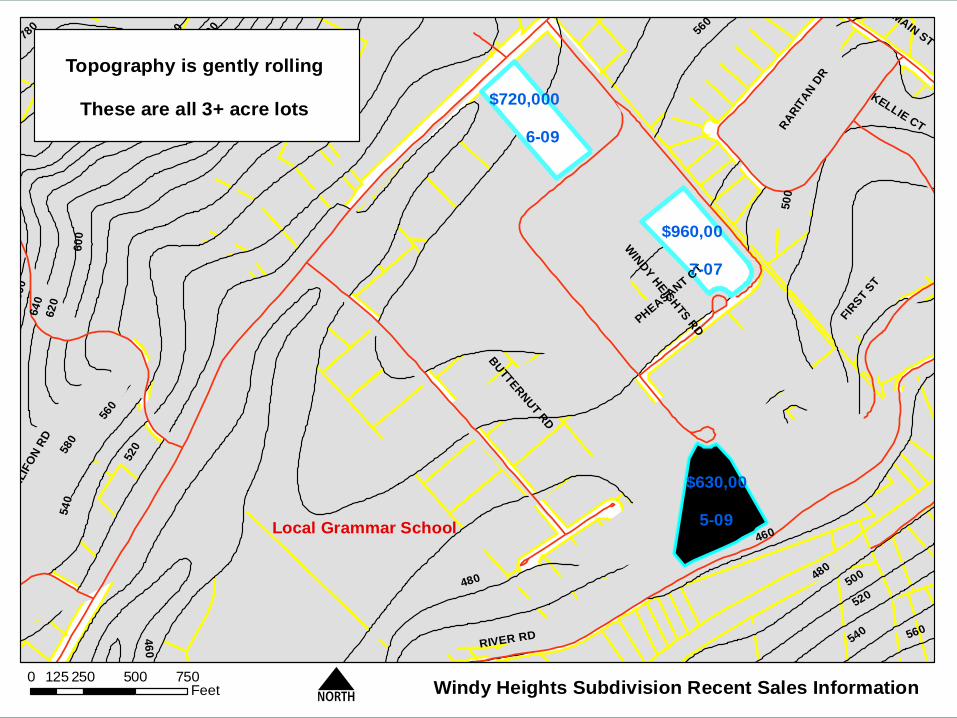
Windy Heights Subdivision Recent Sales Information0 250 500 750125
Feet N
Local Grammar School
Topography is gently rolling
These are all 3+ acre lots$720,000
6-09
$960,00
7-07
$630,00
5-09

RIVER RD
HIG
H B
RID
GE -
CALIF
ON R
D
BUTTE
RN
UT R
D
WIN
DY H
EIG
HTS
RD
FIRST
ST
VA
LL
EY
VIE
W D
R
RA
RIT
AN
DR
MAIN ST
KELLIE CT
GARY LA
PHEASANT CT
Windy Heights Subdivision Recent Sales Information0 250 500 750125
Feet N
Local Grammar School
$720,000
6-09
$960,000
7-07
$630,000
5-09
Topography is gently rolling
These are all 3+ acre lots
HIG
H B
RID
GE
- C
AL
IFO
N R
D
COUNTRY WOODS DR
BUFFALO HOLLOW RD
HILLSIDE TERR
BU
NN
VA
LE
RD
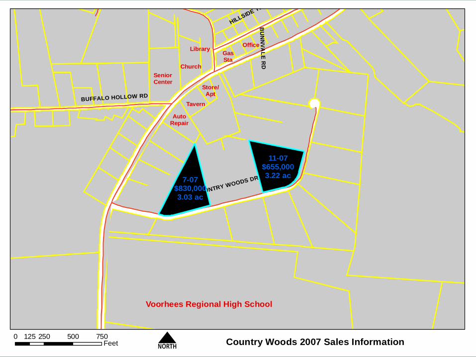
Country Woods 2007 Sales Information0 250 500 750125
Feet N
Voorhees Regional High School
AutoRepair
Tavern
Store/Apt
GasSta
Office
SeniorCenter
Church
Library
7-07$830,0003.03 ac
11-07$655,0003.22 ac

HIG
H B
RID
GE
- C
AL
IFO
N R
D
COUNTRY WOODS DR
BUFFALO HOLLOW RD
HILLSIDE TERR
BU
NN
VA
LE
RD
Country Woods 2007 Sales Information0 250 500 750125
Feet N
Voorhees Regional High School
AutoRepair
Tavern
Store/Apt
GasSta
Office
SeniorCenter
Church
Library
7-07$830,0003.03 ac
11-07$655,0003.22 ac
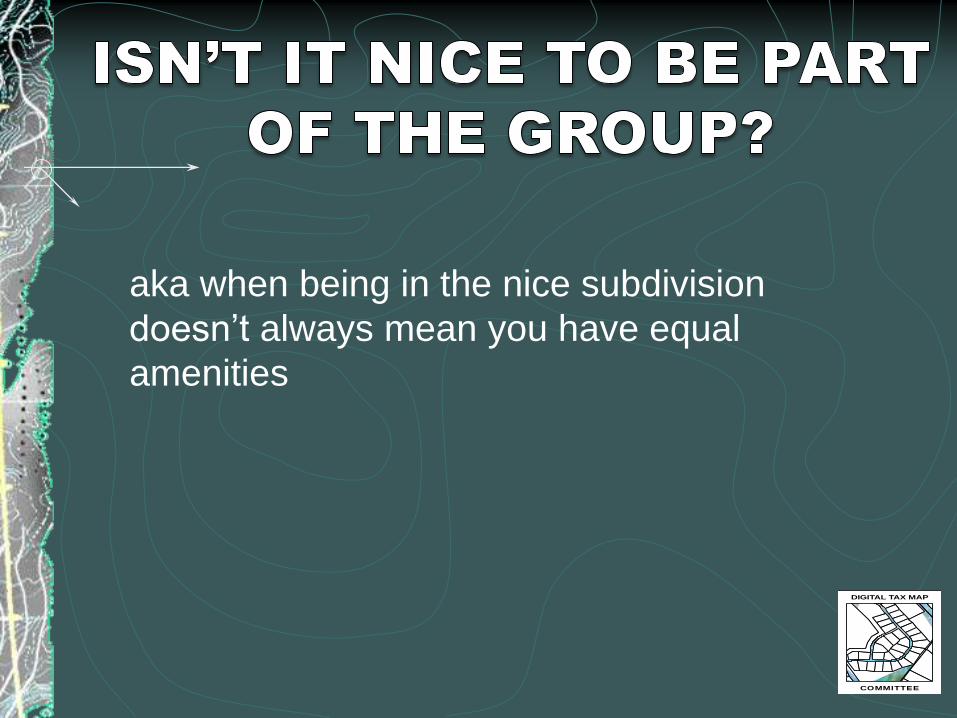
?
aka when being in the nice subdivision
doesn’t always mean you have equal
amenities
DIGITAL TAX MAP
COMMITTEE

820
840
800
860
880
900
780
920
940
760
740
960
940
960
EAST HILL RD
BACKHUS ESTATE RD
Part of the Same Subdivision Does Not Always Mean Equal Amenities0 250 500 750125
Feet N
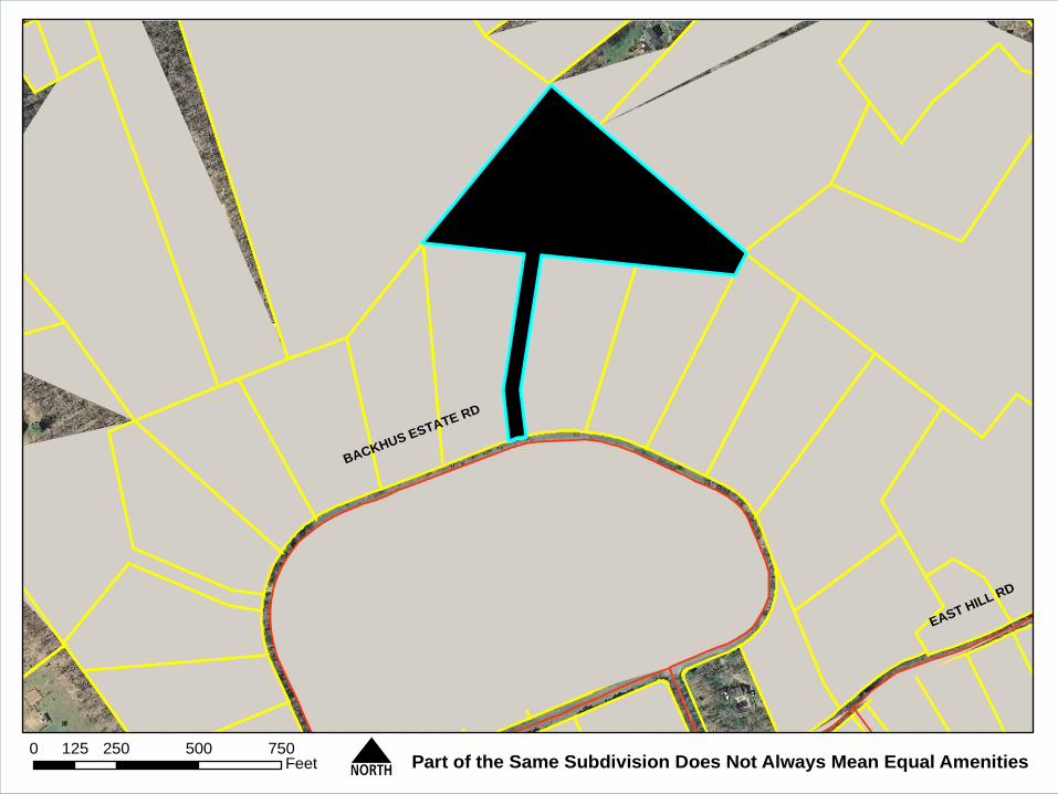
EAST HILL RD
BACKHUS ESTATE RD
Part of the Same Subdivision Does Not Always Mean Equal Amenities0 250 500 750125
Feet N

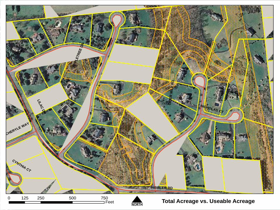
LIL
AC
DR
AP
PL
ET
RE
E D
R
CID
ER
MIL
L R
D
HIBBLER RD
CHRISTOPHER LA
CHERYLE WAY
NICHOLAS CT
CYNTHIA CT
Total Acreage vs. Useable Acreage0 250 500 750125
Feet N
LIL
AC
DR
AP
PL
ET
RE
E D
R
CID
ER
MIL
L R
D
HIBBLER RD
CHRISTOPHER LA
CHERYLE WAY
NICHOLAS CT
CYNTHIA CT
Total Acreage vs. Useable Acreage0 250 500 750125
Feet N

¬«22
7/30/08
$620,000
LAKE DR
MAG
RIET RD
© 0 200100
Feet
Block 21.12, Lot 46.07 1 Magriet
DIGITAL TAX MAP
COMMITTEE
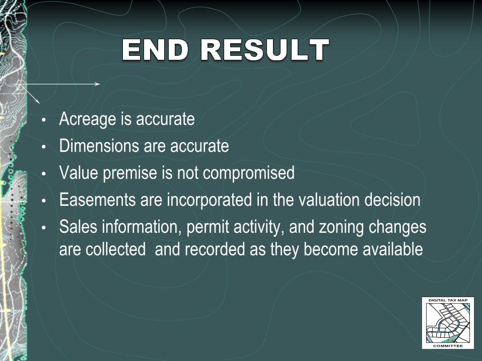
• Acreage is accurate
• Dimensions are accurate
• Value premise is not compromised
• Easements are incorporated in the valuation decision
• Sales information, permit activity, and zoning changes
are collected and recorded as they become available
DIGITAL TAX MAP
COMMITTEE
• Keep pace with updating data as it is
discovered, as then information will be
available when needed
• Visual information is easily digested by the
taxpayer, courts, and public
• Less time in litigation = $$$ SAVINGS
• The municipal land surveyor is the key
to creating these reports
DIGITAL TAX MAP
COMMITTEE

•Lyna Wiggins, PhD, Professor, Bloustein School of
Planning and Public Policy, Rutgers University
DIGITAL TAX MAP
COMMITTEE
• The digital tax map is the base for core planning
layers:
• Current land use
• Planned land use
• Zoning
• Transportation, housing, public facilities, recreation
and open space

• Example: Sustainability Element for Master Plan for
West Cape May
• Download digital parcel data from Cape May County
internet map server
• Join the information from the assessment files,
producing useful maps for planning.DIGITAL TAX MAP
COMMITTEE


• Evaluating current and proposed zoning decisions,
monitoring zoning variances
• Tracking growth by monitoring building permits over
time
• Identifying preserved farmland and open space
• Designing circulation plans for pedestrians and bikes
• And many more applications
DIGITAL TAX MAP
COMMITTEE


• For greater efficiency and cost savings, new
subdivisions are submitted in digital format, eliminating
the paper to digital step.
• Digital tax maps containing current and accurate
information are useful for informing day-to-day decision
making about land use and other planning issues.
DIGITAL TAX MAP
COMMITTEE

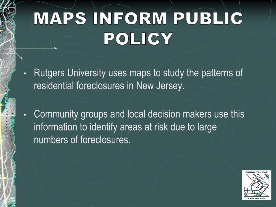
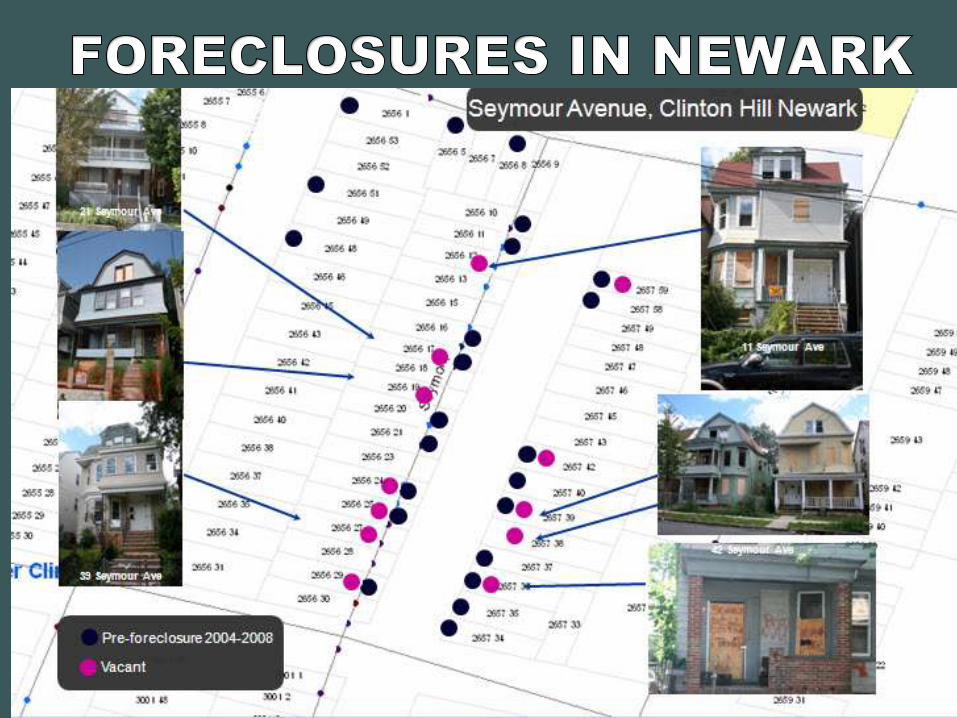
• Rutgers University uses maps to study the patterns of
residential foreclosures in New Jersey.
• Community groups and local decision makers use this
information to identify areas at risk due to large
numbers of foreclosures.
DIGITAL TAX MAP
COMMITTEE

• COAH regulations require the estimate of “developable
land” in municipalities
• Using datasets based on interpretation from imagery do
not provide the accuracy obtained from parcel maps.
DIGITAL TAX MAP
COMMITTEE
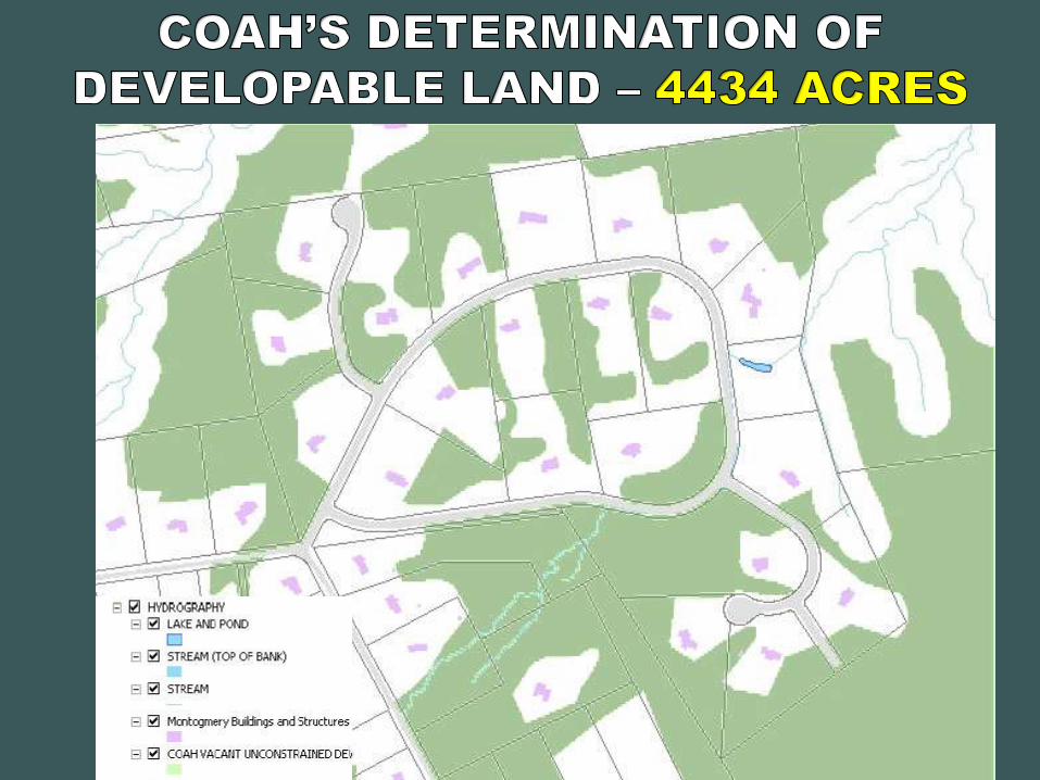


MANUAL ANALYSIS - Previous analysis was
completed for Montgomery Township in 2002 at a
cost of $40,000 and one year of preparation.
DIGITAL ANALYSIS - The processing model,
calculations, and mapping produced in 2008 by
Montgomery Township GIS was prepared at a cost
of $700 and 3 days of preparation.
DIGITAL TAX MAP
COMMITTEE

Andrew Rowan, PhD, GISP, Director of the Office of GIS,
OIT, State of NJ
DIGITAL TAX MAP
COMMITTEE

Citizen Services
Permits
Inspections
Historical BldgsUEZ
Business
Development
Crime response
Crime tracking
Voter Registration
Senior Citizen
Immunization programs
Building
Engineering
Economic Dev.
Housing, Land Use & Zoning,
Open Space
Schools, Day Care
Planning Police
Fire response
Inspection
HazMat
Fire Districts
Fire
Uses for Parcel/Address DataTransportation
Infrastructure
Mgmt.
•Owner
•Address
•Land usage/zoning
•Sales
•Property Value
DIGITAL TAX MAP
COMMITTEE

Electronic Document Management System (EDMS)
Well Record Indexed byBlock and Lot
Failed water test
(red)
200’ radius
(yellow)
Domestic wells based upon
existence of well record in
EDMS (grey)
GIS Integrated with EDMS
DIGITAL TAX MAP
COMMITTEE

DIGITAL TAX MAP
COMMITTEE


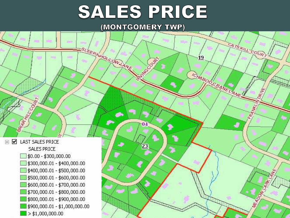
COMMERCIAL
RESIDENTIAL
PUBLIC PARKS
VILLAGE NEIGHBORHOOD
DIGITAL TAX MAP
COMMITTEE
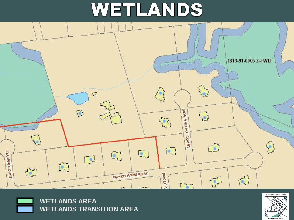
WETLANDS AREA
WETLANDS TRANSITION AREA
DIGITAL TAX MAP
COMMITTEE


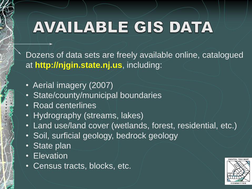
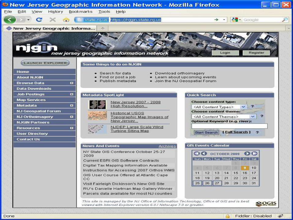
Dozens of data sets are freely available online, catalogued
at http://njgin.state.nj.us, including:
• Aerial imagery (2007)
• State/county/municipal boundaries
• Road centerlines
• Hydrography (streams, lakes)
• Land use/land cover (wetlands, forest, residential, etc.)
• Soil, surficial geology, bedrock geology
• State plan
• Elevation
• Census tracts, blocks, etc.DIGITAL TAX MAP
COMMITTEE

DIGITAL TAX MAP
COMMITTEE
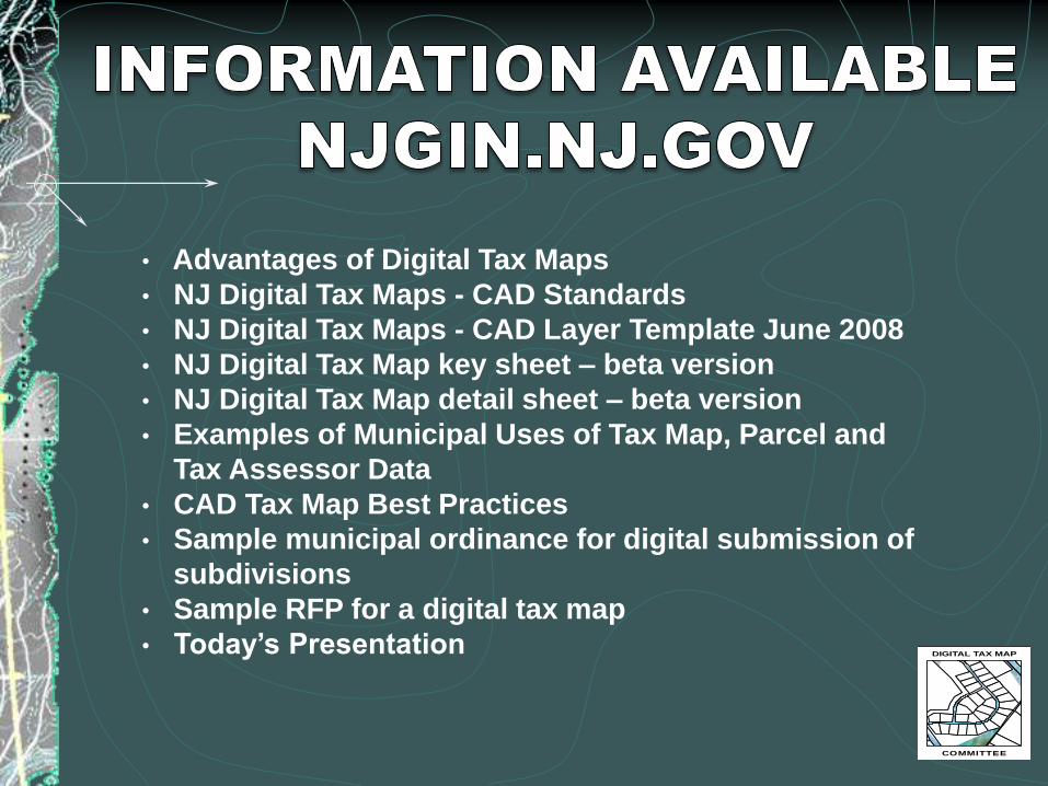
• Advantages of Digital Tax Maps
• NJ Digital Tax Maps - CAD Standards
• NJ Digital Tax Maps - CAD Layer Template June 2008
• NJ Digital Tax Map key sheet – beta version
• NJ Digital Tax Map detail sheet – beta version
• Examples of Municipal Uses of Tax Map, Parcel and
Tax Assessor Data
• CAD Tax Map Best Practices
• Sample municipal ordinance for digital submission of
subdivisions
• Sample RFP for a digital tax map
• Today’s Presentation

“I already have tax parcels in my GIS. Isn’t that the
same as a digital tax map?” NO!
• Majority of parcel data is not mathematically
constructed based upon a uniform standard
• Created from individual tax map sheets that were not
tied to a defined coordinate system
• Data from separate sheets warped to fit

•Current process often involves editing tax maps on paper,
then reproducing the same changes in the GIS data.
•Maintaining two products through separate processes is
needless duplication of effort
•Goal with digital tax maps is a seamless flow of
information from the tax map into GIS and other
information systems

Read and follow the Division of Taxation’s Rules
•N.J.A.C. 18:23A, revised, effective June 4, 2007.
DIGITAL TAX MAP
COMMITTEE
•Lewis H. Conley Jr., PLS & PP, Vice President, van note-
harvey associates, pc

Appointment of a New Jersey Licensed Professional Land
Surveyor
• N.J.A.C. 13:40-5.1(k) requires that Tax assessment
maps must be prepared by a New Jersey Licensed
Professional Land Surveyor.
• Recommended appointment longer than 1-year term,
3-years term is suggested.
• Surveyor and Tax Assessor develop a working
relationship and ease of sharing information on a
timely basis.
DIGITAL TAX MAP
COMMITTEE

Information such as a copy of the MOD IV, deeds,
subdivisions, street vacations should be supplied to the
land surveyor as they occur and revisions made when
time allows.
DIGITAL TAX MAP
COMMITTEE


BEWARE OF
DATUMS!
DIGITAL TAX MAP
COMMITTEE
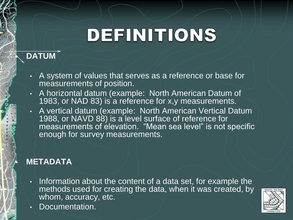
DATUM
• A system of values that serves as a reference or base for measurements of position.
• A horizontal datum (example: North American Datum of 1983, or NAD 83) is a reference for x,y measurements.
• A vertical datum (example: North American Vertical Datum 1988, or NAVD 88) is a level surface of reference for measurements of elevation. “Mean sea level” is not specific enough for survey measurements.
METADATA
• Information about the content of a data set, for example the methods used for creating the data, when it was created, by whom, accuracy, etc.
• Documentation.
DIGITAL TAX MAP
COMMITTEE

DIGITAL TAX MAP
COMMITTEE
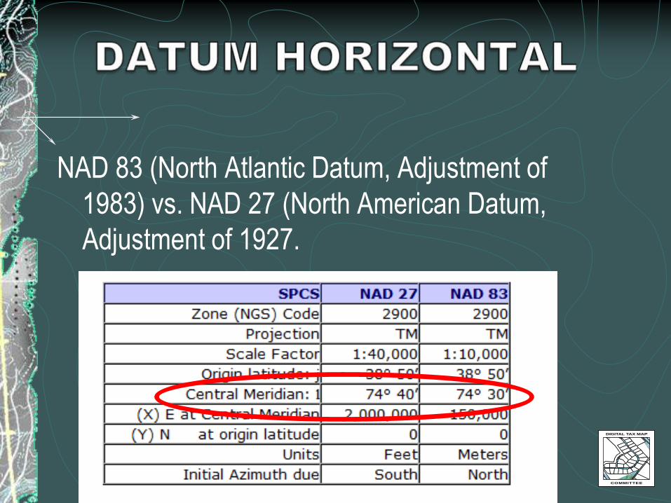
NAD 83 (North Atlantic Datum, Adjustment of
1983) vs. NAD 27 (North American Datum,
Adjustment of 1927.
DIGITAL TAX MAP
COMMITTEE

DIGITAL TAX MAP
COMMITTEE
DIGITAL TAX MAP
COMMITTEE

DIGITAL TAX MAP
COMMITTEE

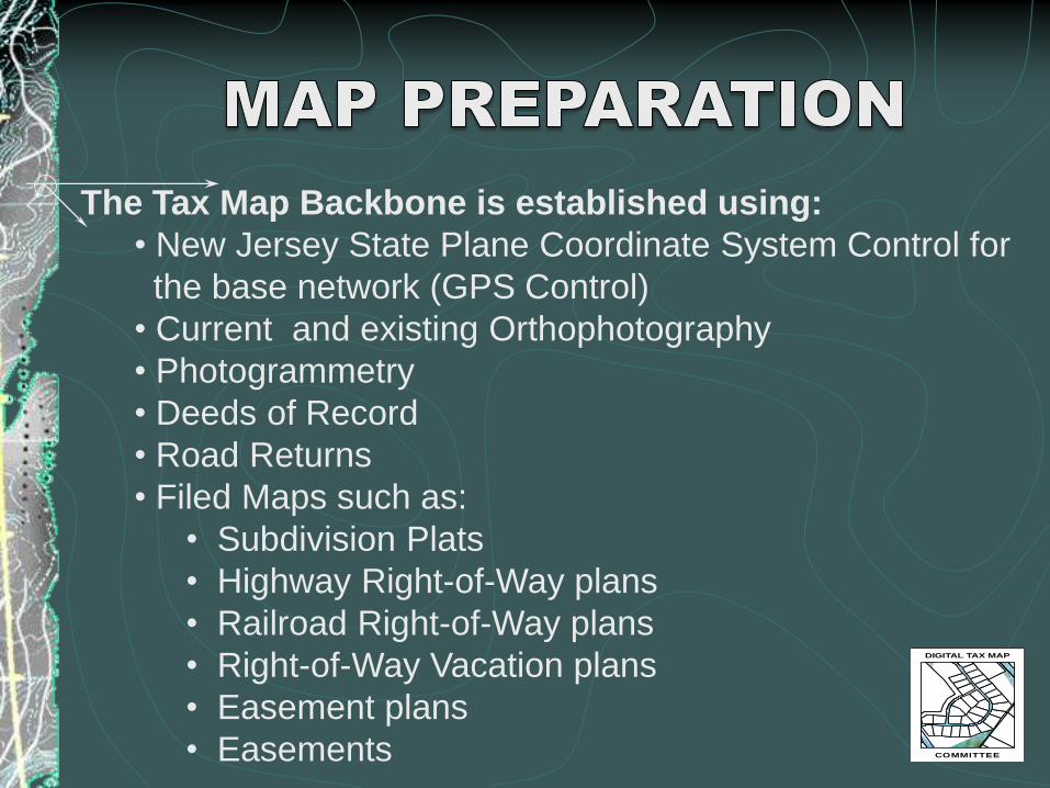
The Tax Map Backbone is established using:
• New Jersey State Plane Coordinate System Control for
the base network (GPS Control)
• Current and existing Orthophotography
• Photogrammetry
• Deeds of Record
• Road Returns
• Filed Maps such as:
• Subdivision Plats
• Highway Right-of-Way plans
• Railroad Right-of-Way plans
• Right-of-Way Vacation plans
• Easement plans
• Easements
DIGITAL TAX MAP
COMMITTEE


Use of Coordinate Geometry (COGO) for creating digital
tax maps.
• DO NOT SCAN THE EXISTING TAX MAP!
• Provides for a geo-referenced seamless tax map
• Provides for layering conventions compliant with a
National and Statewide standard.
• Will ultimately provide for a statewide seamless tax map
DIGITAL TAX MAP
COMMITTEE

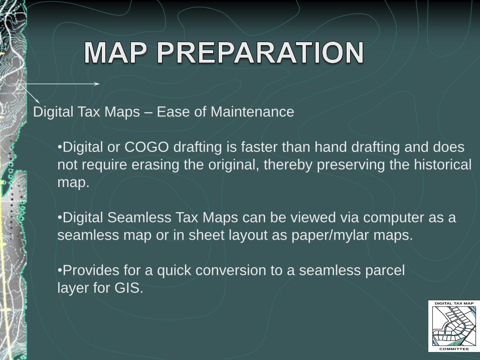
Digital Tax Maps – Ease of Maintenance
•Digital or COGO drafting is faster than hand drafting and does
not require erasing the original, thereby preserving the historical
map.
•Digital Seamless Tax Maps can be viewed via computer as a
seamless map or in sheet layout as paper/mylar maps.
•Provides for a quick conversion to a seamless parcel
layer for GIS.DIGITAL TAX MAP
COMMITTEE
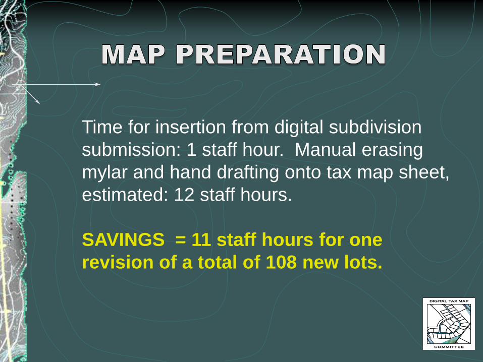
Time for insertion from digital subdivision
submission: 1 staff hour. Manual erasing
mylar and hand drafting onto tax map sheet,
estimated: 12 staff hours.
SAVINGS = 11 staff hours for one
revision of a total of 108 new lots.
DIGITAL TAX MAP
COMMITTEE


• Advantages of Digital Tax Maps
• NJ Digital Tax Maps - CAD Standards
• NJ Digital Tax Maps - CAD Layer Template June 2008
• NJ Digital Tax Map key sheet – beta version
• NJ Digital Tax Map detail sheet – beta version
• Examples of Municipal Uses of Tax Map, Parcel and
Tax Assessor Data
• CAD Tax Map Best Practices
• Sample municipal ordinance for digital submission of
subdivisions
• Sample RFP for a digital tax map
• Today’s Presentation
DIGITAL TAX MAP
COMMITTEE
DIGITAL TAX MAP
COMMITTEE
https://njgin.state.nj.us/NJ_NJGINExplorer/
jviewer.jsp?pg=digital_tax_map
OR•Go to njgin.state.nj.us
•Click on Resources
•Click on Digital Tax Map and Subdivision


