Diapo Del Gps - Finish
28
GOOD AFTERNOON TO ALL OF THESE SUBJECT TO EXHIBIT: "GPSµ
Transcript of Diapo Del Gps - Finish
8/8/2019 Diapo Del Gps - Finish
http://slidepdf.com/reader/full/diapo-del-gps-finish 1/28
GOOD AFTERNOON TOALL OF THESE
SUBJECT TO EXHIBIT:
"GPSµ
8/8/2019 Diapo Del Gps - Finish
http://slidepdf.com/reader/full/diapo-del-gps-finish 2/28
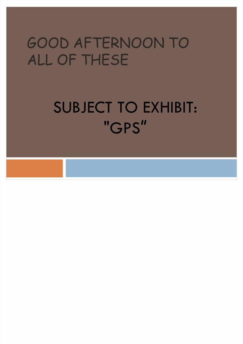
Hitori OF GPS
EL GPS
Entry into service in 1965
The 60 departments of defense, transport and theU.S. space agency (DoD, DoT and NASA
respectively) determines the satellite-based
position.
8/8/2019 Diapo Del Gps - Finish
http://slidepdf.com/reader/full/diapo-del-gps-finish 3/28
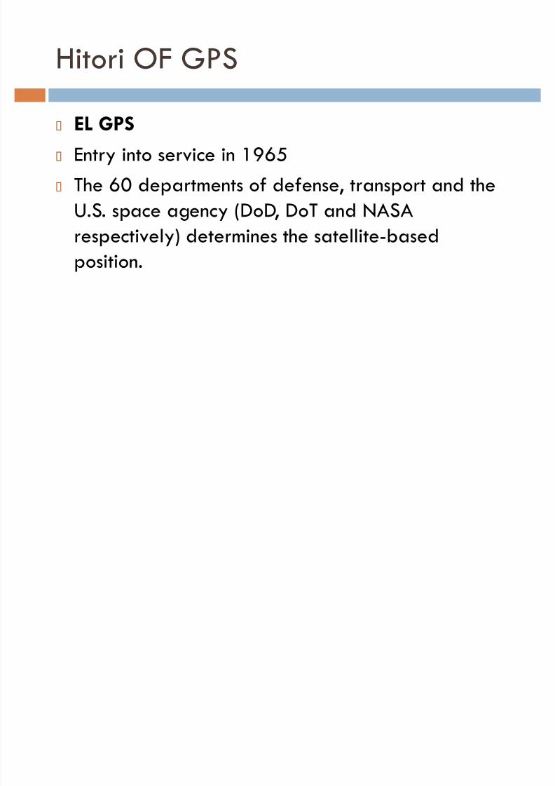
Hitori OF GPS
GLOBABILIDAD REQUIREMENTS:
Continuity
Continuous operation without affecting the
weather conditionsHighly dynamic (for possible use in aviation and
precision)

8/8/2019 Diapo Del Gps - Finish
http://slidepdf.com/reader/full/diapo-del-gps-finish 4/28
CONSTELACION TRANSIT

8/8/2019 Diapo Del Gps - Finish
http://slidepdf.com/reader/full/diapo-del-gps-finish 5/28
CONSTELACION TRANSIT
worked with two signals at two frequencies (to
avoid errors due to ionospheric DISTURBANCE)
The position calculation is based on continuous
measurement of the deviation of DOPPLER
FREQUENCY received signal and then compared
with tables and graphs. His error 250 m.Greater importance in the navigation of submarines
and ships.

8/8/2019 Diapo Del Gps - Finish
http://slidepdf.com/reader/full/diapo-del-gps-finish 6/28
IONOSPHERIC DISTURBANCES

8/8/2019 Diapo Del Gps - Finish
http://slidepdf.com/reader/full/diapo-del-gps-finish 7/28
DOPPLER FREQUENCY

8/8/2019 Diapo Del Gps - Finish
http://slidepdf.com/reader/full/diapo-del-gps-finish 8/28
PROBLEMS WITH THE FIRST GPS
SATELLITE
EE. UU. TRANSIT satellite and had many problems.
Russia invented its own satellite calledTSICADA
Rockell _CALIFORNIA agreed in the manufacture of
28 satellites 170,000,000,000 pesetas. (One
hundred and seventy billion)

8/8/2019 Diapo Del Gps - Finish
http://slidepdf.com/reader/full/diapo-del-gps-finish 9/28
FIRST SATELLITEIn 1978, the entire constellation concrete 8 years later (1983 OPERATIONAL PHASE)
8/8/2019 Diapo Del Gps - Finish
http://slidepdf.com/reader/full/diapo-del-gps-finish 10/28
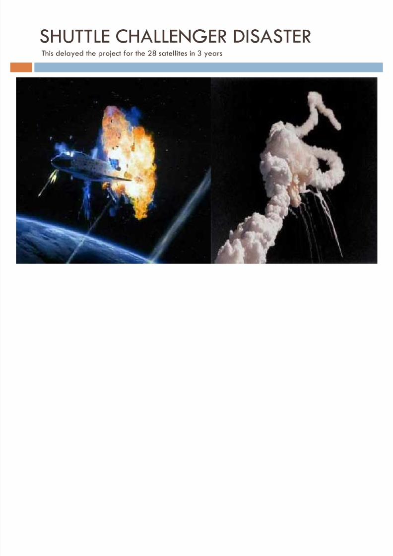
SHUTTLE CHALLENGER DISASTERThis delayed the project for the 28 satellites in 3 years

8/8/2019 Diapo Del Gps - Finish
http://slidepdf.com/reader/full/diapo-del-gps-finish 11/28
Vuelo civil de KOREAN AIRLINESBlown by the Union shall Sovi © tica in 1984.
USSR = UNION OF SOVIET SOCIALIST REPUBLICS

8/8/2019 Diapo Del Gps - Finish
http://slidepdf.com/reader/full/diapo-del-gps-finish 12/28
REBIRTH OF GPSNew manufacturers as : TEXAS INSTRUMENTS Y TRIMBLE NAVIGATION

8/8/2019 Diapo Del Gps - Finish
http://slidepdf.com/reader/full/diapo-del-gps-finish 13/28
8/8/2019 Diapo Del Gps - Finish
http://slidepdf.com/reader/full/diapo-del-gps-finish 14/28

8/8/2019 Diapo Del Gps - Finish
http://slidepdf.com/reader/full/diapo-del-gps-finish 15/28
8/8/2019 Diapo Del Gps - Finish
http://slidepdf.com/reader/full/diapo-del-gps-finish 16/28
8/8/2019 Diapo Del Gps - Finish
http://slidepdf.com/reader/full/diapo-del-gps-finish 17/28
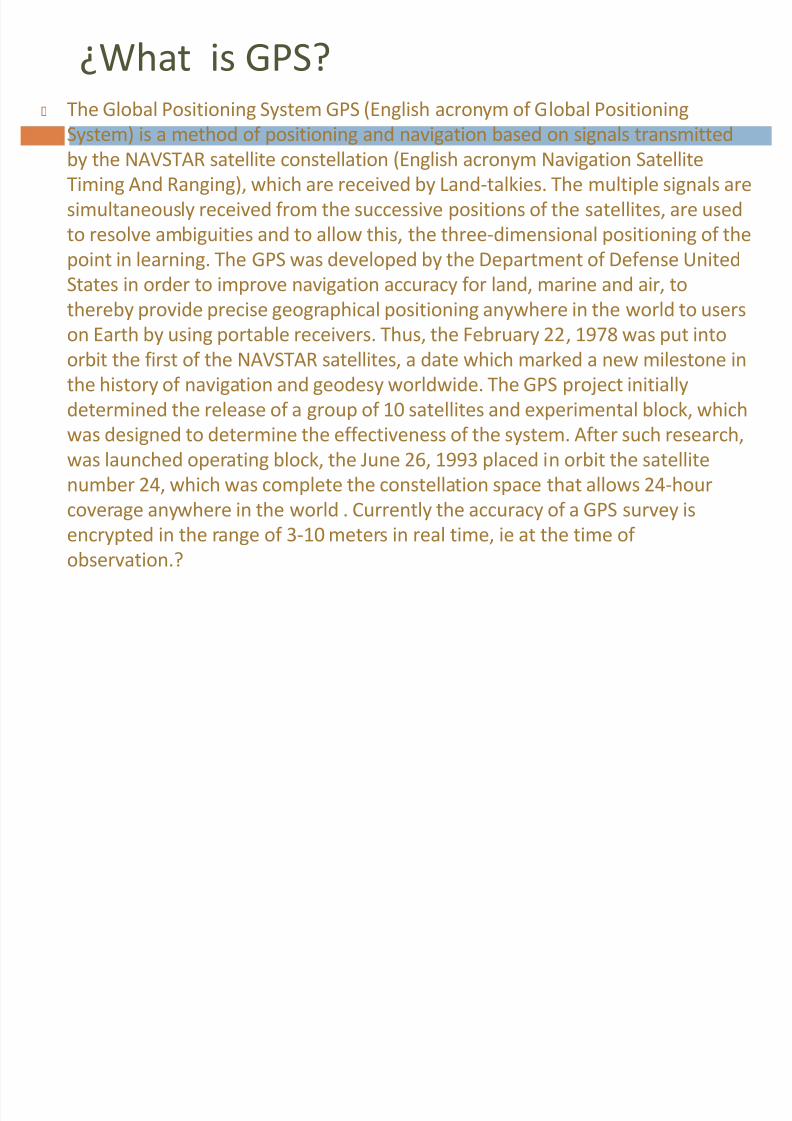
¿What is GPS? The Global Positioning System GPS (English acronym of Global Positioning
System) is a method of positioning and navigation based on signals transmittedby the NAVSTAR satellite constellation (English acronym Navigation Satellite
Timing And Ranging), which are received by Land-talkies. The multiple signals are
simultaneously received from the successive positions of the satellites, are used
to resolve ambiguities and to allow this, the three-dimensional positioning of the
point in learning. The GPS was developed by the Department of Defense United
States in order to improve navigation accuracy for land, marine and air, tothereby provide precise geographical positioning anywhere in the world to users
on Earth by using portable receivers. Thus, the February 22, 1978 was put into
orbit the first of the NAVSTAR satellites, a date which marked a new milestone in
the history of navigation and geodesy worldwide. The GPS project initially
determined the release of a group of 10 satellites and experimental block, whichwas designed to determine the effectiveness of the system. After such research,
was launched operating block, the June 26, 1993 placed in orbit the satellite
number 24, which was complete the constellation space that allows 24-hour
coverage anywhere in the world . Currently the accuracy of a GPS survey is
encrypted in the range of 3-10 meters in real time, ie at the time of
observation.?

8/8/2019 Diapo Del Gps - Finish
http://slidepdf.com/reader/full/diapo-del-gps-finish 18/28
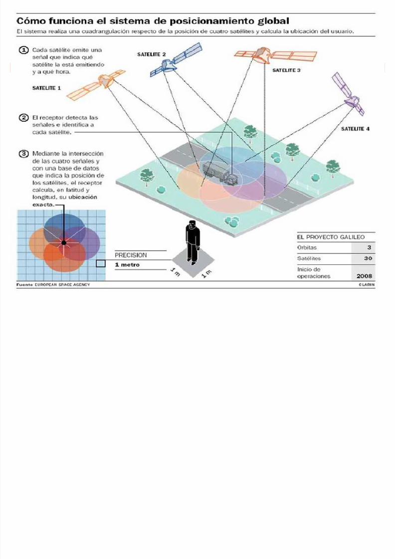
HOW THE GPS?
Knowing that an electromagnetic signal travels at the speed of light(C = 300.000 km / s) in vacuum is the key to understanding theoperation of GPS. Determining how long it takes to travel from thesatellite signal receiver can calculate the distance (d) that existsbetween them. Receiver position in a Cartesian system X, Y could becalculated by the intersection when the distances are calculated
accurate to at least three satellites of known position. In fact the GPSpositioning is not so simple, but the anterior approach anticipates thetheoretical basis of the system
Let satellites take you to your destinationThe operation is based on a receptor that, through the signals itreceives from various satellites fix your position on a map based in thereceiver.
Let's see how the Garmin GPS called "GPS III Plus"now out of print.

8/8/2019 Diapo Del Gps - Finish
http://slidepdf.com/reader/full/diapo-del-gps-finish 19/28
GPS parts:
Satellites display: Indicates the position and intensity of the signal
received from the satellites and the state of battery shows the position
error estimate in meters (SPE) and dilution of precision (DOP).

8/8/2019 Diapo Del Gps - Finish
http://slidepdf.com/reader/full/diapo-del-gps-finish 20/28

8/8/2019 Diapo Del Gps - Finish
http://slidepdf.com/reader/full/diapo-del-gps-finish 21/28

8/8/2019 Diapo Del Gps - Finish
http://slidepdf.com/reader/full/diapo-del-gps-finish 22/28
Highway display: It is like the compass screen but in this case emphasizes the
straight line to follow the desired course. She is employed at sea or desert
crossings
Display information about the services of the next highway exit: indicatesthe next exit and we can take all available Serbs

8/8/2019 Diapo Del Gps - Finish
http://slidepdf.com/reader/full/diapo-del-gps-finish 23/28
GPSIII + screen andMapSource: The GPS III + is compatible with maps from
MapSource Roads and Recreation. These maps provide greater detail the
background map gps.

8/8/2019 Diapo Del Gps - Finish
http://slidepdf.com/reader/full/diapo-del-gps-finish 24/28
Reliability of data:
Due to military GPS system, the Department of Defense
United States reserves the right to include a degree of random error which can vary from 15 to 100 meters.Although not currently apply that induced error, the GPSalone provides an accuracy of about 0 to 15 meters.
Sources of error:Signal delay in the ionosphere and troposphere.Multipath signal produced by the bounce of the signal inbuildings and mountains nearby.Orbital errors, where data from the satellite's orbit is not
completely accurate.Number of visible satellites.Geometry of visible satellites.Local errors in the GPS clock.
8/8/2019 Diapo Del Gps - Finish
http://slidepdf.com/reader/full/diapo-del-gps-finish 25/28
Differential GPS:
DGPS (Differetial GPS) or Differential GPS is a system that provides GPS
receivers corrections to the data received from GPS satellites. Thesecorrections, once implemented, will provide greater accuracy in the calculatedposition.The corrections system works as follows:A base station on land with well-defined coordinates, listen to the GPSsatellites.Calculates its position by the data received from satellites.
Since its position is well defined, estimates the error between true positionand calculated by estimating the error in each satellite.It sends these corrections to the receiver through some medium.There are several ways to get DGPS corrections. The most commonly used are:Received by radio through a channel prepared for it, as the RDS on an FM station.Downloaded from the Internet with a wireless connection.
Provided by a satellite system designed for that purpose. In the U.S. there isWAAS, Europe EGNOS andMSAS in Japan, all compatible.DGPS corrections to be valid, the receiver must be relatively close to a DGPSstation, usually less than a thousand kilometers.The accuracy achieved may be about two meters in latitude and longitude,and about three meters in altitude.
8/8/2019 Diapo Del Gps - Finish
http://slidepdf.com/reader/full/diapo-del-gps-finish 26/28
Applications:
Navigation on land, sea and air. Quite a few cars nowincorporate it being particularly useful for finding
addresses or indicate the status of the crane.
Surveying and geodesy. Location agriculture (precision
farming).Rescue.
Sports, camping and leisure.
For sick and disabled.
Scientific applications in fieldwork.Geocaching, activity involving the search for "treasures"
hidden by other users
8/8/2019 Diapo Del Gps - Finish
http://slidepdf.com/reader/full/diapo-del-gps-finish 27/28
Waypoints:
Waypoints are coordinates of points of reference used in GPS-basednavigation.In GPS receivers can store the coordinates (latitude and longitude)of a specific point, whether or intermediate destination on theroute, for later reference.With this type of application (Waypoints) is possible using a GPSunit on the ground and through a set of maps to pinpoint theavailability of many points of interest that would be evencategorized by a specific application filters to perform based on themap in those categories, so we would have a list like the following:1.Aeropuertos (01,020,345)1.1 John F. Kennedy1.2 The Guard1.3 International Airport of the Americas2.Restaurantes (02,030,405)2.1Burger King2.2Mc Donalds2.3Wendy's2.4Taco Bell

8/8/2019 Diapo Del Gps - Finish
http://slidepdf.com/reader/full/diapo-del-gps-finish 28/28