Decision Document Grid Point - CO401810772 Site - … · 2013-07-22 · Decision Document . Grid...
30
1 Decision Document Grid Point - CO401810772 Site - Rio Blanco Lake Location - Meeker, Colorado Contents: 1. Selection Survey 2. Summary of Other Surveys 3. Installation Package: A. Site Survey Checklist B. Site Photos C. Obstruction Diagram D. Site Score Sheet
Transcript of Decision Document Grid Point - CO401810772 Site - … · 2013-07-22 · Decision Document . Grid...
1
Decision Document
Grid Point - CO401810772
Site - Rio Blanco Lake
Location - Meeker, Colorado
Contents:
1. Selection Survey 2. Summary of Other Surveys 3. Installation Package: A. Site Survey Checklist B. Site Photos C. Obstruction Diagram D. Site Score Sheet
potterm
Typewritten Text
ATDD# 1147
potterm
Typewritten Text
50 Year Maximum Snow Depth = 23" and Minimum Temperature = -32 F
2
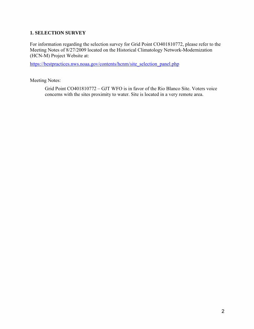
1. SELECTION SURVEY For information regarding the selection survey for Grid Point CO401810772, please refer to the Meeting Notes of 8/27/2009 located on the Historical Climatology Network-Modernization (HCN-M) Project Website at:
https://bestpractices.nws.noaa.gov/contents/hcnm/site_selection_panel.php
Meeting Notes:
Grid Point CO401810772 – GJT WFO is in favor of the Rio Blanco Site. Voters voice concerns with the sites proximity to water. Site is located in a very remote area.
3
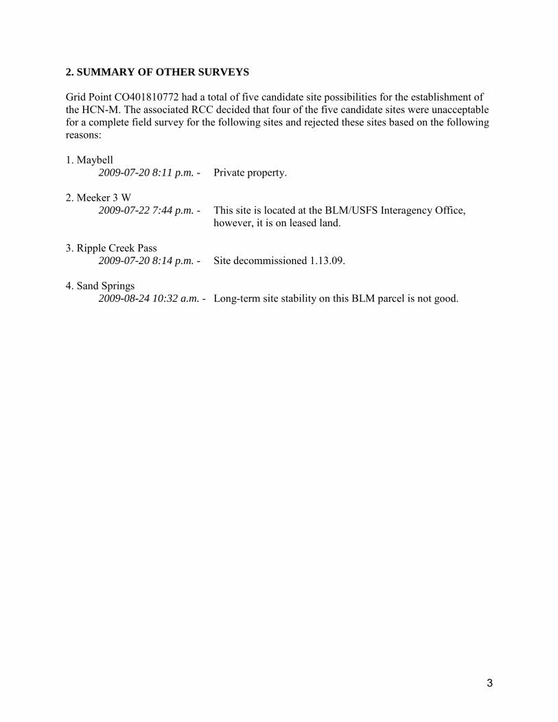
2. SUMMARY OF OTHER SURVEYS Grid Point CO401810772 had a total of five candidate site possibilities for the establishment of the HCN-M. The associated RCC decided that four of the five candidate sites were unacceptable for a complete field survey for the following sites and rejected these sites based on the following reasons: 1. Maybell
2009-07-20 8:11 p.m. - Private property. 2. Meeker 3 W
2009-07-22 7:44 p.m. - This site is located at the BLM/USFS Interagency Office, however, it is on leased land.
3. Ripple Creek Pass
2009-07-20 8:14 p.m. - Site decommissioned 1.13.09. 4. Sand Springs
2009-08-24 10:32 a.m. - Long-term site stability on this BLM parcel is not good.
4
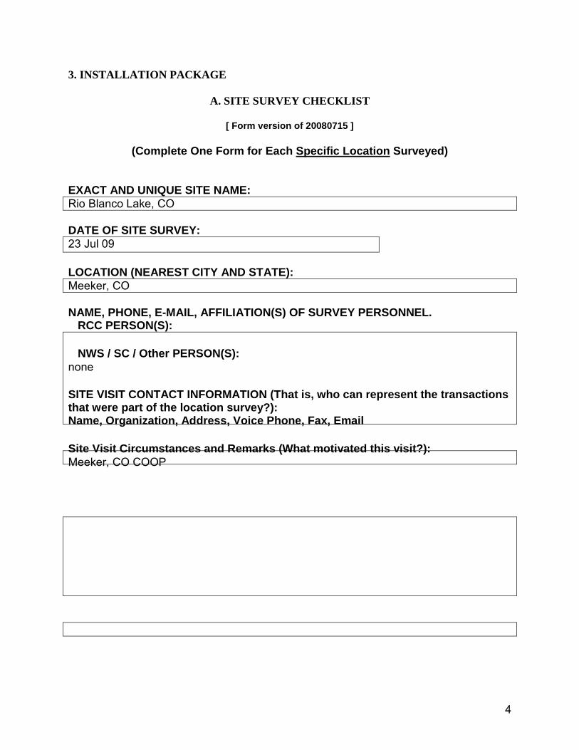
3. INSTALLATION PACKAGE
A. SITE SURVEY CHECKLIST
[ Form version of 20080715 ]
(Complete One Form for Each Specific Location Surveyed) EXACT AND UNIQUE SITE NAME: Rio Blanco Lake, CO DATE OF SITE SURVEY: 23 Jul 09 LOCATION (NEAREST CITY AND STATE): Meeker, CO NAME, PHONE, E-MAIL, AFFILIATION(S) OF SURVEY PERSONNEL. RCC PERSON(S): NWS / SC / Other PERSON(S): none SITE VISIT CONTACT INFORMATION (That is, who can represent the transactions that were part of the location survey?): Name, Organization, Address, Voice Phone, Fax, Email Site Visit Circumstances and Remarks (What motivated this visit?): Meeker, CO COOP

5
HOST ORGANIZATION (Property Owner, Administrative Contact) Contact name, Name / Title of Person to sign agreements, Organization, Address, Voice Phone, Fax, Email Discuss the level of local routine support available for activities such as periodic visual inspections, site maintenance (mowing, cleaning dust from pyranometer lenses, debris removal from precipitation gauge, dumping and recording accumulated precipitation, snowfall and depth measurements) : LOCAL TECHNICAL SUPPORT PERSON CONTACT INFORMATION: Contact, Organization, Address, Voice Phone, Fax, Email Who will be the person who assists with insuring a minimal level of oversight to make sure the station is running properly, and with no obvious damage or problems? SPECIFIC LOCATION INFORMATION Note: Determine beforehand how necessary it is that the host organization contact, NWS representative, SC, or other some representative accompany you on the visits. Place a visible white marker at the exact location of the tower site, and use those coordinates to describe the rest of the site. Record latitude / longitude in ddd mm ss.s, or dd mm.mmmm or dd.ddddd and N, S, E, W. Latitude: N 40.08220 Longitude: W 108.19941

6
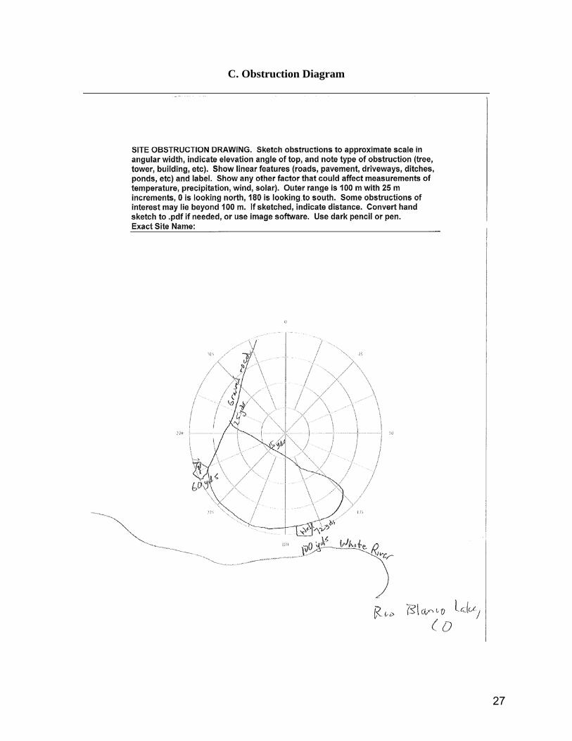
Datum (preferably WGS 84), position uncertainty ( +/- feet): WGS 84 10 feet Coordinates from topo map or GPS ? GPS Elevation in feet (minus = below sea level): 5789 feet City / County-Parish / State: Meeker Rio Blanco Co. CO Type of property (National Park, University Reserve, Private Property, Public Park, etc) Rio Blanco Lake State Wildlife Area Other weather / climate observing sites in vicinity (ASOS, COOP, NADP, ARM, RAWS, USGS, SNOTEL, OTHER) and what elements are measured ? Some stream gauging on-site. Any other remarks about entire site that are not highlighted elsewhere: none PHYSICAL DESCRIPTION OF SITE AND SURROUNDING AREA A. Describe the Present Use of the Property and Surrounding Area. (eg, pasture land used for grazing, national park reserve, manicured lawn, etc) The Wildlife Area appears to be primarily utilized to fish and for birding opportunities. The landscape is in its natural state. B. Describe Terrain (360 degree panorama) and Large Scale Setting (miles to near distance of 300 meters or so). Ex: nearby hills or mountains, open or forested, valley orientations, flatness, proximity to cliffs, urban influences, distance to water, etc. The site is located in a somewhat broad, open river valley that follows the White River which drains towards the west. There are no urban influence, however, there is some construction and natural gas development in the area. C. Document all Obstructions (360 degree panorama) within 300 meters of the tower location. C.1. Distance, nature, size, estimated angular height and angular width of each obstruction. See obstruction diagram.

7
C.2. Elevation angle of solar blockage in degrees, and nature of obstruction (tree, hill, building, etc), with high and low points that are between 8-pt headings. Also give min and max elevation angle and direction to within 16 pt compass bearing. Looking toward (also show high/low points in between these directions): S: 7° - mesa SW: 7° - mesa W: 2° - mesa NW: 2° - mesa N: 2° - mountain NE: 3° - mesa E: 4° - mesa SE: 3° - mesa S (repeated, in case there are features between S and SE): MAX Elevation and Direction(s): 7° south : MIN Elevation and Direction(s): 2° west, northwest, north C.3. Slope of ground and direction of slope, up and down from the site, measure with inclinometer. (example: -2 degrees downward toward the SE, +3 degrees upward toward the northwest) Level C.4. Weather during visit, and time of visit. (example: sunny, raining, cloudy, drizzle, foggy, approx temp, very windy, patches of leftover snow, ground soggy

8
from recent rains, hard packed soil, etc). Do not visit with snow on ground, or in thick fog, or when too dark. 12:15 p.m., sunny, 85 deg F, dry. C.5. Footprint of site, in terms of distance from marker (marker represents what area?) (example: 70 m to West, 120 m to East, 20 M to North, 15 m to South). 24’ X 24’ C.6. Ground surface state during visit and suitability for soil moisture sensor (hard packed soil, soft loam, sandy, rocky, bare rock) Soft, loamy. Suitable for soil sensors. C.7. Height of vegetation near marker (within 10 m) during visit. Representativeness (6” shrubs, but during dry season). Tilled some years? Grazed? Grasses to 2 feet. D. Evaluate Site Meteorological Measurements Representativity for Each Instrument. Use the site score sheet, mark appropriate points in bold font. See Installation Package – D. Site Survey Score Other remarks regarding special or unusual considerations. I have not established any negotiations on the site with the Colorado Division of Wildlife. E. Is AC needed or desired? Distance, Direction, Intermediate Terrain between tower and AC power source. Default is that AC is NOT needed. (trenching conditions, photos, soil type, rocks?) n/a F. Discussion Topics with Host Organization: 1) Unusual local weather phenomena and influences none 2) Is the host willing to absorb cost of AC power (like 60 W light bulb)? n/a 3) Access to the site (Locked? Drive there? Need escort? Hard to locate?) The access is gated, but was not locked when I visited the site. Easy to locate. 4) Local routine housekeeping support By CDW staff?? 5) Long term stability of the site, past/future plans for the surrounding area, other sources of change

9
Stable. 6) Fencing needed? What type? How strong? Nature of hazard? (cows, pigs, pigs, elk, moose, buffalo, bears, etc) Fencing, yes. PRACTICAL SITE PREPARATION INFORMATION NEEDED A. Permits needed? Who to contact? Colorado Division of Wildlife Meeker Service Center PO Box 1181 Meeker, CO 81641 970.878.6090 B. Visual or aesthetics issues? ? C. Other relevant issues? ? D. Ability of concrete truck or other vehicle to get close to exact site to deliver equipment or parts or building materials)? Easy E. Closest road is how far and which way? Colorado Rt 64 is less than .25 mile to the north. F. Where to stay in the area? Meeker, CO G. Fly to which airport? Grand Junction, CO H. Other practical considerations of interest? none

10
Blank Page for Field Notes.

11
Miscellaneous BEFORE GOING ON THE SURVEY FIELD TRIP TO THE SITES - Pre-visit, During-visit, and Post-visit checklists - Coordinate necessary interactions with host, NWS, SC office, others - Have at least two, preferably three or more, pieces of property to survey. - Bring literature about HCN-M program to leave behind - Discuss goals of HCN-Modernization - Discuss what is expected of property owner, and roles of other participants - Get general site description and digital pictures, aerial photos, topographic maps, etc. - Discuss access for installation and maintenance and AC power in the area. - Discuss current and future uses of offered site and surrounding area with host org. - Try to assess past and potential future growth surrounding the site or other changes in exposure - Try to identify, talk to, and then meet with, existing local technical support (i.e. SURFRAD, NADP, etc. support). Appendix A (add content as necessary) Survey equipment (GPS, camera, inclinometer, range finder, compass, etc.) Polar graph paper Notebook for taking survey notes, pens and pencils Reference Material for HCN program. Cheat sheet.(HCN in a nutshell) Material for handout to site hosts Installation video file Photos of existing stations Web pages to go with added material. . .

12
B. Site Photos State CO Station ID Station ID Type Coordinates 40.08220, -108.19941 Elevation 5798 feet N2
(Taken 2009-08-16 by David Simeral)
13
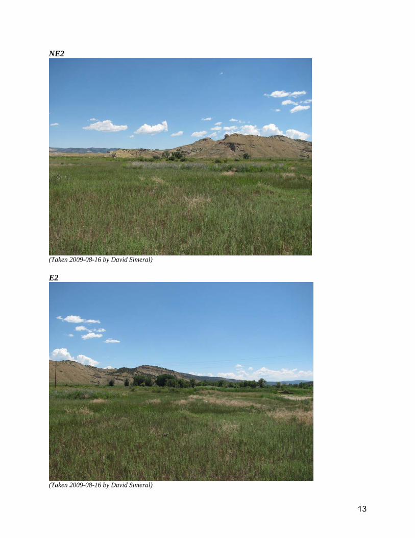
NE2
(Taken 2009-08-16 by David Simeral) E2
(Taken 2009-08-16 by David Simeral)

14
SE2
(Taken 2009-08-16 by David Simeral) S2
(Taken 2009-08-16 by David Simeral)
15
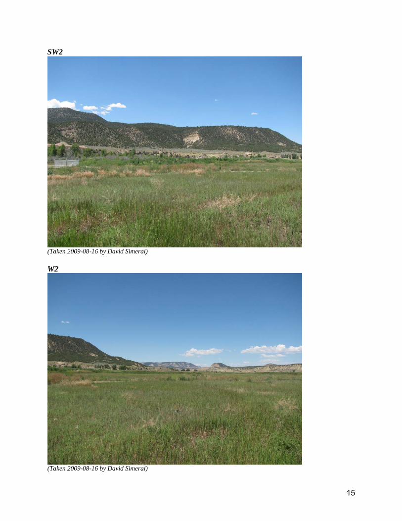
SW2
(Taken 2009-08-16 by David Simeral) W2
(Taken 2009-08-16 by David Simeral)

16
NW2
(Taken 2009-08-16 by David Simeral) N1
(Taken 2009-08-16 by David Simeral)

17
NE1
(Taken 2009-08-16 by David Simeral) E1
(Taken 2009-08-16 by David Simeral)

18
SE1
(Taken 2009-08-16 by David Simeral) S1
(Taken 2009-08-16 by David Simeral)

19
SW1
(Taken 2009-08-16 by David Simeral) W1
(Taken 2009-08-16 by David Simeral)

20
NW1
(Taken 2009-08-16 by David Simeral) Other
Stream gauging equipment near the site survey location. (Taken 2009-08-16 by David Simeral)

21
Other
Access road. (Taken 2009-08-16 by David Simeral) Other
Water pumping from White River. (Taken 2009-08-16 by David Simeral)

22
Other
White River. (Taken 2009-08-16 by David Simeral) Other
Topo1 (Taken 2009-08-16 by David Simeral)

23
Other
Topo2 (Taken 2009-08-16 by David Simeral) Other
Topo3 (Taken 2009-08-16 by David Simeral)

24
Other
Topo 4 (Taken 2009-08-16 by David Simeral) Other
google1 (Taken 2009-08-16 by David Simeral)
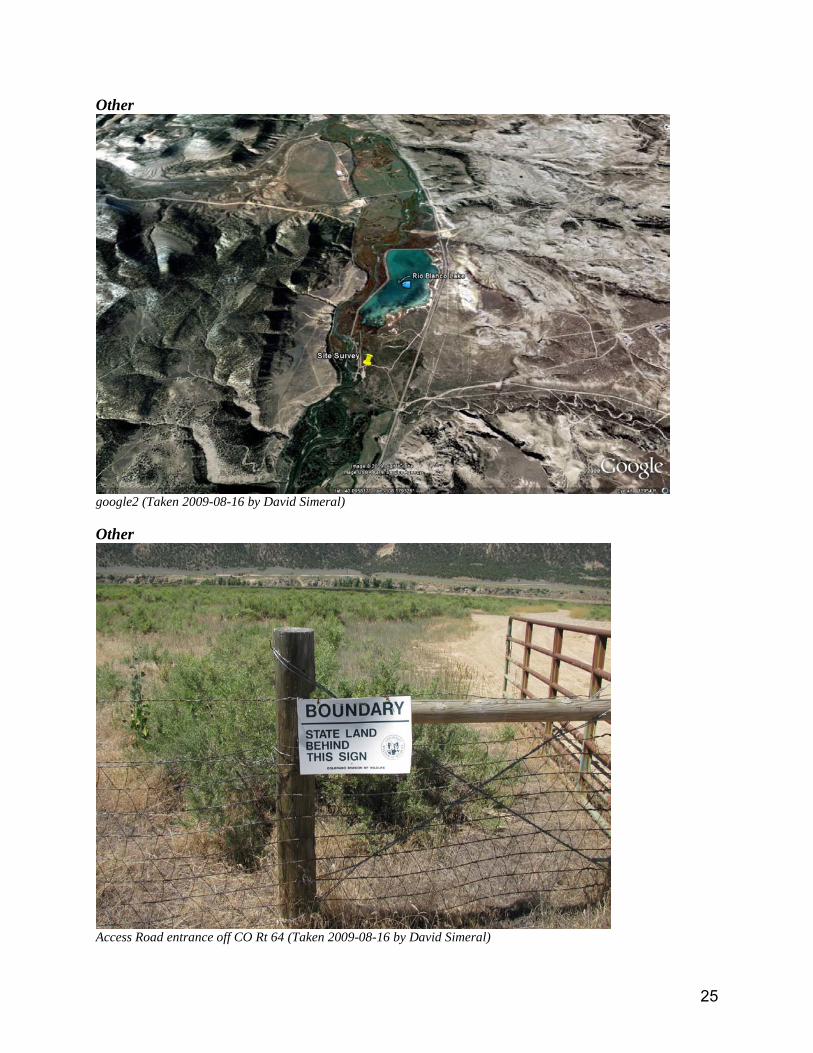
25
Other
google2 (Taken 2009-08-16 by David Simeral) Other
Access Road entrance off CO Rt 64 (Taken 2009-08-16 by David Simeral)
26
Other
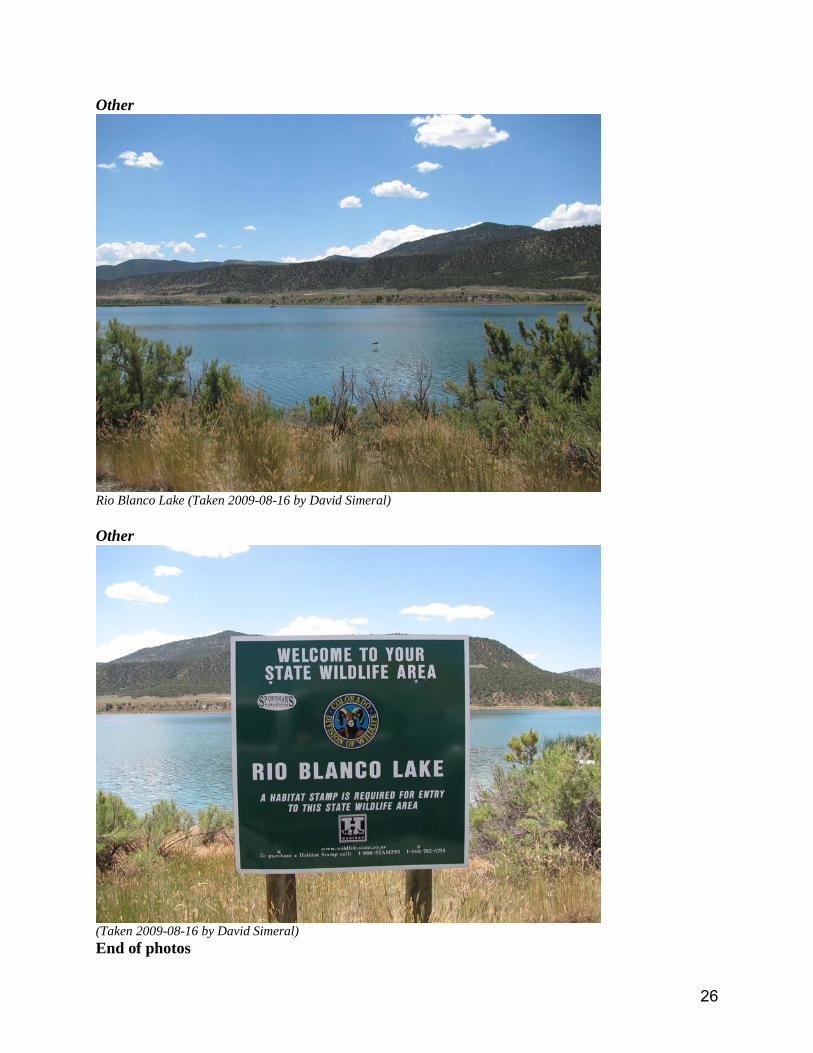
Rio Blanco Lake (Taken 2009-08-16 by David Simeral) Other
(Taken 2009-08-16 by David Simeral) End of photos
27
C. Obstruction Diagram

28
D. Site Score Sheet Temperature and Humidity Classification / Classification Number 1 2 3 4 5
Distance from artificial heating sources and reflective surfaces (m) 300+ m 14 pts 240-300 12 pts 100-240 8 pts 50-100 5 pts 0-50 0 pts
Distances to large bodies of water (m), when location near water is not representative of the area
300+ m 12 pts 240-300 9 pts 100-240 7 pts 50-100 5 pts 0-50 0 pts
Angular height of surrounding vegetation (referenced to eye height) within 100 m radius (80 % or more coverage is below the angle specified)
0-5 deg 8 pts 5-6 deg 6 pts 6-11 deg 3 pts 11+ deg 0 pts * 0 pts
Slope of cleared & flat ground surface within 30 m radius 0-8 deg 6 pts 8-15 deg 3 pts 15-23 deg 2 pts 23+ deg 0 pts * 0 pts
Remarks Precipitation Classification / Classification Number 1 2 3 4 5
Angular height of nearest obstacle with angular width > 10 degrees 0-14 deg 30 pts 14-27 deg 20 pts 27-45 deg 10 pts 45+ deg 0 pts * 0 pts
Remarks Wind Classification / Classification Number 1 2 3 4 5
Angular height of nearest “significant” obstacle (angular width > 10 deg)
0-6= deg 7 pts 6-8 deg 4 pts 8-11 deg 2 pts 11+ deg 0 pts * 0 pts
Angular width of nearest “thin” obstacle (angular width < 10 deg) 0-4 deg 4 pts 4-5 deg 3 pts 5-6 deg 1 pts 6+ deg 0 pts * 0 pts
Surrounding terrain relief change (m) (Expressed as height difference within a radius around the site)
0-5 m / 300 m 4 pts 0-5 m /
100 m 3 pts 0-1 m / 10 m 2 pts 1+ m /
10 m 1 pts * 0 pts
Remarks Solar Radiation Classification / Classification Number 1 2 3 4 5
Angular height of Solar Horizon (degrees) (Average angular height throughout the azimuthal sector from 60 to 300 degrees)
0-7 deg 9 pts 7-10 deg 6 pts 10-15 deg 3 pts 15+ deg 0 pts * 0 pts
Height of “significant” obstacles (angular width >10 deg, < 20 deg) (Expressed as angular height to top of obstacle)
0-12 deg 6 pts 12-16 deg 4 pts 16-22 deg 2 pts 22+ deg 0 pts * 0 pts
Remarks Scores Temperature and RH: _40__ Class: _1__

29
Precipitation: _30__ Class: _1__ Wind: _12__ Class: _2__ Solar Radiation: _15__ Class: _1_
Total Score: 97___ Class: _1__
Acceptable?: yes Temp / RH Precip Wind Solar Rad Total Pts Class 1 35-40 pts 25-30 pts 13-15 pts 13-15 pts 85-100 pts Class 2 30-34 pts 20-24 pts 10-12 pts 8-12 pts 65- 84 pts Class 3 20-29 pts 10-19 pts 5- 9 pts 5- 7 pts 40- 64 pts Class 4 10-19 pts not accept not accept not accept 11- 39 pts Class 5 not accept not accept not accept not accept 0- 10 pts - “not accept” means unacceptable. n= means inclusive of the value n. Adopted from Ed May revision of 20030310.

potterm
Callout
100m D @ 360º