
Coote Marine SDI benefits quantification - blue economy 20150414
22
Quantifying the benefits of Marine Spatial Data Infrastructures www.consultingwhere.com Blue Economy Conference 14 th April 2015 Andrew Coote ConsultingWhere Ltd
-
Upload
andy-coote -
Category
Economy & Finance
-
view
63 -
download
1
Transcript of Coote Marine SDI benefits quantification - blue economy 20150414
Quantifying the benefits of Marine Spatial Data Infrastructures
www.consultingwhere.com
Blue Economy Conference 14th April 2015 Andrew Coote
ConsultingWhere Ltd
Presenter
Presentation Notes
Quantifying the benefits of Marine Spatial Data Infrastructures Analysing risk and measuring benefits to generate sustainable growth for communities and stakeholders around our coasts and in marine areas.

MSDI Benefits Quantification
CEO, ConsultingWhere, UK ConsultingWhere is an International specialist IT consulting organization focused on location Information, particularly: • SDI Development • Economic analysis (and RoI) studies • Business Strategy Twitter: @acoote Email: [email protected]
Andrew Coote
MSDI Benefits Quantification
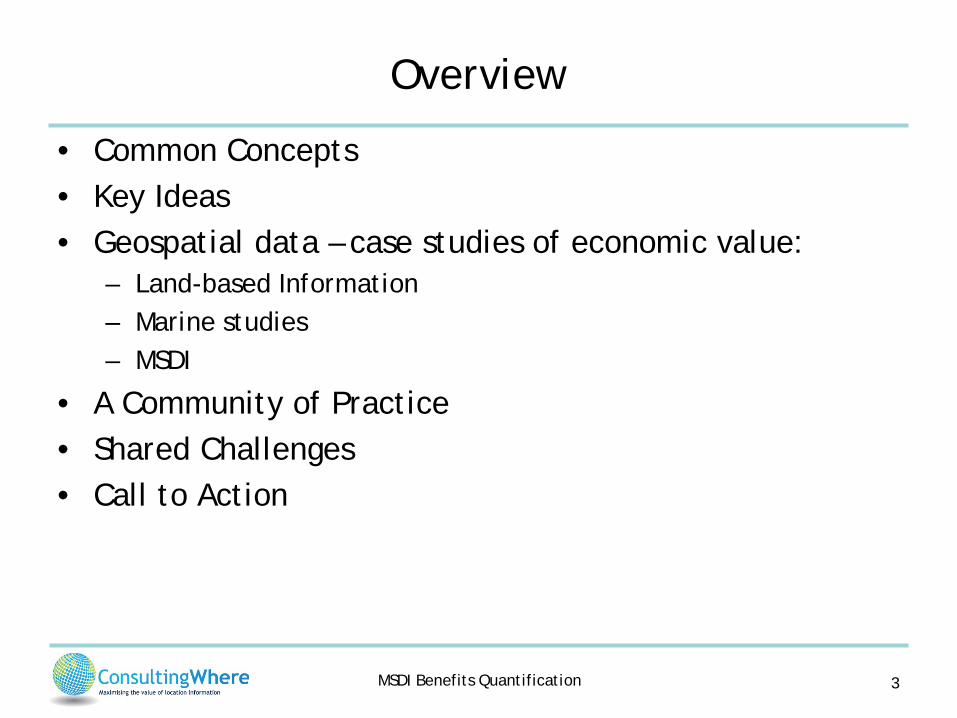
Overview
• Common Concepts • Key Ideas • Geospatial data – case studies of economic value:
– Land-based Information – Marine studies – MSDI
• A Community of Practice • Shared Challenges • Call to Action
3
MSDI Benefits Quantification
Common Concepts
4
MSDI Benefits Quantification
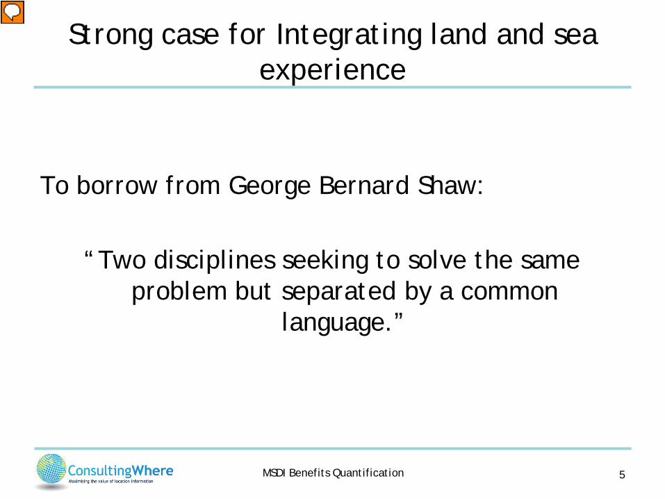
Strong case for Integrating land and sea experience
To borrow from George Bernard Shaw:
“Two disciplines seeking to solve the same problem but separated by a common
language.”
5
Presenter
Presentation Notes
England and America are two countries separated by a common language. George Bernard Shaw�Irish dramatist & socialist (1856 - 1950)
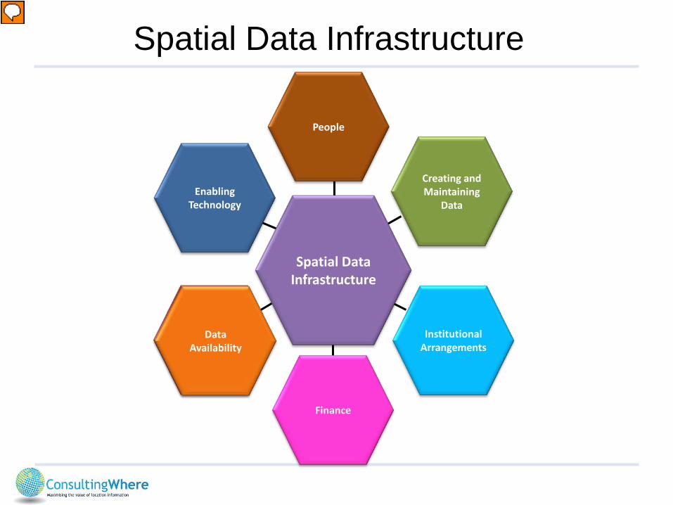
Finance
Institutional Arrangements
Spatial Data Infrastructure
Data Availability
Creating and Maintaining
Data Enabling
Technology
People
Spatial Data Infrastructure
Presenter
Presentation Notes
It is important to establish a common frame of reference. Often we talk of SDI in terms of these four basic components. I want to suggest to you a wider vision which encompasses much more specifically the two additional components that underpin all the others: people and finance. Without people with the rights skills and motivation, we can achieve little Without the financial underpinning we don’t have the money to employ the people or buy the tools
MSDI Benefits Quantification
Key Ideas
7
MSDI Benefits Quantification
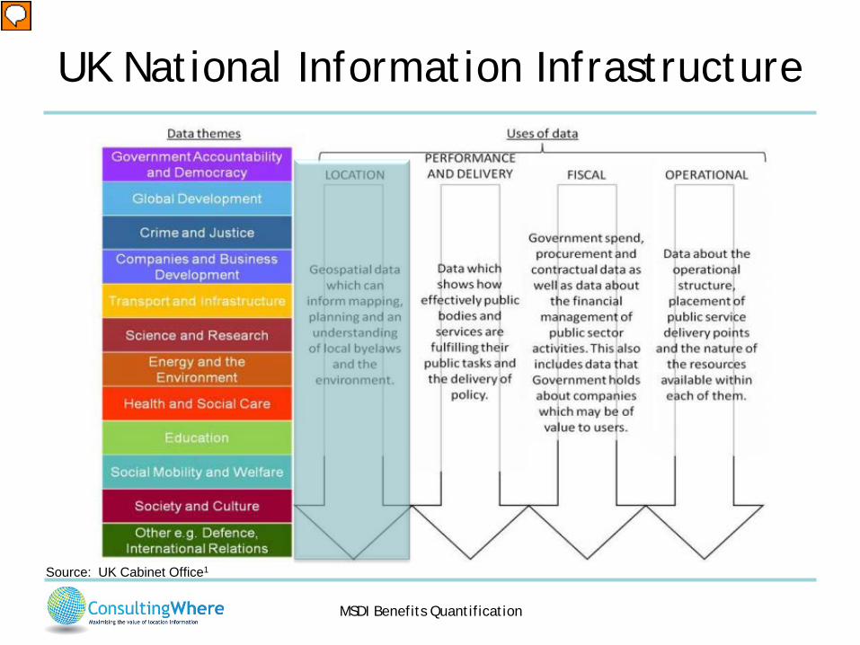
UK National Information Infrastructure
Source: UK Cabinet Office1
Presenter
Presentation Notes
In the Information age Information is as much an infrastructure as roads and energy networks. The UK government is one of the first to formally recognise this. Furthermore, they importantly recognise that location (geospatial) data is a fundamental part of the infrastructure. Setting out a National Information Infrastructure https://www.gov.uk/government/uploads/system/uploads/attachment_data/file/254166/20131029-NII-Narrative-FINAL.pdf
MSDI Benefits Quantification
Valuing Information
• We should not confuse the value of information with the value of benefits from policies and/or systems that use it in decision making (the apportionment problem)
• There is almost always alternative evidence to support decisions (economists call this the “counterfactual”): – other data sources (increasing in a world of data abundance) – different evidence bases (often from social science)
• It follows that an information source is only worth the “delta” in value between it and the next best alternative.
Presenter
Presentation Notes
The seminal research in this area is by Nordhaus, who suggests that better or perfect information is worth in the order of 1% of the value of the output, based on a series of studies that have quantified the impacts across different sectors. 1. This ‘VOI’ approach was adopted by the NOAA when estimating the economic benefits from ports installations. In its approach, the first step was to identify the activities that could be affected by ocean observing systems. Activity areas included a number of recreational activities (fishing and boating, etc.), freight transportation, health and safety (oil spills, search and rescue, beach restoration, etc.), energy planning and development, and commercial fishing. NOAA: “Estimating Economic Benefits from NOAA PORTS® Installations: A Value of Information Approach”, Technical Report NOS CO-OPS 44, Silver Spring, Maryland, July 2005. 2. Cost-Benefit Analysis for GMES (now Copernicus) http://www.copernicus.eu/sites/default/files/library/ec_gmes_cba_final_en.pdf
MSDI Benefits Quantification
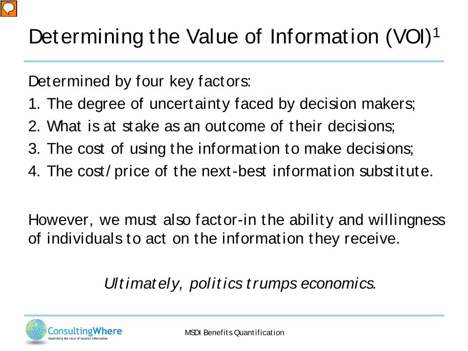
Determining the Value of Information (VOI)1 Determined by four key factors: 1. The degree of uncertainty faced by decision makers; 2. What is at stake as an outcome of their decisions; 3. The cost of using the information to make decisions; 4. The cost/price of the next-best information substitute.
However, we must also factor-in the ability and willingness of individuals to act on the information they receive.
Ultimately, politics trumps economics.
Presenter
Presentation Notes
1. Molly Macauley - The Value of Information: A Background Paper on Measuring the Contribution of Space-Derived Earth Science Data to National Resource Management, Resources for the Future, 2005. The larger the degree of uncertainty and what is at stake, then the larger the value. A high cost of obtaining and using the information tends to reduce VOI.
MSDI Benefits Quantification
Geo-economics: Quantitative Studies
11
Presenter
Presentation Notes
There is a growing body of studies into what we might phrase of geo-economics
MSDI Benefits Quantification
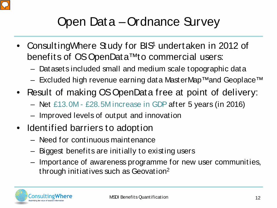
Open Data – Ordnance Survey
• ConsultingWhere Study for BIS1 undertaken in 2012 of benefits of OS OpenData™ to commercial users: – Datasets included small and medium scale topographic data – Excluded high revenue earning data MasterMap™ and Geoplace™
• Result of making OS OpenData free at point of delivery: – Net £13.0M - £28.5M increase in GDP after 5 years (in 2016) – Improved levels of output and innovation
• Identified barriers to adoption – Need for continuous maintenance – Biggest benefits are initially to existing users – Importance of awareness programme for new user communities,
through initiatives such as Geovation2
12
Presenter
Presentation Notes
1. Assessing the Value of OS OpenData™ to the Economy of Great Britain – Synopsis June 2013 https://www.gov.uk/bis-13-950-assessing-value-of-opendata-to-economy-of-great-britain.pdf 2. Geovation - http://www.geovation.org.uk/
MSDI Benefits Quantification
Geospatial Value to National Economy - NZ
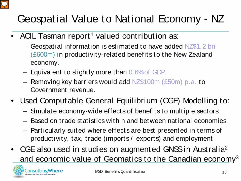
• ACIL Tasman report1 valued contribution as: – Geospatial information is estimated to have added NZ$1.2 bn
(£600m) in productivity-related benefits to the New Zealand economy.
– Equivalent to slightly more than 0.6% of GDP. – Removing key barriers would add NZ$100m (£50m) p.a. to
Government revenue.
• Used Computable General Equilibrium (CGE) Modelling to: – Simulate economy-wide effects of benefits to multiple sectors – Based on trade statistics within and between national economies – Particularly suited where effects are best presented in terms of
productivity, tax, trade (imports / exports) and employment
• CGE also used in studies on augmented GNSS in Australia2 and economic value of Geomatics to the Canadian economy3
13
Presenter
Presentation Notes
1. Spatial Information in the New Zealand Economy - Realising Productivity Gains http://www.linz.govt.nz/about-linz/our-location-strategy/geospatial-projects/spatial-information-new-zealand-economy 2. The value of augmented GNSS in Australia (2013) http://www.acilallen.com.au/cms_files/ACIL_GNSS_positioning.pdf 3. Due for publication later this year. 3.
MSDI Benefits Quantification
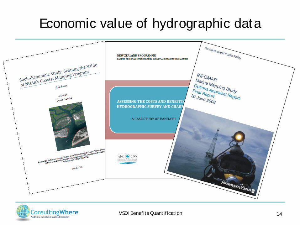
Economic value of hydrographic data
14
MSDI Benefits Quantification
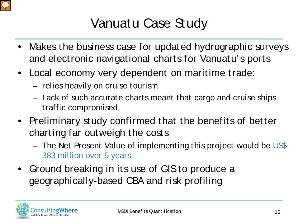
Vanuatu Case Study
• Makes the business case for updated hydrographic surveys and electronic navigational charts for Vanuatu’s ports
• Local economy very dependent on maritime trade: – relies heavily on cruise tourism – Lack of such accurate charts meant that cargo and cruise ships
traffic compromised
• Preliminary study confirmed that the benefits of better charting far outweigh the costs – The Net Present Value of implementing this project would be US$
383 million over 5 years
• Ground breaking in its use of GIS to produce a geographically-based CBA and risk profiling
15
Presenter
Presentation Notes
Source: Marico Marine for Land Information New Zealand
MSDI Benefits Quantification
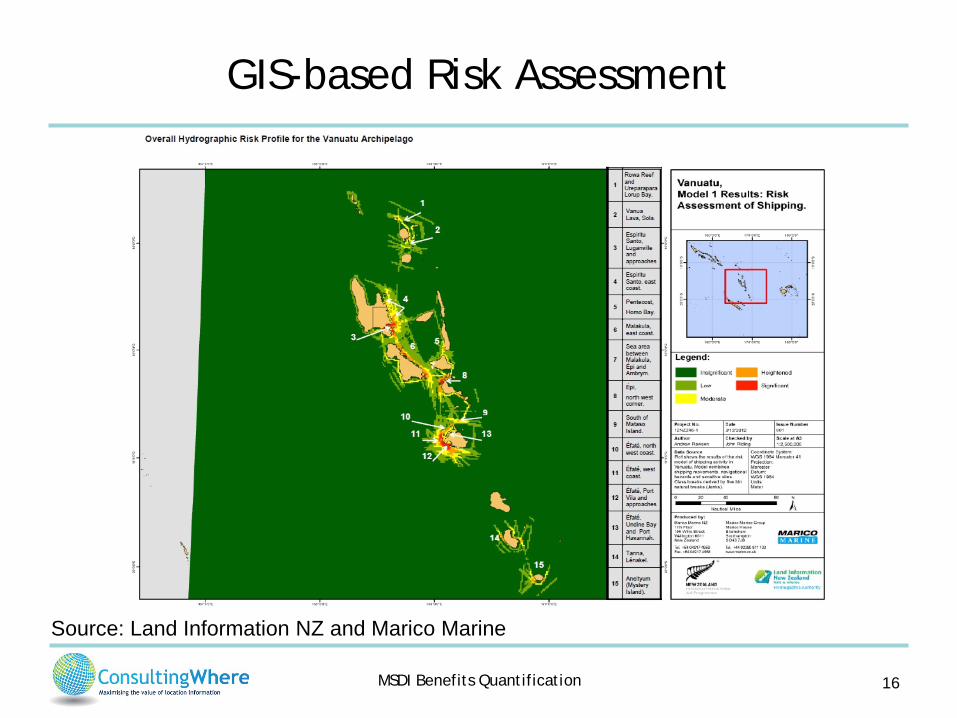
GIS-based Risk Assessment
16
Source: Land Information NZ and Marico Marine

MSDI Benefits Quantification
Economic Appraisal: MSDI Denmark
17
Source: Devoteam presentation at IHO MSDI Working Group 20131
Presenter
Presentation Notes
MSDI Business Case Peter Godiksen http://www.iho.int/mtg_docs/com_wg/MSDIWG/MSDIWG4/MSDI_Open_Forum/MsdiForum_Devoteam-PG_BusinessCase.pdf
MSDI Benefits Quantification
Socio-economic benefits: A Community of Practice
• Group originally formed to help to quantify the business value of INSPIRE
• Objective to advance understanding of the benefits of geospatial and environmental information for complex socioeconomic decisions.
• Holds international annual workshop to discuss key issues • Sponsored by NASA, USGS and EC • Runs a website www.socioeconomicbenefits.org • Also LinkedIn group for knowledge exchange • Free, open membership
18
MSDI Benefits Quantification
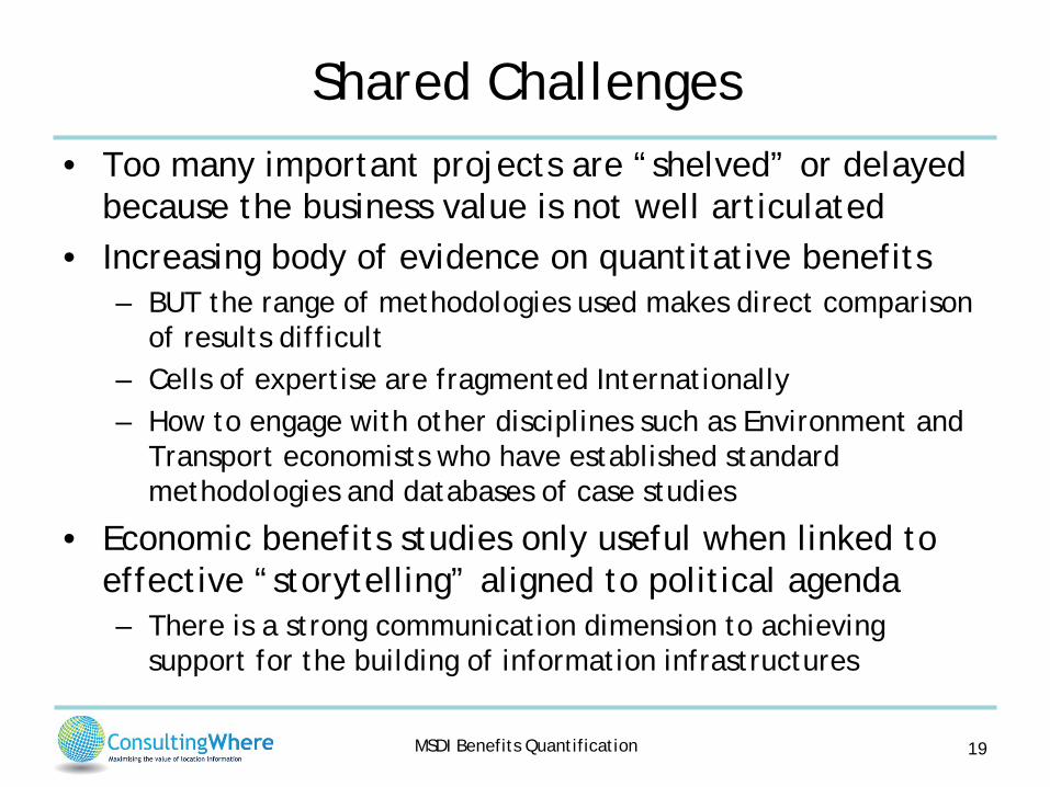
Shared Challenges • Too many important projects are “shelved” or delayed
because the business value is not well articulated • Increasing body of evidence on quantitative benefits
– BUT the range of methodologies used makes direct comparison of results difficult
– Cells of expertise are fragmented Internationally – How to engage with other disciplines such as Environment and
Transport economists who have established standard methodologies and databases of case studies
• Economic benefits studies only useful when linked to effective “storytelling” aligned to political agenda – There is a strong communication dimension to achieving
support for the building of information infrastructures
19
MSDI Benefits Quantification
Call to Action
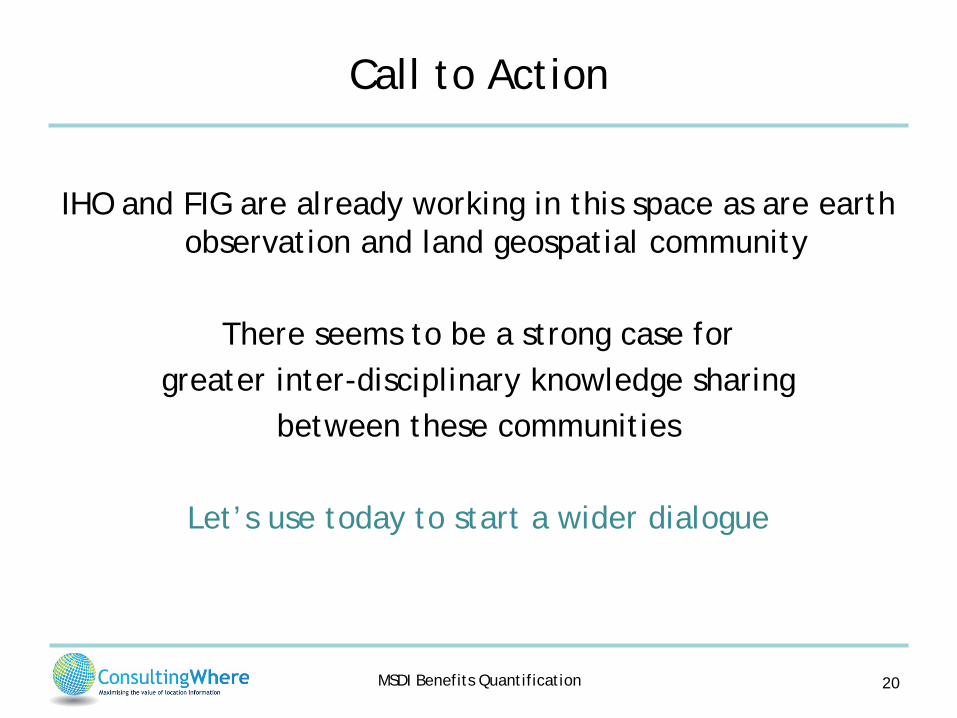
IHO and FIG are already working in this space as are earth
observation and land geospatial community
There seems to be a strong case for greater inter-disciplinary knowledge sharing
between these communities
Let’s use today to start a wider dialogue
20

MSDI Benefits Quantification
Further Information on economic benefits
• ConsultingWhere - Return on Investment (RoI) Information Centre http://www.consultingwhere.com/resources/roi-information-centre.html
• Environmental Valuation Reference Inventory (EVRI) http://www.evri.ca
• Socio-economic Benefits Community website http://www.socioeconomicbenefits.org
• NASA: Measuring Socioeconomic Impacts of Earth Observation http://www.nasa.gov/sites/default/files/files/SocioeconomicImpactsPrimer.pdf
21

Contact Information:
Mobile: +44 7860884119 Email: [email protected]
Skype: andrew.coote Chipperfield, UK Twitter: @acoote
Website: www.consultingwhere.com