CHAPTER 38 COLUMBIA RIVER GORGE NATIONAL SCENIC AREA
262
CHAPTER 38 – COLUMBIA RIVER GORGE NATIONAL SCENIC AREA (S-2 2018) §§: PART 1 - GENERAL PROVISIONS 38.0000- Purposes 38.0005 Area Affected 38.0010 Uses 38.0015 Definitions 38.0020 Exempt Land Uses and Activities 38.0025 Prohibited Land Uses and Activities 38.0030 Existing Uses and Discontinued Uses 38.0035 Expedited Review Use Applications - Submitted Requirements 38.0045 Review and Conditional Use Applications - Submittal Requirements 38.0050 Conditional Uses 38.0060 Agricultural Buffer Zones 38.0065 Variances from Setbacks and Buffers within the General Management Area 38.0080 Signs 38.0100 Plan Amendments 38.0110 Indian Tribal Treaty Rights and Consultation PART 2 - PLANNING AUTHORITY - General Provisions 38.0200- Definitions. 38.0205 Policy and purpose. 38.0207 Authority 38.0210 Severability. PLANNING COMMISSION 38.0300- Planning Commission Established. 38.0305 Membership of Commission. 38.0310 Terms of Office of Commission Members. 38.0315 Vacancies And Removal Of Commission Members. 38.0320 Officers and Staff. 38.0325 Committees. 38.0330 Administration. 38.0333 Meetings. 38.0335 Coordination. 38.0340 Powers And Duties Of Commission. PART 3 - ADMINISTRATION AND PROCEDURES 38.0510- Purpose and scope. 38.0530 Summary of Decision Making Processes. 38.0540 Assignment of decision makers. 38.0550 Initiation of action. 38.0560 Code compliance and applications. 38.0570 Pre-application conference meeting. 38.0580 Application requirements for Type II or Type III applications. 38.0590 Completeness Review – Type I Applications. 38.0600 Completeness Review. 38.0605 Repealed by Ord. 1262. 38.0610 Hearings process - Type II appeals, Type III applications. 38.0620 Hearings Notice - Type II appeals or Type III applications. 38.0630 Posting Notice Requirements - Type III hearings. 38.0640 Appeals. 38.0650 Reapplication limited. 38.0660 Conditions of approval and notice of decision. 38.0670 Recording of decision. 38.0680 Performance guarantees. 38.0685 Expiration and Extension of a Type I Decision. 38.0690 Expiration of a Type II or Type III decision. 38.0691 Expiration of prior land use decisions. 38.0692 Expiration of Prior Type I Permits. 38.0700 Extension of Type II or Type III decisions. 38.0702 Revocation of decisions. 38.0710 (PC) Legislative hearing process. 38.0720 Notice of Legislative Hearings. 38.0730 Continuance of PC hearings. 38.0740 Interpretations.
Transcript of CHAPTER 38 COLUMBIA RIVER GORGE NATIONAL SCENIC AREA

CHAPTER 38 – COLUMBIA RIVER GORGE NATIONAL SCENIC AREA
(S-2 2018)
§§:
PART 1 - GENERAL PROVISIONS
38.0000- Purposes
38.0005 Area Affected
38.0010 Uses
38.0015 Definitions
38.0020 Exempt Land Uses and Activities
38.0025 Prohibited Land Uses and
Activities
38.0030 Existing Uses and Discontinued
Uses
38.0035 Expedited Review Use
Applications - Submitted
Requirements
38.0045 Review and Conditional Use
Applications - Submittal
Requirements
38.0050 Conditional Uses
38.0060 Agricultural Buffer Zones
38.0065 Variances from Setbacks and
Buffers within the General
Management Area
38.0080 Signs
38.0100 Plan Amendments
38.0110 Indian Tribal Treaty Rights and
Consultation
PART 2 - PLANNING AUTHORITY - General
Provisions
38.0200- Definitions.
38.0205 Policy and purpose.
38.0207 Authority
38.0210 Severability.
PLANNING COMMISSION
38.0300- Planning Commission
Established.
38.0305 Membership of Commission.
38.0310 Terms of Office of Commission
Members.
38.0315 Vacancies And Removal Of
Commission Members.
38.0320 Officers and Staff.
38.0325 Committees.
38.0330 Administration.
38.0333 Meetings.
38.0335 Coordination.
38.0340 Powers And Duties Of
Commission.
PART 3 - ADMINISTRATION AND
PROCEDURES
38.0510- Purpose and scope.
38.0530 Summary of Decision Making
Processes.
38.0540 Assignment of decision makers.
38.0550 Initiation of action.
38.0560 Code compliance and
applications.
38.0570 Pre-application conference
meeting.
38.0580 Application requirements for
Type II or Type III applications.
38.0590 Completeness Review – Type I
Applications.
38.0600 Completeness Review.
38.0605 Repealed by Ord. 1262.
38.0610 Hearings process - Type II
appeals, Type III applications.
38.0620 Hearings Notice - Type II
appeals or Type III applications.
38.0630 Posting Notice Requirements -
Type III hearings.
38.0640 Appeals.
38.0650 Reapplication limited.
38.0660 Conditions of approval and
notice of decision.
38.0670 Recording of decision.
38.0680 Performance guarantees.
38.0685 Expiration and Extension of a
Type I Decision.
38.0690 Expiration of a Type II or Type
III decision.
38.0691 Expiration of prior land use
decisions.
38.0692 Expiration of Prior Type I
Permits.
38.0700 Extension of Type II or Type III
decisions.
38.0702 Revocation of decisions.
38.0710 (PC) Legislative hearing process.
38.0720 Notice of Legislative Hearings.
38.0730 Continuance of PC hearings.
38.0740 Interpretations.

ii Multnomah County – Chapter 38 – Columbia River Gorge National Scenic Area
(S-2 2018)
38.0765 Applying New Less-Stringent
Regulations to Development
Approved Under Prior MCC
Chapter 38 Regulations
38.0770 Transfer of approval rights.
38.0780 Ex Parte Contact, Conflict of
Interest and Bias.
38.0790 Procedural objections.
38.0800 Applicability in the event of
conflicts.
38.0850 Fees.
VIOLATIONS AND ENFORCEMENT
38.0910- Violations and Enforcement
38.0915 Repealed by Ord. 1126
38.0920 Savings Clause
STREET NAMING AND PROPERTY
NUMBERING
38.0980- Street Naming and Property
Numbering Procedures
PART 4 - ZONING DISTRICTS
38.1000- General Management Area and
Special Management Area
38.1005 Allowed Uses
38.1010 Expedited Uses.
FOREST DISTRICTS - GGF and GSF
38.2000- Purposes
38.2005 Area Affected
38.2015 Uses
38.2020 Allowed Uses
38.2023 Expedited Uses
38.2025 Review Uses
38.2030 Conditional Uses
38.2060 Dimensional Requirements
38.2085 Off-Street Parking and Loading
38.2090 Access
38.2095 Signs
AGRICULTURAL DISTRICTS - GGA and GSA
38.2200- Purposes
38.2205 Area Affected
38.2215 Uses
38.2220 Allowed Uses
38.2223 Expedited Uses
38.2225 Review Uses
38.2230 Conditional Uses
38.2260 Dimensional Requirements
38.2285 Off-Street Parking and Loading
38.2290 Access
38.2295 Signs
RURAL CENTER - GGRC
38.2400- Purposes
38.2405 Area Affected
38.2415 Uses
38.2420 Allowed Uses
38.2423 Expedited Uses
38.2425 Review Uses
38.2430 Conditional Uses
38.2460 Dimensional Requirements
38.2485 Off-Street Parking and Loading
38.2490 Access
38.2495 Signs
OPEN SPACE - GGO and GSO
38.2600- Purposes
38.2605 Area Affected
38.2615 Uses
38.2620 Allowed Uses
38.2623 Expedited Uses
38.2625 Review Uses
38.2660 Dimensional Requirements
38.2685 Off-Street Parking and Loading
38.2690 Access
38.2695 Signs
RECREATIONAL DISTRICTS - GG-PR, GG-CR
and GS-PR
38.2800- Purposes
38.2805 Area Affected
38.2815 Uses
38.2820 Allowed Uses
38.2823 Expedited Uses
38.2825 Review Uses
38.2830 Conditional Uses
38.2860 Dimensional Requirements
38.2885 Off-Street Parking and Loading
38.2890 Access
38.2895 Sign

Chapter 38 – Columbia River Gorge National Scenic Area iii
(S-1 - LU 2019)
RESIDENTIAL DISTRICTS - GGR and GSR
38.3000- Purposes
38.3005 Area Affected
38.3015 Uses
38.3020 Allowed Uses
38.3023 Expedited Uses
38.3025 Review Uses
38.3030 Conditional Uses
38.3060 Dimensional Requirements
38.3085 Off-Street Parking and Loading
38.3090 Access
38.3095 Signs
COMMERCIAL - GGC
38.3200- Purposes
38.3205 Area Affected
38.3215 Uses
38.3220 Allowed Uses
38.3223 Expedited Uses
38.3225 Review Uses
38.3230 Conditional Uses
38.3260 Dimensional Requirements
38.3285 Off-Street Parking and Loading
38.3290 Access
38.3295 Signs
PART 5 - SPECIAL DISTRICTS - OFF-STREET
PARKING; PLANNED DEVELOPMENT;
HILLSIDE DEVELOPMENT - Off-Street Parking
and Loading
38.4100- Purposes
38.4105 General Provisions
38.4115 Continuing Obligation
38.4120 Plan Required
38.4125 Use of Space
38.4130 Location of Parking and Loading
Spaces
38.4135 Improvements Required
38.4140 Change of Use
38.4145 Joint Parking or Loading
Facilities
38.4150 Existing Spaces
38.4155 Interpretation
38.4160 Standards of Measurement
38.4165 Design Standards: Scope
38.4170 Access
38.4175 Dimensional Standards
38.4180 Improvements
38.4185 Lighting
38.4190 Signs
38.4195 Design Standards: Setbacks
38.4205 Minimum Required Off-Street
Parking Spaces
38.4215 Exceptions from Required Off-
Street Parking or Loading
Spaces
PLANNED DEVELOPMENT
38.4300- Purposes
38.4305 Areas Affected
38.4310 Conditions
38.4315 Development Plan and Program
Contents
38.4320 Criteria for Approval
38.4330 Development Standards
38.4335 Minimum Site Size
38.4340 Relationship of the Planned
Development to Environment
38.4345 Open Space
38.4350 Density Computation for
Residential Developments
38.4355 Staging
38.4360 Permitted Uses
GEOLOGIC HAZARDS
38.5500- Purposes
38.5503 Definitions
38.5505 Permits Required
38.5510 Exemptions
38.5515 Geologic Hazards Permit
Application Information
Required
38.5520 Geologic Hazards Permit
Standards
PART 6 - APPROVAL CRITERIA
38.7000- Purposes
38.7010 Applicability
38.7015 Application for NSA Site Review
and Conditional Use Review
38.7020 Required Findings
38.7035 GMA Scenic Review Criteria
38.7040 SMA Scenic Review Criteria
38.7045 GMA Cultural Resource Review
Criteria
38.7050 SMA Cultural Resource Review
Criteria

iv Chapter 38 – Columbia River Gorge National Scenic Area
(S-2 - LU 2012)
38.7055 GMA Wetland Review Criteria
38.7060 GMA Stream, Lake and
Riparian Area Review Criteria
38.7065 GMA Wildlife Review Criteria
38.7070 GMA Rare Plant Review
Criteria
38.7075 SMA Natural Resource Review
Criteria
38.7080 GMA Recreation Resource
Review Criteria
38.7085 SMA Recreation Resource
Review Criteria
38.7090 Responses to an
Emergency/Disaster Event
38.7100 Expedited Development Review
Criteria
PART 7 - SPECIAL USES - Approval Criteria and
Submittal Requirements
38.7300- Review and Conditional Uses
38.7305 Fire Protection in Forest Zones
38.7310 Specific Uses
38.7315 Siting of Dwellings on Forest
Land
38.7320 Temporary Health Hardship
Dwelling
38.7325 Private Docks and Boathouses
38.7330 Home Occupations and Cottage
Industries
38.7331 Type A Home Occupations
38.7332 Small-Scale Fishing Support and
Fish Processing Operations.
38.7335 Bed and Breakfast Inns
38.7340 Agricultural Buildings
38.7345 Resource Enhancement Projects
38.7350 Disposal Sites for Spoil Materials
from Public Road Maintenance
Activities
38.7355 Life Estates
38.7360 Cluster Development
38.7365 Clearing of Trees for
Agricultural Use in GSF
38.7370 Forest Practices in the Special
Management Area
38.7375 Stewardship Plan Requirements
38.7380 Special Uses in Historic
Buildings
38.7385 Boarding of Horses or Non-
Profit Horse Rescue Facility
PART 8 - VARIANCES AND LAND DIVISIONS -
Variances
38.7600- Variance Approval Criteria
38.7605 Variance Classification
LAND DIVISIONS
38.7700- Title
38.7705 Definitions
38.7725 Compliance Required
38.7730 Repealed by Ord. 1097
38.7740 Undeveloped Subdivisions
38.7765 Land Division Categories
Distinguished
38.7770 Category 1 Land Divisions
38.7775 Category 3 Land Divisions
38.7794 Consolidation of Parcels and
Lots
38.7797 Replatting of Partition and
Subdivision Plats
38.7800 Criteria for Approval: Category
1 Tentative Plan
38.7805 Contents of Category 1 Tentative
Plan
38.7810 Category 1 Tentative Plan Map
Specifications
38.7815 Category 1 Tentative Plan Map
Contents
38.7820 Written Information: Category 1
Tentative Plan
38.7825 Supplementary Material:
Category 1 Tentative Plan
38.7855 Criteria for Approval: Category
3 Tentative Plan
38.7860 Contents of Category 3 Tentative
Plan
38.7865 Tentative Plan Approval Time
Limits; Staged Development
38.7870 Time Limit
38.7875 Staged Development for
Subdivision
38.7880 Re-Approval After Expiration
38.7885 Application of General
Standards and Requirements
38.7890 Land Suitability
38.7895 Lots and Parcels
38.7900 Acreage Tracts
38.7905 Street Layout
38.7910 Street Design
38.7915 Street Reserve Strips

v
(S-2 – LU 2012)
38.7920 Temporary Turnarounds
38.7925 Street Names
38.7930 Sidewalks, Pedestrian Paths and
Bikeways
38.7935 Easements
38.7940 Street Trees
38.7950 Water System
38.7955 Sewage Disposal
38.7960 Surface Drainage
38.7965 Electrical and Other Wires
38.7970 Property Line Adjustment (Lot
Line Adjustment)
38.7975 Required Improvements
38.7980 Streets, Pedestrian Paths and
Bikeways
38.7985 Water System
38.7990 Sewage Disposal
38.7995 Surface Drainage and Storm
Sewer Systems
38.8000 Other Utilities
38.8005 Variances
38.8010 Improvement Agreement
38.8015 Final Drawing and Prints
38.8020 Information Required on
Subdivision Plat or Partition Plat
38.8025 Supplemental Information with
Subdivision Plat or Partition Plat
38.8030 Technical Review and Approval
of Subdivision Plat or Partition
Plat
38.8035 Final Approval Effective

vi Multnomah County – Chapter 38 – Columbia River Gorge National Scenic Area
(S-2 – LU - 2012)

Chapter 38 - Columbia River Gorge National Scenic Area 1-1
(S-1 – LU 2018)
PART 1 - GENERAL PROVISIONS
§ 38.0000- PURPOSES
The purposes of the Columbia River Gorge National
Scenic Area Districts are to protect and provide for
the enhancement of the scenic, cultural, recreational,
and natural resources of the Columbia River Gorge,
and to protect and support the economy of the Co-
lumbia River Gorge by encouraging growth to occur
in existing urban areas and by allowing future eco-
nomic development in a manner that protects and
enhances the scenic, cultural, recreational, and natu-
ral resources of the Gorge. (Ord. 1064, Amended, 06/23/2005; Ord. 997, Repealed and Re-
placed, 10/31/2002; Ord. 953 §2, Reorg&Renum, 11/30/2000)
§ 38.0005 AREA AFFECTED
MCC Chapter 38 shall apply to all lands within the
Columbia River Gorge National Scenic Area as des-
ignated by the Columbia River Gorge National Sce-
nic Area Act. (Ord. 997, Repealed and Replaced, 10/31/2002; Ord. 994,
Amended, 09/26/2002; Ord. 953 §2, Reorg&Renum,
11/30/2000)
§ 38.0010 USES
No building, structure or land shall be used and no
building or structure shall be hereafter erected, al-
tered or enlarged, including those proposed by state
or federal agencies, in the Columbia River Gorge
National Scenic Area except for the uses listed in
MCC 38.1000 through 38.3295; when considered
under the applicable approval provisions of this
Chapter. (Ord. 1064, Amended, 06/23/2005; Ord. 997, Repealed and Re-
placed, 10/31/2002; Ord. 953 §2, Reorg&Renum, 11/30/2000)
§ 38.0015 DEFINITIONS
As used in this Chapter, unless the context requires
otherwise, the following words and their derivations
shall have the meanings provided below.
Accepted agricultural practice: A mode of
operation that is common to farms or ranches of
similar nature, necessary for the operation of
such farms or ranches to obtain a profit in mon-
ey, and customarily utilized in conjunction with
agricultural use.
Accessory Alternative Energy System -- A
system accessory to a primary structure or use
that converts energy into a usable form such as
electricity or heat, and conveys that energy to
uses allowed on the premises. An Accessory Al-
ternative Energy System is a solar thermal, pho-
tovoltaic or wind turbine structure, or group of
structures designed to offset all or part of the
annual energy requirements of the property.
Accessory structure/building: A structure or
detached building whose use is incidental and
subordinate to that of the main use of the prop-
erty, and that is located on the same parcel as
the main building or use. The term “detached”
means that the main building and accessory
building do not share a common wall. An ac-
cessory building connected to the main building
by a breezeway is a detached building.
Accessory use: A use or activity that is a subor-
dinate part of a primary use and that clearly is
incidental to a primary use on a site.
Active wildlife site: A wildlife site that has
been used within the past five years by a sensi-
tive wildlife species.
Addition: An extension or increase in the floor
area or height of an existing building.
Adversely Affect or Adversely Affecting: A
reasonable likelihood of more than moderate
adverse consequences for the scenic, cultural,
recreation or natural resources of the scenic ar-
ea, the determination of which is based on:
(a) The context of a proposed action;
(b) The intensity of a proposed action, in-
cluding the magnitude and duration of an
impact and the likelihood of its occurrence;
(c) The relationship between a proposed ac-
tion and other similar actions which are in-
dividually insignificant but which may have
cumulatively significant impacts; and

1-2 Multnomah County – Chapter 38 - Columbia River Gorge National Scenic Area
(S-1 – LU 2018)
(d) Proved mitigation measures which the
proponent of an action will implement as
part of the proposal to reduce otherwise sig-
nificant effects to an insignificant level.
Agency official: The federal, state, or local
agency head or designee who has authority over
a proposed project.
Agricultural specialist (Special Management
Area): A person such as a county extension
agent with a demonstrated knowledge of farm-
ing operations, and a demonstrated ability to in-
terpret and recommend methods to implement
regulations pertaining to agriculture. Such abili-
ties are usually obtained through a combination
of higher education and experience.
Agricultural structure/building: A structure
or building located on a farm or ranch and used
in the operation for the storage, repair and
maintenance of farm equipment, and supplies,
or for the raising and/or storage of crops and
livestock. This includes, but is not limited to:
barns, silos, workshops, equipment sheds,
greenhouses, orchard wind machines, pro-
cessing facilities, storage bins and structures.
Agricultural use: The current employment of
land for the primary purpose of obtaining a
profit in money by the raising, harvesting and
selling of crops, or by the feeding, breeding,
management and sale of livestock, poultry, fur-
bearing animals or honeybees, or dairying and
the sale of dairy products, or any other agricul-
tural or horticultural use including Christmas
trees. Agricultural use does not include live-
stock feedlots, the boarding of horses or non-
profit horse rescue facility and their accessory
uses. Current employment of land for agricul-
tural use includes:
(a) The operation or use of farmland subject
to any government agricultural program;
(b) Land lying fallow for one year as a nor-
mal and regular requirement of good agri-
cultural management;
(c) Land planted to orchards or to other per-
ennial crops prior to maturity; and
(d) Land under buildings supporting ac-
cepted agricultural practices.
Air: The mixture of gases compromising
the Earth’s atmosphere.
Anadromous fish: Species of fish that mi-
grate upstream to freshwater after spending
part of their life in saltwater.
Anaerobic: A condition in which molecular
oxygen is effectively absent from the envi-
ronment.
Animal-unit-month: The amount of forage
or feed required to feed one horse, one
cow/calf pair, 5 sheep/ 5 goats, 4 lla-
mas/alpacas or other livestock for 30 days.
Aquiculture: The cultivation, maintenance
and harvesting of aquatic species.
Aquatic area: The water area of a stream,
pond, or lake measured at the ordinary high
water mark.
Archaeological resource: See cultural re-
source.
Archival research: Research in primary
documents that is likely to yield information
regarding human occupation of the area in
question, including, but not limited to, deed,
census, cartographic, and judicial records.
Bed and breakfast inn: An owner occu-
pied and operated establishment located in a
structure designed as a single-family dwell-
ing where from two to six rooms are rented
on a daily basis. The bed and breakfast use
is clearly incidental to the use of the struc-
ture as a single-family dwelling, operated as
transient accommodations, not as a rooming
or boarding house.

Chapter 38 - Columbia River Gorge National Scenic Area 1-3
(S-1 – LU 2018)
Best management practices: Conservation
techniques and management measures that (1)
control soil loss and reduce water quality degra-
dation caused by nutrients, animal waste, toxins,
and sediment; (2) minimize adverse affects to
groundwater and surface-water flow and circu-
lation patterns; and (3) maintain the chemical,
biological, and physical characteristics of wet-
lands, ponds, streams, and riparian areas.
Bio-diversity (Special Management Area): A
diversity of biological organisms at the genetic,
species, ecosystem, and landscape levels.
Boarding of Horses (GMA): The stabling,
feeding and grooming for a fee, or the renting of
stalls and related facilities, such as training are-
nas, corrals and exercise tracks, for the care of
horses not belonging to the owner of the proper-
ty. The leasing, renting or use of a pasture for
horses by an individual or family does not con-
stitute the boarding of horses provided the use
of the pasture is for a single individual or fami-
ly’s animals.
Boat landing: A structure or cleared area used
to facilitate launching or retrieving watercraft.
Buffer area: A setback area established and
managed to protect sensitive natural or cultural
resources from human disturbance or conflicting
uses, or an area to protect recreational, agricul-
tural, or forest resources from conflicting uses.
In instances involving a wetland, stream, or
pond, the buffer area includes all, or a portion,
of the riparian area.
Building: A structure used or intended to sup-
port or shelter any use or occupancy. Buildings
have a roof supported by columns or walls.
They include, but are not limited to, dwellings,
garages, barns, sheds and shop buildings.
Business Operator: The person who obtains
approval to conduct a Type A home occupation,
home occupation or cottage industry, holds a
majority ownership interest in the business,
lives full-time in the registered dwelling unit on
the parcel, and is responsible for strategic deci-
sions and day-to-day operations of the home oc-
cupation or cottage industry.
Camping or recreational vehicle: A vacation
trailer, camper or self-propelled vehicle
equipped with wheels for transport and
equipped with plumbing, a sink or a toilet in-
tended for recreational, but not for residential
purposes. A camping or recreational vehicle
shall be considered a dwelling unit if it is con-
nected to a septic tank or other sewer system,
water and electrical lines, or is occupied on the
same parcel for more than 60 days in any con-
secutive 12 month period.
Campsite: Single camping unit, usually consist-
ing of a cleared, level area for a tent, and may
include a parking spur, fire ring, table or other
amenities.
Canopy closure (Special Management Area):
For forest practices, the percentage measuring
the degree to which one layer of a tree canopy
blocks sunlight or obscures the sky as measured
from below.
Capability: The ability of land to produce for-
est or agricultural products based on characteris-
tics of the land such as soil, slope, exposure or
other natural factors.
Cascadian architecture: (Special Management
Area): A style of building design typically char-
acterized by exterior use of native rock, exposed
log or rough hewn timbers, steep roof pitches,
and rustic appearing ornamentation and materi-
als.
Catastrophic situation (SMA): A situation re-
sulting from forces such as fire, insect and dis-
ease infestations and earth movements.
Child care center: A facility providing day
care to three or more children, but not including
the provision of:
(a) Care that is primarily educational unless
provided to a preschool child for more than
4 hours a day;
(b) Care that is primarily supervised training
in a specific subject, including, but not lim-
ited to, dance, gymnastics, drama, music or
religion;

1-4 Multnomah County – Chapter 38 - Columbia River Gorge National Scenic Area
(S-1 – LU 2018)
(c) Short term care in connection with
group athletic or social activities.
(d) Day care in the living quarters of the
home of the provider for less than 13
children.
Columbia River Gorge National Scenic
Area Graphic Signing System: Sign de-
sign standards developed for the Scenic Ar-
ea for public signs in and adjacent to public
road rights-of-way.
Commercial development/use: Any facili-
ty or use of land or water whose function is
primarily retail buying or selling of goods
or services or both, but not including fruit or
produce stands.
Commercial forest product: Timber used
for lumber, pulp, and fire wood for com-
mercial purposes.
Commercial recreation: Any non-
governmental recreational activity or facili-
ty on privately owned land, excluding non-
profit facilities, but not including a public
recreation facility operated by a private
vendor.
Community facilities: Basic utilities and
services necessary to support public service
needs, including, but not limited to water
and power utilities, sanitation facilities,
public micro-wave stations and communica-
tion facilities, schools, roads and highways,
but not including sanitary landfills.
Consulting parties (cultural resources):
Organizations or individuals who submit
substantive written comments to the County
in a timely manner because they are con-
cerned with the effects of a proposed use on
cultural resources.
Contiguous land: Parcels or other lands
that are under the same ownership and have
a common boundary, regardless of whether
portions of the parcels have separate tax lot
numbers, lie in different counties, lie in dif-
ferent sections or government lots, lie in dif-
ferent zoning designations, or are separated
by a public or private road. Contiguous land
does not include parcels which meet only at
a single point.
County Road: A public road that is main-
tained by the County and has been designat-
ed as a county road under ORS 368,016.
Created opening (Special Management
Area): A created forest opening with less
than 40 percent average canopy closure of
overstory trees and less than 60 percent av-
erage canopy closure of understory trees av-
eraging less than 5 inches diameter at breast
height for coniferous forests and less than
25 percent total canopy cover for oak wood-
lands. This definition does not include agri-
cultural fields.
Creation (wetland): A human activity that
converts an upland into a wetland. This def-
inition presumes that the area to be convert-
ed has not been a wetland within the past
200 years).
Cultivation: Any soil turning, breaking, or
loosening activity that prepares land for
raising crops, including plowing, harrowing,
leveling, and tilling.
Cultural resource: Evidence of human oc-
cupation or activity that is important in the
history, architecture, archaeology or culture
of a community or region. Cultural re-
sources include, but are not limited to:
(a) Archaeological resources
1. Physical evidence or ruins of
human occupation or activity at
least 50 years old located on or be-
low the surface of the ground.
2. Archaeological resources in-
clude, but are not limited to, the
remains of houses, villages, camp
and fishing sites and cave shelters;
rock art such as petroglyphs and
pictographs; artifacts such as ar-
rowheads, utensils, tools, fragments
Chapter 38 - Columbia River Gorge National Scenic Area 1-5
(S-1 – LU 2018)
of tools and utensils, obsidian
flakes, or other material by-
products from tool and utensil mak-
ing activities; and graves, human
remains and associated artifacts.
(b) Historic buildings and structures
1. Standing or aboveground build-
ings and structures that are at least
50 years old.
2. Historic buildings and structures
include, but are not limited to, log
cabins, barns, canals, flumes, pipe-
lines, highways and tunnels.
(c) Traditional cultural properties
1. Locations, buildings, structures,
or objects associated with the cul-
tural beliefs, customs or practices of
a living community; rooted in and
important for maintaining the con-
tinued cultural identity of that
community.
2. Traditional cultural properties in-
clude, but are not limited to, locations
or structures associated with the tradi-
tional beliefs of a Native American
group regarding its origins or cultural
history; a location where a Native
American group has traditionally car-
ried out artistic or other cultural practic-
es important in maintaining its historical
identity; or, a location where Native
American religious practitioners have
historically gone, and continue to go, to
perform ceremonial activities. Objects
may include petroglyphs, pictographs,
rock cairns or other rock structures,
trees and rock outcrops.
Cumulative effects: The combined effects of
two or more activities. The effects may be relat-
ed to the number of individual activities, or to
the number of repeated activities on the same
piece of ground. Cumulative effects can result
from individually minor but collectively signifi-
cant actions taking place over a period of time.
Customer: Has its common meaning and in-
cludes a client as well as each person visiting
the premises of a business for business reasons
that is not an employee of the business.
Cut: An area where soil or earth are excavated
or removed in conjunction with development
activities and includes:
(a) An excavation;
(b) The difference between a point on the
original ground surface and the point of
lowest elevation on the final grade;
(c) The material removed in excavation
work.
Daily Care – Daily care includes but is not lim-
ited to bathing, grooming, eating, medication
management, walking and transportation. Daily
care does not include financial management or
the improvement or maintenance of property.
Dedicated site: An area actively devoted to the
current use as delineated on the site plan.
Deer and elk winter range: An area normally
or potentially used by deer and elk from De-
cember through April.
Destruction of a wetland: The filling, draining,
contaminating or any other action which ad-
versely effects the functioning of a wetland.
Developed recreation: Recreational opportuni-
ties characterized by high-density use on specif-
ic sites requiring facilities installation. Density
of use, amount of site development, and type of
recreation site can vary widely across the spec-
trum of recreation activities.
Developed road prism (Special Management
Area): The area of the ground associated with a
particular road and containing the road surface,
ditch, shoulder, retaining walls, or other devel-
oped features. Does not include the natural ap-
pearing portions of cut and fill slopes.

1-6 Multnomah County – Chapter 38 - Columbia River Gorge National Scenic Area
(S-1 – LU 2018)
Development: Any mining, dredging, fill-
ing, grading, paving, excavation, land divi-
sion, or structure, including but not limited
to new construction of a building or struc-
ture.
Diameter at breast height (dbh): The di-
ameter of a tree as measured at breast
height.
Driveway: See private driveway.
Duplex: A building containing two dwell-
ing units and designed for occupancy by
two families.
Dwelling, single-family: A detached build-
ing containing one dwelling unit and de-
signed for occupancy by only one family .
Dwelling unit: A single unit designed for
occupancy by one family and having not
more than one cooking area or kitchen.
Earth materials: Any rock, natural soil or
any combination thereof. Earth materials
do not include non-earth or processed mate-
rials, including, but not limited to, construc-
tion debris (e.g., concrete, asphalt, wood),
organic waste (e.g., cull fruit, food waste)
and industrial byproducts (e.g., slag, wood
waste).
Effect on Treaty Rights: To bring about a
change in, to influence, to modify, or to
have a consequence to Indian treaty or trea-
ty related rights in the Treaties of 1855, ex-
ecuted between the individual Indian tribes
and the Congress of the United States as ad-
judicated by the Federal courts, with the
Nez Perce, Umatilla, Warm Springs and
Yakama tribes.
Emergency/Disaster: A sudden unexpected
occurrence, either the result of human or
natural forces, necessitating immediate ac-
tion to prevent or mitigate significant loss or
damage to life, health, property, essential
public services, or the environment.
Emergency/Disaster Response: Actions
involving any development (such as new
structures, grading, or excavation) or vege-
tation removal that must be taken immedi-
ately in response to an emergency/disaster
event (as defined above). Emergen-
cy/disaster response actions not involving
any structural development or ground-
disturbance (such as use of emergency
transport vehicles, communications activi-
ties or traffic control measures) are not in-
cluded in this definition and are not affected
by these provisions.
Employee: Has its common meaning in ad-
dition to which each participant in the pro-
motion of a business constitutes one em-
ployee, whether participating full-time or
part-time and whether a resident or non-
resident of a dwelling unit authorized for a
Type A home occupation, and home occu-
pation and cottage industries.
Endemic: Plant and animal species found
only in the vicinity of the Columbia River
Gorge area.
Enhancement (natural resource): A hu-
man activity that increases one or more
functions of an existing wetland, stream,
lake, riparian area, or other sensitive area.
Enhancement is generally limited to a wet-
land, stream, lake, riparian, or other sensi-
tive area that is degraded. Enhancement of
an area currently in good or excellent condi-
tion may reduce biological diversity and
eliminate other natural functions; therefore,
and may not be desirable.
Ephemeral streams (Special Management
Area): Streams that contain flowing water
only during, and for a short duration after,
precipitation events
Ethnography: The descriptive and analytic
study of the culture of a particular group by
an ethnographer. An ethnographer seeks to
understand a group through interviews with
its members and often through living in and
observing it.

Chapter 38 - Columbia River Gorge National Scenic Area 1-7
(S-1 – LU 2018)
Existing use or structure: Any use or struc-
ture that was legally established. “Legally estab-
lished” means:
(a) the landowner or developer obtained ap-
plicable land use and building permits and
complied with land use regulations and oth-
er laws that were in effect at the time the
use or structure was established, or that
were in effect at the time the landowner or
developer corrected an improperly estab-
lished use or structure;
(b) the use or structure was initially operat-
ed or constructed according to those appli-
cable permits, land use regulations and oth-
er laws, or has been operated or constructed
according to permits obtained to correct an
improperly established use or structure; and
(c) any changes to the original use or struc-
ture must comply with all applicable permit
requirements, land use regulations and other
laws that were in effect at the time the
change was established.
Exploration, extraction, excavation, and pro-
duction of mineral resources: All or any part
of the process of surface, underground or sub-
merged mining of mineral resources. Minerals
include soil, coal, clay, stone, sand, gravel, me-
tallic ore, oil and gases and any other material
or substance excavated for commercial, indus-
trial or construction use. This includes all explo-
ration and mining, regardless of area disturbed
or volume mined. Production of mineral re-
sources means the use of portable crushing, on-
site stockpiling, washing, milling, screening, or
sorting equipment, or other similar methods of
initial treatment of a mineral resource to
transport to another site for use or further pro-
cessing. Secondary processing such as concrete
or asphalt batch plants are considered industrial
uses.
Fill: The placement, deposition or stockpiling of
sand, sediment or other earth materials to create
new uplands or an elevation above the existing
surface.
Finished grade: See “grade, finished”
Fire break: A break in ground cover fuels, ad-
jacent to and surrounding buildings.
Floor area: The area included within the sur-
rounding exterior walls of a building or portion
thereof. The floor area of a building or a portion
thereof, not provided with surrounding exterior
walls shall be the area under the horizontal pro-
jection of the roof or floor above.
Footprint: The area that falls directly beneath
and shares the same perimeter as a structure.
This includes covered porches.
Forbs: Broad-leaved herbs, in contrast to ferns,
fern allies, and grasses and grasslike plants.
Foreground (SMA): One-half mile either side
of a traveled road or trail.
Forest health (SMA): A measure of the robust-
ness of forest ecosystems. Forests are deemed
healthy when they have capacity across the
landscape for renewal, for the maintenance of
wildlife habitats, for recovery from a wide range
of disturbances, and for retention of their resili-
ence.
Forest practice (SMA): Any activity conducted
on or directly pertaining to forested land and re-
lating to forest ecosystem management includ-
ing but not limited to growing, thinning, or re-
moving live or dead forest tree or shrub species,
road and trail construction, reforestation, ferti-
lizing, brush control, prevention of wildfire, and
suppression of diseases and insects. The re-
moval of hazardous trees is excluded. Uses that
include establishment, management or harvest
of Christmas trees, nursery stock, or fiber pro-
ducing tree species requiring intensive cultiva-
tion (irrigation, fertilization, etc.) and a harvest
rotation of 12 years or less are considered agri-
cultural uses.
Forest practices (General Management Ar-
ea): Those activities related to the growing and
harvesting of forest tree species as defined by
the Oregon Forest Practices Act.

1-8 Multnomah County – Chapter 38 - Columbia River Gorge National Scenic Area
(S-1 – LU 2018)
Forest products: Commodities harvested
from a forest, including, but not limited to,
timber products, boughs, mushrooms, pine
cones, and huckleberries.
Forest stand structure (Special Manage-
ment Area): The number, types and spac-
ing of tree species, tree sizes, and canopy
layers contained in a stand of trees.
Forest use: The growing, propagation and
harvesting of forest tree species and other
forest products.
Fully screened: The relative visibility of a
structure when that structure is not visible
as viewed from a specified vantage point
(generally a Key Viewing Area).
Grade, natural: The undisturbed elevation
of the ground level of a property before any
excavation or construction operations.
Grade, finished: The final elevation of the
ground level of a property after construction
is completed.
Grading: Any excavating or filling of earth
materials or any combination thereof, in-
cluding the land in its excavated or filled
condition.
Hazard tree (SMA): A tree with a structur-
al defect that will predictably result in
whole or partial failure within 1.5 tree
lengths of a road or maintained develop-
ment. A defective tree is hazardous only
when its failure could result in danger to
people or damage to structures, vehicles, or
other property.
Health Hardship – A specific person’s
need for daily supervision due to cognitive
impairment and/or a specific person’s need
for assistance with daily care as a result of
age, physical impairment and/or poor
health.
Height of building: The greatest vertical
distance between the point of lowest fin-
ished grade adjoining any exterior wall of a
building and the highest point of the roof,
such as the highest coping or parapet of a
flat roof, the highest deck line of a mansard
roof, or the highest ridge of a hip, gable,
gambrel, shed or other pitched roof.
Herbaceous: A plant with no persistent
woody stem above the ground, or a plant
with characteristics of an herb.
Herbs: Herbaceous plants, including grass-
es and grasslike plants, forbs, ferns, fern al-
lies, and nonwoody vines. Seedlings of
woody plants less than 3 feet tall shall be
considered part of the herbaceous layer.
Highway: Any road or highway designated
as such by law or by the Oregon Transporta-
tion Commission; includes both primary
and secondary state highways.
Historic buildings and structures: See
cultural resource.
Historic survey: Actions that document the
form, style, integrity, and physical condition
of historic buildings and structures. Historic
surveys may include archival research, ar-
chitectural drawings, and photographs.
Hydric soil: A soil that is saturated, flood-
ed, or ponded long enough during the grow-
ing season to develop anaerobic conditions
in the upper part.
In-lieu sites: Sites acquired by the Army
Corps of Engineers and transferred to the
Bureau of Indian Affairs for treaty fishing,
in lieu of those usual and accustomed fish-
ing areas lost by inundation from reservoir
construction. These sites were acquired un-
der the provisions of Public Law 14 and
Public Law 100– 581, Section 401.

Chapter 38 - Columbia River Gorge National Scenic Area 1-9
(S-1 – LU 2018)
Indian tribal government: The governing bod-
ies of the Nez Perce Tribe (Nez Perce Tribal
Executive Committee), the Confederated Tribes
of the Umatilla Indian Reservation (Board of
Trustees), the Confederated Tribes of the Warm
Springs Reservation of Oregon (Tribal Council),
and the Confederated Tribes and Bands of the
Yakama Indian Nation (Tribal Council).
Indian tribes: The Nez Perce Tribe, the Con-
federated Tribes and Bands of the Yakama Indi-
an Nation, the Confederated Tribes of the Warm
Springs Reservation of Oregon, and the Confed-
erated Tribes of the Umatilla Indian Reserva-
tion.
Industrial uses: Any use of land or water pri-
marily involved in:
(a) Assembly or manufacture of goods or
products;
(b) Processing or reprocessing of raw mate-
rials, processing of recyclable materials or
agricultural products not produced within a
constituent farm unit;
(c) Storage or warehousing, handling or dis-
tribution of manufactured goods or prod-
ucts, raw materials, agricultural products,
forest products or recyclable materials for
purposes other than retail sale and service;
or
(d) Production of electric power for com-
mercial purposes.
Interpretive displays: Signs and structures
which provide for the convenience, education,
and enjoyment of visitors, and intended to help
them understand and appreciate their relation-
ship to natural and cultural resources.
Key components: The attributes that are essen-
tial to maintain the long-term use and productiv-
ity of a wildlife site. The key components vary
by species and wildlife site. Examples include
fledgling and perching trees, watering sites, and
foraging habitat.
Key viewing area: Those portions of important
public roads, parks or other vantage points with-
in the Scenic Area from which the public views
Scenic Area landscapes. They include:
(a) General Management Area and Spe-
cial Management Area:
Beacon Rock
Bonneville Dam Visitor Centers
Bridal Veil State Park
Cape Horn
Columbia River
Cook-Underwood Road
Crown Point
Dog Mountain Trail
Historic Columbia River Highway
Highway I– 84, including rest stops
Larch Mountain
Multnomah Falls
Oregon Highway 35
Pacific Crest Trail
Panorama Point Park
Portland Women’s Forum State Park
Rooster Rock State Park
Rowena Plateau and Nature
Conservancy Viewpoint
Sandy River
Washington State Route 14
Washington State Route 141
Washington State Route 142
(b) Special Management Area only:
Larch Mountain Road
Old Washington State Route 14 (County
Road 1230)
Sherrard Point on Larch Mountain
Wyeth Bench Road
Land division: The division or re-division of
contiguous land(s) into tracts, parcels, sites or
divisions, regardless of the proposed parcel or
tract size or use. A land division includes, but is
not limited to partitions and subdivisions. Land
division does not include the creation of ceme-
tery plots.

1-10 Multnomah County – Chapter 38 - Columbia River Gorge National Scenic Area
(S-1 – LU 2018)
Landscape setting: The combination of
land use, landform and vegetation patterns
which distinguish an area from other por-
tions of the Scenic Area.
Livestock feedlot: Stockyards and com-
mercial livestock finishing yards for cattle,
sheep, swine and fur bearers. Feedlots do
not include winter pasture or winter hay-
feeding grounds.
Lot line adjustment: See “property line ad-
justment.”
Maintenance: Ordinary upkeep or preser-
vation of a serviceable structure affected by
wear or natural elements. Maintenance does
not change the original size, scope, configu-
ration or design of a structure.
Maintenance includes, but is not limited to,
painting and refinishing, regrouting mason-
ry, patching roofs, grading gravel roads and
road shoulders, cleaning and armoring
ditches and culverts, filling potholes, con-
trolling vegetation within rights-of-way,
removing trees and other roadside hazards
within rights-of-way, and testing and treat-
ing utility poles.
Management Plan: The document entitled
Management Plan for the Columbia River
Gorge National Scenic Area adopted Febru-
ary 6, 1993.
Mitigation: The use of any or all of the fol-
lowing actions:
(a) Avoiding the impact altogether by
not taking a certain action or parts of an
action;
(b) Minimizing impacts by limiting the
degree or magnitude of the action and
its implementation;
(c) Rectifying the impact by repairing,
rehabilitating, or restoring the affected
environment; or
(d) Reducing or eliminating the impact
over time by preservation and mainte-
nance operations during the life of the
action.
Mosaic (SMA): The dispersal of overstory
and understory leave trees in irregularly
spaced clumps of varying sizes throughout
an irregularly shaped created forest opening.
Multi-family dwelling: A dwelling con-
structed or modified into two or more
dwelling units.
Native species: Species that naturally in-
habit an area.
Natural grade: see “grade, natural.”
Natural resources: Naturally occurring
features such as land, water, air, plants, an-
imals, including fish, plant and animal habi-
tat, and scenery.
Natural resource specialist: A person with
professional qualifications such as an aca-
demic degree or sufficient professional ex-
perience in the subject matter the specialist
is being asked to analyze or evaluate.
Natural resource-based recreation
(SMA): Recreation activities, uses or facili-
ties that essentially depend on the unique
natural, scenic, or cultural resources found
within the Scenic Area. Campgrounds,
trails, boating and windsurfing facilities,
swimming beaches, picnic sites, viewpoints,
interpretive parks, and similar outdoor rec-
reation facilities are considered resource-
based; whereas, golf courses, tennis courts,
and rental cabins are not.
Navigable (river or lake): Those waters
that are subject to the ebb and flow of the
tide and/or are presently used, or have been
used in the past, or may be susceptible for
use to transport interstate or foreign com-
merce.

Chapter 38 - Columbia River Gorge National Scenic Area 1-11
(S-1 – LU 2018)
New cultivation: Any operation that would cul-
tivate land that has not been cultivated or has
lain idle for more than 5 years.
Non-profit Horse Rescue Facility (GMA):
The stabling, feeding, grooming, and provision
of care for sick, abandoned, or rescued horses,
operated by a non-profit organization to facili-
tate the rehabilitation, adoption, and permanent
placement of abused, neglected or unwanted
horses.
Non-profit organization: An organization
whose non-profit status has been approved by
the U.S. Internal Revenue Service.
Not visually evident (Special Management
Area): A visual quality standard that provides
for development or uses that are not visually no-
ticeable to the casual visitor. Developments or
uses shall only repeat form, line, color, and tex-
ture that are frequently found in the natural
landscape, while changes in their qualities of
size, amount, intensity, direction, pattern, etc.,
shall not be noticeable.
Old growth (Special Management Area): A
forest stand usually at least 180-220 years old
with moderate to high canopy closure; a multi-
layered, multi-species canopy dominated by
large overstory trees; high incidence of large
trees, some with broken tops and other indica-
tions of old and decaying wood (decadence);
numerous large snags, and heavy accumulations
of wood, including large logs on the ground.
Open Spaces: unimproved lands not designated
as agricultural lands or forest lands by the Man-
agement Plan and designated as open space by
the Management Plan. Open spaces include:
(a) Scenic, cultural, and historic areas;
(b) Fish and wildlife habitat;
(c) Lands which support plant species that
are endemic to the scenic area or which are
listed as rare, threatened or endangered spe-
cies pursuant to State or Federal Endan-
gered Species Acts;
(d) Ecologically and scientifically signifi-
cant natural areas;
(e) Outstanding scenic views and sites;
(f) Water areas and wetlands;
(g) Archaeological sites, Indian burial
grounds and village sites, historic trails and
roads and other areas which are culturally or
historically significant;
(h) Potential and existing recreation re-
sources; and
(i) Federal and State wild, scenic, and recre-
ation waterways.
Open Space Plan: A plan, prepared by the pri-
mary managing agency or land owner prior to
any new land uses or development, which in-
cludes the following:
(a). Direction for resource protection, en-
hancement, and management.
(b). Review of existing uses to determine
compatibility with open space values.
(c). Consultation with members of the pub-
lic, and agency and resource specialists.
Operational (Special Management Area):
For new agricultural use, an agricultural use
shall be deemed operational when the improve-
ments and investments described in the Stew-
ardship Plan are in place on the parcel.
Ordinary high water mark: The mark on all
streams, ponds, and lakes where the presence
and action of waters are so common and usual,
and so long continued in all ordinary years, as to
mark upon the soil a vegetative character dis-
tinct from that of the abutting upland. In any ar-
ea where the ordinary high water mark cannot
be found, the line of mean high water shall sub-
stitute.

1-12 Multnomah County – Chapter 38 - Columbia River Gorge National Scenic Area
(S-1 – LU 2018)
Operational (Special Management Area):
For new agricultural use, an agricultural use
shall be deemed operational when the im-
provements and investments described in
the Stewardship Plan are in place on the
parcel.
Overstory (Special Management Area):
For forest practices, the tall or mature trees
that rise above the shorter or immature un-
derstory trees.
Parcel:
(a) Any unit of land legally created by a
short division, partition, or subdivision,
that was legally recognized under all
state laws and local ordinances in effect
on November 17, 1986. A unit of land
that is eligible for consolidation as pro-
vided in the Management Plan shall not
be considered a parcel.
(b) Any unit of land legally created and
separately described by deed, or sales
contract, or record of survey prior to
November 17, 1986, if the unit of land
complied with all planning, zoning, and
land division ordinances or regulations
applicable at the time of creation and up
through November 16, 1986.
(c) A unit of land legally created and
separately described by deed or sales
contract after November 17, 1986 if the
unit was approved under the Final Inter-
im Guidelines or a land use ordinance
consistent with the Management Plan,
or by the U.S. Forest Service Office
prior to the Final Interim Guidelines.
(d) A unit of land shall not be consid-
ered a separate parcel simply because it:
1. Is a unit of land created solely to
establish a separate tax account;
2. Lies in different counties;
3. Lies in different sections or gov-
ernment lots;
4. Lies in different zoning designations;
or
5. Is dissected by a public or private
road.
Park-Model Recreational Vehicle – A rec-
reational vehicle built on a single chassis,
mounted on wheels, and designed to facili-
tate movement from time to time but not in-
tended to be towed on a regular basis and
that does not exceed 400 square feet when
in the set-up mode and designed to provide
recreational seasonal or temporary living
quarters which may be connected to utilities
necessary for the operation of installed fix-
tures and appliances.
Parking area: Any public or private area,
under or outside of a structure, designed and
used for the standing, maneuvering, and cir-
culation of motor vehicles including parking
lots, garages, private driveways, and legally
designated areas of private streets.
Planning Director: The Director of the Di-
vision of Planning and Development or the
Director's delegate.
Practicable: Able to be done, considering
technology and cost.
Preexisting: Existing prior to February 6,
1993, the date of adoption of the Columbia
River Gorge National Scenic Area Man-
agement Plan.
Previously disturbed: An area of land
where the natural surface has been graded,
excavated, paved and/or graveled.
Primary structure: A structure or combi-
nation of structures of chief importance or
function on a site. In general, the primary
use of the site is carried out in a primary
structure.

Chapter 38 - Columbia River Gorge National Scenic Area 1-13
(S-1 – LU 2018)
Primary use: An activity or combination of ac-
tivities of chief importance on the site. The main
purpose for which the land or structures is in-
tended, designed, or ordinarily used. A site may
have more than one primary use.
Private driveway: a private street which is a
part of and provides access only to one lot or
parcel.
Project area: The geographic area or areas
within which new development and uses may
cause changes in the character or use of cultural
resources, if any such resources exist.
Property line adjustment: The transfer of a
portion of a parcel from one owner to the owner
of an adjacent parcel resulting in no increase in
the number of parcels.
Public use facility: A recreation development
meeting the definition of "recreation facility"
which is open for use by the general public. Pri-
vate clubs and other facilities limited to mem-
bers or otherwise restricted in availability shall
not be considered public use facilities.
Rare plant species: Refers to various catego-
ries of sensitive plants cited in federal and state
programs.
Reconnaissance survey: Actions conducted to
determine if archaeological resources that would
be affected by a proposed use are present in an
area. Reconnaissance surveys may include ar-
chival research, surface surveys, subsurface test-
ing, and ethnographic research.
Recreation facility: A cluster or grouping of
recreational developments or improvements
which are not separated in distance by more
than one-quarter mile of land not containing any
such developments or improvements, except for
roads and/or pathways.
Recreation Opportunity Spectrum (ROS): A
means of classifying areas in relation to the
types of recreation opportunities and experienc-
es they provide or are appropriate for. The spec-
trum ranges from primitive (wilderness areas) to
urban (highly modified areas).
(a) Primitive: Remote, inaccessible areas
with a high degree of solitude and with re-
sources essentially unmodified.
(b) Semiprimitive: Areas accessible only by
primitive transportation routes, with low to
moderately infrequent human encounters
and with only subtle modifications to the
natural setting.
(c) Roaded Natural: Roaded areas with
moderately frequent human encounters and
with resource modifications evident.
(d) Rural: Roaded areas with moderate to
highly frequent human encounters and with
the natural setting dominated by cultural
modifications.
(e) Suburban: Areas representing the rural-
urban interface, with urban-like roads,
structures, highly frequent human encoun-
ters, and dominant resource modifications
encroaching into the rural landscape.
(f) Urban: Highly accessible, roaded areas
dominated by human encounters and hu-
man-related structures.
Recreation resources: Areas and facilities that
provide recreation opportunities and experienc-
es. Recreation resources include semi-primitive
areas with few facilities and developed sites.
Recreational Vehicle – A vehicle as defined in
ORS 446.003 and specifically includes camping
trailers, camping vehicles, motor homes, recrea-
tional park trailers, bus conversions, van con-
versions, tent trailers, travel trailers, truck
campers, combination vehicles which include a
recreational vehicle use, and any vehicle con-
verted for use or partial use as a recreational ve-
hicle. Recreational Vehicles contain eating and
sleeping facilities and are equipped with one or
more of the following:
(a) Holding tank(s);
(b) Liquid petroleum gas; or
(c) A 110 to 240 volt electrical systems.

1-14 Multnomah County – Chapter 38 - Columbia River Gorge National Scenic Area
(S-1 – LU 2018)
Regularly maintained: An area of land that
has been previously disturbed and where pe-
riodic actions have been taken to:
(a) keep the area clear of vegetation
(e.g., shoulders, utility yards),
(b) limit the height and type of vegeta-
tion (e.g., utility rights-of-way), and/or
(c) establish and retain non-native vege-
tation (e.g., landscaped medians, rest
area grounds).
Rehabilitation (natural resource): A hu-
man activity that returns a wetland, stream,
buffer area, or other sensitive area disturbed
during construction of a permitted use to its
natural or preconstruction condition.
Remnant old forest (Special Management
Area): Large trees in the overstory that are
well into the mature growth state (older than
180 years).
Repair: Replacement or reconstruction of a
part of a serviceable structure after damage,
decay or wear. A repair returns a structure
to its original and previously authorized and
undamaged condition. It does not change
the original size, scope, configuration or de-
sign of a structure, nor does it excavate be-
yond the depth of the original structure. Up
to a 10 percent increase in the original size
of a portion of a building to be repaired is
allowed if required to comply with building
codes, provided it does not require addition-
al excavation.
Repair includes, but is not limited to, re-
proofing a building, replacing damaged
guardrails, reconstructing a rotten deck or
porch, replacing a broken window or door,
replacing a utility pole and associated an-
chors, replacing a section of broken water or
sewer line, replacing a damaged or defec-
tive utility line, reconstructing a portion of a
building damaged by fire or a natural event,
and replacing railroad ties or rails.
Resource-based recreation: Those recrea-
tion uses which are essentially dependent
upon, and do not adversely affect, the natu-
ral, scenic or cultural resources of the Sce-
nic Area.
Restoration: A human activity that returns
a resource from a disturbed or altered condi-
tion to a previous, less disturbed or less al-
tered condition. This definition does not
modify or eliminate the definition Restora-
tion (wetlands) which applies only to wet-
lands.
Restoration (wetlands): A human activity
that converts a former wetland back into a
wetland.
Riparian area: The area immediately adja-
cent to streams, ponds, lakes, and wetlands
that directly contributes to the water quality
and habitat components of the water body.
This may include areas with high water ta-
bles and soils and vegetation that exhibit
characteristics of wetness, as well as upland
areas immediately adjacent to the water
body that directly contribute shade, nutri-
ents, cover, or debris, or that directly en-
hance water quality within the water body.
Road: The entire right-of-way of any public
or private way that provides ingress to, or
egress from property by vehicles or other
means, or provides travel between places by
means of vehicles. "Road" includes, but is
not limited to:
(a) Ways described as streets, highways,
throughways, or alleys;
(b) Road-related structures, such as tun-
nels, culverts, or similar structures, that
are in the right-of-way; and
(c) Structures such as bridges that pro-
vide for continuity of the right-of-way.
Scenic Area: The Columbia River Gorge
National Scenic Area.

Chapter 38 - Columbia River Gorge National Scenic Area 1-15
(S-1 – LU 2018)
Scenic travel corridor: Those portions of In-
terstate 84, the Historic Columbia River High-
way, Oregon Highway 35, and Washington
State Routes 14, 141, and 142 located in the
Scenic Area, specifically designated to be man-
aged as scenic and recreational travel routes.
Secretary: The Secretary of Agriculture.
Sensitive plant species: Plant species that are:
(a) Endemic to the Columbia River Gorge
and vicinity,
(b) Listed as endangered or threatened pur-
suant to federal or state endangered species
acts, or
(c) Listed as endangered, threatened or sen-
sitive by the Oregon Natural Heritage Pro-
gram.
(d) In the Special Management Area, sensi-
tive plant species also include plant species
recognized by the Regional Forester as
needing special management to prevent
them from being placed on federal or state
endangered species lists.
Sensitive wildlife species: Animal species that
are:
(a) Listed as endangered or threatened pur-
suant to federal or state endangered species
acts,
(b) Listed as sensitive by the Oregon Fish
and Wildlife Commission, or
(c) The great blue heron, osprey, mountain
goat, golden eagle, and prairie falcon.
(d) In the Special Management Area, sensi-
tive wildlife species also include animal
species recognized by the Regional Forester
as needing special management to prevent
them from being placed on federal or state
endangered species lists.
Service station: A business operated for the
purpose of retailing and delivering motor vehi-
cle fuel into the fuel tanks of motor vehicles.
Serviceable: Presently usable.
Shall: Action is mandatory.
Should: Action is encouraged.
Shrub: A woody plant usually greater than 3
feet but less than 20 feet tall that generally ex-
hibits several erect, spreading, or prostrate
stems and has a bushy appearance. Seedlings of
woody plants less than 3 feet tall shall be con-
sidered part of the herbaceous layer.
Sign: Any placard, poster, billboard, advertising
structure or inscribed surface, pattern or artifi-
cial lighting, pictorial or-symbolic ornament,
emblematic structure, banner, fluttering appa-
ratus, statue, model, ornamental figure, or other
visually communicative or expressive device
that is visible from an out-of-doors position and
is used to advertise or call attention to any pub-
lic, business, commercial, industrial, recreation-
al or any other activity, object for sale or lease,
person or place, or to bear any kind of message.
It includes any surface on which a name, text,
device, signal, ornament, logotype, or advertis-
ing matter is made visible, or any frame or sup-
port structure erected specifically to bear or up-
hold a sign. Sign shall also include any device
satisfying this definition, but currently in disuse.
Significant cultural resource (SMA): A cul-
tural resource that is included in, or eligible for
inclusion in, the National Register of Historic
Places. The criteria for evaluating the eligibility
of properties for the National Register of Histor-
ic Places appears in National Register Criteria
for Evaluation (36 CFR 60).
Skyline: The line which represents the place at
which a landform, such as a bluff, ridge, or the
top of a cliff meets the sky, as viewed from a
specified vantage point (generally a Key View-
ing Area). In areas with thick, unbroken tree
cover, the skyline is formed by the top of the

1-16 Multnomah County – Chapter 38 - Columbia River Gorge National Scenic Area
(S-1 – LU 2018)
vegetative canopy. In treeless areas or areas
with more open tree cover, the skyline is
formed by the surface of the ground.
Soil Capability Class: The U.S. Soil Con-
servation Service classification system
which groups soils according to their capa-
bility for agricultural use.
Special habitat area: Wetlands, mudflats,
shallow water, and riparian vegetation that
have a high value for waterfowl, shorebirds,
raptors, songbirds, upland game, and rep-
tiles.
Special streams: Streams that are primary
water supplies for fish hatcheries and rear-
ing ponds.
Stand: A group of trees possessing uni-
formity with respect to type, age, vigor, or
size.
Story: A single floor level of a structure as
defined by the Uniform Building Code.
Streams:
(a) Areas where surface water produces
a defined channel or bed, including bed-
rock channels, gravel beds, sand and silt
beds, springs and defined-channel
swales. The channel or bed does not
have to contain water year-round. They
do not include irrigation ditches, canals,
storm or surface-water runoff structures,
or other artificial watercourses unless
they are used to convey streams natural-
ly occurring prior to construction in
such watercourses.
(b) Streams are categorized into two
classes: perennial streams and intermit-
tent streams. A perennial stream is one
that flows year-round during years of
normal precipitation. An intermittent
stream flows only part of the year, or
seasonally, during years of normal pre-
cipitation.
Structure: That which is built or construct-
ed, an edifice or building of any kind, or
any piece of work artificially built up or
composed of parts joined together in some
definite manner. This includes, but is not
limited to buildings, walls, fences, roads,
parking lots, signs and additions/alterations
to structures. All buildings are structures.
Submit: To deliver a document (e.g., land
use application, written comment) to a re-
viewing agency’s office by personal deliv-
ery, commercial delivery, mail, fax, or E-
mail. When a document must be submitted
within a specified period, it must arrive at
the reviewing agency’s office by the close
of business on the last day of the specified
period.
Subsurface testing: Any procedure that
removes material from beneath the ground
surface for the purpose of identifying cul-
tural resources, such as shovel tests,
posthole digger tests, and auger borings.
Suitability: The appropriateness of land for
production of agricultural or forest products,
or for recreation, considering its capability
for production, surrounding uses and fea-
tures associated with development, compat-
ibility with scenic, cultural, natural and rec-
reation resources, compatibility among uses,
and other cultural factors, such as roads,
power lines, dwellings and size of owner-
ship.
Temporary Dwelling – A detached dwell-
ing allowed to be placed on a lot or parcel
for a limited amount of time in addition to
the permanent, existing dwelling. A tempo-
rary dwelling shall be removed upon the
expiration of the land use permit authorizing
it.
Thinning (Special Management Area): A
forest practice intended to create favorable
conditions for the continued growth of trees
within an existing stand of trees. A thinning
becomes a forest opening in coniferous for-
ests when the average canopy closure of the

Chapter 38 - Columbia River Gorge National Scenic Area 1-17
(S-1 – LU 2018)
overstory layer is zero or less than 40 percent
and the understory layer is less than 60 percent
average canopy closure of trees averaging less
than 5 inches diameter at breast height. A thin-
ning becomes a forest opening in oak wood-
lands when the total average canopy closure is
less than 25 percent.
Total canopy closure (Special Management
Area): For forest practices, the percentage
measuring the degree to which all layers of the
tree canopy combine together to block sunlight
or obscure the sky as measured from below.
Travel Trailer – A non-motorized, towable rec-
reational trailer which contains an Oregon In-
signia of Compliance as a recreational vehicle.
Motor homes, converted buses, van conver-
sions, slide-in truck campers and folding camper
trailers (“pop-up” campers) are not considered a
travel trailer.
Travelers accommodations: Any establish-
ment having rooms rented or kept for rent on a
daily or weekly basis to travelers or transients
for a charge or fee paid or to be paid for rental
use or use of facilities.
Treatment (Special Management Area): For
forest practices, a site-specific operation that
carries out the forest management objectives for
an area.
Treaty rights or other rights: Rights reserved
by the Indian tribes through the Treaties of
1855. These include the right of fishing at all
usual and accustomed places, as well as the
privilege of pasturing livestock and hunting and
gathering on open and unclaimed lands in com-
mon with the citizens of the state.
Tributary fish habitat: Streams that are used
by anadromous or resident fish for spawning,
rearing and/or migration.
Understory (Special Management Area): For
forest practices, the shorter or immature trees
below the tall or mature overstory trees.
Undertaking: Any project, activity, program or
development, or change in land use that can re-
sult in changes in the character or use of a cul-
tural resource, if any such cultural resource is
located in the area of potential effects. For fed-
eral undertakings, the project, activity, or pro-
gram must be under the direct or indirect juris-
diction of a federal agency, or licensed or assist-
ed by a federal agency. Undertakings include
new and continuing projects, activities, or pro-
grams and any of their elements.
Unimproved lands: Lands that do not have de-
velopments such as buildings or structures.
Upland: Any area that does not qualify as a
wetland because the associated hydrologic re-
gime is not sufficiently wet to elicit develop-
ment of vegetation, soils and/or hydrologic
characteristics associated with wetlands.
Utility facility: Any structure which provides
for the transmission or distribution of water,
sewer, fuel, electricity, or communications.
Vested right: The right to develop or continue
to develop a use, development or structure that
was reviewed and approved pursuant to this
Management Plan.
Viewshed: A landscape unit seen from a Key
Viewing Area.
Visual Quality Objective (VQO): A set of vis-
ual management goals established by the U.S.
Forest Service to achieve a desired visual objec-
tive. These objectives include retention and par-
tial retention, and others in the Mt. Hood and
Gifford Pinchot National Forest Plans.
Visually subordinate: The relative visibility of
a structure or use where that structure or use
does not noticeably contrast with the surround-
ing landscape, as viewed from a specified van-
tage point (generally a Key Viewing Area).
Structures which are visually subordinate may
be partially visible, but are not visually domi-
nant in relation to their surroundings. Visually
subordinate forest practices in the Special Man-
agement Area shall repeat form, line, color, or

1-18 Multnomah County – Chapter 38 - Columbia River Gorge National Scenic Area
(S-1 – LU 2018)
texture common to the natural landscape,
while changes in their qualities of size,
amount, intensity, direction, pattern, etc.,
shall not dominate the natural landscape set-
ting.
Water-dependent: Uses that absolutely re-
quire, and cannot exist without, access or
proximity to, or siting within, a water body
to fulfill their basic purpose. Water-
dependent uses include, but are not limited
to, docks, wharfs, piers, dolphins, certain
fish and wildlife structures, boat launch fa-
cilities, and marinas. Dwellings, parking
lots, spoil and dump sites, roads, restau-
rants, trails and paths, trailer parks, resorts,
and motels are not water-dependent.
Water-related: Uses not directly dependent
upon access to a water body, but whose
presence facilitates public access to and en-
joyment of a water body. In the General
Management Area, water-related uses shall
be limited to boardwalks, trails and paths,
observation decks, and interpretative aids,
such as kiosks and signs.
Wetlands: Areas that are inundated or satu-
rated by surface or ground water at a fre-
quency and duration sufficient to normally
support a prevalence of vegetation typically
adapted for life in saturated soil conditions.
This does not include riparian areas, rivers,
streams, and lakes. The exact location of
wetlands boundaries shall be delineated.
Wetlands functions: The beneficial roles
that wetlands serve, including storage, con-
veyance, and attenuation of floodwaters and
stormwaters; groundwater recharge and dis-
charge; protection of water quality and re-
duction of sediment and erosion; production
of waterfowl, game and nongame birds,
mammals, and other living resources; pro-
tection of habitat for endangered, threat-
ened, and sensitive species; food chain sup-
port for a broad range of wildlife and fisher-
ies; educational, historical, and archaeologi-
cal value protection; and scenic, aesthetic,
and recreational amenities.
Wildlife Habitat Conservation and Manage-
ment Plan: ORS 215.800 to 215.802 and ORS
215.806 to 215.808. (Note: A proposed single-
family residential dwelling in conjunction with
a wildlife habitat conservation and management
plan is not authorized by this section.)
Winery: An agricultural facility used for pro-
cessing grapes into wine, including laboratories,
processing areas, offices, and storage areas. A
winery is distinct from a wine sales/tasting
room; each of these uses must be explicitly re-
viewed and approved.
Wine sales/tasting room: A facility that is ac-
cessory to a winery and used for tasting and re-
tail sales of wine, including interior space (e.g.,
wine bar, sitting room) and exterior space (e.g.,
patio, veranda). A wine sales/tasting room shall
not be used for preparing or serving meals or
hosting weddings, receptions or other commer-
cial events. A wine sales/tasting room is distinct
from a winery; each of these uses must be ex-
plicitly reviewed and approved.
Woody plant: A gymnosperm or angiosperm
that develops persistent, hard, fibrous tissues. (Ord. 1254, Amended, 03/22/2018; Ord. 1197, Amended,
02/16/2013; Ord. 1192, Amended, 05/17/2012; Ord. 1186,
Amended, 10/13/2011; Ord. 1176, Amended, 03/03/2011; Ord.
1128, Amended, 01/29/2009; Ord. 1125, Amended, 12/11/2008;
Ord. 1079, Amended, 07/27/2006; Ord. 1064, Amended,
06/23/2005; Ord. 997, Repealed and Replaced, 10/31/2002;
Ord. 994, Amended, 09/26/2002; Ord. 977, Amended,
02/07/2002; Ord. 953 §2, Reorg&Renum, 11/30/2000)
§ 38.0020 EXEMPT LAND USES AND
ACTIVITIES
MCC Chapter 38 shall not apply to:
(A) Any use, activity or other right of Indian
tribes provided by treaty.
(B) Lands held in trust by the Secretary of the
Interior for Indian tribes or for individual mem-
bers of Indian tribes, and lands acquired by the
Army Corps of Engineers and administered by
the Secretary of the Interior for the benefit of
Indian tribes or of individual members of Indian

Chapter 38 - Columbia River Gorge National Scenic Area 1-19
(S-1 – LU 2018)
tribes. This exemption shall extend to lands se-
lected by the Army Corps of Engineers as in
lieu fishing sites pursuant to Public Law 100-
581. For those in lieu sites chosen after Febru-
ary 6, 1993, the effective date of the Manage-
ment Plan, the exemption shall commence upon
selection by the Army Corps of Engineers.
(C) Rights to surface or ground water.
(D) Water transportation activities on the Co-
lumbia River or its tributaries. The term activi-
ties includes those facilities necessary for navi-
gation.
(E) The operation, maintenance and modifica-
tion of existing transmission facilities of the
Bonneville Power Administration.
(F) Hunting or fishing.
(G) The operation, maintenance and improve-
ment of navigation facilities at Bonneville Dam
pursuant to federal law, except for the offsite
disposal of excavation material.
(H) In the General Management Area, the rights
and responsibilities of non-federal timber land-
owners under the Oregon Forest Practices Act,
or under county regulations which supersede
that Act. (Ord. 997, Repealed and Replaced, 10/31/2002; Ord. 994,
Amended, 09/26/2002; Ord. 953 §2, Reorg&Renum,
11/30/2000)
§ 38.0025 PROHIBITED LAND USES
AND ACTIVITIES
The following land uses and activities shall not be
allowed within the Columbia River Gorge National
Scenic Area:
(A) Solid waste disposal sites or sanitary land-
fills within the Special Management Area.
(B) New industrial development outside of the
Urban Areas as designated by the Columbia
River Gorge National Scenic Area Act.
(C) Marijuana Business, private or public re-
search of cannabis, or laboratory for the testing
of marijuana items.
(1) The term “Marijuana Business” and its
derivations means an enterprise author-
ized by state law involving medical or
recreational marijuana production, med-
ical or recreational marijuana pro-
cessing, recreational marijuana whole-
saling, medical marijuana dispensing, or
retailing of recreational marijuana. (Ord. 1232, Amended, 03/31/2016; Ord. 997, Repealed and Re-
placed, 10/31/2002; Ord. 953 §2, Reorg&Renum, 11/30/2000)
§ 38.0030 EXISTING USES AND
DISCONTINUED USES
(A) Right to Continue Existing Uses and Struc-
tures: Any existing use or structure may contin-
ue so long as it is used in the same manner and
for the same purpose, except as otherwise pro-
vided.
(B) Replacement of Existing Structures Not
Damaged or Destroyed by Disaster: Except as
provided in (C) below, an existing structure may
be replaced if a complete land use application
for a replacement structure is submitted to the
reviewing agency within one year of the date
the use of the original structure was discontin-
ued. The replacement structure shall comply
with the following standards:
(1) The replacement structure shall be used
in the same manner and for the same pur-
pose as the original structure.
(2) The replacement structure may have a
different size and/or location than the origi-
nal structure. An existing mobile home may
be replaced with a framed residence and an
existing framed residence may be replaced
with a mobile home.
(3) The replacement structure shall be sub-
ject to the scenic, cultural, recreation and
natural resources provisions; the treaty
rights provisions; and the land use designa-
tions provisions involving agricultural buff-
er zones, approval criteria for fire protect-

1-20 Multnomah County – Chapter 38 - Columbia River Gorge National Scenic Area
(S-1 – LU 2018)
tion, and approval criteria for siting of
dwellings on forest land.
(4) The use of the original structure
shall be considered discontinued if a
complete land use application for a re-
placement structure is not submitted
within the one year time frame.
(C) Replacement of Existing Structures
Damaged or Destroyed by Disaster: An ex-
isting structure damaged or destroyed by
fire, flood, landslide or other similar disaster
may be replaced if a complete land use ap-
plication for a replacement structure is sub-
mitted to the reviewing agency within two
years of the date the original structure was
damaged or destroyed. The replacement
structure shall comply with the following
standards:
(1) The replacement structure shall be
used in the same manner and for the
same purpose as the original structure.
An existing mobile home may be re-
placed with a framed residence.
(2) The replacement structure shall be
in the same location as the original
structure. An exception may be granted
and the replacement structure may be
sited in a different location if the fol-
lowing conditions exist:
(a) A registered civil engineer, reg-
istered geologist, or other qualified
and licensed professional hired by
the applicant demonstrates the dis-
aster made the original building site
physically unsuitable for recon-
struction.
(b) The new building site is no
more visible from key viewing are-
as than the original building site.
An exception may be granted if a
registered civil engineer, registered
geologist, or other qualified and li-
censed professional hired by the
applicant demonstrates the subject
parcel lacks alternative building
sites physically suitable for con-
struction that are no more visible
from key viewing areas than the
original building site.
(c) The new building site complies
with the cultural resources, natural
resources, and treaty rights protec-
tion provisions.
(3) The replacement structure shall be
the same size and height as the original
structure, provided:
(a) The footprint of the replacement
structure may be up to 10 percent
larger than the footprint of the orig-
inal structure.
(b) The walls of the replacement
structure shall be the same height as
the walls of the original structure
unless a minor increase is required
to comply with standards in the cur-
rent jurisdictional building code.
(4) The replacement structure shall only
be subject to the following scenic re-
sources standards:
(a) The replacement structure shall
comply with the scenic resources
provisions regarding color and re-
flectivity. These provisions shall be
applied to achieve the applicable
scenic standard (visually subordi-
nate or not visually evident) to the
maximum extent practicable.
(b) Decks, verandas, balconies and
other open portions of the original
structure shall not be rebuilt as en-
closed (walls and roof) portions of
the replacement structure.

Chapter 38 - Columbia River Gorge National Scenic Area 1-21
(S-1 – LU 2018)
(c) In the General Management Area,
the replacement structure shall comply
with the scenic resources provisions re-
garding landscaping. These provisions
shall be applied to achieve the applica-
ble scenic standard (visually subordi-
nate) to the maximum extent practica-
ble, provided:
1. Except as provided in 2. below,
the percent of the replacement
structure screened by vegetation as
seen from key viewing areas shall
not exceed the percent of the origi-
nal structure that was screened by
vegetation as seen from key view-
ing areas. Coniferous vegetation
shall be replaced with coniferous
vegetation and deciduous vegeta-
tion shall be replaced with decidu-
ous vegetation unless the applicant
chooses to use all coniferous vege-
tation.
2. In situations where the original
structure was approved under Sce-
nic Area regulations (e.g., Final In-
terim Guidelines, land use ordi-
nance), the percent of the replace-
ment structure screened by vegeta-
tion shall comply with any condi-
tions of approval that required a
landowner to preserve existing veg-
etation and/or plant and maintain
new vegetation to screen the origi-
nal structure as seen from key view-
ing areas.
3. To help determine how much
vegetation may be required under 1.
and 2. above, land use applications
shall include all available documen-
tation (photographic or otherwise)
on the amount and type of vegeta-
tion that screened the original struc-
ture from key viewing areas. At a
minimum, development review de-
cisions shall include findings that
address the following:
a. The percent of original
structure facing each key
viewing area that was
screened by coniferous
vegetation, for each key
viewing area from which
the structure was visible.
b. The percent of original
structure facing each key
viewing area that was
screened by deciduous veg-
etation, for each key view-
ing area from which the
structure was visible.
c. Elevation drawings
showing the replacement
structure and the amount of
coniferous and deciduous
vegetation that would
screen the structure from
key viewing areas in 10
years.
4. The height of any new trees shall
not be required to exceed 5 feet.
5. The time frame for achieving
visual sub-ordinance shall be 10
years or less from the commence-
ment of construction.
(d) In the Special Management Area,
the replacement structure shall comply
with the scenic resources provisions re-
garding landscaping. These provisions
shall be applied to achieve the applica-
ble scenic standard (visually subordi-
nate or not visually evident) to the max-
imum extent practicable, provided:
1. The Scenic Resources Implemen-
tation Handbook shall be utilized to
determine approvable species and
minimum approvable sizes of new
trees planted (based on average
growth rates expected for approva-
ble species).

1-22 Multnomah County – Chapter 38 - Columbia River Gorge National Scenic Area
(S-1 – LU 2018)
2. The height of any new trees shall
not be required to exceed 5 feet.
3. The time frame for achieving the
applicable scenic standard (visually
subordinate or not visually evident)
shall be 10 years.
(5) The replacement structure shall be
subject to (B)(1), (B)(2), and (B)(3)
above if it would not comply with
(C)(2) and (C)(3) above.
(6) The original structure shall be con-
sidered discontinued if a complete land
use application for a replacement struc-
ture is not submitted within the two year
time frame.
(D) Changes to Existing Uses and Struc-
tures: Except as otherwise provided, any
change to an existing use or modification to
the exterior of an existing structure shall be
subject to review and approval pursuant to
this Management Plan.
(1) Expansion of Existing Commercial
and Multifamily Residential Uses: In
the Special Management Area, existing
commercial and multi-family residential
uses may expand as necessary for suc-
cessful operation on the Dedicated Site,
subject to MCC 38.0045. Expansion
beyond the Dedicated Site is prohibited.
(2) Conversion of Existing Industrial
Uses in the General Management Area:
In the General Management Area, exist-
ing industrial uses may convert to less
intensive uses, subject to MCC 38.0045.
A less intensive use is a commercial,
recreation or residential use with fewer
adverse effects upon scenic, cultural,
natural and recreation resources.
(3) Existing Development or Production
of Mineral Resources in the General
Management Area: In the General Man-
agement Area, existing development or
production of mineral resources may
continue unless the Gorge Commission
determines that the uses adversely affect
the scenic, cultural, natural or recreation
resources of the Scenic Area. These us-
es will be considered discontinued and
subject to MCC 38.0000 through
38.0110, 38.1000 through 38.3295, and
38.7000 through 38.7085 if:
(a) The mined land has been re-
claimed naturally or artificially to a
point where it is revegetated to 50
percent of its original cover (con-
sidering both basal and canopy) or
has reverted to another beneficial
use, such as grazing. Mined land
shall not include terrain which was
merely leveled or cleared of vegeta-
tion; or
(b) The site has not maintained a
required state permit; or
(c) The site has not operated legally
within 5 years prior to February 6,
1993, the date of adoption of the
Management Plan.
(4) Uses involving the exploration, de-
velopment or production of sand, gravel
or crushed rock in the Special Manage-
ment Area may continue when:
(a) The sand, gravel, or crushed
rock is used for construction or
maintenance of roads used to man-
age or harvest forest products in the
Special Management Area; and
(b) A determination by the U.S.
Forest Service finds that the use
does not adversely affect the scenic,
cultural, natural or recreation re-
sources.

Chapter 38 - Columbia River Gorge National Scenic Area 1-23
(S-1 – LU 2018)
(E) Discontinuance of Existing Uses and Struc-
tures: Except as provided in (C) and (C)(6)
above, any use or structure that is discontinued
for one (1) year or more shall not be considered
an existing use or structure. Proof of intent to
abandon is not required to determine that an ex-
isting use or use of an existing structure has
been discontinued.
(1) Multiple Uses: An existing use or struc-
ture with more than one legally established
use may discontinue one of the uses without
discontinuing the others.
(2) Change in Use: An existing use or struc-
ture shall become discontinued if the use or
use of the structure changes.
(F) Discontinued Uses and Structures: Re-
establishment or replacement of any use or
structure that has been discontinued shall be
subject to all applicable policies and guidelines
in the Management Plan, including, but not lim-
ited to, guidelines for land use designations and
scenic, cultural, recreation and natural re-
sources. (Ord. 1179, Amended, 04/21/2011; Ord. 1125, Amended,
12/11/2008; Ord. 1064, Amended, 06/23/2005; Ord. 997, Re-
pealed and Replaced, 10/31/2002; Ord. 953 §2, Reorg&Renum,
11/30/2000)
§ 38.0035 EXPEDITED REVIEW USE
APPLICATIONS -
SUBMITTED
REQUIREMENTS
Applications for uses eligible for expedited review
shall include:
(A) The information required for review and
conditional use applications listed in MCC
38.0045(A)(1) and (2) and (B).
(B) Elevation drawings if the proposed devel-
opment would be visible from a key viewing ar-
ea. The drawings shall show the appearance of
proposed structures and shall include natural
grade, finished grade, and the geometrical exte-
rior of at least the length and width of structures
as seen from a horizontal view. Elevation draw-
ings shall be drawn to scale. (Ord. 1064, Add, 06/23/2005)
§ 38.0045 REVIEW AND CONDITIONAL
USE APPLICATIONS -
SUBMITTAL
REQUIREMENTS
(A) The following additional information shall
be submitted for all review and conditional uses:
(1) A list of Key Viewing Areas from which
the proposed use would be visible.
(2) A map of the project area. The map shall
be drawn to scale. The scale of the map
shall be large enough to allow the reviewing
agency to determine the location and extent
of the proposed use and evaluate its effects
on scenic, cultural, natural, and recreation
resources. The map shall be prepared at a
scale of 1 inch equals 100 feet (1:1,200), or
a scale providing greater detail. If a parcel is
very large, the map does not have to show
the entire parcel. Rather, it may show only
those portions of the parcel affected by the
proposed use. The map shall include the fol-
lowing elements:
(a) North arrow;
(b) Map scale;
(c) Boundaries, dimensions, and size of
the subject parcel;
(d) Significant terrain features or land-
forms;
(e) Groupings and species of trees and
other vegetation on the parcel;
(f) Location and species of vegetation
that would be removed or planted;
(g) Bodies of water and watercourses;
(h) Location and width of existing and
proposed roads, driveways, and trails;
(i) Location and size of existing and
proposed structures;
1-24 Multnomah County – Chapter 38 - Columbia River Gorge National Scenic Area
(S-1 – LU 2018)
(j) Location of existing and proposed
services, including wells or other water
supplies, sewage disposal systems,
power and telephone poles and lines,
and outdoor lighting; and
(k) Location and depth of all proposed
grading and ditching.
(1) Proposed uses in streams, ponds,
lakes, and their buffer zones shall in-
clude the exact boundary of the ordi-
nary high water-mark or normal pool
elevation and the prescribed buffer
zone; and a description of actions that
would alter or destroy the stream, pond,
lake, or riparian area.
(m) Proposed uses in wetlands or wet-
lands buffer zones shall include the ex-
act boundary of the wetland and the
wetlands buffer zone; and a description
of actions that would alter or destroy the
wetland.
(n) Proposed uses on parcels contiguous
to established recreation sites shall pro-
vide a buffer between the proposed use
and recreation site sufficient to insure
that the proposed use will not detract
from the use or enjoyment of the recrea-
tion site.
(o) New uses located in, or providing
recreation river access to, the Columbia
River or its fish bearing tributaries shall
include the following supplemental in-
formation:
1. The site plan shall show adjacent
river areas at least 1/2 mile up-
stream and downstream from the
project site, the locations at which
river access is planned, and the lo-
cations of all tribal fishing sites
known to the project applicant.
2. The site plan text shall include an
assessment of the potential effects
that new uses may have on Indian
treaty rights. The assessment shall:
a. Describe the type of river ac-
cess and uses proposed, esti-
mated period when the devel-
opment would be used, and an-
ticipated levels of use (people,
boats, and other uses) during
peak-use periods.
b. List tribal commercial fishing
seasons in the project vicinity,
as established by the four treaty
tribes.
c. List tribal ceremonial fishing
seasons in the project vicinity.
d. Based on the above factors,
assess the potential effects that
the proposed uses may have on
Indian treaty rights.
(3) Elevation drawings shall show the ap-
pearance of proposed structures and shall
include natural grade, finished grade, and
the geometrical exterior of at least the
length and width of structures as seen from
a horizontal view. Elevation drawings shall
be drawn to scale.
(4) In the General Management Area, all
applications for structural development in-
volving more than 100 cubic yards of grad-
ing with slopes greater than 10 percent shall
include a grading plan. In the Special Man-
agement Area, all applications for structural
development involving more than 100 cubic
yards of grading with slopes greater than 10
percent (except trails) shall include a grad-
ing plan. Grading plans shall include the
following:
(a) A map of the site, prepared at a scale
of 1 inch equals 200 feet (1:2,400) or a
scale providing greater detail, with con-
tour intervals of at least 5 feet, includ-
ing:

Chapter 38 - Columbia River Gorge National Scenic Area 1-25
(S-1 – LU 2018)
1. Natural and finished grades
2. Location of all areas to be graded,
with cut banks and fill slopes delineat-
ed.
3. Estimated dimensions of graded are-
as.
(b) A narrative description (may be submit-
ted on the grading plan site map and ac-
companying drawings) of the proposed
grading activity, including:
1. Its purpose
2. An estimate of the total volume of
material to be moved.
3. The height of all cut banks and fill
slopes.
4. Provisions to be used for compac-
tions, drainage, and stabilization of
graded areas. (Preparation of this in-
formation by a licensed engineer or en-
gineering geologist is recommended.)
5. A description of all plant materials
used to revegetate exposed slopes and
banks, including the species, number,
size, and location of plants, and a de-
scription of irrigation provisions or oth-
er measures necessary to ensure the
survival of plantings.
6. A description of any other interim or
permanent erosion control measures to
be used.
(B) Supplemental information will be required
for:
(1) Forest practices in the Special Manage-
ment Area,
(2) Production and development of mineral
resources in the General Management Area,
(3) Proposed uses visible from Key Viewing
Areas, and
(4) Proposed uses located near cultural re-
sources, wetlands, streams, ponds, lakes, ri-
parian areas, sensitive wildlife habitat, and
sensitive plant sites. (Ord. 1125, Amended, 12/11/2008; Ord. 1064, Amended,
06/23/2005; Ord. 997, Repealed and Replaced, 10/31/2002;
Ord. 953 §2, Reorg&Renum, 11/30/2000)
§ 38.0050 CONDITIONAL USES
The following Conditional Uses may be permitted
when allowed by the district and found by the Ap-
proval Authority, pursuant to the provisions of
MCC 38.0045, to satisfy MCC 38.7000 through
38.7085:
(A) Land Divisions – All Type I Land Divisions
processed pursuant to MCC 38.7700 through
38.8035.
(B) Cluster Development in the General Man-
agement Area.
(1) A land division in the General Manage-
ment Area may create parcels smaller than
the designated minimum size and may in-
clude a bonus, as specified below, in order
to cluster new dwellings. Approval of clus-
ter development shall be contingent upon
submission of plans specifying dwelling
sites and areas of permanent, undeveloped
open land. To approve a cluster develop-
ment, it must be found that clustering new
dwellings will provide an opportunity not
available through conventional parcel-by-
parcel development to site new dwellings:
(a) In areas with screening vegetation or
other features which reduce visibility of
development as seen from Key Viewing
Areas; or
(b) To avoid significant landscape fea-
tures; or
(c) To protect the existing character of
the landscape setting; or

1-26 Multnomah County – Chapter 38 - Columbia River Gorge National Scenic Area
(S-1 – LU 2018)
(d) To reduce interference with
movement of deer or elk in winter
range; or
(e) To avoid areas of known cultur-
al resources; or
(f) To consolidate road access, sep-
tic drainfields or other development
features in order to reduce impacts
associated with grading or ground
disturbance; or
(g) To reduce adverse effects to ri-
parian areas, wetlands, natural are-
as, rare plants, sensitive wildlife
sites or other natural resources; or
(h) To increase the likelihood of ag-
ricultural or forest management on
the undeveloped land left by the
cluster development.
(2) Following cluster development,
there may be no further division of any
resulting parcel for residential purposes
until the subject parcel is included with-
in the boundary of an Urban Area. Ap-
proval of a cluster development shall
include provisions for the permanent
protection of open areas. No parcel in a
cluster development may be smaller
than 1 acre in a GGR– 5 or GGR– 10 or
2 acres in a GGA– 20 or GGF– 20.
(3) Cluster development may create up
to 25 percent more parcels (rounded to
the nearest whole number) than other-
wise allowed by the minimum parcel
size on lands designated GGR– 5 or
GGR– 10 and up to 50 percent more
parcels (rounded to the nearest whole
number) on lands designated GGA– 20,
GGF– 20, or GGF-40.
(4) At least 75 percent of land subject to
a cluster development shall be perma-
nently protected as undeveloped land.
(5) Contiguous parcels in the same own-
ership or in separate ownership may be
consolidated and re-divided to take ad-
vantage of cluster development bonuses.
(C) Home Occupations and Cottage Industries
Home occupations and cottage industries may
be established as authorized in various districts
consistent with the following:
(1) A home occupation may employ only
residents of the home.
(2) A cottage industry may employ up to
three outside employees.
(3) No more than 25 percent of the total
actual living space of the dwelling may
be utilized for the home occupation or
cottage industry.
(4) No more than 500 square feet of an
accessory structure may be utilized for a
home occupation or cottage industry.
(5) There shall be no outside, visible evi-
dence of the home occupation or cottage
industry, including outside storage.
(6) Exterior structural alterations to the
residence for the home occupation or
cottage industry shall not be permitted.
New structures shall not be constructed
for the primary purpose of housing a
home occupation or cottage industry.
(7) No retail sales may occur on the
premises, except incidental sales at lodg-
ing authorized establishments.
(8) One non-animated, non-illuminated
sign, not exceeding 2 square feet in area
may be permitted on the subject structure
or within the yard containing the home
occupation or cottage industry.
(9) Parking not associated with residen-
tial use shall be screened from Key
Viewing Areas.

Chapter 38 - Columbia River Gorge National Scenic Area 1-27
(S-1 – LU 2019)
(10) A bed and breakfast lodging establish-
ment which is two bedrooms or less is con-
sidered a home occupation and shall meet
the standards of MCC 38.7335.
(D) Bed and Breakfast Inns
Bed and breakfast inns may be established as
authorized in various districts subject to the fol-
lowing:
(1) Guests may not occupy a facility for
more than 14 consecutive days.
(2) One non-animated, non-illuminated sign
not exceeding 4 square feet in area may be
permitted on the structure or within the yard
containing the structure.
(3) Parking areas shall be screened so as to
not be visible from Key Viewing Areas.
(E) Alteration or expansion of pre-existing uses
shall affect the surrounding area to a lesser neg-
ative extent than the current unlisted use, con-
sidering:
(1) The character and history of the use and
of development in the surrounding area;
(2) The comparable degree of noise, vibra-
tion, dust, odor, fumes, glare or smoke de-
tectable at the property line;
(3) The comparative numbers and kinds of
vehicular trips to the site;
(4) The comparative amount and nature of
outside storage, loading and parking;
(5) The comparative visual appearance;
(6) The comparative hours of operation;
(7) The comparative effect on existing vege-
tation;
(8) The comparative effect on water drain-
age;
(9) The degree of service or other benefit to
the area; and
(10) Other factors which tend to reduce con-
flicts or incompatibility with the character
or needs of the area. (Ord. 1270, Amended, 3/14/2019; Ord. 997, Repealed and Re-
placed, 10/31/2002; Ord. 953 §2, Reorg&Renum, 11/30/2000)
§ 38.0060 AGRICULTURAL BUFFER
ZONES
All buildings, as specified, shall satisfy the follow-
ing setbacks when proposed to be located on a par-
cel which is adjacent to lands designated GGA– 20
or GGA– 40:
Type of
Agricul-
ture
Type of Buffer
Open or
fenced
Natural or
created vege-
tation barrier
8 foot berm
or terrain
barrier
Orchards 250’ 100’ 75’
Row
crops/vege
tables
300’ 100’ 75'
Livestock
grazing
pasture,
haying
100’ 15’ 20’
Grains 200’ 75’ 50’
Berries,
vineyards 150’ 50’ 30’
Other 100’ 50' 30'
(A) Earth berms may be used to satisfy, in part, the
setbacks. The berm shall be a minimum of 8 feet in
height, and contoured at 3:1 slopes to appear natu-
ral. Shrubs, trees and/or grasses shall be employed
on the berm to control erosion and achieve a fin-
ished height of 15 feet.
(B) The planting of a continuous vegetative screen
may be used to satisfy, in part, the setback stand-
ards. Trees shall be at least 6 feet high when planted
and reach an ultimate height of at least 15 feet. The
vegetation screen shall be planted along the appro-
priate parcel line(s), and be continuous.

1-28 Multnomah County – Chapter 38 - Columbia River Gorge National Scenic Area
(S-1 – LU 2018)
(C) The necessary berming and/or planting
must be completed during the first phase of
development and maintained in good condi-
tion.
(D) If several crops or crop rotation is in-
volved in the adjacent operation, the greater
setback shall apply.
(E) A variance to buffer setbacks may be
granted upon a demonstration that the
standards of MCC .0065 have been satis-
fied. (Ord. 997, Repealed and Replaced, 10/31/2002; Ord. 953 §2,
Reorg&Renum, 11/30/2000)
§ 38.0065 VARIANCES FROM
SETBACKS AND BUFFERS
WITHIN THE GENERAL
MANAGEMENT AREA
Variances from setbacks and buffers within the
General Management Area, except those required
by MCC 38.7080, shall be classified and processed
pursuant to MCC 38.7600, subject to the following
approval criteria:
(A) When setbacks or buffers for the protection
of scenic, cultural, natural, recreation, agricul-
tural or forestry resources overlap or conflict,
the setbacks or buffers may be varied upon a
demonstration that:
(1) A setback or buffer specified to protect
one resource would cause the proposed use
to fall within a setback or buffer specified in
the plan to protect another resource; and
(2) Variation from the specified setbacks or
buffer would, on balance, best achieve the
protection of the affected resources.
(B) A setback or buffer specified for protection
of scenic, cultural, natural, recreation, agricul-
tural or forestry resources may be varied in or-
der to allow a residence to be built on a parcel
of land upon a demonstration that:
(1) The land use designation otherwise au-
thorizes a residence on the tract;
(2) No site exists on the tract (all contiguous
parcels under the same ownership) on which
a residence could be placed practicably in
full compliance with the setback or buffer;
(3) The variance from the specified setback
or buffer is the minimum necessary to allow
the residence.
(C) The Approval Authority may grant a vari-
ance to the General Management Area setback
and buffer requirements of MCC 38.7080, upon
a finding that the following conditions exist:
(1) The proposed project is a public use, re-
source-based recreation facility providing or
supporting either recreational access to the
Columbia River and it tributaries, or recrea-
tional opportunities associated with a Scenic
Travel Corridor;
(2) All reasonable measures to redesign the
proposed project to comply with required
setbacks and buffers have been explored,
and application of those setbacks and buff-
ers would prohibit a viable recreation use of
the site as proposed;
(3) Resource impacts have been mitigated to
less than adverse levels through design pro-
visions and mitigation measures; and
(4) The variance is the minimum necessary
to accommodate the use.
(D) The Approval Authority may grant a vari-
ance of up to 10 percent to the standards of
General Management Area Recreation Intensity
Class 4 for parking and campground units upon
demonstration that:
(1) Demand and use levels for the proposed
activity(s), particularly in the area where the
site is proposed, are high and expected to
remain so and/or increase. Statewide Com-
prehensive Outdoor Recreation Plan
(SCORP) data and data from Scenic Area
recreation demand studies shall be relied
upon to meet this criterion in the absence of
current applicable studies.

Chapter 38 - Columbia River Gorge National Scenic Area 1-29
(S-1 – LU 2018)
(2) The proposed use is dependent on re-
sources present at the site.
(3) Reasonable alternative sites, including
those in nearby Urban Areas, offering simi-
lar opportunities have been evaluated and it
has been demonstrated that the proposed use
cannot be adequately accommodated else-
where.
(4) The proposed use is consistent with the
goals, objectives and policies in the Man-
agement Plan.
(5) Through site design and/or mitigation
measures, the proposed use can be imple-
mented without adversely affecting scenic,
natural or cultural resources, and adjacent
land uses.
(6) Through site design and/or mitigation
measures, the proposed use can be imple-
mented without affecting treaty rights. (Ord. 1064, Amended, 06/23/2005; Ord. 997, Repealed and Re-
placed, 10/31/2002; Ord. 953 §2, Reorg&Renum, 11/30/2000)
§ 38.0080 SIGNS
(A) The following signs may be permitted with-
out review in the General Management Area,
and in the Special Management Area subject to
MCC 38.0080 (E):
(1) Election signs which are not displayed
for more than 60 days. Removal must be
accomplished within 30 days of election
day.
(2) "For Sale" signs not greater than 12
square feet. Removal must be accomplished
within 30 days of close of sale.
(3) Temporary construction site identifica-
tion, public service company, safety or in-
formation signs not greater than 32 square
feet. Exceptions may be granted for public
highway signs necessary for public safety
and consistent with the Manual for Uniform
Traffic Control Devices. Removal must be
accomplished within 30 days of project
completion.
(4) Signs posted on private property warning the
public against trespassing, danger from animals,
the private nature of a road, driveway or prem-
ise, or signs prohibiting or otherwise controlling
fishing or hunting, provided:
(a) signs are not greater than 6 square feet in
the General Management Area.
(b) signs are not greater than 2 square feet
in all Special Management zones.
(5) Temporary signs advertising civil, social, or
political gatherings and activities not exceeding
12 square feet. Removal must be accomplished
within 30 days of the close of the event.
(6) Signs posted by governmental jurisdictions
giving notice to the public. Such signs shall be
no larger than that required to convey the mes-
sage intended.
(7) In the General Management Area, signs as-
sociated with the use of a building or buildings
shall be placed flat on the outside walls of build-
ings, not on roofs or marquees.
(B) All other signs not listed in MCC 38.0080(A) or
prohibited as listed in MCC 38.0080(C) may be
permitted under an expedited review process subject
to MCC 38.0080(D) in the General Management
Area and (E) in the Special Management Area.
(C) Prohibited Signs
(1) Except for signs along public highways nec-
essary for public safety, traffic control or road
construction which are consistent with the Man-
ual for Uniform Traffic Control Devices, the
following signs are prohibited in the General
Management Area:
(a) Luminous signs or those with intermit-
tent or flashing lights. These include neon
signs, fluorescent signs, light displays and
other signs which are internally illuminated,
exclusive of seasonal holiday light displays.
(b) New billboards.

1-30 Multnomah County – Chapter 38 - Columbia River Gorge National Scenic Area
(S-1 – LU 2018)
(c) Signs with moving elements.
(d) Portable or wheeled signs, or
signs on parked vehicles where the
sign is the primary use of the vehi-
cle.
(2) The following signs are prohibited
in the Special Management Area:
(a) Advertising billboards.
(b) Signs that move or give the ap-
pearance of moving, except signs
used for highway construction,
warning or safety.
(c) Portable or wheeled signs, or
signs on parked vehicles where the
sign is the primary use of the vehi-
cle, except for signs used for high-
way construction, warning or safe-
ty.
(d) Interpretative signs on Interstate
84.
(D) Signs in a General Management Area
shall be permitted under an expedited re-
view process pursuant to the following pro-
visions:
(1) All new signs must meet the follow-
ing standards unless they conflict with
the Manual for Uniform Traffic Control
Devices for public safety, traffic control
or highway construction signs. In such
cases, the standards in the Manual for
Uniform Traffic Control Devices shall
supersede these standards.
(a) The support structure shall be
unobtrusive and have low visual
impact.
(b) Lettering colors with sufficient
contrast to provide clear message
communication shall be allowed.
Colors of signs shall blend with
their setting to the maximum extent
practicable.
(c) Backs of all signs shall be unobtru-
sive, non-reflective, and blend in with
the setting.
(d) Spot lighting of signs may be al-
lowed where needed for night visibility.
Backlighting is not permitted for signs.
(2) Business identification or facility entry
signs located on the premises may be al-
lowed, subject to MCC 38.0080 (D)(1).
(E) Signs in an Special Management Area shall
be permitted under an expedited review process
pursuant to the following provisions:
(1) No sign shall be erected or placed in
such a manner that it may interfere with, be
confused with, or obstruct the view of any
traffic sign, signal or device.
(2) Pre-existing signs are allowed to contin-
ue provided no changes occur in size, struc-
ture, color, or message.
(3) Except for signs allowed without re-
view, all new signs shall meet the following
standards, and be consistent with the Manu-
al for Uniform Traffic Control Devices:
(a) Signs shall be maintained in a neat,
clean and attractive condition.
(b) The character and composition of
sign materials shall be harmonious with
the landscape and/or related to and
compatible with the main structure upon
which the sign is attached.
(c) Signs shall be placed flat on the out-
side walls of buildings, not on roofs or
marquees.
(d) Signs shall be unobtrusive and have
low contrast with the setting and not re-
sult in sign clutter or other negative vis-
ual effect.

Chapter 38 - Columbia River Gorge National Scenic Area 1-31
(S-1 – LU 2018)
(e) The visual impact of the support
structure shall be minimized.
(f) Outdoor sign lighting shall be used
for purposes of illumination only, and
shall not be designed for, or used as, an
advertising display, except for road
safety signs.
(g) Backs of all signs shall be visually
unobtrusive, non-reflective, and blend
in with the setting.
(h) Sign internal illumination or back-
lighting shall not be permitted except
for highway construction, warning or
safety.
(4) Public signs shall meet the follow-
ing standards in addition to subsections
(1) through (3) above:
(a) The Graphic Sign System pro-
vides design standards for public
signs in and adjacent to public road
rights-of-way. All new and re-
placement public signs, except
those transportation, regulatory,
guide and warning signs allowed
outright shall conform to the guide-
lines in this system. Types of signs
addressed include recreation site en-
try, interpretive, specific service
signs, destination and distance
signs, variable message signs, or
signs that bridge or are cantilevered
over the road surface.
(b) Signs located outside public
road rights-of-way are encouraged
to be designed in such a way as to
be consistent with similar purpose
signs described in the Graphic Sign-
ing System.
(c) Signs posted by governmental
jurisdictions giving notice to the
public shall be no larger than that
required to convey the message in-
tended.
(5) Signs for public and commercial
recreation facilities, home occupations,
cottage industries, and commercial uses
shall meet the following standards in
addition to subsections (1) through (3)
of this section:
(a) Any sign advertising or relating
to a business which is discontinued
for a period of 30 consecutive days
shall be presumed to be abandoned
and shall be removed within 30
days thereafter, unless permitted
otherwise by the jurisdictional au-
thority.
(b) Any signs relating to, or adver-
tising, a business shall be brought
into conformance with these sign
standards prior to any expansion or
change in use which is subject to
review.
(c) Off-site and on-site directional
signs on approach roads to recrea-
tional facilities may be permitted.
Name and interpretive signs may be
permitted on-site, but should be
kept to the minimum required to
achieve the purpose(s) of the facili-
ties.
(d) Commercial recreation busi-
nesses approved in conjunction with
a recreational facility may have a
name sign not exceeding 16 square
feet.
(e) Recreation developments may
be permitted one on-premise name
sign at each principal entrance.
Such signs are encouraged to be of
a low profile, monument type, and
shall conform to the Graphic Sign
System.
(6) Sign clutter and other negative visu-
al effects from excessive signs along all
roads and highways, and at parking lots
and recreation facilities, shall be re-
duced.

1-32 Multnomah County – Chapter 38 - Columbia River Gorge National Scenic Area
(S-1 – LU 2019)
(F) Any sign in the General Management Area
which does not conform with subsections (A)
and (D) and has existed prior to adoption of the
Management Plan shall be considered existing
and subject to the following:
(1) Alteration of existing signs shall comply
with MCC 38.0080(A) and (D).
(2) Any existing sign used by a business
must be brought into conformance concur-
rent with any expansion or change in use
which requires a development permit. (Ord. 1270, Amended, 03/14/2019; Ord. 1125, Amended,
12/11/2008; Ord. 1064, Amended, 06/23/2005; Ord. 997, Re-
pealed and Replaced, 10/31/2002; Ord. 953 §2, Reorg&Renum,
11/30/2000)
§ 38.0100 PLAN AMENDMENTS
Proposals to add or delete allowable uses within the
various zones in the Columbia River Gorge National
Scenic Area, change Plan map designations, or
modify approval criteria shall require a plan
amendment, pursuant to Policies 1 through 4 in
Amendment of the Management Plan (Management
Plan, Part IV, Chapter 1, Gorge Commission Role). (Ord. 997, Repealed and Replaced, 10/31/2002; Ord. 953 §2,
Reorg&Renum, 11/30/2000)
§ 38.0110 INDIAN TRIBAL TREATY
RIGHTS AND
CONSULTATION
(A) If a substantive written comment regarding
tribal rights is received during the comment pe-
riod provided in MCC 38.0530 (B) or (C) from
an Indian tribal government, the applicant shall
offer to meet with the affected tribal govern-
ment within 10 calendar days. The 10 day con-
sultation period may be extended upon agree-
ment between the project applicant and the trib-
al government. If a substantive written com-
ment is received on an expedited review prelim-
inary decision, then the application will be re-
viewed using the full Type II process and is no
longer eligible for expedited review.
(1) Consultation meetings should provide an
opportunity for the project applicant and
tribal representatives to identify potential
conflicts and explore options to eliminate
them. The project applicant must demon-
strate that the proposed use would not affect
or modify treaty or other rights of any Indi-
an tribe.
(2) Any substantive comments, recommen-
dations, or concerns expressed by Indian
tribal governments during the consultation
meeting shall be recorded and addressed by
the project applicant in a Treaty Rights Pro-
tection Plan. The protection plan shall in-
clude measures to avoid effects to treaty and
other rights of any Indian tribe. These
measures may include reducing the size and
modifying the location or design of the pro-
posed uses, seasonal closures, stringent on-
site monitoring, information signs, and
highly visible buoys or other markers delin-
eating fishing net locations.
(3) The Planning Director shall submit all
protection plans to the Indian tribal gov-
ernments.
(a) Indian tribal governments shall have
30 calendar days from the date a protec-
tion plan is mailed to submit written
comments to the Planning Director.
(b) If substantiated comment is received
during the 30 day comment period from
an Indian tribal government indicating
that the protection plan is inadequate
and the proposed use would affect or
modify any treaty or other rights of the
tribe, the Planning Director shall place
the matter on the next available Hear-
ings Officer agenda.
1. The Hearings Officer shall de-
termine whether the proposed uses
would affect or modify any treaty or
other rights of any Indian tribe.
2. The decision of the Hearings Of-
ficer shall integrate findings of fact
that address any substantive com-
ments, recommendations, or con-
cerns expressed by Indian tribal
governments.

Chapter 38 - Columbia River Gorge National Scenic Area 1-33
(S-1 – LU 2018)
3. If the decision of the Hearings
Officer contradicts the comments,
recommendations, or concerns of
Indian tribal governments, the
Hearings Officer must justify how
an opposing conclusion was
reached.
4. Uses that would affect or modify
tribal treaty rights shall be prohibit-
ed.
(B) The Planning Director shall deem the Treaty
Rights Protection Plan process complete if no
substantiated comment is received during the 30
day comment period and the Treaty Rights Pro-
tection Plan and/or site plan indicate that the
proposed uses would not affect or modify treaty
or other rights of any Indian tribe.
(1) Notice of the decision of the Planning
Director shall be mailed to those parties en-
titled to notice by MCC 38.0530 (B) or (C)
within 25 days of the expiration of the 30
day comment period.
(2) The decision of the Planning Director
regarding treaty or other rights of any Indi-
an tribe shall be final 14 days from the date
notice is mailed, unless appealed as provid-
ed in MCC 38.0530 (B) or (C).
(3) A finding by the Planning Director that
the proposed uses would not affect or modi-
fy treaty or other rights, or a failure of an
Indian tribe to comment or consult on the
proposed uses as provided in this subsec-
tion, in no way shall be interpreted as a
waiver by the Indian tribe of a claim that
such uses adversely affect or modify treaty
or other tribal rights. (Ord. 1064, Amended, 06/23/2005; Ord. 997, Repealed and Re-
placed, 10/31/2002; Ord. 994, Amended, 09/26/2002; Ord. 953
§2, Reorg&Renum, 11/30/2000)

1-34 Multnomah County – Chapter 38 - Columbia River Gorge National Scenic Area
(S-1 – LU 2018)
(blank page)

Chapter 38 - Columbia River Gorge National Scenic Area 2-1
(S-1 2006)
PART 2 - PLANNING AUTHORITY
GENERAL PROVISIONS
§ 38.0200- DEFINITIONS.
As used in this chapter, unless the context requires
otherwise:
Board means Board of County Commissioners
of Multnomah County, Oregon.
Commission means the Planning Commission
established under this chapter.
Comprehensive plan or plan shall have the
meaning set forth in subsection (4) of ORS
197.015; shall be directed to the elements listed
in the statewide use planning goals opted pursu-
ant to ORS 197.240; shall include framework,
development and operational plans based on an
inventory and cultural data; shall be prepared
under the supervision of the Director of the
Land Use Planning Division and may include
maps, a text, or both.
Gorge Commission means Columbia River Bi-
State Gorge Commission. (Ord. 1064, Amended, 06/23/2005; Ord. 997, Repealed and Re-
placed, 10/31/2002; Ord. 953 §2, Reorg&Renum, 11/30/2000)
§ 38.0205 POLICY AND PURPOSE.
(A) The Board of County Commissioners of
Multnomah County, Oregon, recognized that
planning for county and community develop-
ment is vital to:
(1) Protect the citizenry from fire, flood,
pollution and other health or safety hazards;
(2) Prevent overcrowding and inefficient
use of land;
(3) Safeguard natural resources;
(4) Provide communities and neighborhoods
with a variety of living choices, adequate
housing, amenities, stores, schools, parks
and other public and private facilities;
(5) Provide a transportation system meeting
the needs of all citizens;
(6) Provide for the location of industry and
the creation of new and varied employment
opportunities; and
(7) Provide a framework and process in
which decisions by individuals and gov-
ernmental agencies can be coordinated and
made in the best interests of the general
public.
(B) Therefore, in accordance with ORS chapter
197 and 215 and the County Charter, the Board
has determined that all decisions made by
Multnomah County with respect to County de-
velopment shall be predicated upon a compre-
hensive plan adopted and revised in the manner
described in this chapter.
(1) The Rural Area Plan is an element of the
Multnomah County Comprehensive
Framework Plan, and together with the
Management Plan, provides the policy basis
for Multnomah County Code Chapter 38.
(2) Multnomah County shall amend Chapter
38, Columbia River Gorge National Scenic
Area, of the Multnomah County Code as
needed to be consistent with the Manage-
ment Plan.
(3) Multnomah County shall adopt provi-
sions that vary from the Management Plan
when it deems that the provisions are more
protective of the resources in the Scenic Ar-
ea.
(C) Multnomah County recognizes the Gorge
Commission’s responsibility for revising the
Management Plan and its authority to serve as
the appeals board for Multnomah County Scenic
Area land use decisions.
(D) Multnomah County recognizes the authority
of the U.S. Forest Service to manage National
Forest System lands in the Scenic Area accord-
ing to the Management Plan and the Land and
Resource Management Plan for the Mt. Hood
National Forest.

2-2 Multnomah County – Chapter 38 - Columbia River Gorge National Scenic Area
(S-1 2006)
(E) Multnomah County recognizes the authority
of the U.S. Forest Service to determine con-
sistency with the Management Plan for all pro-
jects on federal lands in the Scenic Area.
(F) Multnomah County shall notify the four In-
dian tribal governments when new uses are pro-
posed on lands where tribal members exercise
treaty or other rights.
(G) Multnomah County recognizes that the Or-
egon State Legislative Assembly and the De-
partment of Land Conservation and Develop-
ment consider the Management Plan to achieve,
on balance, the objectives of the Statewide
Planning Goals.
(H) Multnomah County shall review develop-
ment in the Scenic Area portion of the City of
Troutdale for consistency with the Management
Plan by applying the standards, criteria, and
procedures in Multnomah County Code Chapter
38, until such time that the City of Troutdale
adopts an ordinance to implement the Manage-
ment Plan or the City and County enter into an
agreement that establishes how the Management
Plan is to be implemented in this portion of the
City.. (Ord. 1064, Amended, 06/23/2005; Ord. 997, Repealed and Re-
placed, 10/31/2002; Ord. 953 §2, Reorg&Renum, 11/30/2000)
§ 38.0207 AUTHORITY
Multnomah County must regulate land uses for
compliance with the Columbia River Gorge Nation-
al Scenic Area Act. The Scenic Area Act gives cer-
tain federal, Indian tribe, state, and local agencies
authority in the Scenic Area, and considering provi-
sions of the Act, ORS chapter 196, 197 and 215, the
County Charter, the Board understands those au-
thorities to be as follows:
(A) Gorge Commission:
(1) The Gorge Commission has authority to
develop and adopt land use and resource
protection policy through the Management
Plan.
(2) The Gorge Commission has authority to
serve as the appeals board for Scenic Area
land use decisions issued by Multnomah
County.
(3) The Gorge Commission has authority to
disapprove a land use ordinance enacted by
Multnomah County if the ordinance is in-
consistent with the Management Plan.
(4) The Gorge Commission has authority to
enact a land use ordinance that sets stand-
ards for the use of non-federal land if the
County fails to enact land use ordinances
consistent with the Management Plan.
(B) U.S. Forest Service:
(1) The U.S. Forest Service has authority to
review and issue a determination of con-
sistency with the Management Plan for pro-
jects on federal lands. The U.S. Forest Ser-
vice has authority to review land use and
development actions of federal agencies for
consistency with the Management Plan. The
U.S. Forest Service shall provide copies of
applications for projects on federal land to
Multnomah County for comment.
(2) Federal resource specialists shall pro-
vide resource review for projects on federal
lands.
(3) The U.S. Forest Service has authority to
consult with Indian tribal governments at
the government-to-government level to de-
termine the effect of all new development or
uses in the Special Management Area on
treaty rights. The U.S. Forest Service noti-
fies the County of the determination as part
of the review process.
(4) The U.S. Forest Service has authority to
continue to acquire Special Management
Area and Dodson/Warrendale Special Pur-
chase Unit land through purchase, donation,
or land exchange.

Chapter 38 - Columbia River Gorge National Scenic Area 2-3
(S-2 - LU 2012)
(5) The U.S. Forest Service provides fish
and wildlife resource information to coun-
ties and the Gorge Commission.
(6) The U.S. Forest Service provides histor-
ic resource information to counties and the
Gorge Commission.
(C) Indian Tribes:
(1) The Indian tribal governments exercise
inherent sovereign powers, as limited by
treaty or act of Congress.
(2) Indian tribal governments shall have an
opportunity to review and comment on new
uses that are proposed on lands, or in wa-
ters, where tribal members exercise treaty or
other rights.
(3) Proposed uses that would adversely af-
fect treaty or other rights of any Indian tribe
shall be prohibited.
(D) Multnomah County:
(1) Multnomah County has the authority to
implement the Management Plan for Scenic
Area lands within its jurisdiction.
(2) Multnomah County has authority from
the Act to adopt ordinances with provisions
that vary from the policies and guidelines in
the Management Plan as long as the ordi-
nances provide greater protection for the
scenic, cultural, natural, and recreation re-
sources of the Scenic Area (with concur-
rence by the Gorge Commission and by the
Secretary of Agriculture in the Special
Management Area).
(3) Multnomah County shall review and de-
cide upon applications for all permits relat-
ing to the use of non-federal land within the
Multnomah County portion of the Scenic
Area. These permits include all form of land
divisions, land use, and legislative enact-
ments and amendments to the Multnomah
County Comprehensive Plan and
Multnomah County Code.
(4) Multnomah County shall review all de-
velopment proposals on non-federal land in
the Scenic Area for consistency with the
Management Plan for the Columbia River
Gorge National Scenic Area by applying the
standards, criteria, and procedures in
Multnomah County Code Chapter 38.
(5) The County may adopt provisions in its
land use ordinance that are not required by a
policy or guideline in the Management Plan
for the Columbia River Gorge National
Scenic Area when it deems they are neces-
sary to protect general health, safety, and
welfare or to implement state or federal
laws not regulated by the Columbia River
Gorge National Scenic Area Act. Such pro-
visions shall not conflict with the Act.
(6) The County has the authority to deny
any permit or otherwise refuse to take any
action that is inconsistent with the purposes
and standards of the Management Plan.
(7) Multnomah County has authority to re-
view applications for developments or uses
on non-federal land with the Scenic Area.
Multnomah County shall provide a copy of
the application to The U.S. Forest Service
for comment.
(8) The City of Troutdale has not enacted an
ordinance to implement the Management
Plan, and until the City of Troutdale enacts
such regulations, Multnomah County is di-
rected by the Act to enforce its implement-
ing ordinance in those portions of the city
within the National Scenic Area. (Ord. 1064, Add, 06/23/2005)

2-4 Multnomah County – Chapter 38 - Columbia River Gorge National Scenic Area
(S-2 - LU 2012)
§ 38.0210 SEVERABILITY.
If any subsection, subdivision, phrase, clause, sen-
tence or word in this chapter shall for any reason be
held invalid or unconstitutional by a court of compe-
tent jurisdiction, that holding shall not invalidate the
remainder of this chapter, but shall be confined to
the subsection, subdivision, clause, sentence or
word held invalid or unconstitutional. (Ord. 997, Repealed and Replaced, 10/31/2002; Ord. 953 §2,
Reorg&Renum, 11/30/2000)
PLANNING COMMISSION
(Ord. 1192, Add, 05/17/2012)
§ 38.0300- PLANNING COMMISSION
ESTABLISHED.
The Planning Commission is designated as the land
use planning advisory body to the Board and shall
have the powers and duties described in this chapter
and such other powers and duties as may be im-
posed on it by state, federal or local law, rule or
regulation. (Ord. 1192, Add, 05/17/2012)
§ 38.0305 MEMBERSHIP OF
COMMISSION.
(A) The Commission shall consist of nine mem-
bers, who shall be appointed pursuant to law
and the charter of Multnomah County to fill
designated positions numbered 1 through 9.
(B) Members of the Commission shall be resi-
dents of the various geographic areas of the
county and shall serve without compensation,
except for reimbursement for duly authorized
expenses.
(C) A member who ceases to be a resident of
Multnomah County shall then cease to be a
member of the Commission.
(D) No more than two members of the Commis-
sion shall be engaged principally, whatever be
the form of doing business, in the buying, sell-
ing or developing of real estate for profit. No
more than two members shall be engaged in the
same kind of business, trade or profession. (Ord. 1192, Add, 05/17/2012)
§ 38.0310 TERMS OF OFFICE OF
COMMISSION MEMBERS.
(A) Terms of office of Commission members
shall be a maximum of four years, and the term
of no more than three Commission members
shall expire in any year. The term of a Com-
missioner may continue until a successor is ap-
pointed. The term of a newly appointed Com-
missioner shall be designated such that a stag-
gered term expiration scheme is maintained.
(B) No Commission member shall serve more
than two consecutive terms excluding comple-
tion of an unexpired term of less than two years,
unless otherwise provided by unanimous con-
currence of the Board.
(C) Appointments to uncompleted terms shall
be limited to the remainder of the expiring
Commissioner’s term. (Ord. 1192, Add, 05/17/2012)
§ 38.0315 VACANCIES AND REMOVAL
OF COMMISSION MEMBERS.
(A) Upon resignation, permanent disqualifica-
tion or removal of any member of the Commis-
sion, the Chair of the Board shall, pursuant to
the County Charter, appoint a successor to fill
the remainder of the term.
(B) After a hearing, the Board or the Planning
Commission may remove any member for
cause, which may include misconduct or non-
performance of duty. Nonperformance may in-
clude lack of attendance, as defined by three
consecutive absences from Commission meet-
ings, or five absences total during a calendar
year. (Ord. 1192, Add, 05/17/2012)

Chapter 38 - Columbia River Gorge National Scenic Area 2-5
(S-2 - LU 2012)
§ 38.0320 OFFICERS AND STAFF.
(A) The Commission shall, at or before its first
meeting in April each year, elect and install
from among its members a chair and vice-chair.
The Commission may elect and install from
among its members a second vice-chair. If there
is a vacancy in any officer position, the Com-
mission shall fill such vacancy by appointing an
officer at the first regular meeting following the
vacancy.
(B) The Planning Director shall serve as staff
for the Commission and its committees and
shall provide such administrative and technical
assistance as may be required. (Ord. 1192, Add, 05/17/2012)
§ 38.0325 COMMITTEES.
The presiding officer of the Commission shall ap-
point advisory and other subcommittees as consid-
ered appropriate or as directed by the Commission
or the Board. (Ord. 1192, Add, 05/17/2012)
§ 38.0330 ADMINISTRATION.
(A) The conduct of meetings of the Commission
shall be according to rules of order adopted by
the Commission and filed with the Planning Di-
rector. The rules shall be effective 15 days after
filing.
(B) The Planning Director shall maintain an ac-
curate and permanent record of all proceedings
before the Commission, including a verbatim
recording of such proceedings. Failure to main-
tain an accurate and permanent record does not
invalidate any action taken by the Commission
except as otherwise provided at law.
(C) Five members of the Commission shall con-
stitute a quorum for the conduct of business.
Notwithstanding a lack of quorum, the Commis-
sion may act to continue a hearing or matter to a
time and date certain for consideration by a
quorum.
D) The affirmative vote of at least five members
of the Commission is required for approval of
motions relating to a matter classified in MCC
38.0530 as a Type IV or PC matter or a matter
concerning a proposal to name or rename a
street. Except as otherwise provided, the affirm-
ative vote of the majority of those members of
the Commission present is required for all other
action by the Commission. A member of the
Commission that abstains or is disqualified from
participating or voting in a matter before the
commission is not “present” for purposes of de-
termining the number of votes required to take
action on a matter. (Ord. 1192, Add, 05/17/2012)
§ 38.0333 MEETINGS.
(A) The Commission shall schedule meetings
on a regular monthly basis. The Planning Com-
mission may schedule special meetings at the
request of the Planning Director. Any meeting
may be cancelled for lack of quorum or agenda
item. All meetings are open to the public, except
executive sessions, and notice shall be given as
required by law or rule. Failure to provide an
open meeting or notice as required by law or
rule does not invalidate any action taken by the
Commission except as otherwise provided at
law.
(B) The Commission may continue any pro-
ceeding. A proceeding continued to a date cer-
tain requires no additional notice unless addi-
tional notice is required by law or rule or is or-
dered by the Commission.
(C) The Commission may meet in executive
session in accordance with state law. At the be-
ginning of each executive session, the statutory
authority for the meeting must be stated. The
Commission will require that representatives of
the news media and all other attendees are spe-
cifically directed not to disclose specified in-
formation that is the subject of the executive
session. (Ord. 1192, Add, 05/17/2012)

2-6 Multnomah County – Chapter 38 - Columbia River Gorge National Scenic Area
(S-2 - LU 2012)
§ 38.0335 COORDINATION.
(A) The Commission shall advise and cooperate
with other planning commissions, hearings of-
ficers, agencies or bodies within the state, and
shall, upon request or on its own initiative,
make available advice or reports to the state or
federal government or any regional association
of governments, city, county, public officer or
department on any problem comprehended
within its powers and duties.
(B) All County officials, departments and agen-
cies having information, maps and data consid-
ered by the Commission to be pertinent to its
powers and duties shall make that information
available for the use of the Commission upon
request. (Ord. 1192, Add, 05/17/2012)
§ 38.0340 POWERS AND DUTIES OF
COMMISSION.
The Commission shall:
(A) Recommend to the Board the adoption, re-
vision or repeal of a comprehensive plan or por-
tions thereof;
(B) Report and recommend to the Board the
adoption, revision, amendment or repeal of zon-
ing, subdivision, and other regulatory ordinanc-
es and regulations, intended to carry out part or
all of a plan adopted by the board,
(C) Where appropriate, initiate actions under
MCC Chapter 38 Part 3 – Administration and
Procedures as amended;
(D) On request, provide written advisory opin-
ions to the Board and Hearings Officer on the
application of the Comprehensive Plan, zoning
ordinance or other matter or regulation within
the jurisdiction of the Commission to any pro-
posed action before the Board or the Hearings
Officer;
(E) Recommend to the Board the institution of
injunction, mandamus, abatement or other ap-
propriate proceedings to prevent, temporarily or
permanently enjoin, abate or remove any exist-
ing or proposed unlawful location, construction,
maintenance, repair, alteration or use of any
building or structure or the existing or proposed
unlawful subdivision or other unlawful parti-
tioning or use of any land;
(F) Enter upon any land and make examinations
and surveys and place and maintain the neces-
sary monuments and markers on the land, as re-
quired to perform its functions;
(G) Consult with advisory committees, as ap-
propriate, in regard to any matter within the
powers and duties of the Commission; and
(H) Exercise such other powers and perform
such other duties as may be given to the Com-
mission by federal or state law or by this chapter
or other ordinance. (Ord. 1192, Add, 05/17/2012)

Chapter 38 - Columbia River Gorge National Scenic Area 3-1
(S-1 - LU 2019)
PART 3 - ADMINISTRATION AND
PROCEDURES
§ 38.0510- PURPOSE AND SCOPE.
This chapter provides the procedures by which
Multnomah County reviews and decides upon appli-
cations for all permits relating to the use of land in
Multnomah County within the Columbia River
Gorge National Scenic Area and those other permits
processed through the Multnomah County Land Use
Planning Division. These permits include all form of
land divisions, land use, and legislative enactment’s
and amendments to the Multnomah County Com-
prehensive Plan and Multnomah County Code. An
applicant may elect to consolidate applications for
two or more related permits needed for a single de-
velopment project. (Ord. 997, Repealed and Replaced, 10/31/2002; Ord. 953 §2,
Reorg&Renum, 11/30/2000)
§ 38.0530 SUMMARY OF DECISION
MAKING PROCESSES.
The following decision making processes chart shall
control the County’s review of the indicated per-
mits:
APPROVAL PROCESS
Permit
Type I II
II
Expe-
dited
III PC
Initial Ap-
proval
Body:
(Not a
"land
use de-
cision"
)
(Plan-
ning
Direc-
tor)
(Plan-
ning
Direc-
tor)
(Hear-
ings
Of-
ficer)
(Leg-
is-
la-
tive)
Allowed
Uses1 X
Expedited
Uses X
Review Us-
es X
Conditional
Uses X
Zone Code
Text
Changes
(Initiated by
County on-
ly)
X
APPROVAL PROCESS
Permit
Type I II
II
Expe-
dited
III PC
Initial Ap-
proval
Body:
(Not a
"land
use de-
cision"
)
(Plan-
ning
Direc-
tor)
(Plan-
ning
Direc-
tor)
(Hear-
ings
Of-
ficer)
(Leg-
is-
la-
tive)
Variance X X
Extension
of Decision X
Property
Line Ad-
justments
X
Planned
Unit Devel-
opments
X
Land Divi-
sions
Subdi-
vision
X
Major
Partition
X
Minor
Partition
X
Lot Consol-
idation X
Replat X
Revocation
of Decisions X
Zoning
Code Inter-
pretations
X
Temporary
Health
Hardship
Permit Ex-
tension
X
Geologic
Hazards
Permit
X
Floodplain
Develop-
ment
X
Grading and
Erosion
Control
X

3-2 Multnomah County – Chapter 38 - Columbia River Gorge National Scenic Area
(S-2 - LU 2012)
APPROVAL PROCESS
Permit
Type I II
II
Expe-
dited
III PC
Initial Ap-
proval
Body:
(Not a
"land
use de-
cision"
)
(Plan-
ning
Direc-
tor)
(Plan-
ning
Direc-
tor)
(Hear-
ings
Of-
ficer)
(Leg-
is-
la-
tive)
Property
Addressing X
Street Nam-
ing & Re-
naming
X
Final Plat
Approval X
1 Although an Allowed Use by itself does not re-
quire a Type I permit, zoning approval of a
building permit application for such a use is a
Type 1 review.
Permit Types
(A) Type I decisions do not require interpreta-
tion or the exercise of policy or legal judgment
in evaluating approval standards. Type I deci-
sions include, but are not limited to, site plan
approval of building or other specialty permits
and final subdivision and planned unit devel-
opment plans where there are no material devia-
tions from the approved preliminary plans. Be-
cause no discretion is involved, Type I decisions
do not qualify as land use or limited land use
decisions. The process requires no notice to any
party other than the applicant. The Planning Di-
rector’s decision is final and not appealable by
any party through the normal land use process.
Type I decisions may only be appealed through
a writ of review proceeding to circuit court.
(B) Type II decisions involve the exercise of
some interpretation and discretion in evaluating
approval criteria. Applications evaluated
through this process are typically assumed to be
allowable in the underlying zone. County Re-
view typically focuses on what form the use will
take, where it will be located in relation to other
uses, and it’s relationship to scenic, natural, cul-
tural and recreational resources of the area.
However, an application shall not be approved
unless it is consistent with the applicable siting
standards and in compliance with approval re-
quirements.
(1) For development eligible for Expedited
Review, upon receipt of a complete applica-
tion, the Planning Director issues a prelimi-
nary decision and sends the application in-
cluding the decision and an invitation to
comment to the Gorge Commission; U.S.
Forest Service; the Indian tribal govern-
ments; and property owners within 750 feet
of the subject tract. The Planning Director
accepts comments for 14 days. If no com-
ments are received, the Planning Director’s
decision shall become final at the close of
business on the 14th day after the date on the
preliminary decision. If substantive written
comments are received, the Planning Direc-
tor shall either modify the decision to ad-
dress the comments and re-issue it for a 14-
day appeal period or re-direct the applica-
tion to full review in MCC 38.0530 (B) (2)
if comments establish that the proposed de-
velopment is not eligible for expedited re-
view for reasons listed under MCC 38.7100.
The Planning Director’s decision is appeal-
able to the County Hearings Officer. If an
appeal is received, the Hearings Officer de-
cision is the County’s final decision and is
appealable to the Columbia River Gorge
Commission within 30 days after the deci-
sion is final. The decision is final the day
the decision is signed by the Hearings Of-
ficer.
(2) For all permit types except development
eligible for expedited review, upon receipt

Chapter 38 - Columbia River Gorge National Scenic Area 3-3
(S-1 - LU 2019)
of a complete application, notice of applica-
tion and an invitation to comment are
mailed to the Gorge Commission; the U.S.
Forest Service; the Indian tribal govern-
ments; the State Historic Preservation Of-
fice; the Cultural Advisory Committee; and
property owners within 750 feet of the sub-
ject tract. The Planning Director accepts
comments for 14 days after the notice of
application is mailed, except for comments
regarding Cultural Resources, which will be
accepted for 20 days after the notice is
mailed. The Planning Director’s decision is
appealable to the Hearings Officer. If no
appeal is filed the Planning Director’s deci-
sion shall become final at the close of busi-
ness on the 14th day after the date on the
decision. If an appeal is received, the Hear-
ings Officer decision is the County's final
decision and is appealable to the Columbia
River Gorge Commission within 30 days af-
ter the decision is final. The decision is fi-
nal the day the decision is signed by the
Hearings Officer.
(C) Type III decisions involve the greatest
amount of discretion and evaluation of subjec-
tive approval criteria, yet are not required to be
heard by the Board. Applications evaluated
through this process primarily involve condi-
tional uses and some land divisions applications.
Notice of the application and Hearings Officer
hearing is published and mailed to the applicant,
recognized neighborhood association and prop-
erty owners 750 feet of the subject tract. The
Planning Director shall notify the four Indian
tribal governments, SHPO, the Gorge Commis-
sion, and the U.S. Forest Service of all applica-
tions for Conditional Uses. Notice must be is-
sued at least 20 days pre-hearing, and the staff
report must be available at least 7 days pre-
hearing. The Hearings Officer shall accept into
the record all testimony and evidence relevant to
the matter, prior to the close of the hearing. The
Hearings Officer decision is the County's final
decision and is appealable to the Columbia Riv-
er Gorge Commission within 30 days after the
decision is final. The decision is final the day
the decision is signed by the Hearings Officer.
(D) PC reviews are limited to legislative actions
which involve the adoption or amendment of
textual language to the County's National Scenic
Area (NSA) land use regulations. Within the
NSA the Columbia River Gorge Commission
has the authority to adopt amendments to the
Management Plan and Land Use Designations
Maps that are directly applicable to County ac-
tions. For this reason, PC reviews only involve
limited discretion and evaluation of new or re-
vised subjective approval criteria and revised
maps, and must be referred by the Planning
Commission onto the Board for final action pri-
or to adoption by the County. Upon adoption by
the Board of County Commissioners, the ordi-
nance shall be promptly submitted to the Co-
lumbia River Gorge Commission for their re-
view and approval. (Ord. 1270, Amended, 03/14/2019; Ord. 1192, Amended,
05/17/2012; Ord. 1186, Amended, 10/13/2011; Ord. 1103,
Amended, 11/29/2007; Ord. 1097, Amended, 07/26/2007; Ord.
1064, Amended, 06/23/2005; Ord. 1007, Amended, 02/06/2003;
Ord. 997, Repealed and Replaced, 10/31/2002; Ord. 994,
Amended, 09/26/2002; Ord. 953 §2, Reorg&Renum,
11/30/2000)
§ 38.0540 ASSIGNMENT OF DECISION
MAKERS.
The following County entity or official shall decide
the following types of applications:
(A) Type I Decisions. The Planning Director
shall render all Type I decisions. The Planning
Director's decision is the County's final decision
on a Type I application.
(B) Type II Decisions. The Planning Director
shall render the initial decision on all Type II
permit applications. The Planning Director's de-
cision is the County's final decision unless ap-
pealed to the Hearings Officer. The Hearing Of-
ficer decision on such an appeal is the County's

3-4 Multnomah County – Chapter 38 - Columbia River Gorge National Scenic Area
(S-3 - LU 2011)
final decision on a Type II application and is
appealable to the Columbia River Gorge Com-
mission.
(C) Type III Decisions. The Hearings Officer
shall render all Type III decisions. The Hearings
Officer decision is the County's final decision
on a Type III application and is appealable to
the Columbia River Gorge Commission.
(D) PC Actions. The Planning Commission
shall review all PC actions. If the Planning
Commission adopts a resolution to recommend
an action, the Planning Commission refers the
resolution to the Board for final action. The or-
dinance becomes effective after approval by the
Columbia River Gorge Commission and, if nec-
essary, concurrence by the Secretary of Agricul-
ture. (Ord. 1192, Amended, 05/17/2012; Ord. 997, Repealed and Re-
placed, 10/31/2002; Ord. 994, Amended, 09/26/2002; Ord. 953
§2, Reorg&Renum, 11/30/2000)
§ 38.0550 INITIATION OF ACTION.
Except as provided in MCC 38.0702, Type I - III
applications may only be initiated by written con-
sent of the owner of record or contract purchaser.
PC (legislative) actions may only be initiated by the
Board of Commissioners, Planning Commission, or
Planning Director. (Ord. 1176, Amended, 03/03/2011; Ord. 997, Repealed and Re-
placed, 10/31/2002; Ord. 953 §2, Reorg&Renum, 11/30/2000)
§ 38.0560 CODE COMPLIANCE AND
APPLICATIONS.
Except as provided in subsection (A), the County
shall not make a land use decision approving devel-
opment, including land divisions and property line
adjustments, or issue a building permit for any
property that is not in full compliance with all appli-
cable provisions of the Multnomah County Land
Use Code and/or any permit approvals previously
issued by the County.
(A) A permit or other approval, including build-
ing permit applications, may be authorized if:
(1) It results in the property coming into full
compliance with all applicable provisions of
the Multnomah County Code. This includes
sequencing of permits or other approvals as
part of a voluntary compliance agreement;
or
(2) It is necessary to protect public safety;
or
(3) It is for work related to and within a val-
id easement over, on or under an affected
property.
(B) For the purposes of this section, Public
Safety means the actions authorized by the per-
mit would cause abatement of conditions found
to exist on the property that endanger the life,
health, personal property, or safety of the resi-
dents or public. Examples of that situation in-
clude but are not limited to issuance of permits
to replace faulty electrical wiring; repair or in-
stall furnace equipment; roof repairs; replace or
repair compromised utility infrastructure for wa-
ter, sewer, fuel, or power; and actions necessary
to stop earth slope failures. (Ord. 1187, Amended, 11/17/2011; Ord. 1031, Amended,
05/06/2004; Ord. 997, Repealed and Replaced, 10/31/2002;
Ord. 953 §2, Reorg&Renum, 11/30/2000)
§ 38.0570 PRE-APPLICATION
CONFERENCE MEETING.
(A) A pre-application conference is optional for
uses eligible for Type II expedited review. For
all other Type II or Type III applications, the
applicant shall schedule and attend a pre-
application conference with County staff to dis-
cuss the proposal. The pre-application confer-
ence shall follow the procedure set forth by the
Planning Director and may include a filing fee,
notice to neighbors, neighborhood organiza-
tions, and other organizations and agencies.
(B) To schedule a pre-application conference,
the applicant shall contact the Land Use Plan-
ning Division and pay the appropriate confer-
ence fee. The purpose of the pre-application
conference is for the applicant to provide a

Chapter 38 - Columbia River Gorge National Scenic Area 3-5
(S-2 - LU 2018)
summary of the applicant's development pro-
posal to staff and in return, for staff to provide
feedback to an applicant on likely impacts, limi-
tations, requirements, approval standards, fees
and other information that may affect the pro-
posal. The Planning Director may provide the
applicant with a written summary of the pre-
application conference within 10 days after the
pre-application conference.
(C) Notwithstanding any representations by
County staff at a pre-application conference,
staff is not authorized to waive any require-
ments of the County Code. Any omission or
failure by staff to recite to an applicant all rele-
vant applicable land use requirements shall not
constitute a waiver by the county of any stand-
ard or requirement.
(D) A pre-application conference shall be valid
for a period of 6 months from the date it is held.
If no application is filed within 6 months of the
conference or meeting, the applicant must
schedule and attend another conference before
the County will accept a permit application. The
Planning Director may waive the pre-
application requirements if, in the Director's
opinion, the development does not warrant these
steps. (Ord. 1064, Amended, 06/23/2005; Ord. 997, Repealed and Re-
placed, 10/31/2002; Ord. 953 §2, Reorg&Renum, 11/30/2000)
§ 38.0580 APPLICATION
REQUIREMENTS FOR TYPE I
– III APPLICATIONS.
All permit applications must be submitted at the
Land Use Planning Division office on the most cur-
rent form provided by the county, along with the
appropriate fee and all necessary supporting docu-
mentation and information, sufficient to demonstrate
compliance with all applicable approval criteria.
The applicant has the burden of demonstrating, with
evidence, that all applicable approval criteria are, or
can be met. An application shall not be approved
unless it meets the applicable approval criteria. (Ord. 1262, Amended, 08/30/2018; Ord. 997, Repealed and Re-
placed, 10/31/2002; Ord. 953 §2, Reorg&Renum, 11/30/2000)
§ 38.0590 COMPLETENESS REVIEW –
TYPE I APPLICATIONS.
(A) Upon submission of a Type I application,
the Planning Director shall date stamp the appli-
cation form and verify that the appropriate ap-
plication fee has been submitted. The Planning
Director will then review the application and
evaluate whether the application is complete.
Within 30 days of receipt of the application, the
Planning Director shall complete the initial re-
view and issue to the applicant a completeness
letter indicating whether the application is com-
plete. If not complete, the Planning Director
shall advise the applicant what information must
be submitted to make the application complete.
(B) Upon receipt of a letter indicating the appli-
cation is incomplete, the applicant has 180 days
from the original application submittal date
within which to submit the missing information
or the application shall be void and all materials
returned to the applicant. If the applicant sub-
mits the requested information within the 180-
day period, the Planning Director shall again
verify whether the application, as augmented, is
complete. Each such review and verification
shall follow the procedure in subsection (A) of
this section. If the Planning Director determines
the application is complete, the County may
begin processing it.
(C) The approval criteria and standards which
control the County’s review and decision on a
complete application are those which were in ef-
fect on the date the application was first submit-
ted. (Ord. 1262, Added, 08/30/2018)
§ 38.0600 COMPLETENESS REVIEW.
(A) Type II or Type III applications shall be re-
viewed according to the standards in effect on
the date an applicant submits a complete land
use application to the County. Incomplete appli-
cations shall not be reviewed. A complete appli-
cation is one that the County determines meets
the requirements of this Chapter for:
(1) a complete application form,

3-6 Multnomah County – Chapter 38 - Columbia River Gorge National Scenic Area
(S-2 - LU 2018)
(2) a complete site plan, and
(3) all applicable information specified in
this Chapter.
(B) Upon submission of a Type II or Type III
application, the Planning Director shall date
stamp the application form and verify that the
appropriate application fee has been submitted.
Within 30 days of receipt of the application, for
all Type II and III permits except development
eligible for expedited review, the Planning Di-
rector should review the application, evaluate
whether the application is sufficiently complete
to mail out for comment, and issue to the appli-
cant a completeness letter. For permits pro-
cessed with expedited review, County staff
should review the application and evaluate
whether the application is sufficiently complete
at the time the application is submitted. If not
sufficiently complete, the Planning Director
shall advise the applicant what information must
be submitted to make the application sufficient-
ly complete.
(C) For all Type II and III permits except devel-
opment eligible for expedited review, upon re-
ceipt of a letter indicating the application is not
sufficiently complete, the applicant has 180
days from the original application submittal date
within which to submit the missing information
or the application shall be rejected and all mate-
rials returned to the applicant. If the applicant
submits the requested information within the
180 day period, the Planning Director shall
again verify whether the application, as aug-
mented, is complete. For permits processed with
expedited review, County staff should review
the application and evaluate whether the appli-
cation is sufficiently complete at the time the
application is submitted. Each such review and
verification shall follow the procedure in sub-
section (B) of this section.
(D) For all Type II and III permits except those
reviewed with the expedited process, an appli-
cant shall file within 30 days of the mailing of
the initial completeness letter, a statement ac-
cepting the 180 day time period to complete the
application. Failure of an applicant to accept the
180 day time period to complete the application
within 30 days of the mailing of the complete-
ness letter will constitute a refusal to complete
the application. Where an applicant refuses to
complete an application the County will take no
action, reject the application and return all mate-
rials to the applicant.
(E) The approval criteria and standards which
control the County's review and decision on a
complete application are those which were in ef-
fect on the date the application was first submit-
ted. (Ord. 1064, Amended, 06/23/2005; Ord. 997, Repealed and Re-
placed, 10/31/2002; Ord. 994, Amended, 09/26/2002; Ord. 953
§2, Reorg&Renum, 11/30/2000)
§ 38.0605 Repealed by Ord. 1262.
§ 38.0610 HEARINGS PROCESS - TYPE
II APPEALS, TYPE III
APPLICATIONS.
All public hearings on Type II or Type III applica-
tions shall be quasi-judicial and comply with the
procedures of this section.
(A) Once the Planning Director determines that
an application for a Type III decision is com-
plete, or once an appeal of a Planning Director's
decision on a Type II application has been
properly filed, the Land Use Planning Division
shall schedule a hearing.
(B) Notice of the hearing shall be issued in ac-
cordance with MCC 38.0620.
(C) The property subject to a Type III applica-
tion shall be posted in accordance with MCC
38.0630.
(D) The Planning Director shall prepare a staff
report on the application which lists the applica-
ble approval criteria, describes the application
and the applicant's proposal, summarizes all rel-
evant County department, agency and public
comments, describes all other pertinent facts as
they relate to the application and the approval
criteria, and makes a recommendation as to
whether each of the approval criteria are met.

Chapter 38 - Columbia River Gorge National Scenic Area 3-7
(S-2 - LU 2018)
(E) At the beginning of the initial public hearing
authorized under these procedures, a statement
shall be announced to those in attendance, that:
(1) Lists the applicable substantive criteria;
(2) The hearing will proceed in the follow-
ing general order: staff report, applicant's
presentation, testimony in favor of the ap-
plication, testimony in opposition to the ap-
plication, rebuttal, record closes, delibera-
tion and decision;
(3) That all testimony and evidence submit-
ted, orally or in writing, must be directed
toward the applicable approval criteria. If
any person believes that other criteria apply
in addition to those addressed in the staff
report, those criteria must be listed and dis-
cussed on the record. The decision maker
may reasonably limit oral presentations in
length or content depending upon time con-
straints. Any party may submit written ma-
terials of any length while the public record
is open;
(4) Any party wishing a continuance or to
keep open the record must make that re-
quest while the record is still open;
(5) That the decision maker shall disclose
any ex parte contacts, conflicts of interest or
bias before the beginning of each hearing
item and provide an opportunity for chal-
lenge. Advised parties must raise challenges
to the procedures of the hearing at the hear-
ing and raise any issue relative to ex parte
contacts, conflicts of interest or bias, prior
to the start of the hearing.
(F) Requests for continuances and to keep open
the record. The decision maker(s) may continue
the hearing from time to time to allow the sub-
mission of additional information or for deliber-
ation without additional information. New no-
tice of a continued hearing need not be given so
long as the decision maker(s) establishes a time
certain and location for the continued hearing.
Similarly, the decision maker may close the
hearing but keep open the record for the sub-
mission of additional written material or other
documents and exhibits. The decision maker(s)
may limit the factual and legal issues that may
be addressed in any continued hearing or open-
record period. (Ord. 997, Repealed and Replaced, 10/31/2002; Ord. 953 §2,
Reorg&Renum, 11/30/2000)
§ 38.0620 HEARINGS NOTICE - TYPE II
APPEALS OR TYPE III
APPLICATIONS.
Notice for all public hearings for Type III applica-
tion or an appeal of a Type II application shall con-
form to the requirements of this section. At least 20
days prior to the hearing, the County shall prepare
and send, by first class mail, notice of the hearing to
all owners of record, based upon the most recent
Multnomah County records, of property within 750
feet of the subject tract and to the Gorge Commis-
sion, the U.S. Forest Service, the Indian tribal gov-
ernments. Notice shall also be sent to the State His-
toric Preservation Office, and the Cultural Advisory
Committee, unless the appeal is of a decision sub-
ject to expedited review. The County shall further
provide notice to those persons who have identified
themselves in writing as aggrieved or potentially
aggrieved or impacted by the decision prior to the
required mailing of such notice. The County shall
also publish notice in a newspaper of general circu-
lation within the County. For all Type II and III
hearings except development reviewed with the ex-
pedited process, the County shall mail and publish
notice of hearing at least 20 days prior to hearing.
For development reviewed with the expedited pro-
cess, the County shall mail and publish notice of the
hearing at least 14 days prior to the hearing. Notice
of the hearing shall include the following infor-
mation:
(A) The time, date and location of the public
hearing;
(B) Street address or other easily understood lo-
cation of the subject property and County as-
signed case file number;
(C) A description of the applicant's proposal,
along with a list of citations of the approval cri-
teria that the County will use to evaluate the
proposal;

3-8 Multnomah County – Chapter 38 - Columbia River Gorge National Scenic Area
(S-2 - LU 2018)
(D) A statement that any interested party may
testify at the hearing or submit written com-
ments on the proposal at or prior to the hearing,
and that a staff report will be prepared and made
available to the public at least 7 days prior to the
hearing;
(E) A statement that any issue which is intended
to provide a basis for an appeal to the Columbia
River Gorge Commission must be raised before
the close of the public record. Issues must be
raised and accompanied by statements or evi-
dence sufficient to afford the County and all
parties to respond to the issue;
(F) A statement that the application and all sup-
porting materials and evidence submitted in re-
gard to the application may be inspected at no
charge, and that copies may be obtained at cost,
at the Multnomah County Land Use Planning
Division during normal business hours; and
(G) The name and telephone number of the
planning staff person responsible for the appli-
cation and who is otherwise available to answer
questions about the application.
(H) Notice published in a newspaper shall in-
clude the information in (A), (B) and (G) above,
along with a brief description of the applicant’s
proposal, and a statement that all interested par-
ties may testify at the hearing or submit written
comments on the proposal at, or prior to the
hearing. (Ord. 1098, Amended, 08/16/2007; Ord. 1064, Amended,
06/23/2005; Ord. 997, Repealed and Replaced, 10/31/2002;
Ord. 994, Amended, 09/26/2002; Ord. 953 §2, Reorg&Renum,
11/30/2000)
§ 38.0630 POSTING NOTICE
REQUIREMENTS - TYPE III
HEARINGS.
The requirements of this subsection shall apply to
Type III hearings.
(A) The County shall supply all of the notices
which the applicant is required to post on the
subject property, and shall specify the dates the
notices are to be posted.
(B) The applicant must place the notice along
the frontage of the subject property. If a proper-
ty's frontage exceeds 300 feet, the applicant
shall post one copy of the notice for each 300
feet or fraction thereof, not to exceed four signs.
Notices shall be posted within 10 feet of the
right of way and shall be clearly visible to pe-
destrians and motorists. To the extent practica-
ble, all signs shall be equally spaced. Notices
shall not be posted within the public right of
way nor on trees. The applicant shall remove all
signs within 10 days following the event an-
nounced in the notice. (Ord. 997, Repealed and Replaced, 10/31/2002; Ord. 953 §2,
Reorg&Renum, 11/30/2000)
§ 38.0640 APPEALS.
Appeals of any decisions of the County must com-
ply with the requirements of this section.
(A) Type I decisions by the Planning Director
are not appealable to any other decision maker
within the County.
(B) A Notice of Appeal of a Type II decision by
the Planning Director must be received in writ-
ing by the Land Use Planning Division within
14 calendar days from the date notice of the
challenged decision is provided to those entitled
to notice. If the County's notice of decision is
mailed, any appeal must be received by and at
the Land Use Planning Division within 14 cal-
endar days from the date of mailing. Late or im-
properly filed appeals shall be deemed a juris-
dictional defect and will result in the automatic
rejection of any appeal so filed.
(C) The following must be included as part of
the Notice of Appeal:
(1) The County’s case file number and date
the decision to be appealed was rendered.
(2) The name, mailing address and daytime
telephone number for each appellant.
(3) A statement of how each appellant has
an interest in the matter and standing to ap-
peal.

Chapter 38 - Columbia River Gorge National Scenic Area 3-9
(S-2 - LU 2018)
(4) A statement of the specific grounds for
the appeal.
(5) The appropriate appeal fee. Failure to
include the appeal fee within appeal period
is deemed to be a jurisdictional defect and
will result in the automatic rejection of any
appeal so filed.
(D) Standing to Appeal. Those who are entitled
to appeal a Type II decision include those who
are entitled to notice under MCC 38.0620.
(E) The Land Use Planning Division shall issue
notice of the appeal hearing to all parties enti-
tled to notice had the initial decision been sub-
ject to a hearing under MCC 38.0620. Notice of
the appeal hearing shall contain the following
information:
(1) The case file number and date of the de-
cision being appealed;
(2) The time, date and location of the public
hearing;
(3) The name of the applicant, owner and
appellant (if different);
(4) The street address or other easily under-
stood location of the subject property;
(5) A description of the permit requested
and the applicant's development proposal;
(6) A brief summary of the decision being
appealed and the grounds for appeal listed
in the Notice of Appeal;
(7) A general explanation of the require-
ments for participation and the County's
hearing procedures.
(F) Appeal hearing, scope of review. Appeal
hearings shall comply with the procedural re-
quirements of MCC 38.0610. Appeal hearings
shall be de novo, as if new, and all issues rele-
vant to the applicable approval criteria may be
considered. (Ord. 997, Repealed and Replaced, 10/31/2002; Ord. 994,
Amended, 09/26/2002; Ord. 953 §2, Reorg&Renum,
11/30/2000)
§ 38.0650 REAPPLICATION LIMITED.
If an application is denied, or withdrawn following
the close of the public hearing or the end of the ap-
peal period, no reapplication for the same or sub-
stantially similar proposal may be made for one year
following the date of final decision denying the
permit or the date of withdrawal. (Ord. 997, Repealed and Replaced, 10/31/2002; Ord. 994,
Amended, 09/26/2002; Ord. 953 §2, Reorg&Renum,
11/30/2000)
§ 38.0660 CONDITIONS OF APPROVAL
AND NOTICE OF DECISION.
(A) All County decision makers have the au-
thority to impose reasonable conditions of ap-
proval designed to ensure that all applicable ap-
proval standards are, or can be, met.
(B) The applicant retains the burden of demon-
strating that applications comply with the ap-
proval criteria or can and will comply with the
approval criteria through the imposition of con-
ditions of approval. Further, the applicant must
file evidence demonstrating that an approval cri-
teria can be met with the imposition of condi-
tions as well as demonstrate a commitment to
comply with conditions of approval.

3-10 Multnomah County – Chapter 38 - Columbia River Gorge National Scenic Area
(S-2 - LU 2018)
(C) Failure to comply with any condition of ap-
proval shall be grounds for revocation of the
permit(s) and grounds for instituting code en-
forcement proceedings pursuant to the county
code.
(D) Notice of decision for Type II and Type III
decisions except expedited review decisions.
The County shall send, by first class mail, a no-
tice of all decisions rendered under a Type II or
Type III process. For Type II or Type III deci-
sions, to those who submitted written comment,
requested the decision in writing or provided
oral testimony at a hearing on the matter, and to
the Gorge Commission. The notice of decision
shall include the following information:
(1) The file number and effective date of
decision;
(2) The name of the applicant, owner and
appellant (if different);
(3) The street address or other easily under-
stood location of the subject property;
(4) A brief summary of the decision, and if
an approval, a description of the permitted
use approved;
(5) A statement that the decision is final at
the close of the appeal period unless ap-
pealed, and description of the requirements
for perfecting an appeal;
(6) A statement that a person receiving no-
tice cannot appeal a Type II decision direct-
ly to the Columbia River Gorge Commis-
sion unless all local appeals are exhausted;
(7) The contact person, address and a tele-
phone number whereby a copy of the final
decision may be inspected or copies ob-
tained.
(E) For all decisions on development eligible for
Expedited review, the preliminary decision be-
comes final at the close of business on the 14th
day after the date on the preliminary decision if
no comments are received. The notice of deci-
sion shall include the following information:
(1) The file number and effective date of
decision;
(2) The name of the applicant, owner and
appellant (if different);
(3) The street address or other easily under-
stood location of the subject property;
(4) A brief summary of the decision, and if
an approval, a description of the permitted
use approved;
(5) A statement that a person receiving
comment has 14 days to make comment
which must be directed to the applicable
approval criteria. Failure to provide com-
ments during this period will preclude a
right to appeal.
(6) A statement that the decision is final at
the close of the comment period unless
comments are received;
(F) If comments are received on a preliminary
decision on development eligible for Expedited
review, the Planning Director may modify the
preliminary decision and issue a notice. The no-
tice of decision shall include, in addition to
§38.0660 (E) (1)–(6), response to comments and
a description of how the decision has been mod-
ified based on the comments.
(1) The file number and effective date of
decision;
(2) The name of the applicant, owner and
appellant (if different);
(3) The street address or other easily under-
stood location of the subject property;
(4) A brief summary of the decision, and if
an approval, a description of the permitted
use approved;

Chapter 38 - Columbia River Gorge National Scenic Area 3-11
(S-2 - LU 2018)
(5) A statement that the decision is final at
the close of the appeal period unless ap-
pealed, and description of the requirements
for perfecting an appeal;
(6) A statement that a person receiving no-
tice cannot appeal a Type II decision direct-
ly to the Columbia River Gorge Commis-
sion unless all local appeals are exhausted.
(G) Modification of Conditions. Any request to
modify a condition of permit approval shall be
processed in the same manner, and shall be sub-
ject to the same standards, as was the original
application provided the standards and criteria
used to approve the decision are consistent with
the current code. However, the decision maker
may at its sole discretion, consider a modifica-
tion request and limit its review of the approval
criteria to those issues or aspects of the applica-
tion that are proposed to be changed from what
was originally approved. (Ord. 1064, Amended, 06/23/2005; Ord. 997, Repealed and Re-
placed, 10/31/2002; Ord. 953 §2, Reorg&Renum, 11/30/2000)
§ 38.0670 RECORDING OF DECISION.
The County may impose as a condition of final ap-
proval of a Type II or Type III decision, the re-
quirement that the applicant record with the County
the Notice of Decision. The Notice of Decision shall
run with the land and shall be placed in the county
deed records prior to the issuance of any permits or
development activity pursuant to the approval. Proof
of recording shall be made prior to the issuance of
any permits and filed with the Land Use Planning
Division. Recording shall be at the applicant's ex-
pense. Any recording required under this section
shall be properly signed and executed within 30
days after the decision becomes final; provided,
however, that the Planning Director may grant rea-
sonable extensions, not to exceed an additional 30
days, in cases of practical difficulty. Failure to sign
and record the Notice of Decision within the pre-
scribed period shall void the decision. (Ord. 997, Repealed and Replaced, 10/31/2002; Ord. 953 §2,
Reorg&Renum, 11/30/2000)
§ 38.0680 PERFORMANCE
GUARANTEES.
When conditions of permit approval require the ap-
plicant to construct certain improvements, the Coun-
ty may allow the applicant to submit a financial
guarantee in order to postpone construction, or to
guarantee construction to certain standards. Finan-
cial guarantees shall be governed by this section.
(A) Form of guarantee. Guarantees shall be in a
form approved by the County Attorney, includ-
ing an irrevocable stand-by letter of credit is-
sued by a recognized lending institution to the
benefit of the County, a certified check, dedicat-
ed bank account or allocation of a construction
loan held in reserve by the lending institution
for the benefit of the County. The guarantee
shall be filed with the Land Use Planning Divi-
sion.
(B) Amount of guarantee. The amount of the
performance guarantee shall be equal to at least
110% of that estimated cost of constructing the
improvement in question. The amount of the
performance guarantee may be larger than
110% if deemed necessary by the Planning Di-
rector. The cost estimate substantiating the
amount of the guarantee must be provided by
the applicant supported by either an engineer's
or architect's estimate or written estimates by
three contractors with their names and address-
es. The estimates shall separately itemize all
materials, labor, and other costs.
(C) Duration of the guarantee. The guarantee
shall remain in effect until the improvement is
actually constructed and accepted by. the Coun-
ty. Once the County has inspected and accepted
the improvement, the County shall release the
guarantee to the applicant. If the improvement is
not completed to the County's satisfaction with-
in the time limits specified in the permit ap-
proval or the guarantee, the Director may draw
upon the guarantee and use the proceeds to con-
struct or complete construction of the improve-
ment and for any related administrative and le-
gal costs incurred by the County. Once con-
structed and approved by the County, any re-
maining funds shall be refunded to the appli-
cant.

3-12 Multnomah County – Chapter 38 - Columbia River Gorge National Scenic Area
(S-2 - LU 2018)
(D) If the applicant elects to defer construction
of improvements by using a financial guarantee,
the applicant shall agree to construct those im-
provements upon written notification by the
County, or at some other mutually agreed-to
time. If the applicant fails to commence con-
struction of the required improvements within 6
months of being instructed to do so, the County
may, without further notice, undertake the con-
struction of the improvements and draw upon
the applicant's performance guarantee to pay
those costs as provided in paragraph (C) above. (Ord. 997, Repealed and Replaced, 10/31/2002; Ord. 953 §2,
Reorg&Renum, 11/30/2000)
§ 38.0685 EXPIRATION AND
EXTENSION OF A TYPE I
DECISION.
(A) Type I permits issued pursuant to this Chap-
ter shall expire six years after the date the per-
mit was issued, unless the use or development
was established according to all specifications
and conditions of approval in the permit. The
decision maker may specify an expiration peri-
od in the permit that is shorter than 6 years in
order to align with the expiration period for an-
other permit associated with the same use or de-
velopment or for any other reason determined
by the decision maker. Expiration of a Type I
permit means that a new application is required
for uses that are not established within the ap-
proval period.
(B) Extension of a Type I permit is permitted
only when the use or development to be estab-
lished under the Type I permit is contingent a
Type II, III, or IV permit associated with the
same use or development. However, a Type I
permit shall not be granted an extension beyond
the expiration period of the Type II, III, or IV
permit associated with the same use or devel-
opment. An extension request for a Type I
permit is not a land use decision, and is not sub-
ject to appeal as a land use decision. The exten-
sion request may be approved provided:
(1) An applicant makes a written request for
an extension of the approval period.
(2) The request is submitted to the county
prior to the expiration of the approval peri-
od.
(3) The requested extension aligns with and
does not extend beyond the expiration peri-
od of a Type II, III, or IV permit associated
with the same use or development.
(C) Expiration under (A) above is automatic.
Failure to give notice of expiration shall not af-
fect the expiration of a Type I permit.
(D) If a permit decision is appealed, the expira-
tion period shall not begin until all appeals have
been completed, including any remand proceed-
ings.
(E) The laws of the State of Oregon concerning
vested rights shall not apply in the Columbia
River Gorge National Scenic Area. A person
has a vested right for as long as the permit does
not expire. (Ord. 1262, Added, 08/30/2018)
§ 38.0690 EXPIRATION OF A TYPE II
OR TYPE III DECISION.
(A) Any Type II or Type III land use approval
issued pursuant to this Chapter for a use or de-
velopment that does not include a structure shall
expire two years after the date of the final deci-
sion, unless the use or development was estab-
lished according to all specifications and condi-
tions of approval in the land use approval. For
land divisions, “established’ means the final
deed or plat has been recorded with the county
recorder or auditor.
(B) Any Type II or Type III land use approval
issued pursuant to this Chapter for a use or de-
velopment that includes a structure shall expire
as follows:
(1) When construction has not commenced
within two years of the date the final deci-
sion, or

Chapter 38 - Columbia River Gorge National Scenic Area 3-13
(S-3 - LU 2018)
(2) When the structure has not been com-
pleted within two years of the date of com-
mencement of construction.
(3) As used in (B)(1), commencement of
construction shall mean actual construction
of the foundation or frame of the approved
structure. For utilities and developments
without a frame or foundation, commence-
ment of construction shall mean actual con-
struction of support structures for an ap-
proved above ground utility or development
or actual excavation of trenches for an ap-
proved underground utility or development.
For roads, commencement of construction
shall mean actual grading of the roadway.
(4) As used in (B)(2), completion of the
structure shall mean:
(a) completion of the exterior surface(s)
of the structure and
(b) compliance with all conditions of
approval in the land use approval.
(C) Expiration under (A) or (B) above is auto-
matic. Failure to give notice of expiration shall
not affect the expiration of a Type II or III ap-
proval.
(D) Consistent with subsection (A) of this sec-
tion, the decision maker may set forth in a writ-
ten decision, specific instances or time periods
when a permit expires.
(E) New application required. Expiration of an
approval shall require a new application for any
use on the subject property that is not otherwise
allowed outright.
(F) Deferral of the expiration period due to ap-
peals. If a permit decision is appealed beyond
the jurisdiction of the County, the expiration pe-
riod shall not begin until all subsequent appeals
are resolved. The expiration period provided for
in this section will begin to run on the date of
final disposition of the case (the date when an
appeal may no longer be filed).
(G) The laws of the State of Oregon concerning
vested rights shall not apply in the Columbia
River Gorge National Scenic Area. A person
has a vested right for as long as the land use ap-
proval does not expire. (Ord. 1064, Amended, 06/23/2005; Ord. 997, Repealed and Re-
placed, 10/31/2002; Ord. 953 §2, Reorg&Renum, 11/30/2000)
§ 38.0691 EXPIRATION OF PRIOR
LAND USE DECISIONS.
All land use decisions authorized prior to March 19,
2001 (Ord. No. 953 & Ord. 997) shall expire on
March 19, 2003, unless a different timeframe was
specifically included in the decision. (Ord. 1176, Renum38.0750, 03/03/2011; Ord. 997, Repealed
and Replaced, 10/31/2002; Ord. 994, Amended, 09/26/2002;
Ord. 953 §2, Reorg&Renum, 11/30/2000)
§ 38.0692 EXPIRATION OF PRIOR
TYPE I PERMITS.
All Type I permits issued prior to September 29,
2018 (Ord. 1262) shall expire on September 29,
2024, unless a different timeframe was specifically
included in the permit or the use or development has
been established according to all specifications and
conditions of approval in the permit by September
29, 2024. Expiration of a Type I permit means that
a new application is required for uses that are not es-
tablished within the approval period. (Ord. 1262, Added, 08/30/2018)
§ 38.0700 EXTENSION OF TYPE II OR
TYPE III DECISIONS.
(A) Any request for an extension shall be re-
viewed and decided upon by the Planning Di-
rector as a Type I decision.
(B) A request for extension of the time frames
in §38.0700 (D)(1), (D)(2), and (E) shall be
submitted in writing before the applicable expi-
ration date.
(C) Approval or denial of a request for exten-
sion shall state the reason why events beyond
the control of the applicant warrant an exten-
sion.

3-14 Multnomah County – Chapter 38 - Columbia River Gorge National Scenic Area
(S-2 - LU 2018)
(D) The Planning Director may grant one 12-
month extension to any approved decision if it
determines that events beyond the control of the
applicant prevented:
(1) The commencement of the use or devel-
opment within two years of the decision for
a land use approval that does not include a
structure; or
(2) commencement of construction within
two years of the decision for a land use ap-
proval issued for a use or development that
includes a structure.
(E) The Planning Director may also grant one
12-month extension if it determines that events
beyond the control of the applicant prevented
the completion of the structure within two years
of the date of the commencement of construc-
tion for a land use approval that includes a
structure, when the structure has been com-
menced. (Ord. 1064, Amended, 06/23/2005; Ord. 997, Repealed and Re-
placed, 10/31/2002; Ord. 953 §2, Reorg&Renum, 11/30/2000)
§ 38.0702 REVOCATION OF
DECISIONS.
In the event an applicant, or the applicant's succes-
sor in interest, fails to fully comply with all condi-
tions of approval or otherwise does not comply fully
with the County's approval, the County may insti-
tute a revocation or modification proceeding under
this section.
(A) All Type I, Type II or Type III decisions
may be revoked or modified if the Planning Di-
rector determines a substantial likelihood that
any of the following situations exists:
(1) One or more conditions of the approval
have not been implemented or have been
violated; or
(2) The activities of the use, or the use it-
self, are substantially different from what
was approved or represented by the appli-
cant.
(B) Revocation or modification shall be pro-
cessed as a Type III decision. The Land Use
Planning Division or any private complaining
party shall have the burden of proving, based on
substantial evidence in the whole record, that
the applicant or the applicant's successor has in
some way violated the County's approval.
(C) Possible actions at the revocation hearing.
Depending on the situation, the Hearings Of-
ficer may take any of the actions described be-
low. The Hearings Officer may not approve the
new use or a use that is more intense than origi-
nally approved unless the possibility of this
change has been stated in the public notice. Us-
es or development which are alleged to have not
fulfilled conditions, violate conditions or the use
is not consistent with the County's approval may
be subject to the following actions:
(1) The Hearings Officer may find that the
use or development is complying with the
conditions of the approval or is as approved
by the county. In this case, the use or devel-
opment shall be allowed to continue;
(2) The Hearings Officer may modify the
approval if the Officer finds that the use or
development does not fully comply with the
conditions of approval, that the violations
are not substantial enough to warrant revo-
cation, and that the use can comply with the
original approval criteria if certain condi-
tions are met. In this case, the Hearings Of-
ficer may modify the existing conditions,
add new conditions to ensure compliance
with the approval criteria, or refer the case
to the code compliance officer for enforce-
ment of the existing conditions;
(3) The Hearings Officer may revoke the
approval if the Officer finds there are sub-
stantial violations of conditions or failure to
implement land use decisions as represented
by the applicant in the decision approved,
such that the original approval criteria for
the use or development are not being met.

Chapter 38 - Columbia River Gorge National Scenic Area 3-15
(S-3 - LU 2018)
(D) Effect of revocation. In the event that the
permit approval is revoked, the use or devel-
opment becomes illegal. The use or develop-
ment shall be terminated within thirty days of
the date the revocation final order is approved
by the Hearings Officer, unless the decision
provides otherwise. In the event the decision
maker's decision on a revocation request is ap-
pealed, the requirement to terminate the use
shall be stayed pending a final, unappealed de-
cision. (Ord. 1262, Amended, 08/30/2018; Ord. 1176, Renum38.0760,
03/03/2011; Ord. 997, Repealed and Replaced, 10/31/2002;
Ord. 953 §2, Reorg&Renum, 11/30/2000)
§ 38.0710 (PC) LEGISLATIVE
HEARING PROCESS.
(A) Purpose. Legislative actions involve the
adoption or amendment of County land use or
development regulations. Legislative actions
which affect land use must begin with a public
hearing before the Planning Commission.
(B) Planning Commission Review:
(1) Hearing Required. The Planning
Commission shall hold at least one
public hearing before adopting a
recommendation on a proposal for
legislative action. Any interested
person may provide written or oral
testimony on the proposal at or pri-
or to the hearing.
(2) Planning Director's Report. The
Planning Director shall prepare and
make available a staff report on the
proposal for legislative action at
least 7 days prior to the hearing de-
scribed in paragraph (B)(1) of this
section.
(3) Planning Commission Recom-
mendation. At the conclusion of the
hearing on a proposal for legislative
action, the Planning Commission
shall adopt a recommendation to the
Board of Commissioners on the
proposal. The Planning Commis-
sion may recommend adoption of
the proposal as presented to or mod-
ified by the Planning Commission
or rejection of the proposal. If the
Planning Commission recommends
adoption of some form of the pro-
posal, the Planning Commission
shall prepare and forward to the
Board of Commissioners a report
and recommendation to that effect.
If the Planning Commission rec-
ommends rejection of the proposal,
the matter is terminated and may
not be appealed unless otherwise
provided by law. If the Board of
Commissioners has initiated the
proposal, the Planning Commission
shall prepare and forward to the
Board of Commissioners a report
and recommendation of rejection.
(C) Board of Commissioners Review:
Board of Commissioners Action.
Upon a recommendation from the
Planning Commission on a proposal
for legislative action, the Board of
Commissioners shall hold at least
one public hearing on a proposed
action to amend the County’s land
use regulations, comprehensive
plan, official zoning maps or some
component of any of these docu-
ments. Any interested person may
provide written or oral testimony on
the proposal at or prior to the hear-
ing. At the conclusion of the hear-
ing, the Board of Commissioners
may adopt, modify or reject the
proposal, or it may remand the mat-
ter to the Planning Commission for
further consideration. If the Board
of Commissioners adopts at least
some form of the proposal, the pro-
posal shall be enacted as an ordi-
nance and shall be promptly sub-
mitted to the Columbia River Gorge
Commission for review and ap-
proval and/or concurrence per Sec-
tions 7 and 8 of the Scenic Area
Act. The legislative proposal will

3-16 Multnomah County – Chapter 38 - Columbia River Gorge National Scenic Area
(S-2 - LU 2018)
become effective after approval by
the Gorge Commission and, if nec-
essary, concurrence by the Secre-
tary of Agriculture. Any person ad-
versely affected by such a legisla-
tive proposal may appeal the action
per Section 15 of the Scenic Area
Act. (Ord. 1192, Amended, 05/17/2012; Ord. 1179, Amended,
04/21/2011; Ord. 998, Amended, 11/07/2002; Ord. 997, Re-
pealed and Replaced, 10/31/2002; Ord. 994, Amended,
09/26/2002; Ord. 953 §2, Reorg&Renum, 11/30/2000)
§ 38.0720 NOTICE OF LEGISLATIVE
HEARINGS.
(A) Notice of the date, time, place and subject
of a legislative hearing before the Planning
Commission shall be published in a newspaper
of general circulation within the County at least
20 days prior to the hearing and as required by
law. The Planning Director shall also notify the
Gorge Commission, the US Forest Service, the
Indian tribal governments, the State Historic
Preservation Office, and the Cultural Advisory
Committee.
(B) Notice of the date, time, place and subject of
a legislative hearing before the Board of Com-
missioners shall be published in a newspaper of
general circulation within the County at least 10
days prior to the hearing and as required by law.
(C) Individual notice of a legislative hearing be-
fore the Planning Commission that amends the
Comprehensive Plan, adopts a new Comprehen-
sive Plan, or rezones property shall be mailed at
least 20 days but not more than 40 days prior to
the hearing to the owners of all affected proper-
ties. Such notice shall adhere to the format pro-
vided in ORS 212.503.
(D) For the purpose of this section, property is
rezoned when the County:
(1) Changes the base zoning classification
of the property; or
(2) Adopts or amends an ordinance in a
manner that limits or prohibits land uses
previously allowed in the affected zone.
(E) The provisions of subsection (2) above do
not apply to legislative acts by the County re-
sulting from action by the Legislative Assembly
or the Land Conservation and Development
Commission for which notice is provided under
ORS 197.047. (Ord. 1140, Amended, 06/18/2009; Ord. 997, Repealed and Re-
placed, 10/31/2002; Ord. 953 §2, Reorg&Renum, 11/30/2000)
§ 38.0730 CONTINUANCE OF PC
HEARINGS.
The decision maker(s) may continue the hearing
from time to time to allow the submission of addi-
tional information or for deliberation without addi-
tional information. New notice of a continued hear-
ing need not be given so long as the decision maker
establishes a time certain and location for the con-
tinued hearing. Similarly, the decision maker may
close the hearing but keep open the record for the
submission of additional written material or other
documents and exhibits. The decision maker(s) may
limit the factual and legal issues that may be ad-
dressed in any continued hearing or open-record pe-
riod. (Ord. 997, Repealed and Replaced, 10/31/2002; Ord. 953 §2,
Reorg&Renum, 11/30/2000)
§ 38.0740 INTERPRETATIONS.
(A) The Planning Director shall have the author-
ity to decide all questions of interpretation or
applicability to specific properties within
Multnomah County of any provision of the
Management Plan for the Columbia River
Gorge National Scenic Area (Management
Plan), rural area plan, or other land use code.
Any interpretation of a provision of the Man-
agement Plan, rural area plan or other land use
code shall consider applicable provisions of the
Management Plan, rural area plan, and the pur-
pose and intent of the ordinance adopting the
particular code section in question. The Plan-
ning Director shall strive to apply the land use
code in a uniform manner and interpret the code
and the Management Plan in a way that is con-
sistent with how the language is applied
throughout the National Scenic Area, except
when the County has adopted more restrictive
provisions. A request for an interpretation shall
be processed as a Type II application.

Chapter 38 - Columbia River Gorge National Scenic Area 3-17
(S-3 - LU 2018)
(B) The Planning Director may refuse to accept
an application for an interpretation if:
(1) The Planning Director determines that
the question presented can be decided in
conjunction with approving or denying a
pending land use action application or if in
the Planning Director’s judgment the re-
quested determination should be made as
part of a decision on an application for a
quasi-judicial land use or zone change per-
mit not yet filed; or
(2) The Planning Director determines that
there is an enforcement case pending in
which the same issue necessarily will be de-
cided.
(C) The Planning Director determination to not
accept an application under this section is not a
land use decision and shall be the county’s final
decision. (Ord. 1064, Amended, 06/23/2005; Ord. 997, Repealed and Re-
placed, 10/31/2002; Ord. 953 §2, Reorg&Renum, 11/30/2000)
§ 38.0765 APPLYING NEW LESS-
STRINGENT REGULATIONS
TO DEVELOPMENT
APPROVED UNDER PRIOR
MCC CHAPTER 38
REGULATIONS
A landowner may submit a land use application to
alter conditions of approval for an existing use or
structure approved under prior Scenic Area regula-
tions, subject to the following standards:
(A) The applicant shall apply for the same de-
velopment that was reviewed in the original de-
cision.
(B) The development shall remain in its current
location.
(C) The County shall review the land use appli-
cation under the same process (Type II or Type
III) as the original decision and send notice of
the application to agencies and other parties en-
titled to receive notice under the current MCC
Chapter 38 regulations.
(D) The County shall review the entire devel-
opment to ensure that it would fully comply
with all the current MCC Chapter 38 standards.
(E) The County shall issue a new decision that
supersedes the original decision.
(F) The new decision may remove or revise
original conditions of approval or add new con-
ditions of approval to ensure full compliance
with the current MCC Chapter 38 regulations. (Ord. 1064, Add, 06/23/2005)
§ 38.0770 TRANSFER OF APPROVAL
RIGHTS.
Unless otherwise stated in the County's decision,
any approval granted under this code runs with the
land and is transferred with ownership of the land.
Any conditions, time limits or other restrictions im-
posed with a permit approval shall bind all subse-
quent owners of the property for which the permit
was granted. (Ord. 997, Repealed and Replaced, 10/31/2002; Ord. 953 §2,
Reorg&Renum, 11/30/2000)
§ 38.0780 EX PARTE CONTACT,
CONFLICT OF INTEREST
AND BIAS.
The following rules and procedures govern a deci-
sion maker's participation in a quasi-judicial or leg-
islative proceeding or action affecting land use:
(A) Ex Parte Contacts. Any factual information
obtained by a decision maker from anyone other
than staff outside the context of a quasi-judicial
hearing shall be deemed an ex parte contact.
Prior to the close of the record in any particular
matter, any decision maker that has obtained
any material factual information through an ex
parte contact shall declare the content of that
contact and allow any interested party to rebut
the substance of that contact. This paragraph
does not apply to legislative proceedings or con-
tacts between county staff and the decision
maker.

3-18 Multnomah County – Chapter 38 - Columbia River Gorge National Scenic Area
(S-1 - LU 2019)
(B) Conflict of Interest.
(1) Planning Commission. A member of the
Planning Commission shall not participate
in any Commission proceeding or action in
which any of the following has a direct or
substantial financial interest: the member or
the spouse, brother, sister, child, parent, fa-
ther-in-law, mother-in-law of the member;
any business in which the member is then
serving or has served within the previous
two years; or any business with which the
member is negotiating for or has an ar-
rangement or understanding concerning
prospective partnership or employment.
Any actual or potential interest shall be dis-
closed at the meeting of the Planning Com-
mission where the action is being taken.
(2) Board of Commissioners. With respect
to a potential or actual conflict of interest, a
member of the Board of Commissioners
shall participate in Board proceedings and
actions in accordance with the Rules for
Board Meetings.
(C) Bias. All decisions in quasi-judicial matters
shall be fair, impartial and based on the applica-
ble approval standards and the evidence in the
record. Any decision maker who is unable to
render a decision on this basis in any particular
matter shall refrain from participating in the de-
liberation or decision on that matter. This para-
graph does not apply to legislative proceedings. (Ord. 1179, Add, 04/21/2011)
§ 38.0790 PROCEDURAL OBJECTIONS.
Any party who objects to the procedure followed in
a quasi-judicial or legislative proceeding or action
affecting land use must make a procedural objection
prior to the County’s rendering a final decision.
Procedural objections may be raised at any time pri-
or to a final decision, after which they are deemed
waived. In making a procedural objection, the ob-
jecting party must identify the procedural require-
ment that was not properly followed and identify
how the alleged procedural error harmed that per-
son's substantial rights. No decision or action of the
Planning Commission or Board of Commissioners
shall be voided solely by reason of the failure of a
member thereof to disclose an actual or potential
conflict of interest. (Ord. 1179, Amended, 04/21/2011; Ord. 997, Repealed and Re-
placed, 10/31/2002; Ord. 953 §2, Reorg&Renum, 11/30/2000)
§ 38.0800 APPLICABILITY IN THE
EVENT OF CONFLICTS.
As applied to lands within the Columbia River
Gorge National Scenic Area, the provisions of MCC
38.0510 through 38.0800 supersede all conflicting
provisions in the Multnomah County Code. (Ord. 1270, Amended, 03/14/2019; Ord. 997, Repealed and Re-
placed, 10/31/2002; Ord. 953 §2, Reorg&Renum, 11/30/2000)
§ 38.0850 FEES.
Fees shall be imposed for land use services provided
pursuant to MCC Chapter 38. The amount of the
fees will be set by resolution. (Ord. 1025, Add, 01/15/2004)

Chapter 38 - Columbia River Gorge National Scenic Area 3-19
(S-3 - LU 2018)
VIOLATIONS AND ENFORCEMENT
§ 38.0910- VIOLATIONS AND
ENFORCEMENT
Multnomah County Code Chapter 39, Part 1 pro-
vides the enforcement procedures and fines for vio-
lation of any provision of this chapter, state law;
LCDC goals and rules applicable to the County un-
der ORS 197.646 or the terms and conditions of any
permit issued under any County code. (Ord. 1264, Amended, 10/25/2018; Ord. 1032, Amended,
05/06/2004; Ord. 997, Repealed and Replaced, 10/31/2002;
Ord. 953 §2, Reorg&Renum, 11/30/2000)
§ 38.0920 SAVINGS CLAUSE
If the article, section, subsection, subdivision,
phrase, clause, sentence or work in the ordinance
shall for any reason be held invalid or unconstitu-
tional by a court of competent jurisdiction, it shall
not nullify the remainder of this ordinance, but shall
be confined to the article, section, subsection, sub-
division, phrase, clause, sentence or work held inva-
lid or unconstitutional. (Ord. 997, Repealed and Replaced, 10/31/2002; Ord. 953 §2,
Reorg&Renum, 11/30/2000)
STREET NAMING AND PROPERTY
NUMBERING
§ 38.0980- STREET NAMING AND
PROPERTY NUMBERING
PROCEDURES
The Street Naming and Property Numbering Proce-
dures set forth in MCC 39.9905 through 39.9985
shall apply in the Columbia River Gorge National
Scenic Area. (Ord. 1264, Amended, 10/25/2015; Ord. 1103, Add,
11/29/2007)

3-20 Multnomah County – Chapter 38 - Columbia River Gorge National Scenic Area
(S-1 - LU 2019)

Chapter 38 - Columbia River Gorge National Scenic Area 4-1
(S-2 2009)
PART 4 - ZONING DISTRICTS
(Ord. 1064, Add, 06/23/2005)
§ 38.1000- GENERAL MANAGEMENT
AREA AND SPECIAL
MANAGEMENT AREA
The Columbia River Gorge National Scenic Area
Act ("Act") divides the Columbia River Gorge Na-
tional Scenic Area into two categories of land: Gen-
eral Management Area (GMA) and Special Man-
agement Area (SMA). The Act authorizes the Co-
lumbia River Gorge Commission to plan for the
GMA and U.S. Department of Agriculture, Forest
Service to plan for the SMA. GMA lands are shown
on Multnomah County zoning maps with the prefix
"GG" and SMA lands are shown as "GS". These
prefixes are followed by a letter and/or numerals
identifying the specific type of zoning (e.g. GGA-20
for GMA Agriculture, GSO for SMA Open Space,
etc.) (Ord. 1064, Add, 06/23/2005)
§ 38.1005 ALLOWED USES
(A) The following uses may be allowed without
review in all zone districts except General Man-
agement Area Open Space (GGO, GGO-GW,
and GGO-SP) and Special Management Area
Open Space (GSO) zone districts.
(1) In the General Management Area, agri-
cultural uses except new cultivation. Any
operation that would cultivate land that has
not been cultivated, or has lain idle, for
more than 5 years shall be considered new
cultivation. For this guideline, cultivation
and vegetation removal may be allowed in
conjunction with a home garden.
(2) In the Special Management Area, agri-
cultural uses within previously disturbed
and regularly worked fields or areas.
(3) Forest practices in the General Man-
agement Area that do not violate conditions
of approval for other approved uses and de-
velopments.
(4) Accessory structures 60 square feet or
less in area and 10 feet or less in height, un-
less within the buffer zone of a wetland,
stream, pond, lake or riparian area. This cat-
egory does not include signs, fences, out-
door lights, retaining walls, flagpoles, trans-
portation facilities, or utility facilities.
(5) Wire-strand or woven-wire fences used
for gardens, yards, livestock, and similar
uses less than or equal to 500 feet in length
and less than or equal to 10 feet in height
that are accessory to an existing dwelling,
provided woven-wire fences (posts and
wire) are brown or black if visible from key
viewing areas. Height is measured from the
ground to the top wire.
(6) Wire-strand fences less than or equal to
48 inches in height that are outside deer and
elk winter range as delineated in the Gorge
Commission/U.S. Forest Service natural re-
source inventories or determined by an ap-
propriate federal or state agency. Height is
measured from the ground to the top wire.
This category does not include fences asso-
ciated with transportation facilities or utility
facilities.
(7) Flagpoles that are accessory to the prin-
cipal building on a parcel, provided the
height of the flagpole is less than or equal to
the height of the highest ridge line or para-
pet of the principal building.
(8) In the General Management Area, wind
machines for frost control in conjunction
with agricultural use.
(B) The following uses may be allowed without
review in all zone districts:
(1) Repair, maintenance and operation of
existing structures, including, but not lim-
ited to, dwellings, agricultural structures,
trails, roads, railroads, and utility facilities.

4-2 Multnomah County – Chapter 38 - Columbia River Gorge National Scenic Area
(S-2 2009)
(2) Replace existing safety or protective
structures, including guardrails, access con-
trol fences and gates, barriers, energy atten-
uators, safety cables, and traffic signals and
controllers, provided the replacement struc-
tures are (a) the same location and size as
the existing structures and (b) the same
building materials as the existing structures,
or building materials that are dark brown
with a flat, non-reflective finish, or building
materials consistent with the Historic Co-
lumbia River Highway Master Plan for the
Historic Columbia River Highway or a sce-
nic highway corridor strategy for Interstate
84 prepared according to the General Man-
agement Area policies in the section of the
Scenic Resources chapter of the Manage-
ment Plan titled “Scenic Travel Corridors.”
(3) Replace existing traffic detection devic-
es, vehicle weighing devices, and signal
boxes, provided the replacement structures
are
(a) the same location and size as the ex-
isting structures and
(b) the same building materials as the
existing structures, or building materials
that are dark brown with a flat, non-
reflective finish, or building materials
consistent with the Historic Columbia
River Highway Master Plan for the His-
toric Columbia River Highway or a
scenic highway corridor strategy for In-
terstate 84 prepared according to the
General Management Area policies in
the section of the Scenic Resources
chapter of the Management Plan titled
“Scenic Travel Corridors.”
(4) New raised pavement markers, guide
posts, object markers, inlay markers, and
pavement markings and striping.
(5) Permanent public regulatory, guide, and
warning signs, except those excluded be-
low, provided
(a) the signs comply with the Manual
for Uniform Traffic Control Devices
and
(b) the support structures and backs of
all signs are dark brown with a flat,
non-reflective finish. This category does
not include specific service signs; desti-
nation and distance signs; variable mes-
sage signs; or signs that bridge or are
cantilevered over the road surface.
(6) Extensions of existing guardrails less
than or equal to 50 feet in length and new
guardrail ends for existing guardrails, pro-
vided the guardrails and guardrail ends are
(a) located inside rights-of-way that
have been disturbed in the past and
(b) constructed of materials that match
the existing structure, natural wood,
weathering steel (e.g., Corten), or mate-
rials consistent with the Historic Co-
lumbia River Highway Master Plan for
the Historic Columbia River Highway
or a scenic highway corridor strategy
for Interstate 84 prepared according to
the General Management Area policies
in the section of the Scenic Resources
chapter of the Management Plan titled
“Scenic Travel Corridors.”
(7) New guardrails and guardrail ends (this
category does not include jersey barriers),
provided the structures are:
(a) located inside rights-of-way that
have been disturbed in the past and

Chapter 38 - Columbia River Gorge National Scenic Area 4-3
(S-2 2009)
(b) constructed of natural wood, weath-
ering steel (e.g., Corten), or materials
consistent with the Historic Columbia
River Highway Master Plan for the His-
toric Columbia River Highway or a
scenic highway corridor strategy for In-
terstate 84 prepared according to the
General Management Area policies in
the section of the Scenic Resources
chapter of the Management Plan titled
“Scenic Travel Corridors.”
(8) In the General Management Area, re-
place and/or expand existing culverts, pro-
vided the entity or person owning or operat-
ing the culvert shall obtain all necessary
federal and state permits that protect water
quality and fish and wildlife habitat before
construction.
(9) In the Special Management Area, re-
place and/or expand existing culverts for
ephemeral streams or ditches, provided the
visible ends of culverts shall be dark and
non-reflective.
(10) Resurface or overlay existing paved
roads, provided the activity does not (a) in-
crease the width of a road, (b) disturb the
toe of adjacent embankments, slopes or cut
banks, or (c) change existing structures or
add new structures.
(11) Apply dust abatement products to non-
paved road surfaces.
(12) Grade and gravel existing road shoul-
ders, provided the activity does not
(a) increase the width of a road,
(b) disturb the toe of adjacent embank-
ments, slopes or cut banks, or
(c) change existing structures or add
new structures.
(13) Replace the superstructure of bridges
(e.g., decks, beams) for bridges less than or
equal to 30 feet in length and less than or
equal to 1,000 square feet in area. This
category does not include guardrails or the
substructure of bridges (e.g., foundations,
abutments).
(14) Replace or modify existing under-
ground utility facilities located inside road,
utility or railroad rights-of-way or ease-
ments that have been disturbed in the past or
co-locate new underground utility facilities
with existing underground facilities located
inside road, utility or railroad rights-of-way
or easements that have been disturbed in the
past, provided no excavation would extend
beyond the depth and extent of the original
excavation.
(15) Replace or modify existing under-
ground utility facilities located inside road,
utility or railroad rights-of-way or ease-
ments that have been disturbed in the past or
co-locate new underground utility facilities
with existing underground facilities located
inside road, utility or railroad rights-of-way
or easements that have been disturbed in the
past, provided
(a) no excavation would extend more
than 12 inches beyond the depth and ex-
tent of the original excavation,
(b) no ditch for linear facilities would
be more than 24 inches wide,
(c) no excavation for non-linear facili-
ties would exceed 10 cubic yards, and
(d) no recorded archaeological site is
located within 500 feet of the develop-
ment. To comply with (d) the entity or
person undertaking the development
shall contact the Oregon State Historic
Preservation Office and obtain a letter
or other document stating no recorded
archaeological site is located within 500
feet of the development.
(16) Replace existing aboveground and
overhead utility facilities including towers,
pole/tower-mounted equipment, cables and
wires, anchors, pad-mounted equipment,
service boxes, pumps, valves, pipes, water

4-4 Multnomah County – Chapter 38 - Columbia River Gorge National Scenic Area
(S-2 2009)
meters, and fire hydrants, provided the re-
placement facilities would have
(a) the same location and size as the ex-
isting facilities and
(b) the same building materials as the
existing facilities, or building materials
that are dark brown with a flat, non-
reflective finish, or building materials
consistent with the Historic Columbia
River Highway Master Plan for the His-
toric Columbia River Highway or a
scenic highway corridor strategy for In-
terstate 84 prepared according to the
General Management Area policies in
the section of the Scenic Resources
chapter of the Management Plan titled
“Scenic Travel Corridors.”
(17) Replace existing utility poles, provided
the replacement poles are
(a) located within 5 feet of the original
poles,
(b) no more than 5 feet taller and 6
inches wider than the original poles, and
(c) constructed of natural wood, weath-
ering steel (e.g., Corten), materials that
match the original poles, or materials
that are dark brown with a flat, non-
reflective finish.
(18) New whip antennas for public service
less than or equal to 8-feet in height and less
than or equal to 2 inches in diameter, cables,
wires, transformers, and other similar
equipment, provided all such structures are
on existing utility poles or towers. (Ord. 1125, Amended, 12/11/2008; Ord. 1064, Add,
06/23/2005)
§ 38.1010 EXPEDITED USES.
(A) The following development may be re-
viewed using the expedited process listed in
MCC 38.0530(B), and are permitted when
found to satisfy the applicable approval criteria
pursuant to the provisions of MCC 38.7100.
(1) Except in Open Space zoning districts,
accessory structures between 60 and 200
square feet in area and 10 feet or less in
height. Only one accessory building per
parcel may be allowed under this guideline,
regardless of whether the parcel already in-
cludes an accessory building(s). Additional
accessory buildings shall be subject to full
review. This category does not include
signs, decks, fences, outdoor lights, retain-
ing walls, transportation facilities, or utility
facilities.
(2) Additions and covered decks for existing
buildings, provided the existing building is
at least 500 square feet in area and the addi-
tion or covered deck is no larger than 200
square feet in area and no taller than the
height of the existing building. Only one
addition and one covered deck per parcel
may be allowed under this guideline, re-
gardless of whether the parcel already in-
cludes an addition or covered deck.
(3) Rail, solid or semi-solid fences accesso-
ry to existing dwellings less than or equal to
6 feet in height and less than or equal to 100
feet in length.
(4) Wire-strand fences other than those al-
lowed outright, provided the fence complies
with MCC 38.7065 (F) if it is inside deer
and elk winter range as delineated in the
Gorge Commission/U.S. Forest Service nat-
ural resource inventories or determined by
an appropriate federal or state agency.
(5) In the General Management Area, wo-
ven-wire fences for agricultural use that
would enclose 80 acres or less.
(6) Decks that are (a) uncovered, (b) at-
tached and accessory to existing dwellings,
and (c) 500 square feet or less in area and
30 inches or less in height above existing
grade.

Chapter 38 - Columbia River Gorge National Scenic Area 4-5
(S-2 2009)
(7) Road closure gates.
(8) Signs, other than those allowed outright.
(9) Outdoor lights.
(10) Air, weather, water and other similar
research and monitoring facilities, provided
the facilities are attached to existing struc-
tures or are less than or equal to 120 square
feet in size and less than or equal to 12 feet
in height.
(11) Property line adjustments in General
Management Area zoning districts, except
GGO, GG-PR, and GG-CR that would not
result in the potential to create additional
parcels through subsequent land divisions,
subject to MCC 38.7970.
(12) Property line adjustments in the Special
Management Area, subject to MCC
38.7970.
(13) Removal/demolition of structures that
are less than 50 years old, including wells,
septic tanks and fuel tanks.
(14) Decommission non-paved roads, in-
cluding ripping the road surface, barriers,
and revegetation.
(15) Trail reconstruction involving up to
1,000 feet of trail re-route.
(16) The following transportation facilities,
provided they are not a part of larger con-
struction or reconstruction projects (which
shall be reviewed as a whole):
(a) New guardrails and guardrail ends,
other than those allowed outright, and
new wire-strand and woven-wire access
control fences. This category does not
include jersey barriers.
(b) New traffic detection devices, vehi-
cle weighing devices, and signal boxes
less than or equal to 120 square feet in
size and less than or equal to 12 feet in
height. This category does not include
signs.
(c) Pave existing dirt and gravel roads,
provided the activity does not increase
the width of the road or disturb the toe
of adjacent embankments, slopes or cut
banks.
(d) New weather, air, traffic or other
monitoring equipment attached to exist-
ing structures or that are less than or
equal to 120 square feet in size and less
than or equal to 12 feet in height.
(17) New underground utility facilities lo-
cated inside road, utility or railroad rights-
of-way or easements that have been dis-
turbed in the past, provided:
(a) No ditch for linear facilities would
be more than 36 inches wide and
(b) No excavation for non-linear facili-
ties would exceed 20 cubic yards
(18) Modify existing aboveground and
overhead utility facilities or develop new
aboveground and overhead utility facilities
including building and equipment founda-
tions, poles, transformers, conduit, fencing,
pumps, valves, pipes, and water meters,
provided the development would be less
than or equal to 120 square feet in area and
less than or equal to 12 feet in height.
(19) Replace existing aboveground and
overhead utility facilities including building
and equipment foundations, poles, trans-
formers, conduit, fencing, pumps, valves,
pipes, and water meters, provided the re-
placement facilities would be in the same
location as and no more than 15 percent
larger than the physical size of the existing
facilities.

4-6 Multnomah County – Chapter 38 - Columbia River Gorge National Scenic Area
(S-2 2009)
(20) New antennas and associated support
structures necessary for public service on
existing wireless communication poles and
towers other than those allowed outright,
provided the size is the minimum necessary
to provide the service.
(21) Replace an existing mobile home in a
mobile home space within a mobile home
park, provided:
(a) The mobile home to be replaced, the
mobile home space and the mobile
home park are existing uses, as defined
in MCC 38.0015;
(b) The replacement mobile home shall
be in the same location as the mobile
home to be replaced;
(c) The height of the replacement mo-
bile home shall be no more than 20 per-
cent greater than the mobile home to be
replaced, and
(d) The mass and footprint of the re-
placement mobile home shall be no
more than 100 percent greater than a
single-wide mobile home to be replaced
or no more than 25 percent greater than
a double-wide mobile home to be re-
placed.
(22) Retaining walls accessory to existing
dwellings less than or equal to 2 feet in
height (of exposed surface area) and less
than or equal to 100 feet in length.
(23) In Special Management Area zoning
districts, wind machines for frost control in
conjunction with agricultural use. (Ord. 1125, Amended, 12/11/2008; Ord. 1079, Amended,
07/27/2006; Ord. 1064, Add, 06/23/2005)
Chapter 38 - Columbia River Gorge National Scenic Area 4-7
(S-1 - LU 2012)
FOREST DISTRICTS - GGF and GSF
(Ord. 1064, Amended, 06/23/2005)
§ 38.2000- PURPOSES
The purposes of the Gorge General Forestry and
Gorge Special Forestry districts are to protect and
enhance forest land within the Columbia River
Gorge National Scenic Area for forest uses. Forest
lands are those lands which are used for or suitable
for the production of forest products. (Ord. 997, Repealed and Replaced, 10/31/2002; Ord. 953 §2,
Reorg&Renum, 11/30/2000)
§ 38.2005 AREA AFFECTED
MCC 38.2000 through 38.2095 shall apply to those
areas designated GGF and GSF on the Multnomah
County Zoning Map. (Ord. 997, Repealed and Replaced, 10/31/2002; Ord. 953 §2,
Reorg&Renum, 11/30/2000)
§ 38.2015 USES
No building, structure or land shall be used and no
building or structure shall be hereafter erected, al-
tered or enlarged in this district except for the uses
listed in MCC 38.2015 through 38.2030. (Ord. 997, Repealed and Replaced, 10/31/2002; Ord. 953 §2,
Reorg&Renum, 11/30/2000)
§ 38.2020 ALLOWED USES
The uses listed in MCC 38.1005 are allowed on land
designated GGF and GSF without review. (Ord. 1064, Amended, 06/23/2005; Ord. 997, Repealed and Re-
placed, 10/31/2002; Ord. 994, Amended, 09/26/2002; Ord. 953
§2, Reorg&Renum, 11/30/2000)
§ 38.2023 EXPEDITED USES
The uses listed in MCC 38.1010 may be allowed on
land designated GGF and GSF, pursuant to MCC
38.7100. (Ord. 1064, Add, 06/23/2005)
§ 38.2025 REVIEW USES
(A) The following uses may be allowed on
lands designated GGF, pursuant to MCC
38.0530 (B) and upon findings that the NSA
Site Review standards of MCC 38.7000 through
38.7085 have been satisfied:
(1) On lands designated GGF– 20 and
GGF– 40, one single-family dwelling on a
legally created parcel upon enrollment in
the state’s forest assessment program. Upon
a showing that a parcel cannot qualify, a
parcel is entitled to one single-family dwell-
ing. In either case, the location of a dwelling
shall comply with MCC 38.7305 and MCC
38.7315. A declaration shall be signed by
the landowner and recorded into county
deed records specifying that the owners,
successors, heirs and assigns of the subject
parcel are aware that adjacent and nearby
operators are entitled to carry on accepted
farm or forest practices on lands designated
GGF– 20, GGF– 40, GGF– 80, GGA– 20
and GGA– 40.
(2) One single-family dwelling if found to
be in conjunction with and would substan-
tially contribute to the current agricultural
use of a farm pursuant to MCC 38.2225 (A)
(5). The siting of the dwelling shall comply
with MCC 38.7305.
(3) The following Temporary Uses:
(a) Temporary on-site structures which
are auxiliary to and used during the
term of a particular forest operation.
"Auxiliary" means a use or alteration of
a structure or land which provides help
or is directly associated with the con-
duct of a particular forest practice. An
auxiliary structure shall be located on-
site, temporary in nature, and not de-
signed to remain for the forest’s entire
growth cycle from planting to harvest-
ing. An auxiliary use must be removed
when the particular forest practice for
which it is approved has concluded.
(b) Temporary portable facilities for the
primary processing of forest products
grown on a parcel or contiguous parcels
in the same ownership where the facili-
ty is to be located. The facility shall be

4-8 Multnomah County – Chapter 38 - Columbia River Gorge National Scenic Area
(S-1 - LU 2012)
removed upon completion of the harvest
operation.
(c) On lands designated GGF– 80, a
mobile home in conjunction with a tim-
ber operation, upon a finding that secu-
rity personnel are required to protect
equipment associated with a harvest op-
eration or the subject forest land from
fire. The mobile home must be removed
upon completion of the subject harvest
operation or the end of the fire season.
The placement of the mobile home is
subject to MCC 38.7305 and 38.7315.
(4) Resource enhancement projects for the
purpose of enhancing scenic, cultural, rec-
reation, and/or natural resources, subject to
MCC 38.7345. These projects may include
new structures (e.g. fish ladders, sediment
barriers) and/or activities (e.g. closing and
revegetating unused roads, re-contouring
abandoned quarries).
(5) Agricultural structures, except buildings
in conjunction with agricultural use, as de-
fined in MCC 38.0015, subject to the stand-
ards of MCC 38.7305.
(6) Agricultural buildings in conjunction
with current agricultural use, and, if appli-
cable, proposed agricultural use that a land-
owner would initiate within one year and
complete within five years, subject to the
standards of MCC 38.7305 and MCC
38.7340.
(7) A temporary dwelling for health hard-
ship, pursuant to MCC 38.7320, MCC
38.7305 and MCC 38.7315.
(8) Accessory structures for an existing or
approved dwelling that are not otherwise al-
lowed outright, eligible for the expedited
development review process, or allowed in
(9) or (10).
(9) Accessory building(s) larger than 200
square feet in area or taller than 10 feet in
height for a dwelling on any legal parcel
less than or equal to 10 acres in size are sub-
ject to MCC 38.7305 and MCC 38.7315 and
the following additional standards:
(a) The combined footprints of all ac-
cessory buildings on a single parcel
shall not exceed 1,500 square feet in ar-
ea. This combined size limit refers to
all accessory buildings on a parcel, in-
cluding buildings allowed without re-
view, existing buildings and proposed
buildings.
(b) The height of any individual acces-
sory building shall not exceed 24 feet.
(10) Accessory building(s) larger than 200
square feet in area or taller than 10 feet in
height for a dwelling on any legal parcel
larger than 10 acres in size are subject to
MCC 38.7305 and MCC 38.7315and the
following additional standards:
(a) The combined footprints of all ac-
cessory buildings on a single parcel
shall not exceed 2,500 square feet in ar-
ea. This combined size limit refers to
all accessory buildings on a parcel, in-
cluding buildings allowed without re-
view, existing buildings and proposed
buildings.
(b) The footprint of any individual ac-
cessory building shall not exceed 1,500
square feet.
(c) The height of any individual acces-
sory building shall not exceed 24 feet.
(11) A second single-family dwelling for a
farm operator’s relative, subject to MCC
38.2225 (A) (8), MCC 38.7305 and
38.7315.
(12) Private roads serving a residence, sub-
ject to MCC 38.7305 and 38.7315.
Chapter 38 - Columbia River Gorge National Scenic Area 4-9
(S-1 - LU 2012)
(13) Recreation development, subject MCC
38.7080 and The Recreation Development
Plan (Management Plan, Part III, Chapter
1).
(14) Construction or reconstruction of roads
or modifications not in conjunction with
forest use or practices.
(15) Agricultural labor housing upon a
showing that:
(a) The proposed housing is necessary
and accessory to a current agricultural
use.
(b) The housing shall be seasonal unless
it is shown that an additional full-time
dwelling is necessary to the current ag-
ricultural use of the subject agricultural
unit. Seasonal use shall not exceed nine
months.
(c) The housing will be located to min-
imize the conversion of lands capable of
production of farm crops and livestock
and will not force a significant change
in or significantly increase the cost of
accepted agricultural practices em-
ployed on nearby lands devoted to agri-
cultural use.
(16) New cultivation, subject to compliance
with MCC 38.7045, 38.7055, 38.7060,
38.7065 and 38.7070.
(17) The following uses when found to
comply with MCC 38.7310:
(a) Utility facilities and railroads neces-
sary for public service upon a showing
that:
1. There is no practicable alterna-
tive location with less adverse ef-
fect on agricultural and forest lands,
scenic, cultural, natural and recrea-
tion resources and
2. The size is the minimum neces-
sary to provide the service.
(b) Fruit and produce stands, upon a
showing that sales will be limited to ag-
ricultural products raised on the subject
farm and other farms in the local region.
(c) Wineries, in conjunction with on-
site viticulture, upon a showing that
processing of wine is from grapes
grown on the subject farm or in the lo-
cal region.
(d) Wine sales/tasting rooms, in con-
junction with an on-site winery.
(e) Agricultural product processing and
packaging, upon a showing that the pro-
cessing will be limited to products
grown primarily on the subject farm and
sized to the subject operation.
(f) Aquiculture.
(g) Boarding of horses or non-profit
horse rescue facility, subject to MCC
38.7385.
(h) Temporary portable asphalt/batch
plants related to public road projects,
not to exceed 6 months.
(18) Placement of Structures necessary for
continued public safety, or the protection of
essential public services or protection of
private or public existing structures, utility
facilities, roadways, driveways, accessory
uses and exterior improvements damaged
during an emergency/disaster event. This
includes replacement of temporary struc-
tures erected during such events with per-
manent structures performing an identical or
related function. Land use proposals for
such structures shall be submitted within 12
months following an emergency/disaster
event. Applicants are responsible for all
other applicable local, state and federal
permitting requirements.

4-10 Multnomah County – Chapter 38 - Columbia River Gorge National Scenic Area
(S-1 2013)
(19) Land divisions on lands designated
GGF– 80 when all resultant lots satisfy a
minimum lot size of 80 acres and it is
found:
(a) The land division will facilitate for-
est management, or
(b) The land division will facilitate pro-
tection of scenic, cultural, natural or
recreational resources.
(20) Land divisions on lands designated
GGF– 20 when all resultant lots satisfy a
minimum lot size of 20 acres and on lands
designated GGF-40 when all resultant lots
satisfy a minimum lot size of 40 acres.
(21) Property line adjustments that would
result in the potential to create additional
parcels through subsequent land divisions,
subject to MCC 38.7970.
(22) Additions to existing buildings greater
than 200 square feet in area or greater than
the height of the existing building.
(23) Docks and boat houses, subject to
MCC 38.7325.
(24) Removal/demolition of structures that
are 50 or more years old, including wells,
septic tanks, and fuel tanks.
(25) Consolidation of Parcels and Lots pur-
suant to MCC 38.7794 and Replatting of
Partition and Subdivision Plats pursuant to
MCC 38.7797.
(26) Solar, photovoltaic and wind turbine
alternative energy production facilities ac-
cessory to uses permitted in the zoning dis-
trict provided that:
(a) For all systems:
1. They are not a commercial power
generating facility such as a utility;
2. The system meets all special dis-
trict requirements;
3. The system is mounted to a
ground mount, to the roof of the
dwelling or accessory structure, or
to a wind tower;
(b) The overall height of solar energy
systems shall not exceed the peak of the
roof of the building on which the sys-
tem is mounted;
(c) For wind turbine systems:
1. They are set back to all property
lines a distance equal to or greater
than the combined height of the tur-
bine tower and blade length. Height
is measured from grade to the top of
the wind generator blade when it is
at its highest point. There is no
height restriction for a wind turbine
provided the wind turbine meets the
NSA Site Review Criteria of MCC
38.7035 through 38.7080;
2. No lighting on wind turbine tow-
ers is allowed except as required by
the Federal Aviation Administration
or other federal or state agency and
is consistent with the NSA Site Re-
view approval criteria of MCC
38.7035 through 38.7080.
3. The land owner signs and records
a covenant stating they are respon-
sible for the removal of the system
if it is abandoned. In the case of a
sale or transfer of property, the new
property owner shall be responsible
for the use and/or removal of the
system. Systems unused for one
consecutive year are considered
abandoned.
(27) A Type A home occupations in an ex-
isting dwelling unit, pursuant to MCC
38.7331 and MCC 38.7310.

Chapter 38 - Columbia River Gorge National Scenic Area 4-11
(S-1 2013)
(B) The following uses may be allowed on lands
designated GSF pursuant to MCC 38.0530 (B)
when the use or development will be sited to
minimize the loss of land suitable for the pro-
duction of forest products and upon findings
that the NSA Site Review standards of MCC
38.7000 through 38.7085 have been satisfied:
(1) Any use listed in MCC 38.2225 (B).
(2) Forest practices in accordance with a
site plan for forest practices application ap-
proved by the Oregon Department of For-
estry, or other designated forest practices
review agency, including the requirements
in MCC 38.7370.
(3) Railroads, road construction or recon-
struction.
(4) Silvicultural nurseries.
(5) Resource enhancement projects for the
purpose of enhancing scenic, cultural, rec-
reation, and/or natural resources, subject to
MCC 38.7345. These projects may include
new structures (e.g. fish ladders, sediment
barriers) and/or activities (e.g. closing and
revegetating unused roads, re-contouring
abandoned quarries.
(6) One single family dwelling on a parcel
of 40 contiguous acres or larger if an ap-
proved Forest Management Plan demon-
strates that such dwelling shall be necessary
for and accessory to forest uses. The Forest
Management Plan shall demonstrate the fol-
lowing:
(a) The dwelling will contribute sub-
stantially to the growing, propagation,
and harvesting of trees. The principal
purpose for allowing a dwelling on for-
est lands is to enable the resident to
conduct efficient and effective man-
agement. This requirement shall indi-
cate a relationship between ongoing
forest management and the need for
dwelling on the subject property.
(b) The subject parcel has been enrolled
in the state’s forest assessment program.
(c) A plan for management of the parcel
has been approved by the Oregon De-
partment of Forestry and the county.
The plan must indicate the condition
and productivity of lands to be man-
aged; the operations the owner will car-
ry out (thinning, harvest, planting, etc.);
a chronological description of when the
operations will occur; estimates of
yield, labor, and expenses; and how the
dwelling will contribute towards the
successful management of the property.
(d) There are no other dwellings on the
parcel which are vacant or currently oc-
cupied by persons not engaged in forest
management of the subject parcel.
(e) Complies with the applicable build-
ing code and fire protection standards.
(f) A declaration has been signed by the
landowner and recorded into county
deed records specifying that the owners,
successors, heirs, and assigns of the
subject property are aware that adjacent
and nearby operations are entitled to
carry on accepted agricultural or forest
practices.
(7) Accessory structures for an existing or
approved dwelling that are not otherwise al-
lowed outright, eligible for the expedited
development review process, or allowed in
MCC 38.2025 (B)(8) or MCC 38.2025
(B)(9).
(8) Accessory building(s) larger than 200
square feet in area or taller than 10 feet in
height for a dwelling on any legal parcel
less than or equal to 10 acres in size are sub-
ject to the following additional standards:
(a) The combined footprints of all ac-
cessory buildings on a single parcel
shall not exceed 1,500 square feet in ar-
ea. This combined size limit refers to all
accessory buildings on a parcel, includ-

4-12 Multnomah County – Chapter 38 - Columbia River Gorge National Scenic Area
(S-1 2013)
ing buildings allowed without review,
existing buildings and proposed build-
ings.
(b) The height of any individual ac-
cessory building shall not exceed 24
feet.
(9) Accessory building(s) larger than
200 square feet in area or taller than 10
feet in height for a dwelling on any le-
gal parcel larger than 10 acres in size
are subject to the following additional
standards:
(a) The combined footprints of all
accessory buildings on a single par-
cel shall not exceed 2,500 square
feet in area. This combined size
limit refers to all accessory build-
ings on a parcel, including buildings
allowed without review, existing
buildings and proposed buildings.
(b) The footprint of any individual
accessory building shall not exceed
1,500 square feet.
(c) The height of any individual ac-
cessory building shall not exceed 24
feet.
(10) On a parcel of 40 acres or greater
with an existing dwelling, a temporary
dwelling for health hardship, pursuant
to the guidelines for hardship dwellings
in MCC 38.7320, MCC 38.7305 and
MCC 38.7315.
(11) Additions to existing buildings
greater than 200 square feet in area or
greater than the height of the existing
building.
(12) Docks and boathouses, subject to
MCC 38.7325.
(13) Removal/demolition of structures
that are 50 or more years old, including
wells, septic tanks and fuel tanks.
(14) Clearing trees for new agricultural
use, subject to MCC 38.7365.
(15) Temporary portable facility for the
processing of forest products.
(16) Placement of Structures necessary
for continued public safety, or the pro-
tection of essential public services or
protection of private or public existing
structures, utility facilities, roadways,
driveways, accessory uses and exterior
improvements damaged during an
emergency/disaster event. This includes
replacement of temporary structures
erected during such events with perma-
nent structures performing an identical
or related function. Land use proposals
for such structures shall be submitted
within 12 months following an emer-
gency/disaster event. Applicants are re-
sponsible for all other applicable local,
state and federal permitting require-
ments.
(17) Consolidation of Parcels and Lots
pursuant to MCC 38.7794 and Replat-
ting of Partition and Subdivision Plats
pursuant to MCC 38.7797.
(18) Solar, photovoltaic and wind tur-
bine alternative energy production facil-
ities accessory to uses permitted in the
zoning district provided that:
(a) For all systems:
1. They are not a commercial
power generating facility such
as a utility;
2. The system meets all special
district requirements;
3. The system is mounted to a
ground mount, to the roof of the
dwelling or accessory structure,
or to a wind tower;

Chapter 38 - Columbia River Gorge National Scenic Area 4-13
(S-1 2013)
(b) The overall height of solar energy
systems shall not exceed the peak of the
roof of the building on which the sys-
tem is mounted
(c) For wind turbine systems:
1. They are set back to all property
lines a distance equal or greater
than the combined height of the tur-
bine tower and blade length. Height
is measured from grade to the top of
the wind generator blade when it is
at its highest point. There is no
height restriction for a wind turbine
provided the wind turbine meets the
NSA Site Review Criteria of MCC
38.7040 et al.;
2. No lighting on wind turbine tow-
ers is allowed except as required by
the Federal Aviation Administration
or other federal or state agency and
is consistent with the NSA Site Re-
view approval criteria of MCC
38.7040 et al.
3. The land owner signs and records
a covenant stating they are respon-
sible for the removal of the system
if it is abandoned. In the case of a
sale or transfer of property, the new
property owner shall be responsible
for the use and/or removal of the
system. Systems unused for one
consecutive year are considered
abandoned.
(19) A Type A home occupation in an
existing dwelling unit, pursuant to MCC
38.7331 and MCC 38.7310.
(C) As used in Subsection (B), the following
terms shall have the following meanings:
Necessary for – As applied to forest man-
agement dwellings, the principal purpose
for locating the dwelling is to enable the
resident(s) to contribute substantially to the
effective and efficient management of the
forest land. A resident contributes substan-
tially when the resident spends an extensive
amount of time performing forest manage-
ment activities which increase timber yields,
quality or productivity, and which are rec-
ognized by the Forest Practices Act. Neces-
sary for precludes a dwelling which simply
"enhances" forest management. Necessary
for also does not demand that a dwelling be
absolutely required for forest management
or that the production of trees is physically
possible only with a dwelling.
Accessory to – As applied to forest man-
agement dwellings, a dwelling that is inci-
dental and subordinate to the main forest
use. (Ord. 1197, Amended 02/16/2013; Ord. 1192, Amended,
05/17/2012; Ord. 1186, Amended, 10/13/2011; Ord. 1176,
Amended, 03/03/2011; Ord. 1125, Amended, 12/11/2008; Ord.
1097, Amended, 07/26/2007; Ord. 1064, Amended, 06/23/2005;
Ord. 1007, Amended, 02/06/2003; Ord. 997, Repealed and Re-
placed, 10/31/2002; Ord. 994, Amended, 09/26/2002; Ord. 953
§2, Reorg&Renum, 11/30/2000)
§ 38.2030 CONDITIONAL USES
(A) The following conditional uses may be al-
lowed on lands designated GGF, pursuant to the
provisions of MCC 38.0045 and 38.7300:
(1) Structures associated with hunting and
fishing operations.
(2) Towers and fire stations for forest fire
protection.
(3) On parcels 40 acres in size or larger in a
GGF– 20 or 80 acres in size or larger in a
GGF– 40, a land division creating parcels
smaller than the designated minimum parcel
size, subject to the provisions of MCC
38.7360.
(4) Life Estates pursuant to MCC 38.7355.
(5) The following uses when found to com-
ply with MCC 38.7310:
(a) Home occupations or cottage indus-
tries in an existing dwelling unit or ac-
cessory building, pursuant to MCC
38.7330.

4-14 Multnomah County – Chapter 38 - Columbia River Gorge National Scenic Area
(S-1 2013)
(b) Bed and breakfast inns in single-
family dwellings, pursuant to MCC
38.7335, and provided that the resi-
dence:
1. Is included in the National Regis-
ter of Historic Places; or
2. Is identified and protected under
local landmark status as approved
pursuant to Oregon state land use
regulations protecting historic struc-
tures.
(6) Expansion of existing non-profit group
camps, retreat or conference center.
(7) Non-profit, environmental learning or
research facilities.
(8) Disposal sites managed and operated by
the Oregon Department of Transportation or
the Multnomah County Public Works De-
partment for earth materials and any inter-
mixed vegetation generated by routine or
emergency/disaster public road maintenance
activities within the Scenic Area, subject to
compliance with MCC 38.7350.
(9) Exploration, development, and produc-
tion of mineral and geothermal resources,
subject to MCC 38.7035.
(10) Special uses in historic buildings, sub-
ject to MCC 38.7380.
(B) The following conditional uses may be al-
lowed on lands designated GSF, pursuant to the
provisions of MCC 38.0045.
(1) Exploration, development, and produc-
tion of sand, gravel, or crushed rock for the
construction, maintenance, or reconstruction
of roads used to manage or harvest com-
mercial forest products.
(2) Utility facilities for public service upon
a finding that:
(a) There is no alternative location with
less adverse effect on Forest Land, and
(b) The size is the minimum necessary
to provide the service.
(3) Fish hatcheries and aquiculture facilities.
(4) Public recreation, commercial recrea-
tion, interpretive and educational develop-
ments and uses consistent with MCC
38.7085.
(5) Towers and fire stations for forest fire
protection.
(6) Community facilities and non-profit fa-
cilities related to forest resource manage-
ment.
(7) Expansion of existing non-profit group
camps, retreats, conference or education
centers, for the successful operation on the
dedicated site. Expansion beyond the dedi-
cated site shall be prohibited.
(8) Home occupations or cottage industries
in an existing dwelling unit or accessory
building, pursuant to MCC 38.7330.
(9) Disposal sites managed and operated by
the Oregon Department of Transportation or
the Multnomah County Public Works De-
partment for earth materials and any inter-
mixed vegetation generated by routine or
emergency/disaster public road maintenance
activities within the Scenic Area, subject to
MCC 38.7350.
(10) Agricultural product processing and
packaging, upon a demonstration that the
processing will be limited to products pro-
duced primarily on or adjacent to the prop-
erty. “Primarily” means a clear majority of
the products as measured by volume,
weight, or value.
(11) Bed and breakfast inns in structures
that are included in, or eligible for inclusion
in, the National Register of Historic Places

Chapter 38 - Columbia River Gorge National Scenic Area 4-15
(S-1 2013)
approved under MCC 38.7335. The use or
development shall be compatible with agri-
cultural use. Buffer zones should be consid-
ered to protect agricultural practices from
conflicting uses. (Ord. 1125, Amended, 12/11/2008; Ord. 1074, Amended,
05/04/2006; Ord. 1064, Amended, 06/23/2005; Ord. 997, Re-
pealed and Replaced, 10/31/2002; Ord. 953 §2, Reorg&Renum,
11/30/2000)
§ 38.2060 DIMENSIONAL
REQUIREMENTS
(A) Except as provided in subsections MCC
38.2030 (A) (3) and (4), the minimum lot size
shall be according to the short-title zone district
designation on the Zoning Map, as follows:
GGF-20 20 acres
GGF-40 40 acres
GGF-80 80 acres
GSF-40 Not Applicable
(B) That portion of a street which would accrue
to an adjacent lot if the street were vacated shall
be included in calculating the area of such lot.
(C) Minimum Yard Dimensions - Feet
Front Side Street Side Rear
30 10 30 30
Maximum Structure Height – 35 feet
Minimum Front Lot Line Length – 50 feet.
(D) The minimum yard requirement shall be in-
creased where the yard abuts a street having in-
sufficient right-of-way width to serve the area.
The Planning Commission shall determine the
necessary right-of-way widths and additional
yard requirements not otherwise established by
ordinance.
(E) Structures such as barns, silos, windmills,
antennae, chimneys, or similar structures may
exceed the height requirement if located at least
30 feet from any property line. (Ord. 1197. Amended 02/16/2013; Ord. 997, Repealed and Re-
placed, 10/31/2002; Ord. 953 §2, Reorg&Renum, 11/30/2000)
§ 38.2085 OFF-STREET PARKING AND
LOADING
Off-street parking and loading shall be provided as
required by MCC 38.4100 through 38.4215. (Ord. 997, Repealed and Replaced, 10/31/2002; Ord. 953 §2,
Reorg&Renum, 11/30/2000)
§ 38.2090 ACCESS
Any lot in this district shall abut a street or shall
have other access determined by the approval au-
thority to be safe and convenient for pedestrians and
passenger and emergency vehicles. (Ord. 997, Repealed and Replaced, 10/31/2002; Ord. 953 §2,
Reorg&Renum, 11/30/2000)
§ 38.2095 SIGNS
Signs, pursuant to the provisions of MCC 38.0080. (Ord. 997, Repealed and Replaced, 10/31/2002; Ord. 953 §2,
Reorg&Renum, 11/30/2000)

4-16 Multnomah County – Chapter 38 - Columbia River Gorge National Scenic Area
(S-2 - LU 2012)

Chapter 38 - Columbia River Gorge National Scenic Area 4-17
(S-2 – LU 2012)
AGRICULTURAL DISTRICTS - GGA and GSA
§ 38.2200- PURPOSES
The purposes of the Gorge General Agriculture and
Gorge Special Agriculture districts are to protect
and enhance agricultural land within the Columbia
River Gorge National Scenic Area for agricultural
uses. Agricultural lands are those lands which are
used for or suitable for agricultural use. (Ord. 997, Repealed and Replaced, 10/31/2002; Ord. 953 §2,
Reorg&Renum, 11/30/2000)
§ 38.2205 AREA AFFECTED
MCC 38.2200 through 38.2295 shall apply to those
areas designated GGA and GSA on the Multnomah
County Zoning Map. County GGA-20 zoning im-
plements Small-Scale Agriculture 20-acre and 40-
acre land use designations shown on Gorge Com-
mission maps or established pursuant to Section
8(o) of the Columbia River Gorge National Scenic
Area Act. (Ord. 1064, Amended, 06/23/2005; Ord. 997, Repealed and Re-
placed, 10/31/2002; Ord. 953 §2, Reorg&Renum, 11/30/2000)
§ 38.2215 USES
No building, structure or land shall be used and no
building or structure shall be hereafter erected, al-
tered or enlarged in this district except for the uses
listed in MCC 38.2200 through 38.2230. (Ord. 997, Repealed and Replaced, 10/31/2002; Ord. 953 §2,
Reorg&Renum, 11/30/2000)
§ 38.2220 ALLOWED USES
The uses listed in MCC 38.1005 are allowed on land
designated GGA and GSA without review. (Ord. 1064, Amended, 06/23/2005; Ord. 997, Repealed and Re-
placed, 10/31/2002; Ord. 977, Amended, 02/07/2002; Ord. 953
§2, Reorg&Renum, 11/30/2000)
§ 38.2223 EXPEDITED USES
The uses listed in MCC 38.1010 may be allowed on
land designated GGA and GSA, pursuant to MCC
38.7100. (Ord. 1064, Add, 06/23/2005)
§ 38.2225 REVIEW USES
(A) The following uses may be allowed on
lands designated GGA pursuant to the provi-
sions of MCC 38.0530 (B) and upon findings
that the NSA Site Review standards of MCC
38.7000 through 38.7085 have been satisfied:
(1) New cultivation, including actions im-
plementing a Wildlife Habitat Conservation
and Management Plan involving ground
disturbing activity, subject to compliance
with MCC 38.7045, 38.7055, 38.7060,
38.7065, and 38.7070.
(2) Agricultural structures, except buildings
in conjunction with agricultural use.
(3) Agricultural buildings in conjunction
with current agricultural use and, if applica-
ble, proposed agricultural use that a land-
owner would initiate within one year and
complete within five years, subject to MCC
38.7340.
(4) Accessory structures for an existing or
approved dwelling that are not otherwise al-
lowed outright, eligible for the expedited
development review process, or allowed in
MCC 38.2225 (A)(5) or MCC 38.2225
(A)(6).
(5) Accessory building(s) larger than 200
square feet in area or taller than 10 feet in
height for a dwelling on any legal parcel
less than or equal to 10 acres in size are sub-
ject to the following additional standards:
(a) The combined footprints of all ac-
cessory buildings on a single parcel
shall not exceed 1,500 square feet in ar-
ea. This combined size limit refers to all
accessory buildings on a parcel, includ-
ing buildings allowed without review,
existing buildings and proposed build-
ings.

4-18 Multnomah County – Chapter 38 - Columbia River Gorge National Scenic Area
(S-1 - LU 2019)
(b) The height of any individual acces-
sory building shall not exceed 24 feet.
(6) Accessory building(s) larger than 200
square feet in area or taller than 10 feet in
height for a dwelling on any legal parcel
larger than 10 acres in size are subject to the
following additional standards:
(a) The combined footprints of all ac-
cessory buildings on a single parcel
shall not exceed 2,500 square feet in ar-
ea. This combined size limit refers to all
accessory buildings on a parcel, includ-
ing buildings allowed without review,
existing buildings and proposed build-
ings.
(b) The footprint of any individual ac-
cessory building shall not exceed 1,500
square feet.
(c) The height of any individual acces-
sory building shall not exceed 24 feet.
(7) A temporary dwelling for health hard-
ship, pursuant to MCC 38.7320 and MCC
38.0060.
(8) On lands designated GGA– 40, a single
family dwelling in conjunction with agricul-
tural use, upon a demonstration that:
(a) No other dwellings exist on the sub-
ject farm or ranch, including all of its
constituent parcels, contiguous or oth-
erwise, which are vacant or currently
occupied by persons not directly en-
gaged in farming or working on the sub-
ject farm or ranch and which could be
used as the principal agricultural dwell-
ing;
(b) The farm or ranch upon which the
dwelling will be located is currently de-
voted to agricultural use, as defined in
MCC 38.0015, where the day-to-day ac-
tivities of one or more residents of the
agricultural dwelling will be principally
directed to the agricultural use of the
land. Current use includes a minimum
area which would satisfy subsection (8)
(c) 4. below; and
(c) The farm or ranch is a commercial
agricultural enterprise as determined by
an evaluation of the following factors:
1. Size of the entire farm or ranch,
including all land in the same own-
ership;
2. Type(s) of agricultural uses
(crops, livestock) and acreage;
3. Operational requirements for the
particular agricultural use common
to area agricultural operations; and
4. The farm or ranch, and all its
constituent parcels, is capable of
producing at least $40,000 in gross
annual income. This determination
shall be made using the following
formula:
(A)(B)(C) = I
A = Average yield of the com-
modity per acre, or unit of pro-
duction
B = Average price of the com-
modity
C = Total acres suitable for
production, or total units of
production that can be sus-
tained, on the subject farm or
ranch
I = Income Capability
(9) On lands designated GGA– 40, a second
single-family dwelling in conjunction with
agricultural use when the dwelling would
replace an existing dwelling which is in-
cluded in, or is eligible for inclusion in, the
Chapter 38 - Columbia River Gorge National Scenic Area 4-19
(S-2 – LU 2012)
National Register of Historic Places based
on the criteria for use in evaluating the eli-
gibility of cultural resources contained in
the National Register Criteria for Evalua-
tion (36 CFR Part 60.4), and it meets one or
more of the following:
(a) The dwelling has had association
with events that have made a significant
contribution to the broad patterns of the
history of this region;
(b) The dwelling has had association
with the lives of persons significant in
the past;
(c) The dwelling embodies the distinc-
tive characteristics of a type, period, or
method of construction, or represent the
work of a master, or possess high artis-
tic values, or represent a significant and
distinguishable entity whose compo-
nents may lack individual distinction; or
(d) The dwelling will yield, or may be
likely to yield, information important in
prehistory or history.
(10) On lands designated GGA– 20, a single
family dwelling on any legally existing par-
cel.
(11) On lands designated GGA– 40, a single
family dwelling for an agricultural opera-
tor’s relative provided that:
(a) The dwelling would be occupied by
a relative of the agricultural operator or
of the agricultural operator’s spouse
who will be actively engaged in the
management of the farm or ranch. Rela-
tive means grandparent, grandchild,
parent, child, brother or sister;
(b) The dwelling would be located on
the same parcel as the dwelling of the
principal operator; and
(c) The operation is a commercial en-
terprise as determined by MCC 38.2225
(A) (5) (c).
(12) Construction, reconstruction or modifi-
cations of roads not in conjunction with ag-
riculture.
(13) Resource enhancement projects for the
purpose of enhancing scenic, cultural, rec-
reation and/or natural resources, subject to
MCC 38.7345. Those projects may include
new structures (e.g. fish ladders, sediment
barriers) and/or activities (e.g. closing and
revegetating unused roads, recontouring
abandoned quarries).
(14) Agricultural labor housing upon a
showing that:
(a) The proposed housing is necessary
and accessory to a current agricultural
use;
(b) The housing shall be seasonal unless
it is shown that an additional full-time
dwelling is necessary to the current ag-
ricultural use of the subject farm or
ranch unit. Seasonal use shall not ex-
ceed 9 months.
(c) The housing will be located to min-
imize the conversion of lands capable of
production of farm crops or livestock
and will not force a significant change
in or significantly increase the cost of
accepted agricultural practices em-
ployed on nearby lands devoted to agri-
cultural use.
(15) Land divisions when all resulting par-
cels satisfy the minimum lot size standards
of MCC 38.2260.
4-20 Multnomah County – Chapter 38 - Columbia River Gorge National Scenic Area
(S-1 2013)
(16) Placement of Structures necessary for
continued public safety, or the protection of
essential public services or protection of
private or public existing structures, utility
facilities, roadways, driveways, accessory
uses and exterior improvements damaged
during an emergency/disaster event. This
includes replacement of temporary struc-
tures erected during such events with per-
manent structures performing an identical or
related function. Land use proposals for
such structures shall be submitted within 12
months following an emergency/disaster
event. Applicants are responsible for all
other applicable local, state and federal
permitting requirements.
(17) Property line adjustments that would
result in the potential to create additional
parcels through subsequent land divisions,
subject to MCC 38.7970.
(18) Additions to existing buildings greater
than 200 square feet in area or greater than
the height of the existing building.
(19) Docks and boathouses, subject to MCC
38.7325.
(20) Removal/demolition of structures that
are 50 or more years old, including wells,
septic tanks and fuel tanks.
(21) Consolidation of Parcels and Lots pur-
suant to MCC 38.7794 and Replatting of
Partition and Subdivision Plats pursuant to
MCC 38.7797.
(22) Solar, photovoltaic and wind turbine
alternative energy production facilities ac-
cessory to uses permitted in the zoning dis-
trict provided that:
(a) For all systems:
1. They are not a commercial power
generating facility such as a utility;
2. The system meets all special dis-
trict requirements;
3. The system is mounted to a
ground mount, to the roof of the
dwelling or accessory structure, or
to a wind tower;
(b) The overall height of solar energy
systems shall not exceed the peak of the
roof of the building on which the sys-
tem is mounted;
(c) For wind turbine systems:
1. They are set back to all property
lines a distance equal to or greater
than the combined height of the tur-
bine tower and blade length. Height
is measured from grade to the top of
the wind generator blade when it is
at its highest point. There is no
height restriction for a wind turbine
provided the wind turbine meets the
NSA Site Review Criteria of MCC
38.7035 through 38.7080;
2. No lighting on wind turbine tow-
ers is allowed except as required by
the Federal Aviation Administration
or other federal or state agency and
is consistent with the NSA Site Re-
view approval criteria of MCC
38.7035 through 38.7080.
3. The land owner signs and records
a covenant stating they are respon-
sible for the removal of the system
if it is abandoned. In the case of a
sale or transfer of property, the new
property owner shall be responsible
for the use and/or removal of the
system. Systems unused for one
consecutive year are considered
abandoned.
(23) A Type A home occupation in an exist-
ing dwelling unit, pursuant to MCC
38.7331.

Chapter 38 - Columbia River Gorge National Scenic Area 4-21
(S-1 2013)
(B) The following uses may be allowed on lands
designated GSA– 40 pursuant to MCC 38.0530
(B), provided that the use or development will
be sited to minimize the loss of land suitable for
the production of agricultural crops or livestock
and upon findings that the NSA Site Review
standards of MCC 38.7000 through 38.7085
have been satisfied:
(1) New cultivation or new agricultural use
outside of previously disturbed and regular-
ly worked fields or areas. Clearing trees for
new agricultural use is subject to MCC
38.7365.
(2) Forest uses and practices as allowed in
MCC 38.2025 (B).
(3) A single-family dwelling on a parcel of
40 or more contiguous acres when neces-
sary for and accessory to agricultural use as
determined by MCC 38.2225 (A) (8) (a)
through (c).
(4) Agricultural structures, except buildings,
in conjunction with agricultural use.
(5) Agricultural buildings in conjunction
with current agricultural use and, if applica-
ble, proposed agricultural use that a land-
owner would initiate within one year and
complete within five years, subject to MCC
38.7340.
(6) Accessory structures for an existing or
approved dwelling that are not otherwise al-
lowed outright, eligible for the expedited
development review process, or allowed in
38.2225 (B)(7) or 38.2225(B)(8) below.
(7) Accessory building(s) larger than 200
square feet in area or taller than 10 feet in
height for a dwelling on any legal parcel
less than or equal to 10 acres in size are sub-
ject to the following additional standards:
(a) The combined footprints of all ac-
cessory buildings on a single parcel
shall not exceed 1,500 square feet in ar-
ea. This combined size limit refers to all
accessory buildings on a parcel, includ-
ing buildings allowed without review,
existing buildings and proposed build-
ings.
(b) The height of any individual acces-
sory building shall not exceed 24 feet.
(8) Accessory building(s) larger than 200
square feet in area or taller than 10 feet in
height for a dwelling on any legal parcel
larger than 10 acres in size are subject to the
following additional standards:
(a) The combined footprints of all ac-
cessory buildings on a single parcel
shall not exceed 2,500 square feet in ar-
ea. This combined size limit refers to all
accessory buildings on a parcel, includ-
ing buildings allowed without review,
existing buildings and proposed build-
ings.
(b) The footprint of any individual ac-
cessory building shall not exceed 1,500
square feet.
(c) The height of any individual acces-
sory building shall not exceed 24 feet.
(9) Farm labor housing on a parcel with an
existing dwelling upon a showing that:
(a) The proposed housing is necessary
and accessory to a current agricultural
use and a showing that the operation is
a commercial agricultural enterprise as
determined by MCC 38.2225 (A) (8)
(c).
(b) The housing shall be seasonal unless
it is shown that an additional full-time
dwelling is necessary for the current ag-
ricultural use. Seasonal use shall not ex-
ceed nine months.
(c) The housing shall be located to min-
imize the conversion of lands capable of
production of farm crops and livestock
and shall not force a significant change
in or significantly increase the cost of
accepted agricultural uses employed on

4-22 Multnomah County – Chapter 38 - Columbia River Gorge National Scenic Area
(S-1 2013)
nearby lands devoted to agricultural
use.
(10) Fruit stands and produce stands upon a
showing that sales will be limited to agricul-
tural products raised on the property and
other agriculture properties in the local re-
gion.
(11) Aquiculture.
(12) Temporary asphalt/batch plant opera-
tions related to public road projects, not to
exceed six months.
(13) Road and railroad construction and re-
construction.
(14) Resource enhancement projects for the
purpose of enhancing scenic, cultural, rec-
reation and/or natural resources, subject to
MCC 38.7345. Those projects may include
new structures (e.g. fish ladders, sediment
barriers) and/or activities (e.g. closing and
revegetating unused roads, recontouring
abandoned quarries).
(15) Placement of Structures necessary for
continued public safety, or the protection of
essential public services or protection of
private or public existing structures, utility
facilities, roadways, driveways, accessory
uses and exterior improvements damaged
during an emergency/disaster event. This
includes replacement of temporary struc-
tures erected during such events with per-
manent structures performing an identical or
related function. Land use proposals for
such structures shall be submitted within 12
months following an emergency/disaster
event. Applicants are responsible for all
other applicable local, state and federal
permitting requirements.
(16) On a parcel of 40 acres or greater with
an existing dwelling, a temporary dwelling
for health hardship, pursuant to MCC
38.7320.
(17) Additions to existing buildings greater
than 200 square feet in area or greater than
the height of the existing building.
(18) Docks and boathouses, subject to MCC
38.7325.
(19) Removal/demolition of structures that
are 50 or more years old, including wells,
septic tanks and fuel tanks.
(20) Consolidation of Parcels and Lots pur-
suant to MCC 38.7794 and Replatting of
Partition and Subdivision Plats pursuant to
MCC 38.7797.
(21) Solar, photovoltaic and wind turbine
alternative energy production facilities ac-
cessory to uses permitted in the zoning dis-
trict provided that:
(a) For all systems:
1. They are not a commercial power
generating facility such as a utility;
2. The system meets all special dis-
trict requirements;
3. The system is mounted to a
ground mount, to the roof of the
dwelling or accessory structure, or
to a wind tower;
(b) The overall height of solar energy
systems shall not exceed the peak of the
roof of the building on which the sys-
tem is mounted
(c) For wind turbine systems:
1. They are set back to all property
lines a distance equal or greater
than the combined height of the tur-
bine tower and blade length. Height
is measured from grade to the top of
the wind generator blade when it is
at its highest point. There is no
height restriction for a wind turbine
provided the wind turbine meets the

Chapter 38 - Columbia River Gorge National Scenic Area 4-23
(S-1 2019)
NSA Site Review Criteria of MCC
38.7040 et. al.;
2. No lighting on wind turbine tow-
ers is allowed except as required by
the Federal Aviation Administration
or other federal or state agency and
is consistent with the NSA Site Re-
view approval criteria of MCC
38.7040 et al.
3. The land owner signs and records
a covenant stating they are respon-
sible for the removal of the system
if it is abandoned. In the case of a
sale or transfer of property, the new
property owner shall be responsible
for the use and/or removal of the
system. Systems unused for one
consecutive year are considered
abandoned.
(22) A Type A home occupation in an
existing dwelling unit, pursuant to MCC
38.7331. (Ord. 1270, Amended, 03/14/2019; Ord. 1197, Amended
02/16/2013; Ord. 1192, Amended, 05/17/2012; Ord. 1186,
Amended, 10/13/2011; Ord. 1176, Amended, 03/03/2011; Ord.
1125, Amended, 12/11/2008; Ord. 1097, Amended, 07/26/2007;
Ord. 1064, Amended, 06/23/2005; Ord. 1007, Amended,
02/06/2003; Ord. 997, Repealed and Replaced, 10/31/2002;
Ord. 994, Amended, 09/26/2002; Ord. 977, Amended,
02/07/2002; Ord. 953 §2, Reorg&Renum, 11/30/2000)
§ 38.2230 CONDITIONAL USES
(A) The following conditional uses may be al-
lowed on lands designated GGA, pursuant to the
provisions of MCC 38.0045 and 38.7300.
(1) Fruit and produce stands, upon a show-
ing that sales will be limited to agricultural
products raised on the subject farm and oth-
er farms in the local region.
(2) Wineries, in conjunction with on-site
viticulture, upon a showing that processing
of wine is from grapes grown on the subject
farm or in the local region.
(3) Wine sales/tasting rooms, in conjunction
with an on-site winery.
(4) Agricultural product processing and
packaging, upon a showing that the pro-
cessing will be limited to products grown
primarily on the subject farm and sized to
the subject operation.
(5) Exploration, development and produc-
tion of mineral and geothermal resources
subject to MCC 38.7035.
(6) Personal-use airstrips including associ-
ated accessory structures such as a hangar.
A personal-use airstrip is an airstrip restrict-
ed, except for aircraft emergencies, to use
by the owner and on an infrequent and oc-
casional basis, by invited guests, and by
commercial aviation activities in connection
with agricultural operations. No aircraft
may be based on a personal use airstrip oth-
er than those owned or controlled by the
owner of the airstrip.
(7) Aquiculture.
(8) Recreation development, subject to
MCC 38.7080 and The Recreation Devel-
opment Plan (Management Plan, Part III,
Chapter 1).
(9) Boarding of horses or non-profit horse
rescue facility, subject to MCC 38.7385.
(10) Temporary portable asphalt/batch
plants related to public road projects, not to
exceed six months.
(11) Non-profit, environmental learning or
research facilities.
(12) Expansion of existing schools or places
of worship.
(13) Cluster Developments, pursuant to
MCC 38.7360.
(14) Structures associated with hunting and
fishing operations.
(15) Towers and fire stations for forest fire
protection.

4-24 Multnomah County – Chapter 38 - Columbia River Gorge National Scenic Area
(S-2 - LU 2012)
(16) On lands designated GGA– 40, on a
parcel which was legally created and existed
prior to November 17, 1986, a single-family
dwelling not in conjunction with agricultur-
al use upon a demonstration that:
(a) The dwelling will not force a change
in or increase the cost of accepted agri-
cultural practices on surrounding lands;
(b) The subject parcel is predominantly
unsuitable for the production of farm
crops and livestock, considering soils,
terrain, location and size of the parcel.
Size alone shall not be used to deter-
mine whether a parcel is unsuitable for
agricultural use. An analysis of suitabil-
ity shall include the capability of the
subject parcel to be utilized in conjunc-
tion with other agricultural operations in
the area;
(c) The dwelling shall be set back from
any abutting parcel designated GGA, as
required in MCC 38.0060, or any abut-
ting parcel designated GGF, as required
in MCC 38.7315;
(d) A declaration has been signed by the
landowner and recorded into county
deeds and records specifying that the
owners, successors, heirs and assigns of
the subject property are aware that adja-
cent and nearby operators are entitled to
carry on accepted agriculture or forest
practices on lands designated GGA or
GGF; and
(e) All owners of land in areas designat-
ed GGA or GGF within 500 feet of the
perimeter of the subject parcel on which
the dwelling is proposed to be located
have been notified and given at least 10
days to comment prior to a decision.
(17) Disposal sites managed and operated
by the Oregon Department of Transporta-
tion, or the Multnomah County public
works department for earth materials and
any intermixed vegetation generated by rou-
tine or emergency/disaster public road
maintenance activities with the Scenic Area,
subject to compliance with MCC 38.7350.
(18) On parcels 40 acres or larger in GGA–
20 or 80 acres or larger in GGA– 40, a land
division creating parcels smaller than the
designated minimum parcel size, subject to
MCC 38.7360.
(19) Life estates, pursuant to MCC 38.7355.
(20) Utility facilities and railroads necessary
for public service upon a finding that:
(a) There is no practicable alternative
location with less adverse effect on ag-
ricultural or forest lands, and
(b) The size is the minimum necessary
to provide the service.
(21) Home occupations or cottage industries
in existing dwelling unit or accessory build-
ing, subject to MCC 38.7330.
(22) Bed and breakfast inns in single-family
dwellings, subject to MCC 38.7335 and
provided that the residence:
(a) Is included in the National Register
of Historic Places; or
(b) Is identified and protected under lo-
cal landmark status as approved pursu-
ant to Oregon state land use regulations
protecting historic structures.
(23) Special uses in historic buildings, sub-
ject to MCC 38.7380.

Chapter 38 - Columbia River Gorge National Scenic Area 4-25
(S-2 – LU 2012)
(B) The following conditional uses may be al-
lowed on lands designated GSA, pursuant to the
provisions of MCC 38.0045 and 38.7300.
(1) Exploration, development, and produc-
tion of sand, gravel, and crushed rock for
the construction, maintenance, or recon-
struction of roads used to manage or harvest
commercial forest products on lands within
the Special Management Areas.
(2) Utility facilities necessary for public
service upon a showing that:
(a) There is no alternative location with
less adverse effect on Agriculture lands.
(b) The size is the minimum necessary
to provide the service.
(3) Community facilities and non-profit fa-
cilities related to agricultural resource man-
agement.
(4) Expansion of existing non-profit group
camps, retreats, and conference or education
centers for the successful operation on the
dedicated site. Expansion beyond the dedi-
cated site is prohibited.
(5) Public recreation, commercial recrea-
tion, interpretive and educational develop-
ments and uses consistent with MCC
38.7085.
(6) Agricultural product processing and
packaging, upon demonstration that the pro-
cessing will be limited to products produced
primarily on or adjacent to the property.
"Primarily" means a clear majority of the
product as measured by volume, weight, or
value.
(7) Home occupations and cottage indus-
tries in an existing dwelling unit or accesso-
ry building pursuant to MCC 38.7330. The
use or development shall be compatible
with agricultural use. Buffer zones should
be considered to protect agricultural prac-
tices from conflicting uses.
(8) Bed and breakfast inns in structures that
are included in, or eligible for inclusion in,
the National Register of Historic Places ap-
proved under MCC 38.7335. The use or de-
velopment shall be compatible with agricul-
tural use. Buffer zones should be considered
to protect agricultural practices from con-
flicting uses.
(9) Disposal sites managed and operated by
the Oregon Department of Transportation,
or the Multnomah County public works de-
partment for earth materials and any inter-
mixed vegetation generated by routine or
emergency/disaster public road maintenance
activities with the Scenic Area, subject to
compliance with MCC 38.7350.
(10) Fish hatcheries and aquiculture facili-
ties.
(11) Towers and fire stations for forest fire
protection. (Ord. 1197, Amended 02/16/2013; Ord. 1125, Amended,
12/11/2008; Ord. 1074, Amended, 05/04/2006; Ord. 1064,
Amended, 06/23/2005; Ord. 997, Repealed and Replaced,
10/31/2002; Ord. 953 §2, Reorg&Renum, 11/30/2000)
§ 38.2260 DIMENSIONAL
REQUIREMENTS
(A) Except as provided in MCC 38.2230 (A)
(16) and (17), the minimum lot size shall be ac-
cording to the short-title zone district designa-
tion on the Zoning Map, as follows:
GGA-20 20 acres
GGA-40 40 acres
GSA-40 Not Applicable
(B) That portion of a street which would accrue
to an adjacent lot if the street were vacated shall
be included in calculating the area of such lot.
(C) Minimum Yard Dimensions - Feet
Front Side Street Side Rear
30 10 30 30
Maximum Structure Height – 35 feet
Minimum Front Lot Line Length – 50 feet.

4-26 Multnomah County – Chapter 38 - Columbia River Gorge National Scenic Area
(S-2 - LU 2012)
(D) The minimum yard requirement shall be in-
creased where the yard abuts a street having in-
sufficient right-of-way width to serve the area.
The Planning Commission shall determine the
necessary right-of-way widths and additional
yard requirements not otherwise established by
ordinance.
(E) Structures such as barns, silos, windmills,
antennae, chimneys, or similar structures may
exceed the height requirement if located at least
30 feet from any property line. (Ord. 997, Repealed and Replaced, 10/31/2002; Ord. 953 §2,
Reorg&Renum, 11/30/2000)
§ 38.2285 OFF-STREET PARKING AND
LOADING
Off-street parking and loading shall be provided as
required by MCC 38.4100 through 38.4215. (Ord. 997, Repealed and Replaced, 10/31/2002; Ord. 953 §2,
Reorg&Renum, 11/30/2000)
§ 38.2290 ACCESS
Any lot in this district shall abut a street or shall
have other access determined by the approval au-
thority to be safe and convenient for pedestrians and
passenger and emergency vehicles. (Ord. 997, Repealed and Replaced, 10/31/2002; Ord. 953 §2,
Reorg&Renum, 11/30/2000)
§ 38.2295 SIGNS
Signs, pursuant to the provisions of MCC 38.0080. (Ord. 997, Repealed and Replaced, 10/31/2002; Ord. 953 §2,
Reorg&Renum, 11/30/2000)

Chapter 38 - Columbia River Gorge National Scenic Area 4-27
(S-2 – LU 2012)
RURAL CENTER - GGRC
§ 38.2400- PURPOSES
The purposes of the Gorge General Rural Center
district are to protect and support the economy of
the Columbia River Gorge National Scenic Area by
recognizing the Corbett community as a service cen-
ter and gathering place and allow uses compatible
with the commercial, rural residential, and public
facility and service character of that community. (Ord. 997, Repealed and Replaced, 10/31/2002; Ord. 953 §2,
Reorg&Renum, 11/30/2000)
§ 38.2405 AREA AFFECTED
MCC 38.2405 through 38.2495 shall apply to those
areas designated GGRC on the Multnomah County
Zoning Map. (Ord. 997, Repealed and Replaced, 10/31/2002; Ord. 953 §2,
Reorg&Renum, 11/30/2000)
§ 38.2415 USES
No building, structure or land shall be used and no
building or structure shall be hereafter erected, al-
tered or enlarged in this district except for the uses
listed in MCC 38.2420 through 38.2495. (Ord. 997, Repealed and Replaced, 10/31/2002; Ord. 953 §2,
Reorg&Renum, 11/30/2000)
§ 38.2420 ALLOWED USES
The uses listed in MCC 38.1005 are allowed on land
designated GGRC with review. (Ord. 1064, Amended, 06/23/2005; Ord. 997, Repealed and Re-
placed, 10/31/2002; Ord. 953 §2, Reorg&Renum, 11/30/2000)
§ 38.2423 EXPEDITED USES
The uses listed in MCC 38.1010 may be allowed on
land designated GGRC, pursuant to MCC 38.7100. (Ord. 1064, Add, 06/23/2005)
§ 38.2425 REVIEW USES
The following uses may be allowed on lands desig-
nated GGRC, pursuant to MCC 38.0530 (B) and
upon findings that the NSA Site Review standards
of MCC 38.7000 through 38.7085 have been satis-
fied:
(A) A single-family dwelling on a legally creat-
ed parcel.
(B) Accessory structures for an existing or ap-
proved dwelling that are not otherwise allowed
outright, eligible for the expedited development
review process, or allowed in (C) below.
(C) Accessory building(s) larger than 200
square feet in area or taller than 10 feet in height
for a dwelling on any legal parcel are subject to
the following additional standards:
(1) The combined footprints of all accessory
buildings on a single parcel shall not exceed
1,500 square feet in area. This combined
size limit refers to all accessory buildings
on a parcel, including buildings allowed
without review, existing buildings and pro-
posed buildings.
(2) The height of any individual accessory
building shall not exceed 24 feet.
(D) A temporary dwelling for health hardship,
pursuant to MCC 38.7320.
(E) Duplexes.
(F) New cultivation, subject to compliance with
MCC 38.7045, 38.7055, 38.7060, 38.7065 and
38.7070.
(G) Land divisions, subject to MCC 38.2460.
(H) Rural service commercial and tourist com-
mercial uses limited to 5,000 square feet of floor
area per building or use.
(1) Grocery stores
(2) Variety and hardware stores
(3) Shops, offices and repair shops
(4) Personal services such as barber and
beauty shops

4-28 Multnomah County – Chapter 38 - Columbia River Gorge National Scenic Area
(S-2 - LU 2012)
(5) Restaurants
(6) Taverns and bars
(7) Gas stations
(8) Gift shops
(I) Placement of Structures necessary for con-
tinued public safety, or the protection of essen-
tial public services or protection of private or
public existing structures, utility facilities,
roadways, driveways, accessory uses and exte-
rior improvements damaged during an emergen-
cy/disaster event. This includes replacement of
temporary structures erected during such events
with permanent structures performing an identi-
cal or related function. Land use proposals for
such structures shall be submitted within 12
months following an emergency/disaster event.
Applicants are responsible for all other applica-
ble local, state and federal permitting require-
ments.
(J) Property line adjustments that would result
in the potential to create additional parcels
through subsequent land divisions, subject to
38.7970.
(K) Resource enhancement projects for the pur-
pose of enhancing scenic, cultural, recreation
and/or natural resources, subject to MCC
38.7345. These projects may include new struc-
tures (e.g., fish ladders, sediment barriers)
and/or activities (e.g., closing and revegetating
unused roads, re-contouring abandoned quar-
ries).
(L) Agricultural structures, except buildings, in
conjunction with agricultural use.
(M) Agricultural buildings in conjunction with
current agricultural use and, if applicable, pro-
posed agricultural use that a landowner would
initiate within one year and complete within five
years, subject to MCC 38.7340.
(N) Additions to existing buildings greater than
200 square feet in area or greater than the height
of the existing building.
(O) Removal/demolition of structures that are
50 or more years old, including wells, septic
tanks and fuel tanks.
(P) Consolidation of Parcels and Lots pursuant
to MCC 38.7794 and Replatting of Partition and
Subdivision Plats pursuant to MCC 38.7797.
(Q) Solar, photovoltaic and wind turbine alter-
native energy production facilities accessory to
uses permitted in the zoning district provided
that:
(1) For all systems:
(a) They are not a commercial power
generating facility such as a utility;
(b) The system meets all special district
requirements;
(c) The system is mounted to a ground
mount, to the roof of the dwelling or ac-
cessory structure, or to a wind tower;
(2) The overall height of solar energy sys-
tems shall not exceed the peak of the roof of
the building on which the system is mount-
ed;
(3) For wind turbine systems:
(a) They are set back to all property
lines a distance equal to or greater than
the combined height of the turbine tow-
er and blade length. Height is measured
from grade to the top of the wind gener-
ator blade when it is at its highest point.
There is no height restriction for a wind
turbine provided the wind turbine meets
the NSA Site Review Criteria of MCC
38.7035 through 38.7080;

Chapter 38 - Columbia River Gorge National Scenic Area 4-29
(S-1 2013)
(b) No lighting on wind turbine towers
is allowed except as required by the
Federal Aviation Administration or oth-
er federal or state agency and is con-
sistent with the NSA Site Review ap-
proval criteria of MCC 38.7035 through
38.7080.
(c) The land owner signs and records a
covenant stating they are responsible for
the removal of the system if it is aban-
doned. In the case of a sale or transfer
of property, the new property owner
shall be responsible for the use and/or
removal of the system. Systems unused
for one consecutive year are considered
abandoned.
(R) A Type A home occupation in an exist-
ing dwelling unit, pursuant to MCC
38.7331. (Ord. 1197, Amended 02/16/2013; Ord. 1192, Amended,
05/17/2012; Ord. 1186, Amended, 10/13/2011; Ord. 1176,
Amended, 03/03/2011; Ord. 1097, Amended, 07/26/2007; Ord.
1064, Amended, 06/23/2005; Ord. 1007, Amended, 02/06/2003;
Ord. 997, Repealed and Replaced, 10/31/2002; Ord. 994,
Amended, 09/26/2002)
§ 38.2430 CONDITIONAL USES
The following conditional uses may be allowed on
lands designated GGRC, pursuant to the provisions
of MCC 38.0045 and 38.7300:
(A) Fire stations
(B) Libraries
(C) Government buildings
(D) Community centers and meeting halls
(E) Schools
(F) Accredited child care centers
(G) Utility facilities and railroads
(H) Recreation development, subject to MCC
38.7080.
(I) Places of worship
(J) Planned Developments pursuant to the pro-
visions of MCC 38.4300 through 38.4370.
(K) Travelers accommodations, bed and break-
fast inns pursuant to MCC 38.7335.
(L) Home occupations or cottage industries in
an existing dwelling unit or accessory building,
pursuant to MCC 38.7330.
(M) Special uses in historic buildings, subject to
MCC 38.7380. (Ord. 1197, Amended 02/16/2013; Ord. 1074, Amended,
05/04/2006; Ord. 1064, Amended, 06/23/2005; Ord. 997, Re-
pealed and Replaced, 10/31/2002; Ord. 953 §2, Reorg&Renum,
11/30/2000)
§ 38.2460 DIMENSIONAL
REQUIREMENTS
(A) The minimum lot size for a single family
dwelling shall be one acre.
(B) The minimum lot size for a duplex dwelling
shall be two acres.
(C) The minimum lot size for a conditional use
permitted pursuant to MCC 38.2430, shall be
based upon:
(1) The site size needs of the proposed use;
(2) The nature of the proposed use in rela-
tion to the impacts on nearby properties;
and
(3) Consideration of the purposes of this
district.
(D) That portion of a street which would accrue
to an adjacent lot if the street were vacated shall
be included in calculating the area of such lot.
(E) Minimum Yard Dimensions – Feet
Maximum Structure Height – 35 feet
Minimum Front Lot Line Length – 50 feet.
Front Side Street Side Rear
30 10 30 30

4-30 Multnomah County – Chapter 38 - Columbia River Gorge National Scenic Area
(S-2 - LU 2012)
(F) The minimum yard requirement shall be in-
creased where the yard abuts a street having in-
sufficient right-of-way width to serve the area.
The Planning Commission shall determine the
necessary right-of-way widths and additional
yard requirements not otherwise established by
ordinance.
(G) Structures such as barns, silos, windmills,
antennae, chimneys, or similar structures may
exceed the height requirement if located at least
30 feet from any property line. (Ord. 997, Repealed and Replaced, 10/31/2002; Ord. 953 §2,
Reorg&Renum, 11/30/2000)
§ 38.2485 OFF-STREET PARKING AND
LOADING
Off-street parking and loading shall be provided as
required by MCC 38.4100 through 38.4215. (Ord. 997, Repealed and Replaced, 10/31/2002; Ord. 953 §2,
Reorg&Renum, 11/30/2000)
§ 38.2490 ACCESS
Any lot in this district shall abut a street or shall
have other access determined by the approval au-
thority to be safe and convenient for pedestrians and
passenger and emergency vehicles. (Ord. 997, Repealed and Replaced, 10/31/2002; Ord. 953 §2,
Reorg&Renum, 11/30/2000)
§ 38.2495 SIGNS
Signs, pursuant to the provisions of MCC 38.0080. (Ord. 997, Repealed and Replaced, 10/31/2002; Ord. 953 §2,
Reorg&Renum, 11/30/2000)

Chapter 38 - Columbia River Gorge National Scenic Area 4-31
(S-2 -LU 2012)
OPEN SPACE - GGO and GSO
§ 38.2600- PURPOSES
The purposes of the Gorge General Open Space and
Gorge Special Open Space districts are to protect
those most significant and sensitive scenic, cultural,
natural and recreation resources on unimproved
lands from conflicting uses and enhance them where
appropriate. (Ord. 997, Repealed and Replaced, 10/31/2002; Ord. 953 §2,
Reorg&Renum, 11/30/2000)
§ 38.2605 AREA AFFECTED
MCC 38.2600 through 38.2695 shall apply to those
areas designated GGO and GSO on the Multnomah
County Zoning Map. (Ord. 997, Repealed and Replaced, 10/31/2002; Ord. 953 §2,
Reorg&Renum, 11/30/2000)
§ 38.2615 USES
No building, structure or land shall be used and no
building or structure shall be hereafter erected, al-
tered or enlarged in this district except for the uses
listed in MCC 38.2620 through 38.2695. (Ord. 997, Repealed and Replaced, 10/31/2002; Ord. 953 §2,
Reorg&Renum, 11/30/2000)
§ 38.2620 ALLOWED USES
The uses listed in MCC 38.1005(B) are allowed on
all lands designated GGO, GGO-GW, GSO and
GGO-SP without review: (Ord. 1064, Amended, 06/23/2005; Ord. 997, Repealed and Re-
placed, 10/31/2002; Ord. 953 §2, Reorg&Renum, 11/30/2000)
§ 38.2623 EXPEDITED USES
The uses listed in MCC 38.1010 may be allowed on
land designated GGO, GGO-GW, GSO, AND GSO-
SP, pursuant to MCC 38.7100. (Ord. 1064, Add, 06/23/2005)
§ 38.2625 REVIEW USES
(A) The following uses may be allowed on
lands designated GGO, pursuant to MCC
38.0530 (B) and upon findings that the NSA
Site Review standards of MCC 38.7000 through
38.7085 have been satisfied:
(1) Low intensity recreation, subject MCC
38.7080; and
(2) Land divisions to facilitate efforts to
protect and enhance scenic, cultural, natural
or recreation resources.
(3) Repair, maintenance, operation, and im-
provement of existing structures (such as
adding gutters, railings, shutters or solar or
photovoltaic panels to the structure),, trails,
roads, railroads, utility facilities, and hydro-
electric facilities.
(4) Placement of Structures necessary for
continued public safety, or the protection of
essential public services or protection of
private or public existing structures, utility
facilities, roadways, driveways, accessory
uses and exterior improvements damaged
during an emergency/disaster event. This
includes replacement of temporary struc-
tures erected during such events with per-
manent structures performing an identical or
related function. Land use proposals for
such structures shall be submitted within 12
months following an emergency/disaster
event. Applicants are responsible for all
other applicable local, state and federal
permitting requirements.
(5) Removal of timber, rocks or other mate-
rials for purposes of public safety or place-
ment of structures for public safety.
(6) Resource enhancement projects for the
purpose of enhancing scenic, cultural, rec-
reation and/or natural resources, subject to
MCC 38.7345. These projects may include
new structures (e.g., fish ladders, sediment
barriers) and/or activities (e.g., closing and
revegetating unused roads, re-contouring
abandoned quarries).
(7) Removal/demolition of structures that
are 50 or more years old, including wells,
septic tanks and fuel tanks.
(8) Property line adjustments, subject to
38.7970.
4-32 Multnomah County – Chapter 38 - Columbia River Gorge National Scenic Area
(S-2 - LU 2012)
(9) Consolidation of Parcels and Lots pur-
suant to MCC 38.7794 and Replatting of
Partition and Subdivision Plats pursuant to
MCC 38.7797.
(B) The following uses are allowed on land des-
ignated GGO-GW, pursuant to MCC 38.0530
(B) and upon findings that the NSA Site Review
standards of MCC 38.7000 through 38.7085
have been satisfied:
(1) Livestock grazing;
(2) Fish and wildlife management uses con-
ducted by federal, state or tribal resource
agencies;
(3) Soil, water or vegetation uses performed
in accordance with a conservation plan ap-
proved by a county conservation district;
(4) Harvesting of wild crops; and
(5) Educational or scientific research.
(6) Placement of Structures necessary for
continued public safety, or the protection of
essential public services or protection of
private or public existing structures, utility
facilities, roadways, driveways, accessory
uses and exterior improvements damaged
during an emergency/disaster event. This
includes replacement of temporary struc-
tures erected during such events with per-
manent structures performing an identical or
related function. Land use proposals for
such structures shall be submitted within 12
months following an emergency/disaster
event. Applicants are responsible for all
other applicable local, state and federal
permitting requirements.
(7) Removal of timber, rocks or other mate-
rials for purposes of public safety or place-
ment of structures for public safety.
(8) Repair, maintenance, operation, and im-
provement of existing structures (such as
adding gutters, railings, shutters or solar or
photovoltaic panels to the structure),, trails,
roads, railroads, utility facilities, and hydro-
electric facilities.
(9) Resource enhancement projects for the
purpose of enhancing scenic, cultural, rec-
reation and/or natural resources, subject to
MCC 38.7345. These projects may include
new structures (e.g., fish ladders, sediment
barriers) and/or activities (e.g., closing and
revegetating unused roads, re-contouring
abandoned quarries).
(10) Removal/demolition of structures that
are 50 or more years old, including wells,
septic tanks and fuel tanks.
(11) Property line adjustments, subject to
38.7970.
(12) Continued operation of existing quar-
ries, if they are determined to be consistent
with guidelines to protect scenic, cultural,
natural, and recreation resources.
(13) Consolidation of Parcels and Lots pur-
suant to MCC 38.7794 and Replatting of
Partition and Subdivision Plats pursuant to
MCC 38.7797.
(C) The following uses are allowed on land des-
ignated GGO-SP, pursuant to MCC 38.0530 (B)
and upon findings that the NSA Site Review
standards of MCC 38.7000 through 38.7085
have been satisfied:
(1) Fish and wildlife management uses con-
ducted by federal, state or tribal agencies;
(2) Soil, water or vegetation uses performed
in accordance with a conservation plan ap-
proved by a local conservation district;
(3) Harvesting of wild crops;
(4) Educational or scientific research.

Chapter 38 - Columbia River Gorge National Scenic Area 4-33
(S-2 -LU 2012)
(5) Placement of Structures necessary for
continued public safety, or the protection of
essential public services or protection of
private or public existing structures, utility
facilities, roadways, driveways, accessory
uses and exterior improvements damaged
during an emergency/disaster event. This
includes replacement of temporary struc-
tures erected during such events with per-
manent structures performing an identical or
related function. Land use proposals for
such structures shall be submitted within 12
months following an emergency/disaster
event. Applicants are responsible for all
other applicable local, state and federal
permitting requirements.
(6) Removal of timber, rocks or other mate-
rials for purposes of public safety or place-
ment of structures for public safety.
(7) Repair, maintenance, operation, and im-
provement of existing structures (such as
adding gutters, railings, shutters or solar or
photovoltaic panels to the structure),, trails,
roads, railroads, utility facilities, and hydro-
electric facilities.
(8) Resource enhancement projects for the
purpose of enhancing scenic, cultural, rec-
reation and/or natural resources, subject to
MCC 38.7345. These projects may include
new structures (e.g., fish ladders, sediment
barriers) and/or activities (e.g., closing and
revegetating unused roads, re-contouring
abandoned quarries).
(9) Removal/demolition of structures that
are 50 or more years old, including wells,
septic tanks and fuel tanks.
(10) Property line adjustments, subject to
38.7970.
(11) Consolidation of Parcels and Lots pur-
suant to MCC 38.7794 and Replatting of
Partition and Subdivision Plats pursuant to
MCC 38.7797.
(D) The following uses may be allowed on
lands designated GSO, pursuant to MCC
38.0530 (B), when consistent with an open
space plan approved by the U.S. Forest Service
and upon findings that the NSA Site Review
standards of MCC 38.7000 through 38.7085
have been satisfied:
(1) Changes in existing uses including re-
construction, replacement, and expansion of
existing structures and transportation facili-
ties, except for commercial forest practices.
(2) Resource enhancement projects for the
purpose of enhancing scenic, cultural, rec-
reation and/or natural resources, subject to
MCC 38.7345. These projects may include
vegetation management and forest practices
(subject to MCC 38.7370 for the restoration
of forest health, new structures (e.g., fish
ladders, sediment barriers) and/or activities
(e.g., closing and revegetating unused roads,
re-contouring abandoned quarries).
(3) Low intensity recreation uses and devel-
opments including educational and interpre-
tive facilities, consistent with MCC
38.7085.
(4) Utility facilities for public service upon
a showing that:
(a) There is no alternative location with
less adverse effect on land designated
GSO;
(b) The size is the minimum necessary
to provide the service.
(5) Placement of Structures necessary for
continued public safety, or the protection of
essential public services or protection of
private or public existing structures, utility
facilities, roadways, driveways, accessory
uses and exterior improvements damaged
during an emergency/disaster event. This
includes replacement of temporary struc-
tures erected during such events with per-
manent structures performing an identical or
4-34 Multnomah County – Chapter 38 - Columbia River Gorge National Scenic Area
(S-2 - LU 2012)
related function. Land use proposals for
such structures shall be submitted within 12
months following an emergency/disaster
event. Applicants are responsible for all
other applicable local, state and federal
permitting requirements.
(6) Removal/demolition of structures that
are 50 or more years old, including wells,
septic tanks, and fuel tanks.
(7) Treatment of noxious weeds shall be
permitted without completion of an SMA
Open Space plan when the following crite-
ria have been met:
(a) Noxious weed infestation is new and
eradication is still viable.
(b) Delayed or deferred treatment could
have widespread or major adverse im-
pacts to one or more of the following
resources:
1. Displacement of native and tradi-
tionally gathered plants;
2. Degradation of wildlife habitat
and forage;
3. Degradation or loss of agricultur-
al uses of land, such as cropland or
livestock forage;
4. Limitation of recreational use.
(8) Consolidation of Parcels and Lots pur-
suant to MCC 38.7794 and Replatting of
Partition and Subdivision Plats pursuant to
MCC 38.7797.
(E) For federal land, treatment effects have been
thoroughly evaluated in an environmental as-
sessment. (Ord. 1176, Amended, 03/03/2011; Ord. 1125, Amended,
12/11/2008; Ord. 1097, Amended, 07/26/2007; Ord. 1064,
Amended, 06/23/2005; Ord. 1007, Amended, 02/06/2003; Ord.
997, Repealed and Replaced, 10/31/2002; Ord. 994, Amended,
09/26/2002; Ord. 953 §2, Reorg&Renum, 11/30/2000)
§ 38.2660 DIMENSIONAL
REQUIREMENTS
(A) There is no minimum lot size for properties
designated GGO or GSO.
(B) That portion of a street which would accrue
to an adjacent lot if the street were vacated shall
be included in calculating the area of such lot.
(C) Minimum Yard Dimensions – Feet
Front Side Street Side Rear
30 10 30 30
Maximum Structure Height – 35 feet
Minimum Front Lot Line Length – 50 feet.
(D) The minimum yard requirement shall be in-
creased where the yard abuts a street having in-
sufficient right-of-way width to serve the area.
The Planning Commission shall determine the
necessary right-of-way widths and additional
yard requirements not otherwise established by
ordinance.
(E) Structures such as barns, silos, windmills,
antennae, chimneys, or similar structures may
exceed the height requirement if located at least
30 feet from any property line. (Ord. 997, Repealed and Replaced, 10/31/2002; Ord. 953 §2,
Reorg&Renum, 11/30/2000)
§ 38.2685 OFF-STREET PARKING AND
LOADING
Off-street parking and loading shall be provided as
required by MCC 38.4100 through 38.4215. (Ord. 997, Repealed and Replaced, 10/31/2002; Ord. 953 §2,
Reorg&Renum, 11/30/2000)
§ 38.2690 ACCESS
Any lot in this district shall abut a street or shall
have other access determined by the approval au-
thority to be safe and convenient for pedestrians and
passenger and emergency vehicles. (Ord. 997, Repealed and Replaced, 10/31/2002; Ord. 953 §2,
Reorg&Renum, 11/30/2000)

Chapter 38 - Columbia River Gorge National Scenic Area 4-35
(S-2 -LU 2012)
§ 38.2695 SIGNS
Signs, pursuant to the provisions of MCC 38.0080. (Ord. 997, Repealed and Replaced, 10/31/2002; Ord. 953 §2,
Reorg&Renum, 11/30/2000)

4-36 Multnomah County – Chapter 38 - Columbia River Gorge National Scenic Area
(S-2 - LU 2012)

Chapter 38 - Columbia River Gorge National Scenic Area 4-37
(S-2 -LU 2012)
RECREATIONAL DISTRICTS - GG-PR, GG-CR
and GS-PR
§ 38.2800- PURPOSES
The purposes of the Gorge Recreation districts are
to protect and enhance opportunities for recreation
uses within the Columbia River Gorge National
Scenic Area on lands suitable for recreation. (Ord. 997, Repealed and Replaced, 10/31/2002; Ord. 953 §2,
Reorg&Renum, 11/30/2000)
§ 38.2805 AREA AFFECTED
MCC 38.2800 through 38.2895 shall apply to those
areas designated GG– PR, GG– CR and GS– PR on
the Multnomah County Zoning Map. (Ord. 997, Repealed and Replaced, 10/31/2002; Ord. 953 §2,
Reorg&Renum, 11/30/2000)
§ 38.2815 USES
No building, structure or land shall be used and no
building or structure shall be hereafter erected, al-
tered or enlarged in this district except for the uses
listed in MCC 38.2820 through 38.2895. (Ord. 997, Repealed and Replaced, 10/31/2002; Ord. 953 §2,
Reorg&Renum, 11/30/2000)
§ 38.2820 ALLOWED USES
The uses listed in MCC 38.1005 are allowed on land
designated GG-PR, GG-CR and GS-PR without re-
view. (Ord. 1064, Amended, 06/23/2005; Ord. 997, Repealed and Re-
placed, 10/31/2002; Ord. 953 §2, Reorg&Renum, 11/30/2000)
§ 38.2823 EXPEDITED USES
The uses listed in MCC 38.1010 may be allowed on
land designated GG-PR, GS-PR, and GG-CR, pur-
suant to MCC 38.7100. (Ord. 1064, Add, 06/23/2005)
§ 38.2825 REVIEW USES
(A) The following uses are allowed on all lands
designated GG– PR pursuant to MCC 38.0530
(B) and upon findings that the NSA Site Review
standards of MCC 38.7000 through 38.7085
have been satisfied:
(1) The following uses may be allowed,
subject to compliance with MCC 38.7300,
and the standards of MCC 38.7000 through
38.7085:
(a) One single-family dwelling for each
parcel legally created prior to adoption
of the Management Plan. Exceptions
may be considered only upon demon-
stration that more than one residence is
necessary for management of a public
park.
(b) Accessory structures for an existing
or approved dwelling that are not oth-
erwise allowed outright, eligible for the
expedited development review process,
or allowed in (c) below.
(c) Accessory building(s) larger than
200 square feet in area or taller than 10
feet in height for a dwelling on any le-
gal parcel are subject to the following
additional standards:
1. The combined footprints of all
accessory buildings on a single par-
cel shall not exceed 1,500 square
feet in area. This combined size
limit refers to all accessory build-
ings on a parcel, including buildings
allowed without review, existing
buildings and proposed buildings.
2. The height of any individual ac-
cessory building shall not exceed 24
feet.
(d) Agricultural structures, except build-
ings, in conjunction with agricultural
use.
(e) Agricultural buildings in conjunc-
tion with current agricultural use and, if
applicable, proposed agricultural use
that a landowner would initiate within
one year and complete within five
years, subject to MCC 38.7340.
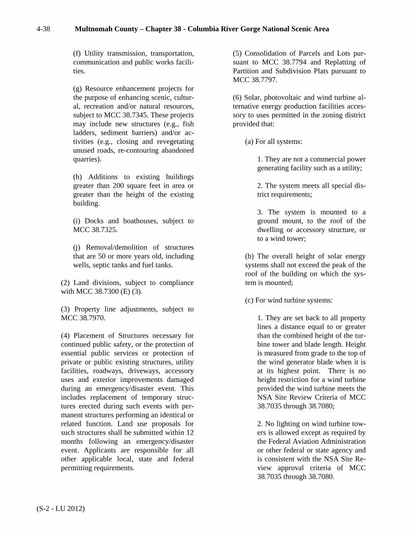
4-38 Multnomah County – Chapter 38 - Columbia River Gorge National Scenic Area
(S-2 - LU 2012)
(f) Utility transmission, transportation,
communication and public works facili-
ties.
(g) Resource enhancement projects for
the purpose of enhancing scenic, cultur-
al, recreation and/or natural resources,
subject to MCC 38.7345. These projects
may include new structures (e.g., fish
ladders, sediment barriers) and/or ac-
tivities (e.g., closing and revegetating
unused roads, re-contouring abandoned
quarries).
(h) Additions to existing buildings
greater than 200 square feet in area or
greater than the height of the existing
building.
(i) Docks and boathouses, subject to
MCC 38.7325.
(j) Removal/demolition of structures
that are 50 or more years old, including
wells, septic tanks and fuel tanks.
(2) Land divisions, subject to compliance
with MCC 38.7300 (E) (3).
(3) Property line adjustments, subject to
MCC 38.7970.
(4) Placement of Structures necessary for
continued public safety, or the protection of
essential public services or protection of
private or public existing structures, utility
facilities, roadways, driveways, accessory
uses and exterior improvements damaged
during an emergency/disaster event. This
includes replacement of temporary struc-
tures erected during such events with per-
manent structures performing an identical or
related function. Land use proposals for
such structures shall be submitted within 12
months following an emergency/disaster
event. Applicants are responsible for all
other applicable local, state and federal
permitting requirements.
(5) Consolidation of Parcels and Lots pur-
suant to MCC 38.7794 and Replatting of
Partition and Subdivision Plats pursuant to
MCC 38.7797.
(6) Solar, photovoltaic and wind turbine al-
ternative energy production facilities acces-
sory to uses permitted in the zoning district
provided that:
(a) For all systems:
1. They are not a commercial power
generating facility such as a utility;
2. The system meets all special dis-
trict requirements;
3. The system is mounted to a
ground mount, to the roof of the
dwelling or accessory structure, or
to a wind tower;
(b) The overall height of solar energy
systems shall not exceed the peak of the
roof of the building on which the sys-
tem is mounted;
(c) For wind turbine systems:
1. They are set back to all property
lines a distance equal to or greater
than the combined height of the tur-
bine tower and blade length. Height
is measured from grade to the top of
the wind generator blade when it is
at its highest point. There is no
height restriction for a wind turbine
provided the wind turbine meets the
NSA Site Review Criteria of MCC
38.7035 through 38.7080;
2. No lighting on wind turbine tow-
ers is allowed except as required by
the Federal Aviation Administration
or other federal or state agency and
is consistent with the NSA Site Re-
view approval criteria of MCC
38.7035 through 38.7080.

Chapter 38 - Columbia River Gorge National Scenic Area 4-39
(S-2 -LU 2012)
3. The land owner signs and records
a covenant stating they are respon-
sible for the removal of the system
if it is abandoned. In the case of a
sale or transfer of property, the new
property owner shall be responsible
for the use and/or removal of the
system. Systems unused for one
consecutive year are considered
abandoned.
(B) The following uses are allowed on all lands
designated GG – CR pursuant to MCC 38.0530
(B) and upon findings that the NSA Site Review
standards of MCC 38.7000 through 38.7085
have been satisfied:
(1) The following uses may be allowed,
subject to compliance with MCC 38.7300
(F) and the standards of MCC 38.7000
through 38.7085:
(a) One single-family dwelling for each
lot or parcel legally created prior to
adoption of the Management Plan.
(b)Accessory structures for an existing
or approved dwelling that are not oth-
erwise allowed outright, eligible for the
expedited development review process,
or allowed in (c) below.
(c) Accessory building(s) larger than
200 square feet in area or taller than 10
feet in height for a dwelling on any le-
gal parcel are subject to the following
additional standards:
1. The combined footprints of all
accessory buildings on a single par-
cel shall not exceed 1,500 square
feet in area. This combined size
limit refers to all accessory build-
ings on a parcel, including buildings
allowed without review, existing
buildings and proposed buildings.
2. The height of any individual ac-
cessory building shall not exceed 24
feet.
(d) Agricultural structures, except build-
ings, in conjunction with agricultural
use.
(e) Agricultural buildings in conjunc-
tion with current agricultural use and, if
applicable, proposed agricultural use
that a landowner would initiate within
one year and complete within five
years, subject to MCC 38.7340.
(f) Utility transmission, transportation
and communication facilities.
(g) Resource enhancement projects for
the purpose of enhancing scenic, cultur-
al, recreation and/or natural resources,
subject to MCC 38.7345. These projects
may include new structures (e.g., fish
ladders, sediment barriers) and/or ac-
tivities (e.g., closing and revegetating
unused roads, re-contouring abandoned
quarries).
(h) Additions to existing buildings
greater than 200 square feet in area or
greater than the height of the existing
building.
(i) Docks and boathouses, subject to
MCC 38.7325.
(j) Removal/demolition of structures
that are 50 or more years old, including
wells, septic tanks and fuel tanks.
(2) Land divisions, subject to compliance
with MCC 38.7300 (E).
(3) Placement of Structures necessary for
continued public safety, or the protection of
essential public services or protection of
private or public existing structures, utility
facilities, roadways, driveways, accessory
uses and exterior improvements damaged
during an emergency/disaster event. This
includes replacement of temporary struc-
tures erected during such events with per-
manent structures performing an identical or
related function. Land use proposals for

4-40 Multnomah County – Chapter 38 - Columbia River Gorge National Scenic Area
(S-2 - LU 2012)
such structures shall be submitted within 12
months following an emergency/disaster
event. Applicants are responsible for all
other applicable local, state and federal
permitting requirements.
(4) Property line adjustments, subject to
MCC 38.7970.
(5) Consolidation of Parcels and Lots pur-
suant to MCC 38.7794 and Replatting of
Partition and Subdivision Plats pursuant to
MCC 38.7797.
(6) Solar, photovoltaic and wind turbine al-
ternative energy production facilities acces-
sory to uses permitted in the zoning district
provided that:
(a) For all systems:
1. They are not a commercial power
generating facility such as a utility;
2. The system meets all special dis-
trict requirements;
3. The system is mounted to a
ground mount, to the roof of the
dwelling or accessory structure, or
to a wind tower;
(b) The overall height of solar energy
systems shall not exceed the peak of the
roof of the building on which the sys-
tem is mounted;
(c) For wind turbine systems:
1. They are set back to all property
lines a distance equal to or greater
than the combined height of the tur-
bine tower and blade length. Height
is measured from grade to the top of
the wind generator blade when it is
at its highest point. There is no
height restriction for a wind turbine
provided the wind turbine meets the
NSA Site Review Criteria of MCC
38.7035 through 38.7080;
2. No lighting on wind turbine tow-
ers is allowed except as required by
the Federal Aviation Administration
or other federal or state agency and
is consistent with the NSA Site Re-
view approval criteria of MCC
38.7035 through 38.7080.
3. The land owner signs and records
a covenant stating they are respon-
sible for the removal of the system
if it is abandoned. In the case of a
sale or transfer of property, the new
property owner shall be responsible
for the use and/or removal of the
system. Systems unused for one
consecutive year are considered
abandoned.
(C) The following uses are allowed on all lands
designated GS– PR pursuant to MCC 38.0530
(B) and upon findings that the NSA Site Review
standards of MCC 38.7000 through 38.7085
have been satisfied:
(1) Uses and practices in the Gorge Special
Forestry (GSF) district as allowed in MCC
38.2025 (B), except (B)(8) and (B)(9).
(2) Public trails, consistent with MCC
38.7085.
(3) Accessory structures for an existing or
approved dwelling that are not otherwise al-
lowed outright, eligible for the expedited
development review process, or allowed in
(4) below.
(4) Accessory building(s) larger than 200
square feet in area or taller than 10 feet in
height for a dwelling on any legal parcel are
subject to the following additional stand-
ards:
(a) The combined footprints of all ac-
cessory buildings on a single parcel

Chapter 38 - Columbia River Gorge National Scenic Area 4-41
(S-2 -LU 2012)
shall not exceed 1,500 square feet in ar-
ea. This combined size limit refers to all
accessory buildings on a parcel, includ-
ing buildings allowed without review,
existing buildings and proposed build-
ings.
(b) The height of any individual acces-
sory building shall not exceed 24 feet.
(5) Road and railroad construction and re-
construction.
(6) Resource enhancement projects for the
purpose of enhancing scenic, cultural,, rec-
reation, an/or natural resources subject to
MCC 38.7345. Those projects may include
new structures (e.g. closing and revegetat-
ing unused roads, recontouring abandoned
quarries).
(7) Uses in the gorge Special Agriculture
(GSA) district as allowed in MCC
38.2225(B), except (B)(7) and B(8).
(8) Placement of Structures necessary for
continued public safety, or the protection of
essential public services or protection of
private or public existing structures, utility
facilities, roadways, driveways, accessory
uses and exterior improvements damaged
during an emergency/disaster event. This
includes replacement of temporary struc-
tures erected during such events with per-
manent structures performing an identical or
related function. Land use proposals for
such structures shall be submitted within 12
months following an emergency/disaster
event. Applicants are responsible for all
other applicable local, state and federal
permitting requirements.
(9) On a parcel of 40 acres or greater with
an existing dwelling, the temporary use of a
mobile home in the case of a family hard-
ship, subject to MCC 38.7320.
(10) Additions to existing buildings greater
than 200 square feet in area or greater than
the height of the existing building.
(11) Removal/demolition of structures that
are 50 or more years old, including wells,
septic tanks and fuel tanks.
(12) Docks and boathouses, subject to MCC
38.7325.
(13) Consolidation of Parcels and Lots pur-
suant to MCC 38.7794 and Replatting of
Partition and Subdivision Plats pursuant to
MCC 38.7797.
(14) Solar, photovoltaic and wind turbine
alternative energy production facilities ac-
cessory to uses permitted in the zoning dis-
trict provided that:
(a) For all systems:
1. They are not a commercial power
generating facility such as a utility;
2. The system meets all special dis-
trict requirements;
3. The system is mounted to a
ground mount, to the roof of the
dwelling or accessory structure, or
to a wind tower;
(b) The overall height of solar energy
systems shall not exceed the peak of the
roof of the building on which the sys-
tem is mounted
(c) For wind turbine systems:
1. They are set back to all property
lines a distance equal or greater
than the combined height of the tur-
bine tower and blade length. Height
is measured from grade to the top of
the wind generator blade when it is
at its highest point. There is no
height restriction for a wind turbine
provided the wind turbine meets the
NSA Site Review Criteria of MCC
38.7040 et. al.;

4-42 Multnomah County – Chapter 38 - Columbia River Gorge National Scenic Area
(S-1 2013)
2. No lighting on wind turbine tow-
ers is allowed except as required by
the Federal Aviation Administration
or other federal or state agency and
is consistent with the NSA Site Re-
view approval criteria of MCC
38.7040 et al.
3. The land owner signs and records
a covenant stating they are respon-
sible for the removal of the system
if it is abandoned. In the case of a
sale or transfer of property, the new
property owner shall be responsible
for the use and/or removal of the
system. Systems unused for one
consecutive year are considered
abandoned.
(15) A Type A home occupation in an
existing dwelling unit, pursuant to MCC
38.7331. (Ord. 1197, Amended 02/16/2013; Ord. 1192, Amended,
05/17/2012; Ord. 1176, Amended, 03/03/2011; Ord. 1125,
Amended, 12/11/2008; Ord. 1097, Amended, 07/26/2007; Ord.
1064, Amended, 06/23/2005; Ord. 1007, Amended, 02/06/2003;
Ord. 997, Repealed and Replaced, 10/31/2002; Ord. 994,
Amended, 09/26/2002; Ord. 953 §2, Reorg&Renum,
11/30/2000)
§ 38.2830 CONDITIONAL USES
(A) The following conditional uses may be al-
lowed on lands designated GG– PR, pursuant to
the provisions of MCC 38.0045, 38.7300 (E)
and 38.7080 (E) (1) and (3) through (7):
(1) Publicly-owned, resource-based recrea-
tion uses consistent with MCC 38.7080.
(2) Commercial uses and non-resource
based recreation uses which are part of an
existing or approved, resource-based public
recreation use consistent with policies,
guidelines and conditional use criteria for
such uses contained in this section.
(3) New cultivation, subject to compliance
with MCC 38.7045, 38.7055, 38.7060,
38.7065 and 38.7070.
(4) Special uses in historic buildings, sub-
ject to MCC 38.7380.
(B) The following conditional uses may be al-
lowed on lands designated GG– CR, pursuant to
the provisions of MCC 38.0045, 38.7300 (E)
and 38.7080 (E) (1) and (3) through (7):
(1) Commercially-owned, resource-based
recreation uses.
(2) Overnight accommodations which are
part of a commercially-owned resource-
based recreation use, where such resource-
based recreation use occurs on the subject
site or is accessed through the site on adja-
cent lands, and which meet the following
standards:
(a) Buildings containing individual
units are no larger than 1,500 square
feet in total floor area and no higher
than two and one-half stories.
(b) Buildings containing more than one
unit are no larger than 6,000 square feet
in total floor area and no higher than
two and one-half stories.
(c) The total number of individual units
shall not exceed 25, unless the proposed
development complies with standards
for clustered accommodations in sub-
section (d) below.
(d) Clustered overnight travelers ac-
commodations meeting the following
standards may include up to 35 individ-
ual units:
1. Average total floor area of all
units is 1,000 square feet or less per
unit;
2. A minimum of 50 percent of the
project site is dedicated to undevel-
oped, open areas (not including
roads or parking areas);

Chapter 38 - Columbia River Gorge National Scenic Area 4-43
(S-1 2013)
3. The facility is in an area classi-
fied for high intensity recreation
(Recreation Intensity Class 4).
(3) Commercial uses, including restaurants
sized to accommodate overnight visitors
and their guests, and non-resource-based
recreation uses which are part of an existing
or approved resource-based commercial rec-
reation use consistent with the policies,
guidelines and conditional use criteria for
such uses contained in this section.
(4) New cultivation, subject to compliance
with MCC 38.7045, 38.7055, 38.7060,
38.7065 and 38.7070.
(5) Special uses in historic buildings, sub-
ject to MCC 38.7380.
(C) The following conditional uses may be al-
lowed on lands designated GS– PR, pursuant to
the provisions of MCC 38.0045 and 38.7085:
(1) Public natural resource-based recrea-
tional facilities, consistent with 38.7085.
(2) Public non-profit group camps, retreats,
conference or educational centers, and in-
terpretive facilities.
(3) Utility facilities for public service upon
a showing that:
(a) There is no alternative location with
less adverse effect on Public Recreation
land.
(b) The size is the minimum necessary
to provide the service.
(4) One single family residence on a parcel
40 contiguous acres or larger, when found
to be necessary for the management of:
(a) An agricultural use pursuant to
MCC 38.2225 (B) (3);
(b) A forest use pursuant to MCC
38.2025 (B) (6); or
(c) A public recreation site.
(5) Home occupations and cottage indus-
tries in an existing dwelling unit or accesso-
ry building, pursuant to MCC 38.7330.
(6) Exploration, development, and produc-
tion of sand, gravel, or crushed rock for the
construction, maintenance, or reconstruction
of roads used to manage or harvest com-
mercial forest products.
(7) Fish hatcheries and aquiculture facilities.
(8) Towers and fire stations for forest fire
protection.
(9) Community facilities and non-profit fa-
cilities related to forest resource manage-
ment or agricultural resource management.
(10) Expansion of existing non-profit group
camps, retreat or conference center.
(11) Bed and Breakfast inns in single-family
dwellings, pursuant to MCC 38.7335, and
provided that the residence is included in, or
eligible for inclusion in, the National Regis-
ter of Historic Places. The use or develop-
ment shall be compatible with agricultural
use. Buffer zones should be considered to
protect agricultural practices from conflict-
ing uses.
(12) Agricultural product processing and
packaging, upon demonstration that the pro-
cessing will be limited to products produced
primarily on or adjacent to the property.
“Primarily” means a clear majority of the
product as measured by volume, weight, or
value. (Ord. 1197, Amended 02/16/2013; Ord. 1074, Amended,
05/04/2006; Ord. 1064, Amended, 06/23/2005; Ord. 997, Re-
pealed and Replaced, 10/31/2002; Ord. 953 §2, Reorg&Renum,
11/30/2000)

4-44 Multnomah County – Chapter 38 - Columbia River Gorge National Scenic Area
(S-2 - LU 2012)
§ 38.2860 DIMENSIONAL
REQUIREMENTS
(A) There is no minimum lot size for properties des-
ignated GG– PR, GG– CR, and GS– PR.
(B) That portion of a street which would accrue to
an adjacent lot if the street were vacated shall be in-
cluded in calculating the area of such lot.
(C) Minimum Yard Dimensions - Feet
Front Side Street Side Rear
30 10 30 30
Maximum Structure Height – 35 feet
Minimum Front Lot Line Length – 50 feet.
(D) The minimum yard requirement shall be in-
creased where the yard abuts a street having insuffi-
cient right-of-way width to serve the area. The
Planning Commission shall determine the necessary
right-of-way widths and additional yard require-
ments not otherwise established by ordinance.
(E) Structures such as barns, silos, windmills, an-
tennae, chimneys, or similar structures may exceed
the height requirement if located at least 30 feet
from any property line. (Ord. 997, Repealed and Replaced, 10/31/2002; Ord. 953 §2,
Reorg&Renum, 11/30/2000)
§ 38.2885 OFF-STREET PARKING AND
LOADING
Off-street parking and loading shall be provided as
required by MCC 38.4100 through 38.4215. (Ord. 997, Repealed and Replaced, 10/31/2002; Ord. 953 §2,
Reorg&Renum, 11/30/2000)
§ 38.2890 ACCESS
Any lot in this district shall abut a street or shall
have other access determined by the approval au-
thority to be safe and convenient for pedestrians and
passenger and emergency vehicles. (Ord. 997, Repealed and Replaced, 10/31/2002; Ord. 953 §2,
Reorg&Renum, 11/30/2000)
§ 38.2895 SIGNS
Signs, pursuant to the provisions of MCC 38.0080. (Ord. 997, Repealed and Replaced, 10/31/2002; Ord. 953 §2,
Reorg&Renum, 11/30/2000)

Chapter 38 - Columbia River Gorge National Scenic Area 4-45
(S-2 - LU 2012)
RESIDENTIAL DISTRICTS - GGR and GSR
§ 38.3000- PURPOSES
The purposes of the Gorge General Residential and
Gorge Special Residential districts are to protect and
enhance the character of existing residential areas,
and to ensure new residential development does not
adversely affect the scenic, cultural, natural and rec-
reation resources of the Columbia River Gorge Na-
tional Scenic Area. (Ord. 997, Repealed and Replaced, 10/31/2002; Ord. 953 §2,
Reorg&Renum, 11/30/2000)
§ 38.3005 AREA AFFECTED
MCC 38.3000 through 38.3095 shall apply to those
areas designated GGR and GSR on the Multnomah
County Zoning Map. (Ord. 997, Repealed and Replaced, 10/31/2002; Ord. 953 §2,
Reorg&Renum, 11/30/2000)
§ 38.3015 USES
No building, structure or land shall be used and no
building or structure shall be hereafter erected, al-
tered or enlarged in this district except for the uses
listed in MCC 38.3020 through 38.3095. (Ord. 997, Repealed and Replaced, 10/31/2002; Ord. 953 §2,
Reorg&Renum, 11/30/2000)
§ 38.3020 ALLOWED USES
The uses listed in MCC 38.1005 are allowed on land
designated GGR and GSR without review. (Ord. 1064, Amended, 06/23/2005; Ord. 997, Repealed and Re-
placed, 10/31/2002)
§ 38.3023 EXPEDITED USES
The uses listed in MCC 38.1010 may be allowed on
land designated GGR and GSR, pursuant to MCC
38.7100. (Ord. 1064, Add, 06/23/2005)
§ 38.3025 REVIEW USES
(A) The following uses may be allowed on
lands designated GGR, pursuant to MCC
38.0530 (B) and upon findings that the NSA
Site Review standards of MCC 38.7000 through
38.7085 have been satisfied:
(1) One single-family dwelling per legally
created parcel.
(a) If the subject parcel is located adja-
cent to lands designated GGA or GGF,
the use shall comply with the buffer re-
quirements of MCC 38.0060; and
(b) If the subject parcel is located is ad-
jacent to lands designated GGF, the
placement of a dwelling shall also com-
ply with the fire protection standards of
MCC 38.7305.
(2) Accessory structures for an existing or
approved dwelling that are not otherwise al-
lowed outright, eligible for the expedited
development review process, or allowed in
(3) below.
(3) Accessory building(s) larger than 200
square feet in area or taller than 10 feet in
height for a dwelling on any legal parcel are
subject to the following additional stand-
ards:
(a) The combined footprints of all ac-
cessory buildings on a single parcel
shall not exceed 1,500 square feet in ar-
ea. This combined size limit refers to all
accessory buildings on a parcel, includ-
ing buildings allowed without review,
existing buildings and proposed build-
ings.
(b) The height of any individual acces-
sory building shall not exceed 24 feet.
(4) A temporary dwelling for health hard-
ship, pursuant to MCC 38.7320.
(5) Construction or reconstruction of roads.
(6) New cultivation, subject to compliance
with MCC 38.7045, 38.7055, 38.7060,
38.7065 and 38.7070.

4-46 Multnomah County – Chapter 38 - Columbia River Gorge National Scenic Area
(S-1 - LU 2019)
(7) Land divisions, pursuant to the provi-
sions of MCC 38.7725 (A).
(8) Placement of Structures necessary for
continued public safety, or the protection of
essential public services or protection of
private or public existing structures, utility
facilities, roadways, driveways, accessory
uses and exterior improvements damaged
during an emergency/disaster event. This
includes replacement of temporary struc-
tures erected during such events with per-
manent structures performing an identical or
related function. Land use proposals for
such structures shall be submitted within 12
months following an emergency/disaster
event. Applicants are responsible for all
other applicable local, state and federal
permitting requirements.
(9) Property line adjustments that would re-
sult in the potential to create additional par-
cels through subsequent land divisions, sub-
ject to 38.7970.
(10) Resource enhancement projects for the
purpose of enhancing scenic, cultural, rec-
reation and/or natural resources, subject to
MCC 38.7345. These projects may include
new structures (e.g., fish ladders, sediment
barriers) and/or activities (e.g., closing and
revegetating unused roads, recontouring
abandoned quarries).
(11) Agricultural structures, except build-
ings, in conjunction with agricultural use.
(12) Agricultural buildings in conjunction
with current agricultural use and, if applica-
ble, proposed agricultural use that a land-
owner would initiate within one year and
complete within five years, subject to MCC
38.7340.
(13) Additions to existing buildings greater
than 200 square feet in area or greater than
the height of the existing building.
(14) Docks and boathouses, subject to MCC
38.7325.
(15) Removal/demolition of structures that
are 50 or more years old, including wells,
septic tanks and fuel tanks.
(16) Consolidation of Parcels and Lots pur-
suant to MCC 38.7794 and Replatting of
Partition and Subdivision Plats pursuant to
MCC 38.7797.
(17) Solar, photovoltaic and wind turbine
alternative energy production facilities ac-
cessory to uses permitted in the zoning dis-
trict provided that:
(a) For all systems:
1. They are not a commercial power
generating facility such as a utility;
2. The system meets all special dis-
trict requirements;
3. The system is mounted to a
ground mount, to the roof of the
dwelling or accessory structure, or
to a wind tower;
(b) The overall height of solar energy
systems shall not exceed the peak of the
roof of the building on which the sys-
tem is mounted;
(c) For wind turbine systems:
1. They are set back to all property
lines a distance equal to or greater
than the combined height of the tur-
bine tower and blade length. Height
is measured from grade to the top of
the wind generator blade when it is
at its highest point. There is no
height restriction for a wind turbine
provided the wind turbine meets the
NSA Site Review Criteria of MCC
38.7035 through 38.7080;

Chapter 38 - Columbia River Gorge National Scenic Area 4-47
(S-1 2013)
2. No lighting on wind turbine tow-
ers is allowed except as required by
the Federal Aviation Administration
or other federal or state agency and
is consistent with the NSA Site Re-
view approval criteria of MCC
38.7035 through 38.7080.
3. The land owner signs and records
a covenant stating they are respon-
sible for the removal of the system
if it is abandoned. In the case of a
sale or transfer of property, the new
property owner shall be responsible
for the use and/or removal of the
system. Systems unused for one
consecutive year are considered
abandoned.
(18) A Type A home occupation in an
existing dwelling unit, pursuant to MCC
38.7331.
(B) The following uses may be allowed on lands
designated GSR, pursuant to MCC 38.0530 (B)
and upon findings that the NSA Site Review
standards of MCC 38.7000 through 38.7085
have been satisfied:
(1) One single-family dwelling per legally
created lot or consolidated parcel, subject to
the standards of MCC 38.7305.
(2) Accessory structures for an existing or
approved dwelling that are not otherwise al-
lowed outright, eligible for the expedited
development review process, or allowed in
(3) below.
(3) Accessory building(s) larger than 200
square feet in area or taller than 10 feet in
height for a dwelling on any legal parcel are
subject to the following additional stand-
ards:
(a) The combined footprints of all ac-
cessory buildings on a single parcel
shall not exceed 1,500 square feet in ar-
ea. This combined size limit refers to all
accessory buildings on a parcel, includ-
ing buildings allowed without review,
existing buildings and proposed build-
ings.
(b) The height of any individual acces-
sory building shall not exceed 24 feet.
(4) Road and railroad construction and re-
construction.
(5) Forest practices, pursuant to the provi-
sions of MCC 38.2025 (B).
(6) Placement of Structures necessary for
continued public safety, or the protection of
essential public services or protection of
private or public existing structures, utility
facilities, roadways, driveways, accessory
uses and exterior improvements damaged
during an emergency/disaster event. This
includes replacement of temporary struc-
tures erected during such events with per-
manent structures performing an identical or
related function. Land use proposals for
such structures shall be submitted within 12
months following an emergency/disaster
event. Applicants are responsible for all
other applicable local, state and federal
permitting requirements.
(7) Resource enhancement projects for the
purpose of enhancing scenic, cultural, rec-
reation and/or natural resources, subject to
MCC 38.7345. These projects may include
new structures (e.g., fish ladders, sediment
barriers) and/or activities (e.g., closing and
revegetating unused roads, re-contouring
abandoned quarries).
(8) On a parcel of 40 acres or greater with
an existing dwelling, a temporary dwelling
for health hardship, pursuant to MCC
38.7320.
(9) Additions to existing buildings greater
than 200 square feet in area or greater than
the height of the existing building.
(10) Removal/demolition of structures that
are 50 or more years old, including wells,
septic tanks and fuel tanks.

4-48 Multnomah County – Chapter 38 - Columbia River Gorge National Scenic Area
(S-1 2019)
(11) Docks and boathouses, subject to MCC
38.7325.
(12) New cultivation or new agricultural use
outside of previously disturbed and regular-
ly worked fields or areas. Clearing trees for
new agricultural use is subject to MCC
38.7365.
(13) Consolidation of Parcels and Lots pur-
suant to MCC 38.7794 and Replatting of
Partition and Subdivision Plats pursuant to
MCC 38.7797.
(14) Solar, photovoltaic and wind turbine
alternative energy production facilities ac-
cessory to uses permitted in the zoning dis-
trict provided that:
(a) For all systems:
1. They are not a commercial power
generating facility such as a utility;
2. The system meets all special dis-
trict requirements;
3. The system is mounted to a
ground mount, to the roof of the
dwelling or accessory structure, or
to a wind tower;
(b) The overall height of solar energy
systems shall not exceed the peak of the
roof of the building on which the sys-
tem is mounted
(c) For wind turbine systems:
1. They are set back to all property
lines a distance equal or greater
than the combined height of the tur-
bine tower and blade length. Height
is measured from grade to the top of
the wind generator blade when it is
at its highest point. There is no
height restriction for a wind turbine
provided the wind turbine meets the
NSA Site Review Criteria of MCC
38.7040 et. al.;
2. No lighting on wind turbine tow-
ers is allowed except as required by
the Federal Aviation Administration
or other federal or state agency and
is consistent with the NSA Site Re-
view approval criteria of MCC
38.7040 et al.
3. The land owner signs and records
a covenant stating they are respon-
sible for the removal of the system
if it is abandoned. In the case of a
sale or transfer of property, the new
property owner shall be responsible
for the use and/or removal of the
system. Systems unused for one
consecutive year are considered
abandoned.
(15) A Type A home occupation in an
existing dwelling unit, pursuant to MCC
38.7331. (Ord. 1270, Amended, 03/14/2019; Ord. 1197, Amended
02/16/2013, Ord. 1192, Amended, 05/17/2012; Ord. 1186,
Amended, 10/13/2011; Ord. 1176, Amended, 03/03/2011; Ord.
1125, Amended, 12/11/2008; Ord. 1097, Amended, 07/26/2007;
Ord. 1064, Amended, 06/23/2005; Ord. 1007, Amended,
02/06/2003; Ord. 997, Repealed and Replaced, 10/31/2002;
Ord. 994, Amended, 09/26/2002; Ord. 953 §2, Reorg&Renum,
11/30/2000)
§ 38.3030 CONDITIONAL USES
(A) The following conditional uses may be al-
lowed on lands designated GGR, pursuant to the
provisions of MCC 38.0045 and MCC 38.7300
(C):
(1) An accredited child care center on land
designated GGR– 2.
(2) A child care center on land designated
GGR– 5 or GGR– 10 within an existing
church or community building.
(3) A school within an existing church or
community building.

Chapter 38 - Columbia River Gorge National Scenic Area 4-49
(S-1 2013)
(4) Expansion of existing primary or middle
schools on land purchased prior to June 8,
1999. For purposes of this section, existing
schools means public schools that existed
prior to adoption of the original Manage-
ment Plan on October 15, 1991.
(5) Utility facilities and railroads.
(6) Fire stations.
(7) Recreation development, subject to the
Recreation Intensity Classes of MCC
38.7080.
(8) Community parks and playgrounds, con-
sistent with the standards of the National
Park and Recreation Society regarding the
need for such facilities.
(9) On parcels 10 acres or larger designated
GGR– 5, or 20 acres or larger designated
GGR– 10, a land division creating new par-
cels smaller than the designated minimum
parcel size, subject to the provisions of
MCC 38.7360.
(10) Home occupations and cottage indus-
tries in an existing dwelling unit or accesso-
ry building pursuant to MCC 38.7330.
(11) Bed and breakfast inns in single family
dwellings on lands designated GGR– 5 or
GGR– 10, pursuant to 38.7335.
(12) Wineries, in conjunction with onsite
viticulture, upon a showing that processing
of wine is from grapes grown on the subject
farm or in the local region.
(13) Wine sales/tasting rooms in conjunc-
tion with an on-site winery, under the fol-
lowing conditions:
(a) The use shall comply with MCC
38.7330, with the following exceptions:
1. The use may employ an unlim-
ited number of outside employees.
2. The wine sales/tasting room may
include interior and/or exterior
space, provided the combined inte-
rior and exterior spaces shall not
exceed 1,000 square feet.
3. The interior space may be located
in an existing building or in a new
building or addition to an existing
building constructed for the primary
purpose of housing the wine
sales/tasting room.
4. The exterior space may be a ve-
randa, patio, or other similar type of
structure.
(14) Special uses in historic buildings, sub-
ject to MCC 38.7380.
(15) Boarding of horses or non-profit horse
rescue facility on lands designated GGR-10,
subject to MCC 38.7385.
(16) Small-Scale Fishing Support and Fish
Processing Operations pursuant to MCC
38.7332.
(B) The following conditional uses may be al-
lowed on lands designated GSR, pursuant to the
provisions of MCC 38.0045 and 38.7300 (C):
(1) New utility facilities.
(2) Fire stations.
(3) Community parks and playgrounds.
(4) Home occupations and cottage indus-
tries in an existing dwelling unit or accesso-
ry building pursuant to MCC 38.7330.
(5) Bed and breakfast inns in structures that
are included in, or eligible for inclusion in,
the National Register of Historic Places,
pursuant to 38.7335. (Ord. 1197, Amended 02/16/2013; Ord. 1179, Amended,
04/21/2011; Ord. 1125, Amended, 12/11/2008; Ord. 1074,
Amended, 05/04/2006; Ord. 1064, Amended, 06/23/2005; Ord.
997, Repealed and Replaced, 10/31/2002; Ord. 953 §2, Re-
org&Renum, 11/30/2000)

4-50 Multnomah County – Chapter 38 - Columbia River Gorge National Scenic Area
(S-1 2019)
§ 38.3060 DIMENSIONAL
REQUIREMENTS
(A) Except as provided in MCC 38.3030 (A)
(8), the minimum lot size shall be according to
the short-title zone district designation on the
Zoning Map, as follows:
GGR-2 2 acres
GGR-5 5 acres
GGR-10 10 acres
GSR
The size of all
contiguous, in-
dividually
owned parcels,
as of Novem-
ber 17, 1986
(B) That portion of a street which would accrue
to an adjacent lot if the street were vacated shall
be included in calculating the area of such lot.
(C) Minimum Yard Dimensions – Feet
Front Side Street Side Rear
30 10 30 30
Maximum Structure Height – 35 feet
Minimum Front Lot Line Length – 50 feet.
(D) The minimum yard requirement shall be in-
creased where the yard abuts a street having in-
sufficient right-of-way width to serve the area.
The Planning Commission shall determine the
necessary right-of-way widths and additional
yard requirements not otherwise established by
ordinance.
(E) Structures such as barns, silos, windmills,
antennae, chimneys, or similar structures may
exceed the height requirement if located at least
30 feet from any property line. (Ord. 997, Repealed and Replaced, 10/31/2002; Ord. 953 §2,
Reorg&Renum, 11/30/2000)
§ 38.3085 OFF-STREET PARKING AND
LOADING
Off-street parking and loading shall be provided as
required by MCC 38.4100 through 38.4215. (Ord. 997, Repealed and Replaced, 10/31/2002; Ord. 953 §2,
Reorg&Renum, 11/30/2000)
§ 38.3090 ACCESS
Any lot in this district shall abut a street or shall
have other access determined by the approval au-
thority to be safe and convenient for pedestrians and
passenger and emergency vehicles. (Ord. 997, Repealed and Replaced, 10/31/2002; Ord. 953 §2,
Reorg&Renum, 11/30/2000)
§ 38.3095 SIGNS
Signs, pursuant to the provisions of MCC 38.0080. (Ord. 997, Repealed and Replaced, 10/31/2002; Ord. 953 §2,
Reorg&Renum, 11/30/2000)

Chapter 38 - Columbia River Gorge National Scenic Area 4-51
(S-2 – LU 2012)
COMMERCIAL - GGC
§ 38.3200- PURPOSES
The purposes of the Gorge General Commercial dis-
trict are to protect and support the economy of the
Columbia River Gorge National Scenic Area by en-
couraging commercial activities in areas where the
topography and proximity to transportation, com-
mercial and industrial facilities and other amenities
make them suited for commercial uses. (Ord. 997, Repealed and Replaced, 10/31/2002; Ord. 953 §2,
Reorg&Renum, 11/30/2000)
§ 38.3205 AREA AFFECTED
MCC 38.3200 through 38.3295 shall apply to those
areas designated GGC on the Multnomah County
Zoning Map. (Ord. 997, Repealed and Replaced, 10/31/2002; Ord. 953 §2,
Reorg&Renum, 11/30/2000)
§ 38.3215 USES
No building, structure or land shall be used and no
building or structure shall be hereafter erected, al-
tered or enlarged in this district except for the uses
listed in MCC 38.3220 through 38.3295. (Ord. 997, Repealed and Replaced, 10/31/2002; Ord. 953 §2,
Reorg&Renum, 11/30/2000)
§ 38.3220 ALLOWED USES
The uses listed in MCC 38.1005 are allowed on all
lands designated GGC without review: (Ord. 1064, Amended, 06/23/2005; Ord. 997, Repealed and Re-
placed, 10/31/2002; Ord. 953 §2, Reorg&Renum, 11/30/2000)
§ 38.3223 EXPEDITED USES
The uses listed in MCC 38.1010 may be allowed on
land designated GGC, pursuant to MCC 38.7100. (Ord. 1064, Add, 06/23/2005)
§ 38.3225 REVIEW USES
The following review uses may be allowed on lands
designated GGC, pursuant to the provisions of MCC
38.0045 and MCC 38.7300:
(A) One single-family dwelling on a legally cre-
ated parcel, pursuant to MCC 38.0530 (B) and
upon findings that the NSA Site Review stand-
ards of MCC 38.7000 through 38.7085 have
been satisfied.
(B) Placement of Structures necessary for con-
tinued public safety, or the protection of essen-
tial public services or protection of private or
public existing structures, utility facilities,
roadways, driveways, accessory uses and exte-
rior improvements damaged during an emergen-
cy/disaster event. This includes replacement of
temporary structures erected during such events
with permanent structures performing an identi-
cal or related function. Land use proposals for
such structures shall be submitted within 12
months following an emergency/disaster event.
Applicants are responsible for all other applica-
ble local, state and federal permitting require-
ments.
(C) Accessory structures for an existing or ap-
proved dwelling that are not otherwise allowed
outright, eligible for the expedited development
review process, or allowed as accessory build-
ings larger than 200 square feet in area or 10
feet in height.
(D) Accessory building(s) larger than 200
square feet in area or taller than 10 feet in height
for a dwelling on any legal parcel, subject to the
following standards:
(1) The combined footprints of all accessory
buildings on a single parcel shall not exceed
1,500 square feet in area. This combined
size limit refers to all accessory buildings
on a parcel, including buildings allowed
without review, existing buildings and pro-
posed buildings.
(2) The height of any individual accessory
building shall not exceed 24 feet
(E) Resource enhancement projects for the pur-
pose of enhancing scenic, cultural, recreation
and/or natural resources, subject to MCC
38.7345. These projects may include new struc-
tures (e.g., fish ladders, sediment barriers)
and/or activities (e.g., closing and revegetating
unused roads, re-contouring abandoned quar-
ries).

4-52 Multnomah County – Chapter 38 - Columbia River Gorge National Scenic Area
(S-1 2019)
(F) Property line adjustments that would result
in the potential to create additional parcels
through subsequent land divisions, subject to
MCC 38.7970.
(G) Additions to existing buildings greater than
200 square feet in area or greater than the height
of the existing building.
(H) Docks and boathouses, subject to MCC
38.7325.
(I) Removal/demolition of structures that are 50
or more years old, including wells, septic tanks
and fuel tanks.
(J) Consolidation of Parcels and Lots pursuant
to MCC 38.7794 and Replatting of Partition and
Subdivision Plats pursuant to MCC 38.7797.
(K) Solar, photovoltaic and wind turbine alter-
native energy production facilities accessory to
uses permitted in the zoning district provided
that:
(1) For all systems:
(a) They are not a commercial power
generating facility such as a utility;
(b) The system meets all special district
requirements;
(c) The system is mounted to a ground
mount, to the roof of the dwelling or ac-
cessory structure, or to a wind tower;
(2) The overall height of solar energy sys-
tems shall not exceed the peak of the roof of
the building on which the system is mount-
ed;
(3) For wind turbine systems:
(a) They are set back to all property
lines a distance equal to or greater than
the combined height of the turbine tow-
er and blade length. Height is measured
from grade to the top of the wind gener-
ator blade when it is at its highest point.
There is no height restriction for a wind
turbine provided the wind turbine meets
the NSA Site Review Criteria of MCC
38.7035 through 38.7080;
(b) No lighting on wind turbine towers
is allowed except as required by the
Federal Aviation Administration or oth-
er federal or state agency and is con-
sistent with the NSA Site Review ap-
proval criteria of MCC 38.7035 through
38.7080.
(c) The land owner signs and records a
covenant stating they are responsible for
the removal of the system if it is aban-
doned. In the case of a sale or transfer
of property, the new property owner
shall be responsible for the use and/or
removal of the system. Systems unused
for one consecutive year are considered
abandoned.
(L) A Type A home occupation in an existing
dwelling unit pursuant to MCC 38.7331. (Ord. 1197, Amended 02/16/2013, Ord. 1192, Amended,
05/17/2012; Ord. 1176, Amended, 03/03/2011; Ord. 1097,
Amended, 07/26/2007; Ord. 1064, Amended, 06/23/2005; Ord.
1007, Amended, 02/06/2003; Ord. 997, Repealed and Replaced,
10/31/2002; Ord. 994, Amended, 09/26/2002; Ord. 953 §2, Re-
org&Renum, 11/30/2000)
§ 38.3230 CONDITIONAL USES
The following conditional uses may be allowed on
lands designated GGC, pursuant to the provisions of
MCC 38.0045 and MCC 38.7300:
(A) Travelers accommodations, bed and break-
fast inns
(B) Restaurants
(C) Gift shops
(D) Utility facilities and railroads.
(E) Home occupations or cottage industries in
an existing dwelling unit or accessory building,
pursuant to MCC 38.7330.

Chapter 38 - Columbia River Gorge National Scenic Area 4-53
(S-1 2013)
(F) Special uses in historic buildings, subject to
MCC 38.7380. (Ord. 1197, Amended 02/16/2013; Ord. 1074, Amended,
05/04/2006; Ord. 1064, Amended, 06/23/2005; Ord. 997, Re-
pealed and Replaced, 10/31/2002; Ord. 953 §2, Reorg&Renum,
11/30/2000)
§ 38.3260 DIMENSIONAL
REQUIREMENTS
(A) There is no minimum lot size for properties
designated GGC.
(B) That portion of a street which would accrue
to an adjacent lot if the street were vacated shall
be included in calculating the area of such lot.
(C) Minimum Yard Dimensions - Feet
Front Side Street Side Rear
30 10 30 30
Maximum Structure Height – 35 feet
Minimum Front Lot Line Length – 50 feet.
(D) The minimum yard requirement shall be in-
creased where the yard abuts a street having in-
sufficient right-of-way width to serve the area.
The Planning Commission shall determine the
necessary right-of-way widths and additional
yard requirements not otherwise established by
ordinance.
(E) Structures such as barns, silos, windmills,
antennae, chimneys, or similar structures may
exceed the height requirement if located at least
30 feet from any property line. (Ord. 997, Repealed and Replaced, 10/31/2002; Ord. 953 §2,
Reorg&Renum, 11/30/2000)
§ 38.3285 OFF-STREET PARKING AND
LOADING
Off-street parking and loading shall be provided as
required by MCC 38.4100 through 38.4215. (Ord. 997, Repealed and Replaced, 10/31/2002; Ord. 953 §2,
Reorg&Renum, 11/30/2000)
§ 38.3290 ACCESS
Any lot in this district shall abut a street or shall
have other access determined by the approval au-
thority to be safe and convenient for pedestrians and
passenger and emergency vehicles. (Ord. 997, Repealed and Replaced, 10/31/2002; Ord. 953 §2,
Reorg&Renum, 11/30/2000)
§ 38.3295 SIGNS
Signs, pursuant to the provisions of MCC 38.0080. (Ord. 997, Repealed and Replaced, 10/31/2002; Ord. 953 §2,
Reorg&Renum, 11/30/2000)

4-54 Multnomah County – Chapter 38 - Columbia River Gorge National Scenic Area
(S-2 - LU 2012)

Chapter 38 - Columbia River Gorge National Scenic Area 5-1
(S-1 2006)
PART 5 - SPECIAL DISTRICTS - OFF-STREET
PARKING; PLANNED DEVELOPMENT;
HILLSIDE DEVELOPMENT
OFF-STREET PARKING AND LOADING
§ 38.4100- PURPOSES
The purposes of these off-street parking and loading
regulations are to reduce traffic congestion associat-
ed with residential, commercial, and other land uses;
to protect the character of neighborhoods; to protect
the public's investment in streets and arterials and to
provide standards for the development and mainte-
nance of off-street parking and loading areas. (Ord. 997, Repealed and Replaced, 10/31/2002; Ord. 953 §2,
Reorg&Renum, 11/30/2000)
§ 38.4105 GENERAL PROVISIONS
In the event of the erection of a new building or an
addition to an existing building, or any change in the
use of an existing building, structure or land which
results in an intensified use by customers, occu-
pants, employees or other persons, off-street parking
and loading shall be provided according to the re-
quirements of this Section. (Ord. 997, Repealed and Replaced, 10/31/2002; Ord. 953 §2,
Reorg&Renum, 11/30/2000)
§ 38.4115 CONTINUING OBLIGATION
The provision for and maintenance of off-street
parking and loading facilities without charge to us-
ers shall be a continuing obligation of the property
owner. No building or any other required permit for
a structure or use under this or any other applicable
rule, ordinance or regulation shall be issued until
satisfactory evidence in the form of a site develop-
ment plan, plans of existing parking and loading
improvements, a deed, lease, contract or similar
document is presented demonstrating that the prop-
erty is and will remain available for the designated
use as a parking or loading facility. (Ord. 997, Repealed and Replaced, 10/31/2002; Ord. 953 §2,
Reorg&Renum, 11/30/2000)
§ 38.4120 PLAN REQUIRED
A plot plan showing the dimensions, legal descrip-
tion, access and circulation layout for vehicles and
pedestrians, space markings, the grades, drainage,
setbacks, landscaping and abutting land uses in re-
spect to the off-street parking area and such other
information as shall be required, shall be submitted
in duplicate to the Planning Director with each ap-
plication for approval of a building or other required
permit, or for a change of classification to O-P. (Ord. 997, Repealed and Replaced, 10/31/2002; Ord. 953 §2,
Reorg&Renum, 11/30/2000)
§ 38.4125 USE OF SPACE
(A) Required parking spaces shall be available
for the parking of vehicles of customers, occu-
pants, and employees without charge or other
consideration.
(B) No parking of trucks, equipment, materials,
structures or signs or the conducting of any
business activity shall be permitted on any re-
quired parking space.
(C) A required loading space shall be available
for the loading and unloading of vehicles con-
cerned with the transportation of goods or ser-
vices for the use associated with the loading
space.
(D) Except for residential and local commercial
districts, loading areas shall not be used for any
purpose other than loading or unloading.
(E) In any district, it shall be unlawful to store
or accumulate equipment, material or goods in a
loading space in a manner which would render
such loading space temporarily or permanently
incapable of immediate use for loading opera-
tions. (Ord. 997, Repealed and Replaced, 10/31/2002; Ord. 953 §2,
Reorg&Renum, 11/30/2000)

5-2 Multnomah County – Chapter 38 - Columbia River Gorge National Scenic Area
(S-1 2006)
§ 38.4130 LOCATION OF PARKING
AND LOADING SPACES
(A) Parking spaces required by this Section
shall be provided on the lot of the use served by
such spaces.
(B) Exception – The Planning Director may au-
thorize the location of required parking spaces
other than on the site of the primary use, upon a
written finding by the Director that:
(1) Parking use of the alternate site is per-
mitted by this Ordinance;
(2) The alternate site is within 350 feet of
the use;
(3) There is a safe and convenient route for
pedestrians between the parking area and
the use;
(4) Location of required parking other than
on the site of the use will facilitate satisfac-
tion of one or more purposes or standards or
requirements of this Chapter; and,
(5) There is assurance in the form of a deed,
lease, contract or other similar document
that the required spaces will continue to be
available for off-street parking use accord-
ing to the required standards.
(C) Loading spaces and vehicle maneuvering
area shall be located only on or abutting the
property served. (Ord. 997, Repealed and Replaced, 10/31/2002; Ord. 953 §2,
Reorg&Renum, 11/30/2000)
§ 38.4135 IMPROVEMENTS REQUIRED
(A) Required parking and loading areas shall be
improved and placed in condition for use before
the grant of a Certificate of Occupancy or a Per-
formance Bond in favor of Multnomah County
equivalent to the cost of completing such im-
provements shall be filed with the Planning Di-
rector.
(B) Any such bond shall include the condition
that if the improvement has not been completed
within one year after issuance of the Certificate
of Occupancy, the bond shall be forfeited.
Any bond filed hereunder shall be subject to the
approval of the Planning Director and the Coun-
ty Attorney. (Ord. 997, Repealed and Replaced, 10/31/2002; Ord. 994,
Amended, 09/26/2002)
§ 38.4140 CHANGE OF USE
(A) Any alteration of the use of any land or
structure under which an increase in the number
of parking or loading spaces is required by this
Section shall be unlawful unless the additional
spaces are provided.
(B) In case of enlargement or change of use, the
number of parking or loading spaces required
shall be based on the total area involved in the
enlargement or change in use. (Ord. 997, Repealed and Replaced, 10/31/2002; Ord. 953 §2,
Reorg&Renum, 11/30/2000)
§ 38.4145 JOINT PARKING OR
LOADING FACILITIES
(A) In the event different uses occupy the same
lot or structure, the total off-street parking and
loading requirements shall be the sum of the re-
quirements for each individual use.
(B) Owners of two or more adjoining uses,
structures, or parcels of land may utilize jointly
the same parking or loading area, when ap-
proved by the Planning Director, upon a finding
by the Director that the hours of operation do
not overlap and provided satisfactory legal evi-
dence is presented to the Director in the form of
a deed, lease, contract or similar document, se-
curing full access to such parking or loading ar-
eas for all the parties jointly using them. (Ord. 997, Repealed and Replaced, 10/31/2002; Ord. 953 §2,
Reorg&Renum, 11/30/2000)

Chapter 38 - Columbia River Gorge National Scenic Area 5-3
(S-1 2014)
§ 38.4150 EXISTING SPACES
Off-street parking or loading spaces existing prior to
February 6, 1993 may be included in calculating the
number of spaces necessary to meet these require-
ments in the event of subsequent enlargement of the
structure or change of use to which such spaces are
accessory. Such spaces shall meet the design and
improvement standards of this Section. (Ord. 997, Repealed and Replaced, 10/31/2002; Ord. 953 §2,
Reorg&Renum, 11/30/2000)
§ 38.4155 INTERPRETATION
Off-street parking or loading requirements for struc-
tures or uses not specifically listed in MCC 38.4205
shall be determined by written decision of the Plan-
ning Director. The Director shall base such require-
ments on the standards for parking or loading of
similar uses. (Ord. 997, Repealed and Replaced, 10/31/2002; Ord. 994,
Amended, 09/26/2002; Ord. 953 §2, Reorg&Renum,
11/30/2000)
§ 38.4160 STANDARDS OF
MEASUREMENT
(A) Square feet means square feet of floor or
land area devoted to the functioning of the par-
ticular use and excluding space devoted to off-
street parking and loading.
(B) When a unit or measurement determining
the number of required off-street parking or off-
street loading spaces results in a requirement of
a fractional space, any fraction up to and includ-
ing one-half shall be disregarded, and any frac-
tion over one-half shall require one off-street
parking or off-street loading space. (Ord. 997, Repealed and Replaced, 10/31/2002; Ord. 953 §2,
Reorg&Renum, 11/30/2000)
§ 38.4165 DESIGN STANDARDS: SCOPE
(A) The design standards of this section shall
apply to all parking, loading, and maneuvering
areas except those serving a single or two-
family residential dwelling or mobile home on
an individual lot.
(B) All parking and loading areas shall provide
for the turning, maneuvering and parking of all
vehicles on the lot. After February 6, 1993 it
shall be unlawful to locate or construct any
parking or loading space so that use of the space
requires a vehicle to back into the right-of-way
of a public street. (Ord. 997, Repealed and Replaced, 10/31/2002; Ord. 953 §2,
Reorg&Renum, 11/30/2000)
§ 38.4170 ACCESS
(A) Where a parking or loading area does not
abut directly on a public street or private street
approved under MCC 38.7700 et seq., the Land
Division Chapter, there shall be provided an un-
obstructed driveway not less than 20 feet in
width for two-way traffic, leading to a public
street or approved private street. Traffic direc-
tions therefore shall be plainly marked.
(B) The Approval Authority may permit and
authorize a deviation from the dimensional
standard in paragraph (A) of this section upon
finding that all the following standards in sub-
paragraphs (1) through (4) are met:
(1) The authorized provider of structural
fire protection services verifies that the pro-
posed deviation complies with such provid-
er’s fire apparatus access standards, or, if
there is no such service provider, the build-
ing official verifies that the proposed devia-
tion complies with the Oregon Fire Code;
(2) The County Engineer verifies that the
proposed deviation complies with the Coun-
ty Road Rules and the County Design and
Construction Manual Standards;
(3) Application of the dimensional standard
would present a practical difficulty, subject
the property owner to unnecessary hardship,
or adversely affect one or more scenic, natu-
ral, cultural or recreational resources of the
Scenic Area; and
(4) Authorization of the proposed deviation
would not:
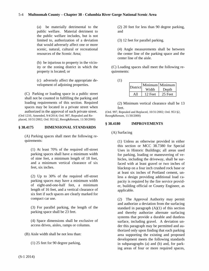
5-4 Multnomah County – Chapter 38 - Columbia River Gorge National Scenic Area
(S-1 2014)
(a) be materially detrimental to the
public welfare. Material detriment to
the public welfare includes, but is not
limited to, authorization of a deviation
that would adversely affect one or more
scenic, natural, cultural or recreational
resources of the Scenic Area;
(b) be injurious to property in the vicin-
ity or the zoning district in which the
property is located; or
(c) adversely affect the appropriate de-
velopment of adjoining properties.
(C) Parking or loading space in a public street
shall not be counted in fulfilling the parking and
loading requirements of this section. Required
spaces may be located in a private street when
authorized in the approval of such private street. (Ord 1210, Amended, 9/4/2014; Ord. 997, Repealed and Re-
placed, 10/31/2002; Ord. 953 §2, Reorg&Renum, 11/30/2000)
§ 38.4175 DIMENSIONAL STANDARDS
(A) Parking spaces shall meet the following re-
quirements:
(1) At least 70% of the required off-street
parking spaces shall have a minimum width
of nine feet, a minimum length of 18 feet,
and a minimum vertical clearance of six
feet, six inches.
(2) Up to 30% of the required off-street
parking spaces may have a minimum width
of eight-and-one-half feet, a minimum
length of 16 feet, and a vertical clearance of
six feet if such spaces are clearly marked for
compact car use.
(3) For parallel parking, the length of the
parking space shall be 23 feet.
(4) Space dimensions shall be exclusive of
access drives, aisles, ramps or columns.
(B) Aisle width shall be not less than:
(1) 25 feet for 90 degree parking,
(2) 20 feet for less than 90 degree parking,
and
(3) 12 feet for parallel parking.
(4) Angle measurements shall be between
the center line of the parking space and the
center line of the aisle.
(C) Loading spaces shall meet the following re-
quirements:
(1)
District Minimum
Width
Minimum
Depth
All 12 Feet 25 Feet
(2) Minimum vertical clearance shall be 13
feet. (Ord. 997, Repealed and Replaced, 10/31/2002; Ord. 953 §2,
Reorg&Renum, 11/30/2000)
§ 38.4180 IMPROVEMENTS
(A) Surfacing
(1) Unless as otherwise provided in either
this section or MCC 38.7380 for Special
Uses in Historic Buildings; all areas used
for parking, loading or maneuvering of ve-
hicles, including the driveway, shall be sur-
faced with at least gravel or two inches of
blacktop on a four inch crushed rock base or
at least six inches of Portland cement, un-
less a design providing additional load ca-
pacity is required by the fire service provid-
er, building official or County Engineer, as
applicable.
(2) The Approval Authority may permit
and authorize a deviation from the surfacing
standard in paragraph (A)(1) of this section
and thereby authorize alternate surfacing
systems that provide a durable and dustless
surface, including gravel. A deviation un-
der this paragraph may be permitted and au-
thorized only upon finding that each parking
area supporting the existing and proposed
development meets the following standards
in subparagraphs (a) and (b) and, for park-
ing areas of four or more required spaces,

Chapter 38 - Columbia River Gorge National Scenic Area 5-5
(S-1 2014)
also meets the following standards in sub-
paragraphs (c) and (d):
(a) The authorized provider of structur-
al fire protection services verifies that
the proposed deviation complies with
such provider’s fire apparatus access
standards, or, if there is no such service
provider, the building official verifies
that the proposed deviation complies
with the Oregon Fire Code;
(b) The County Engineer verifies that
the proposed deviation complies with
the County Road Rules and the County
Design and Construction Manual
Standards. Alternative surfacing can be
considered for all areas used for park-
ing, loading and maneuvering, includ-
ing the driveway; however, approaches
to paved public rights-of-way shall be
paved for a minimum distance of 21
feet from the fog line, or for a greater
distance when required by the County
Engineer;
(c) Authorization of the proposed devi-
ation would not:
1. be materially detrimental to the
public welfare. Material detriment
to public welfare includes, but is
not limited to, authorizing a pro-
posed deviation that would adverse-
ly affect one or more scenic, natu-
ral, cultural or recreational re-
sources of the Scenic Area;
2. be injurious to property in the
vicinity or the zoning district in
which the property is located; or
3. adversely affect the appropriate
development of adjoining proper-
ties; and
(d) Any impacts resulting from the
proposed surfacing are mitigated to the
extent practical. Mitigation may in-
clude but is not limited to such consid-
erations as provision for pervious drain-
age capability, drainage runoff control
and dust control. A dust control plan is
required when a dwelling, excluding
any dwelling served by the driveway, is
located within 200-feet of any portion
of the driveway for which gravel or oth-
er similar surfacing materials is pro-
posed. Common dust control measures
include, but are not limited to, reduced
travel speeds, gravel maintenance plan-
ning, establishment of windbreaks and
use of binder agents.
(B) Curbs and Bumper Rails
(1) All areas used for parking, loading, and
maneuvering of vehicles shall be physically
separated from public streets or adjoining
property by required landscaped strips or
yards or in those cases where no landscaped
area is required, by curbs, bumper rails or
other permanent barrier against unchanneled
motor vehicle access or egress.
(2) The outer boundary of a parking or load-
ing area shall be provided with a bumper
rail or curbing at least four inches in height
and at least three feet from the lot line or
any required fence.
(C) Marking – All areas for the parking and ma-
neuvering of vehicles shall be marked in ac-
cordance with the approved plan required under
MCC 38.4120, and such marking shall be con-
tinually maintained.
(D) Drainage – All areas for the parking and
maneuvering of vehicles shall be graded and
drained to provide for the disposal of all surface
water on the lot. (Ord. 1210, Amended, 9/4/2014; Ord. 1064, Amended,
06/23/2005; Ord. 997, Repealed and Replaced, 10/31/2002;
Ord. 953 §2, Reorg&Renum, 11/30/2000)
§ 38.4185 LIGHTING
Any artificial lighting which may be provided shall
be shielded or deflected so as to not shine into ad-
joining dwellings or other types of living units, and
so as not to create a hazard to the traveling public on
any street. (Ord. 997, Repealed and Replaced, 10/31/2002; Ord. 953 §2,

5-6 Multnomah County – Chapter 38 - Columbia River Gorge National Scenic Area
(S-1 2014)
Reorg&Renum, 11/30/2000)
§ 38.4190 SIGNS
Signs, pursuant to the provisions of MCC 38.0080. (Ord. 1064, Amended, 06/23/2005; Ord. 997, Repealed and Re-
placed, 10/31/2002; Ord. 953 §2, Reorg&Renum, 11/30/2000)
§ 38.4195 DESIGN STANDARDS:
SETBACKS
(A) Any required yard which abuts upon a street
lot line shall not be used for a parking or load-
ing space, vehicle maneuvering area or access
drive other than a drive connecting directly to a
street.
(B) A required yard which abuts a street lot line
shall not be paved, except for walkways which
do not exceed 12 feet in total width and not
more than two driveways which do not exceed
the width of their curb cuts for each 150 feet of
street frontage of the lot. (Ord. 997, Repealed and Replaced, 10/31/2002; Ord. 953 §2,
Reorg&Renum, 11/30/2000)
§ 38.4205 MINIMUM REQUIRED OFF-
STREET PARKING SPACES
(A) Residential Uses
(1) Single Family Dwelling – Two spaces
for each dwelling unit.
(2) Two Family Dwelling – Two spaces for
each dwelling unit.
(B) Public and Semi-Public Buildings and Uses
(1) Auditorium or Meeting Room (except
schools) – One space for each 60 square
feet of floor area in the auditorium or,
where seating is fixed to the floor, one
space for each four seats or eight feet of
bench length.
(2) Church – One space for each 80 square
feet of floor area in the main auditorium or,
where seating is fixed to the floor, one
space for each four seats or eight feet of
bench length.
(3) Church Accessory Use – In addition to
spaces required for the church, one space
for each ten persons residing in such build-
ing.
(4) Club or Association – These shall be
treated as combinations of uses such as
overnight accommodation, restaurant, audi-
torium etc., and the required spaces for each
separate use shall be provided.
(5) Library – One space for each 100 square
feet of reading room.
(6) Senior High School and Equivalent Pri-
vate and Parochial School – One space for
each 56 square feet of floor area in the audi-
torium or, where seating is fixed to the
floor, one space for each eight seats or 16
feet of bench length, or one space for each
ten seats in classrooms, whichever is great-
er.
(7) Primary, Elementary, or Junior High and
Equivalent Private or Parochial School –
One space for 84 square feet of floor area in
the auditorium, or one space for each 12
seats or 24 feet of bench length, whichever
is greater.
(8) Kindergarten, Day Nursery, or Equiva-
lent Private or Parochial School – One
driveway, designed for continuous flow of
passenger vehicles for the purpose of load-
ing and unloading children plus one parking
space for each two employees.
(9) Campground – One space for each
campsite.
(C) Retail, Office and Commercial Uses
(1) Store, and Personal Service Shop – One
space for each 400 square feet of gross floor
area.
(2) Service and Repair Shop – One space
for each 600 square feet of gross floor area.

Chapter 38 - Columbia River Gorge National Scenic Area 5-7
(S-1 2014)
(3) Bank or Office, including Medical and
Dental – One space for each 300 square feet
of gross floor area.
(4) Restaurant, Coffee Shop, Tavern or Bar
– One space for each 100 square feet of
gross floor area.
(5) Mortuary – One space for each four
chapel seats or eight feet of bench length.
(6) Overnight Accommodations – One
space per guest room or suite plus extra
spaces for dining rooms, ballrooms or meet-
ing rooms as required by this section where
the capacity of such areas exceeds the ca-
pacity of the guest rooms or suites.
(7) Commercial Events – One space for
every three guests allowed within the max-
imum event size plus one space for each
two employees
(8) Conference or Retreat Facilities – These
shall be treated as combinations of uses
such as overnight accommodations, restau-
rant, auditorium, etc., and the required spac-
es for each separate use shall be provided.
(D)Recreation Uses
(1) Gymnasium (except Schools) – One
space for each 100 square feet of floor area.
(2) Moorage (Boat) – One space for each
two boat berths.
(3) Stadium – One space for each eight seats
or 16 feet of bench length.
(4) Swimming Pool – One space for each
100 square feet of water surface.
(5) Tennis Court or Racquet Club – One
space for each court.
(E) Storage
(1) Storage – One space for each 5,000
square feet of storage area for the first
20,000 square feet, plus one additional
space for each additional 50,000 square feet.
(F) Unspecified Uses
Any use not specifically listed above shall have
the requirements of the listed use or uses
deemed most nearly equivalent by the Planning
Director.
(G) Alternative Parking Standards
Alternatively, where a mixture of uses is pro-
posed or where the applicant asserts that a dif-
ferent amount or type of parking is appropriate
as the required parking, the applicant may sub-
mit a parking and loading study. Such a study
will include estimates of parking and off-street
loading demand based on recommendations of
the Institute of Traffic Engineers (ITE), or other
acceptable estimates, and should include other
reliable data collected from uses or combina-
tions of uses that are the same as or comparable
with the proposed use. The study will document
the source of data used to develop the recom-
mendations for identification of the use’s re-
quired parking. (Ord. 1187, Amended, 11/17/2011; Ord. 1074, Amended,
05/04/2006; Ord. 997, Repealed and Replaced, 10/31/2002;
Ord. 953 §2, Reorg&Renum, 11/30/2000)
§ 38.4215 EXCEPTIONS FROM
REQUIRED OFF-STREET
PARKING OR LOADING
SPACES
(A) As part of Site Review the Planning Direc-
tor may grant an exception with or without con-
ditions for up to 30% of the required number of
off- street parking or loading spaces, upon a
finding by the Director that there is substantial
evidence that the number of spaces required is
inappropriate or unneeded for the particular use,
based upon:
(1) A history of parking or loading use for
comparable developments;
(2) The age, physical condition, motor vehi-
cle ownership or use characteristics or other

5-8 Multnomah County – Chapter 38 - Columbia River Gorge National Scenic Area
(S-1 2014)
circumstances of residents, users or visitors
of the use; or
(3) The availability of alternative transpor-
tation facilities; and
(4) That there will be no resultant on-street
parking or loading or interruptions or haz-
ards to the movement of traffic, pedestrians
or transit vehicles.
(B) The Director shall file with the application
for the building or other required permit, find-
ings in support of any exception, including any
conditions of approval.
(C) An exception in excess of 15% of the re-
quired number of spaces shall include a condi-
tion that a plan shall be filed with the applica-
tion, showing how the required number of spac-
es can be provided on the lot in the future.
(1) The Director may order the revocation,
in whole or in part, of any exception under
this section, upon a finding of on-street
parking or loading use or of interruptions in
or hazards to the movement of traffic, pe-
destrians or transit vehicles caused by the
absence of off-street parking or loading
spaces. (Ord. 997, Repealed and Replaced, 10/31/2002; Ord. 953 §2,
Reorg&Renum, 11/30/2000)

Chapter 38 - Columbia River Gorge National Scenic Area 5-9
(S-1 2006)
PLANNED DEVELOPMENT
§ 38.4300- PURPOSES
The purposes of the Planned Development provi-
sions are to provide a means of creating planned en-
vironments through the application of flexible and
diversified land development standards; to encour-
age the application of new techniques and new tech-
nology to community development which will result
in superior living or development arrangements; to
use land efficiently and thereby reduce the costs of
housing, maintenance, street systems and utility
networks; to promote energy conservation and crime
prevention; to relate developments to the natural en-
vironment and to inhabitants, employers, employ-
ees, customers, and other users in harmonious ways. (Ord. 997, Repealed and Replaced, 10/31/2002; Ord. 953 §2,
Reorg&Renum, 11/30/2000)
§ 38.4305 AREAS AFFECTED
The Planned Development provisions may only be
applied in the GGRC district. (Ord. 997, Repealed and Replaced, 10/31/2002; Ord. 953 §2,
Reorg&Renum, 11/30/2000)
§ 38.4310 CONDITIONS
(A) Within one year after the final County deci-
sion, the owner shall prepare and file with the
Planning Director a Final Development Plan
and Program, unless the action on the Prelimi-
nary Development Plan and Program shall have
specified a different period. (Ord. 997, Repealed and Replaced, 10/31/2002; Ord. 953 §2,
Reorg&Renum, 11/30/2000)
§ 38.4315 DEVELOPMENT PLAN AND
PROGRAM CONTENTS
(A) The preliminary Development Plan and
Program shall consist of plans, maps or dia-
grams drawn in sufficient detail to indicate the
nature of the plan elements and a written narra-
tive descriptive of the program elements.
(1) Plan Elements.
(a) Proposed land uses and residential
densities.
(b) Means of access, circulation and
parking.
(c) Building types and locations.
(d) Parks, playgrounds, paths and open
spaces.
(e) A land division plan if the land is to
be divided.
(2) Program Elements.
(a) A narrative statement of the goals
and objectives of the planned develop-
ment.
(b) Tables showing overall density of
any proposed residential development
and showing density by dwelling types
and intensity of any supporting com-
mercial uses.
(c) A narrative statement indicating how
the proposed planned development
complies with the applicable Manage-
ment Plan Policies.
(d) A general timetable of development.
(e) The proposed ownership pattern.
(f) An operation and maintenance pro-
posal. (Ord. 1064, Amended, 06/23/2005; Ord. 997, Repealed and Re-
placed, 10/31/2002; Ord. 953 §2, Reorg&Renum, 11/30/2000)
§ 38.4320 CRITERIA FOR APPROVAL
(A) Action on the Preliminary Development
Plan and Program shall be based on findings
that the following are satisfied:
(1) The applicable provisions of MCC
38.7700 et seq., the Land Division Sub-
Chapter;
5-10 Multnomah County – Chapter 38 - Columbia River Gorge National Scenic Area
(S-1 2006)
(2) That any exceptions from the standards
or requirements of the underlying district
are warranted by the design and amenities
incorporated in the Development Plan and
Program, as related to the purposes stated in
MCC 38.4300;
(3) That the system of ownership and the
means of developing, preserving and main-
taining open space is suitable to the purpos-
es of the proposal;
(4) The provisions of MCC 38.4340;
(5) That the proposed development can be
substantially completed within four years of
the approval or according to the develop-
ment stages proposed under MCC 38.4355;
(6) The Development Standards of MCC
38.4335, 38.4345 and 38.4350;
(7) The purposes stated in MCC 38.4300;
and
(8) That modifications or conditions of ap-
proval are necessary to satisfy the purposes
stated in MCC 38.4300.
(B) Approval by the Planning Director of the
Final Development Plan and Program shall be
based on the final Plan and Program being con-
sistent with the approved Preliminary Develop-
ment Plan and Program and the modifications or
conditions attached thereto by the Approval Au-
thority. (Ord. 997, Repealed and Replaced, 10/31/2002; Ord. 953 §2,
Reorg&Renum, 11/30/2000)
§ 38.4330 DEVELOPMENT
STANDARDS
The Development Standards stated in MCC 38.4335
through 38.4350 shall apply to an approved Planned
Development. In the case of a conflict between a
standard of the underlying district and that of the
Planned Development, the standard of the Planned
Development shall apply. (Ord. 997, Repealed and Replaced, 10/31/2002; Ord. 953 §2,
Reorg&Renum, 11/30/2000)
§ 38.4335 MINIMUM SITE SIZE
A Planned Development shall be established only
on a parcel of land found by the Approval Authority
to be suitable for the proposed development and of
sufficient size to be planned and developed in a
manner consistent with the purposes stated in MCC
38.4300. (Ord. 997, Repealed and Replaced, 10/31/2002; Ord. 953 §2,
Reorg&Renum, 11/30/2000)
§ 38.4340 RELATIONSHIP OF THE
PLANNED DEVELOPMENT
TO ENVIRONMENT
(A) The Development Plan and Program shall
indicate how the proposal will be compatible
with the natural environment.
(B) The elements of the Development Plan and
Program shall promote the conservation of en-
ergy, and may include such factors as the loca-
tion and extent of site improvements, the orien-
tation of buildings and usable open spaces with
regard to solar exposure and climatic conditions,
the types of buildings and the selection of build-
ing materials in regard to the efficient use of en-
ergy and the degree of site modification re-
quired in the proposal.
(C) The Development Plan and Program shall
be designed to provide freedom from hazards
and to offer appropriate opportunities for resi-
dential privacy and for transition from public to
private spaces.
(D) The location and number of points of access
to the site, the interior circulation patterns, the
separations between pedestrians and moving
and parked vehicles, and the arrangement of
parking areas in relation to buildings, structures
and uses shall be designed to maximize safety
and convenience and be compatible with neigh-
boring road systems, buildings, structures and
uses. (Ord. 997, Repealed and Replaced, 10/31/2002; Ord. 953 §2,
Reorg&Renum, 11/30/2000)
Chapter 38 - Columbia River Gorge National Scenic Area 5-11
(S-1 2006)
§ 38.4345 OPEN SPACE
Open space in a Planned Development means the
land area used for scenic, landscaping or open rec-
reational purposes within the development.
(A) Open space shall not include street rights-
of-way, driveways or open parking areas.
(B) Locations, shapes and sizes of open space
shall be consistent with the proposed uses and
purposes of the Planned Development.
(C) Open spaces shall be suitably improved for
intended use. Open spaces containing natural
features worthy of preservation may be left un-
improved or may be improved to assure protec-
tion of the features.
(D) The development schedule shall provide for
coordination of the improvement of open spaces
with the construction of other site improvements
proposed in the Development Plan and Program.
(E) Assurance of the permanence of open spaces
may be required in the form of deeds, covenants
or the dedication of development rights to
Multnomah County or other approved entity.
(F) The Approval Authority may require that in-
struments of conveyance provide that in the
event an open space is permitted to deteriorate
or is not maintained in a condition consistent
with the approved plan and program, the County
may at its option cause such maintenance to be
done and assess the costs to the affected proper-
ty owners. Any instruments guaranteeing the
maintenance of open spaces shall be reviewed
as to form by the County Attorney. (Ord. 997, Repealed and Replaced, 10/31/2002; Ord. 953 §2,
Reorg&Renum, 11/30/2000)
§ 38.4350 DENSITY COMPUTATION
FOR RESIDENTIAL
DEVELOPMENTS
In order to preserve the integrity of the Management
Plan and relate a residential Planned Development
to it, the number of dwelling units permitted shall be
determined by dividing the total site area by the
minimum lot area per dwelling unit required by the
underlying district or districts in which the Planned
Development is located. (Ord. 997, Repealed and Replaced, 10/31/2002; Ord. 953 §2,
Reorg&Renum, 11/30/2000)
§ 38.4355 STAGING
(A) The applicant may elect to develop the site
in successive stages in a manner indicated in the
Development Plan and Program. Each such
stage shall satisfy the requirements of this Chap-
ter.
(B) In acting to approve the Preliminary Devel-
opment Plan and Program, the Approval Au-
thority may require that development be com-
pleted in specific stages if public facilities are
not otherwise adequate to service the entire de-
velopment. (Ord. 997, Repealed and Replaced, 10/31/2002; Ord. 953 §2,
Reorg&Renum, 11/30/2000)
§ 38.4360 PERMITTED USES
In the GGRC district, the following uses may be
permitted in a Planned Development:
(A) Housing types may include only duplexes
and single family detached or attached dwell-
ings.
(B) A related commercial use which is designat-
ed to serve the development of which it is a part,
upon approval by the Approval Authority.
(C) A use or structure customarily accessory or
incidental to a permitted or approved use. (Ord. 1064, Amended, 06/23/2005; Ord. 997, Repealed and Re-
placed, 10/31/2002; Ord. 953 §2, Reorg&Renum, 11/30/2000)

5-12 Multnomah County – Chapter 38 - Columbia River Gorge National Scenic Area
(S-1 2006)

Chapter 38 - Columbia River Gorge National Scenic Area 5-13
(S-1 2019)
GEOLOGIC HAZARDS
§ 38.5500- PURPOSES
The purpose of this subdistrict is to regulate ground
disturbing activity within the Geologic Hazards
Overlay in order to promote public health, safety
and general welfare and to minimize the following
risks potentially arising from ground disturbing ac-
tivity or the establishment or replacement of imper-
vious surfaces: public and private costs; expenses
and losses; environmental harm; and human-caused
erosion, sedimentation or landslides. (Ord. 1271, Amended, 3/14/2019; Ord. 1064, Amended,
06/23/2005; Ord. 997, Repealed and Replaced, 10/31/2002;
Ord. 994, Amended, 09/26/2002; Ord. 953 §2, Reorg&Renum,
11/30/2000)
§ 38.5503 DEFINITIONS
As used in this Subsection, unless the context re-
quires otherwise, the following terms and their deri-
vations shall have the meanings provided below:
Best Management Practices – Methods that
have been determined to be the most effective, prac-
tical means of preventing or reducing erosion, sedi-
mentation or landslides including but not limited to:
use of straw bales, slash windrows, filter fabric
fences, sandbags, straw cover and jute netting.
Certified Engineering Geologist – Any person
who has obtained certification by the State of Ore-
gon as an engineering geologist.
Cut – When used in the context of ground dis-
turbing activity:
(1) An excavation;
(2) The difference between a point on the
original ground surface and the point of
lowest elevation on the final grade;
(3) The material removed in excavation
work.
Development – An act requiring a permit stipu-
lated by Multnomah County Ordinances as a pre-
requisite to the use or improvement of any land, in-
cluding but not limited to, a building, land use, oc-
cupancy, sewer connection, or other similar permit,
and any associated ground disturbing activity or re-
moval of vegetation. As the context allows or re-
quires, the term “development” may be synonymous
with the term “use” and the terms “use or develop-
ment” and “use and development.”
Development Area – The total area of alteration
of the naturally occurring ground surface resulting
from construction activities whether permanent or
temporary.
Disturbed Area – When used in reference to
ground disturbing activity, the area where ground
disturbing activity is occurring or has, will or is pro-
posed to occur.
Drainage Area – The subject property together
with the watershed (acreage) contributing water
runoff to and receiving water runoff from the sub-
ject property.
Drainageway – Any natural or artificial stream,
swale, creek, river, ditch, channel, canal or other
open water body.
Erosion – The wearing away of the ground sur-
face or other earth layer, whether dry, submerged or
submersible, due to the movement of wind, water,
ice, gravity, or other element.
Excavation – The motorized removal of earth
material or other motorized activity resulting in the
exposure of the ground surface or other earth layer
to wind, water, ice, gravity, or other element, in-
cluding, but not limited to, cutting, digging, grading,
stripping, trenching, dredging, bulldozing, benching,
terracing, mining or quarrying, and vegetation or
tree removal. Hydrologic scour attributed to devel-
opment is also a form of excavation. Work con-
ducted by hand without the use of motorized equip-
ment is not excavating.
Farming Practice – As defined in ORS 30.930.
Fill – The deposit (noun or verb) of any earth
materials by motorized means for any purpose, in-
cluding, but not limited to, stockpiling, storage,
dumping, raising elevation or topography, and track-
ing material, such as mud onto a road surface with
vehicle tires. Work conducted by hand without the
use of motorized equipment is not filling.

5-14 Multnomah County – Chapter 38 - Columbia River Gorge National Scenic Area
(S-1 2019)
Geological Hazards Overlay Map – A series of
maps adopted by the Multnomah County Board of
Commissioners.
Geotechnical Engineer - A Civil Engineer, li-
censed to practice in the State of Oregon, who by
training, education and experience is competent in
the practice of geotechnical or soils engineering
practices.
Geotechnical Report – Any information re-
quired in addition to GHP Form 1 which clarifies
the geotechnical conditions of a proposed develop-
ment site. Examples of this would be reports on test
hole borings, laboratory tests or analysis of materi-
als, or hydrologic studies.
Gravel – Aggregate composed of hard and du-
rable stones or pebbles, crushed or uncrushed, more
than half of which is retained on a No. 4 sieve (2
mm).
Ground Disturbing Activity – Any excavating
or filling or combination thereof.
GHP Form– 1 – The form required for speci-
fied developments subject to the Geologic Hazards
Overlay. It contains a geotechnical reconnaissance
and stability questionnaire which must be filled out
and certified by a Certified Engineering Geologist
or Geotechnical Engineer.
Hydrologic Scour - Evidence of concentrated
flows of water over bare soils or evidence of on-site
erosion such as rivulets on bare soil slopes, where
the flow of water is not filtered or captured on site.
Landslide – Any downward slope movement of
earth material, including, but not limited to, soil,
creep, debris flow, mudflow, earth flow, mudslide,
rock slide, rotational slide, slide, slump, block fail-
ure, rock fall, fall, topple, and spread.
Mulch – Organic materials, such as straw, bark,
jute, coconut fibers, or nut shells spread over the
surface of the ground, especially freshly graded or
exposed soils, to prevent physical damage from ero-
sive agents such as stormwater, precipitation or
wind, and which shield soil surfaces until vegetative
cover or other stabilization measures can take effect.
Ordinary High Watermark – Features found by
examining the bed and banks of a stream and ascer-
taining where the presence and action of waters are
so common and usual, and so long maintained in all
ordinary years, as to mark upon the land a character
distinct from that of the abutting upland, particularly
with respect to vegetation. For streams where such
features cannot be found, the channel bank shall be
substituted. In braided channels and alluvial fans,
the ordinary high watermark shall be measured to
include the entire stream feature.
Sedimentation (sediment) – The deposit in a
waterbody of any earthen material by wind, water,
ice, gravity, or other element.
Slope -
(1) Any ground whose surface makes an
angle from the horizontal; or
(2) The face of an embankment or cut sec-
tion.
Spoil Material – Any rock, sand, gravel, soil or
other earth material removed by ground disturbing
activity.
Stream – Areas where surface waters flow suf-
ficient to produce a defined channel or bed. A de-
fined channel or bed is indicated by hydraulically
sorted sediments or the removal of vegetative litter
or loosely rooted vegetation by the action of moving
water. The channel or bed need not contain water
year-round. This definition is not meant to include
irrigation ditches, canals, stormwater runoff devices
or other entirely artificial water bodies unless they
are used to convey Class 1 or 2 streams naturally
occurring prior to construction. Those topographic
features resembling streams but which have no de-
fined channels (e.g. swales) shall be considered
streams when hydrologic and hydraulic analyzes
performed pursuant to a development proposal pre-
dict formation of a defined channel after develop-
ment.
Stream Protection – Activities or conditions
which avoid or lessen adverse water quality and tur-
bidity effects to a stream.

Chapter 38 - Columbia River Gorge National Scenic Area 5-15
(S-1 2019)
Topographic Information – Surveyed elevation
information which details slopes, contour intervals
and water bodies. Topographic information shall be
prepared by a registered Land Surveyor or a regis-
tered Professional Engineer qualified to provide
such information and represented on maps with a
contour interval not to exceed 10 feet.
Topsoil – The top organic and mineral rich layer
of soil that provides nutrients to growing plants.
Vegetation – All plant growth, especially trees,
shrubs, grasses and mosses.
Vegetative Protection – Stabilization of erosive
or sediment-producing areas by covering the soil
with:
(1) Permanent seeding, producing long-term
vegetative cover;
(2) Short-term seeding, producing tempo-
rary vegetative cover;
(3) Sodding, producing areas covered with a
turf or perennial sod-forming grass; or
(4) Netting with seeding if the final grade
has not stabilized.
Water Body – Any surface or ground water, or
wetland of the state or the United States, including
but not limited to, rivers, streams, creeks, sloughs,
drainageways, swales, seeps, springs, watercourses,
canals, drainages, ponds, lakes, bays, aquifers,
coastal waters, impounding reservoirs, estuaries,
marshes, and inlets, regardless of whether perennial,
intermittent, ephemeral, or otherwise, and regardless
of whether natural or human-made. (Ord. 1271, Amended, 03/14/2019; Ord. 1061, Amended,
05/26/2005, eff. 7/1/2005; Ord. 997, Repealed and Replaced,
10/31/2002; Ord. 953 §2, Reorg&Renum, 11/30/2000)
§ 38.5505 PERMITS REQUIRED
Unless exempt under this code; no development, or
ground disturbing activity shall occur (1) on land lo-
cated in hazard areas as identified on the Geologic
Hazards Overlay map, or (2) where the disturbed ar-
ea or the land on which the development will occur
has average slopes of 25 percent or more, except
pursuant to a Geologic Hazards permit (GH). (Ord. 1271, Amended, 03/14/2019; Ord. 997, Repealed and Re-
placed, 10/31/2002; Ord. 953 §2, Reorg&Renum, 11/30/2000)
§ 38.5510 EXEMPTIONS
Ground disturbing activity occurring in association
with the following uses is exempt from GH permit
requirements:
(A) An excavation below finished grade for
basements and footings of a building, retaining wall,
or other structure authorized by a valid building
permit. This shall not exempt any fill made with the
material from such excavation, nor exempt any ex-
cavation having an unsupported finished depth
greater than four feet.
(B) Cemetery graves, but not cemetery soil dis-
posal sites.
(C) Excavations for wells.
(D) Farming practices other than filling or the
placement of structures.
(E) Residential gardening disturbing less than
5,000 square feet of ground surface area and land-
scape maintenance disturbing less than 10,000
square feet of ground surface area when either activ-
ity is at least 100 feet from the top of the bank of
any watercourse located at a lower elevation to and
in the surface drainage path of the ground disturbing
activity. Landscape maintenance includes normal
planting, transplanting, and replacement of trees and
vegetation. Landscape maintenance does not in-
clude preparatory ground disturbing activity for a
development project.
(F) Emergency response activities conducted
according to MCC 38.7090.
(G) Forest Practices.
(H) Ground disturbing activities attributed to
routine road maintenance when undertaken by an
organization operating under Limit 10, Section 4d of
the Endangered Species Act.

5-16 Multnomah County – Chapter 38 - Columbia River Gorge National Scenic Area
(S-1 2019)
(I) Decommissioning or replacing an under-
ground storage tank(s), such as a septic, oil, or other
similar tank(s), but not including a sanitary drain-
field, provided that:
(1) Any contaminated excavated material is
handled in accordance with law, whether
through treatment, being transported to and
deposited at an off-site facility certified and
willing to accept the material, or other di-
rection from the Oregon Department of En-
vironmental Quality, and
(2) Any replacement tank(s) is placed in the
same location as the tank(s) being replaced.
(J) Placement and replacement of mailbox
posts, fence posts, sign posts, utility posts or poles,
and similar support structures, but not including any
post or pole that provides structural support to a
building requiring a structural building permit.
(K) Boring for utilities in a public road right-of-
way, provided such activity does not occur within
100-feet of a water body and is completed within
48-hours of commencement. Completion includes
final compaction of earthen materials within any
trench and removal and lawful disposal or deposit of
any excess excavation or fill material from the site
of the activity.
(L) Uses not identified in subsections (A)
through (K) that meet all of the following require-
ments:
(1) Natural and finished slopes will be less
than 25 percent; and,
(2) The disturbed or filled area is 20,000
square feet or less; and,
(3) The volume of soil or earth materials to
be stored is 50 cubic yards or less; and,
(4) Rainwater runoff is diverted, either dur-
ing or after construction, from an area
smaller than 10,000 square feet; and,
(5) Impervious surfaces, if any, of less than
10,000 square feet are to be created; and,
(6) No drainageway is to be blocked or
have its stormwater carrying capacities or
characteristics modified.
(M) Placement of gravel or asphalt for the
maintenance of existing driveways, roads and other
travel surfaces. (Ord. 1271, Amended, 03/14/2019; Ord. 1064, Amended,
06/23/2005; Ord. 997, Repealed and Replaced, 10/31/2002;
Ord. 953 §2, Reorg&Renum, 11/30/2000)
§ 38.5515 GEOLOGIC HAZARDS
PERMIT APPLICATION
INFORMATION REQUIRED
An application for a Geologic Hazards permit shall
include two copies of each of the following:
(A) A scaled site plan showing the following,
both existing and proposed;
(1) Property lines;
(2) Buildings, structures, driveways, roads
and right-of-way boundaries;
(3) Location of wells, utility lines, site
drainage provisions, stormwater disposal
system, sanitary tanks and drainfields (pri-
mary and reserve);
(4) Trees and vegetation proposed for re-
moval and planting and an outline of wood-
ed areas;
(5) Water bodies;
(6) Boundaries of ground disturbing activi-
ties;
(7) Location and height of unsupported fin-
ished slopes;
(8) Location for washout and cleanup of
concrete equipment;
(9) Storage location and proposed handling
and disposal methods for potential sources
of non-erosion pollution including pesti-
cides, fertilizers, petrochemicals, solid

Chapter 38 - Columbia River Gorge National Scenic Area 5-17
(S-1 2019)
waste, construction chemicals, and
wastewaters;
(10) Soil types;
(11) Ground topography contours (con-
tour intervals no greater than 10-feet); and
(12) Erosion and sediment control
measures.
(B) Calculations of the total area of proposed
ground disturbance (square feet), volume of pro-
posed cut and fill (cubic yards), and existing and
proposed slopes in areas to be disturbed (percent
slope);
(C) Written findings, together with any supple-
mental plans, maps, reports, or other information
necessary to demonstrate compliance of the pro-
posal with all applicable provisions of the Geologic
Hazards standards in MCC 38.5520 (A). Necessary
reports, certifications, or plans may pertain to: engi-
neering, soil characteristics, stormwater drainage
control, stream protection, erosion and sediment
control, and replanting. The written findings and
supplemental information shall include:
(1) With respect to fill:
(a) Description of fill materials, com-
paction methods, and density speci-
fications (with calculations). The
planning director may require addi-
tional studies or information or
work regarding fill materials and
compaction.
(b) Statement of the total daily number
of fill haul truck trips, travel timing,
loaded haul truck weight, and haul
truck travel route(s) to be used from
any fill source(s) to the fill deposit
site.
(2) A description of the use that the ground
disturbing activity will support or help
facilitate.
(3) One of the following:
(a) Additional topographic information
showing that the proposed development
to be on land with average slopes less
than 25 percent, and located more than
200 feet from a known landslide, and
that no cuts or fills in excess of 6 feet in
depth are planned. High groundwater
conditions shall be assumed unless doc-
umentation is available, demonstrating
otherwise; or
(b) A geological report prepared by a
Certified Engineering Geologist or Ge-
otechnical Engineer certifying that the
site is suitable for the proposed devel-
opment; or,
(c) An GHP Form– 1 completed, signed
and certified by a Certified Engineering
Geologist or Geotechnical Engineer
with their stamp and signature affixed
indicating that the site is suitable for the
proposed development.
(i) If the GHP Form– 1 indicates a
need for further investigation,
or if the Director requires fur-
ther study based upon infor-
mation contained in the GHP
Form– 1, a geotechnical report
as specified by the director shall
be prepared and submitted.
[a] A geotechnical investiga-
tion in preparation of a
geotechnical report shall
be conducted at the appli-
cant’s expense by a Certi-
fied Engineering Geolo-
gist or Geotechnical En-
gineer. The report shall
include specific investi-
gations required by the
director and recommen-
dations for any further
work or changes in pro-
posed work which may
be necessary to ensure

5-18 Multnomah County – Chapter 38 - Columbia River Gorge National Scenic Area
(S-1 2019)
reasonable safety from
landslide hazards.
[b] Any development
related manipulation of
the site prior to issuance
of a permit shall be sub-
ject to corrections as rec-
ommended by the ge-
otechnical report to en-
sure safety of the pro-
posed development.
[c] Observation of
work required by an ap-
proved geotechnical re-
port shall be conducted
by a Certified Engineer-
ing Geologist or Ge-
otechnical Engineer at the
applicant’s expense; the
geologist’s or engineer’s
name shall be submitted
to the director prior to is-
suance of the permit.
[d] The director, at the
applicant’s expense, may
require an evaluation of
GHP Form– 1 or the ge-
otechnical report by an-
other Certified Engineer-
ing Geologist or Ge-
otechnical Engineer.
(4) Documentation of approval by each
governing agency having authority
over the matter of any new storm-
water discharges into public right-
of-way.
(5) Documentation of approval by the
City of Portland Sanitarian and any
other agency having authority over
the matter of any new stormwater
surcharges to sanitary drainfields. (Ord. 1271, Amended, 03/14/2019; Ord. 997, Repealed and Re-
placed, 10/31/2002; Ord. 953 §2, Reorg&Renum, 11/30/2000)
§ 38.5520 GEOLOGIC HAZARDS
PERMIT STANDARDS
(A) A Geologic Hazards (GH) permit shall not
be issued unless the application for such permit es-
tablishes compliance with MCC 39.6210 and satis-
faction of the following standards:
(B) Fill shall be composed of earth materials on-
ly.
(C) Cut and fill slopes shall not exceed 33 per-
cent grade (3 Horizontal: 1 Vertical), unless a Certi-
fied Engineering Geologist or Geotechnical Engi-
neer certifies in writing that a grade in writing that a
grade in excess of 33 percent is safe (including, but
not limited to, not endangering or disturbing adjoin-
ing property) and suitable for the proposed devel-
opment.
(D) Unsupported finished cuts and fills greater
than 1 foot in height and less than or equal to 4 feet
in height at any point shall meet a setback from any
property boundary of a distance at least twice the
height of the cut or fill, unless a Certified Engineer-
ing Geologist or Geotechnical Engineer certifies in
writing that the cuts or fills will not endanger or dis-
turb adjoining property. All unsupported finished
cuts and fills greater than 4 feet in height at any
point shall require a Certified Engineering Geologist
or Geotechnical Engineer to certify in writing that
the cuts or fills will not endanger or disturb adjoin-
ing property.
(E) Fills shall not encroach on any water body
unless an Oregon licensed Professional Engineer
certifies that the altered portion of the water body
will continue to provide equal or greater flood carry-
ing capacity for a storm of 10-year design frequen-
cy.
(F) Stripping of vegetation, ground disturbing
activities, or other soil disturbance shall be done in a
manner which will minimize soil erosion, stabilize
the soil as quickly as practicable, and expose the
smallest practical area at any one time during con-
struction.

Chapter 38 - Columbia River Gorge National Scenic Area 5-19
(S-1 2019)
(G) Development Plans shall minimize cut or
fill operations and ensure conformity with topogra-
phy so as to create the least erosion potential and
adequately accommodate the volume and velocity of
surface runoff.
(H) Temporary vegetation and/or mulching shall
be used to protect exposed critical areas during de-
velopment;
(I) Whenever feasible, natural vegetation shall
be retained, protected, and supplemented;
(1) A 100-foot undisturbed buffer of natural
vegetation shall be retained from the top
of the bank of a stream, or from the or-
dinary high watermark (line of vegeta-
tion) of a water body, or within 100-feet
of a wetland;
(2) The buffer required in (I)(1) may only
be disturbed upon the approval of a mit-
igation plan which utilizes erosion, sed-
iment and stormwater control measures
designed to perform as effectively as
those prescribed in the most recent edi-
tion of the City of Portland Erosion and
Sediment Control Manual and the City
of Portland Stormwater Management
Manual and which is consistent with at-
taining equivalent surface water quality
standards as those established for the
Tualatin River Drainage Basin in OAR
340-041-0345(4).
(J) Permanent plantings and any required struc-
tural erosion control and drainage measures shall be
installed as soon as practical.
(K) Provisions shall be made to effectively ac-
commodate increased runoff caused by altered soil
and surface conditions during and after develop-
ment. The rate of surface water runoff shall be struc-
turally retarded where necessary.
(L) Sediment in the runoff water shall be
trapped by use of debris basins, silt traps, or other
measures until the disturbed area is stabilized.
(M) Provisions shall be made to prevent surface
water from damaging the cut face of excavations or
the sloping surface of fills by installation of tempo-
rary or permanent drainage across or above such ar-
eas, or by other suitable stabilization measures such
as mulching or seeding.
(N) All drainage measures shall be designed to
avoid erosion and adequately carry existing and po-
tential surface runoff to suitable drainageways such
as storm drains, natural water bodies, drainage
swales, or an approved drywell system.
(O) Where drainage swales are used to divert
surface waters, they shall be vegetated or protected
as required to minimize potential erosion.
(P) Erosion and sediment control measures must
be utilized such that no visible or measurable ero-
sion shall occur on-site and no visible or measurable
sediment shall exit the site, enter the public right-of-
way or be deposited into any water body or storm
drainage system. Control measures which may be
required include, but are not limited to:
(1) Energy absorbing devices to reduce run-
off water velocity;
(2) Sedimentation controls such as sediment
or debris basins. Any trapped materials
shall be removed to an approved dis-
posal site on an approved schedule;
(3) Dispersal of water runoff from devel-
oped areas over large undisturbed areas.
(Q) Disposed spoil material or stockpiled top-
soil shall be prevented from eroding into water bod-
ies by applying mulch or other protective covering;
or by location at a sufficient distance from water
bodies; or by other sediment reduction measures.
(R) Such non-erosion pollution associated with
construction such as pesticides, fertilizers, petro-
chemicals, solid wastes, construction chemicals, or
wastewaters shall be prevented from leaving the
construction site through proper handling, disposal,
continuous site monitoring and clean-up activities.


Chapter 38 - Columbia River Gorge National Scenic Area 6-1
(S-1 2019)
(S) Ground disturbing activities within a water
body shall use instream best management practices
designed to perform as prescribed in the City of
Portland Erosion and Sediment Control Manual. To
the extent that there is a conflict between the Manu-
al and the requirements of the National Scenic Area
(NSA) Permit, the requirements in the NSA will ap-
ply; and
(T) The total daily number of fill haul truck
trips shall not cause a transportation impact (as de-
fined in the Multnomah County Road Rules) to the
transportation system or fill haul truck travel routes,
unless mitigated as approved by the County Trans-
portation Division.
(U) Fill trucks shall be constructed, loaded, cov-
ered, or otherwise managed to prevent any of their
load from dropping, sifting, leaking, or otherwise
escaping from the vehicle. No fill shall be tracked
or discharged in any manner onto any public right-
of-way.
(V) No compensation, monetary or otherwise,
shall be received by the property owner for the re-
ceipt or placement of fill. (Ord. 1271, Amended, 03/14/2019; Ord. 997, Repealed and Re-
placed, 10/31/2002; Ord. 953 §2, Reorg&Renum, 11/30/2000)


Chapter 38 - Columbia River Gorge National Scenic Area 6-1
(S-1 2019)
PART 6 - APPROVAL CRITERIA
(Ord. 1064, Amended, 06/23/2005)
§ 38.7000- PURPOSES
This part of the code contains approval criteria for
development subject to review in the National Sce-
nic Area. The purposes of these criteria are to en-
sure that development is undertaken in a manner
that protects or provides for the enhancement of the
scenic, natural, cultural and recreational values of
the Columbia River Gorge National Scenic Area. (Ord. 1064, Amended, 06/23/2005; Ord. 997, Repealed and Re-
placed, 10/31/2002; Ord. 953 §2, Reorg&Renum, 11/30/2000)
§ 38.7010 APPLICABILITY
With the exception of Primary Uses, no building,
structure or land shall be used and no building or
structure shall be hereafter erected, altered or en-
larged in the Columbia River Gorge National Scenic
Area except when approved pursuant to MCC
38.0530 (B) or (C) or 38.7090. (Ord. 997, Repealed and Replaced, 10/31/2002; Ord. 994,
Amended, 09/26/2002)
§ 38.7015 APPLICATION FOR NSA SITE
REVIEW AND CONDITIONAL
USE REVIEW
An application for NSA Expedited Development
Review, Site Review or Conditional Use Review
shall address the applicable criteria for approval,
under MCC 38.7035 through 38.7100. (Ord. 1064, Amended, 06/23/2005; Ord. 997, Repealed and Re-
placed, 10/31/2002; Ord. 953 §2, Reorg&Renum, 11/30/2000)
§ 38.7020 REQUIRED FINDINGS
A decision on an application for NSA Expedited
Development Review, Site Review or Conditional
Use Review shall be based upon findings of con-
sistency with the criteria for approval specified in
MCC 38.7035 through 38.7100 as applicable. (Ord. 1064, Amended, 06/23/2005; Ord. 997, Repealed and Re-
placed, 10/31/2002; Ord. 953 §2, Reorg&Renum, 11/30/2000)
§ 38.7035 GMA SCENIC REVIEW
CRITERIA
The following scenic review standards shall apply to
all Review and Conditional Uses in the General
Management Area of the Columbia River Gorge
National Scenic Area:
(A) All Review Uses and Conditional Uses:
(1) New buildings and roads shall be sited
and designed to retain the existing topogra-
phy and to minimize grading activities to
the maximum extent practicable.
(2) New buildings shall be compatible with
the general scale (height, dimensions and
visible mass) of similar buildings that exist
nearby (e.g. dwellings to dwellings). Ex-
pansion of existing development shall com-
ply with this guideline to the maximum ex-
tent practicable. For purposes of applying
this standard, the term nearby generally
means buildings within ¼ mile of the parcel
on which development is proposed.
(3) New vehicular access points to the Sce-
nic Travel Corridors shall be limited to the
maximum extent practicable, and access
consolidation required where feasible.
(4) Property owners shall be responsible for
the proper maintenance and survival of any
required vegetation.
(5) For all proposed development, the de-
termination of compatibility with the land-
scape setting shall be based on information
submitted in the site plan.
(6) For all new production and/or develop-
ment of mineral resources and expansion of
existing quarries, a reclamation plan is re-
quired to restore the site to a natural appear-
ance which blends with and emulates sur-
rounding landforms to the maximum extent
practicable.
At minimum, such reclamation plans shall
include:
(a) A map of the site, at a scale of 1
inch equals 100 feet (1:1,200), or a
scale providing greater detail, with 10

6-2 Multnomah County – Chapter 38 - Columbia River Gorge National Scenic Area
(S-1 2019)
foot contour intervals or less, showing
pre-mining existing grades and post-
mining, final grades; locations of top-
soil stockpiles for eventual reclamation
use; location of catch-basins or similar
drainage and erosion control features
employed for the duration of the use;
and the location of storage, processing
and equipment areas employed for the
duration of the use;
(b) Cross-sectional drawings of the site
showing pre-mining and post-mining
grades;
(c) Descriptions of the proposed use, in
terms of estimated quantity and type of
material removed, estimated duration of
the use, processing activities, etc.;
(d) Description of drainage/erosion con-
trol features to be employed for the du-
ration of the use; and
(e) A landscaping plan providing for re-
vegetation consistent with the vegeta-
tion patterns of the subject landscape
setting, indicating the species, number,
size and location of plantings for the fi-
nal reclaimed grade, as well as a de-
scription of irrigation provisions or oth-
er measures necessary to ensure the
survival of plantings.
(7) All reclamation plans for new quarries
or expansion of existing quarries shall be
sent to the appropriate state reclamation
permitting agency for review and comment.
The state agency shall have 30 calendar
days from the date a reclamation plan is
mailed to submit written comments on the
proposal. State agency comments shall ad-
dress the following:
(a) Whether the proposed mining is sub-
ject to state reclamation permit re-
quirements;
(b) If subject to state jurisdiction,
whether an application has been re-
ceived for a state reclamation permit,
and if, so, the current status of the ap-
plication; and
(c) For uses subject to state jurisdiction,
any issues or concerns regarding con-
sistency with state reclamation require-
ments, or any suggested modifications
to comply with state reclamation re-
quirements.
The Planning Director may request tech-
nical assistance from state agencies on rec-
lamation plans for proposed mining not
within the state agency’s jurisdiction.
(B) All Review Uses and Conditional Uses
topographically visible from Key Viewing Are-
as:
(1) Each development shall be visually sub-
ordinate to its setting as seen from Key
Viewing Areas.
(2) The extent and type of conditions ap-
plied to a proposed development or use to
achieve the scenic standard shall be propor-
tionate to its potential visual impacts as seen
from Key Viewing Areas. Decisions shall
include written findings addressing the fac-
tors influencing potential visual impact in-
cluding but not limited to: the amount of ar-
ea of the building site exposed to Key
Viewing Areas, the degree of existing vege-
tation providing screening, the distance
from the building site to the Key Viewing
Areas it is visible from, the number of Key
Viewing Areas it is visible from, and the
linear distance along the Key Viewing Are-
as from which the building site is visible
(for linear Key Viewing Areas, such as
roads). Conditions may be applied to vari-
ous elements of proposed developments to
ensure they are visually subordinate to their
setting as seen from key viewing areas, in-
cluding but not limited to siting (location of

Chapter 38 - Columbia River Gorge National Scenic Area 6-3
(S-2 2009)
development on the subject property, build-
ing orientation, and other elements); reten-
tion of existing vegetation; design (color,
reflectivity, size, shape, height, architectural
and design details and other elements); and
new landscaping.
(3) Determination of potential visual effects
and compliance with visual sub-ordinance
policies shall include consideration of the
cumulative effects of proposed develop-
ments.
(4) In addition to the site plan requirements
in MCC 38.0045 (A) applications for all
buildings visible from key viewing areas
shall include a description of the proposed
building(s)’ height, shape, color, exterior
building materials, exterior lighting, and
landscaping details (type of plants used;
number, size, locations of plantings; and
any irrigation provisions or other measures
to ensure the survival of landscaping plant-
ed for screening purposes).
(5) For proposed mining and associated ac-
tivities on lands visible from Key Viewing
Areas, in addition to submittal of plans and
information pursuant to MCC 38.7035 (A)
(6) and subsection (4) above, project appli-
cants shall submit perspective drawings of
the proposed mining areas as seen from ap-
plicable Key Viewing Areas.
(6) New development shall be sited on por-
tions of the subject property which mini-
mize visibility from Key Viewing Areas,
unless the siting would place such develop-
ment in a buffer specified for protection of
wetlands, riparian corridors, sensitive
plants, sensitive wildlife sites or conflict
with the protection of cultural resources. In
such situations, development shall comply
with this standard to the maximum extent
practicable.
(7) New development shall be sited using
existing topography and/or existing vegeta-
tion as needed to achieve visual subordi-
nance from key viewing areas.
(8) Existing tree cover screening proposed
development from key viewing areas shall
be retained as specified in MCC
38.7035(C).
(9) Driveways and buildings shall be de-
signed and sited to minimize visibility of
cut banks and fill slopes from Key Viewing
Areas.
(10) The exterior of buildings on lands seen
from Key Viewing Areas shall be composed
of non-reflective materials or materials with
low reflectivity, unless the structure would
be fully screened from all Key Viewing Ar-
eas by existing topographic features. The
Scenic Resources Implementation Hand-
book includes a list of recommended exteri-
or materials. These recommended materials
and other materials may be deemed con-
sistent with this code, including those that
meet recommended thresholds in the “visi-
bility and Reflectivity Matrices” in the Im-
plementation Handbook. Continuous sur-
faces of glass unscreened from key viewing
areas shall be limited to ensure visual sub-
ordinance. Recommended square footage
limitations for such surfaces are provided
for guidance in the Implementation Hand-
book
(11) Exterior lighting shall be directed
downward and sited, hooded and shielded
such that it is not highly visible from Key
Viewing Areas. Shielding and hooding ma-
terials shall be composed of non-reflective,
opaque materials.
(12) Unless expressly exempted by other
provisions in this chapter, colors of struc-
tures on sites visible from key viewing areas
shall be dark earth-tones found at the specif-
ic site or in the surrounding landscape. The
specific colors or list of acceptable colors
shall be included as a condition of approval.
The Scenic Resources Implementation
Handbook will include a recommended pal-
ette of colors.
6-4 Multnomah County – Chapter 38 - Columbia River Gorge National Scenic Area
(S-2 2009)
(13) Additions to existing buildings smaller
in total square area than the existing build-
ing may be the same color as the existing
building. Additions larger than the existing
building shall be of dark earth-tone colors
found at the specific site or in the surround-
ing landscape. The specific colors or list of
acceptable colors shall be included as a
condition of approval. The Scenic Re-
sources Implementation Handbook will in-
clude a recommended palette of colors.
(14) Rehabilitation of or modifications to
existing significant historic structures shall
be exempted from visual sub-ordinance re-
quirements for lands seen from Key View-
ing Areas. To be eligible for such exemp-
tion, the structure must be included in, or el-
igible for inclusion in, the National Register
of Historic Places or be in the process of
applying for a determination of significance
pursuant to such regulations. Rehabilitation
of or modifications to such historic struc-
tures shall be consistent with National Park
Service regulations for historic structures.
(15) The silhouette of new buildings shall
remain below the skyline of a bluff, cliff or
ridge as seen from Key Viewing Areas.
Variances may be granted if application of
this standard would leave the owner without
a reasonable economic use. The variance
shall be the minimum necessary to allow the
use, and may be applied only after all rea-
sonable efforts to modify the design, build-
ing height, and site to comply with the
standard have been made.
(16) An alteration to a building built prior to
November 17, 1986, which already pro-
trudes above the skyline of a bluff, cliff or
ridge as seen from a Key Viewing Areas,
may itself protrude above the skyline if:
(a) The altered building, through use of
color, landscaping and/or other mitiga-
tion measures, contrasts less with its
setting than before the alteration; and
(b) There is no practicable alternative
means of altering the building without
increasing the protrusion.
(17) The following standards shall apply to
new landscaping used to screen develop-
ment from key viewing areas:
(a) New landscaping (including new
earth berms) shall be required only
when there is no other means to make
the development visually subordinate
from key viewing areas. Alternate sites
shall be considered prior to using new
landscaping to achieve visual sub-
ordinance. Development shall be sited
to avoid the need for new landscaping
wherever possible.
(b) If new landscaping is required, it
shall be used to supplement other tech-
niques for achieving visual sub-
ordinance.
(c) Vegetation planted for screening
purposes shall be of sufficient size to
make the development visually subor-
dinate within five years or less of com-
mencement of construction.
(d) Landscaping shall be installed as
soon as practicable, and prior to project
completion. Applicant. The property
owner(s), and their successor(s) in in-
terest are responsible for the proper
maintenance and survival of planted
vegetation, and replacement of such
vegetation that does not survive.
(e) The Scenic Resources Implementa-
tion Handbook includes recommended
species for each landscape setting con-
sistent with MCC 38.7035(C) and the
minimum recommended sizes for tree
plantings (based on average growth
rates expected for recommended spe-
cies).

Chapter 38 - Columbia River Gorge National Scenic Area 6-5
(S-2 2009)
(18) Conditions regarding new landscaping
or retention of existing vegetation for new
developments on land designated GMA
Forest shall meet both scenic guidelines and
the fuel break requirements of MCC
38.7305(A).
(19) New main lines on lands visible from
Key Viewing Areas for the transmission of
electricity, gas, oil, other fuels, or commu-
nications, except for connections to individ-
ual users or small clusters of individual us-
ers, shall be built in existing transmission
corridors unless it can be demonstrated that
use of existing corridors is not practicable.
Such new lines shall be underground as a
first preference unless it can be demonstrat-
ed to be impracticable.
(20) New communication facilities (anten-
nae, dishes, etc.) on lands visible from Key
Viewing Areas, which require an open and
unobstructed site shall be built upon exist-
ing facilities unless it can be demonstrated
that use of existing facilities is not practica-
ble.
(21) New communications facilities may
protrude above a skyline visible from a Key
Viewing Area only upon demonstration
that:
(a) The facility is necessary for public
service;
(b) The break in the skyline is seen only
in the background; and
(c) The break in the skyline is the min-
imum necessary to provide the service.
(22) Overpasses, safety and directional
signs and other road and highway facilities
may protrude above a skyline visible from a
Key Viewing Area only upon a demonstra-
tion that:
(a) The facility is necessary for public
service;
(b) The break in the skyline is the min-
imum necessary to provide the service.
(23) Except for water-dependent develop-
ment and for water-related recreation devel-
opment, development shall be set back 100
feet from the ordinary high water mark of
the Columbia River below Bonneville Dam,
and 100 feet from the normal pool elevation
of the Columbia River above Bonneville
Dam, unless the setback would render a
property unbuildable. In such cases, vari-
ances to the setback may be authorized.
(24) New buildings shall not be permitted
on lands visible from Key Viewing Areas
with slopes in excess of 30 percent. A vari-
ance may be authorized if the property
would be rendered unbuildable through the
application of this standard. In determining
the slope, the average percent slope of the
proposed building site shall be utilized.
(25) All proposed structural development
involving more than 100 cubic yards of
grading on sites visible from Key Viewing
Areas shall include submittal of a grading
plan. This plan shall be reviewed by the
Planning Director for compliance with Key
Viewing Area policies. The grading plan
shall include the following:
(a) A map of the site, prepared at a scale
of 1 inch equals 200 feet (1:2,400), or a
scale providing greater detail, with con-
tour intervals of at least 5 feet, includ-
ing:
1. Existing and proposed final
grades;
2. Location of all areas to be grad-
ed, with cut banks and fill slopes
delineated; and
3. Estimated dimensions of graded
areas.

6-6 Multnomah County – Chapter 38 - Columbia River Gorge National Scenic Area
(S-2 2009)
(b) A narrative description (may be
submitted on the grading plan site map
and accompanying drawings) of the
proposed grading activity, including:
1. Its purpose;
2. An estimate of the total volume
of material to be moved;
3. The height of all cut banks and
fill slopes;
4. Provisions to be used for com-
paction, drainage, and stabilization
of graded areas (preparation of this
information by a licensed engineer
or engineering geologist is recom-
mended);
5. A description of all plant materi-
als used to revegetate exposed
slopes and banks, including type of
species, number of plants, size and
location, and a description of irriga-
tion provisions or other measures
necessary to ensure the survival of
plantings; and
6. A description of any other inter-
im or permanent erosion control
measures to be utilized.
(26) Expansion of existing quarries and new
production and/or development of mineral
resources proposed on sites more than 3
miles from the nearest Key Viewing Areas
from which it is visible may be allowed up-
on a demonstration that:
(a) The site plan requirements for such
proposals pursuant to this chapter have
been met;
(b) The area to be mined and the area to
be used for primary processing, equip-
ment storage, stockpiling, etc. associat-
ed with the use would be visually
subordinate as seen from any Key
Viewing Areas; and
(c) A reclamation plan to restore the site
to a natural appearance which blends
with and emulates surrounding land-
forms to the maximum extent practica-
ble has been approved. At minimum, a
reclamation plans shall comply with
MCC 38.7035 (A) (5); and
(d) A written report on a determination
of visual sub-ordinance has been com-
pleted, with findings addressing the ex-
tent of visibility of proposed mining ac-
tivities from Key Viewing Areas, in-
cluding:
1. A list of Key Viewing Areas
from which exposed mining surfac-
es (and associated facili-
ties/activities) would be visible;
2. An estimate of the surface area of
exposed mining surfaces which
would be visible from those Key
Viewing Areas;
3. The distance from those Key
Viewing Areas and the linear dis-
tance along those Key Viewing Ar-
eas from which proposed mining
surfaces are visible;
4. The slope and aspect of mining
surfaces relative to those portions of
Key Viewing Areas from which
they are visible;
5. The degree to which potentially
visible mining surfaces are screened
from Key Viewing Areas by exist-
ing vegetation, including winter
screening considerations.
6. The degree to which potentially
visible mining surfaces would be
screened by new plantings, berms,
etc. and appropriate time frames to

Chapter 38 - Columbia River Gorge National Scenic Area 6-7
(S-2 2009)
achieve such results, including win-
ter screening considerations.
(27) Unless addressed by subsection (26)
above, new production and/or development
of mineral resources may be allowed upon a
demonstration that:
(a) The site plan requirements for such
proposals pursuant to this chapter have
been met;
(b) The area to be mined and the area
used for primary processing, equipment
storage, stockpiling, etc. associated with
the use would be fully screened from
any Key Viewing Area; and
(c) A reclamation plan to restore the ar-
ea to a natural appearance which blends
with and emulates surrounding land-
forms to the maximum extent practica-
ble has been approved. At minimum,
the reclamation plan shall comply with
MCC 38.7035 (A) (6) and (7).
(28) An interim time period to achieve
compliance with visual sub-ordinance re-
quirements for expansion of existing quar-
ries and development of new quarries locat-
ed more than 3 miles from the nearest visi-
ble Key Viewing Area shall be established
prior to approval. The interim time period
shall be based on site-specific topographic
and visual conditions, but shall not exceed 3
years beyond the date of approval.
(29) An interim time period to achieve
compliance with full screening requirements
for new quarries located less than 3 miles
from the nearest visible Key Viewing Area
shall be established prior to approval. The
interim time period shall be based on site-
specific topographic and visual conditions,
but shall not exceed 1 year beyond the date
of approval. Quarrying activity occurring
prior to achieving compliance with full
screening requirements shall be limited to
activities necessary to provide such screen-
ing (creation of berms, etc.).
(C) All Review Uses and Conditional Uses
within the following landscape settings, regard-
less of visibility from KVAs:
(1) Pastoral
(a) Accessory structures, outbuildings
and accessways shall be clustered to-
gether as much as possible, particularly
towards the edges of existing meadows,
pastures and farm fields.
(b) In portions of this setting visible
from Key Viewing Areas, the following
standards shall be employed to achieve
visual sub-ordinance for new develop-
ment and expansion of existing devel-
opment:
1. Except as is necessary for site
development or safety purposes, the
existing tree cover screening the
development from Key Viewing
Areas shall be retained.
2. Vegetative landscaping shall,
where feasible, retain the open
character of existing pastures and
fields.
3. At least half of any trees planted
for screening purposes shall be spe-
cies native to the setting or com-
monly found in the area. Such spe-
cies include fruit trees, Douglas fir,
Lombardy poplar (usually in rows),
Oregon white oak, bigleaf maple,
and black locust (primarily in the
eastern Gorge). The Scenic Re-
sources Implementation Handbook
includes recommended minimum
sizes.

6-8 Multnomah County – Chapter 38 - Columbia River Gorge National Scenic Area
(S-2 2009)
4. At least one-quarter of any trees
planted for screening shall be conif-
erous for winter screening.
(c) Compatible recreation uses include
resource-based recreation uses of a very
low or low-intensity nature, occurring
infrequently in the landscape.
(2) Coniferous Woodland
(a) Structure height shall remain below
the forest canopy level.
(b) In portions of this setting visible
from Key Viewing Areas, the following
standards shall be employed to achieve
visual sub-ordinance for new develop-
ment and expansion of existing devel-
opment:
1. Except as is necessary for con-
struction of access roads, building
pads, leach fields, etc., the existing
tree cover screening the develop-
ment from Key Viewing Areas shall
be retained.
2. At least half of any trees planted
for screening purposes shall be spe-
cies native to the setting. Such spe-
cies include: Douglas fir, grand fir,
western red cedar, western hem-
lock, bigleaf maple, red alder, pon-
derosa pine and Oregon white oak,
and various native willows (for ri-
parian areas). The Scenic Re-
sources Implementation Handbook
includes recommended minimum
sizes.
3. At least half of any trees planted
for screening purposes shall be co-
niferous to provide winter screen-
ing.
(c) Compatible recreation uses include
resource-based recreation uses of vary-
ing intensities. Typically, outdoor rec-
reation uses should be low-intensity,
and include trails, small picnic areas
and scenic viewpoints. Some more in-
tensive recreation uses, such as
campgrounds, may occur. They should
be scattered, interspersed with large ar-
eas of undeveloped land and low-
intensity uses.
(3) Rural Residential
(a) Existing tree cover shall be retained
as much as possible, except as is neces-
sary for site development, safety pur-
poses, or as part of forest management
practices.
(b) In portions of this setting visible
from Key Viewing Areas, the following
standards shall be employed to achieve
visual sub-ordinance for new develop-
ment and expansion of existing devel-
opment:
1. Except as is necessary for site
development or safety purposes, the
existing tree cover screening the
development from Key Viewing
Areas shall be retained.
2. At least half of any trees planted
for screening purposes shall be spe-
cies native to the setting or com-
monly found in the area.
3. At least half of any trees planted
for screening purposes shall be co-
niferous to provide winter screen-
ing.
(c) Compatible recreation uses include
should be limited to small community
park facilities, but occasional low-

Chapter 38 - Columbia River Gorge National Scenic Area 6-9
(S-2 2009)
intensity resource-based recreation uses
(such as small scenic overlooks) may be
allowed.
(4) Rural Residential in Conifer Woodland
or Pastoral
(a) New development in this setting
shall meet the design standards for both
the Rural Residential setting and the
more rural setting with which it is com-
bined (either Pastoral or Coniferous
Woodland), unless it can be demon-
strated that compliance with the stand-
ards for the more rural setting is imprac-
ticable. Expansion of existing develop-
ment shall comply with this standard to
the maximum extent practicable.
(b) In the event of a conflict between
the standards, the standards for the more
rural setting (Coniferous Woodland or
Pastoral) shall apply, unless it can be
demonstrated that application of such
standards would not be practicable.
(c) Compatible recreation uses should
be limited to very low and low-intensity
resource-based recreation uses, scat-
tered infrequently in the landscape.
(5) Residential
(a) In portions of this setting visible
from Key Viewing Areas, the following
standards shall be employed to achieve
visual sub-ordinance for new develop-
ment and expansion of existing devel-
opment:
1. Except as is necessary for site
development or safety purposes, the
existing tree cover screening the
development from Key Viewing
Areas shall be retained.
2. Structures’ exteriors shall be non-
reflective unless fully screened
from Key Viewing Areas with ex-
isting vegetation and/or topography.
3. At least half of any trees planted
for screening purposes shall be spe-
cies native to the setting or com-
monly found in the area.
4. At least half of any trees planted
for screening purposes shall be co-
niferous to provide winter screen-
ing.
(b) Compatible recreation uses are lim-
ited to community park facilities.
(6) Village
(a) New development in this setting is
exempt from the color and siting re-
quirements of MCC 38.7035(B).
(b) New commercial buildings shall be
limited in size to a total floor area of
5,000 square feet or less, and shall be
limited in height to 2 and 1/2 stories or
less.
(c) For new commercial, institutional
(churches, schools, government build-
ings) or multi-family residential uses on
parcels fronting a Scenic Travel Corri-
dor (the Historic Columbia River
Highway) and expansion of existing de-
velopment for such uses, parking shall
be limited to rear or side yards of build-
ings to the maximum extent practicable.
(d) New vehicular access points to the
scenic travel corridors shall be limited
to the maximum extent practicable, and
access consolidation shall be required
where feasible.
(e) New development proposals and ex-
pansion of existing development shall
be encouraged to follow planned unit
development approaches, featuring con-
solidated access, commonly-shared
landscaped open areas, etc.

6-10 Multnomah County – Chapter 38 - Columbia River Gorge National Scenic Area
(S-2 2009)
(f) New commercial, institutional or
multi-family residential uses fronting a
Scenic Travel Corridor shall comply
with the following landscape require-
ments:
1. Parking or loading areas for 10 or
more spaces shall include a land-
scaped strip at least 5 feet in width
between the new use and the Scenic
Travel Corridor roadway.
2. The landscape strip required in
subsection (f) 1. above shall include
shrubs, vegetative ground cover
and, at minimum, one tree spaced as
appropriate to the species and not to
exceed 25 feet apart on the average.
(g) The use of building materials rein-
forcing the Village Setting’s character,
such as wood, logs or stone, and reflec-
tive of community desires, should be
encouraged.
(h) Architectural styles characteristic of
the area (such as 1½ story dormer roof
styles in Corbett), and reflective of
community desires, should be encour-
aged. Entry signs should be consistent
with such architectural styles.
(i) Design features which create a "pe-
destrian friendly" atmosphere, such as
large shop windows on the ground floor
of commercial buildings, porches along
ground floors with street frontage, etc.
should be encouraged.
(j) Pedestrian walkways and bicycle
paths should be encouraged and inte-
grated into new developments wherever
feasible.
(k) Where feasible, existing tree cover
of species native to the region or com-
monly found in the area shall be re-
tained when designing new develop-
ment or expanding existing develop-
ment.
(l) Compatible recreation uses may in-
clude community parks serving the rec-
reation needs of local residents, and
varying intensities of other recreation
uses.
(7) River Bottomlands
(a) In portions of this setting visible
from Key Viewing Areas, the following
standards shall be employed to achieve
visual sub-ordinance for new develop-
ment and expansion of existing devel-
opment:
1. Except as is necessary for site
development or safety purposes, ex-
isting tree cover screening the de-
velopment from Key Viewing Are-
as shall be retained.
2. At least half of any trees planted
for screening purposes shall be spe-
cies native to the River Bottomland
setting. Public recreation develop-
ments are encouraged to maximize
the percentage of planted screening
vegetation native to this setting.
Such species include: black cotton-
wood, big leaf maple, red alder, Or-
egon white ash, Douglas fir, west-
ern red cedar and western hemlock
(west Gorge) and various native
willow species.
3. At least one-quarter of any trees
planted for screening purposes shall
be coniferous for winter screening.
(b) Compatible recreation uses depend
on the degree of natural resource sensi-
tivity of a particular site. In the most
critically sensitive River Bottomlands,
very low-intensity uses which do not
impair wetlands or special habitat re-
quirements may be compatible.

Chapter 38 - Columbia River Gorge National Scenic Area 6-11
(S-2 2009)
(8) Gorge Walls, Canyons and Wildlands
(a) New development and expansion of
existing development shall be screened
so as to not be seen from Key Viewing
Areas to the maximum extent practica-
ble.
(b) All trees planted to screen permitted
development and uses from Key View-
ing Areas shall be native to the area.
(c) Existing tree cover shall be retained
to the maximum extent practicable, ex-
cept for the minimum necessary to be
removed to accommodate facilities oth-
erwise permitted in the underlying land
use designation or for safety purposes.
(d) All buildings shall be limited in
height to 1 1/2 stories.
(e) All structures’ exteriors shall be
non-reflective.
(f) Signage shall be limited to natural
materials such as wood or stone, and
natural or earth-tone colors, unless pub-
lic safety concerns or federal or state
highway standards require otherwise.
(g) Compatible recreation uses are lim-
ited to very low or low-intensity, re-
source-based activities which focus on
enjoyment and appreciation of sensitive
resources. Such uses compatible (such
as trails) are generally associated with
minimal facility development, if any.
(D) All Review Uses and Conditional Uses
within scenic travel corridors:
(1) For the purposes of implementing this
section, the foreground of a Scenic Travel
Corridor shall include those lands within
one-quarter mile of the edge of pavement of
the Historic Columbia River Highway and
I– 84.
(2) All new buildings and alterations to ex-
isting buildings, except in a GGRC, shall be
set back at least 100 feet from the edge of
pavement of the Scenic Travel Corridor
roadway. A variance to this setback re-
quirement may be granted pursuant to MCC
38.0065. All new parking lots and expan-
sions of existing parking lots shall be set
back at least 100 feet from the edge of
pavement of the Scenic Travel Corridor
roadway, to the maximum extent practica-
ble.
(3) Additions to existing buildings or ex-
pansion of existing parking lots located
within 100 feet of the edge of pavement of a
Scenic Travel Corridor roadway except in a
GGRC, shall comply with subsection (2)
above to the maximum extent practicable.
(4) All proposed vegetation management
projects in public rights-of-way to provide
or improve views shall include the follow-
ing:
(a) An evaluation of potential visual
impacts of the proposed project as seen
from any Key Viewing Area;
(b) An inventory of any rare plants, sen-
sitive wildlife habitat, wetlands or ripar-
ian areas on the project site. If such re-
sources are determined to be present,
the project shall comply with applicable
standards to protect the resources.
(5) When evaluating which locations to
consider undergrounding of signal wires or
powerlines, railroads and utility companies

6-12 Multnomah County – Chapter 38 - Columbia River Gorge National Scenic Area
(S-2 2009)
shall prioritize those areas specifically rec-
ommended as extreme or high priorities for
undergrounding in the Columbia River
Gorge National Scenic Area Corridor Visu-
al Inventory prepared in April, 1990.
(6) New production and/or development of
mineral resources proposed within one-
quarter mile of the edge of pavement of a
Scenic Travel Corridor may be allowed up-
on a demonstration that full visual screening
of the site from the Scenic Travel Corridor
can be achieved by use of existing topo-
graphic features or existing vegetation de-
signed to be retained through the planned
duration of the proposed project. An excep-
tion to this may be granted if planting of
new vegetation in the vicinity of the access
road to the mining area would achieve full
screening. If existing vegetation is partly or
fully employed to achieve visual screening,
over 75 percent of the tree canopy area shall
be coniferous species providing adequate
winter screening. Mining and associated
primary processing of mineral resources is
prohibited within 100 feet of a Scenic Trav-
el Corridor, as measured from the edge of
pavement, except for access roads. Compli-
ance with full screening requirements shall
be achieved within time frames specified in
MCC 38.7035 (B) (29).
(7) Expansion of existing quarries may be
allowed pursuant to MCC 38.7035 (B) (26).
Compliance with visual subordinance re-
quirements shall be achieved within time
frames specified in MCC 38.7035 (B) (28). (Ord. 1125, Amended, 12/11/2008; Ord. 1064, Amended,
06/23/2005; Ord. 997, Repealed and Replaced, 10/31/2002;
Ord. 953 §2, Reorg&Renum, 11/30/2000)
§ 38.7040 SMA SCENIC REVIEW
CRITERIA
The following scenic review standards shall apply to
all Review and Conditional Uses in the Special
Management Area of the Columbia River Gorge
National Scenic Area with the exception of rehabili-
tation or modification of historic structures eligible
or on the National Register of Historic Places when
such modification is in compliance with the national
register of historic places guidelines:
(A) All Review Uses and Conditional Uses visi-
ble from KVAs. This section shall apply to pro-
posed development on sites topographically vis-
ible from KVAs::
(1) New developments and land uses shall
be evaluated to ensure that the scenic stand-
ard is met and that scenic resources are not
adversely affected, including cumulative ef-
fects, based on the degree of visibility from
Key Viewing Areas.
(2) The required SMA scenic standards for
all development and uses are summarized in
the following table.
REQUIRED SMA SCENIC STANDARDS
LANDSCAPE
SETTING
LAND USE
DESIGNA-
TION
SCENIC
STANDARD
Coniferous
Woodland,
Oak-Pine
Woodland
Forest (Na-
tional Forest
Lands), Open
Space
NOT VISU-
ALLY EVI-
DENT
River Bottom-
lands
Open Space NOT VISU-
ALLY EVI-
DENT
Gorge Walls,
Canyonlands,
Wildlands
Forest, Agri-
culture, Public
Recreation,
Open Space
NOT VISU-
ALLY EVI-
DENT
Coniferous
Woodland,
Oak-Pine
Woodland
Forest, Agri-
culture, Resi-
dential, Public
Recreation
VISUALLY
SUBORDI-
NATE
Residential Residential VISUALLY
SUBORDI-
NATE
Pastoral Forest, Agri-
culture, Public
Recreation,
Open Space
VISUALLY
SUBORDI-
NATE
River Bottom-
lands
Forest, Agri-
culture, Public
Recreation
VISUALLY
SUBORDI-
NATE

Chapter 38 - Columbia River Gorge National Scenic Area 6-13
(S-2 2009)
(3) In all landscape settings, scenic stand-
ards shall be met by blending new devel-
opment with the adjacent natural landscape
elements rather than with existing develop-
ment.
(4) Proposed developments or land use shall
be sited to achieve the applicable scenic
standards. Development shall be designed
to fit the natural topography and to take ad-
vantage of vegetation and land form screen-
ing, and to minimize visible grading or oth-
er modifications of landforms, vegetation
cover, and natural characteristics. When
screening of development is needed to meet
the scenic standard from key viewing areas,
use of existing topography and vegetation
shall be given priority over other means of
achieving the scenic standard such as plant-
ing new vegetation or using artificial berms.
(5) The extent and type of conditions ap-
plied to a proposed development or use to
achieve the scenic standard shall be propor-
tionate to its degree of visibility from key
viewing areas.
(a) Decisions shall include written find-
ings addressing the Primary factors in-
fluencing the degree of visibility, in-
cluding but not limited to:
1. The amount of area of the build-
ing site exposed to key viewing are-
as,
2. The degree of existing vegetation
providing screening,
3. The distance from the building
site to the key viewing areas from
which it is visible,
4. The number of key viewing areas
from which it is visible, and
5. The linear distance along the key
viewing areas from which the build-
ing site is visible (for linear key
viewing areas, such as roads).
(b) Conditions may be applied to vari-
ous elements of proposed developments
to ensure they meet the scenic standard
for their setting as seen from key view-
ing areas, including but not limited to:
1. Siting (location of development
on the subject property, building
orientation, and other elements),
2. Retention of existing vegetation,
3. Design (color, reflectivity, size,
shape, height, architectural and de-
sign details and other elements),
and
4. New landscaping.
(6) Sites approved for new development to
achieve scenic standards shall be consistent
with guidelines to protect wetlands, riparian
corridors, sensitive plant or wildlife sites
and the buffer zones of each of these natural
resources, and guidelines to protect cultural
resources.
(7) Proposed developments shall not pro-
trude above the line of a bluff, cliff, or sky-
line as seen from Key Viewing Areas.
(8) Structure height shall remain below the
average tree canopy height of the natural
vegetation adjacent to the structure, except
if it has been demonstrated that compliance
with this standard is not feasible considering
the function of the structure.

6-14 Multnomah County – Chapter 38 - Columbia River Gorge National Scenic Area
(S-2 2009)
(9) The following guidelines shall apply to
new landscaping used to screen develop-
ment from key viewing areas:
(a) New landscaping (including new
earth berms) to achieve the required
scenic standard from key viewing areas
shall be required only when application
of all other available guidelines in this
chapter is not sufficient to make the de-
velopment meet the scenic standard
from key viewing areas. Development
shall be sited to avoid the need for new
landscaping wherever possible.
(b) If new landscaping is necessary to
meet the required standard, existing on-
site vegetative screening and other visi-
bility factors shall be analyzed to de-
termine the extent of new landscaping,
and the size of new trees needed to
achieve the standard. Any vegetation
planted pursuant to this guideline shall
be sized to provide sufficient screening
to meet the scenic standard within five
years or less from the commencement
of construction.
(c) Landscaping shall be installed as
soon as practicable, and prior to project
completion. Applicants and successors
in interest for the subject parcel are re-
sponsible for the proper maintenance
and survival of planted vegetation, and
replacement of such vegetation that
does not survive.
(d) The Scenic Resources Implementa-
tion Handbook shall include recom-
mended species for each landscape set-
ting consistent with the Landscape Set-
tings Design Guidelines in this chapter,
and minimum recommended sizes of
new trees planted (based on average
growth rates expected for recommended
species).
(10) Unless expressly exempted by other
provisions in this chapter, colors of struc-
tures on sites visible from key viewing areas
shall be dark earth-tones found at the specif-
ic site or the surrounding landscape. The
specific colors or list of acceptable colors
shall be included as a condition of approval.
The Scenic Resources Implementation
Handbook will include a recommended pal-
ette of colors as dark or darker than the col-
ors in the shadows of the natural features
surrounding each landscape setting
(11) The exterior of structures on lands seen
from key viewing areas shall be composed
of non-reflective materials or materials with
low reflectivity. The Scenic Resources Im-
plementation Handbook will include a rec-
ommended list of exterior materials. These
recommended materials and other materials
may be deemed consistent with this guide-
line, including those where the specific ap-
plication meets approval thresholds in the
“Visibility and Reflectivity Matrices” in the
Implementation Handbook. Continuous
surfaces of glass unscreened from key view-
ing areas shall be limited to ensure meeting
the scenic standard. Recommended square
footage limitations for such surfaces will be
provided for guidance in the Implementa-
tion Handbook.
(12) Any exterior lighting shall be sited,
limited in intensity, shielded or hooded in a
manner that prevents lights from being
highly visible from Key Viewing Areas and
from noticeably contrasting with the sur-
rounding landscape setting except for road
lighting necessary for safety purposes.
(13) Seasonal lighting displays shall be
permitted on a temporary basis, not to ex-
ceed three months duration.

Chapter 38 - Columbia River Gorge National Scenic Area 6-15
(S-2 2009)
(B) The following shall apply to all lands with-
in SMA landscape settings regardless of visibil-
ity from KVAs (includes areas seen from KVAs
as well as areas not seen from KVAs):
(1) Gorge Walls, and Canyonlands and
Wildlands: New developments and land us-
es shall retain the overall visual character of
the natural appearing landscape.
(a) Structures, including signs, shall
have a rustic appearance, use non-
reflective materials, and have low con-
trast with the surrounding landscape and
be of a Cascadian architectural style.
(b) Temporary roads shall be promptly
closed and revegetated.
(c) New utilities shall be below ground
surface, where feasible.
(d) Use of plant species non-native to
the Columbia River Gorge shall not be
allowed.
(2) Coniferous Woodlands and Oak-Pine
Woodland: Woodland areas shall retain the
overall appearance of a woodland land-
scape. New developments and land uses
shall retain the overall visual character of
the natural appearance of the Coniferous
and Oak/Pine Woodland landscape.
(a) Buildings in the Coniferous Wood-
land landscape setting shall be encour-
aged to have a vertical overall appear-
ance and a horizontal overall appear-
ance in the Oak-Pine Woodland land-
scape setting.
(b) Use of plant species native to the
landscape setting shall be encouraged.
Where non-native plants are used, they
shall have native appearing characteris-
tics.
(3) River Bottomlands: River bottomland
shall retain the overall visual character of a
floodplain and associated islands.
(a) Buildings should have an overall
horizontal appearance in areas with lit-
tle tree cover.
(b) Use of plant species native to the
landscape setting shall be encouraged.
Where non-native plants are used, they
shall have native appearing characteris-
tics.
(4) Pastoral: Pastoral areas shall retain the
overall appearance of an agricultural land-
scape.
The use of plant species common to the
landscape setting shall be encouraged.
The use of plant species in rows as
commonly found in the landscape set-
ting is encouraged.
(5) Residential: The Residential setting is
characterized by concentrations of dwell-
ings.
(a) At Latourell Falls, new buildings
shall have an appearance consistent
with the predominant historical archi-
tectural style.
(b) Use of plant species native to the
landscape setting shall be encouraged.
Where non-native plants are used, they
shall have native appearing characteris-
tics.
(C) SMA Requirements for KVA Foregrounds
and Scenic Routes
(1) All new developments and land uses
immediately adjacent to the Historic Co-
lumbia River Highway, Interstate 84, and
Larch Mountain Road shall be in conform-
ance with state or county scenic route
standards.

6-16 Multnomah County – Chapter 38 - Columbia River Gorge National Scenic Area
(S-2 2009)
(2) The following guidelines shall apply on-
ly to development within the immediate
foregrounds of key viewing areas. Immedi-
ate foregrounds are defined as within the
developed prism of a road or trail KVA or
within the boundary of the developed area
of KVAs such as Crown Pt. and Multnomah
Falls. They shall apply in addition to MCC
38.7040(A).
(a)The proposed development shall be
designed and sited to meet the applica-
ble scenic standard from the foreground
of the subject KVA. If the development
cannot meet the standard, findings must
be made documenting why the project
cannot meet the requirements of
38.7040(A) and why it cannot be rede-
signed or wholly or partly relocated to
meet the scenic standard.
(b)Findings must evaluate the follow-
ing:
1. The limiting factors to meeting
the required scenic standard and/or
applicable provisions of
38.7040(A),
2. Reduction in project size;
3. Options for alternative sites for
all or part of the project, consider-
ing parcel configuration and on-site
topographic or vegetative screen-
ing;
4. Options for design changes in-
cluding changing the design shape,
configuration, color, height, or tex-
ture in order to meet the scenic
standard.
(c) Form, line, color, texture, and design
of a proposed development shall be
evaluated to ensure that the develop-
ment blends with its setting as seen
from the foreground of key viewing ar-
eas:
1. Form and Line-Design of the de-
velopment shall minimize changes
to the form of the natural landscape.
Development shall borrow form and
line from the landscape setting and
blend with the form and line of the
landscape setting. Design of the
development shall avoid contrasting
form and line that unnecessarily call
attention to the development.
2. Color-Color shall be found in the
project’s surrounding landscape set-
ting. Colors shall be chosen and re-
peated as needed to provide unity to
the whole design.
3. Texture-Textures borrowed from
the landscape setting shall be em-
phasized in the design of structures.
Landscape textures are generally
rough, irregular, and complex rather
than smooth, regular, and uniform.
4. Design-Design solutions shall be
compatible with the natural scenic
quality of the Gorge. Building ma-
terials shall be natural or natural
appearing. Building materials such
as concrete, steel, aluminum, or
plastic shall use form, line color and
texture to harmonize with the natu-
ral environment. Design shall bal-
ance all design elements into a har-
monious whole, using repetition of
elements and blending of elements
as necessary.
(3) Right-of-way vegetation shall be man-
aged to minimize visual impact of clearing
and other vegetation removal as seen from
Key Viewing Areas. Roadside vegetation
management should enhance views out
from the highway (vista clearing, planting,
etc.).

Chapter 38 - Columbia River Gorge National Scenic Area 6-17
(S-1 2019)
(4) Encourage existing and require new road
maintenance warehouse and stockpile areas
to be screened from view from Key View-
ing Areas.
(5) Development along Interstate 84 and the
Historic Columbia River Highway shall be
consistent with the scenic corridor strategies
developed for these roadways.
(D) SMA Requirements for areas not seen from
KVAs
Unless expressly exempted by other provi-
sions in MCC 38.7040, colors of structures
on sites not visible from key viewing areas
shall be earth-tones found at the specific
site. The specific colors or list of acceptable
colors shall be approved as a condition of
approval, drawing from the recommended
palette of colors included in the Scenic Re-
sources Implementation Handbook. (Ord. 1270, Amended, 03/14/2019; Ord. 1125, Amended,
12/11/2008; Ord. 1064, Amended, 06/23/2005; Ord. 997, Re-
pealed and Replaced, 10/31/2002; Ord. 953 §2, Reorg&Renum,
11/30/2000)
§ 38.7045 GMA CULTURAL RESOURCE
REVIEW CRITERIA
(A) Cultural Resource Reconnaissance Surveys
Each proposed use or element of a proposed
use within an application shall be evaluated
independently to determine whether a re-
connaissance survey is required; for exam-
ple, an application that proposes a land divi-
sion and a new dwelling would require a re-
connaissance survey if a survey would be
required for the dwelling.
(1) A cultural reconnaissance survey shall
be required for all proposed uses, except:
(a) The modification, expansion, re-
placement, or reconstruction of existing
buildings and structures.
(b) Proposed uses that would not disturb
the ground, including land divisions and
lot-line adjustments; storage sheds that
do not require a foundation; low-
intensity recreation uses, such as fish-
ing, hunting, and hiking; installation of
surface chemical toilets; hand treatment
of brush within established rights-of-
way; and new uses of existing struc-
tures.
(c) Proposed uses that involve minor
ground disturbance, as defined by depth
and extent, including repair and mainte-
nance of lawfully constructed and ser-
viceable structures; home gardens; live-
stock grazing; cultivation that employs
minimum tillage techniques, such as re-
planting pastures using a grassland drill;
construction of fences; new utility poles
that are installed using an auger, post-
hole digger, or similar implement; and
placement of mobile homes where sep-
tic systems and underground utilities are
not involved.
The Gorge Commission will review all
land use applications and determine if
proposed uses would have a minor
ground disturbance.
(d) Proposed uses that occur on sites
that have been disturbed by human ac-
tivities, provided the proposed uses do
not exceed depth and extent of existing
ground disturbance. To qualify for this
exception, a project applicant must
demonstrate that land disturbing activi-
ties occurred in the project area. Land
disturbing activities include grading and
cultivation.
(e) Proposed uses that would occur on
sites that have been adequately sur-
veyed in the past.
1. The project applicant must
demonstrate that the project area
has been adequately surveyed to
qualify for this exception.
2. Past surveys must have been
conducted by a qualified profes-
sional and must include a surface
survey and subsurface testing.

6-18 Multnomah County – Chapter 38 - Columbia River Gorge National Scenic Area
(S-2 2018)
3. The nature and extent of any
cultural resources in the project
area must be adequately docu-
mented.
(f) Proposed uses occurring in areas
that have a low probability of con-
taining cultural resources, except:
1. Residential development that
involves two or more new dwell-
ings for the same project appli-
cant;
2. Recreation facilities that con-
tain parking areas for more than
10 cars, overnight camping facil-
ities, boat ramps, and visitor in-
formation and environmental
education facilities;
3. Public transportation facilities
that are outside improved rights-
of-way;
4. Electric facilities, lines,
equipment, and appurtenances
that are 33 kilovolts or greater;
and
5. Communications, water and
sewer, and natural gas transmis-
sion (as opposed to distribution)
lines, pipes, equipment, and ap-
purtenances.
Areas that have a low probability of
containing cultural resources will be
identified using the results of reconnais-
sance surveys conducted by the Gorge
Commission, the U.S. Forest Service,
public agencies, and private archaeolo-
gists.
The Gorge Commission, after consult-
ing Indian tribal governments and state
historic preservation officers, will pre-
pare and adopt a map showing areas
that have a low probability of contain-
ing cultural resources. This map will be
adopted within 200 days after the Secre-
tary of Agriculture concurs with the
Management Plan. It will be refined and
revised as additional reconnaissance
surveys are conducted. Areas will be
added or deleted as warranted. All revi-
sions of this map shall be reviewed and
approved by the Gorge Commission.
(2) A reconnaissance survey shall be re-
quired for all proposed uses within 500 feet
of a known cultural resources, including
those listed above in MCC 38.7045 (A) (1)
(a) through (f). The location of known cul-
tural resources are shown in the cultural re-
source inventory.
(3) The Gorge Commission may choose to
conduct a reconnaissance survey for pro-
posed uses listed in the exceptions if, in its
professional judgment, a reconnaissance
survey may be necessary to ensure protec-
tion of cultural resources.
(4) A historic survey shall be required for
all proposed uses that would alter the exte-
rior architectural appearance of buildings
and structures that are 50 years old or older,
or compromise features of the surrounding
area that are important in defining the his-
toric or architectural character of the build-
ings or structures that are 50 years old or
older.
(B) The cultural resource review criteria shall be
deemed satisfied, except MCC 38.7045 (L) and
(M), if:
(1) The project is exempted by MCC
38.7045 (A) (1), no cultural resources are
known to exist in the project area, and no
substantiated comment is received during
the comment period provided in MCC
38.0530 (B).
(2) The proposed use would avoid archaeo-
logical resources and traditional cultural re-
sources that exist in the project area. To
meet this standard, a reasonable buffer zone
must be established around the affected re-
sources or properties; all ground disturbing

Chapter 38 - Columbia River Gorge National Scenic Area 6-19
(S-2 2018)
activities shall be prohibited within the
buffer zone.
(a) Buffer zones must preserve the in-
tegrity and context of cultural resources.
They will vary in width depending on
the eventual use of the project area, the
type of cultural resources that are pre-
sent, and the characteristics for which
the cultural resources may be signifi-
cant. A deed covenant, easement, or
other appropriate mechanism shall be
developed to ensure that the buffer zone
and the cultural resources are protected.
(b) An Evaluation of Significance shall
be conducted if a project applicant de-
cides not to avoid the affected cultural
resource. In these instances, the Recon-
naissance Survey and survey report
shall be incorporated into the Evalua-
tion of Significance.
(3) A historic survey demonstrates that the
proposed use would not have an effect on
historic buildings or structures because:
(a) SHPO concludes that the historic
buildings or structures are clearly not
significant, as determined using the cri-
teria in the National Register Criteria
for Evaluation ("36 CFR Part 60.4); or
(b) The proposed use would not com-
promise the historic or architectural
character of the affected buildings or
structures, or compromise features of
the site that are important in defining
the overall historic character of the af-
fected buildings or structures, as deter-
mined by the guidelines and standards
in The Secretary of the Interior’s Stand-
ards for Rehabilitation (U.S. Depart-
ment of the Interior 1990) and The Sec-
retary of the Interior’s Standards for
Historic Preservation Projects (U.S.
Department of the Interior 1983).
1. The historic survey conducted by
the Gorge Commission may provide
sufficient information to satisfy
these standards. If it does not, archi-
tectural and building plans, photo-
graphs, and archival research may
be required. The project applicant
shall be responsible for providing
information beyond that included in
the survey conducted by the Gorge
Commission.
2. The historic survey and report
must demonstrate that these stand-
ards have been clearly and absolute-
ly satisfied. If SHPO or the Plan-
ning Director question whether
these standards have been satisfied,
the project applicant shall conduct
an Evaluation of Significance.
(C) If comment is received during the comment
period provided in MCC 38.0530 (B), the appli-
cant shall offer to meet with the interested per-
sons within 10 calendar days. The 10 day con-
sultation period may be extended upon agree-
ment between the project applicant and the in-
terested persons.
(1) Consultation meetings should provide an
opportunity for interested persons to explain
how the proposed use may affect cultural
resources. Recommendations to avoid po-
tential conflicts should be discussed.
(2) All written comments and consultation
meeting minutes shall be incorporated into
the reconnaissance or historic survey report.
In instances where a survey is not required,
all such information shall be recorded and
addressed in a report that typifies a survey
report; inapplicable elements may be omit-
ted.
(3) A project applicant who is proposing a
large-scale use shall conduct interviews and
other forms of ethnographic research if in-
terested persons submit a written request for
such research. All requests must include a
description of the cultural resources that
may be affected by the proposed use and the
identity of knowledgeable informants. Eth-
nographic research shall be conducted by
qualified specialists. Tape recordings, maps,

6-20 Multnomah County – Chapter 38 - Columbia River Gorge National Scenic Area
(S-2 2018)
photographs, and minutes shall be used
when appropriate.
(4) All written comments, consultation
meeting minutes and ethnographic research
shall be incorporated into the reconnais-
sance or historic survey report. In instances
where a survey is not required, all such in-
formation shall be recorded and addressed
in a report that typifies a survey report.
(D) Reconnaissance and historic surveys, evalu-
ations, assessments and mitigation plans shall be
performed by professionals whose expertise re-
flects the type of cultural resources that are in-
volved. Principal investigators shall meet the
professional standards published in 36 Code of
Federal Regulations (CFR) Part 61 and Guide-
lines for Evaluating and Documenting Tradi-
tional Cultural Properties (Parker and King
n.d.). A survey shall consist of the following:
(1) Reconnaissance Survey for Small-Scale
Uses
Reconnaissance surveys for small scale uses
shall consist of the following:
(a) A surface survey of the project area,
except for inundated areas and impene-
trable thickets.
(b) Subsurface testing shall be conduct-
ed if the surface survey reveals that cul-
tural resources may be present. Subsur-
face probes will be placed at intervals
sufficient to determine the absence or
presence of cultural resources.
(c) A confidential report that includes:
1. A description of the fieldwork
methodology used to identity cul-
tural resources, including a descrip-
tion of the type and extent of the re-
connaissance survey.
2. A description of any cultural re-
sources that were discovered in the
project area, including a written de-
scription and photographs.
3. A map that shows the project ar-
ea, the areas surveyed, the location
of subsurface probes, and, if appli-
cable, the approximate boundaries
of the affected cultural resources
and a reasonable buffer area.
(d) The Gorge Commission will con-
duct and pay for all reconnaissance or
historic surveys, and for Evaluations of
Significance and Mitigation Plans for
cultural resources discovered during
construction of small-scale uses.
(2) Reconnaissance Survey for Large Scale
Uses
For the purposes of this section, large-scale
uses include residential development in-
volving two or more new dwellings; recrea-
tion facilities; commercial and industrial
development; public transportation facili-
ties; electric facilities, lines, equipment, and
appurtenances that are 33 kilovolts or great-
er; and communications, water and sewer,
and natural gas transmission (as opposed to
distribution) lines, pipes, equipment, and
appurtenances.
Reconnaissance surveys for Large Scale
Uses shall consist of the following:
(a) A written description of the survey
shall be submitted to and approved by
the Gorge Commission’s designated ar-
chaeologist.
(b) Reconnaissance surveys shall reflect
the physical characteristics of the pro-
ject area and the design and potential ef-
fects of the proposed use. They shall
meet the following standards:
1. Archival research shall be per-
formed prior to any field work. It
should entail a thorough examina-
tion of tax records; historic maps,
photographs, and drawings; previ-
ous archaeological, historic, and
ethnographic research; cultural re-
source inventories and records

Chapter 38 - Columbia River Gorge National Scenic Area 6-21
(S-2 2009)
maintained by federal, state, and lo-
cal agencies; and primary historic
accounts, such as diaries, journals,
letters, and newspapers.
2. Surface surveys shall include the
entire project area, except for inun-
dated areas and impenetrable thick-
ets.
3. Subsurface probes shall be placed
at intervals sufficient to document
the presence or absence of cultural
resources.
4. Archaeological site inventory
forms shall be submitted to SHPO
whenever cultural resources are dis-
covered.
(c) A confidential report that includes:
1. A description of the proposed
use, including drawings and maps.
2. A description of the project area,
including soils, vegetation, topog-
raphy, drainage, past alterations,
and existing land use.
3. A list of the documents and rec-
ords examined during the archival
research and a description of any
prehistoric or historic events associ-
ated with the project area.
4. A description of the fieldwork
methodology used to identify cul-
tural resources, including a map that
shows the project area, the areas
surveyed, and the location of sub-
surface probes. The map shall be
prepared at a scale of 1 inch equals
100 feet (1:1,200), or a scale
providing greater detail.
5. An inventory of the cultural re-
sources that exist in the project ar-
ea, including a written description,
photographs, drawings, and a map.
The map shall be prepared at a
scale of 1 inch equals 100 feet
(1:1,200), or a scale providing
greater detail.
6. A summary of all written com-
ments submitted by Indian tribal
governments and other interested
persons.
7. A preliminary assessment of
whether the proposed use would or
would not have an effect on cultural
resources. The assessment shall in-
corporate concerns and recommen-
dations voiced during consultation
meetings and information obtained
through archival and ethnographic
research and field surveys.
(d) The applicant shall be responsible
for reconnaissance surveys for large-
scale uses.
(e) The Gorge Commission will conduct
and pay for all Evaluations of Signifi-
cance and Mitigation Plans for cultural
resources discovered during construc-
tion of large-scale uses.
(3) Historic Surveys
(a) Historic surveys shall document the
location, form, style, integrity, and
physical condition of historic buildings
and structures. They shall include:
1. Original photographs;
2. Original maps; and
3. Archival research, blueprints, and
drawings as necessary.
(b) Historic surveys shall describe any
uses that will alter or destroy the exteri-
or architectural appearance of the his-
toric buildings or structures, or com-
promise features of the site that are im-
portant in defining the overall historic
character of the historic buildings or
structures

6-22 Multnomah County – Chapter 38 - Columbia River Gorge National Scenic Area
(S-1 2019)
(c) The project applicant shall provide
detailed architectural drawings and
building plans that clearly illustrate all
proposed alterations.
(E) The Planning Director shall submit a copy
of all cultural resource survey reports to the
Gorge Commission, SHPO, the Indian tribal
governments, the Cultural Advisory Committee,
and any party who submitted substantiated
comment during the comment period provided
in MCC 38.0530 (B). Survey reports may in-
clude measures to avoid affected cultural re-
sources, such as a map that shows a reasonable
buffer area.
(1) All parties notified shall have 30 calen-
dar days from the date a survey report is
mailed to submit written comments to the
Planning Director. The Planning Director
shall record and address all written com-
ments in the Site Review analysis.
(2) The Planning Director shall require an
evaluation of significance if the reconnassi-
ance or historic survey or substantiated
comment received indicate that the pro-
posed use might affect any of the following:
(a) Cultural resources
(b) Archaeological resources
(c) Traditional cultural properties
(d) Historic buildings or structures
(3) The Planning Director shall deem the
cultural resource review process complete if
no substantiated comment is received dur-
ing the 30 day comment period and the re-
connassiance or historic survey indicate that
the proposed use would have no effect on
the items listed in subsection (2)(a) through
(d) above.
(4) Notice of the decision of the Planning
Director shall be mailed to those parties en-
titled to notice by MCC 38.0530 (B) within
10 days of the expiration of the 30 day
comment period.
(5) The decision of the Planning Director on
an application for cultural resource review
shall be final 14 days from the date notice is
mailed, unless appealed as provided in
MCC 38.0530 (B).
(F) Evaluations of significance shall meet the
following standards:
(1) Evaluations of significance shall follow
the procedures in How to Apply the Nation-
al Register Criteria for Evaluation (U.S.
Department of the Interior, n.d.) and Guide-
lines for the Evaluation and Documentation
of Traditional Cultural Properties (Parker
and King, n.d.). They shall be presented
within local and regional contexts and shall
be guided by previous research and current
research designs that are relevant to specific
research questions for the Columbia River
Gorge.
(2) To evaluate the significance of cultural
resources, the information gathered during
the reconnaissance or historic survey may
have to be supplemented. Detailed field
mapping, subsurface testing, photographic
documentation, laboratory analysis, and ar-
chival research may be required.
(3) The project applicant shall contact Indi-
an tribal governments and interested per-
sons, as appropriate. Ethnographic research
shall be undertaken as necessary to fully
evaluate the significance of the cultural re-
sources.
(4) The Evaluation of Significance shall fol-
low the principles, guidelines, and report
format recommended by Oregon SHPO
(Oregon State Historic Preservation Office
1990). It shall incorporate the results of the
reconnaissance or historic survey and shall

Chapter 38 - Columbia River Gorge National Scenic Area 6-23
(S-2 2009)
illustrate why each cultural resource is or is
not significant. Findings shall be presented
within the context of relevant local and re-
gional research.
(5) All documentation used to support the
evaluation of significance shall be cited. Ev-
idence of consultation with Indian tribal
governments and other interested persons
shall be presented. All comments, recom-
mendations, and correspondence from Indi-
an tribal governments and interested per-
sons shall be appended to the Evaluation of
Significance.
(6) The applicant shall be responsible for
Evaluations of Significance.
(G) If the Evaluation of Significance demon-
strates that the affected cultural resources are
not significant, the Planning Director shall sub-
mit a copy of all cultural resource survey reports
to the Gorge Commission, SHPO, the Indian
tribal governments, the Cultural Advisory
Committee, and any party who submitted sub-
stantiated comment during the comment period
provided in MCC 38.7045 (E) (1).
(1) All parties notified shall have 30 calen-
dar days from the date the evaluation of sig-
nificance is mailed to submit written com-
ments to the Planning Director. The Plan-
ning Director shall record and address all
written comments in the Site Review analy-
sis.
(2) The Planning Director shall find the cul-
tural resources significant and require an
Assessment of Effect if the Evaluation of
Significance or comments received indicate
either of the following:
(a) The cultural resources are included
in, or eligible for inclusion in, the Na-
tional Register of Historic Places. The
criteria for use in evaluating the eligibil-
ity of cultural resources for the National
Register of Historic Places appear in the
"National Register Criteria for Evalua-
tion" (36 CFR 60.4). Cultural resources
are eligible for the National Register of
Historic Places if they possess integrity
of location, design, setting, materials,
workmanship, feeling, and association.
In addition, they must meet one or more
of the following criteria:
1. Association with events that have
made a significant contribution to
the broad patterns of the history of
this region;
2. Association with the lives of per-
sons significant in the past;
3. Embody the distinctive character-
istics of a type, period, or method of
construction, or represent the work
of a master, or possess high artistic
values, or represent a significant
and distinguishable entity whose
components may lack individual
distinction; or
4. Yield, or may be likely to yield,
information important in prehistory
or history.
(b) The cultural resources are deter-
mined to be culturally significant by a
Indian tribal government, based on cri-
teria developed by that Indian tribal
government and filed with the Gorge
Commission.
(3) The Planning Director shall deem the
cultural resource review process complete if
no substantiated comment is received dur-
ing the 30 day comment period and the
Evaluation of Significance indicates the ef-
fected cultural resources are not significant.
(4) Notice of the decision of the Planning
Director shall be mailed to those parties en-
titled to notice by MCC 38.7045 (E) within
10 days of the expiration of the 30 day
comment period.
(5) The decision of the Planning Director on
an application for cultural resource review
shall be final 14 days from the date notice is

6-24 Multnomah County – Chapter 38 - Columbia River Gorge National Scenic Area
(S-1 2019)
mailed, unless appealed as provided in
MCC 38.0530 (B).
(H) An Assessment of Effect shall meet the fol-
lowing standards:
(1) The Assessment of Effect shall be based
on the criteria published in Protection of
Historic Properties (36 CFR Part 800.5)
and shall incorporate the results of the Re-
connaissance or Historic Survey and the
Evaluation of Significance. All documenta-
tion shall follow the requirements listed in
36 CFR Part 800.11.
(a) Proposed uses have an effect on cul-
tural resources when they alter or de-
stroy characteristics of the resources
that make them significant [36 CFR
Part 800.5].
(b) Proposed uses are considered to
have an adverse effect when they may
diminish the integrity of the cultural re-
source’s location, design, setting, mate-
rials, workmanship, feeling, or associa-
tion [36 CFR Part 800.5]. Adverse ef-
fects on cultural resources include, but
are not limited to:
1. Physical destruction, damage, or
alteration of all or part of the cul-
tural resource;
2. Isolation of the cultural resource
from its setting or alteration of the
character of the resource’s setting
when that character contributes to
the resource’s qualification as being
significant;
3. Introduction of visual, audible, or
atmospheric elements that are out of
character with the cultural resource
or its setting;
4. Neglect of a significant cultural
resource resulting in its deteriora-
tion or destruction except as de-
scribed in 36 CFR 800.5.
(2) The Assessment of Effect shall be pre-
pared in consultation with Indian tribal gov-
ernments and interested persons, as appro-
priate. The concerns and recommendations
voiced by Indian tribal governments and in-
terested persons shall be recorded and ad-
dressed in the assessment.
(3) The effects of a proposed use that would
otherwise be determined to be adverse may
be considered to not be adverse in the fol-
lowing instances:
(a) The cultural resources are of value
only for their potential contribution to
archaeological, historical, or architec-
tural research, and when such value can
be substantially preserved through the
conduct of appropriate research before
development begins, and such research
is conducted in accordance with appli-
cable professional standards and guide-
lines;
(b) The undertaking is limited to the re-
habilitation of buildings and structures,
and is conducted in a manner that pre-
serves the historical and architectural
character of affected cultural resources
through conformance with The Secre-
tary of the Interior’s Standards for Re-
habilitation (U.S. Department of the In-
terior 1990) and The Secretary of the In-
terior’s Standards for Historic Preser-
vation Projects (U.S. Department of the
Interior 1983); or
(c) The proposed use is limited to the
transfer, lease, or sale of cultural re-
sources, and adequate restrictions or
conditions are included to ensure
preservation of the significant features
of the resources.

Chapter 38 - Columbia River Gorge National Scenic Area 6-25
(S-2 2009)
(4) The applicant shall be responsible for
the Assessment of Effect.
(I) If the Assessment of Effect concludes that
the proposed use would have no effect or no ad-
verse effect on significant cultural resources, the
Planning Director shall submit a copy of the as-
sessment to the Gorge Commission, SHPO, the
Indian tribal governments, the Cultural Adviso-
ry Committee, and any party who submitted
substantiated comment during the comment pe-
riod provided in MCC 38.7045 (E) (1).
(1) All parties notified shall have 30 calen-
dar days from the date the Assessment of
Effect is mailed to submit written comments
to the Planning Director. The Planning Di-
rector shall record and address all written
comments in the Site Review analysis.
(2) The Planning Director shall require the
applicant to prepare a Mitigation Plan if the
Assessment of Effect or substantiated com-
ment received during the 30 day comment
period indicates the proposed use would
have an effect or an adverse effect on signif-
icant cultural resources.
(3) The Planning Director shall deem the
cultural resource review process complete if
no comment is received during the 30 day
comment period and the Assessment of Ef-
fect indicates the proposed use would have
no effect or no adverse effect on significant
cultural resources.
(4) Notice of the decision of the Planning
Director shall be mailed to those parties en-
titled to notice by MCC 38.7045 (E) within
10 days of the expiration of the 30 day
comment period.
(5) The decision of the Planning Director on
an application for cultural resource review
shall be final 14 days from the date notice is
mailed, unless appealed as provided in
MCC 38.0530 (B).
(J) Mitigation plans shall meet the following
standards:
(1) Mitigation Plans shall be prepared in
consultation with persons who have con-
cerns about or knowledge of the affected
cultural resources, including Indian tribal
governments, Native Americans, local gov-
ernments whose jurisdiction encompasses
the project area, and SHPO.
(2) Avoidance of cultural resources through
project design and modification is preferred.
Avoidance may be effected by reducing the
size, scope, configuration, and density of
the proposed use.
(a) Alternative mitigation measures
shall be used only if avoidance is not
practicable. Alternative measures in-
clude, but are not limited to, burial un-
der fill, stabilization, removal of the
cultural resource to a safer place, and
partial to full excavation and re-
cordation.
(b) If the mitigation plan includes buffer
areas to protect cultural resources, a
deed covenant, easement, or other ap-
propriate mechanism must be developed
and recorded in county deeds and rec-
ords.
(3) Mitigation plans shall incorporate the re-
sults of the reconnaissance or historic sur-
vey, the evaluation of significance, and the
assessment of effect, and shall provide the
documentation required in 36 CFR Part
800.11, including, but not limited to:
(a) A description and evaluation of any
alternatives or mitigation measures that
the project applicant proposes for reduc-
ing the effects of the proposed use;
(b) A description of any alternatives or
mitigation measures that were consid-
ered but not chosen and the reasons for
their rejection;

6-26 Multnomah County – Chapter 38 - Columbia River Gorge National Scenic Area
(S-1 2019)
(c) Documentation of consultation with
SHPO regarding any alternatives or mit-
igation measures;
(d) A description of the project appli-
cant’s efforts to obtain and consider the
views of Indian tribal governments, in-
terested persons, and local govern-
ments; and
(e) Copies of any written recommenda-
tions submitted to the Planning Director
or project applicant regarding the ef-
fects of the proposed use on cultural re-
sources and alternatives to avoid or re-
duce those effects.
(4) The applicant shall be responsible for
Mitigation Plans.
(K) The Planning Director shall submit a copy
of the Mitigation Plan to the Gorge Commis-
sion, SHPO, the Indian tribal governments, the
Cultural Advisory Committee, and any party
who submitted substantiated comment during
the comment period provided in MCC 38.7045
(E) (1).
(1) All parties shall have 30 calendar days
from the date the mitigation plan is mailed
to submit written comments to the Planning
Director. The Planning Director shall record
and address all written comments in the Site
Review analysis.
(2) If substantiated comment is received
during the 30 day comment period, the
Planning Director shall place the matter on
the next available Planning Commission
agenda. The Planning Commission shall de-
termine if the adverse effect identified in the
Assessment of Effect is reduced to no effect
or no adverse effect.
(3) The Planning Director shall deem the
cultural resource review process complete if
the Mitigation Plan indicates that the impact
of the proposed use is reduced to no effect
or no adverse effect and no substantiated
comment is received during the 30 day
comment period.
(a) Notice of the decision of the Plan-
ning Director shall be mailed to those
parties entitled to notice by MCC
38.7045 (E) within 10 days of the expi-
ration of the 30 day comment period.
(b) The decision of the Planning Direc-
tor on an application for cultural re-
source review shall be final 14 days
from the date notice is mailed, unless
appealed as provided in MCC 38.0530
(B).
(4) The proposed use shall be prohibited
when acceptable mitigation measures fail to
reduce an adverse effect to no effect or no
adverse effect.
(L) Cultural Resources Discovered After Con-
struction Begins
The following procedures shall be effected
when cultural resources are discovered during
construction activities. All survey and evalua-
tion reports and mitigation plans shall be sub-
mitted to the Planning Director and SHPO. In-
dian tribal governments also shall receive a
copy of all reports and plans if the cultural re-
sources are prehistoric or otherwise associated
with Native Americans.
(1) Halt Construction – All construction ac-
tivities within 100 feet of the discovered
cultural resource shall cease. The cultural
resources shall remain as found; further dis-
turbance is prohibited.
(2) Notification – The project applicant
shall notify the Planning Director and the
Gorge Commission within 24 hours of the
discovery. If the cultural resources are pre-
historic or otherwise associated with Native
Americans, the project applicant shall also
notify the Indian tribal governments within
24 hours.

Chapter 38 - Columbia River Gorge National Scenic Area 6-27
(S-2 – LU 2012)
(3) Survey and Evaluation – The Gorge
Commission will survey the cultural re-
sources after obtaining written permission
from the landowner and appropriate permits
from SHPO (see ORS 358.905 to 358.955).
It will gather enough information to evalu-
ate the significance of the cultural re-
sources. The survey and evaluation will be
documented in a report that generally fol-
lows the standards in MCC 38.7045 (C) (2)
and MCC 38.7045 (E).
(a) The Planning Director shall, based
on the survey and evaluation report and
any written comments, make a final de-
cision within 10 days of the receipt of
the report of the Gorge Commission on
whether the resources are significant.
(b) The Planning Director shall require
a Mitigation Plan if the affected cultural
resources are found to be significant.
(c) Notice of the decision of the Plan-
ning Director shall be mailed to those
parties entitled to notice by MCC
38.0530 (B).
(d) The decision of the Planning Direc-
tor shall be final 14 days from the date
notice is mailed, unless appealed as
provided in MCC 38.0530 (B). Con-
struction activities may recommence if
no appeal is filed.
(4) Mitigation Plan – Mitigation plans shall
be prepared according to the information,
consultation, and report standards of MCC
38.7045 (J). Construction activities may re-
commence when the conditions in the miti-
gation plan have been executed.
(M) Discovery of Human Remains
The following procedures shall be effected
when human remains are discovered during a
cultural resource survey or during construction.
Human remains means articulated or disarticu-
lated human skeletal remains, bones, or teeth,
with or without attendant burial artifacts.
(1) Halt Activities – All survey, excavation,
and construction activities shall cease. The
human remains shall not be disturbed any
further.
(2) Notification – Local law enforcement
officials, the Planning Director, the Gorge
Commission, and the Indian tribal govern-
ments shall be contacted immediately.
(3) Inspection – The State Medical Examin-
er shall inspect the remains at the project
site and determine if they are prehistor-
ic/historic or modern. Representatives from
the Indian tribal governments shall have an
opportunity to monitor the inspection.
(4) Jurisdiction – If the remains are modern,
the appropriate law enforcement officials
will assume jurisdiction and the cultural re-
source protection process may conclude.
(5) Treatment – Prehistoric/historic remains
of Native Americans shall generally be
treated in accordance with the procedures
set forth in Oregon Revised Statutes, Chap-
ter 97.740 to 97.760.
(a) If the human remains will be rein-
terred or preserved in their original po-
sition, a mitigation plan shall be pre-
pared in accordance with the consulta-
tion and report standards of MCC
38.7045 (I).
(b) The plan shall accommodate the cul-
tural and religious concerns of Native
Americans. The cultural resource pro-
tection process may conclude when the
conditions set forth in the standards of

6-28 Multnomah County – Chapter 38 - Columbia River Gorge National Scenic Area
(S-1 - LU 2019)
MCC 38.7045 (J) are met and the miti-
gation plan is executed. (Ord. 1270, Amended, 03/14/2019; Ord. 1254, Amend 3/22/18;
Ord. 1125, Amended, 12/11/2008; Ord. 997, Repealed and Re-
placed, 10/31/2002; Ord. 994, Amended, 09/26/2002; Ord. 953
§2, Reorg&Renum, 11/30/2000)
§ 38.7050 SMA CULTURAL RESOURCE
REVIEW CRITERIA
(A) The cultural resource review criteria shall
be deemed satisfied, except MCC 38.7050 (H),
if the U.S. Forest Service or Planning Director
does not require a cultural resource survey and
no comment is received during the comment pe-
riod provided in MCC 38.0530 (B).
(B) If comment is received during the comment
period provided in MCC 38.0530 (B), the appli-
cant shall offer to meet with the interested per-
sons within 10 calendar days. The 10 day con-
sultation period may be extended upon agree-
ment between the project applicant and the in-
terested persons.
(1) Consultation meetings should provide an
opportunity for interested persons to explain
how the proposed use may affect cultural
resources. Recommendations to avoid po-
tential conflicts should be discussed.
(2) All written comments and consultation
meeting minutes shall be incorporated into
the reconnaissance or historic survey report.
In instances where a survey is not required,
all such information shall be recorded and
addressed in a report that typifies a survey
report; inapplicable elements may be omit-
ted.
(C) The procedures of MCC 38.7045 shall be
utilized for all proposed developments or land
uses other than those on all Federal lands, feder-
ally assisted projects and forest practices.
(D) All cultural resource information shall re-
main confidential, according to the Act, Section
6(a)(1)(A). Federal agency cultural resource in-
formation is also exempt by statute from the
Freedom of Information Act under 16 USC 470
hh and 36 CFR 296.18.
(E) Principal investigators shall meet the profes-
sional standards published in 36 CFR part 61.
(F) The U.S. Forest Service will provide for do-
ing (1) through (5) of subsection (G) below for
forest practices and National Forest system
lands.
(G) If the U.S. Forest Service or Planning Di-
rector determines that a cultural resource survey
is required for a new development or land use
on all Federal lands, federally assisted projects
and forest practices, it shall consist of the fol-
lowing:
(1) Literature Review and Consultation
(a) An assessment of the presence of
any cultural resources, listed on the Na-
tional Register of Historic Places at the
national, state or county level, on or
within the area of potential direct and
indirect impacts.
(b) A search of state and county gov-
ernment, National Scenic Area/U.S.
Forest Service and any other pertinent
inventories, such as archives and photo-
graphs, to identify cultural resources,
including consultation with the State
Historic Preservation Office (SHPO)
and tribal governments.
(c) Consultation with cultural resource
professionals knowledgeable about the
area.
(d) If the U.S. Forest Service deter-
mines that there no recorded or known
cultural resource, after consultation with
the tribal governments on or within the
immediate vicinity of a new develop-
ment or land use, the cultural resource
review shall be complete.
(e) If the U.S. Forest Service determines
that there is the presence of a recorded
or known cultural resources, including

Chapter 38 - Columbia River Gorge National Scenic Area 6-29
(S-2 2009)
those reported in consultation with the
tribal governments on or within the
immediate vicinity of a new develop-
ment or land use, a field inventory by a
cultural resource professional shall be
required.
(2) Field Inventory
(a) Tribal representatives shall be invit-
ed to participate in the field inventory.
(b) The field inventory shall consist of
one or the other of the following stand-
ards, as determined by the cultural re-
source professional:
1. Complete survey: the systematic
examination of the ground surface
through a controlled procedure,
such as walking an area in evenly-
spaced transects. A complete survey
may also require techniques such as
clearing of vegetation, angering or
shovel probing of subsurface soils
for the presence of buried cultural
resources.
2. Sample survey: the sampling of
an area to assess the potential of
cultural resources within the area of
proposed development or use. This
technique is generally used for large
or difficult to survey parcels, and is
generally accomplished by a strati-
fied random or non-stratified ran-
dom sampling strategy. A parcel is
either stratified by variables such as
vegetation, topography or elevation,
or by non-environmental factors
such as a survey grid.
Under this method, statistically val-
id samples are selected and sur-
veyed to indicate the probability of
presence, numbers and types of cul-
tural resources throughout the sam-
pling strata. Depending on the re-
sults of the sample, a complete sur-
vey may or may not subsequently
be recommended.
(c) A field inventory report is required,
and shall include the following:
1. A narrative integrating the litera-
ture review of subsection (1) above
with the field inventory of subsec-
tion (2) (b) above.
2. A description of the field inven-
tory methodology utilized under
subsection (2) (b) above, describing
the type and extent of field invento-
ry, supplemented by maps which
graphically illustrate the areas sur-
veyed, not surveyed, and the ra-
tionale for each.
3. A statement of the presence or
absence of cultural resources within
the area of the new development or
land in use.
4. When cultural resources are not
located, a statement of the likeli-
hood of buried or otherwise con-
cealed cultural resources shall be
included. Recommendations and
standards for monitoring, if appro-
priate, shall be included.
(d) Report format shall follow that spec-
ified by the Oregon State Historic
Preservation Office.
(e) The field inventory report shall be
presented to the U.S. Forest Service for
review.
(f) If the field inventory determines that
there are no cultural resources within
the area of the new development or land
use, the cultural resource review shall
be complete.

6-30 Multnomah County – Chapter 38 - Columbia River Gorge National Scenic Area
(S-2 2009)
(3) Evaluations of Significance
(a) When cultural resources are found
within the area of the new development
or land use, an evaluation of signifi-
cance shall be completed for each cul-
tural resource relative to the criteria of
the National Register of Historic Places
(36 CFR 60.4).
(b) Evaluations of cultural resource sig-
nificance shall be guided by previous
and current research designs relevant to
specific research questions for the area.
(c) Evaluations of the significance of
traditional cultural properties should
follow National Register Bulletin 38,
Guidelines for the Evaluation and Doc-
umentation of Traditional Cultural
Properties, within local and regional
contexts.
(d) Recommendations for eligibility of
individual cultural resources under Na-
tional Register Criteria A through D (36
CFR 60.4) shall be completed for each
identified resource. The U.S. Forest
Service shall review evaluations for ad-
equacy.
(e) Evidence of consultation with tribal
governments and individuals with
knowledge of the cultural resources in
the project area, and documentation of
their concerns, shall be included as part
of the evaluation of significance.
(f) If the U.S. Forest Service determines
that the inventoried cultural resources
are not significant, the cultural resource
review shall be complete.
(g) If the determines that the invento-
ried cultural resources are significant,
an assessment of effect shall be required
.
(4) Assessment of Effect
(a) For each significant (i.e., National
Register eligible) cultural resource in-
ventoried within the area of the pro-
posed development or change in use,
assessments of effect shall be complet-
ed, using the criteria outlined in 36 CFR
800.5 Assessing Effects. Evidence of
consultation with tribal governments
and individuals with knowledge of the
cultural resources of the project area
shall be included for subsections (b)
through (d) below. The U.S. Forest Ser-
vice shall review each determination for
adequacy and appropriate action.
(b) If the proposed development or
change in use will have "No Adverse
Effect" (36 CFR 800.4) to a significant
cultural resource, documentation for
that finding shall be completed, follow-
ing the "Documentation Standards" of
36 CFR 800.11. If the proposed devel-
opment or change in use will have an
effect, then the Resolution of Adverse
Effects must be applied (36 CFR
800.5).
(c) If the proposed development or
change in use will have an "Adverse Ef-
fect" as defined by 36 CFR 800.5 to a
cultural resource, the type and extent of
"Adverse Effect" upon the qualities of
the property that make it eligible to the
National Register shall be documented
36 CFR 800.6 “Resolution of Adverse
Effects.” This documentation shall fol-
low the process outlined under 36 CFR
800.11 “Failure to Resolve Adverse Ef-
fects.”
(d) If the "effect" appears to be benefi-
cial (i.e., an enhancement to cultural re-
sources), documentation shall be com-
pleted for the recommendation of that
effect upon the qualities of the signifi-
cant cultural resource that make it eligi-
ble to the National Register. This
Chapter 38 - Columbia River Gorge National Scenic Area 6-31
(S-2 2009)
documentation shall follow the process
outlined under 36 CFR 800.11 Docu-
mentation Standards.
(5) Mitigation
(a) If there will be an effect on cultural
resources, measures shall be provided
for mitigation of effects pursuant to 36
CFR 800.6 “Resolution of Adverse Ef-
fects.” These measures shall address
factors such as avoidance of the proper-
ty through project design or modifica-
tion and subsequent protection, burial
under fill, data recovery excavations, or
other measures which are proposed to
mitigate effects.
(b) Evidence of consultation with tribal
governments and individuals with
knowledge of the resources to be affect-
ed, and documentation of their con-
cerns, shall be included for all mitiga-
tion proposals.
(c) The U.S. Forest Service shall review
all mitigation proposals for adequacy.
(H) Discovery During Construction
All authorizations for new developments or land
uses shall be conditioned to require the immedi-
ate notification of the Planning Director in the
event of the inadvertent discovery of cultural re-
sources during construction or development.
(1) In the event of the discovery of cultural
resources, work in the immediate area of
discovery shall be suspended until a cultural
resource professional can evaluate the po-
tential significance of the discovery pursu-
ant to MCC 38.7050 (G) (3).
(2) If the discovered material is suspected to
be human bone or a burial, the following
procedure shall be used:
(a) Stop all work in the vicinity of the
discovery.
(b) The applicant shall immediately no-
tify the U.S. Forest Service, the appli-
cant’s cultural resource professional, the
State Medical Examiner, and appropri-
ate law enforcement agencies.
(c) The U.S. Forest Service shall notify
the tribal governments if the discovery
is determined to be an Indian burial or a
cultural resource.
(d) A cultural resource professional
shall evaluate the potential significance
of the discovery pursuant to MCC
38.7050 (G) (3) and report the results to
the U.S. Forest Service which shall
have 30 days to comment on the report.
(3) If the U.S. Forest Service determines
that the cultural resource is not significant
or does not respond within the 30 day re-
sponse period, the cultural resource review
process shall be complete and work may
continue.
(4) If the U.S. Forest Service determines
that the cultural resource is significant, the
cultural resource professional shall recom-
mend measures to protect and/or recover the
resource pursuant to MCC 38.7050 (G) (4)
and (5) (Ord. 1125, Amended, 12/11/2008; Ord. 1064, Amended,
06/23/2005; Ord. 997, Repealed and Replaced, 10/31/2002;
Ord. 953 §2, Reorg&Renum, 11/30/2000)
§ 38.7055 GMA WETLAND REVIEW
CRITERIA
(A) The wetland review criteria shall be deemed
satisfied if:
(1) The project site is not identified as a
wetland on the National Wetlands Inventory
(U.S. Fish and Wildlife Service, 1987);
(2) The soils of the project site are not iden-
tified by the Soil Survey of Multnomah
County, Oregon (U.S.D.A. Soil Conserva-
tion Service, 1983) as hydric soils;

6-32 Multnomah County – Chapter 38 - Columbia River Gorge National Scenic Area
(S-2 2009)
(3) The project site is adjacent to the main
stem of the Columbia River.
(4) The project site is not within a wetland
buffer zone; and
(5) Wetlands are not identified on the pro-
ject site during site review.
(B) If the project site is within a recognized wet-
land or wetland buffer zone, the applicant shall
be responsible for determining the exact loca-
tion of the wetland boundary. Wetlands bounda-
ries shall be delineated using the procedures
specified in the Corps of Engineers Wetland De-
lineation Manual (Wetland Research Program
Technical Report Y-87-1, on-line edition, up-
dated through March 21, 1997.
All wetlands delineations shall be conducted by
a professional, such as a soil scientist, botanist,
or wetlands ecologist, who has been trained to
use the federal delineation procedures.
The Planning Director may verify the accuracy
of, and may render adjustments to, a wetlands
boundary delineation. In the event the adjusted
boundary delineation is contested by the appli-
cant, the Planning Director shall, at the appli-
cant’s expense, obtain professional services to
render a final delineation.
(C) The following uses may be allowed in wet-
lands and wetland buffer zones when approved
pursuant to the provisions of MCC 38.0045,
MCC 38.7055 (E), and reviewed under the ap-
plicable provisions of MCC 38.7035 through
38.7085:
(1) The modification, expansion, replace-
ment, or reconstruction of serviceable struc-
tures, if such actions would not:
(a) Increase the size of an existing struc-
ture by more than 100 percent,
(b) Result in a loss of wetlands acreage
or functions, and
(c) Intrude further into a wetland or
wetlands buffer zone.
New structures shall be considered intrud-
ing further into a wetland or wetlands buffer
zone if any portion of the structure is locat-
ed closer to the wetland or wetlands buffer
zone than the existing structure.
(2) The construction of minor water-related
recreation structures that are available for
public use. Structures in this category shall
be limited to boardwalks; trails and paths,
provided their surface is not constructed of
impervious materials; observation decks;
and interpretative aids, such as kiosks and
signs.
(3) The construction of minor water-
dependent structures that are placed on pil-
ings, if the pilings allow unobstructed flow
of water and are not placed so close together
that they effectively convert an aquatic area
to dry land. Structures in this category shall
be limited to public and private docks and
boat houses, and fish and wildlife manage-
ment structures that are constructed by fed-
eral, state, or tribal resource agencies.
(D) Uses not listed in MCC 38.7055 (A) and (C)
may be allowed in wetlands and wetlands buffer
zones, when approved pursuant to MCC
38.7055 (F) and reviewed under the applicable
provisions of MCC 38.7035 through 38.7085.
(E) Applications for modifications to servicea-
ble structures and minor water-dependent and
water-related structures in wetlands shall
demonstrate that:
(1) Practicable alternatives to locating the
structure outside of the wetland or wetland
buffer zone and/or minimizing the impacts
of the structure do not exist;
(2) All reasonable measures have been ap-
plied to ensure that the structure will result
in the minimum feasible alteration or de-
struction of a wetlands function, existing

Chapter 38 - Columbia River Gorge National Scenic Area 6-33
(S-2 2009)
contour, vegetation, fish and wildlife re-
sources, and hydrology;
(3) The structure will be constructed using
best management practices;
(4) Areas disturbed during construction of
the structure will be rehabilitated to the
maximum extent practicable; and
(5) The structure complies with all applica-
ble federal, state, and county laws.
(F) Applications for all other Review and Con-
ditional Uses in wetlands shall be processed
pursuant to the provisions of MCC 38.0045 and
shall demonstrate that:
(1) The proposed use is water-dependent, or
is not water-dependent but has no practica-
ble alternative considering all of the follow-
ing:
(a) The basic purpose of the use cannot
be reasonably accomplished using one
or more other sites in the vicinity that
would avoid or result in less adverse ef-
fects on wetlands;
(b) The basic purpose of the use cannot
be reasonably accomplished by reduc-
ing its size, scope, configuration, or
density as proposed, or by changing the
design of the use in a way that would
avoid or result in less adverse effects on
wetlands; and
(c) Reasonable attempts have been
made to remove or accommodate con-
straints that caused a project applicant
to reject alternatives to the use as pro-
posed. Such constraints include inade-
quate infrastructure, parcel size, and
land use designations. If a land use des-
ignation or recreation intensity class is a
constraint, an applicant must request a
Management Plan revision pursuant to
MCC 38.0100 to demonstrate that prac-
ticable alternatives do not exist.
An alternative site for a proposed use shall
be considered practicable if it is available
and the proposed use can be undertaken on
that site after taking into consideration cost,
technology, logistics, and overall project
purposes.
(2) The proposed use is in the public interest
as determined by:
(a) The extent of public need for the
proposed use.
(b) The extent and permanence of bene-
ficial or detrimental effects that the pro-
posed use may have on the public and
private uses for which the property is
suited.
(c) The functions and size of the wet-
land that may be affected.
(d) The economic value of the proposed
use to the general area.
(e) The ecological value of the wetland
and probable effect on public health and
safety, fish, plants, and wildlife.
(3) Measures will be applied to ensure the
minimum feasible alteration or destruction
of the wetland’s functions, existing contour,
vegetation, fish and wildlife resources, and
hydrology.
(4) Groundwater and surface-water quality
will not be degraded by the proposed use.
(5) Those portions of a proposed use that
are not water-dependent or have a practica-
ble alternative will not be located in wet-
lands or wetlands buffer zones.
(6) The proposed use complies with all ap-
plicable federal, state, and county laws.
(7) Areas that are disturbed during construc-
tion will be rehabilitated to the maximum
extent practicable.

6-34 Multnomah County – Chapter 38 - Columbia River Gorge National Scenic Area
(S-2 2018)
(8) Unavoidable impacts to wetlands will be
offset through restoration, creation, or en-
hancement of wetlands.
The following wetlands restoration, crea-
tion, and enhancement standards shall ap-
ply:
(a) Impacts to wetlands shall be offset
by restoring or creating new wetlands or
by enhancing degraded wetlands. Wet-
lands restoration shall be the preferred
alternative.
(b) Wetlands restoration, creation, and
enhancement projects shall be conduct-
ed in accordance with a wetlands com-
pensation plan.
(c) Wetlands restoration, creation, and
enhancement projects shall use native
vegetation.
(d) The size of replacement wetlands
shall equal or exceed the following rati-
os.(the first number specifies the acre-
age of wetlands requiring replacement
and the second number specifies the
acreage of wetlands altered or de-
stroyed):
1. Restoration: 2:1
2. Creation: 3:1
3. Enhancement: 4:1
(e) Replacement wetlands shall repli-
cate the functions of the wetland that
will be altered or destroyed such that no
net loss of wetlands functions occurs.
(f) Replacement wetlands should repli-
cate the type of wetland that will be al-
tered or destroyed. If this standard is not
feasible or practical due to technical
constraints, a wetland type of equal or
greater benefit may be substituted, pro-
vided that no net loss of wetlands func-
tions occurs.
(g) Wetlands restoration, creation, or
enhancement should occur within 1,000
feet of the affected wetland. If this is
not practicable due to physical or tech-
nical constraints, replacement shall oc-
cur within the same watershed and as
close to the altered or destroyed wetland
as practicable.
(h) Wetlands restoration, creation, and
enhancement efforts should be complet-
ed before a wetland is altered or de-
stroyed. If it is not practicable to com-
plete all restoration, creation, and en-
hancement efforts before the wetland is
altered or destroyed, these efforts shall
be completed before the new use is oc-
cupied or used.
(i) Five years after a wetland is restored,
created, or enhanced at least 75 percent
of the replacement vegetation must sur-
vive. The owner shall monitor the hy-
drology and vegetation of the replace-
ment wetland and shall take corrective
measures to ensure that it conforms
with the approved wetlands compensa-
tion plan.
(9) Proposed uses in wetlands and wetland
buffer zones shall be evaluated for adverse
effects, including cumulative effects. Ad-
verse effects shall be prohibited.
(G) Wetlands Buffer Zones
(1) The width of wetlands buffer zones shall
be based on the dominant vegetation com-
munity that exists in a buffer zone.
(2) The dominant vegetation community in
a buffer zone is the vegetation community
that covers the most surface area of that por-
tion of the buffer zone that lies between the
proposed activity and the affected wetland.
Vegetation communities are classified as
forest, shrub, or herbaceous.

Chapter 38 - Columbia River Gorge National Scenic Area 6-35
(S-2 2018)
(a) A forest vegetation community is
characterized by trees with an average
height equal to or greater than 20 feet,
accompanied by a shrub layer; trees
must form a canopy cover of at least 40
percent and shrubs must form a canopy
cover of at least 40 percent. A forest
community without a shrub component
that forms a canopy cover of at least 40
percent shall be considered a shrub veg-
etation community.
(b) A shrub vegetation community is
characterized by shrubs and trees that
are greater than 3 feet tall and form a
canopy cover of at least 40 percent.
(c) A herbaceous vegetation community
is characterized by the presence of
herbs, including grass and grasslike
plants, forbs, ferns, and non-woody
vines.
(3) Buffer zones shall be measured outward
from a wetlands boundary on a horizontal
scale that is perpendicular to the wetlands
boundary. The following buffer zone widths
shall be required:
(a) Forest communities: 75 feet
(b) Shrub communities: 100 feet
(c) Herbaceous communities: 150 feet
(4) Except as otherwise allowed, wetlands
buffer zones shall be retained in their natu-
ral condition. When a buffer zone is dis-
turbed by a new use, it shall be replanted
with native plant species.
(5) Proposed uses in wetlands and wetland
buffer zones shall be evaluated for adverse
effects, including cumulative effects. Ad-
verse effects shall be prohibited.
(H) Wetlands Compensation Plans
Wetlands compensation plans shall be prepared
when a project applicant is required to restore,
create or enhance wetlands and shall satisfy the
following:
(1) Wetlands compensation plans shall be
prepared by a qualified professional hired
by a project applicant. They shall provide
for land acquisition, construction, mainte-
nance, and monitoring of replacement wet-
lands.
(2) Wetlands compensation plans shall in-
clude an ecological assessment of the wet-
land that will be altered or destroyed and the
wetland that will be restored, created, or en-
hanced. The assessment shall include in-
formation on flora, fauna, hydrology, and
wetlands functions.
(3) Compensation plans shall also assess the
suitability of the proposed site for establish-
ing a replacement wetland, including a de-
scription of the water source and drainage
patterns, topography, wildlife habitat oppor-
tunities, and value of the existing area to be
converted.
(4) Plan view and cross-sectional, scaled
drawings; topographic survey data, includ-
ing elevations at contour intervals no greater
than 1 foot, slope percentages, and final
grade elevations; and other technical infor-
mation shall be provided in sufficient detail
to explain and illustrate:
(a) Soil and substrata conditions, grad-
ing, and erosion and sediment control
needed for wetland construction and
long-term survival.
(b) Planting plans that specify native
plant species, quantities, size, spacing,
or density; source of plant materials or
seeds; timing, season, water, and nutri-
ent requirements for planting; and
where appropriate, measures to protect
plants from predation.
(c) Water-quality parameters, water
source, water depths, water-control
structures, and water-level maintenance

6-36 Multnomah County – Chapter 38 - Columbia River Gorge National Scenic Area
(S-2 2018)
practices needed to achieve the neces-
sary hydrologic conditions.
(5) A 5-year monitoring, maintenance, and
replacement program shall be included in all
plans. At a minimum, a project applicant
shall provide an annual report that docu-
ments milestones, successes, problems, and
contingency actions. Photographic monitor-
ing stations shall be established and photo-
graphs shall be used to monitor the re-
placement wetland.
(6) A statement indicating sufficient fiscal,
technical, and administrative competence to
successfully execute the plan. (Ord. 1254, Amended, 03/22/2018; Ord. 1125, Amended,
12/11/2008; Ord. 1064, Amended, 06/23/2005; Ord. 997, Re-
pealed and Replaced, 10/31/2002; Ord. 994, Amended,
09/26/2002; Ord. 953 §2, Reorg&Renum, 11/30/2000)
§ 38.7060 GMA STREAM, LAKE AND
RIPARIAN AREA REVIEW
CRITERIA
(A) The following uses may be allowed in
streams, ponds, lakes and riparian areas, and
their buffer zones, when approved pursuant to
the provisions of MCC 38.0045, MCC 38.7060
(C), and reviewed under the applicable provi-
sions of MCC 38.7035 through 38.7085:
(1) The modification, expansion, replace-
ment, or reconstruction of serviceable struc-
tures, provided that such actions would not:
(a) Increase the size of an existing struc-
ture by more than 100 percent,
(b) Result in a loss of water quality,
natural drainage, and fish and wildlife
habitat, or
(c) Intrude further into a stream, pond,
lake, or buffer zone. New structures
shall be considered intruding further in-
to a stream, pond, lake, or buffer zone if
any portion of the structure is located
closer to the stream, pond, lake, or buff-
er zone than the existing structure.
(2) The construction of minor water-related
recreation structures that are available for
public use. Structures in this category shall
be limited to boardwalks; trails and paths,
provided their surface is not constructed of
impervious materials; observation decks;
and interpretative aids, such as kiosks and
signs.
(3) The construction of minor water-
dependent structures that are placed on pil-
ings, if the pilings allow unobstructed flow
of water and are not placed so close together
that they effectively convert an aquatic area
to dry land. Structures in this category shall
be limited to public and private docks and
boat houses, and fish and wildlife manage-
ment structures that are constructed by fed-
eral, state, or tribal resource agencies.
(B) Uses not listed in MCC 38.7060 (A) may be
allowed in streams, ponds, lakes, and riparian
areas, when approved pursuant to MCC 38.7060
(D) and reviewed under the applicable provi-
sions of MCC 38.7035 through 38.7085.
(C) Applications for modifications to servicea-
ble structures and minor water-dependent and
water-related structures in aquatic and riparian
areas shall demonstrate that:
(1) Practicable alternatives to locating the
structure outside of the stream, pond, lake,
or buffer zone and/or minimizing the im-
pacts of the structure do not exist;
(2) All reasonable measures have been ap-
plied to ensure that the structure will result
in the minimum feasible alteration or de-
struction of water quality, natural drainage,
and fish and wildlife habitat of streams,
ponds, lakes, and riparian areas;
(3) The structure will be constructed using
best management practices;
(4) Areas disturbed during construction of
the structure will be rehabilitated to the
maximum extent practicable; and

Chapter 38 - Columbia River Gorge National Scenic Area 6-37
(S-2 2018)
(5) The structure complies with all applica-
ble federal, state, and local laws.
(D) Applications for all other Review and Con-
ditional Uses in wetlands shall be processed
pursuant to the provisions of MCC 38.0045 and
shall demonstrate that:
(1) The proposed use is water-dependent, or
is not water-dependent but has no practica-
ble alternative as determined by MCC
38.7055 (F) (1), substituting the term
stream, pond, lake, or riparian area as ap-
propriate.
(2) The proposed use is in the public interest
as determined by MCC 38.7055 (F) (2),
substituting the term stream, pond, lake, or
riparian area as appropriate.
(3) Measures have been applied to ensure
that the proposed use results in minimum
feasible impacts to water quality, natural
drainage, and fish and wildlife habitat of the
affected stream, pond, lake, and/or buffer
zone.
As a minimum, the following mitigation
measures shall be considered when new us-
es are proposed in streams, ponds, lakes,
and buffer zones:
(a) Construction shall occur during pe-
riods when fish and wildlife are least
sensitive to disturbance. Work in
streams, ponds, and lakes shall be con-
ducted during the periods specified in
Oregon Guidelines for Timing of In-
Water Work to Protect Fish and Wild-
life Resources (Oregon Department of
Fish and Wildlife, 2000) unless other-
wise coordinated with and approved by
the Oregon Department of Fish and
Wildlife.
(b) All natural vegetation shall be re-
tained to the greatest extent practicable,
including aquatic and riparian vegeta-
tion.
(c) Nonstructural controls and natural
processes shall be used to the greatest
extent practicable.
(d) Bridges, roads, pipeline and utility
corridors, and other water crossings
shall be minimized and should serve
multiple purposes and properties.
(e) Stream channels should not be
placed in culverts unless absolutely
necessary for property access. Bridges
are preferred for water crossings to re-
duce disruption to streams, ponds,
lakes, and their banks. When culverts
are necessary, oversized culverts with
open bottoms that maintain the chan-
nel’s width and grade should be used.
(f) Temporary and permanent control
measures should be applied to minimize
erosion and sedimentation when ripari-
an areas are disturbed, including slope
netting, berms and ditches, tree protec-
tion, sediment barriers, infiltration sys-
tems, and culverts.
(4) Groundwater and surface-water quality
will not be degraded by the proposed use.
(5) Those portions of a proposed use that
are not water-dependent or have a practica-
ble alternative will be located outside of
stream, pond, and lake buffer zones.
(6) The use complies with all applicable
federal, state, and county laws.
(7) Unavoidable impacts to aquatic and ri-
parian areas will be offset through rehabili-
tation and enhancement.
Rehabilitation and enhancement shall
achieve no net loss of water quality, natural
drainage, and fish and wildlife habitat of the
affected stream, pond, lake, and/or buffer
zone. When a project area has been dis-
turbed in the past, it shall be rehabilitated to
its natural condition to the maximum extent
practicable.

6-38 Multnomah County – Chapter 38 - Columbia River Gorge National Scenic Area
(S-2 2018)
When a project area cannot be completely
rehabilitated, such as when a boat launch
permanently displaces aquatic and riparian
areas, enhancement shall also be required.
The following rehabilitation and enhance-
ment standards shall apply:
(a) Rehabilitation and enhancement pro-
jects shall be conducted in accordance
with a rehabilitation and enhancement
plan.
(b) Natural hydrologic conditions shall
be replicated, including current patterns,
circulation, velocity, volume, and nor-
mal water fluctuation.
(c) Natural stream channel and shore-
line dimensions shall be replicated, in-
cluding depth, width, length, cross-
sectional profile, and gradient.
(d) The bed of the affected aquatic area
shall be rehabilitated with identical or
similar materials.
(e) Riparian areas shall be rehabilitated
to their original configuration, including
slope and contour.
(f) Fish and wildlife habitat features
shall be replicated, including pool-riffle
ratios, substrata, and structures. Struc-
tures include large woody debris and
boulders.
(g) Stream channels and banks, shore-
lines, and riparian areas shall be re-
planted with native plant species that
replicate the original vegetation com-
munity.
(h) Rehabilitation and enhancement ef-
forts shall be completed no later 90 days
after the aquatic area or buffer zone has
been altered or destroyed, or as soon
thereafter as is practicable.
(i) Three years after an aquatic area or
buffer zone is rehabilitated or enhanced,
at least 75 percent of the replacement
vegetation must survive. The owner
shall monitor the replacement vegeta-
tion and take corrective measures to sat-
isfy this standard.
(8) Proposed uses in streams, ponds, lakes,
and riparian areas and their buffer zones
shall be evaluated for adverse effects, in-
cluding cumulative effects, and adverse ef-
fects shall be prohibited.
(E) Stream, Pond, and Lake Buffer Zones
(1) Buffer zones shall generally be meas-
ured landward from the ordinary high wa-
ter-mark on a horizontal scale that is per-
pendicular to the ordinary high water-mark.
On the main stem of the Columbia River
above Bonneville Dam, buffer zones shall
be measured landward from the normal pool
elevation of the Columbia River. The fol-
lowing buffer zone widths shall be required:
(a) Streams used by anadromous or res-
ident fish (tributary fish habitat), special
streams, intermittent streams that in-
clude year-round pools, and perennial
streams: 100 feet.
(b) Intermittent streams, provided they
are not used by anadromous or resident
fish: 50 feet.
(c) Ponds and lakes: Buffer zone widths
shall be based on dominant vegetative
community and shall comply with MCC
38.7055 (G) (3), substituting the term
pond or lake as appropriate.
(2) Except as otherwise allowed, buffer
zones shall be retained in their natural con-
dition. When a buffer zone is disturbed by a
new use, it shall be replanted with native
plant species.
(3) Determining the exact location of the
ordinary high watermark or normal pool el-
evation shall be the responsibility of the
project applicant. The Planning Director
may verify the accuracy of, and may render

Chapter 38 - Columbia River Gorge National Scenic Area 6-39
(S-2 2018)
adjustments to, an ordinary high water-mark
or normal pool delineation. In the event the
adjusted boundary delineation is contested
by the applicant, the Planning Director
shall, at the project applicant’s expense, ob-
tain professional services to render a final
delineation.
(4) Proposed uses in streams, ponds, lakes,
and riparian areas and their buffer zones
shall be evaluated for adverse effects, in-
cluding cumulative effects, and adverse ef-
fects shall be prohibited.
(F) Rehabilitation and Enhancement Plans
Rehabilitation and enhancement plans shall be
prepared when a project applicant is required to
rehabilitate or enhance a stream, pond, lake
and/or buffer area and shall satisfy the follow-
ing:
(1) Rehabilitation and enhancement plans
are the responsibility of the project appli-
cant; they shall be prepared by qualified
professionals, such as fish or wildlife biolo-
gists.
(2) All plans shall include an assessment of
the physical characteristics and natural
functions of the affected stream, pond, lake,
and/or buffer zone. The assessment shall in-
clude hydrology, flora, and fauna.
(3) Plan view and cross-sectional, scaled
drawings; topographic survey data, includ-
ing elevations at contour intervals of at least
2 feet, slope percentages, and final grade el-
evations; and other technical information
shall be provided in sufficient detail to ex-
plain and illustrate:
(a) Soil and substrata conditions, grad-
ing and excavation, and erosion and
sediment control needed to successfully
rehabilitate and enhance the stream,
pond, lake, and buffer zone.
(b) Planting plans that specify native
plant species, quantities, size, spacing,
or density; source of plant materials or
seeds; timing, season, water, and nutri-
ent requirements for planting; and
where appropriate, measures to protect
plants from predation.
(c) Water-quality parameters, construc-
tion techniques, management measures,
and design specifications needed to
maintain hydrologic conditions and wa-
ter quality.
(4) A 3-year monitoring, maintenance, and
replacement program shall be included in all
rehabilitation and enhancement plans. At a
minimum, a project applicant shall prepare
an annual report that documents milestones,
successes, problems, and contingency ac-
tions. Photographic monitoring shall be
used to monitor all rehabilitation and en-
hancement efforts.
(5) A statement indicating sufficient fiscal,
administrative, and technical competence to
successfully execute and monitor a rehabili-
tation and enhancement plan. (Ord. 1064, Amended, 06/23/2005; Ord. 997, Repealed and Re-
placed, 10/31/2002; Ord. 953 §2, Reorg&Renum, 11/30/2000)
§ 38.7065 GMA WILDLIFE REVIEW
CRITERIA
Wildlife Habitat Site Review shall be required for
any project within 1,000 feet of sensitive wildlife
areas and sensitive wildlife sites (i.e., sites used by
sensitive wildlife species).
Sensitive Wildlife Areas in the Columbia Gorge
Bald eagle habitat
Deer and elk winter range
Elk habitat
Mountain goat habitat
Peregrine falcon habitat
Pika colony area
Pileated woodpecker habitat
Pine marten habitat
Shallow water fish habitat (Columbia R.)
Special streams
Special habitat area
Spotted owl habitat
Sturgeon spawning area

6-40 Multnomah County – Chapter 38 - Columbia River Gorge National Scenic Area
(S-2 2018)
Tributary fish habitat
Turkey habitat
Waterfowl area
Western pond turtle habitat
Oregon Endangered, Threatened and Sensitive Spe-
cies in the Columbia Gorge (1991)
Common Name Scientific Name
Endangered:
Peregrine falcon Falco peregrinus*
Threatened:
Bald Eagle
Northern spotted owl
Wolverine
Haliaeetus leucocepha-
lus**
Strix occidentalis**
Gulo gulo
Sensitive:
Acorn woodpecker Melanerpes formicivorus
Bank swallow Riparia riparia
Barrow's goldeneye Bucephala islandica
Black-backed wood-
pecker Picoides arcticus
Bufflehead Bucephala albeola
Bull trout Salvelinus confluentus+
California mountain
kingsnake Lampropeltis zonata
Cascade frog Rana cascadae
Chinook salmon Oncorhynchus tshawytscha
Chum salmon Oncorhynchus keta
Clouded salamander Aneides ferreus
Coastal cutthroat trout Oncorhynchus clarki
Coho salmon Oncorhynchus kisutch
Common kingsnake Lampropeltis getulus
Cope's giant salaman-
der Dicamptodon copei
Dusky Canada goose Branta canadensis occiden-
talis
Flammulated owl Otus flammeolus
Fisher Martes pennanti
Foothill yellow-legged
frog Rana boylii
Fringed myotis Myotis thysanodes
Grasshopper sparrow Ammodramus savannarum
Great gray owl Strix nebulosa
Greater sandhill crane Grus canadensis tabida
Harlequin duck Histrionicas histrionicas
Larch mountain sala-
mander Plethodon larselli+
Lewis' woodpecker Melanerpes lewis
Marten Martes americana
Northern goshawk Accipiter gentilis
Northern leopard frog Rana pipiens
Northern pygmy-owl Glaucidium gnoma
Olympic salamander Phyacotriton olympicus
Oregon slender sala-
mander Batrachoseps wrighti
Painted turtle Chrysemys picta
Pileated woodpecker Dryocopus pileatus
Purple martin Progne subis
Pygmy nuthatch Sitta pygmaea
Red-legged frog Rana aurora
Sharptail snake Contia tenuis
Spotted frog Rana pretiosa
Tailed frog Ascaphus truei
Three-toed woodpecker Picoides tridactylus
Townsend's big-eared
bat Plecotus townsendii+
Tricolored blackbird Agelaius tricolor+
Western bluebird Sialia mexicana
Western pond turtle Clemmys marmorata+
White-headed wood-
pecker Picoides albolarvatus
White-tailed jackrabbit Lepus townsendii
Williamson's sapsucker Sphyrapicus thyroideus
* Endangered species under U.S. Endangered
Species Act
** Threatened species under U.S. Endangered
Species Act
+ Candidate species for U.S. Endangered Spe-
cies Act.
(A) Field Survey
A field survey to identify sensitive wildlife are-
as or sites shall be required for:
(1) Land divisions that create four or more
parcels;

Chapter 38 - Columbia River Gorge National Scenic Area 6-41
(S-2 2018)
(2) Recreation facilities that contain parking
areas for more than 10 cars, overnight
camping facilities, boat ramps, and visitor
information and environmental education
facilities;
(3) Public transportation facilities that are
outside improved rights-of-way;
(4) Electric facilities, lines, equipment, and
appurtenances that are 33 kilovolts or great-
er; and
(5) Communications, water and sewer, and
natural gas transmission (as opposed to dis-
tribution) lines, pipes, equipment, and ap-
purtenances and other project related activi-
ties, except when all of their impacts will
occur inside previously disturbed road, rail-
road, or utility corridors, or existing devel-
oped utility sites, that are maintained annu-
ally.
Field surveys shall cover all areas affected by
the proposed use or recreation facility. They
shall be conducted by a professional wildlife bi-
ologist hired by the project applicant. All sensi-
tive wildlife areas and sites discovered in a pro-
ject area shall be described and shown on the
site plan map.
(B) Uses may be allowed within 1,000 feet of a
sensitive wildlife area or site, when approved
pursuant to MCC 38.7065 (C) and reviewed un-
der the applicable provisions of MCC 38.7035
through 38.7085. The approximate locations of
sensitive wildlife areas and sites are shown on
maps provided to the County by the Gorge
Commission. State wildlife biologists will help
determine if a new use would adversely affect a
sensitive wildlife area or site.
(C) Uses that are proposed within 1,000 feet of
a sensitive wildlife area or site shall be reviewed
as follows:
(1) Site plans shall be submitted to Oregon
Department of Fish and Wildlife by the
Planning Director. State wildlife biologists
will review the site plan and their field sur-
vey records. They will:
(a) Identify/verify the precise location
of the wildlife area or site,
(b) Ascertain whether the wildlife area
or site is active or abandoned, and
(c) Determine if the proposed use may
compromise the integrity of the wildlife
area or site or occur during the time of
the year when wildlife species are sensi-
tive to disturbance, such as nesting or
rearing seasons.
In some instances, state wildlife biologists
may conduct field surveys to verify the
wildlife inventory and assess the potential
effects of a proposed use.
(2) The following factors may be considered
when site plans are reviewed:
(a) Biology of the affected wildlife spe-
cies.
(b) Published guidelines regarding the
protection and management of the af-
fected wildlife species. The Oregon De-
partment of Forestry has prepared tech-
nical papers that include management
guidelines for osprey and great blue
heron.
(c) Physical characteristics of the sub-
ject parcel and vicinity, including to-
pography and vegetation.
(d) Historic, current, and proposed uses
in the vicinity of the sensitive wildlife
area or site.
(e) Existing condition of the wildlife ar-
ea or site and the surrounding habitat
and the useful life of the area or site.
(3) The wildlife protection process may
terminate if the Planning Director, in con-
sultation with the Oregon Department of
Fish and Wildlife, determines:
(a) The sensitive wildlife area or site is
not active, or

6-42 Multnomah County – Chapter 38 - Columbia River Gorge National Scenic Area
(S-2 2018)
(b) The proposed use would not com-
promise the integrity of the wildlife area
or site or occur during the time of the
year when wildlife species are sensitive
to disturbance.
(4) If the Planning Director, in consultation
with the Oregon Department of Fish and
Wildlife, determines that the proposed use
would have only minor effects on the wild-
life area or site that could be eliminated
through mitigation measures recommended
by the state wildlife biologist, or by simply
modifying the site plan or regulating the
timing of new uses, a letter shall be sent to
the applicant that describes the effects and
measures needed to eliminate them. If the
project applicant accepts these recommen-
dations, the Planning Director will incorpo-
rate them into the site review order and the
wildlife protection process may conclude.
(5) The project applicant shall prepare a
wildlife management plan if the Planning
Director, in consultation with the Oregon
Department of Fish and Wildlife, deter-
mines that the proposed use would adverse-
ly affect a sensitive wildlife area or site and
the effects of the proposed use cannot be
eliminated through site plan modifications
or project timing.
(6) The Planning Director shall submit a
copy of all field surveys and wildlife man-
agement plans to Oregon Department of
Fish and Wildlife. The Oregon Department
of Fish and Wildlife will have 20 days from
the date that a field survey or management
plan is mailed to submit written comments
to the Planning Director.
The Planning Director shall record and ad-
dress any written comments submitted by
the Oregon Department of Fish and Wildlife
in its site review order.
Based on the comments from the Oregon
Department of Fish and Wildlife, the Plan-
ning Director will make a final decision on
whether the proposed use would be con-
sistent with the wildlife policies and stand-
ards. If the final decision contradicts the
comments submitted by the Oregon De-
partment of Fish and Wildlife, the Planning
Director shall justify how the opposing con-
clusion was reached.
The Planning Director shall require the ap-
plicant to revise the wildlife management
plan to ensure that the proposed use would
not adversely affect a sensitive wildlife area
or site.
(7) Proposed uses within 1,000 feet of a
sensitive wildlife area or site shall be evalu-
ated for adverse effects, including cumula-
tive effects, and adverse effects shall be
prohibited.
(D) Wildlife Management Plans
Wildlife management plans shall be prepared
when a proposed use is likely to adversely affect
a sensitive wildlife area or site. Their primary
purpose is to document the special characteris-
tics of a project site and the habitat requirements
of affected wildlife species. This information
provides a basis for the project applicant to re-
design the proposed use in a manner that pro-
tects sensitive wildlife areas and sites, maximiz-
es his/her development options, and mitigates
temporary impacts to the wildlife area or site
and/or buffer zone.
Wildlife management plans shall meet the fol-
lowing standards:
(1) Wildlife management plans shall be pre-
pared by a professional wildlife biologist
hired by the project applicant.
(2) All relevant background information
shall be documented and considered, includ-
ing biology of the affected species, pub-
lished protection and management guide-
lines, physical characteristics of the subject
parcel, past and present use of the subject
parcel, and useful life of the wildlife area or
site.

Chapter 38 - Columbia River Gorge National Scenic Area 6-43
(S-2 2018)
(3) The core habitat of the sensitive wildlife
species shall be delineated. It shall encom-
pass the sensitive wildlife area or site and
the attributes, or key components, that are
essential to maintain the long-term use and
integrity of the wildlife area or site.
(4) A wildlife buffer area shall be em-
ployed. It shall be wide enough to ensure
that the core habitat is not adversely affect-
ed by new uses, or natural forces, such as
fire and wind. Buffer areas shall be deline-
ated on the site plan map and shall reflect
the physical characteristics of the project
site and the biology of the affected species.
(5) The size, scope, configuration, or densi-
ty of new uses within the core habitat and
the wildlife buffer area shall be regulated to
protect sensitive wildlife species. The tim-
ing and duration of all uses shall also be
regulated to ensure that they do not occur
during the time of the year when wildlife
species are sensitive to disturbance. The fol-
lowing shall apply:
(a) New uses shall generally be prohib-
ited within the core habitat. Exceptions
may include uses that have temporary
and negligible effects, such as the in-
stallation of minor underground utilities
or the maintenance of existing struc-
tures. Low intensity, non-destructive
uses may be conditionally authorized in
the core habitat.
(b) Intensive uses shall be generally
prohibited in wildlife buffer areas. Such
uses may be conditionally authorized
when a wildlife area or site is inhabited
seasonally, provided they will have only
temporary effects on the wildlife buffer
area and rehabilitation and/or enhance-
ment will be completed before a partic-
ular species returns.
(6) Rehabilitation and/or enhancement shall
be required when new uses are authorized
within wildlife buffer areas. When a buffer
area has been altered or degraded in the
past, it shall be rehabilitated to its natural
condition to the maximum extent practica-
ble. When complete rehabilitation is not
possible, such as when new structures per-
manently displace wildlife habitat, en-
hancement shall also be required. Enhance-
ment shall achieve a no net loss of the integ-
rity of the wildlife area or site.
Rehabilitation and enhancement actions
shall be documented in the wildlife man-
agement plan and shall include a map and
text.
(7) The applicant shall prepare and imple-
ment a 3 year monitoring plan when the af-
fected wildlife area or site is occupied by a
species that is listed as endangered or
threatened pursuant to federal or state wild-
life lists. It shall include an annual report
and shall track the status of the wildlife area
or site and the success of rehabilitation
and/or enhancement actions.
At the end of 3 years, rehabilitation and en-
hancement efforts may conclude if they are
successful. In instances where rehabilitation
and enhancement efforts have failed, the
monitoring process shall be extended until
the applicant satisfies the rehabilitation and
enhancement standards.
(E) New fences in deer and elk winter range
(1) New fences in deer and elk winter range
shall be allowed only when necessary to
control livestock or exclude wildlife from
specified areas, such as gardens or sensitive
wildlife sites. The areas fenced shall be the
minimum necessary to meet the immediate
needs of the project applicant.
(2) New and replacement fences that are al-
lowed in winter range shall comply with the
guidelines in Specifications for Structural
Range Improvements (Sanderson, et. al.
1990), as summarized below, unless the ap-
plicant demonstrates the need for an alterna-
tive design:

6-44 Multnomah County – Chapter 38 - Columbia River Gorge National Scenic Area
(S-2 2018)
(a) To make it easier for deer to jump
over the fence, the top wire shall not be
more than 42 inches high.
(b) The distance between the top two
wires is critical for adult deer because
their hind legs often become entangled
between these wires. A gap of at least
10 inches shall be maintained between
the top two wires to make it easier for
deer to free themselves if they become
entangled.
(c) The bottom wire shall be at least 16
inches above the ground to allow fawns
to crawl under the fence. It should con-
sist of smooth wire because barbs often
injure animals as they crawl under fenc-
es.
(d) Stays, or braces placed between
strands of wire, shall be positioned be-
tween fences posts where deer are most
likely to cross. Stays create a more rigid
fence, which allows deer a better chance
to wiggle free if their hind legs become
caught between the top two wires.
(3) Woven wire fences may be authorized
only when it is clearly demonstrated that
such a fence is required to meet specific and
immediate needs, such as controlling hogs
and sheep. (Ord. 1254, Amended, 03/22/2018; Ord. 1064, Amended,
06/23/2005; Ord. 997, Repealed and Replaced, 10/31/2002;
Ord. 953 §2, Reorg&Renum, 11/30/2000)
§ 38.7070 GMA RARE PLANT REVIEW
CRITERIA
Rare Plant Site Review shall be required for any
project within 1,000 feet of endemic plants and sen-
sitive plant species.
Columbia Gorge and Vicinity Endemic Plant Spe-
cies
Scientific Name Common Name
Howell's bentgrass Agrostis howellii
Northern wormwood Artemisia campestris
var. wormskioldii
Hood River milk-vetch Astragalus hoodianus
Howell's reedgrass Calamagrostis howellii
Smooth-leaf douglasia Douglasia laevigata
var. Iaevigata
Howell's daisy Erigeron howellii
Columbia Gorge daisy Erigeron oreganus
Long-beard hawkweed Hieracium longiberbe
Smooth desert parsley Lomatium laevigatum
Suksdorf's desert parsley Lomatium suksdorfii
Columbia Gorge broad-
leaf lupine
Lupinus latifolius
var. thompsonianus
Barrett's penstemon Penstemon barrettiae
Pacific bluegrass Poa gracillima
var. multnomae
Obscure buttercup Panunculus reconditus
Oregon sullivantia Sullivantia oregana
Columbia kitten tails Synthyris stellata
Rare Plant Species in the Columbia Gorge
Scientific Name Common Name
List 1:
Howell's bentgrass Agrostis howellii+
Oregon bolandra Bolandra oregana+
Tall bugbane Cimicifuga elata+
Howell's daisy Erigeron howellii*+
Columbia Gorge daisy Erigeron oreganus+
Branching stickweed Hackelia diffusa var.
diffusa+
Suksdorf's desert parsley Lomatium suksdoffii*
White meconella Meconella oregana+
Columbia monkey flower Mimulus jungermanni-
oides+
Barrett's penstemon Penstemon barrettiae*+
Obscure buttercup Ranunculus recondi-
tus*+
Columbia yellow cress Porippa columbiae*+
Oregon sullivantia Sullivantia oregana*+
List 2:
Hood River milk-vetch Astragalus hoodianus
Large-awn sedge Carex macrochaeta
Columbia lewisia Lewisia columbiana
var. columbiana
Fir clubmoss Lycopodium selago

Chapter 38 - Columbia River Gorge National Scenic Area 6-45
(S-1 2006)
Wool-grass Scirpus cyperinus
Scribner grass Scribneria bolanderi
Violet suksdorfia Suksdorfia violacea
List 3 (Review):
Cliff paintbrush Castilleja rupicola
Shining flatsedge Cyperus bipartitus = C.
rivularis
Nuttall's larkspur Delphinium nuttallii
Smooth douglasia Douglasia laevigata
Baker's linanthus Linanthus bakeri
Western ladies' tresses Spiranthes porrifolia
List 4 (Watch):
Douglas' onion Allium douglasii
var. nevii
Cascade rock cress Arabis furcata
The Dalles milk-vetch Astragalus sclerocarpus
Columbia milk-vetch Astragalus succumbens
Virginia grape-fern Botrychium virginianum
Mountain lady's slipper Cypripedium montanum
Branching stickseed Hackelia diffusa
var. cottonii
Gooseberry-leaved alum-
root
Heuchera grossulariifo-
lia
var. tenuifolia
Long-beard hawkweed Hieracium longiberbe
Smooth desert parsley Lomatium laevigatum*
Columbia Gorge broad-
leaf lupine
Lupinus latifolius
var. thompsonianus
Branching montia Montia diffusa
Withered bluegrass Poa marcida
Columbia kittentails Synthyris stellata
* Candidate species for U.S. Endangered Species
Act.
+ Candidate species for Oregon Endangered Species
Act.
Source: Oregon Natural Heritage Program. Ra-
re, Threatened and Endangered Plants and An-
imals of Oregon. Portland, Oregon: Oregon
Natural Heritage Program, 1991.
(A) Field Survey
A field survey to identify sensitive plants shall
be required for:
(1) Land divisions that create four or more
parcels;
(2) Recreation facilities that contain parking
areas for more than 10 cars, overnight
camping facilities, boat ramps, and visitor
information and environmental education
facilities;
(3) Public transportation facilities that are
outside improved rights-of-way;
(4) Electric facilities, lines, equipment, and
appurtenances that are 33 kilovolts or great-
er; and
(5) Communications, water and sewer, and
natural gas transmission (as opposed to dis-
tribution) lines, pipes, equipment, and ap-
purtenances. and other project related activ-
ities, except when all of their impacts will
occur inside previously disturbed road, rail-
road or utility corridors, or existing devel-
oped utility sites that are maintained annual-
ly.
Field surveys shall cover all areas affected by
the proposed use or recreation facility. They
shall be conducted by a person with recognized
expertise in botany or plant ecology hired by the
project applicant. Field surveys shall identify
the precise location of the sensitive plants and
delineate a 200 foot buffer area. The results of a
field survey shall be shown on the site plan
map.
(B) Uses may be allowed within 1,000 feet of a
sensitive plant, when approved pursuant to
MCC 38.0045, 38.7070 (C), and reviewed under
the applicable provisions of MCC 38.7035
through 38.7085. The approximate locations of
sensitive plants are shown on maps provided to
the County by the Gorge Commission. Staff
with the Oregon Natural Heritage Program will
help determine if a new use would invade the
buffer zone of sensitive plants.

6-46 Multnomah County – Chapter 38 - Columbia River Gorge National Scenic Area
(S-LU-1 2019)
(C) Uses that are proposed within 1,000 feet of
a sensitive plant shall be reviewed as follows:
(1) Site plans shall be submitted to the Ore-
gon Natural Heritage Program by the Plan-
ning Director. The Natural Heritage Pro-
gram staff will review the site plan and their
field survey records. They will identify the
precise location of the affected plants and
delineate a 200 foot buffer area on the pro-
ject applicant’s site plan.
If the field survey records of the state herit-
age program are inadequate, the project ap-
plicant shall hire a person with recognized
expertise in botany or plant ecology to as-
certain the precise location of the affected
plants.
(2) The rare plant protection process may
conclude if the Planning Director, in consul-
tation with the Natural Heritage Program
staff, determines that the proposed use
would be located outside of a sensitive plant
buffer area.
(3) New uses shall be prohibited within sen-
sitive plant species buffer areas.
(4) If a proposed use must be allowed with-
in a sensitive plant buffer area in accord-
ance with formal variance practices, the
project applicant shall prepare a protection
and rehabilitation plan pursuant to MCC
38.7070 (D).
(5) The Planning Director shall submit a
copy of all field surveys and protection and
rehabilitation plans to the Oregon Natural
Heritage Program. The Natural Heritage
Program staff will have 20 days from the
date that a field survey is mailed to submit
written comments to the Planning Director.
The Planning Director shall record and ad-
dress any written comments submitted by
the Natural Heritage Program staff in the
site review order.
Based on the comments from the Natural
Heritage Program staff, the Planning Direc-
tor will make a final decision on whether
the proposed use would be consistent with
the rare plant policies and standards. If the
final decision contradicts the comments
submitted by the Natural Heritage Program
staff, the Planning Director shall justify how
the opposing conclusion was reached.
(6) Proposed uses within 1,000 feet of a
sensitive plant shall be evaluated for ad-
verse effects, including cumulative effects,
and adverse effects shall be prohibited.
(D) Protection and Rehabilitation Plans
Protection and rehabilitation plans minimize and
offset unavoidable impacts that result from a
new use that occurs within a sensitive plant
buffer zone as the result of a variance. All plans
shall meet the following standards:
(1) Protection and rehabilitation plans shall
be prepared by a professional botanist or
plant ecologist hired by the project appli-
cant.
(2) Construction, protection, and rehabilita-
tion activities shall occur during the time of
the year when ground disturbance will be
minimized and protection, rehabilitation,
and replacement efforts will be maximized.
(3) Sensitive plants that will be destroyed
shall be transplanted or replaced, to the
maximum extent practicable. Replacement
is used here to mean the establishment of a
particular plant species in areas of suitable
habitat not affected by new uses. Replace-
ment may be accomplished by seeds, cut-
tings, or other appropriate methods.
Replacement shall occur as close to the
original plant site as practicable. The project
applicant shall ensure that at least 75 per-
cent of the replacement plants survive three
years after the date they are planted.
(4) Sensitive plants and their surrounding
habitat that will not be altered or destroyed

Chapter 38 - Columbia River Gorge National Scenic Area 6-47
(S-1 2006)
shall be protected and maintained. Appro-
priate protection and maintenance tech-
niques shall be applied, such as fencing,
conservation easements, livestock manage-
ment, and noxious weed control.
(5) Habitat of a sensitive plant that will be
affected by temporary uses shall be rehabili-
tated to a natural condition.
(6) Protection efforts shall be implemented
before construction activities begin. Reha-
bilitation efforts shall be implemented im-
mediately after the plants and their sur-
rounding habitat are disturbed.
(7) Protection and rehabilitation plans shall
include maps, photographs, and text. The
text shall:
(a) Describe the biology of sensitive
plant species that will be affected by a
proposed use.
(b) Explain the techniques that will be
used to protect sensitive plants and their
surrounding habitat that will not be al-
tered or destroyed.
(c) Describe the rehabilitation and en-
hancement actions that will minimize
and offset the impacts that will result
from a proposed use.
(d) Include a 3-year monitoring,
maintenance, and replacement program.
The project applicant shall prepare and
submit to the local government an an-
nual report that documents milestones,
successes, problems, and contingency
actions.
(E) Sensitive Plant Buffer Areas
(1) A 200 foot buffer area shall be main-
tained around sensitive plants. Buffer areas
shall remain in an undisturbed, natural con-
dition.
(2) Buffer areas may be reduced if a project
applicant demonstrates that intervening to-
pography, vegetation, man-made features,
or natural plant habitat boundaries negate
the need for a 200 foot radius. Under no cir-
cumstances shall the buffer area be less than
25 feet.
(3) Requests to reduce buffer areas shall be
considered if a professional botanist or plant
ecologist hired by the project applicant:
(a) Identifies the precise location of the
sensitive plants,
(b) Describes the biology of the sensi-
tive plants, and
(c) Demonstrates that the proposed use
will not have any negative effects, ei-
ther direct or indirect, on the affected
plants and the surrounding habitat that
is vital to their long-term survival.
All requests shall be prepared as a written
report. Published literature regarding the bi-
ology of the affected plants and recommen-
dations regarding their protection and man-
agement shall be cited. The report shall in-
clude detailed maps and photographs.
(4) The Planning Director shall submit all
requests to reduce sensitive plant species
buffer areas to the Oregon Natural Heritage
Program. The Natural Heritage Program
staff will have 20 days from the date that
such a request is mailed to submit written
comments to the Planning Director.
The Planning Director shall record and ad-
dress any written comments submitted by
the Oregon Natural Heritage Program in the
site review order.
Based on the comments from the Oregon
Natural Heritage Program, the Planning Di-
rector will make a final decision on whether
the reduced buffer area is justified. If the fi-
nal decision contradicts the comments sub-
mitted by the Natural Heritage Program
staff, the Planning Director shall justify how
the opposing conclusion was reached. (Ord. 1254, Amended, 03/22/2018; Ord. 1064, Amended,
6-48 Multnomah County – Chapter 38 - Columbia River Gorge National Scenic Area
(S-LU-1 2019)
06/23/2005; Ord. 997, Repealed and Replaced, 10/31/2002;
Ord. 953 §2, Reorg&Renum, 11/30/2000)
§ 38.7075 SMA NATURAL RESOURCE
REVIEW CRITERIA
All new developments and land uses shall be evalu-
ated using the following standards to ensure that
natural resources are protected from adverse effects.
Proposed uses and development within wetlands,
streams, ponds, lakes, riparian areas and their buffer
zones shall be evaluated for cumulative effects to
natural resources and cumulative effects that are ad-
verse shall be prohibited. Comments from state and
federal agencies shall be carefully considered.
(A) All Water Resources shall, in part, be pro-
tected by establishing undisturbed buffer zones
as specified in MCC 38.7075(A)(2)(a) and
(2)(b). These buffer zones are measured hori-
zontally from a wetland, stream, lake, or pond
boundary as defined in MCC 38.7075(A)(2)(a)
and (2)(b).
(1) All buffer zones shall be retained undis-
turbed and in their natural condition, except
as permitted with a mitigation plan.
(2) Buffer zones shall be measured outward
from the bank full flow boundary for
streams, the high water mark for ponds and
lakes, the normal pool elevation for the Co-
lumbia River, and the wetland delineation
boundary for wetlands on a horizontal scale
that is perpendicular to the wetlands,
stream, pond or lake boundary. On the main
stem of the Columbia River above Bonne-
ville Dam, buffer zones shall be measured
landward from the normal pool elevation of
the Columbia River. The following buffer
zone widths shall be required:
(a) A minimum 200 foot buffer on each
wetland, pond, lake, and each bank of a
perennial or fish bearing stream, some
of which can be intermittent.
(b) A 50-foot buffer zone along each
bank of intermittent (including ephem-
eral), non-fish bearing streams.
(c) Maintenance, repair, reconstruction
and realignment of roads and railroads
within their rights-of-way shall be ex-
empted from the wetlands and riparian
guidelines upon demonstration of all of
the following:
1. The wetland within the right-of-
way is a drainage ditch not part of a
larger wetland outside of the right-
of-way.
2. The wetland is not critical habi-
tat.
3. Proposed activities within the
right-of-way would not adversely
affect a wetland adjacent to the
right-of-way.
(3) The buffer width shall be increased for
the following:
(a) When the channel migration zone
exceeds the recommended buffer width,
the buffer width shall extend to the out-
er edge of the channel migration zone.
(b) When the frequently flooded area
exceeds the recommended riparian
buffer zone width, the buffer width shall
be extended to the outer edge of the fre-
quently flooded area.
(c) When an erosion or landslide hazard
area exceeds the recommended width of
the buffer, the buffer width shall be ex-
tended to include the hazard area.
(4) Buffer zones can be reconfigured if a
project applicant demonstrates all of the fol-
lowing:
(a) The integrity and function of the
buffer zones is maintained.
(b) The total buffer area on the devel-
opment proposal is not decreased.
(c) The width reduction shall not occur
within another buffer.

Chapter 38 - Columbia River Gorge National Scenic Area 6-49
(S-1 2006)
(d) The buffer zone width is not reduced
more than 50% at any particular loca-
tion. Such features as intervening to-
pography, vegetation, man made fea-
tures, natural plant or wildlife habitat
boundaries, and flood plain characteris-
tics could be considered.
(5) Requests to reconfigure buffer zones
shall be considered if an appropriate profes-
sional (botanist, plant ecologist, wildlife bi-
ologist, or hydrologist), hired by the project
applicant (1) identifies the precise location
of the sensitive wildlife/plant or water re-
source, (2) describes the biology of the sen-
sitive wildlife/plant or hydrologic condition
of the water resource, and (3) demonstrates
that the proposed use will not have any neg-
ative effects, either direct or indirect, on the
affected wildlife/plant and their surrounding
habitat that is vital to their long-term sur-
vival or water resource and its long term
function.
(6) The local government shall submit all
requests to re-configure sensitive wild-
life/plant or water resource buffers to the
U.S. Forest Service and the appropriate state
agencies for review. All written comments
shall be included in the project file. Based
on the comments from the state and federal
agencies, the local government will make a
final decision on whether the reconfigured
buffer zones are justified. If the final deci-
sion contradicts the comments submitted by
the federal and state agencies, the local gov-
ernment shall justify how it reached an op-
posing conclusion.
(B) When a buffer zone is disturbed by a new
use, it shall be replanted with only native plant
species of the Columbia River Gorge.
(C) The applicant shall be responsible for identi-
fying all water resources and their appropriate
buffers.
(D) Wetlands Boundaries shall be delineated us-
ing the following:
(1) The approximate location and extent of
wetlands in the Scenic Area is shown on the
National Wetlands Inventory (U. S. De-
partment of the Interior 1987). In addition,
the list of hydric soils and the soil survey
maps shall be used as an indicator of wet-
lands.
(2) Some wetlands may not be shown on the
wetlands inventory or soil survey maps.
Wetlands that are discovered by the local
planning staff during an inspection of a po-
tential project site shall be delineated and
protected.
(3) The project applicant shall be responsi-
ble for determining the exact location of a
wetlands boundary. Wetlands boundaries
shall be delineated using the procedures
specified in the ‘1987 Corps of Engineers
Wetland Delineation Manual (on-line Edi-
tion)’.
(4) All wetlands delineations shall be con-
ducted by a professional who has been
trained to use the federal delineation proce-
dures, such as a soil scientist, botanist, or
wetlands ecologist.
(E) Stream, pond, and lake boundaries shall be
delineated using the bank full flow boundary for
streams and the high water mark for ponds and
lakes. The project applicant shall be responsible
for determining the exact location of the appro-
priate boundary for the water resource.
(F) The local government may verify the accu-
racy of, and render adjustments to, a bank full
flow, high water mark, normal pool elevation
(for the Columbia River), or wetland boundary
delineation. If the adjusted boundary is contest-
ed by the project applicant, the local govern-
ment shall obtain professional services, at the
project applicant's expense, or the county will
ask for technical assistance from the U.S. Forest
Service to render a final delineation.
(G) Buffer zones shall be undisturbed unless the
following criteria have been satisfied:

6-50 Multnomah County – Chapter 38 - Columbia River Gorge National Scenic Area
(S-LU-2 2018)
(1) The proposed use must have no practi-
cable alternative as determined by the prac-
ticable alternative test. Those portions of a
proposed use that have a practicable alterna-
tive will not be located in wetlands, stream,
pond, lake, and riparian areas and/or their
buffer zone.
(2) Filling and draining of wetlands shall be
prohibited with exceptions related to public
safety or restoration/enhancement activities
as permitted when all of the following crite-
ria have been met:
(a) A documented public safety hazard
exists or a restoration/ enhancement
project exists that would benefit the
public and is corrected or achieved only
by impacting the wetland in question.
(b) Impacts to the wetland must be the
last possible documented alternative in
fixing the public safety concern or
completing the restoration/enhancement
project.
(c) The proposed project minimizes the
impacts to the wetland.
(3) Unavoidable impacts to wetlands and
aquatic and riparian areas and their buffer
zones shall be offset by deliberate restora-
tion and enhancement or creation (wetlands
only) measures as required by the comple-
tion of a mitigation plan.
(H) Protection of sensitive wildlife/plant areas
and sites shall begin when proposed new devel-
opments or uses are within 1000 feet of a sensi-
tive wildlife/plant site and/or area. Sensitive
Wildlife Areas are those areas depicted in the
wildlife inventory and listed in Table 2 of the
Management Plan titled “Types of Wildlife Ar-
eas and Sites Inventoried in the Columbia
Gorge”, including all Priority Habitats Table.
Sensitive Plants are listed in Table 3 of the
Management Plan, titled “Columbia Gorge and
Vicinity Endemic Plant Species.” The approx-
imate locations of sensitive wildlife and/or plant
areas and sites are shown in the wildlife and rare
plant inventory.
(I) The local government shall submit site plans
(of proposed uses or development proposed
within 1,000 feet of a sensitive wildlife and/or
plant area or site) for review to the U.S. Forest
Service and the appropriate state agencies (Ore-
gon Department of Fish and Wildlife for wild-
life issues and by the Oregon Natural Heritage
Program for plant issues).
(J) The U.S. Forest Service wildlife biologists
and/or botanists, in consultation with the appro-
priate state biologists, shall review the site plan
and their field survey records. They shall:
(1) Identify/verify the precise location of the
wildlife and/or plant area or site.
(2) Determine if a field survey will be re-
quired.
(3) Determine, based on the biology and
habitat requirements of the affected wild-
life/plant species, if the proposed use would
compromise the integrity and function of or
result in adverse affects (including cumula-
tive effects) to the wildlife or plant area or
site. This would include considering the
time of year when wildlife or plant species
are sensitive to disturbance, such as nesting,
rearing seasons, or flowering season. Cumu-
lative effects that are adverse shall be pro-
hibited.
(4) Delineate the undisturbed 200 ft buffer
on the site plan for sensitive plants and/or
the appropriate buffer for sensitive wildlife
areas or sites, including nesting, roosting
and perching sites.
(a) Buffer zones can be reconfigured if
a project applicant demonstrates all of
the following: (1) the integrity and
function of the buffer zones is main-
tained, (2) the total buffer area on the
development proposal is not decreased,
(3) the width reduction shall not occur
within another buffer, and (4) the buffer
zone width is not reduced more than
50% at any particular location. Such
features as intervening topography,
vegetation, man made features, natural

Chapter 38 - Columbia River Gorge National Scenic Area 6-51
(S-1 2006)
plant or wildlife habitat boundaries, and
flood plain characteristics could be con-
sidered.
(b) Requests to reduce buffer zones
shall be considered if an appropriate
professional (botanist, plant ecologist,
wildlife biologist, or hydrologist), hired
by the project applicant, (1) identifies
the precise location of the sensitive
wildlife/plant or water resource, (2) de-
scribes the biology of the sensitive
wildlife/plant or hydrologic condition of
the water resource, and (3) demon-
strates that the proposed use will not
have any negative effects, either direct
or indirect, on the affected wild-
life/plant and their surrounding habitat
that is vital to their long-term survival
or water resource and its long term
function.
(c) The local government shall submit
all requests to re-configure sensitive
wildlife/plant or water resource buffers
to the U.S. Forest Service and the ap-
propriate state agencies for review. All
written comments shall be included in
the record of application and based on
the comments from the state and federal
agencies, the local government will
make a final decision on whether the
reduced buffer zones is justified. If the
final decision contradicts the comments
submitted by the federal and state agen-
cies, the local government shall justify
how it reached an opposing conclusion.
(K) The local government, in consultation with
the State and federal wildlife biologists and/or
botanists, shall use the following criteria in re-
viewing and evaluating the site plan to ensure
that the proposed developments or uses do not
compromise the integrity and function of or re-
sult in adverse affects to the wildlife or plant ar-
ea or site:
(1) Published guidelines regarding the pro-
tection and management of the affected
wildlife/plant species. Examples include:
the Oregon Department of Forestry has pre-
pared technical papers that include man-
agement guidelines for osprey and great
blue heron; the Washington Department of
Wildlife has prepared similar guidelines for
a variety of species, including the western
pond turtle, the peregrine falcon, and the
Larch Mountain salamander (Rodrick and
Milner 1991).
(2) Physical characteristics of the subject
parcel and vicinity, including topography
and vegetation.
(3) Historic, current, and proposed uses in
the vicinity of the sensitive wildlife/plant
area or site.
(4) Existing condition of the wildlife/plant
area or site and the surrounding habitat and
the useful life of the area or site.
(5) In areas of winter range, habitat compo-
nents, such as forage, and thermal cover,
important to the viability of the wildlife
must be maintained or, if impacts are to oc-
cur, enhancement must mitigate the impacts
so as to maintain overall values and func-
tion of winter range.
(6) The site plan is consistent with the "Or-
egon Guidelines for Timing of In-Water
Work to Protect Fish and Wildlife Re-
sources" (Oregon Department of Fish and
Wildlife 2000).
(7) The site plan activities coincide with pe-
riods when fish and wildlife are least sensi-
tive to disturbance. These would include,
among others, nesting and brooding periods
(from nest building to fledgling of young)
and those periods specified.
(8) The site plan illustrates that new devel-
opments and uses, including bridges, cul-
verts, and utility corridors, shall not inter-
fere with fish and wildlife passage.
(9) Maintain, protect, and enhance the integ-
rity and function of Priority Habitats (such
as old growth forests, talus slopes, and oak
woodlands) as listed in the Priority Habitats

6-52 Multnomah County – Chapter 38 - Columbia River Gorge National Scenic Area
(S-1 2006)
Table. This includes maintaining structural,
species, and age diversity, maintaining con-
nectivity within and between plant commu-
nities, and ensuring that cumulative impacts
are considered in documenting integrity and
function.
PRIORITY HABITATS TABLE
Priority
Habitats Criteria
Aspen
stands
High fish and wildlife species di-
versity, limited availability, high
vulnerability to habitat alteration.
Caves Significant wildlife breeding habi-
tat, limited availability, dependent
species.
Old-
growth
forest
High fish and wildlife density, spe-
cies diversity, breeding habitat, sea-
sonal ranges, and limited and de-
clining availability, high vulnerabil-
ity.
Oregon
white oak
wood-
lands
Comparatively high fish and wild-
life density, species diversity, de-
clining availability, high vulnerabil-
ity
Prairies
and steppe
Comparatively high fish and wild-
life density, species diversity, im-
portant breeding habitat, declining
and limited availability, high vul-
nerability.
Riparian
High fish and wildlife density, spe-
cies diversity, breeding habitat,
movement corridor, high vulnera-
bility, dependent species.
Wetlands
High species density, high species
diversity, important breeding habi-
tat and seasonal ranges, limited
availability, high vulnerability.
Snags and
logs
High fish and wildlife density, spe-
cies diversity, limited availability,
high vulnerability, dependent spe-
cies.
Talus
Limited availability, unique and
dependent species, high vulnerabil-
ity.
Cliffs Significant breeding habitat, limited
availability, dependent species.
Dunes
Unique species habitat, limited
availability, high vulnerability, de-
pendent species.
(L) The wildlife/plant protection process may
terminate if the local government, in consulta-
tion with the U.S. Forest Service and state wild-
life agency or Heritage program, determines (1)
the sensitive wildlife area or site is not active, or
(2) the proposed use is not within the buffer
zones and would not compromise the integrity
of the wildlife/plant area or site, and (3) the
proposed use is within the buffer and could be
easily moved out of the buffer by simply modi-
fying the project proposal (site plan modifica-
tions). If the project applicant accepts these
recommendations, the local government shall
incorporate them into its development review
order and the wildlife/plant protection process
may conclude.
(M) If the above measures fail to eliminate the
adverse affects, the proposed project shall be
prohibited, unless the project applicant can meet
the Practicable Alternative Test and prepare a
mitigation plan to offset the adverse effects by
deliberate restoration and enhancement.
(N) The local government shall submit a copy
of all field surveys (if completed) and mitigation
plans to the U.S. Forest Service and appropriate
state agencies. The local government shall in-
clude all comments in the record of application
and address any written comments submitted by
the state and federal wildlife agency/heritage
programs in its development review order.
Based on the comments from the state and fed-
eral wildlife agency/heritage program, the local
government shall make a final decision on
whether the proposed use would be consistent
with the wildlife/plant policies and guidelines. If
the final decision contradicts the comments
submitted by the state and federal wildlife agen-
cy/heritage program, the local government shall
justify how it reached an opposing conclusion.

Chapter 38 - Columbia River Gorge National Scenic Area 6-53
(S-1 2006)
(O) The local government shall require the pro-
ject applicant to revise the mitigation plan as
necessary to ensure that the proposed use would
not adversely affect a sensitive wildlife/plant ar-
ea or site.
(P) Soil productivity shall be protected using the
following guidelines:
(1) A description or illustration showing the
mitigation measures to control soil erosion
and stream sedimentation.
(2) New developments and land uses shall
control all soil movement within the area
shown on the site plan.
(3) The soil area disturbed by new devel-
opment or land uses, except for new cultiva-
tion, shall not exceed 15 percent of the pro-
ject area.
(4) Within 1 year of project completion, 80
percent of the project area with surface dis-
turbance shall be established with effective
native ground cover species or other soil-
stabilizing methods to prevent soil erosion
until the area has 80 percent vegetative cov-
er.
(Q) An alternative site for a proposed use shall
be considered practicable if it is available and
the proposed use can be undertaken on that site
after taking into consideration cost, technology,
logistics, and overall project purposes. A practi-
cable alternative does not exist if a project ap-
plicant satisfactorily demonstrates all of the fol-
lowing:
(1) The basic purpose of the use cannot be
reasonably accomplished using one or more
other sites in the vicinity that would avoid
or result in less adverse effects on wetlands,
ponds, lakes, riparian areas, wildlife or plant
areas and/or sites.
(2) The basic purpose of the use cannot be
reasonably accomplished by reducing its
proposed size, scope, configuration, or den-
sity, or by changing the design of the use in
a way that would avoid or result in less ad-
verse effects on wetlands, ponds, lakes, ri-
parian areas, wildlife or plant areas and/or
sites..
(3) Reasonable attempts were made to re-
move or accommodate constraints that
caused a project applicant to reject alterna-
tives to the proposed use. Such constraints
include inadequate infrastructure, parcel
size, and land use designations. If a land use
designation or recreation intensity class is a
constraint, an applicant must request a
Management Plan amendment to demon-
strate that practicable alternatives do not ex-
ist.
(R) The Mitigation Plan shall be prepared when:
(1) The proposed development or use is
within a buffer zone (wetland, pond, lakes,
riparian areas, wildlife or plant areas and/or
sites).
(2) There is no practicable alternative as de-
termined by MCC 38.7075 (Q).
(S) In all cases, Mitigation Plans are the respon-
sibility of the applicant and shall be prepared by
an appropriate professional (botanist/ecologist
for plant sites, a wildlife/fish biologist for wild-
life/fish sites, and a qualified professional for
water resource sites).
(T) The primary purpose of this information is
to provide a basis for the project applicant to re-
design the proposed use in a manner that pro-
tects sensitive water resources, and wild-
life/plant areas and sites, that maximizes his/her
development options, and that mitigates,
through restoration, enhancement, and replace-
ment measures, impacts to the water resources
and/or wildlife/plant area or site and/or buffer
zones.
(U) The applicant shall submit the mitigation
plan to the local government. The local gov-
ernment shall submit a copy of the mitigation
plan to the U.S. Forest Service, and appropriate
state agencies. If the final decision contradicts
the comments submitted by the state and federal
wildlife agency/heritage program, the local gov-

6-54 Multnomah County – Chapter 38 - Columbia River Gorge National Scenic Area
(S-1 2006)
ernment shall justify how it reached an opposing
conclusion.
(V) A project applicant shall demonstrate suffi-
cient fiscal, technical, and administrative com-
petence to successfully execute a mitigation
plan involving wetland creation.
(W) Mitigation plans shall include maps, photo-
graphs, and text. The text shall:
(1) Describe the biology and/or function of
the sensitive resources (e.g. Wildlife/plant
species, or wetland) that will be affected by
a proposed use. An ecological assessment
of the sensitive resource to be altered or de-
stroyed and the condition of the resource
that will result after restoration will be re-
quired. Reference published protection and
management guidelines.
(2) Describe the physical characteristics of
the subject parcel, past, present, and future
uses, and the past, present, and future poten-
tial impacts to the sensitive resources. In-
clude the size, scope, configuration, or den-
sity of new uses being proposed within the
buffer zone.
(3) Explain the techniques that will be used
to protect the sensitive resources and their
surrounding habitat that will not be altered
or destroyed (for examples, delineation of
core habitat of the sensitive wildlife/plant
species and key components that are essen-
tial to maintain the long-term use and integ-
rity of the wildlife/plant area or site).
(4) Show how restoration, enhancement,
and replacement (creation) measures will be
applied to ensure that the proposed use re-
sults in minimum feasible impacts to sensi-
tive resources, their buffer zones, and asso-
ciated habitats.
(5) Show how the proposed restoration, en-
hancement, or replacement (creation) miti-
gation measures are NOT alternatives to
avoidance. A proposed development/use
must first avoid a sensitive resource, and
only if this is not possible should restora-
tion, enhancement, or creation be consid-
ered as mitigation. In reviewing mitigation
plans, the local government, appropriate
state agencies, and U.S. Forest Service shall
critically examine all proposals to ensure
that they are indeed last resort options.
(X) At a minimum, a project applicant shall
provide to the local government a progress re-
port every 3-years that documents milestones,
successes, problems, and contingency actions.
Photographic monitoring stations shall be estab-
lished and photographs shall be used to monitor
all mitigation progress.
(Y) A final monitoring report shall be submitted
to the local government for review upon com-
pletion of the restoration, enhancement, or re-
placement activity. This monitoring report shall
document successes, problems encountered, re-
source recovery, status of any sensitive wild-
life/plant species and shall demonstrate the suc-
cess of restoration and/or enhancement actions.
The local government shall submit copies of the
monitoring report to the U.S. Forest Service;
who shall offer technical assistance to the local
government in helping to evaluate the comple-
tion of the mitigation plan. In instances where
restoration and enhancement efforts have failed,
the monitoring process shall be extended until
the applicant satisfies the restoration and en-
hancement guidelines.
(Z) Mitigation measures to offset impacts to re-
sources and/or buffers shall result in no net loss
of water quality, natural drainage,
fish/wildlife/plant habitat, and water resources
by addressing the following:
(1) Restoration and enhancement efforts
shall be completed no later than one year af-
ter the sensitive resource or buffer zone has
been altered or destroyed, or as soon there-
after as is practicable.
(2) All natural vegetation within the buffer
zone shall be retained to the greatest extent

Chapter 38 - Columbia River Gorge National Scenic Area 6-55
(S-LU-2 2009)
practicable. Appropriate protection and
maintenance techniques shall be applied,
such as fencing, conservation buffers, live-
stock management, and noxious weed con-
trol. Within five years, at least 75 percent
of the replacement vegetation must survive.
All plantings must be with native plant spe-
cies that replicate the original vegetation
community.
(3) Habitat that will be affected by either
temporary or permanent uses shall be reha-
bilitated to a natural condition. Habitat shall
be replicated in composition, structure, and
function, including tree, shrub and herba-
ceous species, snags, pool-riffle ratios, sub-
strata, and structures, such as large woody
debris and boulders.
(4) If this standard is not feasible or practi-
cal because of technical constraints, a sensi-
tive resource of equal or greater benefit may
be substituted, provided that no net loss of
sensitive resource functions occurs and pro-
vided the County, in consultation with the
appropriate State and Federal agency, de-
termine that such substitution is justified.
(5) Sensitive plants that will be destroyed
shall be transplanted or replaced, to the
maximum extent practicable. Replacement
is used here to mean the establishment of a
particular plant species in areas of suitable
habitat not affected by new uses. Replace-
ment may be accomplished by seeds, cut-
tings, or other appropriate methods. Re-
placement shall occur as close to the origi-
nal plant site as practicable. The project ap-
plicant shall ensure that at least 75 percent
of the replacement plants survive 3 years af-
ter the date they are planted
(6) Nonstructural controls and natural pro-
cesses shall be used to the greatest extent
practicable.
(a) Bridges, roads, pipeline and utility
corridors, and other water crossings
shall be minimized and should serve
multiple purposes and properties.
(b) Stream channels shall not be placed
in culverts unless absolutely necessary
for property access. Bridges are pre-
ferred for water crossings to reduce dis-
ruption to hydrologic and biologic func-
tions. Culverts shall only be permitted if
there are no practicable alternatives as
determined by MCC .38.7075 (Q).
(c) Fish passage shall be protected from
obstruction.
(d) Restoration of fish passage should
occur wherever possible.
(e) Show location and nature of tempo-
rary and permanent control measures
that shall be applied to minimize ero-
sion and sedimentation when riparian
areas are disturbed, including slope net-
ting, berms and ditches, tree protection,
sediment barriers, infiltration systems,
and culverts.
(f) Groundwater and surface water qual-
ity will not be degraded by the proposed
use. Natural hydrologic conditions
shall be maintained, restored, or en-
hanced in such a manner that replicates
natural conditions, including current
patterns (circulation, velocity, volume,
and normal water fluctuation), natural
stream channel and shoreline dimen-
sions and materials, including slope,
depth, width, length, cross-sectional
profile, and gradient.
(g) Those portions of a proposed use
that are not water-dependent or that
have a practicable alternative will be lo-
cated outside of stream, pond, and lake
buffer zones.
(h) Streambank and shoreline stability
shall be maintained or restored with
natural revegetation.
(i) The size of restored, enhanced, and
replacement (creation) wetlands shall
equal or exceed the following ratios.
The first number specifies the required

6-56 Multnomah County – Chapter 38 - Columbia River Gorge National Scenic Area
(S-LU-2 2018)
acreage of replacement wetlands, and
the second number specifies the acreage
of wetlands altered or destroyed.
Restoration: 2: l
Creation: 3: l
Enhancement: 4: l
(7) Wetland creation mitigation shall be
deemed complete when the wetland is self-
functioning for 5 consecutive years. Self-
functioning is defined by the expected func-
tion of the wetland as written in the mitiga-
tion plan. The monitoring report shall be
submitted to the local government to ensure
compliance. The U.S. Forest Service, in
consultation with appropriate state agencies,
shall extend technical assistance to the local
government to help evaluate such reports
and any subsequent activities associated
with compliance.
(8) Wetland restoration/enhancement can be
mitigated successfully by donating appro-
priate funds to a non-profit wetland con-
servancy or land trust with explicit instruc-
tions that those funds are to be used specifi-
cally to purchase protection easements or
fee title protection of appropriate wetlands
acreage in or adjacent to the Columbia Riv-
er Gorge meeting the ratios given above in
MCC 38.7075 (Z) (6) (i). These transactions
shall be explained in detail in the Mitigation
Plan and shall be fully monitored and doc-
umented in the monitoring report. (Ord. 1254, Amended, 03/22/2018; Ord. 1125, Amended,
12/11/2008; Ord. 1064, Amended, 06/23/2005; Ord. 997, Re-
pealed and Replaced, 10/31/2002; Ord. 953 §2, Reorg&Renum,
11/30/2000)
§ 38.7080 GMA RECREATION
RESOURCE REVIEW
CRITERIA
The following uses are allowed, subject to compli-
ance with MCC 38.7080 (E) and (F).
(A) Recreation Intensity Class 1
(1) Parking areas for a maximum of 10 cars
for any allowed uses in Recreation Intensity
Class 1.
(2) Trails for hiking, equestrian and moun-
tain biking use.
(3) Pathways for pedestrian and bicycling
use.
(4) Trailheads (with provisions for hitching
rails and equestrian trailers at trailheads ac-
commodating equestrian use).
(5) Scenic viewpoints and overlooks.
(6) Wildlife/botanical viewing and nature
study areas.
(7) River access areas.
(8) Simple interpretive signs and/or dis-
plays, not to exceed a total of 50 square
feet.
(9) Entry name signs not to exceed 10
square feet per sign.
(10) Boat docks, piers or wharfs.
(11) Picnic areas.
(12) Rest-rooms/comfort facilities.
(B) Recreation Intensity Class 2
(1) All uses permitted in Recreation Intensi-
ty Class 1.
(2) Parking areas for a maximum of 25 cars,
including campground units, to serve any
allowed uses in Recreation Intensity Class
2.
(3) Simple interpretive signs and displays,
not to exceed a total of 100 square feet.
(4) Entry name signs not to exceed 20
square feet per sign.
(5) Boat ramps, not to exceed two lanes.

Chapter 38 - Columbia River Gorge National Scenic Area 6-57
(S-1 2006)
(6) Campgrounds for 20 units or less, tent
sites only.
(C) Recreation Intensity Class 3
(1) All uses permitted in Recreation Intensi-
ty Classes 1 and 2.
(2) Parking areas for a maximum of 75 cars,
including campground units, for any al-
lowed uses in Recreation Intensity Class 3.
(3) Interpretive signs, displays and/or facili-
ties.
(4) Visitor information and environmental
education signs, displays or facilities.
(5) Entry name signs not to exceed 32
square feet per sign.
(6) Boat ramps, not to exceed three lanes.
(7) Concessions stands, pursuant to applica-
ble policies in this chapter.
(8) Campgrounds for 50 individual units or
less for tents and/or recreational vehicles,
with a total density of no more than 10 units
per acre (density to be measured based on
total size of recreation facility and may in-
clude required buffer and setback areas).
Class 3 campgrounds may also include one
group campsite area, in addition to the indi-
vidual campground units or parking area
maximums allowed as described herein.
(D) Recreation Intensity Class 4
(1) All uses permitted in Recreation Intensi-
ty Classes 1, 2, and 3.
(2) Parking areas for a maximum of 250
cars, including campground units, for any
allowed uses in Recreation Intensity Class
4.
(3) Horseback riding stables and associated
facilities.
(4) Entry name signs, not to exceed 40
square feet per sign.
(5) Boat ramps.
(6) Campgrounds for 175 individual units or
less for tents and/or recreation vehicles with
a total density of no more than 10 units per
acre (density to be measured based on total
size of recreation facility and may include
required buffer and setback areas). Class 4
campgrounds may also include up to 3
group campsite areas, in addition to indi-
vidual campsite units or parking area maxi-
mums allowed as described herein.
(E) Approval Criteria for Recreation Uses
All proposed recreation projects outside of GG–
PR or GG– CR districts shall satisfy the follow-
ing:
(1) Cumulative effects of proposed recrea-
tion projects on landscape settings shall be
based on the "compatible recreation use"
standard for the landscape setting in which
the use is located.
(2) For proposed recreation projects in or
adjacent to lands designated GGA– 20,
GGA– 40, GGF– 20 and GGF– 40:
(a) The use would not seriously inter-
fere with accepted forest or agricultural
practices on surrounding lands devoted
to forest or farm uses. Provision of on-
site buffers may be used to partially or
fully comply with this criterion, de-
pending upon project design and/or site
conditions.
(b) A declaration has been signed by the
project applicant or owner and recorded
with county deeds and records specify-
ing that the applicant or owner is aware
that operators are entitled to carry on
accepted forest or farm practices on
lands designated GGA– 20, GGA– 40,
GGF– 20 and GGF– 40.

6-58 Multnomah County – Chapter 38 - Columbia River Gorge National Scenic Area
(S-1 2006)
(3) For proposed projects including facili-
ties for outdoor fires for cooking or other
purposes or proposed campgrounds:
The project applicant shall demonstrate that
a sufficient quantity of water necessary for
fire suppression (as determined pursuant to
applicable fire codes) is readily available to
the proposed facility, either through connec-
tion to a community water system or on-site
wells, storage tanks, sumps, ponds or simi-
lar storage devices. If connection to a com-
munity water system is proposed, the pro-
ject applicant shall demonstrate that the wa-
ter system has adequate capacity to meet the
facility’s emergency fire suppression needs
without adversely affecting the remainder of
the water system with respect to fire sup-
pression capabilities. In addition, in order to
provide access for fire-fighting equipment,
access drives shall be constructed to a min-
imum of 12 feet in width and a maximum
grade of 12 percent. Access drives shall be
maintained to a level that is passable to fire-
fighting equipment.
(4) Trail or trailhead projects shall comply
with applicable trails policies in the Man-
agement Plan.
(5) For proposed projects providing boating
or windsurfing access to the Columbia Riv-
er or its tributaries: compliance with appli-
cable "River Access and Protection of Trea-
ty Rights" objectives in the Management
Plan.
(6) For proposed projects on public lands or
proposed projects providing access to the
Columbia River or its tributaries: compli-
ance with guidelines for protection of tribal
treaty rights in Part IV, Chapter 3, Indian
Tribal Treaty Rights and Consultation in the
Management Plan.
(7) For proposed projects which include in-
terpretation of natural or cultural resources:
A demonstration that the interpretive facili-
ties will not adversely affect natural or cul-
tural resources and that appropriate and
necessary resource protection measures
shall be employed.
(8) For proposed Recreation Intensity Class
3 or 4 projects (except for projects predom-
inantly devoted to boat access):
A demonstration that the project accommo-
dates provision of mass transportation ac-
cess to the site. The number and size of the
mass transportation facilities shall reflect
the physical capacity of the site. This re-
quirement may be waived upon a demon-
stration that provision of such facilities
would result in overuse of the site, either
degrading the quality of the recreation expe-
rience or adversely affecting other resources
at the site.
(9) A demonstration that the proposed pro-
ject or use will not generate traffic, either by
type or volume, which would adversely af-
fect the Historic Columbia River Highway,
shall be required prior to approval.
(F) Facility Design Standards for All Recreation
Projects
(1) Recreation facilities which are not re-
source-based in nature may be included at
sites providing resource-based recreation
uses consistent with the standards contained
herein, as long as such facilities comprise
no more than one-third of the total land area
dedicated to recreation uses and/or facilities.
Required landscaped buffers may be includ-
ed in calculations of total land area dedicat-
ed to recreation uses and/or facilities.
(2) The facility design standards contained
herein are intended to apply to individual
recreation facilities. For the purposes of
these standards, a recreation facility is con-
sidered a cluster or grouping of recreational
developments or improvements located in
relatively close proximity to one another.

Chapter 38 - Columbia River Gorge National Scenic Area 6-59
(S-1 2006)
To be considered a separate facility from
other developments or improvements within
the same Recreation Intensity Class, recrea-
tion developments or improvements must be
separated by at least one-quarter mile of un-
developed land (excluding trails, pathways,
or access roads) from such developments or
improvements.
(3) Parking areas, access roads, and
campsites shall be sited and designed to fit
into the existing natural contours as much as
possible, both to minimize ground-
disturbing grading activities and utilize to-
pography to screen parking areas and asso-
ciated structures. Parking areas, access
roads, and campsites shall be sited and set
back sufficiently from bluffs so as to be vis-
ually subordinate as seen from Key Viewing
Areas.
(4) Existing vegetation, particularly mature
trees, shall be maintained to the maximum
extent practicable, and utilized to screen
parking areas and campsites from Key
Viewing Areas and satisfy requirements for
perimeter and interior landscaped buffers.
(5) Parking areas providing over 50 spaces
shall be divided into discrete "islands" sepa-
rated by unpaved, landscaped buffer areas.
(6) Lineal frontage of parking areas and
campsite loops to Scenic Travel Corridors
shall be minimized to the greatest extent
practicable.
(7) Ingress/egress points shall be consoli-
dated to the maximum extent practicable,
providing for adequate emergency access
pursuant to applicable fire and safety codes.
(8) Signage shall be limited to that neces-
sary to provide relevant recreation or facili-
ty information, interpretive information, ve-
hicular and pedestrian direction, and for
safety purposes.
(9) Exterior lighting shall be shielded, de-
signed and sited in a manner which prevents
such lighting from projecting off-site or be-
ing highly visible from Key Viewing Areas.
(10) Innovative designs and materials which
reduce visual impacts (such as "turf blocks"
instead of conventional asphalt paving)
shall be encouraged through incentives such
as additional allowable parking spaces and
reduce required minimum interior or perim-
eter landscaped buffers. Upon determination
that potential visual impacts have been sub-
stantially reduced by use of such designs
and materials, the Planning Director shall
allow either reductions in required mini-
mum interior or perimeter landscape buffers
up to 50 percent of what would otherwise be
required, or additional parking spaces not to
exceed 10 percent of what would otherwise
be permitted.
(11) A majority of trees, shrubs and other
plants in landscaped areas shall be species
native or naturalized to the landscape setting
in which they occur (landscape setting de-
sign standards specify lists of appropriate
species).
(12) All structures shall be designed such
that height, exterior colors, reflectivity,
mass and siting result in the structures
blending with and not noticeably con-
trasting with their setting.
(13) Landscape buffers around the perime-
ter of parking areas accommodating more
than 10 vehicles shall be provided. Mini-
mum required widths are 5 feet for 20 vehi-
cles or less, 20 feet for 50 vehicles or less,
30 feet for 100 vehicles or less, and 40 feet
for 250 vehicles or less.
(14) Interior landscaped buffers breaking up
continuous areas of parking shall be provid-
ed for any parking areas over 50 spaces in
size. The minimum width of interior land-
scaped buffers between each parking lot of
50 spaces or less shall be 20 feet.

6-60 Multnomah County – Chapter 38 - Columbia River Gorge National Scenic Area
(S-1 2006)
(15) Within required perimeter and interior
landscaped buffer areas, a minimum of one
tree of at least 6 feet in height shall be
planted for every 10 lineal feet as averaged
for the entire perimeter width. A minimum
of 25 percent of planted species in perimeter
buffers shall be coniferous to provide
screening during the winter. Project appli-
cants are encouraged to place such trees in
random groupings approximating natural
conditions. In addition to the required trees,
landscaping shall include appropriate
shrubs, groundcover and other plant materi-
als.
(16) Minimum required perimeter landscape
buffer widths for parking areas or
campgrounds may be reduced by as much
as 50 percent, at the discretion of the Plan-
ning Director, if existing vegetation stands
and/or existing topography are utilized such
that the development is not visible from any
Key Viewing Area.
(17) Grading or soil compaction within the
drip line of existing mature trees shall be
avoided to the maximum extent practicable,
to reduce risk of root damage and associated
tree mortality.
(18) All parking areas and campsites shall
be set back from Scenic Travel Corridors,
and the Columbia River and its major tribu-
taries at least 100 feet. Required perimeter
landscaped buffers may be included when
calculating such setbacks. Setbacks from
rivers shall be measured from the ordinary
high water mark. Setbacks from Scenic
Travel Corridors shall be measured from the
edge of road pavements.
(19) Project applicants shall utilize
measures and equipment necessary for the
proper maintenance and survival of all
vegetation utilized to meet the landscape
standards contained herein, and shall be re-
sponsible for such maintenance and surviv-
al.
(20) All parking areas shall be set back from
property boundaries by at least 50 feet. All
campsites and associated facilities shall be
set back from property boundaries by at
least 100 feet.
(21) All proposed projects at levels con-
sistent with Recreation Intensity Class 4 on
lands classified RIC 4 (except for proposals
predominantly devoted to boat access) shall
comply with MCC 38.7080 (E) (8) regard-
ing provision of mass transportation access. (Ord. 997, Repealed and Replaced, 10/31/2002; Ord. 953 §2,
Reorg&Renum, 11/30/2000)
§ 38.7085 SMA RECREATION
RESOURCE REVIEW
CRITERIA
(A) The following shall apply to all new develop-
ments and land uses:
(1) New developments and land uses shall be
natural resource-based and not displace existing
recreational use.
(2) Protect recreation resources from adverse ef-
fects by evaluating new developments and land
uses as proposed in the site plan. An analysis of
both on and off site cumulative effects such as
site accessibility and the adverse effects on the
Historic Columbia River Highway shall be re-
quired.
(3) New pedestrian or equestrian trails shall not
have motorized uses, except for emergency ser-
vices.
(4) Mitigation measures shall be provided to
preclude adverse effects on the recreation re-
source.
(5) The facility standards contained herein are
intended to apply to individual recreation facili-
ties. For the purposes of these standards, a rec-
reation facility is considered a cluster or group-
ing of recreational developments or improve-
ments located in relatively close proximity to
one another. Recreation developments or im-
provements to be considered a separate facility
from other developments or improvements

Chapter 38 - Columbia River Gorge National Scenic Area 6-61
(S-1 2006)
within the same Recreation Intensity Class must
be separated by at least one-quarter mile of un-
developed land (excluding trails, pathways, or
access roads) from such developments or im-
provements.
(6) New development and reconstruction of
scenic routes (see Part III, Chapter 1 of the
Management Plan) shall include provisions for
bicycle lanes.
(7) The Planning Director may grant a variance
of up to 10 percent to the standards of Recrea-
tion Intensity Class 4 for parking and
campground units upon demonstration that:
(a) Demand and use levels for the proposed
activity(s), particularly in the area where the
site is proposed, are high and expected to
remain so and/or increase. Statewide Com-
prehensive Outdoor Recreation Plan
(SCORP) data and data from National Sce-
nic Area recreation demand studies shall be
relied upon to meet the criterion in the ab-
sence of current applicable studies.
(b) The proposed use is dependent on re-
sources present at the site.
(c) Reasonable alternative sites, including
those in Urban Areas, offering similar op-
portunities have been evaluated and it has
been demonstrated that the proposed use
cannot be adequately accommodated else-
where.
(d) The proposed use is consistent with the
goals, objectives, and policies in the Man-
agement Plan, Part I, Chapter 4.
(e) Through site design and/or mitigation
measures, the proposed use can be imple-
mented without adversely affecting scenic,
natural or cultural resources, and adjacent
land uses.
(f) Through site design and/or mitigation
measures, the proposed use can be imple-
mented without affecting treaty rights.
(g) Mass transportation has been considered
and implemented, if feasible.
(8) New interpretive or education programs
and/or facilities shall follow recommendations
of the Interpretive Strategy for the Columbia
River Gorge National Scenic Area.
(9) Proposals to change the Recreation Intensity
Class of an area to a different class shall require
a Plan Amendment pursuant to MCC 38.0100.
(10) A demonstration that the proposed project
or use will not generate traffic, either by type or
volume, which would adversely affect the His-
toric Columbia River Highway, shall be re-
quired prior to approval.
(B) SMA Recreation Intensity Class Standards. The
recreation intensity classes are designed to protect
recreation resources by limiting land development
and land uses.
(1) Intensity Class 1
Emphasis is to provide opportunities for semi-
primitive recreation opportunities.
(a) Uses permitted are those in which peo-
ple participate in outdoor activities to real-
ize experiences such as solitude, tension re-
duction, and nature appreciation.
(b) Maximum site design capacity shall not
exceed 35 people at one time on the site.
Maximum design capacity for parking areas
shall be 10 vehicles.
(c) The following uses may be permitted:
1. Trails and trailheads.
2. Parking areas.
3. Dispersed campsites accessible only
by a trail.
4. Viewpoints and overlooks.
5. Picnic areas.

6-62 Multnomah County – Chapter 38 - Columbia River Gorge National Scenic Area
(S-1 2006)
6. Signs.
7. Interpretive exhibits and displays.
8. Rest-rooms.
(2) Intensity Class 2
Emphasis is to provide semi-primitive recrea-
tion opportunities.
(a) Permitted uses are those that provide set-
tings where people can participate in activi-
ties such as physical fitness, outdoor learn-
ing, relaxation, and escape from noise and
crowds.
(b) The maximum site design capacity shall
not exceed 70 people at one time on the site.
The maximum design capacity shall be 25
vehicles.
(c) All uses permitted in Class 1 are permit-
ted in Class 2. The following uses may also
be permitted:
1. Campground with vehicle access.
2. Boat anchorages designed for no
more than 10 boats at one time.
3. Swimming areas.
(3) Intensity Class 3
Emphasis is on facilities with design themes
emphasizing the natural qualities of the area.
Developments are complementary to the natural
landscape, yet can accommodate moderate
numbers of people.
(a) Permitted uses are those in which people
can participate in activities to realize expe-
riences such as group socialization, nature
appreciation, relaxation, cultural learning,
and physical activity.
(b) Maximum site design capacity shall not
exceed 250 people at on the site. The
maximum design capacity shall be 50 vehi-
cles. The GMA vehicle capacity level of 75
vehicles would be approved if enhancement
or mitigation measures for scenic, cultural,
or natural resources are approved for at least
10 percent of the site.
(c) Accommodation of facilities for mass
transportation (bus parking, etc.) shall be
required for all new (Recreation Intensity
Class 3) day-use recreation sites, except for
sites predominantly devoted to boat access.
(d) All uses permitted in Classes 1 and 2 are
permitted in Class 3. The following uses
may also be permitted:
1. Campgrounds improvement may in-
clude water, power, sewer, and sewage
dump stations.
2. Boat anchorages designed for not
more than 15 boats.
3. Public visitor, interpretive, historic,
and environmental education facilities.
4. Full service rest-rooms, may include
showers.
5. Boat ramps.
6. Riding stables.
(4) Intensity Class 4
Emphasis is for providing roaded natural, rural,
and suburban recreation opportunities with a
high level of social interaction.
(a) Permitted uses are those in which people
can participate in activities to realize expe-
riences such as socialization, cultural and
natural history appreciation, and physical
activity.
(b) The maximum design capacity shall not
exceed 1000 people at one time on the site.
The maximum design capacity for parking

Chapter 38 - Columbia River Gorge National Scenic Area 6-63
(S-1 2006)
areas shall be 200 vehicles. The GMA ve-
hicle capacity level of 250 vehicles shall be
allowed if enhancement or mitigation
measures of scenic, cultural, or natural re-
sources are approved for at least 20 percent
of the site.
(c) Accommodation of facilities for mass
transportation (bus parking, etc.) shall be
required for all new (Recreation Intensity
Class 4) day-use recreation sites, except for
sites predominantly devoted to boat races.
(d) All uses permitted in Classes 1, 2, and 3
are permitted in Class 4. (Ord. 1064, Amended, 06/23/2005; Ord. 997, Repealed and Re-
placed, 10/31/2002; Ord. 953 §2, Reorg&Renum, 11/30/2000)
§ 38.7090 RESPONSES TO AN
EMERGENCY/DISASTER
EVENT
Responses to an emergency/disaster event are al-
lowed in all zoning districts within the Columbia
River Gorge National Scenic Area when in compli-
ance with the following standards:
(A) General standards for all response activities.
(1) Following emergency/disaster response
actions, best management practices (BMPs)
to prevent sedimentation and provide ero-
sion control shall be utilized whenever dis-
aster response actions necessitate vegetation
removal, excavation, and/or grading. BMPs
may include but are not limited to: use of
straw bales, slash windrows, filter fabric
fences, sandbags, straw cover, jute netting,
etc.
(2) Structures or development installed or
erected for a temporary use (e.g. sandbags,
check dams, plastic sheeting, chain link
fences, debris walls, etc.) shall be removed
within one year following an emergency
event. If it can be demonstrated that the
continued use of these devices is necessary
to protect life, property, public services or
the environment, an extension of no more
than two years may be granted by the Plan-
ning Director, or the U.S. Forest Service for
federal agency actions.
(3) The new exploration, development (ex-
traction or excavation), and production of
mineral resources, used for commercial,
private or public works projects, shall not be
conducted as an emergency/disaster re-
sponse activity.
(4) No spoils resulting from grading or ex-
cavation activities shall be deliberately de-
posited into a wetland, stream, pond, lake,
or riparian area within the National Scenic
Area (NSA) as a part of an emergen-
cy/disaster response action. The only excep-
tion to this is for construction of a fire line
during a wildfire, where avoiding the aquat-
ic area or its buffer zone has been consid-
ered and determined to not be possible
without further jeopardizing life or property.
(B) Notification Requirements
(1) Actions taken in response to an emer-
gency/disaster event, as defined in MCC
38.0015, are allowed in all GMA and SMA
land use designations, subject to the follow-
ing notification requirements.
(a) Notification of an emergen-
cy/disaster response activity shall be
submitted either within 48 hours of the
commencement of a response action, or
by the next business day following the
start of such an action, whichever is
sooner. Notification shall be submitted
by the party conducting an emergen-
cy/disaster response activity or their
representatives. In the case of multiple
responding parties, the first party to re-
spond shall provide the required notifi-
cation, unless, upon mutual agreement
of responding parties, another responder
elects to assume this responsibility.
(b) Notification shall be submitted by
mail, fax, telephone, e-mail or in per-
son. If notification occurs by telephone,
a hard copy of the notification shall be

6-64 Multnomah County – Chapter 38 - Columbia River Gorge National Scenic Area
(S-1 2006)
submitted by mail or in person within 7
days.
(c) Notification shall be furnished to the
Planning Director, or the U.S. Forest
Service for federal agency actions.
(d) At a minimum, the following infor-
mation shall be required at the time of
notification:
1. Nature of emergency/disaster
event.
2. Description of emergen-
cy/disaster response activities and
magnitude of response actions to be
taken, if applicable (such as extent
of earth movement, erection of
structures, etc.).
3. Location of emergency/disaster
response activities.
4. Estimated start and duration of
emergency/disaster response activi-
ties.
5. Contact person and phone num-
ber for the parties conducting emer-
gency/disaster response actions.
(e) Repair and maintenance of an exist-
ing serviceable structure to its previous-
ly authorized and undamaged condition
are not subject to the above referenced
notification requirements.
(2) Upon notification of an emergen-
cy/disaster response action, the Planning Di-
rector or the Forest Service shall, as soon as
possible:
(a) Review their natural resource inven-
tory data and notify the contact person
for the emergency/disaster response ac-
tions of all inventoried natural resource
sites, and their buffers, that are within
or adjacent to the response area or that
may be adversely affected by response
activities;
(b) Notify the Oregon Department of
Fish and Wildlife of all noticed emer-
gency/disaster response actions, to pro-
vide that agency an opportunity to con-
sult with responding agencies during the
event, and;
(c) Notify the U.S. Forest Service (ex-
cept when the U.S. Forest Service is the
notifying agency), State Historic
Preservation Office (SHPO), and the
Tribal governments of all emergen-
cy/disaster response activities. The U.S.
Forest Service will review their cultural
resource inventory data and notify the
contact person for the emergen-
cy/disaster response action as soon as
possible of all inventoried cultural re-
source sites, or their buffers, that are
within, or adjacent to, emergen-
cy/disaster response areas.
(3) Upon notification of a response action,
the U.S. Forest Service shall, as soon as
possible, offer the services of a resource ad-
visor to the agency(ies) conducting the re-
sponse action. The resource advisor will
provide on-site advice to minimize impacts
to resources from emergency/disaster re-
sponse actions.
(C) Post-Emergency/Disaster Response Site
Review Application Requirements
(1) Within 30 days following notification, a
post-emergency/disaster response applica-
tion shall be submitted by the party con-
ducting the response action to the Planning
Director, or U.S. Forest Service for federal
agency actions. In the case of an event with
multiple responding parties, the agency
providing initial notification as required
herein shall submit the application. An ex-
ception to this may occur if another re-
sponding party, by mutual agreement with
the other respondents, elects to submit the
applica

Chapter 38 - Columbia River Gorge National Scenic Area 6-65
(S-LU-2 2009)
tion. Requests to extend this submittal dead-
line may be made in writing and shall in-
clude the reason why an extension is neces-
sary. Extensions shall not exceed 30 days in
duration and no more than two (2) exten-
sions shall be granted.
(2) Post-emergency/disaster response appli-
cations shall only address development ac-
tivities conducted during an emergen-
cy/disaster response. Applications shall
specify if development placed during an
emergency/disaster event is permanent or
temporary. The terms “development activi-
ties” and “development” include the dispos-
al of any soil materials associated with an
emergency/disaster response action. Appli-
cants shall be responsible for operations un-
der their control and that of other respond-
ers, upon mutual agreement. Responders not
agreeing to have another responder address
their actions shall be responsible to submit
an application for those actions.
(3) Emergency/disaster response actions not
involving structural development or ground
disturbance with mechanized equipment are
exempt from these requirements, except for
those actions within 500 feet of a known
cultural resource (as determined in the noti-
fication process).
(4) Applications shall include the following
information:
(a) Applicant's name and address.
(b) Location of emergency/disaster re-
sponse.
(c) A written description of the emer-
gency/disaster response, including any
structures erected, excavation or other
grading activities, or vegetation remov-
al.
(d) A map of the project area drawn to
scale, at a scale of 1"=200' or a scale
providing greater detail. The map shall
include:
1. North arrow and scale.
2. Boundaries, dimensions and size
of subject parcel(s).
3. Topography at a contour interval
sufficient to describe the terrain of
the project site.
4. Bodies of water, watercourses,
and significant landforms.
5. Existing roads and structures.
6. New structures placed and any
vegetation removal, excavation or
grading resulting from the response
actions.
(e) An exception to the scale require-
ments of subsection (4)(d) may be
granted for an event encompassing an
area greater than one square mile. In
such cases, a clear sketch map of the en-
tire response action area shall be pro-
vided. In addition, a map of 1"=200' or
a scale providing greater detail shall be
provided that shows a section of the re-
sponse area exemplifying the specific
actions taken.
(D) Post-Emergency/Disaster Response Site
Review
All applications for post-emergency/disaster re-
sponse Site Review shall be processed pursuant
to the procedural provisions of MCC 38.0530
(B) and evaluated for compliance with the
standards of MCC 38.7090 (E).

6-66 Multnomah County – Chapter 38 - Columbia River Gorge National Scenic Area
(S-LU-2 2009)
(E) Post-Emergency/Disaster Response Site Re-
view Approval Criteria
Actions taken in all land use designations that
are in response to an emergency/disaster event
shall be reviewed for compliance with the fol-
lowing standards:
(1) Scenic Resources
(a) Impacts of emergency/disaster re-
sponse actions shall be evaluated to en-
sure that scenic resources are not ad-
versely affected. In the GMA, such ac-
tions shall be rendered visually subordi-
nate in their landscape setting as seen
from key viewing areas to the greatest
extent practicable, except for actions lo-
cated in the Corbett Rural Center zon-
ing district. In the SMA, such actions
shall meet the scenic standard to the
greatest extent practicable.
(b) Vegetation shall be used to screen or
cover road cuts, structural development,
landform alteration, and areas denuded
of vegetation, as a result of emergen-
cy/disaster response actions.
(c) Areas denuded of vegetation as a re-
sult of emergency/disaster response ac-
tions shall be revegetated with native
plant species to restore the affected are-
as to its pre-response condition to the
greatest extent practicable. Revegeta-
tion shall occur as soon as practicable,
but no later than one year after the
emergency/disaster event. An exception
to the one year requirement may be
granted upon demonstration of just
cause, with an extension of up to one
year.
(d) The painting, staining or use of oth-
er materials on new structural develop-
ment shall be used to ensure that the
structures are non-reflective, or of low
reflectivity, and visually subordinate in
their landscape setting as seen from key
viewing areas, unless the structure is
fully screened from key viewing areas
by existing topographic features.
(e) Additions to existing structures, re-
sulting from a emergency/disaster re-
sponse action, which are smaller in total
height, bulk or area than the existing
structures may be the same color as the
existing development. Additions larger
than the existing development shall be
visually subordinate in their landscape
setting as seen from key viewing areas
to the greatest extent practicable.
(f) In the General Management Area,
spoil materials associated with grading,
excavation and slide debris removal ac-
tivities in relation to an emergen-
cy/disaster response action, shall com-
ply with the following standards:
1. The spoil materials shall either
be:
a. Removed from the NSA or
b. Deposited at a site within the
NSA where such deposition is,
or can be, allowed, or
c. Contoured, to the greatest ex-
tent practicable, to retain the
natural topography, or a topog-
raphy which emulates that of
the surrounding landscape.
2. The County shall decide whether
an applicant removes the spoil ma-
terials (MCC 38.7090(E)(1)(f) 1.a.),
deposits the spoil materials (MCC
38.7090(E)(1)(f) 1.b.), or contours
the spoils materials (MCC
38.7090(E)(1)(f)1.c.) The applicant
does not make this decision.
3. The County shall select the ac-
tion in MCC 38.7090(E)(1)(f) 1.
that, to the greatest extent practica-

Chapter 38 - Columbia River Gorge National Scenic Area 6-67
(S-LU-1 2019)
ble, best complies with the provi-
sions in Chapter 38 that protect sce-
nic, cultural, recreation, and natural
resources.
4. Disposal sites created according
to MCC 38.7090(E)(1)(f)1.b. shall
only be used for spoil materials as-
sociated with an emergency/disaster
response action. Spoil materials
from routine road maintenance ac-
tivities shall not be deposited at
these sites.
(g) In the Special Management Area,
spoil materials associated with grading,
excavation, and slide debris removal ac-
tivities in relation to an emergen-
cy/disaster response action shall comply
with the following standards:
1. The spoil materials shall either
be:
a. Removed from the NSA, or
b. Deposited at a site within the
NSA where such deposition is,
or can be, allowed within two
years of the emergency.
2. After the spoils materials are re-
moved, the emergency disposal site
shall be rehabilitated to meet the
scenic standard.
3. All grading (i.e. contouring) shall
be completed within 30 days after
the spoils materials are removed.
4. Sites shall be replanted using na-
tive plants found in the landscape
setting or ecoregion to the maxi-
mum extent practicable.
5. All revegetation shall take place
within one (1) year of the date an
applicant completes the grading.
6. MCC 38.7090 (E) (1) (g) shall
take effect on August 3, 2006, or
approval of a disposal site, which-
ever comes first.
(2) Cultural Resources and Treaty Rights
(a) To the greatest extent practicable,
emergency/disaster response actions
shall not adversely affect cultural re-
sources. Emergency/disaster response
actions shall not affect Tribal treaty
rights.
(b) The U.S. Forest Service shall deter-
mine if a reconnaissance survey or his-
toric survey is necessary within three
days after receiving notice that a post-
emergency land use application has
been received by the Planning Director.
1. Reconnaissance surveys shall be
conducted by the U.S. Forest Ser-
vice and comply with the standards
of MCC 38.7045 (D) (1) and
(D)(2)(c).
2. Historic surveys shall be con-
ducted by the USDA Forest Service
and shall describe any adverse ef-
fects to historic resources resulting
from an emergency/disaster re-
sponse action. Historic surveys
shall document the location, form,
style, integrity, and physical condi-
tion of historic buildings and struc-
tures. Such surveys shall also in-
clude original photographs, if avail-
able, and maps, and should use ar-
chival research, blueprints, and
drawings as necessary.
(c) Following the submittal of a post-
emergency land use application, in ad-
dition to other public notice require-
ments that may exist, the Planning Di-
rector shall notify the Tribal govern-
ments when:
1. A reconnaissance survey is re-
quired, or

6-68 Multnomah County – Chapter 38 - Columbia River Gorge National Scenic Area
(S-LU-2 2009)
2. Cultural resources exist in the
project area.
All such notices shall include a copy of
the site plan required by MCC 38.7090
(C) (4) (d).
Tribal governments shall have 15 cal-
endar days from the date a notice is sent
to submit written comments. Written
comments should describe the nature
and extent of any cultural resources that
exist in the project area or treaty rights
that exist in the project area and how
they have been affected, and identify
individuals with specific knowledge
about them. The Planning Director shall
send a copy of all comments to the
Gorge Commission.
(d) When written comments are submit-
ted in compliance with (C) (2) above,
the project applicant shall offer to meet
within five calendar days with the inter-
ested persons. The five day consultation
period may be extended upon agree-
ment between the project applicant and
the interested persons. A report shall be
prepared by the Planning Director fol-
lowing the consultation meeting. Con-
sultation meetings and reports shall
comply with the standards of MCC
38.7045 (C) (1) and (2) and 38.0110
(A)(1) and (2).
(e) If cultural resources are discovered
within the area disturbed by emergency
response actions, the project applicant
shall have a qualified professional con-
duct a survey to gather enough infor-
mation to evaluate the significance of
the cultural resources and what effects
the action had on such resources. The
survey and evaluation shall be docu-
mented in a report that follows the
standards of MCC 38.7045 (D) (2)(c)
and, (F).
(f) A mitigation plan shall be prepared
by the project applicant if the affected
cultural resources are significant. The
mitigation plan shall be prepared ac-
cording to the information, consultation,
and report standards of MCC 38.7045
(J).
(g) The Planning Director shall submit a
copy of all reconnaissance and historic
survey reports and treaty rights protec-
tion plans to the SHPO and the Tribal
governments. Survey reports shall in-
clude measures to mitigate adverse ef-
fects to cultural resources resulting from
emergency/disaster response actions.
The SHPO and Tribal governments
shall have 15 calendar days from the
date a survey report is mailed to submit
written comments to the Planning Di-
rector. The Director shall record and
address all written comments in the Site
Review decision.
(h) The Planning Director shall make a
final decision on whether the emergen-
cy/disaster response actions are con-
sistent with the applicable cultural re-
source goals, policies, and guidelines. If
the final decision contradicts the com-
ments submitted by the SHPO, or those
submitted by a Tribal government re-
garding treaty rights, the Director shall
justify how an opposing conclusion was
reached.
(i) The cultural resource protection pro-
cess may conclude when it has been de-
termined that Tribal treaty rights have
not been affected and one of the follow-
ing conditions exists:
1. The emergency/disaster response
does not require a reconnaissance or
historic survey, or a reconnaissance
survey demonstrates that no cultural
resources are known to exist in the
project area, and no substantiated
concerns were voiced by interested

Chapter 38 - Columbia River Gorge National Scenic Area 6-69
(S-1 2006)
persons within 15 calendar days of
the date that a notice was mailed.
2. The emergency/disaster response
action avoided cultural resources
that exist in the project area.
3. Adequate mitigation measures to
affected cultural resources have
been developed and will be imple-
mented.
4. A historic survey demonstrates
that emergency/disaster response
actions, and associated develop-
ment, had no effect on historic
buildings or structures because:
a. The SHPO concluded that the
historic buildings or structures
are clearly not eligible, as de-
termined by using the criteria in
the National Register Criteria
for Evaluation (36 CFR 60.4),
or
b. The emergency/disaster re-
sponse actions did not com-
promise the historic or architec-
tural character of the affected
buildings or structures, or com-
promise features of the site that
are important in defining the
overall historic character of the
affected buildings or structures,
as determined by the guidelines
and standards in The Secretary
of the Interior's Standards for
Rehabilitation [U.S. Depart-
ment of the Interior 1990] and
The Secretary of the Interior's
Standards for Historic Preser-
vation Projects [U.S. Depart-
ment of the Interior 1983].
(3) Natural Resources
(a) To the greatest extent practicable,
emergency/disaster response actions
shall not adversely affect natural re-
sources.
(b) Buffer zones for wetlands, streams,
ponds, riparian areas, sensitive wildlife
sites or areas, and sites containing rare
plants, shall be the same as those estab-
lished in MCC .7060(F).
1. Wetlands, Streams, Ponds, Lakes,
Riparian Areas
a. Emergency/disaster response
actions occurring within a buff-
er zone of wetlands, streams,
pond, lakes or riparian areas
shall be reviewed by the Ore-
gon Department of Fish and
Wildlife. These areas are also
referred to in this section as
aquatic areas. State biologists
will help determine if emergen-
cy/disaster response actions
have affected or have a poten-
tial to affect these aquatic areas
or their buffer zones. State bi-
ologists shall respond within 15
days of the date the application
is mailed.
b. When emergency/disaster re-
sponse activities occur within
wetlands, streams, ponds, lakes,
riparian areas, or the buffer
zones of these areas, the appli-
cant shall demonstrate the fol-
lowing:
1) All reasonable measures
have been applied to ensure
that the response actions
have resulted in the mini-
mum feasible alteration or
destruction of the functions,
existing contours, vegeta-
tion, fish and wildlife re-
sources, and hydrology of

6-70 Multnomah County – Chapter 38 - Columbia River Gorge National Scenic Area
(S-1 2006)
wetlands, streams, ponds,
lakes, or riparian areas.
2) Areas disturbed by re-
sponse activities and asso-
ciated development will be
rehabilitated to the maxi-
mum extent practicable.
c. Impacts to wetlands, streams,
ponds, lakes, and riparian areas,
and their buffers will be offset
through mitigation and restora-
tion to the greatest extent prac-
ticable. Mitigation and restora-
tion efforts shall use native
vegetation, and restore natural
functions, contours, vegetation
patterns, hydrology and fish and
wildlife resources to the maxi-
mum extent practicable.
d. If the Planning Director, in
consultation with the Oregon
Department of Fish and Wild-
life, determines that the emer-
gency/disaster response actions
had minor effects on the aquatic
area or its buffer zone that
could be eliminated with simple
modifications, a letter shall be
sent to the project applicant that
describes the effects and
measures that need to be taken
to eliminate them. The state bi-
ologist, or a Forest Service nat-
ural resource advisor (as avail-
able) in consultation with the
state biologist, shall visit the
site in order to make this de-
termination. If the project ap-
plicant accepts these recom-
mendations, the Planning Di-
rector shall incorporate them in-
to the Site Review decision and
the aquatic area protection pro-
cess may conclude.
e. Unless addressed through d.
above, mitigation and restora-
tion efforts shall be delineated
in a Rehabilitation Plan. Reha-
bilitation Plans shall satisfy the
standards of MCC .7060(F)(1)
and (2). Rehabilitation Plans
shall also satisfy the following:
1) Plans shall include a plan
view and cross-sectional
drawing at a scale that ade-
quately depicts site reha-
bilitation efforts. Plans will
illustrate final site topo-
graphic contours that emu-
late the surrounding natural
landscape.
2) Planting plans shall be
included that specify native
plant species to be used,
specimen quantities, and
plant locations.
3) The project applicant
shall be responsible for the
successful rehabilitation of
all areas disturbed by emer-
gency/disaster response ac-
tivities.
2. Wildlife Habitat
a. Emergency/disaster response
actions occurring within 1,000
feet of a sensitive wildlife area
or site, shall be reviewed by the
Oregon Department of Fish and
Wildlife. State wildlife biolo-
gists will help determine if
emergency/disaster response
actions have affected or have a
potential to affect a sensitive
wildlife area or site.

Chapter 38 - Columbia River Gorge National Scenic Area 6-71
(S-1 2006)
b. Site plans for emergen-
cy/disaster response sites shall
be submitted by the Planning
Director to the Oregon Depart-
ment of Fish and Wildlife for
review as required by MCC
38.7065 (C) (1) and (2). The
department shall respond within
15 days of the date the applica-
tion is mailed.
c. The wildlife protection pro-
cess may terminate if the Plan-
ning Director, in consultation
with the Oregon Department of
Fish and Wildlife, determines:
1) The sensitive wildlife ar-
ea or site was not active, or
2) The emergency/disaster
response did not compro-
mise the integrity of the
wildlife area or site or oc-
curred at a time when wild-
life species are not sensitive
to disturbance.
d. If the Planning Director, in
consultation with the Oregon
Department of Fish and Wild-
life, determines that the emer-
gency/disaster response activi-
ties had minor effects on the
wildlife area or site that could
be eliminated with simple mod-
ifications, a letter shall be sent
to the project applicant that de-
scribes the effects and measures
that need to be taken to elimi-
nate them. The state wildlife
biologist, or a U.S. Forest Ser-
vice natural resource advisor
(as available) in consultation
with the state wildlife biologist,
shall visit the site in order to
make this determination. If the
project applicant accepts these
recommendations, the Planning
Director shall incorporate them
into the Site Review decision
and the wildlife protection pro-
cess may conclude.
e. If the Planning Director, in
consultation with the Oregon
Department of Fish and Wild-
life, determines that the emer-
gency/disaster response activi-
ties had adverse effects on a
sensitive wildlife area or site,
the project applicant shall pre-
pare a Wildlife Management
Plan. Wildlife Management
Plans shall satisfy the standards
of MCC 38.7065(D). Upon
completion of the Wildlife
Management Plan, the Planning
Director shall:
1) Submit a copy of the
Wildlife Management Plan
to the Oregon Department
of Fish and Wildlife for re-
view. The department will
have 15 days from the date
that a management plan is
mailed to submit written
comments to the Planning
Director;
2) Record any written
comments submitted by the
Oregon Department of Fish
and Wildlife in the Site Re-
view decision. Based on
these comments, the Plan-
ning Director shall make a
final decision on whether
the proposed use would be
consistent with the wildlife
policies and guidelines. If
the final decision contra-
dicts the comments submit-
ted by the Oregon Depart-
ment of Fish and Wildlife,
the Director shall justify
how an opposing conclu-
sion was reached.

6-72 Multnomah County – Chapter 38 - Columbia River Gorge National Scenic Area
(S-1 2006)
3) Require the project ap-
plicant to revise the wildlife
management plan as neces-
sary to ensure that the pro-
posed use would not ad-
versely affect a sensitive
wildlife area or site.
3. Deer and Elk Winter Range
Any fencing permanently erected
within deer and elk winter range, as
a result of an emergency/disaster
response, shall satisfy the standards
of MCC 38.7065 (E).
4. Rare Plants
a. Emergency/disaster response
actions occurring within 1,000
feet of a sensitive plant, shall be
reviewed by the Oregon Natural
Heritage Program. State herit-
age staff will help determine if
emergency/disaster response
actions have occurred within
the buffer zone of a rare plant.
b. Site plans for emergen-
cy/disaster response sites shall
be submitted to the Oregon
Natural Heritage Program by
the Planning Director. State
natural heritage staff will, with-
in 15 days from the date the ap-
plication is mailed, identify the
location of the affected plants
and delineate a 200 foot buffer
zone on the applicant's site
plan.
c. The rare plant protection pro-
cess may conclude if the Plan-
ning Director, in consultation
with the Oregon Natural Herit-
age Program, determines that
emergency/disaster response
activities occurred outside of a
rare plant buffer zone.
d. If the Planning Director, in
consultation with the Oregon
Natural Heritage Program, de-
termines that the emergen-
cy/disaster response activities
had minor effects on rare plants
or the rare plant buffer zone, a
letter shall be sent to the project
applicant that describes the ef-
fects and measures that need to
be taken to eliminate them. The
state natural heritage staff, or a
Forest Service natural resources
advisor (as available) in consul-
tation with the state natural her-
itage staff, shall visit the site in
order to make this determina-
tion. If the project applicant ac-
cepts these recommendations,
the Planning Director shall in-
corporate them into the Site
Review decision and the rare
plant protection process may
conclude.
e. If emergency/disaster re-
sponse activities occurred with-
in a rare plant buffer zone that
had adverse affects on rare
plants or their buffer zone, the
project applicant shall prepare a
protection and rehabilitation
plan, that meets the standards of
MCC 38.7070 (D).
f. The Planning Director shall
submit a copy of all protection
and rehabilitation plans to the
Oregon Natural Heritage Pro-
gram for review. The state natu-
ral heritage program will have
15 days from the date the pro-
tection and rehabilitation plan is
mailed to submit written com-
ments to the Planning Director.
g. The Planning Director shall
record any written comments

Chapter 38 - Columbia River Gorge National Scenic Area 6-73
(S-LU-1 2019)
submitted by the Oregon Natu-
ral Heritage Program in the Site
Review decision. Based on
these comments, the Director
shall make a final decision on
whether the proposed use
would be consistent with the ra-
re plant policies and guidelines.
If the final decision contradicts
the comments submitted by the
Oregon Natural Heritage Pro-
gram, the Director shall justify
how an opposing conclusion
was reached.
h. The Planning Director shall
require the project applicant to
revise the protection and reha-
bilitation plan as necessary to
ensure that the proposed use
would not adversely affect a ra-
re plant site.
(4) Recreational Resources
(a) To the greatest extent practicable,
emergency/disaster response actions
shall not adversely affect recreational
resources.
(b) Mitigation measures shall be im-
plemented to mitigate any adverse ef-
fects on existing recreation resources
caused by emergency/disaster response
activities to the maximum extent practi-
cable. (Ord. 1270, Amended, 03/14/2019; Ord. 1125, Amended,
12/11/2008; Ord. 1064, Amended, 06/23/2005; Ord. 997, Re-
pealed and Replaced, 10/31/2002; Ord. 994, Amended,
09/26/2002; Ord. 953 §2, Reorg&Renum, 11/30/2000)
§ 38.7100 EXPEDITED DEVELOPMENT
REVIEW CRITERIA
(A) Proposed developments reviewed using the
expedited review process shall comply with the
following resource protection guidelines:
(1) Scenic
(a) In the General Management Area,
the scenic resource protection provi-
sions MCC 38.7100 (A)(1)(b) through
(f) shall not apply to woven-wire fences
for agricultural use that would enclose
80 acres or less.
(b) Except signs, the colors of structures
topographically visible from key view-
ing areas shall be dark earth-tones
found at the specific site or the sur-
rounding landscape. The specific colors
or list of acceptable colors shall be in-
cluded as a condition of approval. This
guideline shall not apply to additions,
which may match the color of existing
buildings.
(c) Except signs, structures topograph-
ically visible from key viewing areas
shall use low or non-reflective building
materials, including roofing, gutters,
vents, and chimneys.
(d) Outdoor lights shall be directed
downward and sited, hooded, and
shielded such that they are not highly
visible from key viewing areas. Shield-
ing and hooding materials shall be
composed of non-reflective, opaque ma-
terials.
(e) Signs shall comply with the applica-
ble sign provisions of MCC 38.0080.
(f) Structures within ½-mile of a key
viewing area and topographically visi-
ble from the key viewing area shall be
sited, screened and/or designed to
achieve the applicable scenic standard
(e.g., visual subordinance, not visually
evident).
(2) Cultural
(a) The expedited development review
process shall only be used to review
proposed development that does not re-
quire a reconnaissance survey or histor-
ic survey. The GMA Cultural Resources
Reconnaissance Survey Criteria in
MCC 38.7045(A)(1), (2), and (3)
6-74 Multnomah County – Chapter 38 - Columbia River Gorge National Scenic Area
(S-LU-2 2009)
shall be used to determine if a recon-
naissance and/or historic survey is re-
quired for a proposed development.
(b) The GMA provisions that protect
cultural resources in MCC 38.7045(L)
and human remains discovered during
construction in MCC 38.7045(M) shall
be applied as conditions of approval for
all development approved under the ex-
pedited development review process.
(3) Recreation
The development shall not detract from
the use and enjoyment of established
recreation sites on adjacent parcels.
(4) Natural
(a) Wetlands, Streams, Rivers, Ponds,
and Lakes
The development is outside buffer
zones for wetlands, streams, rivers,
ponds, and lakes. This guideline
shall not apply to lot line adjust-
ments or development located in-
side road, utility or railroad rights-
of-way or easements that have been
previously disturbed and regularly
maintained.
(b) Sensitive Wildlife and Sensitive
Plants
1. The development meets one of
the following:
a. The development is at least
1,000 feet from known sensitive
wildlife areas or sites (exclud-
ing sensitive aquatic species,
deer winter range, and turkey
habitat) and known sensitive
plants; or
b. The development does not
disturb the ground or is inside
road, utility or railroad rights-
of-way or easements or other
areas that have been previously
disturbed and regularly main-
tained; or
c. For sensitive wildlife, the de-
velopment is within 1,000 feet
of known sensitive wildlife are-
as or sites (excluding sensitive
aquatic species, deer winter
range and turkey habitat), but
an appropriate federal or state
wildlife agency determines
1) the sensitive wildlife ar-
ea or site is not active; or
2) the proposed develop-
ment would not compro-
mise the integrity of the
wildlife area or site or oc-
cur during the time of the
year when wildlife species
are sensitive to disturbance.
For sensitive plants, the de-
velopment is within 1,000
feet of known sensitive
plants, but the Oregon Nat-
ural Heritage Program or a
person with recognized ex-
pertise in botany or plant
ecology hired by the appli-
cant has determined that the
development would be at
least 200 feet from the sen-
sitive plants.
2. Development eligible for expe-
dited review shall be exempt from
the field surveys for sensitive wild-
life in MCC 38.7065 (A) or sensi-
tive plants in MCC 38.7070 (A).

Chapter 38 - Columbia River Gorge National Scenic Area 6-75
(S-LU-2 2009)
(B) Proposed developments reviewed using the
expedited review process shall comply with the
following treaty rights protection guidelines:
(1) Proposed developments shall not ad-
versely affect treaty or other rights of any
Indian tribe.
(2) The expedited development review pro-
cess shall cease and the proposed develop-
ment shall be reviewed using the full devel-
opment review process if an Indian tribe
submits substantive written comments dur-
ing the comment period that identify the
treaty rights that exist in the project vicinity
and explain how they would be affected or
modified by the proposed development.
(3) Except as provided in MCC
38.7100(B)(2) above, the GMA and SMA
treaty rights, and the consultation process
discussed in MCC 38.0110 shall not apply
to proposed developments reviewed under
the expedited review process. (Ord. 1125, Amended, 12/11/2008; Ord. 1064, Add,
06/23/2005)

6-76 Multnomah County – Chapter 38 - Columbia River Gorge National Scenic Area
(S-LU-2 2009)

Chapter 38 - Columbia River Gorge National Scenic Area 7-1
(S-1 2019)
PART 7 - SPECIAL USES
APPROVAL CRITERIA AND SUBMITTAL
REQUIREMENTS
(Ord. 1064, Add, 06/23/2005)
§ 38.7300- REVIEW AND CONDITIONAL
USES
(A) Agriculture
(1) The use is compatible with agricultural
uses and would not force a change in or sig-
nificantly increase the cost of accepted agri-
cultural practices on nearby lands devoted
to agricultural use; and
(2) The use will be sited to minimize the
loss of land suitable for the production of
crops or livestock..
(B) Forestry
(1) The owners of land designated GGF or
GGA within 500 feet of the perimeter of the
subject parcel have been notified of the land
use application and have been given at least
10 days to comment prior to a final deci-
sion;
(2) The use will not interfere seriously with
accepted forest or agricultural practices on
nearby lands devoted to resource use;
(3) The use will be sited in such a way as to
minimize the loss of forest or agricultural
land and to minimize the chance of interfer-
ence with accepted forest or agricultural
practices on nearby lands; and
(4) The use will not significantly increase
fire hazard, fire suppression costs or risks to
fire suppression personnel and will comply
with MCC 38.7305.
(C) Residential
(1) The proposed use would be compatible
with the surrounding area. Review of com-
patibility shall include impacts associated
with the visual character of the area, traffic
generation, effects of noise, dust and odors.
(2) The proposed use will not require public
services other than those existing or ap-
proved for the area.
(3) If the subject parcel is located within
500 feet of lands designated GGA or GGF,
new buildings associated with the proposed
use shall comply with MCC 38.0060.
(4) If the subject parcel is located within
500 feet of lands designated GGF, new
buildings associated with the proposed use
shall comply with MCC 38.7305.
(D) Commercial
(1) The proposal is limited to 5,000 square
feet of floor area per building or use; and
(2) The proposed use would be compatible
with the surrounding areas including review
for impacts associated with the visual char-
acter of the area, traffic generation and the
effects of noise, dust and odors.
(E) Non-Recreation Uses in GG– PR
(1) The proposed use will not interfere with
existing or approved public recreation uses
on the subject property or adjacent lands.
Mitigation measures to comply with this cri-
terion may include onsite buffers, seasonal
or temporary closures during peak recrea-
tion use periods, etc.
(2) The proposed use will not permanently
commit the majority of the site to a non-
recreational use. Careful siting and design
of structure and other improvements may be
utilized to comply with this criterion.

7-2 Multnomah County – Chapter 38 - Columbia River Gorge National Scenic Area
(S-1 2019)
(3) Land divisions may be allowed upon a
demonstration that the proposed land divi-
sion is necessary to facilitate, enhance or
otherwise improve recreational uses on the
site.
(F) Non-Recreation Uses in GG– CR
(1) The proposed use will not interfere with
existing or approved commercial recreation
uses on the subject property or adjacent
lands. Mitigation measures to comply with
this criterion may include onsite buffers,
seasonal or temporary closures during peak
recreation use periods, etc.
(2) The proposed use will not permanently
commit the majority of the site to a non-
recreational use. Careful siting and design
of structure and other improvements may be
utilized to comply with this criterion.
(3) Land divisions may be allowed upon a
demonstration that the proposed land divi-
sion is necessary to facilitate, enhance or
otherwise improve recreational uses on the
site. (Ord. 1270, Amended, 03/14/2019; Ord. 1179, Amended,
04/21/2011; Ord. 1064, Renum38.0075, 06/23/2005; Ord. 997,
Repealed and Replaced, 10/31/2002; Ord. 953 §2, Re-
org&Renum, 11/30/2000)
§ 38.7305 FIRE PROTECTION IN
FOREST ZONES
(A) All buildings shall be surrounded by a
maintained fuel break of 50 feet. Hazardous
fuels shall be removed within the fuel break ar-
ea. Irrigated or fire resistant vegetation may be
planted within the fuel break. This could include
green lawns and low shrubs (less than 24 inches
in height). Trees should be spaced greater than
15 feet between the crowns and pruned to re-
move dead and low (less than 8 feet) branches.
Accumulated leaves, needles, and other dead
vegetation shall be removed from beneath trees.
(B) Buildings with plumbed water systems shall
install at least one standpipe a minimum of 50
feet from the structure.
(C) For properties located outside of a fire dis-
trict, a pond, stream, tank or sump with storage
of not less than 1,000 gallons, or a well or water
system capable of delivering 20 gallons per mi-
nute shall be provided. If a well pump is located
on-site, the electrical service shall be separate
from the dwelling.
(D) Access drives shall be constructed to a min-
imum of 12 feet in width and not exceed a grade
of 12 percent. Turnouts shall be provided at a
minimum of every 500 feet. Access drives shall
be maintained to a level that is passable to fire
equipment. Variances to road standards may be
made only after consultation with the local rural
fire district and the Oregon Department of For-
estry.
(E) Within one year of the occupancy of a
dwelling, the Planning Director shall conduct a
review of the development to assure compliance
with these standards.
(F) Telephone and power supply systems shall
be underground whenever possible.
(G) Roofs of structures should be constructed of
fire-resistant materials such as metal, fiberglass
shingle or tile. Roof materials such as cedar
shake and shingle should not be used.
(H) Any chimney or stovepipe on any structure
for use with a woodstove or fireplace should be
screened with no coarser than 1¼ inch mesh
metal screen that is noncombustible and corro-
sion resistant and should be equipped with a
spark arrestor.
(I) All structural projections such as balconies,
decks and roof gables should be built with fire
resistant materials equivalent to that specified in
the Uniform Building Code.

Chapter 38 - Columbia River Gorge National Scenic Area 7-3
(S-1 - LU 2012)
(J) Attic openings, soffit vents, foundation lou-
vers or other ventilation openings on dwellings
and accessory structures should be screened
with no coarser than 1¼ inch mesh metal screen
that is noncombustible and corrosion resistant. (Ord. 1064, Renum&Amd38.0085, 06/23/2005; Ord. 997, Re-
pealed and Replaced, 10/31/2002; Ord. 953 §2, Reorg&Renum,
11/30/2000)
§ 38.7310 SPECIFIC USES
Uses identified in MCC 38.2025 (A) (17); MCC
38.2030 (A) (5), (6) and (7); and MCC 38.2030 (B)
(8) may be allowed only if they meet all of the fol-
lowing criteria:
(A) The owners of land designated GGF-20,
GGF-40, GGA-20 or GGA-40 within 500 feet
of the perimeter of the subject parcel have been
notified of the land use application and have
been given at least 10 days to comment prior to
a final decision;
(B) The use will not interfere seriously with ac-
cepted forest or agricultural practices on nearby
lands devoted to resource use;
(C) The use will be sited in such a way as to
minimize the loss of forest or agricultural land
and to minimize the chance of interference with
accepted forest or agricultural practices on
nearby lands; and
(D) The use will not significantly increase fire
hazard, fire suppression costs or risks to fire
suppression personnel and will comply with
MCC 38.7305. (Ord. 1064, Renum&Amd38.0090, 06/23/2005; Ord. 997, Re-
pealed and Replaced, 10/31/2002; Ord. 953 §2, Reorg&Renum,
11/30/2000)
§ 38.7315 SITING OF DWELLINGS ON
FOREST LAND
The approval of new dwellings and accessory struc-
tures on forest lands shall comply with the following
standards:
(A) The dwelling and structures shall be sited
on the parcel so that they will have the least im-
pact on nearby or adjoining forest operations.
Dwellings shall be set back at least 200 feet
from adjacent properties unless locating the
proposed development closer to existing devel-
opment on adjacent lands would minimize im-
pacts on nearby or adjacent forest operations;
(B) The amount of forest land used to site
dwellings, structures, access roads and service
corridors shall be minimized. The dwelling shall
be located on that portion of the lot having the
lowest productivity characteristics for the pro-
posed primary use, subject to the limitations of
subsection (A), above; and
(C) Dwellings shall be located to minimize the
risks associated with fire. Dwellings should be
located on gentle slopes and in any case not on
slopes which exceed 40 percent. Narrow can-
yons and draws should be avoided. Dwellings
should be located to minimize the difficulty in
gaining access to the structure in the case of
fire. Dwellings should be located to make the
access roads as short and flat as possible.
(D) A variance to the siting standards of this
subsection may be granted pursuant to the pro-
visions of MCC 38.0065. (Ord. 1064, Renum&Amd38.0095, 06/23/2005; Ord. 997, Re-
pealed and Replaced, 10/31/2002; Ord. 953 §2, Reorg&Renum,
11/30/2000)
§ 38.7320 TEMPORARY HEALTH
HARDSHIP DWELLING
(A) The purpose of the Temporary Health Hard-
ship Permit is to allow the convenient provision
of supervision and/or assistance with daily care
to a person or persons with a demonstrated
health hardship by allowing the placement of
one temporary dwelling on a parcel with a sin-
gle-family dwelling on a renewable term. This
use is temporary in nature and shall not increase
the residential density on the subject property.
(B) The Planning Director may grant a Tempo-
rary Health Hardship Permit to allow occupancy
of a temporary dwelling on a parcel in conjunc-
tion with a single-family dwelling allowed in
the base zone based on the following findings:
(1) The person with the health hardship is
either one of the property owners or is a

7-4 Multnomah County – Chapter 38 - Columbia River Gorge National Scenic Area
(S-1 – LU 2012)
relative of one of the property owners occu-
pying the principal dwelling. For the pur-
poses of this section a relative is defined as
a grandparent, grandchild, parent, child,
brother or sister, wife, husband, brother-in-
law, sister-in-law, son-in-law, daughter-in-
law, mother-in-law, father-in-law, aunt, un-
cle, niece, nephew, first cousin, stepparent,
stepchild, step-grandparent, or step-
grandchild either by blood or legal relation-
ship.
(2) For each person with a health hardship,
a written statement by a licensed physician
dated within 90 days of submittal of the ini-
tial application, verifying the following in-
formation:
(a) The person identified in the applica-
tion has a health hardship as defined in
MCC 38.0005;
(b) The person needs supervision and/or
assistance with daily care as that term is
defined in MCC 38.0005; and
(c) The proposed care provider is capa-
ble of providing the necessary supervi-
sion and/or assistance with daily care
needed by the person with the health
hardship.
(3) Each proposed care provider shall pro-
vide a written statement dated within 90
days of submittal of the initial application
that the provider understands the physi-
cian’s determination of the extent of daily
care required and is capable of providing
and will provide the necessary supervision
and/or assistance during implementation of
the Temporary Health Hardship Permit.
(4) The following criteria are satisfied:
(a) The temporary dwelling shall be ei-
ther a mobile home or park-model rec-
reational vehicle.
(b) The temporary dwelling shall be lo-
cated within 100 feet of the single-
family dwelling on the subject parcel,
unless a variance pursuant to MCC
38.7600 through 38.7605 is approved.
This distance shall be measured from
the closest portion of each building.
(c) The temporary dwelling shall be
connected to the same utilities (on-site
sewage disposal, power main,
well/water meter) as the single-family
dwelling. In addition, the temporary
dwelling shall be accessed by the same
driveway entrance as the single-family
dwelling, although the driveway may be
extended.
(d) The temporary dwelling will not re-
quire any attached or detached accesso-
ry structures other than wheelchair
ramps to accommodate the care needs
of the proposed occupant.
(C) Prior to installation of the temporary dwell-
ing on the site, the property owner shall:
(1) Obtain the necessary permits to place
the temporary dwelling on the site and con-
nect utilities.
(2) The property owner shall record a cove-
nant that states the dwelling is temporary
and must be removed as set forth in (G) be-
low and that the Temporary Health Hard-
ship Permit is not transferable to another
party.
(D) Expiration of the Temporary Health Hard-
ship Permit. The Temporary Health Hardship
Permit expires automatically one year after the
date of final approval unless an extension is ap-
proved as set forth in (E) below,
(E) Extension of the Temporary Health Hard-
ship Permit. The expiration date of a Tempo-
rary Health Hardship Permit may be extended
upon satisfaction of the requirements in (B)(1)
through (4) above. More than one extension
may be granted, but each extension is limited to
a one-year period from the date the permit

Chapter 38 - Columbia River Gorge National Scenic Area 7-5
(S-1 - LU 2012)
would have otherwise expired. To obtain an ex-
tension, the property owner shall use the forms
provided by the Planning Director and shall
submit the application at least 30 days prior to
expiration of the permit. Upon approval of an
extension, the Planning Director shall mail noti-
fication to the property owners that are contigu-
ous to the subject parcel.
(F) Occupancy of the Temporary Dwelling.
Occupancy of the temporary dwelling may oc-
cur only while the person or persons for which
the Temporary Health Hardship Permit was
granted lives on the property.
(G) Removal of Temporary Dwelling. The
temporary dwelling shall be removed and utility
and septic connections shall be terminated with-
in 30 days of expiration of the Temporary
Health Hardship Permit of end of the health
hardship or the provision of supervision or as-
sistance with daily care. (Ord. 1186, Amended, 10/13/2011; Ord. 1064, Add,
06/23/2005)
§ 38.7325 PRIVATE DOCKS AND
BOATHOUSES
New docks shall be consistent with applicable
standards for protection of scenic, cultural, natural
and recreation resources.
(A) New private docks and boathouses serving
only one family and one property shall be lim-
ited to a maximum of 120 square feet in size.
(B) New private docks and boathouses serving
more than one family and property shall be lim-
ited to a maximum of 200 square feet in size.
(C) Public docks open and available for public
use shall be allowed.
(D) Boathouses may be allowed under 38.7325
(A) and (B) only when accessory to a dwelling
and associated with a navigable river or lake. (Ord. 1064, Add, 06/23/2005)
§ 38.7330 HOME OCCUPATIONS AND
COTTAGE INDUSTRIES
Home occupations and cottage industries may be es-
tablished as authorized in various districts consistent
with the following:
(A) A home occupation may employ only resi-
dents of the home.
(B) A cottage industry may employ up to three
outside employees.
(C) No more than 25 percent of the total actual
living space of the dwelling may be utilized for
the home occupation or cottage industry.
(D) No more than 500 square feet of an accesso-
ry structure may be utilized for a home occupa-
tion or cottage industry.
(E) There shall be no outside, visible evidence
of the home occupation or cottage industry, in-
cluding outside storage.
(F) Exterior structural alterations to the resi-
dence for the home occupation or cottage indus-
try shall not be permitted. New structures shall
not be constructed for the primary purpose of
housing a home occupation or cottage industry.
(G) No retail sales may occur on the premises,
except incidental sales at lodging authorized es-
tablishments.
(H) One non-animated, non-illuminated sign,
not exceeding 2 square feet in area may be per-
mitted on the subject structure or within the
yard containing the home occupation or cottage
industry.
(I) Parking not associated with residential use
shall be screened so it is not visible from Key
Viewing Areas.
(J) A bed and breakfast lodging establishment
which is two bedrooms or less is considered a
home occupation and shall meet the standards of
MCC 38.7335.

7-6 Multnomah County – Chapter 38 - Columbia River Gorge National Scenic Area
(S-1 2013)
(K) Each approval issued by the approval
authority shall be specific for the particular
home occupation or cottage industry and
reference the business operator, description
of the business operation on and off-site, the
hours of operation, frequency and type of
deliveries, and any other specific infor-
mation needed to define the particular ap-
plication.
(L) Notwithstanding the transfer of approval
rights in MCC 38.0770, approval of a home
occupation or cottage industry does not run
with the land and is not transferred with
ownership of the land. Approval of a home
occupation or cottage industry is personal to
the business operator and specific to the au-
thorized parcel. Approval of a home occu-
pation or cottage industry terminates auto-
matically, immediately and without notifi-
cation if the business operator ceases to re-
side full-time on the authorized parcel.
(M) The home occupation or cottage indus-
try may continue for a period of three years
from date of the final decision provided it is
in compliance with the approved permit. At
the end of the three year period, the right to
operate the home occupation or cottage in-
dustry from the property expires automati-
cally unless the permit is renewed for an
additional three year period pursuant to the
following:
(1) The home occupation or cottage in-
dustry has been conducted in full com-
pliance with the permit for a preponder-
ance of the time since the prior approv-
al.
(2) Each renewal period shall be for a
three year period from the last expira-
tion date. The home occupation or cot-
tage industry may be renewed an unlim-
ited number of times.
(3) To obtain a renewal of the home oc-
cupation or cottage industry, the busi-
ness operator shall use the forms pro-
vided by the Planning Director and shall
submit the application prior to expira-
tion of the permit. Provided the renew-
al application is submitted on or before
its expiration date, the business operator
may continue the home occupation
pending the County’s final decision on
the renewal request.
(4) A home occupation or cottage in-
dustry renewal shall be processed pur-
suant to the Type II approval process in
MCC 38.0530.
(5) The Planning Director may consider
minor modifications to the Hearings Of-
ficer’s decision and the conditions of
approval if requested by the business
operator as part of a home occupation or
cottage industry renewal application. A
minor modification may be approved if
it:
(a) Is consistent with the prior ap-
proval;
(b) Is consistent with MCC 38.7330
(A) – (K); and
(c) Does not increase the intensity
of use of the premises. (Ord. 1197, Amended 02/16/2013; Ord. 1064, Add, 06/23/2005)
§ 38.7331 TYPE A HOME
OCCUPATIONS
A Type A home occupation is a lawful commercial
activity that is conducted within a dwelling unit by a
business operator, is subordinate to the residential
use of the dwelling unit, and complies with the fol-
lowing:
(A) No non-resident employees are allowed.
No more than two customers may be on the
premises at any one time.
(B) No more than 25 percent of the total ac-
tual living space of the existing dwelling
unit may be utilized. No new buildings or
modifications to an existing dwelling shall
be allowed to facilitate the use.
Chapter 38 - Columbia River Gorge National Scenic Area 7-7
(S-1 2013)
(C) No deliveries or pick-ups associated
with the home occupation between the
hours of 7 p.m. – 7 a.m. are permitted. De-
liveries and pick-ups shall occur on the
premises only. The road serving the prem-
ises may not be used for loading and un-
loading purposes. No more than two pick-
ups or deliveries shall occur on any given
day with a maximum of six vehicle trips
generated per week.
(D) There shall be no outside, visible evi-
dence of the home occupation, including
outside storage or display on the premises,
except for parking associated with the use
pursuant to (H) below.
(E) No signage shall be allowed, including
temporary signage with the exception of
property numbers.
(F) The use shall not generate noise, vibra-
tion, glare, flashing lights, dust, smoke,
fumes, or odors detectable at the property
line. This standard does not apply to vehi-
cles entering or exiting the premises, but
does apply to idling vehicles.
(G) No repair or assembly of any motor or
motorized vehicles. A motorized vehicle in-
cludes any vehicle or equipment with an
engine including an automobile, motorcy-
cle, scooter, snowmobile, outboard marine
engine, lawn mower, and chain saw.
(H) In additional to the required residential
parking, the premises has on-site parking
pursuant to MCC 38.4100–38.4215. to ac-
commodate the total number of business
vehicles and customers. Parking not associ-
ated with residential use shall be screened
so it is not visible from Key Viewing Areas.
The use, parking or storing of any vehicle in
excess of a gross vehicle weight of 11,000
is prohibited.
(I) No operation of a dispatch center pursu-
ant to which employees enter the premises
for the purpose of being dispatched to other
locations is allowed.
(J) All storage, use and disposal of chemi-
cals and materials shall be in conformance
with all other applicable state pollution con-
trol regulations.
(K) No retail sales may occur on the prem-
ises.
(L) Notwithstanding the transfer of approval
rights in MCC 38.0770, approval of a Type
A home occupation does not run with the
land and is not transferred with ownership
of the land. Approval of a Type A home
occupation is personal to the business op-
erator and specific to the authorized parcel.
Approval of a Type A home occupation
terminates automatically, immediately and
without notification if the business operator
ceases to reside full-time on the authorized
parcel. (Ord. 1197, Added 02/16/2013)
§ 38.7332 SMALL-SCALE FISHING
SUPPORT AND FISH
PROCESSING OPERATIONS.
Small-scale fishing support and fish processing op-
erations in conjunction with a family-based com-
mercial fishing business may be allowed on parcels
designated GGR Residential subject to the follow-
ing:
(A) In addition to the provisions of the GGR
district, the operation shall comply with the
guidelines for "Treaty Rights and Consultation
in MCC 38.0110 "Approval Criteria for Fire
Protection" in MCC 38.7305, and "Approval
Criteria for Siting of Dwellings on Forest Land"
in MCC 38.7315.
(B) The following fishing support activities may
be allowed: maintenance, repair, and storage of
boats, nets, fish totes and other commercial fish-
ing equipment that is used in the family-based
commercial fishing business; and garaging of
fish hauling trucks, trailers and all other related
equipment that is used in the family-based
commercial fishing business.
(C) The following fish processing activities may
be allowed: cleaning, gutting, heading, and ic-

7-8 Multnomah County – Chapter 38 - Columbia River Gorge National Scenic Area
(S-1 2013)
ing or freezing of fish that is caught by the
family-based commercial fishing business. Oth-
er fish processing activities shall not be al-
lowed, including, but not limited to, canning,
smoking, salting or brining for wholesale or re-
tail sale.
(D) The operation shall be located on a lawful
parcel that is contiguous with and has direct ac-
cess to the Columbia River. (E) The subject
parcel shall include a lawful dwelling, and the
permanent resident of the dwelling shall partici-
pate in the fishing support and fish processing
operation.
(F) The operation may only employ residents of
the dwelling and up to three outside employees.
(G) No more than 25 percent of the total actual
living space of the dwelling may be used for the
fishing support and fish processing operation.
(H) The operation may take place in an existing
or new lawful accessory building or an existing
agricultural building on the subject parcel. A
new building constructed for the purpose of
housing a fishing support and fish processing
operation shall be considered an accessory
building. An existing agricultural building shall
not be expanded and a new agricultural building
shall not be constructed for the purpose of hous-
ing a fishing support and fish processing opera-
tion.
(I). An accessory building used in the fishing
support and fish processing operation may be
allowed up to 2,500 square feet.
(J) Docks may be allowed as follows:
(1) One dock serving a parcel with an ap-
proved fishing support and fish processing
operation may be allowed up to 500
square feet in size.
(2) For multiple contiguous parcels each
with approved fishing support and fish
processing operation, the area of the docks
authorized in J(1) above may be combined
into one dock, provided the total size of
the dock shall not exceed 2,000 square
feet.
(K) There shall be no outside visible evidence
of the fishing support and fish processing opera-
tion, including storage, other than boats and
docks.
(L) No retail sales may occur on the parcel.
(M) The operation shall only support and pro-
cess fish caught by residents of the dwelling and
up to three outside employees.
(N) Before beginning the operation, applicants
shall demonstrate that they have obtained and
complied with federal, state and/or local water
quality and wastewater permits. (Ord. 1179, Add, 04/21/2011)
§ 38.7335 BED AND BREAKFAST INNS
Bed and breakfast inns may be established as au-
thorized in various districts subject to the following:
(A) Guests may not occupy a facility for more
than 14 consecutive days.
(B) One non-animated, non-illuminated sign not
exceeding 4 square feet in area may be permit-
ted on the structure or within the yard contain-
ing the structure.
(C) Parking areas shall be screened so as to not
be visible from Key Viewing Areas. (Ord. 1064, Add, 06/23/2005)
§ 38.7340 AGRICULTURAL BUILDINGS
(A) The size of proposed agricultural buildings
shall not exceed the size needed to serve the
current agricultural use and, if applicable, the
proposed agricultural use.
(B) To explain how (A) above is met, applicants
shall submit the following information with
their land use application:
(1) A description of the size and characteris-
tics of current agricultural use.

Chapter 38 - Columbia River Gorge National Scenic Area 7-9
(S-1 2013)
(2) An agricultural plan for any proposed
agricultural use that specifies agricultural
use (e.g., crops, livestock, products), agri-
cultural areas and acreages (e.g., fields, pas-
tures, enclosures), agricultural structures
(e.g., irrigation systems, wind machines,
storage bins) and schedules (e.g., plowing,
planting, grazing).
(3) A floor plan showing intended uses of
the agricultural building (e.g., space for
equipment, supplies, agricultural products,
livestock). (Ord. 1064, Add, 06/23/2005)
§ 38.7345 RESOURCE ENHANCEMENT
PROJECTS
(A) Applications for resource enhancement pro-
jects must describe the goals and benefits of the
proposed enhancement project. They must also
thoroughly document the condition of the re-
source before and after the proposed enhance-
ment project.
(B) In addition to other provisions that protect
scenic, cultural, recreation, and natural re-
sources, quarry enhancement projects shall
comply with the following provisions:
(1) Application Requirements. In addition to
other applicable requirements, land use ap-
plications for quarry enhancement projects
shall include perspective drawings of the
site as seen from key viewing areas and a
reclamation plan that shall include:.
(a) A map of the site, at a scale of 1
inch equals 200 feet (1:2,400) or a scale
providing greater detail, with 10-foot
contour intervals or less, showing pre-
reclamation existing grades and post-
reclamation final grades; locations of
topsoil stockpiles for eventual reclama-
tion use; location of catch basins or sim-
ilar drainage and erosion control fea-
tures employed for the duration of the
use; and the location of storage, pro-
cessing, and equipment areas employed
for the duration of the use.
(b) Cross-sectional drawings of the site
showing pre-reclamation and post-
reclamation grades.
(c) Descriptions of the proposed use, in
terms of estimated quantity and type of
material removed, estimated duration of
the use, processing activities, etc.
(d) Description of drainage/erosion con-
trol features to be employed for the du-
ration of the use.
(e) A landscaping plan providing for re-
vegetation consistent with the vegeta-
tion patterns of the subject landscape
setting, indicating species, number, size,
and location of plantings for the final
reclaimed grade, as well as a description
of irrigation provisions or other
measures necessary to ensure the sur-
vival of plantings.
(2) Scenic Resource Standard. Quarry en-
hancement projects shall restore the site to a
natural appearance that blends with and em-
ulates surrounding landforms to the maxi-
mum extent practicable.
(3) Natural Resource Standard. Sites shall
be replanted using native plants found in the
landscape setting or ecoregion to the maxi-
mum extent practicable.
(4) Time Frames. The following time
frames shall apply to quarry enhancement
projects:
(a) All grading (e.g., excavating, filling
and re-contouring) shall be completed
within one (1) year of the date an appli-
cant begins on-the-ground work.
(b) All landscaping shall be planted
within one (1) year of the date an appli-
cant completes the grading.
(c) An applicant may request one one-
year extension to the one year grading
time frame if a project is unexpectedly
delayed by adverse weather or emer-

7-10 Multnomah County – Chapter 38 - Columbia River Gorge National Scenic Area
(S-1 2013)
gency/disaster. Such requests shall be
considered an administrative action. An
applicant shall submit such a request to
the reviewing agency after grading has
commenced and before the one year
grading time frame has expired.
(d) An applicant may also request one
six-month extension to the one (1) year
landscaping time frame if a project is
unexpectedly delayed by adverse
weather or emergency/disaster. Such
requests shall be considered an adminis-
trative action. An applicant shall submit
such a request to the reviewing agency
after landscaping has commenced and
before the one-year landscaping time
frame has expired. (Ord. 1064, Add, 06/23/2005)
§ 38.7350 DISPOSAL SITES FOR SPOIL
MATERIALS FROM PUBLIC
ROAD MAINTENANCE
ACTIVITIES
(A) Application Requirements. In addition to
other applicable requirements, land use applica-
tions for disposal sites shall include the same in-
formation that applicants are required to submit
for expansion of existing quarries and produc-
tion and/or development of mineral resources in
the GMA, including, but not limited to:
(1) A reclamation plan that includes:
(a) A map of the site, at a scale of 1
inch equals 200 feet (1:2,400) or a scale
providing greater detail, with 10-foot
contour intervals or less, showing pre-
reclamation existing grades and post-
reclamation final grades; locations of
topsoil stockpiles for eventual reclama-
tion use; location of catch basins or sim-
ilar drainage and erosion control fea-
tures employed for the duration of the
use; and the location of storage, pro-
cessing, and equipment areas employed
for the duration of the use.
(b) Cross-sectional drawings of the site
showing pre-reclamation and post-
reclamation grades.
(c) Descriptions of the proposed use, in
terms of estimated quantity and type of
material removed, estimated duration of
the use, processing activities, etc.
(d) Description of drainage/erosion con-
trol features to be employed for the du-
ration of the use.
(e) A landscaping plan providing for re-
vegetation consistent with the vegeta-
tion patterns of the subject landscape
setting, indicating species, number, size,
and location of plantings for the final
reclaimed grade, as well as a description
of irrigation provisions or other
measures necessary to ensure the sur-
vival of plantings.
(2) Perspective drawings of the site as seen
from key viewing areas.
(3) Cultural resource reconnaissance and
historic surveys, as required by MCC
38.7045 (A). Disposal sites shall be consid-
ered a “large-scale use” according to MCC
38.7045 (D)(2).
(4) Written reports of field surveys to iden-
tify sensitive wildlife areas or sites and sen-
sitive plants.
(a) Field survey reports identifying sen-
sitive wildlife sites shall:
1. Cover all areas affected by the
proposed use or recreation facility;
2. Be conducted by a professional
wildlife biologist hired by the pro-
ject applicant;
3. Describe and show all sensitive
wildlife areas and sites discovered
in a project area on the site plan
map.

Chapter 38 - Columbia River Gorge National Scenic Area 7-11
(S-1 2019)
(b) Field survey reports identifying sen-
sitive plant sites shall:
1. Cover all areas affected by the
proposed use or recreation facility;
2. Be conducted by a person with
recognized expertise in botany or
plant ecology hired by the project
applicant;
3. Identify the precise location of
the sensitive plants and delineate a
200-foot buffer zone;
4. Show results on the site plan
map.
(B) Siting Standard. The proposed disposal site
shall only be approved if the applicant demon-
strates it is not practicable to locate the disposal
site outside the Scenic Area or inside an Urban
Area. At a minimum, the applicant shall submit
a feasibility and suitability analysis that com-
pares the proposed disposal site to existing or
potential disposal sites located both outside the
Scenic Area and inside an Urban Area.
(C) Scenic Resource Standards. Disposal sites
shall comply with the same scenic resources
protection standards as expansion of existing
quarries and production and/or development of
mineral resources in the GMA, including, but
not limited to:
(1) Sites more than 3 miles from the nearest
key viewing area shall be visually subordi-
nate as seen from any key viewing area, ac-
cording to MCC 38.7035 (B) (26).
An interim period to achieve compliance
with this requirement shall be established
before approval. The period shall be based
on site-specific topographic and visual con-
ditions, but shall not exceed 3 years beyond
the start of on-the-ground activities.
(2) Sites less than 3 miles from the nearest
key viewing area shall be fully screened
from any key viewing area, according to
MCC 38.7035 (B) (27).
An interim period to achieve compliance
with this requirement shall be established
before approval. The period shall be based
on site-specific topographic and visual con-
ditions, but shall not exceed 1 year beyond
the start of on-the-ground activities. Dispos-
al activity occurring before achieving com-
pliance with full screening requirements
shall be limited to activities necessary to
provide such screening (creation of berms,
etc.).
(3) Reclamation plans shall restore the site
to a natural appearance that blends with and
emulates surrounding landforms and vegeta-
tion patterns to the maximum extent practi-
cable. (Ord. 1270, Amended, 03/14/2019; Ord. 1064, Add,
06/23/2005)
§ 38.7355 LIFE ESTATES
A landowner who sells or otherwise transfers real
property on lands designated GGA or GGF may re-
tain a life estate in a dwelling and a tract of land sur-
rounding the dwelling. The life estate tract shall not
be considered a parcel as defined in MCC 38.0015.
A second dwelling may be allowed subject to com-
pliance with MCC 38.7000 to 38.7085, and upon
findings that:
(A) The proposed dwelling is in conjunction
with agricultural use as determined by MCC
38.2225 (A) (5) (c); or
(B) On lands designated GGF, one single-family
dwelling on a legally created parcel upon en-
rollment in the state’s forest assessment pro-
gram. Upon a showing that a parcel cannot qual-
ify, a parcel is entitled to one single-family
dwelling. In either case, the location of the
dwelling shall comply with MCC 38.7305 and
38.7315. A declaration shall be signed by the
landowner and recorded into county deeds and
records specifying that the owners, successors,
heirs and assigns of the subject parcel are aware
that adjacent and nearby operators are entitled to
carry on accepted farm or forest practices on
lands designated GGF– 80, GGF– 20, GGA–
40, or GGA– 20.

7-12 Multnomah County – Chapter 38 - Columbia River Gorge National Scenic Area
(S-1 2013)
(C) Upon termination of the life estate, either
the original or second dwelling shall be re-
moved. (Ord. 1125, Amended, 12/11/2008; Ord. 1064, Re-
num&Amd38.0070, 06/23/2005; Ord. 997, Repealed and Re-
placed, 10/31/2002; Ord. 953 §2, Reorg&Renum, 11/30/2000)
§ 38.7360 CLUSTER DEVELOPMENT
(A) A land division in the General Management
Area may create parcels smaller than the desig-
nated minimum size and may include a bonus,
as specified below, in order to cluster new
dwellings. Approval of cluster development
shall be contingent upon submission of plans
specifying dwelling sites and areas of perma-
nent, undeveloped open land. To approve a clus-
ter development, it must be found that clustering
new dwellings will provide an opportunity not
available through conventional parcel-by-parcel
development to site new dwellings:
(1) In areas with screening vegetation or
other features which reduce visibility of de-
velopment as seen from Key Viewing Are-
as; or
(2) To avoid significant landscape features;
or
(3) To protect the existing character of the
landscape setting; or
(4) To reduce interference with movement
of deer or elk in winter range; or
(5) To avoid areas of known cultural re-
sources; or
(6) To consolidate road access, septic drain-
fields or other development features in order
to reduce impacts associated with grading or
ground disturbance; or
(7) To reduce adverse effects to riparian ar-
eas, wetlands, natural areas, rare plants, sen-
sitive wildlife sites or other natural re-
sources; or
(8) To increase the likelihood of agricultural
or forest management on the undeveloped
land left by the cluster development.
(B) Following cluster development, there may
be no further division of any resulting parcel for
residential purposes until the subject parcel is
included within the boundary of an Urban Area.
Approval of a cluster development shall include
provisions for the permanent protection of open
areas. No parcel in a cluster development may
be smaller than 1 acre in a GGR– 5 or GGR– 10
or 2 acres in a GGA– 20 or GGF– 20.
(C) Cluster development may create up to 25
percent more parcels (rounded to the nearest
whole number) than otherwise allowed by the
minimum parcel size on lands designated GGR–
5 or GGR– 10 and up to 50 percent more on
parcels (rounded to the nearest whole number)
on lands designated GGA– 20, GGF– 20, or
GGF-40.
(D) At least 75 percent of land subject to a clus-
ter development shall be permanently protected
as undeveloped land.
(E) Contiguous parcels in the same ownership
or in separate ownership may be consolidated
and redivided to take advantage of cluster de-
velopment bonuses. (Ord. 1125, Amended, 12/11/2008; Ord. 1064, Add,
06/23/2005)
§ 38.7365 CLEARING OF TREES FOR
AGRICULTURAL USE IN GSF
Clearing of trees for agricultural use in GSF is sub-
ject to the following:
(A) A Stewardship Plan, in accordance with
MCC 38.7375, shall be submitted and deemed
complete by the county and submitted to the
U.S. Forest Service for review.
(B) Clearing trees for new agricultural use shall
be limited to 15 acres.
(C) If the Stewardship Plan proves that MCC
38.7365 (B) is detrimental to the proposed agri-
cultural use, the final size of the clearing shall

Chapter 38 - Columbia River Gorge National Scenic Area 7-13
(S-1 2019)
be determined by the application of MCC
38.7365 (D) below and subject to MCC 38.7365
(I).
(D) After a 30-day public comment period, the
U.S. Forest Service shall review the Steward-
ship Plan using the following criteria:
(1) MCC 38.7370 (B) (1) and (B) (7).
(2) Applicable Cultural, Natural and Rec-
reational Resource criteria in MCC Chapter
38 Part 6.
(3) The Natural Resource Conservation
Service (NRCS) soil unit description shall
indicate that soils are suitable for the pro-
posed agricultural use. The woodland man-
agement tables shall be used as part of the
analysis of suitability for both agricultural
and forest uses.
(4) The size, shape and pattern on the land-
scape of the clearing for the new agricultur-
al use shall blend with the surrounding
landscape pattern either because the existing
pattern includes agricultural openings or be-
cause the new agricultural opening is de-
signed to appear natural.
(E) The U.S. Forest Service shall send the re-
view statement to the appropriate county plan-
ning office. The U.S. Forest Service shall state
whether or not the new agricultural use should
proceed including any conditions that are rec-
ommended to be required by the county.
(F) The county will accept an application for
new agricultural use on forested lands after re-
ceipt of a positive review statement from the
U.S. Forest Service.
(G) The forest practice portion of the new agri-
cultural use shall not be approved by the state
forestry department or county until a decision
on the new agricultural use is issued from the
county.
(H) The new agricultural use shall be operation-
al within two years of the time frame described
in the approved Stewardship Plan.
(I) New agricultural uses with an approved
Stewardship Plan requiring more than 15 acres
shall attain the final approved size sequentially.
After the first 15 cleared acres is operational,
each subsequent clearing shall not occur until
the previous clearing is operational. (Ord. 1064, Add, 06/23/2005)
§ 38.7370 FOREST PRACTICES IN THE
SPECIAL MANAGEMENT
AREA
(A) Forest practices permitted as Review Uses
in the Special Management Area in accordance
with an approved forest practices application
(see application requirements) and subject to the
additional provisions in this chapter.
(1) The following information, in addition
to the site plan requirements of MCC
38.0045 (A) (2) shall be required:
(a) Delineate the following on a recent
aerial photo or detailed map.
1. The size, shape, and exact loca-
tion of the proposed treatment area
including any clumps of leave trees
to remain. If more than one silvi-
cultural prescription is to be used,
code each on the photo.
2. Other important natural features
of the subject parcel such as steep
areas, streams, wetlands, rock out-
crops, etc.
3. Road and structure construction
and/or reconstruction location.
4. Location of proposed rock or ag-
gregate sources.
5. Major skid trails, landings, and
yarding corridors.
6. Commercial firewood cutting ar-
eas.

7-14 Multnomah County – Chapter 38 - Columbia River Gorge National Scenic Area
(S-1 2013)
7. Protection measures for scenic,
cultural, natural, and recreation re-
sources, such as road closures.
(b) Describe the existing forest in terms
of species, ages, sizes, landscape pattern
(including how it fits into the surround-
ing landscape pattern) and canopy clo-
sure for all canopy layers.
(c) Describe how the forest practice will
fit into the existing landscape pattern
and how it will meet scenic and natural
resource standards in MCC 38.7370 (B)
and (C).
(d) Written silvicultural prescriptions
with projected post-treatment forest
condition specified in terms of species,
ages, sizes, landscape pattern (including
how it fits into the surrounding land-
scape pattern) and canopy closure for
all canopy layers.
(e) Road and structure construction
and/or reconstruction design.
(f) Existing and proposed rock pit de-
velopment plans.
(g) A discussion of slash disposal meth-
ods.
(h) A reforestation plan as reviewed by
the appropriate state forest practices
agency.
(2) As part of the application, flag, stake or
mark buffers, any trees or downed wood to
be retained or removed (whichever makes
the most sense), and areas for placing fill or
removing material in preparation for a field
visit by the reviewer.
(B) For forest practices in the Special Manage-
ment Area, the following scenic resource provi-
sions shall apply:
(1) Forest practices shall meet the design
guidelines and VQO scenic standards for
the applicable landscape setting designated
for the management area and zone (See
MCC 38.7040(A)).
(2) In the western portion (to White Salmon
River) of the SMA Coniferous Woodland
Landscape Setting, no more than 8% of the
composite KVA viewshed from which the
forest practice is topographically visible
shall be in created forest openings at one
time. Not more than 16% of each total
ownership within. The viewshed boundaries
shall be delineated by the U.S. Forest Ser-
vice. The U.S. Forest Service will assist (as
available) in calculating and delineating the
percentage of the composite KVA viewshed
that is in created forest openings at one
time.
(3) In the Western portion (to White Salmon
River) of the SMA Gorge Walls, Can-
yonlands and Wildlands Landscape Setting,
no more than 4% of the composite KVA
viewshed from which the forest practice is
topographically visible shall be in created
forest openings at one time. The viewshed
boundaries shall be delineated by the U.S.
Forest Service. The U.S. Forest Service will
assist (as available) in calculating and delin-
eating the percentage of the composite KVA
viewshed that is in created forest openings
at one time.
(4) For all other landscape settings, created
forest openings visible at one time shall be
within the desired range for the vegetation
type as set forth in MCC 38.7370 (C) (1)-
(3).
(5) Size, shape, and dispersal of created for-
est openings shall maintain the desired natu-
ral patterns in the landscape as set forth in
MCC 38.7370 (C) (1)-(3).
(6) The maximum size of any created forest
opening is set forth by the “Desired” vege-
tation type in the Forest Structure and Pat-
tern Table. The maximum size of any creat-
ed opening shall be 15 acres. In the fore-
ground of key viewing areas, the maximum
size of created opening shall be 5 acres.

Chapter 38 - Columbia River Gorge National Scenic Area 7-15
(S-1 2019)
(a) If the treatment is proposed to go
beyond the above guideline based on
forest health or ecosystem function re-
quirements, a Stewardship Plan shall be
required.
(b) If the Stewardship Plan proves that
the above guideline is detrimental to ei-
ther forest health or ecosystem function,
the size of the created forest opening
shall be within the natural range for the
vegetation type as listed in the Desired
Forest Structure and Pattern Table for
each vegetation type, shall not mimic
catastrophic fires, and shall maintain
scenic standards.
(7) Created forest openings shall not create
a break or opening in the vegetation in the
skyline as viewed from a key viewing area.
(C) Forest practices in the Special Management
Area shall maintain the following in addition to
applicable natural resources criteria in MCC
38.7075.
(1) Silvicultural prescriptions shall maintain
the desired natural forest stand structures
(tree species, spacing, layering, and mixture
of sizes) based on forest health and ecosys-
tem function requirements. Forest tree stand
structure shall meet the requirements listed
in the Desired Forest Structure and Pattern
Table for each vegetation type. Forest tree
stand structure is defined as the general
structure of the forest in each vegetation
type within which is found forest openings.
(2) Created forest openings shall be de-
signed as mosaics not to exceed the limits
defined as Desired in the Desired Forest
Structure and Pattern Table unless proposed
as a deviation as allowed in MCC 38.7370
(B) (6).
(3) Snag and down wood requirements shall
be maintained or created as listed in the De-
sired Forest Structure and Pattern Table for
each vegetation type.
(4) If the treatment is proposed to deviate
from the snag and down wood requirements
based on forest health or ecosystem function
requirements, a Stewardship Plan shall be
required and shall show and prove why a
deviation from the snag and down wood re-
quirements is required.

7-16 Multnomah County – Chapter 38 - Columbia River Gorge National Scenic Area
(S-1 2019)
DESIRED FOREST STRUCTURE AND PATTERN
1 2 3 4 5 6 7
Vege-
tation
Type#
Forest
Structure
(Average
% total
canopy
closure
(cc)) *
Typical Forest Open-
ings Size
Disturbance caused
Historic (Natural)
Desired
Percent Openings at One
Time
Historic (Natural)
Desired
Leave
Trees
Includes all
available
remnant
old forest
Average Down
Wood
Pieces 30 ft
long per acre
(scattered)
Average Snags
(Conifers)
No. per acre
Snags are 20-40
ft in height
West
Conifer
60-80%
canopy
closure
Understory
layer vari-
able (0-
60% of to-
tal cc)
Variable
sizes
with
mosaic
pattern,
irregular
shapes
Mosaic
fire
1-
100acres
Catas-
tro-phic
fire over
100
acres
Retain for-
ested char-
acter
Allow open-
ings up to
15 acres
(up to 5
acres in the
foreground
of KVAs)
All open-
ings 1 acre
or less on
National
Forest land
and all
Open Space
LUD
Openings
retain 15 -
40 % cano-
py closure
10%(mos
aic fire)
up to
55%(cata
stro-phic
fire)
Intense
fire re-
turn in-
terval is
300 yrs
Not to exceed
8% for West
Coniferous
Woodland
Landscape Set-
ting and not to
exceed 4% for
Gorge Walls,
Canyonlands
and Wildlands
Landscape Set-
ting
Widely dis-
persed, variable
sized mosaic of
irregular shapes
blending with
existing open-
ings.
Leave 15%
of existing
trees per
acre
throughout
opening
and in
clumps.
Include 3
trees per
acre of the
largest size
trees avail-
able
18 - 25 pieces
greater than
20” dbh
10 snags at 10”
-20” dbh, and 7
snags greater
than 20” dbh
East
Conifer
(Pon-
derosa
Pine/
Doug-
las fir)
40-80%
canopy
closure
Understory
layer less
than 25%
of total cc
Few
Open-
ings due
to low
intensity
fires.
¼ to 2
acres
Openings
less than 1
acre
Openings
have 0 -
40% canopy
closure
Openings
widely dis-
persed
1 -10%
1 - 10%
(% by vegeta-
tion type)
No leave
trees re-
quired
3 - 6 pieces
greater than
20” dbh
5 snags at 10”-
20” dbh and 3
snags greater
than 20” dbh
# Map available at the U.S. Forest Service National Scenic Area Office
* Does not apply to openings.
Dbh: Diameter at Breast Height (Ord. 1270, Amended, 03/14/2019; Ord. 1064, Add, 06/23/2005)

Chapter 38 - Columbia River Gorge National Scenic Area 7-17
(S-1 2013)
§ 38.7375 STEWARDSHIP PLAN
REQUIREMENTS
The following information, in addition to the appli-
cable portions of the forest practice application re-
quirements above and general site plan requirements
in MCC 38.0045 (A) (2) shall be provided:
(A) Outline the long term goals, proposed oper-
ations, and future sustainability of the subject
parcel.
(B) Describe the time frame and steps planned
to reach the long term goals.
(C) For Forest Practices, describe how the pro-
posed activities fit into the long term goals and
sustainability of the parcel and/or forest health.
The following shall be addressed:
(1) Describe the range of natural conditions
expected in the forest in terms of tree spe-
cies, structure, and landscape pattern.
(2) Describe what the resulting tree species,
structure, and landscape pattern will be after
the proposed activities.
(3) Give a clear explanation how a deviation
from the applicable provisions may better
achieve forest health objectives.
(4) Give a clear explanation how and why
the proposed activities will lead the forest
towards its range of natural variability and
result in reaching sustainability, resiliency
to disturbances.
(D) For clearing trees for new agricultural use,
the following shall be addressed in addition to
MCC 38.7375 (A) and (B) above:
(1) Submit NRCS soil unit description and
map for each soil unit affected by the pro-
posed clearing or treatment.
(2) Based on the needs of the operation,
give a clear explanation as to the exact size
of the clearing needed and how it will meet
the natural and scenic requirements set forth
in MCC 38.7365 (D).
(3) Describe in sufficient detail for evalua-
tion the proposed agricultural use, the im-
provements needed on the parcel, time line
for its establishment, and its marketability.
(4) Show evidence that an agricultural spe-
cialist, such as the county extension agent,
has examined and found the proposed agri-
cultural use reasonable and viable. (Ord. 1064, Add, 06/23/2005)
§ 38.7380 SPECIAL USES IN HISTORIC
BUILDINGS
(A) Definitions
(1) For the purposes of this section, the term
“historic buildings” refers to buildings ei-
ther on or eligible for the National Register
of Historic Places. Eligibility for the Na-
tional Register shall be determined pursuant
to MCC 38.7380(F)(1)(a).
(2) For the purposes of this section, the term
“subject property” refers to the parcel or
group of parcels in common ownership that
have been historically used in conjunction
with an historic building.
(B) As established in each zone, the following
uses shall be allowed on properties with build-
ings included on the National Register of His-
toric Places. All uses authorized under this sec-
tion shall be subject to the provisions of MCC
38.7000-38.7085 and MCC 38.7300.
(1) The properties shall be permitted to be
open for public viewing, interpretive dis-
plays, and an associated gift shop that is no
larger than 100 square feet and incidental
and subordinate to the primary use of the
property, subject to compliance with
38.7380(G) and 38.7380(F) except
38.7380(F)(1)(a), 38.7380(F)(1)(b)(iii) and
38.7380(F)(1)(b)(iv). This use is not sub-
ject to the parking limits and associated
“Facility Design Guidelines” in MCC
38.7080.
7-18 Multnomah County – Chapter 38 - Columbia River Gorge National Scenic Area
(S-1 2013)
Voluntary donations and/or fees to support
maintenance, preservation and enhancement
of the cultural resource may be accepted by
the landowner.
(2) Properties which were former restau-
rants and/or inns shall be permitted to re-
establish these former uses, subject to com-
pliance with MCC 38.7380(G) and
38.7380(F) except 38.7380(F)(1)(a),
38.7380(F)(1)(b)(iii) and
38.7380(F)(1)(b)(iv).
The capacity of restaurant use and overnight
accommodations shall be limited to that ex-
isting in the former use, and the former use
shall be contained within the limits of the
building as of January 1, 2006. The capaci-
ty of the use may include any decks, terrac-
es, or patios that were used as part of the
former use and that existed on January 1,
2006. Banquets, private parties and other
special events that take place entirely within
an approved restaurant facility shall be con-
sidered a restaurant use allowed under this
section.
(3) Properties shall be permitted to hold
commercial events, subject to compliance
with MCC 38.7000-38.7085, MCC
38.7380(G) and MCC 38.7380(F) except
38.7380(F)(1)(a).
(C) The following uses may be allowed as es-
tablished in each zone on a property with a
building either on or eligible for the National
Register of Historic Places and that was 50
years old or older as of January 1, 2006 subject
to compliance with the standards of MCC
38.7000-38.7085, MCC 38.7300 and parts (D),
(E), (F), and (G) of this section.
(1) Establishment selling food and/or bever-
ages, limited to historic buildings that origi-
nally had kitchen facilities. The seating ca-
pacity of such an establishment shall be lim-
ited to the building, as the building existed
as of January 1, 2006, including any decks,
terraces or patios also existing as of that
date. Banquets, private parties and other
special events that take place entirely within
an approved establishment selling food
and/or beverages shall be considered a part
of the approved use.
(2) Overnight accommodations. The room
capacity of such accommodations shall be
limited to the total number of lawfully exist-
ing rooms in the historic building as of Jan-
uary 1, 2006.
(3) Commercial events in the building or on
the subject property, incidental and subordi-
nate to the primary use of the property
(4) A winery upon a showing that pro-
cessing of wine is from grapes grown on the
subject parcel or the local region, within a
historic building, as the building existed as
of January 1, 2006.
(5) Sales/tasting rooms in conjunction with
an on-site winery, within a historic building,
as the building existed as of January 1,
2006.
(6) A conference and/or retreat facility with-
in a historic building, as the building existed
as of January 1, 2006.
(7) Artist studios and galleries within a his-
toric building, as the building existed as of
January 1, 2006.
(8) A gift shop within a historic building, as
the building existed as of January 1, 2006
that is:
(a) incidental and subordinate to another
approved use included in Guideline 1 of
“Additional Review Uses for Historic
Buildings”; and
(b) no larger than 100 square feet in ar-
ea.

Chapter 38 - Columbia River Gorge National Scenic Area 7-19
(S-1 2013)
(9) Interpretive displays, picnic areas or
other resource-based recreational day use
activities on the subject property. This use
is not subject to the parking limits and asso-
ciated “Facility Design Guidelines” in MCC
38.7080.
(10) Parking areas on the subject property to
support any of the above uses.
(D) Uses allowed by parts (B)(3) and (C)(3) of
this section shall include all information re-
quired for the “Operational Plan for Commer-
cial Events” as specified in MCC
38.7380(F)(1)(b)(iv). The following apply to
commercial events at historic properties:
(1) Commercial events include weddings,
receptions, parties and other gatherings that
are incidental and subordinate to the prima-
ry use on a parcel.
(2) The owner of the subject property shall
notify the reviewing agency and all owners
of land within 500 feet of the perimeter of
the subject property of each event. The no-
tice shall be in writing and shall be mailed
at least seven calendar days before an event.
(E) Land use approvals for Special Uses in His-
toric Buildings shall be subject to review every
five years from the date the original approval
was issued.
(1) As part of this review, the applicant
shall submit documentation on the progress
made in implementing the “Protection and
Enhancement Plan” required by MCC
38.7380(F)(1)(b).
(2) The County shall submit a copy of the
applicant’s documentation to the State His-
toric Preservation Office (SHPO). The
SHPO shall have 30 calendar days from the
date this information is mailed to submit
written comments. If the County’s deter-
mination contradicts comments from the
SHPO, the County shall justify how it
reached an opposing conclusion.
(3) The County shall revoke the land use
approval if the owner has failed to substan-
tially implement the actions described in the
“Protection and Enhancement Plan” accord-
ing to the schedule for completing such ac-
tions in this plan or if the property has not
been used in compliance with applicable
County rules or conditions of approval. The
County may, however, allow such a use to
continue for up to one additional year from
the date the County determines the applicant
has failed to implement the actions if the
applicant submits a written statement de-
scribing:
(a) unforeseen circumstances that pre-
vented the applicants from completing
the specified actions according to the
approved schedule;
(b) what progress the applicants have
made towards completing such actions;
and
(c) a proposed revised schedule for
completing such actions.
(F) The following criteria apply to all proposed
Special Uses in Historic Buildings in addition to
the Site Review Criteria of MCC 38.7000-
38.7085.
(1) Cultural Resources.
(a) All applications for uses listed in
MCC 38.7380(C) shall include a histor-
ic survey and evaluation of eligibility
for the National Register of Historic
Places, to be prepared by a qualified
professional hired by the applicant. The
evaluation of eligibility shall not be re-
quired for buildings previously deter-
mined to be eligible. For such proper-
ties, documentation of a prior eligibility
determination shall be included in the
application. The historic survey shall
meet the requirements specified in
MCC 38.7045(D)(3). The evaluation of
eligibility shall follow the process and
include all information specified in the

7-20 Multnomah County – Chapter 38 - Columbia River Gorge National Scenic Area
(S-1 2013)
National Register Bulletin “How to Ap-
ply the National Register Criteria for
Evaluation” [National Park Service, Na-
tional Register Bulletin #15].
Eligibility determinations shall be made
by the County, based on input from the
State Historic Preservation Office
(SHPO). The local government shall
submit a copy of any historic survey
and evaluation of eligibility to the
SHPO. The SHPO shall have 30 calen-
dar days from the date this information
is mailed to submit written comments
on the eligibility of the property to the
local government. If the County’s de-
termination contradicts comments from
the SHPO, the County shall justify how
it reached an opposing conclusion.
(b) Applications for Special Uses in
Historic Buildings shall include a “Pro-
tection and Enhancement Plan” which
shall include the following:
(i) A description of how the pro-
posed use will significantly contrib-
ute to the protection and enhance-
ment of the historic resource, in-
cluding specific actions that will be
taken towards restoration, protec-
tion and enhancement, and adequate
maintenance of the historic re-
source, and a proposed schedule for
completion of such actions.
(ii) A statement addressing con-
sistency of the proposed use with
the Secretary of the Interior’s
Standards for Rehabilitation of His-
toric Properties and the Secretary of
the Interior’s Standards for Preser-
vation of Historic Properties.
(iii) Detailed architectural drawings
and building plans that clearly illus-
trate all proposed exterior altera-
tions to the building associated with
the proposed use. Any exterior ad-
ditions to the building or outdoor
components of the proposed use
(e.g. parking areas, site for tempo-
rary structures, interpretive dis-
plays) shall be shown on the site
plan.
(iv) Any proposal for commercial
events at a historic property shall
include an Operation Plan for
Commercial Events, to be incorpo-
rated into the “Protection and En-
hancement Plan”. The Operational
Plan shall include sufficient infor-
mation to demonstrate how the
commercial events will remain in-
cidental and subordinate to the pri-
mary use of the property, and shall,
at minimum, address:
Number of events to be held
annually.
Maximum size of events, in-
cluding number of guests and
vehicles at proposed parking
area.
Provision for temporary struc-
tures, including location and
type of structures anticipated.
How the proposed commercial
events will contribute to protec-
tion and enhancement of the
historic resource.
(c) The local government shall submit a
copy of the “Protection and Enhance-
ment Plan” to the State Historic Preser-
vation Office (SHPO). The SHPO shall
have 30 calendar days from the date this
information is mailed to submit written
comments to the local governments.
The SHPO comments shall address con-
sistency of the proposed use with the
Secretary of the Interior’s Standards for
Rehabilitation of Historic Properties
and the Secretary of the Interior’s
Standards for Preservation of Historic

Chapter 38 - Columbia River Gorge National Scenic Area 7-21
(S-1 2013)
Properties, and the effect of the pro-
posed use on the historic resource.
(d) Any alterations to the building or
surrounding area associated with the
proposed must be determined by the lo-
cal government to be consistent with the
Secretary of the Interior’s Standards for
Rehabilitation of Historic Properties
and the Secretary of the Interior’s
Standards for Preservation of Historic
Properties. If the County’s final deci-
sion contradicts the comments submit-
ted by the State Historic Preservation
Office, the County shall justify how it
reached an opposing conclusion.
(e) The proposed use must be deter-
mined by the County to have no effect
or no adverse effect on the historic
character of the property, including fea-
tures of the property contributing to its
historic significance. If the County’s fi-
nal decision contradicts the comments
submitted by the State Historic Preser-
vation Office, the County shall justify
how it reached an opposing conclusion.
(2) Scenic Resources.
(a) New parking areas associated with
the proposed use shall be located on the
subject property as it existed as of Janu-
ary 1, 2006. Such parking areas may be
developed using paving blocks, gravel,
or other pervious surfaces; asphalt, con-
crete and other impervious materials are
prohibited.
(b) Parking areas associated with the
proposed use shall be visually subordi-
nate from Key Viewing Areas, and shall
to the maximum extent practicable, use
existing topography and existing vege-
tation to achieve visual sub-ordinance.
(c) Temporary structures associated
with a commercial event (e.g. tents,
canopies, portable restrooms) shall be
placed on the subject property no soon-
er than two days before the event and
removed within two days after the
event. Alternatively, temporary struc-
tures may remain in place for up to 90
days in one calendar year if the County
determines that they will be visually
subordinate from Key Viewing Areas.
(3) Recreation Resources. The proposed
use shall not detract from the use and en-
joyment of existing recreation resources on
nearby lands.
(4) Agricultural and Forest Lands.
(a) The proposed use shall be compati-
ble with and will not interfere with ac-
cepted forest or agricultural practices on
nearby lands devoted to such uses.
(b) The proposed use will be sited to
minimize the loss of land suitable for
production of crops, livestock or forest
products.
(c) A declaration has been signed by the
landowner and recorded into county
deeds and records specifying that the
owners, successors, heirs and assigns of
the subject property are aware that adja-
cent and nearby operators are entitled to
carry on accepted agriculture or forest
practices on nearby lands.
(G) The following standards address health,
safety, and potential impacts to surrounding
properties and apply to all proposed Special Us-
es in Historic Buildings.
(1) Outdoor uses shall be limited to the
hours of 7:00 am to 7:00 pm or sunset,
whichever is later, except that between
Memorial Day and Labor Day afternoon ac-
tivities may extend to as late as 10:00 pm.
(2) The use of outdoor amplification in con-
junction with a use authorized under this
section is prohibited. All amplification
must be contained within the historic build-
ing associated with the use.

7-22 Multnomah County – Chapter 38 - Columbia River Gorge National Scenic Area
(S-1 2013)
(3) Parking shall be provided in accordance
with the Minimum Required Off-Street
Parking Spaces in MCC 38.4205. Existing
off street parking and loading areas on a
historic property shall be allowed to be
used in their current configuration. New
parking areas or expansions to existing
parking areas shall meet the design and
improvement standards of MCC 38.4100-
38.4215 with the following exceptions.
MCC 38.4130(B) and (C) shall not apply to
Special Uses in Historic Buildings. All re-
quired parking associated with the use shall
be provided on the subject property.
Additionally, the surfacing requirements of
MCC 38.4180(A) shall not apply. Instead,
the surfacing requirements of MCC
38.7380(F)(2)(a) shall be employed.
(4) Business identification or facility entry
signs located on the premises may be al-
lowed, subject to the provisions of MCC
38.0080.
(5) The proposed use shall be compatible
with the surrounding area. Review of com-
patibility shall include but not be limited to
impacts associated with the scale of the use,
effects of noise, traffic generation, and
hours of operation.
(6) The proposed use shall not create haz-
ardous conditions.
(7) The proposed use shall not require pub-
lic services other than those existing or ap-
proved in the area.
(8) If private services will be used, the ap-
plicant shall demonstrate the private service
is or can be made adequate to serve the use. (Ord. 1074, Add, 05/04/2006)
§ 38.7385 BOARDING OF HORSES OR
NON-PROFIT HORSE
RESCUE FACILITY
(A) The boarding of horses or a non-profit
horse rescue facility may be established as au-
thorized in various districts provided the ap-
proval authority makes findings on the property
characteristics, parcel size and impacts to
neighbors and sets a maximum number of
horses that may be boarded at any one time
based upon those findings.
(B) The applicant shall submit the following in-
formation with related supporting evidence to
demonstrate compliance with the criteria under
(A):
(1) A description of the proposed horse fa-
cility with all accompanying accessory uses
shall be provided. This shall include the
maximum number of horses to be boarded
on site, number of employees, accessory us-
es and services to be provided and hours
that the facility will be available to the horse
owners. The description shall include a site
plan identifying the uses intended for a spe-
cific area, and floor plans and building ele-
vations for all proposed buildings.
(2) A Stewardship Plan consisting of an
Operations Plan and Maximum Usage Plan
shall be created by the applicant in consulta-
tion with the Oregon Department of Agri-
culture, East Multnomah Soil and Water
Conservation District or Oregon Extension
Service for the proposed site of the horse
boarding facility.
(a) The Operation Plan shall include the
following:
1. Soil types and its animal-unit-
month rating for all pastures to be
used as part of the operation;
2. Irrigation techniques, if pro-
posed;
3. Off-stream stock watering;
4. Pasture management;
5. Manure, waste and compost
management;
6. Mud, dust and fly control;

Chapter 38 - Columbia River Gorge National Scenic Area 7-23
(S-1 2013)
7. Dedicated all-weather paddock;
8. Stream bank and riparian vegeta-
tion preservation;
9. Capture and reuse rainwater and
snowmelt on the site from areas of
animal confinement and impervious
surfaces.
(b) The Maximum Usage Plan shall
specify the maximum number of horses
to be boarded based upon the animal-
units-month rating of the site.
1. The plan shall:
a. Consider all livestock to be
pastured on the site in establish-
ing the number of horses to be
boarded.
b. Maintain adequate ground
cover and vegetation for all are-
as to be used as part of the
horse boarding use to prevent
soil erosion.
c. Provide basic measurements
to verify that the operation plan
is achieving the necessary im-
pact reductions for erosion &
sediment control, dust control
and insect control.
(C) The following accessory uses, if proposed,
shall be evaluated as part of the boarding of
horses use or non-profit horse rescue facility:
(1) Riding arena, covered or uncovered;
(2) Lessons to boarders (minor component)
(3) Training tracks;
(4) Hot walkers, covered or uncovered;
(5) Horse pool, covered or uncovered;
(6) Storage building for hay and grains;
(7) Farrier services & veterinarian services
on an intermittent basis provided only for
the use of owners of horses boarded at the
facility;
(8) Horse trailer storage only for the use of
owners of horses boarded at the facility.
The area where the horse trailers are to be
stored shall be screened by evergreen vege-
tation or topography from the public road,
adjacent properties and from all key view-
ing areas.
(9) The hosting of fund-raising events for a
non-profit horse rescue operation. (Ord. 1125, Add, 12/11/2008)

7-24 Multnomah County – Chapter 38 - Columbia River Gorge National Scenic Area
(S-1 2013)

Chapter 38 - Columbia River Gorge National Scenic Area 8-1
(S-1 2006)
PART 8 - VARIANCES AND LAND DIVISIONS
VARIANCES
(Ord. 1064, Amended, 06/23/2005)
§ 38.7600- VARIANCE APPROVAL
CRITERIA
(A) The Approval Authority may permit and au-
thorize a variance from the dimensional re-
quirements of 38.2060 (C), 38.2260 (C),
38.2460 (E), 38.2660 (C), 38.2860 (C), 38.3060
(C), and 38.3260 (C) only when there are prac-
tical difficulties in the application of the Chap-
ter. A Major Variance shall be granted only
when all of the following criteria are met. A
Minor Variance shall met criteria (3) and (4).
(1) A circumstance or condition applies to
the property or to the intended use that does
not apply generally to other property in the
same vicinity or district. The circumstance
or condition may relate to the size, shape,
natural features and topography of the prop-
erty or the location or size of physical im-
provements on the site or the nature of the
use compared to surrounding uses.
(2) The zoning requirement would restrict
the use of the subject property to a greater
degree than it restricts other properties in
the vicinity or district.
(3) The authorization of the variance will
not be materially detrimental to the public
welfare or injurious to property in the vicin-
ity or district in which the property is locat-
ed, or adversely affects the appropriate de-
velopment of adjoining properties.
(4) The granting of the variance will not ad-
versely affect the realization of the Man-
agement Plan nor will it establish a use
which is not listed in the underlying zone. (Ord. 997, Repealed and Replaced, 10/31/2002; Ord. 953 §2,
Reorg&Renum, 11/30/2000)
§ 38.7605 VARIANCE
CLASSIFICATION
(A) A Major Variance is one that is in excess of
25 percent of an applicable dimensional re-
quirement. A Major Variance must be found to
comply with MCC 38.7600 (A).
(1) A Major Variance must be approved at a
public hearing except when all owners of
record of property within 100 feet of the
subject property grant their consent to the
variance according to the procedures of
MCC 38.7605 (B) (1) and (2).
(B) A Minor Variance is one that is within 25
percent of an applicable dimensional require-
ment. The Approval Authority is authorized to
grant a Minor Variance in accordance with the
following conditions:
(1) Application shall be accompanied by the
written consent of the owner or owners of
each lot adjoining and across any street
from the subject property;
(2) The form to be presented to each owner
must include the zoning requirement, the
amount of relief requested by the applicant
and a declaration by the owner that the
granting of the variance shall not harm the
value and livability of his property.
(C) Notwithstanding (B) above, an applicant
may seek approval of a variance to a dimen-
sional requirement as a Major Variance, subject
to the standards of this section. (Ord. 1064, Amended, 06/23/2005; Ord. 997, Repealed and Re-
placed, 10/31/2002; Ord. 953 §2, Reorg&Renum, 11/30/2000)

8-2 Multnomah County – Chapter 38 - Columbia River Gorge National Scenic Area
(S-1 2006)
LAND DIVISIONS
§ 38.7700- TITLE
This part of Chapter 38 shall be known as the
Multnomah County Land Division Ordinance and
may be so pleaded and referred to. (Ord. 997, Repealed and Replaced, 10/31/2002; Ord. 953 §2,
Reorg&Renum, 11/30/2000)
§ 38.7705 DEFINITIONS
As used in this Chapter, unless the context requires
otherwise, the following words and their derivations
shall have the meanings provided below.
Accessway means a private road which is not a
part of a lot or parcel and which provides access
to more than one lot or parcel.
Applicant means the record owner or owners of
a unit, area or tract of land or contiguous units,
areas or tracts, proposing subdivision or parti-
tioning and includes the authorized representa-
tive of the record owner or owners.
Approval authority means the Hearings Officer,
Planning Commission or Planning Director au-
thorized by this Chapter to approve tentative
plans or final plans for land divisions.
Board means the Board of County Commis-
sioners of Multnomah County.
Cul-de-sac means a short public street which is
open to traffic at one end and is terminated by a
vehicle turnaround at the other.
Development permit means any permit required
by this or other Multnomah County Ordinances
as a prerequisite to the use or improvement of
any land and includes a building, land use, oc-
cupancy, sewer connection or other similar
permit.
Flag lot means a parcel which includes a private
driveway as a part thereof.
Frontage street means a minor street substan-
tially parallel and adjacent to an arterial street,
providing access to abutting properties and sep-
aration from through traffic.
Half street means a portion of the standard
width of a street along the boundary of a land
division, where the remaining portion of the
street width could be provided from the adjoin-
ing property.
Hearings Officer means the Hearings Officer of
Multnomah County.
Land Division means a subdivision or partition.
For the purposes of this Sub-chapter, land divi-
sions are further classified as Category 1, and
Category 3 Land Divisions, as provided in this
Sub-chapter.
Land Feasibility Study means a Site Evaluation
Report which is the first step in obtaining a con-
struction permit for an on-site sewage disposal
system.
Lot means a unit of land that is created by a
subdivision of land.
Parcel See 38.0015.
Partition means either an act of partitioning
land or an area or tract of land partitioned as de-
fined in this Chapter.
Partition land means to divide an area or tract
of land into two or three parcels within a calen-
dar year when such area or tract of land exists as
a unit or contiguous units of land under single
ownership at the beginning of such year. Parti-
tion land does not include:
(1) A division of land resulting from a lien
foreclosure, foreclosure of a recorded con-
tract for the sale of real property or the crea-
tion of cemetery lots;
(2) An adjustment of a property line by the
relocation of a common boundary in ac-
cordance with 38.7970; or

Chapter 38 - Columbia River Gorge National Scenic Area 8-3
(S-3 2009)
(3) A sale or grant by a person to a public
agency or public body for state highway,
county road, or other right-of-way purposes
provided that such road or right-of-way
complies, in the case of a county road, with
the Street Standards Code and Rules, or, in
the case of other right of way, the applicable
standards of the agency to which the sale or
grant is made. However, any property di-
vided by the sale or grant of property for
state highway or county road or other right-
of-way purposes shall continue to be con-
sidered a single unit of land until such time
as the property is further subdivided or par-
titioned; or
(4) The sale of a lot in a recorded subdivi-
sion, even though the lot may have been ac-
quired prior to the sale with other contigu-
ous lots or property by a single owner.
Partition Plat means a final map and other writ-
ing containing all the descriptions, locations,
specifications, provisions and information con-
cerning a partition.
Pedestrian path and bikeway means a right- of-
way or easement for pedestrian, bicycle or other
non-motorized traffic.
Person means a natural person, firm, partner-
ship, association, social or fraternal organiza-
tion, corporation, trust, estate, receiver, syndi-
cate, branch of government, or any group or
combination acting as a unit.
Planning Commission means the Planning
Commission of Multnomah County.
Planning Director means the Director of the
Land Use Planning Division or the Director’s
delegate.
Plat includes a final subdivision plat or partition
plat.
Private driveway means a private means of ac-
cess to a public road or private road which is
part of and provides access only to one lot or
parcel.
Private Road means a private accessway built
on a separate lot from the lots it serves, connect-
ing more than one property to the local public
road system and each lot using the private road
for access has an undivided interest in the pri-
vate road.
Private street —See private road.
Property Line means the division line between
two units of land.
Property Line Adjustment means the relocation
of a common property line between two abut-
ting properties.
Public Road means a road over which the public
has a right of use that is a matter of public rec-
ord. County roads, city streets, state highways,
federal roads and local access roads are all pub-
lic roads.
Public street—See public road.
Right-of-way means the area between boundary
lines of a public street or other area dedicated
for pedestrian or vehicular circulation.
Road means the entire right-of-way of any pub-
lic or private way that provides ingress to, or
egress from property by vehicles or other
means, or provides travel between places by
means of vehicles. "Road" includes, but is not
limited to:
(a) Ways described as streets, highways,
throughways, or alleys;
(b) Road-related structures, such as tunnels,
culverts, or similar structures, that are in the
right-of-way; and
(c) Structures such as bridges that provide
for continuity of the right-of-way.
Sale or sell includes every disposition or trans-
fer of land in a subdivision or partition or an in-
terest or estate therein.

8-4 Multnomah County – Chapter 38 - Columbia River Gorge National Scenic Area
(S-3 2009)
Sidewalk means a pedestrian walkway with all
weather surfacing.
Street —See road.
Street classifications such as Arterial, Collector,
Minor Arterial, etc., shall have the meanings
stated in the Multnomah County Street Stand-
ards Code and Rules.
Street lighting means the total system of wiring,
poles, arms, fixtures and lamps, including all
parts thereof that are necessary to light a street
or pedestrian path and bikeway.
Subdivide land means to divide an area or tract
of land into four or more lots within a calendar
year when such area or tract of land exists as a
unit or contiguous units of land under a single
ownership at the beginning of such year.
Subdivision means either an act of subdividing
land or an area or a tract of land subdivided as
defined in this Chapter.
Subdivision Plat means a final map and other
writing containing all the descriptions, loca-
tions, specifications, provisions and information
concerning a subdivision.
Tentative plan means the applicant’s proposal
for subdivision or partition and consists of the
drawings, written information and supplemen-
tary material required by this Chapter. (Ord. 1128, Amended, 01/29/2009; Ord. 1064, Amended,
06/23/2005; Ord. 997, Repealed and Replaced, 10/31/2002;
Ord. 953 §2, Reorg&Renum, 11/30/2000)
§ 38.7725 COMPLIANCE REQUIRED
No land may be divided in the Columbia River
Gorge National Scenic Area except in accordance
with this Chapter.
(A) Land Divisions within the NSA shall be
classified and found to satisfy the applicable ap-
proval criteria specified in MCC 38.7700
through 38.8035, subject to the following:
(1) New land divisions, except lot line ad-
justments, are not allowed in the Special
Management Area, unless the creation of a
new parcel will facilitate land acquisition by
the federal government to achieve the poli-
cies and standards of the Management Plan.
(2) All land divisions must consider consol-
idation of access in order to reduce adverse
effects on scenic, cultural, natural and rec-
reation resources.
(B) No person shall create a street for the pur-
pose of dividing land without the approval of a
subdivision or partition as provided by this
Chapter.
(C) Except as provided in MCC 38.0560, no de-
velopment permit shall be issued for the im-
provement or use of any land divided in viola-
tion of the provisions of this Chapter, regardless
of whether the permit applicant created the vio-
lation. A division of land which is contrary to an
approved subdivision plat or partition map is a
violation of this Chapter.
(D) The requirements of this Chapter shall apply
to the applicant for a land division and to the
applicant’s successors in interest in the land di-
vision or any portion thereof. (Ord. 1064, Amended, 06/23/2005; Ord. 997, Repealed and Re-
placed, 10/31/2002; Ord. 953 §2, Reorg&Renum, 11/30/2000)
§ 38.7740 UNDEVELOPED
SUBDIVISIONS
A unit of land shall be consolidated with adjacent
lands in the same ownership if the subdivision with-
in which it is located is undeveloped pursuant to
ORS chapter 92. (Ord. 1064, Add, 06/23/2005)
§ 38.7765 LAND DIVISION
CATEGORIES
DISTINGUISHED
For the purposes of this Chapter, the land division
classifications listed in sections 38.7770 through
38.7775 are established. (Ord. 1064, Amended, 06/23/2005; Ord. 997, Repealed and Re-
placed, 10/31/2002; Ord. 953 §2, Reorg&Renum, 11/30/2000)

Chapter 38 - Columbia River Gorge National Scenic Area 8-5
(S-3 2018)
§ 38.7770 CATEGORY 1 LAND
DIVISIONS
The following proposals are designated Category 1
Land Divisions:
(A) A Rural Area subdivision;
(B) A Rural Area partition which creates a new
street when the Planning Director determines
that:
(1) The proposal includes the continuation
of an existing or planned street to adjacent
property, or,
(2) The proposal either eliminates or makes
impractical the continuation of an existing
street or the provision of needed access to
adjacent property.
(C) A subdivision or partition associated with an
application affecting the same property for any
action proceeding requiring a public hearing
under MCC Chapter 38 or for a variance under
the Land Division part of this Chapter; and
(D) Any other land division proposal which, as
determined by the Planning Director, will have
a substantial impact on the use or development
of nearby property such that determination at a
public hearing is required, considering:
(1) The nature of nearby land uses or the
pattern of existing land divisions in relation
to the applicable elements of the Compre-
hensive Plan;
(2) Plans or programs for the extension of
the street or utility systems on or near the
proposed division; or
(3) Physical characteristics of the tract or
nearby area such as steep slopes, a history
of flooding, poor drainage, land slides or
other existing or potential hazards. (Ord. 997, Repealed and Replaced, 10/31/2002; Ord. 953 §2,
Reorg&Renum, 11/30/2000)
§ 38.7775 CATEGORY 3 LAND
DIVISIONS
All other land partition proposals are designated
Category 3 Land Divisions. (Ord. 997, Repealed and Replaced, 10/31/2002; Ord. 953 §2,
Reorg&Renum, 11/30/2000)
§ 38.7794 CONSOLIDATION OF
PARCELS AND LOTS
This section states the procedures and requirements
for removing property lines between adjacent par-
cels or lots in the same ownership in order to create
one parcel or lot. The act of parcel or lot consolida-
tion does not, in itself, remove prior conditions of
land use approvals. A property owner may also
choose to consolidate parcels or lots as part of a land
division application. The parcel and lot consolida-
tion process described in this section is different
from (and does not replace) the process used by the
County Assessment and Taxation Program to con-
solidate parcels and lots under one tax account.
Consolidation of parcels and lots may be approved
under the applicable descriptions and approval crite-
ria given in subsection (A) for parcels created by
“metes and bounds” deed descriptions and subsec-
tion (B) for parcels and lots that were created by a
Partition or Subdivision Plat.
(A) Consolidation of parcels created by “metes
and bounds” deed descriptions may be approved
under the standards of either subsections (1) or
(2) as follows:
(1) If all the subject parcels proposed for
consolidation were created by deed instru-
ments prior to October 19, 1978, (the effec-
tive date of Ord. 174), or are Lots of Record
created by deed instrument under the “mi-
nor partitions exempted” section 1.224 of
Ord. 174 and MCC section 11.45.110, then
the following shall apply:
(a) Under a Type I Permit Review and
in accordance with MCC 39.1115, an
application and fee shall be submitted to
8-6 Multnomah County – Chapter 38 - Columbia River Gorge National Scenic Area
(S-2 2007)
the Land Use Planning office. The con-
tents of the application shall include
maps, copies of all current deeds, a title
report, an affidavit signed by the owner
that verifies that the owner has the au-
thority to consolidate the parcels, and
any supplementary material that is de-
termined by the Planning Director to be
necessary and relevant to demonstrate
compliance with the standards in (b);
(b) The Planning Director shall verify
the following in a written report:
1. The subject parcels are in the
same ownership and there are no
ownership or financing obstacles to
completing the consolidation;
2. The parcels to be consolidated
are either existing Lots of Record or
the act of consolidation will correct
a past unlawful land division;
(c) The applicant shall submit to the
Planning Director a copy of an unre-
corded deed that conforms to the re-
quirements of the Director’s report; and
(d) The applicant shall record the ap-
proved deed that accurately reflects the
approved parcel consolidation.
(2) If the subject parcels proposed for con-
solidation include a parcel created by deed
instrument as described in (A)(1) above and
include a parcel created by Partition Plat or
lot within a Subdivision Plat, then the fol-
lowing shall apply:
(a) The application and Planning Direc-
tor verification requirements are those
given in (A)(1)(a)&(b);
(b) Before submittal to the County Sur-
veyor, the applicant shall submit to the
Planning Director a copy of a “one par-
cel” Partition Plat that accurately re-
flects the requirements of the Director’s
report; and
(c) The “one parcel” Partition Plat shall
meet the technical requirements of ORS
Chapter 92 before it is recorded with the
County Recorder.
(B) Consolidation of parcels within a Partition
Plat or lots within a Subdivision Plat (Parcel and
Lot Line Vacation) may be approved with a re-
plat. (Ord. 1097, Add, 07/26/2007)
§ 38.7797 REPLATTING OF
PARTITION AND
SUBDIVISION PLATS
(A) This section states the procedures and re-
quirements for reconfiguring parcels, lots, and
public easements within a recorded plat as de-
scribed in ORS 92.180 through 92.190 (2006).
This provision shall be utilized only in those
zoning districts in which replatting is a Review
Use. Nothing in this section is intended to pre-
vent the utilization of other vacation actions in
ORS chapters 271 or 368.
(B) As used in this subsection, “replat” and “re-
platting” shall mean the act of platting the par-
cels, lots and easements in a recorded Partition
Plat or Subdivision Plat to achieve a reconfigu-
ration of the existing Partition Plat or Subdivi-
sion Plat or to increase or decrease the number
of parcels or lots in the Plat.
(C) Limitations on replatting include, but are
not limited to, the following: A replat shall only
apply to a recorded plat; a replat shall not vacate
any public street or road; and a replat of a por-
tion of a recorded plat shall not act to vacate any
recorded covenants or restrictions.

Chapter 38 - Columbia River Gorge National Scenic Area 8-7
(S-3 2018)
(D) The Planning Director may approve a re-
platting application under a Type II Permit Re-
view upon finding that the following are met:
(1) In accordance with MCC 38.0550 or
39.1115, an application and fee shall be
submitted to the Land Use Planning office.
The contents of the tentative plan shall in-
clude those maps, written information and
supplementary material listed for contents
of a Category 3 tentative plan that are de-
termined by the Planning Director to be ad-
equate to demonstrate compliance with the
applicable approval criteria;
(2) Reconfiguration of the parcels or lots
shall not result in an increase in the number
of “buildable parcels or lots” over that
which exist prior to reconfiguration. “Build-
able parcels or lots,” as used in this approv-
al criteria, shall mean that there is confi-
dence that a building and sanitation permit
could be approved on the parcel or lot. A
replat resulting in an increase in the number
of “buildable parcels or lots” shall be re-
viewed as a land division as defined in this
Chapter;
(3) Parcels or lots that do not meet the min-
imum lot size of the zoning district shall not
be further reduced in lot area in the pro-
posed replat;
(4) The proposed reconfiguration shall meet
the approval criteria given in the land divi-
sion code sections on easements, water sys-
tems, sewage disposal, and surface drain-
age;
(5) All reconfigured parcels and lots shall
have frontage on a public street except as
provided for alternative access in the access
requirement sections of each zoning district;
and
(6) The applicant shall submit a Partition
Plat or Subdivision Plat to the Planning Di-
rector and County Surveyor in accordance
with the requirements of ORS 92 and which
accurately reflects the approved tentative
plan map and other materials. (Ord. 1264, Amended, 10/25/2018; Ord. 1097, Add,
07/26/2007)
§ 38.7800 CRITERIA FOR APPROVAL:
CATEGORY 1 TENTATIVE
PLAN
In granting approval of a Category 1 tentative plan,
the approval authority shall find that:
(A) The tentative plan is in accordance with the
applicable elements of the Management Plan;
(B) Approval will permit development of the
remainder of the property under the same own-
ership, if any, or of adjoining land or of access
thereto, in accordance with this and other appli-
cable ordinances;
(C) The tentative plan complies with the appli-
cable provisions, including the purposes and in-
tent of this Chapter;
(D) The tentative plan complies with the Zoning
Ordinance;
(E) If a subdivision, the proposed name has
been approved by the County Surveyor and does
not use a word which is the same as, similar to
or pronounced the same as a word in the name
of any other subdivision in Multnomah County,
except for the words town, city, place, court,
addition or similar words, unless the land plat-
ted is contiguous to and platted by the same ap-
plicant that platted the subdivision bearing that
name or unless the applicant files and records
the consent of the party that platted the subdivi-
sion bearing that name and the block numbers
continue those of the plat of the same name last
filed;
(F) The streets are laid out and designed so as to
conform, within the limits of MCC 38.7905 and
38.7910 and the Street Standards Code and
Rules, to the plats of subdivisions and maps of
partitions already approved for adjoining prop-
erty unless the approval authority determines it
is in the public interest to modify the street pat-
tern; and,

8-8 Multnomah County – Chapter 38 - Columbia River Gorge National Scenic Area
(S-2 2007)
(G) Streets held for private use are laid out and
designed so as to conform with MCC 38.7905
and 38.7910 and the Street Standards Code and
Rules, and are clearly indicated on the tentative
plan and all reservations or restrictions relating
to such private streets, including ownership, are
set forth thereon.
(H) Approval will permit development to be
safe from known flooding and flood hazards.
Public utilities and water supply systems shall
be designed and located so as to minimize or
prevent infiltration of flood waters into the sys-
tems. Sanitary sewer systems shall be designed
and located to minimize or prevent:
(1) The infiltration of flood waters into the
system; and
(2) The discharge of matter from the system
into flood waters. (Ord. 997, Repealed and Replaced, 10/31/2002; Ord. 953 §2,
Reorg&Renum, 11/30/2000)
§ 38.7805 CONTENTS OF CATEGORY 1
TENTATIVE PLAN
A tentative plan shall consist of maps, written in-
formation and supplementary material adequate to
provide the information required in MCC 38.7810
through 38.7825. (Ord. 997, Repealed and Replaced, 10/31/2002; Ord. 953 §2,
Reorg&Renum, 11/30/2000)
§ 38.7810 CATEGORY 1 TENTATIVE
PLAN MAP SPECIFICATIONS
The tentative plan map shall be drawn on a sheet 18
x 24 inches or 11 x 17 inches in size or a size ap-
proved by the Planning Director. The scale of the
map shall be 10, 20, 30, 40, 50, 60, 100 or 200 feet
to the inch or multiples of ten of any of these scales.
The map shall include one copy of a scaled drawing
of the proposed subdivision, on a sheet 8.5 x 11
inches, suitable for reproduction, mailing and post-
ing with the required notices. (Ord. 997, Repealed and Replaced, 10/31/2002; Ord. 953 §2,
Reorg&Renum, 11/30/2000)
§ 38.7815 CATEGORY 1 TENTATIVE
PLAN MAP CONTENTS
The tentative plan map shall indicate the following:
(A) General information:
(1) In the case of a subdivision, the pro-
posed name which shall be in accord with
subsection (E) of MCC 38.7800.
(2) Date, north point and scale of drawing.
(3) Description of the proposed land divi-
sion sufficient to define its location and
boundaries.
(4) Identification as a tentative plan map.
(B) Existing conditions:
(1) Streets: the location, name and present
width of each street, alley or right-of-way in
or serving the tract.
(2) Easements: location, width and nature of
any easement of record on or serving the
tract.
(3) Utilities: location and identity of all util-
ities on or serving the tract.
(4) Contour lines at ten foot intervals. The
map shall state the source of the contour in-
formation.
(5) The location of at least one temporary
bench mark within the land division.
(6) Any natural features such as rock out-
croppings, marshes, wooded areas, major
vegetation, etc., which may affect the pro-
posal.
(7) Water courses on and abutting the tract,
including their location, width and direction
of flow.

Chapter 38 - Columbia River Gorge National Scenic Area 8-9
(S-2 2007)
(8) The approximate location of areas sub-
ject to periodic inundation and all areas
covered by water.
(9) The location of any harbor line.
(10) Scaled location and size of all existing
driveways and pedestrian walkways, and the
scaled location and size and present use of
all existing buildings or other structures,
and designation of any existing buildings or
structures proposed to remain on the proper-
ty after division.
(C) Proposed improvements:
(1) Streets: location, proposed name, right-
of-way width and approximate radii of
curves of each proposed street.
(2) Any proposed pedestrian path or
bikeway.
(3) Easements: location, width and nature of
all proposed easements.
(4) Lots or parcels: location and approxi-
mate dimensions of all lots or parcels, the
minimum lot or parcel size and, in the case
of a subdivision, the proposed lot and block
numbers.
(5) Water supply: the proposed domestic
water supply system.
(6) Sewage disposal: the proposed method
of sewage disposal.
(7) Drainage: proposed methods for surface
water disposal and any proposed drainage
easements.
(8) Other utilities: the approximate location
and nature of other utilities including the lo-
cation of street lighting fixtures.
(9) Railroad rights-of-way, if any.
(10) Changes to navigable streams, if any.
(11) A street tree planting plan and sched-
ule. (Ord. 997, Repealed and Replaced, 10/31/2002; Ord. 953 §2,
Reorg&Renum, 11/30/2000)
§ 38.7820 WRITTEN INFORMATION:
CATEGORY 1 TENTATIVE
PLAN
Written information shall include:
(A) Name, address and telephone number of the
record owner(s), owner’s representative, and de-
signer(s) of the proposed land division and the
name of the engineer(s) or surveyor(s) and the
date of the survey, if any.
(B) Proof of record ownership of the tract and
the representative’s authorization.
(C) Legal description of the tract.
(D) Present and proposed uses of the tract in-
cluding all areas proposed to be dedicated to the
public.
(E) Statements of the manner in which the crite-
ria for approval listed in MCC 38.7800 are satis-
fied.
(F) Statement of the improvements to be made
or installed, including street tree planting, and
the time such improvements are to be made or
completed. (Ord. 997, Repealed and Replaced, 10/31/2002; Ord. 953 §2,
Reorg&Renum, 11/30/2000)
§ 38.7825 SUPPLEMENTARY
MATERIAL: CATEGORY 1
TENTATIVE PLAN
The following supplementary material may be re-
quired by the Planning Director:
(A) A survey of the tract.
(B) A vicinity map showing existing divided
and undivided land adjacent to the proposed
land division, the existing uses and structures
thereon, and an indication of the manner in
which the proposed streets and utilities may be

8-10 Multnomah County – Chapter 38 - Columbia River Gorge National Scenic Area
(S-2 2007)
extended to connect to existing streets and utili-
ties or to serve future land divisions.
(C) Proposed deed restrictions and methods of
proposed ownership.
(D) Such other material as the Planning Director
deems necessary to assist in the review and as-
sessment of the land division proposal accord-
ing to the provision of this Chapter. (Ord. 997, Repealed and Replaced, 10/31/2002; Ord. 953 §2,
Reorg&Renum, 11/30/2000)
§ 38.7855 CRITERIA FOR APPROVAL:
CATEGORY 3 TENTATIVE
PLAN
In granting approval of a Category 3 tentative plan,
the Planning Director shall find that the criteria
listed in subsections (B), (C) and (H) of MCC
38.7800 are satisfied and that the tentative plan
complies with the area and dimensional require-
ments of the underlying zoning district. (Ord. 997, Repealed and Replaced, 10/31/2002; Ord. 953 §2,
Reorg&Renum, 11/30/2000)
§ 38.7860 CONTENTS OF CATEGORY 3
TENTATIVE PLAN
A tentative plan for a Category 3 Land Division
shall consist of maps, written information and sup-
plementary material adequate to provide the follow-
ing:
(A) Category 3 tentative plan map contents. A
tentative plan map of a sheet size and scale as
specified in MCC 38.7810 shall indicate the fol-
lowing:
(1) Date, north point and scale of drawing.
(2) Description of the proposed land divi-
sion sufficient to define its location and
boundaries.
(3) Identification as a tentative plan map.
(4) Location, names or purpose and width of
all streets, rights-of-way or easements on or
abutting the tract.
(5) Natural features, water courses or areas
covered by water.
(6) The location and use of any buildings or
structures proposed to remain after division.
(7) The proposed parcels, their dimensions
and areas.
(8) Contiguous property under the same
ownership.
(B) Written information; Category 3 tentative
plan. Written information shall include:
(1) Name, address and telephone number of
the record owner(s), owner’s representative,
designer(s), engineer(s) or surveyor(s), and
the date of survey, if any.
(2) Proof of record ownership of the tract
and the representative’s authorization.
(3) Legal description of the tract.
(4) Present and proposed uses.
(5) Description of the water supply, meth-
ods of sewage disposal and storm water dis-
posal, and the availability of other utilities.
(6) Statements of the manner in which the
criteria for approval listed in MCC 38.7855
are satisfied.
(7) Statement of the improvements to be
made or installed and the time scheduled
therefore.
(C) Supplementary material; Category 3 tenta-
tive plan. The Planning Director may require
such additional information, listed in sections
MCC 38.7805 through 38.7825, as the Director
deems necessary to assist in the review and as-
sessment of the land division proposal accord-
ing to the provisions of this Chapter. (Ord. 997, Repealed and Replaced, 10/31/2002; Ord. 953 §2,
Reorg&Renum, 11/30/2000)

Chapter 38 - Columbia River Gorge National Scenic Area 8-11
(S-2 2007)
§ 38.7865 TENTATIVE PLAN
APPROVAL TIME LIMITS;
STAGED DEVELOPMENT
The time limits for approval of tentative plans and
staged development proposals shall be in accord-
ance with MCC 38.7870 through 38.7880. (Ord. 997, Repealed and Replaced, 10/31/2002; Ord. 953 §2,
Reorg&Renum, 11/30/2000)
§ 38.7870 TIME LIMIT
The final subdivision plat or final partition plat shall
be delivered to the Planning Director for approval
within two years following the approval of the tenta-
tive plan, and shall incorporate any modification or
condition required by approval of the tentative plan.
The Planning Director may, upon written request by
the applicant, and payment of the required fee, grant
an extension of the approval period, not to exceed
six months, upon a written finding that the facts up-
on which the approval was based have not changed
to an extent sufficient to warrant re-filing of the ten-
tative plan. (Ord. 1064, Amended, 06/23/2005; Ord. 997, Repealed and Re-
placed, 10/31/2002; Ord. 953 §2, Reorg&Renum, 11/30/2000)
§ 38.7875 STAGED DEVELOPMENT
FOR SUBDIVISION
When an applicant desires to record and develop
subdivision plats covering portions of an approved
tentative plan in stages, the approval authority may
authorize a time schedule for platting the various
stages in periods of time in excess of one year, but
in no case shall the total time period for platting of
all stages be greater than five years without re-filing
the tentative plan. Each stage so platted and devel-
oped shall conform to all applicable requirements of
this Chapter. (Ord. 997, Repealed and Replaced, 10/31/2002; Ord. 953 §2,
Reorg&Renum, 11/30/2000)
§ 38.7880 RE-APPROVAL AFTER
EXPIRATION
After the expiration of the approval period, and ex-
tension, if any, a tentative plan shall be re-filed and
considered as a new application. (Ord. 997, Repealed and Replaced, 10/31/2002; Ord. 953 §2,
Reorg&Renum, 11/30/2000)
§ 38.7885 APPLICATION OF GENERAL
STANDARDS AND
REQUIREMENTS
Every land division proposal shall comply with the
applicable provisions of MCC 38.7890 through
38.7965. (Ord. 997, Repealed and Replaced, 10/31/2002; Ord. 953 §2,
Reorg&Renum, 11/30/2000)
§ 38.7890 LAND SUITABILITY
A land division shall not be approved on land found
by the approval authority to be both unsuitable and
incapable of being made suitable for the intended
uses because of any of the following characteristics:
(A) Slopes exceeding 20%;
(B) Severe soil erosion potential;
(C) Within the 100-year flood plain;
(D) A high seasonal water table within 0– 24
inches of the surface for three or more weeks of
the year;
(E) A fragipan or other impervious layer less
than 30 inches from the surface; or
(F) Subject to slumping, earth slides or move-
ment. (Ord. 997, Repealed and Replaced, 10/31/2002; Ord. 953 §2,
Reorg&Renum, 11/30/2000)
§ 38.7895 LOTS AND PARCELS
The design of lots and parcels shall comply with the
following:
(A) The size, shape, width, orientation and ac-
cess shall be appropriate:
(1) To the types of development and uses
contemplated;
(2) To the nature of existing or potential de-
velopment on adjacent tracts;
(3) For the maximum preservation of exist-
ing slopes, vegetation and natural drainage;

8-12 Multnomah County – Chapter 38 - Columbia River Gorge National Scenic Area
(S-2 2007)
(4) To the need for privacy through such
means as transition from public to semi-
public to private use areas and the separa-
tion of conflicting areas by suitable distanc-
es, barriers or screens; and
(5) To the climactic conditions including so-
lar orientation and winter wind and rain.
(B) The side lot lines shall be perpendicular to
the front lot line or radial to the curve of a
street, to the extent practicable.
(C) Double frontage or reverse frontage lots or
parcels shall be provided only when essential
for separation of land uses from arterials or to
overcome specific disadvantages of topography
or orientation.
(D) A land division may include creation of a
flag lot with a pole that does not satisfy the min-
imum frontage requirement of the applicable
zoning district, subject to the following:
(1) When a flag lot does not adjoin another
flag lot, as shown in MCC 38.7895 Figure
1, the pole portion of the flag lot shall be at
least 16 feet wide.
(2) Where two flag lots are placed back to
back as shown in MCC 38.7895 Figure 2,
the pole portion of each flag lot shall be at
least 12 feet wide.
(E) Within a land division, flag lots shall not be
stacked one behind the other as shown in MCC
38.7895 Figure 3. Instead, a private accessway
shall be used as shown in MCC 38.7895 Figure
4.
(Ord. 997, Repealed and Replaced, 10/31/2002; Ord. 953 §2,
Reorg&Renum, 11/30/2000)
§ 38.7900 ACREAGE TRACTS
Where a tract of land is to be divided into lots or
parcels capable of re-division in accordance with
this or other ordinance, the approval authority shall
require an arrangement of lots, parcels and streets
which facilitates future re-division. In such a case,
building setback lines may be required in order to
preserve future rights-of-way or building sites. (Ord. 997, Repealed and Replaced, 10/31/2002; Ord. 953 §2,
Reorg&Renum, 11/30/2000)

Chapter 38 - Columbia River Gorge National Scenic Area 8-13
(S-2 2008)
§ 38.7905 STREET LAYOUT
(A) Except as otherwise provided in subsections
(B) and (C) of this section, the arrangement of
streets in a land division shall be designed:
(1) To conform to the arrangement estab-
lished or approved in adjoining land divi-
sions;
(2) To continue streets to the boundary of
any adjoining undivided tract where such is
necessary to the proper development of the
adjoining land;
(3) To assure the maximum possible preser-
vation of existing slopes, vegetation and
natural drainage;
(4) To limit unnecessary through traffic in
residential areas;
(5) To permit surveillance of street areas by
residents and users for maximum safety;
(6) To assure building sites with appropriate
solar orientation and protection from winter
wind and rain;
(7) To assure storm water drainage to an
approved means of disposal; and
(8) To provide safe and convenient access.
(B) Where topography or other conditions make
conformance to the existing street pattern or
continuance to an adjoining tract impractical,
the street layout shall conform to an alternate ar-
rangement authorized by the approval authority.
(C) Where a street layout affecting the proposed
land division has been established, the arrange-
ment of streets in the land division shall con-
form to the established layout.
(D) A half street may be permitted only where
appropriate to the future division of adjoining
undeveloped property, provided that when pos-
sible, additional dedicated right-of-way exceed-
ing one-half of a street may be required to pro-
vide adequate width to accommodate two-way
vehicle traffic.
(E) When necessary for adequate protection of
existing or proposed land uses or to afford sepa-
ration of through and local traffic, a land divi-
sion abutting or containing an existing or pro-
posed arterial may be required to include,
among other things, a frontage street, reverse
frontage lots with extra depth, or screen plant-
ings in a non-access reservation along a proper-
ty line. (Ord. 997, Repealed and Replaced, 10/31/2002; Ord. 953 §2,
Reorg&Renum, 11/30/2000)
§ 38.7910 STREET DESIGN
The width, design and configuration of all streets in
or abutting the land division shall comply with ap-
plicable ordinance standards as follows:
(A) For a public street — in accordance with the
Street Standards Code and Rules; and
(B) For a private street — in accordance with
the Street Standards Code and Rules, subject to
the following additional requirements:
(1) Accessways shall be designed in accord-
ance with Permit Requirements for Access-
way Construction published by the
Multnomah County Department of Envi-
ronmental Service. Accessways shall have a
maximum length of 300 feet.
(C) A cul-de-sac shall be as short as possible
and shall have a maximum length of 400 feet
and serve building sites for not more than 18
dwelling units. A cul-de-sac shall terminate with
a turnaround having a radius of 50 feet. (Ord. 997, Repealed and Replaced, 10/31/2002; Ord. 953 §2,
Reorg&Renum, 11/30/2000)

8-14 Multnomah County – Chapter 38 - Columbia River Gorge National Scenic Area
(S-2 2008)
§ 38.7915 STREET RESERVE STRIPS
The land division shall provide for the appropriate
extension or widening of streets serving the division
or for allocating the improvement costs among fu-
ture land divisions. A reserve strip or street plug
may be required for such purposes. The control and
disposition of reserve strips or plugs shall be placed
within the jurisdiction of the County. (Ord. 997, Repealed and Replaced, 10/31/2002; Ord. 953 §2,
Reorg&Renum, 11/30/2000)
§ 38.7920 TEMPORARY
TURNAROUNDS
A temporary turnaround shall be provided on any
street that is appropriate for continuation, either
within the land division or beyond, when the street
serves more than six interior lots. However, in the
case of a subdivision to be recorded and developed
in stages under MCC 38.7875, a temporary turna-
round shall not be required on a street to be contin-
ued in a subsequent stage. In such case, an appropri-
ate improvement agreement under MCC 38.8010
may be required by the Planning Director to assure
that a temporary turnaround will be provided should
the subsequent stage not proceed according to the
approved schedule. (Ord. 997, Repealed and Replaced, 10/31/2002; Ord. 953 §2,
Reorg&Renum, 11/30/2000)
§ 38.7925 STREET NAMES
Names for public streets shall conform to the street
naming system of Multnomah County. In order to
discourage unnecessary traffic, the nature of a pri-
vate street, a dead end street or a cul-de-sac shall be
identified by a sign approved as to design, content
and placement by the County Engineer. (Ord. 997, Repealed and Replaced, 10/31/2002; Ord. 953 §2,
Reorg&Renum, 11/30/2000)
§ 38.7930 SIDEWALKS, PEDESTRIAN
PATHS AND BIKEWAYS
(A) A sidewalk shall be required along any pri-
vate street serving more than six dwelling units.
(B) A pedestrian path located outside a street
right-of-way may be substituted for a required
sidewalk when it serves the same circulation
function.
(C) Where a pedestrian path and bikeway is part
of an approved plan for the area or has been ap-
proved on adjoining property, the approval au-
thority may require the provision of a pedestrian
path or bikeway within the land division.
(D) In order to provide for an appropriate circu-
lation system, the approval authority may re-
quire a pedestrian path and bikeway across an
unusually long or oddly-shaped block.
(E) The width, design and configuration of
sidewalks and pedestrian paths and bikeways
shall comply with applicable ordinance stand-
ards, as follows:
(1) In a public right-of-way — in accord-
ance with the Street Standards Code and
Rules; and
(2) On private property — as approved by
the Planning Director in accordance with an
approved Site Review. (Ord. 997, Repealed and Replaced, 10/31/2002; Ord. 953 §2,
Reorg&Renum, 11/30/2000)
§ 38.7935 EASEMENTS
Easements shall be provided and designed according
to the following:
(A) Along the front property line abutting a
Street, a five foot utility easement shall be re-
quired. The placement of the utility easement
may be modified as requested by a public or
private utility provider. Utility infrastructure
may not be placed within one foot of a survey
monument location noted on a subdivision or
partition plat.

Chapter 38 - Columbia River Gorge National Scenic Area 8-15
(S-2 2008)
(B) Where a tract is traversed by a water course
such as a drainage way, channel or stream, a
storm water easement or drainage right-of-way
adequate to conform substantially with the lines
of the water course shall be provided. In a
drainage district or water control district, such
easement or right-of-way shall be approved by
the district board, in accordance with ORS
92.110. If not within such District, approval
shall be by the County Engineer.
(C) Easements for pedestrian paths and
bikeways shall be not less than 10 feet in width. (Ord. 1114, Amended, 05/29/2008; Ord. 997, Repealed and Re-
placed, 10/31/2002; Ord. 953 §2, Reorg&Renum, 11/30/2000)
§ 38.7940 STREET TREES
Street trees shall be planted by the applicant accord-
ing to the street tree planting plan and schedule ap-
proved by the County Engineer as an element of the
tentative plan. Trees which have not survived for
one year after initial planting shall be replaced by
the applicant within four months of loss. (Ord. 997, Repealed and Replaced, 10/31/2002; Ord. 953 §2,
Reorg&Renum, 11/30/2000)
§ 38.7950 WATER SYSTEM
The provision of domestic water to every lot or par-
cel in a land division shall comply with the require-
ments of subsections (4) (a), (b), or (c) of ORS
92.090 and MCC 38.7985 of this Chapter. (Ord. 997, Repealed and Replaced, 10/31/2002; Ord. 953 §2,
Reorg&Renum, 11/30/2000)
§ 38.7955 SEWAGE DISPOSAL
The provision for the disposal of sewage from every
lot or parcel in a land division shall comply with the
requirements of subsection (5) (c) of ORS 92.090
and MCC 38.7990 of this Chapter. (Ord. 997, Repealed and Replaced, 10/31/2002; Ord. 953 §2,
Reorg&Renum, 11/30/2000)
§ 38.7960 SURFACE DRAINAGE
Surface drainage and storm sewer systems shall be
provided as required by section 38.7995. The Coun-
ty Engineer may require on-site water disposal
or retention facilities adequate to insure that surface
runoff volume after development is no greater than
that before development. (Ord. 997, Repealed and Replaced, 10/31/2002; Ord. 953 §2,
Reorg&Renum, 11/30/2000)
§ 38.7965 ELECTRICAL AND OTHER
WIRES
Wires serving within a land division, including but
not limited to electric power, communication, street
lighting and cable television wires, shall be placed
underground. The approval authority may modify or
waive this requirement in acting on a tentative plan
upon a finding that underground installation:
(A) Is impracticable due to topography, soil or
subsurface conditions;
(B) Would result in only minor aesthetic ad-
vantages, given the existence of above-ground
facilities nearby; or
(C) Would be unnecessarily expensive in con-
sideration of the need for low-cost housing pro-
posed on the lots or parcels to be served. (Ord. 997, Repealed and Replaced, 10/31/2002; Ord. 953 §2,
Reorg&Renum, 11/30/2000)
§ 38.7970 PROPERTY LINE
ADJUSTMENT (LOT LINE
ADJUSTMENT)
(A) In the General Management Area:
(1) Lot line adjustments for parcels in all
land use designations except Open Space,
Commercial (GGC), Public Recreation(GG-
PR, GS-PR), or Commercial Recreation
(GG-CR) shall comply with the following
standards:
(a) The lot line adjustment shall not re-
sult in the creation of any new parcel(s).
(b) The lot line adjustment shall not re-
sult in the potential to create a new par-
cel(s) or residential development in ex-
cess of the minimum density allowed by
the land use designation(s) for the af-
fected parcels.

8-16 Multnomah County – Chapter 38 - Columbia River Gorge National Scenic Area
(S-1 2008)
(c) The lot line adjustment shall not al-
low a parcel that is equal to or larger
than the minimum parcel size before the
lot line adjustment to become less than
the minimum parcel size after the lot
line adjustment, except to allow a public
or non-profit entity to acquire land for
the purpose of protecting and enhancing
scenic, cultural, recreation or natural re-
sources, provided the land to be ac-
quired would be protected by a conser-
vation easement or other similar proper-
ty restriction that precludes future land
divisions and development.
(d) The lot line adjustment shall not al-
low a parcel that is smaller than the
minimum parcel size to be reduced in
size, except to accomplish one of the
following purposes:
1. Resolve boundary disputes, cor-
rect physical encroachments, pro-
vide reasonable access, or meet
buffer or set back requirements,
provided
a. The parcel to be enlarged
would not become eligible for a
subsequent land division and
b. The amount of land trans-
ferred would be the minimum
necessary to resolve the issue.
2. Allow a public or non-profit enti-
ty to acquire land for the purpose of
protecting and enhancing scenic,
cultural, recreation or natural re-
sources, provided the land to be ac-
quired would be protected by a con-
servation easement or other similar
property restriction that precludes
future land divisions and develop-
ment.
(e) The lot line adjustment shall not al-
low the boundary of a parcel designated
Large-Scale Agriculture (GGA-40),
Commercial Forest Land (GGF-40 or
GGF-80), or Open Space to be extended
into another land use designation for the
purpose of establishing a dwelling un-
der less stringent provisions (e.g., ex-
tending a parcel designated GMA
Large-Scale Agriculture [GGA-40] into
a parcel designated Rural Center
[GGRC] or Residential [GGR, GSR]).
(f) The lot line adjustment shall not al-
low previously approved parcels or de-
velopments to violate conditions of ap-
proval or become out of compliance or
further out of compliance with existing
land use and resource protection provi-
sions, including, but not limited to, re-
quirements for buffer zones and land-
scaping.
(g) The lot line adjustment shall not re-
sult in a parcel that cannot comply with
existing land use and resource protec-
tion provisions, including, but not lim-
ited to requirements for buffer zones
and landscaping.
(2) Lot line adjustments for parcels desig-
nated Open Space shall comply with the fol-
lowing standards:
(a) The lot line adjustment may be al-
lowed upon demonstration that it is
necessary to facilitate efforts to protect
and enhance scenic, cultural, natural, or
recreation resources. (Note: There is no
specified minimum parcel size for par-
cels designated Open Space.)
(b) The lot line adjustment shall comply
with provisions (A)(1)(a), (e), (f), and
(g) above.

Chapter 38 - Columbia River Gorge National Scenic Area 8-17
(S-LU-2 2009)
(3) Lot line adjustments for parcels desig-
nated Commercial shall comply with provi-
sions (A)(1)(a), (e), (f), and (g) above.
(4) Lot line adjustments for parcels desig-
nated Public Recreation (GG-PR, GS-PR)
or Commercial Recreation (GG-CR) shall
comply with the following standards:
(a) The lot line adjustment may be al-
lowed upon demonstration that it is
necessary to facilitate, enhance, or oth-
erwise improve recreation uses on the
parcel. (Note: There are no specified
minimum parcel sizes for parcels desig-
nated Public Recreation [GG-PR, GS-
PR] or Commercial Recreation [GG-
CR].)
(b) The lot line adjustment shall comply
with provisions (A)(1)(a), (e), (f), and
(g) above.
(B) In the Special Management Area:
(1) The proposed lot line adjustment shall
not result in the creation of any new par-
cel(s).
(2) A lot line adjustment shall not result in a
parcel greater than or equal to 40 acres be-
coming less than 40 acres.
(3) A lot line adjustment shall not result in a
parcel less than 40 acres becoming 40 acres
or greater.
(4) A parcel that is smaller than 40 acres
shall not be reduced in size, except to ac-
complish one of the following purposes:
(a) Resolve boundary line disputes, cor-
rect physical encroachments, provide
reasonable access, or meet buffer or set
back requirements, provided
1. The parcel to be enlarged would
not become 40 acres or greater and
2. The amount of land transferred
would be the minimum necessary to
resolve the issue.
(b) Allow a public or non-profit entity
to acquire land for the purpose of pro-
tecting and enhancing scenic, cultural,
recreation or natural resources, provided
the land to be acquired would be pro-
tected by a conservation easement or
other similar property restriction that
precludes residential development.
(5) The lot line adjustment shall not cause
previously approved parcels or development
to violate conditions of approval or become
out of compliance or further out of compli-
ance with existing land use and resource
protection provisions, including, but not
limited to, requirements for buffer zones
and landscaping.
(6) The lot line adjustment shall not result in
a parcel that cannot comply with existing
land use and resource protection provisions,
including, but not limited to requirements
for buffer zones and landscaping. (Ord. 1125, Amended, 12/11/2008; Ord. 1064, Amended,
06/23/2005; Ord. 997, Repealed and Replaced, 10/31/2002;
Ord. 953 §2, Reorg&Renum, 11/30/2000)
§ 38.7975 REQUIRED IMPROVEMENTS
Improvements in a land division shall be made in
accordance with the provisions of MCC 38.7980
through 38.8000 and 38.8010. (Ord. 997, Repealed and Replaced, 10/31/2002; Ord. 953 §2,
Reorg&Renum, 11/30/2000)
§ 38.7980 STREETS, PEDESTRIAN
PATHS AND BIKEWAYS
Any street, pedestrian path or bikeway shall be im-
proved as follows:
(A) In a public street — in accordance with this
Chapter and the Street Standards Code and
Rules; and,
8-18 Multnomah County – Chapter 38 - Columbia River Gorge National Scenic Area
(S-LU-2 2009)
(B) In a private street — in accordance with the
Street Standards Code and Rules.
(C) Underground utilities and street lighting fa-
cilities, storm drains and water mains located in
a street shall be installed prior to the surfacing
of the street. (Ord. 997, Repealed and Replaced, 10/31/2002; Ord. 953 §2,
Reorg&Renum, 11/30/2000)
§ 38.7985 WATER SYSTEM
Water mains, service and fire hydrants shall meet
the requirements of the Water District and shall be
located as follows:
(A) In a public street — in accordance with the
Street Standards Code and Rules; and
(B) In a private street — as approved by the ap-
proval authority. (Ord. 997, Repealed and Replaced, 10/31/2002; Ord. 953 §2,
Reorg&Renum, 11/30/2000)
§ 38.7990 SEWAGE DISPOSAL
(A) A sewage disposal system approved by the
State Department of Environmental Quality
shall be provided. All lots or parcels in a pro-
posed land division which will utilize private
subsurface sewage disposal system shall apply
for and obtain approval of a Land Feasibility
Study confirming the ability to utilize the sys-
tem prior to tentative plan approval. In such
cases, the approval authority may require that a
sanitary sewer line, with branches to the right-
of-way line for connection to a future sewer sys-
tem, be constructed and sealed. (Ord. 997, Repealed and Replaced, 10/31/2002; Ord. 953 §2,
Reorg&Renum, 11/30/2000)
§ 38.7995 SURFACE DRAINAGE AND
STORM SEWER SYSTEMS
Drainage facilities shall be constructed as follows:
(A) In a public street — in accordance with the
Street Standards Code and Rules; and
(B) In a private street and on lots or parcels —
in accordance with the plans prepared by an Or-
egon licensed and registered professional engi-
neer and approved by the approval authority. (Ord. 997, Repealed and Replaced, 10/31/2002; Ord. 953 §2,
Reorg&Renum, 11/30/2000)
§ 38.8000 OTHER UTILITIES
Other utilities, including electric, gas, street lighting
and cable television facilities shall be provided as
required by this Chapter and as follows:
(A) In a public street — in accordance with the
Street Standards Code and Rules; and
(B) In a private street — as approved by the ap-
proval authority. (Ord. 997, Repealed and Replaced, 10/31/2002; Ord. 953 §2,
Reorg&Renum, 11/30/2000)
§ 38.8005 VARIANCES
(A) A variance from the provisions of MCC
38.7885 through 38.8000 of this Chapter may be
authorized by the Hearings Officer or the Plan-
ning Commission, as appropriate. Such a vari-
ance may be authorized only when substantially
all of the following factors exist:
(1) Special circumstances or conditions ap-
ply to the property or to the intended use
that do not apply to other property in the
same vicinity;
(2) The variance is necessary for the preser-
vation and enjoyment of a substantial prop-
erty right of the applicant and extraordinary
hardship would result from strict compli-
ance with the ordinance requirements;
(3) The authorization of the variance will
not be materially detrimental to the public
welfare or injurious to other property in the
vicinity;
(4) The granting of the variance will not ad-
versely affect implementation of the Com-
prehensive Plan; and

Chapter 38 - Columbia River Gorge National Scenic Area 8-19
(S-3 - LU 2018)
(5) The circumstances of any hardship are
not of the applicant’s making.
(B) Application for a variance shall be filed
with the Planning Director, on the forms pro-
vided, at the time of application for tentative
plan approval. The application shall be accom-
panied by the required fee. Notice of the hearing
on the tentative plan shall include notice of the
proposed variance.
(C) A variance authorized under the provisions
of MCC 38.8005 shall expire upon expiration of
the tentative plan approval or of the phase of an
approved staged development associated there-
with.
(D) A variance from the provisions of the Street
Standards Code and Rules may be authorized as
provided therein. (Ord. 997, Repealed and Replaced, 10/31/2002; Ord. 953 §2,
Reorg&Renum, 11/30/2000)
§ 38.8010 IMPROVEMENT
AGREEMENT
Prior to approval of a subdivision plat or partition
plat by the County Engineer, the applicant shall ex-
ecute and file with the County Engineer an agree-
ment with the County, which shall include:
(A) A schedule for the completion of required
improvements;
(B) Provision that the applicant file with the
County Engineer a maintenance bond, on forms
provided by the Engineer, guaranteeing the ma-
terials and workmanship in the improvements
required by this Chapter against defects for a
period of 12 months following the issuance of a
certificate of acceptance by the County Engi-
neer; and
(C) A surety bond, executed by a surety compa-
ny authorized to transact business in the State of
Oregon, or a certified check or other assurance
approved by the County Attorney, guaranteeing
complete performance. Such assurance shall be
for a sum equal to 110% of the actual costs of
the improvements as estimated by the County
Engineer. (Ord. 997, Repealed and Replaced, 10/31/2002; Ord. 953 §2,
Reorg&Renum, 11/30/2000)
§ 38.8015 FINAL DRAWING AND
PRINTS
(A) Two prints of the subdivision or partition
plat shall accompany the final drawing, con-
forming to all applicable requirements as estab-
lished by the Oregon Revised Statutes (ORS),
Chapters 92 and 209.
(B) Notwithstanding optional provisions in ORS
Chapter 92, all parcels created shall be sur-
veyed, monumented and platted, regardless of
parcel area. (Ord. 997, Repealed and Replaced, 10/31/2002; Ord. 953 §2,
Reorg&Renum, 11/30/2000)
§ 38.8020 INFORMATION REQUIRED
ON SUBDIVISION PLAT OR
PARTITION PLAT
In addition to the information required to be shown
on the tentative plan, the following shall be shown
on the subdivision plat or partition plat:
(A) Corners of adjoining subdivisions or parti-
tions.
(B) The location, width and centerline of streets
and easements abutting the boundaries of the
land division.
(C) Any plat that includes land in areas of Spe-
cial Flood Hazard or includes a water body or
watercourse, as those features are described in
MCC Chapter 39.5000 through 39.5055 Flood
Hazard Regulations, shall contain a plat note in-
dicating that portions of the plat are subject to
flooding and/or high water.

8-20 Multnomah County – Chapter 38 - Columbia River Gorge National Scenic Area
(S-3 - LU 2018)
(D) The ownership of each private street shall
be shown.
(E) Other certifications required by law. (Ord. 1264, Amended, 10/25/2018; Ord. 1176, Amended,
03/03/2011; Ord. 997, Repealed and Replaced, 10/31/2002;
Ord. 953 §2, Reorg&Renum, 11/30/2000)
§ 38.8025 SUPPLEMENTAL
INFORMATION WITH
SUBDIVISION PLAT OR
PARTITION PLAT
The following shall accompany the subdivision plat
or partition plat, as appropriate:
(A) A copy of any deed restrictions applicable
to the subdivision or partition.
(B) A copy of any dedication requiring separate
documents.
(C) As used in this section, "lot" means a unit of
land that is created by a subdivision of land, and
a "tract" will be considered a lot, except for
street plugs.
(D) A map, prepared by an Oregon licensed
surveyor, of the subdivision plan or partition
plat that depicts the normal flood plain or high
water line for any water body or watercourse
and the extent of areas of Special Flood Hazard
as defined in MCC 39.5000 through 39.5055. (Ord. 1264, Amended, 10/25/2018; Ord. 1176, Amended,
03/03/2011; Ord. 997, Repealed and Replaced, 10/31/2002;
Ord. 953 §2, Reorg&Renum, 11/30/2000)
§ 38.8030 TECHNICAL REVIEW AND
APPROVAL OF SUBDIVISION
PLAT OR PARTITION PLAT
(A) The subdivision plat or partition plat and all
required material shall be filed with the Plan-
ning Director for final approval. Within 10
business days of filing, the Planning Director
shall determine whether the material conforms
with the approved tentative plan and with the
applicable requirements of this Ordinance. If the
Planning Director determines that there is not
such conformity, the applicant shall be so ad-
vised and afforded an opportunity to make cor-
rections. When the plat is found to be in con-
formity, it shall be signed and dated by the
Planning Director.
(B) On a subdivision plat, the approval signa-
ture of the Chair of the Board of County Com-
missioners or the Chair’s delegate, shall be re-
quired to certify that the plat is approved.
(C) No building permit shall be issued or parcel
sold, transferred or assigned until the partition
plat has been approved by the Planning Director
and County Surveyor and recorded with the
public office responsible for public records. (Ord. 997, Repealed and Replaced, 10/31/2002; Ord. 953 §2,
Reorg&Renum, 11/30/2000)
§ 38.8035 FINAL APPROVAL
EFFECTIVE
Subdivision and partition approvals shall become fi-
nal upon the recording of the approved plats, under
ORS 92.120, any required street dedications and
other required documents with the public office re-
sponsible for public records. (Ord. 997, Repealed and Replaced, 10/31/2002; Ord. 953 §2,
Reorg&Renum, 11/30/2000)