Environmental Resources Unit Natural Resources. Problem Area Introduction to Natural Resources.
Upload
truonghanhCategory
view
216download
2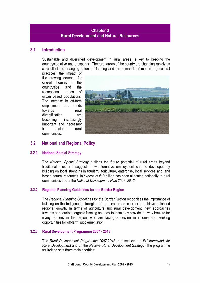
Draft Louth County Development Plan 2009 - 2015 45
Chapter 3 Rural Development and Natural Resources
3.1 Introduction
Sustainable and diversified development in rural areas is key to keeping the countryside alive and prospering. The rural areas of the county are changing rapidly as a result of the changing nature of farming and the demands of modern agricultural practices, the impact of the growing demand for one-off houses in the countryside and the recreational needs of urban based populations. The increase in off-farm employment and trends towards rural diversification are becoming increasingly important and necessary to sustain rural communities.
3.2 National and Regional Policy 3.2.1 National Spatial Strategy
The National Spatial Strategy outlines the future potential of rural areas beyond traditional uses and suggests how alternative employment can be developed by building on local strengths in tourism, agriculture, enterprise, local services and land based natural resources. In excess of €10 billion has been allocated nationally to rural communities under the National Development Plan 2007- 2013.
3.2.2 Regional Planning Guidelines for the Border Region
The Regional Planning Guidelines for the Border Region recognises the importance of building on the indigenous strengths of the rural areas in order to achieve balanced regional growth. In terms of agriculture and rural development, new approaches towards agri-tourism, organic farming and eco-tourism may provide the way forward for many farmers in the region, who are facing a decline in income and seeking opportunities for off-farm supplementation.
3.2.3 Rural Development Programme 2007 - 2013
The Rural Development Programme 2007-2013 is based on the EU framework for Rural Development and on the National Rural Development Strategy. The programme for Ireland sets three main priorities:
Chapter 3 Rural Development and Natural Resources
Draft Louth County Development Plan 2009 - 2015 46
• Improving the competitiveness of the agricultural sector • Improving the environment of the countryside by supporting sustainable land
management practises • Improving the quality of life in rural areas and encouraging diversification of
economic activity.
Under the Rural Development Programme 2007-2013, much of the Border Region is classed under one of the five broad rural area types, namely “Areas that are Changing”. These are areas where population and agricultural employment are in decline and where replacement employment is required.
This programme suggests that to complete the picture, another category of rural areas should be recognised namely ‘Peri-urban Areas’. These are defined as areas close to and under the influence of, main urban centres. Features of such areas include high population densities and levels of commuting to work with relatively low reliance on farming. Much of County Louth falls into this classification.
The council recognises that the restructuring of agriculture, through diversification, is crucial to sustaining the rural economy of Louth and as such, the council will endeavour to facilitate these changes.
Policy RD 1 To support the implementation of the policies identified in the NSS, Regional
Planning Guidelines and Rural Development Programme 2007-2013 pertaining to the sustainable and balanced development of County Louth’s rural areas.
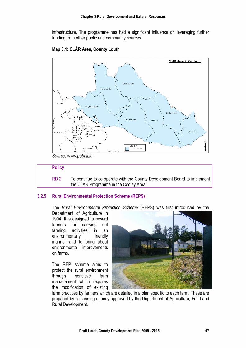
3.2.4 CLAR Programme (Ceantair Laga Árd- Riachtanais)
The CLÁR programme is a targeted investment programme for rural areas which experienced a decline of more than 35% in population since the foundation of the State. Whilst County Louth did not experience such declines, the Cooley Peninsula area of the county was included in the programme due to the serious impact of the foot and mouth outbreak in 2001 which resulted in the total de-stocking of animal herds in the area.
CLÁR contains a range of measures to accelerate the development of physical, community and social infrastructure which would have a clear benefit in terms of employment creation, thus providing opportunities for local people who otherwise would have limited employment opportunities.
These measures include village, community and school enhancement projects and the provision and improvements to broadband, roads, water supply and sewerage
Chapter 3 Rural Development and Natural Resources
Draft Louth County Development Plan 2009 - 2015 47
infrastructure. The programme has had a significant influence on leveraging further funding from other public and community sources.
Map 3.1: CLÁR Area, County Louth
Source: www.pobail.ie
Policy RD 2 To continue to co-operate with the County Development Board to implement
the CLÁR Programme in the Cooley Area. 3.2.5 Rural Environmental Protection Scheme (REPS)
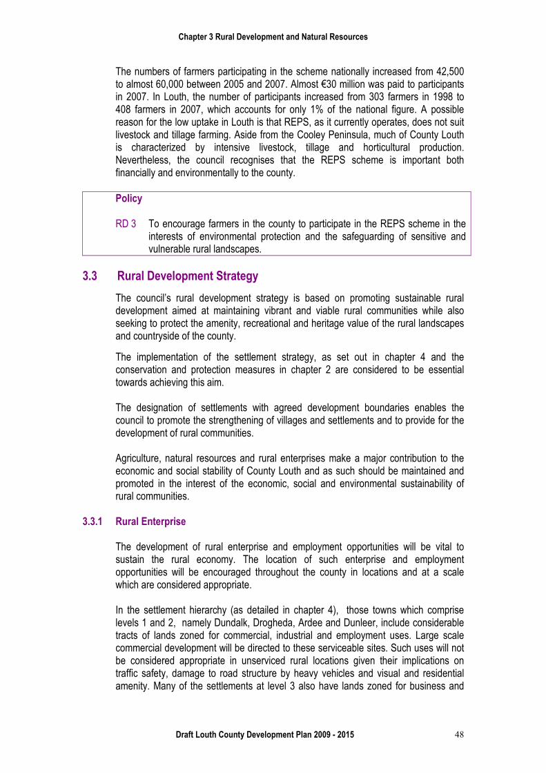
The Rural Environmental Protection Scheme (REPS) was first introduced by the Department of Agriculture in 1994. It is designed to reward farmers for carrying out farming activities in an environmentally friendly manner and to bring about environmental improvements on farms.
The REP scheme aims to protect the rural environment through sensitive farm management which requires the modification of existing farm practices by farmers which are detailed in a plan specific to each farm. These are prepared by a planning agency approved by the Department of Agriculture, Food and Rural Development.
Chapter 3 Rural Development and Natural Resources
Draft Louth County Development Plan 2009 - 2015 48
The numbers of farmers participating in the scheme nationally increased from 42,500 to almost 60,000 between 2005 and 2007. Almost €30 million was paid to participants in 2007. In Louth, the number of participants increased from 303 farmers in 1998 to 408 farmers in 2007, which accounts for only 1% of the national figure. A possible reason for the low uptake in Louth is that REPS, as it currently operates, does not suit livestock and tillage farming. Aside from the Cooley Peninsula, much of County Louth is characterized by intensive livestock, tillage and horticultural production. Nevertheless, the council recognises that the REPS scheme is important both financially and environmentally to the county. Policy RD 3 To encourage farmers in the county to participate in the REPS scheme in the
interests of environmental protection and the safeguarding of sensitive and vulnerable rural landscapes.
3.3 Rural Development Strategy
The council’s rural development strategy is based on promoting sustainable rural development aimed at maintaining vibrant and viable rural communities while also seeking to protect the amenity, recreational and heritage value of the rural landscapes and countryside of the county.
The implementation of the settlement strategy, as set out in chapter 4 and the conservation and protection measures in chapter 2 are considered to be essential towards achieving this aim.
The designation of settlements with agreed development boundaries enables the council to promote the strengthening of villages and settlements and to provide for the development of rural communities.
Agriculture, natural resources and rural enterprises make a major contribution to the economic and social stability of County Louth and as such should be maintained and promoted in the interest of the economic, social and environmental sustainability of rural communities.
3.3.1 Rural Enterprise
The development of rural enterprise and employment opportunities will be vital to sustain the rural economy. The location of such enterprise and employment opportunities will be encouraged throughout the county in locations and at a scale which are considered appropriate.
In the settlement hierarchy (as detailed in chapter 4), those towns which comprise levels 1 and 2, namely Dundalk, Drogheda, Ardee and Dunleer, include considerable tracts of lands zoned for commercial, industrial and employment uses. Large scale commercial development will be directed to these serviceable sites. Such uses will not be considered appropriate in unserviced rural locations given their implications on traffic safety, damage to road structure by heavy vehicles and visual and residential amenity. Many of the settlements at level 3 also have lands zoned for business and
Chapter 3 Rural Development and Natural Resources
Draft Louth County Development Plan 2009 - 2015 49
employment uses which have the potential of providing a spread of employment opportunities throughout the county.
However, it is recognised that certain commercial activities, industrial activities and strategic infrastructure may need to be accommodated in rural areas outside of existing settlements.
Within designated rural settlements, the council will promote the establishment of small incubator units to accommodate new enterprises. The council will facilitate the development of alternative home based micro enterprises of appropriate nature and scale. Policy
RD 4 To secure vibrant and viable rural communities by promoting sustainable development and settlement patterns in rural areas, environmentally friendly agricultural practices and the protection of the natural resources, environment and landscape of the countryside.
RD 5 To encourage the development of alternative rural based enterprises where the scale and nature of such enterprises are not detrimental to the amenity of the area, adjoining dwellings and where the proposal can meet all other planning requirements.
RD 6 To ensure that such new developments do not impinge on areas of special amenity value or on areas designated as sensitive landscapes.
RD 7 To facilitate the location of certain resource based and location specific developments of significant regional or national importance and critical infrastructure projects at suitable locations in rural areas.
3.4 Agriculture
Agriculture is an important source of employment and income in rural areas. The county’s agricultural land bank is not only a source of value in terms of food production, but also a vital ingredient in the county’s character. The 2006 census illustrates that 2.4% of the population of County Louth is employed directly in the agricultural sector. This is equivalent to 1,182 persons. This is a significant a drop from 6% of the population as recorded in the 2002 census of population. Farming is the traditional form of economic activity in rural areas. However, traditional farming methods have undergone significant changes, through increased mechanisation and the emergence of larger commercial farm units. County Louth occupies an area of 82,100 hectares, of which 61, 308 hectares is farmed. In table 3.1 it can be seen that a significant proportion of farms in County Louth, some 47%, operate on farm holdings of less than 20 hectares. The average farm size in the county is 35.1 hectares which is an increase from the average size of 28 hectares in 2001.
Chapter 3 Rural Development and Natural Resources
Draft Louth County Development Plan 2009 - 2015 50
Table 3.1: Farm Sizes in County Louth
Area <10ha 10-20ha 20-30ha 30-50ha 50-100ha >100ha No. of Farms
460
360
250
300
310
90
(%) of Total Farms
26%
21%
14%
17%
17%
5%
Source: www.cso.ie
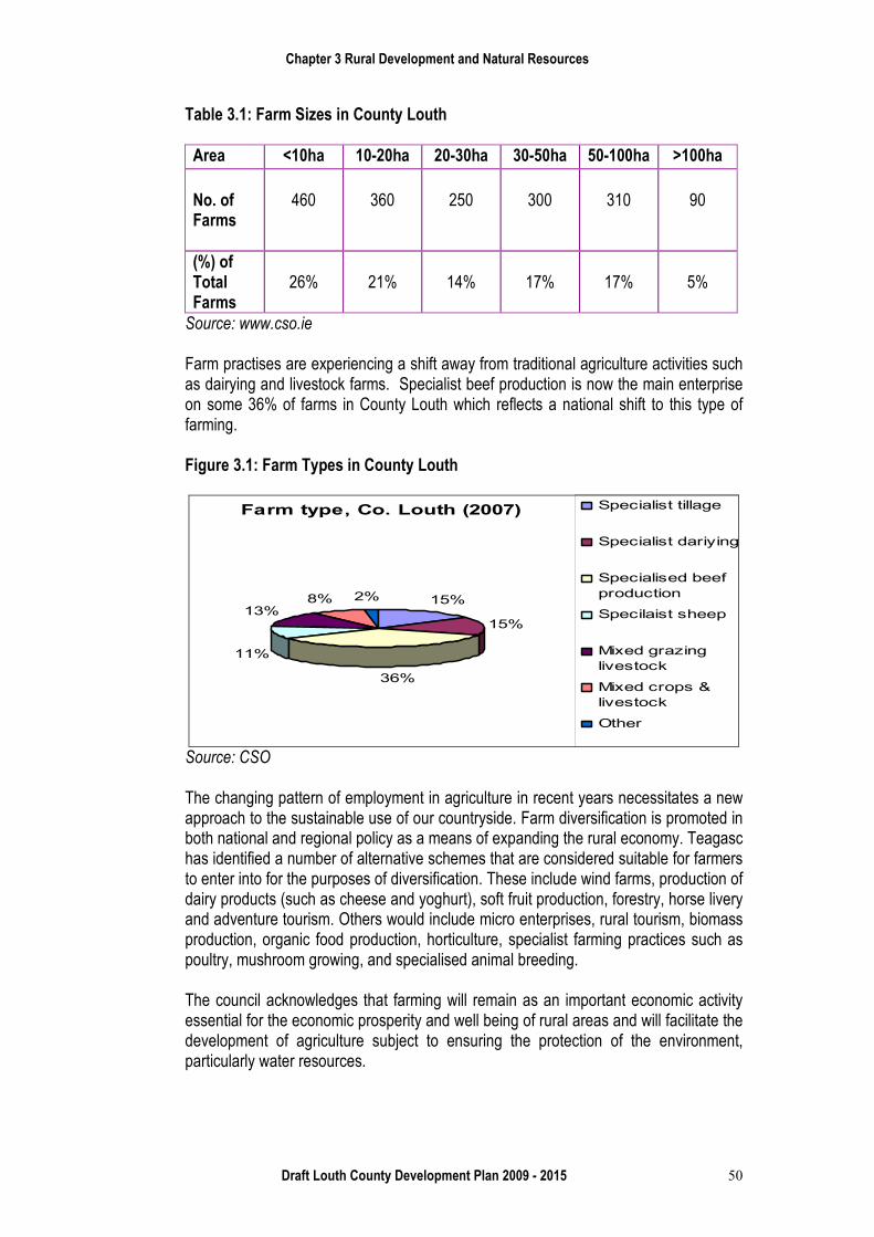
Farm practises are experiencing a shift away from traditional agriculture activities such as dairying and livestock farms. Specialist beef production is now the main enterprise on some 36% of farms in County Louth which reflects a national shift to this type of farming. Figure 3.1: Farm Types in County Louth
Farm type, Co. Louth (2007)
15%
15%
36%
11%
13%8% 2%
Specialist tillage
Specialist dariying
Specialised beef
production
Specilaist sheep
Mixed grazing
livestock
Mixed crops &
livestock
Other
Source: CSO
The changing pattern of employment in agriculture in recent years necessitates a new approach to the sustainable use of our countryside. Farm diversification is promoted in both national and regional policy as a means of expanding the rural economy. Teagasc has identified a number of alternative schemes that are considered suitable for farmers to enter into for the purposes of diversification. These include wind farms, production of dairy products (such as cheese and yoghurt), soft fruit production, forestry, horse livery and adventure tourism. Others would include micro enterprises, rural tourism, biomass production, organic food production, horticulture, specialist farming practices such as poultry, mushroom growing, and specialised animal breeding. The council acknowledges that farming will remain as an important economic activity essential for the economic prosperity and well being of rural areas and will facilitate the development of agriculture subject to ensuring the protection of the environment, particularly water resources.
Chapter 3 Rural Development and Natural Resources
Draft Louth County Development Plan 2009 - 2015 51
Policy RD 8 To maintain a vibrant and healthy agricultural sector based on the principles
of sustainable agriculture and associated activities as a cornerstone of rural development and prosperity.
RD 9 To facilitate the development of agriculture while ensuring that natural waters, wildlife habitats and conservation areas are protected from pollution.
RD 10 To encourage and facilitate agricultural development whilst ensuring that such development does not result in a negative effect on the scenic amenity of the countryside.
RD 11 To encourage and facilitate agricultural diversification into related agri-businesses subject to the retention of the holding for primarily agricultural use and the proper planning and development of the area.
RD 12 To consider farm based diversification which is complementary to the farm and is operated as part of the holding.
RD 13 To encourage rural diversification intended to supplement farm incomes such as production of dairy products, soft fruit production, forestry, horse livery, organic food production and specialist farming practices.
RD 14 To encourage farmers to see themselves as custodians of the countryside and the rural landscapes which are valuable to the present and future generations.
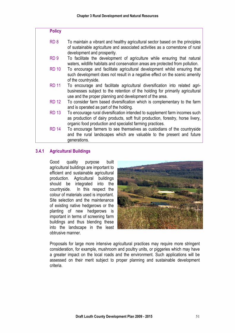
3.4.1 Agricultural Buildings
Good quality purpose built agricultural buildings are important to efficient and sustainable agricultural production. Agricultural buildings should be integrated into the countryside. In this respect the colour of materials used is important. Site selection and the maintenance of existing native hedgerows or the planting of new hedgerows is important in terms of screening farm buildings and thus blending these into the landscape in the least obtrusive manner. Proposals for large more intensive agricultural practices may require more stringent consideration, for example, mushroom and poultry units, or piggeries which may have a greater impact on the local roads and the environment. Such applications will be assessed on their merit subject to proper planning and sustainable development criteria.
Chapter 3 Rural Development and Natural Resources
Draft Louth County Development Plan 2009 - 2015 52
Policy RD 15 To ensure that agricultural buildings are designed and appropriately sited to
integrate into the landscape. RD 16 To ensure that agricultural developments provide adequate waste collection
and storage facilities and adhere to all legislation on water quality including the Water Framework Directive, Nitrates Directive and Phosphorus Regulations.
RD 17 To ensure that agricultural developments are designed and constructed in a manner that will ensure that watercourses and sources of potable water are protected from the threat of pollution.
Where new agricultural developments are proposed, it will be a requirement that the development is well screened by trees and hedgerows and of a colour which permits the structure to satisfactorily blend into its surroundings.
3.5 Rural Tourism and Coastal Areas
Tourism can make a significant contribution to the development of rural areas. It is an aim of the Plan to support rural tourism enterprises that are developed in conjunction with established rural activities and to facilitate the development of agri-tourism. Rural tourism is expanded on in chapter 7 of the Plan.
Policy RD 18 To support tourism enterprises that are developed in conjunction with
established rural activities and to facilitate the development of agri – tourism. 3.5.1 Coastal areas
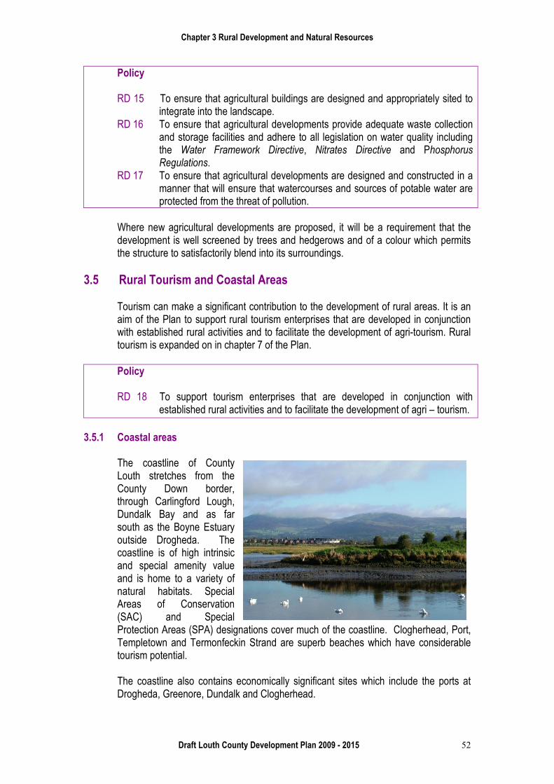
The coastline of County Louth stretches from the County Down border, through Carlingford Lough, Dundalk Bay and as far south as the Boyne Estuary outside Drogheda. The coastline is of high intrinsic and special amenity value and is home to a variety of natural habitats. Special Areas of Conservation (SAC) and Special Protection Areas (SPA) designations cover much of the coastline. Clogherhead, Port, Templetown and Termonfeckin Strand are superb beaches which have considerable tourism potential. The coastline also contains economically significant sites which include the ports at Drogheda, Greenore, Dundalk and Clogherhead.
Chapter 3 Rural Development and Natural Resources
Draft Louth County Development Plan 2009 - 2015 53
The coastline is susceptible to pressure for development which has the potential to encroach on sensitive sites and cause pollution. The coastal waters off County Louth provide an important resource, supporting and generating employment and recreational activities.
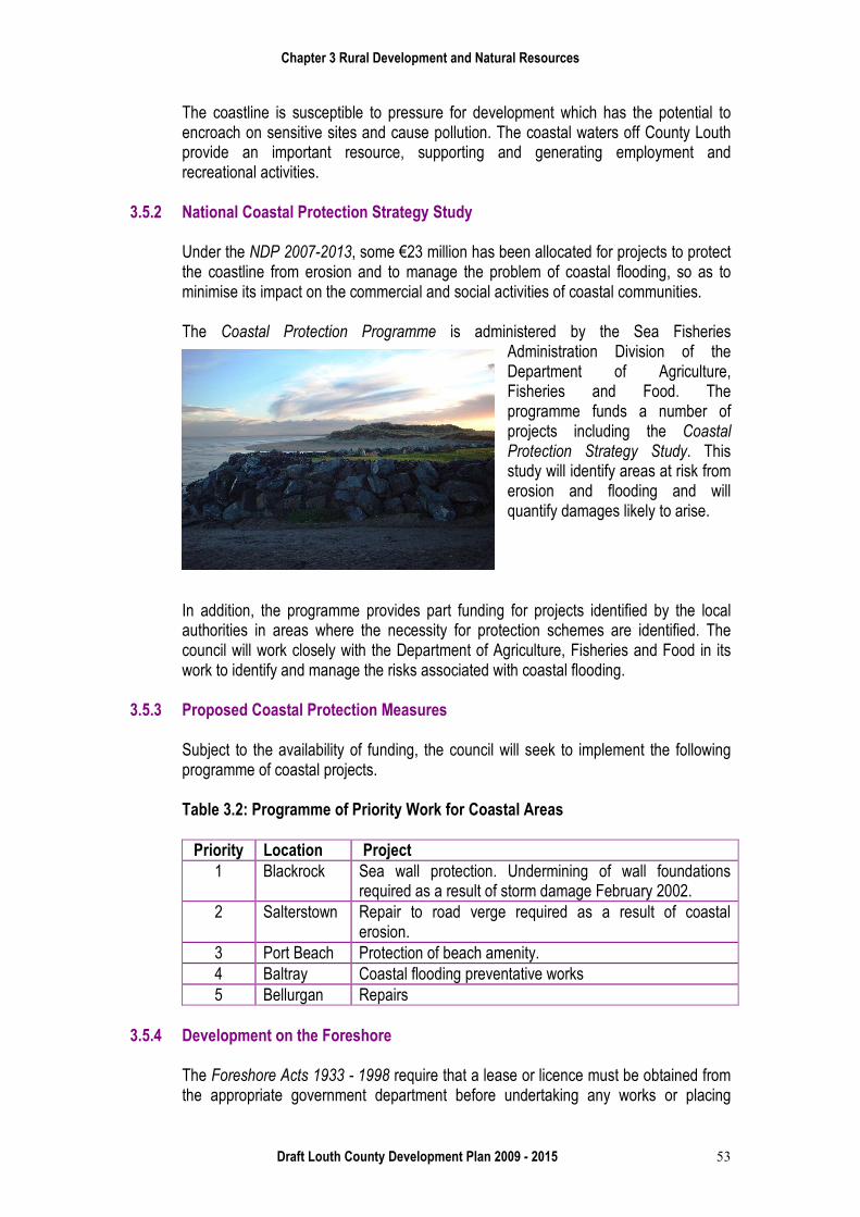
3.5.2 National Coastal Protection Strategy Study
Under the NDP 2007-2013, some €23 million has been allocated for projects to protect the coastline from erosion and to manage the problem of coastal flooding, so as to minimise its impact on the commercial and social activities of coastal communities. The Coastal Protection Programme is administered by the Sea Fisheries
Administration Division of the Department of Agriculture, Fisheries and Food. The programme funds a number of projects including the Coastal Protection Strategy Study. This study will identify areas at risk from erosion and flooding and will quantify damages likely to arise.
In addition, the programme provides part funding for projects identified by the local authorities in areas where the necessity for protection schemes are identified. The council will work closely with the Department of Agriculture, Fisheries and Food in its work to identify and manage the risks associated with coastal flooding.
3.5.3 Proposed Coastal Protection Measures
Subject to the availability of funding, the council will seek to implement the following programme of coastal projects.
Table 3.2: Programme of Priority Work for Coastal Areas
Priority Location Project
1 Blackrock Sea wall protection. Undermining of wall foundations required as a result of storm damage February 2002.
2 Salterstown Repair to road verge required as a result of coastal erosion.
3 Port Beach Protection of beach amenity. 4 Baltray Coastal flooding preventative works 5 Bellurgan Repairs
3.5.4 Development on the Foreshore
The Foreshore Acts 1933 - 1998 require that a lease or licence must be obtained from the appropriate government department before undertaking any works or placing
Chapter 3 Rural Development and Natural Resources
Draft Louth County Development Plan 2009 - 2015 54
structures or materials on, or removal of material from, any state owned foreshore which falls below the high water mark. However, planning permission will be required for any development on the foreshore that is above the high water. Policy RD19 To increase the quality of beaches in the county and in so doing contribute to
the development of the tourism industry and to the enjoyment of the facilities. RD 20 To resist development along the coast which would detract from its visual
appearance or conflict with its recreational and leisure functions. RD 21 To work closely with the Department of Agriculture, Fisheries and Food in its
work to identify and manage the risks associated with coastal flooding. RD 22 To ensure that any development on the foreshore does not detract from the
visual amenities of the coast and the public enjoyment thereof. 3.6 Forestry
In the Republic of Ireland, forest cover at the end of 2007 stood at an estimated 700,000 hectares. This represents approximately 10% of the total land area. Over half of this is in public ownership, primarily Coillte. The Government Forestry Strategy aims to have 17% forest cover by 2030. Its importance in terms of generating economic activity in the countryside is recognised as well as other benefits such as the provision of a sustainable construction material and its role in the promotion of biodiversity. However, it is important that intensive forestry practices do not impinge upon the visual amenity of the landscape or adversely affect the biodiversity in the area.
The overall national policy in relation to forestry is set out in Growing for the Future: a Strategic Plan for the Development of the Forestry Sector in Ireland, 1996. The strategy aims to develop the sector to a scale and in a manner which maximises its contribution to national economic and social well-being on a sustainable basis and which is compatible with the protection of the environment. The draft Indicative Forestry Statement (IFS) ‘The right trees in the right places’ has been developed in the context of a national forest policy and provides high-level, national guidance in relation to the suitability of land for forestation. It also facilitates the establishment of high quality forests serving a variety of purposes including timber production, enhancement of the environment, mitigation of climate change, forest industry development, creation of alternative off farm incomes and opportunities for tourism and amenity use.
The IFS is a map based approach which provides a comprehensive overview of all the opportunities and constraints which exist for forestry in Ireland, at a national level. It sets out four broad categories
• Category 1 Suitable for a range of forest types • Category 2 Suitable for certain types of forest development, • Category 3 Suitable for nature conservation and amenity forests • Category 4 Unsuitable, that is, unproductive or un-plantable areas
Chapter 3 Rural Development and Natural Resources
Draft Louth County Development Plan 2009 - 2015 55
Currently in Louth, Coillte has a total forest area of almost 1400 hectares, of which just over 100 hectares are broad leaf. It also has three recreational sites at Ravensdale, Slieve Foye Wood and Townley Hall.
Initial forestation is exempt under the provisions of the Planning and Development Regulations 2001. Replacement of broad leaf forests by conifer species where the area involved is less than ten hectares is also exempt under the provisions.
Policy RD 23 To support the Government Forestry Strategy in co-operation with Coillte,
which aims to increase forest cover and to encourage state and private forestation, both native broad leaf and coniferous species, in appropriate locations.
3.7 Energy
The policy of the council in relation to energy conservation and generation is detailed in chapter 9. However, in a rural development context, particularly in relation to the production of renewable fuel sources such as wind farms, biomass and solar energy, renewable energy production provides a significant opportunity for the generation of rural based economic activity and employment. The council will have regard to the relevant guidelines concerning such developments including the suitability of the proposed location (see map 9.1), nature of use, scale and feasibility of the proposal. Policy RD 24 To support the development of renewable energy resources in rural areas
where proposals are consistent with the landscape objectives of the Plan, the protection of the natural and built environment and the visual and residential amenities of the area.
RD 25 To consider any individual renewable energy proposal on its merits having regard to the Wind Energy Development Guidelines for Planning Authorities and any other relevant guidance.
3.8 Extractive Industry and Building Materials Production
County Louth has significant deposits of high grade stone, sand and gravel quarries, with substantial building sand reserves in the Cooley area. The council is aware that where such resources exist there will be a demand for their extraction. The council will facilitate the recovery of this important resource subject to the overall protection of the environment. Section 261 of the Planning and Development Act 2000 required the registration of all quarries within the functional areas of planning authorities. A total of twelve quarries have been registered in County Louth. The Quarry and Ancillary Facilities – Guidelines for Planning Authorities document (2004) provides guidance to planning authorities on how to manage the development of extractive industries in a sustainable manner.
Chapter 3 Rural Development and Natural Resources
Draft Louth County Development Plan 2009 - 2015 56
The council will seek to protect established or potential quarry resources from inappropriate development, that would jeopardise their recovery and to safeguard valuable, un-worked deposits for future extraction. During the period of the Plan, the council will consider the feasibility of carrying out an analysis and mapping of aggregate reserves in the county in conjunction with the Geological Survey of Ireland. (GSI) Policy RD 26 To ensure that all existing and proposed quarries comply with the
requirements of the document Quarry and Ancillary Facilities – Guidelines for Planning Authorities, 2004.
RD 27 To prevent development that would hinder the efficient or effective recovery of the county’s aggregate resources.
RD 28 To ensure that the extraction of stone and mineral materials is carried out in a manner that is sustainable and has due regard to the protection of the environment.
RD 29 To refer any application for development to the Geological Survey of Ireland, where it relates to mineral extraction, quarrying developments/extensions and any development involving excavations greater than 50,000m³ in volume or one hectare in area.
3.8.1 Development Management Criteria
In assessing applications for new quarries and extensions to existing quarries, the council will have regard to the following: • Registration of quarries under Section 261 (Control of Quarries) of the Planning
and Development Act 2000. • Visual impact on sensitive landscapes. • Environmental impact and mitigation measures proposed in the environmental
impact statement (EIS) submitted with planning applications, where required. • Require a detailed and progressive restoration and rehabilitation plan for the
aftercare and re-use of the site, to be submitted as part of the proposed development.
• Minimising effects on residential amenity through the imposition of conditions regarding hours of operation, dust and noise emissions.
• Ensure that public roads are not unduly damaged by quarry and pit related traffic and to impose a special contribution on Section 48(2) in respect of any road works which the council is required to carry out to facilitate the development.
• Methods of extraction, noise levels, dust prevention, protection of rivers, lakes and other water sources.
The council welcomes the joint publication of the Irish Concrete Federation and the Geological Survey of Ireland of the document, ‘Geological Guidelines for Extractive Industries’ and will expect that members will operate their quarries in accordance with them.
Chapter 3 Rural Development and Natural Resources
Draft Louth County Development Plan 2009 - 2015 57
3.9 Residential Development in Rural Areas
The council has always recognised and accepted the importance of rural housing in meeting local housing needs and in sustaining rural services such as primary schools, post offices and village shops. The council also accepts what it considers as the legitimate aspirations of people who are born and raised in the countryside wishing to reside within their own community. Specific rural housing policies including qualifying criteria based on local needs is set out in detail in paragraph 4.6 of chapter 4 of this plan.
Policy RD 30 To apply a presumption in favour of granting planning permissions to bone-
fide applicants for rural generated housing where the qualifying criteria set down in chapter 4, (paragraph 4.6) are met and where standards in relation to siting, design, drainage and traffic safety set down in the Plan are achieved.
RD 31 To apply a presumption against urban generated housing in the rural areas of the county or where standards in relation to siting design, drainage and traffic safety set down in the Plan are not achieved.
3.10 Development Zones
In order to ensure development in the countryside takes place in a sustainable and appropriate manner, the county area was divided into six development control zones in the County Development Plan 2003 – 2009. The purpose of these development control zones was to conserve and protect the amenities of rural areas and to promote development in a sustainable manner. These zones also assisted in the operation of the development management function of the council with regard to planning applications for developments in rural areas.
This Plan continues the approach taken in the 2003 – 2009 Plan. Some modifications to the control zone boundaries have been made in light of experience gained during the operation of the previous plan. In this regard it is proposed to amalgamate the areas of the county formerly referred to as Control Zones 5 and 6. Other changes include an extension to Control Zone 4 (green belts), alterations to the boundaries of Control Zone 3 and additional areas incorporated within Control Zone 2. It should be noted that in the interest of clarity, the areas formerly referred to as Control Zones are now referenced as Development Zones 1 to 5. The extent of each of these zones is outlined in map 3.2 in appendix 11. In exercising its development management role, the council will have regard to the strategic objectives of the Development Zones 1 to 5, specific aspects of siting and design and specific policies in relation to development management standards, roads, sanitary services and environmental constraints. In relation to rural housing, the council will be guided by design and siting criteria as set out in the document “Building Sensitively and Sustainably in County Louth” and the guidelines contained in chapter 4 of this Plan.
Chapter 3 Rural Development and Natural Resources
Draft Louth County Development Plan 2009 - 2015 58
3.10.1 Development Zone 1 - To preserve and protect the natural unspoilt physical landscapes.
Zone 1 relates principally to the high mountainous areas of Cooley, Feede, and Ravensdale.
Due to the extremely sensitive landscapes of this zone which include proposed Natural Heritage Areas, Special Conservation Areas and Special Protection Areas (refer to chapter 2), this unspoilt landscape must be protected from harmful development. As such, only very limited development appropriate to these sensitive landscapes will be considered, except by way of extensions to existing authorised uses. Policy RD 32 To permit only very limited development appropriate to these sensitive
landscapes. This would include active recreational amenities such as pedestrian and cycle paths, equestrian trails, ecological corridors, small scale ancillary recreational facilities, agriculture and related activities. Certain unique, location tied or resource based developments and renewable energy schemes will be open to consideration.
RD 33 Development of a residential, commercial, industrial or other similar nature will not be considered appropriate.
3.10.2 Development Zone 2 - To protect the scenic quality of the landscape and
facilitate development required to sustain the existing rural community.
Zone 2 relates to areas that are to be found in the lower regions of the Cooley Mountains, in Upper Faughart, Ardee Bog, Hamilstown, Fieldstown, Monasterboice, Mount Oriel, Dunany Point and the Boyne Valley. The area covered by this development zone contains landscapes of high scenic quality which the council considers should be protected. There is, however, a substantial existing rural population within these areas and the Plan supports the continued vibrancy and vitality of these communities. Policy RD 34 To permit only essential resource and infrastructure based developments
and developments necessary to sustain the existing local rural community. Such development would include limited one-off housing*, farm developments, extensions to existing authorised uses, tourism related projects (excluding holiday homes) and renewable energy schemes.
RD 35 Multi-unit residential, large scale intensive industrial, agricultural and commercial developments or other developments of a similar scale or nature would not be considered appropriate within this zone.
Chapter 3 Rural Development and Natural Resources
Draft Louth County Development Plan 2009 - 2015 59
3.10.3 Development Zone 3 - To protect the recreational and amenity value of the coast.
The coastline of County Louth stretches from the County Down border, along Carlingford Lough and Dundalk Bay to the Boyne Estuary outside Drogheda. It is of considerable intrinsic, special amenity and recreational value. Furthermore, the coastline is home to a variety of natural habitats and many species of flora and fauna. The coastline is protected by a number of statutory designations. Special Areas of Conservation (SAC), proposed Natural Heritage Areas (NHA) and Special Protection Areas (SPA) designations cover much of the coastline. For the purposes of the Plan, the coastline, Zone 3, is that outlined on map 3.2 in appendix 11.
Policy RD 36 To only permit development that would not be detrimental to the visual and
recreational amenities of the coast. Such development would include limited one-off housing*, extensions to existing authorised uses and farmyards, tourism, (excluding holiday homes) leisure and recreation related projects, and renewable energy schemes.
RD 37 Multi-unit residential developments, large-scale intensive agricultural, industrial and commercial developments or other developments of similar scale or nature would not be considered appropriate within this zone.
3.10.4 Development Zone 4 - To provide for a greenbelt area around the urban centres
of Dundalk, Drogheda and Ardee.
It is an objective of the council to preserve a clear distinction between the built up areas of settlements and the surrounding countryside. In this regard, greenbelt areas are proposed surrounding the main urban settlements of Dundalk, Drogheda and Ardee.
Policy RD 38 To permit limited one-off housing*, extensions to existing authorised uses and
farmyards, institutional and educational facilities, tourism, (excluding holiday homes), leisure and recreation related projects and renewable energy schemes.
RD 39 Multi-unit residential, large scale industrial and commercial developments, or other developments of similar scale or nature, would not be considered appropriate within this zone.
3.10.5 Development Zone 5 - To protect and provide for the development of agriculture
and sustainable rural communities and to facilitate certain resource based and location specific developments of significant regional or national importance. Critical infrastructure projects of local, regional or national importance will also be considered within this zone.
Zone 5 encompasses an extensive area of land outside the greenbelts, extending from the eastern section of the Cooley peninsula in the north, to the western boundary of the county, Drogheda in the south and the Irish Sea in the east. Over the past number of years, this area has been subject to increasing pressure for development of one-off
Chapter 3 Rural Development and Natural Resources
Draft Louth County Development Plan 2009 - 2015 60
rural housing and other commercial and industrial type developments due to proximity to Dublin and access to the M1 motorway. This area is extensively farmed and contains some of the finest agricultural land in the county.
It is an objective of this Plan, from both social and economic perspectives, that agricultural activity and local communities should be protected and permitted to develop and prosper in this area. This area also affords opportunities for certain resource based and location specific developments and critical infrastructure projects of significant regional or national importance. Such development proposals will be subject to the provision of adequate environmental and landscape protection and the provisions of the Interchange Strategy. Policy RD 40 To consider developments falling within the following categories; limited one-
off housing*, agricultural developments; developments to be used for leisure, recreation and tourism; holiday accommodation including cottages and lodges where these are part of an existing or proposed integrated tourism complex; hotels/ guest houses / B & B’s; extensions to existing authorised commercial and industrial developments; diversified agricultural activity and farm enterprises; renewable energy schemes, public utility infrastructure, certain resource based and location specific developments of significant regional or national importance and critical infrastructure projects.
RD 41 Multi-unit residential, conventional industrial and commercial development appropriate to existing settlements, developments directly adjacent to rural motorway interchanges would not be considered appropriate within this zone.
*The qualifying criteria in respect of one-off rural housing are set out in Chapter 4.
3.10.6 Summary of Strategy Objectives for each Development Zones 1 to 5. Table 3.3 sets out in summary the strategic objectives for the five Development Zones as set above.
Table 3.3: Strategic Objectives for Development Zones 1 to 5
Zone
Strategic Objective
1 To preserve and protect the natural unspoilt physical landscapes.
2
To protect the scenic quality of the landscape and facilitate development required to sustain the existing rural community.
3
To protect the recreational and amenity value of the coast.
4
To provide for a greenbelt area around the urban centres of Dundalk, Drogheda and Ardee.

Chapter 3 Rural Development and Natural Resources
Draft Louth County Development Plan 2009 - 2015 61
5 To protect and provide for the development of agriculture and sustainable rural communities and to facilitate certain resource based and location specific developments of significant regional or national importance. Critical infrastructure projects of local, regional or national importance will also be considered within this zone.

Chapter 3 Rural Development and Natural Resources
Draft Louth County Development Plan 2009 - 2015 62