Centre Regional Planning Agency6AD7E2DC-ECE4-41CD...Steve Lyncha Kevin Ryan College Township Todd...
38
Serving the Townships of College, Ferguson, Halfmoon, Harris, Patton and the Borough of State College The Centre Region is a Bicycle Friendly Community SM Centre Regional Planning Agency 2643 Gateway Drive, Suite #4 State College, PA 16801 Phone (814) 231-3050 www.crcog.net JOINT MEETING CENTRE REGIONAL PLANNING COMMISSION & COG TRANSPORTATION AND LAND USE COMMITTEE AGENDA Centre Region Council of Governments Office Building 2643 Gateway Drive Thursday October 5, 2017 6:30 p.m. 1. CALL TO ORDER – Ms. Strickland will convene the meeting. 2. INTRODUCTIONS Ms. Strickland will call for introductions. TLU Committee and CRPC Members TLU Committee CRPC Representing Steve Lyncha Kevin Ryan College Township Todd Kirsten Mike Brown Halfmoon Township Frank Harden Roy Hammerstedt Harris Township Janet Whitaker Lisa Strickland, Chair Ferguson Township Jeff Luck, Chair Bill Steudler Patton Township Theresa Lafer, Vice Chair Jon Eich, Vice Chair State College Borough Rob Cooper Steve Watson Penn State University 3. APPROVAL OF MINUTES – The minutes of the September 7, 2017 Centre Regional Planning Commission (CRPC) meeting are enclosed for action by members of the CRPC. The minutes of the September 11, 2017 COG Transportation & Land Use (TLU) Committee meeting are enclosed for action by members of the TLU Committee. 4. CITIZENS’ COMMENTS – For items not on the agenda 5. REGIONAL INTEREST ITEMS – Commission members and TLU Committee members should report on activities in their municipalities that may be of interest to fellow Commissioners, TLU Committee members, and the public.
Transcript of Centre Regional Planning Agency6AD7E2DC-ECE4-41CD...Steve Lyncha Kevin Ryan College Township Todd...

Serving the Townships of College, Ferguson, Halfmoon, Harris, Patton and the Borough of State College The Centre Region is a Bicycle Friendly Community
SM
Centre Regional Planning Agency
2643 Gateway Drive, Suite #4 State College, PA 16801 Phone (814) 231-3050 www.crcog.net
JOINT MEETING
CENTRE REGIONAL PLANNING COMMISSION &
COG TRANSPORTATION AND LAND USE COMMITTEE
AGENDA
Centre Region Council of Governments Office Building
2643 Gateway Drive
Thursday
October 5, 2017
6:30 p.m.
1. CALL TO ORDER – Ms. Strickland will convene the meeting.
2. INTRODUCTIONS
Ms. Strickland will call for introductions.
TLU Committee and CRPC Members
TLU Committee CRPC Representing
Steve Lyncha Kevin Ryan College Township
Todd Kirsten Mike Brown Halfmoon Township
Frank Harden Roy Hammerstedt Harris Township
Janet Whitaker Lisa Strickland, Chair Ferguson Township
Jeff Luck, Chair Bill Steudler Patton Township
Theresa Lafer, Vice Chair Jon Eich, Vice Chair State College Borough
Rob Cooper Steve Watson Penn State University
3. APPROVAL OF MINUTES – The minutes of the September 7, 2017 Centre Regional
Planning Commission (CRPC) meeting are enclosed for action by members of the CRPC.
The minutes of the September 11, 2017 COG Transportation & Land Use (TLU)
Committee meeting are enclosed for action by members of the TLU Committee.
4. CITIZENS’ COMMENTS – For items not on the agenda
5. REGIONAL INTEREST ITEMS – Commission members and TLU Committee members
should report on activities in their municipalities that may be of interest to fellow
Commissioners, TLU Committee members, and the public.

Joint Meeting – Centre Regional Planning Commission &
COG Transportation and Land Use Committee October 5, 2017
Page 2 of 17
Please note that CRPC members will act upon two items requiring CRPC comment
to accommodate municipal meeting schedules prior to discussion of items on the
joint meeting agenda.
6. CRPC CONSENT AGENDA
a. Proposed Zoning Text Amendment for Pet Care Service Facilities within the IRD
District – Ferguson Township
7. CRPC ACTION AGENDA
a. Recommendation on the Act 537 Plan Special Study - Beneficial Reuse Waterline
Extension into Harris Township – Centre Region
8. CRPC/TLU COMMITTEE JOINT MEETING AGENDA
a. Demonstration of ArcGIS On Line (AGOL) Capabilities
b. Student Housing and the Distribution of Transit Trips in the Centre Region
c. Progress Report on the Regional Development Capacity (REDCAP) Report
d. Status of the Comprehensive Plan Implementation Program (CHIP)
9. OTHER BUSINESS
a. Matter of Record – The CRPC will next meet on Thursday November 2, 2017 at
6:30 p.m. in the COG Building Forum Room.
b. Matter of Record – The COG TLU Committee will meet on Monday November 6,
2017 at 12:15 in the COG Building Forum Room.
c. Matter of Record – Comment letters from the CRPC’s September 7, 2017 meeting
are enclosed:
Ferguson Township Official Map
Proposed Text Amendment for Water Production Facilities – Ferguson
Township
Proposed Zoning Map Amendment for the Harner Farm Property –
Ferguson Township
d. Matter of Record – The CRPA’s September 2017 Activity Report is enclosed.
e. Matter of Record – The American Planning Association Pennsylvania Chapter’s
2017 Annual Conference is being held at the Penn Stater from October 22 to 24.
Program and registration information can be found at www.planningpa.org.
10. ADJOURNMENT
Joint Meeting – Centre Regional Planning Commission &
COG Transportation and Land Use Committee October 5, 2017
Page 3 of 17
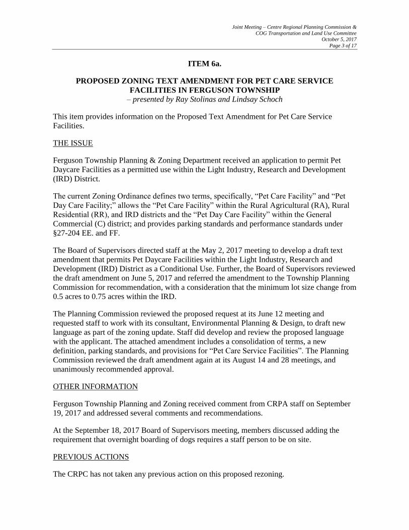
ITEM 6a.
PROPOSED ZONING TEXT AMENDMENT FOR PET CARE SERVICE
FACILITIES IN FERGUSON TOWNSHIP
– presented by Ray Stolinas and Lindsay Schoch
This item provides information on the Proposed Text Amendment for Pet Care Service
Facilities.
THE ISSUE
Ferguson Township Planning & Zoning Department received an application to permit Pet
Daycare Facilities as a permitted use within the Light Industry, Research and Development
(IRD) District.
The current Zoning Ordinance defines two terms, specifically, “Pet Care Facility” and “Pet
Day Care Facility;” allows the “Pet Care Facility” within the Rural Agricultural (RA), Rural
Residential (RR), and IRD districts and the “Pet Day Care Facility” within the General
Commercial (C) district; and provides parking standards and performance standards under
§27-204 EE. and FF.
The Board of Supervisors directed staff at the May 2, 2017 meeting to develop a draft text
amendment that permits Pet Daycare Facilities within the Light Industry, Research and
Development (IRD) District as a Conditional Use. Further, the Board of Supervisors reviewed
the draft amendment on June 5, 2017 and referred the amendment to the Township Planning
Commission for recommendation, with a consideration that the minimum lot size change from
0.5 acres to 0.75 acres within the IRD.
The Planning Commission reviewed the proposed request at its June 12 meeting and
requested staff to work with its consultant, Environmental Planning & Design, to draft new
language as part of the zoning update. Staff did develop and review the proposed language
with the applicant. The attached amendment includes a consolidation of terms, a new
definition, parking standards, and provisions for “Pet Care Service Facilities”. The Planning
Commission reviewed the draft amendment again at its August 14 and 28 meetings, and
unanimously recommended approval.
OTHER INFORMATION
Ferguson Township Planning and Zoning received comment from CRPA staff on September
19, 2017 and addressed several comments and recommendations.
At the September 18, 2017 Board of Supervisors meeting, members discussed adding the
requirement that overnight boarding of dogs requires a staff person to be on site.
PREVIOUS ACTIONS
The CRPC has not taken any previous action on this proposed rezoning.

Joint Meeting – Centre Regional Planning Commission &
COG Transportation and Land Use Committee October 5, 2017
Page 4 of 17
CONSISTENCY WITH THE COMPREHENSIVE PLAN
Ferguson Township Planning & Zoning staff feels the proposed text amendment is generally
consistent with the following Goals, Objectives and Policies of the 2013 Centre Region
Comprehensive Plan:
Sustainable and Smart Development Practices:
Objective 3.2: Locate the majority of industrial development within the Regional Growth
Boundary in accordance with sound land planning principles and the needs of industry.
Policy 3.2.5: Secondary uses in industrial zoning districts should be consistent with
the purpose of the industrial district and be limited to those uses necessary to support
the primary industrial use, such as administrative offices and retail sales of products.
The applicant that submitted the zoning ordinance text amendment requested that pet
care service be allowed within areas such as the Industrial Research and
Development district to accommodate professionals working in adjacent facilities.
Additionally, pet care services are not widely available as an ancillary use that may
compliment an area such as the IRD.
Objective 3.3: Balance the amount of vacant commercially zoned property with the needs
of the Centre Region.
Policy 3.3.4: Given the adequacy of the existing amount of commercially zoned land,
the Centre Region municipalities should encourage the redevelopment of existing
commercial property and the development of vacant commercial lands that have
appropriate infrastructure.
Pet care service facilities are an example of a land use that can succeed within an
existing commercial property already containing necessary infrastructure.
RECOMMENDATION
Staff recommends that the CRPC support this item and direct staff to send a letter indicating
such to the Ferguson Township Board of Supervisors.
ATTACHMENT
1. Proposed Pet Care Service Facilities Zoning Ordinance Text Amendment
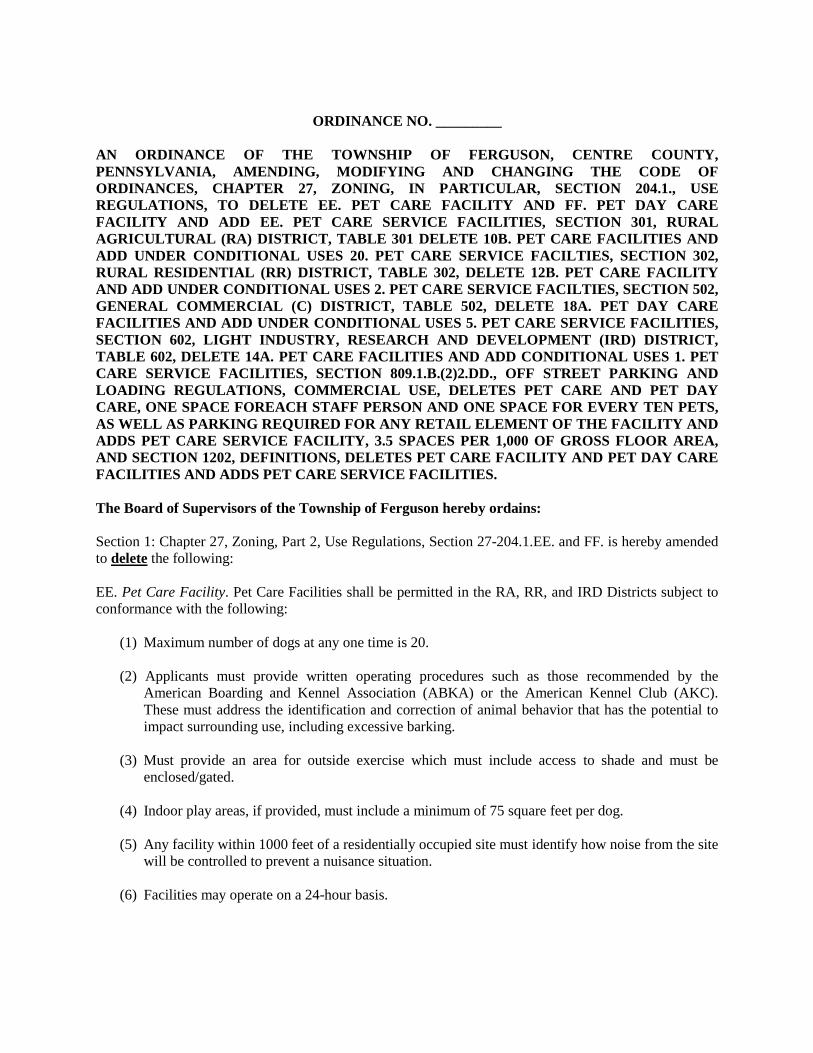
ORDINANCE NO. _________
AN ORDINANCE OF THE TOWNSHIP OF FERGUSON, CENTRE COUNTY,
PENNSYLVANIA, AMENDING, MODIFYING AND CHANGING THE CODE OF
ORDINANCES, CHAPTER 27, ZONING, IN PARTICULAR, SECTION 204.1., USE
REGULATIONS, TO DELETE EE. PET CARE FACILITY AND FF. PET DAY CARE
FACILITY AND ADD EE. PET CARE SERVICE FACILITIES, SECTION 301, RURAL
AGRICULTURAL (RA) DISTRICT, TABLE 301 DELETE 10B. PET CARE FACILITIES AND
ADD UNDER CONDITIONAL USES 20. PET CARE SERVICE FACILTIES, SECTION 302,
RURAL RESIDENTIAL (RR) DISTRICT, TABLE 302, DELETE 12B. PET CARE FACILITY
AND ADD UNDER CONDITIONAL USES 2. PET CARE SERVICE FACILTIES, SECTION 502,
GENERAL COMMERCIAL (C) DISTRICT, TABLE 502, DELETE 18A. PET DAY CARE
FACILITIES AND ADD UNDER CONDITIONAL USES 5. PET CARE SERVICE FACILITIES,
SECTION 602, LIGHT INDUSTRY, RESEARCH AND DEVELOPMENT (IRD) DISTRICT,
TABLE 602, DELETE 14A. PET CARE FACILITIES AND ADD CONDITIONAL USES 1. PET
CARE SERVICE FACILITIES, SECTION 809.1.B.(2)2.DD., OFF STREET PARKING AND
LOADING REGULATIONS, COMMERCIAL USE, DELETES PET CARE AND PET DAY
CARE, ONE SPACE FOREACH STAFF PERSON AND ONE SPACE FOR EVERY TEN PETS,
AS WELL AS PARKING REQUIRED FOR ANY RETAIL ELEMENT OF THE FACILITY AND
ADDS PET CARE SERVICE FACILITY, 3.5 SPACES PER 1,000 OF GROSS FLOOR AREA,
AND SECTION 1202, DEFINITIONS, DELETES PET CARE FACILITY AND PET DAY CARE
FACILITIES AND ADDS PET CARE SERVICE FACILITIES.
The Board of Supervisors of the Township of Ferguson hereby ordains:
Section 1: Chapter 27, Zoning, Part 2, Use Regulations, Section 27-204.1.EE. and FF. is hereby amended
to delete the following:
EE. Pet Care Facility. Pet Care Facilities shall be permitted in the RA, RR, and IRD Districts subject to
conformance with the following:
(1) Maximum number of dogs at any one time is 20.
(2) Applicants must provide written operating procedures such as those recommended by the
American Boarding and Kennel Association (ABKA) or the American Kennel Club (AKC).
These must address the identification and correction of animal behavior that has the potential to
impact surrounding use, including excessive barking.
(3) Must provide an area for outside exercise which must include access to shade and must be
enclosed/gated.
(4) Indoor play areas, if provided, must include a minimum of 75 square feet per dog.
(5) Any facility within 1000 feet of a residentially occupied site must identify how noise from the site
will be controlled to prevent a nuisance situation.
(6) Facilities may operate on a 24-hour basis.
lcromell
Typewritten Text
Ferguson Township Proposed Pet Care Service Facilities Zoning Ordinance Text Amendment
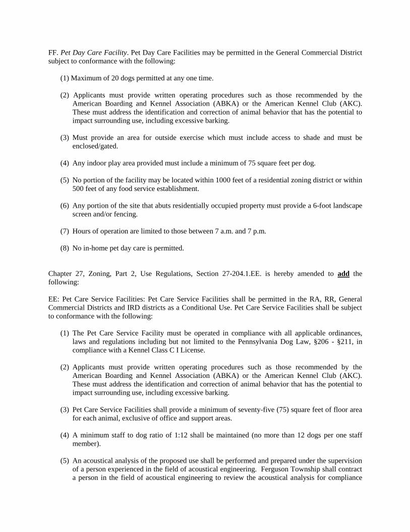
FF. Pet Day Care Facility. Pet Day Care Facilities may be permitted in the General Commercial District
subject to conformance with the following:
(1) Maximum of 20 dogs permitted at any one time.
(2) Applicants must provide written operating procedures such as those recommended by the
American Boarding and Kennel Association (ABKA) or the American Kennel Club (AKC).
These must address the identification and correction of animal behavior that has the potential to
impact surrounding use, including excessive barking.
(3) Must provide an area for outside exercise which must include access to shade and must be
enclosed/gated.
(4) Any indoor play area provided must include a minimum of 75 square feet per dog.
(5) No portion of the facility may be located within 1000 feet of a residential zoning district or within
500 feet of any food service establishment.
(6) Any portion of the site that abuts residentially occupied property must provide a 6-foot landscape
screen and/or fencing.
(7) Hours of operation are limited to those between 7 a.m. and 7 p.m.
(8) No in-home pet day care is permitted.
Chapter 27, Zoning, Part 2, Use Regulations, Section 27-204.1.EE. is hereby amended to add the
following:
EE: Pet Care Service Facilities: Pet Care Service Facilities shall be permitted in the RA, RR, General
Commercial Districts and IRD districts as a Conditional Use. Pet Care Service Facilities shall be subject
to conformance with the following:
(1) The Pet Care Service Facility must be operated in compliance with all applicable ordinances,
laws and regulations including but not limited to the Pennsylvania Dog Law, §206 - §211, in
compliance with a Kennel Class C I License.
(2) Applicants must provide written operating procedures such as those recommended by the
American Boarding and Kennel Association (ABKA) or the American Kennel Club (AKC).
These must address the identification and correction of animal behavior that has the potential to
impact surrounding use, including excessive barking.
(3) Pet Care Service Facilities shall provide a minimum of seventy-five (75) square feet of floor area
for each animal, exclusive of office and support areas.
(4) A minimum staff to dog ratio of 1:12 shall be maintained (no more than 12 dogs per one staff
member).
(5) An acoustical analysis of the proposed use shall be performed and prepared under the supervision
of a person experienced in the field of acoustical engineering. Ferguson Township shall contract
a person in the field of acoustical engineering to review the acoustical analysis for compliance

with this section of the ordinance and participate in inspections of the site prior to opening. All
township expenses borne by the acoustical engineering review shall be paid by the applicant. The
acoustical analysis shall evaluate existing and projected noise levels, noise attenuation measures
to be applied, and the noise insulation effectiveness to eliminate animal noise from reaching
adjacent properties and neighborhoods. This is to ensure that any noise impacts to sensitive uses
are adequately mitigated. The specific noise attenuation provisions identified in the analysis
(padded walls, acoustical panels, etc.) shall be indicated on the construction drawings prior to the
issuance of any permits. The person preparing the report shall, under the direction of a person
experienced in the field of acoustical engineering, perform an inspection of the site prior to the
opening of the business to the public to ensure that noise attenuation measures are implemented
as recommended by the acoustical expert. A final certificate of occupancy or building inspection
for the proposed use shall not be issued until this condition of approval is satisfied.
(6) Signs shall be posted, instructing dog owners to keep dogs on leashes and other domestic pets
with carriers until they are inside the facility to assist with animal control measures in the pick-up
and drop-off area.
(7) Outdoor areas shall provide a minimum of 500 ft.2 of fenced space. Outside areas must include
access to shade and must be enclosed and gated. Animals will always be supervised outdoors and
shall be allowed between the hours of 7:00 a.m. and 7:00 p.m. A maximum of five (5) dogs shall
occupy the outdoor exercise and run at any time between these hours.
(8) Fencing surrounding exercise areas and/or runs shall be of a sufficient height to prevent escape
and shall be buried as part of installation to prevent escape by digging beneath the fences.
(9) All animal quarters and runs are to be kept in a clean, dry and sanitary condition.
(10) Hours of operation and dog pick-up and drop-off are limited to those between 7:00 a.m. and 7:00
p.m. Overnight boarding shall be allowed in designated areas on the premise with the requirement
that a staff member be on-site during overnight hours. The overnight boarding area within the
establishment shall not exceed 50% of the total gross floor area of the business.
(11) No unlicensed animals shall be accepted into the facility. Pet owners shall provide the owners of
the Pet Care Service Facilities an individual pet record of all vaccinations.
(12) Animal waste shall be picked up from the outdoor portion of the property daily. Storage of
animal waste shall utilize air-tight containers or in-ground, septic style digesters. Applicants for
Pet Care Service Facilities shall acquire all necessary DEP permitting for in-ground, style waste
disposal facilities.
(13) Any portion of the site that abuts residentially occupied property or the side or rear yard area that
contains outdoor areas must provide a 6-foot sound buffering landscape screen and/or fencing.
(14) The retail sale of pet products and food shall not exceed 25% of the total gross floor area of the
business.
(15) The minimum lot size shall be five (0.5) acres within the General Commercial district, (0.75)
acres within the IRD district and (1.0) acre within the RA and RR districts.
Section 2: This amendment reorganizes Chapter 27, Zoning, Part 2, Use Regulations, Section 27-
204.1.FF. Veterinary Office/Clinic through RR. Domestic Chickens.

Section 3: Chapter 27, Zoning, Part 3, Rural Agricultural (RA) district, Table 301 delete 10B. Pet Care
Facilities and add under conditional uses 20. Pet Care Service Facilities.
Section 4: Chapter 27, Zoning, Part 3, Rural Residential (RR) district, Table 302, delete 12B. Pet Care
Facility and add under Conditional Uses 2. Pet Care Service Facilities.
Section 5: Chapter 27, Zoning, Part 5, General Commercial (C) district, Table 502, delete 18a. Pet Day
Care Facilities and add under Conditional Uses 5. Pet Care Service Facilities.
Section 6: Chapter 27, Zoning, Part 6, Light Industry, Research and Development (IRD) district, Table
602, delete 14a. Pet Care Facilities and add Conditional Uses 1. Pet Care Service Facilities.
Section 7: Chapter 27, Zoning, Part 8, Off Street Parking and Loading Regulations, Commercial Use,
Section 809.1.B.(2)2.DD., is hereby amended to delete the following:
DD. Pet Care and Pet Day Care 1 space for each staff person and 1 space for every 10 pets, as
well as parking required for any retail element of the facility
Chapter 27, Zoning, Part 8, Off Street Parking and Loading Regulations, Commercial Use, Section
809.1.B.(2)2.DD., is hereby amended to add the following:
DD. Pet Care Service Facility 3.5 spaces per 1,000 of gross floor area
Section 8: Chapter 27, Zoning, Part 12, Definitions, Section 1202, is hereby amended to delete the
following:
Pet Care Facility - a site utilized for short-term care of domestic animals or household pets. May
include spas, resorts, and/or grooming facilities which provide overnight boarding. No outdoor,
overnight boarding of animals is permitted. [Ord. 888]
Pet Day Care Facilities - the daytime care of domestic dogs or other household pets, belonging to
persons not residing on the premises. Grooming and training services may also be provided at such a
facility, as well as the retail sale of pet food and pet accessories. No outdoor or overnight boarding of
animals is permitted. [Ord. 888]
Chapter 27, Zoning, Part 12, Definitions, Section 1202, is hereby amended to adds the following:
Pet Care Service Facility - A building, structure or portion thereof designed or used for grooming,
boarding, training, daycare or overnight boarding of domestic animals or other household pets. A
portion of the facility used for the retail sale of pet products and food may be accessory to the primary
Pet Care Service Facilities use.
ORDAINED AND AMENDED this 16th day of October, 2017
Ferguson Township Board of Supervisors

___________________________________
Steve Miller, Chairman
[S E A L]
ATTEST:
__________________________
David Pribulka, Secretary

Joint Meeting – Centre Regional Planning Commission &
COG Transportation and Land Use Committee October 5, 2017
Page 5 of 17
ITEM 7a.
2017 ACT 537 SEWAGE FACILITIES PLAN UPDATE - BENEFICIAL REUSE
WATERLINE EXTENSION INTO HARRIS TOWNSHIP
– presented by Mark Boeckel
This item provides the CRPC with an opportunity to provide a formal recommendation
regarding the approval of the 2017 Act 537 Sewage Facilities Plan Update (Special Study)
prepared by Herbert, Rowland, and Grubic (HRG) on behalf of the University Area Joint
Authority (UAJA). The goal of the Special Study is to evaluate the needs and alternatives to
extend the UAJA’s existing reuse water system into Harris Township in order to serve
potential customers such as the Mountain View Country Club and Tussey Mountain Ski Area.
THE ISSUE
HRG, on behalf of the UAJA, prepared a draft Act 537 Plan Special Study to evaluate
extending the Beneficial Reuse water system from its existing terminus in College Township
into Harris Township. An extension of the reuse water system into Harris Township would
allow the UAJA to provide reuse water to potential customers, such as the Mountain View
Country Club and the Tussey Mountain Ski Area.
The Beneficial Reuse Water Project was initially identified in the 2000 Centre Region Act
537 Plan as a disposal alternative for the UAJA. The 2006 Act 537 Plan defines a three phase
Beneficial Reuse water distribution system and states that water produced from the Beneficial
Reuse Project will be reused in the community for industrial, agricultural, and irrigation
purposes. The plan also states that the ultimate goal of the Beneficial Reuse Project is to move
reuse water back to the headwaters of the community, where it can be used to replenish
headwater streams, springs, and groundwater resources.
The current reuse water system extends from the Spring Creek Pollution Control Facility in
Benner Township into portions of College Township, where it is utilized by commercial
customers and for environmental uses. The draft Act 537 Plan Special Study recommends
extending approximately 27,600 linear feet of 12 inch waterline and appurtenances from the
booster station near the Centre Hills Country Club into Harris Township in order to provide
reuse water to the Mountain View Country Club, the Tussey Mountain Ski Area, and potential
customers in the Boalsburg Technology Park along Discovery Drive.
Because the Beneficial Reuse system is utilized to dispose of treated wastewater, the location
of all reuse water infrastructure and distribution lines must be identified in the Centre Region
Act 537 Sewage Facilities Plan. In February 2016, the COG General Forum recommended
that the UAJA prepare an Act 537 Plan Special Study to potentially extend a Beneficial Reuse
waterline into College and Harris Townships. In accordance with guidance from the PA
Department of Environmental Protection (DEP), HRG prepared an Act 537 Plan Special
Study on behalf of the UAJA to evaluate this extension and is pursuing the required review
and approval from the Centre Region.

Joint Meeting – Centre Regional Planning Commission &
COG Transportation and Land Use Committee October 5, 2017
Page 6 of 17
OTHER INFORMATION
At its June 26, 2017 meeting, the COG General Forum initiated a 60-day public comment
period for the 2017 Act 537 Plan Update, which began on June 28, 2017 and ended on August
28, 2017. In addition to initiating the public comment period, the General Forum also referred
the study to the individual municipalities for review and potential comment. CRPA staff
received comments related to the Special Study from the State College Borough Water
Authority (SCBWA), as well as from two Centre Region residents. Each Centre Region
municipality also provided comments to the COG Executive Director in relation to the Special
Study.
Cory Miller, UAJA Executive Director, provided a written response to comments received
during the comment period. At the September 7, 2017 COG Public Services and
Environmental (PSE) Committee meeting, the representative from College Township
requested additional cost-benefit analysis information from the UAJA with regard to the
proposed reuse water line extension. UAJA has since provided College Township with
additional details, as requested. There have been no other requests for information from the
Centre Region municipalities in relation to the municipal and public comments submitted
during the comment period.
Over the past several months, the CRPA has been working with the College Township Water
Authority (CTWA), SCBWA, and UAJA to amend the Source Water Protection Agreement
that was initially signed in 2003. The agreement was intended to allow for the limited
distribution of Beneficial Reuse water in the Region, while protecting the source waters used
by SCBWA and CTWA to produce potable water. Final action on the Act 537 Plan Special
Study was deferred until the Source Water Protection Agreement was amended to the
satisfaction of all parties.
Representatives from the CRPA, CTWA, SCBWA, and UAJA met on September 29, 2017
to discuss the proposed amendments to the Source Water Protection Agreement, and there
appears to be general consensus that the amended agreement is acceptable to all parties. It is
anticipated that each authority will take action on the amended agreement at their October
meetings, which would allow the COG General Forum to consider final action on the Act 537
Plan Special Study at its meeting on October 23, 2017.
PREVIOUS ACTIONS
The CRPC reviewed and discussed municipal and public comments related to the 2017 Act
537 Plan Special Study at its September 7, 2017 meeting.
CONSISTENCY WITH COMPREHENSIVE PLAN
This request is consistent with the Centre Region Comprehensive Plan. Specifically:
Community Facilities Element:
Goal 1: There is a reliable, safe, and cost effective water supply to meet the existing and
future needs of the Centre Region community

Joint Meeting – Centre Regional Planning Commission &
COG Transportation and Land Use Committee October 5, 2017
Page 7 of 17
Objective 1.2: Assure the efficient use of water supplies by encouraging water
conservation, water re-use, and public education about local water resources.
Goal 2: Sewer service in the Centre Region is efficient, cost effective, and adequate to
support future growth.
Objective 2.3: Continue to support the University Area Joint Authority’s efforts to
expand the use of high-purity (beneficial reuse) water through recharge or by
consumption in order to accommodate capacity limitations associated with future
growth.
Sustainability Element:
Goal 2: Adequate infrastructure for sewer service is available within the Regional
Growth Boundary and Sewer Service Area to support growth and development for the
foreseeable future.
Objective 2.2: The Centre Region municipalities should continue to support the
University Area Joint Authority’s efforts to identify customers for the Beneficial
Reuse water.
RECOMMENDATION
CRPA staff supports the UAJA’s efforts to extend its Beneficial Reuse Water System into
Harris Township and recommends that the CRPC consider a motion recommending that the
COG General Forum approve the 2017 Act 537 Plan Special Study.
NEXT STEPS
CRPA staff will prepare a letter with the CRPC recommendation and comments and forward
it to the COG Executive Committee for consideration on a future COG General Forum
agenda. CRPA staff anticipates that the General Forum may consider action on the Special
Study at its October 23, 2017 meeting.
ATTACHMENTS
None

Joint Meeting – Centre Regional Planning Commission &
COG Transportation and Land Use Committee October 5, 2017
Page 8 of 17
ITEM 8a.
DEMONSTRATION OF ARCGIS ONLINE (AGOL) CAPABILITIES
– presented by Jim May and Steve Arnold
This item provides information to the TLU Committee and the CRPC regarding ArcGIS
Online (AGOL). AGOL is a web-based platform that will allow the CRPA to use, create, and
share online maps, GIS layers, and data with the public. The CRPA will use the AGOL
platform to steadily broaden the availability of information regarding planning and zoning
issues and ordinances, specific projects, and other information. The public will be able to
access and query information in ways that were not available from the CRPA until recently.
THE ISSUE
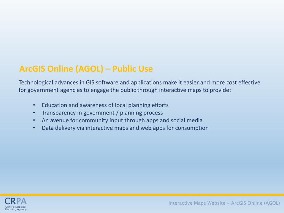
There is a growing trend to deliver data and geographic information via the internet.
Interactive “web maps” and “web apps” have grown tremendously in popularity, usefulness
and importance.
In the internet age, the public expects to find information quickly, easily, and in a concise
manner, whether by home computer, tablet, or smart phone. Technological advances in GIS
software and applications make it easier and more cost effective for agencies such as the
CRPA to engage the public through interactive maps to provide:
Education and awareness of local planning efforts
Transparency in government/planning processes
An avenue for community input through apps and social media
Data delivery via interactive maps and web apps for consumption
In addition to providing information to the public, AGOL can leverage the CRPA’s GIS
capabilities to benefit staff in a way not possible in the past. Some of these benefits include:
Eliminating the need to train staff and managers in GIS and provide GIS software for
each of those individuals which is time consuming, inefficient, and COSTLY
Development of web maps/apps to be shared and used internally, serving a wide
variety of data without the need for training or expensive GIS hardware/software to
use
Sharing or consuming data among other municipal partners now or in the future
All that is needed is an internet connection and the proper organizational credentials to access
AGOL anywhere…at the office, home, or next meeting. The use of the AGOL platform is
consistent with the core services identified in the CRPA Regional Planning Program
Evaluation (accepted by the COG General Forum in August 2015) to strengthen planning-
related educational and learning opportunities in the Region.
PREVIOUS ACTION
There have been no previous actions on this item.

Joint Meeting – Centre Regional Planning Commission &
COG Transportation and Land Use Committee October 5, 2017
Page 9 of 17
RECOMMENDATION
This item is for informational purposes only. No formal action is required by the CRPC or the
COG TLU Committee.
NEXT STEPS
None
ATTACHMENTS
1. Interactive Maps PowerPoint
2. Use this link https://centrecog.maps.arcgis.com/home/index.html to access the CRPA
AGOL organization page if you are interested in seeing a preview of the projects prior
to the meeting.
Interactive Maps Website ArcGIS Online (AGOL)

Interactive Maps Website - ArcGIS Online (AGOL)
There is a growing trend to deliver data and geographic information via the internet. Interactive
“web maps” and “web apps” have grown tremendously in popularity, usefulness and
importance.
Flight Tracker Google Maps (directions) West Penn Power Outages
Interactive Maps
In the internet age, the public expects to find information quickly, easily and in a concise easy to
use manner…. whether by home computer, tablet or smart phone.
Technological advances in GIS software and applications make it easier and more cost effective for government agencies to engage the public through interactive maps to provide:
• Education and awareness of local planning efforts • Transparency in government / planning process • An avenue for community input through apps and social media • Data delivery via interactive maps and web apps for consumption
ArcGIS Online (AGOL) – Public Use
Interactive Maps Website - ArcGIS Online (AGOL)

In addition to providing information to the public, AGOL can leverage the CRPA GIS to benefit staff in a way not possible in the past. Some of these benefits include:
• Eliminating the need to train staff and managers in GIS and provide GIS software for each of those individuals which is time consuming, inefficient and COSTLY
• The CRPA GIS can develop web maps/apps to be shared and used internally serving a wide variety of data without the need for training or expensive GIS hardware/software to use
• Sharing or consuming data among other municipal partners now or in the future All that is needed is an internet connection and the proper organizational credentials to access AGOL anywhere…the office, home or next meeting
The CRPA Interactive Maps Website is here: https://centrecog.maps.arcgis.com/home/index.html
ArcGIS Online (AGOL) – Internal Use
Interactive Maps Website - ArcGIS Online (AGOL)

Joint Meeting – Centre Regional Planning Commission &
COG Transportation and Land Use Committee October 5, 2017
Page 10 of 17
ITEM 8b.
STUDENT HOUSING AND THE DISTRIBUTION OF TRANSIT TRIPS IN THE
CENTRE REGION – presented by Greg Kausch
This item provides information to the TLU Committee and the CRPC regarding student
housing complexes in the Centre Region that currently participate or may participate in the
Centre Area Transportation Authority (CATA) apartment pass program. This program was
pioneered a number of years ago to increase student mobility and transit ridership, mitigate
traffic congestion, and allow property managers to provide added value to their tenants. As
the Centre Region grows and changes—and as new student housing areas are proposed both
within and outside the urban core—CATA can continue to play a demonstrated, vital role in
meeting the transportation challenges associated with these developments. The effectiveness
of transit in meeting these challenges, however, will depend largely on continued investment
in both operations and capital equipment.
THE ISSUE
For a number of years, CATA has participated with area student housing complexes in a
wide-ranging, unique, and innovative program that allows tenants of contracted complexes
to receive a special fixed route transit pass valid for unlimited access to the CATA fixed
community route(s) serving their complex. This apartment pass program:
Currently provides about 2.1 million trips annually, or slightly less than one third of
CATA’s total fixed route ridership.
Serves as a foundational public-private partnership, and a model for potential
universal transit access, studied under the auspices of the Centre County Metropolitan
Planning Organization (CCMPO) in 2013.
Removes a number of single-occupant vehicle trips from the road—particularly in
the Vairo Boulevard, Martin Street, North Atherton Street, and Waupelani Drive
corridors, as well as on the campus of Penn State University. Removing these single-
occupant vehicle trips helps reduce traffic congestion and highway infrastructure
investment.
Provides apartment complex owners and management firms with a valuable amenity
that can be passed on to their individual tenants, and reduces parking requirements and
traffic impact mitigation measures, helping these complexes to compete more
effectively in the marketplace.
Over the past several years, a handful of new student housing complexes have come on-line,
and have been brought into CATA’s apartment pass program. These include: Blue Course
Commons (retrofit to student focus), The View, The Heights, The Retreat, and Villas at
Happy Valley. These new partnerships have increased CATA’s fixed route ridership on core
routes, assisted in reducing traffic congestion, allowed CATA to provide a higher level of
service to the benefit of other non-student populations within the community, and helped to
contribute to the success of these newer complexes, while enhancing quality of life for student
residents.

Joint Meeting – Centre Regional Planning Commission &
COG Transportation and Land Use Committee October 5, 2017
Page 11 of 17
As the Centre Region continues to grow and change, a number of additional new student
housing areas are either proposed, planned, approved, or under construction. CATA’s
apartment pass program provides a proven, workable model that can be applied to meeting
some of the transportation challenges associated with these potential new developments. In
order for the agency to play its most effective role, however, continued investment and
involvement in the planning process is critical. Transit considerations will need to be designed
and built into new developments to allow CATA to maximize operational efficiency,
convenience, and safety. Moreover, CATA will need to maintain and increase its pool of
rolling stock to meet the demand of a changing, increasing, and more geographically
dispersed customer base.
PREVIOUS ACTION
There have been no previous actions on this item.
RECOMMENDATION
This item is for informational purposes only. No formal action is required by the CRPC or the
COG TLU Committee.
NEXT STEPS
None
ATTACHMENTS
None

Joint Meeting – Centre Regional Planning Commission &
COG Transportation and Land Use Committee October 5, 2017
Page 12 of 17
ITEM 8c.
2017 UPDATE OF THE REGIONAL DEVELOPMENT CAPACITY REPORT
– presented by Greg Garthe
This item provides the CRPC and COG TLU Committee information on the Regional
Development Capacity (REDCAP) Report. The REDCAP Report estimates the development
potential within the Regional Growth Boundary (RGB) and Sewer Service Area (SSA) of the
Centre Region, assesses the ability of that potential to accommodate forecasted growth, and
examines the ability of the Region’s sewer system to support forecasted growth or a full
buildout of the growth boundary under existing municipal regulations. The first REDCAP
Report was completed in 2012, and a minor update was completed in 2014. A full update is
completed every five years.
THE ISSUE
The majority of development in the Centre Region is directed inside the RGB and SSA, where
public infrastructure such as water, sewer, transportation, broadband internet, natural gas, and
emergency services are most efficiently provided, and where permitted development densities
require public sewer infrastructure. The REDCAP Report is a tool used to analyze the
remaining development capacity inside this boundary. Areas outside the boundary are not
considered because they are not intended to support the majority of the Region’s growth and
are not served by the public sewer system.
The REDCAP estimates are based on an inventory of vacant or partially developed land with
plans for additional development inside the growth boundary. CRPA staff developed a
methodology to identify, classify, and calculate the development potential of these properties,
and is working with municipal planners to complete the land inventory. The number of
approved dwelling units and the amount of non-residential square footage are generated by
reviewing approved land development plans. For the purposes of this analysis, properties with
proposed plans—including subdivision plans, land developments that are still in the
preliminary stages but have had some level of review by a municipality, and approved master
plans where specific land development plans have not yet been approved for each phase—are
considered approved developments to account for what is likely to be constructed upon final
plan approval.
The potential maximum development capacity of vacant properties is estimated by
referencing the existing zoning district standards of each municipality. Beginning in 2017,
the REDCAP will forecast the additional impacts expected to result from major proposed
rezonings or redevelopments. Staff has relied heavily on the local knowledge and professional
judgment of the municipal planning staffs for this part of the analysis, and only properties
likely to rezone or redevelop within the next five years have been considered.
The major findings of the report will include summaries of:
The developable land inside the growth boundary
The remaining number of residential dwelling units inside the growth boundary
The remaining square feet of non-residential development inside the boundary

Joint Meeting – Centre Regional Planning Commission &
COG Transportation and Land Use Committee October 5, 2017
Page 13 of 17
The adequacy of the land inside the growth boundary to accommodate forecasted
growth through 2040
The UAJA’s ability to accommodate forecasted growth through 2040
The UAJA’s ability to accommodate a full buildout of the growth boundary under
existing municipal regulations
OTHER INFORMATION
Most of the developed areas inside of the RGB and SSA are served by the public sewer
system owned and operated by the University Area Joint Authority (UAJA). The wastewater
treatment capacity at the UAJA plant is shared by the Region’s municipalities, and the
authority does not have an unlimited ability to discharge the treated wastewater to Spring
Creek. The average daily discharge to Spring Creek is limited to 6.0 million gallons per day
(MGD) by the UAJA’s National Pollutant Discharge Elimination System (NPDES) permit—a
requirement of the United States Environmental Protection Agency.
The REDCAP Report is not a market feasibility study, nor does it attempt to speculate on the
availability of a particular parcel of land, the affordability of land, the availability or capacity
of existing or future infrastructure, or the rate of development in the future. The major
findings in the report are intended to inform discussions by the COG municipalities in order to
plan for, determine the effectiveness of, or amend plans, policies, or recommendations related
to the RGB and SSA and its impacts on treatment or discharge limits of the UAJA, as well as
other issues that may benefit from this information.
CRPA staff coordinated a meeting with the Region’s municipal planners on September 15,
2017 to review the REDCAP methodology and process and to receive municipal input. CRPA
staff and the municipal planners will continue to collaborate on municipal data collection and
verification in order to complete the REDCAP estimates of remaining residential and non-
residential development potential inside the RGB and SSA.
PREVIOUS ACTIONS
There have been no previous actions by the CRPC on this item.
CONSISTENCY WITH THE COMPREHENSIVE PLAN
This project supports many Goals, Objectives, and Policies of the 2013 Centre Region
Comprehensive Plan. In particular, this work relates to the areas of Land Use, Housing,
Community Services & Facilities, and Sustainability.
RECOMMENDATION
The CRPC should review the attached draft Executive Summary and presentation and provide
comments to the CRPA and municipal staff.

Joint Meeting – Centre Regional Planning Commission &
COG Transportation and Land Use Committee October 5, 2017
Page 14 of 17
ATTACHMENTS
1. Draft Executive Summary: 2017 Centre Region Regional Development Capacity
Report
NEXT STEPS
A first draft of the full report, with complete municipal data, will be brought back to the
CRPC for review at a future meeting.

Regional Development Capacity Report - Centre Region
October 2017 Page 1 of 3
EXECUTIVE SUMMARY
The 2017 Regional Development Capacity (REDCAP) Report estimates the total amount of
development potential within the Regional Growth Boundary/Sewer Service Area (RGB/SSA) of the
Centre Region, assesses the ability of that potential to accommodate forecasted growth, and
examines the capacity of the Region’s sewer system to support anticipated growth.
Since the mid-1970s, the Centre Region has planned for and implemented a series of policies that
direct growth to areas where infrastructure exists in order to preserve prime agricultural lands,
natural areas, and other sensitive environmental resources in the Centre Region. The Centre
Region used these growth management policies to establish the Regional Growth Boundary that
was initially included in the 2000 Centre Region Comprehensive Plan update.
In the early 1990s, the Pennsylvania Department of Environmental Protection (DEP) approved the
Centre Region Act 537 Sewage Facilities Plan, which established the Sewer Service Area (SSA). The
Plan also limited the average annual discharge from the University Area Joint Authority’s (UAJA)
Spring Creek Pollution Control Facility to Spring Creek to 6.0 Million Gallons per Day (MGD) based
on thermal loading restrictions. Spring Creek is designated as a High-Quality Coldwater Fishery by
the Pennsylvania Department of Environmental Protection (DEP), which requires that the
temperature of the water not exceed certain parameters. Additionally, the UAJA is only permitted
to discharge a specific amount of nitrogen into the waterway in accordance with the Chesapeake
Bay Tributary Strategy.
In late 1990s, the municipal elected officials of the Centre Region evaluated fourteen alternatives to
the traditional discharge of treated wastewater into Spring Creek. The Region was seeking a way to
meet the projected wastewater treatment needs of the community and allow for economic growth,
while also protecting Spring Creek and its tributaries and encouraging effective water management
practices consistent with High-Quality Coldwater Fishery designation. Each of the alternatives was
analyzed on its cost, feasibility, environmental impacts, and community perception. The beneficial
reuse of reclaimed water was determined to be the best long-term and sustainable option, and the
elected officials voted to support it as the preferred alternative for the Region.
The Beneficial Reuse Project is an advanced wastewater treatment method that produces high
quality water through microstraining, microfiltration, and reverse osmosis. The Centre Region uses
this high quality water for groundwater recharge, economic development, or similar projects.
Additionally, the Beneficial Reuse Project expands the wastewater discharge capacity for the Centre
Region by removing the amount of nitrogen that is introduced to Spring Creek each day.
The boundaries of the RGB and SSA were brought together with the 2006 Act 537 Plan update. The
boundary has had a significant influence on the location of growth and development in the Centre
Region and has affected the quality of life experienced by residents by directing urban growth to

Regional Development Capacity Report - Centre Region
October 2017 Page 2 of 3
where it is most appropriate, while preserving the rural character of the Region outside of the
boundary. As indicated in a community survey completed in the summer of 2011, residents of the
Region continue to overwhelming support the Comprehensive Plan policies that implement the
intent of the Regional Growth Boundary, including preservation of farming, preservation of open
space, and directing the majority of growth to areas inside the RGB/SSA.
The REDCAP Report estimates the total development potential of vacant properties and the
remaining development potential of partially developed properties within the RGB/SSA. This
REDCAP update also estimates the redevelopment potential of significant properties inside the
RGB/SSA that have been previously considered for redevelopment and that have at least a
conceptual plan associated with them. Potential properties that may be redeveloped in the next
five years are determined using the professional judgment of local planning staff in each
municipality.
One fundamental question the REDCAP Report attempts to answer is whether there is sufficient
land to accommodate forecasted residential and non-residential growth within the RGB/SSA until
2040. The major findings of this report include information on total and remaining development
capacity of vacant land with and without approved development plans. The findings are based on
the number of approved or potential dwelling units, non-residential square footage, and the
amount of vacant land within the RGB/SSA. The findings are compared to growth forecasts for the
Region in order to provide an answer to whether sufficient capacity exists, or whether it may be
appropriate for the Region to consider an expansion of the RGB/SSA.
Another fundamental question, in addition to the amount of buildable land, is whether the UAJA
can accommodate the forecasted development within the RGB/SSA. The estimates of potential
dwelling units and non-residential square footage presented in this report are used to forecast
potential sewage flows in order to determine when the UAJA is likely to reach its maximum
permitted discharge capacity. That is perhaps the most important outcome of this report.
Overall, the major findings conclude that there is/is not sufficient land inside the RGB/SSA to
provide capacity to accommodate forecasted growth for a planning horizon of at least 2040 without
the need to expand the RGB/SSA. The horizon of 2040 provides consistency with future
Comprehensive Plan Update cycles and with the growth forecasting project completed for the
Centre County Long Range Transportation Plan. In addition, the findings conclude that the UAJA
will/will not be able to support, at full buildout, the total amount of development that the land
within the RGB/SSA could accommodate.
The findings of the REDCAP Report can act as a tool for municipal officials to identify, plan for,
strengthen, and amend existing policies and practices as appropriate, such as Subdivision and Land
Development Ordinances (SALDO) or Zoning Ordinances, which are two of the most significant tools
that are used in conjunction with the RGB/SSA to manage growth.

Regional Development Capacity Report - Centre Region
October 2017 Page 3 of 3
Upon discussing the findings of the 2017 REDCAP Report, Centre Region municipal officials many
want to consider a more detailed assessment of the following issues to prepare for the longer-term
implementation of the RGB/SSA to manage growth in the area:
1. The Development of Regional Impact (DRI) process, which is the method for expanding the
RGB/SSA is scheduled for a five-year review in 2018. Given that there is/is not sufficient
development capacity inside the RGB/SSA, what other DRI criteria could the Centre Region
review to assess impacts, and how soon should that occur?
2. All municipalities, with the exception of Halfmoon Township, have land inside the RGB/SSA.
How should the Centre Region address potential sewage disposal needs of Halfmoon
Township if there is a desire to develop at a density that requires sewage disposal beyond
individual or community on-lot disposal systems (COLDS)? The Township is considering a
DRI for a portion of the eastern end of the Township that may bring public sewer to this
area of the Region.
3. Should the Centre Region consider funding a project to document and quantify the long-
term costs of installing new infrastructure to serve new development versus the costs of
using existing infrastructure (i.e. water, sewer, police, fire, transportation, and other public
services)?
4. Are existing municipal zoning districts within and outside the RGB/SSA effectively
implementing the current policy? If not, what changes to existing zoning districts should
municipalities consider to make them more compatible with the RGB/SSA (currently
underway)?
5. How adequate is the inventory of existing and approved commercial land in the Region?
Should the Region consider changes, such as conversion to residential or industrial, if there
is an excess amount of commercial land?
6. Is the current distribution of beneficial reuse water flexible enough to satisfy the need for
additional customers (50% environmental users and 50% business users), or does it leave
the region vulnerable in the long-term? Should the Region consider changes to the
beneficial reuse distribution system to maximize potential uses and delivery of beneficial
water to new users in the future?
The REDCAP is fully updated every five years. The first REDCAP was completed in 2012 and a
minor update was completed in 2014. The 2014 REDCAP minor update introduced some
changes requested by municipal officials, and this update includes additional changes to provide
a better picture of the Region’s development capacity.

Joint Meeting – Centre Regional Planning Commission &
COG Transportation and Land Use Committee October 5, 2017
Page 15 of 17
ITEM 8d.
COMPREHENSIVE PLAN IMPLEMENTATION PROGRAM (CHIP)
– presented by Jim May
This item provides information to the TLU Committee and the CRPC regarding the CHIP
process, including an overview of the process, progress made on on-going projects, and
anticipated projects for the 2018 calendar year. Recommendations for potential 2019 projects
should be deferred until the joint CRPC/TLU Committee meeting in April 2019.
Specific information can be found in the “Comprehensive Plan Implementation Program –
Project Status Report for Ongoing and Programmed Projects and Consideration of New
Priority Projects for 2019,” which is included as an attachment to this agenda.
Since the last report in April 2017, a number of events have caused some adjustment in the
existing workload. These include:
The CRPA has been given authority to hire a Sustainability Planner to develop
potential regional-level sustainability initiatives and programs.
The resignation of a Senior Planner in August 2017 has deferred some projects.
The General Forum has discussed the potential of preparing an integrated water
resources plan in 2018 or 2019. This is in preliminary discussion, and should be
discussed within the context of a potential Act 537 Plan update in 2018.
Table 1 in the Report provides a summary of projects and organizes projects in six categories.
The categories include:
i. 2016 Completed and Active Projects – This category includes one-time projects
approved in 2015 that were started in 2016 and which the CRPA expects to
complete in 2017. These projects have been completed with the exception of the
Nutrient Management Plan. The CRPA is waiting for information from the UAJA
to document specific impacts of the nitrogen issues at the treatment plant.
ii. 2017 Active and Completed Projects – This category includes one-time projects
approved in 2016 that the CRPA expects to complete in 2017. These six projects
were approved by the COG General Forum for inclusion in the CRPA Annual
Program Plan. This is for information only. No formal action is required on these
projects. Project to “Promote Alternative Energy Options in the Centre Region:
and “Improve the Sustainability of Agriculture” will not be completed this year
due to a vacancy in the Senior Planner position.
iii. 2017 Ongoing/Reoccurring Projects – This category includes projects that are
updated on an annual process and should be included in the overall workload.
This is for information only. No formal action is required on these projects. The
only project in this category is the update of the “Annual State of Housing
Report,” which should be deferred due to the vacancy in the Senior Planner
position.

Joint Meeting – Centre Regional Planning Commission &
COG Transportation and Land Use Committee October 5, 2017
Page 16 of 17
iv. 2017 Inactive Projects in the Queue – These projects were included in the 2016
CHIP process, as recommended by the TLU Committee and the CRPC. They
were not, however, forwarded to the COG General Forum for inclusion in the
CRPA Program Plan. The CRPA Director recommends the following actions for
projects in this category:
That “Cost of Development”, “Pocket Neighborhoods Ordinance”,
“Creation of an Affordable Housing Clearinghouse”, and “Develop an
Inventory of Vacant Non-residential Buildings and Vacant Properties for
the Centre Region” be deleted from consideration.
That “Regional Student Housing Analysis” be considered for 2018. The
CRPA Director has discussed this project with the Planning Directors in
State College Borough and Ferguson Township. All feel there is a need
to have a better understanding of how changes in student housing are
impacting the region.
That “Redevelopment of Older Neighborhoods in Transition/
Redevelopment of Commercial Properties” be integrated into work to be
completed in 2018 related to the potential 2018 Act 537 Plan update.
v. 2017 Active UAJA Projects – These projects were requested by the UAJA and
approved by the COG General Forum. This is for information only. No formal
action is required on these projects.
vi. 2018 Required and Potential Projects – These projects were identified by
CRPA staff based upon expected work that MAY be programmed in 2018.
Although this is an “off year” for preparation of the formal CHIP program, staff
anticipates several of these projects will need to be developed and completed in
2018. The TLU Committee and CRPC unanimously approved a motion to
forward these projects to the COG General Forum for incorporation into the 2018
Program Plan.
RECOMMENDATION
The COG TLU Committee and CRPC should consider the following motions:
1. That the TLU Committee and CRPC move to delete the following projects from
consideration: “Cost of Development”, “Pocket Neighborhoods Ordinance”,
“Creation of an Affordable Housing Clearinghouse”, and “Develop an Inventory
of Vacant Non-residential Buildings and Vacant Properties for the Centre Region”.
2. That the TLU Committee and CRPC move to consider keeping the “Regional
Student Housing Analysis” and direct the CRPA to work with other Planning
Directors to develop a specific program for consideration at the Spring 2018 joint
meeting.

Joint Meeting – Centre Regional Planning Commission &
COG Transportation and Land Use Committee October 5, 2017
Page 17 of 17
3. That “Redevelopment of Older Neighborhoods in Transition/Redevelopment of
Commercial Properties” be integrated into work related to the potential Act 537
Plan update.
ATTACHMENTS
1. Comprehensive Plan Implementation Program – Project Status Report for Ongoing
and Programmed Projects and Consideration of New Priority Projects for 2019
NEXT STEPS
The CRPA Director and staff will continue to work on the existing projects and develop
additional information for the Spring 2018 joint CRPC/TLU Committee meeting.

CENTRE REGIONAL PLANNING AGENCY
Comprehensive Plan Implementation Program
Project Status Report for Ongoing and Programmed Projects and Consideration of
New Priority Projects for 2019
Joint Meeting of the COG Transportation and Land Use Committee and the Centre Regional Planning Commission
October 5, 2017

Centre Regional Planning Agency Page 1 of 4 October 5, 2017
Purpose of the Comprehensive Plan Implementation Program (CHIP)
The Comprehensive Plan Implementation Program, or CHIP for short, provides a list of short-term
projects that the Region should complete to implement the goals, objectives, and policies of the Centre
Region Comprehensive Plan. The CHIP translates the goals, objectives, and policies into actionable
projects and identifies priorities, timeframes, and primary responsibilities to complete the projects.
The CHIP is not a static document, but a dynamic, evolving process that annually involves staff from the
CRPA, municipal planning departments, COG Transportation and Land Use Committee, Centre Regional
Planning Commission, and COG General Forum. The process involves many people to encourage an
organizational environment that supports collaborative regional planning. The process also encourages
a consensus-based approach to identify and implement projects that best meet the needs of all Centre
Region municipalities. The annual CHIP update process will ensure visibility, relevancy of projects, and
regular progress towards achieving Comprehensive Plan goals, objectives, and policies.
Municipal managers, municipal planning staff, and CRPA staff developed the initial list of projects in this
document at a workshop on September 16, 2015. CRPA staff conducted this workshop based upon a
recommendation from the CRPA Regional Planning Program Evaluation requested by the Borough of
State College and accepted by the COG General Forum on August 25, 2015. The recommendation
requested that municipal managers and staff be involved in setting priorities earlier in the CHIP process.
The CHIP uses a public process for recommending priorities to the COG General Forum to implement in the next budget year. The process also includes annual reporting to the General Forum on Comprehensive Plan implementation. In summary, the outcomes of this process:
Proactively engage regional and municipal staffs, and municipal representatives on the CRPC, COG TLU Committee, and COG General Forum in an annual public process to implement the Comprehensive Plan.
Ensure all municipalities have an active role to identify and establish priorities, and reach consensus on the most relevant and beneficial projects and programs the CRPA should undertake to implement the Comprehensive Plan in the short-term.
Provide a systematic process to address and adjust, on an annual basis, regional priorities, needs, and projects to implement long-term goals in the Comprehensive Plan.
Ensure that the Comprehensive Plan remains a dynamic, up-to-date, relevant, and responsive guide for the physical development of the Centre Region.
Project Status Report and Consideration of New Projects
The Status Report provides a summary of ongoing land use planning projects and policy initiatives of the
CRPA. These projects and initiatives were approved for the CRPA to work on in the 2016 and 2017
calendar years. The Status Report does not provide a list of the various land use planning projects and
policy initiatives the COG TLU Committee and the CRPC may consider for the 2019 CHIP. These will be

Centre Regional Planning Agency Page 2 of 4 October 5, 2017
presented for consideration at the joint TLU/CRPC meeting in April 2018. The purpose of this Report is
to provide the COG TLU Committee and the CRPC with an opportunity to understand progress and
estimated completion date for each major project or initiative and make adjustments if necessary. The
Report also is an opportunity to consider new priority projects, and to initially discuss potential work to
incorporate into the 2019 Annual Program Plan for the CRPA.
A full CHIP process will not be completed this year however, the CRPA is requesting that the COG TLU
Committee and the CRPC consider a motion to delete some 2017 inactive projects and review 2018 all
projects in the queue for work in 2018 (see “2018 Required and Potential Projects” in Table 1 below).
The CRPA is requesting the TLU Committee and CRPC to consider this action because there are several
projects and initiatives that are under consideration and development. For example, the RGB and SSA
Implementation Agreement is required to be reviewed in 2018, but the extent of potential amendments
and the staff time required to complete amendments won’t be known until early 2018. Likewise, the
COG General Forum approved the hiring of a Sustainability Planner to being reviewing potential for
regional sustainability efforts and programs. This a new position, but will require additional resources
from the CRPA Director and Principal Planner to manage the effort. A Senior Planner position was
vacated in August of 2017 requiring some regional projects to be deferred until a later date.
At the spring 2017 joint meeting, there was a motion made to put several studies into a single project.
These included:
Redevelopment of Older Neighborhoods in Transition/Redevelopment of Commercial Properties
Pocket Neighborhoods Ordinance
Regional Study Housing Analysis
Create an Affordable Housing Clearinghouse
Table 1
CHIP REGIONAL PLANNING PROJECTS Joint Meeting of the CRPC and COG TLU Committee
October 5, 2017
Year Project Name Percent
Complete Estimated
Completion
2016 COMPLETED PROJECTS
2016
1.Annual State of Housing Report (Erica) 100% Complete
2.Potential Expansion of Beneficial Reuse System in the Centre Region 100% Complete May be integrated into an Act 537 Plan Update
3.Develop a Centre Region Nutrient Management Plan with UAJA 65%
August 2017 TBD May be integrated into an Act 537 Plan Update
4.Joint Sewage Treatment Policy with the UAJA and Penn State University 100% Complete May be integrated into an Act 537 Plan Update

Centre Regional Planning Agency Page 3 of 4 October 5, 2017
2017 ACTIVE AND COMPLETED PROJECTS
2017
1.Utilizing Multi-Municipal Agreements to Share Land Uses (Mark B.) 75% June 2018
Pending opinion from the COG solicitor
2.Planning Commission Training – Planning 101 (Mark B.) 100% Complete
3.Promote Alternative Energy Options within the Centre Region (Erica) 75% Nov. 2017 Recommend deferring completion until 2018
4.Comprehensive Update to the REDCAP Report (Greg) 75% Dec. 2017
On schedule
5.Review and Potential Changes to Administration of the RGB and SSA (Greg) 100% Dec. 2017 Complete
6.Improve the Sustainability of Agriculture (Erica) 25% Nov. 2017
Recommend deferring completion until 2018
2017 ONGOING/REOCCURRING PROJECTS
2017 1.Update to the Annual State of Housing Report (Erica)
10% Jan. 2018 Recommend deferring completion until 2018
2017 INACTIVE PROJECTS IN THE QUEUE
2017
1.Cost of Development (TBD) - -
Delete from consideration
2.Redevelopment of Older Neighborhoods in Transition/Redevelopment of Commercial Properties (TBD) 2018 2018 Integrate with potential Act 537 Plan Update in 2018
3.Pocket Neighborhoods Ordinance (TBD) - -
Delete from consideration
4.Regional Student Housing Analysis (TBD) 2018 2018
Compete in 2018
5.Create an Affordable Housing Clearinghouse (TBD) - -
Delete from consideration
6.Develop an Inventory of Vacant Non-residential Buildings and Vacant Properties for the Region - - Delete from consideration
2017 ACTIVE UAJA PROJECTS
2017
1. Act 537 Plan Special Study – Extension of Beneficial Reuse Water Line into Harris Townships (Mark B.)
100% Sept. 2017 This project is tentatively scheduled for action by the COG General Forum on October 23, 2017.
2.Act 537 Plan Special Study – Meeks Lane Force Main and Pump Station Replacement (Greg)
- 2018/2019 This project is active, and will be initiated when requested by the UAJA. CRPA would request that the UAJA defer until 2018 or 2019

Centre Regional Planning Agency Page 4 of 4 October 5, 2017
2018 REQUIRED AND POTENTIAL PROJECTS
2018
1. Complete training for newly elected officials at the Spring COG TLU Committee and CRPC joint meeting. (TBD)
- April 2018
2. Required Review and Possible Amendments to the RGB and SSA Implementation Agreement (TBD)
- June 2018
3. Annual State of Housing Report (TBD) - -
4. Potential Comprehensive Act 537 Plan Amendment (TBD) - Sept 2018
5. Potential Development of Regional Impact Request – Halfmoon Township (TBD)
- TBD
6. Development assessment of potential regional sustainability initiatives or programs
- June 2019
2019 POTENTIAL PROJECTS
2019
Initial discussion at the joint meeting in April 2018
FUTURE COMPREHENSIVE PLAN IMPLEMENTATION PROGRAM (CHIP) CYCLES
CHIP cycles generally start in the summer when CRPA develops and solicits projects from municipalities. The fall TLU/CRPC meeting starts formal process to review projects and establish priorities. At the spring TLU/CRPC joint meeting, the TLU Committee and the CRPC finalize the priorities and make a recommendation to the COG General Forum for projects to work on in the following year. The CHIP process aligns with the COG-wide Program Plan process and annual detailed budgeting process. Aligning with the Program Plan and detailed budgeting process allows the CRPA to adequately plan for and understand staffing and budgeting issues
CHIP CYCLE YEAR
Fall 2016 Spring 2017
2018 Project Priorities
Fall2017 Spring 2018
2019 Project Priorities(1)
Fall 2018 Spring 2019
2020 Project Priorities
Fall 2019 Spring 2020
2021 Project Priorities(1)
Fall 2020 Spring 2021
2022 Project Priorities
Notes: (1) There is not a formal CHIP process when the fall joint meeting occurs in an odd year. The CRPA will still conduct required joint meetings with the TLU Committee and CRPC to provide an update on ongoing projects. There are generally more than enough projects programmed to provide work for staff for two years. This cycle allows staff more time to work on projects and permits persons elected in the fall to take office and undertake COG committee assignments with some time to transition into their committee roles.

Serving the Townships of College, Ferguson, Halfmoon, Harris, Patton and the Borough of State College The Centre Region is a Bicycle Friendly Community
Centre Regional Planning Agency
2643 Gateway Drive, Suite #4 State College, PA 16801 Phone (814) 231-3050 www.crcog.net
September 8, 2017
Mr. David Pribulka
Township Manager
Ferguson Township
3147 Research Drive
State College, PA 16801
RE: FERGUSON TOWNSHIP – OFFICIAL MAP UPDATE
Dear Dave:
The Joint Articles of Agreement of the Centre Regional Planning Commission (CRPC) require that
the CRPC review any proposed action of a governing body of a participating municipality relating to:
1. The location, opening, vacation, extension, narrowing or enlargement of any street, public
ground, or watercourse;
2. The location, erection, demolition or sale of any public structures located within a
municipality;
3. The adoption, amendment or repeal of any official map, subdivision and land development
ordinance, zoning ordinance or planned residential ordinance.
This process facilitates regional cooperation and coordination by allowing members of the CRPC to
provide advisory comments to the governing body for its consideration.
At its regularly scheduled meeting on September 7, 2017, the CRPC considered the update to the
Township Official Map. The CRPC supports the update and did not offer any additional comments for
the Township Board of Supervisors to consider.
Please call or e-mail if you have questions, or if you require additional information.
Sincerely,
Jim May, AICP
Director
cc: Centre Regional Planning Commission
Greg Garthe, Senior Planner
Ray Stolinas, Ferguson Township Director of Planning and Zoning

Serving the Townships of College, Ferguson, Halfmoon, Harris, Patton and the Borough of State College The Centre Region is a Bicycle Friendly Community
Centre Regional Planning Agency
2643 Gateway Drive, Suite #4 State College, PA 16801 Phone (814) 231-3050 www.crcog.net
September 8, 2017
Mr. David Pribulka
Township Manager
Ferguson Township
3147 Research Drive
State College, PA 16801
RE: FERGUSON TOWNSHIP – PROPOSED ZONING TEXT AMENDMENT FOR
WATER PRODUCTION FACILITIES
Dear Dave:
The Joint Articles of Agreement of the Centre Regional Planning Commission (CRPC) require that
the CRPC review any proposed action of a governing body of a participating municipality relating to:
1. The location, opening, vacation, extension, narrowing or enlargement of any street, public
ground, or watercourse;
2. The location, erection, demolition or sale of any public structures located within a
municipality;
3. The adoption, amendment or repeal of any official map, subdivision and land development
ordinance, zoning ordinance or planned residential ordinance.
This process facilitates regional cooperation and coordination by allowing members of the CRPC to
provide advisory comments to the governing body for its consideration.
At its regularly scheduled meeting on September 7, 2017, the CRPC reviewed the proposed zoning
text amendment for Water Production Facilities. The CRPC supports the amendment and did not offer
any comments for the Township Board of Supervisors to consider.
Please call or e-mail if you have questions, or if you require additional information.
Sincerely,
Jim May, AICP
Director
cc: Centre Regional Planning Commission
Greg Garthe, Senior Planner
Ray Stolinas, Ferguson Township Director of Planning and Zoning

Serving the Townships of College, Ferguson, Halfmoon, Harris, Patton and the Borough of State College The Centre Region is a Bicycle Friendly Community
Centre Regional Planning Agency
2643 Gateway Drive, Suite #4 State College, PA 16801 Phone (814) 231-3050 www.crcog.net
September 8, 2017
Mr. David Pribulka
Township Manager
Ferguson Township
3147 Research Drive
State College, PA 16801
RE: FERGUSON TOWNSHIP – PROPOSED ZONING MAP AMENDMENT FOR
THE HARNER FARM PROPERTY
Dear Dave:
The Joint Articles of Agreement of the Centre Regional Planning Commission (CRPC) require
that the CRPC review any proposed action of a governing body of a participating municipality
relating to:
1. The location, opening, vacation, extension, narrowing or enlargement of any street,
public ground, or watercourse;
2. The location, erection, demolition or sale of any public structures located within a
municipality;
3. The adoption, amendment or repeal of any official map, subdivision and land development
ordinance, zoning ordinance or planned residential ordinance.
This process facilitates regional cooperation and coordination by allowing members of the CRPC
to provide advisory comments to the governing body for its consideration.
At its regularly scheduled meeting on September 7, 2017, the CRPC reviewed the proposed
zoning map amendment for the Harner Farm property. The CRPC offers the following comments
for the Township Board of Supervisors to consider:
1. The CRPC asked that the Board consider if this rezoning would cause a “domino” effect
for other rezoning requests in the West College Avenue corridor between the Harner
property and Pine Grove Mills.
2. The Township should provide a map in the Zoning Analysis clearly showing the property
that is proposed for rezoning.
3. The CRPC asked that the Board encourage mixed use and affordable housing in the
proposed rezoning.
4. The CRPC asked that that Board encourage universal access in some units to make those
homes accessible to everyone to the greatest extent possible regardless of age or ability.
Mr. David Pribulka
Harner Farm Property September 8, 2017
Page 2 of 2
Please call or e-mail if you have questions, or if you require additional information.
Sincerely,
Jim May, AICP
Director
cc: Centre Regional Planning Commission
Greg Garthe, Senior Planner
Ray Stolinas, Ferguson Township Director of Planning and Zoning