Maximizing Energy Efficiency and Renewable Energy in British Columbia
5 3 -?GI Ministry of
Petroleum Resources British Columbia Energy, Mines and
TITLE PAGE AND SUMMARY
/
/ /
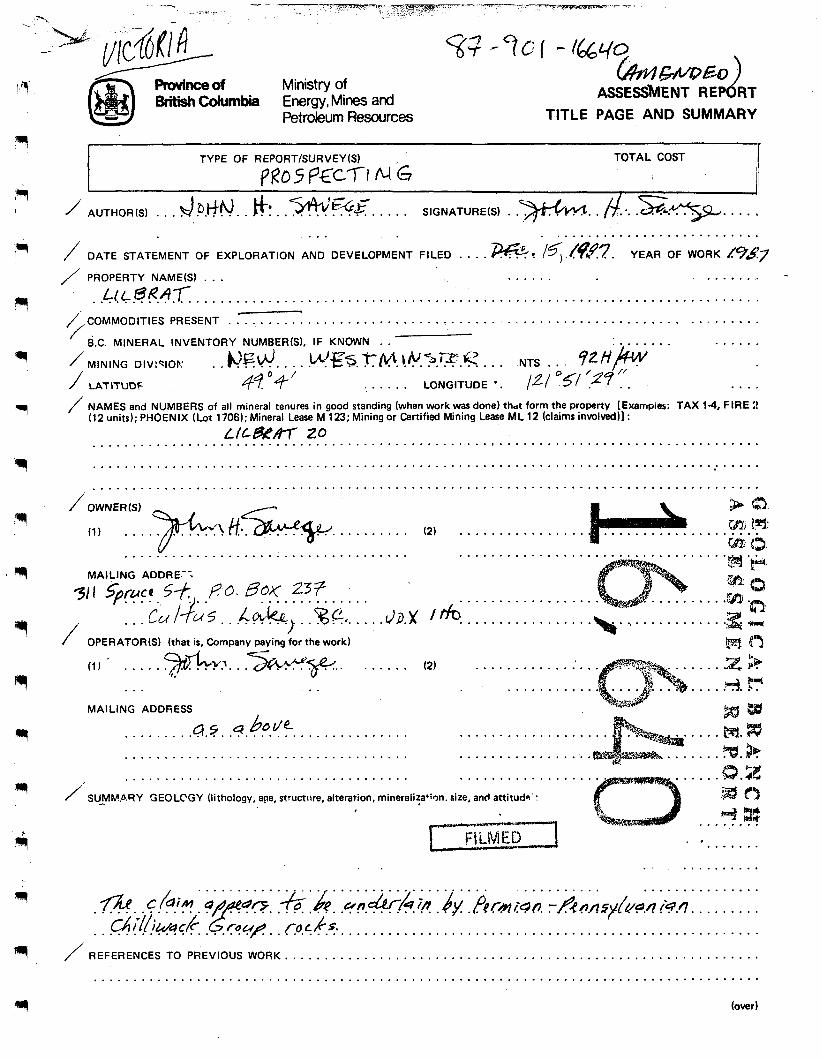
1 TOTAL COST
1 I
AUTHOR(S) . . . d P.kfM. . #: . .%%E. . . . . SIGNATURE(S) . .*. . $ .. .si.-. . . . !, . . . . . . . . . . . . . . . . . . . . . . . . . . . . .
DATE STATEMENT OF EXPLORATION AND DEVELOPMENT FILED . . . . m: /<,&??. YEAR OF WORK 1(%#?7 PROPERTY NAME61 . . . . . . . . . . . . . . . . . . . .L! c.ee.4.T- . . . . . . . . . . . . . . . . . . . . . . . . . . . . . . . . . . . . . . . . . . . . . . . . . . . . . . . . . . . . . . . . . . . . . . .
c--c-. COMMODITIES PRESENT . . . . . . . . . . . . . . . . . . . . . . . . . . . . . . . . . . . . . . . . . . . . . . . . . . . . . . . . . . . . . . . . . . . B.C. MINERAL INVENTORY NUMBER(S1, IF KNOWN . . 5 MINING DIV:TlOF: . . k'Fd.. . . .!#€$.rfl.!@.?,??.I;;'. . . NTS . . qz/ip' * .
. . . . . . LATITUDF LONGITUDE * . /2 / og/ /2? . .
. . . . .
. . . . / NAMES and NUMBERS of all mineral tenures in good standing (when work was done) thdt form the property [Examprer: TAX 14, FIRE 2
(12 units); PHOENIX (Lot 1706); Mineral Lease M 123; Mining or Certified Mining Lease M L 12 (claims involved)] : L/u%4T 20 . . . . . . . . . . . . . . . . . . . . . . . . . . . . . . . . . . . . . . . . . . . . . . . . . . . . . . . . . . . . . . . . . . . . . . . . . . . . . . . . . . . .
. . . . . . . . . . . . . . . . . . . . . . . . . . . . . . . . . . . . . . . . . . . . . . . . . . . . . . . . . . . . . . . . . . . . . . . . . . . . . . . . . . . .
. . . . . . . . . . . . . . . . . . . . . . . . . . . . . . . . . . . . . . . . . . . . . . . . . . . . . . . . . . . . . . . . . . . . . . . . . . . . . . . . . . . . / owNER(s) & (3.
?fa Bfl: 6% 63,
(1) . . . . . . . . . . . . . (2) . . . . . . . . . . . . . . . . . . . . . . . . . . . . . . . . . . . . . . . . . . . . . . . . . . . . . . . . . . . . . . . . . . . . . . . .
MAILING ADDRE--;
/ . . . . . . . 7. %%. . . . . d3.X'
OPERATOR(S) (that is, Company paying for the work)
(1) . . . . . *.\. t; . .5+e-p,. . . . . . .
MAILING ADDRESS
b o L/e . . . . . .a%. .9. . . . . . . . . . . . . . . . . . . . . . . . . . . . . . . . . . . . . . . . . . . . . . . . . . . . . . . . .
I . . . . . . . . . . . . . . . . . . . . . . . . . . . . . .
. . . . . . . . . . . . . . . . . .
.'a. . . . . . . . . . . . . . .
(2) . . . . . . . . . . . . . . . . . . . . . . . . . . . .
. . . . . . . . . . . . . . . . .
. . . . . . . . . . . . . . . . . . . . . . . . . . . . . . . . . . . . . . . . . . . . . . . . . . . . . . . . . . . . . . . . . . . . . .
/'. SU-MKARY GEOLCGY (lithology, age, structure, alteration, minerali:a+ien. size, and attitude' :
. . . . . . . . . . . . . . . . . . . . . .
/ REFERENCES TO PREVIOUS WORK.. . . . . . . . . . . . . . . . . . . . . . . . . . . . . . . . . . . . . . . . . . . . . . . . . . . . . . . . . . . . . . . . . . . . . . . . . . . . . . . . . . . . . . . . . . . . . . . . . . . . . . . . . . . . . . . . . . . . . . . . . . . . . . . . . . . . . . . . . . . . . .
4 (over)
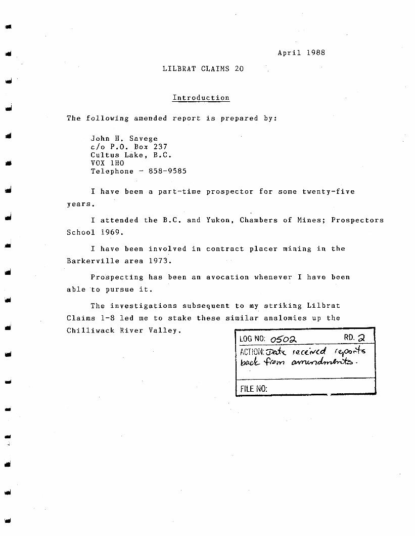
April 1988
LILBRAT CLAIMS 20
Introduction
The following amended report is prepared by:
John H. Savege c/o P.O. Box 237 Cultus Lake, B.C. VOX 1HO Telephone - 858-9585
I have been a part-time prospector for some twenty-five years.
I attended the B.C. and Yukon, Chambers of Mines; Prospectors School 1969.
I have been involved in contract placer mining in the Barkerville area 1973.
Prospecting has been an avocation whenever I have been able to pursue it.
The investigations subsequent to my striking Lilbrat Claims 1-8 led me to stake these similar analomies up the Chilliwack River Valley.
Y
J
LILBRAT CLAIMS 20
d
d
d
Table of Contents
(Keyed to Pages)
Page
Property Description / Map of Physical Description 2
Physiography 3 Map of Physiography - Vertical 5 Map of Physiography - Horizontal 6
Access and Previous Work -7 Object of Present Work $
Theory 4 Interpretation 9
10 Procedure
Discussion II
Conclusion
C.AAWPER Ivur84
i
Y
J
LILBRAT CLAIMS 20
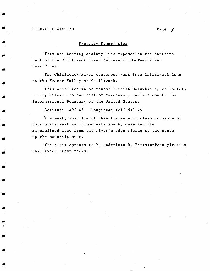
Property Description
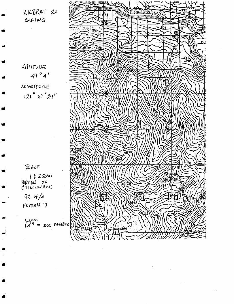
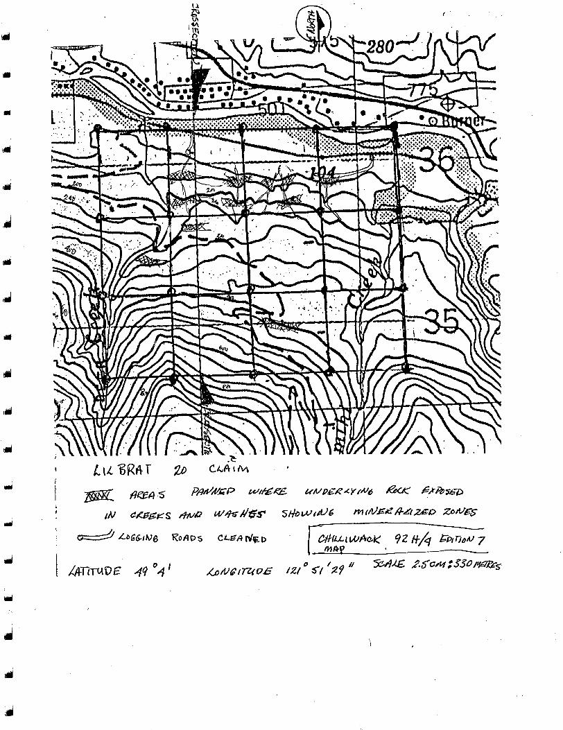
This ore bearing analomy lies. exposed on the southern bank of the Chilliwack River betweenLittleTamihi and Deer Creek.
The Chilliwack River traverses west from Chilliwack Lake to the Fraser Valley at Chilliwack.
This area lies in southwest British Columbia approximately ninety kilometers due east of Vancouver, quite close to the International Boundary of the United States.
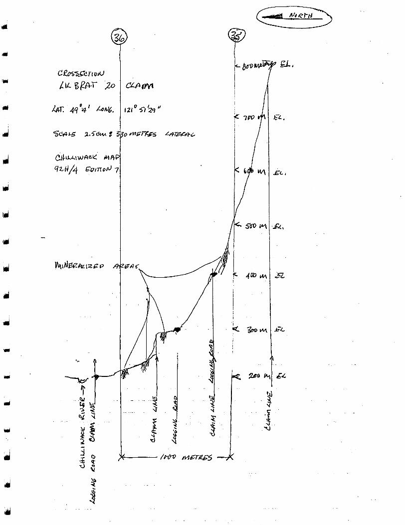
Latitude 49" 4 ' Longitude 1 2 1 " 51' 29"
The east, west lie o f this twelve unit claim consists of four units west and threeunits south, covering the mineralized zone from the river's edge rising to the south up the mountain side.
The claim appears to be underlain by Permain-Pennsylvanian Chilliwack Group rocks.
P
121 * 51 '29 I I
LILBRAT CLAIMS 20
The or
Physiography
zones, are hosted in'a ro
Page 3
klike appearing material commonly described as a type of argillite. This material appears on the exposed portions of the mountainside where slides and creek banks undercutting the overburden. Old logging operations have left skid trails enhancing access along steep hillsides.
This argillaceous material is extremely hard and durable to weathering, thus explaining its existing beyond comparative rock weathering on adjacent mountains. It stands near to vertical approximately 78' rising from &he southern riverbank and approximately 400 meters from tlye water's edge. There is a clay like overburden on the lower elevations suggesting a glacier residue. Through this overburden springs, small streams and slides are exposing the host rock.
The ore zones lie east west rising in altitude up the mountainside striking south at approximately 78'. These zones appear layered one upon another varying in thickness.
4
J
U
d
d
d
G
I
f /m ,
Y ' 3
. .
. -
LILBRAT CLAIMS 20
Access
This group of claims is readily accessed from logging roads and short excursions along skid roads. The area is clean cut logged and re-planted.
Previous Work
This author is not knowledgeable of any previous claims on this type of formation in this area. The geological survey map is reasonably accurate.
LILBRAT CLAIMS 20
Object of Present Work
The work undertaken has been to reestablish some logging skid roads.
Close inspection, panning of small creeks and slides,
microscopic inspection of grab samples have been
undertaken.
The purpose; to establish general attitude of the area and to hopefully locate a localized rich area.
J
w
Y
LILBRAT CLAIMS 20
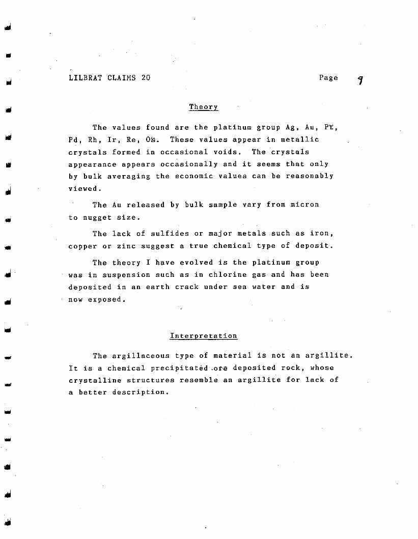
Theory
Y Page
The values found are the platinum group Ag, Au, Pt, Pd, Rh, Ir, Re, OS. These values appear in metallic crystals formed in occasional voids. The crystals appearance appears occasionally and it seems that only by bulk averaging the economic values can be reasonably viewed.
The Au released by bulk sample vary from micron to nugget size.
The lack of sulfides or major metals such as iron, copper or zinc suggest a true chemical type of deposit.
The theory I have evolved is the platinum group was in suspension such as in chlorine gas and has been deposited in an earth crack under sea water and is now exposed.
Interpretation
The argillaceous type of material is not an argillite. It is a chemical precipitated.ore deposited rock, whose crystalline structures resemble an argillite for lack of a better description.
Y
LILBRAT CLAIMS 20 Page 117
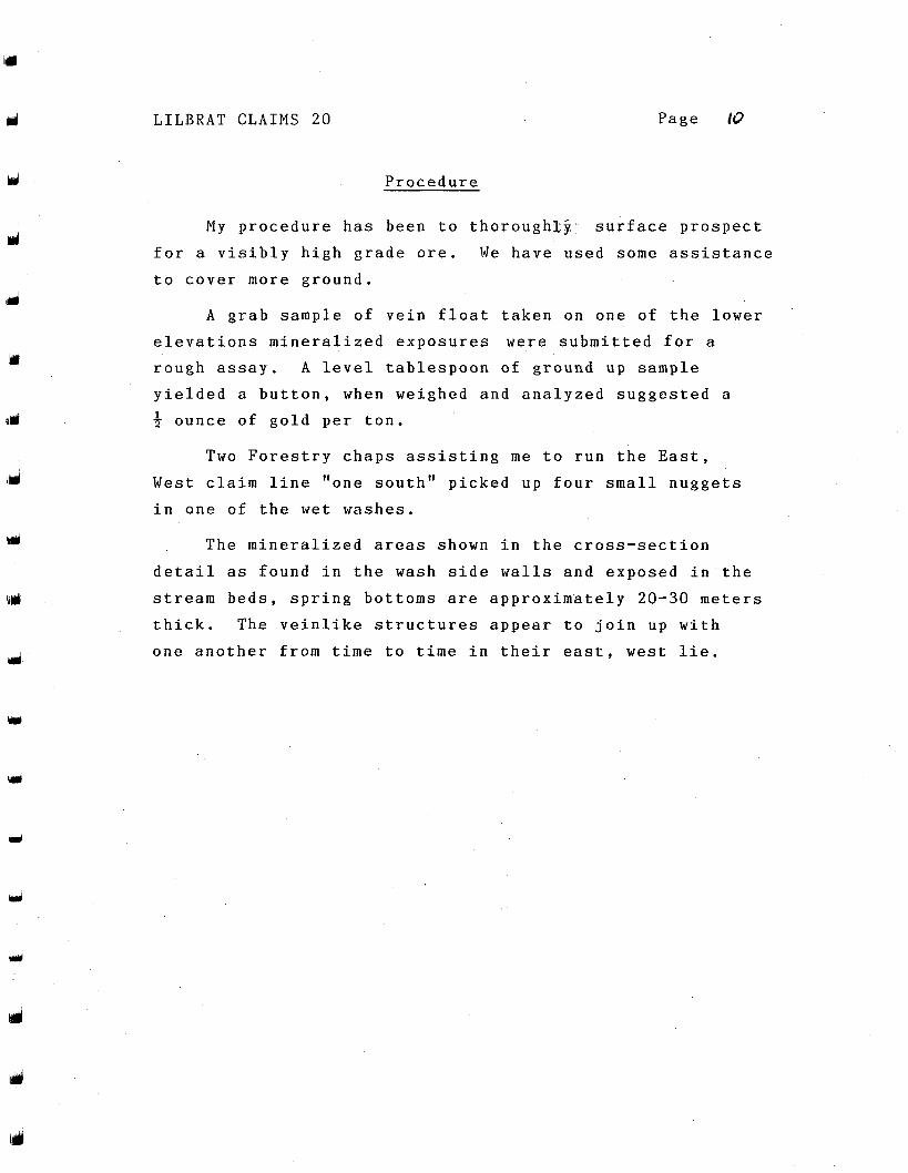
Procedure
My procedure has been to thoroughxji. surface prospect for a visibly high grade ore. We have used some assistance to cover more ground.
A grab sample of vein float taken on one of the lower elevations mineralized exposures were submitted for a rough assay. A level tablespoon of ground up sample yielded a button, when weighed and analyzed suggested a 3 ounce of gold per ton. 1
Two Forestry chaps assisting me to run the East, West claim line "one south" picked up four small nuggets in one of the wet washes.
The mineralized areas shown in the cross-section detail as found in the wash side walls and exposed in the stream beds, spring bottoms are approximately 20-30 meters thick. The veinlike structures appear to join up with one another from time to time in their east, west lie.
J
J
LILBRAT CLAIMS 2 0
Discussion
After panning and microscopic inspection of grab samples, free gold is readily visible.
I have been researching for any practical processes concerning the platinum group. We have partially constructed a processing device to prove the platinum group values and we should be operating early in 1988.
Limited resources and time to pursue these uncharted areas are our limiting factors.
Conclusion
The Lilbrat 20 Claims are economically viable subject only toaneconomical process for the platinum group.
m
Focus of develoment tAans ’!., > . . . .
m I
Gold /mine .for Pierce Mtn. “There’s gold in them thar hills..” projects in B.C., Manitoba and Denver, Col.‘He said Pierce Mountain Resources (PMR) Ltd. hopes to con- these prospects are “primarily involved
vince potential investors of the truth in that saying as it exploration.” pertains to Pierce Mountain, located in the Chilliwack Exploration in the arecof the Pierce Mountain proper- River Valley. ty appears to date from 1898, when the Lone Jack gold
The Pierce Mountain property covers about‘2,000 hec- property pn Red Mountain was staked near the tares in the New Westminster Mining Division. U.S.-Canada border, George said.
Jonathan George, president of Pierce Mountain The Red Mountain mine has‘reported production bet- Resources, said the property was acquired by the com- ween 1914 and 1946 of 46,000 ounces of gold from 80,oOO pany in April, 1987 “to evaluate the economic potential of tons of ore. a gold bearing vein zone between Pierce Mountain and The first published reference to the Pierce Mountain Mt. MacFarlane.” property was by Daly for the Canadian Geological
The company was recently accepted for listing on the Survey of 1901. Daly refers to a gold property being ex- Vancouver Stock Exchange. ploited by G.O. Pierce at an elevation of 5,000 feet.
The Pierce Mountain property is situated in the head- In Daly’s report for 1901, he credits the Pierce Moun- water area of the Pierce Creek, between Slesse and ( I tain property as being the producer of free-milling gold Nesakwatch (Smith) creeks, and between the Chilliwack ore valued at $40 to the ton. River and the United States border. The 1915 report of the B.C. minister of mines describes
George said exploratory work is centred on the moun- several open cuts and a 90-foot shaft that was water- tain between the 4,500- and 6,Wfoot levels. He said filled. The minister’s 1933 report describes prospecting $lOO,oOO will be spent this year “on initial trenching, and activity on Pierce Mountain, but no development. about 1,000 feet of drilling.” The Pierce Mountain property covers British Colum-
He said 1,500 feet more of drilling is planned for next bia Government Mineral Inventory Occurrence MI 92H- year. Projected work for the next three years totals SW 63, called the “Mountain Goat” or “Pierce Moun- about $500,000. tain” prospect.
Mt. MacFarlane, Pierce Mountain and part of Free milling gold reported by Daly in the 1901 report of Grossover Peak are covered by the claim block. The pro- the Geological Survey of Canada and Clothier describes perty is situated 26 kilometres southeast of Chilliwack an assay of $70 in gold to the ton from the shaft zone, and and 23 kilometres south-southeast of Agassiz. “high gold values, up to several hundred dollars to the
George said his company is currently looking at other ton.”
\
1
I
1
I
E
1 G
L
R P
A
C
C.
CI
A:
h
dt . .