BLM h Escalante Bureau of Land Management National ... our last newsletter we have been working with...
4
The BLM is an agency in the US Department of the Interior that manages approximately one-quarter billion acres – more than any other Federal agency. This land, known as the Naonal System of Public Lands, is primarily located in 12 Western states, including Alaska. Approximately 27 million acres of BLM administered lands make up the collecon of Naonal Conservaon Lands, also known as the Naonal Landscape Conservaon System. These include BLM Naonal Monuments, Naonal Conservaon Areas, Wilderness Areas, Wilderness Study Areas, and Naonal Scenic and Historic Trails. The mission of the Naonal Conservaon Lands is to conserve, protect, and restore these naonally significant landscapes that are recognized for their outstanding cultural, ecological, and scienfic values. Title of Resource/Resource Use Bureau of Land Management US Department of Interior Livestock Grazing Plan Amendment EIS NEWSLETTER #4 - August 2015 Grand Staircase-Escalante National Monument BLM - Utah Dear Friends and Neighbors, I am pleased to provide in this newsleer some updates on our Livestock Grazing EIS process, products related to the planning effort, some clarificaon on grazing use levels, and also invite you to aend a restoraon forum and field tour. Since our last newsleer we have been working with our Cooperang Agencies to finalize the Analysis of Management Situaon (AMS) and the Socioeconomic Baseline Study. The AMS describes current condions and trends of resources, uses and acvies in the planning area, and idenfies management opportunies to respond to issues. The Socioeconomic Baseline Study provides an overview of the socioeconomic condions which exist in the planning area and lays out the general concept of social and economic impact analysis that will be used in the planning process. A descripon of these documents and a link to them is included in this newsleer. The topic of restoraon is oſten discussed not only among BLM and our Cooperators, but also locally and statewide, as we look across landscapes and evaluate, establish, and maintain healthy landscapes. BLM and our Cooperators are hosng a two-day Vegetaon Restoraon Forum here in Kanab at the Kanab City Library on August 18 and 19, 2015. We are bringing together a panel of experts to discuss why and how we do vegetaon restoraon, the goals of our restoraon projects, and how we priorize our efforts. I invite you to mark your calendars and join us for a lively and enlightening discussion and an opportunity to go out in the field to see some restoraon projects. Thank you for your interest in livestock grazing management on Grand Staircase-Escalante Naonal Monument, Glen Canyon Naonal Recreaon Area, and other public lands within the planning area. We encourage and look forward to your connued involvement in this important planning process. Sincerely, Cynthia Staszak Monument Manager Grand Staircase-Escalante Naonal Monument Grand Staircase-Escalante Naonal Monument is preparing an amendment to its 2000 Monument Management Plan (MMP). Amending the MMP will integrate livestock grazing and rangeland management with the management of other resources. The amendment will also integrate Glen Canyon Naonal Recreaon Area values and purposes into livestock management decisions for lands within the Naonal Recreaon Area where GSENM administers livestock grazing. This is the fourth in a series of newsleers to keep you informed about the planning process and to announce the availability of the Analysis of the Management Situaon and the Socioeconomic Baseline Report.
Transcript of BLM h Escalante Bureau of Land Management National ... our last newsletter we have been working with...

The BLM is an agency in the US Department of the Interior that manages approximately one-quarter billion
acres – more than any other Federal agency. This land, known as the National System of Public Lands, is
primarily located in 12 Western states, including Alaska. Approximately 27 million acres of BLM administered
lands make up the collection of National Conservation Lands, also known as the National Landscape
Conservation System. These include BLM National Monuments, National Conservation Areas, Wilderness Areas, Wilderness Study Areas, and National Scenic and
Historic Trails. The mission of the National Conservation Lands is to conserve, protect, and restore these nationally significant landscapes that are recognized for
their outstanding cultural, ecological, and scientific values.
Title o
f Re
sou
rce/R
eso
urce
Use
Bureau of Land Management
US Department of Interior
Livestock Grazing Plan Amendment EIS
NEWSLETTER #4 - August 2015
Grand Staircase-Escalante
National Monument
BL
M - U
tah
Dear Friends and Neighbors,
I am pleased to provide in this newsletter some updates on our Livestock Grazing EIS process, products related to the planning effort, some clarification on grazing use levels, and also invite you to attend a restoration forum and field tour.
Since our last newsletter we have been working with our Cooperating Agencies to finalize the Analysis of Management Situation (AMS) and the Socioeconomic Baseline Study. The AMS describes current conditions and trends of resources, uses and activities in the planning area, and identifies management opportunities to respond to issues. The Socioeconomic Baseline Study provides an overview of the socioeconomic conditions which exist in the planning area and lays out the general concept of social and economic impact analysis that will be used in the planning process. A description of these documents and a link to them is included in this newsletter.
The topic of restoration is often discussed not only among BLM and our Cooperators, but also locally and statewide, as we look across landscapes and evaluate, establish, and maintain healthy landscapes. BLM and our Cooperators are hosting a two-day Vegetation Restoration Forum here in Kanab at the Kanab City Library on August 18 and 19, 2015. We are bringing together a panel of experts to discuss why and how we do vegetation restoration, the goals of our restoration projects, and
how we prioritize our efforts. I invite you to mark your calendars and join us for a lively and enlightening discussion and an opportunity to go out in the field to see some restoration projects.
Thank you for your interest in livestock grazing management on Grand Staircase-Escalante National Monument, Glen Canyon National Recreation Area, and other public lands within the planning area. We encourage and look forward to your continued involvement in this important planning process.
Sincerely,
Cynthia Staszak Monument Manager Grand Staircase-Escalante National Monument
Grand Staircase-Escalante National Monument is
preparing an amendment to its 2000 Monument
Management Plan (MMP). Amending the MMP will
integrate livestock grazing and rangeland management
with the management of other resources. The
amendment will also integrate Glen Canyon National
Recreation Area values and purposes into livestock
management decisions for lands within the National
Recreation Area where GSENM administers livestock
grazing.
This is the fourth in a series of newsletters to keep you
informed about the planning process and to announce
the availability of the Analysis of the Management
Situation and the Socioeconomic Baseline Report.

Page 2 - Grand Staircase-Escalante National Monument - Livestock Grazing Plan Amendment / EIS - Newsletter #4 - August 2015
The Planning Area
The planning area includes all public lands within Grand Staircase-Escalante National Monument (GSENM) and public lands for which GSENM has livestock grazing administration responsibility. This includes Bureau of Land Management (BLM) lands within the Monument and additional lands within portions of the Kanab Field Office and the Arizona Strip Field Office as well as lands managed by the National Park Service (NPS) in Glen Canyon National Recreation Area (Glen Canyon). Small areas of additional state, municipal, and private lands also border or are contained within the planning area.
Cooperating Agencies
The BLM invited eligible federal agencies, state and local governments, and Native American tribes to participate as Cooperating Agencies. These agencies were invited to participate because they have jurisdiction by law or have special expertise. Five agencies agreed to serve as Cooperating Agencies:
NPS - Glen Canyon National Recreation Area
State of Utah
Garfield County
Kane County
Natural Resources Conservation Service (NRCS)
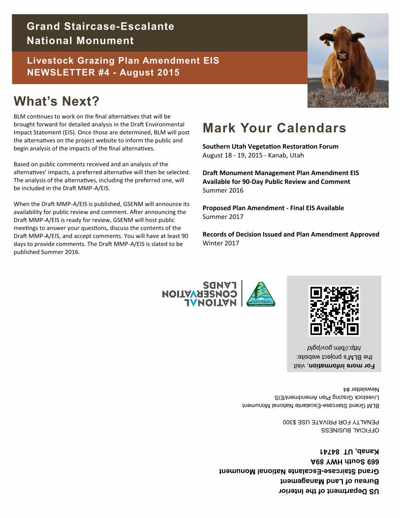
Livestock Grazing Use Levels
During the course of this planning effort we have fielded many questions about grazing use levels on the Monument. Although actual grazing use levels have varied considerably from year to year due to external factors, primarily rainfall and available forage, no reductions in permitted livestock grazing use have been made as a result of the Monument’s designation nearly 20 years ago.
When the BLM talks about the number of cattle permitted to graze on public lands, it uses the term “Animal Unit Month” or AUM. An AUM is the amount of forage needed to sustain one cow and her calf (or one horse) for a month. The total of permitted AUMs on the Monument is 106,202. That number is roughly the same as it has
been since the early 1990s. The fluctuations that have happened in permitted use over the years have been from the addition of AUMs when BLM acquired the School and Institutional Trust Lands within the Monument and some reduction in AUMs when a 1999 amendment to an older management plan, under standard BLM planning processes, closed several allotments and pastures in GSENM and neighboring Glen Canyon, to protect riparian resources and reduce recreation conflicts along perennial streams.
In contrast to permitted use, actual use levels vary from year-to-year. Actual use is the number of cows put out on allotments each grazing season. The ranchers and BLM work together each year to make voluntary use adjustments to the number of cows put out based on monitoring results, weather and the resulting forage produced that season, and the variability in a rancher’s livestock operations. Actual use levels in the planning area have averaged just over 41,000 AUMs annually over the past 20 years.
Analysis of the Management Situation Available The Analysis of the Management Situation (AMS) describes the current resource conditions and trends in resources, as well as uses and activities in the planning area. It presents current management direction from the Monument Management Plan (MMP) and older Management Framework Plans with respect to livestock grazing. The report also identifies opportunities for change in management.
This report can be downloaded from the GSENM website at http://blm.gov/pgld. A hard copy for review is available at the GSENM Offices in Kanab and Escalante during regular business hours (8:00 am – 4:30 pm), Monday through Friday, except holidays:
Kanab BLM Headquarters, 669 HWY 89A, Kanab, Utah 84741
Escalante Interagency Visitor Center, 755 W. Main, Escalante, Utah, 84726

Grand Staircase-Escalante National Monument - Livestock Grazing Plan Amendment / EIS - Newsletter #4 - August 2015 - Page 3
Common Acronyms
AMS - Analysis of Management Situation
BLM - Bureau of Land Management
EIS - Environmental Impact Statement
GSENM - Grand Staircase-Escalante National Monument
Glen Canyon - Glen Canyon National Recreation Area
MMP - Monument Management Plan
MMP-A - Monument Management Plan Amendment
NPS - National Park Service
NRCS - Natural Resources Conservation Service
Socioeconomic Baseline Report Available The Socioeconomic Baseline Report looks at how economic activity affects and is shaped by social processes in and around GSENM. The report provides a “slice in time” overview of the
socioeconomic conditions which exist as a backdrop for the planning effort, and it lays out the general concepts of social and economic impacts analysis which will be applied as part of the planning and decision-making process. In the report, you will find recent economic summaries and charts pertaining to the three counties surrounding GSENM: Kane and Garfield Counties in Utah and Coconino County in Arizona. The report can be downloaded from the GSENM
website at http://blm.gov/pgld. A hard copy for review is available at the GSENM Offices in Kanab and Escalante during regular business hours (8:00 am – 4:30 pm), Monday through Friday, except holidays:
Kanab BLM Headquarters, 669 HWY 89A, Kanab, Utah 84741
Escalante Interagency Visitor Center, 755 W. Main, Escalante, Utah, 84726
Vegetation Restoration Forum - You’re Invited What does “restoration” mean when talking about public lands? Why do restoration? How do you decide where and when to do restoration? How do you actually do restoration? These four seemly simple questions are the focus of a two-day Southern Utah Vegetation Restoration Forum being held August 18 and 19, 2015 in Kanab, Utah. The public is invited and encouraged to attend this free event.
Restoration is returning disturbed areas to a natural array of native plant and animal associations. This may sound easy, but in practice, restoration to a pre-disturbance condition is often very difficult, if not impossible, to achieve. Restoration is more than just returning vegetation to a site; it is also the return of the entire ecosystem, including soil characteristics, water relations, associated wildlife and non-dominant plants. The What, Why, When, Where and How that may be achieved related to restoration efforts will be at the center of the discussion.
The forum has two parts: a panel discussion on restoration starting at 9 a.m. on Tuesday, August 18, at the Kanab City Library, 374 North Main Street; and a field trip to look at restoration sites
on Wednesday, August 19, leaving from the Kanab BLM Headquarters Building, 669 South Highway 89A at 8:45 a.m.
Participants in the Tuesday panel include:
Hal Gordon, Economist, NRCS;
Shane Green, Rangeland Management Specialist, NRCS;
Mary O’Brien, Utah Forests Program Director, Grand Canyon Trust;
Adrienne Pilmanis, Botanist, BLM;
Karen Prentice, Healthy Lands Initiative Coordinator, BLM;
Bruce Roundy, Plant and Wildlife Sciences Faculty, Brigham Young University; and
Jason Vernon, Habitat Restoration Coordinator, Utah Division of Wildlife Resources.
The panel discussion will be recorded and available electronically shortly after the forum concludes.
Wednesday’s field trip will take panel members and interested members of the public out to look at actual restoration sites – the Five Mile Sagebrush Restoration Project; restoration work along Skutumpah Road and Thompson Creek; and along the Coal Road to look at five years of restoration efforts. Participants should bring their own transportation – high-clearance, 4-wheel-drive vehicles are recommended; dress for hot weather and consider the need for a hat, sunglasses and sunscreen; and bring water and a brown bag lunch.
To register to attend the forum discussion, the field trip or both, go to: http://restorationforum.eventbrite.com/ and register. A link to the registration site is also available on our website at: http://blm.gov/pgld.
US Department of the Interior
Bureau of Land Management
Grand Staircase-Escalante National Monument
669 South HWY 89A
Kanab, UT 84741
OFFICIAL BUSINESS
PENALTY FOR PRIVATE USE $300
BLM Grand Staircase-Escalante National Monument
Livestock Grazing Plan Amendment/EIS
Newsletter #4
For more information, visit
the BLM’s project website:
http://blm.gov/pgld
Livestock Grazing Plan Amendment EIS
NEWSLETTER #4 - August 2015
Grand Staircase-Escalante
National Monument
What’s Next?
BLM continues to work on the final alternatives that will be brought forward for detailed analysis in the Draft Environmental Impact Statement (EIS). Once those are determined, BLM will post the alternatives on the project website to inform the public and begin analysis of the impacts of the final alternatives.
Based on public comments received and an analysis of the alternatives’ impacts, a preferred alternative will then be selected. The analysis of the alternatives, including the preferred one, will be included in the Draft MMP-A/EIS.
When the Draft MMP-A/EIS is published, GSENM will announce its availability for public review and comment. After announcing the Draft MMP-A/EIS is ready for review, GSENM will host public meetings to answer your questions, discuss the contents of the Draft MMP-A/EIS, and accept comments. You will have at least 90 days to provide comments. The Draft MMP-A/EIS is slated to be published Summer 2016.
Mark Your Calendars
Southern Utah Vegetation Restoration Forum August 18 - 19, 2015 - Kanab, Utah Draft Monument Management Plan Amendment EIS Available for 90-Day Public Review and Comment Summer 2016 Proposed Plan Amendment - Final EIS Available Summer 2017 Records of Decision Issued and Plan Amendment Approved Winter 2017