regional geolgical mapping in tropical environments using landsat

1
Applications and Data Environments BreakoutGroup IV: Regional Data Environment
Paul PisanoFederal Highway Administration
Office of Transportation Operations
Randy ButlerFederal Highway AdministrationOffice of Operations and Freight
Mobility and Environment Workshop - November 30, 2010
Karl WunderlichNoblis

Today’s Exercise(Part 1) Scorecards
• Feedback materials provided in the breakout rooms
– Application scorecards
– 3 poker chips (for voting)
• Facilitators will brief assumptions about the data environment that applications can draw upon
• Facilitators will clarify application evaluation criteria
• Consider a set of (up to 12) IntelliDrive application concepts
– Facilitators provide one slide that describes the application
– Field questions and clarifying discussion
– Individually, you rate the application (HIGH, MEDIUM, LOW) against the criteria on your scorecard
2

Today’s Exercise(Part 2) Voting
• Once you have scored each application, each participant votes for the three most promising applications
– “Most promising”: strong potential for transformative impact, low deployment risk, and clear alignment with IntelliDrive program goals
– BLUE = 3 points (top priority)
– RED = 2 points (second-highest priority)
– WHITE = 1 point (third-highest priority)
– Deposit your chips in the voting bins identified for each application(also turn in your scorecards)
• Quick break (5 minutes) to tabulate the results
• Reconvene to consider results within each breakout
– Discuss the implications of your group process
– Identify a presenter from your group for the breakout report at 3 PM
3

Exercise Ground Rules
• For today’s exercise, these items can’t be changed
– Evaluation criteria
– Data Environment assumptions
– Application concepts (no altering or adding new ones)
• Policy-related issues are NOT in play for discussion
– Intellectual Property, Privacy, Access/Security, Meta-data, Quality, Aggregation, Standards, Financial/Business Models….
– If these topics come up, we will park the discussion until tomorrow, when we have special session to deal with these in turn
4

5
Data Environment AssessmentScorecard Activity

Regional Data Environment Description
6
ArterialData Environments
FreewayData Environment
RegionalData Environment
CorridorData
Environment
• Organizes multi-source data in a regional, state-wide, rural, multi-state or national data environment
• Vehicles (light, transit, freight, non-motorized, public safety)
• Mobile devices
• Roadside/wayside infrastructure
• Federated with related data environments
• Can pull in federated data to assist in regional control decisions

Regional DataEnvironment Assumptions
7
• Spans a network of subsidiary sub-networks
• Roadway sub-networks (e.g., arterial, freeway, or rural)
• Parking facilities
• Integrated transit sub-network (rail, bus and ferry sub-networks)
• Roadway facilities within the network may have access restrictions (e.g., HOV or Truck Only)
• Tolls may be collected on some or all lanes of these facilities
• Weather and incident-related closures are infrequent but significant events
• Regional network carries significant traveler demand and supports time-critical goods movement between intermodal facilities
• Directional passenger and freight demand patterns vary by time-of-day, day-of-week, and season

Vehicle and TravelerData Source Assumptions
8
• Nearly all travelers carry GPS-enabled mobile devices
• Some travelers opt-in to configure their mobile devices to contribute data regarding position, time and trip characteristics
• Many light vehicles opt-in to contribute data, some broadcast HIA messages
• Many transit vehicles contribute position, passenger count, and other data, some broadcast HIA
• Many freight vehicles provide data on position, credentials and other data, some broadcast HIA
• Most emergency vehicles broadcast HIA and vehicle type data
VEHICLE
TRAVELER
“many”
“some”
“where needed”
INFRASTRUCTURE

InfrastructureData Source Assumptions
9
• Road Weather sensors, loop detectors, other roadside sensors as currently deployed (2010 baseline)
• Many signalized intersections act as advanced intersections
• DSRC-capable roadside equipment for 2-way communication with enabled devices and vehicles
• Broadcast Signal Phase and Timing (SPaT) data via DSRC
• Some transit and curbside parking facilities provide utilization data (spaces used/remaining), every minute
VEHICLE
TRAVELER
“many”
“some”
“where needed”
INFRASTRUCTURE

10
Application AssessmentScorecard Activity

Application Evaluation Criteria
• Next, we’re going to go through application concepts that utilize data from the regional data environment
• We will present each concept on a single slide– You can ask clarifying questions, or offer suggestions about how data might be
leveraged
– But the concept itself cannot be altered, modified or enhanced in discussion
– Please record notes or comments on each concept on your scorecard
• You rate each application on three criteria (High, Medium, Low)– Potential Impact: will this application have transformative impact?
– Deployment Readiness: if we assume the data is available, can this application be developed, tested and widely deployed by 2025?
– Program Alignment: does the application align with program objectives and is there a clear federal role in its development and deployment?
11

Application #1:ATIS
• Multi-modal Real-Time Traveler Information
• Problem Addressed:– Improve precision and accuracy traveler information with respect to travel
times, cost, or availability on alternate routes or modes
• Description– Considers real-time and historical travel conditions for the traveler’s trip (pre-
specified origin, destination, and time of departure)
– Suggests potential routes and modes (e.g., HOV, transit, tolled lanes) with travel times, travel time reliability, and costs for each alternative
– Predicts travel times based on existing and expected traffic patterns, weather conditions, incident locations, and work zone locations and timings
12
PARTICIPANTS: ON YOUR SCORECARDS, PLEASERECORD NOTES/COMMENTS – CRITERIA RATING

Application #2:DR-OPT
• Drayage Optimization
• Problem Addressed:– Reduce freight delays at key facilities that overbook their capacity to ensure
uninterrupted operations within the terminal/warehouse
• Description– Optimize drayage operations so that load movements are coordinated
between freight facilities
– Individual trucks are assigned time windows within which they will be expected to arrive at a pickup or drop-off location
– Early or late arrivals to the facility are dynamically balanced
– Web-based forum for load matching provided to reduce empty moves
13
PARTICIPANTS: ON YOUR SCORECARDS, PLEASERECORD NOTES/COMMENTS – CRITERIA RATING

Application #3:F-ATIS
• Freight Real-Time Traveler Information with Performance Monitoring
• Problem Addressed:– Uncertainties in traffic congestion and weather conditions pose a productivity
and safety risks to freight traffic, result in negative environmental impacts
• Description– Enhance traveler information systems to address specific freight needs
– Provide route guidance to freight facilities, incident alerts, road closures, work zones, routing restrictions (hazmat, oversize/overweight)
– Tailored weather information, regulatory and enforcement information (speed limit reductions), “concierge” services and maintenance locations
– Intermodal connection information, container disposition and schedule
– Performance monitoring
14
PARTICIPANTS: ON YOUR SCORECARDS, PLEASERECORD NOTES/COMMENTS – CRITERIA RATING

Application #4:MAYDAY
• Mayday Relay
• Problem Addressed:– Run-off-the-road single vehicle crashes in rural areas are frequent, response
can be delayed due to limited communications and infrequent patrolling
• Description– Enabled vehicles send a mayday message, including vehicle location, airbag
status, g-loading (magnitude and direction)
– Passing IntelliDrive-enabled vehicle receives the mayday message, and relays the message at a roadside hot spot
– Message passed to 911 center for EMS dispatch, minimizing the time required to deliver medical attention to crash victims
15
PARTICIPANTS: ON YOUR SCORECARDS, PLEASERECORD NOTES/COMMENTS – CRITERIA RATING

Application #5:EFP
• Multi-modal Integrated Payment System
• Problem Addressed:– Unfamiliarity with fare payment methods and inconvenience are factors that
deter some travelers from using transit more often
• Description– Utilize standards for an open architecture electronic payment system
– Establish a transportation payment environment that reduces delays at toll plazas and parking payment kiosks, and reduces dwell times at bus stops
– Promote ease of transfers across modes and increase customer convenience
– Mine trip chaining patterns to improve service planning and operations
– Support implementation of congestion-based transit fare pricing
16
PARTICIPANTS: ON YOUR SCORECARDS, PLEASERECORD NOTES/COMMENTS – CRITERIA RATING

Application #6:T-DISP
• Dynamic Transit Operations
• Problem Addressed:– Traditional fixed route/fixed schedule transit is inherently inefficient for the
traveler in low density, low ridership, and dispersed origin/destination areas
• Description– Enable demand-responsive transportation services utilizing GPS and mapping
capabilities of mobile devices
– Travelers input a desired destination and time of departure tagged with their current location
– Central system dynamically schedules and dispatches or modifies the route of an in-service vehicle by matching compatible trips together
– Like a stock exchange, providers can bid/trade within a transparent platform
17
PARTICIPANTS: ON YOUR SCORECARDS, PLEASERECORD NOTES/COMMENTS – CRITERIA RATING

Application #7:T-EVAC
• Emergency Communications and Evacuation
• Problem Addressed:– In an evacuation, many people willing to evacuate are unable to leave, and
coordinating efforts is limited by data scattered across multiple institutions
• Description– Integrate data across multiple agencies to identify and locate people who are
more likely to require guidance and evacuation assistance
– Provide a mobile-accessible database that contains information about who needs help, what kind of help, and where help is needed
– Individuals who require assistance transmit a “help” message to and receive directions from the authorities
– Enable dynamic dispatching and routing of available resources (e.g., vehicles) during the evacuation
18
PARTICIPANTS: ON YOUR SCORECARDS, PLEASERECORD NOTES/COMMENTS – CRITERIA RATING
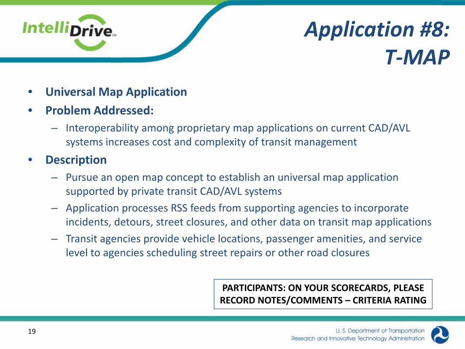
Application #8:T-MAP
• Universal Map Application
• Problem Addressed:– Interoperability among proprietary map applications on current CAD/AVL
systems increases cost and complexity of transit management
• Description– Pursue an open map concept to establish an universal map application
supported by private transit CAD/AVL systems
– Application processes RSS feeds from supporting agencies to incorporate incidents, detours, street closures, and other data on transit map applications
– Transit agencies provide vehicle locations, passenger amenities, and service level to agencies scheduling street repairs or other road closures
19
PARTICIPANTS: ON YOUR SCORECARDS, PLEASERECORD NOTES/COMMENTS – CRITERIA RATING

Application #9:VMT
• IntelliDrive-Driven Mileage Based User Fees
• Problem Addressed:– Projected reduced gas tax revenue for same vehicle miles traveled (VMT),
while cost of providing transportation system increases with inflation
• Description– Integrate IntelliDrive and Mileage Based User Fees (MBUF) to eliminate
redundant GPS, maps, driver interfaces, and communications in the vehicle
– Accumulate miles driven in categories determined by policy and charge for the miles driven, ensure interoperability among jurisdictions
– Considerations may include vehicle type, time of day, roadway type, jurisdiction, direction of travel, and geographic area of travel
20
PARTICIPANTS: ON YOUR SCORECARDS, PLEASERECORD NOTES/COMMENTS – CRITERIA RATING

Application #10:WX-INFO
• Real-Time Route Specific Weather Information for Motorized and Non-Motorized Modes
• Problem Addressed:– improve mobility and safety of users of motorized and non-motorized modes
of transportation (e.g., automobiles, transit, freight, bicyclists, and pedestrians) by providing real-time, highly localized weather and road condition
• Description– Fuse weather-related probe data generated by probe vehicles with weather
data from traditional weather information sources
– Develop highly localized weather and pavement conditions for specific roadways, pathways, and bikeways
21
PARTICIPANTS: ON YOUR SCORECARDS, PLEASERECORD NOTES/COMMENTS – CRITERIA RATING

Application #11:WX-MDSS
• Enhanced MDSS (Maintenance Decision Support System) Communications
• Problem Addressed:– Reduce reliance on (potentially expensive) commercial wireless networks to
communicate with snowplows or other maintenance vehicles
– Keep treatment recommendations current
• Description– MDSS equipped maintenance vehicles utilize DSRC hot spots to download
treatment recommendations and upload recent maintenance activities
– In many rural areas access to commercial networks is limited and/or expensive
– Utilize DSRC hot spots to reduce costs and improve communications latency for state DOTs
22
PARTICIPANTS: ON YOUR SCORECARDS, PLEASERECORD NOTES/COMMENTS – CRITERIA RATING
23
Voting

Breakout Exercise(Part 2) Voting
• Now that we’ve worked through all the applications,vote for the three most promising applications
– “Most promising”: strong potential for transformative impact, low deployment risk, and clear alignment with IntelliDrive program goals
– BLUE = 3 points (top priority)
– RED = 2 points (second-highest priority)
– WHITE = 1 point (third-highest priority)
– Deposit your chips in the voting bins identified for each application(also turn in your scorecards)
• We’ll take a quick break (5 minutes) to tabulate the results
• One Bin, One Participant, One Chip rule– Do NOT dump all of your chips in a single bin
– We want your individual priority of the top THREE applications
24

25
Quick Break

26
Exercise Results

Results Discussion
• Were similar or dissimilar applications selected during voting?
• Did the highest ranking applications align in the same quadrants of the impact/deployment readiness chart?
• Regarding the top 6 applications:– Are they highly overlapping? Or independent?
– Do they require coordinated research?
– Will they require coordinated deployment?
• Who would like to volunteer to report out the breakout group findings?
27

28
Exercise Complete