AP Human Geography Name Chapter 13 – Urban Patterns
32
AP Human Geography Name_______________________ Chapter 13 – Urban Patterns Key Issue #1 – Why are downtowns distinctive? Introducing Urban Patterns Central City Urban Area Metropolitan Area How to measure the functional area of a settlement – MSA (Metropolitan Statistical Area) – MSA includes the following: 1. Urbanized area with population of at least _______________ 2. The _________________ within which the city is located 3. Adjacent counties with a high population density and a large percentage of residents ____________________________________________________ (county with at least 25 persons per square mile & at least 50% working in central city’s county) 84% of US population Micropolitan Statistical Area 9% of US population includes an urbanized area between _____________ and ________________ largely found __________________________________________________
Transcript of AP Human Geography Name Chapter 13 – Urban Patterns

AP Human Geography Name_______________________
Chapter 13 – Urban Patterns
Key Issue #1 – Why are downtowns distinctive? Introducing Urban Patterns
Central City Urban Area
Metropolitan Area How to measure the functional area of a settlement – MSA (Metropolitan Statistical Area) – MSA includes the following:
1. Urbanized area with population of at least _______________ 2. The _________________ within which the city is located 3. Adjacent counties with a high population density and a large percentage of
residents ____________________________________________________ (county with at least 25 persons per square mile & at least 50% working in central city’s county)
84% of US population Micropolitan Statistical Area 9% of US population includes an urbanized area between _____________ and ________________ largely found __________________________________________________
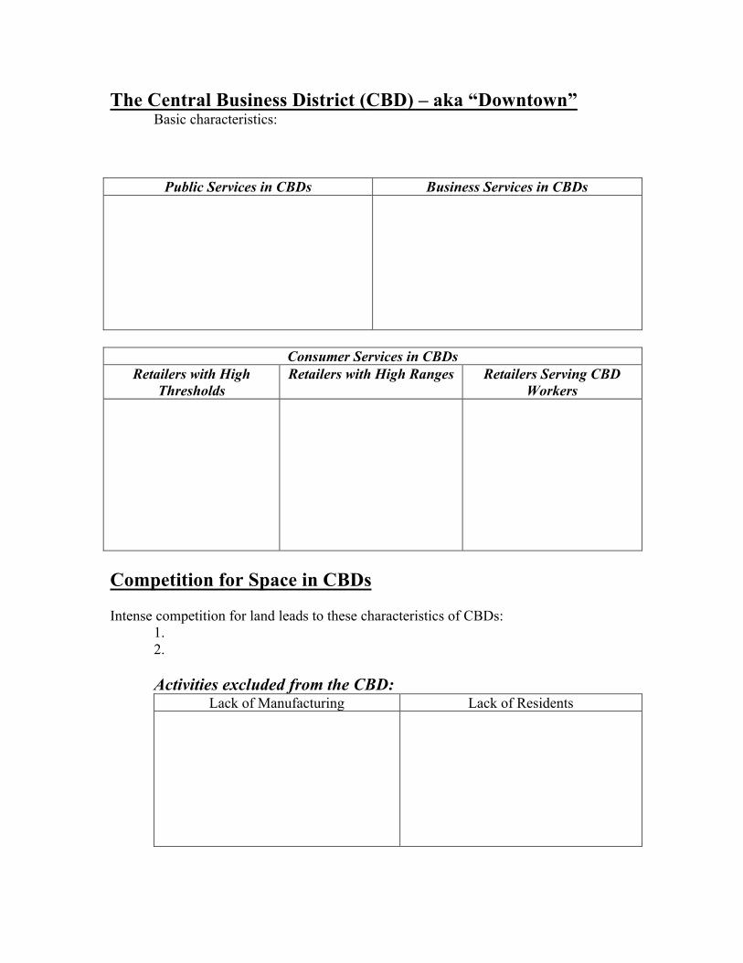
The Central Business District (CBD) – aka “Downtown” Basic characteristics:
Public Services in CBDs Business Services in CBDs
Consumer Services in CBDs
Retailers with High Thresholds
Retailers with High Ranges Retailers Serving CBD Workers
Competition for Space in CBDs Intense competition for land leads to these characteristics of CBDs: 1. 2.
Activities excluded from the CBD: Lack of Manufacturing Lack of Residents

Vertical Features of the CBD: The Underground CBD Skyscrapers
Key Issue #2 – Where are people distributed within urban areas? Three Models of Urban Structure -used to explain… Concentric Zone Model Explanation
Sector Model
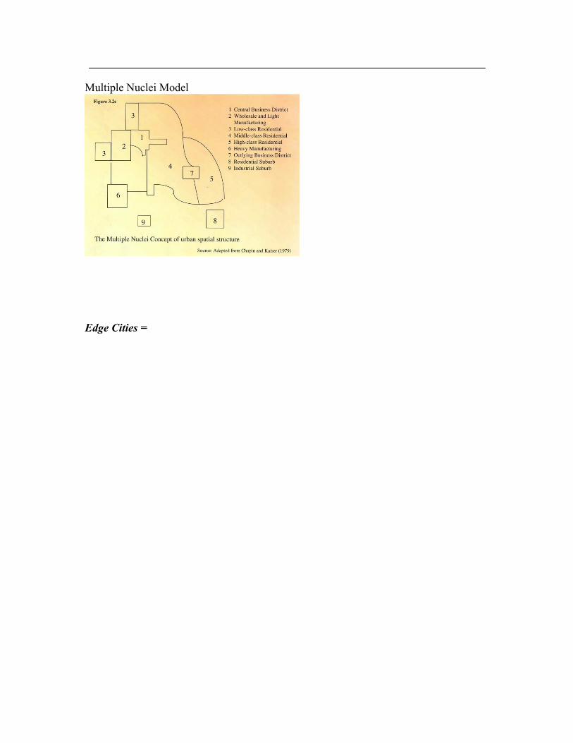
Multiple Nuclei Model
Edge Cities =

Applying the Models in North America How the models help understand urban areas Social Area Analysis Concentric Zone Model = Sector Model = Multiple Nuclei Model = Limitations of the Models: Applying the Models in Europe CBDs in European Cities *Residences *Consumer Services

*Public Services *Business Services The Three Models in Europe Concentric Zones Sectors Multiple Nuclei
Pre-modern Cities in Developing Countries Ancient & Medieval City: Beijing
Colonial Legacy

Applying the Models in Developing Countries Concentric Zones in Developing Countries
Multiple Nuclei in Developing Countries
Sectors in Developing Countries
Changing Urban Structure of Mexico City Three stages of development PreColonial Mexico City Colonial Mexico City Mexico City Since
Independence

Key Issue #3 – Why do urban areas expand? Suburb = Origin and Growth of Suburbs 1950 USA: -20% suburbs, 40% cities, 40% small towns/rural areas 1960 USA: -33% suburbs, 33% cities, 33% small towns/rural areas 2000 USA: -50% suburbs, 30% cities, 20% small towns/rural areas Reasons people are attracted to suburbs:
v . v . v . v . v . v .
Annexation = Reasons to favor vs Reasons to oppose Annexation: Annexation: Local Government Fragmentation 2012 Census of Governments – USA has 89,004 local governments why? 2 kinds of Strong metropolitan-wide governments in North America:
1. Consolidation of city and county governments a. Examples Indianapolis and Miami
2. Federations a. Toronto
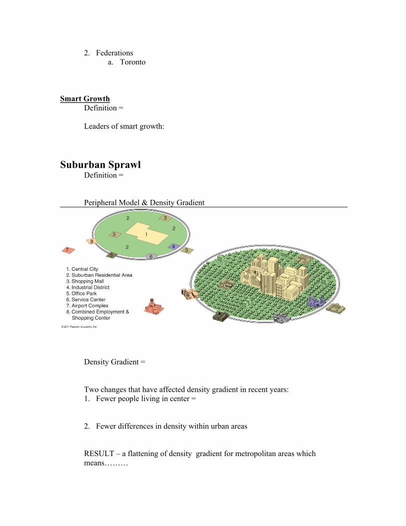
Smart Growth Definition = Leaders of smart growth: Suburban Sprawl Definition = Peripheral Model & Density Gradient
Density Gradient = Two changes that have affected density gradient in recent years:
1. Fewer people living in center =
2. Fewer differences in density within urban areas
RESULT – a flattening of density gradient for metropolitan areas which means………

Costs of sprawl = Megalopolis Definition = Good examples:
Suburban Segregation Segregation of social classes
Segregation of land uses
UK and US Suburbs Residential Segregation
Suburban Services Suburbanization of Consumer Services Suburbanization of Business Services
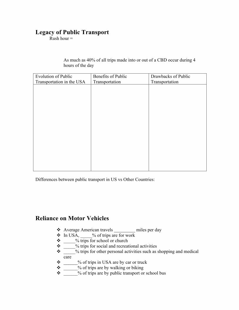
Legacy of Public Transport Rush hour =
As much as 40% of all trips made into or out of a CBD occur during 4 hours of the day
Evolution of Public Transportation in the USA
Benefits of Public Transportation
Drawbacks of Public Transportation
Differences between public transport in US vs Other Countries: Reliance on Motor Vehicles
v Average American travels _________ miles per day v In USA, _____% of trips are for work v _____% trips for school or church v _____% trips for social and recreational activities v _____% trips for other personal activities such as shopping and medical
care v ______% of trips in USA are by car or truck v ______% of trips are by walking or biking v ______% of trips are by public transport or school bus
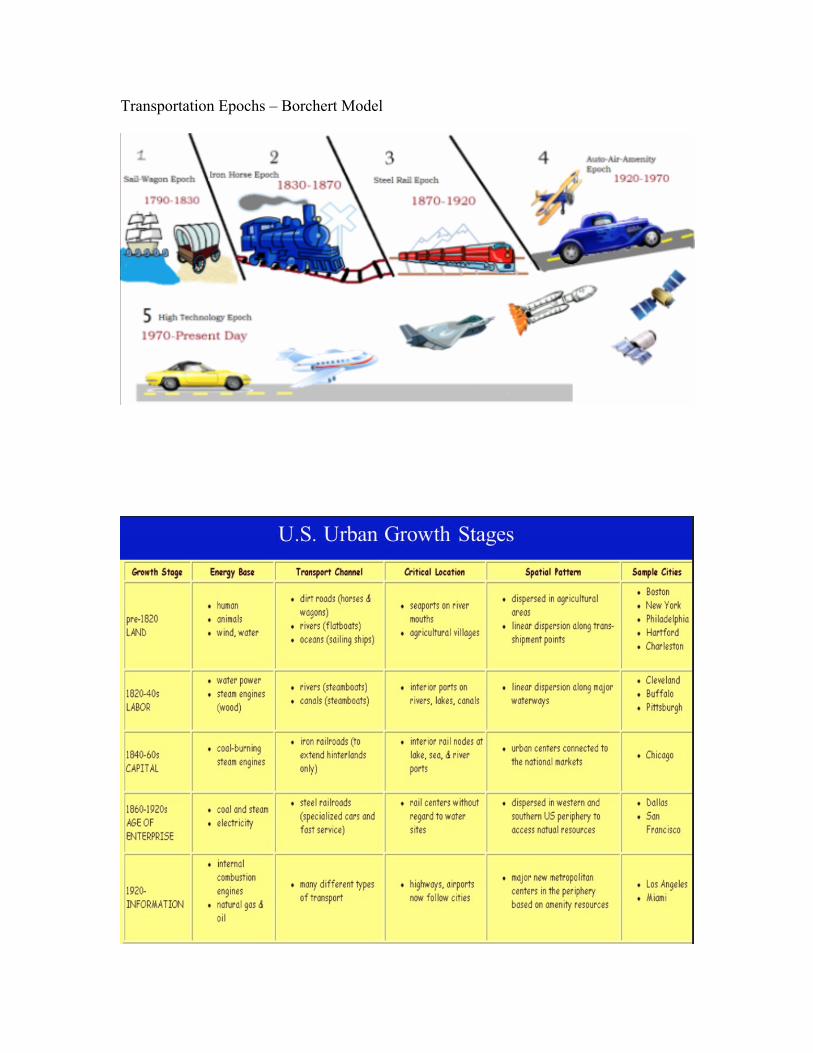
Transportation Epochs – Borchert Model

Benefits & Costs of Motor Vehicles Benefits Costs
Autonomous Driving Vehicles
Key Issue #4 – Why do cities face sustainability challenges? The City Challenged
Social Challenges Underclass =
Homelessness
Inadequate Job Skills
Culture of Poverty

Drugs
Crime
Municipal Finances
Physical Challenges Inner City Physical Problems
Process of Deterioration Absentee Landlords Filtering Redlining “Food Deserts” (do you remember from our Agriculture chapter?)

The City Renewed Define: gentrification = Reasons for the attraction to run-down inner-city neighborhoods:
v . v . v . v .
Cities encourage it by providing _____________________________________________ Public Housing Defined: Problems associated with public housing today: Solutions? To affordable housing crisis Reviving Consumer Services Examples: Boston –
Baltimore- Chicago-
New York –
Philadelphia - San Francisco -
The City Contrasted Using the maps listed below, what similarities and differences do you observe between the maps of Chicago (Figure 13-63) and the maps of Paris (Figures 13-21, 13-22, and 13-23)?

p. 492 – Doing Geography – Markey Segmentation: You Are Where You Live 1. Compare the PRIZM cluster for zip code 77401 with that of 77021. Referring to Figures 13-15, 13-16, 13-17, and 13-5, describe similarities and differences in the rings, sectors, and nodes that they occupy within the Houston urban area. 3. Find the PRIZM cluster for the zip code where you live. Use your search engine to find Nielsen Claritas PRIZM website and select Zip Code look-up. Enter your 5-digit zip code and the security code and click Submit. a. What are the five clusters for your zipcode? b. Click on the names of the clusters to learn more about each of them. Do these five clusters accurately represent your expectations for your zipcode? Why or why not? The City Cleaned Sustainable development = Why it is needed: What does it look like: The City Controlled One of the most important issues is traffic congestion Controlling Vehicles
1. Congestion charges
2. Tolls
3. Permits
4. Bans

Alternative Fuel Vehicles *Challenges to reduce pollution and conserve nonrenewable energy sources *Alternative technologies being addressed: 1. Diesel 2. Hybrid 3. Ethanol
4. Full electric
5. Plug-in hybrid
6. Hydrogen fuel cell

Essay Outlines FRQ #1 – Planning Sheet – Use the textbook/internet to add at least 6 specific details to each section of the question that could be used to answer the essay question. The evolution of the American city has been largely influenced by improvements in transportation technology. Discuss how each of the following affected the growth and geography of a large American city: A) street-cars and subways (1900-1930). 1. 2. 3. 4. 5. 6. B) highways (1950s-present). 1. 2. 3. 4. 5. 6.
C) new light rail and subway systems (1970s-present). 1. 2. 3. 4. 5. 6.
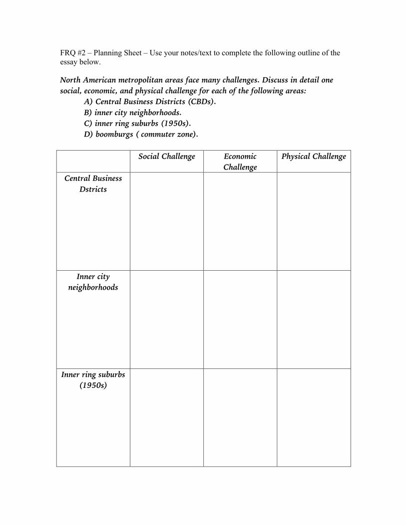
FRQ #2 – Planning Sheet – Use your notes/text to complete the following outline of the essay below. North American metropolitan areas face many challenges. Discuss in detail one social, economic, and physical challenge for each of the following areas: A) Central Business Districts (CBDs). B) inner city neighborhoods. C) inner ring suburbs (1950s). D) boomburgs ( commuter zone).
Social Challenge Economic Challenge
Physical Challenge
Central Business Dstricts
Inner city neighborhoods
Inner ring suburbs (1950s)

Boomburgs (commuter zone)
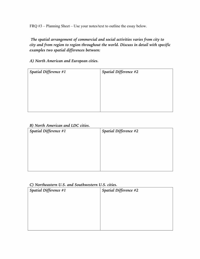
FRQ #3 – Planning Sheet – Use your notes/text to outline the essay below. The spatial arrangement of commercial and social activities varies from city to city and from region to region throughout the world. Discuss in detail with specific examples two spatial differences between: A) North American and European cities. Spatial Difference #1 Spatial Difference #2
B) North American and LDC cities. Spatial Difference #1 Spatial Difference #2
C) Northeastern U.S. and Southwestern U.S. cities. Spatial Difference #1 Spatial Difference #2

D) North American and Latin American cities. Spatial Difference #1 Spatial Difference #2

FRQ #4 – Planning Sheet – Outline the essay in the space below.
Source: www.census.gov Census tracts A and B are located in a major metropolitan area in the western United States. Give two reasons for why census tracts A and B would be located in specific geographic locations for any three of the following urban models: A) Concentric Zone Model. B) Sector Model. C) Multiple Nuclei Model. D) Peripheral Model.

Concentric
Zone Model Sector Model Multiple
Nuclei Model Peripheral Model
Specific Geographic Location
Reason 1
Reason 2
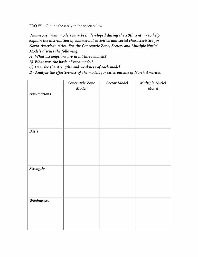
FRQ #5 – Outline the essay in the space below. Numerous urban models have been developed during the 20th century to help explain the distribution of commercial activities and social characteristics for North American cities. For the Concentric Zone, Sector, and Multiple Nuclei Models discuss the following: A) What assumptions are in all three models? B) What was the basis of each model? C) Describe the strengths and weakness of each model. D) Analyze the effectiveness of the models for cities outside of North America. Concentric Zone
Model Sector Model Multiple Nuclei
Model Assumptions
Basis
Strengths
Weaknesses
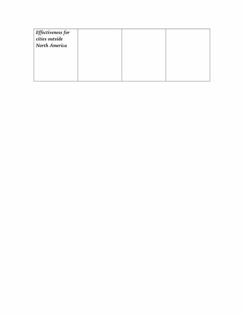
Effectiveness for cities outside North America

FRQ #6 – Outline the essay in the space below. Rapid urbanization in Least Developed Counties (LDCs) has many profound impacts for the world. Answer the following questions in detail and give specific examples. A) Discuss the changing percentage of the top ten world’s largest cities located in More Developed Countries (MDCs) vs. Least Developed Countries (LDCs), since 1900. Details: Examples:
B) How will this trend play out for the next twenty years? What cities and areas of the world will continue to rapidly urbanize? Details: Examples:
C) Discuss two factors that are contributing to the rapid geographical shifts in urbanization on a global scale. Details: Examples:
D) Discuss three geographic challenges for mega cities in both MDCs and LDCs. Details: Examples:
Watch “The Walkable City” with Jeff Speck https://youtu.be/Wai4ub90stQ Take notes below:

New Urbanism (Smart Growth) – The 2017 FRQ Question
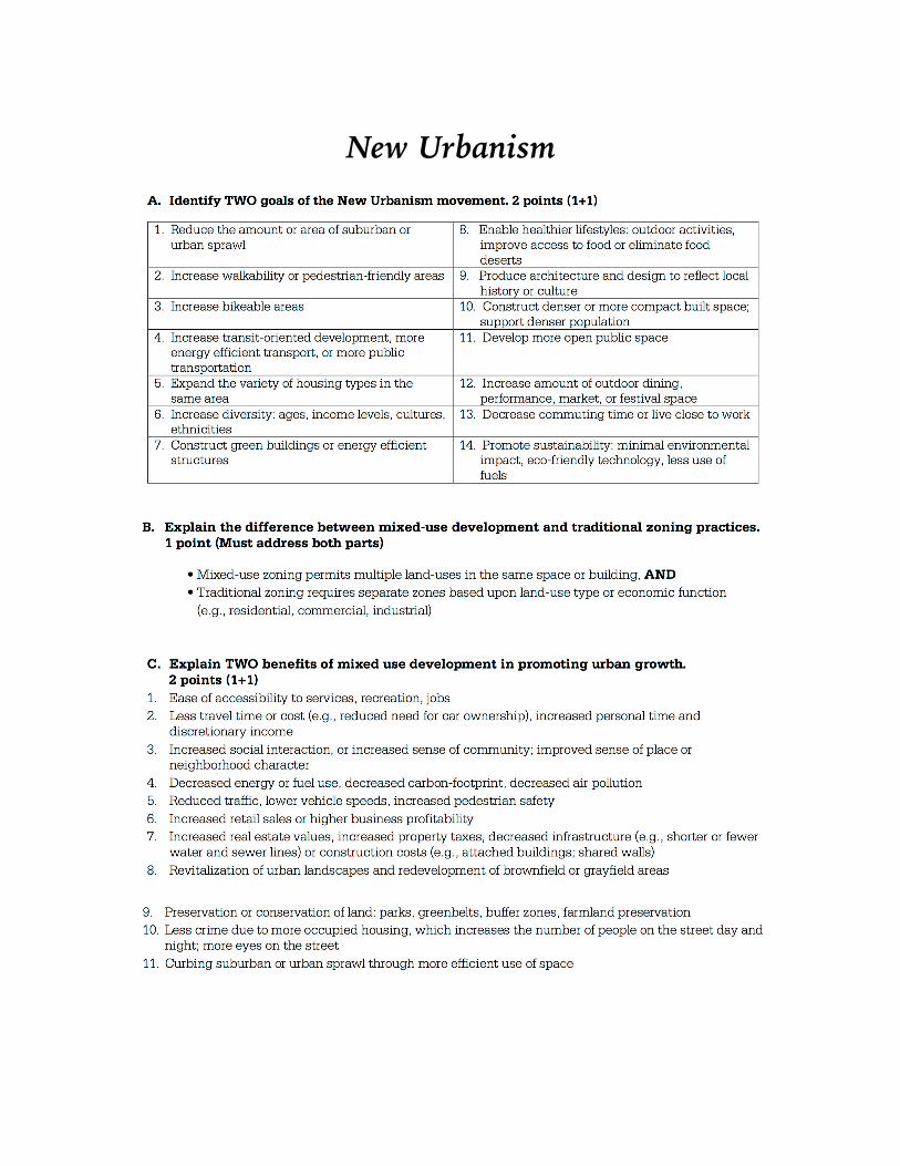
New Urbanism