Abingdon-on-Thames and Oxford Fringe – which covers the ... VWH Plan_Body... · 58 Vale of White...
93
Vale of White Horse District Council 56 Overview This chapter sets out the Sub-Area Strategies that apply to different parts of the Vale to help us plan effectively and help ensure the plan is locally distinctive. The three sub-areas are: Abingdon-on-Thames and Oxford Fringe – which covers the northern and north eastern parts of the Vale that have strong linkages with the city of Oxford. This area contains the Market Town of Abingdon-on-Thames, the Local Service Centre of Botley and several Larger Villages including Cumnor, Drayton, East Hanney, Kennington, Kingston Bagpuize with Southmoor, Marcham, Radley, Steventon and Wootton. A large part of this Sub-Area is located within the Oxford Green Belt. South East Vale – which includes most of the Science Vale area and contains the Market Town of Wantage, the Local Service Centre of Grove as well as a number of significant employment sites, including Harwell Campus, Milton Park and Didcot A Power Station. The area also contains part of the North Wessex Downs Area of Outstanding Natural Beauty (AONB), which stretches along the south of the district and a number of Larger Villages including Blewbury, East Hendred, Harwell, Harwell Campus, Milton and Sutton Courtenay. Western Vale – which is a more rural area stretching from the North Wessex Downs (AONB) to the River Thames, containing the Market Town of Faringdon and several Larger Villages including East Challow, Shrivenham, Stanford-in-the-Vale, Uffington and Watchfield. 5 Sub-Area Strategies
Transcript of Abingdon-on-Thames and Oxford Fringe – which covers the ... VWH Plan_Body... · 58 Vale of White...
Vale of White Horse District Council56
Overview
This chapter sets out the Sub-Area Strategies that apply to different parts of the Vale to help us plan effectively and help ensure the plan is locally distinctive. The three sub-areas are:
Abingdon-on-Thames and Oxford Fringe – which covers the northern and north eastern parts of the Vale that have strong linkages with the city of Oxford. This area contains the Market Town of Abingdon-on-Thames, the Local Service Centre of Botley and several Larger Villages including Cumnor, Drayton, East Hanney, Kennington, Kingston Bagpuize with Southmoor, Marcham, Radley, Steventon and Wootton. A large part of this Sub-Area is located within the Oxford Green Belt.
South East Vale – which includes most of the Science Vale area and contains the Market Town of Wantage, the Local Service Centre of Grove as well as a number of significant employment sites, including Harwell Campus, Milton Park and Didcot A Power Station. The area also contains part of the North Wessex Downs Area of Outstanding Natural Beauty (AONB), which stretches along the south of the district and a number of Larger Villages including Blewbury, East Hendred, Harwell, Harwell Campus, Milton and Sutton Courtenay.
Western Vale – which is a more rural area stretching from the North Wessex Downs (AONB) to the River Thames, containing the Market Town of Faringdon and several Larger Villages including East Challow, Shrivenham, Stanford-in-the-Vale, Uffington and Watchfield.
5Sub-Area Strategies
1
2
3
4
5
7
6
Local Plan 2031: Part One 57
5 Sub-Area Strategies
Introduction
5.1 The Abingdon-on-Thames and Oxford Fringe Sub-Area lies in the north of the Vale District (Figure
5.1). It has strong functional links with the city of Oxford and over 40 % of the Sub-Area is located within the Oxford Green Belt. The Sub-Area provides housing for residents working in Oxford and also functions as a significant employment area in its own right. The Sub-Area has good access to the strategic road network, including the A34 and A420.
5.2 The Market Town of Abingdon-on-Thames is the largest settlement in the Sub-Area. It benefits from an attractive frontage to the River Thames and an historic town centre. The second largest settlement in the Sub-Area is Botley, which is located on the south-western edge of Oxford, and consists of parts of the North Hinksey and Cumnor parishes. Botley has strong links with the city of Oxford and also functions
as a Local Service Centre in its own right. The Oxford Brookes University Harcourt Hill Campus is located nearby in North Hinksey.
5.3. The Abingdon-on-Thames and Oxford Fringe Sub-Area contains a network of attractive rural villages, which include the Larger Villages of Cumnor, Drayton, East Hanney, Kingston Bagpuize with Southmoor, Kennington, Marcham, Radley, Steventon and Wootton.
5.4 The Sub-Area is a highly sustainable location for development, particularly due to its proximity to the city of Oxford and excellent public transport connectivity.
5.5 To help ensure our vision for the Vale of White Horse is achieved, our over-arching priority for the area is to maintain the service and employment centre roles for Abingdon-on-Thames and Botley, whilst ensuring future growth is managed to minimise any pressure
on the highway network and to respect the overarching purposes of the Oxford Green Belt.
5.6 This section sets out:
Building healthy and sustainable communities Core Policy 8: Spatial Strategy
for the Abingdon-on-Thames and
Oxford Fringe Sub-Area – which sets out our strategic site allocations for this area.
Supporting economic prosperityCore Policy 9: Harcourt Hill
Campus – which supports appropriate and sustainable development to meet future business needs of the University.
Core Policy 10: Abbey Shopping
Centre and the Charter, Abingdon-
on-Thames – which supports the redevelopment of this area to enhance the retail offer within the town.Core Policy 11: Botley Central Area
– which supports the redevelopment of this area to provide for new retail, leisure and commercial provision.
Supporting sustainable transport and accessibility Core Policy 12: Safeguarding
of Land for Strategic Highway
Improvements within the
Abingdon-on-Thames and Oxford
Fringe Sub-Area – which seeks to protect land needed for the delivery of highway schemes within the area.
Abingdon-on-Thames and Oxford Fringe Sub-Area Strategy

Vale of White Horse District Council58
5 Sub-Area Strategies
Protecting the environment and responding to climate change
Core Policy 13: The Oxford Green
Belt – which seeks to protect the land that continues to meet the five purposes of Green Belt and maintaining the setting of and managing the growth of the city of Oxford. Core Policy 14: Strategic Water
Storage Reservoirs – which safe-guards land for the provision of a res-ervoir to assist with the management of water supply in the South East of England, should this be needed.
Figure 5.1: Abingdon-on-Thames and Oxford Fringe Sub-Area

Local Plan 2031: Part One 59
5 Sub-Area Strategies Abingdon-on-Thames and Oxford Fringe
1
2
3
4
5
7
6
How the Abingdon-on-Thames and Oxford Fringe Sub-Area will change by 2031
The Abingdon-on-Thames and Oxford Fringe Sub-Area will continue to provide an attractive place to live, with development carefully managed and the overarching purposes of the Oxford Green Belt protected.
Abingdon-on-Thames will continue to function as an important service and employment centre within the district. The historic character of the town centre will have been maintained and the Abbey Shopping Centre and Charter Area will have been comprehensively and attractively redeveloped.
Botley will continue to function as a thriving community on the western edge of Oxford and new housing will have been sensitively designed to complement the attractive environments of Cumnor Hill and North Hinksey village. The centre of Botley will be enhanced and modernised to function as a safe and vibrant Local Service Centre and the
Seacourt Retail Park will have maintained its own identity.
Oxford Brookes University Harcourt Hill Campus will be sensitively modernised to continue to provide further education and sports facilities to students and local residents. The area will also be successfully linked by public transport and a network of footpaths and cycle routes.
Joint working with Oxford City Council, Oxfordshire County Council, Highways England and other neighbouring authorities will have identified a long-term solution to traffic management around Oxford, the A34, and in Abingdon-on-Thames and Botley.
The countryside and villages will have maintained their distinctive character and will be much enjoyed by residents, workers and visitors to the Vale. Growth within the Larger Villages will have helped to maintain or enhance their services and to provide for residents’ day-to-day needs. New residents in the villages will be helping to sustain the services and social life of the rural communities.
Vale of White Horse District Council60
5 Sub-Area Strategies Abingdon-on-Thames and Oxford Fringe
Strategic policies for the Abingdon-on-Thames and Oxford Fringe Sub-Area
Building healthy and sustainable communities
5.7 Abingdon-on-Thames is our largest settlement: it has the largest range of services and facilities, a good employment base, excellent public transport links to Oxford and beyond, and it has the highest need for affordable housing across the Vale. For this reason, land is identified to the north of the town that is deemed to be sustainable for strategic growth.
5.8 The strategic development to the north of Abingdon-on-Thames will provide much needed housing in our most sustainable settlement and help to facilitate the delivery of an upgrade to the A34 junction at Lodge Hill. This not only provides access to the strategic road network but would also help to alleviate existing traffic issues within the town.
5.9 A number of sites are also allocated for strategic growth at the Larger Villages of Kennington (within Radley Parish), Kingston Bagpuize with Southmoor and Radley. These villages are suitable locations for development in the Vale, with comparatively high levels of services and facilities, good public transport connectivity with opportunities for improvement and good access to a wide range of employment.
5.10 The strategic sites will be designed to integrate successfully with the local community and to minimise any harmful effects. Appropriate infrastructure, such as open space, leisure provision and new services and facilities will all be delivered alongside the housing.
5.11 Our strategy for meeting our housing needs in this Sub-Area is set out in Core Policy 8: Spatial
Strategy for the Abingdon-on-
Thames and Oxford Fringe Sub-
Area.
Local Plan 2031: Part One 61
5 Sub-Area Strategies Abingdon-on-Thames and Oxford Fringe
1
2
3
4
5
7
6
Core Policy 8: Spatial Strategy for
Abingdon-on-Thames and Oxford Fringe
Sub-Area
Our over-arching priority for this Sub-Area is to maintain the service and employment centre roles for Abingdon-on-Thames and Botley and ensure growth is managed to minimise pressure on the highway network, whilst protecting the Oxford Green Belt. Development in the Abingdon-on-Thames and Oxford Fringe Sub-Area should be in accordance with the Settlement Hierarchy set out in Core
Policy 3:
Market Town: Abingdon-on-ThamesLocal Service Centre: BotleyLarger Villages: Cumnor, Drayton, East Hanney,
Kennington, Kingston Bagpuize with Southmoor, Marcham, Radley, Steventon and Wootton
Smaller Villages: Appleton, Dry Sandford, Farmoor, Frilford, Longworth, North Hinksey, Shippon, South Hinksey, Sunningwell, West Hanney and Wytham
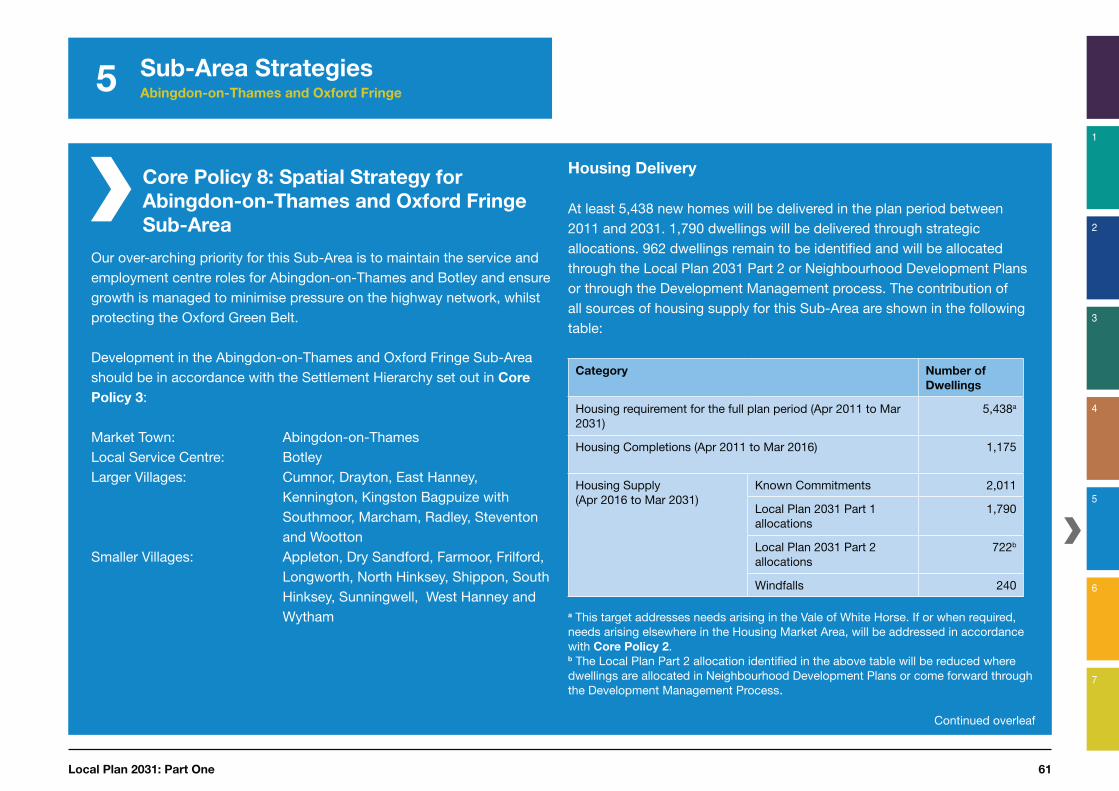
Housing Delivery
At least 5,438 new homes will be delivered in the plan period between 2011 and 2031. 1,790 dwellings will be delivered through strategic allocations. 962 dwellings remain to be identified and will be allocated through the Local Plan 2031 Part 2 or Neighbourhood Development Plans or through the Development Management process. The contribution of all sources of housing supply for this Sub-Area are shown in the following table:
Category Number of
Dwellings
Housing requirement for the full plan period (Apr 2011 to Mar 2031)
5,438a
Housing Completions (Apr 2011 to Mar 2016) 1,175
Housing Supply(Apr 2016 to Mar 2031)
Known Commitments 2,011
Local Plan 2031 Part 1 allocations
1,790
Local Plan 2031 Part 2 allocations
722b
Windfalls 240
a This target addresses needs arising in the Vale of White Horse. If or when required, needs arising elsewhere in the Housing Market Area, will be addressed in accordance with Core Policy 2. b The Local Plan Part 2 allocation identified in the above table will be reduced where dwellings are allocated in Neighbourhood Development Plans or come forward through the Development Management Process.
Continued overleaf

Vale of White Horse District Council62
5 Sub-Area Strategies Abingdon-on-Thames and Oxford Fringe
Core Policy 8: Spatial Strategy for
Abingdon-on-Thames and Oxford Fringe
Sub-Area
Employment
3.20 hectares of employment land is identified for future business and employment growth in accordance with Core Policy 6. In addition, the following strategic employment sites will be safeguarded for employment use in line with Core Policy 29.
Strategic employment sites:
Abingdon-on-Thames:
Ashville Trading Estate, Abingdon Business Park, Nuffield Way, Drayton Road Industrial Estate, Fitzharris Trading Estate, Abingdon Science Park, Radley Road Industrial Estate, Barton Mill in Audlett Drive.
Botley:
Curtis Industrial Estate, Hinksey Business Centre, Minns Business Park, Seacourt Tower.
Strategic Allocations
Development will be supported at the strategic site allocations through a masterplanning process involving the community, local planning authority, developer and other stakeholders where development meets the requirements set out within the Site Development Templates shown by Appendix A and are in accordance with the Development Plan taken as a whole. The following table shows how the level of housing required within this Sub-Area through strategic development sites will be distributed:
Part 1 Allocations
Settlement/
Parish
Settlement Type Site Name Number of
Dwellings
Abingdon-on-Thames
Market Town North Abingdon-on-Thames
800
North West Abingdon-on-Thames
200
Kingston Bagpuize with Southmoor
Larger Villages East Kingston Bagpuize with Southmoor
280
Radley North West Radley 240
South of Kennington 270
Total 1,790

Local Plan 2031: Part One 63
5 Sub-Area Strategies Abingdon-on-Thames and Oxford Fringe
1
2
3
4
5
7
6
Supporting economic prosperity
5.12 The Sub-Area functions as an important centre for employment and contains a number of strategic employment sites, including Abingdon Science Park, Abingdon Business Park, Curtis Industrial Estate, Hinksey Business Park, Minns Business Park and Seacourt Tower.
5.13 Our strategy for meeting business needs in the Sub-Area is set out in Core Policy 8: Spatial
Strategy for Abingdon-on-Thames
and Oxford Fringe Sub-Area.
5.14 Higher Education facilities such as the Oxford Brookes University Harcourt Hill Campus will be supported in their important role in ensuring local residents are equipped to take up the skilled jobs that will be provided in the Science Vale and wider area (Core Policy 9).
49 Refer to Saved Local Plan 2011 Policy E15
5.15 The Steventon Storage Facility, formerly used by the Home Office as a storage depot, is a 30 hectare site used for warehousing and distribution. It is located in the open countryside between Steventon and East Hanney. Although there is relatively little traffic arising from the site now, if used more intensively, it would result in significant amounts of traffic on an unclassified rural road. There is an aspiration for the business use to be relocated to a more sustainable site, at a scale that would generate a similar number of jobs to those currently on the site49. This matter will be reviewed through the Local Plan 2031 Part 2.
Meeting needs for retailing
5.16 Abingdon-on-Thames is one of the main shopping and commercial centres within the district. The town offers a mix of national retailers and small independent traders, and provides a good range and choice of services such as banks, cafés and
restaurants. Recent enhancements to the Abbey Shopping Centre have improved the attractiveness of the town centre, and proposals for further improvements in the Abbey Shopping Centre and Charter area will be supported in line with Core
Policy 10.
Vale of White Horse District Council64
5 Sub-Area Strategies Abingdon-on-Thames and Oxford Fringe
5.17 The main shopping centre in Botley is known as West Way. Although popular, offering a range of shops and services, including restaurants and a library, the age and condition of its buildings detract from the centre’s appearance. Elms Parade is located in close proximity to the West Way centre and includes a number of independent shops. Proposals for the refurbishment of Botley’s Central Area, including the West Way Shopping Centre and Elms Parade, will be supported in accordance with Core Policy 11.
Oxford Brookes Harcourt Hill
Campus, Botley
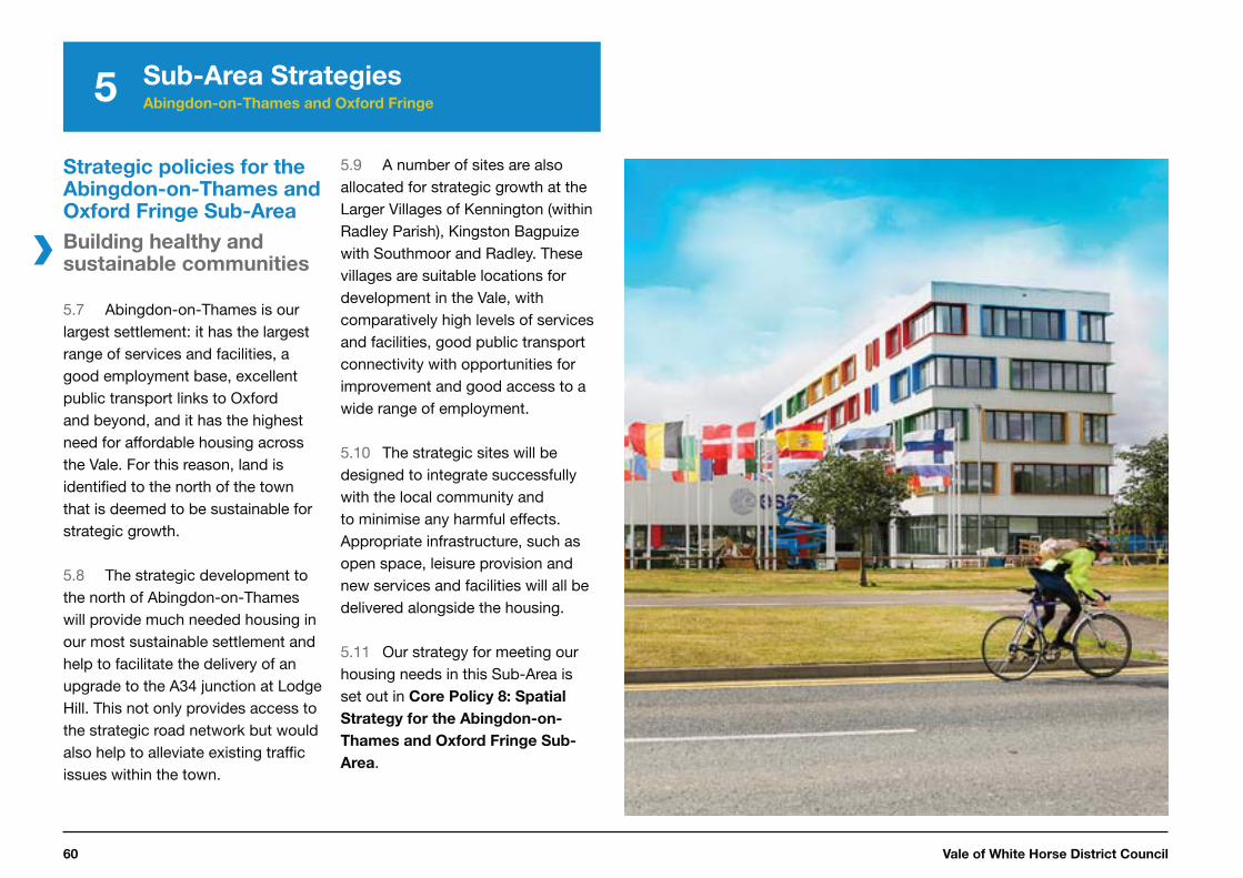
5.18 The Harcourt Hill Campus is one of three sites occupied by Oxford Brookes University, and provides teaching facilities, student accommodation and supporting uses including sports facilities. It is currently home to the Westminster Institute of Education.
5.19 Harcourt Hill Campus is located in a wooded section of the Oxford Green Belt on the urban-rural fringe. Its curtilage falls within the setting of protected views of the countryside setting from Oxford and also the panoramic views of the city’s famous towers and spires.
5.20 The University wishes to improve the quality of the campus and is reviewing its future role. Work has commenced on a masterplan for the long-term development of the site in consultation with the local community, Oxfordshire County Council and other stakeholders. The masterplan is intended to ensure that the campus evolves in a coherent and comprehensive manner to provide improved educational facilities, including student accommodation and academic buildings.
5.21 Core Policy 9 supports the redevelopment of the Harcourt Hill Campus. Transport and access matters will need to be agreed with Oxfordshire County Council and supported by a transport assessment including area level impact assessment. Proposals will also need to meet the requirements of Core
Policy 13: the Oxford Green Belt.

Local Plan 2031: Part One 65
5 Sub-Area Strategies Abingdon-on-Thames and Oxford Fringe
1
2
3
4
5
7
6
Core Policy 9:
Harcourt Hill Campus
The Council will work proactively with Oxford Brookes University, Oxfordshire County Council, local residents and other appropriate stakeholders to help the university to develop a masterplan for the Harcourt Hill Campus site that meets the university’s longer term business needs for predominantly educational uses and in a manner that respects its Green Belt setting and urban-rural fringe context.
Proposals for the upgrading or redevelopment of the Harcourt Hill Campus will be supported in principle where guided by an agreed masterplan that sets a clear vision for the future use of the site. The agreed masterplan and any subsequent proposals should be prepared to clearly identify and address key site issues including, but not limited to, the following matters:
i. the scale of development proposed and intended usesii. the integration of built form into the landscape which will be assessed
at the planning application stage with reference to a comprehensive landscape, tree and planting strategy
iii. sustainable site access including by public transport, and the effective management of car trips and car parking demand to a level that can safely be accommodated on the local road network, and
iv. the safeguarding of long distance views of the site from Oxford and to ensure that new development does not detract from views of the existing spires by reason of its height or form.
Vale of White Horse District Council66
5 Sub-Area Strategies Abingdon-on-Thames and Oxford Fringe
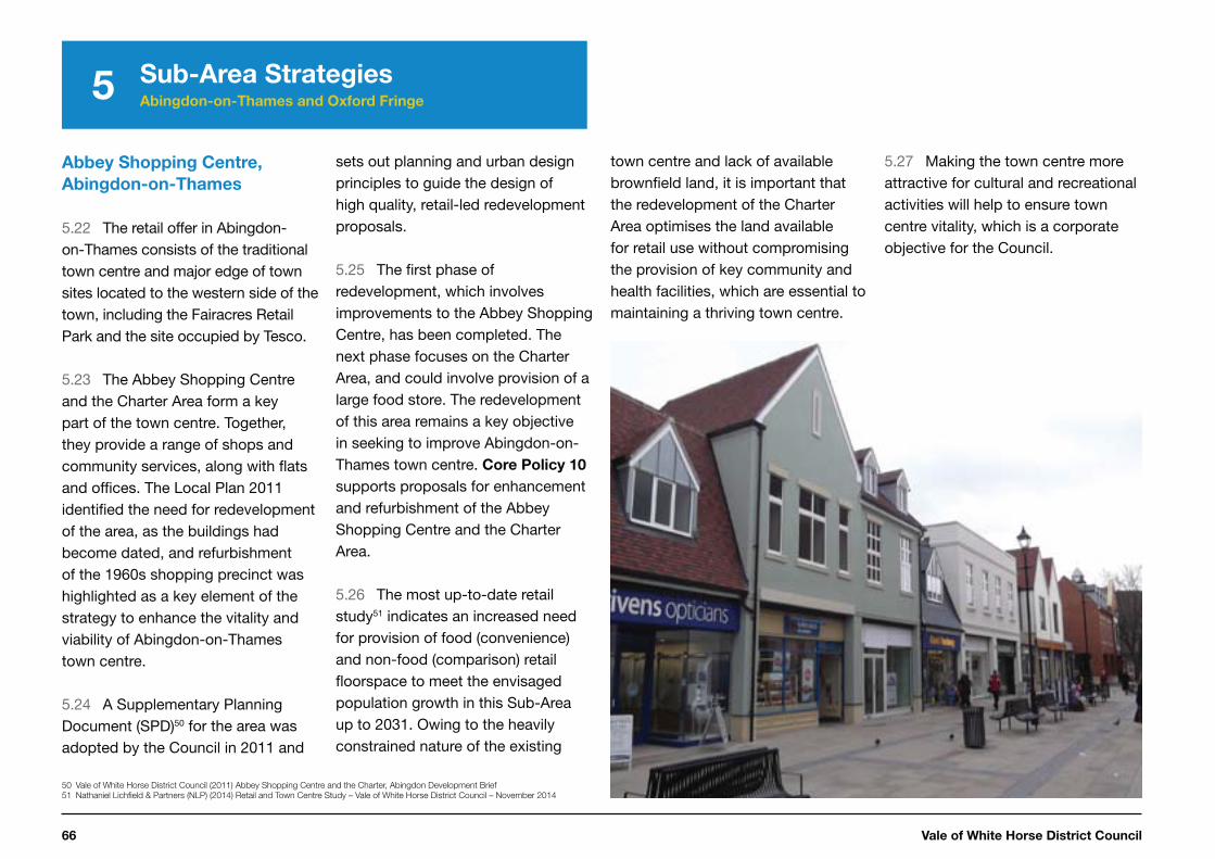
town centre and lack of available brownfield land, it is important that the redevelopment of the Charter Area optimises the land available for retail use without compromising the provision of key community and health facilities, which are essential to maintaining a thriving town centre.
5.27 Making the town centre more attractive for cultural and recreational activities will help to ensure town centre vitality, which is a corporate objective for the Council.
Abbey Shopping Centre,
Abingdon-on-Thames
5.22 The retail offer in Abingdon-on-Thames consists of the traditional town centre and major edge of town sites located to the western side of the town, including the Fairacres Retail Park and the site occupied by Tesco.
5.23 The Abbey Shopping Centre and the Charter Area form a key part of the town centre. Together, they provide a range of shops and community services, along with flats and offices. The Local Plan 2011 identified the need for redevelopment of the area, as the buildings had become dated, and refurbishment of the 1960s shopping precinct was highlighted as a key element of the strategy to enhance the vitality and viability of Abingdon-on-Thames town centre.
5.24 A Supplementary Planning Document (SPD)50 for the area was adopted by the Council in 2011 and
50 Vale of White Horse District Council (2011) Abbey Shopping Centre and the Charter, Abingdon Development Brief
51 Nathaniel Lichfield & Partners (NLP) (2014) Retail and Town Centre Study – Vale of White Horse District Council – November 2014
sets out planning and urban design principles to guide the design of high quality, retail-led redevelopment proposals.
5.25 The first phase of redevelopment, which involves improvements to the Abbey Shopping Centre, has been completed. The next phase focuses on the Charter Area, and could involve provision of a large food store. The redevelopment of this area remains a key objective in seeking to improve Abingdon-on-Thames town centre. Core Policy 10 supports proposals for enhancement and refurbishment of the Abbey Shopping Centre and the Charter Area.
5.26 The most up-to-date retail study51 indicates an increased need for provision of food (convenience) and non-food (comparison) retail floorspace to meet the envisaged population growth in this Sub-Area up to 2031. Owing to the heavily constrained nature of the existing
Local Plan 2031: Part One 67
5 Sub-Area Strategies Abingdon-on-Thames and Oxford Fringe
1
2
3
4
5
7
6
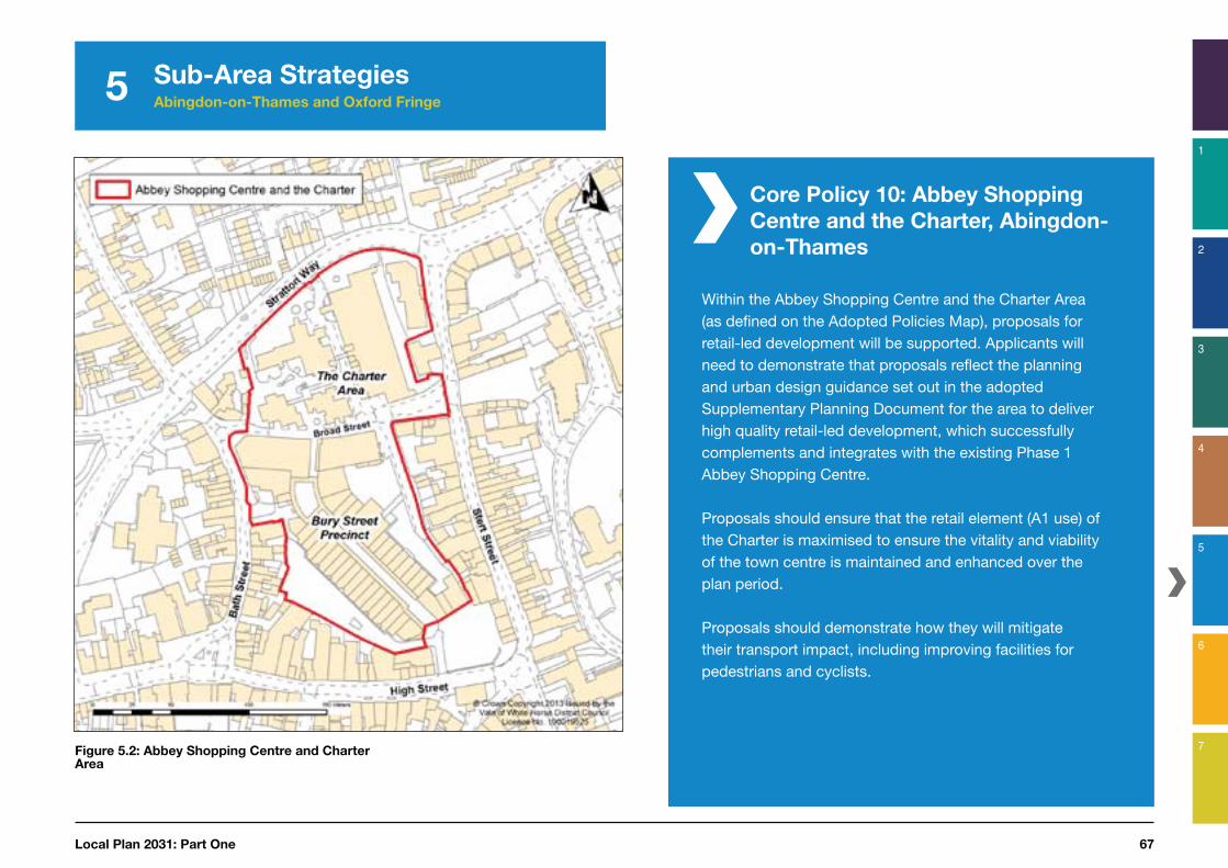
Figure 5.2: Abbey Shopping Centre and Charter Area
Core Policy 10: Abbey Shopping
Centre and the Charter, Abingdon-
on-Thames
Within the Abbey Shopping Centre and the Charter Area (as defined on the Adopted Policies Map), proposals for retail-led development will be supported. Applicants will need to demonstrate that proposals reflect the planning and urban design guidance set out in the adopted Supplementary Planning Document for the area to deliver high quality retail-led development, which successfully complements and integrates with the existing Phase 1 Abbey Shopping Centre.
Proposals should ensure that the retail element (A1 use) of the Charter is maximised to ensure the vitality and viability of the town centre is maintained and enhanced over the plan period.
Proposals should demonstrate how they will mitigate their transport impact, including improving facilities for pedestrians and cyclists.

Vale of White Horse District Council68
5 Sub-Area Strategies Abingdon-on-Thames and Oxford Fringe
Central Botley
5.28 The West Way shopping centre is a 1960s, part-covered shopping centre that forms the main shopping area in Botley. The West Way centre is located to the rear of Elms Parade, which contains a number of small independent shops. This shopping area has served Botley well over the years but the West Way centre is now in need of refurbishment to fulfil its potential as a Local Service Centre.
5.29 The most recent Retail and Town Centre Study52 identifies that Botley is a similar size, in terms of retail units and floorspace, to the Market Town of Faringdon. Despite this, it does not perform as a town centre and does not provide the range of services and other facilities that would be expected. The identified retail need for Botley is approximately 1,500 sq.m of floorspace which will need to be delivered over the plan period.
5.30 The Retail and Town Centre
52 Nathanial Lichfield & Partners (NLP) (2012) Retail and Town Centre Study – Vale of White Horse District Council, March 2013
Study identifies that around 25 % of residents in the Botley retail catchment area do their main convenience shopping in the immediate area, with the majority travelling into the city of Oxford. The provision of a food superstore in Botley would address this imbalance. The study also notes that the provision of leisure and entertainment facilities, other than restaurants and pubs, is limited in Botley. Redevelopment of the area could therefore include commercial leisure facilities, thereby helping to improve the overall offer and appeal of Botley as a shopping and leisure destination.
5.31 Redevelopment of the central area could provide a large supermarket, shops, offices, hotel, car parking and other uses to meet the needs of Botley and the surrounding area. Core Policy
11 therefore supports proposals for the redevelopment of the Botley Central Area (Figure 5.3), which includes the West Way Shopping Centre and Elms Parade.
Figure 5.3: Botley Central Area

Local Plan 2031: Part One 69
1
2
3
4
5
7
6
5 Sub-Area Strategies Abingdon-on-Thames and Oxford Fringe
Core Policy 11:
Botley Central Area
Proposals for a comprehensive retail-led redevelopment and upgrading of Botley central area, as defined on the Adopted Policies Map, will be supported provided that:
i. taken as a whole, the proposals support the role and function of Bot-ley as a Local Service Centre, providing a well-integrated mix of shops and services to meet day-to-day shopping needs of the local area
ii. effective use is made of development potential above ground level and on more peripheral parts of the site for a mix of uses that may include, but are not limited to, office, community, residential, hotel and leisure activities
iii. existing residential and community facilities, including: the community hall, library, Church of St Peter and St Paul and Baptist Church are re-placed with facilities of an appropriate size and quality to meet current and likely future local needs
iv. it can be demonstrated that proposals will not harm the character or appearance of the local area, particularly West Way, Arthray Road and Westminster Way
v. proposals for the site are prepared through a comprehensive mas-terplanning process providing an integrated solution to site access, traffic management, air quality management, servicing and sufficient car parking, whilst prioritising the pedestrian customer environment, and
vi. proposals that seek to demolish Elms Parade should demonstrate that its successor is of at least equal architectural merit and particular attention should be given to provide at least the same level of active frontage.

Vale of White Horse District Council70
5 Sub-Area Strategies Abingdon-on-Thames and Oxford Fringe
Supporting sustainable transport and accessibility
Safeguarding of land for strategic
highway improvements within the
Abingdon-on-Thames and Oxford
Fringe Sub-Area
5.32 This Sub-Area benefits from excellent public transport connectivity, particularly to the nearby city of Oxford. However, there are also a number of transport related constraints. In particular, these include:
• Abingdon-on-Thames and Botley are constrained by congestion from traffic accessing Oxford via the A34, the Botley Interchange, including traffic accessing Oxford from the A420 and Botley Road, and
• Drayton Road (B4017) is a key route into Abingdon-on-Thames from the south. This road already suffers from significant congestion in both the morning and evening
53 ATKINS (2014) Evaluation of Transport Impacts Assessment, available at: www.whitehorsedc.gov.uk/evidence
54 A Memorandum of Understanding has been prepared with VWHDC, SODC and OCC relating to this matter.
peak periods, which results in long and unreliable journey times. The River Ock bridge and the double mini-roundabouts at the junction with Marcham Road/Ock Street are also physical pinch-points which restrict vehicle flow.
5.33 The transport constraints at Abingdon-on-Thames are a key reason why strategic growth is not currently planned to the south of the town.
5.34 However, a potential long-term approach to alleviating traffic congestion to the south of Abingdon-on-Thames is the provision of a new southern bypass, including a second Thames crossing. Additional development to the south of Abingdon-on-Thames is inappropriate without the provision of this new bypass53.
5.35 Part of the potential route for a southern Abingdon-on-Thames bypass falls within the South
Oxfordshire District. The Council will work positively with South Oxfordshire District Council and Oxfordshire County Council to ensure that any proposals for a new road are developed in partnership and meet the requirements of both Councils54.
5.36 The long-term potential for a new crossing of the River Thames in conjunction with a southern town bypass is protected by Core Policy
12, which ensures that development proposals in this area do not prejudice its potential future delivery.
5.37 The delivery of south facing slips to the A34 junction at Lodge Hill, in conjunction with strategic development to the north of the town, will make a positive contribution to alleviating traffic congestion and providing improved access to the strategic road network. Land to enable the delivery of this scheme is also safeguarded in accordance with Core Policy 12.
5.38 Oxfordshire County Council is developing a strategy for the A420 to enhance key junctions and improve capacity on this route. Contributions will be sought from developers along the A420 corridor towards improvements to this route and further details are set out in the Site Development Templates – Appendix A.
Local Plan 2031: Part One 71
5 Sub-Area Strategies Abingdon-on-Thames and Oxford Fringe
1
2
3
4
5
7
6
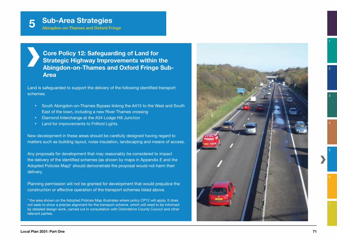
Core Policy 12: Safeguarding of Land for
Strategic Highway Improvements within the
Abingdon-on-Thames and Oxford Fringe Sub-
Area
Land is safeguarded to support the delivery of the following identified transport schemes:
South Abingdon-on-Thames Bypass linking the A415 to the West and South East of the town, including a new River Thames crossingDiamond Interchange at the A34 Lodge Hill JunctionLand for improvements to Frilford Lights.
New development in these areas should be carefully designed having regard to matters such as building layout, noise insulation, landscaping and means of access.
Any proposals for development that may reasonably be considered to impact the delivery of the identified schemes (as shown by maps in Appendix E and the Adopted Policies Map)* should demonstrate the proposal would not harm their delivery.
Planning permission will not be granted for development that would prejudice the construction or effective operation of the transport schemes listed above.
* the area shown on the Adopted Policies Map illustrates where policy CP12 will apply. It does not seek to show a precise alignment for the transport scheme, which will need to be informed by detailed design work, carried out in consultation with Oxfordshire County Council and other relevant parties.

Vale of White Horse District Council72
5 Sub-Area Strategies Abingdon-on-Thames and Oxford Fringe
Protecting the environment and responding to climate change
The Oxford Green Belt
5.39 The Oxford Green Belt was first conceived in 1956 and its boundaries approved in 1975, some 40 years ago. The purpose of the Oxford Green Belt in the Vale of White Horse District is to prevent urban sprawl around Oxford by keeping the land permanently open, and to preserve the rural setting and special character of the city of Oxford.
5.40 The Council took into account the government’s policy in the NPPF relating to Green Belt and concluded that in the light of housing requirements over the plan period, the need to promote sustainable patterns of development in the district and the findings of a local green belt boundary review, exceptional circumstances existed to revise the Green Belt boundaries in the district.
5.41 The local Green Belt Review55 assessed land around inset settlements
55 Kirkham Landscape Planning Ltd. Terra Firma Consultancy (2014) Vale of White Horse District Council Green Belt Review, available at: http://www.whitehorsedc.
gov.uk/evidence
56 NPPF, paragraph 80
in the Vale against the purposes of the Green Belt and the considerations of the NPPF56. Having regard to that assessment, and housing needs the Council concluded that the exceptional circumstances exist to justify removing from the Green Belt a number of parcels of land.
5.42 This plan has therefore altered the Green Belt boundary to remove land from the Green Belt at Abingdon, Kennington and Radley to be allocated as new strategic housing allocations, as shown in Appendix I.
5.43 The local Green Belt Review undertaken does not preclude, and would inform any future Green Belt Review, should this be needed, to contribute to meeting any identified unmet housing need within the Oxfordshire Housing Market Area, in which this matter is addressed by Core Policy 2:
Cooperation on Unmet Housing Need for
Oxfordshire (Chapter 1).

Local Plan 2031: Part One 73
5 Sub-Area Strategies Abingdon-on-Thames and Oxford Fringe
1
2
3
4
5
7
6
Core Policy 13:
The Oxford Green Belt
The Oxford Green Belt area in the Vale, as amended following the local Green Belt Review, will continue to be protected to maintain its openness and permanence.
Development will be permitted in the following settlements, which are inset to the Green Belt (as shown on the Adopted Policies Map), where the proposed development is within the existing built area of the village and in accordance with Core Policies 3 and 4:
• Appleton• Botley• Cumnor• Kennington• North Hinksey• Radley, and • Wootton
Proposals for inappropriate development will not be approved except in very special circumstances*.
The construction of new buildings in the Green Belt is considered inappropriate except where they are:
i. buildings for agriculture or forestry ii. provision of appropriate facilities for outdoor sport, outdoor
recreation and for cemeteries, as long as it preserves the openness of the Green Belt and does not conflict with the
purposes of including land within it iii. the extension or alteration of a building provided it does not
result in disproportionate additions over and above the size of the original building
iv. the replacement of a building, provided the new building is in the same use and not materially larger than the one it replaces
v. limited infilling in Shippon, South Hinksey, Wootton Old Village and Wytham
vi. limited affordable housing for local community needs as set out in Core Policy 24, or
vii. limited infilling or the partial or complete redevelopment of previously developed sites, whether redundant or in continuing use (excluding temporary buildings), which would not have a greater impact on the openness of the Green Belt and the purpose of including land within it than the existing development.
The following forms of development are also not inappropriate in the Green Belt provided they preserve the openness of the Green Belt and do not conflict with the purposes of including land in the Green Belt:
• mineral extraction• engineering operations• local transport infrastructure that can demonstrate a requirement for a
Green Belt location• the re-use of buildings, provided that they are permanent and of
substantial construction, and• development brought forward under a Community Right to Build Order.
* ‘Very special circumstances’ will not exist unless the potential harm, is clearly outweighed by other considerations (NPPF, Paragraph 88).
Vale of White Horse District Council74
5 Sub-Area Strategies Abingdon-on-Thames and Oxford Fringe
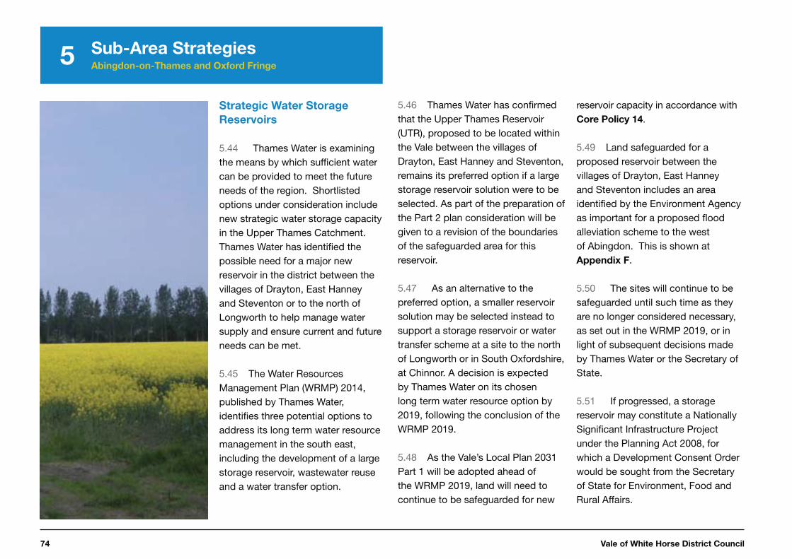
Strategic Water Storage
Reservoirs
5.44 Thames Water is examining the means by which sufficient water can be provided to meet the future needs of the region. Shortlisted options under consideration include new strategic water storage capacity in the Upper Thames Catchment. Thames Water has identified the possible need for a major new reservoir in the district between the villages of Drayton, East Hanney and Steventon or to the north of Longworth to help manage water supply and ensure current and future needs can be met.
5.45 The Water Resources Management Plan (WRMP) 2014, published by Thames Water, identifies three potential options to address its long term water resource management in the south east, including the development of a large storage reservoir, wastewater reuse and a water transfer option.
5.46 Thames Water has confirmed that the Upper Thames Reservoir (UTR), proposed to be located within the Vale between the villages of Drayton, East Hanney and Steventon, remains its preferred option if a large storage reservoir solution were to be selected. As part of the preparation of the Part 2 plan consideration will be given to a revision of the boundaries of the safeguarded area for this reservoir.
5.47 As an alternative to the preferred option, a smaller reservoir solution may be selected instead to support a storage reservoir or water transfer scheme at a site to the north of Longworth or in South Oxfordshire, at Chinnor. A decision is expected by Thames Water on its chosen long term water resource option by 2019, following the conclusion of the WRMP 2019.
5.48 As the Vale’s Local Plan 2031 Part 1 will be adopted ahead of the WRMP 2019, land will need to continue to be safeguarded for new
reservoir capacity in accordance with Core Policy 14.
5.49 Land safeguarded for a proposed reservoir between the villages of Drayton, East Hanney and Steventon includes an area identified by the Environment Agency as important for a proposed flood alleviation scheme to the west of Abingdon. This is shown at Appendix F.
5.50 The sites will continue to be safeguarded until such time as they are no longer considered necessary, as set out in the WRMP 2019, or in light of subsequent decisions made by Thames Water or the Secretary of State.
5.51 If progressed, a storage reservoir may constitute a Nationally Significant Infrastructure Project under the Planning Act 2008, for which a Development Consent Order would be sought from the Secretary of State for Environment, Food and Rural Affairs.

Local Plan 2031: Part One 75
5 Sub-Area Strategies Abingdon-on-Thames and Oxford Fringe
1
2
3
4
5
7
6
Core Policy 14:
Strategic Water Storage Reservoirs
Land is safeguarded for a reservoir and ancillary works between the settlements of Drayton, East Hanney and Steventon, and to the north of Longworth unless subsequent publication of Thames Water’s Resources Management Plan 2019 indicates that the location is not necessary for future reservoir provision. Development that might prejudice the implementation of a new reservoir on the safeguarded sites will be refused. The safeguarded areas for the reservoirs are shown on the Adopted Policies Map and Appendix F.
The proposed reservoir/s, if included as a preferred option in an adopted Water Resources Management Plan, must be brought forward through a masterplan, development brief and design statement following consultation on these documents by Thames Water with the community, the local authority, the local highway authority and the statutory environmental bodies and utility providers.
Any proposal for a reservoir must:
i. mitigate the impact of construction on local people, the environment and roads
ii. minimise the effects on the landscape of an embankment reservoir through its design, general configuration and the use of hard and soft landscaping
iii. maximise the creation of wildlife habitats and biodiversityiv. promote the recreational uses of the reservoir consistent with the
landscape and biodiversity values of the proposal and having regard to the traffic impacts of such uses
v. include a new route for the diverted Hanney to Steventon road, to include provision for an off-road cycle path in relation to the reservoir proposal between the villages of Drayton, East Hanney and Steventon
vi. make provision for the new route of the Wilts and Berks Canal in relation to the reservoir proposal between the villages of Drayton, East Hanney and Steventon
vii. include measures to avoid or mitigate any other significant adverse effects identified through the environmental impact assessment of the proposal, including on the local and wider highway networks and on surface water and fluvial flooding, and
viii. minimise any impact on the archaeological significance of the site, to include the retention of in situ archaeological remains, where possible, and their full investigation and recording with the results deposited in a public archive.

Vale of White Horse District Council76
5
South East Vale Sub-Area Strategy
Introduction
5.52 The South East Vale Sub-Area provides an important strand to our Spatial Strategy and is where around 75 % of our planned strategic housing growth and around 70 % of our projected new jobs are located (15,830 of 23,000).
5.53 The South East Vale Sub-Area houses a number of significant centres of employment, including several sites located within the Science Vale area. These include Harwell Campus and Milton Park, which were designated as an Enterprise Zone in 2011.
5.54 Science Vale is one of the key growth areas set out within the Oxfordshire Strategic Economic Plan and is the focus of significant investment. The Oxford and Oxfordshire City Deal announced in
57 Saved Local Plan (2011) allocation
2014 will continue to unleash a new wave of innovation-led growth by maximising the area’s world class assets. The Science Vale sites are central to the City Deal programme and the area is benefiting from part of £95 million of Government investment for the county.
5.55 Didcot A Power Station, a feature on the area’s landscape for over forty years, closed in March 2013 and offers a significant opportunity for further development when it is fully decommissioned.
5.56 This Sub-Area contains the Market Town of Wantage, the nearby large village of Grove (which functions as a Local Service Centre in its own right), and extends within Harwell and Milton parishes, to the western edge of Didcot. Although the town of Didcot is located within South Oxfordshire, some of the proposed housing for this area is to be located within the Vale. For this reason we are working closely with
South Oxfordshire District Council to prepare our Local Plan and ensure that appropriate services and facilities and infrastructure are available for the new communities in this area.
5.57 The historic Market Town of Wantage and the nearby larger village of Grove are separate settlements with their own unique character and identity. They have a strong functional relationship with many shared services including for health, education and leisure. It is important that growth here is carefully coordinated to seek to ensure that service and infrastructure provision closely matches the needs of the two communities. Grove Airfield57 will contribute up to 2,500 homes to Grove and provide services and facilities. New development should be successfully integrated with the existing and newly planned communities.
5.58 The South East Vale Sub-Area also houses many attractive rural villages and approximately half of
the area lies within the North Wessex Downs AONB. These more rural settlements are an important part of the wider community and their historic character should be conserved and enhanced.
5.59 The proposals within the South East Vale Sub-Area will be supported where appropriate, by additional policies in the Local Plan 2031 Part 2 to provide additional delivery and implementation detail to cover the Didcot Garden Town area that falls within the Vale district. LPP2 will set out greater plan detail to support the delivery of high quality development and supporting infrastructure across the area.
5.60 To help to ensure that our vision for the Vale of White Horse is achieved, our focus for this Sub-Area is to ensure that employment growth centred on the Enterprise Zone and Science Vale sits alongside strategic housing and infrastructure to support sustainable growth.
Sub-Area Strategies South East Vale

Local Plan 2031: Part One 77
5
1
2
3
4
5
7
6
5.61 This section sets out:
• how the Sub-Area will
change by 2031, and
• our strategic policies to
address the key challenges
and opportunities identified
for this Sub-Area in relation
to our four thematic areas:
Building healthy and
sustainable communities
Core Policy 15: Spatial
Strategy for the South East
Vale Sub-Area – which sets out our strategic site allocations for this area
Supporting economic
prosperity
Core Policy 16: Didcot A Power
Station – which safeguards land at this site for employment development
Sub-Area Strategies South East Vale
Figure 5.4: South East Vale Sub-Area
Vale of White Horse District Council78
5 Sub-Area Strategies South East Vale
How the South East Vale Sub-Area will change by 2031
The South East Vale Sub-Area will consist of thriving communities that have benefited from sustainable growth and the successful delivery of major infrastructure. The area will continue to be a vital economic area for Oxfordshire, including employment of international importance, where new jobs have been provided alongside housing and community facilities.
Wantage and Grove will be places where people are proud to live and work and recognised as a vital part of the Science Vale area. Growth in these settlements will have been balanced alongside the delivery of community facilities. This will have included new schools and significant highway improvements, including the Wantage Eastern Link Road and the Grove Northern Link Road. The area will benefit from improved public transport and strategic growth in these settlements will have provided more local job opportunities.
The ecological value of the Letcombe Brook as an important wildlife habitat will have been enhanced. The strategic development sites will have successfully extended the network of green spaces in the area for both recreation and wildlife benefits.Strategic development in Harwell and Milton parishes, to the west of Didcot, will have provided a sustainable urban extension of high quality homes and community facilities. The strategic road and public transport improvements identified in the Science Vale Area Strategy will have been delivered and will be helping to reduce traffic congestion.
The town centre in Wantage will have been conserved and enhanced and the local centre in Grove will have been strengthened. The countryside and villages will have maintained their distinctive character. The Larger Villages will have retained their separate identities and their services will provide for residents’ day-to-day needs. New residents in the villages will be helping to sustain the services and social life of the rural communities.
Supporting sustainable
transport and accessibility
Core Policy 17: Transport Delivery
for the South East Vale Sub-
Area – which sets out the approach for delivering critical transport infrastructure within this area Core Policy 18: Safeguarding
of Land for Strategic Highway
Schemes in the South East Vale
Sub-Area – which seeks to ensure land required for the critical transport infrastructure in this area is protected Core Policy 19: Re-opening Grove
Railway Station – which sets out the Council’s commitment to support the ambition to re-open the station at Grove
Protecting the environment
and responding to climate
change
Local Plan 2031: Part One 79
5
1
2
3
4
5
7
6
Strategic policies for the South East Vale Sub-Area
Building healthy and sustainable communities
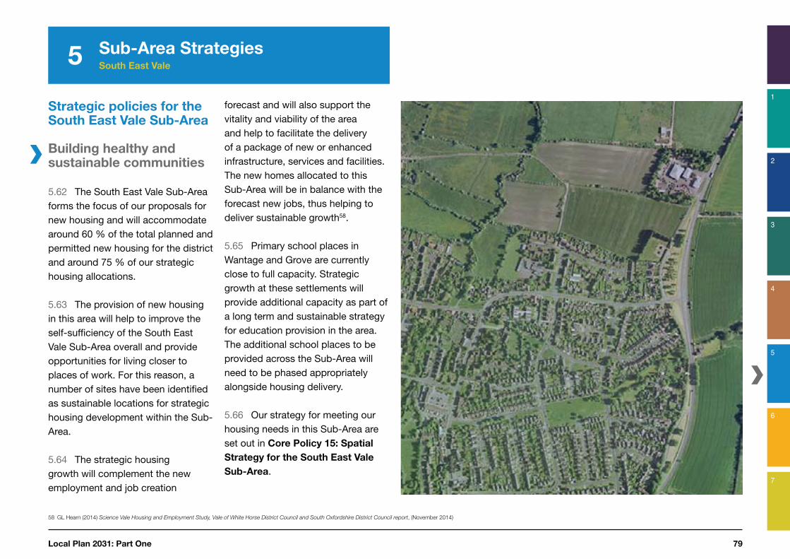
5.62 The South East Vale Sub-Area forms the focus of our proposals for new housing and will accommodate around 60 % of the total planned and permitted new housing for the district and around 75 % of our strategic housing allocations.
5.63 The provision of new housing in this area will help to improve the self-sufficiency of the South East Vale Sub-Area overall and provide opportunities for living closer to places of work. For this reason, a number of sites have been identified as sustainable locations for strategic housing development within the Sub-Area.
5.64 The strategic housing growth will complement the new employment and job creation
58 GL Hearn (2014) Science Vale Housing and Employment Study, Vale of White Horse District Council and South Oxfordshire District Council report, (November 2014)
forecast and will also support the vitality and viability of the area and help to facilitate the delivery of a package of new or enhanced infrastructure, services and facilities. The new homes allocated to this Sub-Area will be in balance with the forecast new jobs, thus helping to deliver sustainable growth58.
5.65 Primary school places in Wantage and Grove are currently close to full capacity. Strategic growth at these settlements will provide additional capacity as part of a long term and sustainable strategy for education provision in the area. The additional school places to be provided across the Sub-Area will need to be phased appropriately alongside housing delivery.
5.66 Our strategy for meeting our housing needs in this Sub-Area are set out in Core Policy 15: Spatial
Strategy for the South East Vale
Sub-Area.
Sub-Area Strategies South East Vale

Vale of White Horse District Council80
5
Core Policy 15: Spatial Strategy for South
East Vale Sub-AreaCategory Number of
Dwellings
Housing requirement for the full plan period (Apr 2011 to Mar 2031) 12,450a
Housing Completions (Apr 2011 to Mar 2016) 1,031
Housing Supply(Apr 2016 to Mar 2031)
Known Commitments 1,725
Local Plan 2031 Part 1 allocations 9,055
Local Plan 2031 Part 2 allocations 56b
Windfalls 360
a This target addresses needs arising in the Vale of White Horse. If or when required, needs arising elsewhere in the Housing Market Area, will be addressed in accordance with Core Policy 2.
b The Local Plan Part 2 allocation identified in the above table will be reduced where dwellings are allocated in Neighbourhood Development Plans or come forward through the Development Management Process.
Housing Supply Ring Fence
11,850 new homes are ‘ring-fenced’ for the purposes of the assessment of housing land supply within this Sub-Area in accordance with Core
Policy 5. Development will be supported at the strategic site allocations through a masterplanning process involving the community, local planning authority, developer and other stakeholders where development meets the requirements set out within the Site Development Templates shown by Appendix A and are in accordance with the Development Plan taken as a whole. Design, delivery and implementation detail will also be set out in the Local Plan 2031 Part 2. The following table shows how the level of housing required within this Sub-Area through the strategic development sites will be distributed:
Our over-arching priority for this Sub-Area is to secure the aligned delivery of housing and employment growth together with the infrastructure required to achieve sustainable development.
Development in the South East Vale Area should be in accordance with the Settlement Hierarchy set out in Core Policy 3:
Market Town: WantageLocal Service Centre: GroveLarger Villages: Blewbury, East Hendred, Harwell, Harwell Campus*, Milton and Sutton CourtenaySmaller Villages: Appleford, Ardington, Chilton, Milton Heights**, Rowstock, Upton and West Hendred
*Harwell Campus has facilities and services equivalent to a Larger Village** Milton Heights has facilities and services within a short walk that are equivalent to those offered by a Larger Village.
Housing Delivery
At least 12,450 new homes will be delivered in the plan period between 2011 and 2031. 9,055 dwellings will be delivered through strategic allocations. 416 dwellings remain to be identified and will be allocated through the Local Plan 2031 Part 2 or Neighbourhood Development Plans or through the Development Management Process. The contribution of all sources of housing for this Sub-Area are shown by the following table:
Sub-Area Strategies South East Vale
Continued overleaf

Local Plan 2031: Part One 81
5
1
2
3
4
5
7
6
Core Policy 15: Spatial Strategy for
South East Vale Sub-Area
Part 1 Allocations
Settlement/
Parish
Settlement
Type
Site Name Number of
Dwellings
Wantage Market Town Crab Hill (North East Wantage and South East Grove)
1,500
Grove Local Service Centre
Monks Farm (North Grove) 885
Grove Airfield c,d 2,500
Harwell and Milton parishes, east of the A34 adjoining Didcot town
Adjoining Didcot Town
Valley Parke 2,550
North West Valley Park 800
Milton parish west of the A34
Larger Village Milton Heights(Smaller Village)
400
Harwell West of Harwell 200
Sutton Courtenay East of Sutton Courtenay 220
Total 9,055
C This site has ‘Resolution to Grant’ planning permission subject to a legal agreement as at Sept 2014. d Saved Local Plan 2011 Allocation.e The allocation at Valley Park has the capacity to deliver considerably more housing,
subject to appropriate infrastructure improvements. Housing which is in addition to the 2,550 homes is expected to be delivered after 2031.
Sub-Area Strategies South East Vale
Employment
208 hectares of employment land will be provided for business and employment growth in accordance with Core Policy 6. In addition, the following strategic employment sites will be safeguarded for employment use in line with Core Policy 29:
Strategic employment sites:
Grove Technology ParkGrove Road, WantageDownsview Road, GroveStation Road, GroveExisting Business Premises around Didcot Power Station (not including vacant surplus land)Milton Park SiteHarwell Campus

Vale of White Horse District Council82
5 Sub-Area Strategies South East Vale
Supporting economic prosperity
5.67 The Science Vale area spans from Didcot in the east to Wantage and Grove in the west and includes the Science Centre at Culham within South Oxfordshire. Vale of White Horse District Council is committed to the future growth and development of the Science Vale area, which has been identified as a strategic priority of the Oxfordshire Local Enterprise Partnership (LEP)59.
5.68 There is an ambitious programme of job creation and growth for the Science Vale area, including the two Enterprise Zone sites at Harwell Campus and Milton Park designated in 2011. It is important this growth is delivered alongside new housing and the provision of appropriate infrastructure to help make the area more self-contained and to achieve a sustainable pattern of development.
59 Southern Central Oxfordshire Transport Study (SCOTS) final report, 2008
60 Oxfordshire County Council Local Transport Plan 3, 2011-2030
61 The south eastern corner of the site lies within the administrative boundary of South Oxfordshire District Council
5.69 Job growth in this Sub-Area will therefore be focused at the Science Vale sites, which make a nationally significant contribution to the UK economy and provide the area with a positive opportunity for job creation.
5.70 The Harwell Campus and Milton Park sites are both identified as strategic employment sites in Core
Policy 15, providing a combined total of 156 hectares of available employment land. Other employment sites across the Sub-Area notably include Williams F1 and Grove Technology Park and the former power station at Didcot.
5.71 A Local Development Order has been adopted for Milton Park, which simplifies the planning process at the site for a period of 15 years. A Local Development Order may also be appropriate for the Harwell Campus; the Council will work with partners to ensure appropriate future planning for the development of this site.
5.72 As part of delivering this growth, a key challenge is ensuring that the area remains attractive for private sector investment. A number of projects to enable the continuing attractiveness of the area have already been funded and some have already been delivered. For example, a Science Vale Broadband project will secure superfast broadband to the Enterprise Zone, providing market advantage and ensuring occupants of the Zone are fully digitally enabled. The electrification and signalling of the Great Western main line and improvements to Didcot Parkway Station Interchange will further enhance the accessibility of the Science Vale area by rail.
5.73 A key challenge to the continued attractiveness of this rapidly expanding area is the capacity of the local road network and a number of improvements have been identified in the Science Vale Area Strategy60. These are outlined in the
‘Supporting sustainable transport and accessibility’ section of this Sub-Area Strategy.
Didcot A Power Station
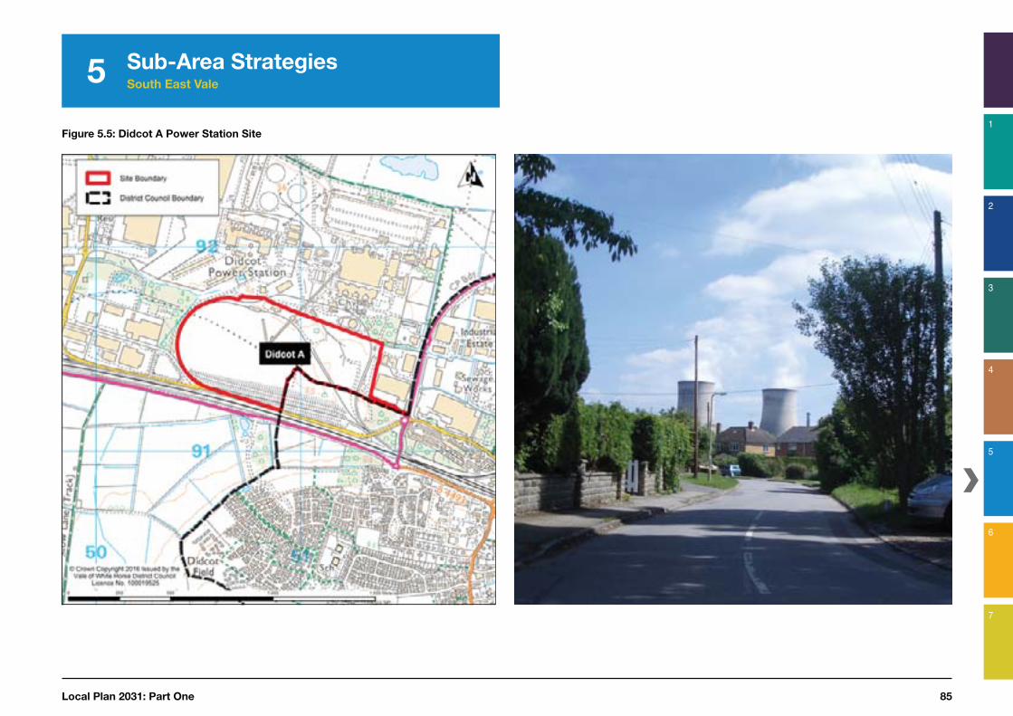
5.74 The redevelopment of the Didcot A Power Station site provides the area with an opportunity for the regeneration of around 47 hectares of brownfield land61 and the site will be instrumental in the future place shaping of Didcot (Figure 5.5).
5.75 The provision of the Science Bridge, a new bridge over the railway at the Didcot A power station site, aims to help reduce congestion on the A4130 through Didcot and reduce severance caused by the railway line. The new bridge will also help to create direct connections with the new housing developments of Great Western Park and Valley Park to the south of the site.

Local Plan 2031: Part One 83
5
1
2
3
4
5
7
6
Sub-Area Strategies South East Vale
5.76 The Employment Land Review62 highlighted that part of the Didcot A Power Station site (29 hectares; refer to Core Policy
6) should be safeguarded for employment uses. This is to ensure the district can provide sufficient employment to deliver new jobs alongside new housing in line with forecast population growth up to 203163.
5.77 The distribution of the employment and other potential uses across the site, as identified in Core Policy 16, will need to be carefully considered through a detailed masterplanning process. Development proposals will need to reflect the aspirations for Didcot as a whole. Achieving a high quality development with active frontages will be important, particularly due to the site’s location on what will become a key access route into the town.
62 Employment Land Review Update Addendum (July 2014)
63 Employment Land Review Update Addendum (July 2014) Page 10
5.78 Part of the site is located within South Oxfordshire District and so it is important that development proposals are considered jointly with both local authorities. The Local Plan 2031 Part 2 will set out more detail to help inform the master planning of the site.

Vale of White Horse District Council84
5 Sub-Area Strategies South East Vale
Core Policy 16:
Didcot A Power Station
The Council supports the redevelopment of the Didcot A site to provide a high quality mixed-use development. The site will continue to be reserved for a range of uses, particularly employment (B1, B2 and B8). Other acceptable uses for the site include, but are not limited to, residential (C1, C2 and C3), ancillary retail, an element of bulky goods retail, leisure (D2) and community uses. Any proposed uses for the site must have regard to relevant policies contained within South Oxfordshire District Council’s Adopted Core Strategy.
Proposals for retail development that exceed 500 square metres gross retail floorspace will need to be subject to a retail impact assessment to demonstrate there would be no adverse impacts on the vitality and viability on nearby centres.
The mix of these uses will need to reflect demand, suitability of the site and any transport implications to be identified by a detailed transport assessment with appropriate mitigation provided. Any development will need to be appropriate to the site’s location adjacent to Didcot B Power Station.
These uses need to be carefully considered in the masterplanning process to ensure that the site incorporates the following key design principles:
• The creation of a mixed-use local centre forming a high street and active frontages on the main routes through the site;
• Strong connectivity with Didcot town centre, Milton Park and Valley Park;
• Design across the site must have regard to sensitive views from elevated positions towards (but not limited to) residential amenity space, the treatment of facades and rooftops of prominent buildings, and reducing the visual impact of car parks;
• Any residential development (C2 and C3) to be situated towards the south of the site and separate from the movement of heavy goods vehicles along key transport corridors; and
• Integrated SUDS and natural landscape features throughout the site.
The proposed route of the new Science Bridge and A4130 re-routing is safeguarded. Planning permission will not be granted for development that would prejudice the construction or effective operation of this highway infrastructure in accordance with Core Policy 17.
Local Plan 2031: Part One 85
5
1
2
3
4
5
7
6
Sub-Area Strategies South East Vale
Figure 5.5: Didcot A Power Station Site

Vale of White Horse District Council86
5 Sub-Area Strategies South East Vale
Science Vale
5.79 The Science Vale area is a nationally and internationally significant location for research and innovation and is the focus for large-scale expansion. The area is predominately located within the South East Vale Sub-Area and this is where we are focusing most of our future development. As outlined above, the area is home to the largest of our significant employment sites, and is where the largest number of our new jobs will be created.
5.80 The area extends into South Oxfordshire and it is important we plan effectively across our district boundaries to ensure the coordinated delivery of new infrastructure, services and facilities.
5.81 The town boundary of Didcot is located within our neighbouring district of South Oxfordshire and adjoins parts of the Vale to the north and west. The Vale parishes
64 South Oxfordshire District Council, South Oxfordshire Core Strategy, December 2012, available at: http://www.southoxon.gov.uk/services-and-advice/planning-and-building/planning-policy/core-strategy/adopted-core-strategy
of Appleford-on-Thames, Sutton Courtenay and Harwell all have borders with Didcot. Some of these parishes house the important employment land to the west of Didcot, including the Didcot A Power Station and Milton Park sites.
5.82 Parts of Harwell and Milton parishes have been identified for future housing, which although located within the Vale, clearly relate to Didcot. As a larger settlement and service centre, Didcot will provide many important services and facilities for the new development, including for retail and leisure.
5.83 Didcot is identified as a location for strategic growth within the adopted South Oxfordshire Core Strategy, which allocates 6,300 homes within South Oxfordshire at Didcot64. The Core Strategy also identifies the need for significant regeneration and outlines proposals for improvements to the central area of the town, the Orchard Centre and the railway station.
5.84 Overall there is significant change proposed around Didcot, in both the Vale of White Horse and South Oxfordshire Districts, which includes housing, employment and large infrastructure projects. There is also significant change proposed across other parts of the Science Vale area, as described in the rest of our South East Vale Sub-Area Strategy.
5.85 The Didcot area forms part of Science Vale and has been designated by central government as a Garden Town. To ensure our aspiration for this area of change is met (refer to Figure 2.2), this will be considered further through the Local Plan Part 2, which will provide additional focus on delivery and implementation and on successful place making.

Local Plan 2031: Part One 87
5
1
2
3
4
5
7
6
Sub-Area Strategies South East Vale
Meeting the needs for retailing
5.86 The main retail facilities in the Wantage and Grove area are provided by Wantage town centre. Large improvements were delivered to the retail offer in Wantage in 2007 when a major food store and several large non-food (comparison) stores were built, just to the north of the town centre. These new stores successfully complement the historic Market Square, which includes a number of attractive historic buildings.
5.87 Wantage is one of the main shopping and commercial centres within the District. The centre provides a reasonable range and mix of national and independent comparison retailers and has a good range and choice of non-retail services. The vitality and viability of Wantage town centre will be maintained and enhanced through the implementation of Core Policy 32.
65 http://m.oxfordshire.gov.uk/cms/sites/default/files/folders/documents/roadsandtransport/transportpoliciesandplans/localtransportplan/ltp3/May2011CompleteApprovedLTP3.pdf
5.88 Grove functions as a small neighbourhood shopping centre with a limited range of non-food (comparison) shops and predominantly independent traders serving day-to-day shopping needs. Grove’s role as a Local Service Centre will be supported by Core
Policy 32. The Local Plan 2011 allocation of 2,500 new homes on the former Grove Airfield site will provide a new local centre, which will help to improve the range of shops available in the village.
5.89 The nearby settlement of Didcot, located in South Oxfordshire, also provides for the shopping needs of residents within the Sub-Area. Furthermore, housing growth in the Vale of White Horse makes a significant contribution to the continued viability and vitality of Didcot Town Centre.
Supporting sustainable transport and accessibility
Delivery of strategic highway
infrastructure within the South
East Vale Sub-Area
5.90 We are planning to focus most of our development within the South East Vale Sub-Area (around 75 % of the proposed strategic growth). This is because the area is home to the largest of our significant employment sites and where the largest number of new jobs will be created. Locating the majority of the planned housing within this area, also provides the opportunity to promote and deliver sustainable transport options, allowing easy access between homes, employment and facilities.
5.91 Working jointly with key partners, including Oxfordshire County Council, we have investigated the impact of the proposed growth within this area and have identified a significant package of
new infrastructure. This includes new roads and improvements to public transport, to ensure that development is sustainable. The identified package of measures complements and builds upon those already identified in the ‘Science Vale Area Strategy’ as set out in the Local Transport Plan 365 which was the relevant document up until July 2015.
5.92 The main focus of these improvements is to ensure that there are efficient and effective transport linkages between the major Science Vale employment sites (as well as those within the Science Transit Arc) and the planned housing growth, as well as allowing for strategic public transport and road access to the area. The package includes improvements to the cycle and public transport network within, and to, the area, as well as necessary upgrades to roads and road junctions to allow for growth (Figures 5.6 a to c).

Vale of White Horse District Council88
5 Sub-Area Strategies South East Vale
5.93 The measures are consistent with the Local Transport Plan 4 which was approved by Oxfordshire County Council Cabinet in July 2015. Of relevance to Vale of White Horse, Local Transport Plan 4 includes a Science Vale Area Strategy, as well as a Science Transit Strategy and an A420 Strategy. In addition to the highway schemes identified in the LTP4 Science Vale Area Strategy the Local Plan also safeguards land to deliver a West Wantage Link Road (WWLR) connecting the A417 from Mably Way in Wantage to East Challow, a South Abingdon bypass crossing the Thames and connecting with the A415 and some junction improvement schemes. These are safeguarded to ensure their future delivery is not compromised, should they be found to be needed later in the plan period, or beyond.
Figure 5.6a: Map showing the proposed road and junction improvements within the Science Vale area

Local Plan 2031: Part One 89
5
1
2
3
4
5
7
6
Sub-Area Strategies South East Vale
Figure 5.6b: Map showing the proposed Science Vale strategic cycle network
Figure 5.6c: Map showing the proposed improvements to the bus network within the Science Vale area

Vale of White Horse District Council90
5 Sub-Area Strategies South East Vale
5.94 The strategic importance of the highway schemes identified in the Science Vale Area Strategy have been acknowledged at a larger than local planning level. Local authorities have been working together through the Oxfordshire Growth Board and the Oxfordshire Local Enterprise Partnership to identify funding mechanisms for this infrastructure to secure its delivery. As part of this work the package has been identified as one of the top priority projects within the Oxfordshire Local Investment Plan66.
5.95 Core Policy 7 (Chapter
4) sets out the principle that all developments will contribute to infrastructure provision as identified in the Infrastructure Delivery Plan67 that supports the Local Plan 2031 Part 1.
5.96 Without investment in the identified infrastructure, the growth in the Science Vale area would be unsustainable and be put at risk. For this reason, Core Policy 17 sets
66 Spatial Planning and Infrastructure Partnership (2010) Oxfordshire Local Investment Plan, available at: https://www.oxford.gov.uk/downloads/download/501/oxfordshire_local_investment_plan
67 http://www.whitehorsedc.gov.uk/evidence
out the requirement for all strategic growth within the Sub-Area to contribute towards strategic highway infrastructure.
5.97 The housing supply ring-fence (Core Policy 5 - Chapter 4) supports our Spatial Strategy to ensure housing is located in the Science Vale area and in close proximity to the projected new jobs. This approach will also focus financial contributions from development to help deliver the essential infrastructure needed to support sustainable development.
5.98 In addition to the infrastructure identified within the Science Vale Area Strategy, there is an existing requirement for a development road to serve the Local Plan 2011 allocation at Grove Airfield. This is known as the Grove Northern Link Road (GNLR) and is required to provide access to the Grove Airfield site from the A338. It does not form part of the Science Vale Area Strategy and will be provided in association
with the Saved Local Plan 2011 allocation at Grove Airfield and the new strategic allocation at Monks Farm (refer to the Site Development Templates shown by Appendix A).
© Milton Park
Local Plan 2031: Part One 91
5
1
2
3
4
5
7
6
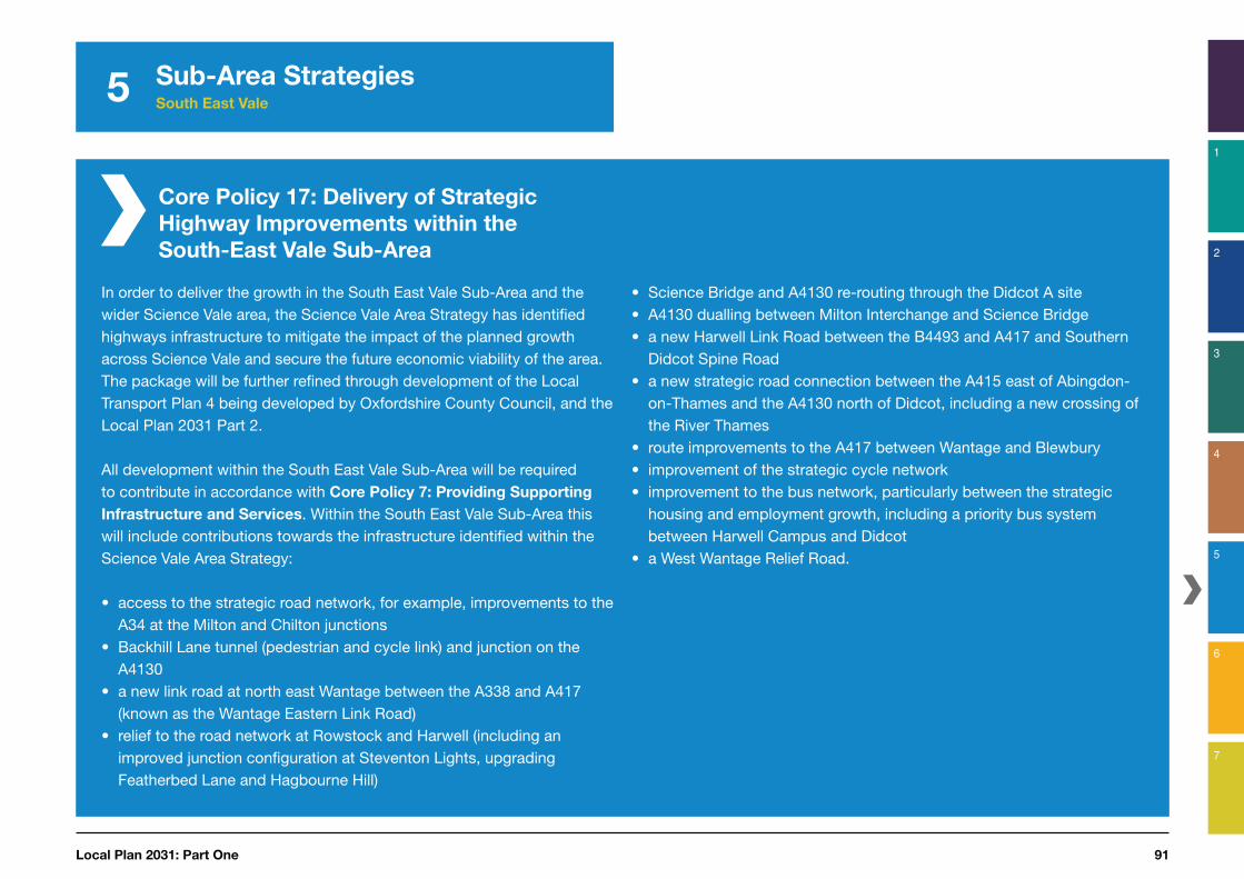
Core Policy 17: Delivery of Strategic
Highway Improvements within the
South-East Vale Sub-Area
• Science Bridge and A4130 re-routing through the Didcot A site• A4130 dualling between Milton Interchange and Science Bridge • a new Harwell Link Road between the B4493 and A417 and Southern
Didcot Spine Road • a new strategic road connection between the A415 east of Abingdon-
on-Thames and the A4130 north of Didcot, including a new crossing of the River Thames
• route improvements to the A417 between Wantage and Blewbury• improvement of the strategic cycle network• improvement to the bus network, particularly between the strategic
housing and employment growth, including a priority bus system between Harwell Campus and Didcot
• a West Wantage Relief Road.
Sub-Area Strategies South East Vale
In order to deliver the growth in the South East Vale Sub-Area and the wider Science Vale area, the Science Vale Area Strategy has identified highways infrastructure to mitigate the impact of the planned growth across Science Vale and secure the future economic viability of the area. The package will be further refined through development of the Local Transport Plan 4 being developed by Oxfordshire County Council, and the Local Plan 2031 Part 2.
All development within the South East Vale Sub-Area will be required to contribute in accordance with Core Policy 7: Providing Supporting
Infrastructure and Services. Within the South East Vale Sub-Area this will include contributions towards the infrastructure identified within the Science Vale Area Strategy:
• access to the strategic road network, for example, improvements to the A34 at the Milton and Chilton junctions
• Backhill Lane tunnel (pedestrian and cycle link) and junction on the A4130
• a new link road at north east Wantage between the A338 and A417 (known as the Wantage Eastern Link Road)
• relief to the road network at Rowstock and Harwell (including an improved junction configuration at Steventon Lights, upgrading Featherbed Lane and Hagbourne Hill)

Vale of White Horse District Council92
5 Sub-Area Strategies South East Vale
Safeguarding of land
for strategic highway
improvements within the South
East Vale Sub-Area
5.99 The planning and funding of transport infrastructure can take a long time to prepare and it is therefore important that our plans are not compromised by inappropriate development occurring in the interim. Core Policy 18 seeks to prevent development that may prejudice the delivery of the required schemes identified in the Science Vale Area Strategy.
Rail services
Didcot
5.100 The Council is working with Oxfordshire County Council and other partners to examine how the rail network can be accessed more effectively and to deliver improvements to facilities at stations.
5.101 Whilst located within South Oxfordshire, Didcot Station is nonetheless an important transport hub for Vale residents, particularly for those commuting or travelling outside of the district and functions as an important gateway for Science Vale. For these reasons, Didcot Station is the focus for investment that will lead to a step change in the station’s capacity for rail services, the delivery of an integrated transport hub with facilities for pedestrians, cyclists and bus users.
Core Policy 18: Safeguarding of Land for
Transport Schemes in the South East
Vale Sub-Area
Land is safeguarded to support the delivery of the identified transport schemes listed by Core Policies 17 and 19.
Any proposals for development that may reasonably be considered to impact the delivery of the identified transport schemes (as shown by the maps in Appendix E and the Adopted Policies Map)* should demonstrate the proposal would not harm their delivery.
Planning permission will not be granted for development that would prejudice the construction or effective operation of the transport schemes listed.
New development in these areas should be carefully designed having regard to matters such as building layout, noise insulation, landscaping, the historic environment and means of access. Where appropriate, further detail for these schemes will be set out in Local Plan 2031 Part 2.
* the area shown on the Adopted Policies Map illustrates where Core Policy
18 will apply. It does not seek to show a precise alignment for the transport schemes, which will need to be informed by detailed design work, carried out in consultation with Oxfordshire County Council and other relevant parties.
Local Plan 2031: Part One 93
5
1
2
3
4
5
7
6
5.102 The Oxfordshire Strategic Economic Plan68 identifies six discrete measures for improving Didcot Railway Station, which are:
• construction of a deck access car park on to the existing Foxhall Road car park to increase car parking capacity
• improved connectivity to enable four stopping trains an hour between Didcot and Oxford
• additional platform to enable north-south trains from Southampton and Birmingham to stop at Didcot
• construction of an underpass to provide access from the north into the station
• firm plans for direct access to Heathrow as part of the Western Rail Access to Heathrow project without changes at Reading, and
• rebuilding of Didcot Station to create an appropriate fit for purpose gateway to Science Vale.
68 Oxfordshire Local Enterprise Partnership (LEP) (March 2014), Strategic Economic Plan: Driving economic growth through innovation, available at: http://www.oxfordshirelep.org.uk/sites/default/files/Oxford%20SEP_FINAL_March14_1_0.pdf
69 http://www.atoc.org/clientfiles/files/publicationsdocuments/ConnectingCommunitiesReport_S10.pdf
Wantage and Grove
5.103 There are long-standing ambitions to re-open the railway station at Grove and the Council will continue to support this aim in accordance with Core Policy 19.
5.104 In 2009 the Association of Train Operating Companies (ATOC) published Connecting Communities: Expanding Access to the Rail Network69, which identified the re-opening of Grove Station as being within the top five best business cases for opening a new station across the whole of the UK.
5.105 Furthermore, wider initiatives already being brought forward to enhance the national rail network, may also help to enable the re-opening of Grove Station. Examples include:
• the electrification of the London to Bristol main line will increase capacity of the network, and
• the East West Rail link that will eventually connect Oxford and Cambridge may offer a longer term opportunity to connect Oxford with Swindon or Bristol.
Sub-Area Strategies South East Vale
Core Policy 19: Re-opening of Grove
Railway Station
The Council will continue to support the re-opening of the railway station at Grove, ideally within the lifetime of this plan, and will work with rail operators, Oxfordshire County Council and other partners to develop and implement a strategy to re-open the station and ensure opportunities to do so are maximised.
Planning permission will not be granted for development that would prejudice the construction or effective operation of the re-opening of Grove Railway Station in accordance with Core Policy 18.

Vale of White Horse District Council94
5 Sub-Area Strategies South East Vale
Protecting the environment and responding to climate change
5.106 The Sub-Area contains many areas important for their environmental or landscape value. These include the Letcombe Brook, a green corridor, which provides informal recreation, amenity and wildlife value and is an important flood management feature. Other land between East Challow and Wantage, and Wantage and Grove helps to preserve the separate and unique identities of these communities and so it is important these areas are protected from development.
5.107 Wantage Market Place contains many historic buildings and groups of buildings that are important to the overall ‘sense of place’ and quality of the town centre. Future development should be of high quality design and well integrated with the existing built form and landscape setting of the town. Heritage assets and their respective settings should be conserved.
5.108 The conservation and enhancement of the North Wessex Downs AONB (as identified in Figure
5.4) together with its Management Plan will be supported (as required by the Countryside and Rights of Way (CROW) Act 2000).

Local Plan 2031: Part One 95
1
2
3
4
5
7
6
Western Vale Sub-Area Strategy
Introduction
5.109 The Western Vale Sub-Area is predominantly rural in character and extends from the North Wessex Downs Area of Outstanding Natural Beauty (AONB) to the River Thames (Figure 5.8). The historic Market Town of Faringdon is the largest settlement within the Sub-Area and functions as the main service centre of the surrounding rural catchment.
5.110 The area contains many attractive villages, which range in size from small isolated hamlets to Larger Villages, such as East Challow, Shrivenham, Stanford-in-the-Vale, Uffington and Watchfield. Shrivenham and Watchfield are located approximately five miles east of Swindon and house the Shrivenham Hundred Business Park and the Defence Academy of the United Kingdom, which includes a campus of Cranfield University.
5.111 Significant growth is planned in the Eastern Villages area within the neighbouring borough of Swindon to the west of this Sub-Area. The Council is working positively with Swindon Borough Council, Oxfordshire County Council and other partners to ensure the growth in both areas is coordinated, particularly in relation to transport and the A420 corridor in accordance with an agreed Statement of Common Ground.
5.112 Our overall priority for the Western Vale Sub-Area is to ensure the service centre role of Faringdon is maintained and continues to meet the needs of the town and surrounding rural catchment. Future development should secure a housing and employment balance, thus helping to improve the self-sufficiency of the area. Development within the Sub-Area should also contribute towards upgrading the A420 to help reduce existing traffic congestion.
5.113 This section sets out:
• how the Sub-Area will
change by 2031, and
• our strategic policies to
address the key challenges
and opportunities identified
in the Sub-Area in relation to
our four thematic areas,
along with other policy
considerations:
Building healthy and sustainable communitiesCore Policy 20: Spatial
Strategy for the Western Vale
Sub-Area
– which sets out our strategic site allocations for this area.
Supporting economic prosperity
Supporting sustainable transport and accessibilityCore Policy 21: Safeguarding
of land for strategic highway
improvements within the
Western Vale Sub-Area
Protecting the environment and responding to climate change
5 Sub-Area Strategies Western Vale
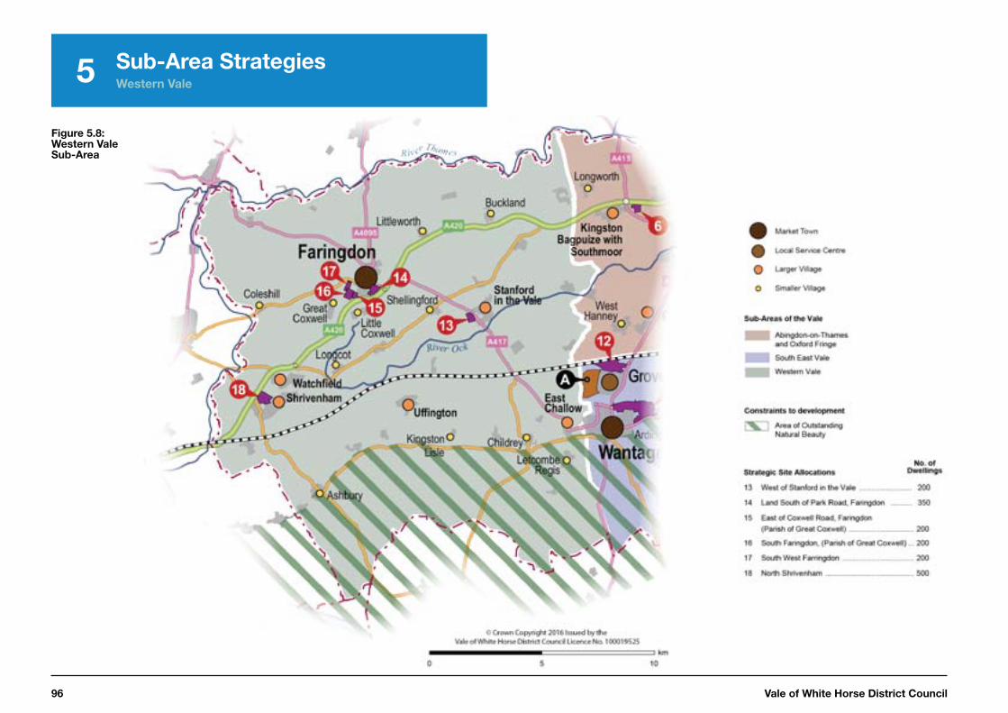
Vale of White Horse District Council96
5 Sub-Area Strategies Western Vale
Figure 5.8: Western Vale Sub-Area
Local Plan 2031: Part One 97
5
1
2
3
4
5
7
6
Sub-Area Strategies Western Vale
How the Western Vale Sub-Area will change by 2031
The Western Vale Sub-Area will continue to be an attractive and prosperous rural area. Development will have been focused at Faringdon with complementary growth in the Larger Villages, especially Shrivenham and Stanford-in-the-Vale. The quality of the rural environment will have been maintained.
Faringdon will continue to be a thriving Market Town providing an important service centre role for the surrounding rural catchment. Its historic character and attractive landscape setting will have been maintained. New development will have been successfully integrated with the town and will have been provided alongside additional employment, improving the self-sufficiency of the town. The high quality business park, at the junction of Park Road and the A420, will be thriving and provide an attractive entrance to the town.
The quality of the public area in the centre of Faringdon will have been improved, along with the revitalisation of the shopping and tourism offer. The town will attract residents and visitors alike, serving as a gateway to the Cotswolds. The landscape setting of Faringdon will have been preserved along with ongoing protection for the AONB and Great Western Community Forest.
The countryside and villages will have maintained, conserved and enhanced their distinctive character. The Larger Villages will have retained their services and provide for residents’ day-to-day needs. New residents in the villages will be helping to sustain the services and social life of the rural communities.

Vale of White Horse District Council98
5 Sub-Area Strategies Western Vale
Strategic policies and other planning considerations for the Western Vale Sub-Area
Building healthy and sustainable communities
5.114 Faringdon is a sustainable Market Town that acts as a service centre for a large rural catchment to the west of the Vale. It has an excellent range of services and facilities and further development, adjoining Faringdon, including within Great Coxwell parish, will help to support the delivery of improvements to the town through developer contributions. These could include upgrades to the A420 Junction at Coxwell Road, provision of a new primary school, and increasing the frequency of public transport.
5.115 Land has been identified for strategic development on a number of sites at Faringdon. These are well related to the existing built form of
70 A Statement of Common Ground was agreed between Swindon Borough Council, Oxfordshire County Council, Vale of White Horse District Council and the Western Vale Villages in April 2014.
Faringdon and provide an opportunity to help strengthen community facilities.
5.116 Strategic housing development is also proposed at Shrivenham and Stanford-in-the-Vale. These are sustainable Larger Villages with good services and facilities and good access to employment. Development will ensure the vitality and viability of these rural communities are maintained and facilitate the delivery of new infrastructure.
5.117 The strategic sites will be designed to integrate successfully with the local community and to minimise any harmful effects. Appropriate infrastructure, such as open space, leisure provision and new services and facilities will all be delivered alongside the housing.
5.118 Our strategy for meeting our housing needs in this Sub-Area is set out in Core Policy 20: Spatial
Strategy for the Western Vale Sub-
Area
5.119 This Sub-Area neighbours the borough of Swindon to the west where significant development is proposed close to the borders of the Vale. Vale of White Horse
District Council will continue to work positively with Swindon Borough Council, Oxfordshire County Council and the rural communities within the Western Vale Sub-Area to help ensure any planned growth to the east of Swindon does not adversely affect the west of the Vale and its rural villages to a significant extent70.

Local Plan 2031: Part One 99
5
1
2
3
4
5
7
6
Core Policy 20: Spatial Strategy for
Western Vale Sub-Area
Our overarching priority for this Sub-Area is to protect the service centre role of Faringdon and deliver a balance of housing and employment to improve the self-sufficiency of the area and to protect the vitality and viability of our rural communities.
Development in the Western Vale Sub-Area should be in accordance with the Settlement Hierarchy set out in Core Policy 3:
Western Vale Sub-Area
Market Town: FaringdonLarger Villages: East Challow, Shrivenham, Stanford-in-
the-Vale, Uffington and WatchfieldSmaller Villages: Ashbury, Buckland, Childrey, Coleshill,
Great Coxwell, Kingston Lisle, Little Coxwell, Littleworth, Longcot, Letcombe Regis and Shellingford
Housing Delivery
At least 3,173 new homes will be delivered in the plan period between 2011 and 2031. 1,650 dwellings will be delivered through strategic allocations. 462 dwellings remain to be identified and will be allocated through the Local Plan 2031 Part 2 or Neighbourhood Development Plans or through the Development Management process. The contribution of all sources of housing supply within this Sub-Area are shown by the following table:
Category Number of
Dwellings
Housing requirement for the full plan period (Apr 2011 to Mar 2031) 3,173a
Housing Completions (Apr 2011 to Mar 2016)
860
Housing Supply(Apr 2016 to Mar 2031)
Known Commitments 732
Local Plan 2031 Part 1 allocations 1,650
Local Plan 2031 Part 2 allocations 222b
Windfalls 240
a This target addresses needs arising in the Vale of White Horse. If or when required, needs arising elsewhere in the Housing Market Area, will be addressed in accordance with Core Policy 2.b The Local Plan Part 2 allocation will be reduced where dwellings are allocated in Neighbourhood Developments Plans or come forward through the Development Management Process.
Strategic Allocations
Development will be supported at the strategic allocations through a masterplanning process involving the community, local planning authority, developer and other stakeholders where development meets the requirements set out within the Site Development Templates shown by Appendix A and are in accordance with the Development Plan taken as a whole. The following table shows how the level of housing required within this Sub-Area through strategic development sites will be distributed:
Sub-Area Strategies Western Vale
Continued overleaf
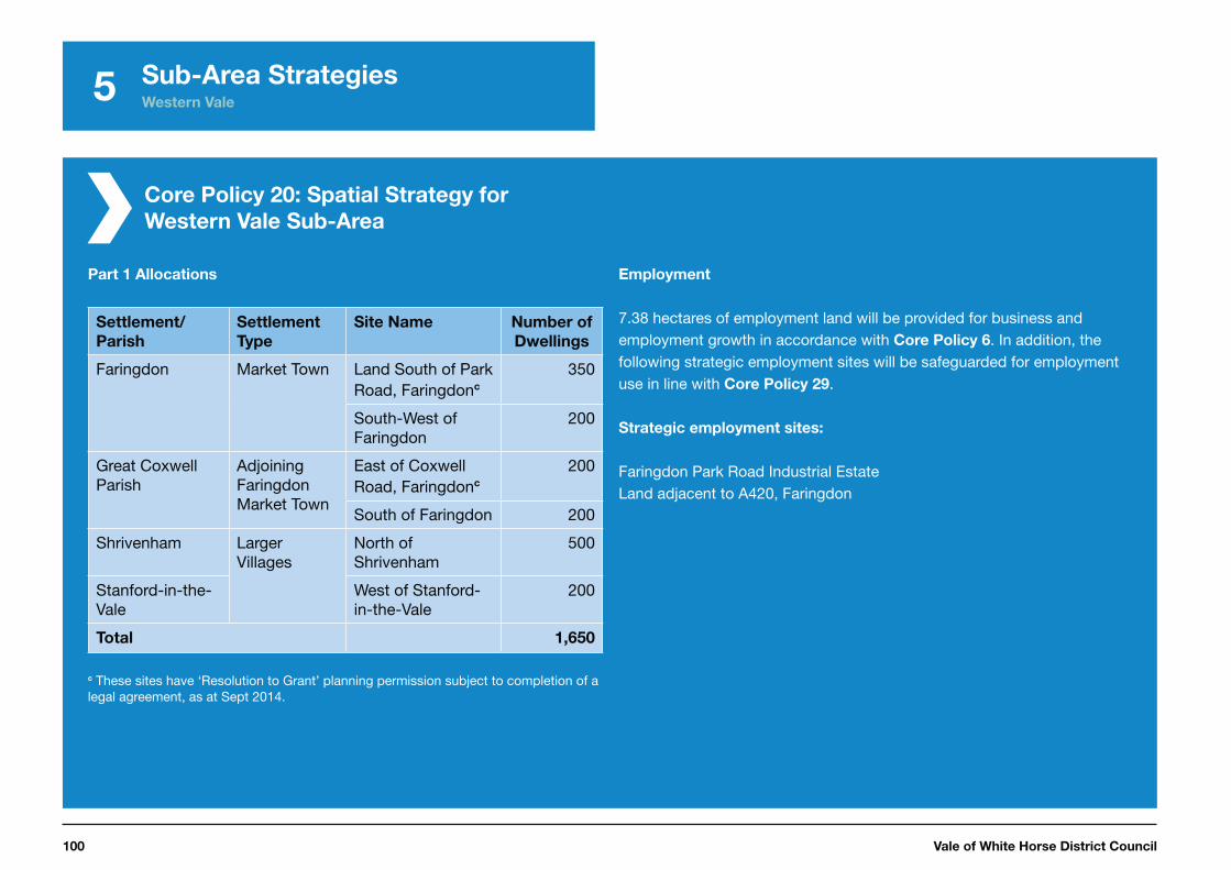
Vale of White Horse District Council100
5
Core Policy 20: Spatial Strategy for
Western Vale Sub-Area
Part 1 Allocations
Settlement/
Parish
Settlement
Type
Site Name Number of
Dwellings
Faringdon Market Town Land South of Park Road, Faringdonc
350
South-West of Faringdon
200
Great Coxwell Parish
Adjoining Faringdon Market Town
East of Coxwell Road, Faringdonc
200
South of Faringdon 200
Shrivenham Larger Villages
North of Shrivenham
500
Stanford-in-the-Vale
West of Stanford-in-the-Vale
200
Total 1,650
c These sites have ‘Resolution to Grant’ planning permission subject to completion of a legal agreement, as at Sept 2014.
Employment
7.38 hectares of employment land will be provided for business and employment growth in accordance with Core Policy 6. In addition, the following strategic employment sites will be safeguarded for employment use in line with Core Policy 29.
Strategic employment sites:
Faringdon Park Road Industrial EstateLand adjacent to A420, Faringdon
Sub-Area Strategies Western Vale

Local Plan 2031: Part One 101
5
1
2
3
4
5
7
6
Sub-Area Strategies Western Vale
Supporting economic prosperity
5.120 The provision of employment in Faringdon is a key priority for the Sub-Area; helping to improve the self-sufficiency of the town and reduce the need for out-commuting.
5.121 The employment development to be provided on the strategic allocation to the South of Park Road will complement the saved Local Plan 2011 allocation at the 4&20 Business Park of 4.2 hectares.
5.122 A number of employment allocations from the former Local Plan 2011 will also be saved. Some other smaller employment sites are no longer fit for purpose (for example, Pioneer Road / south of Willes Close and north of Park Road / south east of Volunteer Way) and it may be appropriate for these sites to be redeveloped in accordance with
71 http://www.whitehorsedc.gov.uk/evidence
72 Nathanial Lichfield & Partners (NLP) (2012) Retail and Town Centre Study – Vale of White Horse District Council, March 2013
73 www.whitehorsedc.gov.uk/evidence
Core Policy 2971.
5.123 Faringdon town centre has a mix of shops and services that meet day-to-day and local shopping needs, but the range and choice of shops could be improved. However, the 2013 Retail Needs Assessment for the Vale of White Horse District indicates that the need for additional convenience floorspace in Faringdon in the foreseeable future can largely be met by the new food store on Park Road72.
Supporting sustainable transport and accessibility
Safeguarding of land
for strategic highway
improvements within the
Western Vale Sub-Area
5.124 The Evaluation of Transport Impacts (ETI) Study73 that has been prepared to inform the Vale Local Plan 2031 Part 1 has identified that
some capacity issues on the A420 are likely to occur later in the plan period. This impact is partly as a result of the development proposed in the Sub-Area and will particularly affect junctions accessing Faringdon and Shrivenham.
5.125 Oxfordshire County Council has worked with partners, including Vale of White Horse District Council and Swindon Borough Council to develop a Route Strategy for the A420 (between the A419 and A34) as part of the Local Transport Plan (LTP).
The strategy helps to ensure this important and strategic route continues to operate with minimal congestion and to avoid rat runs on minor roads.
5.126 The ETI has identified that revised junctions are needed on the A420 at both Faringdon and Shrivenham. For this reason, land is safeguarded at these locations to ensure these necessary upgrades can be delivered alongside the planned growth at these settlements in accordance with Core Policy 21.

Vale of White Horse District Council102
5 Sub-Area Strategies Western Vale
Protecting the environment and responding to climate change
5.127 The North Wessex Downs AONB extends across part of the Sub-Area and this area will continue to be protected because of its high quality landscape and setting in accordance with Core Policy 44.
5.128 The Great Western Community Forest covers an area of 168 square miles around Swindon and extends as far as Faringdon to the east. The project aims to produce long-term environmental improvements by promoting tree planting and woodland management and has supported the regeneration of woodland around Faringdon Folly. Development proposals in the forest area should demonstrate how they will contribute to the objectives of the project.
Core Policy 21: Safeguarding of Land for
Strategic Highway Improvements within
the Western Vale Sub-Area
Land is safeguarded to support the delivery of the following identified transport schemes:
• junction enhancement on the A420 at Faringdon and Shrivenham
New development in these areas should be carefully designed, having regard to matters such as building layout, noise insulation, landscaping and means of access.
Any proposals for development that may reasonably be considered to impact the delivery of the identified schemes (as shown by maps in Appendix E and the Adopted Policies Map)* should demonstrate the proposal would not harm their delivery.
Planning permission will not be granted for development that would prejudice the construction or effective operation of the transport schemes listed above.
* the area shown on the Adopted Policies Map illustrates where policy CP21 will apply. It does not seek to show a precise alignment for the transport scheme, which will need to be informed by detailed design work, carried out in consultation with Oxfordshire County Council and other relevant parties.
Local Plan 2031: Part One 103
1
2
3
4
5
7
6

Vale of White Horse District Council104
6District Wide Policies
Overview
The Local Plan 2031 Part 1 establishes a strategic policy framework to guide development in the Vale up to 2031.
This chapter sets out those strategic policies necessary to complement the Spatial Strategy (Chapter 4) and Sub-Area Strategies (Chapter 5) to ensure planned growth is sustainable. The policies will apply across the Vale and provide greater detail to ensure a balance is met between addressing local housing needs, supporting economic growth and conserving and enhancing the Vale’s high quality natural, historic and built environment, and the quality of life in existing settlements.
The policies in this chapter have been developed where national guidance alone is not sufficient to deliver the Council’s vision. The policies therefore build on, rather than duplicate, national guidance.
Some of the policies set out in the Vale Local Plan 2011 will continue to be saved and relied upon (and used alongside new Local Plan policies) for day-to-day decision making on planning applications until they are reviewed as part of the Local Plan 2031 Part 2. The Council has published an assessment of the consistency of Saved Local Plan 2011 policies when compared with the National Planning Policy Framework (NPPF). This will be used to help ensure that the saved policies are applied appropriately alongside the NPPF.
The policies are structured into the four thematic areas, which are common throughout the plan:
• building healthy and sustainable communities
• supporting economic prosperity
• supporting sustainable transport and accessibility, and
• protecting the environment and responding to climate change

1
2
3
4
5
7
6
Local Plan 2031: Part One 105
6 District Wide Policies
Building healthy and sustainable communities
Introduction
6.1 The Local Plan 2031 Part 1 has a key role in helping to build sustainable communities in the Vale and helping to meet the diverse needs of the people living there. This will be achieved in part through the Spatial Strategy (set out in Chapter 4) that seeks to direct new development to the most sustainable locations and in communities with the best range of services and facilities. Furthermore, the Sub-Area Strategies (set out in Chapter 5), are focused on addressing more location-specific issues and the needs of different parts of the District.
6.2 Chapter 2 of this plan identified a number of key challenges and opportunities facing this thematic area for achieving sustainable communities and these include the high cost of housing and the disparity between income levels and housing costs in the district. It showed the long-
term demographic trends towards an ageing population and a higher number of smaller sized households. For these reasons, our vision and objectives (Chapter 3) seek to increase the supply of new housing and ensure that the right size, type and tenure of housing is delivered to address the needs of existing and future residents. They also seek to address the specific needs of vulnerable groups (such as the elderly and those with disabilities).
6.3 We have set out a number of site specific proposals and policies relating to housing in our Sub-Area Strategies included within Chapter
5. This section includes policies that apply across the whole district. These are:
• Core Policy 22: Housing Mix – which seeks to ensure that the right mix of housing sizes, types and tenures are provided on all residential development sites.
Core Policy 23: Housing Density
– which seeks to ensure that residential dwellings are provided at an appropriate density to reflect the need to use land efficiently whilst also taking account of local circumstances.
Core Policy 24: Affordable
Housing – which sets out the Council’s approach to the provision of affordable housing as part of new residential development.
Core Policy 25: Rural Exception
Sites – which identifies the circumstances in which affordable housing can be provided on ‘exception sites’ in the rural areas, where residential development would not normally be permitted.
Core Policy 26: Accommodating
Current and Future Needs of
An Ageing Population – which sets out measures to ensure new
homes are well designed and easily adapted to the changing needs of residents throughout their lives.
Core Policy 27: Meeting the
Housing Needs of Gypsies,
Travellers and Travelling
Showpeople – which seeks to provide for the needs of gypsies, travellers and travelling showpeople.
Vale of White Horse District Council106
6 District Wide Policies
Housing mix
6.4 It is important that housing provision across the district reflects the needs of an ageing population and growth in smaller households. The Strategic Housing Market Assessment (SHMA) provides details of the recommended mix of housing type and size. The assessment identifies that there is most need in the Open Market sector for 3-bed units with the lowest need for 1-bed units. For affordable housing, there is a greater need for 2-bed units with the lowest need for 4-bed units74. It is important that new housing addresses any imbalance within the existing stock and the impact of demographic and household change. It is also important to provide the type of housing needed to attract people to live and work locally and built to a size and standard that supports a good quality of life.
74 Strategic Housing Market Assessment (2014) Tables 65 and 66
6.5 The SHMA acknowledges the longer-term objective to deliver a more balanced stock, which reflects the identified needs of the area, but this objective must be seen in the context of viability. As a result, Core
Policy 22 adopts a flexible approach to the implementation of housing mix.
6.6 Additional policy detail will be set out in the Local Plan 2031 Part 2 to determine the specific needs of housing types and sizes on strategic housing development sites within the Science Vale area.
Core Policy 22:
Housing Mix
A mix of dwelling types and sizes to meet the needs of current and future households will be required on all new residential developments. This should be in accordance with the Council’s current Strategic Housing Market Assessment unless an alternative approach can be demonstrated to be more appropriate through the Housing Register or where proven to be necessary due to viability constraints*.
*Viability should be set out in an independent viability assessment on terms agreed by the relevant parties including the Council and funded by the developer. This will involve an open book approach.

Local Plan 2031: Part One 107
6 District Wide Policies
1
2
3
4
5
7
6
Housing density
6.7 New housing should provide good quality, attractive and acceptable living environments. Density is an important consideration in delivering these high quality environments. Historically, some of the most successful settlements included high density development, such as medieval villages and town centres and Georgian, Victorian and Edwardian terraces. This is often the case in many of the District’s market towns and village centres.
6.8 Land is a finite resource and should be used efficiently. Consideration is needed for local context of proposed development sites and new development should seek to achieve a target net75 density of at least 30 dwellings per hectare. Higher or lower densities may be acceptable and the approach to density should be justified in the Design and Access Statement and relate to urban structure, legibility, landscape and
75 Net Density excludes major elements of supporting uses such as open space, community facilities, infrastructure etc.
townscape context and creating enclosure to streets and spaces.
Core Policy 23:
Housing Density
On all new housing develop-ments a minimum density of 30 dwellings per hectare (net) will be required unless specif-ic local circumstances indicate that this would have an adverse effect on the character of the area, highway safety or the amenity of neighbours. Higher densities will be encouraged in locations where it will result in the optimum use of land, where there is good access to services and public transport routes, and where it would contribute to enhancing the character and legibility of a place.
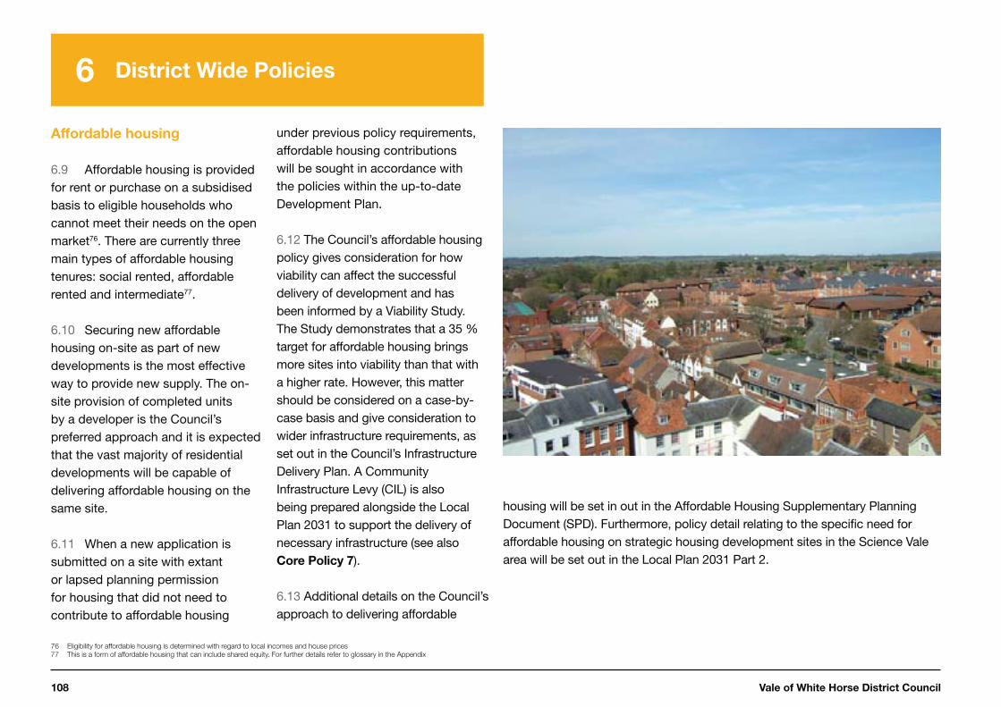
Vale of White Horse District Council108
6 District Wide Policies
Affordable housing
6.9 Affordable housing is provided for rent or purchase on a subsidised basis to eligible households who cannot meet their needs on the open market76. There are currently three main types of affordable housing tenures: social rented, affordable rented and intermediate77.
6.10 Securing new affordable housing on-site as part of new developments is the most effective way to provide new supply. The on-site provision of completed units by a developer is the Council’s preferred approach and it is expected that the vast majority of residential developments will be capable of delivering affordable housing on the same site.
6.11 When a new application is submitted on a site with extant or lapsed planning permission for housing that did not need to contribute to affordable housing
76 Eligibility for affordable housing is determined with regard to local incomes and house prices
77 This is a form of affordable housing that can include shared equity. For further details refer to glossary in the Appendix
under previous policy requirements, affordable housing contributions will be sought in accordance with the policies within the up-to-date Development Plan.
6.12 The Council’s affordable housing policy gives consideration for how viability can affect the successful delivery of development and has been informed by a Viability Study. The Study demonstrates that a 35 % target for affordable housing brings more sites into viability than that with a higher rate. However, this matter should be considered on a case-by-case basis and give consideration to wider infrastructure requirements, as set out in the Council’s Infrastructure Delivery Plan. A Community Infrastructure Levy (CIL) is also being prepared alongside the Local Plan 2031 to support the delivery of necessary infrastructure (see also Core Policy 7).
6.13 Additional details on the Council’s approach to delivering affordable
housing will be set in out in the Affordable Housing Supplementary Planning Document (SPD). Furthermore, policy detail relating to the specific need for affordable housing on strategic housing development sites in the Science Vale area will be set out in the Local Plan 2031 Part 2.
Local Plan 2031: Part One 109
6 District Wide Policies
1
2
3
4
5
7
6
Core Policy 24:
Affordable Housing
The Council will seek 35 % affordable housing on all sites capable of a net gain of eleven or more dwellings. There should be a 75:25 split for rented (either social or affordable) and intermediate housing respectively. In circumstances where it can be demonstrated that the level of affordable housing being sought would be unviable, alternative tenure mixes and levels of affordable housing provision, may be considered. Any difference in tenure mix or percentage of affordable housing to be delivered will need to be supported by a viability assessment*.
Any affordable housing provided should:
i. be of a size and type which meets the requirements of those in housing need, and
ii. be indistinguishable in appearance from the market housing on site and distributed evenly across the site
The Council’s preference is for on-site affordable housing provision (with the exception of part units). Only in exceptional circumstances will any other scenario be considered. In such cases the following delivery hierarchy will be considered:
iii. mix of on-and off-site delivery with the level of affordable housing to be achieved to be ‘broadly equivalent’ to that which would have been delivered on-site
iv. full off-site delivery v. part off-site delivery and part commuted sum vi. commuted sum which shall be based on the open market
value of units to be delivered on site in lieu of full-on or off-site delivery
In cases where the 35 % calculation provides a part unit, a financial contribution will be sought, equivalent to that part unit.
Off-site contributions and/or financial contributions for the provision of affordable housing in lieu of on-site provision will not be appropriate, unless it can be robustly justified that:
vii. it is not physically possible or feasible to provide affordable housing on the application site, or
viii. there is evidence that a separate site would more satisfactorily meet local housing need and contribute to the creation of sustainable mixed communities.
Planning permission will be refused for development proposals where it appears that a larger site has been sub-divided into smaller development parcels in order to avoid the requirements of the affordable housing policy.
*Viability should be set out in an independent viability assessment on terms agreed by the relevant parties including the Council and funded by the developer. This will involve an open book approach.

Vale of White Horse District Council110
6 District Wide Policies
Rural exception sites
6.14 The ‘rural exception site’ policy is aimed at providing homes for local people, who are unable to rent or buy a property on the open market in rural locations.
6.15 Schemes should be supported in principle by the local community, as represented by the relevant parish council. To facilitate this approach, a detailed housing needs assessment must be carried out following a methodology agreed with the District and to include formal engagement with the local parish councils before a planning application is made. The housing needs assessment must include the following information:
• the present housing circumstances and income levels of those considered to be in need, related to local house prices and rent levels
• the connection of the likely occupants with the village or nearby village, and
• the type and size of dwellings that would meet their requirements.
6.16 Housing schemes approved under the Rural Exceptions Policy must be genuinely designed to meet a specific local need. The homes will be allocated in accordance with the Council’s allocations policy with priority given to those households with the required local connection which is clearly set out in the policy. The Council’s housing team may be able to give a preliminary indication of whether there is sufficient need in the village to pursue a scheme.
6.17 Early discussion with the Council will be essential to establish whether a particular site is likely to be suitable for a rural exception housing scheme.
6.18 Secure arrangements must be made to ensure that the scheme meets the local needs that have been identified and remains affordable, both initially and in respect of successive occupiers. The precise nature of these arrangements may vary but will most often be achieved through a legal agreement or planning
conditions. It will also be important to involve a registered provider or housing trust who can retain a long-term interest in the housing and thus control subsequent changes of ownership and occupation in accordance with the agreed criteria.

Local Plan 2031: Part One 111
6 District Wide Policies
1
2
3
4
5
7
6
Core Policy 25:
Rural Exception Sites
Affordable housing schemes will be permitted on sites that would not otherwise be acceptable for housing development, providing the scheme would satisfy the following:
i. it meets a clearly established local need identified through a robust housing needs assessment in accordance with a methodology agreed with the District Council
ii. it is designed to meet the established need of a village (or its neighbouring village) in terms of dwelling numbers, types, sizes and affordability
iii. it includes secure arrangements to ensure that all the houses will be occupied by local people in need of affordable housing and that the benefits of the low cost provision will remain available to local people in the long term
iv. it is located within or on the edge of a village and would not harm the character, visual amenity or setting of settlements, particularly in Areas of Outstanding Natural Beauty. The design, layout and materials of new housing complements and enhances its surrounding natural and built environment
v. is consistent with Green Belt policy as set out in the National Planning Policy Framework and Core Policy 13
vi. it will not adversely impact upon designated heritage assets or their setting (i.e. Listed Buildings, Conservation Areas, Registered Parks and Gardens, Scheduled Monuments, and non-designated Heritage Assets)
vii. it is located in a sustainable location with good access to public transport, employment and local services/facilities, and
viii. is consistent with Core Policy 42: Flood Risk.
Where robust evidence establishes that viability issues* would prevent the delivery of an exception site, the minimum level of market housing required to make the development viable will be favourably considered where it would ensure the provision of significant additional affordable housing to meet local needs.
Any market housing included in a scheme (where considered necessary for reasons of viability) should be constructed to reflect the character of the affordable units and be sympathetic to the rural location.
*Viability should be set out in an independent viability assessment on terms agreed by the relevant parties including the Council and funded by the developer. This will involve an open book approach.
Vale of White Horse District Council112
6 District Wide Policies
Accommodating current and
future needs of the ageing
population
6.19 The district has an ageing population. Over the plan period the 65+ age group is projected to increase by 58 % between 2010 and 2030 to represent 26 % of the district’s total population by 203078. The high level of growth in this age group is a key demographic driver and should be adequately addressed in the Local Plan 2031 to ensure that housing supply addresses the current and future needs of older people.
6.20 As the population of the district increases and ages, the level of disabilities and health issues amongst the older population is likely to increase significantly, along with the specialist housing to address their needs.
6.21 In delivering homes that will meet the current and future needs of the ageing population, it is important that new homes are adaptable to the
78 2010-based sub national population projections available at http://www.oxford.gov.uk/districtdata/
79 OCC Extra Care Housing Strategy, January 2008
80 A Framework for an Oxfordshire Extra Care Housing Strategy, Oxfordshire County Council, January 2008
changing needs of residents over time. The Council will consider a need to set out higher accessibility, adaptability and wheelchair housing standards through Local Plan Part 2, in accordance with the National Planning Practice Guidance in identifying optional technical standards.
6.22 There are a range of models that can play a part in providing specialist accommodation for the elderly. These include sheltered and enhanced sheltered housing, Extra Care housing, retirement villages, continuing care retirement communities and registered care homes both with and without nursing care. The Council’s preference is for Extra Care housing or schemes which include an element of Extra Care provision within them, in accordance with the County Council’s Extra Care Housing Strategy79. 6.23 Specialist accommodation for the elderly should be provided on a mixed-tenure basis wherever
possible. Where the accommodation caters for mobile residents, it should be located on sites in or adjacent to the towns or within the Larger Villages80. Where any scheme providing specialist accommodation
for the elderly (with or without care) includes an affordable housing component, this can count towards the overall 35% affordable housing requirement if part of a wider development.
Core Policy 26:
Accommodating Current and Future
Needs of the Ageing Population
In order to meet the needs of current and future households in the context of an ageing population, the following requirements will be sought subject to the viability* of provision on each site:
i. residential dwelling houses designed for older people (with or without Extra Care) should be provided in the strategic site allocations in the Local Plan 2031 Part 1 and other suitable locations.
ii. where possible, residential dwellings designed for older people should be located within close proximity to public transport routes, retail and other local facilities, including for health care.
iii. where residential dwelling houses for older people (with or without Extra Care) are provided, wherever possible it should be on a mixed-tenure basis in accordance with the requirements of Core Policy 24: Affordable Housing.
iv. where standards that would apply to general housing have been relaxed in response to the special needs of the occupiers of the scheme, the occupancy will be limited to accord with the nature of the scheme.
*Viability should be set out in an independent viability assessment on terms agreed by the
relevant parties including the Council and funded by the developer. This will involve an open
book approach.
Local Plan 2031: Part One 113
6 District Wide Policies
1
2
3
4
5
7
6
Meeting the needs of Gypsies
and Travellers and Travelling
Show People
6.24 The needs of the Gypsies, Travellers and Travelling Show People communities are important to us to ensure we develop a fair and effective strategy to meet these needs, particularly through the identification of land for pitches.
6.25 The Gypsy, Traveller and Travelling Show People Accommodation Needs Assessment (2013)81, prepared jointly with Oxford City Council and South Oxfordshire District Council, assessed the housing needs for the Gypsy, Traveller and Travelling Show People communities within these areas.
81 Oxford City, South Oxfordshire District and Vale of White Horse District Council’s Gypsy, Traveller and Travelling Show People
Accommodation Needs Assessment. Opinion Research Services 2013
6.26 For the Vale of White Horse District, the identified need is for 13 additional permanent Gypsy and Traveller pitches to be delivered during the plan period. For the Travelling Show People community, the assessment identified that no plots are needed within the district during this plan period.
Core Policy 27:
Meeting the housing needs of Gypsies,
Travellers and Travelling Show People
The Council will enable or provide for at least 13 pitches for gypsies and travellers during the plan period to 2031. Existing sites will be safeguarded.
The identified need will be met by a combination of the following: i. implementation of extant planning permissions ii. extending existing sites where possible to meet the needs of
existing residents and their families iii. allocating specific deliverable sites through Local Plan 2031 Part
2 to meet any remaining identified need.
Proposals to meet the identified need will be permitted where it has been demonstrated that the following criteria have been met: iv. the site is not located within the Oxford Green Belt v. the development will not harm the Area of Outstanding Natural
Beauty, areas of high landscape or ecological value, or heritage assets and their setting
vi. the development will not have an adverse impact on the character of the area, highway safety or the amenities of neighbouring properties
vii. the site is located within a reasonable walking distance of key local services including a primary school, a local shop and a public transport service
viii. the site can be provided with safe vehicular and pedestrian access, electricity, mains drinking water, sewage connections and waste disposal facilities.
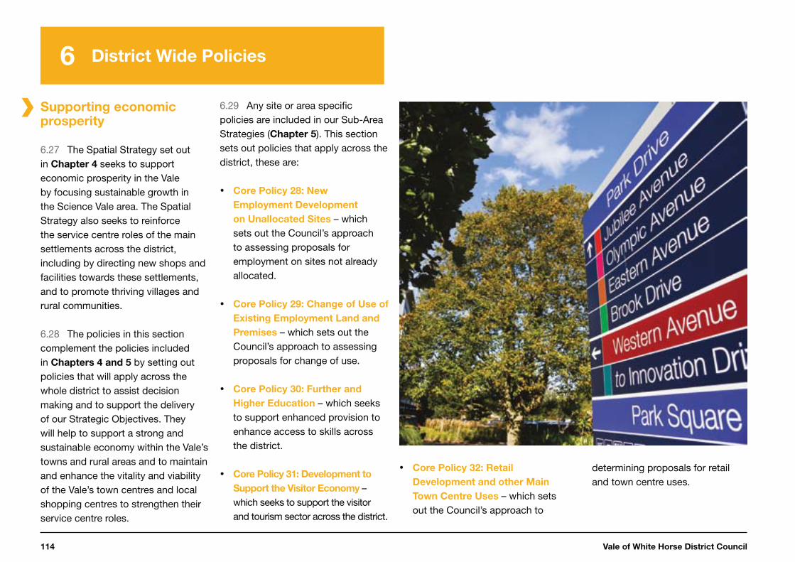
Vale of White Horse District Council114
6 District Wide Policies
Supporting economic prosperity
6.27 The Spatial Strategy set out in Chapter 4 seeks to support economic prosperity in the Vale by focusing sustainable growth in the Science Vale area. The Spatial Strategy also seeks to reinforce the service centre roles of the main settlements across the district, including by directing new shops and facilities towards these settlements, and to promote thriving villages and rural communities.
6.28 The policies in this section complement the policies included in Chapters 4 and 5 by setting out policies that will apply across the whole district to assist decision making and to support the delivery of our Strategic Objectives. They will help to support a strong and sustainable economy within the Vale’s towns and rural areas and to maintain and enhance the vitality and viability of the Vale’s town centres and local shopping centres to strengthen their service centre roles.
6.29 Any site or area specific policies are included in our Sub-Area Strategies (Chapter 5). This section sets out policies that apply across the district, these are:
Core Policy 28: New
Employment Development
on Unallocated Sites – which sets out the Council’s approach to assessing proposals for employment on sites not already allocated.
Core Policy 29: Change of Use of
Existing Employment Land and
Premises – which sets out the Council’s approach to assessing proposals for change of use.
Core Policy 30: Further and
Higher Education – which seeks to support enhanced provision to enhance access to skills across the district.
Core Policy 31: Development to
Support the Visitor Economy – which seeks to support the visitor and tourism sector across the district.
Core Policy 32: Retail
Development and other Main
Town Centre Uses – which sets out the Council’s approach to
determining proposals for retail and town centre uses.

Local Plan 2031: Part One 115
6 District Wide Policies
1
2
3
4
5
7
6
New employment development on unallocated sites
6.30 The Local Plan 2031 Part 1 sets out employment allocations within Core Policy 6. There is a strong focus on the Science Vale area, with a total of 157 hectares allocated to Milton Park and Harwell Campus, and 29 hectares to be provided at the Didcot A Power Station site. Core Policy
28 complements these allocations by supporting appropriate B-Class employment development on unallocated sites across the district.
6.31 In the rural areas, outside the Market Towns, Local Service Centres and Larger and Smaller Villages, new employment activities can be accommodated with least impact on the landscape through the re-use, conversion or adaptation of suitable existing buildings. However, there is some flexibility for new employment buildings to come forward in the rural areas if there are no suitable existing buildings available for re-use, providing that the proposals meet the other criteria set out in the policy.
Core Policy 28:
New Employment Development on
Unallocated Sites
Proposals for new employment development (Use Classes B1, B2 or B8) will be supported on unallocated sites in or on the edge of, the built up area of Market Towns, Local Service Centres and Larger and Smaller Villages provided that the benefits are not outweighed by any harmful impacts, taking into account the following:
i. the effect on the amenity of nearby residents and occupiers ii. the provision of safe site access for pedestrians and cyclists
and for all types of vehicles likely to visit the sites, and measures to promote the use of sustainable modes of transport where possible, and
iii. the scale, nature and appearance of the employment development and its relationship with the local townscape and/
or landscape character
In the rural areas the re-use, conversion or adaptation of suitable existing buildings for employment will also be supported subject to criteria (i)-(iii) where applicable. Other rural proposals will be supported, provided that, in addition to criteria (i)-(iii) where applicable:
iv. the proposal cannot reasonably be accommodated on employment land identified as vacant or developable, and
v. it can be demonstrated that the proposal will benefit the local economy and will not undermine the delivery of the strategic employment allocations.
Vale of White Horse District Council116
6 District Wide Policies
Change of use of existing
employment land and premises
6.32 In addition to supporting appropriate new employment development, there is also a need to protect important existing employment sites in the Vale. This will help ensure the overall employment provision is increased over the Local Plan 2031 period. The Government has introduced new permitted development rights that impact upon existing employment uses in the district82. Vale of White Horse District Council will continue to monitor the impacts of these rights on the district. Should we consider them to potentially conflict with our Spatial Strategy, we will seek an Article 4 direction to maintain control of our strategic employment sites. Core
Policy 29 will apply to all proposals for changes of use of existing employment land and premises that are not covered by the new permitted development rights.
82 http://www.planningportal.gov.uk/permission/commonprojects/changeofuse/
83 Milton Park Local Development Order, December 2012, available at: http://www.whitehorsedc.gov.uk/services-and-advice/planning-and-building/milton-park-local-development-order
6.33 There are a number of key existing strategic employment sites, at the main settlements and in the Science Vale area, where retention of the existing employment uses will be particularly important to help deliver our overall Spatial Strategy. These strategic employment sites are listed in the Sub-Area Strategies in Chapter 5. Core Policy 29 sets out the Council’s intention to safeguard land and premises on these existing sites and on sites allocated for new employment development (also listed in the Sub-Area Strategies in Chapter
5), for employment uses.
6.34 There is an adopted Local Development Order (LDO) that covers the Milton Park site83 for a period of 15 years from December 2012. The LDO permits an element of non-B class employment generating uses (specifically car dealership and private healthcare uses) and also allows for some other uses that will help support the sustainability and viability of the business park, such
as small-scale shops and recreation facilities. Core Policy 29 will apply to any applications for non B-class uses at Milton Park which are not permitted by the LDO.
6.35 There are also a number of rural employment sites that make an important contribution to the local economy and provide employment opportunities in rural locations across the district. These rural multi-user sites and large campus style sites (listed in Appendix D) are identified in the Local Plan 2011 and will be reviewed through the Local Plan 2031 Part 2.
6.36 Proposals for alternative uses on these rural employment sites and other employment land and premises in the district will need to demonstrate that at least one of the criteria set out in Core Policy 29 will be met.
6.37 In seeking to demonstrate that a site has no reasonable
prospect of being used for employment purposes, applicants will be expected to demonstrate that the site is no longer viable for its present, or any other realistic and suitable, employment use. They must demonstrate that the site has remained un-sold or un-let for at least 12 months. In addition, applicants will need to provide evidence relating to the marketing of the site for its present use for a minimum period of 12 months up to the date at which the planning application was lodged. This should demonstrate that despite genuine and sustained attempts to sell or let a site on reasonable terms for employment use, they have failed to do so.
Local Plan 2031: Part One 117
6 District Wide Policies
1
2
3
4
5
7
6
6.38 The site’s potential contribution to the local and wider economy must be considered, both currently and in the long term, taking proper account of the economic cycle and the likely future needs of the economy. The Council will need to be satisfied that the change of use of the employment site would not jeopardise the provision of sufficient employment land across the district to meet the identified need.
6.39 Saved Policy E13 of the Local Plan 2011 sets out the circumstances in which ancillary uses will be permitted on employment sites. This policy will be reviewed through the Local Plan 2031 Part 2, and will continue to be used alongside the Local Plan 2031 Part 1 until such time as it is replaced.
Core Policy 29:
Change of Use of Existing Employment
Land and Premises
The strategic employment sites, as listed in the Sub-Area Strategies, form part of the District’s reserve for employment land to meet objectively assessed employment needs and will be safeguarded for employment uses. Alternative uses will be considered if they provide ancillary supporting services or meet a need identified through the Local Plan 2031 review process, or exceptionally where a reassessment of the district-wide 2013 Employment Land Review demonstrates that these sites are no longer needed over the full plan period.
Elsewhere in the District, where there is no reasonable prospect of land or premises being used for continued employment use, a mixed use enabling development which incorporates employment space should first be considered. If a mixed use scheme is not viable, the extent to which the proposed use generates new employment will be considered in determining the relevant planning application.
Proposals for alternative uses will need to demonstrate compliance with other relevant policies.
Vale of White Horse District Council118
6 District Wide Policies
Further and higher education
provision
6.40 Growth in the Science Vale area is expected to lead to an increase in the number of jobs in high tech and science-based industries in the Vale. Core Policy 30 supports improvements to further and higher education facilities to help ensure local people have opportunities to gain the skills needed to access the jobs available and local employers have access to a suitably skilled local labour force.
6.41 Core Policy 30 identifies the most appropriate locations for further and higher education facilities. The Council will support, where consistent with the other relevant policies in this plan, the development and expansion of higher education facilities at Oxford Brookes University Harcourt Hill Campus and at Cranfield University (Defence Academy) at Watchfield.
Core Policy 30:
Further and Higher Education
The Council will support the development and enhancement of further and higher education facilities to help support the local economy and to ensure the local labour force is equipped to take advantage of the opportunities likely to arise in the future. The most appropriate locations for further and higher education provision are:
i. by the extension or more intensive use of existing education or other suitable community facilities
ii. within identified strategic employment locations, provided that the training offered is clearly relevant to meet the needs of businesses in that strategic employment location, and
iii. in the main settlements and other locations with good pedestrian and cycle access and well served by public transport connections between the proposed facility and its likely student catchment.
Local Plan 2031: Part One 119
6 District Wide Policies
1
2
3
4
5
7
6
Development to support the
visitor economy
6.42 The benefits of the visitor economy can include indirect impacts such as acting as a positive force for protecting and improving the environment, as well as the direct economic gains arising from visitor economy related expenditure. The Vale is well-placed to take advantage of this, being close to the visitor attractions of the city of Oxford and the River Thames, and with the Ridgeway National Trail passing through the south of the district.
6.43 A joint Hotel Needs Assessment has been prepared with South Oxfordshire District Council84 and confirms the need for a significant increase in hotel supply in the Science Vale area. It has also identified the potential need for hotels in the Market Towns of Abingdon-on-Thames and Wantage and on the fringe of the city of Oxford at Botley.
84 www.whitehorsedc.gov.uk/evidence
6.44 Core Policy 31 supports new development in the visitor economy, including hotels and guest houses. Development should be of an appropriate scale and character in relation to the location. Proposals for development relating to the visitor economy within the Oxford Green Belt or the North Wessex Downs AONB will need to be in accordance with the relevant Local Plan 2031 policies for these areas or in accordance with Saved Policies NE7, NE 8, NE9, NE10, NE11 and NE12 until these policies are updated through Local Plan Part 2.
Core Policy 31:
Development to Support the
Visitor Economy
The Council encourages new development to advance the visitor economy for leisure and business purposes. Proposals will be supported as follows:
i. within the built-up areas of the Market Towns and Local Service Centres - larger scale developments including conference facilities, museums, heritage centres, hotels, guest houses and associated facilities for visitors
ii. within the built-up areas of the Larger and Smaller Villages - smaller and proportionately scaled developments that are in keeping with the character of the settlement, including museums, heritage centres, hotels, guest houses, self-catering accommodation and associated facilities for visitors
iii. at Milton Park and Harwell Campus - ancillary business hotel and conference facilities, and
iv. at service areas on the main transport corridors - hotel accommodation.
Outside the above locations, small-scale development to support the visitor economy, including farm diversification and equine development, will be supported provided that proposals are in keeping with the scale and character of the locality and which would not adversely affect heritage assets or their setting. Larger developments will only be supported in exceptional circumstances, for example to sensitively re-use a historic building, or to proportionally support or enhance enjoyment of a significant and established visitor attraction where this cannot reasonably be achieved from a town or village location.

Vale of White Horse District Council120
6 District Wide Policies
Retail development and main
town centre uses
6.45 The Vale has good local shopping provision in the Market Towns and Local Service Centres. One of the Strategic Objectives of this Local Plan 2031 is to maintain and enhance the vitality and viability of the existing centres in these settlements.
6.46 It is important that existing centres remain active and vibrant in light of changing trends. Retail growth suffered nationally during the economic downturn between 2008 and 2012 and a number of important national operators failed during that period. In addition, shopping from home has grown rapidly since the late 1990s and with the continued expansion of superfast broadband to the more rural and remote areas of the District, it is predicted that this form of retail offering will continue to grow.
85 As defined in Annex 2 of the NPPF. Main town centre uses: Retail development (including warehouse clubs and factory outlet centres); leisure, entertainment facilities, the more intensive sport and recreation uses (including cinemas, restaurants, drive-through restaurants, bars and pubs,
night-clubs, casinos, health and fitness centres, indoor bowling centres, and bingo halls); offices; and arts, culture and tourism development (including theatres, museums, galleries and concert halls, hotels and conference facilities).
86 Paragraph 26 of the National Planning Policy Framework, Communities and Local Government, March 2012
6.47 The focus for future retail development and other town centre uses85 will continue to centre on the primary and secondary retail frontages and town centre policy areas as defined in the Local Plan 2011. Local shopping centres, also identified through the Adopted Policies Map, will maintain a healthy level of shopping facilities that serves the surrounding residential areas.
6.48 Consequently, we have saved a number of policies from the Local Plan 2011 and will review these as part of our Local Plan 2031 Part 2 or where amended through a Neighbourhood Development Plan. These saved policies are identified in Appendix G.
6.49 Specific proposals for the redevelopment of the Charter Area in Abingdon-on-Thames and the Botley Central Area are supported by Core
Policies 10 and 11 respectively in the Abingdon-on-Thames and Oxford Fringe Sub-Area Strategy.
6.50 The main retail warehouse provision in the Vale is at Fairacres Retail Park in Abingdon-on-Thames, the Limborough Road/Kings Park area in Wantage, and Seacourt Retail Park in Botley. The Fairacres Retail Park accommodates a high proportion of the total comparison retail floorspace in the district. Any proposals for retail warehouse development or redevelopment will need to follow the approach set out in Core Policy 32.
6.51 As well as the shopping centres at the Market Towns and Local Service Centres, there are also smaller shopping centres in the Larger Villages of Kennington, Kingston Bagpuize with Southmoor, Shrivenham, Watchfield, and Wootton, and at Harwell Campus. Core Policy 32 supports the provision of retail development at these settlements, and also other Larger and Smaller Villages, where this meets the needs of the local community.
6.52 Local plan policies that support main town centre uses in other locations include Core Policy 11:
Botley Central Area, Core Policy 28:
New Employment Development on
Unallocated Sites and Core Policy
31: Development to support the
Visitor Economy.
6.53 The National Planning Policy Framework (NPPF) sets a default threshold of 2,500 square metres gross floorspace, above which all proposals for retail, leisure and office development outside town centres that are not in accordance with an up-to-date Local Plan, should be accompanied by an impact assessment86. The NPPF indicates that this default will apply where there is no threshold set locally. We consider that a 2,500 square metres gross threshold is inappropriate in the Vale, as this scale of development would represent a significant proportion of the overall retail need in the area. Development smaller than 2,500 square metres gross could have a significant
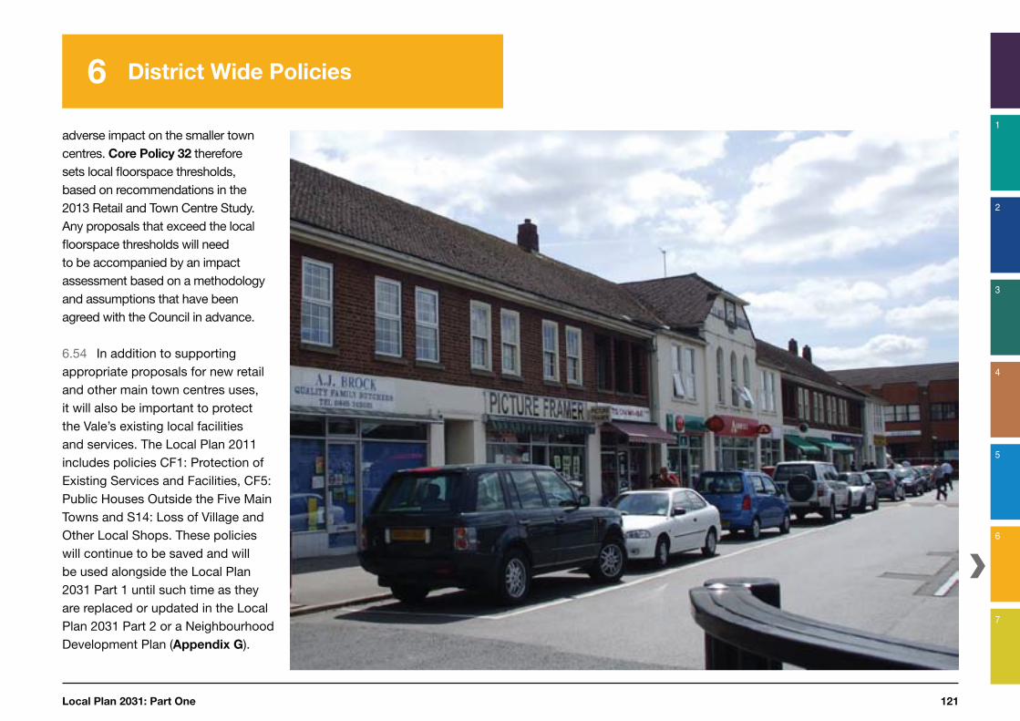
Local Plan 2031: Part One 121
6 District Wide Policies
1
2
3
4
5
7
6
adverse impact on the smaller town centres. Core Policy 32 therefore sets local floorspace thresholds, based on recommendations in the 2013 Retail and Town Centre Study. Any proposals that exceed the local floorspace thresholds will need to be accompanied by an impact assessment based on a methodology and assumptions that have been agreed with the Council in advance.
6.54 In addition to supporting appropriate proposals for new retail and other main town centres uses, it will also be important to protect the Vale’s existing local facilities and services. The Local Plan 2011 includes policies CF1: Protection of Existing Services and Facilities, CF5: Public Houses Outside the Five Main Towns and S14: Loss of Village and Other Local Shops. These policies will continue to be saved and will be used alongside the Local Plan 2031 Part 1 until such time as they are replaced or updated in the Local Plan 2031 Part 2 or a Neighbourhood Development Plan (Appendix G).

Vale of White Horse District Council122
6 District Wide Policies
Core Policy 32:
Retail Development and other Main Town Centre Uses
The Market Towns and Local Service Centres defined in the Settlement Hierarchy (Core Policy 3) are the preferred locations for larger scale development or redevelopment for retailing and other main town centre uses.
For new retail proposals (Use Class A), first consideration should be given to areas designated as primary and secondary shopping frontages1 and the redevelopment sites at the Charter area of Abingdon-on-Thames and the Botley Central Area. For other town centre uses, first consideration should be given to opportunities within the designated town centre areas1 that are well linked to the retail core by foot, including identified redevelopment sites, before more peripheral locations are considered. Proposals for new retail development or changes of use to retail or other main town centre uses will be supported elsewhere as follows:
i. for development primarily intended to serve the day-to-day needs of the local community, within the Larger and Smaller Villages, and in the local shopping centres located within Abingdon-on-Thames, Faringdon, Grove and Wantage1
ii. ancillary and proportionate food, drink and convenience retailing within and primarily servicing the users of designated employment areas, and
iii. offices in employment locations where office use is identified elsewhere in this plan to be appropriate.
Proposals for retail or other main town centre uses that are on the edge of or outside the town or local shopping centres, and are not supported by Local Plan policies, will only be supported if it is demonstrated that the proposal satisfies the sequential approach to site selection, and, where the proposal exceeds the local floorspace thresholds set out below, an impact assessment confirms that there are no likely significant adverse impacts on the vitality and viability of nearby centres. The impact assessment methodology and assumptions are to be agreed with the Council in advance.
The local floorspace thresholds for impact assessment are as follows:
iv. 1,000 square metres gross retail floorspace for development likely to have an impact on Abingdon-on-Thames or Wantage town centres, and
v. 500 square metres gross retail floorspace elsewhere in the district.
1 As defined by the Adopted Policies Map or where amended through an adopted Neighbourhood Development Plan
Local Plan 2031: Part One 123
6 District Wide Policies
1
2
3
4
5
7
6
Supporting sustainable transport and accessibility
Introduction
6.55 Our approach seeks to encourage sustainable modes of transport and a reduction in the need to travel. These are key features of our vision and objectives set out in Chapter 3.
6.56 The Local Plan 2031 has been informed by national policy as well as the principles within Oxfordshire County Council’s adopted and emerging Local Transport Plans (LTP)87.
6.57 The main requirements of national policy relating to transport are to reduce the need to travel, promote more sustainable modes of travel and improve accessibility. The location of all forms of development is therefore very important and these principles have helped to inform our Spatial Strategy set out in Chapter 4.
87 https://www.oxfordshire.gov.uk/cms/public-site/connecting-oxfordshire
88 http://m.oxfordshire.gov.uk/cms/sites/default/files/folders/documents/roadsandtransport/transportpoliciesandplans/localtransportplan/ltp3/May2011CompleteApprovedLTP3.pdf Work has started to prepare the LTP4. For more information please visit: https://www.oxfordshire.gov.
uk/cms/public-site/connecting-oxfordshire
89 www.whitehorsedc.gov.uk/evidence
90 CLG (2012) National Planning Policy Framework (NPPF), paragraph 14
6.58 The Oxfordshire Local Transport Plan 3 (2011-2030)88 sets out transport policies and area transport strategies for the county up to 2030. It aims to deliver four local transport goals:
to support the local economy and the growth and competitiveness of the countyto make it easier to travel around the county and improve access to jobs and services for all by offering real choiceto reduce the impact of transport on the environment and help tackle climate change, andto promote healthy, safe and sustainable travel.
6.59 We have set out a number of site-specific proposals and policies relating to transport in our Sub-Area Strategies included within Chapter 5. This section includes policies that apply across the whole district – these are:
Core Policy 33: Promoting
Sustainable Transport and
Accessibility – which seeks to support key improvements to the transport network.
Core Policy 34: A34 Strategy
– which sets out the Council’s support to the long-term strategic planning of the A34.
Core Policy 35: Promoting
Public Transport, Cycling and
Walking – which seeks to support the provision of sustainable transport measures to promote the use of public transport, cycling and walking.
Core Policy 36: Electronic
Communications – which promotes electronic communications to help reduce the need to travel.
The local and strategic
transport network
6.60 We have conducted a district wide assessment of how our strategy may impact on the transport network89. This has been prepared in partnership with Oxfordshire County Council and independent consultants. The work concludes that the impact of the proposed growth is acceptable, subject to the implementation of comprehensive highway infrastructure and public transport improvements, which are outlined in this plan.
6.61 The assessment does acknowledge that the proposed housing growth set out in the plan will place increased pressure on the road network at certain locations within the district. However, where congestion is expected to worsen, the level is forecast to be within acceptable tolerances in relation to the NPPF test90. For this reason, a number of measures are proposed to help

Vale of White Horse District Council124
6 District Wide Policies
minimise the identified impacts. Where infrastructure is funded by development, we will seek the timely provision of infrastructure to ensure any short term impacts are within acceptable limits before they improve. The proposals include:
the delivery of a comprehensive package of new highway infrastructuresignificant improvements to public transport and measures to encourage sustainable travel choices, andrequiring Transport Assessments and Travel Plans to accompany planning applications for any major development91 to ensure any local impacts are successfully mitigated.
6.62 Our main proposals for improving the transport network are located within the Science Vale area because this is where around 75 % of our strategic housing growth is located. This is explained in more detail in the South East Vale Sub-Area Strategy (see also Figure 5.6a).
91 Refer to Oxfordshire County Council Guidance for New Developments: Transport Assessments and Travel Plans (March 2014). https://www.oxfordshire.gov.uk/cms/public-site/transport-new-developments
92 www.whitehorsedc.gov.uk/evidence
6.63 However, the plan also proposes improvements to the highway network across the other parts of the district to ensure development in our other Sub-Areas is sustainable and to minimise any impacts on the highway network. These are set out in the Abingdon-on-Thames and Oxford Fringe Sub-Area and Western Vale Sub-Area Strategies.
6.64 The Infrastructure Delivery Plan (IDP) published alongside this strategy sets out the strategic transport measures that are planned or required to accommodate proposed development in the plan92. The IDP is a live document that will be updated as further requirements emerge and where additional resources are secured through the Local Plan 2031 and Local Transport Plan processes.
6.65 Vale of White Horse District Council, working with Oxfordshire County Council, has had some
success in securing significant external funding towards strategic highway infrastructure (£26.1 million as at Sept 2014). The funds include monies contributed from the Oxfordshire and Oxford City Deal and Local Growth Fund, in addition to a commitment from the Oxfordshire Local Enterprise Partnership to contribute £40 million Enterprise Zone Business Rate
income towards critical new highway infrastructure.
6.66 Core Policy 33 sets out the Council’s commitment to continue working with Oxfordshire County Council to promote sustainable transport and accessibility, for example, by supporting measures identified in the up-to-date Local Transport Plan.
Core Policy 33:
Promoting Sustainable Transport and
Accessibility
The Council will work with Oxfordshire County Council and others to: i. actively seek to ensure that the impacts of new development
on the strategic and local road network are minimised ii. ensure that developments are designed in a way to promote
sustainable transport access both within new sites, and linking with surrounding facilities and employment
iii. support measures identified in the Local Transport Plan for the district, including within the relevant local area strategies
iv. support improvements for accessing Oxford v. ensure that transport improvements are designed to minimise
any effects on the amenities, character and special qualities of the surrounding area, and
vi. promote and support improvements to the transport network that increase safety, improve air quality and/or make our towns and villages more attractive.
Local Plan 2031: Part One 125
6 District Wide Policies
1
2
3
4
5
7
6
A34 Strategy
6.67 The A34 has a dual role as a nationally important strategic route as well as being a vital part of the local road network in Oxfordshire, linking Didcot and Abingdon-on-Thames with Oxford and Bicester.
6.68 Highways England is currently preparing a Route Based Strategy for the A34 as part of the wider proposals for movement between the Midlands and the Solent. As part of this, a Baseline Statement was prepared by Oxfordshire County Council to assess the capacity and capability of the A34 in terms of its physical characteristics, traffic flow patterns, network performance and conditions.93
6.69 The Baseline Statement examined a number of possible improvements to the A34 and its immediate feeder routes. It also identified that it was likely that by 2030, congestion along the route would take place more frequently,
93
and that instances of network congestion outside of peak hours would increase and that they may occur at any time of the day, including weekends. The Statement suggested that congestion may occur through most weekdays and at weekend peak periods.
6.70 To ensure the A34 successfully functions as a major strategic route without impacting local routes, a number of traffic management options are under consideration and may form part of the Route Based Strategy. These include ramp metering, speed control, rationalisation of laybys and lorry services, measures to promote bus lanes for shorter journeys, widening of the current route and constructing alternative alignments for some of the route. The Solent to Midlands Route Based Strategy, which includes the A34, was finalised in April 2015.
6.71 Core Policy 34 includes a commitment to monitor air quality to
ensure we continue to have an up-to-date understanding of potential impacts on the Oxford Meadows Special Area of Conservation (SAC). This is important to inform joint working to ensure this SAC continues to be safeguarded.
6.72 The Council will continue to support the development and implementation of the A34 Route Based Strategy in accordance with Core Policy 34.
Core Policy 34:
A34 Strategy
The Council will continue to work with Highways England, Oxfordshire County Council and other partners to develop and implement a Route Based Strategy for the A34, which enables it to function as a major strategic route, thereby reducing consequential congestion on the local road network.
The Council will continue to work with Highways England, Oxfordshire County Council and other partners to develop an air quality monitoring framework associated with the A34 within the Vale of White Horse District to monitor any impact on the Oxford Meadows SAC.
Vale of White Horse District Council126
6 District Wide Policies
Public transport, cycling and
walking
6.73 New development should be designed to positively promote the use of public transport, walking, cycling and efficient car use and the location of development is therefore essential to encourage their use. However, this approach should also be complemented with the provision of new services and facilities. 6.74 For this reason, a package of improvements is proposed to upgrade existing public transport services, particularly between key routes, and to introduce new services to ensure the proposed housing growth is connected by public transport. Figure
5.6c shows the proposed new bus routes within the district.
6.75 However, the rural nature of the district does mean that some residents will continue to be dependent on car travel, for some or all of their journeys, and so we will
94 As defined by Development Management Procedure Order 2010
95 Refer to Oxfordshire County Council Guidance for New Developments: Transport Assessments and Travel Plan (March 2014).
https://www.oxfordshire.gov.uk/cms/public-site/transport-new-developments
also support improvements to travel choices in rural areas.
6.76 Transport Assessments are required to support any planning application for major development94. These will help us to determine the precise nature of local impacts associated with individual proposals and identify appropriate mitigation measures to compensate for such impacts. Where off-site mitigation is identified, the developments that result in the need for the mitigation will be required to make financial contributions through the appropriate mechanism. These include, for example, Section 106 and Section 278 agreements. The Community Infrastructure Levy (CIL) Regulation 123 list will contain some highway infrastructure projects to be funded by use of the levy.
6.77 Travel Plans will also be required for major development, to encourage the use of sustainable forms of travel95. These plans should
Core Policy 35:
Promoting Public Transport,
Cycling and Walking
The Council will work with Oxfordshire County Council and others to:
i. encourage the use of sustainable modes of transport and support measures that enable a modal shift to public transport, cycling and walking in the district
ii. ensure new development is located close to, or along, existing strategic public transport corridors, where bus services can then be strengthened in response to increases in demand for travel
iii. ensure that new development is designed to encourage walking as the preferred means of transport, not only within the development, but also to nearby facilities and transport hubs
iv. ensure that new development encourages and enables cycling not only through the internal design of the site, but also through the provision of cycle friendly infrastructure to link the new residents with nearby services, employment areas, educational facilities and public transport hubs where interchange can be provided for longer distance travel
v. seek to support the provision of new cycling routes where the proposals are consistent with the other policies of this plan
vi. ensure proposals for major development* are supported by a Transport Assessment and Travel Plan, in accordance with Oxfordshire County Council guidance**, and
vii. ensure adequate parking is delivered on new developments in accordance with Oxfordshire County Council’s published standards***.
* as defined by Development Management Procedure Order 2010
** Transport for new developments (Oxfordshire County Council)
*** Parking standards for new developments (Oxfordshire County Council)

Local Plan 2031: Part One 127
6 District Wide Policies
1
2
3
4
5
7
6
set out a package of measures and initiatives with the aim of reducing the number of car journeys made by people travelling to and from the site by providing greater choice.
6.78 Cycling and walking can provide a healthier alternative to private modes of transport, especially for short trips. They may also form part of a more sustainable way of travel when combined with public transport.
6.79 Therefore, we will seek to promote cycling and walking by improving the existing network, in partnership with Oxfordshire County Council and other stakeholders. This will include the provision of new routes both generally and in association with new development and making available information on the routes and other measures to promote these forms of travel in accordance with Core Policy 35. An example includes improving provision for cycling along the A417 corridor, particularly between Wantage and Grove, and Harwell Campus and Didcot.
96 Better Broadband for Oxfordshire, available at: http://www.betterbroadbandoxfordshire.org.uk/cms/
Electronic communications
6.80 The Internet provides an opportunity to reduce the need to travel. It means that location is increasingly less important for businesses and enables greater possibilities for home-working. The Local Plan 2031 therefore recognises the role of the Internet and seeks to promote it as a means of reducing the need to travel and supporting the economy.
6.81 Core Policy 36 seeks to ensure the provision of superfast broadband connectivity to all new developments, and supports network enhancements including supporting infrastructure, to provide superfast broadband to all existing homes and businesses in the district. It is essential that the strategic site allocations set out in this plan provide appropriate infrastructure to ensure all properties can be connected to superfast broadband96 without any further works post-development.
Core Policy 36:
Electronic communications
The Council will work with Oxfordshire County Council and others to promote faster, more reliable and more comprehensive coverage of electronic communications and allow businesses and residents to access services and information more effectively, thereby helping to reduce the need to travel.
Proposals for all new development should ensure appropriate infrastructure is provided during development, sufficient to enable all properties to be connected to superfast broadband without any post-development works.
Vale of White Horse District Council128
6 District Wide Policies
Protecting the environment and responding to climate change
6.82 Protecting the environment and responding to climate change are important themes that form a key part of our vision and objectives as set out in Chapter 3 and have informed our Spatial Strategy as set out in Chapter 4. Our approach ensures that protecting the environment and responding to climate change have also influenced the location of strategic growth (Core Policy 4).
6.83 This section of the plan includes strategic policies that help to maintain and achieve a high quality environment across the district. The policies set out how we will seek to respond to climate change and protect the Vale’s historic, built, and natural environment.
6.84 Any site or area-specific policies are set out in our Sub-Area Strategies (Chapter 5). This section
sets out policies that apply across the district, these are:
Core Policy 37: Design and Local
Distinctiveness - which seeks to ensure that all development achieves high quality design standards.
Core Policy 38: Design
Strategies for Strategic and
Major Development Sites – which sets out the requirement for Masterplans and Design and Access Statements to accompany strategic and major development proposals.
Core Policy 39: The Historic
Environment – which sets out the Council’s approach to conserving historic assets across the district.
Core Policy 40: Sustainable
Design and Construction – which sets out the requirement for new development to incorporate climate change adaptation measures to ensure resilience to climate change.
Core Policy 41: Renewable
Energy – which sets out the Council’s approach to supporting proposals for renewable energy.
Core Policy 42: Flood Risk – which defines how flood risk should be addressed to support new development proposals.
Core Policy 43: Natural
Resources – which sets out the Council’s approach to minimising environmental impacts associated with development proposals.
Core Policy 44: Landscape
– which sets out the Council’s approach to protecting the important landscape setting of the Vale.
Core Policy 45: Green
Infrastructure – which seeks to ensure the appropriate provision of Green Infrastructure through new development.
Core Policy 46: Conservation
and Improvement of Biodiversity – which seeks to protect and enhance biodiversity across the district.

Local Plan 2031: Part One 129
6 District Wide Policies
1
2
3
4
5
7
6
Design
6.85 The Government attaches great importance to the design of the built environment97. Good design is a key aspect of sustainable development, is indivisible from good planning, and should contribute positively to making better places to live and work. New development should create a sense of place and distinct character where people will feel safe and be proud to live and work. Design quality and the historic environment are linked because the historic environment often includes characteristics we associate with high standards of design quality.
6.86 The Council has prepared a comprehensive Design Guide to support the design policies set out in the Local Plan 2031 (Core
Policies 37 and 38). The Design Guide has been adopted as a Supplementary Planning Document (SPD) that ensures new development
97 NPPF, paragraph 56
98 As defined by the Development Management Procedure Order 2010
99 Additional design policies may be set out within Local Plan Part 2 for sites within this area
is provided to the high quality standards that are appropriate for the Vale. Core Policy 37 and the SPD will apply to all development in the district, although not all of the requirements will apply in every case.
6.87 The Local Plan 2031 Part 1 makes provision for significant strategic growth, including a number of major urban extensions to our existing towns and villages. It is important the new developments are places where people will want to live in, and that new buildings also make a positive contribution to established settlements and the local environment.
6.88 The demonstration of good urban design principles through a masterplan approach for strategic and major applications98 is required by Core Policy 38. The masterplan should set out the strategy for new development to help clarify site expectations, improve collaboration between stakeholders and should be
prepared in accordance with the Site Development Templates (Appendix
A). This approach should also optimise the potential of the site to:
create and sustain an appropriate mix of uses (including open and other public spaces as part of developments)support existing services and amenities and facilitate delivery of housing, and tie the design process into the planning process by setting an overarching framework to achieve a cohesive development that integrates with the existing settlement.
6.89 The masterplans should be produced in consultation between Vale of White Horse District Council, the community and other stakeholders where appropriate (for example, Oxfordshire County Council and South Oxfordshire District Council) and may be subject to design review. The information
provided should be proportionate to the scale, complexity and location of the application99. Applicants are recommended to contact the Local Planning Authority at an early stage to determine the extent of information required.

Vale of White Horse District Council130
6 District Wide Policies
Core Policy 37:
Design and Local Distinctiveness
All proposals for new development will be required to be of high quality design that:
i. responds positively to the site and its surroundings, cultural diversity and history, conserves and enhances historic character and reinforces local identity or establishes a distinct identity whilst not preventing innovative responses to context
ii. creates a distinctive sense of place through high quality townscape and landscaping that physically and visually integrates with its surroundings
iii. provides a clear and permeable structure of streets, routes and spaces that are legible and easy to navigate through because of the use of street typology, views, landmarks, public art and focal points
iv. is well connected to provide safe and convenient ease of movement by all users, ensuring that the needs of vehicular traffic does not dominate at the expense of other modes of transport, including pedestrians and cyclists, or undermine the resulting quality of places
v. incorporates and/or links to high quality Green Infrastructure and landscaping to enhance biodiversity and meet recreational needs, including Public Rights of Way
vi. is built to last, functions well and is flexible to changing requirements of occupants and other circumstances
vii. addresses the needs of all in society by incorporating mixed uses and facilities as appropriate with good access to public transport and a wide range of house types and tenures
viii. is visually attractive and the scale, height, density, grain, massing, type, details and materials are appropriate for the site and surrounding area
ix. creates safe communities and reduces the likelihood and fear of crime
x. secures a high quality public realm with well managed and maintained public areas that are overlooked to promote greater community safety, with clearly defined private spaces
xi. ensures a sufficient level of well-integrated car and bicycle parking and external storage, and
xii. is sustainable and resilient to climate change by taking into account landform, layout, building orientation, massing and landscaping to minimise energy consumption and mitigate water run-off and flood risks.

Local Plan 2031: Part One 131
6 District Wide Policies
1
2
3
4
5
7
6
Core Policy 38:
Design Strategies for Strategic and Major Development Sites
Proposals for housing allocations and major development* sites must be accompanied by a site-wide design strategy that includes the following:
1. a Masterplan which should:i. identify the Vision for the development, setting out a clear description of the
type of place that could be created whilst building on the overall aims for the district
ii. demonstrate a coherent and robust framework for development that clearly sets out: land uses proposed including amount, scale and density, movement and access arrangements and Green Infrastructure provision
iii. show how the design requirements of the scheme work within the Vision and demonstrate how the Vision will be achieved
iv. integrate with the surrounding built, historic and natural environments, in particular maximising existing and potential movement connections and accessibility to encourage walking, cycling and use of public transport
v. provide community facilities and other amenities to meet the needs of all the community, including access to education and training facilities, health care, community leisure and recreation facilities as appropriate
vi. define a hierarchy of routes and the integration of suitable infrastructure, including, for example, SUDS within the public realm
vii. contain a Green Infrastructure framework to ensure that public and private open space standards are met, relate well to each other and to existing areas and that the new spaces are safe, convenient, accessible and functional, and
viii. contain an indicative layout which illustrates a legible urban structure based on strategic urban design principles and identifies key elements of
townscape such as main frontages, edges, landmark buildings and key building groups and character areas.
2. an accompanying Design and Access Statement, which should explain:i. the steps taken to appraise the context of the proposed development, and
how the design of the development takes that context into account to create or reinforce local distinctiveness to achieve a positive sense of place and identity
ii. the design principles and concepts that have been applied to the proposed development and how these principles will be used to inform subsequent phases or development parcels within the overall site
iii. the mechanism for delivering the Vision at more detailed stages, for example through design coding
iv. how sustainability and environmental matters will be addressed including the efficient use of resources both during construction and when the development is complete
v. the delivery phasing and implementation strategies to be in place to ensure the timely delivery of infrastructure and services to the development when they are needed by new residents, and that new developments are built out in a logical manner
vi. how the mix of housing types and tenures is integrated and supports a range of household sizes, ages and incomes to meet identified housing need, and
vii. how consultation with the existing community has been incorporated.
* As defined by Development Management Procedure Order 2010
Vale of White Horse District Council132
6 District Wide Policies
The Historic Environment
6.90 One of the greatest assets of the Vale is its rich and varied built heritage, which contributes greatly to the distinctive character and cherished identity of its towns, villages and countryside. The district displays a subtle range of building types and materials reflecting the underlying geology of the area. The historic landscape also plays an important role in shaping the varied character of the district as a heritage asset in itself. This will be further explored through Oxfordshire County Council’s Historic Landscape Characterisation (funded by English Heritage), which is due to be completed in 2015. Some of this work has already been undertaken for the Vale district to inform the selection of the strategic sites. The importance of the heritage across the district is recognised by the designation of 52 Conservation Areas, over 2000 Listed Buildings, 8 Registered Parks and Gardens and 68 Scheduled Monuments.
100 English Heritage, Heritage at Risk Register, available at: http://risk.english-heritage.org.uk/register.aspx
101 http://www.english-heritage.org.uk/publications/enabling-development-and-the-conservation-of-significant-places/
6.91 The numerous features of architectural or historic interest mean that heritage is a key reason that draws people to want to live in the district’s towns and villages and so it is important their character and heritage assets are retained, particularly in areas that face pressure from development. New development can often be informed by principles of good urban design through studying historic towns and villages and it is important these heritage assets are not lost.
6.92 The most effective protection for historic buildings is to maintain them in active use. In many cases the most appropriate use for a historic building is that for which it was originally constructed and this should, where possible, be retained. However, in many cases this use will no longer be practical or viable and a new use will have to be found. In such circumstances, the Council will consider appropriate alternative uses for historic buildings and
structures or, if necessary, enabling development to ensure that buildings and structures are conserved for the future. In particular, this will apply for buildings and structures on the Heritage at Risk Register100, maintained by Historic England. However, the heritage asset most at risk of being lost has often been archaeology, through neglect, decay, or inappropriate development.
6.93 Proposals for new uses of historic assets should avoid the need to remove architectural or historic features, respect the integrity of the built form and quality of spaces within the buildings and avoid or minimise the introduction of new structural features. Any enabling development will be assessed in accordance with Historic England guidance101, which recognises that such proposals should secure the future conservation of a heritage asset and that the benefits of such schemes should outweigh the dis-benefits of departing from the national and local policies.
6.94 The Council will improve its understanding of the historic environment in the district by continuing to produce Conservation Area Character Appraisals and Management Plans. The Council will also identify non-designated heritage assets through the preparation of Conservation Area Character Appraisals and Management Plans.
All of these will be produced with the help of the local community, who often have a deep knowledge of, and passion for, their local heritage. The Council will support communities who would like to gather evidence about their Conservation Area to help them produce Character Appraisals and Management Plans.
6.95 The Historic Environment Record (HER), which is currently maintained by Oxfordshire County Council, shows where there are known archaeological sites and monuments within the county. The HER will be used to guide the application of national policy
Local Plan 2031: Part One 133
6 District Wide Policies
1
2
3
4
5
7
6
in relation to heritage assets of archaeological interest.
6.96 Applications relating to heritage assets should describe the significance of the asset, including any contribution made by their setting, with a proportionate level of detail relating to the likely impact the proposal could have on the asset’s cultural, historic, architectural and archaeological interest.
6.97 Development proposals that would harm the significance of designated assets, such as Listed Buildings, Conservation Areas, Registered Parks and Gardens and Scheduled Monuments, and their settings will be strongly resisted in accordance with national guidance and Core Policy 39. Non-designated heritage assets, such as important archaeology, will be conserved, taking into account the scale of any harm or loss and the significance of the asset.
6.98 New development in Conservation Areas should make a positive contribution to, or better reveal, the significance of the setting within the Conservation Area, using an up-to-date Conservation Area Character Appraisal, where one is available.
Core Policy 39:
The Historic Environment
The Council will work with landowners, developers, the community, Historic England and other stakeholders to:
i. ensure that new development conserves, and where possible enhances, designated heritage assets and non-designated heritage assets and their setting in accordance with national guidance and legislation1
ii. ensure that vacant historic buildings are appropriately re-used as soon as possible to prevent deterioration of condition
iii. seek to reduce the number of buildings on the “Heritage at Risk” Register
iv. encourage better understanding of the significance of scheduled monuments on the “Heritage at Risk” Register and to aid in their protection
v. better understand the significance of Conservation Areas in the district through producing Conservation Area Character Appraisals and Management Plans
vi. identify criteria for assessing non designated heritage assets and maintaining a list of such assets as Locally Listed Buildings, and
vii. encourage Heritage Partnership Agreements, particularly for Listed Buildings on any ‘at risk’ register.
1 Planning (Listed Buildings and Conservation Areas) Act 1990

Vale of White Horse District Council134
6 District Wide Policies
Responding to climate change
6.99 Responding to climate change is one of our Strategic Objectives and has informed our Spatial Strategy, the location of our strategic site allocations and many of the Local Plan policies. Through the planning process the Council is seeking to achieve a low carbon Vale by:
locating housing development close to jobs and services to minimise the need to travelproviding good access by public transport, cycling and walking to reduce the need to travel by carimproving the energy efficiency of new and existing buildingspromoting the development and use of decentralised renewable and low carbon energy, andpromoting superfast broadband coverage to reduce the need to travel (Core Policy 36).
102 http://ukclimateprojections.defra.gov.uk/
103 https://www.gov.uk/government/consultations/housing-standards-review-consultation.
104 Thames Water (2014): Water Resources Management Plan 2015-2040 (July 2014)
6.100 As well as seeking to reduce emissions of greenhouse gases, the Council also recognises that climate change is already happening and so it is important that new development is designed to be resilient to its effects. It is anticipated that the UK will experience warmer, wetter winters, hotter, drier summers and see an increased incidence of extreme weather102.
6.101 The Housing Standards Review103 has indicated that the Government will put less emphasis on the Code for Sustainable Homes and will instead set equivalent standards through Building Regulations. Therefore, the Council does not set policy standards for the Code for Sustainable Homes. However, Government policy does still allow Councils to choose to apply a local standard for water efficiency in advance of national standards. As the Vale is in an area of water stress104, the Council is applying a higher standard for water efficiency, as recommended within the Water Cycle Study.
Core Policy 40:
Sustainable Design and Construction
The Council encourages developers to incorporate climate change adaptation and design measures to combat the effects of changing weather patterns in all new development, which could include:
i. planting, shading and advanced glazing systems to reduce solar heat gain during the summer
ii. using materials to prevent penetration of heat, including use of cool building materials, green roofs and walls and using flood resilient materials
iii. increasing natural ventilation and removing heat by using fresh air iv. orientating windows of habitable rooms within 30 degrees of south
and utilising southern slopesv. locating windows at heights that maximise heating from lower sub
angles during the winter, andvi. incorporating flood resilient measures such as raising floor levels,
electrical fittings and rain-proofing and overhangs to prevent infiltration of heavy rain around doors and windows.
A sensitive approach will need to be taken to safeguard the special character of the heritage assets e.g. in a Conservation Area or where historic assets would be affected.
The Vale of White Horse is located within an area of water stress and is applying a higher standard for water efficiency*.
New developments are required to be designed to a water efficiency standard of 110 litres/head/day (l/h/d) for new homes.
* Vale of White Horse District Council Water Cycle Study: updated Phase 1 Study September 2015

Local Plan 2031: Part One 135
6 District Wide Policies
1
2
3
4
5
7
6
Renewable energy
6.102 The Government has set a target of 15 % of the UK’s energy to come from renewable sources
105 Directive 2009/28/EC of the European Parliament and of the Council of 23 April 2009 on the promotion of the use of energy from
renewable sources, available at: http://eur-lex.europa.eu/legal-content/EN/TXT/PDF/?uri=CELEX:32009L0028&from=EN
by 2020105. To enable the Vale to contribute towards the government’s target, the Council will support schemes for renewable energy where they are suitable in all other respects.
Core Policy 41:
Renewable Energy
(excluding wind energy)
The Council encourages schemes for renewable and low carbon energy generation. Planning applications for renewable and low carbon energy generation (excluding wind energy) will be supported, provided that they do not cause a significantly adverse effect to:
i. landscape, both designated AONB and locally valued ii. biodiversity, including protected habitats and species and
Conservation Target Areas iii. the historic environment, both designated and non-designated
assets, including by development within their settings iv. the visual amenity and openness of the Green Belt v. local residential amenity, and vi. the safe movement of traffic and pedestrians.
Vale of White Horse District Council136
6 District Wide Policies
Flood Risk
6.103 Core Policy 42 seeks to ensure that development provides appropriate measures for the management of surface water as an essential element of reducing future flood risk to both the site and its surroundings. Sustainable drainage methods, such as green roofs, ponds and permeable surfaces, will be encouraged, where technically possible. The drainage elements of new development must be designed to the principles set out in the Flood and Water Management Act 2010106 and associated relevant design standards. Further information on sustainable drainage systems can be found in the Strategic Flood Risk Assessment (SFRA)107 and from Oxfordshire County Council, who are the lead flood authority for Oxfordshire. Sustainable drainage systems should seek to enhance water quality and biodiversity in line with The Water Framework Directive (WFD)108.
106 http://www.legislation.gov.uk/ukpga/2010/29/contents
107 http://www.whitehorsedc.gov.uk/evidence
108 http://www.legislation.gov.uk/uksi/2003/3242/contents/made
Core Policy 42:
Flood Risk
The risk and impact of flooding will be minimised through:
i. directing new development to areas with the lowest probability of flooding
ii. ensuring that all new development addresses the effective management of all sources of flood risk
iii. ensuring that development does not increase the risk of flooding elsewhere, and
iv. ensuring wider environmental benefits of development in relation to flood risk.
The suitability of development proposed in flood zones will be strictly assessed using the Sequential Test, and, where necessary, the Exceptions Test. A sequential approach should be used at site level.
A site-specific flood risk assessment will be required for all developments of 1 hectare and greater in Flood Zone 1 and, for all proposals for new development, including minor development and change of use in Flood Zone 2 and 3 and, in Critical Drainage Areas, and also where proposed development or a change
of use to a more vulnerable class that may be subject to other forms of flooding. Appropriate mitigation and management measures will be required to be implemented.
All development proposals must be assessed against the Vale of White Horse and South Oxfordshire Strategic Flood Risk Assessment and the Oxfordshire Local Flood Risk Management Strategy to address locally significant flooding. Appropriate mitigation and management measures must be implemented.
All development will be required to provide a drainage strategy. Developments will be expected to incorporate sustainable drainage systems and ensure that run-off rates are attenuated to greenfield run-off rates. Higher rates would need to be justified and the risks quantified. Developers should strive to reduce run-off rates for existing developed sites.
Sustainable drainage systems should seek to enhance water quality and biodiversity in line with the Water Framework Directive (WFD).

Local Plan 2031: Part One 137
6 District Wide Policies
1
2
3
4
5
7
6
Efficient Use of Natural
Resources
6.104 National planning policy underlines the importance of prudent use of natural resources, from using land effectively to encouraging the use of renewable resources. Core
Policy 43 incorporates all elements of natural resources, including land, water and air quality, to ensure they are protected from decline.
6.105 National policy states that policies should take account of the presence of Air Quality Management Areas and the cumulative impacts on air quality from individual sites in local areas. There are three Air Quality Management Areas designated in the Vale. These are:
those parts of Botley closest to the A34 have been declared an Air Quality Management Area (AQMA) due to the pollution generated by the heavy volume of traffic. The
109 http://www.legislation.gov.uk/uksi/2003/3242/contents/made
110 https://www.gov.uk/government/publications/thames-river-basin-management-plan
111 http://www.oxfordshire.gov.uk/cms/content/minerals-and-waste-core-strategy
Council will continue to monitor levels of nitrogen dioxide in this areacentral Abingdon-on-Thames was designated as an AQMA for nitrogen dioxide in 2006 and an Action Plan was approved in 2009. Abingdon’s Integrated Transport Strategy (AbITS) was subsequently put in place to alter the flow of traffic within the town centre. Pollution levels in the town will continue to be monitored, and an AQMA was designated in Marcham in 2005 due to a highly constrained road layout and resultant traffic congestion and nitrogen dioxide pollution. The Council will continue to monitor pollution levels and work with stakeholders to identify a long-term solution.
6.106 The Water Framework Directive109 requires that there is no deterioration in the status of water bodies and that they all achieve good ecological status by 2027. The
Thames River Basin Management Plan110 sets out actions to help meet this obligation. Policies on Green Infrastructure, biodiversity and sustainable construction will also assist in achieving this objective by ensuring that surface water run-off is appropriately controlled.
6.107 Oxfordshire County Council is responsible for determining planning applications for minerals and waste development and producing the Minerals and Waste Local Plan111, which will safeguard mineral resources, aggregate rail depots, sites for recycled and secondary aggregate supply, other minerals infrastructure sites and sites for waste management. These areas will be marked on this Plan’s Adopted Policies Map for reference in future, following adoption by the County Council. Should the district receive a planning application in any of these areas, the County Council will be consulted on the development. Applicants are advised to review the
Minerals and Waste Local Plan prior to making a planning application.
Vale of White Horse District Council138
6 District Wide Policies
Core Policy 43:
Natural Resources
The Council encourages developers to make provision for the effective use of natural resources where applicable, including:
i. minimising waste and making adequate provision for the recycling of waste on site
ii. using recycled and energy efficient materials iii. maximising passive solar heating, lighting, natural ventilation,
energy and water efficiency and re-use of materials iv. making efficient use of water, for example through rainwater
harvesting and grey water v. causing no deterioration in, and where possible, achieving
improvements in water quality vi. takes account of, and if located within an AQMA, is consistent
with, the Council’s Air Quality Action Plan vii. ensuring that the land is of a suitable quality for development
and that remediation of contaminated land is undertaken where necessary
viii. avoiding the development of the best and most versatile agricultural land, unless it is demonstrated to be the most sustainable choice from reasonable alternatives, by first using areas of poorer quality land in preference to that of a higher quality, and
ix. re-using previously developed land, provided it is not of high environmental value.
Landscape
6.108 The Vale of White Horse occupies an attractive part of the Upper Thames Valley. From south to north the landscape features range from the rolling sweep of the chalk downs (designated as part of the North Wessex Downs Area of Outstanding Natural Beauty (AONB)), across the wide vistas of the lowland clay vale, then rising to the limestone Corallian ridge, before dropping to the floodplain of the River Thames.
6.109 The distinctive landscapes within the district have been classified by Natural England as falling within three distinct National Character Areas:
NCA 108 Upper Thames Clay ValesNCA 109 Midvale RidgeNCA 116 Berkshire and Marlborough Downs
6.110 Within these national areas there are a number of smaller and
more detailed landscapes that add to and enhance the local landscape character of the district.
6.111 The conservation of the intrinsic character and beauty of the countryside is a core planning principle of the NPPF, stating that the planning system should contribute to and enhance the natural and local environment by protecting and enhancing valued landscapes.
6.112 Landscape encompasses all outdoor space. There are pressures on these landscapes as a result of changes in agricultural practice and the impact of new development for housing and employment. The distinctive landscape of the Vale needs to be enhanced and protected for the future. There will be opportunities to enhance the landscape particularly in growth areas around Science Vale and elsewhere in the district and the Green Infrastructure Strategy will identify further opportunities for landscape enhancement within the district.
Local Plan 2031: Part One 139
6 District Wide Policies
1
2
3
4
5
7
6
6.113 Core Policy 44 will be applied using the most up-to-date legislation112 and landscape studies available from Natural England, the District and County Council, and from the North Wessex Downs AONB Board. These include: National Character Areas; Vale of White Horse Landscape Strategy 2006; the Oxfordshire Wildlife and Landscape Study; Oxfordshire Historic Landscape Characterisation; Oxford View Cones Study 2015 produced by Oxford City Council in association with Oxford Preservation Trust and Historic England; and documents produced by the North Wessex Downs AONB Board such as the AONB Landscape Character Assessment. Reference should also be made to the Council’s Design Guide SPD.
6.114 Other studies may be forthcoming to support more detailed landscape policies in the Local Plan 2031 Part 2. The Council will also examine the necessity for an update to the district wide Landscape Character Assessment to support the Local Plan 2031 Part 2.
112 AONB Management Plan and CROW Act 2000
Core Policy 44:
Landscape
The key features that contribute to the nature and quality of the Vale of White Horse District’s landscape will be protected from harmful development and where possible enhanced, in particular:
i. features such as trees, hedgerows, woodland, field boundaries, watercourses and water bodies ii. important landscape settings of settlements iii. topographical features iv. areas or features of cultural and historic value v. important views and visually sensitive skylines, and vi. tranquillity and the need to protect against intrusion from light pollution, noise, and motion.
Where development is acceptable in principle, measures will be sought to integrate it into the landscape character and/or the townscape of the area. Proposals will need to demonstrate how they have responded to the above aspects of landscape character and will be expected to:
vii. incorporate appropriate landscape proposals that reflect the character of the area through appropriate design and management;
viii. preserve and promote local distinctiveness and diversity and, where practical, enhance damaged landscape areas.
High priority will be given to conservation and enhancement of the natural beauty of the North Wessex Downs AONB and planning decisions will have regard to its setting. Proposals that support the economy and social wellbeing of communities located in the AONB, including affordable housing schemes, will be encouraged, provided they do not conflict with the aims of conservation and enhancement.

Vale of White Horse District Council140
6 District Wide Policies
Green Infrastructure
6.115 Green Infrastructure relates to the active planning and management of substantial networks of multi-functional open space. Such networks need to be planned and managed to deliver the widest range of linked environmental and social benefits, including conserving and enhancing biodiversity as well as landscape, recreation, water management, and social and cultural benefits to underpin community health and well being.
6.116 The Council has produced a Green Infrastructure Audit that identifies the main Green Infrastructure assets within the Vale and assesses the provision of Green Infrastructure against an adapted version of nationally accepted standards. The Green Infrastructure Audit recommends that everyone, wherever they live, should have an accessible natural green space:
at least one accessible 20 hectare site within two kilometres of home
113 Conservation Target Areas are ecological networks that promote the preservation, restoration and re-creation of priority habitats and the protection and recovery of populations of priority species. They represent the main components of the ecological networks across Oxfordshire.
one accessible 100 hectare site within five kilometres of home, andone accessible 500 hectare site within ten kilometres of home.
6.117 The Council has commissioned a joint Green Infrastructure Strategy with South Oxfordshire District Council. This strategy will set out the main priorities, policies and standards for the delivery of new Green Infrastructure to meet the identified needs. The Strategy will need to take account of plans already in place to maintain and deliver new Green Infrastructure provision, such as the North Wessex Downs AONB Management Plan, and will also consider whether there are opportunities to enhance access to Green Infrastructure and recreation in the Oxford Green Belt.
6.118 When assessing planning applications, the Council will take into account the findings of the Green Infrastructure Audit, Green Infrastructure Strategy and the Habitat Regulations Assessment
(HRA) to define what new Green Infrastructure will be required and how it should be delivered. Where there are justifiable reasons why Green Infrastructure cannot be delivered on site, the Council will seek a financial contribution, which will focus on improvements in Conservation Target Areas113 and
areas of deficit as outlined in the Green Infrastructure Audit. Where new Green Infrastructure is identified as a mitigation requirement within the Habitats Regulations Assessment this will have to be delivered by the developer to meet the requirements of the HRA.
Figure 6.1: Vale of White Horse Green Infrastructure network

Local Plan 2031: Part One 141
6 District Wide Policies
1
2
3
4
5
7
6
Core Policy 45:
Green Infrastructure
A net gain in Green Infrastructure, including biodiversity, will be sought either through on-site provision or off-site contributions and the targeted use of other funding sources. A net loss of Green Infrastructure, including biodiversity, through development proposals, will be resisted.
Proposals for new development must provide adequate Green Infrastructure in line with the Green Infrastructure Strategy. All major applications must be accompanied by a statement demonstrating that they have taken into account the relationship of the proposed development to existing Green Infrastructure and how this will be retained and enhanced. Proposals will be required to contribute to the delivery of new Green Infrastructure and/or the improvement of existing assets including Conservation Target Areas in accordance with the standards in the Green Infrastructure Strategy and the Habitats Regulations Assessment.
Biodiversity
6.119 The district contains a rich variety of semi-natural habitats including woodlands, hedgerows, rivers, streams, and meadows. Together they help secure the survival of many species. There are a number of important nature conservation sites, which are protected at international, national and local level. These include:
International:o Two Special Areas of
Conservation (SAC)National:o One National Nature Reserveo 23 Sites of Special Scientific
Interest (SSSI)Local:o 84 Local Wildlife Sites*o Five Local Nature Reserveso Nine Geologically Important Sites
* A current list of Local Wildlife Sites is available on the Thames Valley Environmental Records Centre website114. The list is updated periodically so should be referred to for the most up to date list of conservation sites.
114 http://www.tverc.org/cms/
115 Natural Environment and Rural Communities Act 2006, available at: http://www.legislation.gov.uk/ukpga/2006/16/contents
6.120 In addition to these sites, there are numerous important natural habitats, including ancient woodlands and habitats of principal importance for the purpose of conserving biodiversity (under Section 41 of the Natural Environment and Rural Communities Act)115. Waterways and river corridors are also an important feature in the district, making a significant contribution to the character, biodiversity and landscape quality. There are also a wide variety of legally protected and priority species resident throughout the Vale.
6.121 Distinctions will be made between the hierarchy of international, national and locally designated sites, so that protection is commensurate with their status and gives weight to their importance and the contribution that they make to wider ecological networks.
6.122 Opportunities to incorporate biodiversity in and around
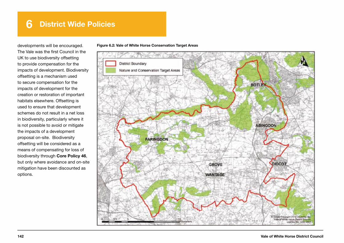
Vale of White Horse District Council142
6 District Wide Policies
developments will be encouraged. The Vale was the first Council in the UK to use biodiversity offsetting to provide compensation for the impacts of development. Biodiversity offsetting is a mechanism used to secure compensation for the impacts of development for the creation or restoration of important habitats elsewhere. Offsetting is used to ensure that development schemes do not result in a net loss in biodiversity, particularly where it is not possible to avoid or mitigate the impacts of a development proposal on-site. Biodiversity offsetting will be considered as a means of compensating for loss of biodiversity through Core Policy 46, but only where avoidance and on-site mitigation have been discounted as options.
Figure 6.2: Vale of White Horse Conservation Target Areas
Local Plan 2031: Part One 143
6 District Wide Policies
1
2
3
4
5
7
6
Core Policy 46:
Conservation and Improvement of Biodiversity
Development that will conserve, restore and enhance biodiversity in the district will be permitted. Opportunities for biodiversity gain, including the connection of sites, large-scale habitat restoration, enhancement and habitat re-creation will be actively sought, with a primary focus on delivery in the Conservation Target Areas. A net loss of biodiversity will be avoided.
The highest level of protection will be given to sites and species of international nature conservation importance (Special Areas of Conservation and European Protected Species). Development that is likely to result in a significant effect, either alone or in combination, on such sites and species will need to satisfy the requirements of the Habitat Regulations*.
Development likely to result in the loss, deterioration or harm to habitats or species of importance to biodiversity or of importance for geological conservation interests, either directly or indirectly, will not be permitted unless:
i. the need for, and benefits of, the development in the proposed location
outweighs the adverse effect on the relevant biodiversity interest;
ii. it can be demonstrated that it could not reasonably be located on an alternative site that would result in less or no harm to the biodiversity interests; and
iii. measures can be provided (and are secured through planning conditions or legal agreements), that would avoid, mitigate against or, as a last resort, compensate for, the adverse effects likely to result from development.
The habitats and species of importance to biodiversity and sites of geological interest considered in relation to points i) to iii) comprise:
Sites of Special Scientific Interest (SSSI)Local Wildlife Sites Local Nature ReservesPriority Habitats and species listed in the national and local Biodiversity Action PlanAncient Woodland and veteran treesLegally Protected Species Locally Important Geological Sites
The level of protection and mitigation should be proportionate to the status of the habitat or species and its importance individually and as part of a wider network.
It is recognised that habitats/areas not considered above (i.e. Nationally or Locally designated and not priority habitats) can still have a significant biodiversity value within their local context, particularly where they are situated within a Conservation Target Area and/or they have good potential to be restored to priority habitat status or form/have good potential to form links between priority habitats or act as corridors for priority species. These habitats will be given due weight in the consideration of planning applications. If significant harm to these sites cannot be avoided (through locating on an alternative site with less harmful impacts) it will be expected that mitigation will be provided to avoid a net loss in biodiversity or, as a last resort, compensation will be required to offset the impacts and achieve a net gain in biodiversity.
* Habitats Directive 92/43/EEC of 21 May 1992.
Vale of White Horse District Council144
6 District Wide Policies
Wilts and Berks Canal
6.123 The Wilts and Berks canal route extends from Melksham in Wiltshire, through Swindon and on towards Abingdon-on-Thames where it meets with the River Thames. There is a branch (the North Wiltshire Canal) from Swindon to the Thames and Severn Canal near Cricklade. The canal was formally abandoned by Act of Parliament in 1914. Unlike many other canals in the country, where the towpath and canal itself remained in public ownership, the Act of Parliament returned the Wilts and Berks Canal to the adjacent landowners and Local Authorities. Much of the route of the canal is in private ownership so the Wilts and Berks Canal Partnership will have to work closely with landowners if plans for its restoration are to go ahead.
6.124 The restoration of the Wilts and Berks Canal is currently focused
116 www.whitehorsedc.gov.uk/evidence
117 Vale of White Horse District Council (2008) Supplementary Planning Document: Open Space, Sport and Recreation, adopted July 2008, available at: http://www.whitehorsedc.gov.uk/services-and-advice/planning-and-building/planning-policy/local-development-framework/
supplementary-
118 http://www.oxfordshire.gov.uk/cms/content/definitive-map-and-statement-online
on the sections in Wiltshire and Swindon, with only a few projects in the Vale. Further evidence is needed to understand the work required to restore the canal in the Vale before the Council can safeguard the route. Saved Local Plan 2011 Policies L14 and L15 will continue to be saved and will apply to any planning applications relating to the canal. The Local Plan 2031 Part 2 will provide the opportunity to update the policy relating to the Wilts and Berks Canal, which should be informed by the work that the Partnership and the Trust undertake in the meantime. This work should include:
• an overall viability study of the scheme to show that it is deliverable, including taking into account all infrastructure implications for the existing road and rail network
• investigating issues relating to the existing ecology, historic
and natural environment, and identifying steps to mitigate these accordingly, and
• ensuring that all landowners affected by the proposals are consulted as part of the process.
Leisure
6.125 In planning for development, regard must be had to the Council’s Leisure and Sports Facilities Strategy116 and the Open Space, Sport and Recreation Future Provision SPD117. In doing so, development will be expected to make appropriate provision for open space and recreational facilities as outlined in these documents in accordance with Core Policy 7 and in line with the Council’s up-to-date Infrastructure Delivery Plan. This will ensure that communities have access to high quality open spaces and opportunities for sport and recreation, which makes an important contribution to
their health and well-being. These documents will be reviewed and updated when appropriate.
6.126 Existing leisure facilities will be protected in line with saved policies in the Local Plan 2011, until such time as they are replaced by Local Plan 2031 Part 2. Existing leisure facilities include Public Rights of Way, as shown on the Oxfordshire County Council definitive map118, and long-distance recreational paths such as The Ridgeway, the Thames Path and the d’Arcy Dalton Way.

Local Plan 2031: Part One 145
1
2
3
4
5
7
6
Vale of White Horse District Council146
Overview
This chapter sets out a detailed monitoring framework to ensure the plan policies are delivered. It sets out:
• what will be delivered by each policy• targets to monitor progress towards achieving our Strategic
Objectives, and• what action we will take if the policies do not deliver in accordance
with the targets.
The implementation of the plan will be reported against the targets through the Authority’s Monitoring Report.
7 Implementing the Plan

Local Plan 2031: Part One 147
Implementing the Plan Abingdon-on-Thames and Oxford Fringe
1
2
3
4
5
7
6
2
3
4
5
7
6
7
Introduction
7.1 Monitoring the Local Plan 2031 policies is important to ensure they are effectively being delivered, that they continue to be relevant to the local area, and meet the requirements of national planning policy.
7.2 This chapter sets out how we will implement the strategy and includes clear arrangements for the delivery, monitoring and review of the plan and its policies.
Delivery and Contingency
7.3 We will continue to work jointly with stakeholders to deliver Local Plan 2031 objectives. This will include partnership working with both public agencies and the private sector and is necessary to ensure development progresses in a manner consistent with the strategy identified in this plan.
7.4 To deliver the visions and objectives in this plan, the Council will work collaboratively with key partners and stakeholders involved.
This includes (and is not limited to) the Local Enterprise Partnership, neighbouring authorities, developers, infrastructure providers, local communities and interest groups and other organisations relating to the ‘duty-to-cooperate’.
7.5 The Council will publish information at least annually to show progress with Local Plan implementation in its Authority Monitoring Report.
7.6 The Council has included a Monitoring Framework at Appendix
H, which identifies how the Council will monitor the effectiveness and implementation of the Local Plan for each policy. The Council recognises that appropriate action will need to be taken if implementation of the plan is clearly off track.
7.7 The Council is also aware that the plan needs to be resilient to changing circumstances and be flexible and responsive if the plan is not delivering in accordance with the Monitoring Framework. Core Policy
47, ‘Delivery and Contingency’, sets out the Council’s intended approach.
Core Policy 47:
Delivery and Contingency
If the Local Plan 2031 policies are not delivered in accordance with the Monitoring Framework set out in Appendix H, the contingency measures identified in the monitoring framework will apply.
If the Authority’s Monitoring Report shows that implementation of the plan, either in part or as a whole, is not taking place as envisaged, the Council, in conjunction with its partners, will investigate the reasons for the situation and will implement appropriate action which may include one or more of the following:
i. seeking alternative sources of funding if a lack of infrastructure is delaying development or causing significant problems as a result of new development;
ii. seeking to accelerate delivery on other permitted or allocated sites; iii. identifying alternative deliverable sites that are in general
accordance with the Spatial Strategy of the plan through the Local Plan 2031: Part 2 or other appropriate mechanism;
iv. undertaking a partial or full review of the Local Plan, if investigation indicates that its strategy, either in whole or in part, is no longer appropriate.
Alternative formats of this publication are available on request
These include large print, Braille, audio, email, easy read and alternative languages
Please contact Planning on 01235 422600
www.whitehorsedc.gov.uk
Planning Policy Team 135 Eastern Avenue, Milton
Park, Abingdon, OX14 4SB
Email: [email protected]