11 th International Scientific and Technical Conference September 19–22, 2011, Tossa de Mar, Spain...
15
11 th International Scientific and Technical Conference September 19–22, 2011, Tossa de Mar, Spain From imagery to map: digital photogrammetric technologies [email protected] UPDATING OF BULGARIAN LARGE SCALE UPDATING OF BULGARIAN LARGE SCALE TOPOGRAPHIC MAP TOPOGRAPHIC MAP BY DIGITAL PHOTOGRAMMETRIC BY DIGITAL PHOTOGRAMMETRIC SOFTWARE PHOTOMOD 5.1 SOFTWARE PHOTOMOD 5.1 GIS-SOFIA Ltd., GIS-SOFIA Ltd., Bulgaria Bulgaria Vanya Petrova, M. Sc.
-
Upload
kelley-mclaughlin -
Category
Documents
-
view
214 -
download
0
Transcript of 11 th International Scientific and Technical Conference September 19–22, 2011, Tossa de Mar, Spain...
11th International Scientific and Technical Conference
September 19–22, 2011, Tossa de Mar, Spain From imagery to map: digital photogrammetric technologies
UPDATING OF BULGARIAN LARGE SCALE UPDATING OF BULGARIAN LARGE SCALE TOPOGRAPHIC MAPTOPOGRAPHIC MAP BY DIGITAL BY DIGITAL
PHOTOGRAMMETRIC SOFTWARE PHOTOMOD 5.1PHOTOGRAMMETRIC SOFTWARE PHOTOMOD 5.1
GIS-SOFIA Ltd.,GIS-SOFIA Ltd., BulgariaBulgaria
Vanya Petrova, M. Sc.
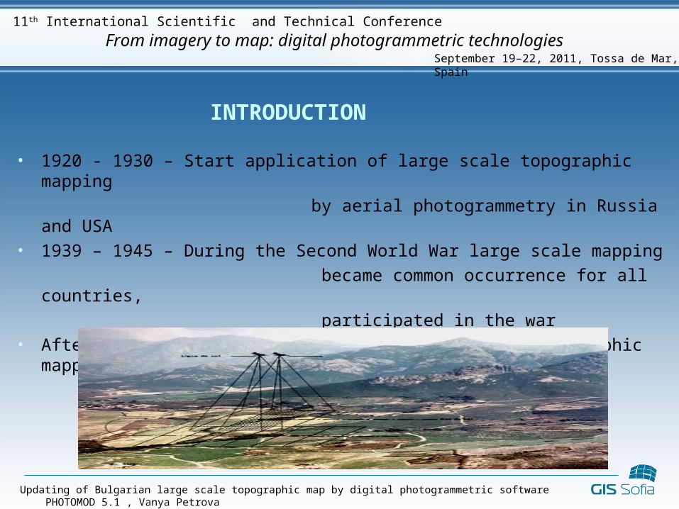
INTRODUCTION
• 1920 - 1930 – Start application of large scale topographic mapping
by aerial photogrammetry in Russia and USA• 1939 – 1945 – During the Second World War large scale mapping
became common occurrence for all countries,
participated in the war• After 1945 – All European countries started topographic mapping
by aerial photogrammetry
Updating of Bulgarian large scale topographic map by digital photogrammetric software PHOTOMOD 5.1 , Vanya Petrova
September 19–22, 2011, Tossa de Mar, Spain
From imagery to map: digital photogrammetric technologies11th International Scientific and Technical Conference
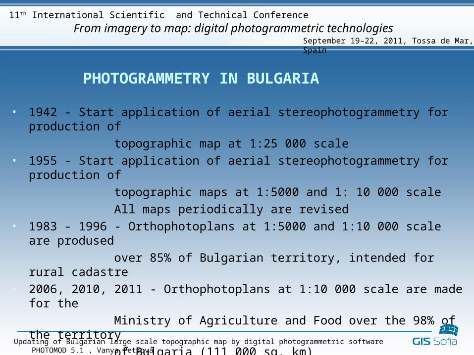
PHOTOGRAMMETRY IN BULGARIA
• 1942 - Start application of aerial stereophotogrammetry for production of
topographic map at 1:25 000 scale• 1955 - Start application of aerial stereophotogrammetry for production of
topographic maps at 1:5000 and 1: 10 000 scale
All maps periodically are revised• 1983 - 1996 - Orthophotoplans at 1:5000 and 1:10 000 scale are prodused
over 85% of Bulgarian territory, intended for rural cadastre• 2006, 2010, 2011 - Orthophotoplans at 1:10 000 scale are made for the
Ministry of Agriculture and Food over the 98% of the territory
of Bulgaria (111 000 sq. km)• 2008 - Digital aerial photogrammetry is used for production of
orthophotoplans at 1:1000 and 1:2000 scale over territory of 1467 sq. km
Sofia Municipality, as well as generation of DTM
Updating of Bulgarian large scale topographic map by digital photogrammetric software PHOTOMOD 5.1 , Vanya Petrova
September 19–22, 2011, Tossa de Mar, Spain
From imagery to map: digital photogrammetric technologies11th International Scientific and Technical Conference
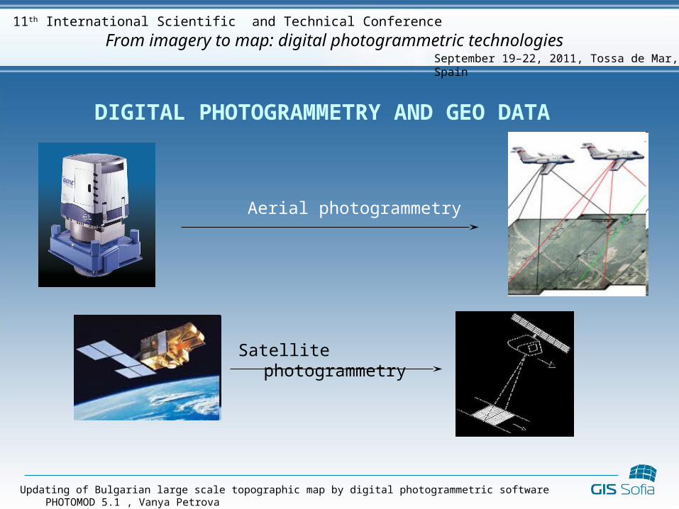
DIGITAL PHOTOGRAMMETRY AND GEO DATA
Aerial photogrammetry
Satellite photogrammetry
Updating of Bulgarian large scale topographic map by digital photogrammetric software PHOTOMOD 5.1 , Vanya Petrova
September 19–22, 2011, Tossa de Mar, Spain
From imagery to map: digital photogrammetric technologies11th International Scientific and Technical Conference
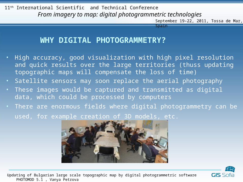
WHY DIGITAL PHOTOGRAMMETRY?
• High accuracy, good visualization with high pixel resolution and quick results over the large territories (thuss updating topographic maps will compensate the loss of time)
• Satellite sensors may soon replace the aerial photography• These images would be captured and transmitted as digital data, which could be
processed by computers
• There are enormous fields where digital photogrammetry can be used, for example
creation of 3D models, etc.
Updating of Bulgarian large scale topographic map by digital photogrammetric software PHOTOMOD 5.1 , Vanya Petrova
September 19–22, 2011, Tossa de Mar, Spain
From imagery to map: digital photogrammetric technologies11th International Scientific and Technical Conference
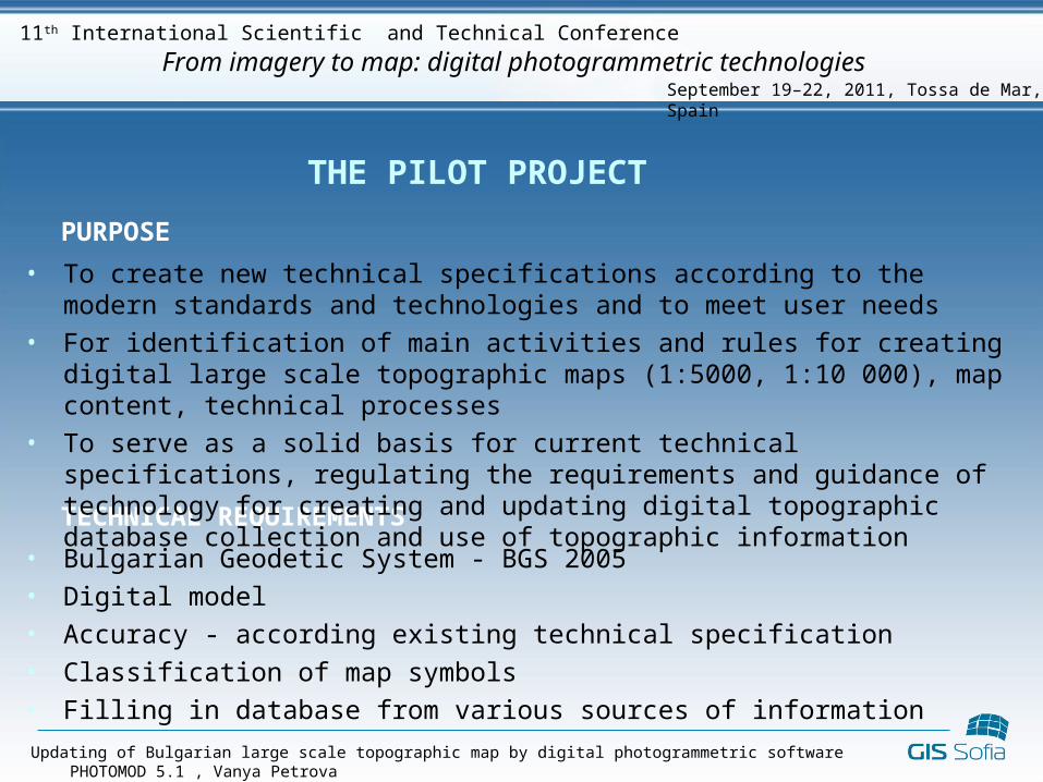
THE PILOT PROJECT
PURPOSE
TECHNICAL REQUIREMENTS
• To create new technical specifications according to the modern standards and technologies and to meet user needs
• For identification of main activities and rules for creating digital large scale topographic maps (1:5000, 1:10 000), map content, technical processes
• To serve as a solid basis for current technical specifications, regulating the requirements and guidance of technology for creating and updating digital topographic database collection and use of topographic information
• Bulgarian Geodetic System - BGS 2005• Digital model• Accuracy - according existing technical specification• Classification of map symbols• Filling in database from various sources of information
Updating of Bulgarian large scale topographic map by digital photogrammetric software PHOTOMOD 5.1 , Vanya Petrova
September 19–22, 2011, Tossa de Mar, Spain
From imagery to map: digital photogrammetric technologies11th International Scientific and Technical Conference

THE PILOT PROJECT
SCOPE OF THE PROJECT
• Photogrammetric processing• Interpretation and stereovectorization• Determination of metric characteristics of the terrain, landforms and vegetation,
as well as determination of roads, rivers, streams etc. width • Creating a database• Using the elements of digital cadastral map• Database of geographical names• Printing the map
Updating of Bulgarian large scale topographic map by digital photogrammetric software PHOTOMOD 5.1 , Vanya Petrova
September 19–22, 2011, Tossa de Mar, Spain
From imagery to map: digital photogrammetric technologies11th International Scientific and Technical Conference
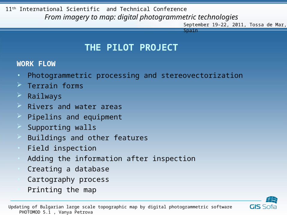
THE PILOT PROJECT
WORK FLOW
• Photogrammetric processing and stereovectorization Terrain forms Railways Rivers and water areas Pipelins and equipment Supporting walls Buildings and other features• Field inspection• Adding the information after inspection• Creating a database• Cartography process• Printing the map
Updating of Bulgarian large scale topographic map by digital photogrammetric software PHOTOMOD 5.1 , Vanya Petrova
September 19–22, 2011, Tossa de Mar, Spain
From imagery to map: digital photogrammetric technologies11th International Scientific and Technical Conference
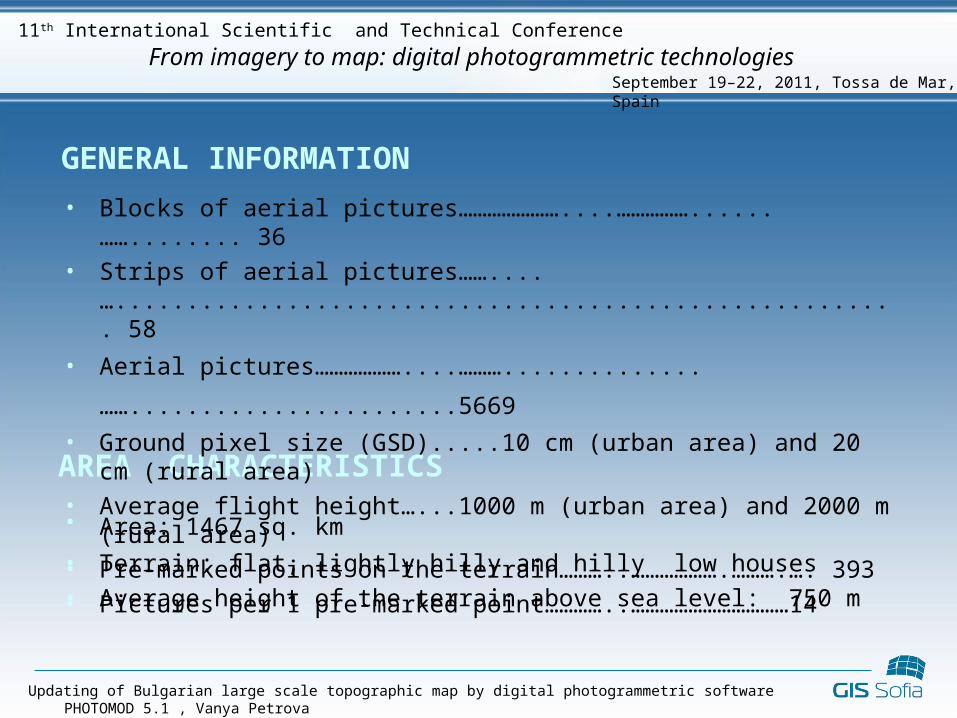
GENERAL INFORMATION
• Area: 1467 sq. km • Terrain: flat, lightly hilly and hilly low houses• Average height of the terrain above sea level: 750 m
AREA CHARACTERISTICS
Updating of Bulgarian large scale topographic map by digital photogrammetric software PHOTOMOD 5.1 , Vanya Petrova
September 19–22, 2011, Tossa de Mar, Spain
From imagery to map: digital photogrammetric technologies11th International Scientific and Technical Conference
• Blocks of aerial pictures…………………....……………......……........ 36• Strips of aerial pictures……....…....................................................... 58
• Aerial pictures………………....………..............…….......................5669 • Ground pixel size (GSD).....10 cm (urban area) and 20 cm (rural area)• Average flight height…...1000 m (urban area) and 2000 m (rural area)• Pre-marked points on the terrain………..……………….……….…. 393• Pictures per 1 pre-marked point…………..……………………………14
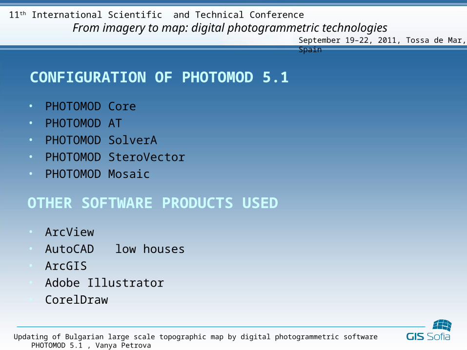
CONFIGURATION OF PHOTOMOD 5.1
• PHOTOMOD Core• PHOTOMOD AT• PHOTOMOD SolverA• PHOTOMOD SteroVector• PHOTOMOD Mosaic
OTHER SOFTWARE PRODUCTS USED
• ArcView• AutoCAD low houses• ArcGIS• Adobe Illustrator• CorelDraw
Updating of Bulgarian large scale topographic map by digital photogrammetric software PHOTOMOD 5.1 , Vanya Petrova
September 19–22, 2011, Tossa de Mar, Spain
From imagery to map: digital photogrammetric technologies11th International Scientific and Technical Conference
Updating of Bulgarian large scale topographic map by digital photogrammetric software PHOTOMOD 5.1 , Vanya Petrova
September 19–22, 2011, Tossa de Mar, Spain
From imagery to map: digital photogrammetric technologies11th International Scientific and Technical Conference
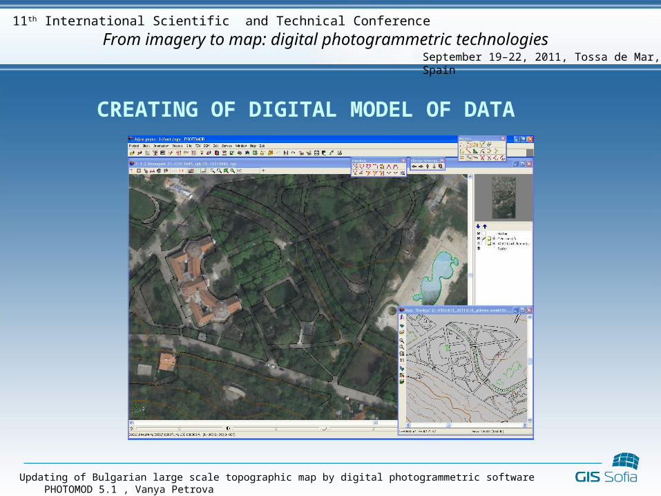
CREATING OF DIGITAL MODEL OF DATA
Updating of Bulgarian large scale topographic map by digital photogrammetric software PHOTOMOD 5.1 , Vanya Petrova
September 19–22, 2011, Tossa de Mar, Spain
From imagery to map: digital photogrammetric technologies11th International Scientific and Technical Conference
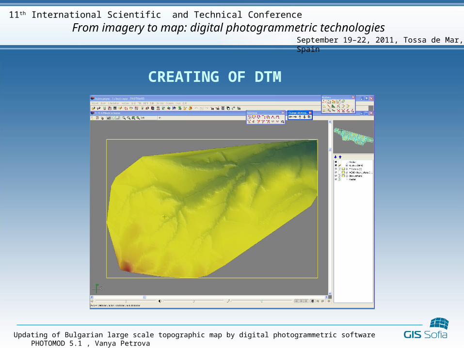
CREATING OF DTM
Updating of Bulgarian large scale topographic map by digital photogrammetric software PHOTOMOD 5.1 , Vanya Petrova
September 19–22, 2011, Tossa de Mar, Spain
From imagery to map: digital photogrammetric technologies11th International Scientific and Technical Conference
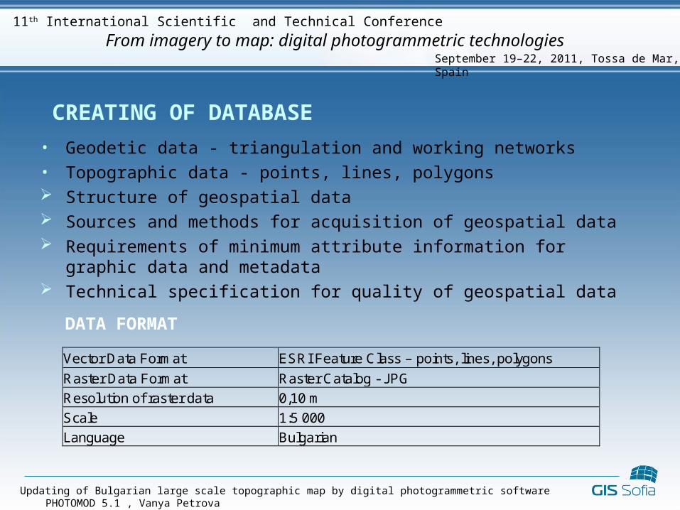
CREATING OF DATABASE
• Geodetic data - triangulation and working networks• Topographic data - points, lines, polygons Structure of geospatial data Sources and methods for acquisition of geospatial data Requirements of minimum attribute information for graphic data and
metadata Technical specification for quality of geospatial data
Vector Data Format ESRI Feature Class – points, lines, polygons
Raster Data Format Raster Catalog - JPG
Resolution of raster data 0,10 m
Scale 1:5 000
Language Bulgarian
DATA FORMAT
CONCLUSIONS AND RECOMMENDATIONS
• Concerning the modern digital technology and the steady increase urban territories, it is necessary to create and update the entire topographic information
• For the new method of mapping i.e. new technologies, technical means and software it is needed to create new ordinances or to update the old ones
• The digital technology significantly reduce the time required for producing or updating maps and will improve the overall accuracy
• Classical mapping is supplemented by new types of visualization systems from different platforms
• The pictures themselves represent huge opportunities for visualization and analysis of 2D, 3D and 4D data
• These capabilities must be integrated into e-government and e-commerce development
• Internet provides more efficient means of communication than printed media
especially when it comes to rapidly developing technology
Updating of Bulgarian large scale topographic map by digital photogrammetric software PHOTOMOD 5.1 , Vanya Petrova
September 19–22, 2011, Tossa de Mar, Spain
From imagery to map: digital photogrammetric technologies11th International Scientific and Technical Conference
THANK YOU FOR YOUR ATTENTION !THANK YOU FOR YOUR ATTENTION !
Updating of Bulgarian large scale topographic map by digital photogrammetric software PHOTOMOD 5.1 , Vanya Petrova
September 19–22, 2011, Tossa de Mar, Spain
From imagery to map: digital photogrammetric technologies11th International Scientific and Technical Conference