1 Soil Resource Inventory Tool Box (SRITB) MO-13 Meeting April 17, 2008.
32
1 Soil Resource Inventory Tool Box (SRITB) MO-13 Meeting April 17, 2008
-
Upload
evelyn-matthews -
Category
Documents
-
view
215 -
download
0
Transcript of 1 Soil Resource Inventory Tool Box (SRITB) MO-13 Meeting April 17, 2008.

1
Soil Resource Inventory Tool Box (SRITB)
MO-13 MeetingApril 17, 2008

2
What is SRITB?•Soil Resource Inventory
Toolbox•Initiative by Soil Survey
Division to provide automated tools for field soil scientists

3
SRITB components:
• Pedon PC• Analysis PC• Lab Database Entry Program• Editing Toolbar (ArcMap
extension)• Soil scientist’s “My Toolbar”
(desktop)

4
Where to get help/training

5
Soils Job Aids

6

7
• Pedon PC - form based data entry application for tablets
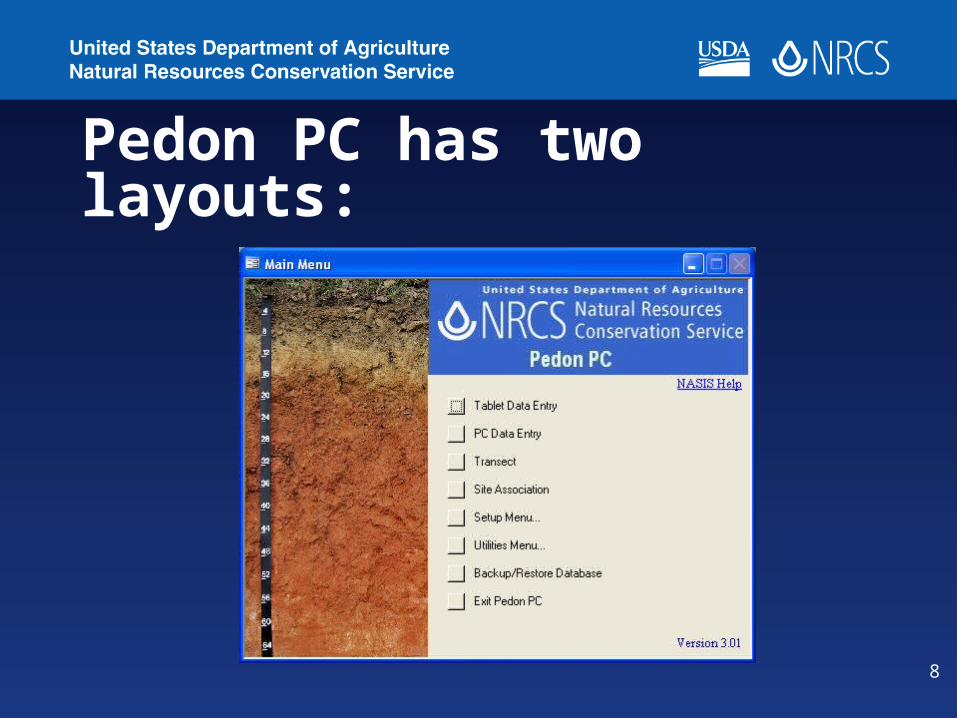
8
Pedon PC has two layouts:

9
Pedon PC layout for PC (landscape)

10
Pedon PC Tablet layout (portrait)
11
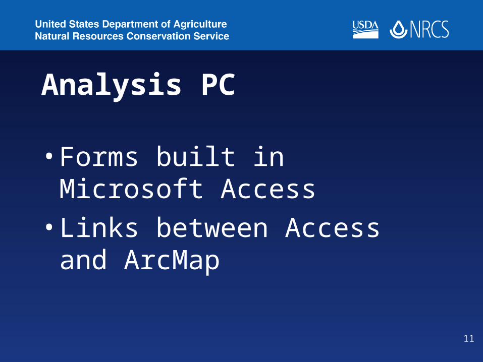
Analysis PC
•Forms built in Microsoft Access
•Links between Access and ArcMap

12
Analysis PC main menu

13
Analysis PC:1. Analysis form: uses Access
built queries to display selected sets

14
• Allows the user to send data to ArcMap

15
Laboratory Data Entry Program
• Numerous universities, states, and other entities collect and store soil data
• Lab Database Entry Program is an attempt to centralize this external data into our system

16
Lab Database Entry main menu

17
Editing Toolbar (SRITB 1.1.18)• Adds a suite of toolbars to ArcMap (loads as an
extension)• Programmed to simplify GIS digitizing procedures
and data capture. • Developed to increase the efficiency of field digitizing
and data collection. • Designed to maximize screen real estate • Provide field scientists with enough GIS capability to
make informed decisions in the field.• Digitizing standards are pre-set as the defaults so
user does not have to know or understand all the details of these standards

18
Six toolbars in one:

19
Edit Manager
Start Editing
Stop Editing
Save Edits
Editor icons

20
Edit Manager
Snappingenvironment
Set SnappingDistance
Set StickyMove
Tolerance
Set StreamTolerance
Tolerance Settings icons

21
Edit Toolbar
Streaming Sketch
Editing ToolsTopology
Editing Tools
ReshapeEdge
ModifyEdge
MergeCreateIsland
Polygon
CutPolygon
AutoCompletePolygon
Editing Tools

22
Custom Edit ToolsSaving Keystrokes (Ex: Cutting Polygons)
Out-of-the-Box ArcMap
1. Start Editing
2. Set task to Cut Polygon Features
3. Activate Select Features Tool
4. Select features
5. Activate Sketch Tool
6. Make cut
7. Explode multi-part features
8. Label features
SRITB Cut Polygon Tool
1. Activate Cut Polygon Mode
2. Select features
3. Make cut
4. Label featuresCut
Polygon
23
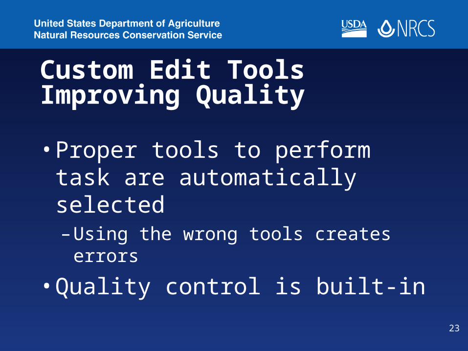
Custom Edit ToolsImproving Quality
•Proper tools to perform task are automatically selected– Using the wrong tools creates
errors
•Quality control is built-in

24
Sketch Toolbar
Draw using a Thin pen
Erase Ink
Finish InkSketch
Clear InkSketch
Undo Ink SettingsAdd Ink

25
Topology Toolbar
ConstructFeatures
PlanarizeLines
TopologyEdit
ShowShared
Features
ValidateTopology
In SpecifiedArea
ValidateTopologyIn Current
Extent
ValidateEntire
Topology
FixTopology
Error
ErrorInspector
! Topology is critical for data quality and integrity !

26
QC Toolbar in Version 1.1.18
FindsMinimum
SizedPolygons
FindsCommon
Lines
ExtentSelection
FindAnd Fix
Inspector
27
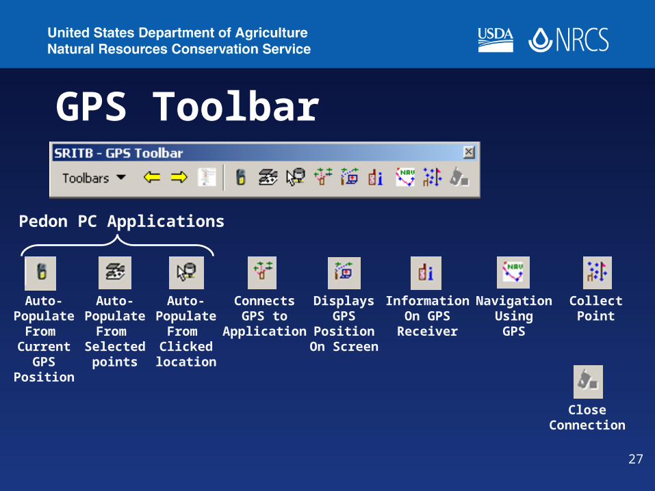
GPS Toolbar
Auto-Populate
From Current
GPSPosition
Auto-Populate
From Selectedpoints
Auto-Populate
From Clickedlocation
ConnectsGPS to
Application
DisplaysGPS
PositionOn Screen
InformationOn GPS
Receiver
NavigationUsingGPS
CollectPoint
CloseConnection
Pedon PC Applications

28
Autopopulation of Location
29
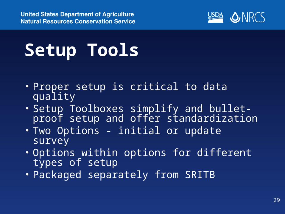
Setup Tools
• Proper setup is critical to data quality• Setup Toolboxes simplify and bullet-
proof setup and offer standardization• Two Options - initial or update survey• Options within options for different
types of setup• Packaged separately from SRITB

30

31
32
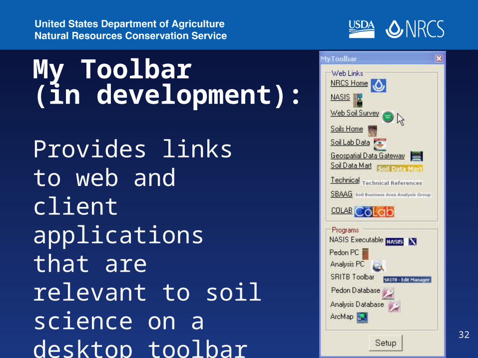
My Toolbar (in development):
Provides links to web and client applications that are relevant to soil science on a desktop toolbar