-MILFORD WA L K - Auckland Council · -MILFORD WA L K North Shore City heritage trails ... with...
12
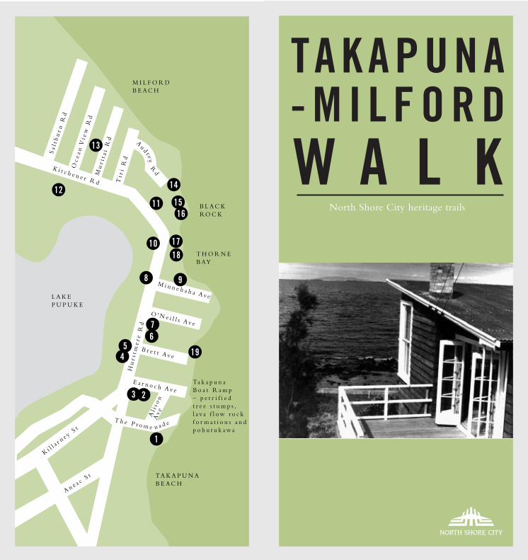
TAKAPUNA -MILFORD WALK North Shore City heritage trails Kitchener Rd Hurstmere Rd Killarney St Anzac St Minnehaha Ave Tiri Rd Muritai Rd Ocean View Rd Saltburn Rd O'Neills Ave Brett Ave Earnoch Ave Alison Ave Th eP r o me nade THORNE BAY TAKAPUNA BEACH Takapuna Boat Ramp – petrified tree stumps, lava flow rock formations and pohutukawa BLACK ROCK LAKE PUPUKE MILFORD BEACH 1 2 5 4 3 6 7 9 11 12 13 14 15 8 16 17 18 19 10 Aud r ey Rd
-
Upload
trinhnguyet -
Category
Documents
-
view
219 -
download
6
Transcript of -MILFORD WA L K - Auckland Council · -MILFORD WA L K North Shore City heritage trails ... with...
TA K A P U N A- M I L F O R DW A L K
North Shore City heritage trails
K i t c h e n e r R d
Hu
r st m
er e
Rd
K i l la r n e y S
t
A n z a c St
M i n n e h a h a Av e
Ti r
i R
d
Mu
r it a
i R
d
Oc
ea n
Vi e
w R
d
Sa l
t bu
r n R
d
O ' N e i l l s Av e
B r e t t Av e
E a r n o c h Av e
Al i
s on
Av e
T h e P r o m e n a d e
T H O R N EB AY
TA K A P U N AB E A C H
Ta k a p u n aB o a t R a m p– p e t r i f i e dt r e e s t u m p s ,l a v a f l o w r o c kf o r m a t i o n s a n dp o h u t u k a w a
B L A C K RO C K
L A K EP U P U K E
M I L F O R DB E A C H
1
2
54
3
67
9
1112
13
14
15
8
16
1718
19
10
Au d r e
yR
d
THE TAKAPUNA–MILFORD WALK
This walk guides you past historic interest points,known locally as Takapuna’s ‘Golden Mile’. While aconsiderable amount of expensive development hashappened along this stretch over recent decades,much of its historic architecture, flora and geologyhas been preserved and makes for a fascinating landscape.
Even in the early days, the areaaround Takapuna and MilfordBeaches and Lake Pupuke was where wealthy Auckland businessmen built homes fortheir families. These houses were usually their second homewhere the family spent the summer months entertaining and relaxing in rural surroundings. Theirtown houses were usually in the heart of the businessdistrict in Symonds St or Grafton. Many of thesefamilies grew so attached to their summer houses onthe North Shore that they moved here permanentlyand commuted to town daily. Families such as theHursts, Alisons, Pierces, O’Neills and Bretts havebecome established names in Takapuna, and areremembered in some street names.
Takapuna and Milford Beaches were ‘PleasureGardens’, places for family day trips and picnics. The Devonport Steam Ferry Co had a regular serviceto the North Shore. You could step out straight onto the beach at the Takapuna wharf (where the boatramp currently is) or catch the steam tram fromBayswater along Hurstmere Rd to Milford.
Start at the Takapuna boat ramp on The Promenade, onyour left towards the main road you will see…
Terrain: Roads, a paved promenade, beach and somelava rocks. Part of the walk follows the coastline andis only possible at low tide.
Duration: Minimum 2 hours.
Parking: Parking is available near the Takapuna boat ramp or at the end of Muritai Road nearMilford Beach.
Privacy: The walk is mainly along public road andpaths and highlights historical facts about the buildings and the area. We recommend the walk beundertaken at low tide when the fossil forest is mostvisible and the foreshore more accessible.
Part of the route, between Milford and TakapunaBeach, follows the foreshore and crosses private property thanks to the owners' goodwill. Pleaserespect the environment and the privacy of local residents, and do not trespass on private property outside the described route. The pathway in this area is not properly constructed so please take care.Part of the charm of the walk is the natural state of the paths, particularly near the fossil forest.
Neither North Shore City Council nor the privateproperty owners accept any responsibility for anyloss, damage or injury to you or your property arising from your use of this walkway.
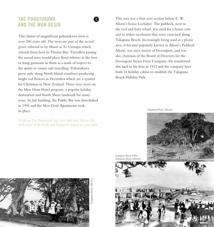
Takapuna Beach looking north, 1894. Watercolour by K Watkins, Takapuna library collection.
Alison’s Corner, Takapuna library collection.
THE POHUTUKAWAAND THE MON DESIR
This cluster of magnificent pohutukawa trees is over 200 years old. The trees are part of the sacredgrove referred to by Maori as Te Urutapu whichextends from here to Thorne Bay. Travellers passingthe sacred trees would place floral tributes at the footor hang garments in them as a mark of respect to the spirits to ensure safe travelling. Pohutukawa grow only along North Island coastlines producingbright red flowers in December which are a symbolfor Christmas in New Zealand. These trees were onthe Mon Desir Hotel property, a popular holiday destination and North Shore landmark for manyyears. Its last building, the Public Bar was demolishedin 1996 and the Mon Desir Apartments tookits place.
Walk up The Promenade and turn right into Alison Avewith views of the beach and Rangitoto Island on your right.
1 This area was a four-acre section below E. W.Alison’s house Lochaber. The paddock, next to the reef and ferry wharf, was used for a house cowand to tether racehorses that were exercised alongTakapuna Beach. Increasingly being used as a picnicarea, it became popularly known as Alison’s Paddock.Alison, was once mayor of Devonport, and was also chairman of the Board of Directors for theDevonport Steam Ferry Company. He transferredthis land to his firm in 1912 and the company laterbuilt 14 holiday cabins to establish the TakapunaBeach Holiday Park.
Tak
apun
a lib
rary
colle
ction
.
Takapuna Beach 1890, Takapuna library collection.
Takapuna library collection.
Turn left into Earnoch Ave. Towards the end of the road is…
OLD TELEPHONE EXCHANGE2/187a Hurstmere Rd
Built in 1920 to accommodate a rapidly expandingtelephone network. Subdividing of large estates forseaside housing in the previous decade had placedgreat demand on the newly opened corner post officeand it no longer had room for telephone functions.This plastered brick building was built next door in a stripped Classical style.
2 3
on the corner is…
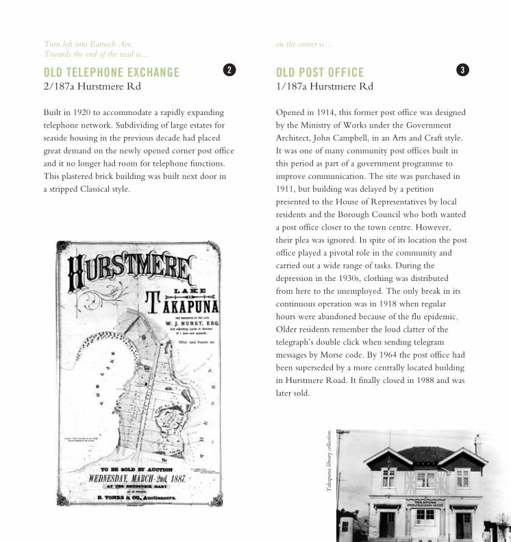
OLD POST OFFICE1/187a Hurstmere Rd
Opened in 1914, this former post office was designedby the Ministry of Works under the GovernmentArchitect, John Campbell, in an Arts and Craft style. It was one of many community post offices built inthis period as part of a government programme toimprove communication. The site was purchased in1911, but building was delayed by a petition presented to the House of Representatives by localresidents and the Borough Council who both wanteda post office closer to the town centre. However,their plea was ignored. In spite of its location the postoffice played a pivotal role in the community andcarried out a wide range of tasks. During the depression in the 1930s, clothing was distributedfrom here to the unemployed. The only break in itscontinuous operation was in 1918 when regularhours were abandoned because of the flu epidemic. Older residents remember the loud clatter of the telegraph’s double click when sending telegram messages by Morse code. By 1964 the post office hadbeen superseded by a more centrally located buildingin Hurstmere Road. It finally closed in 1988 and waslater sold.
Tak
apun
a lib
rary
colle
ction
.
A few houses along on the right is…
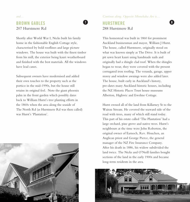
WHITE OAKS 203 Hurstmere Rd
White Oaks stands on what was known as Nixielandbecause it was part of an extensive property ownedby the Nicks family. In 1908 Mary Ann Nicksbought the land from Jessi Craig, wife of J. J. Craig.She had only a very simple beach cottage on theproperty and it was her son George who developedthe land profitably. At the same time as he built hisfamily home at 207, he bought his sister’s and half-brother’s shares of Mrs Nicks’ estate and built twomore houses, for resale. White Oaks is one of them.Of a slightly later period than its neighbour BrownGables, White Oaks is constructed of cedar with marseille (now decramastic) tiles. The local mediadescribed the interior as oak with rimu panelling,rimu scotias in the doorways and exposed beams,before the estate was put up for auction in 1986.
Turn right into Hurstmere Rd and cross the busy road. On the left hand-side, up a right of way is…
EARNOCH194-196 Hurstmere Rd
Now a hairdressing boutique, this simple gabledhomestead, built in 1876, was home to well-knownAuckland businessman, John Roberton. The familycalled the estate Earnoch after the area in Lanarkshirefrom where their ancestors came. They tried to makethe house their permanent home in 1884 but commuting to Auckland City was not easy so theymoved back to town. Although most of the land hasbeen subdivided, the homestead is largely unchanged.
Back on Hurstmere Rd, a few houses along on theleft is…
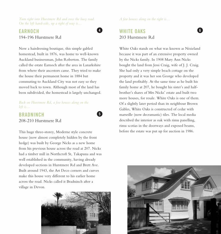
BRADNINCH 208-210 Hurstmere Rd
This huge three-storey, Moderne style concretehouse (now almost completely hidden by the fronthedge) was built by George Nicks as a new homefrom his previous house across the road at 207. Nickshad a timber mill in Northcroft St, Takapuna and waswell established in the community, having alreadydeveloped sections in Hurstmere Rd and Brett Ave.Built around 1943, the Art Deco corners and curvesmake this house very different to his earlier homeacross the road. Nicks called it Bradninch after a village in Devon.
4 6
5
and...
BROWN GABLES 207 Hurstmere Rd
Shortly after World War I, Nicks built his familyhome in the fashionable English Cottage style, characterised by bold rooflines and large picture windows. The house was built with the finest timberfrom his mill, the exterior being kauri weatherboardand finished with the best materials. All the windowshave lead canes.
Subsequent owners have modernised and added their own touches to the property such as the portico in the mid-1990s, but the house still retains its original feel. Note the giant phoenix palm in the front garden which possibly dates back to William Hurst’s tree planting efforts in the 1860s when the area along the seaside of The North Rd (as Hurstmere Rd was then called)was Hurst’s ‘Plantation’.
7
Continue along. Opposite Minnehaha Ave is…
HURSTMERE288 Hurstmere Rd
This homestead was built in 1860 for prominentAuckland businessman and mayor, William J Hurst.The house, called Hurstmere, originally stood onwhat was known simply as The Drive. It is built ofpit sawn heart kauri using handmade nails and originally had a shingle clad roof. When the shinglesbegan to wear, they were covered with the presentcorrugated iron roofing. The veranda, garage, upperstorey and window awnings were also added later.The house, built early in Auckland’s history, pre-dates many Auckland historic houses, includingthe NZ Historic Places Trust house museumsAlberton, Highwic and Ewelme Cottage.
Hurst owned all of the land from Killarney St to theWairau Stream. He covered the seaward side of theroad with trees, many of which still stand today. This part of his estate called ‘The Plantation’ had alarge orchard, pine grove and native trees. Hurst’sneighbours at the time were John Roberton, theoriginal owner of Earnoch, Rev. Houchen, anAnglican priest and George Pierce, the general manager of the NZ Fire Insurance Company. After his death in 1886, his widow subdivided theland twice. The Nicks and O’Neill families boughtsections of the land in the early 1900s and becamelong-term residents in the area.
8
Continue along. At one point, you can see Lake Pupukeon the left and Rangitoto Island on the right.
ALGIE’S CASTLE253 Hurstmere Rd
When 70 year old Captain John Alexander Algiereturned from a trip to his ancestral Scotland in 1924,he brought back a new wife, Penelope, and a passionfor all things Scottish. Having decided to spend therest of his years on the Shore, he consulted witharchitect W.H. Jaime and together with stonemasonFrank Savidan, began building the castle of his ancestral dreams.
Merkesworth Castle, as it was called, is a two-storeybaronial home. A tower with 2ft thick locally quarried basalt walls and crenellations overhangs thesea at the back. Reminders of Scotland can be seeneverywhere in the house, inside and out. Stained glasscrests with the family motto, ‘gang warily’ are woveninto the windows. The initials of John and Penelopeare carved above the entrance along with the completion date of the castle, 1926. Captain Algie’sprize acquisition from his trip to Scotland, AmoralBearings is also proudlydisplayed. MerkesworthCastle is still owned bythe Algie family today.
THE HURST TREES
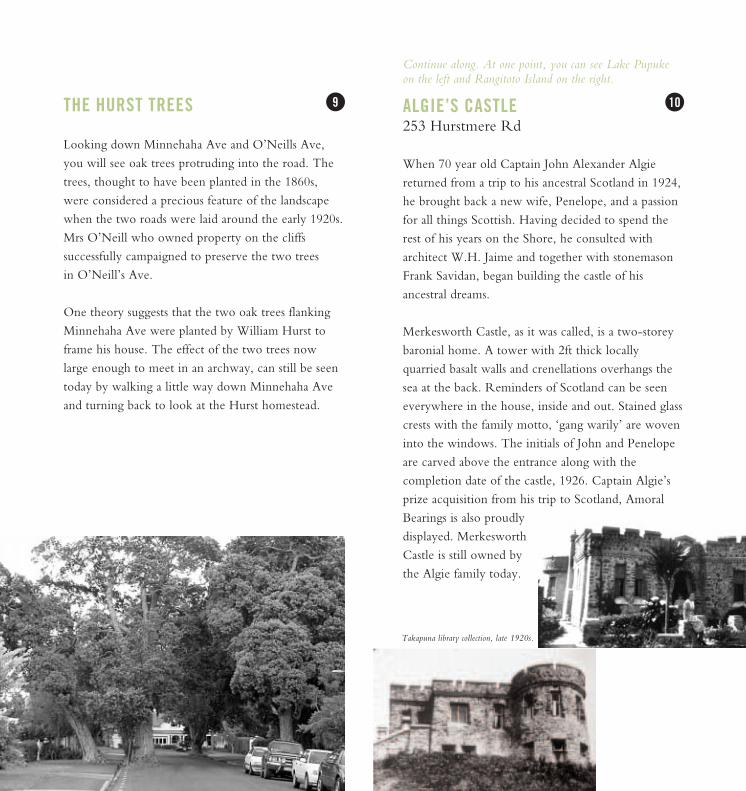
Looking down Minnehaha Ave and O’Neills Ave,you will see oak trees protruding into the road. Thetrees, thought to have been planted in the 1860s,were considered a precious feature of the landscapewhen the two roads were laid around the early 1920s.Mrs O’Neill who owned property on the cliffs successfully campaigned to preserve the two trees in O’Neill’s Ave.
One theory suggests that the two oak trees flankingMinnehaha Ave were planted by William Hurst toframe his house. The effect of the two trees nowlarge enough to meet in an archway, can still be seentoday by walking a little way down Minnehaha Aveand turning back to look at the Hurst homestead.
9 10
Takapuna library collection, late 1920s.

Continue along to the Muritai Rd corner, to your left youshould see…
THE CIRCLE/GOLDIE HOUSE90 Kitchener Rd
The circular apartment building peering out abovethe trees was built in 1968 and was recognised as thefirst apartment tower in New Zealand to have 360°views. At the time, it was an impressive 11 storeyshigh with 12 apartments and took two years to complete. Named ‘The Circle’, it was built on thesite of ‘Maratea’, the Goldie family’s summer house.Charles Goldie, the acclaimed painter of Maori portraits made considerable use of the studio hisfather had built for him there. Tales of parties andweekends held at the house have become legendamong Shore residents. Two Norfolk pines, traditionally planted in pairs, were retained when the ageing house was demolished to make way forThe Circle. However, lightning struck one of thepines in 1969 so only one can be seen standing tall, as if competing in height with The Circle today.
Continue along…
BLACK ROCK/THE STABLES17 Kitchener Rd
This simple cottage made of heart kauri was builtaround 1886 by Auckland businessman GeorgePatrick Pierce. The land was bought with riparianrights which means the buyers own all of the landdown to the high tide mark on the shore line. Thisincluded the black lava rock (see to ) on thebeach which formed after the eruption of LakePupuke 100,000 years before. Pierce liked the idea of owning part of a volcano and called his estateBlack Rock.
The house, while an adequate size for the large familyas a summer cottage, was much simpler than some ofthe other grand mansions in the area. It passed out ofPierce hands after George’s death in 1891 and it wasn’t until the 1980s that it got its new name ‘The Stables’.
1211
14 18
Milford Carnival, 1920s. Takapuna library collection.
David Goldie’s house, Takapuna library collection.
View from one of The Circle apartments 1968,Takapuna library collection.
Continue walking around the point. Just before the pumping station is a dark creosote house…
VERNON BROWN EARLY MODERN HOUSE
Built in the 1940s on a steep site overlooking BlackRock. It was designed by architect Vernon Brownwho was one of the first to grapple with designingbuildings that respond to New Zealand living conditions and explore a distinctly New Zealand styleof architecture. This house is a superb example of hisphilosophies. Low single pitched roof, dark creosoteboards and tall double hung sash windows, were hallmarks of his style. Together they form a simpleshed-like building that perches precariously on the shore and opens out to the sea and towards Rangitoto.
Turn right into Muritai Rd, halfway down is…
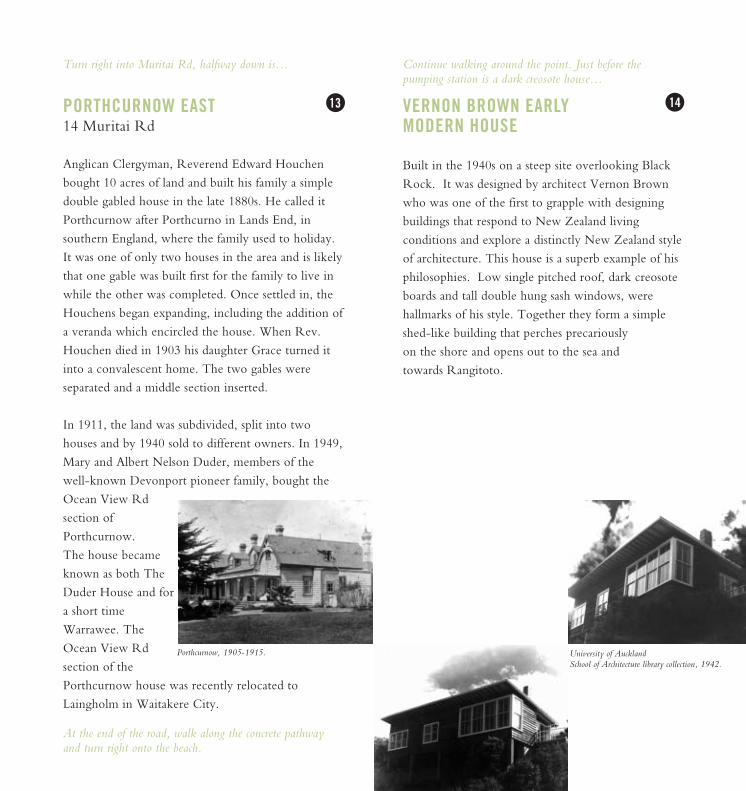
PORTHCURNOW EAST14 Muritai Rd
Anglican Clergyman, Reverend Edward Houchenbought 10 acres of land and built his family a simpledouble gabled house in the late 1880s. He called itPorthcurnow after Porthcurno in Lands End, insouthern England, where the family used to holiday.It was one of only two houses in the area and is likelythat one gable was built first for the family to live inwhile the other was completed. Once settled in, theHouchens began expanding, including the addition ofa veranda which encircled the house. When Rev.Houchen died in 1903 his daughter Grace turned itinto a convalescent home. The two gables were separated and a middle section inserted.
In 1911, the land was subdivided, split into twohouses and by 1940 sold to different owners. In 1949,Mary and Albert Nelson Duder, members of the well-known Devonport pioneer family, bought theOcean View Rd section ofPorthcurnow. The house becameknown as both TheDuder House and fora short timeWarrawee. TheOcean View Rd section of thePorthcurnow house was recently relocated toLaingholm in Waitakere City.
At the end of the road, walk along the concrete pathwayand turn right onto the beach.
13 14
Porthcurnow, 1905-1915. University of Auckland School of Architecture library collection, 1942.

Walk along the wooden bridge, at the end is…
FIRTH COTTAGE
Portrait photographer Clifton Firth, his wife andthree children moved into this bach, one of the original cottages in Thorne Bay in the 1920s. Milford Beach was covered with beach houses at the time, mostly rustic, basic houses but sufficientlycomfortable for weekends and family holidays.
The Firths grew so fond of their holiday home thatthey made it their permanent base, sticking with thesmall cottage rather than upgrading to somethinglarger. Nestled in a garden among pohutukawa withbeach facing windows and a covered porch providinggood views and shelter from harbour storms, it is aclassic example of a New Zealand bach, and one ofthe few remaining on this stretch of beach. TheFirths relished their casual lifestyle where local penguins felt free to nest under the house and generally make themselves at home.
When the mirror house went up next door in 1984,Mrs Firth said that she appreciated the extra light itprovided as the sun reflected off the glass and into herkitchen and garden.
A couple of houses along, just past the pumping station is…
MIRROR HOUSE
Designed in 1984 by Swan Railley Paterson thehouse is a remarkable example of late-modernistarchitecture and parodies buildings of the 1980s while making clever references to its immediate environment. With its hull-like curves, stainless steelrailings, flagpole and chimneys that resemble funnels,it suggests a giant mirrored cruise liner in the leagueof the Titanic. The way it towers over and dwarfs the neighbouring cottage, as a cruise ship would atugboat, gives the impression of majesty.
The most notable feature of the house is the mirrorcladding which is striking both to the eye and thesun. With marvellous views of the beach andRangitoto, the house is in fact quite insular, as if hiding behind mirrored sunglasses, so that passers-byhave no idea what is going on behind the façade.
15 16

Continue walking along…
SEA WALLS & THE GIANT’S CHAIR
The walls and chair have the castle theme of Algie’screation (see ) but with more of an edge of fantasy compared to the traditional baronial look ofMerkesworth. The crenellated walls along the shorefront with their cathedral windows and towers are more Jack and the Beanstalk than traditional Scotland.
The ‘Giant’s Chair’ or‘Throne’, at the end of thewall, was made for Mr W.Leaning. Frank Savidan was commissioned by Thorne Bay residents to build stone walls along the beach to hold back the sea. A sprightly 70-year-old Captain Algie was responsible for building some of the walls himself.
Walk across Thorne Bay. Local residents in the 1930s-40sclubbed together to form concrete footpaths over some of therougher surfaces. You will see natural drains flowing fromLake Pupuke into the sea. You can reach the main roadfrom any of the side streets or continue along the rocks (be prepared to climb over rocks) to see the Fossil Forest.
Continue along, at the end of the concrete wall built aroundthe pohutukawa tree is…
CHAPPLE HOUSE
Architect Mike Austin was hired by Win Chapple in1967 to design a house in Thorne Bay. The briefstated the house was to be straightforward, that theoccupants were not interested in ostentatious orobvious displays of money and it had to fit in withthe existing natural landscape. This included gnarledpohutukawa trees, one of which encroached onpotential house space, and the lava flow rock whichmade up the shoreline. Using rocks collected by thefamily, stonemason Sven Hansen built rock walls 20ftfrom the house to separate it from the sea.Neighbours commented that on stormy days itappeared as if the house were floating as the seawashed over the rocks.
The multi-layered building which steps down theslope to the beach is the result of a combined effortby professionals, family and helpers. It resembles ‘a collection of army huts’ with weathered exteriorwalls and an aluminium roof. This house was built ata time when architects were experimenting with a New Zealand identity. It represents a progressionfrom the simple style of Vernon Brown’s EarlyModern house (see ) to a New Zealand architecture that is more complex in its response to our environment.
17
14
18
10
Captain Algie, Takapuna library collection.
Gia
nt’s
Cha
ir, T
akap
una
libra
ry co
llecti
on.
Cha
pple
Hou
se,
1969
. Jo
an C
happ
le.
Just past O’Neills Ave and the boat ramp is…
THE FOSSIL FORESTBordered by O’Neills, Brett and Earnoch Aves and The Promenade
About 100,000 years ago the sea level was muchlower and kauri, pohutukawa and mixed broadleaftrees covered the coast. Around this time a craterwhich is now now Lake Pupuke erupted coveringthe forest area in hot lava.
The lava covered trees turned into flaming torches or rotted inside the basalt crust when it cooled andturned into a hard shell. Perfectly formed hollowimprints of the trunks detailing bark and leaves wereleft and can be seen today, some lying horizontal inthe rock face and others standing upright. One ofthese, a 1.6m diameter, 3m deep kauri trunk has been covered by grating for safety and is often mistaken for a well.
The elliptical (oval shaped) holes dotted along thecoastal basalt walls were caused by gas blisters in thelava as the outer layer of the lava cooled. These alongwith moulds of trees or large branches that werecaught up and carried along by the flowing lava canbe seen in the bank between O’Neills and Brett Aves.
At low tide the remnants of 500 tree stumps can beseen on the reef by the boat ramp. These tree mouldsformed when fluid lava congealed around standingtrees. Most of the lava then flowed away, leavingisolated stumps of basalt where the trees once stood. It is New Zealand’s only example of a fossil forest.
19
We hope you’ve enjoyed this heritage walk.
AcknowledgementsThank you to Louise Anderson for researching and writingthis guide and to Greg Bowron and Johanna Barnett fortheir significant contribution.
© January 2002. North Shore City Council holds all copyrightsassociated with this document. You may not copy or reproducethe content of any of these pages without permission from North Shore City Council. North Shore City Council has taken every care to ensure that the information contained in this leaflet is complete and accurate. North Shore City Council accepts no responsibility arising from, or in connectionwith, your use of this leaflet and the information contained in it.
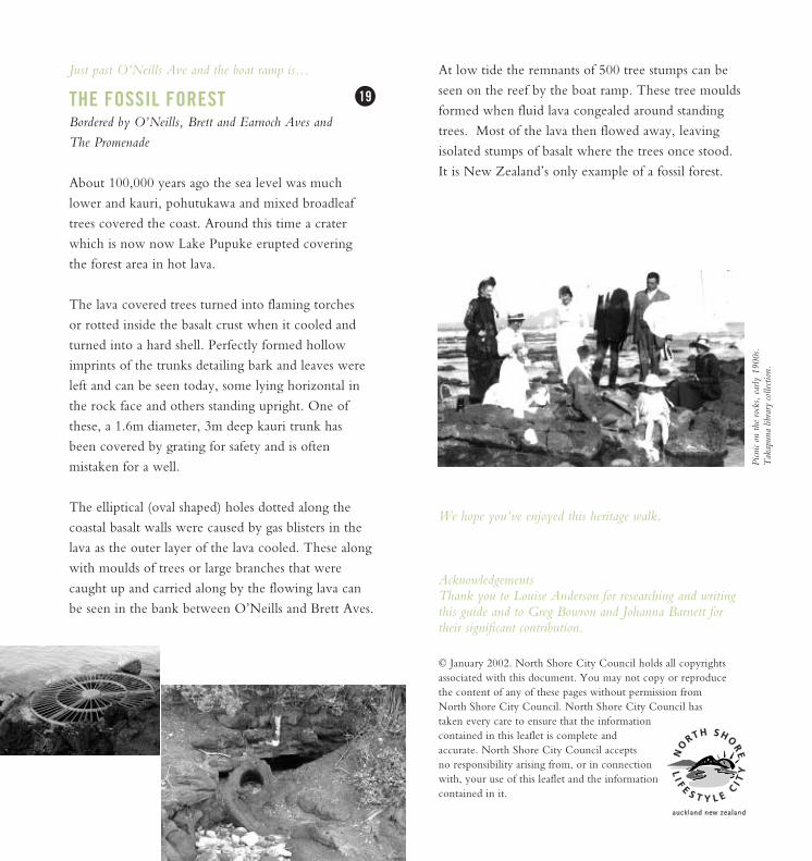
Picn
ic on
the
rock
s, e
arly
190
0s.
Tak
apun
a lib
rary
colle
ction
.