


Languages
Pages
Legal

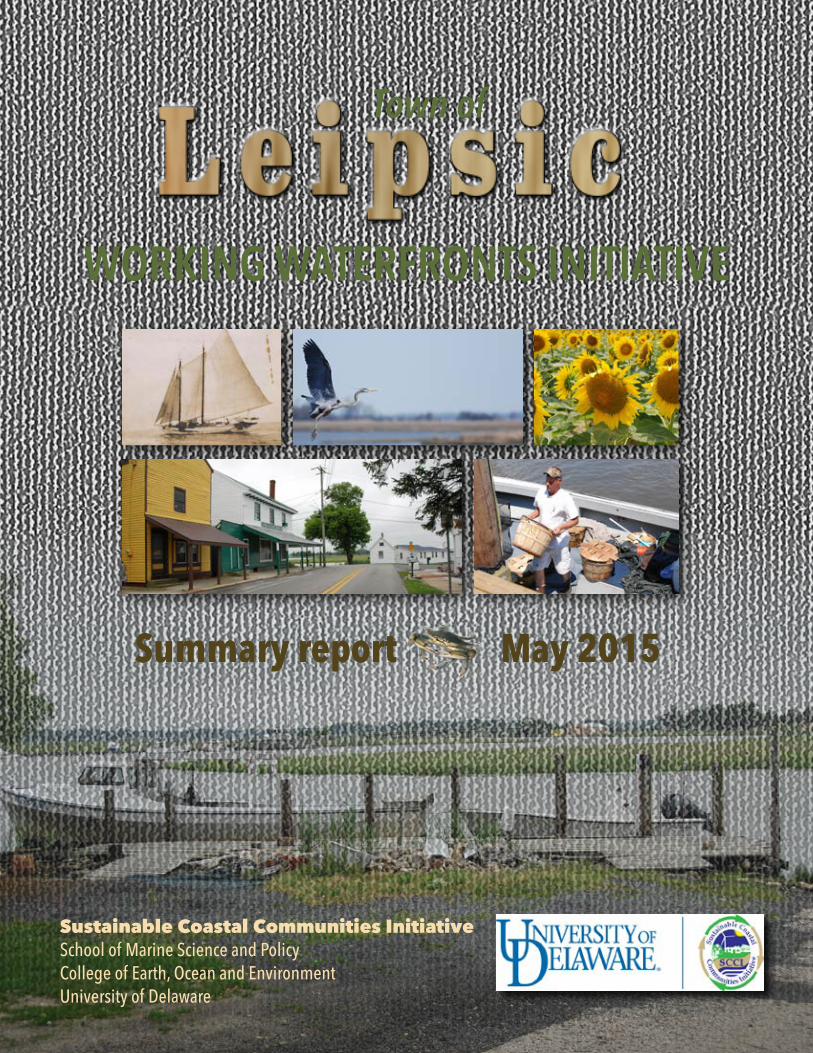
WORKING WATERFRONTS INITIATIVE
Summary report May 2015
Town of
Sustainable Coastal Communities Initiative School of Marine Science and PolicyCollege of Earth, Ocean and EnvironmentUniversity of Delaware
Leipsic: A Working Waterfront Page 2
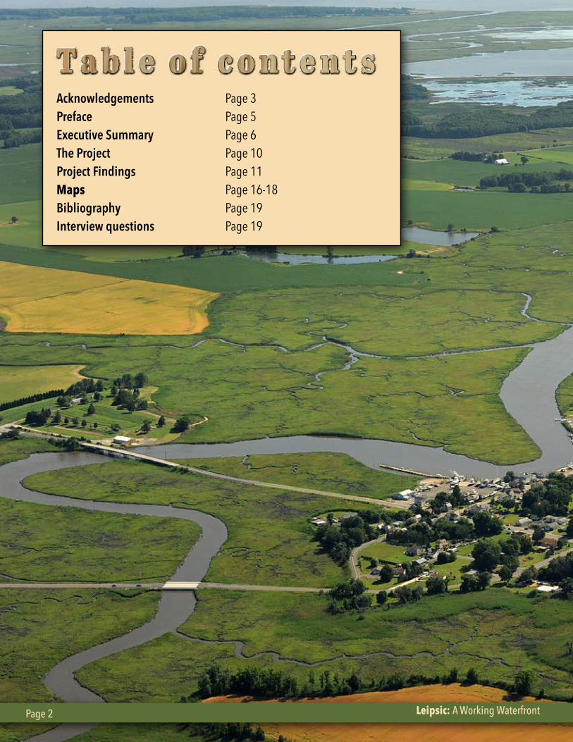
Acknowledgements Page 3Preface Page 5Executive Summary Page 6The Project Page 10Project Findings Page 11Maps Page 16-18Bibliography Page 19Interview questions Page 19
Leipsic: A Working Waterfront Page 2
University of Delaware Sustainable Coastal Communities Initiative Page 3
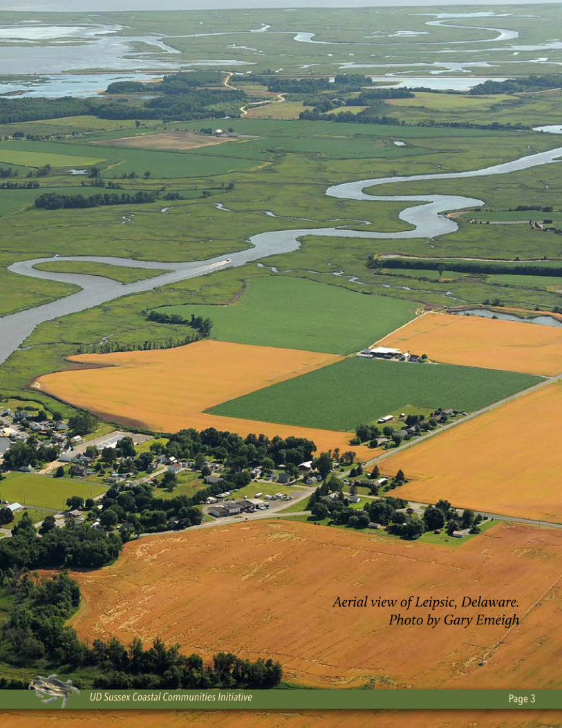
Aerial view of Leipsic, Delaware. Photo by Gary Emeigh
UD Sussex Coastal Communities Initiative Page 3
Leipsic: A Working Waterfront Page 4
The UD/Sustainable Coastal Communities Initiative appreciates and acknowledges our project partners, the municipal officials in Leipsic, and community stakeholders for their assistance and contributions to this public service project. We believe that the information collected and analyzed in this report will provide stakeholders with a more complete understanding of their collective challenges to sustain and enhance the working waterfront.
We hope our suggested development and community engagement strategies will help the Town of Leipsic enhance its commercial, water-dependent businesses while preserving the many characteristics that make it a unique, maritime community rich with history, culture and opportunity.
University of DelawarePrincipal Investigators/Authors
Ed Lewandowski, Coastal Communities Development Specialist, Delaware Sea Grant, UDClark Evans, Contractor, M.A. Marine Affairs, University of Rhode Island 1996
Editorial Review
Jim Falk, Sea Grant Associate Director/Director, Marine Advisory Service, Delaware Sea Grant, UD
Project partners Delaware Department of Natural Resources & Environmental Control
Karen Bennett, Bayshore Coordinator, Delaware Division of Fish & Wildlife
Delaware Office of State Planning CoordinationDavid Edgell, Kent County Circuit Rider Planner
Leipsic Steering CommitteeCraig Pugh, Mayor
Photography (unless otherwise noted), design
and layout by Lee Ann Walling
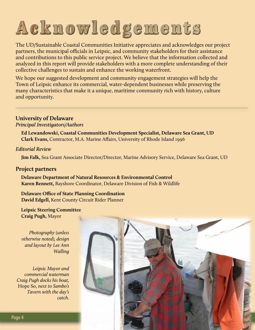
Leipsic Mayor and commercial waterman
Craig Pugh docks his boat, Hope So, next to Sambo’s
Tavern with the day’s catch.
University of Delaware Sustainable Coastal Communities Initiative Page 5
Unfortunately, many of these working waterfronts have experienced significant decline due to the loss of commercial fishing and processing industries over the last several decades. In addition, the collapse of some recreational fisheries and other water-dependent businesses has caused economic malaise in areas that once supported a robust economy.
Also, as populations shift to coastal areas, new growth and development pressures (tourism, residential housing, condos, etc.) are being exerted on communi-ties with working waterfronts.
Commercial and recreational fishing have long been traditional waterfront uses in most of these commu-nities. Tourism and other recreational pursuits are now vying for a larger share of the uses.
Whether a community views these possible changes as opportunities or threats is critical, since each type of economic development could represent a conflict with some types of water-related businesses. These issues can be especially acute for rural coastal econo-mies.
These challenges emphasize the need for sustainable development of working waterfronts. The tenets of sustainable development support an environment in which economic growth and environmental protec-
tion are viewed as mutually compatible activities and not conflicting ones.
Such a goal requires that various human activities must be integrated within a coherent setting of land-use planning policies, addressing problems of environmental carrying capacity. They also should be planned and developed within the limits of the local socioeconomic and natural carrying capacities.
To determine what the current status and needs are for Delaware’s traditional maritime communities, the University of Delaware’s Sustainable Coastal Commu-nities Initiative is coordinating the Working Water-fronts Initiative. The objectives are:
• Assess the prevailing socioeconomic conditions of Delaware’s working waterfronts; this includes pro-vision of a baseline study and characterizing the existing state of these communities, which will assist in identifying the main areas of concern;
• Analyze the impacts of the prevailing environmen-tal conditions on the socioeconomic structure of the study sites;
• Identify business infrastructure needs; and
• Develop a set of guidelines and/or recommenda-tions for establishing or enhancing viable water-front communities.
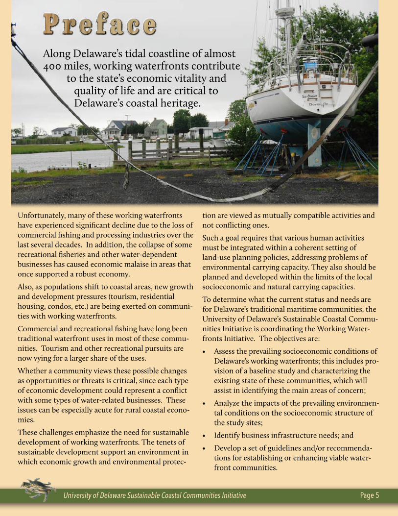
Along Delaware’s tidal coastline of almost 400 miles, working waterfronts contribute to the state’s economic vitality and quality of life and are critical to Delaware’s coastal heritage.
Leipsic: A Working Waterfront Page 6
In 2012, the University of Delaware’s Sustainable Coastal Communities Initiative launched its Working Waterfronts Initiative to develop sustainability strategies for preserving and maintaining the state’s traditional maritime communities.
After a successful pilot study was conducted in Bowers Beach in early 2013, the town of Leipsic requested to be engaged as part of this ongoing study in the Delaware Bayshore communities.
During the fall of 2013 and winter/spring of 2014, numerous community members and regulatory officials were interviewed to obtain their feedback concerning the current status and trends in Leipsic.
Their responses were used to create a qualitative characterization concerning the current economic conditions in the community, the potential for economic development and growth, the needs for quality of life improvements, and actions that could be taken to address these issues.
This summary report represents the findings of these interviews and will be used to inform the stakeholders in Leipsic and the state’s resource managers about the potential for enhancing life in this working waterfront community.
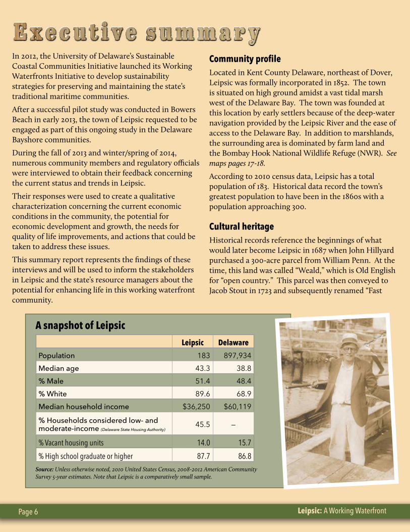
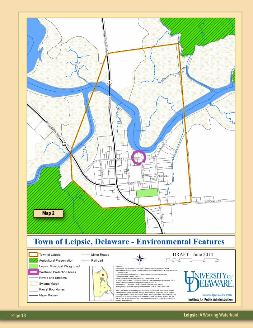
Community profileLocated in Kent County Delaware, northeast of Dover, Leipsic was formally incorporated in 1852. The town is situated on high ground amidst a vast tidal marsh west of the Delaware Bay. The town was founded at this location by early settlers because of the deep-water navigation provided by the Leipsic River and the ease of access to the Delaware Bay. In addition to marshlands, the surrounding area is dominated by farm land and the Bombay Hook National Wildlife Refuge (NWR). See maps pages 17-18.
According to 2010 census data, Leipsic has a total population of 183. Historical data record the town’s greatest population to have been in the 1860s with a population approaching 300.
Cultural heritageHistorical records reference the beginnings of what would later become Leipsic in 1687 when John Hillyard purchased a 300-acre parcel from William Penn. At the time, this land was called “Weald,” which is Old English for “open country.” This parcel was then conveyed to Jacob Stout in 1723 and subsequently renamed “Fast
A snapshot of Leipsic
Leipsic Delaware
Population 183 897,934Median age 43.3 38.8% Male 51.4 48.4% White 89.6 68.9Median household income $36,250 $60,119
% Households considered low- and moderate-income (Delaware State Housing Authority)
45.5 —
% Vacant housing units 14.0 15.7% High school graduate or higher 87.7 86.8
Source: Unless otherwise noted, 2010 United States Census, 2008-2012 American Community Survey 5-year estimates. Note that Leipsic is a comparatively small sample.
University of Delaware Sustainable Coastal Communities Initiative Page 7
Landing” in reference to the accessible high ground of the natural waterfront.
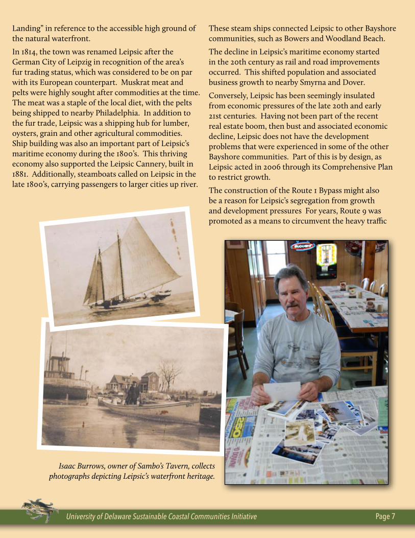
In 1814, the town was renamed Leipsic after the German City of Leipzig in recognition of the area’s fur trading status, which was considered to be on par with its European counterpart. Muskrat meat and pelts were highly sought after commodities at the time. The meat was a staple of the local diet, with the pelts being shipped to nearby Philadelphia. In addition to the fur trade, Leipsic was a shipping hub for lumber, oysters, grain and other agricultural commodities. Ship building was also an important part of Leipsic’s maritime economy during the 1800’s. This thriving economy also supported the Leipsic Cannery, built in 1881. Additionally, steamboats called on Leipsic in the late 1800’s, carrying passengers to larger cities up river.
These steam ships connected Leipsic to other Bayshore communities, such as Bowers and Woodland Beach.
The decline in Leipsic’s maritime economy started in the 20th century as rail and road improvements occurred. This shifted population and associated business growth to nearby Smyrna and Dover.
Conversely, Leipsic has been seemingly insulated from economic pressures of the late 20th and early 21st centuries. Having not been part of the recent real estate boom, then bust and associated economic decline, Leipsic does not have the development problems that were experienced in some of the other Bayshore communities. Part of this is by design, as Leipsic acted in 2006 through its Comprehensive Plan to restrict growth.
The construction of the Route 1 Bypass might also be a reason for Leipsic’s segregation from growth and development pressures For years, Route 9 was promoted as a means to circumvent the heavy traffic
Isaac Burrows, owner of Sambo’s Tavern, collects photographs depicting Leipsic’s waterfront heritage.
Leipsic: A Working Waterfront Page 8
on Route 113, but the bypass has alleviated those traffic concerns.
The Comprehensive Plan designates a “sphere of influence” that extends outside the town’s boundaries in a one mile radius. This allows the town influence over development beyond its physical area. This creates a unique quality in that the town is a reflection of the surrounding area and vice versa.
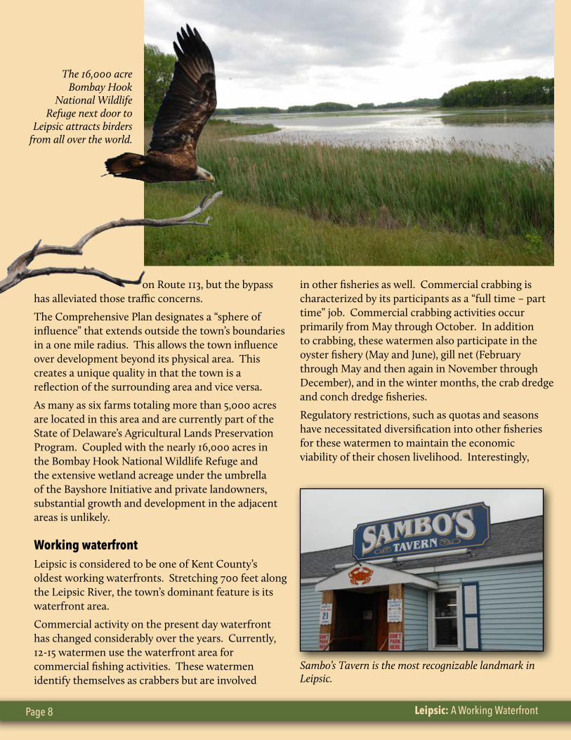
As many as six farms totaling more than 5,000 acres are located in this area and are currently part of the State of Delaware’s Agricultural Lands Preservation Program. Coupled with the nearly 16,000 acres in the Bombay Hook National Wildlife Refuge and the extensive wetland acreage under the umbrella of the Bayshore Initiative and private landowners, substantial growth and development in the adjacent areas is unlikely.
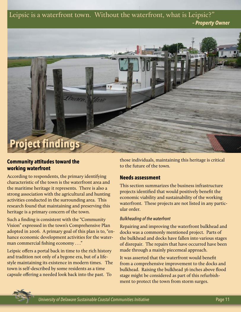
Working waterfrontLeipsic is considered to be one of Kent County’s oldest working waterfronts. Stretching 700 feet along the Leipsic River, the town’s dominant feature is its waterfront area.
Commercial activity on the present day waterfront has changed considerably over the years. Currently, 12-15 watermen use the waterfront area for commercial fishing activities. These watermen identify themselves as crabbers but are involved
in other fisheries as well. Commercial crabbing is characterized by its participants as a “full time – part time” job. Commercial crabbing activities occur primarily from May through October. In addition to crabbing, these watermen also participate in the oyster fishery (May and June), gill net (February through May and then again in November through December), and in the winter months, the crab dredge and conch dredge fisheries.
Regulatory restrictions, such as quotas and seasons have necessitated diversification into other fisheries for these watermen to maintain the economic viability of their chosen livelihood. Interestingly,
The 16,000 acre Bombay Hook
National Wildlife Refuge next door to
Leipsic attracts birders from all over the world.
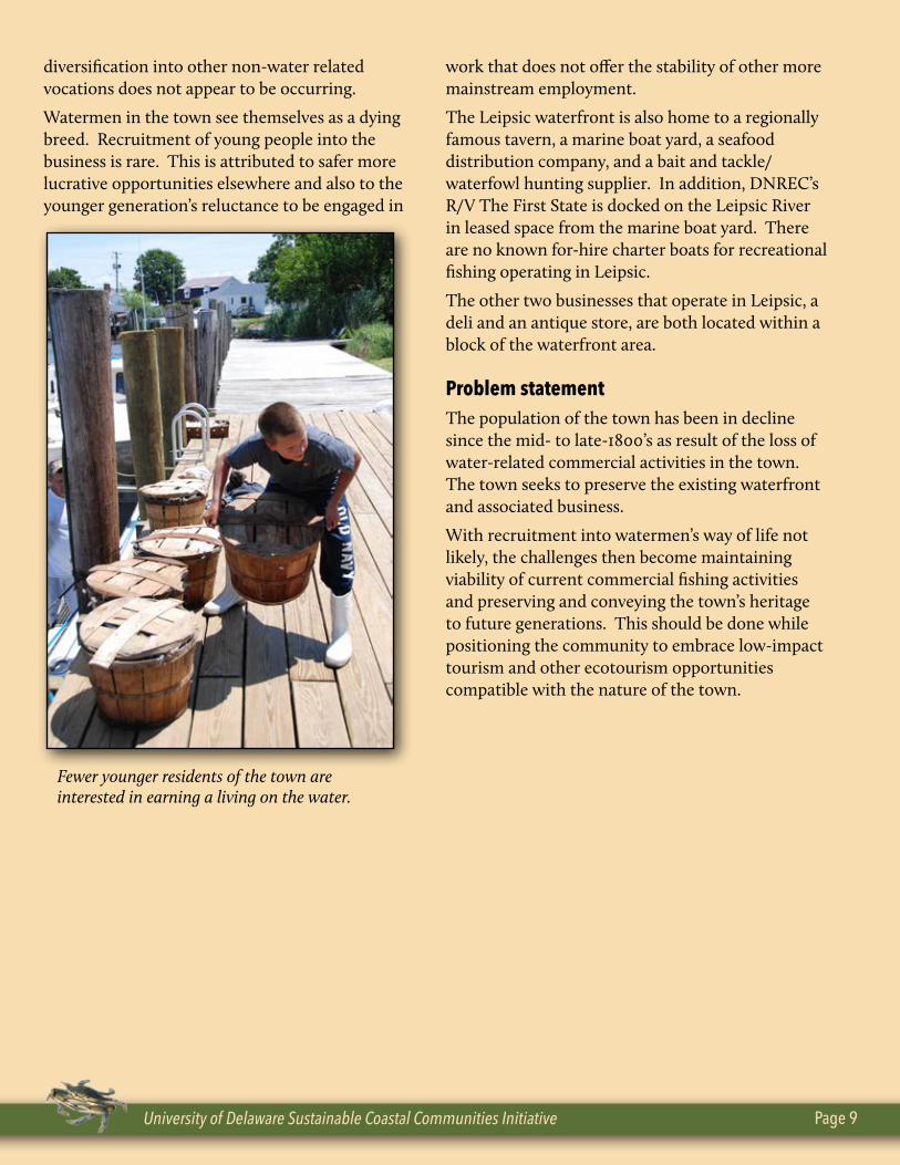
Sambo’s Tavern is the most recognizable landmark in Leipsic.
University of Delaware Sustainable Coastal Communities Initiative Page 9
diversification into other non-water related vocations does not appear to be occurring.
Watermen in the town see themselves as a dying breed. Recruitment of young people into the business is rare. This is attributed to safer more lucrative opportunities elsewhere and also to the younger generation’s reluctance to be engaged in
work that does not offer the stability of other more mainstream employment.
The Leipsic waterfront is also home to a regionally famous tavern, a marine boat yard, a seafood distribution company, and a bait and tackle/waterfowl hunting supplier. In addition, DNREC’s R/V The First State is docked on the Leipsic River in leased space from the marine boat yard. There are no known for-hire charter boats for recreational fishing operating in Leipsic.
The other two businesses that operate in Leipsic, a deli and an antique store, are both located within a block of the waterfront area.
Problem statementThe population of the town has been in decline since the mid- to late-1800’s as result of the loss of water-related commercial activities in the town. The town seeks to preserve the existing waterfront and associated business.
With recruitment into watermen’s way of life not likely, the challenges then become maintaining viability of current commercial fishing activities and preserving and conveying the town’s heritage to future generations. This should be done while positioning the community to embrace low-impact tourism and other ecotourism opportunities compatible with the nature of the town.
Fewer younger residents of the town are interested in earning a living on the water.
Leipsic: A Working Waterfront Page 10
Scope of work The purpose of this study is to survey community and business leaders to solicit responses regarding different forms of development activity (tourism, residential housing, condos, etc.) near the waterfront area and identify possible resource management issues. This feedback will help the project investigators to assess socioeconomic impacts and identify main areas of concern in order to develop a conceptual framework for sustainable development, including identifying future water-dependent, business infrastructure needs that might enhance profitability within the community.
The desire of the research is to focus and synthesize the discussion. The resulting report is then intended to be a launching point for a more detailed community-wide examination of the issues. It is the intent to surface pertinent issues and shape the conversation for others to participate.
MethodologyThe survey method included synthesizing and focusing the discussion of community needs among respondents. This allowed for the development of a conceptual framework for use in strategic planning. The intent was to take input that had been previously only conversational and anecdotal and transform it into more qualitative data.
Twenty-two individuals were contacted and interviewed utilizing a semi-structured interview technique. The respondent pool was comprised of a diverse group of community members representing municipal leaders, community activists, safety officials, business owners, commercial and recreational fishermen, residents and non-residents. Appropriate state and federal agency personnel with direct regulatory responsibility/jurisdiction in and around Leipsic were interviewed as well.
Respondents were initially selected based on the
study team’s knowledge of the town and its issues. Additional respondents were identified during the interviews, which allowed the researcher an opportunity to solicit other key people and seek a diverse group of opinions. Every attempt was made to obtain an array of opinions on each issue as it arose.
The interview questionnaire was based on a framework of themes identified in meetings with municipal and business leaders and through a review of planning documents and other related background materials. The interview process was first initiated with community leaders and then expanded to include others as they were identified. This is commonly referred to as a “snowball” approach.
The interview process and questionnaire were meant to be adaptable to allow for subsequent questions to be appropriately modified as a result of individual responses. This allowed the researcher an opportunity to tailor the interview to the specific knowledge and interests of the respondent and more thoroughly explore the theme and associated sub-components as they were discovered.
The semi-structured interview technique is common in the social sciences and particularly within cultural anthropological research (Salant and Dillman, 1994). This method was chosen because it allowed for the open flow of ideas and exchange of opinion. Specifically, it allowed the researcher to identify common issues and themes among respondents as well as areas of conflict (Bernard 1994).
All respondent identities and responses have been kept confidential in accordance with University of Delaware human subject research policy.
University of Delaware Sustainable Coastal Communities Initiative Page 11
Community attitudes toward the working waterfront According to respondents, the primary identifying characteristic of the town is the waterfront area and the maritime heritage it represents. There is also a strong association with the agricultural and hunting activities conducted in the surrounding area. This research found that maintaining and preserving this heritage is a primary concern of the town.
Such a finding is consistent with the “Community Vision” expressed in the town’s Comprehensive Plan adopted in 2006. A primary goal of this plan is to, “en-hance economic development activities for the water-man commercial fishing economy . . .”
Leipsic offers a portal back in time to the rich history and tradition not only of a bygone era, but of a life-style maintaining its existence in modern times. The town is self-described by some residents as a time capsule offering a needed look back into the past. To
those individuals, maintaining this heritage is critical to the future of the town.
Needs assessmentThis section summarizes the business infrastructure projects identified that would positively benefit the economic viability and sustainability of the working waterfront. These projects are not listed in any partic-ular order.
Bulkheading of the waterfront
Repairing and improving the waterfront bulkhead and docks was a commonly mentioned project. Parts of the bulkhead and docks have fallen into various stages of disrepair. The repairs that have occurred have been made through a mainly piecemeal approach.
It was asserted that the waterfront would benefit from a comprehensive improvement to the docks and bulkhead. Raising the bulkhead 36 inches above flood stage might be considered as part of this refurbish-ment to protect the town from storm surges.
Leipsic is a waterfront town. Without the waterfront, what is Leipsic?” – Property Owner
Project findings
Leipsic: A Working Waterfront Page 12
DNREC regulations are considered an impediment to these improvements. Specifically, DNREC favors riprap as a solution for protecting the waterfront, while the town would prefer bulkheading.
The bulkhead also protects the town from sea level rise associated with climate change. Bombay Hook National Wildlife Refuge and the State of Delaware are addressing this issue on properties surrounding the town. Those adaptation or mitigation efforts should be coordinated with Leipsic and other coastal commu-nities so they do not worsen flooding problems along working waterfronts.
A secondary goal of improving the aesthetic appeal of the waterfront could also be accomplished as part of this project. Beautification of the waterfront and the town are both considered to be positive steps toward economic viability and sustainability.
Boat Ramp/Kayak Launch
It is well-known among respondents that the Division of Fish and Wildlife would like to obtain property on the Leipsic River to construct a public boat ramp and dock. The boat ramp would provide recreational boat-ing and fishing access to the Leipsic River. The dock also would be used as a permanent home for the R/V The First State, which is currently moored on property leased from the local boat yard.
It is important to note that all of the property on the waterfront within town limits is privately owned. There are two private boat ramps on the river with-
in town limits, but currently no public access to the Leipsic River. The closest public access is at Woodland Beach to the north and Port Mahon to the south. Both access points are more than 5 miles away by water.
In addition to the state’s desire to provide public ac-cess, Bombay Hook Refuge officials indicated a need for increased public use of refuge waterways for boat-ing, fishing and bird watching that might be accom-plished if the public had access to the Leispic River.
Leipsic public safety officials indicated a need for a better launch site for the volunteer fire department’s fire/rescue boat. The current ramps do not allow for launching of this boat below a half-tide, which pres-ents a public safety issue in terms of ability to respond.
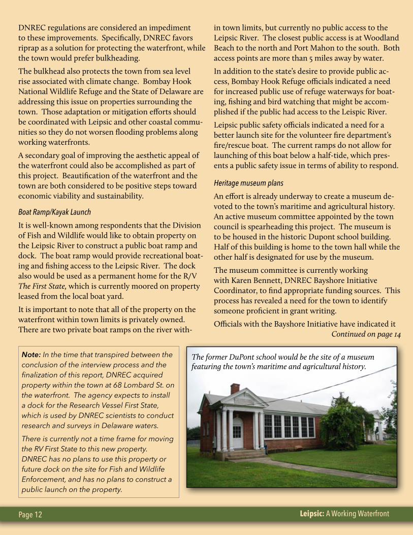
Heritage museum plans
An effort is already underway to create a museum de-voted to the town’s maritime and agricultural history. An active museum committee appointed by the town council is spearheading this project. The museum is to be housed in the historic Dupont school building. Half of this building is home to the town hall while the other half is designated for use by the museum.
The museum committee is currently working with Karen Bennett, DNREC Bayshore Initiative Coordinator, to find appropriate funding sources. This process has revealed a need for the town to identify someone proficient in grant writing.
Officials with the Bayshore Initiative have indicated it Continued on page 14
The former DuPont school would be the site of a museum featuring the town’s maritime and agricultural history.
Note: In the time that transpired between the conclusion of the interview process and the finalization of this report, DNREC acquired property within the town at 68 Lombard St. on the waterfront. The agency expects to install a dock for the Research Vessel First State, which is used by DNREC scientists to conduct research and surveys in Delaware waters.
There is currently not a time frame for moving the RV First State to this new property. DNREC has no plans to use this property or future dock on the site for Fish and Wildlife Enforcement, and has no plans to construct a public launch on the property.
University of Delaware Sustainable Coastal Communities Initiative Page 13
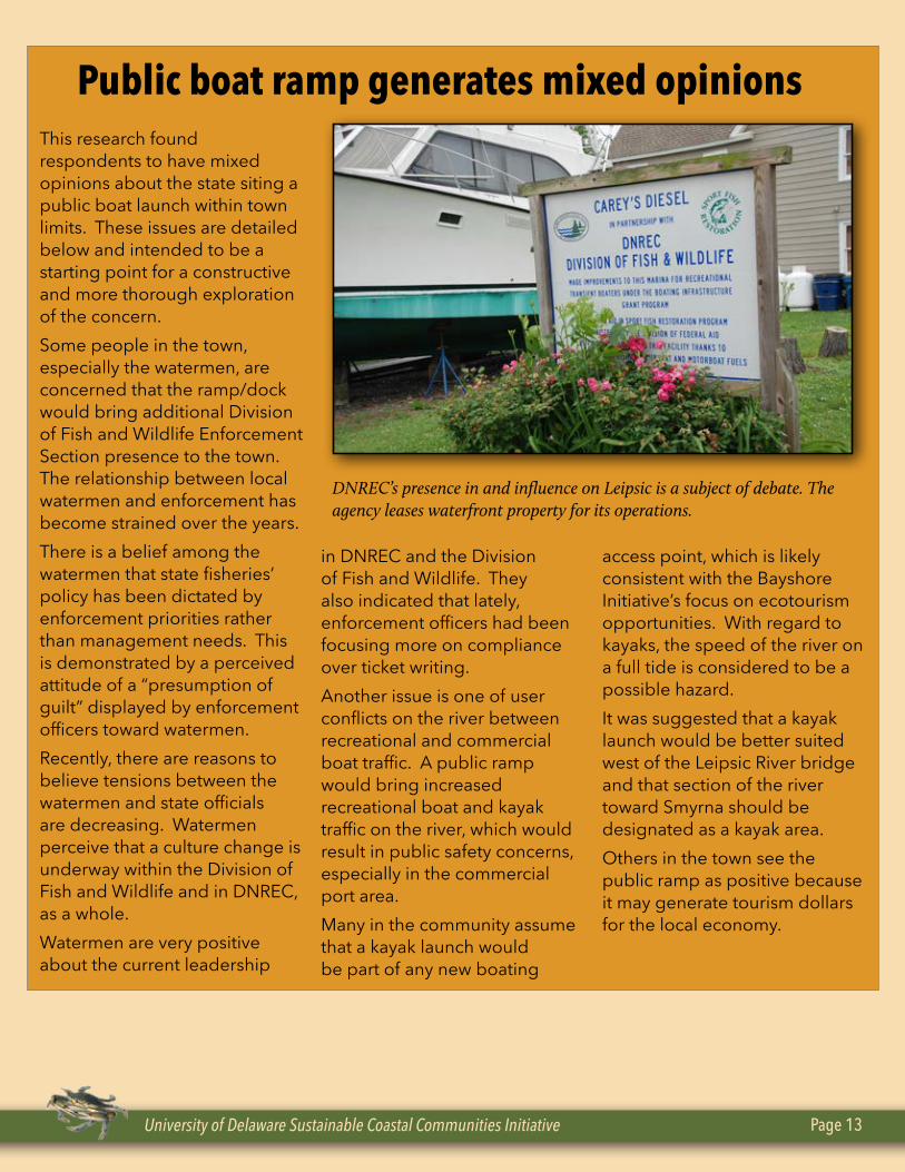
This research found respondents to have mixed opinions about the state siting a public boat launch within town limits. These issues are detailed below and intended to be a starting point for a constructive and more thorough exploration of the concern.Some people in the town, especially the watermen, are concerned that the ramp/dock would bring additional Division of Fish and Wildlife Enforcement Section presence to the town. The relationship between local watermen and enforcement has become strained over the years. There is a belief among the watermen that state fisheries’ policy has been dictated by enforcement priorities rather than management needs. This is demonstrated by a perceived attitude of a “presumption of guilt” displayed by enforcement officers toward watermen.Recently, there are reasons to believe tensions between the watermen and state officials are decreasing. Watermen perceive that a culture change is underway within the Division of Fish and Wildlife and in DNREC, as a whole. Watermen are very positive about the current leadership
in DNREC and the Division of Fish and Wildlife. They also indicated that lately, enforcement officers had been focusing more on compliance over ticket writing.Another issue is one of user conflicts on the river between recreational and commercial boat traffic. A public ramp would bring increased recreational boat and kayak traffic on the river, which would result in public safety concerns, especially in the commercial port area. Many in the community assume that a kayak launch would be part of any new boating
access point, which is likely consistent with the Bayshore Initiative’s focus on ecotourism opportunities. With regard to kayaks, the speed of the river on a full tide is considered to be a possible hazard. It was suggested that a kayak launch would be better suited west of the Leipsic River bridge and that section of the river toward Smyrna should be designated as a kayak area.Others in the town see the public ramp as positive because it may generate tourism dollars for the local economy.
Public boat ramp generates mixed opinions
DNREC’s presence in and influence on Leipsic is a subject of debate. The agency leases waterfront property for its operations.
Leipsic: A Working Waterfront Page 14
is inadequately staffed to assist the town with grant writing opportunities. The committee has made an informal request to determine if graduate students from the University of Delaware’s Institute for Public Administration would be interested in assisting the town in this regard.
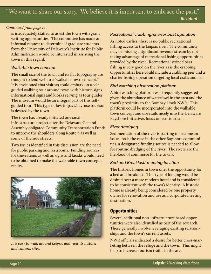
Walkable town conceptThe small size of the town and its flat topography are thought to lend well to a “walkable town concept.” It is envisioned that visitors could embark on a self-guided walking tour around town with historic signs, informational signs and kiosks serving as tour guides. The museum would be an integral part of this self-guided tour. This type of low impact/day-use tourism is desired by the town.
The town has already initiated one small infrastructure project after the Delaware General Assembly obligated Community Transportation Funds to improve the shoulders along Route 9 as well as some of the side streets.
Two issues identified in this discussion are the need for public parking and restrooms. Funding sources for these items as well as signs and kiosks would need to be obtained to make the walk-able town concept a reality.
Recreational crabbing/charter boat operationAs noted earlier, there is no public recreational fishing access to the Leipsic river. The community may be missing a significant revenue stream by not taking advantage of recreational fishing opportunities provided by the river. Recreational striped bass fishing is very good on the river as is the crabbing. Opportunities here could include a crabbing pier and a charter fishing operation targeting local crabs and fish.
Bird watching observation platformA bird watching platform was frequently suggested given the abundance of waterfowl in the area and the town’s proximity to the Bombay Hook NWR. This platform could be incorporated into the walkable town concept and dovetails nicely into the Delaware Bayshore Initiative’s focus on eco-tourism.
River dredgingSedimentation of the river is starting to become an issue. As is the case in the other Bayshore communi-ties, a designated funding source is needed to allow for routine dredging of the river. The rivers are the lifeblood of commerce for the towns.
Bed and Breakfast/ meeting location The historic homes in town offer the opportunity for a bed and breakfast. This type of lodging would be desired over a more modern hotel and is considered to be consistent with the town’s identity. A historic home is already being considered by one property owner for renovation and use as a corporate meeting destination.
OpportunitiesSeveral additional non-infrastructure based oppor-tunities were also identified as part of the research. These generally involve leveraging existing relation-ships and the town’s current assets.
NWR officials indicated a desire for better cross-mar-keting between the refuge and the town. This might help to increase tourism traffic in the area.
Continued from page 12
“We want to share our story. We believe it is important to embrace the past.” – Resident
It is easy to walk around Leipsic and view its historic and cultural sites.
University of Delaware Sustainable Coastal Communities Initiative Page 15
Delaware’s Bayshore Byways Council also presents an opportunity to leverage partnerships among towns in the designated byway. Each town could become part of a “Heritage Trail” providing tourists self-guided discovery.
Another opportunity that surfaced included capitaliz-ing on local seafood as a marketing tool. It was sug-gested by several respondents that most of the seafood harvested in Delaware waters goes out of state. A Leipsic Seafood Festival was suggested as an appropri-ate marketing tool.
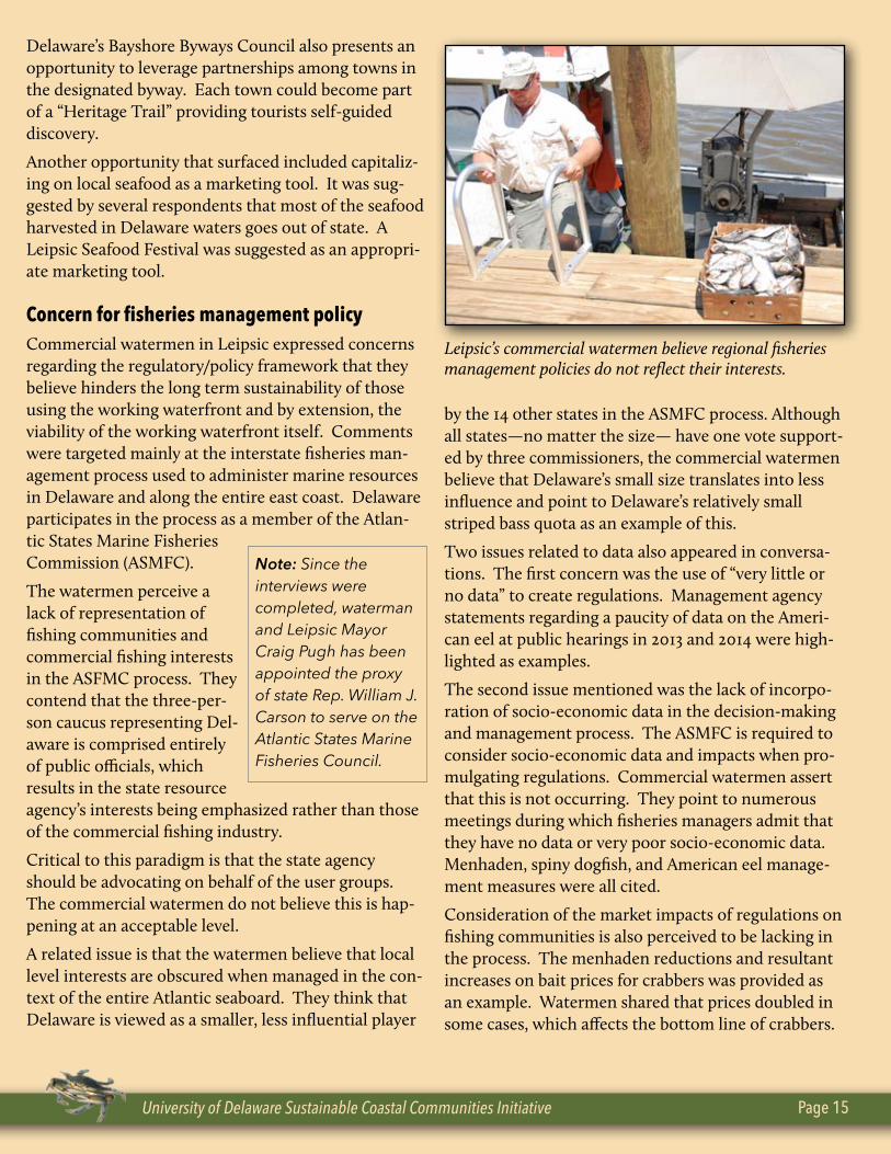
Concern for fisheries management policyCommercial watermen in Leipsic expressed concerns regarding the regulatory/policy framework that they believe hinders the long term sustainability of those using the working waterfront and by extension, the viability of the working waterfront itself. Comments were targeted mainly at the interstate fisheries man-agement process used to administer marine resources in Delaware and along the entire east coast. Delaware participates in the process as a member of the Atlan-tic States Marine Fisheries Commission (ASMFC).
The watermen perceive a lack of representation of fishing communities and commercial fishing interests in the ASFMC process. They contend that the three-per-son caucus representing Del-aware is comprised entirely of public officials, which results in the state resource agency’s interests being emphasized rather than those of the commercial fishing industry.
Critical to this paradigm is that the state agency should be advocating on behalf of the user groups. The commercial watermen do not believe this is hap-pening at an acceptable level.
A related issue is that the watermen believe that local level interests are obscured when managed in the con-text of the entire Atlantic seaboard. They think that Delaware is viewed as a smaller, less influential player
by the 14 other states in the ASMFC process. Although all states—no matter the size— have one vote support-ed by three commissioners, the commercial watermen believe that Delaware’s small size translates into less influence and point to Delaware’s relatively small striped bass quota as an example of this.
Two issues related to data also appeared in conversa-tions. The first concern was the use of “very little or no data” to create regulations. Management agency statements regarding a paucity of data on the Ameri-can eel at public hearings in 2013 and 2014 were high-lighted as examples.
The second issue mentioned was the lack of incorpo-ration of socio-economic data in the decision-making and management process. The ASMFC is required to consider socio-economic data and impacts when pro-mulgating regulations. Commercial watermen assert that this is not occurring. They point to numerous meetings during which fisheries managers admit that they have no data or very poor socio-economic data. Menhaden, spiny dogfish, and American eel manage-ment measures were all cited.
Consideration of the market impacts of regulations on fishing communities is also perceived to be lacking in the process. The menhaden reductions and resultant increases on bait prices for crabbers was provided as an example. Watermen shared that prices doubled in some cases, which affects the bottom line of crabbers.
Leipsic’s commercial watermen believe regional fisheries management policies do not reflect their interests.
Note: Since the interviews were completed, waterman and Leipsic Mayor Craig Pugh has been appointed the proxy of state Rep. William J. Carson to serve on the Atlantic States Marine Fisheries Council.
Leipsic: A Working Waterfront Page 16
This increase in operating costs is then passed along to wholesalers, restaurants and ultimately, the consumer at the retail level.
Strategic doing/Path forwardThis report summarizes the attitude of the town towards the working waterfront, identifies business infrastructure needs, addresses issues associated with these needs, and then lists additional opportunities.
It is evident from this research that the town wants to preserve and enhance the working waterfront, embraces low impact, day-use tourism and wants to take advantage of eco-tourism opportunities. The questions now become, “Does the town want to move forward? And if so, how?”
This research represents the first step in the Strategic Doing Process. Step One is a Needs Assessment that looks at “What Could We Do?” Step Two is “What Should We Do?” The answer(s) to this question will evolve during a town meeting facilitated by the University of Delaware’s Sustainable Coastal Communities staff.
This conversation will then lead to Step Three: “What Will We Do?” and involves prioritization of preferred projects through the development of an action framework. During Step Three, community members will need to determine roles and responsibilities by assigning appropriate tasks for the desired projects.
Throughout this process, the facilitators will make efforts to have appropriate state and federal personnel involved in the conversation to answer regulatory, policy and funding questions.
This process will evolve over time as community members become engaged in Step 4: “When Will We Meet Again?” A series of subsequent public meetings will be convened to give participants an opportunity to report on progress made implementing the action framework.
These gatherings will also involve open participation, leadership direction, and problem solving to address the remaining issues facing the community.
University of Delaware Sustainable Coastal Communities Initiative Page 17
Leipsic River
Dyke
Br
anch
DEN
NY
STM
AIN
ST
SAVANNAH RD
FRONT ST
SECOND ST
SMY
RN
A-LE
IPSIC
RD
FAST LANDINGRD
BAYS
IDE D
R
TEXAS LN
WE
ST S
T
LOM
BARD
ST
QR9
QR42
DRAFT - July 20140 460 920 1,380 1,840230
Feet
Sources:Investment Strategies for Policies and Spending - Office of State Planning Coordination (OMB), Sept. 2010.Parcel Boundaries - Kent County GIS Department, 05/14.Municipal Boundaries - Delaware Office of State Planning Coordination, 05/14.Roads - Kent County Planning Department, 05/21/14.Rail Network - Delaware Department of Transportation, 06/14.Hydrography - National Hydrography Dataset (NHD), USGS and EPA.
Note:This map is provided by the University of Delaware, Institute for PublicAdministration (IPA) solely for display and reference purposes and is subjectto change without notice. No claims, either real or assumed, as to the absolute accuracy or precision of any data contained herein are made by IPA, nor will IPA be held responsible for any use of this document for purposes other than which it was intended.
2010 State Investment StrategiesLevel 1
Level 2
Level 3
Level 4
Out of Play
Town of Leipsic
Major Routes
Minor Roads
Parcel Boundaries
Railroad
Rivers and Streams ®
Town of Leipsic, Delaware - State Investment Strategies
^
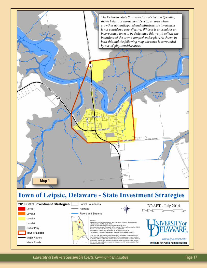
The Delaware State Strategies for Policies and Spending shows Leipsic as Investment Level 3, an area where growth is not anticipated and infrastructure investment is not considered cost-effective. While it is unusual for an incorporated town to be designated this way, it reflects the intentions of the town’s comprehensive plan. As shown in both this and the following map, the town is surrounded by out-of-play, sensitive areas.
Map 1
Leipsic: A Working Waterfront Page 18
Map 3
Leips
icRiver
Dyke Branch
DEN
NY
ST
MA
IN S
T
FRONT ST
SECOND ST
FAST LANDINGRD
SMY
RN
A-LE
IPSIC
RD
TEXAS LNSAVANNAH RD
WE
ST S
T
WA
LNU
T ST
LOM
BARD
ST
CH
ESTN
UT S
T MCCLARY ST
QR9
QR42
DRAFT - June 20140 300 600 900 1,200150
Feet
Sources:Agricultural Preservation - Delaware Department of Agriculture, 06/14.Wellhead Protection Areas - Department of Natural Resources & Environmental Control, 05/13.Outdoor Recreation Inventory - Department of Natural Resources & Environmental Control, 05/13.Parcel Boundaries - Kent County GIS Department, 05/14.Municipal Boundaries - Delaware Office of State Planning Coordination, 05/14.Roads - Kent County Planning Department, 05/21/14.Rail Network - Delaware Department of Transportation, 06/14.Hydrography - National Hydrography Dataset (NHD), USGS and EPA.
Note:This map is provided by the University of Delaware, Institute for PublicAdministration (IPA) solely for display and reference purposes and is subjectto change without notice. No claims, either real or assumed, as to the absolute accuracy or precision of any data contained herein are made by IPA, nor will IPA be held responsible for any use of this document for purposes other than which it was intended.
Town of Leipsic
Agricultural Preservation
Leipsic Municipal Playground
Wellhead Protection Areas
Rivers and Streams
Swamp/Marsh
Parcel Boundaries
Major Routes
Minor Roads
Railroad ®
Town of Leipsic, Delaware - Environmental Features
^
Map 2
University of Delaware Sustainable Coastal Communities Initiative Page 19
Bibliography
Bernard, H. Russel. 1995. Research Methods in Anthropology: Qualitative and Quantitative Approaches. 2nd Edition. Walnut Creek, CA. Altimara Press
Delaware Greenways. 2013. Corridor Management Plan: Delaware’s Bayshore Byway. New Castle and Kent Counties.
Food and Agriculture Organization (FAO), United Nations, Rapid Rural Appraisal. Chapter 8 in Marketing Research and Information Systems. FAO Corporate Document Repository.
Hanna, James Milton. 2007. Meandering Around Delaware Bay: True Stories of the Delaware Bay. Cherokee Books. Dover, Delaware
IISD. Participatory Research for Sustainable Livelihoods: A Guide for Field Projects on Adaptive Strate-gies. Rapid Rural Appraisal
Salant, Priscilla, Don A. Dillman. 1994. How to Conduct Your Own Survey. New York. John Wiley and Sons, Inc.
Town of Leipsic, 2006. Comprehensive Plan. Town of Leipsic Planning Commission.
Thorp, Steven. 2012. Preliminary Research: Working Waterfronts of Delaware, Phase 1. University of Delaware Sea Grant College Program. Coastal Communities Enhancement Initiative.
Semi-Structured Interview Questions Interviewer: Clark Evans
Interview subjects: Municipal, community and business leaders
1. Describe your family/civic/business association with the waterfront in Leipsic.
2. Describe what Leipsic waterfront looked like “x” years ago (specific to their association).
3. Describe the present day waterfront.
4. How has it changed and for what reasons?
5. How could it be revitalized/is there are need?
6. What could make it happen/and/or what are the impediments?
7. What access/business infrastructure needs/improvements are needed?
8. If funding were to become available, how could it best be spent?
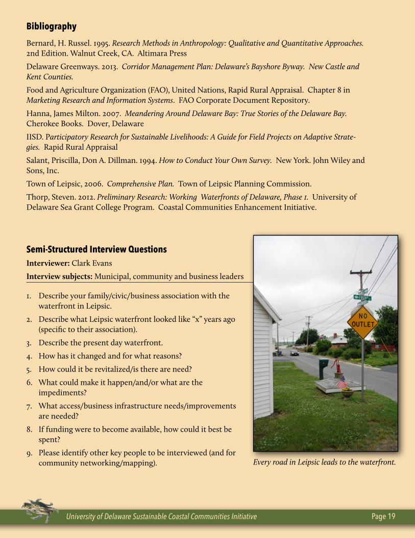
9. Please identify other key people to be interviewed (and for community networking/mapping). Every road in Leipsic leads to the waterfront.
Photo credits: Above, Lee Ann Walling; top, Tim Schreckengost; right, IStock Getty Images
Top Related