


Languages
Pages
Legal


Together for the Peel/Chuu Tl’ti Geenjit Khetok
February 2010
Summary: recommended Peel Watershed regional Land use Plan
Peel Watershed Planning Commission Whitehorse, yukon

Cover photo: alpenglow over Goz Lake in the headwaters of the Bonnet Plume river.Jimmy Johnny
!9!9
!9
!9
!9
#*
#*#*#*#*
#*#*#*
#*#*#*#*
#*
#*
#*
#*
#*
#*
#*
#*
#*#*#*#*#*#*#*#*#*
#*
#*#*
#*
#*#*#*#*
#*#*
#*#*#*#*#*
#*
#*
#*#*
#*
#*
#*#*
#*#*
#*
#*
#*#*
#*#*
#*#*
#* #*
#*
#*#*#*#*#*
#*
#*#*#*
#*
#*
#*
#*
#*
#*
#*
#*
#*
#*#*#*
#*#*#*
#*
#*#*
#*#*#*#*
#*#*
#*#*
#*
#*
#*
#*
#*#*
#*#*
#*
#* #*#*#*
#*#*
#*
#*
#*
#*
#*
#*#*
#*
#*
#*
#*#*
#*
#*
#*
#*#*
#*#*
#*
#*
#*
#*
#*#*#*
#*
#*#*
#*
#*#*
#*
#*
#*
Rock River
Yu kon Ri ver
Engi neer Cre ek
Klon dikeRive r
To mbston e
We s
t
Rapi tan
RI
VE
R
MountMacD onald
QuartetLakes
PopcornfishLake
DogLake
ChappieLake
TurnerLake
Ra cklaPa ss
Aberdeen C anyon
RI
CH
AR
DS
ON
M
OU
NT
AI
NS
Do
l l
C k
En ter prise Ck
Dalg lish Ck
Eng
inee
r
C
k
Eng
inee
r
C
k
No rth
Cache C k
Sa pperHill
Gill L
RI
VE
R
Ha r t
Chance
Geo
rge
Riv e r
N a d a l e e n
R i v e r
Rackla
R i v e r
Or
t ho
go
na
l
Cre ek
Creek
K
R
McQ
ueste n
Ea gle
Fif
teen
mi le
R iver
C h a n d i n d u
Riv
er
Sw ede
K lon dike
No
rth
Kl o
ndi
ke
Riv
erYU
KO
N
Si x
t yM
R
Roc
kC
reek
Cre ek
Brew
ery
R
Waugh
Creek
R a e
C r e e k
H a r t
R i v e r
Ri v
e r
Ck
Corn
TatondukR
oyal
Ck
Bear
River
I l l t yd
Ck
Ck
K
n o r r
C r e e k
Hungry L
McQuestenL
B eaver
River
R i v e r
S t e w a r t
Whi te s t on e
Riv
er
Cre ek
Cre ek
Ri ver
Bl a
c k s t o ne
Riv
er
Ha
r t
Wi
nd
Ri v e r
R
Win d
Li t t le
Bo
nn
et
Pl u m
e
Ri v
er
Sn
ak
e
Ri v
e r
Cr
an
swi c
kR
ive
rN o i s y
Cr e
e k
Fi s
hi n
g
Br a
n c h
Mo u n
t ai n
Ck
R i ver
Trail
River
Cre
ek
AR
CT
IC
RE
D
RI
VE
R
Fishing
Lakes
Nerejo L
Ston eyCreek
Sch
ae ff er
Husky Lake
R i v e r
HungryCk
Runt
Ck
Min
er
R iver
Riv
er
Ea
gl e
Ro
c k
Pi n e
JohnsonC
k
CodyC
reek
Vyah
Kit
Creek
La
ChuteR
Lord
C
Bl u
e f i sh
Sal mon
Trout
R
Ra
MA C K E N Z
I E
RI
VE
R
O g i l v i e
R i v e r
Creek
O n t a r a t u e
R i v e r
Ra
mp
ar
t s
Ham
i lton
F o r k
F o r k
Ri v
er
RI V
ER
Ck
R i v er
Lak e
Ck
P E E L
Ca
ny
on
Cre
ek
Car i b ou
Road
Ri ver
Brown Bear
Ck
RI
VE
R
Sa
inv
i lle
R
PE
EL
Satah
RVit
trek
wa
Riv
er
Nu
kon
Ck
B e l lRi v
e r
TR
EV
OR
RA
NG
EKN
OR
R R A N G E
M A C K E N Z I E M O U N T A I N S
W E R N E C K E
M O U N T A I N S
N A D A L E E N R A N G E
N A H O N I
R A N G E
F
O G I L V I E M O U N T A I N S
MountBa ird
MountSc hellinger
MountPhelps
AitchHill
MountJo yal
IthothHill
Ed igii H ill
BO
NN
E
T P
LU
ME
R
AN
GE
BO
NN
E
T P
LU
ME
R
AN
GE
Go z
Goz Lake
Duo Lakes
Pinguicula L.
Elliot L.
Gillespie L.
McClusky L.
FairchildLake
MargaretLake
Hart L.
Lusk Lake(Caribou lake)
DeceptionLake
Chapman Lake
Bonnet Plume L.
Lomond L.
DEMPST
ER
NORT H KLONDIK E
HWY
HIGHW
AY
Arctic Cir cle
N O R T H W E S T T E R R I T O R I E S
N O R T H W E S T T E R R I T O R I E SY U K O N
Mason Hill
C A
S E L W Y N M O U N T A I NS
Mount F errellMount H art
Re dMountain
Ru styMountain
NadaleenMtn
Bo nnetPlumePa ss
MtPa tterson
MtCa meron
St eamboatMountain
Ca stleMountain
MountJe ckell
NorthForkPa ss
S eela Pass
To mbst oneTe rritorial P ark
MtHa rper
Ca ss iarDomeBa ldyMtn
MountBu rgess
Be arCa veMountain
MtRo ver
Sh arp Mtn
Ba ldHill
TI
NT
IN
A
TR
EN
CH
MountDempster
MountTurner
MountMc Cu llum
Mount H uley
Sa lter H ill
VGR- 07A
TGR- 07FS
VGR- 06A
NNDR- 04A
THR- 49A
NNDR- 07A
THR- 64B
VGR- 08A
NNDR- 11A
THR- 01A
VGR- 02A
THR- 02A
NNDR- 05A
THR- 03A
TGR- 03FS
VGR- 05A
TGR- 10FS
TGR- 08FS
NNDR- 17A
TGR- 12FS
VGR- 04A
NNDR- 08B
TGR- 04FS
THR- 79B
NNDR- 10B
NNDR- 09B
THR- 58B
THR- 20A TH
R- 22B
THR- 80 B
TGR- 05FS
TGR- 13FS
TGR- 14 FS
TGR- 11 FS
TGR- 01 FS
THR- 07 A
VGR- 12 A
THR- 11 A
VGR- 09 A
THR- 83 A
NNDR- 26 B
THR- 19 B
THR- 14A
THR- 23 A
THR- 27 A
THR- 21 B
THR- 31A
THR- 25 A
THR- 40B
THR- 34 B
THR- 29 A
THR- 33 A
THR- 28 A
THR- 66 A
THR- 63A
THR- 69B
THR- 41 B
THR- 35 B
THR- 59 B
THR- 32 A
THR- 70 B
THR- 38 A
NNDR- 15 B
VGS- 3A
VGS- 6A
VGS- 1A
VGS- 7A
THS- 2B
VGS- 19A
VGS- 37A
S- 30A
VGS- 17A
VGS- 32A
VGS- 44A
VGS- 10A
VGS- 45A
VGS- 16A
VGS- 16A
VGS- 39A
VGS- 48A
TGS- 4F S
TGS- 4F S
TGS- 3F S
TGS- 9F S
TGS- 6F S
TGS- 8F S
THS- 31B
THS- 64B
NNDS- 1B
THS- 74B
THS- 13B
THS- 12B
THS- 90B
THS- 14B
THS- 75B
THS- 33B
THS- 30BTH
S- 29B
THS- 88B
THS- 25B
THS- 24B
THS- 27B
THS- 66B
THS- 99B
THS- 50B
THS- 47B
THS- 80B
VGS- 2A /D
VGS- 4A /D
VGS- 8A /D
VGS- 9A /D
TGS- 11F S
TGS- 12F S
TGS- 10F S
THS- 107B
THS- 169B
TGS- 11F S
TGS- 12F S
NNDS- 185
NNDS- 106
THS- 200B
THS- 171B
THS- 155B
THS- 186B
THS- 181B
THS- 145B
THS- 134B
THS- 135B
THS- 123B
THS- 144BTH
S- 206B
THS- 176B
THS- 142B
THS- 159B
VGS- 59A /D
VGS- 57A /D
VGS- 14A /D
VGS- 13A /D
VGS- 11A /D
VGS- 12A /D
VGS- 56A /D
VGS- 41A /D
VGS- 40A /D
NNDS- 187B
NN DS- 138B
NNDS- 134B
NNDS- 122B
NNDS_ 115B
NN DS- 137B
NNDS- 143B
NNDS- 102B
NNDS- 101B
NNDS- 104B
NNDS- 139B
NNDS- 188B
NNDS- 149B
NNDS- 152B
NNDS- 151B
NNDS- 135B
NNDS- 150B
NN DS- 198B
NND
NN DS- 168B
NNDS- 171B
NN DS- 121B
NN DS- 103B
NNDS- 140B
NN DS- 125B
NNDS- 124B
NNDS- 148B
NNDS- 130B
NN DS -172B
TGS- 2F S
TGS- 7F S
THS- 28B
THS- 41B
THS- 72B
THS- 71B
THS- 128B
TGS- 13F S
THS- 112B
THS- 184B
THS- 109B
THS- 180B
THS- 124BTH
S- 202B
THS- 136B
THS- 137B
THS- 138B
THS- 143B
THS- 168B
THS- 106B
THS- 113B
THS- 203B
THS- 205B
VGS- 58A /D
VGS- 20A /D
NN DS- 105B
NN DS- 133B
NNDS- 183B
NN DS- 184B NN D
S- 170BNND
S- 169B
NNDS- 127B
THS- 26B /D
THS- 208B /D
Dawson
Eagle Plains
LMU 9
LMU 12A
LMU 7
LMU 6
LMU 2B
LMU 5 LMU 4B
LMU 10B
LMU11
LMU8B
LMU10A
LMU8A
LMU8C
!I
!5
!G
!4
!F
!N
!M
!K
!5
!H
!E
!D
!B
!C!3
!B
!1
!1
!A
!L
!P
!O
!J
!2
130°
131°
131°
132°
132°
133°
133°
134°
134°
135°
135°
136°
136°
137°
137°
138°
138°
139°
139°
140°
140°141°142°
67°
67°
66°
66°
65°
65°
64°
64°
F0 20 40 60 km
Map 1: Landscape Management Unit Index
Special Management Areas
Integrated Management Areas1 - Lower Ogilvie River2 - Dempster Highway3 - Blackstone River4 - Dalglish Creek5 - Peel Plateau
Watershed Management EmphasisD - Wind/Bonnet Plume River
A - Ogilvie River HeadwatersC - Hart RiverG - Richardson Mountains - SouthP - Mid-Peel River and Big Eddy
Fish and Wildlife Emphasis
Heritage EmphasisF - Hungry LakesN -Tshuu tr'adaojìich'uu / Aberdeen and Peel CanyonsO - Teetl'it njik / Lower Peel River
First Nation Settlement and Tetlit Gwich'in Yukon Lands
Site selection#
! ! ! ! ! !
! ! ! ! ! !
! ! ! ! ! !
R-blocks
Protection EmphasisB - Blackstone River UplandsE - Snake RiverH - Richardson Mountains - NorthI - Vittrekwa RiverJ - Tabor LakesK - Jackfish Creek LakesL - Chappie Lake ComplexM - Turner Lake Wetlands
Landscape management unitDempster Hwy Development Area
Peel Watershed planning region
Landscape Management UnitsDesignation & Emphasis
Integrated Management Area
SMA - Heritage
SMA - Fish & Wildlife
SMA - Watershed Management
SMA - Protection

Contents
acknowledgements 2
message from the Commission 4
Highlights of the recommended Plan 5
about the Plan 6
Introduction 7
Principles and goals 9
Planning process 11
Planning region overview 13
Key issues and findings 15
Tools and concepts 17
recommendations 19
Implementation 23
Next steps 24
acronyms
GmD General management Direction
Ima Integrated management area
Lmu Landscape management unit
OrV Off-road vehicle
PWPC Peel Watershed Planning Commission
Sma Special management area
uFa umbrella Final agreement
yLuPC yukon Land use Planning Council
About our logo:
The logo of the Peel Watershed Planning Commission depicts several groups of people (represented by four blue droplets of water) working together for the Peel Watershed (the red circle in the middle). The green background suggests a healthy environment, while the red outer circle enclosed by a blue circle suggests the interconnection between people and the Peel Watershed.
An earlier version of this plan, published on the web in December 2009, erroneously stated that existing industrial land use was prohibited in
Special Management Areas with an emphasis on general environmental protection (see Table 3, page 20).

u a narrow mountain tributary of the Snake river. John meikle, Government of yukon
2 Summary: recommended Peel Watershed regional Land use Plan
acknowledgementsThis Plan was developed with the help of many partners. A large number of agencies and groups supported the work of the Peel Watershed Planning Commission (PWPC) with information collection and analysis, the development of planning concepts, responses to early drafts, and the writing and editing of various planning documents.
The Commission appreciates the assistance of its key partners. We thank the Yukon Government, represented by the Internal Working Group and other staff, the First Nation governments of Na-Cho Nyak Dun, Tr’ondëk Hwëch’in, and Vuntut Gwitchin, and the Gwich’in Tribal Council for their sustained involvement and contributions. Special thanks to the chiefs and councils, elders, and community members who took time to provide guidance and share their knowledge.
Representatives from each of these five key partners sat on PWPC’s Senior Liaison Committee and the Technical Working Group. These two groups provided extensive guidance, information, and comments on Commission documents. The Wildlife Conservation Society, Ducks Unlimited Canada, Environment Canada (Canadian Wildlife Service), and Fisheries and Oceans Canada also provided assistance. Thanks also to the Gwich’in Land Use Planning Board and the North Yukon Planning Commission for their experience, insights, examples, and advice.
The Commission appreciates the contribution of colleagues from the Yukon Land Use Planning Council (Ron Cruikshank, Jeff Hamm, Gerald Isaac, and Megan Schneider), who provided finan-cial administration, mapping, technical reviews, First Nations community liaison, and general advice. Former Commission member Ken Roberts and former staff members Brian Johnston, Kathleen Zimmer, Richard Vladars, and Graham Baird laid the foundations for this plan. Thanks also to YLUPC Chair Doug Phillips and Council members Ian Robertson and Steven Buyck for their advisory roles in guiding the PWPC from inception to delivery of the Recommended Plan.
We also thank the many individuals from interested organizations who reviewed preliminary drafts, provided written comments, and participated in meetings. Finally, we gratefully acknowl-edge members of the public for their attendance at public meetings, their direct enquiries, and their considerable written response to earlier documents and drafts.

The Plan recognizes and supports the heritage and culture of the Na-Cho Nyak Dun, the Tr’ondëk Hwëch’in, the Vuntut Gwitchin, the Tetłit Gwich’in, other affected First Nations, and the yukon.

4 Summary: recommended Peel Watershed regional Land use Plan
message from the CommissionIn writing this Plan, the Commission considered research and reports, stakeholder submissions, and public consultations, as well as advice and statements from the key partners. The Recom-mended Plan differs substantially from the Draft Plan issued in April 2009. The responses to the Draft Plan made clear that the conflicting visions for the Peel Watershed Planning Region were intractable and that its compromise approach satisfied no one.
As this planning process is founded in the UFA, the Commission focused on “sustainable development.” The UFA definition is clear that ecosystems and social systems must be sustained, and development should be fostered as long as it does not undermine them. The UFA also requires the Commission to recommend measures to limit actual and potential land-use conflicts, to “recognize and promote the cultural values of Yukon Indian People,” and to “promote the well-being of Yukon Indian People, residents of the region, the Yukon as a whole, and consider the interests of other Canadians.” This Plan accomplishes these objectives.
In view of the starkly drawn conflicts over how to manage lands and resources in the planning region, the Commission offers a conservative, cautious plan that preserves the maximum number of future options for society. The Plan recommends a substantial amount of protection for the planning region, but it also provides a process by which society can amend the Plan in light of new information or changed priorities. As the Peel Watershed is unique in several key ways, the Commission does not consider this Plan to be a template for other planning regions in the Yukon.
The Plan recommends that 80.6% of the planning region be given a high degree of protection as designated Special Management Areas (SMAs). These SMAs emphasize a range of priorities: heritage management (2.1%), fish and wildlife management (19.6%), watershed management (27.7%), and general environmental protection (31.2%). The Plan also recommends that proposed Special Management Areas should be immediately withdrawn from staking. However, continued aerial access to, and development of, existing mineral claims will be allowed, subject to specific management conditions. New surface access development is prohibited within SMAs. A Plan Amendment will be required to modify this recommendation.
In Integrated Management Areas (19.4% of the planning region), mineral and oil and gas resources can be developed. Such development is subject to key land-use and environmental management considerations, including enhanced community consultation where specified.
u l: Cloudberries from the Blackstone uplands. Heritage Department Collection, Tr’ondëk Hwëch’in archive
c: a fuel cache at an airstrip near the Bonnet Plume river. Steven Buyck, FNNND
r: Draft Plan consultation with the North yukon rrC in Old Crow. PWPC

Summary: recommended Peel Watershed regional Land use Plan 5
Highlights of the recommended Plan The Plan provides a sustainable development framework for land management in the Peel Watershed Planning Region.
The Plan addresses several issues, including: • the potential development of roads in an area where wilderness and ecosystem integrity are
important to outfitters, tourism operators, affected First Nations, and wildlife.• the potential effects of development on wetlands, lakes, and rivers.
The Plan divides the region into 21 Landscape Management Units (LMUs) (see Map 1).
LMUs are designated as either: • Special Management Areas (SMAs) with one of four emphases (heritage, fish and wildlife,
watershed management, or general protection). • Integrated Management Areas (IMAs) where more development may be possible.
For each SMA, the Plan also recommends a type of protected area that best fits the Commission’s vision for the area. These types of protected area are clearly described in existing laws (e.g., natural area park, habitat protection area).
Under the Plan, 19.4% of the region is in IMAs, while 80.6% is in SMAs. SMAs are recommended for withdrawal from staking. However, existing oil and gas and mineral tenures may remain, subject to certain conditions of operation.
The Plan imposes the following conditions on new and existing roads and trails:• It does not allow new roads or winter trails in the region, except near the Dempster Highway.
They may later be permitted in IMAs if (a) enhanced consultation with affected First Nations is carried out, along with protection of key wildlife values, and (b) the Plan is amended.
• It recommends strict control of any new roads or trails, if and when allowed. It also states that the developer must restore the area to its original state when development ends.
• The Plan recommends developing a sub-regional plan for the Dempster Highway corridor.• It recommends that the Wind River Trail no longer be considered an existing right-of-way.
The Plan recommends an immediate interim land withdrawal from mineral staking and new gas tenures.
The Plan recommends the development of a comprehensive regional water management plan.

6 Summary: recommended Peel Watershed regional Land use Plan
about the PlanThis document summarizes the full Recommended Peel Watershed Regional Land Use Plan. The full Plan was produced by the Peel Watershed Planning Commission (PWPC) as part of the imple-mentation of Chapter 11 of the Final Agreements of the Na-Cho Nyak Dun, Tr’ondëk Hwëch’in,
and Vuntut Gwitchin First Nations.
A cornerstone of the Plan is the definition of sustainable development found in the Umbrella Final Agreement (UFA). The definition suggests that renewable and non-renewable land uses should be allowed only if ecosystems and social systems can be sustained at the same time. The Recommended Plan will help ensure that wilderness characteristics, wildlife and their habitat, cultural resources, and waters are maintained over time while managing resource use.
Who is the Peel Watershed Planning Commission?
As described in Chapter 11 of the UFA, the Peel Watershed Planning Commission is an independent public commis-sion. Its members are nominated by the key partners. The Commission was formed in fall 2004 and is composed of
six members. They are nominated by the First Nation of Na-Cho Nyak Dun (one nominee), the Gwich’in Tribal Council (one nominee), the Yukon Government/Vuntut Gwitchin First Nation (joint nominee), the Yukon Government/Tr’ondëk Hwëch’in (joint nominee), and the Yukon Government (two nominees).
Who are the Parties to the Plan?
The Parties are governments and agencies with jurisdictions in the planning region. The Yukon Government, the Gwich’in Tribal Council of the Northwest Territories (NWT), and the Yukon First Nations of Na-Cho Nyak Dun, Tr’ondëk Hwëch’in, and Vuntut Gwitchin are all Parties to the Plan. These Parties all agreed to establish the Peel Watershed Planning Commission. In this docu-ment we refer to them as key partners.
Hunting practice and hauling firewood on the lower Peel river. PWPC

Summary: recommended Peel Watershed regional Land use Plan 7
IntroductionThe Recommended Peel Watershed Land Use Plan is the second regional land use plan in Yukon produced under the mandate of Yukon First Nation land claims agreements. This Plan and future ones will make up the territory’s regional planning regime.
Regional land use plans help us to visualize and achieve the kind of future we want. They are collective statements about how to manage land and resources within a given area, and they provide guidance for making decisions about that area.
This Plan aims to reflect the vision, values, and interests of the Tetłit Gwich’in of the NWT, the Yukon First Nations of Na-Cho Nyak Dun, Tr’ondëk Hwëch’in, and Vuntut Gwitchin, and Yukoners as a whole. It also aims to ensure that wilderness characteristics, wildlife and their habitats, and waters are sustained over time while managing human activities in the Watershed.
The Plan provides a “sustainable development” framework for land management in the Peel Watershed Planning Region. All land uses must be consistent with sustaining ecosystems and social systems.
Background
In 1993, the Council for Yukon Indians, along with the governments of Yukon and Canada, signed the Umbrella Final Agreement. This document provided the framework for subsequent land claim and self-government agreements. Self-government agreements for the First Nation of Na-Cho Nyak Dun and Vuntut Gwitchin First Nation were signed in 1993, while the Tr’ondëk Hwëch’in signed their agreement in 1998. Independently, the Gwich’in of the NWT and the governments of the Northwest Territories and Canada signed the Gwich’in Comprehensive Land Claim Agreement in 1992. This document includes agreements about Yukon lands of the Tetłit Gwich’in.
above: The confluence of Hungry Creek (l) with the Wind river (r); mount Deception is in the background; evidence of a winter trail is in the foreground. John meikle, Government of yukon

8 Summary: recommended Peel Watershed regional Land use Plan
All these agreements require the development of regional land use plans. The Yukon portion of the Peel River watershed falls within the tradi-tional territories of the Na-Cho Nyak Dun, Tr’ondëk Hwëch’in, Vuntut Gwitchin, and the Tetłit Gwich’in. The Peel Watershed Planning Region (Map 2), which is roughly the same as the Yukon portion of the Peel River water-shed, is the focus of this Plan.
Since late 2004, the Peel Watershed Planning Commission has been involved in producing this Plan. The governments of Yukon, Na-Cho Nyak Dun, Tr’ondëk Hwëch’in, and Vuntut Gwitchin, and the Gwich’in Tribal Council, are responsible for its approval and implementation.
Why plan now?
Economic development activity in Canada’s North will continue to increase. Interest in oil and gas and mineral resources will probably continue to be high. The demand for wilderness and culture-based tourism
activities is growing. New roads will be proposed. Increasing levels of economic development will bring many benefits to the North, but will not come without negative effects. With proper planning, many of these effects can be avoided.
Imagine a road map of Canada in 1900, 1925, 1950, 1975, and now. Over that time, roads became more and more densely built, and they also gradually moved northward. The pattern could continue, bringing more and more roads to the Yukon, and with them the amount of human activity on the land. Some activities may negatively affect others or may affect the environ-ment and traditional culture. The people of the Na-Cho Nyak Dun, Tr’ondëk Hwëch’in, Vuntut Gwitchin, Tetłit Gwich’in, and other First Nations, who have lived in this region for millennia, depend on the health of the land and its waters, wildlife, fish, and plants. This Plan makes an important contribution to putting regional conservation measures in place before levels of land-use activity increase.
Y U K O N
N O R T H W E S TT E R R I T O R I E S
AL
AS
KA
BR IT ISH COLUMBIA
Fort McPherson
Peel Watershed Planning Region
Whitehorse
Mayo
Dawson
EaglePlains
Inuvik
Old Crow
A R C T I C C I R C L E
B E A U F O R T S E A
map 2. Peel Watershed Planning region

Summary: recommended Peel Watershed regional Land use Plan 9
Principles and goals There are six guiding principles that underlie the Peel Watershed Regional Land Use Plan:• independence and impartiality;• sustainable development;• First Nations traditional and community resource use;• conservation;• adaptive management; and• the precautionary principle.
Independence and impartiality
The Peel Watershed Planning Commission is an independent public agency appointed to represent the best interests of Yukon people.
The Commission must consider, in a balanced and neutral manner, any and all information, advice, or recommendations provided to it by any government, agency, or the public.
Sustainable development
The core principle that guides the Plan is sustainable development, as defined in the Umbrella Final Agreement: “Beneficial socio-economic change that does not undermine the ecological and social systems upon which communities and societies are dependent.”
Specific goals flow from the principle of sustainable devel-opment (Figure 1).
First Nations traditional and community resource use
The Plan will promote the interests, rights, and responsi-bilities of the Tetłit Gwich’in, Na-Cho Nyak Dun, Tr’ondëk Hwëch’in, and Vuntut Gwitchin for the conservation and use of their traditional territories.
It will support their country food harvest, their renewable resource economy, and other purposes they choose for settlement lands.
Conservation
The Plan proposes to use the conservation principle in managing fish and wildlife, their habitats, and waters.
Conservation is defined in the Umbrella Final Agreement as “the management of Fish and Wild-life populations and habitats and the regulation of users to ensure the quality, diversity and Long Term Optimum Productivity of Fish and Wildlife populations, with the primary goal of ensuring a sustainable harvest and its proper utilization.”
Whitefish in a smoking shack on the Peel river.Peter mather

10 Summary: recommended Peel Watershed regional Land use Plan
adaptive management
The Plan is a living document. It will be reviewed, monitored, and updated to respond to changes in land use and/or the environment, or as better information becomes available.
Adaptive management means that we must “look, learn, and adjust as required.”
Precautionary principle
The Plan recognizes that the Peel Watershed is an intact ecosystem. It also recognizes the need to consider potential effects before making resource decisions.
Our limited understanding of the effects of different land uses on other resources in the North makes this especially important.
The International Institute for Sustainable Development gives this description of the precaution-ary principle: “A lack of conclusive scientific evidence does not justify inaction on managing the environment, particularly when the consequences of inaction may be undesirable or when the costs of action are negligible.”
Figure 1. Plan goals and their relationship to sustainable development
Sustain ecosystem integrity first Conserving the land, its living things, and its processes is the fundamentalpriority
Sustaincommunities
and cultures nextPreserving
communities andcultures relieson achievingsuccess with
the first priority
Sustainabledevelopment
Foster sustainable economic activitiesthird There are two kinds of sustainability: activities that do not degrade the land orundermine communities and can be sustained indefinitely; and activities that deplete resources, but from which the land can recover
Not all economic activities fit everywherein this region
The Plan provides a sustainable development framework for land management in the Peel Watershed Planning Region. All land uses must be consistent with maintaining intact regional ecosystems and social systems.

Summary: recommended Peel Watershed regional Land use Plan 11
Planning processThe PWPC started working towards the Plan in late fall 2004. Since then, the Commission has worked with many agencies and groups, and has hosted consultations and workshops in Mayo, Dawson City, Old Crow, Inuvik, Fort McPherson, and Whitehorse. The Commission has writ-ten reports, descriptions of three scenarios, and a Draft Plan. The Recommended Plan is a result of consultation and feedback on those earlier documents, and further analysis. At this stage, the Commission has completed most of its work in Plan development (Table 1).
Table 1. Phases of Plan development
Time frame Planning phase
2004–2005 Phase 1 Commission start-up
2005–2006 Phase 2 Issues gathering
2006–2008 Phase 3 Information gathering
2008–2009 Phase 4Phase 5
Planning tools and componentsDevelopment of land use scenarios
2009 Phase 6 Development of Draft Land Use Plan
2009 Phase 7 Development of Recommended Land Use Plan
2009–? Phase 8 The key partners review the recommended Land use Plan, consult with one another and with regional communities, and accept it as the approved Land use Plan Or reject it Or recommend modifications to the Commission
? Phase 9 The Commission modifies the recommended Land use Plan to create the Final Recommended Land Use Plan
? Phase 10 The key partners review the Final recommended Land use Plan and approve it Or modify it Or reject it.
We are here

This Plan aims to ensure that wilderness characteristics, wildlife and their habitats, and waters are sustained over time while managing human activities in the watershed.

t The late fall landscape of the Source Peaks area. Jimmy Johnny
Summary: recommended Peel Watershed regional Land use Plan 13
Planning region overview
Setting
The Peel Watershed Planning Region makes up about 14% of the Yukon. At about 68,000 square kilometres, it is almost as large as New Brunswick. Despite its name, the region does not cover exactly the same area as the Peel Watershed. Portions of the watershed are in Tombstone Territorial Park and in a block of settlement land on the Ogilvie River, both of which are outside the planning region.
The region is the only one in the Yukon without permanent settlements, though there is a seasonal population base. Commercial or residential facilities are connected to Demp-ster Highway maintenance operations, big-game outfitting base camps, trapping concessions, and temporary mineral exploration camps. There is one all-season road, the Dempster Highway.
Land ownership, regulation, and management
The Government of Yukon manages non-settlement, or public, lands (both surface and subsurface rights), which total 97.3% of the region. There are no protected areas in the region, though the Bonnet Plume River has been recognized as a Canadian Heritage River. Traditional territories of settled First Nations overlap with one another and with all of the non-settlement lands in the region. First Nation citizens have various trapping and hunting rights in their traditional territories.
The Tetłit Gwich’in of the NWT own eleven blocks of fee-simple settlement land — with surface rights only — and fourteen smaller site-specific settlement lands, representing 2.32% of the plan-ning region. These are the only privately owned lands in the planning region. As with Yukon First Nations, the Tetłit Gwich’in have areas where they have trapping and hunting rights. These areas are in the Richardson Mountains and the northern plateau and plains of the planning region.
The Na-Cho Nyak Dun hold 25 site-specific settlement lands and one Category A block (which means they own both surface and subsurface rights), accounting for 0.38% of the region. The tradi-tional territory of the Na-Cho Nyak Dun includes the entire region east of the Dempster Highway.
The Tr’ondëk Hwëch’in have eight site-specific blocks and two Category B blocks (which means they own surface rights only), totalling less than 0.01% of the region. Their traditional territory includes all of the Ogilvie and Blackstone drainages and part of the Hart watershed.
The Vuntut Gwitchin have two site-specific blocks along the Dempster Highway. Their traditional territory includes the lower reaches of the Ogilvie and Blackstone rivers, the Peel River above the Hart, and upper Canyon Creek.
Vittrekwa Wetlands, with the richardson mountains in the background.John meikle

14 Summary: recommended Peel Watershed regional Land use Plan
Environment
The Peel Watershed has a cold and dry climate. Short spruce forests, shrub and tundra vegetation underlain with permafrost, and scattered wetlands are found in low-lying areas. The wetlands are ideal habitats for culturally important waterfowl, furbearers, and moose, and they act as reservoirs of water. Some of the wetlands are thought to be sensitive to disturbance and climate change.
High-elevation mountain ranges contain rock and sparse vegetation. Large tributaries of the Peel River are often flanked by gravel bars, shrubs, and older stands of big white spruce. Rivers exhibit
very low winter flows and dramatic variations in the summer.
The region has a number of unusual plants, and also has animal species that are listed as national or international conservation concerns. These include the wolverine, northern mountain caribou populations (e.g., Hart River, Bonnet Plume, and Redstone herds), grizzly bear, Peregrine Falcon, Short-eared Owl, and ten other types of birds. The Porcupine and Boreal caribou also use much of the region. Caribou, moose, and fur-bearers like marten and beaver have been highly important to First Nations for generations. The watershed also supports a unique collection of fish species; some of these are also culturally important.
Heritage resources
There are currently no settlements in the planning region. However, the Tr’ondëk Hwëch’in, Na-Cho Nyak Dun, and Vuntut Gwitchin of the Yukon, and the Tetł’it Gwich’in of the Northwest Territories have traditionally lived in, travelled, or harvested vir-tually every corner. This presence is reflected in the many trails and named places, which provide a window into the culture and history of the region. Archaeological evidence shows that the area has been occupied for millennia. Fossils and other plant remains, dinosaurs, ancient fish, insects, and ice age mammals have all been found at a number of sites around the region.
Economy
The regional economy today is a mixed one, in which traditional subsistence harvesting and wage-based activities co-exist. Subsistence hunting, gathering, and trapping are still very important economic and cultural activities to residents of Mayo, Keno City, Dawson City, Fort McPherson, and Old Crow. These communities also want to participate in the wage economy.
Big-game outfitting has occurred in the Peel Watershed for decades. Sport hunting species are Dall’s sheep, grizzly bear, caribou, and moose. Outfitting generally occurs in the more moun-tainous south of the region. More recently, tourism along the Dempster Highway and in the backcountry has become economically important. Operators in both of these industries require large intact wilderness and healthy wildlife populations.
Oil, gas, and mineral exploration in the Peel Watershed has also been part of the local economy for many decades. Oil and gas exploration has focused on the flatter plains and plateaus in the northern part of the region, while most mineral exploration has taken place in the mountainous
Charmaine Christiansen performs archeology work at a test pit at Black City on the Blackstone river.Heritage Department Coll., Tr’ondëk Hwëch’in archive

Summary: recommended Peel Watershed regional Land use Plan 15
portions. Discoveries include deposits of natural gas, coal, iron, and zinc, as well as potential for other commodities including copper and uranium.
The main methods of travel in this region are rivers, trails, winter roads, the Dempster Highway, and airplanes. The Wind River Trail and the Hart River Winter Road are two well-known winter trails used occasionally to support exploration projects. There are also a number of small air-strips. Oil and gas development and mining generally need gravel roads, which in turn need large amounts of gravel.
Key issues and findingsThe Plan’s principles and conclusions flow from the issues and findings that emerged from the Com-mission’s consultations and research. Some especially important issues and findings are listed here:• Local First Nations have stated clearly that they depend upon intact regional ecosystems and
landscapes in the Peel Watershed. A conservative and precautionary approach will sustain current uses while keeping future resource options open for First Nation citizens.
• Large parts of the Yukon public have identified values and interests that match those of the affected First Na-tions. They believe that ecosystem wholeness and intact landscapes are the most important land-use consider-ations in the planning region.
• Air access to mineral claims may have been generally manageable, but most of the Yukon public believes that surface access such as roads will undermine the region’s wilderness character outside the Dempster Highway corridor. This wilderness character is very important to most renewable resource sectors (e.g., tourism operators, big-game outfitters) in the planning region.
• Many people, especially those living along the lower reaches of the Peel River, are concerned about sustain-ing clean water and natural flows. Low winter flows are a major limit on certain forms of industrial development in the planning region.
• The Commission believes that current consultation processes and site management for oil and gas development are adequate. However, affected First Nations do not yet have enough information to understand the cumulative effects of such development.
• The Plan is not a template for other Yukon regional land-use plans. It is specific to the region’s unique biophysical and socio-economic features and values.
• Cumulative environmental and socio-economic effects are not well understood or evaluated in project assessments in the Yukon.
• Roads, trails, and off-road vehicles like ATVs and snowmobiles are affecting caribou popula-tions. Voluntary conservation measures may not be enough to sustain these herds at accept-able levels.
• Some resource conflicts are not reconcilable and cannot be solved by on-site management techniques.
Decades-old signs of mineral exploration near the Snake river and Iron Creek.PWPC

The Plan addresses the potential development of roads in wilderness, which is important to outfitters, tourism operators, First Nations, and wildlife.
Dog teams are still used in the Wernecke mountains.Blaine Walden, Walden’s Guiding & Outfitting

Summary: recommended Peel Watershed regional Land use Plan 17
Tools and conceptsThe Plan proposes five tools to communicate and guide land management decisions in the region. Four of these tools function like the supportive legs of a table. These are Landscape Management Units (LMUs), the land-use designation system, LMU-specific con-ditions, and general management directions/monitoring. The fifth tool, Plan conformity evaluation, is like the table top that holds the rest of the Plan’s “legs” or tools together. These tools comple-ment each other and form part of an integrated land-use plan.
Plan conformity evaluation
The Plan guides how existing and new land-use proposals may be evaluated to see if they are consistent (or in conformance) with the Plan. Key partners may decide to use existing regulatory agencies, like YESAB, to evaluate plan conformance.
However, the Plan needs to be flexible in order to adapt to unforeseen circumstances. Decisions about changing the Plan may be influenced by: new land-management approaches; significant new land and resource informa-tion; better knowledge about land-use effects; changes in society’s values; changed demand for land and resources in the region; and new technology affecting land-use management.
The Plan provides three procedures for allowing new land uses that are not permitted under the current version of the Plan: • Plan variances (for land uses that do not conform with some conditions set in the current
Plan) — involves affected key partners.• Plan amendments (for alterations to the Plan’s framework, policy, or management directions)
— involves the Commission and key partners.• Plan review (a systematic process for updating the Plan, either after a five- to seven-year period
or when the key partners agree that a review is needed) — involves the Commission and key partners.
Landscape management units (Lmus)
Different parts of the region have different characteristics, and therefore need to be managed differ-ently. To do this, the region is divided into 21 Landscape Management Units (LMUs). These are dis-tinct areas of land that have well-defined ecological or topographical boundaries (e.g., a watershed boundary, a change from mountains to plain, or a change in vegetation). Some LMUs also have unique ecological characteristics that need special management (e.g., lakes and wetlands on perma-frost). Still other LMUs have concentrations of values for existing or potential land uses (e.g., Eagle Plains oil and gas basin, or overlapping of traditional use areas around Hungry Lakes). The tools of the plan apply differently to each LMU, and the Plan provides a vision statement for each LMU.
Land-use designation or zoning
If LMUs are different parts of the region, land-use designation fits each LMU into a category or zone. Together with a vision statement for each LMU, the zoning provides the broadest level of guidance for land and resource decision making.
What is Plan conformity?
When the Plan is formally approved, it becomes a guide for regulatory agencies like the yukon Environmental and Socio-economic assessment Board in reviewing new proj-ects. The regulator must check whether a land-use activity fits with (conforms with) the Plan.

18 Summary: recommended Peel Watershed regional Land use Plan
The Plan creates two major management zones to guide future land-use decisions in the region:
1. Special Management Areas (SMAs) These areas do not allow new industrial tenures like mineral claims, oil and gas exploration per-mits, or new winter or all-season roads. SMAs can be one of several types of protected area (e.g., territorial park, national park, habitat protection area) that provide additional legal strength. One or more types of protected area are recommended for each SMA, as well as one of four emphases.
2. Integrated Management Areas (IMAs) These areas may still have very high ecological, heritage, and cultural values; however, the Commission believes these zones can include industrial resource development in a working
landscape. Unlike within the Plan’s SMAs, new oil and gas exploration permits and mineral claims may be staked, although new winter roads or all-season roads are still not allowed. However, the Plan provides an amendment process if industrial development can meet the environmental and socio-economic goals of the Plan (see Plan conformity evaluation).
management conditions
Management conditions (Table 4) are specific rules that apply to a particular LMU. Where an LMU is particularly sensitive to some activities, or where many activities are allowed, more management conditions may apply.
There are Class A and Class B conditions. Class A conditions are man-datory and can only be avoided by going through a formal amendment process, while the more flexible Class B conditions may be avoided with a Plan variance.
General management directions and monitoring
General management directions provide additional guidance for human activities in most of the region. These directions are organized in two main groups:
1. Management of land use by sectorThese directions pertain to different human activities and are divided into sectors (Table 5). For each sector, the Plan lists key issues and may also make a number of recommendations. There are two kinds of recommendations: a) Policy: These recommendations are mainly for regulators and developers. Policy recommendations may require some kinds of activities to be done a certain way or not at all; and b) Research: The Plan recommends more research in certain areas. The key partners will generally be responsible for carrying out the research in order to support better land-use decisions.
2. Management of land use by potential impactDespite the management directions above, various effects or concerns may still occur and are divided into categories (Table 6). For each one, the Plan lists key issues, as well as any policy or research recommendations. These recommendations are generally directed to the key partners.
Putting it all together
In the Plan, each Lmu is discussed in its own section. These sections contain a map of the Lmu; the land-use designation (or zone) with checkboxes showing which general land uses may be allowed; man-agement conditions; a description of land own-ership and status; and a description of ecological, heritage, cultural, and economic values.

Summary: recommended Peel Watershed regional Land use Plan 19
recommendations
Landscape management units (Lmus)
The 21 LMUs proposed in the planning region are shown on Map 1. They range in size from 157 km2 (0.2% of the region) to 18,678 km2 (27.7% of the region). Table 2 pro-vides an overview of these planning units. Five LMUs have been assigned to Integrated Management Areas (IMAs), and are numbered 1 to 5. The other sixteen LMUs have been assigned to Special Management Areas (SMAs). These are labelled A to P.
The Recommended Plan gives more complete descriptions for each LMU, including maps and photos. LMUs cannot be significantly changed without a Plan amendment.
Table 2. Summary, Landscape management units
Landscape Management Unit Designation and emphasis Area (km2)
Area (%)
ECC*
Integrated Management Areas (IMAs)1. Lower Ogilvie river2. Dempster Highway3. Blackstone river4. Dalglish Creek5. Peel Plateau
ImaIma - Sub-regional Planning areaImaImaIma
2,7721,8992,7731,5994,004
4.12.84.12.45.9
yesyesyesyesyes
Ima total 13,047 19.4
Special Management Areas (SMAs)a. Ogilvie river HeadwatersB. Blackstone river uplandsC. Hart riverD. Wind/Bonnet Plume riverE. Snake riverF. Hungry LakesG. richardson mountains - SouthH. richardson mountains - NorthI. Vittrekwa riverJ. Tabor LakesK. Jackfish Creek LakesL. Chappie Lake Complexm. Turner Lake WetlandsN. Tshuu tr’adaojìich’uu/aberdeen and Peel CanyonsO. Teetl’it njik/Lower Peel riverP. mid-Peel river and Big Eddy
Sma - Fish and WildlifeSma - ProtectionSma - Fish and WildlifeSma - Watershed managementSma - ProtectionSma - HeritageSma - Fish and WildlifeSma - ProtectionSma - ProtectionSma - ProtectionSma - ProtectionSma - ProtectionSma - ProtectionSma - HeritageSma - HeritageSma - Fish and Wildlife
1,5105,4308,305
18,67811,193
2272,4341,442
180157772267
1,611493698987
2.28.1
12.327.716.6
0.33.62.10.30.21.10.42.40.71.01.5
yes yes yesyes
Sma total 54,384 80.6
Regional total 67,431 100.0
*ECC: Enhanced community consultation
a retrogressive thaw due to melting permafrost above a tributary of the Caribou river.Doug Davidge, Environment Canada

20 Summary: recommended Peel Watershed regional Land use Plan
Land-use designation (zoning)
Table 3 summarizes the Plan’s designations and emphases. The Recommended Plan gives detailed reasons for each zoning decision. Land-use designations cannot be changed without a Plan amendment.
Special management areas
Sixteen LMUs, covering almost 81% of the region, are designated as Special Management Areas. SMAs are divided into one of four emphases: heritage, fish and wildlife, water-shed, or general environmental protection. Like IMAs, SMAs allow existing non-industrial activities (e.g., big-game outfit-ting) and do not allow new roads. However, unlike IMAs, SMAs do not allow new mineral claims or new oil and gas exploration permits.
Integrated management areas
Five LMUs, covering 19.4% of the region, are designated as IMAs, where fewer land-use conflicts are likely. New and existing non-renewable industries are allowed, but new roads generally are not. The IMAs are all relatively near the Dempster Highway, where most of the region’s development has taken place (or is likely to). The Plan recommends sub-regional planning for one of these IMAs, the corridor immediately on either side of the Dempster Highway, because of the many existing and potential human activities that overlap with valuable heritage and wildlife areas. This IMA also allows new roads. For all IMAs, the key partners must consult before any major developments.
Table 3. Summary: Land-use designation
Designation and emphasis
Area (km2)
Area (%)
Winter or all-season road
Existing non-indus-trial land use1
New non-industrial land use
Existing industrial land use
New industrial land use
ECC*
Ima 11,148 16.5 X √ √ √ √ yes
Ima - Sub-regional Planning area
1,899 2.8 √ √ √ √ √ yes
Sma - Fish and Wildlife 13,236 19.6 X √ √ √ X
Sma - Watershed management 18,678 27.7 X √ √ √ X
Sma - General Environmental Protection
21,052 31.2 X √ X √2 X
Sma - Heritage 1,418 1.7 X √ √ √ X yes
*ECC: Enhanced community consultation Notes: 1. Here, non-industrial land use refers to non-industrial developments, e.g., outfitting camps, etc. 2. The plan published December 2, 2009 erroneously indicated that existing industrial land use was prohibited.
What is enhanced community consultation?
The Plan’s definition of en-hanced consultation comes from the consultation process in the yukon Oil and Gas Act and the definition of consul-tation in the umbrella Final agreement.
In this Plan, enhanced con-sultation asks governments to consult confidentially with each other before making decisions about any new and significant land uses or land tenures.

Summary: recommended Peel Watershed regional Land use Plan 21
management conditions
No conditions on land use were applied to some LMUs (those that will probably be little used or visited). For other LMUs that will probably be more used and visited, the Plan applies up to four-teen conditions. These are intended to reduce the effects of human activities on caribou move-ment, caribou habitat, sheep, peregrine falcons, fish, heritage resources, permafrost, water, and other land users. These conditions will also ensure adequate consultation.
There are two types of management conditions: Class A and Class B. Class A conditions are required and only a formal amendment process can alter them. The more flexible Class B conditions may be altered with a Plan variance. Table 4 gives some examples of management conditions (the Plan lists many more). Where needed, these conditions are supported by recom-mended new policies, research and monitoring programs, and best management practices.
Table 4. Example of management conditions
Value considered Example of management condition
Fish avoid or reduce activities in fish habitat during important biological periods or seasons.
Enhancedconsultation
Consult with affected residents and First Nations to identify concerns before granting new land uses that would disturb land, cultural sites, or wildlife.
Permafrost reduce ground temperature changes due to land-use disturbances.
General management directions and monitoring
General management directions (GMDs) give additional guidance to key partners and project developers, but are not required.
management of land use by sector
The Commission recommended GMDs for a number of sectors (types or areas of activity), includ-ing industrial activities (in general), mineral resources, oil and gas resources, subsistence harvesting, trapping, big-game outfitting, tourism and recreation, the Dempster Highway, the Wind River Trail, new surface access, off-road vehicle (ORV) access, air and water access, and new or experimental ORV technologies. Table 5 lists examples of GMDs for specific sectors (the Plan lists many more).
Table 5. Examples of general management directions for specific sectors
Sector Recommendation type
Example of a sector-specific recommendation Intended for
mineral resources
research Develop and distribute mining-specific best management practices. Key partners
Tourism research analyze data for all outdoor recreation and tourism activity to de-velop a carrying capacity threshold for each Lmu.
Key partners
New surface access
Policy restore new all-season access using state-of-the-art techniques once activity has halted. a road restoration bond, levied on the devel-oper, is strongly recommended.
regulators and developers
Off-road vehicle access
Policy apply localized restrictions to OrV use, where necessary, to all resource users. These restrictions should be reflected in legislation of all key partners.
Key partners and regulators

What happened to the cumulative effects indicators listed in the Draft Plan?
The Draft Peel Watershed regional Land use Plan discussed a number of cumulative effects indicators. These are things that can be measured to help find the total cumulative effects on the land. These indicators are not included in the recommended Plan because:• Some indicators were developed for flatter landscapes and for the migratory Porcupine Caribou
Herd. Woodland caribou were not considered.• There is not enough data to develop meaningful indicator levels.• The zoning framework has changed. monitoring of cumulative effects is no longer a primary tool
of the Plan.
Nonetheless, the Plan recommends researching and developing effective indicators for habitat of all regional caribou herds, wilderness, stream health, wetland health, and stream crossings.
22 Summary: recommended Peel Watershed regional Land use Plan
management of land use by resource issue
The Commission recommended GMDs for a number of resource issues, including management of cumulative effects, surface disturbances, disturbances to hydrology and aquatic habitats, disturbances to wildlife and terrestrial habitats, contaminated sites, climate change effects, and socio-economic assessment.
Table 6 lists examples of GMDs for specific resource issues (the Plan lists many more).
Table 6. Examples of general management directions for resource issues
Resource Issue Recommendation type
Example of issue-specific recommendation Typicalaudience
management of cumulative effects
Policy Consider alternative options and strategies to reduce cumu-lative effects when assessing new development proposals.
regulators and key partners
Surface disturbances
research Determine the effects of roads and other linear features on wildlife populations (e.g., Porcupine Caribou Herd).
Key partners
Disturbances to hydrology and aquatic habitats
research Determine biologically relevant limits to water withdrawal upstream of key overwintering habitats before major devel-opments.
Key partners
Climate change effects
Policy Carry out detailed ground temperature and engineering studies to measure ice content, ice distribution, ground temperature, etc., before the development of any new roads (where permitted) and other structures.
Key partners
Socio-economic assessment
Policy use enhanced consultation recommendations to make sure that First Nations’ traditional use, country food harvest, and other socio-economic objectives are fully analyzed and included in any socio-economic assessment for major projects.
Key partners
Summary: recommended Peel Watershed regional Land use Plan 23
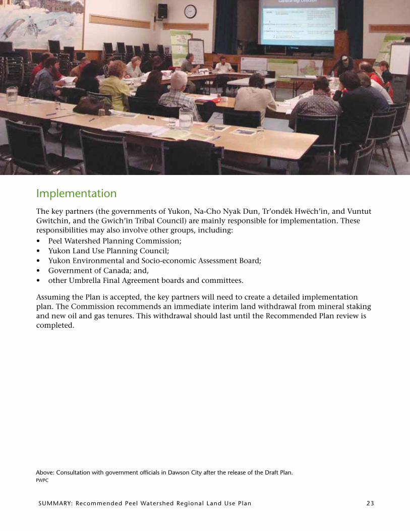
Implementation The key partners (the governments of Yukon, Na-Cho Nyak Dun, Tr’ondëk Hwëch’in, and Vuntut Gwitchin, and the Gwich’in Tribal Council) are mainly responsible for implementation. These responsibilities may also involve other groups, including:• Peel Watershed Planning Commission;• Yukon Land Use Planning Council;• Yukon Environmental and Socio-economic Assessment Board; • Government of Canada; and,• other Umbrella Final Agreement boards and committees.
Assuming the Plan is accepted, the key partners will need to create a detailed implementation plan. The Commission recommends an immediate interim land withdrawal from mineral staking and new oil and gas tenures. This withdrawal should last until the Recommended Plan review is completed.
above: Consultation with government officials in Dawson City after the release of the Draft Plan.PWPC

24 Summary: recommended Peel Watershed regional Land use Plan
Next Steps
What happens next?
The key partners will review the Recommended Regional Land Use Plan and consult with each other. The Yukon Government has the added responsibility of consulting with affected communi-ties. When this review and consultation period is complete, the key partners will: • approve the Recommended Plan as the Final Plan; or • recommend modifications to the Commission; or • reject the Plan.
How do I provide comments?
Please send your questions and comments to the key partners (listed below). You can find the full version of this Plan, supporting documents, resource maps, and PWPC news at the website: www.peel.planyukon.ca.
Vuntut Gwitchin First Nation
Box 94, Old Crow, YT Y0B 1N0
phone 867-966-3121
e-mail [email protected]
Tr’ondëk Hwëch’in
Box 599, Dawson City, YT Y0B 1G0
phone 867-993-7145
e-mail [email protected]
First Nation of Na-Cho Nyak Dun
Box 220, Mayo, YT Y0B 1M0
phone 867-996-2265 ext. 138
e-mail [email protected]
Gwich’in Tribal Council
Box 1509, Inuvik, NT X0E 0T0
phone 867-777-7913
e-mail [email protected]
Government of Yukon
Energy, Mines and Resources, Corporate Policy and Planning
Box 2703, Whitehorse, YT Y1A 2C6
phone 867-667-5461 e-mail [email protected]
Please note that, during the review period for the Recom-mended Plan, the Peel Watershed Planning Commission will not have an office. Comments specifically for the Commission may be directed to the Yukon Land Use Planning Council at:Yukon Land Use Planning Council201-307 Jarvis St., Whitehorse, YT Y1A 2H3phone 867-667-7397fax 867-667-4624e-mail [email protected]
Where do I find out about updates?
The Government of Yukon has a public website for regional land-use planning. For updates on the Plan review process, go to www.emr.gov.yk.ca/lands/peel_watershed.html.
a calm stretch of river.Blaine Walden, Walden’s Guiding & Outfitting

Summary: recommended Peel Watershed regional Land-use Plan
Commission members (l-r): marvin Frost, Steve Taylor, Dave Loeks, Peter Kaye, albert Genier (Chair) and ray Hayes. m. Wright, PWPC
Planning staffReg Whiten Nadele FlynnSenior Land Use Planner Land Use Planner
Sam Skinner Heidi FauldsLand Use Planner Office Administrator
www.peel.planyukon.ca

Peel Watershed Planning Commission201-307 Jarvis St., Whitehorse, yT, Canada y1a 2H3phone 867-667-7397fax 867-667-4624e-mail [email protected] web www.peel.planyukon.ca
Top Related