


Languages
Pages
Legal


REGIONS OF THE UNITED STATES
Student/Class Goal One student was talking about taking a trip down south to visit family and other students became interested to learn more about that section of the U.S.
Outcome (lesson objective) Learners will present a travelogue of a particular U.S. geographic region that includes the aspects of population, climate, landforms, economics, culture, famous people and
places, and natural resources.
Time Frame 6-8 hours
Standard Convey Ideas in Writing
NRS EFL 3-6
Prewriting Benchmarks Drafting Benchmarks Editing and Revising Benchmarks
Topic, purpose, & audience 3.1, 4.1, 5.1, 6.1
Organize writing 3.10, 4.11, 5.11, 6.10
Reread & revise 3.18, 4.19, 5.17, 6.14
Writing for purpose 3.2, 4.2, 5.2, 6.2
Sentences/paragraphs 3.11, 4.12, 5.12
Proofread 3.19, 4.20, 5.18, 6.15
Writing for various tasks 3.3, 4.3, 5.3, 6.3
Descriptive language 4.13, 5.13, 6.11
Feedback from others 3.20, 4.21, 5.19, 6.16
Generate ideas 3.4, 4.4, 5.4, 6.4
Sentence structure 3.13, 4.14, 5.14, 6.12
Checklists & rubrics 3.21, 4.22
Main idea/thesis 3.5, 4.5, 5.5, 6.5
Spelling 3.14, 4.15, 5.15, 6.13
Publishing Benchmarks
Research 3.6, 4.6, 5.6, 6.6
Punctuation 3.15, 4.16 Technology 3.22, 4.23, 5.20, 6.17
Plagiarism 3.7, 4.7, 5.7, 6.7
Capitalization 3.16, 4.17 Publication 3.23, 4.24, 5.21, 6.18
Sources 4.8, 5.8, 6.8
Parts of speech 3.17, 4.18, 5.16
Organize ideas 3.8, 4.9, 5.9, 6.9
Organizational pattern 3.9, 4.10, 5.10
Materials Regional Brainstorming Charts Regions of the US Travelogue Worksheet Travelogue Presentation Rubric Presentation Computer Programs Regions of the United States Learning Objects
Learner Prior Knowledge Before having your students talk about regions of the U.S., it is essential to activate their background knowledge about the outstanding characteristics from each area. One way to do this is by brainstorming. Working individually, the students will use the regional charts to think of everything they know about each region. It seems to work well if you give students enough time to think of ideas, but then let them pair up or work in small groups to fill in additional information. In this way, you can let the brainstorming function like a Think-Pair-Share.
Instructional Activities Step 1 - Americans often speak of their country as one of several large regions. These regions are cultural units rather than governmental units --formed by history and geography and shaped by the economics, literature and folkways that all the parts of a region share. What makes one region different from another? Use the brainstorming lists for this discussion. Step 2 - Students should divide into six small groups by region: New England, Mid-Atlantic, The South, Midwest, The Southwest, and The West. Decide on responsibilities for each group member. Refer to the Regions of the United States Travelogue Worksheet and assign each person a section to research. Make requirements of the Travelogue explicit by discussing the Travelogue Rubric before they begin. Assessments will be completed individually after the presentation.
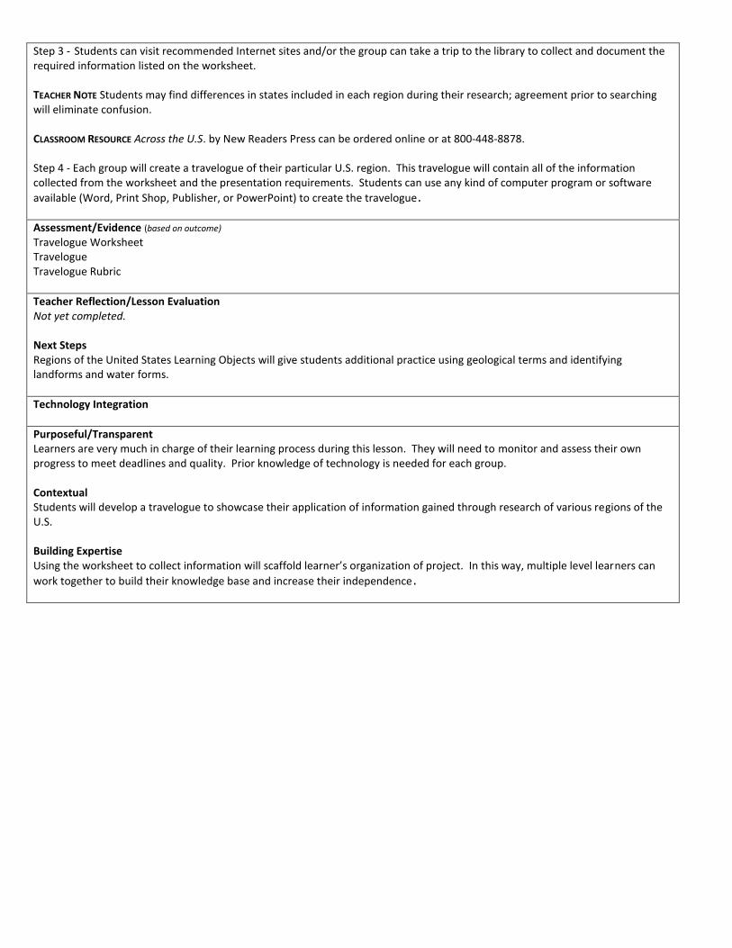
Step 3 - Students can visit recommended Internet sites and/or the group can take a trip to the library to collect and document the required information listed on the worksheet. TEACHER NOTE Students may find differences in states included in each region during their research; agreement prior to searching will eliminate confusion. CLASSROOM RESOURCE Across the U.S. by New Readers Press can be ordered online or at 800-448-8878. Step 4 - Each group will create a travelogue of their particular U.S. region. This travelogue will contain all of the information collected from the worksheet and the presentation requirements. Students can use any kind of computer program or software
available (Word, Print Shop, Publisher, or PowerPoint) to create the travelogue.
Assessment/Evidence (based on outcome) Travelogue Worksheet Travelogue Travelogue Rubric
Teacher Reflection/Lesson Evaluation Not yet completed. Next Steps Regions of the United States Learning Objects will give students additional practice using geological terms and identifying landforms and water forms.
Technology Integration
Purposeful/Transparent Learners are very much in charge of their learning process during this lesson. They will need to monitor and assess their own progress to meet deadlines and quality. Prior knowledge of technology is needed for each group. Contextual Students will develop a travelogue to showcase their application of information gained through research of various regions of the U.S. Building Expertise Using the worksheet to collect information will scaffold learner’s organization of project. In this way, multiple level learners can
work together to build their knowledge base and increase their independence.

States & Regions Information
The states in each region have similar climate, geography, traditions, and history
New England Connecticut, Maine, Massachusetts, New Hampshire, Rhode Island, Vermont
Middle Atlantic Delaware, Maryland, New Jersey, New York, Pennsylvania
South Alabama, Arkansas, Florida, Georgia, Kentucky, Louisiana, Mississippi, Missouri, North Carolina, South Carolina, Tennessee, Virginia, West Virginia
Midwest Illinois, Indiana, Iowa, Kansas, Michigan, Minnesota, Nebraska, North Dakota, Ohio, South Dakota, Wisconsin
Southwest Arizona, New Mexico, Oklahoma, Texas
West Alaska, California, Colorado, Hawaii, Idaho, Montana, Nevada, Oregon, Utah, Washington, Wyoming
Sizing-up the states
Largest: Alaska, 570,374 square miles
Smallest: Rhode Island, 1,045 square miles
Most populous: California, 32,268,301 residents (1997)
Least populous: Wyoming, 479,743 residents (1997)
How to cite an Internet article: Article title in quotation marks. Website title. “State Regions.” Fact Monster. Copyright date and company name. © 2003 Family Education Network. Access date and full URL in angle brackets. 09 June 2004 <http://www.factmonster.com/ipka/A0770177.html> Recommended Internet Sites The Regions of the United States http://www.dembsky.net/regions/
Lists of the states by regions. Start here. About the USA – Geography and Travel http://usa.usembassy.de/travel-regions.htm
Background statistics and links for each region Stately Knowledge http://www.ipl.org/youth/stateknow/skhome.html
Contains information about all 50 states with links to each one 50 States and Capitols http://www.50states.com
Contains facts about each states Eco-regions of the United States http://www.fs.fed.us/land/ecosysmgmt/ecoreg1_home.html
Description of the ecosystem geography of the nation Postcards from America Gallery http://www.postcardsfrom.com/t1/arcin.html
Contains postcard pictures, postage stamps, artifacts, maps and travel tips to famous places in each state Illinois Atlas http://www.illinoisatlas.com/index.htm
Links to various U.S. maps such as agriculture, climate, demographics, income, education, transportation and more. To access the maps, click on the .jpg file name for each one
US Regional Map/Quiz Printouts http://www.enchantedlearning.com/usa/statesbw/regions.shtml
Use for end of activity quiz
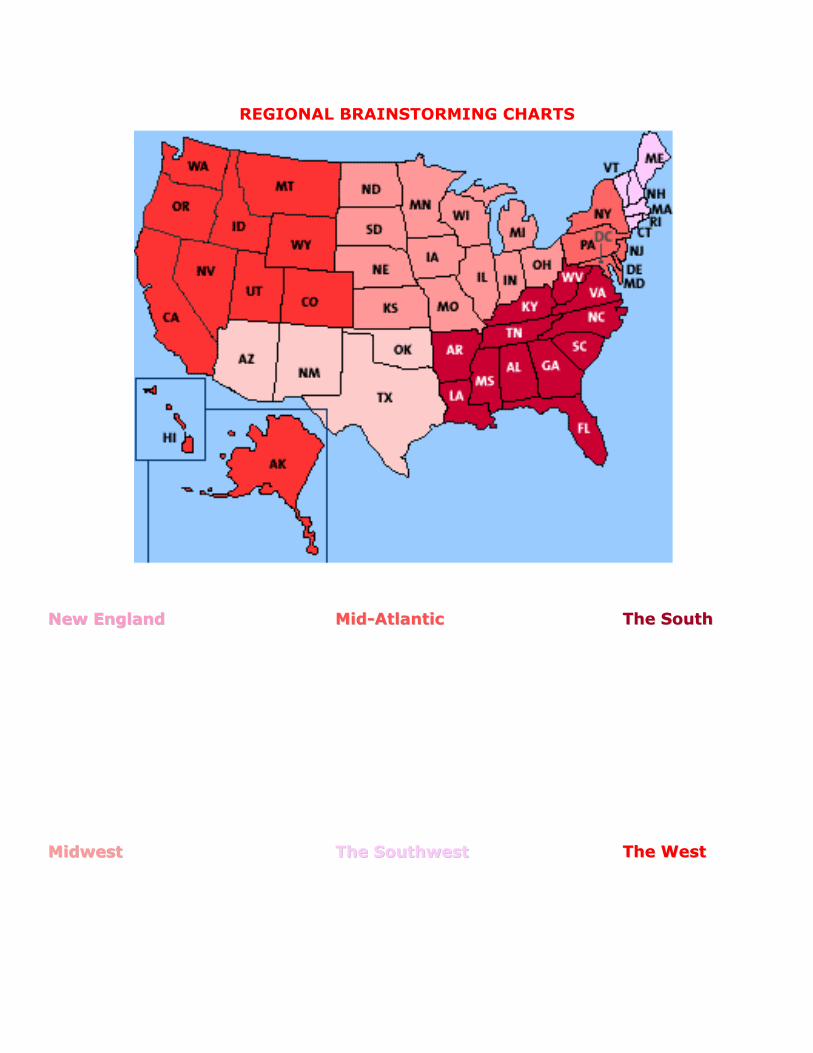
REGIONAL BRAINSTORMING CHARTS
NNeeww EEnnggllaanndd MMiidd--AAttllaannttiicc TThhee SSoouutthh
MMiiddwweesstt TThhee SSoouutthhwweesstt TThhee WWeesstt

Regions of the United States
Region Population
Most Populated State Most Populated City
Group Member’s Names Date
1.
2.
3.
4.
Directions –
Visit the suggested Internet sites or your local library to investigate your
particular U.S. region. Collect music, audio, video clips, pictures and information to include in your presentation.
Each presentation must contain --
Circle, bar or chart graph that illustrates geographic, economic, cultural, natural or population aspects of your selected region. This chart or graph
must have correct labels, a short description of the information and a documented source.
Maps of the region with labeled states, largest cities and landforms.
Pictures, video and audio clips that represent various aspects of the region.
Each piece should include a short description and documented source.
Each aspect of the region should be covered including population, climate, landforms, economics, culture, famous people and places, and natural
resources.
Make sure your have collected feedback from several sources to ensure a
quality presentation.

Travelogue Worksheet
FAMOUS PEOPLE What famous people are from this region?
Person City, State Contribution___________________
Collect pictures, audio and video clips of famous people and keep track of them here. Description of Picture or Clip Source _______________
CULTURE What are the cultural flavors of the region? Describe the culture, music and lifestyle of
the people.
Collect music clips that demonstrate the cultural flavor of this region as well as video
and audio clips here. Description of Clip Source______________________

Travelogue Worksheet
FAMOUS PLACES
What places in this region are particularly well-known? What are these places known for?
Collect pictures of each place (city, landform, building, river, ocean) and keep track of them here.
Place Picture Source_________________
NATURAL RESOURCES
What natural resources does this region contain? Describe the importance of each resource
CLIMATE Describe the climate in this region

Travelogue Worksheet
LANDFORMS Determine the landforms and how these affect the ways people make a living and have
fun in the region.
Collect pictures of landforms and keep track of them here. Description of Picture Source_______________________
ECONOMICS How do a majority of the people make a living in this region? Collect pictures and
statistics that represent the economics of the region including major occupations, occupations that this region is known for, major industries and crops.
Keep track of these pictures and statistics here. Description of Picture or Statistic Source_______________________

Travelogue Worksheet
Category Outstanding Competent Developing
Beginning
Standard
All benchmarks
were addressed.
One benchmark
was not
completely
addressed.
One topic was not
addressed.
More than one
benchmark or
topic was not
addressed.
Content Covers topic in-
depth with details
and examples.
Subject
knowledge is
excellent.
Includes essential
knowledge about
the topic. Subject
knowledge
appears to be
good.
Includes essential
information about
the topic but
there are 1-2
factual errors.
Content is
minimal or there
are several factual
errors.
Organization Content is well
organized using
headings or
bulleted lists to
group related
material.
Uses headings or
bulleted lists to
organize, but the
overall
organization of
topics appears
flawed.
Content is
logically organized
for the most part.
There was not
clear or logical
organizational
structure, just lots
of facts.
Requirements All requirements
are met and
exceeded.
All requirements
are met.
One requirement
was not
completely met.
More than one
requirement was
not completely
met.
Contributions Routinely provides
useful ideas when
participating in
small group and
in classroom
discussion.
Usually provides
useful ideas when
participating in
small group and
in classroom
discussion.
Sometimes
provides useful
ideas when
participating in
small group and
in classroom
discussion.
Rarely provides
useful ideas when
participating in
small group and
in classroom
discussion. May
refuse to
participate.
Oral
Presentation
Interesting, well-
rehearsed with
smooth delivery
that holds
audience
attention.
Relatively
interesting,
rehearsed with a
fairly smooth
delivery that
usually holds
Delivery not
smooth, but able
to hold audience
attention most of
the time.
Delivery not
smooth and
audience attention
lost.
Travelogue Presentation Rubric
Student Name
Teacher Name
Date
audience
attention.
Comments
http://www.wisconline.org
Recognizing Landforms in North and Central America
Author: Barbara Laedtke School: Fox Valley Technical College Date: 3/18/2003
Description: Learners read the definitions of geological terms and identify the landforms in various images.
http://www.wisc-online.com/objects/index_tj.asp?objID=SOC5302
Recognizing Water Forms in North and Central America
Author: Barbara Laedtke School: Fox Valley Technical College Date: 3/24/2003
Description: Learners read the definitions of various water forms and locate the bodies of water on a map.
http://www.wisc-online.com/objects/index_tj.asp?objID=SOC5402

Regions of the United States Learning Objects
Top Related