


Languages
Pages
Legal


Rehl Road / I-265 Interchange Feasibility Study
Gene Snyder Freeway (I-265/KY 841), I-64, Taylorsville Road (KY 155) / Blankenbaker Parkway (KY 913) / Rehl Road
Jefferson County, Kentucky Item No.: N/A
Final ReportOctober 2009
N
Prepared for:
Kentucky Transportation Cabinet:Division of Planning and
District 5, Louisville, Kentucky
Prepared by:
Qk4 815 West Market Street
Louisville, KY 40202


TABLE OF CONTENTS
Page
EXECUTIVE SUMMARY ...................................................................................... 1
1.0 INTRODUCTION............................................................................................. 11.1 Purpose of the Study ...................................................................................................... 11.2 Project Background......................................................................................................... 2
2.0 EXISTING CONDITIONS................................................................................ 32.1 Roadway Characteristics ................................................................................................ 32.2 Crash Analysis................................................................................................................ 42.3 Existing and Future No-Build Traffic Characteristics ...................................................... 4
3.0 PROJECT TEAM MEETINGS ........................................................................ 6
4.0 STUDY ALTERNATIVES CONSIDERED....................................................... 64.1 No-Build Alternative ........................................................................................................ 64.2 New I-265 Interchange at Rehl Road.............................................................................. 7
5.0 INTERCHANGE JUSTIFICATION STUDY ANALYSIS ............................... 10Policy Statement No. 1: Existing Facilities Capability .......................................................... 10Policy Statement No. 2: Transportation System Management ............................................ 11Policy Statement No. 3: Operational Analysis ..................................................................... 11Policy Statement No. 4: Access Connections and Design................................................... 12Policy Statement No. 5: Transportation and Land Use Plans.............................................. 12Policy Statement No. 6: Comprehensive Interstate Network Study..................................... 12Policy Statement No. 7: Coordination with Transportation System Improvements.............. 13Policy Statement No. 8: Status of Planning and NEPA ....................................................... 13
6.0 CONCLUSIONS AND RECOMMENDATIONS ............................................ 13
LIST OF TABLES Table 1: Crash Analysis Summary............................................................................................................... 4Table 2: 2007, 2030, and 2038 Traffic Conditions—Current and No-Build ................................................. 5Table 3: 2020, 2038 Traffic Conditions—No-Build Scenario and New Interchange.................................... 9
Rehl Road / I-265 Interchange Feasibility Study, Final Report October 2009 i
Rehl Road / I-265 Interchange Feasibility Study, Final Report October 2009 ii
FIGURESFigure ES-1 Project Location ........................................................................................................... ES-1 Figure ES-2 Design Concept ............................................................................................................ ES-3 Figure 1 Project Location ..................................................................................................................1 Figure 2 Cornerstone 2020 Form District Map ..................................................................................2Figure 3 Design Concept ...................................................................................................................7
APPENDICES Appendix A Exhibits
Exhibit 1 Project Location Exhibit 2 Existing Roadway Characteristics Exhibit 3 Environmental Overview Exhibit 4 Existing and Future Build and No-Build Traffic Exhibit 5 Peak-Hour Operational (Merge/Diverge/Weave) Analysis (3 sheets) Exhibit 6 Rehl Road Interchange Build Alternative
Appendix B Louisville Metro Letter of Support Appendix C Existing State Highway Data Appendix D Photograph Log Appendix E 2007 and 2030 Traffic Model Analysis Appendix F Project Team Meeting Minutes Appendix G KIPDA Long-Range Plan Project Status Sheets Appendix H Cost Estimates

EXECUTIVE SUMMARY
This project is a planning study to evaluate the feasibility of constructing an interchange linking I-265 and Rehl Road in eastern Louisville Metro (see Figure ES-1). The area is west of I-265 and south of I-64 and has been identified for a future employment center in the Jefferson County Comprehensive Plan: Cornerstone 2020. It has been rezoned for industrial use, and utilities, including sewers, have been installed. This area for future development is just east of and adjacent to the Bluegrass Industrial Park which surrounds Blankenbaker Parkway (KY 913). The resulting traffic from this development is a top concern for Louisville Metro, the Kentucky Transportation Cabinet (KYTC), and the neighboring public.
Figure ES-1: Project Location Map
The planning-level purpose and need for the project are to accommodate the safe and efficient movement of traffic to and from the future development and the interstate network. Louisville Metro has approved the rezoning for industrial land use, but with a condition that only specified percentages of the proposed developments can occur until the transportation network is improved.
Rehl Road / I-265 Interchange Feasibility Study, Final Report October 2009
Executive Summary-1

Louisville Metro has identified the interchange as a top priority and outlined the anticipated economic benefit from the proposed improved access. The following is excerpted from the letter of support for the interchange:
This proposed development would have an annual net new impact of: � $1.9 million in Kentucky state property tax revenues � $74.9 million in Kentucky State individual income tax revenues � $64.1 million in Kentucky State sales tax revenues � $12.5 million in local occupational tax revenues � $3.4 million in local property tax revenues � an additional 49,000 jobs in our 25-county economic area
Three interstate interchanges exist in the area—Blankenbaker Parkway at I-64, I-64 at I-265, and Taylorsville Road (KY 155) at I-265, and the traffic operates at or above capacity. Likewise, existing traffic volumes and congestion on the two interstates and the I-64/I-265 interchange are substantial. Therefore, the primary objective of this feasibility study is to identify a design concept that would address the traffic needs of the proposed developments without worsening traffic flow on the interstate network.
Study Process
A project study team approach was used, consisting of representatives from the KYTC Central Office, KYTC District 5, the Kentuckiana Regional Planning and Development Agency (KIPDA), Louisville Metro, and Qk4. (The FHWA elected to reserve involvement until the Cabinet begins to prepare a full IJS and NEPA document.)
Two alternatives were considered in this planning study: No-Build Alternative and a new I-265 interchange at Rehl Road and associated improvements to I-265
Traffic forecasts were provided by KIPDA, the Metropolitan Planning Organization (MPO), using the traffic model for the Metro Area. The traffic model incorporated the planned and programmed improvements to the network, including a rebuilt I-64/I-265 interchange and a widened I-265. The preliminary layout of the interchange concept is in concert with these proposed improvements. The traffic merge/diverge/weave analysis for the proposed interchange concept was conducted by Qk4. The future traffic was projected and analyzed for years 2020 and 2038 for both Build and No-Build scenarios. Year 2020 traffic assumed a limited number of the planned roadway improvements would be in place, while year 2038 traffic assumed all planned roadway improvements would be in place. Because the planning-level purpose and need is to accommodate future development, the 2038 No-Build scenario is based on a partial build out of the planned land uses, while the 2038 Build scenario is based on a full build-out of the proposed land uses.
After the traffic projections were developed, Qk4 developed the design concept with the merge/diverge/weave analysis to provide a design that would accommodate the various movements. The resulting design concept includes a compressed diamond interchange with collector/distributor (c/d) lanes. The c/d lanes begin in the south inside the KY 155/I-265 interchange, north of the southern ramps and south of the northern ramps, and extend north to connect with the c/d lanes associated with the proposed long-term redevelopment of the I-64/I-265 interchange. The anticipated
Rehl Road / I-265 Interchange Feasibility Study, Final Report October 2009
Executive Summary-2

cost estimate of this design concept, in 2008 dollars, is as follows: Design, $4.0M; Right-of-Way, $2.0M; Utilities, $2.0M; Construction $47.0M1; Total, $55.0M.
Conclusion
Based on the review of the existing conditions, the cost, the traffic forecasts and analyses, and the planning-level purpose and need for the project, the Project Team concurred that a new interchange with c/d lanes, as described above, would be feasible.
N
Next Steps
The advancement of the interchange will require 1) inclusion of the project into the KIPDA TIP (Transportation Improvement Plan) and the KYTC Six-Year Highway Plan, 2) further detailed design, and 3) an Interchange Justification Study (IJS), and a National Environmental Policy Act (NEPA) analysis and document, both of which will need to be coordinated with and approved by FHWA.
The IJS will require the development of a detailed sub area traffic model for the study area. The traffic study for this feasibility report is based on the multi-county model developed by KIPDA and does not afford the detail to satisfy each element of an IJS. The IJS will require a comparison of two options—a new interchange versus rebuilding the existing roads—as a way to meet the project purpose and need. The sub area traffic analysis would be the basis for that analysis.
The NEPA analysis would include public involvement and some level of indirect and cumulative impact analysis for the induced growth. Because of the lack of known environmental impacts and public controversy, it is anticipated the level of documentation could be a CE-Level 3 or an EA/FONSI rather than an EIS.2
Figure ES-2: Design Concept (See Exhibit 6)
1 The cost estimate is based on a c/d system the terminates inside the KY 155 interchange—between the northern and southern ramps. It was requested that cost estimates be generated for extending the c/d lanes south of the southern KY 155 interchange. The construction cost for such a design is estimated to be $60.5M, in total. 2 CE = Categorical Exclusion (KYTC offers 3 levels, with a Level-3 being the most involved); EA/FONSI = Environmental Assessment/Finding Of No Significant Impact; EIS = Environmental Impact Assessment.
Rehl Road / I-265 Interchange Feasibility Study, Final Report October 2009
Executive Summary-3


1.0 INTRODUCTION 1.1 Purpose of the Study
This project is a planning study to evaluate the feasibility of constructing an interchange linking I-265 and Rehl Road in eastern Louisville Metro (see Figure 1). The area is west of I-265 and south of I-64 and has been identified for a future employment center in the Jefferson County Comprehensive Plan: Cornerstone 2020. It has been rezoned for industrial use, and utilities, including sewers, have been installed. This area for future development is just east of and adjacent to the Bluegrass Industrial Park which surrounds Blankenbaker Parkway (KY 913). The resulting traffic from this development is a top concern for Louisville Metro, the Kentucky Transportation Cabinet (KYTC), and the neighboring public.
Figure 1: Project Location Area
Rehl Road / I-265 Interchange Feasibility Study, Final Report October 2009
1

1.2 Project Background
In 2000 the then-Louisville and Jefferson County (now Louisville Metro) Planning Commission adopted a comprehensive land use plan: Cornerstone 2020. One of the key elements of the plan is Form Districts. Form Districts provide general direction for future land use decisions. In the study area, the Form District is Suburban Workplace (SW), which is described as “large scale industrial and employment centers buffered from surrounding uses.” In eastern Louisville Metro there are three SW Form Districts, the other two are to the north along I-265: the Ford Plant and surrounding land uses off Chamberlain Lane, and the Eastpoint Business center off KY 146.
Since that time, numerous development activities have occurred in the study area including the amassing of land into large (over 200-acre) tracts; the rezoning of these tracts from residential to more intensive industrial uses; and the installation of sanitary sewers. Although the rezoning has been approved, full build-out is conditioned upon improvements to the transportation network.
N
Louisville Metro has identified the need for new interchanges in Jefferson County in several planning documents, and has identified an interchange of Rehl Road and I-265 as the top new interchange priority.
Figure 2: Cornerstone 2020 Form District Map SW = Suburban Workforce Form District SDN = Special District Neighborhood (i.e., Historic District) C = Campus Form Yellow is Neighborhood Form
The development activities, coupled with the identification of the need for new interchanges, have led to the advancement of this interchange feasibility study.
1.3 Purpose and Need
The planning-level purpose and need for the project is to accommodate the safe and efficient movement of traffic to and from the future development and the interstate network. The project should accommodate traffic from the future development of the area and, thereby, mitigate traffic impacts on other roads in the study area to aid in the area’s economic viability. Louisville Metro has approved the rezoning for industrial land use, but with a condition that only certain percentages of the proposed developments can be realized until improvements to the capacity of the road network are made to ensure adequate traffic movement. In Appendix B, there is a letter from Louisville
Rehl Road / I-265 Interchange Feasibility Study, Final Report October 2009
2

Metro Economic Development Authority identifying the anticipated economic benefit from the proposed improved access. The following is excerpted from the letter:
This proposed development would have an annual net new impact of:
� $1.9 million in Kentucky state property tax revenues
� $74.9 million in Kentucky State individual income tax revenues
� $64.1 million in Kentucky State sales tax revenues
� $12.5 million in local occupational tax revenues
� $3.4 million in local property tax revenues
� an additional 49,000 jobs in our 25-county economic area
While Louisville Metro has long planned the Rehl Road interchange, it is not included in KIPDA’s Transportation Improvement Plan (TIP) for future funding, nor is it in KYTC’s current Highway Plan (Kentucky’s 2008 Highway Plan As Approved by the 2009 General Assembly); however, it is included in KIPDA’s Long-Range Transportation Plan, Horizon 2030.
2.0 EXISTING CONDITIONS
2.1 Roadway Characteristics
Data on the state-maintained streets in the study area is included in Appendix C, and a Photo Log of the study area is included as Appendix D. The number of lanes and functional classification of the roadways in the project area are illustrated on Exhibit 2; the key roads are summarized as follows:
� I-64: Urban Interstate—eight 12-foot-wide lanes, four in each direction, between Blankenbaker Parkway and I-265. The current ADT for this section of I-64 is 92,200.
� I-265: Urban Interstate—four lanes, two in each direction, between KY 155 and I-64. The current ADT for this section of I-265 is 64,700.
� Blankenbaker Parkway (KY 913): Urban Principal Arterial—between four and six lanes from Blankenbaker Access Road north to I-64. Blankenbaker Parkway is programmed to be extended south to KY 155 in 2009-10. The current ADT for Blankenbaker Parkway is 36,600.
� Taylorsville Road (KY 155): Urban Principal Arterial—four lanes at the I-265 interchange, and two lanes west to the future Blankenbaker Parkway extension. The current ADT for this section of KY 155 is 17,900.
� Plantside Drive, Bluegrass Parkway/S. Pope Lick Road, and Rehl Road: Each are 2-lane Metro Collector Roads that run east-west through the study area linking the future development area with Blankenbaker Parkway.
� Tucker Station Road: Local collector—two lane north south road that runs through the study area east of Blankenbaker Parkway. Tucker Station Road has narrow pavement, little to no shoulders, substandard geometrics (including four 90-degree curves, and one
Rehl Road / I-265 Interchange Feasibility Study, Final Report October 2009
3

off-set intersection) and an at-grade crossing of the Norfolk Southern railroad track. South of the Norfolk Southern railroad track, Tucker Station Road runs adjacent to the Black Acre State Nature Preserve and Historic Site and bisects the Tyler Settlement Historic District.
2.2 Crash Analysis
Crash report data in the project study area from the five-year period January 2001–December 2005 was examined to identify roadway sections with abnormally high crash rates. This analysis indicates four roadway sections in the project study area are experiencing high crash rates. A critical crash rate factor (CCRF) greater than 1.0 indicates that the high rate of crashes is statistically significant, i.e. this high crash rate is not occurring randomly. The CCRF for each state road in the study area is located in Appendix C. Table 1, Crash Analysis Summary, lists the high crash locations for the project area.
Table 1: Crash Analysis Summary
Route Begin Milepoint
EndMilepoint Location Description CCRF
I-64 18.9 19.6 From I-265 Underpass to 0.8 mile East 1.36
KY 913 2.1 2.3 Commonwealth Drive to Bluegrass Parkway 1.96
2.3 Existing and Future No-Build Traffic Characteristics
For the traffic modeling purposes the existing traffic volumes are for the year 2007, and were obtained from KIPDA. The forecasting model was used to develop year 2020 forecasts, and then the model was run to generate year 2030 forecasts. Because the model only predicts to 2030, the 2030 volumes were extended to the year 2038 based on average annual growth rates generated from the model. The traffic analyses and forecasts are included in Appendix E. The projections take into account planned highway projects in the Horizon 2030 Long-Range Transportation Plan. For the year 2020, it was assumed that the following roadway capacity improvements would be in place:
� A new flyover ramp from I-265 northbound to I-64 westbound with collector/distributor lanes on I-265 north and south of I-64
� The extension of Blankenbaker Parkway south to KY 155 as a four-lane road
� I-64 east of I-265 widened to six lanes
For the year 2038, each of the following KIPDA LRTP planned projects were assumed to be constructed:
� I-265 widened to six lanes
� A full flyover ramp system for the I-64/I-265 interchange
� The construction of Urton Lane—a new three-lane road from north of I-64 south to KY 155, west of and parallel to I-265
� KY 155 widened from I-265 north to Blankenbaker Parkway from two lanes to five lanes
� New I-64 interchange east of I-265 in the vicinity of Gilliland Road overpass.
Rehl Road / I-265 Interchange Feasibility Study, Final Report October 2009
4

Table 2 provides the years 2007, 2020, and 2038 average daily traffic (ADT) and Level of Service3
(LOS) data for the existing conditions and the No-Build scenario. 1
Table 2: 2007, 2020, and 2038 Traffic Conditions—Current and No-Build No-Build* No-Build
Route Link 2007ADT 2020
ADT2038ADT
2007LOS 2038
LOSI-64
West of Blankenbaker Pkwy. 107,000 125,800 155,300 E E
West of I-265 92,200 124,200 161,500 D E
East of I-265 53,800 91,600 116,600 C F
Gene Snyder Freeway (I-265) North of I-64 – Main 64,700 59,200 65,600 D D
North of I-64 – C/D n/a 52,800 79,700 D F
From I-64 to KY 155 – Main 64,700 98,900 120,200 D E
From I-64 to near Rehl Rd. – C/D n/a 39,800 55,300 C D
From KY 155 to KY 1819 – Main 57,500 90,700 113,100 D E
Taylorsville Road (KY 155) North of Blankenbaker Pkwy. 14,100 19,900 27,300 D D
South of Blankenbaker Pkwy. 13,700 19,000 27,000 D D
North of Old Heady Rd. 13,700 15,300 21,700 D C
South of Old Heady Rd. 13,700 15,700 22,400 D C
South of Tucker Station Rd. 18,300 21,300 24,300 F C
North of Stone Lakes Dr. 18,300 22,000 24,100 D C
North of I-265 18,300 22,800 26,200 C D
Blankenbaker Parkway (KY 913) North of I-64 30,500 32,800 39,800 D F
South of I-64 36,400 37,000 50,800 C E
South of Bluegrass Pkwy 25,100 33,500 44,300 C D
South of Plantside Dr. 15,800 19,400 28,800 C D
South of Rehl Rd. 11,000 16,800 26,300 C D
North of Blankenbaker Access 11,000 18,800 29,100 C D
North of Chenoweth Run Rd. N/A 14,700 23,300 N/A C
North of KY 155 N/A 7,700 14,000 N/A C
* The No-Build scenario assumes less overall socioeconomic activity (i.e., jobs and residents) than the build alternatives; therefore, under these assumptions the No-Build scenario would result in less traffic on the study area roads.
3 Level of service” (LOS), as defined in the 2000 Highway Capacity Manual published by the Transportation Research Board, is a qualitative measure of operational conditions, and the motorists’ perception of those conditions. The conditions are usually defined in terms such as speed, travel time, maneuverability, delay, and comfort and convenience. The letters “A” through “F” designate the six levels of service. LOS A represents the best operating conditions (i.e., free flow conditions), while LOS F defines the worst (i.e., severe congestion). According to the national standards, the lower levels of service (i.e., D, E, and F) are unacceptable for safe and efficient operation since they generally reflect unstable traffic flows, and drivers have little freedom to maneuver.
Rehl Road / I-265 Interchange Feasibility Study, Final Report October 2009
5

3.0 PROJECT TEAM MEETINGS
The full project team met twice during this study, with one additional meeting with select members to review and discuss traffic assumptions. These meetings were documented with meeting minutes (see Appendix F). A brief summary of the major topics discussed at each meeting follows:
� May 15, 2007, Louisville Metro. This pre-scoping meeting was to identify key issues with Louisville Metro and the project scope and schedule.
� July 12, 2007, KIPDA. The purpose of this meeting was to identify traffic issues associated with the proposed interchange study.
� May 5, 2008, KYTC District-5, Project Team Meeting #1. The team’s kick-off meeting at which members were introduced, the type of study was discussed, and the study’s scope and schedule were reviewed. Major topics of discussion included: the existing conditions, issues and potential problems, and the project purpose and need. Issues associated with the proposed interchanges that were discussed include the merge/diverge/weave analysis in the south, and the close spacing of the existing interchanges.
� July 18, 2008, KYTC District 5. This was a follow-up meeting to re-address traffic concerns and design issues. At this meeting it was decided that different socioeconomic variables would be required for the build as compared to the No-Build alternative, whereas the build analysis would have approximately 10,000 more jobs, and therefore more traffic, than the No-Build option.
� July 8, 2009, KYTC District 5, Project Team Meeting #2. Team members reviewed updated designs, cost estimates, and additional traffic analysis for the preliminary design concept. The team concluded that while a significant amount of work and analysis remains, based on the planning level effort an interchange at Rehl Road and I-265 appears feasible from both a constructability and federal IJS criteria perspective.
4.0 STUDY ALTERNATIVES CONSIDEREDTwo alternative concepts were considered in this planning study:
� No-Build Alternative
� Install a new I-265 interchange at Rehl Road and associated improvements to I-265
4.1 No-Build Alternative
The No-Build Alternative involves improvements that are already planned and illustrated in the MPO Long-Range Plan, except for the Rehl Road/I-265 interchange. (The project description for the KIPDA Long-Range Plan projects in the study area included in Appendix G.) The No-Build option will be referred to as appropriate for baseline comparisons throughout the future decision-making process.
Rehl Road / I-265 Interchange Feasibility Study, Final Report October 2009
6

The No-Build Alternative for this study, it has been assumed, will result in approximately 10,000 fewer jobs in the study area than either the Build option, or an alternative to rebuild the existing road network to manage and distribute growth-included traffic as effectively as the Build Alternative. This significant difference illustrates that No-Build alternative would not meet the planning-level purpose and need for the project and would not be in concert with the long-planned and long-term economic development plans for Louisville Metro. From a traffic perspective, the No-Build alternative would result in less traffic to and from the study area, including several segments of the adjacent interstates.
N
4.2 New I-265 Interchange at Rehl Road
This alternative would involve the construction of an interchange with I-265 in the vicinity of the current Rehl Road overpass. Because the programmed construction of a flyover ramp from I-265 northbound to I-64 westbound will include two-lane collector/distributor lanes on both sides of I-265, this alternative will require the extension of the collector/distributor lanes south into the I-265/KY 155 interchange. Because of the proximity of the southern ramps of the proposed Rehl Road interchange and the northern ramps of the KY 155 interchange, it is proposed to extend the ramp termini as auxiliary lanes on the outsides of both the northbound and southbound two-lane collector/distributor lanes. This will result in a three-lane section for the collector/distributor lanes between KY 155 and Rehl Road entrance/exit ramps. This concept is illustrated on Exhibit 6. A detailed signage plan will need to be created to guide travelers into the appropriate mainline, c/d and auxiliary lanes. Figure 3: Design Concept (See Exhibit 6)
At the beginning of this study several conceptual design options were considered, such as a flop diamond interchange and a clover leaf design, but because of the need for the c/d lanes, the topography, and the objective to minimize right-of-way acquisition and construction costs, a compressed diamond was identified as the most prudent preliminary design concept.
The traffic volumes and forecast for this alternative are illustrated on Exhibit 4, Appendix A. The peak hour levels of service for the merge/diverge/weave analysis are illustrated on Exhibit 5, Appendix A. Table 3 compares ADT and LOS data for the future Build and No-Build Alternatives.
Rehl Road / I-265 Interchange Feasibility Study, Final Report October 2009
7

The anticipated cost estimate in 2008 dollars for this alternative is as follows:
Design: $4.0M Right-of-Way: $2.0M Utilities: $2.0M Construction: $47.0M4
Total: $55.0M
The cost estimate worksheets for the construction costs are included in Appendix H. The construction and utility costs were based on recently completed projects; the right-of-way costs were based on Property Valuation Administration (PVA) records available from Louisville and Jefferson County Information Consortium (LOJIC) mapping; and the design costs were estimated to be 10% of the construction costs.
While the purpose and need for this project includes economic development for the greater Louisville Metro area, it should be noted that the interchange would serve many existing and proposed land uses in this area of Jefferson County, rather than a single development. Such land uses included the future Floyds Fork Park system and several existing residential developments east of I-265. While much of the area east of I-265 is rural in nature, it is all currently zoned R-4, which allows for approximately 4 single family units per acre. Based on input from Louisville Metro for this planning study, minimal residential (rather than a build out for the R-4 zoned land) was assumed for the KIPDA traffic model for this area.
The traffic model for the Build Alternative is based on a full build-out of the study area, which includes 10,000 more jobs than the No-Build Alternative, as illustrated below.
Rehl Road Interchange Study Area Total Projected Employment
2020 No-Build 2020 Build 2030 No-Build 2030 Build
KIPDA TAZ 421 6,309 12,970 7,474 17,474
District = Collection of several Traffic Analysis Zones from KIPDA Traffic Model, see Appendix E.
Consequently, the Build Alternative results in more overall traffic than the No-Build Alternative on the study area roadways. The higher volumes result in lower LOS in some places. The data in Table 3 shows two areas where the 2038 LOS is expected to be worse for the Build than for the No-Build Alternative: I-265 North of I-64 on the main line only (even though the difference in traffic is only 1,200 ADT, or 2%), and on Blankenbaker Parkway south of I-64, where the traffic is anticipated to be 5,200 to 6,800 ADT (or 9 to 13%) higher for the Build Alternative. These values are to expected since the traffic model anticipates that much of the new employment would travel to/from the west, from Louisville proper, to the new jobs in the east, and therefore exit at Blankenbaker rather than travel via I-265 to Rehl Road. The Project Team noted that this assumption may or may not prove
4 The cost estimate is based on a c/d system the terminates inside the KY 155 interchange—between the northern and southern ramps. It was requested that cost estimates be generated for extending the c/d lanes south of the southern KY 155 interchange. The construction cost for such a design is estimated to be $60.5M, in total.
Rehl Road / I-265 Interchange Feasibility Study, Final Report October 2009
8
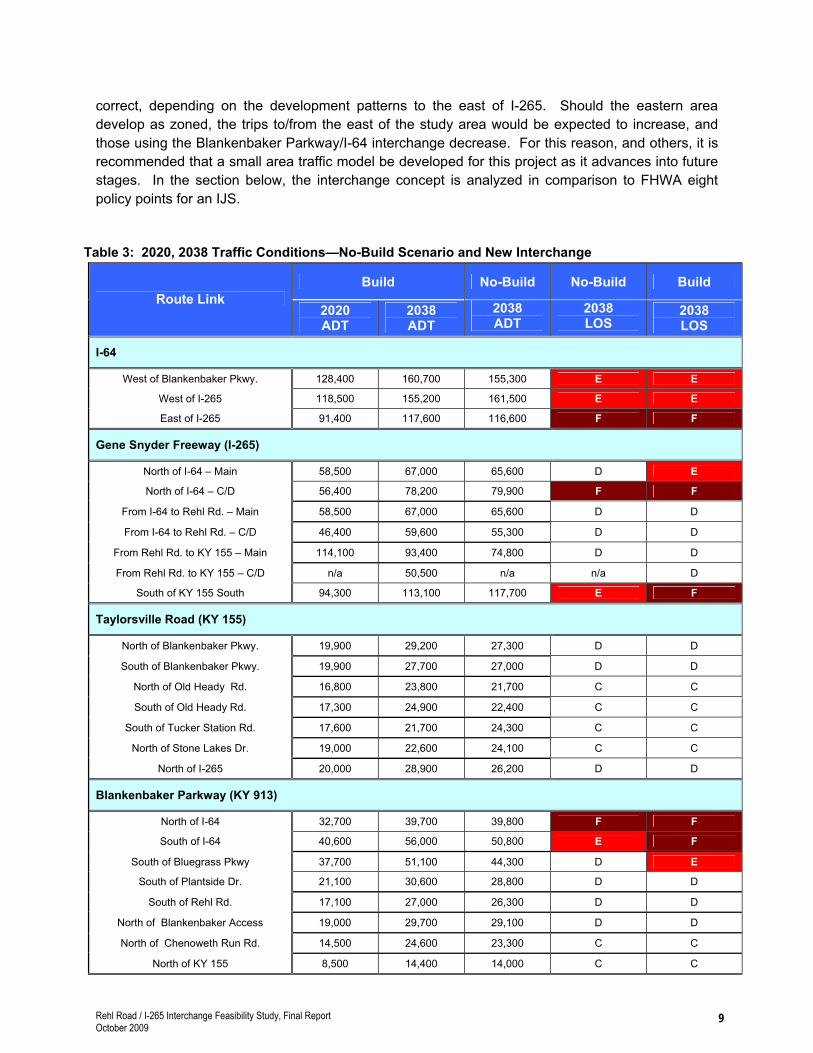
correct, depending on the development patterns to the east of I-265. Should the eastern area develop as zoned, the trips to/from the east of the study area would be expected to increase, and those using the Blankenbaker Parkway/I-64 interchange decrease. For this reason, and others, it is recommended that a small area traffic model be developed for this project as it advances into future stages. In the section below, the interchange concept is analyzed in comparison to FHWA eight policy points for an IJS.
Table 3: 2020, 2038 Traffic Conditions—No-Build Scenario and New Interchange
Build No-Build No-Build BuildRoute Link
2020ADT
2038ADT
2038ADT
2038LOS
2038LOS
I-64
West of Blankenbaker Pkwy. 128,400 160,700 155,300 E E
West of I-265 118,500 155,200 161,500 E E
East of I-265 91,400 117,600 116,600 F F
Gene Snyder Freeway (I-265)
North of I-64 – Main 58,500 67,000 65,600 D E
North of I-64 – C/D 56,400 78,200 79,900 F F
From I-64 to Rehl Rd. – Main 58,500 67,000 65,600 D D
From I-64 to Rehl Rd. – C/D 46,400 59,600 55,300 D D
From Rehl Rd. to KY 155 – Main 114,100 93,400 74,800 D D
From Rehl Rd. to KY 155 – C/D n/a 50,500 n/a n/a D
South of KY 155 South 94,300 113,100 117,700 E F
Taylorsville Road (KY 155)
North of Blankenbaker Pkwy. 19,900 29,200 27,300 D D
South of Blankenbaker Pkwy. 19,900 27,700 27,000 D D
North of Old Heady Rd. 16,800 23,800 21,700 C C
South of Old Heady Rd. 17,300 24,900 22,400 C C
South of Tucker Station Rd. 17,600 21,700 24,300 C C
North of Stone Lakes Dr. 19,000 22,600 24,100 C C
North of I-265 20,000 28,900 26,200 D D
Blankenbaker Parkway (KY 913)
North of I-64 32,700 39,700 39,800 F F
South of I-64 40,600 56,000 50,800 E F
South of Bluegrass Pkwy 37,700 51,100 44,300 D E
South of Plantside Dr. 21,100 30,600 28,800 D D
South of Rehl Rd. 17,100 27,000 26,300 D D
North of Blankenbaker Access 19,000 29,700 29,100 D D
North of Chenoweth Run Rd. 14,500 24,600 23,300 C C
North of KY 155 8,500 14,400 14,000 C C
Rehl Road / I-265 Interchange Feasibility Study, Final Report October 2009
9

5.0 INTERCHANGE JUSTIFICATION STUDY ANALYSIS
The Intermodal Surface Transportation Efficiency Act of 1991 (ISTEA) contains requirements for planning a proposed interchange to the existing Interstate Highway System. These requirements are implemented in FHWA policy and through Federal regulation located in 23 CFR part 450. The policy for Additional Interchanges to the Interstate System contains eight points that must be taken into consideration. This section discusses each policy point as it relates to the proposed Rehl Road/I-265 interchange.
Policy Statement No. 1: Existing Facilities Capability
“It is demonstrated that the existing interchanges and/or local roads and streets in the corridor can neither provide the necessary access, nor be improved to satisfactorily accommodate the design-year traffic demands while at the same time providing the access intended by the proposal. “
The existing roads and interchanges cannot provide the adequate access intended by the proposal. This statement is validated by the fact that Louisville Metro has, based on the traffic impact study prepared for the proposed developments, limited development in the area until the transportation network is improved. There are two general concepts considered for such improvements: rebuilding the existing roads and interchanges or adding a new interchange. Although it is likely that rebuilding the existing roads to accommodate traffic to serve the study area would have significant right-of-way and construction impacts, and prove much more costly, this alternative has not been examined in detail in this planning study. This alternative concept would likely include rebuilding the following 4 roadway elements: 1) The two-lane east-west collector roads leading into the development area: Rehl Road, Plantside Drive, and Bluegrass Parkway/S. Pope Lick Road, each of which would be expected to have major right-of-way impacts. 2) The north-south Tucker Station Road from Bluegrass Parkway south to Taylorsville Road, which would have involvement with the Norfolk Southern railroad crossing and impact both the Blackacre State Nature Preserve and Historic Site, and the Taylor Rural Settlement Historic District. 3) The two roads leading to the interstates: Blankenbaker Parkway to I-64 and Taylorsville Road to I-265, would need additional capacity. 4) The Blankenbaker Parkway/I-64 interchange and the Taylorsville Road/I-265 interchange would need added capacity.
The exact roads and the type of improvements to each would be determined during a future detailed traffic analysis generated to study the traffic impacts on each of the streets in the study area for the Build and No-Build scenario. This detailed analysis will be necessary task for the required full IJS.
It should be noted that, because the traffic forecasts prepared for this study indicate that traffic volumes on the existing roads for the build alternative are in many locations higher than the No-Build volumes. Consequently, it is likely that improvements to the existing road network will not be unnecessary even with the proposed interchange.
Rehl Road / I-265 Interchange Feasibility Study, Final Report October 2009
10

Policy Statement No. 2: Transportation System Management
“All reasonable alternatives for design options, location and transportation system management type improvements (such as ramp metering, mass transit, and HOV facilities) have been assessed and provided for, if currently justified, or provisions are included for accommodating such facilities if a future need is identified.”
Transportation System Management (TSM) and Spot Improvements alternatives involve relatively low-cost options. TSM options generally refer to such activities/features as signing, striping, traffic lights, and simple roadway improvements such as removing vegetation to improve visibility or improving the radius of a street corner. Spot Improvements include concepts such as reconstructing relatively short substandard curves, hills, intersections, etc., to address a safety concern, and then reconnecting with the existing roadway. Transit options could include higher cost activities/features ranging from the addition of High Occupancy Vehicle (HOV) lanes and park-and-ride lots to the construction of light rail/commuter train facilities.
Although such alternative concepts could be implemented on study area roadways, none would significantly address the issues of mitigating congestion, connectivity of the road and interstate network, and safety. Therefore, the low-cost TSM and Spot Improvement options were not studied in detail as part of this planning effort.
Bus transit is provided for in the western portion of the study area, but not on I-265 or in the vicinity of the interchange under study. Neither meter ramps nor HOV lanes are provided in any Louisville area interstates.
Policy Statement No. 3: Operational Analysis
“The proposed access point does not have a significant adverse impact on the safety and operation of the Interstate facility based on an analysis of current and future traffic. The operational analysis for existing conditions shall, particularly in urbanized areas, include an analysis of sections of Interstate to and including at least the first interchange on either side. Crossroads and other roads and streets shall be included in the analysis to the extent necessary to assure their ability to collect and distribute traffic to and from the interchange with new or revised access point.”
On I-265 the spacing of the center of the interchanges with KY 155 and I-64 is 2.0 miles, which leaves 1.0 mile in either direction of the proposed interchange. The spacing on I-265 between the northern termini of KY 155 ramps and the southern termini of the I-64 ramps is 9,961 feet on the west side and 10,015 feet on the east side. The traffic operational analysis has been performed for the proposed interchange, and it included the interchanges to the north (I-64), to the south (KY 155), and the I-64 / Blankenbaker interchange to the west and the surface streets within the study area. The operational analysis illustrates that the proposed interchange would not have an adverse effect on the safety and operation of the interstate weaving movement for future traffic as compared to the No-Build Alternative. This conclusion was reached after adjustments to the alternative were made; specifically, the collector/distributor lanes were extended south into the I-265/KY 155 interchange, auxiliary lanes were added between Rehl Road and KY 155, and for northbound traffic entering the c/d system, two lanes were provided instead of the initially estimated one lane. Without these
Rehl Road / I-265 Interchange Feasibility Study, Final Report October 2009
11

elements added to the c/d lanes the traffic merging and diverging would have resulted in a substandard LOS E or F for those movements. The merge, diverge, and weave analysis is illustrated on Exhibit 5 in Appendix A. As illustrated in Table 3, two sections of the mainline of I-265—south of KY 155 and north of I-64—are anticipated to experience worsened LOS, from E to F, and from D to E, respectively.
Policy Statement No. 4: Access Connections and Design
“The proposed access connects to a public road only and will provide for all traffic movements. Less than “full interchanges” for special purposes access for transit vehicles, for HOVs or into park and ride lots may be considered on a case-by-case basis. The proposed access will be designed to meet or exceed standards for Federal-aid projects on the Interstate system.”
The proposed interchange will connect to a public road, Rehl Road, and provide for all directional movements, designed to meet or exceed current standards for Federal-aid projects.
West of I-265, Rehl Road is proposed to be upgraded in the KIPDA Long-Range Plan as a rebuilt two-lane road, and it is proposed to be widened and redesigned as part of the proposed developments. East of I-265, the design of the interchange will need to provide an acceptable connection to the current Louisville Metro maintained Rehl Road. At present, neither Louisville Metro or KIPDA have identified the reconstruction of Rehl Road east of I-265 as a project, and no proposed extensions further east onto new alignment to the proposed I-64 interchange near Gilliland Road have been proposed.
Policy Statement No. 5: Transportation and Land Use Plans
“The proposal considers and is consistent with local and regional land use and transportation plans.”
The proposed interchange is included in the KIPDA Long-Range Plan, the Louisville Metro Comprehensive Plan, Cornerstone 2020, and is a top priority for Louisville Metro. In the recent past land use rezoning and other infrastructure improvement, including sanitary sewer lines and expanded capacity at the treatment plant, have been advanced in this area, each with the understanding that an interchange is planned and desired by the local government.
Policy Statement No. 6: Comprehensive Interstate Network Study
“In areas where the potential exists for future multiple interchange additions, all request for new or revised access are supported by a comprehensive Interstate network study with recommendations that address all proposed and desired access within the context of a long-term plan.”
There are several planned new interchanges in Jefferson County, but none other than Rehl Road are proposed on I-265. The only one in proximity to the study area is a proposed interchange on I-64 approximately 2 miles east of I-265 in the vicinity of Gilliland Road. Although a planning study
Rehl Road / I-265 Interchange Feasibility Study, Final Report October 2009
12

was completed by KYTC in 2008 for this interchange, this project is illustrative, only, and has not been advanced by KYTC to the preliminary engineering and environmental documentation phase. It should be noted that each project has independent utility. However, should either of these new interchanges be advanced, the future sub-area traffic studies for each project should take the other proposed interchange into consideration. Both interchanges are included in KIPDA’s Long-Range Transportation Plan, and therefore both are included in the regional traffic model that was used for this Rehl Road/I-265 interchange feasibility study.
Policy Statement No. 7: Coordination with Transportation System Improvements
“The request for a new or revised access generated by new or expanded development demonstrates appropriate coordination between the development and related or otherwise required transportation system improvements.”
As stated throughout the planning study, and in Policy Statement No. 5, the interchange has been taken into consideration by the local and regional planning agencies and is supported by the planned land use developments within the study area. The interchange is viewed by the Louisville Metro planners as an asset to the development goals for the area that are supported by the comprehensive land use plan. Other transportation system improvements in the Long-Range plan and considered by Louisville Metro have been coordinated with the proposed Rehl Road/I-265 interchange.
Policy Statement No. 8: Status of Planning and NEPA
“The request for new or revised access contains information relative to the planning requirements and the status of the environmental processing of the proposal.”
The planning process and planning objectives, herein, were implemented to provide a basis for scoping and advancing the subsequent decision-making stages for approving or rejecting a new interstate interchange. Therefore, much of the process and information considered and documented herein for this interchanges is in concert with the process and information required by the National Environmental Policy Act (NEPA) and Interchange Justification Study (IJS) requirements. Regarding the NEPA process, based on the preliminary literature research and the Environmental Overview map, Exhibit 3 in Appendix A, no significant impacts or public controversy are anticipated with the proposed interchange; therefore, it is anticipated the project could be advanced as an EA/FONSI or CE-Level 3 rather than an EIS. Regarding the IJS, a sub-area traffic model will need to be developed to further analyze design details and operational issues.
6.0 CONCLUSIONS AND RECOMMENDATIONS
Based on the planning analysis herein, the Project Team anticipates the interchange with c/d lanes, as described above, would 1) be feasible in regards to constructability and federal IJS and NEPA policy requirements, 2) be beneficial to Louisville Metro by meeting the planning-level purpose and need, 3) although it is recognized the further work is required, it appears the based on the work conducted herein, the interchange can be designed to not be harmful to the interstate network, and 4) cost approximately $55.0M in 2008 dollars: Design, $4.0M; Right-of-Way, $2.0M; Utilities, $2.0M;
Rehl Road / I-265 Interchange Feasibility Study, Final Report October 2009
13

Rehl Road / I-265 Interchange Feasibility Study, Final Report October 2009
14
Construction $47.0M. this fee estimate is based on the assumption that the c/d lanes will taper to the mainline between the north and south ramps to/from KY 155. Should the c/d lanes be extended south past the southern ramps to/from KY 155, the construction cost alone is estimated to increase to $60.5M.
The Project Team also notes that a significant amount of work and analysis remains prior to final approval, as described throughout this report and below.
Next Steps
The advancement of the interchange will require 1) inclusion of the project into the KIPDA TIP (Transportation Improvement Plan) and the KYTC Six-Year Highway Plan, 2) further detailed design, including continued coordination with the redesign of the I-265/I-64 interchange and a detailed signage plan, and 3) an IJS and a NEPA analysis and document, both of which will need to be coordinated with and approved by FHWA.
� The IJS will require the development of a detailed sub area traffic model for the study area, based on specific developments in the future Suburban Workplace Form District. (The traffic study for this feasibility report is based on currently anticipated future conditions the multi-county model developed by KIPDA and does not afford the detail to satisfy each element of an IJS.) The IJS will require a comparison of two options—a new interchange verses rebuilding the existing roads—as a way to meet the project purpose and need. The more detailed sub area traffic analysis would be the basis for that analysis.
� The NEPA analysis would include public involvement and disclosure of some level of indirect and cumulative impact analysis for the induced growth. Because of the lack of known environmental impacts and public controversy, it is anticipated the level of documentation could be a CE-Level 3 or an EA/FONSI rather than an EIS.

APPENDIX A EXHIBITS

X
XX
XX
XX
X
£¤60
UV913
SHELBYVILLE RD
WAT
TERS
ON
TR
L
BLA
NK
ENB
AK
ER PK
WY
OLD SHELBYVILLE RDN W
ATTERSO
N TR
L
UV1819
MO
SER
RD
TUC
KE
R STATION RD
URTON LN
BELLEW
OO
D R
D
EVERG
REEN
RDWARD AVE
DORSEY LN
UV1819
UV913
BLA
NK
EN
BA
KE
R P
KW
Y
ELECTRON DR
PLANTSIDE DR
TUCK
ER STATIO
N R
DS POPE LICK RD
£¤60
SHELBYVILLE RD
N EN
GLISH
STATIO
N R
D
OLD HEN
RY RD
§¦64
§¦265
§¦265
§¦265
§¦64
§¦64
£¤60
SHELBYVILLE RD
N B
ECKLEY STA
TION R
D
S ENG
LISH STA
TION
RD
AIKEN RD
AIKE
N RD
N BECK
LEY STATIO
N R
D
POPLAR LN
S EN
GLISH STA
TI ON
RD
N BE
CKL E Y ST
ATION RD
BLUEGRAS S PKWY
REHL RD
S POPE LICK RD
PLANTSIDE DR
TAYLORSVILLE RD
UV155
BIL
LTO
WN
RD
UV1819
CH
EN
OW
ET H
RU
N R
D
TAYLORSVILLE RD
EASUM RD
OLD HEADY RD
UV1819
LOV
ER
S L
N
CHENOWET H RUN R
D
§¦265
UV155
NEW
HO
PEWELL R
D
HO
PEW
ELL RD
TAY
LORSVILLE LAKE RD
ROUTT RD
TAYLORSVILLE RD
ECHO
TRL
EASUM RD
ProposedInterchange
ProjectStudy Area
¯
Exhibit 1
Project
Location
I-265/Rehl Rd Interchange
Not to Scale

X
XX
X
X
X
X
X
X
X
X
X
XX
X
X
X
X
X
X
X
X
X
X
X
X
X
UV913
WAT
TER
SON
TR
L
BLA
NK
ENB
AK
ER PK
WY
N TR
L
UV1819
MO
SER
RD
TUC
K
ER STATION RD
URTON LN
UV1819
UV913
BLA
NK
EN
BA
KE
R P
KW
YELECTRON DR
PLANTSIDE DR
TUCK
ER STATIO
N RD
S POPE LICK RD
§¦64
§¦265
§¦265
§¦64
S ENG
LISH STA
TION
RD
POPLAR LN
BLUEGRASS PKWY
REHL RD
S POPE LICK RD
UV155
CH
EN
OW
ETH
RU
N R
D
TAYLORSVILLE RD
OLD HEADY RD
§¦265
UV155
NEW
HO
PEWELL R
D
TAYLORSVILLE RD
EASUM RD
N PO
PE LIC
K R
D
TUC
KER
STATIO
N R
D
ELLINGSWORTH LN
BLA
NK
ENB
AK
ER R
D
TUC
KER
STA
TIO
N R
D
CA
MPU
S PL
AM
PER
E DR
BLANKENBAKER ACCESS DR
CHENOW
E TH RUN R
D
REHL RD
MA
REN
GO
DR
MO
SER
RD
Lanes = 6/12'Median = raised/16'Truck % = 5.1
Lanes = 5/12'Median = raised/26'Truck % = 5.1
Lanes = 4/12'Median = raised/16'Truck % = 5.1
Lanes = 2/12'Median = TWLTL*Truck % = 5.1
Lanes = 4/12'Median = raised/4'Truck % = 5.1
Lanes = 2/11'Median = none/0'Truck % = 8
Lanes = 4/12'Median = raised/16'Truck % = 8
Lanes = 2/12'Median = none/0'Truck % = 8
Lanes = 4/12'Median = depressed/52'Truck % = 12.2
Lanes = 4/12'Median = depressed/26'Truck % = 12.2
Lanes = 3/12'Median = depressed/54'Truck % = n/a
Lanes = 3/12'Median = concrete barrier/12'Truck % = n/a
ProjectStudy Area
¯
Exhibit 2
Existing Roadway
Characteristics
I-265/Rehl Rd Interchange
Not to Scale
X
X Urban Interstate
X
X Urban Minor Arterial Street
X
X Urban Principal Arterial
Local
*TWLTL = Two-way Left turn lane

nmnm
nmnmnm
nm
nm
nm
§ ¦64
§ ¦265
U V5
U V913
U V1819
WATTERSON TRL
BLU
EGR
ASS
PK
WY
BLU
EGR
ASS
PK
WY
MOSER RD
BLANKENBAKER PKWY
TUC
KER
STA
TIO
N R
D
TUCKER STATION RD
TUCKER STATION RD
BLANKENBAKER RD
PLA
NTS
IDE
DR
BLA
NK
ENB
AK
ER P
KW
Y
U V913
PLAN
TSID
E DR
CAMPUS PL
REH
L R
D
AMPERE DR
DEC
IMA
L D
R
TAYLORSVILLE RD
WATT
ERSON TRL
RUCKRIEGEL PKWY
BLA
NK
EN
BA
KE R
AC
CE S
S D
R
CHEN
OW
ETH
RU
N R
D
GR
AN
D A
VE
U V155
TAYL
OR
SVIL
LE R
D
BILLTOWN RD
MAPLE RD
CHENOWETH RUN RD
PINOAK VIEW DR
FAIR
VIEW
AVE
TAY
LOR
SVIL
LE R
D
TUCKER STATION RD
REH
L R
D
OLD HEADY RD
U V155
HOPEWELL RD
NEW HOPEWELL RD
REH
L R
DR
EHL
RD
S PO
PE L
ICK
RD
TAY
LOR
SVIL
LE R
D
REHL
RD
U V155O
LD T
AY
LOR
SVIL
LE R
D
S ENGLISH STATION RD
ECHO TRL
POPL
AR
LN
S PO
PE L
ICK
RD
S POPE LICK RD
S ENGLISH STATION RD
S ENGLISH STATION RD
S B
ECK
LEY
STA
TIO
N R
D
WILDERNESS TRL
S POPE LICK RD
§ ¦265
§ ¦265
§ ¦64
§ ¦64
RAMBLIN CREEK RD
BLANKENBAKER PKWY
ELEC
TRO
N D
R
SARATOGA WOODS DR
BLU
EGR
ASS
RES
EAR
CH
&
IND
UST
RIA
L PA
RK
BLA
NK
ENB
AK
ERC
RO
SSIN
GS
BLA
NK
ENB
AK
ERC
RO
SSIN
GS
BLU
EGR
ASS
RES
EAR
CH
&
IND
UST
RIA
L PA
RK
RA
MB
LIN
CR
EEK
LON
E O
AK
CLE
AR
CH
AN
NEL
CO
MM
UN
ICAT
ION
S
TUC
KER
LA
KE
ESTA
TES
WO
OD
S O
FFO
X C
REE
K
DO
VEPO
INT
CH
APE
LVI
EW
STO
NE
LAK
ES
TYLE
R R
ETA
ILC
ENTE
R
TRES
TLE
CR
EEK
MA
RTH
A H
. J.
CO
LYER
FA
RM
WEI
MA
NPR
OPE
RTY
SOU
TH E
NG
LISH
STAT
ION
SIG
NAT
UR
EPO
INT
CO
PPER
FIEL
DN
OR
MA
ND
YPL
AC
ESW
AN
PO
INTE
ELEC
TRIC
AL
SUB
STAT
ION
Proj
ect
Stud
y A
rea
Exh
ibit
3
En
vir
on
men
tal
Ov
ervie
wI-
26
5/R
eh
l R
d I
nte
rch
an
ge
Not
to S
ca
le
Wat
erlin
eSe
wer
s3 Q
Was
tew
ater
Tre
atm
ent P
lant
[ ÚW
aste
wat
er P
ump
Stat
ion
3 QW
ater
Tre
atm
ent P
lant
Í BPa
ckag
e Pl
ant
UTW
ater
Tan
k
® vH
ospi
tal
nmSc
hool
Park
Exis
ting
Dev
elop
men
tPr
opos
ed D
evel
opm
ent
Wet
land
sPo
tent
ial F
lood
Ris
k
Sour
ce C
itiat
ion
Topo
grap
hic
data
, inc
ludi
ng u
tiliti
es a
nd im
ager
y an
d le
ss h
isto
ric,
aqua
tic a
nd te
rrest
rial c
ourte
sy o
f the
Ken
tuck
y O
ffice
of G
eogr
aphi
cIn
form
atio
n S
yste
ms
(KY
OG
IS) a
nd th
e Lo
uisv
ille/J
effe
rson
Cou
nty
Info
rmat
ion
Con
sorti
um (L
OJI
C).Q
k4 m
akes
no
clai
m to
the
accu
racy
of th
at d
ata
show
n on
this
map
.

X
X
X
X
X
X
X
X
X
X
X
X
X
X
X
X
X
X
X
X
X
XX
X
X
X
X
X
X
X
X
X
X
X
X
X
X
X
X
X
X
X
X
X
X
X
X
X
X
X
X
X
X
X
X
X
X
X
X
X
X
X
X
X
X
X
X
X
X
X
X
X
X
X
X
X
X X
X
X
X
X
X
X
X
X X
X
X
X
X
XX
X
X
X
X
X
X
X
X
XX
X
X
X
X
X
X
X
X
X X
X
X
X
X
X
XXX
XX
X
X
X
X
X
X
X
§ ¦64
§ ¦265
UV913
UV1819
WATTERSON TRL
BLU
EGR
ASS
PK
WY
BLU
EGR
ASS
PK
WY
MOSER RD
BLANKENBAKER PKWY
TUC
KER
STA
TIO
N R
D
TUCKER STATION RD
TUCKER STATION RD
BLANKENBAKER RD
PLA
NTS
IDE
DR
BLA
NK
ENB
AK
ER P
KW
Y
UV913
PLAN
TSID
E DR
CAMPUS PL
REH
L R
D
ELEC
TRO
N D
R
AMPERE DR
DEC
IMA
L D
R
RUCKRIEGEL
PKW
Y
BLA
NK
ENB
AK
ER
AC
CE
SS
DR
CHEN
OW
ETH
RUN
RD
UV155
TAYL
OR
SVIL
LE R
D
BILLTOWN RDMAPLE RD
CHENOWETH RUN RD
PINOAK VIEW DR
BA
YPO
RT
RD
TAY
LOR
SV
ILLE
RD
TUCKER STATION RD
REH
L R
D
OLD HEADY RD
UV155
HOPEWELL RD
NEW HOPEWELL RD
REH
L R
DR
EHL
RD
S PO
PE
LIC
K R
D
TAY
LOR
SV
ILLE
RD
UV155O
LD T
AYL
OR
SVIL
LE R
D
S ENGLISH STATION RD
ECHO TRL
POPL
AR
LN
S PO
PE
LIC
K R
D
S POPE LICK RD
S ENGLISH STATION RD
S B
ECK
LEY
STA
TIO
N R
D
§ ¦265
§ ¦265
§ ¦64
§ ¦64
RAMBLIN CREEK RD
BLANKENBAKER PKWY
DOMINIO
N W
AY
ELEC
TRO
N D
R
SARATOGA WOODS DR
See
Det
ail A
See
Det
ail B
See
Det
ail D
Futu
re P
lant
side
Dr
Future Urton Lane
Future Urton Lane
Futu
re
Bla
nken
bake
r Pkw
y
See
Det
ail C
Prop
osed
Reh
lR
d In
terc
hang
e
MA
INLI
NE
CD
MA
INLI
NE
CD
MA
INLI
NE
CD
2007
Exi
stin
g =
2020
No-
Bui
ld =
2020
Bui
ld =
2038
No-
Bui
ld =
2038
Bui
ld =
*AD
T10
7,00
012
5,80
012
8,40
015
5,30
016
0,70
0
*LO
SE D C E E
2007
Exi
stin
g =
2020
No-
Bui
ld =
2020
Bui
ld =
2038
No-
Bui
ld =
2038
Bui
ld =
*AD
T92
,200
124,
200
118,
500
161,
500
155,
200
*LO
SD D D E E
2007
Exi
stin
g =
2020
No-
Bui
ld =
2020
Bui
ld =
2038
No-
Bui
ld =
2038
Bui
ld =
*AD
T53
,800
91,6
0091
,400
116,
600
117,
600
*LO
SC D D F F
2007
Exi
stin
g =
2020
No-
Bui
ld =
2020
Bui
ld =
2038
No-
Bui
ld =
2038
Bui
ld =
*AD
T64
,700
59,2
0058
,500
65,6
0067
,000
*LO
SD D D D E
2007
Exi
stin
g =
2020
No-
Bui
ld =
2020
Bui
ld =
2038
No-
Bui
ld =
2038
Bui
ld =
*AD
T64
,700
59,2
0058
,500
65,6
0067
,000
*LO
SD D D D D
2007
Exi
stin
g =
2020
No-
Bui
ld =
2020
Bui
ld =
2038
No-
Bui
ld =
2038
Bui
ld =
*AD
T64
,700
98,9
0011
4,10
074
,800
93,4
00
*LO
SD D D D D
*AD
T57
,500
90,7
0094
,300
113,
100
117,
700
2007
Exi
stin
g =
2020
No-
Bui
ld =
2020
Bui
ld =
2038
No-
Bui
ld =
2038
Bui
ld =
*LO
SD D D E F
2020
No-
Bui
ld =
2020
Bui
ld =
2038
No-
Bui
ld =
2038
Bui
ld =
*AD
T52
,800
56,4
0079
,900
78,2
00
*LO
SD D F F
2020
No-
Bui
ld =
2020
Bui
ld =
2038
No-
Bui
ld =
2038
Bui
ld =
*AD
T39
,800
46,4
0055
,300
59,6
00
*LO
SC C D D
2020
No-
Bui
ld =
2020
Bui
ld =
2038
No-
Bui
ld =
2038
Bui
ld =
*AD
TN
/AN
/AN
/A50
,500
*LO
SN
/AN
/AN
/A D
2007
Exi
stin
g =
2020
No-
Bui
ld =
2020
Bui
ld =
2038
No-
Bui
ld =
2038
Bui
ld =
*AD
T14
,100
17,9
0019
,900
27,3
0029
,200
*LO
SD C C D D
2007
Exi
stin
g =
2020
No-
Bui
ld =
2020
Bui
ld =
2038
No-
Bui
ld =
2038
Bui
ld =
*AD
T13
,700
19,0
0019
,900
27,0
0027
,700
*LO
SD C C D D
2007
Exi
stin
g =
2020
No-
Bui
ld =
2020
Bui
ld =
2038
No-
Bui
ld =
2038
Bui
ld =
*AD
T13
,700
15,3
0016
,800
21,7
0023
,800
*LO
SD C C C C
2007
Exi
stin
g =
2020
No-
Bui
ld =
2020
Bui
ld =
2038
No-
Bui
ld =
2038
Bui
ld =
*AD
T13
,700
15,7
0017
,300
22,4
0024
,900
*LO
SD C C C C
2007
Exi
stin
g =
2020
No-
Bui
ld =
2020
Bui
ld =
2038
No-
Bui
ld =
2038
Bui
ld =
*AD
T18
,300
21,3
0017
,600
24,3
0021
,700
*LO
SF C C C C
*LO
SD C C C C
*AD
T18
,300
22,0
0019
,000
24,1
0022
,600
2007
Exi
stin
g =
2020
No-
Bui
ld =
2020
Bui
ld =
2038
No-
Bui
ld =
2038
Bui
ld =
2007
Exi
stin
g =
2020
No-
Bui
ld =
2020
Bui
ld =
2038
No-
Bui
ld =
2038
Bui
ld =
*AD
T18
,300
22,8
0020
,000
26,2
0028
,900
*LO
SC C C D D
2007
Exi
stin
g =
2020
No-
Bui
ld =
2020
Bui
ld =
2038
No-
Bui
ld =
2038
Bui
ld =
*AD
T17
,100
28,1
0026
,900
28,1
0026
,600
*LO
SE F F F F
2007
Exi
stin
g =
2020
No-
Bui
ld =
2020
Bui
ld =
2038
No-
Bui
ld =
2038
Bui
ld =
*AD
T30
,500
32,8
0032
,700
39,8
0039
,700
*LO
SD E E F F
2007
Exi
stin
g =
2020
No-
Bui
ld =
2020
Bui
ld =
2038
No-
Bui
ld =
2038
Bui
ld =
*AD
T36
,400
37,0
0040
,600
50,8
0056
,000
*LO
SC C D E F
2007
Exi
stin
g =
2020
No-
Bui
ld =
2020
Bui
ld =
2038
No-
Bui
ld =
2038
Bui
ld =
*AD
T25
,100
33,5
0037
,700
44,3
0051
,100
*LO
SC C C D E
2007
Exi
stin
g =
2020
No-
Bui
ld =
2020
Bui
ld =
2038
No-
Bui
ld =
2038
Bui
ld =
*AD
T15
,800
19,4
0021
,100
28,8
0030
,600
*LO
SC C C D D
2007
Exi
stin
g =
2020
No-
Bui
ld =
2020
Bui
ld =
2038
No-
Bui
ld =
2038
Bui
ld =
*AD
T11
,000
16,8
0017
,100
26,3
0027
,000
*LO
SC C C D D
2007
Exi
stin
g =
2020
No-
Bui
ld =
2020
Bui
ld =
2038
No-
Bui
ld =
2038
Bui
ld =
*AD
T11
,000
18,8
0019
,000
29,1
0029
,700
*LO
SC C C D D
2007
Exi
stin
g =
2020
No-
Bui
ld =
2020
Bui
ld =
2038
No-
Bui
ld =
2038
Bui
ld =
*AD
TN
/A14
,700
14,5
0023
,300
24,6
00
*LO
SN
/A C C C C
2007
Exi
stin
g =
2020
No-
Bui
ld =
2020
Bui
ld =
2038
No-
Bui
ld =
2038
Bui
ld =
*AD
TN
/A7,
700
8,50
014
,000
14,4
00
*LO
SN
/A C C C C
Exh
ibit
4
Ex
isti
ng
an
d F
utu
re B
uil
d
an
d N
o-B
uil
d T
raff
icI-
26
5/R
eh
l R
d I
nte
rch
an
ge
Not
to S
cale
*AD
T =
Ave
rage
Dai
ly T
raffi
c*L
OS
= L
evel
of S
ervi
ceA
ll tr
affic
fore
cast
s pr
ovid
ed b
y K
IPD
A
X
X
X
X
X
X
X
X
X
X
X
X
X X
X
X
X
BLANKENBAKER PKWY
BLANKENBAKER PKWY
§ ¦64
2020
No-
Bui
ld =
2020
Bui
ld =
2038
No-
Bui
ld =
2038
Bui
ld =
*AD
T7,
300
7,10
08,
600
8,40
0
2020
No-
Bui
ld =
2020
Bui
ld =
2038
No-
Bui
ld =
2038
Bui
ld =
*AD
T8,
900
11,8
0010
,400
14,5
00
2020
No-
Bui
ld =
2020
Bui
ld =
2038
No-
Bui
ld =
2038
Bui
ld =
*AD
T11
,500
10,1
0013
,100
12,1
00
2020
No-
Bui
ld =
2020
Bui
ld =
2038
No-
Bui
ld =
2038
Bui
ld =
*AD
T6,
900
9,20
07,
900
11,3
00
2020
No-
Bui
ld =
2020
Bui
ld =
2038
No-
Bui
ld =
2038
Bui
ld =
*AD
T9,
800
9,00
016
,200
14,6
00
2020
No-
Bui
ld =
2020
Bui
ld =
2038
No-
Bui
ld =
2038
Bui
ld =
*AD
T8,
600
8,00
09,
900
9,30
0
X
X
X
X
X
X
X
X
X
X
X
XX
X
X
X
X
X
X
X
X
XX
X§ ¦64
§ ¦265
2020
No-
Bui
ld =
2020
Bui
ld =
2038
No-
Bui
ld =
2038
Bui
ld =
*AD
T5,
900
5,20
05,
300
5,30
0
2020
No-
Bui
ld =
2020
Bui
ld =
2038
No-
Bui
ld =
2038
Bui
ld =
*AD
T5,
800
5,50
07,
300
7,40
0
2020
No-
Bui
ld =
2020
Bui
ld =
2038
No-
Bui
ld =
2038
Bui
ld =
*AD
T6,
600
6,30
07,
500
7,40
0
2020
No-
Bui
ld =
2020
Bui
ld =
2038
No-
Bui
ld =
2038
Bui
ld =
*AD
T5,
700
5,70
08,
000
8,10
0
2020
No-
Bui
ld =
2020
Bui
ld =
2038
No-
Bui
ld =
2038
Bui
ld =
*AD
T7,
400
8,40
09,
300
10,1
00
2020
No-
Bui
ld =
2020
Bui
ld =
2038
No-
Bui
ld =
2038
Bui
ld =
*AD
T6,
900
7,40
09,
900
10,9
00
2020
No-
Bui
ld =
2020
Bui
ld =
2038
No-
Bui
ld =
2038
Bui
ld =
*AD
T13
,900
12,8
0016
,600
14,6
00
2020
No-
Bui
ld =
2020
Bui
ld =
2038
No-
Bui
ld =
2038
Bui
ld =
*AD
T12
,900
11,8
0023
,400
20,8
00
X
X
X
X
X X
X
X
X
X
X X
X
X
X
TAYL
OR
SVI
LLE
RD
§ ¦265
2020
No-
Bui
ld =
2020
Bui
ld =
2038
No-
Bui
ld =
2038
Bui
ld =
*AD
T8,
400
7,60
08,
400
7,80
0
2020
No-
Bui
ld =
2020
Bui
ld =
2038
No-
Bui
ld =
2038
Bui
ld =
*AD
T9,
000
8,30
07,
700
7,30
0
2020
No-
Bui
ld =
2020
Bui
ld =
2038
No-
Bui
ld =
2038
Bui
ld =
*AD
T5,
000
3,40
04,
300
3,80
0
2020
No-
Bui
ld =
2020
Bui
ld =
2038
No-
Bui
ld =
2038
Bui
ld =
*AD
T4,
200
2,40
04,
300
4,10
0
¯
DET
AIL
A
DET
AIL
B
DET
AIL
D
¯¯
X
X
X
X X
X X
XXX
XX
X
X
X
X
X
X
X§ ¦26
5R
EHL
RD
REH
L R
D
S PO
PE LICK RD
E REHL C
T
2020
Bui
ld =
2038
Bui
ld =
*AD
T5,
600
6,50
020
20 B
uild
=20
38 B
uild
=
*AD
T5,
300
5,70
0
2020
Bui
ld =
2038
Bui
ld =
*AD
T4,
700
4,60
0
2020
Bui
ld =
2038
Bui
ld =
*AD
T5,
200
5,00
0
DET
AIL
C
¯
Sour
ce C
itiat
ion
Topo
grap
hic
data
, inc
ludi
ng u
tiliti
es a
nd im
ager
y an
d le
ss h
isto
ric,
aqua
tic a
nd te
rres
trial
cou
rtesy
of t
he K
entu
cky
Offi
ce o
f Geo
grap
hic
Info
rmat
ion
Syst
ems
(KYO
GIS
) and
the
Loui
svill
e/Je
ffers
on C
ount
y In
form
atio
nC
onso
rtium
(LO
JIC
).Qk4
mak
es n
o cl
aim
to th
e ac
cura
cyof
that
dat
a sh
own
on th
is m
ap.

Exh
ibit
5
Peak
-Hou
rO
peratio
nal
(Merge/D
iverge/W
eave)
An
aly
sis
Sh
eet
1of
3

Exh
ibit
5
Peak
-Hou
rO
peratio
nal
(Merge/D
iverge/W
eave)
An
aly
sis
Sh
eet
2of
3

Exh
ibit
5
Peak
-Hou
rO
peratio
nal
(Merge/D
iverge/W
eave)
An
aly
sis
Sh
eet
3of
3


APPENDIX B LOUISVILLE METRO
LETTER OF SUPPORT

Appendix B - Page 1

Appendix B - Page 2

APPENDIX C EXISTING STATE HIGHWAY DATA

Reh
l Roa
d Fe
asib
ility
Stu
dyE
xist
ing
(May
200
9) R
oadw
ay C
ondi
tions
Rou
teB
egin
ning
MP
Beg
inni
ng F
eatu
reEn
ding
MP
Endi
ng F
eatu
reLe
ngth
Func
tiona
l Cla
ssSt
ate
Syst
emN
HS ?
NTN ?
Truc
kW
eigh
tC
lass
# of
La
nes
Lane
Wid
thSh
ould
er T
ype
Shou
lder
Wid
th
% P
assi
ng
Sigh
tD
ista
nce
I-64
17.0
74K
Y 9
13 (B
LAN
KE
NB
AK
ER
RO
AD
)18
.888
I 265
UN
DE
RP
AS
S1.
814
Urb
an In
ters
tate
Sta
te P
rimar
yY
YA
AA
612
Pav
ed10
100
18.8
89I 2
65 U
ND
ER
PA
SS
19.6
00S
PE
ED
LIM
IT C
HA
NG
E0.
711
Rur
al In
ters
tate
Sta
te P
rimar
yY
YA
AA
412
Pav
ed10
100
19.6
00S
PE
ED
LIM
IT C
HA
NG
E20
.765
FLO
YD
S F
OR
K B
RID
GE
1.
165
Rur
al In
ters
tate
Sta
te P
rimar
yY
YA
AA
412
Pav
ed10
100
I-265
22.1
01M
P 2
2.10
1 (O
ne M
ile S
outh
of
Tayl
osvi
lle R
oad
Ove
rpas
s)23
.101
KY
155
(TA
YLO
RS
VIL
LE R
OA
D)
1.00
0U
rban
Inte
rsta
teS
tate
Prim
ary
YY
AA
A4
12P
aved
1010
023
.102
KY
155
(TA
YLO
RS
VIL
LE R
OA
D)
24.3
34R
EH
L R
OA
D B
RID
GE
1.23
2U
rban
Inte
rsta
teS
tate
Prim
ary
YY
AA
A4
12P
aved
1010
024
.335
RE
HL
RO
AD
BR
IDG
E25
.454
I 64
OV
ER
PA
SS
1.11
9U
rban
Inte
rsta
teS
tate
Prim
ary
YY
AA
A4
12P
aved
1010
025
.455
I 64
OV
ER
PA
SS
26.7
95U
S 6
0 O
VE
RP
AS
S1.
340
Urb
an In
ters
tate
Sta
te P
rimar
yY
YA
AA
412
Pav
ed10
100
KY
15 5
5.14
9O
LD T
AY
LOR
SV
ILLE
RD
5.71
1N
EW
HO
PE
WE
LL R
D0.
562
Urb
an P
rinci
pal A
rteria
lS
tate
Sec
onda
ryN
YA
AA
211
Com
bina
tion
48
5.71
2N
EW
HO
PE
WE
LL R
D5.
727
BE
GIN
NIN
G O
F D
IVID
ED
HIG
HW
AY
0.01
5U
rban
Prin
cipa
l Arte
rial
Sta
te S
econ
dary
NY
AA
A2
11C
ombi
natio
n4
85.
727
BE
GIN
NIN
G O
F D
IVID
ED
HIG
HW
AY
5.73
70.
010
Urb
an P
rinci
pal A
rteria
lS
tate
Sec
onda
ryN
YA
AA
211
Com
bina
tion
85.
738
5.78
10.
043
Urb
an P
rinci
pal A
rteria
lS
tate
Sec
onda
ryN
YA
AA
411
Com
bina
tion
128
5.78
25.
990
I 265
EA
STB
OU
ND
ON
RA
MP
/I 26
5 E
AS
TBO
UN
D O
FFR
AM
P0.
208
Urb
an P
rinci
pal A
rteria
lS
tate
Sec
onda
ryN
YA
AA
412
Com
bina
tion
12N
PZ*
*
5.99
1I 2
65 E
AS
TBO
UN
D O
NR
AM
P/I
265
EA
STB
OU
ND
OFF
RA
MP
6.05
8I 2
65 U
ND
ER
PA
SS
(SO
UTH
EN
D O
F E
AS
TBO
UN
D B
RID
GE
)0.
067
Urb
an P
rinci
pal A
rteria
lS
tate
Prim
ary
NY
AA
A4
12C
ombi
natio
n12
NP
Z
6.05
9I 2
65 U
ND
ER
PA
SS
(SO
UTH
EN
D O
F E
AS
TBO
UN
D B
RID
GE
)6.
150
I 265
WE
STB
OU
ND
OFF
RA
MP
/I 26
5 W
ES
TBO
UN
D O
NR
AM
P0.
091
Urb
an P
rinci
pal A
rteria
lS
tate
Prim
ary
NY
AA
A4
12C
ombi
natio
n12
NP
Z
6.15
1I 2
65 W
ES
TBO
UN
D O
FFR
AM
P/I
265
WE
STB
OU
ND
ON
RA
MP
6.27
9H
OP
EW
ELL
RO
AD
0.12
8U
rban
Prin
cipa
l Arte
rial
Sta
te P
rimar
yN
NA
AA
412
Com
bina
tion
12N
PZ
6.
280
HO
PE
WE
LL R
OA
D6.
407
0.12
7U
rban
Prin
cipa
l Arte
rial
Sta
te P
rimar
yN
NA
AA
311
Com
bina
tion
12N
PZ
6.
408
6.45
00.
042
Urb
an P
rinci
pal A
rteria
lS
tate
Prim
ary
NN
AA
A2
11C
ombi
natio
n12
NP
Z
6.45
16.
889
TUC
KE
R S
TATI
ON
RD
/SW
EE
NE
Y L
N0.
438
Urb
an P
rinci
pal A
rteria
lS
tate
Prim
ary
NN
AA
A2
11C
ombi
natio
n4
NP
Z
KY
913
2.10
8C
OM
MO
NW
EA
LTH
DR
2.18
7R
ES
OU
RC
E W
AY
0.07
9U
rban
Prin
cipa
l Arte
rial
Sta
te P
rimar
yN
NA
AA
612
Cur
bed
N/A
752.
188
RE
SO
UR
CE
WA
Y2.
263
BLU
EG
RA
SS
PK
Y0.
075
Urb
an P
rinci
pal A
rteria
lS
tate
Prim
ary
NN
AA
A5
12C
urbe
dN
/A75
2.26
4B
LUE
GR
AS
S P
KY
2.70
8I 6
4 B
RID
GE
0.44
4U
rban
Prin
cipa
l Arte
rial
Sta
te P
rimar
yN
NA
AA
412
Pav
ed10
752.
709
I 64
BR
IDG
E2.
845
I-64
WE
STB
OU
ND
OFF
RA
MP
0.13
6U
rban
Prin
cipa
l Arte
rial
Sta
te P
rimar
yN
NA
AA
412
Pav
ed10
752.
846
I-64
WE
STB
OU
ND
OFF
RA
MP
2.95
1E
LLIN
GS
WO
RTH
LN
0.10
5U
rban
Prin
cipa
l Arte
rial
Sta
te P
rimar
yN
NA
AA
412
Pav
ed10
752.
951
ELL
ING
SW
OR
TH L
N3.
260
KY
181
90.
309
Urb
an P
rinci
pal A
rteria
lS
tate
Prim
ary
NN
AA
A4
12C
urbe
dN
/A10
0
* C
ritic
al C
rash
Rat
e Fa
ctor
** N
o P
assi
ng Z
one
***
Est
imat
ed W
eigh
ted
Ave
rage
from
Mul
tiple
Sec
tions
App
endi
x C
- Pag
e 1

Reh
l Roa
d Fe
asib
ility
Stu
dyE
xist
ing
(May
200
9) R
oadw
ay C
ondi
tions
Rou
teB
egin
ning
MP
Beg
inni
ng F
eatu
reEn
ding
MP
Endi
ng F
eatu
re
I-64
17.0
74K
Y 9
13 (B
LAN
KE
NB
AK
ER
RO
AD
)18
.888
I 265
UN
DE
RP
AS
S18
.889
I 265
UN
DE
RP
AS
S19
.600
SP
EE
D L
IMIT
CH
AN
GE
19.6
00S
PE
ED
LIM
IT C
HA
NG
E20
.765
FLO
YD
S F
OR
K B
RID
GE
I-265
22.1
01M
P 2
2.10
1 (O
ne M
ile S
outh
of
Tayl
osvi
lle R
oad
Ove
rpas
s)23
.101
KY
155
(TA
YLO
RS
VIL
LE R
OA
D)
23.1
02K
Y 1
55 (T
AY
LOR
SV
ILLE
RO
AD
)24
.334
RE
HL
RO
AD
BR
IDG
E24
.335
RE
HL
RO
AD
BR
IDG
E25
.454
I 64
OV
ER
PA
SS
25.4
55I 6
4 O
VE
RP
AS
S26
.795
US
60
OV
ER
PA
SS
KY
15 5
5.14
9O
LD T
AY
LOR
SV
ILLE
RD
5.71
1N
EW
HO
PE
WE
LL R
D5.
712
NE
W H
OP
EW
ELL
RD
5.72
7B
EG
INN
ING
OF
DIV
IDE
D H
IGH
WA
Y5.
727
BE
GIN
NIN
G O
F D
IVID
ED
HIG
HW
AY
5.73
75.
738
5.78
1
5.78
25.
990
I 265
EA
STB
OU
ND
ON
RA
MP
/I 26
5 E
AS
TBO
UN
D O
FFR
AM
P
5.99
1I 2
65 E
AS
TBO
UN
D O
NR
AM
P/I
265
EA
STB
OU
ND
OFF
RA
MP
6.05
8I 2
65 U
ND
ER
PA
SS
(SO
UTH
EN
D O
F E
AS
TBO
UN
D B
RID
GE
)
6.05
9I 2
65 U
ND
ER
PA
SS
(SO
UTH
EN
D O
F E
AS
TBO
UN
D B
RID
GE
)6.
150
I 265
WE
STB
OU
ND
OFF
RA
MP
/I 26
5 W
ES
TBO
UN
D O
NR
AM
P
6.15
1I 2
65 W
ES
TBO
UN
D O
FFR
AM
P/I
265
WE
STB
OU
ND
ON
RA
MP
6.27
9H
OP
EW
ELL
RO
AD
6.28
0H
OP
EW
ELL
RO
AD
6.40
76.
408
6.45
06.
451
6.88
9TU
CK
ER
STA
TIO
N R
D/S
WE
EN
EY
LN
KY
913
2.10
8C
OM
MO
NW
EA
LTH
DR
2.18
7R
ES
OU
RC
E W
AY
2.18
8R
ES
OU
RC
E W
AY
2.26
3B
LUE
GR
AS
S P
KY
2.26
4B
LUE
GR
AS
S P
KY
2.70
8I 6
4 B
RID
GE
2.70
9I 6
4 B
RID
GE
2.84
5I-6
4 W
ES
TBO
UN
D O
FF R
AM
P2.
846
I-64
WE
STB
OU
ND
OFF
RA
MP
2.95
1E
LLIN
GS
WO
RTH
LN
2.95
1E
LLIN
GS
WO
RTH
LN
3.26
0K
Y 1
819
* C
ritic
al C
rash
Rat
e Fa
ctor
** N
o P
assi
ng Z
one
***
E
Spee
dLi
mit
Roa
dway
Typ
eTe
rrai
nC
lass
Pave
men
t Typ
ePa
vem
ent R
ough
ness
In
dex
Avg
R/W
W
idth
AD
TU
pdat
edC
CR
F*
65D
ivid
ed H
ighw
ay w
/ Med
ian
Hig
h Ty
pe F
lexi
ble
8520
092
,200
0.56
865
Div
ided
Hig
hway
w/ M
edia
nH
igh
Type
Fle
xibl
e89
200
53,8
001.
361
70D
ivid
ed H
ighw
ay w
/ Med
ian
Hig
h Ty
pe F
lexi
ble
8920
053
,800
0.47
3
65D
ivid
ed H
ighw
ay w
/ Med
ian
Hig
h Ty
pe R
igid
96**
*30
659
,800
0.40
965
Div
ided
Hig
hway
w/ M
edia
nH
igh
Type
Fle
xibl
e93
***
300-
306
64,7
000.
415
65D
ivid
ed H
ighw
ay w
/ Med
ian
Hig
h Ty
pe F
lexi
ble
91**
*30
064
,700
0.80
965
Div
ided
Hig
hway
w/ M
edia
nH
igh
Type
Fle
xibl
e10
7***
300
79,0
000.
572
55U
ndiv
ided
Hig
hwa y
Hig
h Ty
pe F
lexi
ble
133
8517
,900
0.10
255
Und
ivid
ed H
ighw
ayH
igh
Type
Fle
xibl
e11
9***
8517
,900
55D
ivid
ed H
ighw
ay w
/ Med
ian
Hig
h Ty
pe F
lexi
ble
114
8517
,900
55D
ivid
ed H
ighw
ay w
/ Med
ian
Hig
h Ty
pe F
lexi
ble
114
8517
,900
55D
ivid
ed H
ighw
ay w
/ Med
ian
Hig
h Ty
pe F
lexi
ble
109
120
17,9
00
55D
ivid
ed H
ighw
ay w
/ Med
ian
Hig
h Ty
pe F
lexi
ble
109
120
17,9
00
55D
ivid
ed H
ighw
ay w
/ Med
ian
Hig
h Ty
pe F
lexi
ble
115*
*12
017
,200
55D
ivid
ed H
ighw
ay w
/ Med
ian
Hig
h Ty
pe F
lexi
ble
123
120
17,2
000.
102
55D
ivid
ed H
ighw
ay w
/ Med
ian
Hig
h Ty
pe F
lexi
ble
114*
*80
-120
17,2
000.
100
55U
ndiv
ided
Hig
hway
Hig
h Ty
pe F
lexi
ble
113
8017
,200
55U
ndiv
ided
Hig
hway
Hig
h Ty
pe F
lexi
ble
123*
*80
17,2
00
45D
ivid
ed H
ighw
ay w
/ Med
ian
Hig
h Ty
pe R
igid
115
150
35,9
0045
Div
ided
Hig
hway
w/ M
edia
nH
igh
Type
Rig
i d11
515
035
,900
45D
ivid
ed H
ighw
ay w
/ Med
ian
Hig
h Ty
pe R
igid
115
150
35,9
000.
364
45D
ivid
ed H
ighw
ay w
/ Med
ian
Hig
h Ty
pe R
igid
115
150
36,6
000.
482
45D
ivid
ed H
ighw
ay w
/ Med
ian
Hig
h Ty
pe R
igid
115
150
36,6
000.
214
45D
ivid
ed H
ighw
ay w
/ Med
ian
Hig
h Ty
pe F
lexi
ble
116
100
36,6
000.
045
ROLLING
1.96
1
0.22
8
0.49
6
0.08
1
App
endi
x C
- Pag
e 2

APPENDIX D PHOTOGRAPH LOG

Appendix D Rehl Road Photo Log
Photo 1 I-265
Photo 2 I-265
Photo 3 I-265

Photo 4 I-265
Photo 5 I-265
Photo 6 I-265 over KY 155
Page 2 of 10
Appendix D
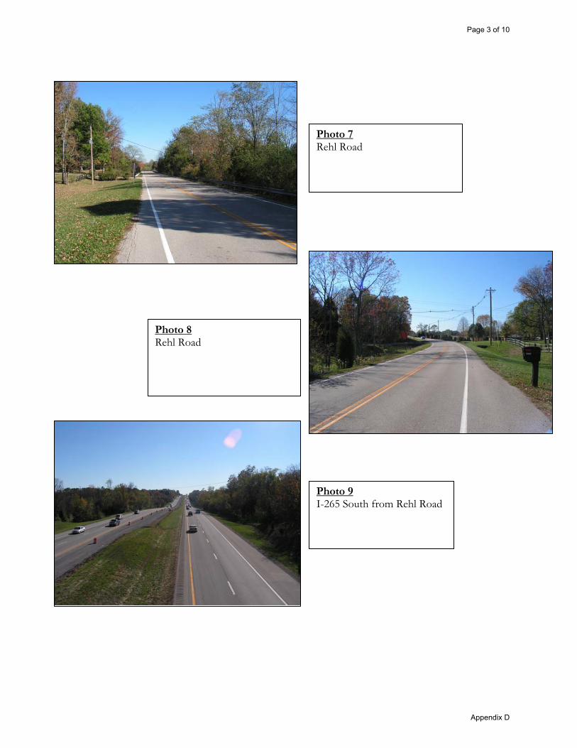
Photo 7 Rehl Road
Photo 8 Rehl Road
Photo 9 I-265 South from Rehl Road
Page 3 of 10
Appendix D

Photo 10 I-265 North from Rehl Road
Photo 11 Rehl Road
Photo 12 I-64 Eastbound to KY 913 Southbound
Page 4 of 10
Appendix D

Photo 13 KY 913
Photo 14 KY 913
Photo 15 KY 913
Page 5 of 10
Appendix D

Photo 16 KY 913
Photo 17 I-64 Eastbound to I-265 Southbound
Photo 18 I-265 at I-64
Page 6 of 10
Appendix D

Photo 19 I-265 at KY 155
Photo 20 I-265 Southbound ext at KY 155
Photo 21 KY 155
Page 7 of 10
Appendix D

Photo 22 KY 155
Photo 23 I-265 over KY 155
Photo 24 KY 155 intersection with I-265
Page 8 of 10
Appendix D

Photo 25 KY 155 intersection with I-265
Photo 26 I-265 at I-64
Photo 27 I-265 at I-64
Page 9 of 10
Appendix D

Photo 28 Rehl Road bridge over I-265
Page 10 of 10
Appendix D

APPENDIX E 2007 AND 2030 TRAFFIC
MODEL ANALYSIS

Kentucky Member Counties Bullitt Henry Jefferson Oldham Shelby Spencer Trimble Indiana Member Counties Clark Floyd Equal Opportunity Employer
11520 Commonwealth Drive Louisville, KY 40299
502-266-6084 Fax: 502-266-5047
KY TDD 1-800-648-6056
To: Tom Springer and Jeremy Lukat
From: Andy Rush
Date: June 11, 2008
Subject: Updated Rehl Road Interchange Vicinity Traffic Forecasts
I have included 2020, 2030, and 2038 traffic forecasts in the vicinity of the proposed Interstate 265 Interchange at Rehl Road. The study area for this project extends from Interstate 64 to KY 155 (Taylorsville Road), and from KY 913 (Blankenbaker Parkway) to Interstate 265. These forecasts are meant to supersede the prior forecasts as they incorporate new, considerably different socioeconomic projections (provided by Louisville Metro Planning & Design Services) as well as significantly revised network assumptions. Similar to the first transmittal of traffic forecasts, I have included level-of-service maps for each scenario, aerial photos of each of the four interchanges in the study area with the forecasted ramp volumes, along with the same data in tabular form. These forecasts incorporate the following assumptions:
� There were four additional model runs performed. These included 2020 Build, 2020 No-Build, 2030 Build, and 2030 No-Build model runs.
� These forecasts come from the KIPDA travel demand model, which includes all projects planned to be open to traffic by the year of the model run, as well as all other assumptions in the Horizon 2030 long-range transportation plan (unless otherwise noted below).
� The proposed Urton Lane was removed from the network in both No-Build scenarios, from the existing Urton Lane to KY 155.
� A collector/distributor (C/D) system on I-265 was included in the network in all model runs. For the Build scenarios, it was assumed to extend from north of the US 60 interchange to south of the Rehl Road interchange. In the No-Build scenarios, it was assumed to extend from north of the US 60 interchange to south of the I-64 interchange.
www.kipda.org Metropolitan Planning Organization Kentucky Designated Area Agency on Aging

� No intermediate access points were assumed to/from the C/D system.
� For the Year 2020 scenarios, the ramp from northbound I-265 to westbound I-64 was assumed to be a 2-lane “flyover” ramp.
� For the Year 2030 scenarios, the I-265/I-64 interchange was assumed to be completely re-constructed as a fully directional interchange with four “flyover” ramps, each with 2 lanes.
� For the Year 2030 scenarios, the I-265/US 60 interchange was assumed to be re-constructed as a single-point urban interchange (SPUI).
� Due to the lack of a Year 2038 model scenario in the KIPDA model, an alternative methodology was used to provide forecasts for the year 2038. A yearly (compound) growth rate was calculated, based on 2020 and 2030 forecasts. This growth rate was used to expand the 2030 volumes to 2038 volumes.
� This growth rate was limited to between 0.0% and 3.0% per year.
� The Year 2030 socioeconomic projections assumed a 75% build-out of the study area. Based on Louisville Metro’s request, the Year 2020 scenarios incorporated a 50% build-out of the study area.
If you have any questions, please let me know.

C6187/0.5%
C5113/0.3%
C4275/0.8%
C3162/0.5%
C2476/1.3%
C1249/0.7%
F481/0.2%F3
126/0.4%
F137/0.1%
F2200/0.6%
O2583/1.6%
O5229/0.6%
O1695/1.9%
O3751/2.1%
O4380/1.1%
B41013/2.8%
J181479/4.1%
B5484/1.3%
B3525/1.5%
B2150/0.4%
B6228/0.6%
B10/0.0%
J19309/0.9%
J244098/11.4%
J172533/7.0%
J14459/1.3%
J20712/2.0%
J231286/3.6%
J251906/5.3%
J271022/2.8%
J21323/0.9%
J291059/2.9%
J281017/2.8%
J26763/2.1%
J3627/1.7%
J5536/1.5%
J22402/1.1%
J11804/2.2%
J161208/3.4%
J15975/2.7%
J12935/2.6%
J13349/1.0%J9
499/1.4%
District Trips % of TotalJ1 743 2.1%J2 430 1.2%J4 241 0.7%J6 219 0.6%J7 288 0.8%J8 316 0.9%J10 299 0.8%
J10J7
J6
J1
J8
J2
J4
External3179/8.8%
2030 Rehl No-BuildCreated by KIPDA July 2008 (AHR)
Copyright (c) 2008, Kentuckiana Regional Planning & Development Agency (KIPDA). All rights reserved.
No part of this may be reproduced or transmitted in any form or by any means,electronic or mechanical, including photocopying or recording, or by any informationstorage or retrieval system, except as expressly permitted in writing by KIPDA.
LIMITATION OF LIABILITY: KIPDA has no indication or reason to believe that there areany inaccuracies or defects in information incorporated in this work and make NOREPRESENTATIONS OF ANY KIND, INCLUDING, BUT NOT LIMITED TO, THEWARRANTIES OF MERCHANTIBILITY OR FITNESS FOR A PARTICULAR USE, NORARE ANY SUCH WARRANTIES TO BE IMPLIED, WITH RESPECT TO THEINFORMATION OR DATA, FURNISHED HEREIN.
Total Trips to Study Area / % of Total
^

C6184/0.5%
C5110/0.3%
C4279/0.8%
C3159/0.4%
C2462/1.3%
C1244/0.7%
F479/0.2%F3
122/0.3%
F136/0.1%
F2196/0.5%
O2593/1.6%
O5232/0.6%
O1746/2.1%
O3785/2.2%
O4396/1.1%
B41067/3.0%
J181612/4.5%
B5507/1.4%
B3558/1.6%
B2154/0.4%
B6237/0.7%
B10/0.0%
J19331/0.9%
J244014/11.2%
J172481/6.9%
J14453/1.3%
J20756/2.1%
J231264/3.5%
J251855/5.2%
J271050/2.9%
J21335/0.9%
J291069/3.0%
J28992/2.8%
J26747/2.1%
J3610/1.7%
J5522/1.5%
J22400/1.1%
J11785/2.2%
J161175/3.3%
J15953/2.7%
J12914/2.5%
J13338/0.9%J9
488/1.4%
District Trips % of TotalJ1 733 2.0%J2 422 1.2%J4 236 0.7%J6 215 0.6%J7 284 0.8%J8 308 0.9%J10 292 0.8%
J10J7
J6
J1
J8
J2
J4
External3179/8.8%
2030 Rehl BuildCreated by KIPDA July 2008 (AHR)
Copyright (c) 2008, Kentuckiana Regional Planning & Development Agency (KIPDA). All rights reserved.
No part of this may be reproduced or transmitted in any form or by any means,electronic or mechanical, including photocopying or recording, or by any informationstorage or retrieval system, except as expressly permitted in writing by KIPDA.
LIMITATION OF LIABILITY: KIPDA has no indication or reason to believe that there areany inaccuracies or defects in information incorporated in this work and make NOREPRESENTATIONS OF ANY KIND, INCLUDING, BUT NOT LIMITED TO, THEWARRANTIES OF MERCHANTIBILITY OR FITNESS FOR A PARTICULAR USE, NORARE ANY SUCH WARRANTIES TO BE IMPLIED, WITH RESPECT TO THEINFORMATION OR DATA, FURNISHED HEREIN.
Total Trips to Study Area / % of Total
^

RehlNew
I�64�EB
�to�I�26
5�SB
7,40
0ADT
2001
5,20
05,90
05,30
05,30
00.19
%0.00
%0.10
%5,30
05,30
0I�2
65�NB�to�I�64
�WB
6,95
0ADT
2001
5,50
05,80
06,60
06,50
01.84
%1.15
%1.49
%7,40
07,30
0I�6
4�WB�to�I�26
5�NB
3,00
0ADT
2001
6,30
06,60
07,10
07,00
01.20
%0.59
%0.90
%7,60
07,50
0I�2
65�SB�to�I�64
�EB
3,60
0ADT
2001
5,70
05,70
06,90
06,90
01.93
%1.93
%1.93
%8,00
08,00
0I�2
65�NB�to�I�64
�EB
4,25
0ADT
2001
8,40
07,40
09,20
08,50
00.91
%1.40
%1.15
%10
,100
9,30
0I�6
4�WB�to�I�26
5�SB
3,70
0ADT
2001
7,40
06,90
09,20
08,40
02.20
%1.99
%2.09
%10
,900
9,90
0I�2
65�SB�to�I�64
�WB
15,700
ADT
2001
12,800
13,900
13,600
15,500
0.61
%1.10
%0.85
%14
,600
16,600
I�64�EB
�to�I�26
5�NB
15,400
ADT
2001
11,800
12,900
16,400
18,500
3.00
%3.00
%3.00
%20
,800
23,400
Coun
t�Year
�2038�Bu
ild�
Mod
el�
�2038�NoB
uild�
Mod
el�
2020�Build�
Mod
el�
2020�NoB
uild�
Mod
el�
2030�NoB
uild�
Mod
el�
2020�2030�Bu
ild�
Growth
2020�2030�No�
Build
�Growth
2030�Build�
Mod
el�
2020�2030�Avg�
Growth
Coun
t�Type
Ramp�Description
Coun
t
Reh
lNew
NoB
uild
2 R
amps
9/18
/200
8
I�265
�SB�off�ramp�@�Reh
l�Rd
5,60
06,10
00.86
%0.86
%6,50
0I�2
65�NB�on
�ram
p�@�Reh
l�Rd
5,30
05,50
00.37
%0.37
%5,70
0I�2
65�NB�off�ramp�@�Reh
l�Rd
4,70
04,60
00.00
%0.00
%4,60
0I�2
65�SB�on
�ram
p�@�Reh
l�Rd
5,20
05,00
00.00
%0.00
%5,00
0
I�265
�SB�off�ramp�@�KY�15
591
4Pe
ak�Hou
r20
047,10
08,40
07,60
08,20
00.68
%0.00
%0.34
%7,80
08,40
0I�2
65�NB�on
�ram
p�@�KY�155
826
Peak�Hou
r2004
8,30
09,00
07,30
07,70
00.00
%0.00
%0.00
%7,30
07,70
0I�2
65�NB�off�ramp�@KY�155
555
Peak�Hou
r20
043,40
05,00
03,70
04,20
00.85
%0.00
%0.42
%3,80
04,30
0I�2
65�SB�on
�ram
p�@�KY�15
548
9Pe
ak�Hou
r20
042,40
04,20
03,80
03,60
03.00
%0.00
%1.50
%4,30
04,10
0
I�64�EB
�to�Blanken
baker�NB
916
Peak�Hou
r20
047,10
07,30
07,80
08,00
00.94
%0.92
%0.93
%8,40
08,60
0I�6
4�EB
�to�Blanken
baker�SB
1,34
1Pe
ak�Hou
r20
0411
,800
8,90
013
,400
9,60
01.28
%0.76
%1.02
%14
,500
10,400
I�64�WB�to�Blanken
baker�NB
517
Peak�Hou
r2004
4,50
04,80
05,30
05,10
01.65
%0.61
%1.13
%5,80
05,60
0I�6
4�WB�to�Blanken
baker�SB
965
Peak�Hou
r20
045,60
06,70
06,00
07,10
00.69
%0.58
%0.64
%6,30
07,50
0Blankenb
aker�NB�to�I�64�EB
1,363
Peak�Hou
r2004
5,40
06,30
08,50
09,90
03.00
%3.00
%3.00
%10
,800
12,500
Blankenb
aker�SB�to�I�64
�EB
291
Peak�Hou
r20
043,60
03,50
03,70
03,60
00.27
%0.28
%0.28
%3,80
03,70
0Blankenb
aker�NB�to�I�64�W
B1,031
Peak�Hou
r2004
9,20
06,90
010
,500
7,30
01.33
%0.57
%0.95
%11
,300
7,90
0Blankenb
aker�SB�to�I�64
�WB
817
Peak�Hou
r20
048,00
08,60
08,70
09,30
00.84
%0.79
%0.81
%9,30
09,90
0,
,,
,,
,
Reh
lNew
NoB
uild
2 R
amps
9/18
/200
8

Reh
lNew
I-64
wes
t of B
lank
enba
ker
128,
400
125,
800
145,
900
141,
000
160,
700
155,
300
1.29
%1.
15%
1.22
%
I-64
wes
t of I
-265
118,
500
124,
200
137,
900
143,
500
155,
200
161,
500
1.53
%1.
45%
1.49
%
I-64
east
of I
-265
91
,400
91,6
0010
5,40
010
4,50
011
7,60
011
6,60
01.
44%
1.33
%1.
38%
Link
Des
crip
tion
2020
Bui
ld20
20N
oBui
ld20
30 B
uild
2030
NoB
uild
2038
Bui
ld20
38N
oBui
ld
2020
-203
0 B
uild
Gro
wth
R
t
2020
-203
0 N
oBui
ldG
row
th
2020
-203
0 Av
erag
e G
row
th
I-265
(Mai
n) n
orth
of I
-64
58,5
0059
,200
63,6
0062
,100
67,0
0065
,500
0.84
%0.
48%
0.66
%
I-265
(Mai
n) b
etw
een
I-64
and
Reh
l58
,500
59,2
0063
,600
62,1
0067
,000
65,5
000.
84%
0.48
%0.
66%
I-265
(Mai
n) b
etw
een
Reh
l and
KY
155
103,
900
98,9
0011
4,10
011
0,70
012
3,90
012
0,20
00.
94%
1.13
%1.
04%
I-265
bet
wee
n KY
155
and
KY
1819
94,3
0090
,700
106,
700
102,
500
117,
700
113,
100
1.24
%1.
23%
1.24
%
I-265
(C/D
) nor
th o
f I-6
456
,400
52,8
0066
,300
67,8
0078
,200
79,9
001.
63%
2.53
%2.
08%
I-265
(C/D
) bet
wee
n I-6
4 an
d R
ehl
46,4
0039
,800
52,4
0048
,600
59,6
0055
,300
1.22
%2.
02%
1.62
%
I-265
(C/D
) bet
wee
n R
ehl a
nd K
Y 15
545
,400
N/ A
50,5
00N
/A55
,000
N/A
1.07
%N
/A1.
07%
KY15
5th
fBl
kb
k19
900
190
024
400
2280
029
200
2730
02
06%
245
%2
25%
KY15
5 no
rth o
fBla
nken
bake
r19
,900
17,9
0024
,400
22,8
0029
,200
27,3
002.
06%
2.45
%2.
25%
KY 1
55 s
outh
of B
lank
enba
ker
19,9
0019
,000
23,8
0023
,200
27,7
0027
,000
1.81
%2.
02%
1.91
%
KY 1
55 n
orth
of O
ld H
eady
16,8
0015
,300
20,4
0018
,600
23,8
0021
,700
1.96
%1.
97%
1.97
%
KY 1
55 s
outh
of O
ld H
eady
17,3
0015
,700
21,2
0019
,100
24,9
0022
,400
2.05
%1.
98%
2.02
%
KY 1
55 s
outh
of T
ucke
r Sta
tion
17,6
0021
,300
20,1
0022
,500
21,7
0024
,300
1.34
%0.
55%
0.94
%
KY 1
55 n
orth
of U
rton
(Nor
th)
19,0
0022
,000
21,3
0022
,700
22,6
0024
,100
1.15
%0.
31%
0.73
%
KY 1
55 n
orth
of I
-265
inte
rcha
nge
20,0
0022
,800
25,8
0023
,400
28,9
0026
,200
2.58
%0.
26%
1.42
%
KY 1
55 s
outh
of I
-265
inte
rcha
nge
26,9
0028
,100
26,6
0028
,100
26,6
0028
,100
0.00
%0.
00%
0.00
%
Blan
kenb
aker
nor
th o
f I-6
432
,700
32,8
0036
,400
36,5
0039
,700
39,8
001.
08%
1.07
%1.
08%
Blan
kenb
aker
sou
th o
f I-6
440
,600
37,0
0048
,600
44,1
0056
,000
50,8
001.
81%
1.77
%1.
79%
Blan
kenb
aker
sou
th o
f Blu
egra
ss37
,700
33,5
0044
,900
38,9
0051
,100
44,3
001.
76%
1.51
%1.
63%
Blan
kenb
aker
sou
th o
f Pla
ntsi
de21
,100
19,4
0025
,800
24,3
0030
,600
28,8
002.
03%
2.28
%2.
15%
Blan
kenb
aker
sou
th o
f Reh
l17
,100
16,8
0022
,100
21,5
0027
,000
26,3
002.
60%
2.50
%2.
55%
Blan
kenb
aker
nor
th o
f Bla
nken
bake
r Acc
ess
19,0
0018
,800
24,4
0023
,900
29,7
0029
,100
2.53
%2.
43%
2.48
%
Blan
kenb
aker
nor
th o
f Che
now
eth
Run
14,5
0014
,700
19,8
0018
,800
24,6
0023
,300
3.00
%2.
49%
2.75
%
Blan
kenb
aker
nor
th o
f KY
155
8,50
07,
700
11,4
0011
,100
14,4
0014
,000
2.98
%3.
00%
2.99
%
Reh
lNew
NoB
uild
2 20
38 A
vgG
R9/
18/2
008

APPENDIX F PROJECT TEAM
MEETING MINUTES
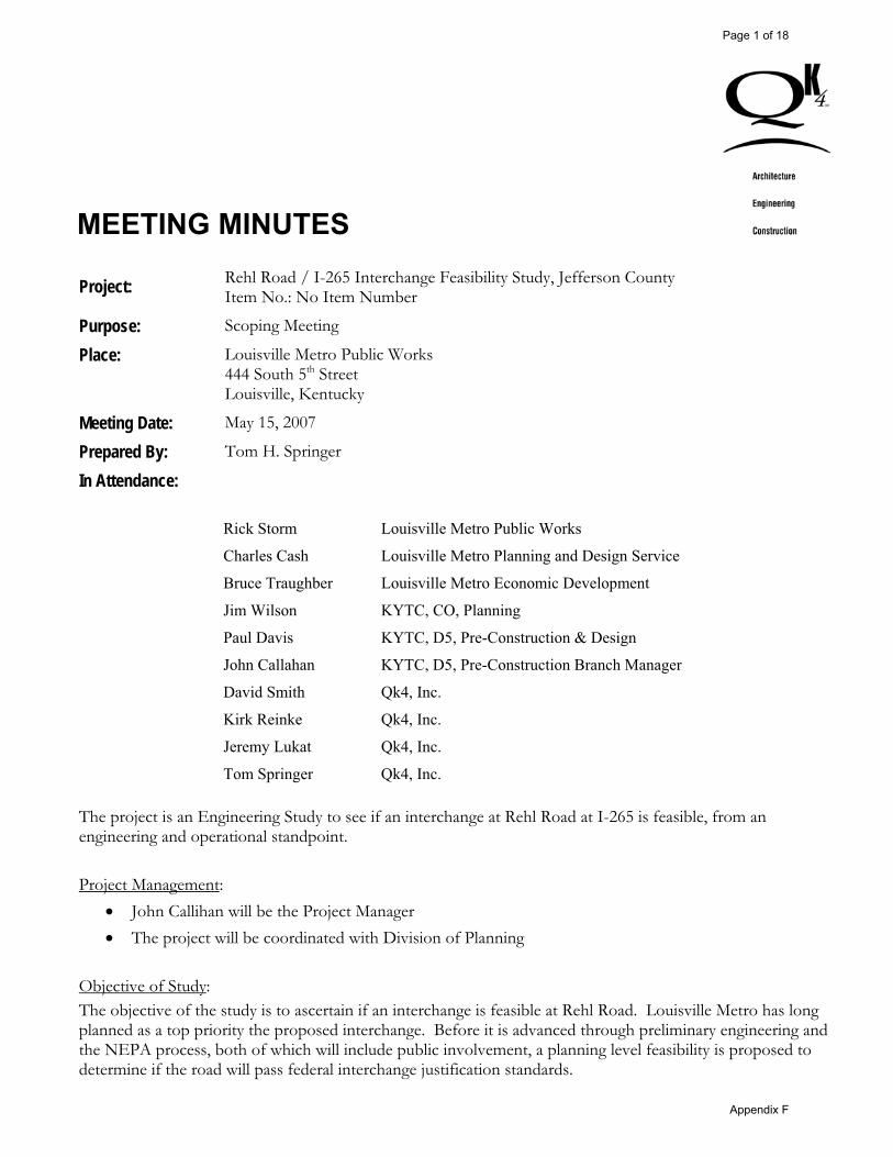
MEETING MINUTES
Project: Rehl Road / I-265 Interchange Feasibility Study, Jefferson County Item No.: No Item Number
Purpose: Scoping Meeting
Place: Louisville Metro Public Works 444 South 5th Street Louisville, Kentucky
Meeting Date: May 15, 2007
Prepared By: Tom H. Springer
In Attendance:
Rick Storm Louisville Metro Public Works
Charles Cash Louisville Metro Planning and Design Service
Bruce Traughber Louisville Metro Economic Development
Jim Wilson KYTC, CO, Planning
Paul Davis KYTC, D5, Pre-Construction & Design
John Callahan KYTC, D5, Pre-Construction Branch Manager
David Smith Qk4, Inc.
Kirk Reinke Qk4, Inc.
Jeremy Lukat Qk4, Inc.
Tom Springer Qk4, Inc.
The project is an Engineering Study to see if an interchange at Rehl Road at I-265 is feasible, from an engineering and operational standpoint. Project Management:
� John Callihan will be the Project Manager � The project will be coordinated with Division of Planning
Objective of Study: The objective of the study is to ascertain if an interchange is feasible at Rehl Road. Louisville Metro has long planned as a top priority the proposed interchange. Before it is advanced through preliminary engineering and the NEPA process, both of which will include public involvement, a planning level feasibility is proposed to determine if the road will pass federal interchange justification standards.
Page 1 of 18
Appendix F

Rehl Road / I-265 Interchange Feasibility Study May 15, 2007 Meeting Minutes Page 2 of 3
Project Objectives: The three main elements of the plan will be:
� Preliminary design concepts, which will include a stand alone interchange and if necessary one with collector/distributor lanes
� Cost estimates will include design, construction, right-of-way, and utility costs � Operational analyses will include the proposed interchange at Rehl Road, the interchange at Taylorsville
Road, and the interchange at I-64. It may also include US 60/I-265 and I-64/Blakenbaker Parkway, depending on coordination with FHWA.
Traffic:
� Qk4 and KYTC will coordinate with KIPDA to perform the traffic forecasts, including the directional splits.
� Qk4 will perform the operational analysis. � Qk4 will obtain crash data and perform a crash analysis. NOTE: On May 16, 2007, District-5 and Qk4 staff met with Bill Hanson with FHWA to discuss the proposed approach to this study. Specifically, KYTC has a number of near-term and ultimate improvements programmed and planned for the interchanges in the area, including I-265/I-64 and I-265/US 60. After discussing the area and these programmed improvements, it was decided to conduct the following traffic analyses: � Current Conditions � 2017 Build With Near-Term Improvements included in the model � 2037 Build With Ultimate Improvements included in the model. � 2037 No Build
Project Issues:
� I-265 in the study area has become an urban interstate. � The spacing between I-64 to the north and KY 155 to the south is almost exactly 2 miles. � Louisville has approved a 300+/- acres rezoning for a Planned Economic Center (PEC) known as the
Hollenbeck-Oakley property just west of the proposed interchange. The development will generate a significant number of trips. Louisville Metro will supply the traffic report prepared for the rezoning.
� The near-term and ultimate redesign of the I-64/I-265 interchange and the US 60/I-265 interchange will be taken into account.
� Qk4 and KTYC will coordinate with FHWA regarding which interchanges to include in the analysis. Obviously the I-265 interchange with I-64 and KY 155 will be included, but the US 60/I-265 and the Blakenbaker Parkway/I-64 interchange may also be included. NOTE: At the May 16, 2007 meeting with FHWA it was decided to include four existing interchanges (I-265/KY 155, I-265/I-64, I-265/US 60, and I-64/Blakenbaker Parkway) plus the proposed Rehl Road interchange for the future Build and No-Build scenarios.
� Both a stand-alone interchange and one with collector/distributor lanes will be considered if necessary.
Page 2 of 18
Appendix F

Rehl Road / I-265 Interchange Feasibility Study May 15, 2007 Meeting Minutes Page 3 of 3
� Termini to the east and west will include the nearest and most appropriate road. Rehl Road and the proposed extension of Plantside Drive (which was included in the rezoning for the Hollenbeck Oakley property) to the west, will be considered. To the east Rehl Road and South Pope Lick Road will be considered.
� It is desired by Louisville Metro to complete the analysis in time to be considered for inclusion in the Six-year Highway plan, which will be revised in the fall of 2007.
Other Tasks:
� The only element of an environmental overview that will be conducted is for historic resources by KYTC, Division of Environmental Analysis and District -5.
� No resource agency coordination, public involvement, or geotechnical analysis will be preformed.
End of Minutes
cc: attendants
Page 3 of 18
Appendix F

Page 4 of 18
Appendix F

MEETING MINUTES
Project: Rehl Road / I-265 Interchange Feasibility Study, Jefferson County Item No.: No Item Number
Purpose: Traffic Forecasting
KIPDA 11520 Commonwealth Drive Louisville, Kentucky 40299
Meeting Date: July 12, 2007
Prepared By: Tom H. Springer
In Attendance:
Harold Tull KIPDA
Randy Simon KIPDA
Andy Rush KIPDA
John Callahan KYTC, D5
Bruce Siria Qk4, Inc.
Jeremy Lukat Qk4, Inc.
Tom Springer Qk4, Inc.
Overview The project is an Engineering Study to see if an interchange at Rehl Road at I-265 is feasible, from an engineering and operational standpoint. The purpose of the meeting was to discuss specifics for the required traffic forecasts. On May 15, 2007 the initial scooping meeting was held at Metro Public Works. On May 16 a meeting was held with KYTC and FHWA to discuss the traffic forecasts necessary. Minutes from those meetings were circulated to the above-listed individuals to initiate the traffic request from KIDPA. After a review of the minutes, KIPDA hosted this meeting to discuss the project and further define the tasks needed to complete the traffic forecasts. NOTE: Since this July 12 meeting correspondence has been made with FHWA to answer some questions, as noted herein.
Page 5 of 18
Appendix F

Rehl Road / I-265 Interchange Feasibility Study July 12, 2007 Meeting Minutes Page 2 of 3
Project Schedule It was noted that in order to include the project into the revised Six-Year Highway Plan, information on the feasibility and costs estimates were needed by mid-September, and at the latest early-October. Traffic Counts It was agreed that existing and available traffic data would be used in lieu of conducting traffic counts. Because of the current changes in traffic patterns caused by the Restore 64 project in downtown Louisville, traffic counts conducted within the next few weeks would be skewed, and with the short schedule for this project, we would not have time to conduct reliable counts. However, if time permits and if necessary, counts could be conducted on surface streets. Interchanges to be Studied At the May 16, 2007 meeting with FHWA it was decided to include four existing interchanges (I-265/KY 155, I-265/I-64, I-265/US 60, and I-64/Blakenbaker Parkway) plus the proposed Rehl Road interchange for the future Build and No-Build scenarios. During the July 12 meeting it was questioned if the US60/I-265 interchange should be included. NOTE: Since the meeting John Callihan contacted FHWA and it has been agreed to remove the I-265/US 60 interchange from the Rehl Road Interchange traffic analysis. Time Horizons During the May 15 Scoping meeting and the May 16 meeting with FHWA it was decided to use the year 2017 as the near-term horizon. However, based on discussions with KIPDA during the July 12 meeting, it was agreed that year 2020 would be more practical since that is one of the horizon year used in their traffic model. The socioeconomic data has been forecasted for both 2012 and 2020, but not 2017. 2020 was selected because it was closer to 2017 and anticipating that the interchange would be open to traffic in 13 years rather than 10 years was not unreasonable. NOTE: Since the meeting John Callihan coordinated this change with FHWA who has concurred with switching they interim year to 2020. The long-term horizon year will remain 2037 and KIPDA will use the average annual growth rate for each forecasted road section to project to this time horizon. Assumptions There are several planned transportation projects in the study area. For the Rehl Road traffic forecasts, the following assumptions will be made:
� For 2020:
o At I-265/I-64 interchange, it will be assumed the flyover from I-265 northbound to I-64 westbound will be constructed. This design also includes the following improvements at the Blakenbaker exit from westbound I-64: two travel lanes on the ramp dual-lefts and dual-rights at Blakenbaker. The plan sheet for that design was provided to KIPDA.
o All other improvements in the MPO Long-Range Plan that are expected to be completed by 2020 will also be included in the 2020 traffic forecasts. Such improvements within proximity to the Rehl Road Interchange project include:
� Widening I-265 to six lanes
Page 6 of 18
Appendix F

Rehl Road / I-265 Interchange Feasibility Study July 12, 2007 Meeting Minutes Page 3 of 3
� Widening I-64 east of I-265 to six lanes
� Construction of the Urton Lane Extension between US 60 in the north and Chenoweth Run in the south
� Construction of the Plantside Drive extension through the Hollenback-Oakley property
� Construction of the I-64 interchange near Gilliland Road and the connector north to US 60 and south to KY 155/KY 148
o Socioeconomic Data:
� Because of the Floyds Fork Greenway Transportation Plan, Metro Planning recently produced forecasts of households, population, and employment based on alternative land use scenarios for the Floyds Fork area. Should these update be incorporated into the model, they will be coordinated with the Rehl Road study so that KIPDA uses the same socioeconomic assumptions for each of these studies.
� The Hollenback-Oakley property is 300+/- acres for a Planned Economic Center (PEC) just west of the proposed interchange. KIPDA will research whether or not Metro considered this in their recent socioeconomic updates. If KIPDA believes the development is not included, there will need to be a request to Metro Planning and Design Services to provide an alternate forecast for this TAZ. Qk4 will provide KIPDA with a copy of the traffic report prepared for the rezoning.
� For 2037:
o At I-265/I-64 it will be assumed four flyovers will be provided. Qk4 will provide the full design to KIDPA.
Rehl Road Interchange Design:
� Qk4 will provide KIPDA with interchange design concepts as soon as possible. Such concepts could include a stand-alone interchange or one with collector/distributor lanes. Without detailed traffic data, Qk4 will base this on available forecasts for the mainline of I-265 and weaving considerations.
End of Minutes
cc: attendants Jim Wilson, KYTC, Planning Aman Razavi, District-5
Page 7 of 18
Appendix F

Page 8 of 18
Appendix F

MEETING NOTES
Project: Rehl Road / I-265 Interchange Feasibility Study Ite u er N/A Purpose: Project Team Meeting #1, Place: Kentucky Transportation Cabinet (KYTC) District 5 Conference Room,
Louisville, Kentucky Meeting Date: May 5, 2008 9:30 am EST Prepared By: Doug Heberle In Attendance: John Callihan KYTC – D5
Jeff Schaefer KYTC – D5 Aman Razavi KYTC – D5 Robert Farley KYTC – CO Design Rick Storm Metro Public Works Dirk Gowin Metro Public Works Harold Tull KIPDA Andy Rush KIPDA Tom Springer Qk4 Darryl Renfrow Qk4 Jeremy Lukat Qk4 Doug Heberle Qk4
INTRODUCTIONS: Aman Razavi and John Callihan opened the Project Team Meeting by providing a brief background of the project and asking the attendees to introduce themselves. The proposed project is an interchange feasibility study which focuses on an interchange on I-265 with Rehl Road in eastern Jefferson County. An agenda and a folder containing other handouts were given to all the attendees.
STATUS OF STUDY: The presentation consists of a review of existing conditions, planned land uses, interchange design options, and projected traffic volumes. It is noted that the impetus for a new interchange is due largely in part to the Louisville Metro-planned Suburban Workplace Form District expansion east, from Blankenbaker Parkway to I-265, including the Hollenbeck-Oakley property which is a very significant proposed employment center. Tom Springer provided descriptions of the project study area and scope of work. The study will evaluate the build and no build alternatives to address both current and future (2020 and 2038) transportation needs. It was noted that the proposed interchange has been a priority project of Louisville Metro for many years.
EXISTING CONDITIONS: Tom Springer reviewed the handouts describing the existing conditions of the area consisting of project location, Highway Information System (HIS) data, environmental overview, crash data (2004-2006), network traffic and LOS. Tom also presented some photos of the study area, which illustrated the primary interchanges in the area that are of concern to the study: I-64 and Blankenbaker, I-265 and I-64, I-265 and Taylorsville Road, and I-265 and Rehl Road (proposed).
Page 9 of 18
Appendix F

Rehl Road Interchange Feasibility Study PTM # 1 Meeting Minutes Page 2
TRAFFIC STUDY ASSUMPTIONS:
For Year 2020:
� Flyover for northbound I-265 to westbound I-64 will be constructed
� Hollenbeck-Oakley Property will be 75% built out in both the Build and No-Build scenarios.
� Construction of a new interchange at I-64 and Gilliland Road
For Year 2038:
� The yearly growth rates of 0.0-3.0% were applied to the 2030 ADT projections. These were not applied to either the household or employment inputs to the KIPDA travel demand model.
� The socioeconomic projections used as input to the KIPDA model are only projected out to 2030, necessitating this alternative approach. Similarly, the latest model year network is 2030; therefore these 2038 projections were based on a 2030 network (i.e. a network that includes no new projects built between 2030 and 2038).
� Hollenbeck-Oakley property is to be 100% built out for the build scenario.
� Socioeconomic projections provided to KIPDA from Louisville Metro Planning & Design included two scenarios of adding 500 and 1500 employees respectively, to year 2030 total employment projections to the two Traffic Analysis Zones (TAZ’s) that comprise the study area. Considerable residential growth is expected east of I-265.
DISCUSSION POINTS:
� The build option features a compressed diamond interchange with collector/distributor (C/D) lanes. The C/D lanes are to be tied into the C/D lanes for the planned I-64/I-265 interchange rebuild. To the south, the C/D lanes would end north of KY 155 interchange. The modeled networks assumed three lanes in each direction for all scenarios.
� The traffic forecasts for the build and no build scenarios in the study areas for 2020 and 2038 did not exhibit significant differences.�The modeled highway network is projected to be severely congested in the 2030 model, and therefore the Build alternative may not show as much relief to the system as may have been expected. Further, the primarily residential development included in the 2030 model in the area east of I-265 may be conservative based on recent information made available since the last model update
� One area noted to experience a reduction in traffic volumes with the 2038 Build option, as compared to the Build Alternatives, is Blankenbaker Parkway south of I-64. This area is also a high-crash area.
� This project is included in the Jefferson County Thoroughfare Plan, the KIPDA long range plan, Horizon 2030, but it is not included in KIPDA’s current Transportation Improvement Program (TIP) or the KYTC Six-Year Highway Plan.
Page 10 of 18
Appendix F

� Concern was raised regarding the spacing between the I-64/I-265, I-265/Rehl Road, and the I-265/Taylorsville Road interchanges. Also, the ability to install effective signage was mentioned. The existing spacing is just over 2 miles.
� The preliminary construction cost estimates were approximately $20,000,000 in 2008 dollars.
� The only area of concern for the merger/diverge LOS analysis for the Build Alternative was the southbound entrance weaving movement from Rehl Road. This was projected to be a LOS E. It was requested that the design and planning level cost estimate be provided.
� It was noted that the Purpose and Need for the proposed interchange was primarily economic development, congestion, and safety.
� Before the project will be able to be approved, the 8 FHWA policy points will need to be met. The first of which is a demonstration that the existing interchanges and roadway network cannot be improved to meet the purpose and need of the project.
NEXT STEPS:
� A review of the other recent traffic studies that have been conducted in this study area is to be conducted to ensure the traffic assumptions are consistent.
� A meeting is to be held with Louisville Metro Economic Development to update them on the results of the study and the issues associated with getting approval for the new interchange.
� FHWA will be consulted to obtain federal guidance and recommendations.
END OF MEETING NOTES
File Id: 07403.000 \ Rehl Road File Name: PTM #1 5-05-08
Page 11 of 18
Appendix F

Page 12 of 18
Appendix F

MEETING NOTES
Project: Rehl Road / I-265 Interchange Feasibility Study Item Number N/A Purpose: Traffic Forecast Meeting Place: Kentucky Transportation Cabinet (KYTC) District 5 Conference Room,
Louisville, Kentucky Meeting Date: July 18, 2008 1:00 am EST Prepared By: Doug Heberle In Attendance: Aman Razavi KYTC – D5
Rick Storm Metro Public Works Dirk Gowin Metro Public Works Pat Johnson Metro Public Works Harold Tull KIPDA Andy Rush KIPDA Tom Springer Qk4 Doug Heberle Qk4
INTRODUCTIONS: Tom Springer opened the Traffic Forecast Review Meeting with introductions. The purpose of this meeting was to clarify the assumptions made by the Project Team that were utilized as inputs to the traffic forecast produced by KIPDA.
TRAFFIC STUDY ASSUMPTIONS: Current traffic assumptions were reviewed and the following remarks/recommendations were made:
• The internal streets will be removed as an input factor from the traffic model.
• The ramp analysis will be revised to prevent through traffic from circumventing mainline I-265 at the interchange by utilizing the Rehl Road ramps.
• It was noted that the transportation network of the study area is not a closed system; it is in fact part of the larger regional network. Some traffic volumes may appear unexpected due to the fact that traffic from the larger network traverses this study area.
• The weave movements south of the projected Rehl Road interchange appear questionable. The possibility of relocating the interchange to the north to possibly improve the weave movements was discussed.
Page 13 of 18
Appendix F

Rehl Road Interchange Feasibility Study PTM # 1 Meeting Minutes Page 2
• The current requirement of the 2038 traffic horizon year will be revisited.
• Metro Public Works will request the letter of need from Metro Economic Development.
END OF MEETING NOTES
Page 14 of 18
Appendix F

MEETING NOTESProject: Rehl Road / I-265 Interchange Feasibility Study Ite u er N/A Purpose: Project Team Meeting #2 Place: Kentucky Transportation Cabinet (KYTC) District 5 Conference Room,
Louisville, Kentucky Meeting Date: July 8, 2009 9:00 am EDT Prepared By: Doug Heberle In Attendance: Matt Bullock KYTC – D5
Brian Meade KYTC – D5 Jeff Schaefer KYTC – D5 Tala Quino KYTC – D5 Keith Downs KYTC – D5 Robert Farley KYTC – CO Design J. R. Ham KYTC – CO Planning Rick Storm Metro Public Works Dirk Gowin Metro Public Works Pat Johnson Metro Public Works Larry Chaney KIPDA Andy Rush KIPDA Tom Springer Qk4 David Smith Qk4 Doug Heberle Qk4
INTRODUCTIONS: Brian Meade opened the second Project Team Meeting by providing a brief background of the project and asking the attendees to introduce themselves. The proposed project is an interchange feasibility study which focuses on an interchange with Rehl Road on I-265 in eastern Jefferson County, between the existing I-265/I-64 and I-265/Taylorsville Road interchanges. An agenda and other handouts were provided to all the attendees.
STATUS OF STUDY: Tom Springer outlined the meeting agenda which began with a review of the first project team meeting on May 8, 2008. At that meeting, existing conditions and the proposed compressed diamond interchange configuration were reviewed, as well as the initial set of traffic forecasts, and the existing conditions.
At a follow up meeting in July 2008 revised traffic was provided by KIPDA. At this meeting it was decided that since a key element of the purpose and need is economic development, Louisville Metro would need to provide KIPDA with difference socioeconomic data (i.e., jobs and households) for the area for a Build and a No Build scenario.
Page 15 of 18
Appendix F

Rehl Road Interchange Feasibility Study PTM # 2 Meeting Minutes Page 2
DISCUSSION POINTS:
� NEPA requirements will most likely not be significant due to the lack of environmental issues or public controversy.
� This project is one of Louisville Metro’s highest priorities as evidenced by a supportive letter from the Metro Economic Development Department. This letter was included in the meeting handouts.
� In Cornerstone 2020, Louisville Metro identified the area as a Suburban Workforce. In the recent past sewer lines have been installed and the area has been rezoned for high intense development.
� The socioeconomic differences between build and no build scenarios from the traffic model were approximately 10,000 jobs.
� The question of rebuilding the existing area roadway system in lieu of constructing an interchange at Rehl Road was raised. The consensus is that the scope of such a project would depend on a sub-area traffic model to generate forecasts based on more exact land uses and the conditions of the local and collector roads in the area. This type of analysis is beyond the KIPDA Long-Range traffic model and the scope of this feasibility study. It was generally agreed that the already-identified projects in the study area would not be adequate to address the traffic needs at an acceptable level in lieu of an interchange. It was also discussed that an alternative to rebuild the existing roads and interchanges would have impacts and issues with historic sites (specifically at Blackacre State Nature Preserve and the Rural Tyler Settlement), and right-of-way, cost and community impacts.
� According to the KIPDA model, the majority of traffic is originating to the west (from downtown Louisville). This is due to the fact that the model is showing minimal residential areas east of I-265.
� The rebuilding of Rehl Road to the west of I-265 is the responsibility of the developer.
� Concern was raised regarding the spacing between the I-64/I-265, I-265/Rehl Road, and the I-265/Taylorsville Road interchanges. The existing spacing is just over 2 miles from the centers of the interchange (not from the ramp termini).
� Discussion was had regarding the planned I-265/I-64 interchange reconstruction, and what affect it would have on preliminary layout of the Rehl Road interchange. The schedule for construction of the I-265/I-64 interchange is unclear. The preliminary design concept of the Rehl Road interchange is made to be consistent with a full reconstruction of the I-265/I-64 interchange. Should the Rehl Road interchange be advanced before I-265 and the I-64 reconstruction, it is felt by the project engineers that the Rehl Road interchange could be redesigned to accommodate either a partial rebuild or no rebuild of the I-64/I-265 interchange.
Page 16 of 18
Appendix F

Rehl Road Interchange Feasibility Study PTM # 2 Meeting Minutes Page 3
� It was decided that this report on the feasibility of a Rehl Road/I-265 interchange be finalized with the identification of the issues that would be required to be addressed for this project if it is advanced further.
NEXT STEPS:
� A draft report will be submitted by Qk4 to KYTC that reflects the decisions make at this project team meeting.
END OF MEETING NOTES
Page 17 of 18
Appendix F

Page 18 of 18
Appendix F

APPENDIX G KIPDA LONG-RANGE
PLAN PROJECT STATUS SHEETS

WAT
TER
SON
TR
L
BLA
NK
ENB
AK
ER PK
WY
UV1819
TUCK
ER STATION RD
URTON LN
UV1819
UV913
BLA
NK
EN
BA
KER
PKW
Y
ELECTRON DR
PLANTSIDE DR
TUCK
ER STATION RD
S POPE LICK RD
§¦64
§¦265
§¦265
§¦64
£¤6
S ENG
LISH STA
TION
RD
POPLAR LN
BLUEGRASS PKWY
REHL RD
S POPE LICK RD
UV155
CH
ENO
WE
T H R
UN
RD
TAYLORSVILLE RD
OLD HEADY RD
§¦265
UV155
NEW
HO
PEWELL R
D
TAYLORSVILLE RD
EASUM RD
N PO
PE LIC
K R
D
TUC
KER
STATIO
N R
D
ELLINGSWORTH LN
BLA
NK
ENB
AK
ER R
D
TUC
KER
STA
TIO
N R
D
CA
MPU
S PL
AM
PER
E DR
BLANKENBAKER ACCESS DR
CHENOW
E
TH RUN RD
REHL RD
MA
REN
GO
DR
MO
SER
RD
Assumed to beConstructed by 2038
ProjectStudy Area
Assumed to beConstructed by 2020
PLANTSIDE DR
Full Fly-overRamp System
Widen to 6 Lanes
Fly-over Ramp
Widen to 6 Lanes
Widen to 5 Lanes
Urton Lane3-lane Raod
Widen to 6 Lanes
Widen to 6 Lanes
Urton Lane3-lane Raod
Blankenbaker ParkwayExtension
¯
Exhibit 6
KIPDA Long Range Plan
and TIP Projects
I-265/Rehl Rd Interchange
Not to Scale
TIP Projects assumed to be constructed by 2020LRP Projects assumed to be constructed by 2038
Page 1 of 12
Appendix G

I-265
Construct a new interchange on I-265 at Rehl Road.
Contact Agency: Lou. Metro PW State ID #: 0
1514
County : JeffersonProject Cost: $31,586,181Estimated Open to Public Year: 2012
Regional PriorityIncluded in AQ Analysis / Regionally Significant
Project will improve access to the rapidly developing area between I-64 and Billtown Road. The interchange will provide interstate access and relieve demand at the Taylorsville Road/I-265 interchange.
Bicycle AccomodationsPedestrian Accomodations
KIPDA
Project Purpose:
A M E N D M E N T
�
Description of Amendments
Add project to the Plan.2007 4
10A-159
Page 2 of 12
Appendix G

HORIZON 2030: Plan ProjectsNovember 2005
10-182
Project Type: OPERATIONS
Description: Reconstruct I-265 (Gene Snyder Freeway) interchange at I-64.
Purpose: The purpose of this project is to eliminate the clover-leaf interchange, increasecapacity, and reduce congestion.
Primary Contact Agency: Kentucky Transportation CabinetCounty: Jefferson State ID #: 21Project Cost: $85,500,000Estimated Open to Public Year: 2012
Regional Priority: NOIncluded in AQ Analysis/Regionally Significant: YESSubject to CMS Review: YESWithin 1/4 Mile or on a Freight Corridor: YESWithin 1/4 Mile or on a Bicycle & Pedestrian Priority Corridor: YESIncludes Bicycle Facilities: NO Includes Pedestrian Facilities: NO
I-265I-265I-265I-265I-265 KIPDA ID # 179 KIPDA ID # 179 KIPDA ID # 179 KIPDA ID # 179 KIPDA ID # 179
Page 3 of 12
Appendix G

HORIZON 2030: Plan ProjectsNovember 2005
10-183
Project Type: OPERATIONS
Description: Reconstruct I-265 (Gene Snyder Freeway) interchange at US 60 (ShelbyvilleRoad).
Purpose: This project will reduce traffic congestion and improve safety.
Primary Contact Agency: Kentucky Transportation CabinetCounty: Jefferson State ID #: 41Project Cost: $63,000,000Estimated Open to Public Year: 2010
Regional Priority: NOIncluded in AQ Analysis/Regionally Significant: YESSubject to CMS Review: NOWithin 1/4 Mile or on a Freight Corridor: YESWithin 1/4 Mile or on a Bicycle & Pedestrian Priority Corridor: YESIncludes Bicycle Facilities: NO Includes Pedestrian Facilities: NO
KIPDA ID # 197KIPDA ID # 197KIPDA ID # 197KIPDA ID # 197KIPDA ID # 197 I-265 I-265 I-265 I-265 I-265
Page 4 of 12
Appendix G

HORIZON 2030: Plan ProjectsNovember 2005
10-189
Project Type: ROADWAY CAPACITY
Description: Widen I-265 from 4 to 6 lanes from US 31E (Bardstown Road) to I-64.Approximately 8.0 miles.
Purpose: Increase capacity.
Primary Contact Agency: Kentucky Transportation CabinetCounty: Jefferson State ID #:Project Cost: $65,000,000Estimated Open to Public Year: 2020
Regional Priority: YESIncluded in AQ Analysis/Regionally Significant: YESSubject to CMS Review: YESWithin 1/4 Mile or on a Freight Corridor: YESWithin 1/4 Mile or on a Bicycle & Pedestrian Priority Corridor: YESIncludes Bicycle Facilities: NO Includes Pedestrian Facilities: NO
KIPDA ID # 959KIPDA ID # 959KIPDA ID # 959KIPDA ID # 959KIPDA ID # 959 I-265 I-265 I-265 I-265 I-265
Page 5 of 12
Appendix G

HORIZON 2030: Plan ProjectsNovember 2005
10-365
KIPDA ID # 458KIPDA ID # 458KIPDA ID # 458KIPDA ID # 458KIPDA ID # 458 Plantside Drive Plantside Drive Plantside Drive Plantside Drive Plantside Drive
Project Type: ROADWAY CAPACITY
Description: Extend Plantside Drive as a 3 lane collector road (3rd lane will be a center turnlane) from Tucker Station Road to Rehl Road.
Purpose: Extend Plantside Drive on new 3 lane alignment from Tucker Station Road to RehlRoad to address future travel needs.
Primary Contact Agency: Louisville Metro Public WorksCounty: Jefferson State ID #:Project Cost: $7,000,000Estimated Open to Public Year: 2010
Regional Priority: YESIncluded in AQ Analysis/Regionally Significant: YESSubject to CMS Review: YESWithin 1/4 Mile or on a Freight Corridor: NOWithin 1/4 Mile or on a Bicycle & Pedestrian Priority Corridor: NOIncludes Bicycle Facilities: YES Includes Pedestrian Facilities: YES
Page 6 of 12
Appendix G

HORIZON 2030: Plan ProjectsNovember 2005
10-370
Rehl RoadRehl RoadRehl RoadRehl RoadRehl Road KIPDA ID # 462 KIPDA ID # 462 KIPDA ID # 462 KIPDA ID # 462 KIPDA ID # 462
Project Type: OPERATIONS
Description: Reconstruct Rehl Road as a 2 lane road (no additional lanes) from KY 913(Blankenbaker Parkway) to S. Pope Lick Road.
Purpose: Rehl Road is an east-west corridor that intersects with Blankenbaker Lane on thewest and South Pope Lick Road and English Station Road on the east. At its junction with I-265,a new interchange is being proposed. Traffic volumes are expected to increase on Rehl Roadnearly 500% from 2009 to 2020.
Primary Contact Agency: Louisville Metro Public WorksCounty: Jefferson State ID #:Project Cost: $9,000,000Estimated Open to Public Year: 2015
Regional Priority: YESIncluded in AQ Analysis/Regionally Significant: NOSubject to CMS Review: NOWithin 1/4 Mile or on a Freight Corridor: YESWithin 1/4 Mile or on a Bicycle & Pedestrian Priority Corridor: YESIncludes Bicycle Facilities: NO Includes Pedestrian Facilities: NO
Page 7 of 12
Appendix G

HORIZON 2030: Plan ProjectsNovember 2005
10-400
Project Type: OPERATIONS
Description: Reconstruct Tucker Station Road as a 2 lane road (no additional lanes) from RehlRoad to Ellingsworth Lane & improve intersections (S. Pope Lick, Rehl Road & EllingsworthLane).
Purpose: Tucker Station Road is a narrow 2 lane collector extending from U. S. 60 to KY 155(Taylorsville Road). It is the only non-interstate route which crosses I-64 between Blankenbakerand English Station roads. With planned development in the Urton Lane corridor, it should beable to relieve some traffic demand if an Urton Lane-Tucker Station Road-Ellingsworth Roadconnection is made. It would serve increased development south of I-64 near Rehl Road as well.
Primary Contact Agency: Louisville Metro Public WorksCounty: Jefferson State ID #:Project Cost: $9,000,000Estimated Open to Public Year: 2020
Regional Priority: YESIncluded in AQ Analysis/Regionally Significant: NOSubject to CMS Review: NOWithin 1/4 Mile or on a Freight Corridor: YESWithin 1/4 Mile or on a Bicycle & Pedestrian Priority Corridor: NOIncludes Bicycle Facilities: NO Includes Pedestrian Facilities: NO
Tucker Station RoadTucker Station RoadTucker Station RoadTucker Station RoadTucker Station Road KIPDA ID # 472 KIPDA ID # 472 KIPDA ID # 472 KIPDA ID # 472 KIPDA ID # 472
Page 8 of 12
Appendix G

HORIZON 2030: Plan ProjectsNovember 2005
10-404
Urton Lane Corridor StudyUrton Lane Corridor StudyUrton Lane Corridor StudyUrton Lane Corridor StudyUrton Lane Corridor Study KIPDA ID # 473 KIPDA ID # 473 KIPDA ID # 473 KIPDA ID # 473 KIPDA ID # 473
Project Type: STUDY
Description: Urton Lane Corridor Study from US 60 (Shelbyville Road) to north or south of I-64or further south to KY 1065 (Seatonville Road). Implement recommendations for corridor studybeginning with protective ROW purchase.
Purpose: Urton Lane begins on the north at the US 60 - English Station Road intersection inMiddletown, north of I-64. Several developments are currently planned between US 60 and I-64along the route. Currently Urton Lane is a narrow 2 lane facility with poor geometrics. By extendingUrton Lane south of I-64, traffic from the proposed developments could access BlankenbakerRoad/I-64 via Rehl Road and I-265 via KY 155 (Taylorsville Road). An Urton Lane extension toSeatonville Road would open hundreds of acres to development and provide a parallel route to I-265 which could be used to divert incident related traffic.
Primary Contact Agency: Louisville Metro Public WorksCounty: Jefferson State ID #:Project Cost: $850,000Estimated Open to Public Year: 2020
Regional Priority: NOIncluded in AQ Analysis/Regionally Significant: NOSubject to CMS Review: NOWithin 1/4 Mile or on a Freight Corridor: YESWithin 1/4 Mile or on a Bicycle & Pedestrian Priority Corridor: YESIncludes Bicycle Facilities: N/A Includes Pedestrian Facilities: N/A
Page 9 of 12
Appendix G

HORIZON 2030: Plan ProjectsNovember 2005
10-405
KIPDA ID # 474KIPDA ID # 474KIPDA ID # 474KIPDA ID # 474KIPDA ID # 474 Urton Lane Urton Lane Urton Lane Urton Lane Urton Lane
Project Type: ROADWAY CAPACITY
Description: Extend & widen Urton Lane from 2 to 3 lanes (3rd lane will be a center turn lane)from north of I-64 to Seatonville Road.
Purpose: Urton Lane begins on the north at the US 60 - English Station Road intersection inMiddletown, north of I-64. Several developments are planned between US 60 and I-64 along theroute. Currently Urton Lane is a narrow 2 lane facility with poor geometrics. By extending UrtonLane south of I-64, traffic from the proposed developments could access Blankenbaker Road/I-64 via Rehl Road and I-265 via KY 155 (Taylorsville Road). An Urton Lane extension from northof I-64 to Seatonville Road would open hundreds of acres to development and provide a parallelroute to I-265 which could be used to divert incident related traffic.
Primary Contact Agency: Louisville Metro Public WorksCounty: Jefferson State ID #:Project Cost: $31,500,000Estimated Open to Public Year: 2020
Regional Priority: YESIncluded in AQ Analysis/Regionally Significant: YESSubject to CMS Review: YESWithin 1/4 Mile or on a Freight Corridor: YESWithin 1/4 Mile or on a Bicycle & Pedestrian Priority Corridor: YESIncludes Bicycle Facilities: NO Includes Pedestrian Facilities: NO
Page 10 of 12
Appendix G

HORIZON 2030: Plan ProjectsNovember 2005
10-276
KY 913 (Blankenbaker Parkway)KY 913 (Blankenbaker Parkway)KY 913 (Blankenbaker Parkway)KY 913 (Blankenbaker Parkway)KY 913 (Blankenbaker Parkway) KIPDA ID # 220 KIPDA ID # 220 KIPDA ID # 220 KIPDA ID # 220 KIPDA ID # 220
Project Type: ROADWAY CAPACITY
Description: Extend KY 913 (Blankenbaker Parkway) as 5 lane road from Blankenbaker AccessRoad to KY 155 (Taylorsville Road).
Purpose: Extend Blankenbaker to provide access to KY 155 (Taylorsville Road).
Primary Contact Agency: Kentucky Transportation CabinetCounty: Jefferson State ID #: 401Project Cost: $5,446,000Estimated Open to Public Year: 2010
Regional Priority: NOIncluded in AQ Analysis/Regionally Significant: YESSubject to CMS Review: NOWithin 1/4 Mile or on a Freight Corridor: NOWithin 1/4 Mile or on a Bicycle & Pedestrian Priority Corridor: NOIncludes Bicycle Facilities: NO Includes Pedestrian Facilities: YES
Page 11 of 12
Appendix G

HORIZON 2030: Plan ProjectsNovember 2005
10-135
KIPDA ID # 390KIPDA ID # 390KIPDA ID # 390KIPDA ID # 390KIPDA ID # 390 I-64 I-64 I-64 I-64 I-64
Project Type: ROADWAY CAPACITY
Description: New interchange & connector road from KY 148 to US 60 (Shelbyville Road)with interchange on I-64. Corridor would be in vicinity of Gilliland Road.
Purpose: Provide access to I-64 and KY 1848 in Shelby County.
Primary Contact Agency: Kentucky Transportation CabinetCounty: Jefferson State ID #:Project Cost: $25,000,000Estimated Open to Public Year: 2015
Regional Priority: NOIncluded in AQ Analysis/Regionally Significant: YESSubject to CMS Review: YESWithin 1/4 Mile or on a Freight Corridor: YESWithin 1/4 Mile or on a Bicycle & Pedestrian Priority Corridor: NOIncludes Bicycle Facilities: NO Includes Pedestrian Facilities: NO
Page 12 of 12
Appendix G

APPENDIX H COST ESTIMATES

Estimate 5-41.00Estimated Cost: $38,518,392.47
Contingency: 20.00%
Estimated Total: $46,222,070.96
REHL ROAD INTERCHANGE
County: JEFFERSON
Season: FALL
Urban/Rural Type: URBAN
Highway Type: INTERSTATE
Work Type: GRADE & DRAIN WITH BRIDGE
Unit System: E
Spec Year: 04
Letting Date: 09/04/09
Prepared by RJC on 07/08/08Checked by DBR on 07/08/08
Page 1 of 8
Appendix H

Line # Item Number Quantity Units Unit Price Extension
Estimate: 5-41.00
DescriptionSupplemental Description
Group 0001: PAVING0006 00219 40,491.00 TON $54.00 $2,186,514.00
CL4 ASPH BASE 1.00D PG76-220009 00335 20,245.00 TON $62.00 $1,255,190.00
CL4 ASPH SURF 0.50A PG76-220010 00217 69,501.00 TON $51.00 $3,544,551.00
CL4 ASPH BASE 1.00D PG64-220012 00018 78,732.00 TON $46.00 $3,621,672.00
DRAINAGE BLANKET-TYPE II-ASPH0013 00001 72,433.00 TON $16.50 $1,195,144.50
DGA BASE0014 00358 126.00 TON $640.00 $80,640.00
ASPHALT CURING SEAL0016 00337 16,871.00 TON $63.00 $1,062,873.00
CL4 ASPH SURF 0.38B PG76-220019 01810 2,710.00 LF $19.98 $54,145.80
STANDARD CURB AND GUTTER
Regression price 01810 Active: Y Unit Price: $19.980179 02720 1,360.00 SQYD $52.65 $71,604.00
SIDEWALK-4 INCH CONCRETE
Regression price 02720 Active: Y Unit Price: $52.650180 03287 8.00 EACH $1,633.80 $13,070.40
SIDEWALK RAMP TYPE 1
Unit Price: $1,633.80Active: YAverage price 03287
Total for Group 0001: $13,085,404.70
Group 0002: ROADWAY0058 01000 38,100.00 LF $7.90 $300,990.00
PERFORATED PIPE-4 INCH
Regression price 01000 Active: Y Unit Price: $7.900060 01010 1,020.00 LF $12.19 $12,433.80
NON-PERFORATED PIPE-4 INCH
Regression price 01010 Active: Y Unit Price: $12.190063 01020 32.00 EACH $379.91 $12,157.12
PERF PIPE HEADWALL TY 1-4 INCH0066 01032 30.00 EACH $429.24 $12,877.20
PERF PIPE HEADWALL TY 4-4 INCH
Regression price 01032 Active: Y Unit Price: $429.240068 01310 48.00 LF $11.84 $568.32
REMOVE PIPE
Regression price 01310 Active: Y Unit Price: $11.840069 01740 50.00 EACH $113.48 $5,674.00
CORED HOLE DRAINAGE BOX CON-4 INCH
Regression price 01740 Active: Y Unit Price: $113.48
Page 2 of 7 8:56:28AMWednesday, August 05, 2009
Page 2 of 8
Appendix H
Line # Item Number Quantity Units Unit Price Extension
Estimate: 5-41.00
DescriptionSupplemental Description
0078 02200 301,000.00 CUYD $12.97 $3,903,970.00ROADWAY EXCAVATION
Regression price 02200 Active: Y Unit Price: $12.970085 02351 12,500.00 LF $19.85 $248,125.00
GUARDRAIL-STEEL W BEAM-S FACE
Regression price 02351 Active: Y Unit Price: $19.850090 02367 16.00 EACH $2,700.00 $43,200.00
GUARDRAIL END TREATMENT TYPE 10092 02369 12.00 EACH $525.45 $6,305.40
GUARDRAIL END TREATMENT TYPE 2A
Regression price 02369 Active: Y Unit Price: $525.450093 02381 2,100.00 LF $1.66 $3,486.00
REMOVE GUARDRAIL
Regression price 02381 Active: Y Unit Price: $1.660095 02363 6.00 EACH $2,116.29 $12,697.74
GUARDRAIL CONNECTOR TO BRIDGE END TY A
Unit Price: $2,116.29Active: YAverage price 023630096 02387 6.00 EACH $344.88 $2,069.28
GUARDRAIL CONNECTOR TO BRIDGE END TY A-10101 02484 2,450.00 TON $27.20 $66,640.00
CHANNEL LINING CLASS III
Regression price 02484 Active: Y Unit Price: $27.200102 02545 1.00 LS $280,000.00 $280,000.00
CLEARING AND GRUBBING0104 02562 1.00 LS $610,000.00 $610,000.00
SIGNS0107 02596 2,200.00 SQYD $1.70 $3,740.00
FABRIC-GEOTEXTILE TYPE I
Regression price 02596 Active: Y Unit Price: $1.700108 02599 3,100.00 SQYD $2.60 $8,060.00
FABRIC-GEOTEXTILE TYPE IV
Regression price 02599 Active: Y Unit Price: $2.600109 02650 1.00 LS $550,000.00 $550,000.00
MAINTAIN & CONTROL TRAFFIC0110 02653 20.00 EACH $2,583.54 $51,670.80
LANE CLOSURE0111 02671 4.00 EACH $6,179.41 $24,717.64
VAR MESSAGE SIGN-PORT 3 LINE0114 02701 12,000.00 LF $2.21 $26,520.00
TEMPORARY SILT FENCE
Regression price 02701 Active: Y Unit Price: $2.210115 02703 216.00 EACH $105.07 $22,695.12
SILT TRAP TYPE A
Page 3 of 7 8:56:28AMWednesday, August 05, 2009
Page 3 of 8
Appendix H

Line # Item Number Quantity Units Unit Price Extension
Estimate: 5-41.00
DescriptionSupplemental Description
Regression price 02703 Active: Y Unit Price: $105.070116 02704 216.00 EACH $258.22 $55,775.52
SILT TRAP TYPE B
Regression price 02704 Active: Y Unit Price: $258.220117 02706 1,296.00 EACH $55.77 $72,277.92
CLEAN SILT TRAP TYPE A0119 02707 1,296.00 EACH $35.99 $46,643.04
CLEAN SILT TRAP TYPE B0120 20496NS843 73.00 EACH $18.00 $1,314.00
SILT TRAP TYPE C0121 20497NS843 292.00 EACH $108.00 $31,536.00
CLEAN SILT TRAP TYPE C0122 02625 12.00 EACH $336.97 $4,043.64
REMOVE HEADWALL
Regression price 02625 Active: Y Unit Price: $336.970123 02709 72,000.00 LF $0.24 $17,280.00
CLEAN TEMPORARY SILT FENCE
Regression price 02709 Active: Y Unit Price: $0.240124 02726 1.00 LS $400,000.00 $400,000.00
STAKING0126 02731 1.00 LS $120,000.00 $120,000.00
REMOVE STRUCTURE A0128 02775 4.00 EACH $2,224.34 $8,897.36
FLASHING ARROW
Unit Price: $2,224.34Active: YAverage price 027750133 05950 15,000.00 SQYD $1.76 $26,400.00
EROSION CONTROL BLANKET
Regression price 05950 Active: Y Unit Price: $1.760134 05952 315,000.00 SQYD $0.15 $47,250.00
TEMPORARY MULCH
Regression price 05952 Active: Y Unit Price: $0.150135 05953 232,500.00 SQYD $0.16 $37,200.00
TEMP SEEDING AND PROTECTION
Regression price 05953 Active: Y Unit Price: $0.160136 05966 12.00 TON $609.49 $7,313.88
TOPDRESSING FERTILIZER
Regression price 05966 Active: Y Unit Price: $609.490137 05985 232,500.00 SQYD $0.31 $72,075.00
SEEDING AND PROTECTION
Regression price 05985 Active: Y Unit Price: $0.310138 05989 45,000.00 SQYD $0.20 $9,000.00
SPECIAL SEEDING CROWN VETCH
Page 4 of 7 8:56:28AMWednesday, August 05, 2009
Page 4 of 8
Appendix H

Line # Item Number Quantity Units Unit Price Extension
Estimate: 5-41.00
DescriptionSupplemental Description
Regression price 05989 Active: Y Unit Price: $0.200145 06510 4,500.00 LF $0.71 $3,195.00
PAVE STRIPING-TEMP PAINT-4 IN
Regression price 06510 Active: Y Unit Price: $0.710146 86,800.00 LF $24.03 $2,085,804.00
PAVE STRIPING-PERM PAINT-6-IN-W-Y0147 06546 3,600.00 LF $2.08 $7,488.00
PAVE STRIPING-THERMO-12 INCH W
Regression price 06546 Active: Y Unit Price: $2.080148 06591 38.00 EACH $24.03 $913.14
PAVEMENT MARKER TYPE V-BY0150 06589 860.00 EACH $20.82 $17,905.20
PAVEMENT MARKER TYPE V-MW0151 06592 80.00 EACH $20.82 $1,665.60
PAVEMENT MARKER TYPE V-B W/R
Regression price 06592 Active: Y Unit Price: $20.820152 06593 725.00 EACH $19.68 $14,268.00
PAVEMENT MARKER TYPE V-B Y/R
Regression price 06593 Active: Y Unit Price: $19.680155 08100 7.00 CUYD $1,142.86 $8,000.02
CONCRETE-CLASS A
Regression price 08100 Active: Y Unit Price: $1,142.860183 21383ES507 14,500.00 LF $275.00 $3,987,500.00
CONC MEDIAN BARRIER TY 14C2(50)0184 02585 210.00 LF $75.68 $15,892.80
EDGE KEY
Regression price 02585 Active: Y Unit Price: $75.68
Total for Group 0002: $13,308,235.54
Group 0003: DRAINAGE0021 00462 3,270.00 LF $48.69 $159,216.30
CULVERT PIPE-18 INCH
Regression price 00462 Active: Y Unit Price: $48.690022 00464 440.00 LF $73.61 $32,388.40
CULVERT PIPE-24 INCH
Regression price 00464 Active: Y Unit Price: $73.610027 00441 120.00 LF $57.74 $6,928.80
ENTRANCE PIPE-18 INCH
Regression price 00441 Active: Y Unit Price: $57.740030 00522 7,600.00 L.F. $46.50 $353,400.00
18 INCH STORM SEWER
Page 5 of 7 8:56:28AMWednesday, August 05, 2009
Page 5 of 8
Appendix H

Line # Item Number Quantity Units Unit Price Extension
Estimate: 5-41.00
DescriptionSupplemental Description
0031 00524 4,200.00 L.F. $62.00 $260,400.0024 INCH STORM SEWER
0032 01371 8.00 EACH $1,264.45 $10,115.60METAL END SECTION TY 1-18 INCH
Unit Price: $1,264.45Active: YAverage price 013710033 00466 450.00 LF $61.20 $27,540.00
CULVERT PIPE-30 INCH
Regression price 00466 Active: Y Unit Price: $61.200034 00469 240.00 LF $138.81 $33,314.40
CULVERT PIPE-42 INCH
Regression price 00469 Active: Y Unit Price: $138.810035 01391 10.00 EACH $743.60 $7,436.00
METAL END SECTION TY 3-18 INCH
Unit Price: $743.60Active: YAverage price 013910036 01456 10.00 EACH $3,586.90 $35,869.00
CURB BOX INLET TYPE A
Unit Price: $3,586.90Active: YAverage price 014560037 01394 4.00 EACH $2,198.76 $8,795.04
METAL END SECTION TY 3-30 INCH
Unit Price: $2,198.76Active: YAverage price 013940038 01490 5.00 EACH $2,572.92 $12,864.60
DROP BOX INLET TYPE 1
Regression price 01490 Active: Y Unit Price: $2,572.920039 01614 10.00 EACH $7,100.00 $71,000.00
CONC MED BARR BOX INLET TY 14A20040 01480 8.00 EACH $3,109.44 $24,875.52
CURB BOX INLET TYPE B0042 01642 3.00 EACH $1,665.74 $4,997.22
JUNCTION BOX-18 INCH
Unit Price: $1,665.74Active: YAverage price 016420043 01644 2.00 EACH $2,450.00 $4,900.00
JUNCTION BOX-30 INCH0044 02159 12,000.00 LF $0.50 $6,000.00
TEMPORARY DITCH
Regression price 02159 Active: Y Unit Price: $0.500045 72,000.00 EACH $0.01 $720.00
CLEAN TEMPORARY DITCH0046 21261ED 18,000.00 SQYD $6.10 $109,800.00
TURF REINFORCEMENT MAT0049 01646 1.00 EACH $2,304.59 $2,304.59
JUNCTION BOX-42 INCH
Regression price 01646 Active: Y Unit Price: $2,304.590050 01615 40.00 EACH $7,300.00 $292,000.00
Page 6 of 7 8:56:28AMWednesday, August 05, 2009
Page 6 of 8
Appendix H

Line # Item Number Quantity Units Unit Price Extension
Estimate: 5-41.00
DescriptionSupplemental Description
CONC MED BARR BOX INLET TY 14B20056 08150 250.00 LB $2.00 $500.00
STEEL REINFORCEMENTTotal for Group 0003: $1,465,365.47
Group 0004: BRIDGE0156 1.00 LS $525,700.00 $525,700.00
14 x 6 x 250 RCBC0157 1.00 LS $1,850,000.00 $1,850,000.00
34 X 13 X 400 CONC ARCH0177 1.00 LS $2,353,000.00 $2,353,000.00
BRIDGE OVER I-2650190 1.00 L.S. $2,574,000.00 $2,574,000.00
BRIDGE OVER RAILROAD0191 1.00 L.S. $1,698,000.00 $1,698,000.00
BRIDGE OVER TAYLORSVILLE ROADTotal for Group 0004: $9,000,700.00
Group 0019: DEMOBILIZATION &/OR MOBILIZATION0181 02568 1.00 LS $1,105,791.17 $1,105,791.17
MOBILIZATION
Unit Price: $1,105,791.17Active: YReference Price 0182 02569 1.00 LS $552,895.59 $552,895.59
DEMOBILIZATION
Unit Price: $552,895.59Active: YReference Price
Total for Group 0019: $1,658,686.76
Page 7 of 7 8:56:28AMWednesday, August 05, 2009
Page 7 of 8
Appendix H

Page 8 of 8
Appendix H
Top Related