


Languages
Pages
Legal


MSL 301, Lesson 3a: Land Navigation I
Introduction to Map Reading
MSL 301
Rev. 15 Apr 2005
MSL 301, Lesson 3a: Land Navigation I
Slide 3 of 57
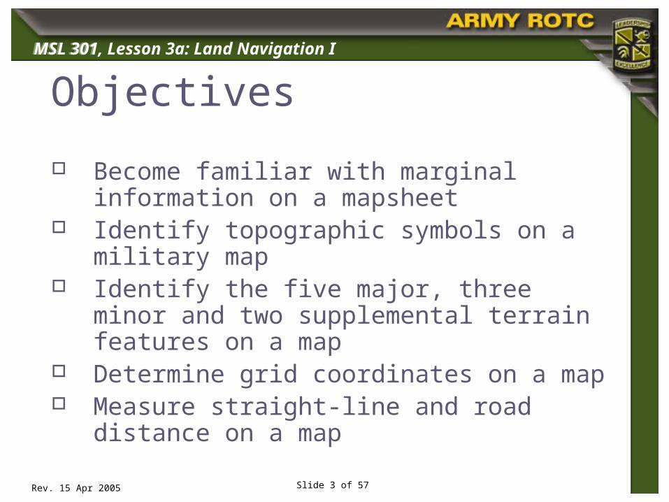
Objectives
Become familiar with marginal information on a mapsheet
Identify topographic symbols on a military map
Identify the five major, three minor and two supplemental terrain features on a map
Determine grid coordinates on a map Measure straight-line and road distance on
a map
MSL 301
Rev. 15 Apr 2005
MSL 301, Lesson 3a: Land Navigation I
Slide 4 of 57
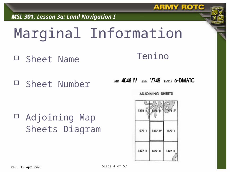
Marginal Information
Sheet Name
Sheet Number
Adjoining Map Sheets Diagram
Tenino
MSL 301
Rev. 15 Apr 2005
MSL 301, Lesson 3a: Land Navigation I
Slide 5 of 57
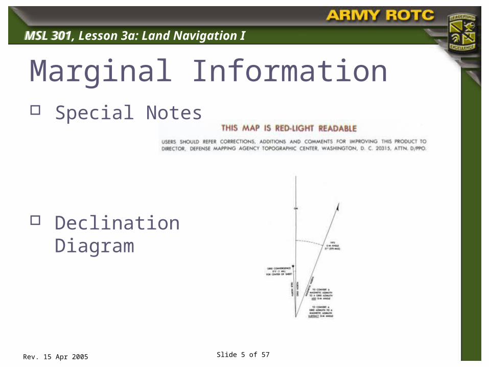
Marginal Information Special Notes
Declination Diagram

MSL 301
Rev. 15 Apr 2005
MSL 301, Lesson 3a: Land Navigation I
Slide 6 of 57
Marginal Information Scales
Contour Interval Notes
Grid Reference Box

MSL 301
Rev. 15 Apr 2005
MSL 301, Lesson 3a: Land Navigation I
Slide 7 of 57
Marginal Information Unit Imprint
Legend

MSL 301
Rev. 15 Apr 2005
MSL 301, Lesson 3a: Land Navigation I
Slide 8 of 57
Topographic Symbols

MSL 301
Rev. 15 Apr 2005
MSL 301, Lesson 3a: Land Navigation I
Slide 9 of 57
Colors used on a Military Map Black: Man-made features
Blue: Water features
Brown: Relief features and elevation on older or red-light
readable maps
Green: Vegetation
Red: Man-made features
Red-Brown: Cultural features and non-surveyed spot
elevations
Other: Occasionally other colors may be used to show
special information and if used will be noted in the marginal
information.

MSL 301
Rev. 15 Apr 2005
MSL 301, Lesson 3a: Land Navigation I
Slide 10 of 57
Topographic Symbols: Black
MSL 301
Rev. 15 Apr 2005
MSL 301, Lesson 3a: Land Navigation I
Slide 11 of 57
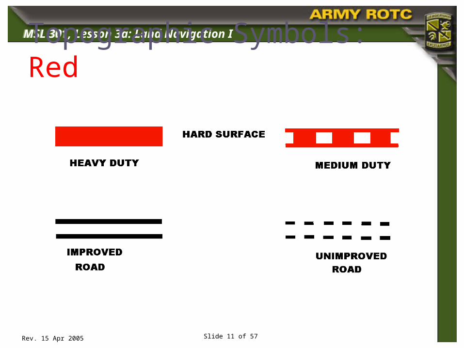
Topographic Symbols: Red

MSL 301
Rev. 15 Apr 2005
MSL 301, Lesson 3a: Land Navigation I
Slide 12 of 57
Topographic Symbols: Blue

MSL 301
Rev. 15 Apr 2005
MSL 301, Lesson 3a: Land Navigation I
Slide 13 of 57
Topographic Symbols: Green
MSL 301
Rev. 15 Apr 2005
MSL 301, Lesson 3a: Land Navigation I
Slide 14 of 57
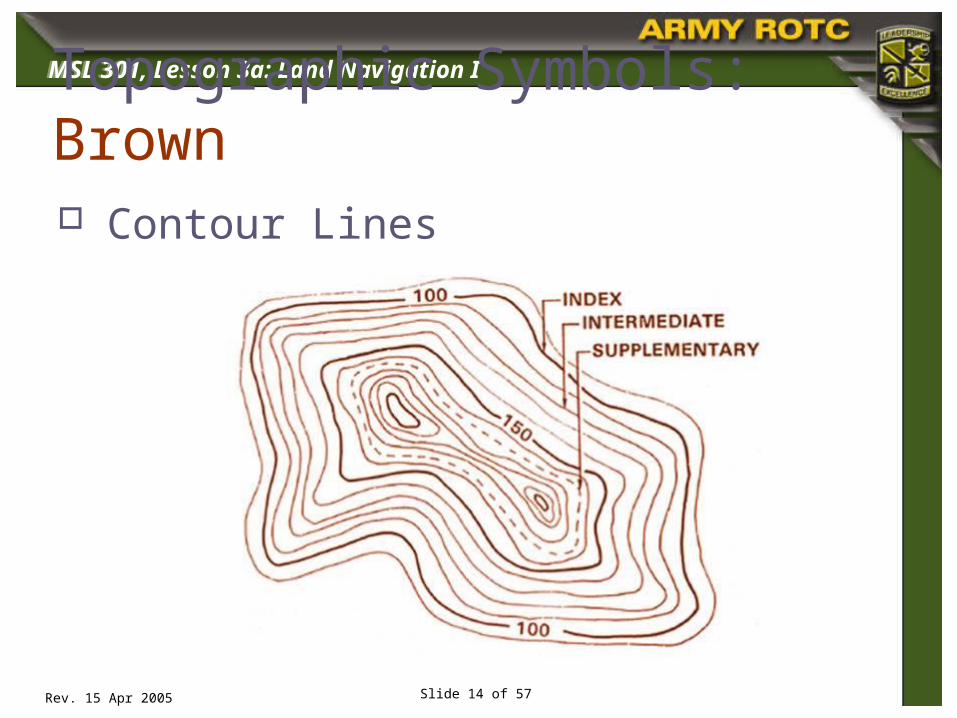
Topographic Symbols: Brown Contour Lines

MSL 301
Rev. 15 Apr 2005
MSL 301, Lesson 3a: Land Navigation I
Slide 15 of 57
Terrain Features
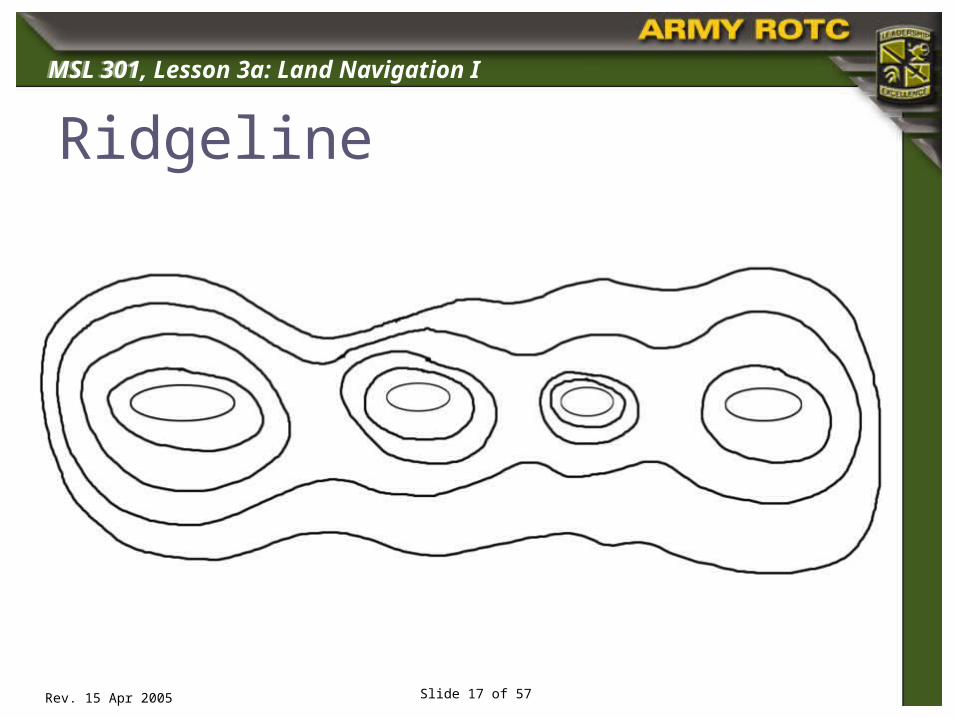
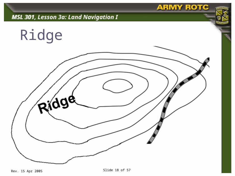
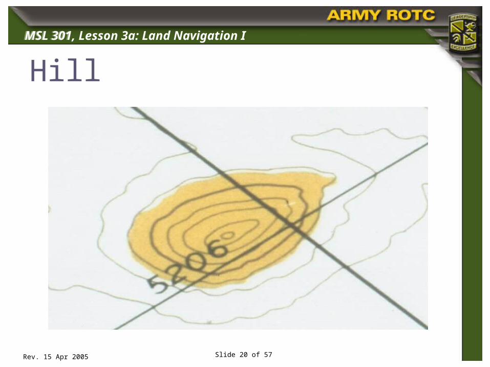
Five Major Ridge Hill Saddle Valley Depression
Three Minor Draw Spur Cliff
Two Supplemental Cut Fill

MSL 301
Rev. 15 Apr 2005
MSL 301, Lesson 3a: Land Navigation I
Slide 16 of 57
Ridgeline
MSL 301
Rev. 15 Apr 2005
MSL 301, Lesson 3a: Land Navigation I
Slide 17 of 57
Ridgeline
MSL 301
Rev. 15 Apr 2005
MSL 301, Lesson 3a: Land Navigation I
Slide 18 of 57
Ridge

MSL 301
Rev. 15 Apr 2005
MSL 301, Lesson 3a: Land Navigation I
Slide 19 of 57
Ridge
MSL 301
Rev. 15 Apr 2005
MSL 301, Lesson 3a: Land Navigation I
Slide 20 of 57
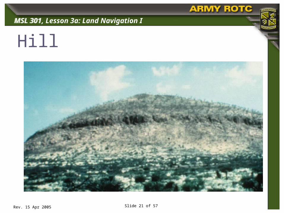
Hill
MSL 301
Rev. 15 Apr 2005
MSL 301, Lesson 3a: Land Navigation I
Slide 21 of 57
Hill

MSL 301
Rev. 15 Apr 2005
MSL 301, Lesson 3a: Land Navigation I
Slide 22 of 57
Saddle

MSL 301
Rev. 15 Apr 2005
MSL 301, Lesson 3a: Land Navigation I
Slide 23 of 57
Saddle

MSL 301
Rev. 15 Apr 2005
MSL 301, Lesson 3a: Land Navigation I
Slide 24 of 57
Valley

MSL 301
Rev. 15 Apr 2005
MSL 301, Lesson 3a: Land Navigation I
Slide 25 of 57
Valley
MSL 301
Rev. 15 Apr 2005
MSL 301, Lesson 3a: Land Navigation I
Slide 26 of 57
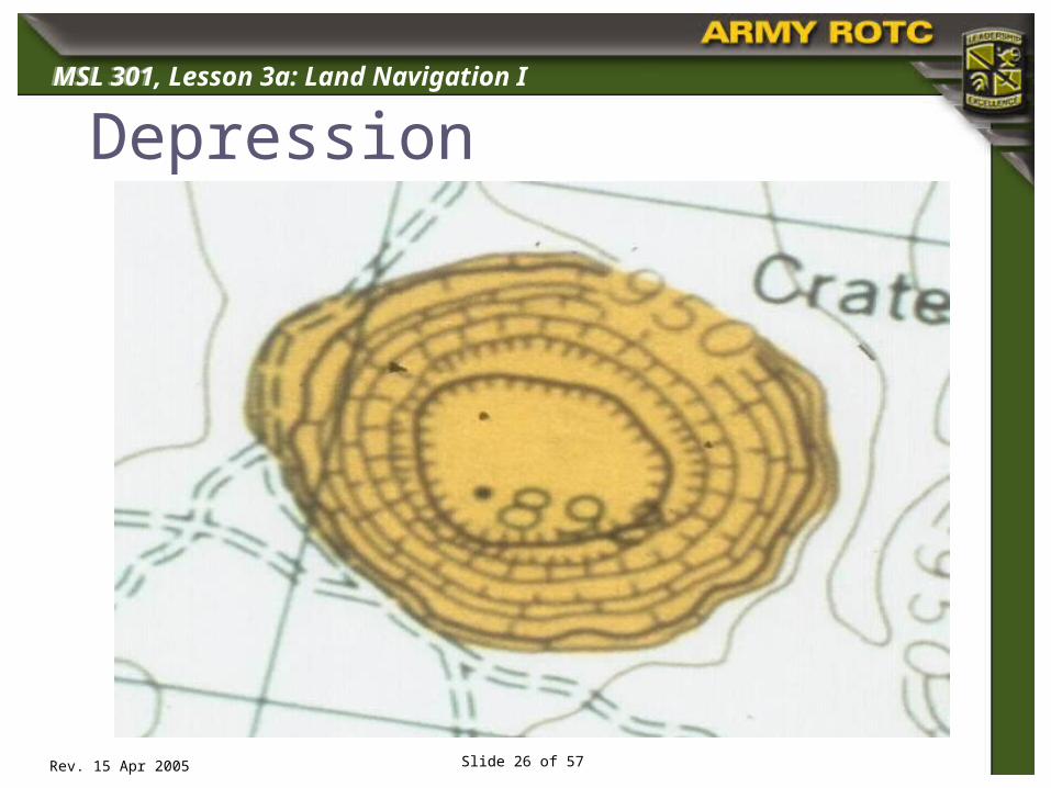
Depression

MSL 301
Rev. 15 Apr 2005
MSL 301, Lesson 3a: Land Navigation I
Slide 27 of 57
Depression

MSL 301
Rev. 15 Apr 2005
MSL 301, Lesson 3a: Land Navigation I
Slide 28 of 57
Spur
MSL 301
Rev. 15 Apr 2005
MSL 301, Lesson 3a: Land Navigation I
Slide 29 of 57
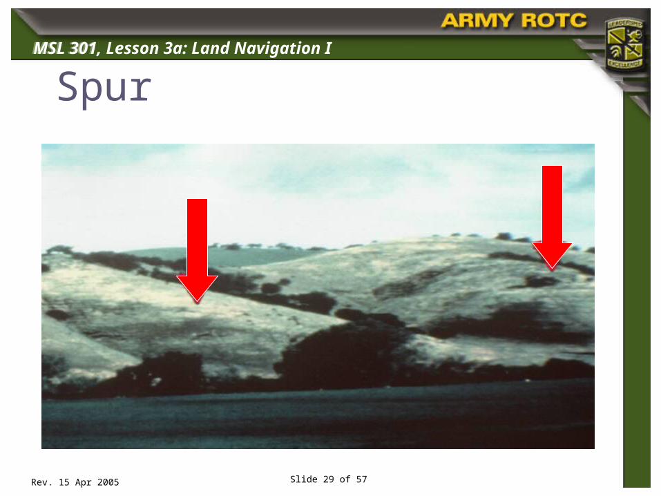
Spur
MSL 301
Rev. 15 Apr 2005
MSL 301, Lesson 3a: Land Navigation I
Slide 30 of 57
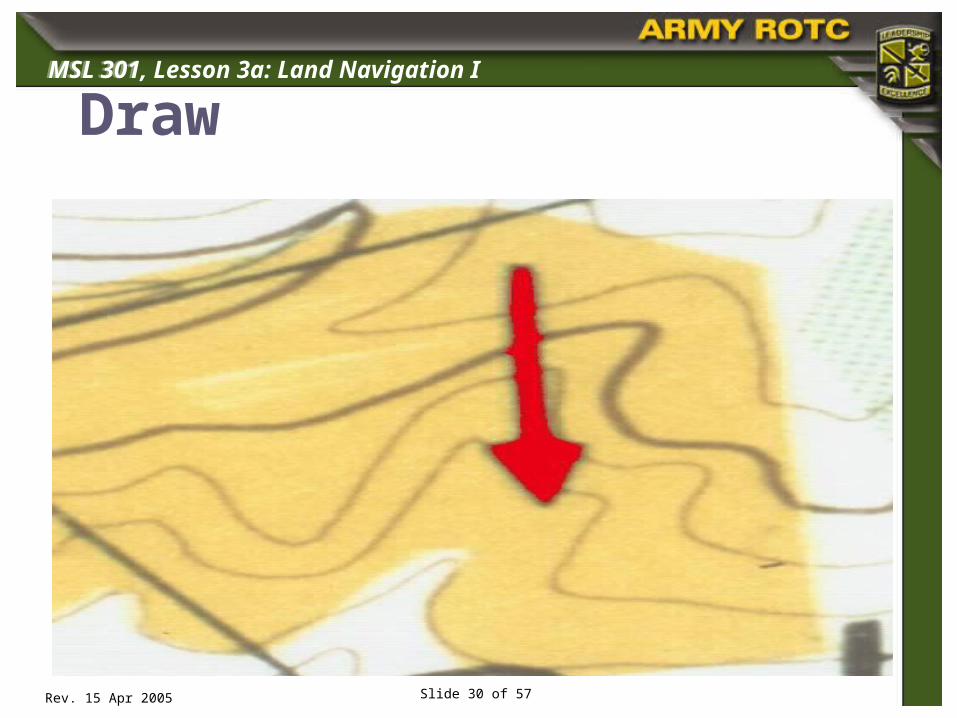
Draw

MSL 301
Rev. 15 Apr 2005
MSL 301, Lesson 3a: Land Navigation I
Slide 31 of 57
Draw
MSL 301
Rev. 15 Apr 2005
MSL 301, Lesson 3a: Land Navigation I
Slide 32 of 57
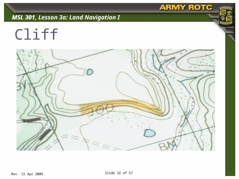
Cliff

MSL 301
Rev. 15 Apr 2005
MSL 301, Lesson 3a: Land Navigation I
Slide 33 of 57
Cliff
MSL 301
Rev. 15 Apr 2005
MSL 301, Lesson 3a: Land Navigation I
Slide 34 of 57
I
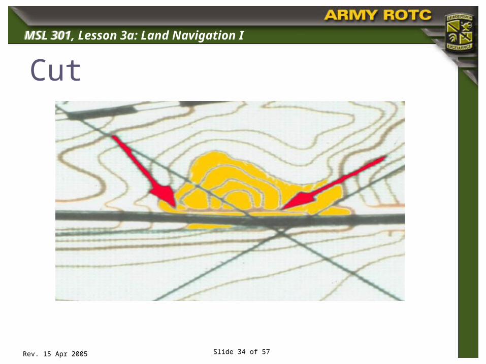
Cut
MSL 301
Rev. 15 Apr 2005
MSL 301, Lesson 3a: Land Navigation I
Slide 35 of 57
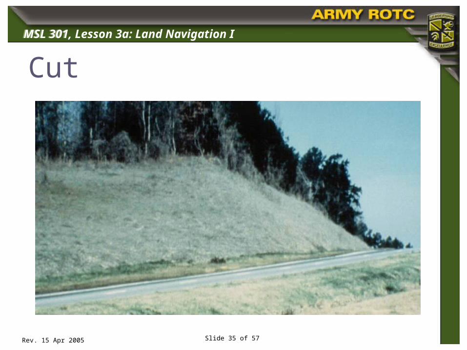
Cut

MSL 301
Rev. 15 Apr 2005
MSL 301, Lesson 3a: Land Navigation I
Slide 36 of 57
Fill

MSL 301
Rev. 15 Apr 2005
MSL 301, Lesson 3a: Land Navigation I
Slide 37 of 57
Fill

MSL 301
Rev. 15 Apr 2005
MSL 301, Lesson 3a: Land Navigation I
Slide 38 of 57
Terrain Features
MSL 301
Rev. 15 Apr 2005
MSL 301, Lesson 3a: Land Navigation I
Slide 39 of 57
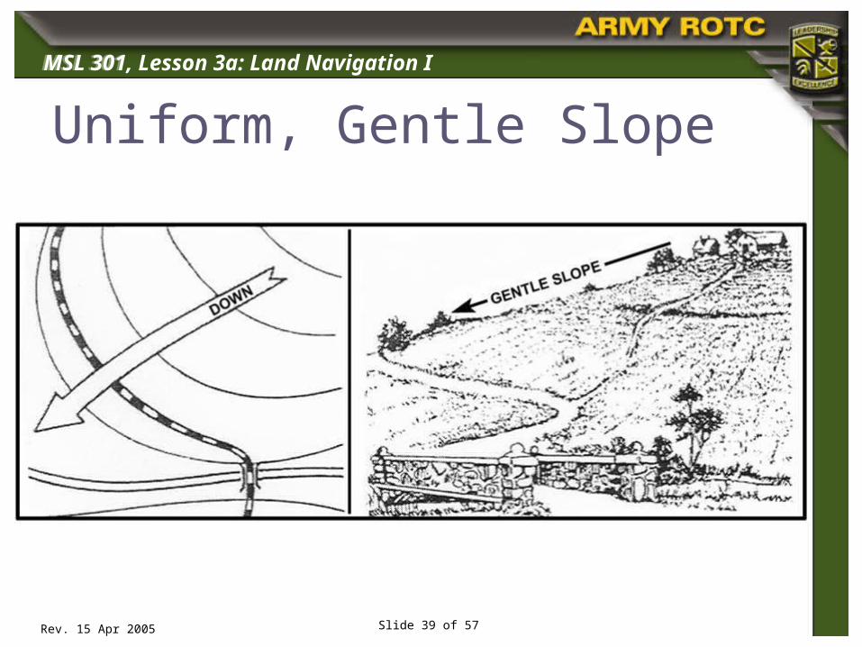
Uniform, Gentle Slope
Insert figure 10-6
MSL 301
Rev. 15 Apr 2005
MSL 301, Lesson 3a: Land Navigation I
Slide 40 of 57
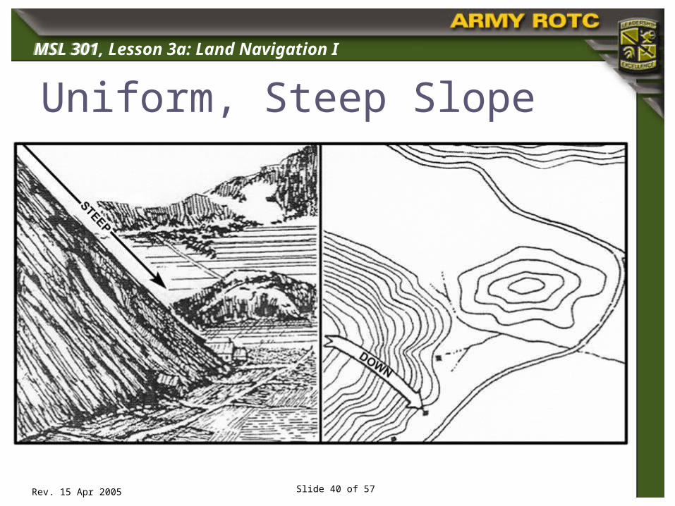
Uniform, Steep Slope
MSL 301
Rev. 15 Apr 2005
MSL 301, Lesson 3a: Land Navigation I
Slide 41 of 57
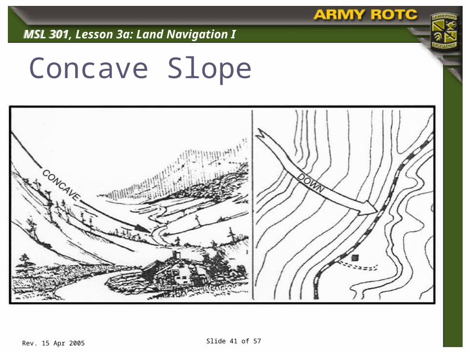
Concave Slope
MSL 301
Rev. 15 Apr 2005
MSL 301, Lesson 3a: Land Navigation I
Slide 42 of 57
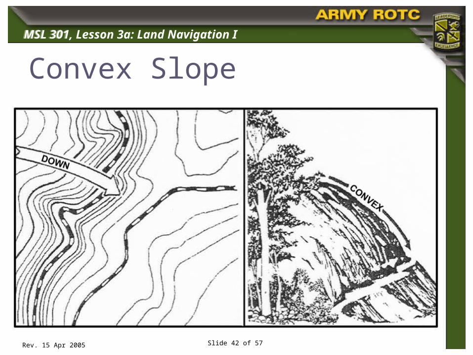
Convex Slope
Insert figure 10-6
MSL 301
Rev. 15 Apr 2005
MSL 301, Lesson 3a: Land Navigation I
Slide 43 of 57
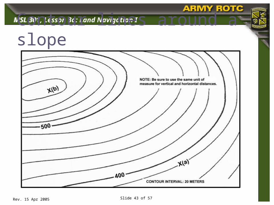
Contour lines around a slope
Insert figure 10-6
MSL 301
Rev. 15 Apr 2005
MSL 301, Lesson 3a: Land Navigation I
Slide 44 of 57
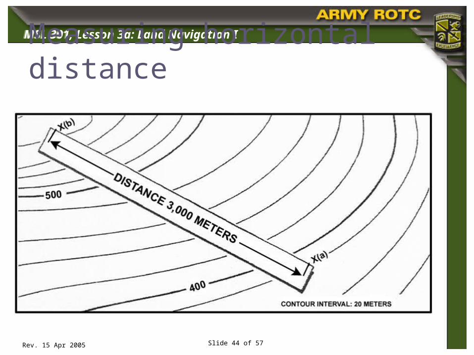
Measuring horizontal distance
Insert figure 10-6

MSL 301
Rev. 15 Apr 2005
MSL 301, Lesson 3a: Land Navigation I
Slide 45 of 57
Percentage of Slope in meters
Insert figure 10-6
MSL 301
Rev. 15 Apr 2005
MSL 301, Lesson 3a: Land Navigation I
Slide 46 of 57
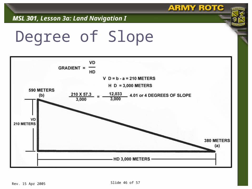
Degree of Slope
Insert figure 10-6
MSL 301
Rev. 15 Apr 2005
MSL 301, Lesson 3a: Land Navigation I
Slide 47 of 57
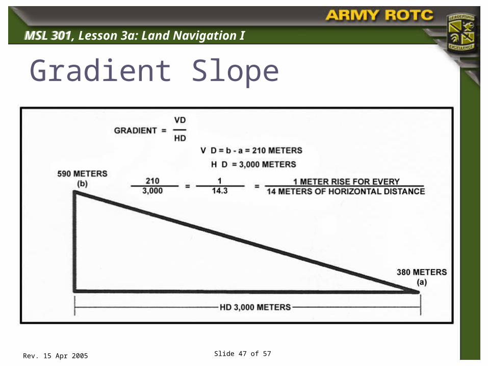
Gradient Slope
Insert figure 10-6

MSL 301
Rev. 15 Apr 2005
MSL 301, Lesson 3a: Land Navigation I
Slide 48 of 57
Protractor(GTA 5-2-12, 1981)

MSL 301
Rev. 15 Apr 2005
MSL 301, Lesson 3a: Land Navigation I
Slide 49 of 57
Determining Grid Coordinates Select the correct scale on the protractor. Place the horizontal scale on the grid line
with the “0 mark” at the lower left-hand corner of the grid square.
Slide scale right into until the vertical scale intersects the center of your plot point.
Read right then read up

MSL 301
Rev. 15 Apr 2005
MSL 301, Lesson 3a: Land Navigation I
Slide 50 of 57
Four-Digit Grid Coordinates
Read Right
The
n U
p
EH 78 00 1) Identify the 100, 000 Grid Square Identification Letters (in the Grid Reference Box).
2) Read Right to the last grid before your point.
3) Read Up to the last east-west grid below or before your point.
MSL 301
Rev. 15 Apr 2005
MSL 301, Lesson 3a: Land Navigation I
Slide 51 of 57
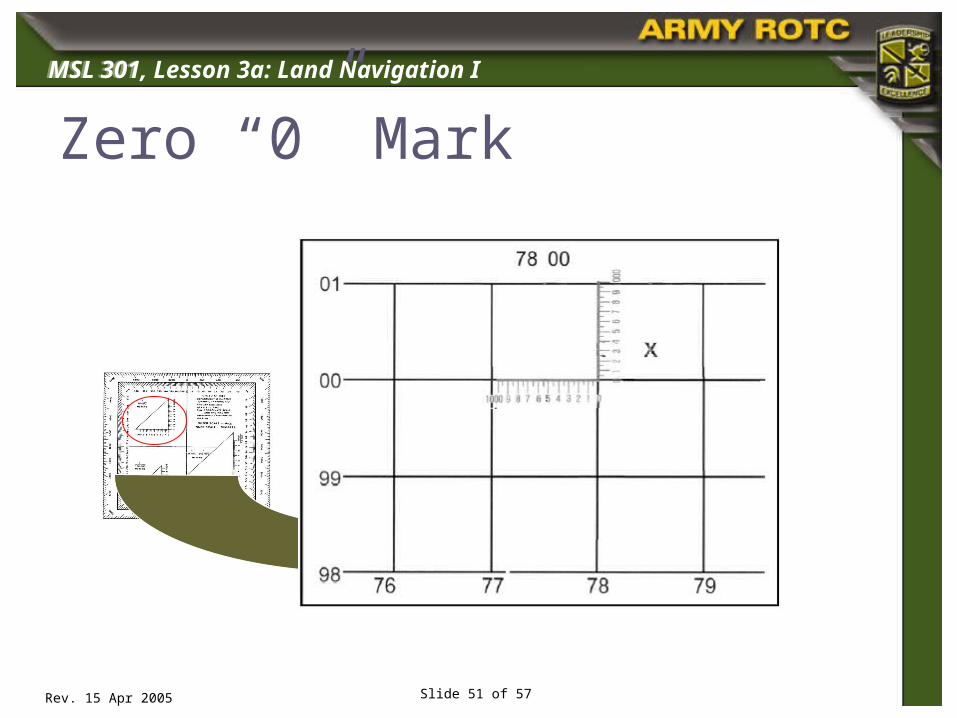
Place your protractor scale on the Zero-Mark( )
Zero “0” Mark

MSL 301
Rev. 15 Apr 2005
MSL 301, Lesson 3a: Land Navigation I
Slide 52 of 57
Six-Digit Grid Coordinates

MSL 301
Rev. 15 Apr 2005
MSL 301, Lesson 3a: Land Navigation I
Slide 53 of 57
Eight-Digit Grid Coordinates
MSL 301
Rev. 15 Apr 2005
MSL 301, Lesson 3a: Land Navigation I
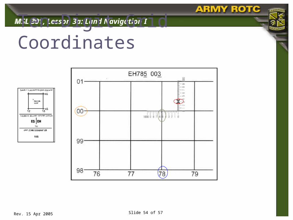
Slide 54 of 57
Ten-Digit Grid Coordinates

MSL 301
Rev. 15 Apr 2005
MSL 301, Lesson 3a: Land Navigation I
Slide 55 of 57
Graphic Scale
Statute Miles
Kilometers
Nautical Miles

MSL 301
Rev. 15 Apr 2005
MSL 301, Lesson 3a: Land Navigation I
Slide 56 of 57
Straight Line Distance

MSL 301
Rev. 15 Apr 2005
MSL 301, Lesson 3a: Land Navigation I
Slide 57 of 57
Curved Line Distance

MSL 301
Rev. 15 Apr 2005
MSL 301, Lesson 3a: Land Navigation I
Slide 58 of 57
Conclusion
Become familiar with marginal information on a mapsheet
Identify topographic symbols on a military map
Identify the five major, three minor and two supplemental terrain features on a map
Determine grid coordinates on a map Measure straight-line and road distance on
a map
Top Related