


Languages
Pages
Legal

Navigation Systems
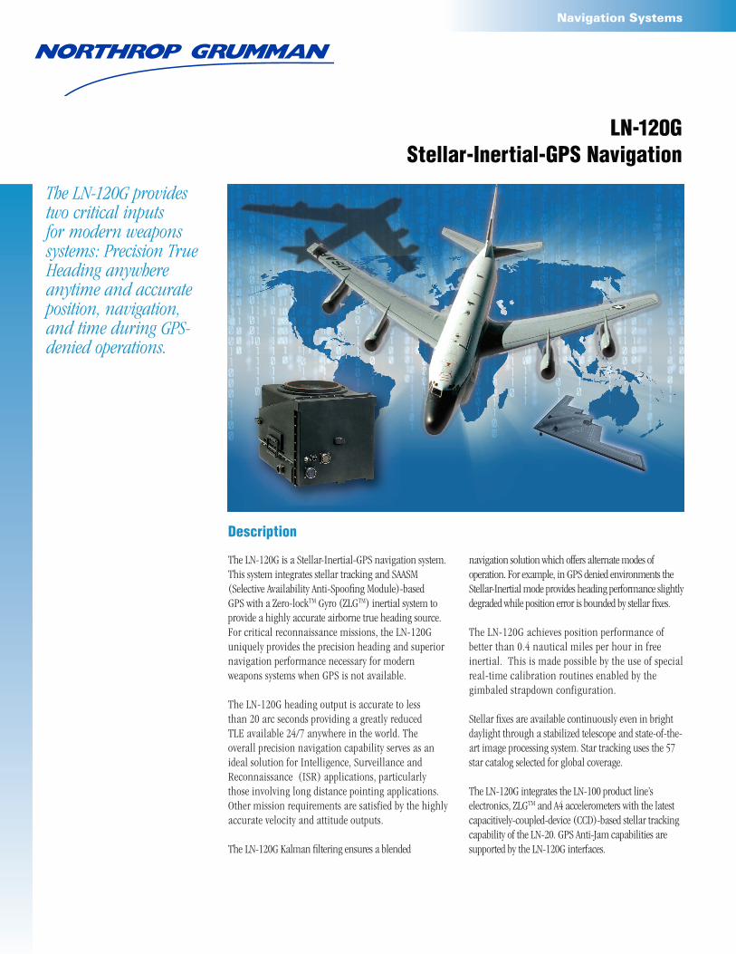
LN-120GStellar-Inertial-GPS Navigation
navigation solution which offers alternate modes of operation. For example, in GPS denied environments the Stellar-Inertial mode provides heading performance slightly degraded while position error is bounded by stellar fixes.
The LN-120G achieves position performance of better than 0.4 nautical miles per hour in free inertial. This is made possible by the use of special real-time calibration routines enabled by the gimbaled strapdown configuration.
Stellar fixes are available continuously even in bright daylight through a stabilized telescope and state-of-the-art image processing system. Star tracking uses the 57 star catalog selected for global coverage.
The LN-120G integrates the LN-100 product line’s electronics, ZLGTM and A4 accelerometers with the latest capacitively-coupled-device (CCD)-based stellar tracking capability of the LN-20. GPS Anti-Jam capabilities are supported by the LN-120G interfaces.
Description
The LN-120G is a Stellar-Inertial-GPS navigation system. This system integrates stellar tracking and SAASM (Selective Availability Anti-Spoofing Module)-based GPS with a Zero-lockTM Gyro (ZLGTM) inertial system to provide a highly accurate airborne true heading source.For critical reconnaissance missions, the LN-120G uniquely provides the precision heading and superior navigation performance necessary for modern weapons systems when GPS is not available.
The LN-120G heading output is accurate to less than 20 arc seconds providing a greatly reduced TLE available 24/7 anywhere in the world. The overall precision navigation capability serves as an ideal solution for Intelligence, Surveillance and Reconnaissance (ISR) applications, particularly those involving long distance pointing applications. Other mission requirements are satisfied by the highly accurate velocity and attitude outputs.
The LN-120G Kalman filtering ensures a blended
The LN-120G provides two critical inputs for modern weapons systems: Precision True Heading anywhere anytime and accurate position, navigation, and time during GPS-denied operations.

Navigation Systems
24163/March 2010
For more information, please contact:Northrop Grumman CorporationNavigation Systems21240 Burbank BoulevardWoodland Hills, CA 91367 USA1-866-NGNAVSYS(646-2879)www.northropgrumman.com Search: NSD
LN-120G Stellar-Inertial-GPS Navigation System
Performance:Mode True Heading
(RMS)Position (CEP)
Velocity (RMS)
Roll & Pitch (RMS)
Stellar, Inertial, and GPS Updating (SIG)
<20 arc sec <0.01 nm0.07 ft/sec (0.02 m/sec)
0.02 deg
Stellar and Inertial Updating (SI)
24 arc sec 0.15 + 0.15 (t)1/2 nm1.2 + 0.4 (t) ft/sec (0.37 + 0.12 (t) m/sec)
0.2 + 0.0025 (t)1/2 deg
Inertial and GPS Updating (IG)
1.6 arc min <0.01 nm0.07 ft/sec (0.02 m/sec)
0.02 deg
Free Inertial Only (I) 1.6 + 0.2 (t) arc min 0.4 nm/hr1.5 + 0.5 (t) ft/sec (0.46 + 0.15 (t) m/sec)
0.022 deg
Features:Daylight Star Tracking from CCD based image processing
Global stellar navigation solutions with 57 star catalog
Integrated SAASM based GPS receiver
Control & Display via optional CMU or 1553 Bus Commands
Full steering & waypoint management
Alignment Modes
− Ground Gyrocompass or Stored Heading
− In Flight GPS Aided or LN-100 Transfer
Digital and Analog Avionics Interfaces
Characteristics:Weight: 104 lb (47.2 kg)
Dimensions: 18.2 in. x 14.3 in. x 14.4 in.(46.2 cm x 36.3 cm x 36.6 cm)
Power Utilization: 28 VDC: 9A typical, 10A maximum 26 VAC 400Hz Synchro Reference: 25VA115 VAC 400Hz: 300W nominal - 3ø
Forced Air Cooling 1.5 lb (0.68 kg)/minute at cabin ambient temperature (75°F/23.8°C)
System MTBF: 4,000 hours
Electrical Interfaces: − MIL-STD-1553 − ARINC 429 − Discrete Inputs/Outputs − Analog Autopilot Control − GPS CRPA Interface − Crypto Variable Keyings
t = time in hours
Top Related