


Languages
Pages
Legal

www.geostor.arkansas.gov1
GeoStor Tutorial
Additional information can be viewed
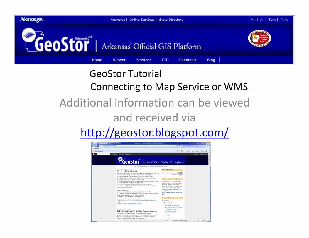
GeoStor TutorialConnecting to Map Service or WMS
Additional information can be viewed and received via
http://geostor blogspot com/http://geostor.blogspot.com/
www.geostor.arkansas.gov
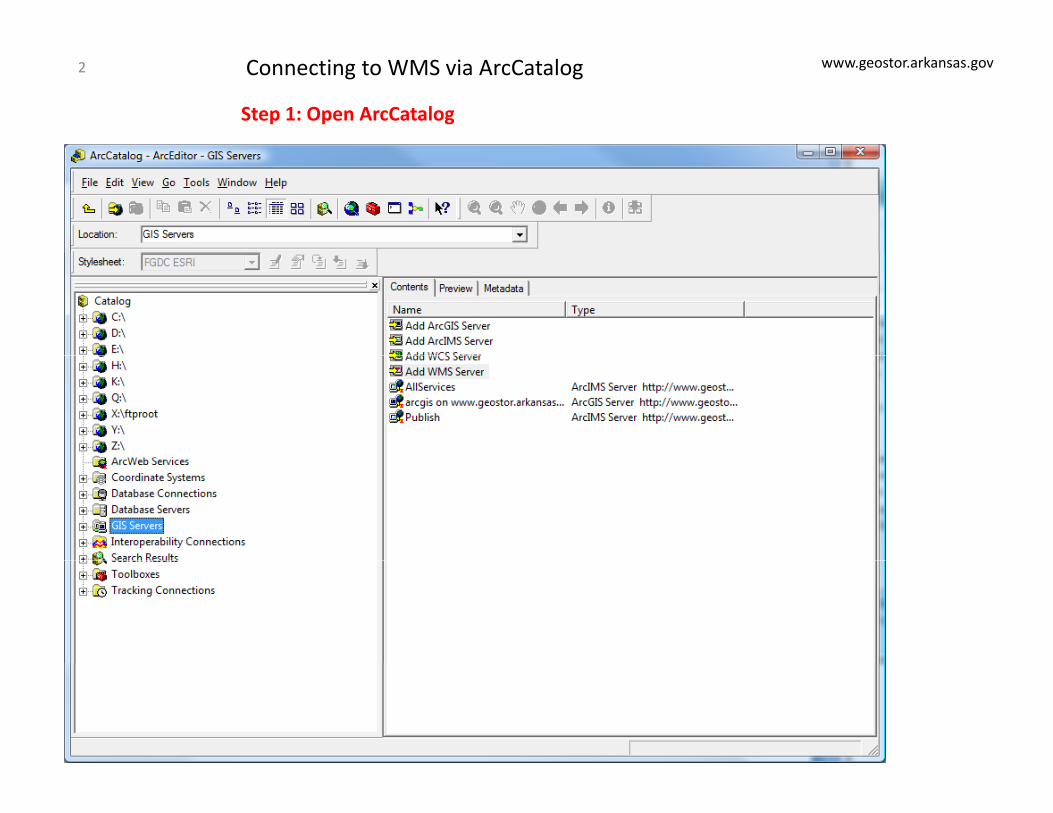
Step 1: Open ArcCatalog
Connecting to WMS via ArcCatalog2
www.geostor.arkansas.gov
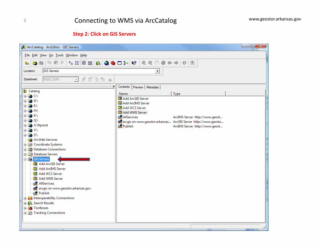
Step 2: Click on GIS Servers
Connecting to WMS via ArcCatalog3
www.geostor.arkansas.gov
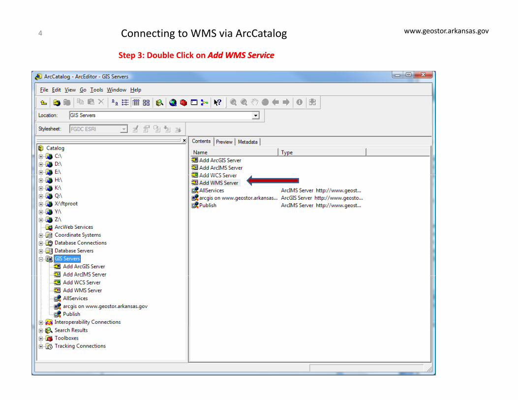
Step 3: Double Click on Add WMS ServiceAdd WMS Service
Connecting to WMS via ArcCatalog4
www.geostor.arkansas.gov
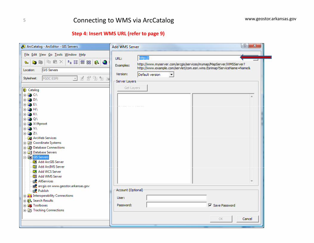
Step 4: Insert WMS URL (refer to page 9)
Connecting to WMS via ArcCatalog5
www.geostor.arkansas.gov
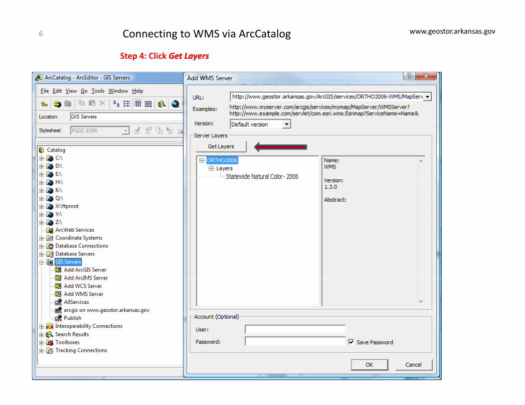
Step 4: Click Get LayersGet Layers
Connecting to WMS via ArcCatalog6
www.geostor.arkansas.gov
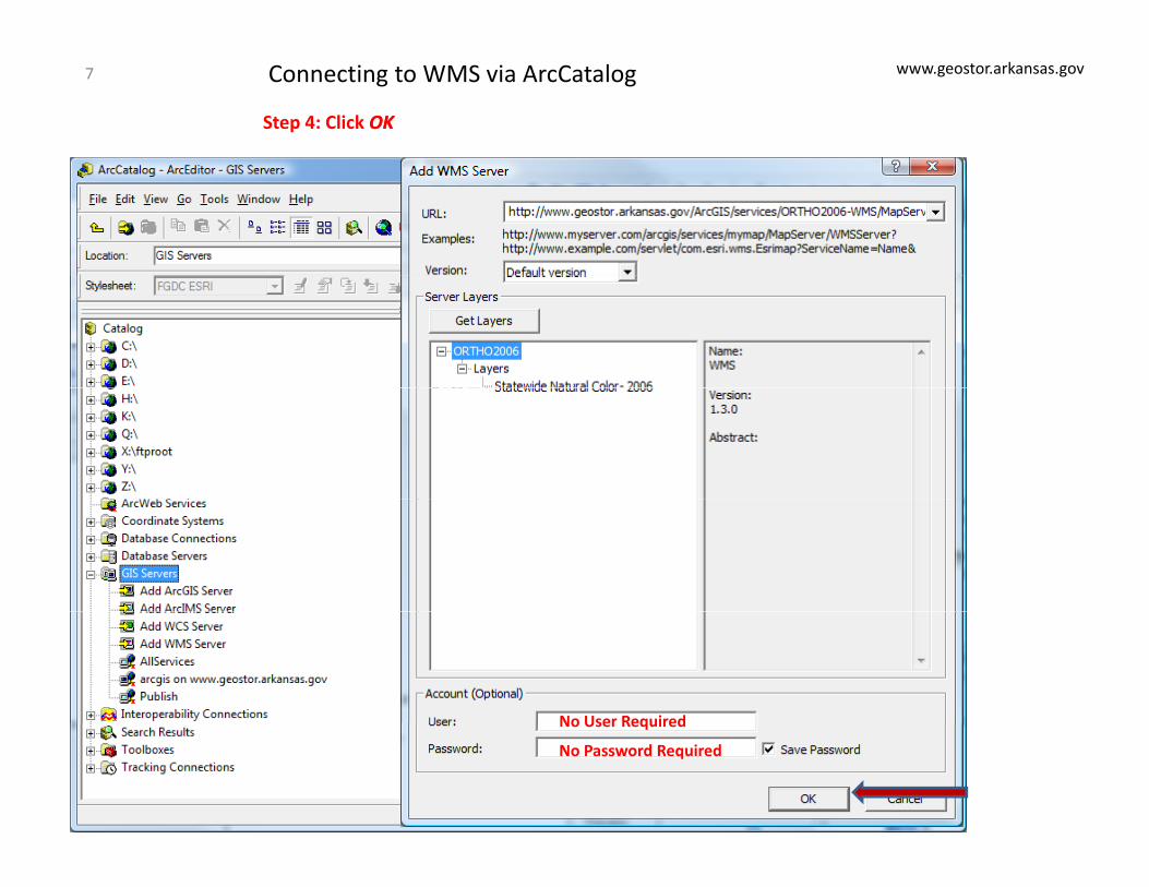
Step 4: Click OKOK
Connecting to WMS via ArcCatalog7
No User RequiredNo User Required
No Password Required
www.geostor.arkansas.gov
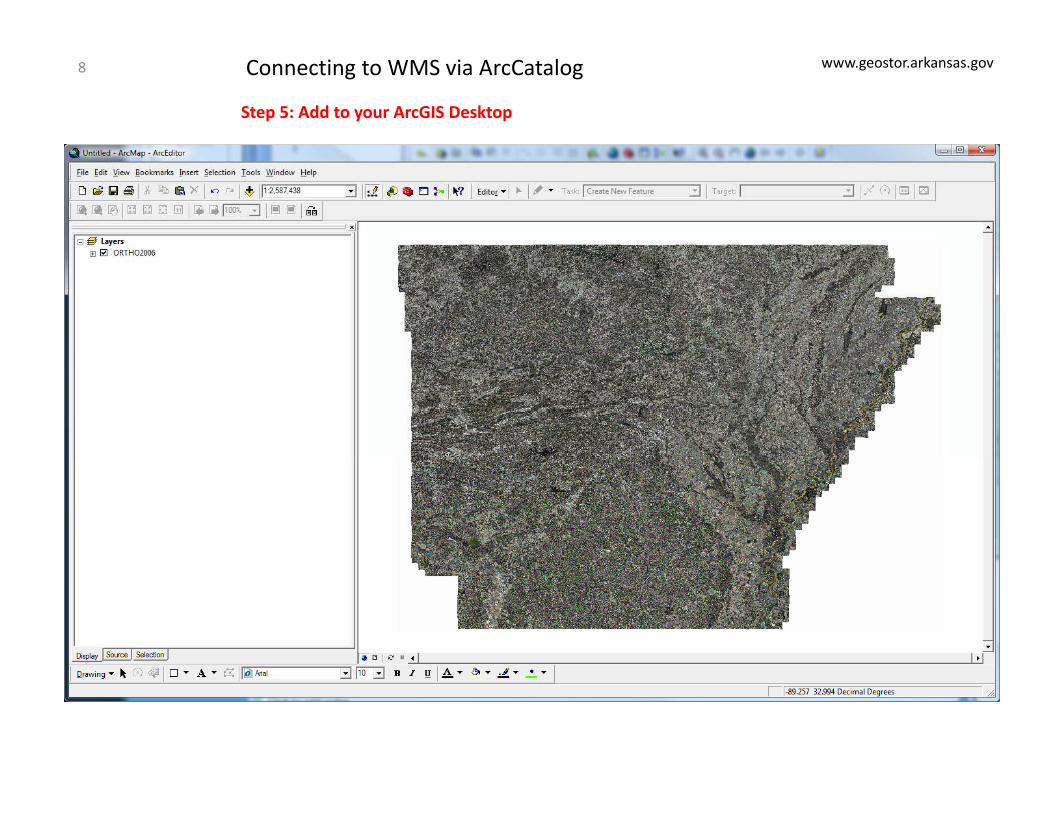
Step 5: Add to your ArcGIS Desktop
Connecting to WMS via ArcCatalog8
www.geostor.arkansas.gov
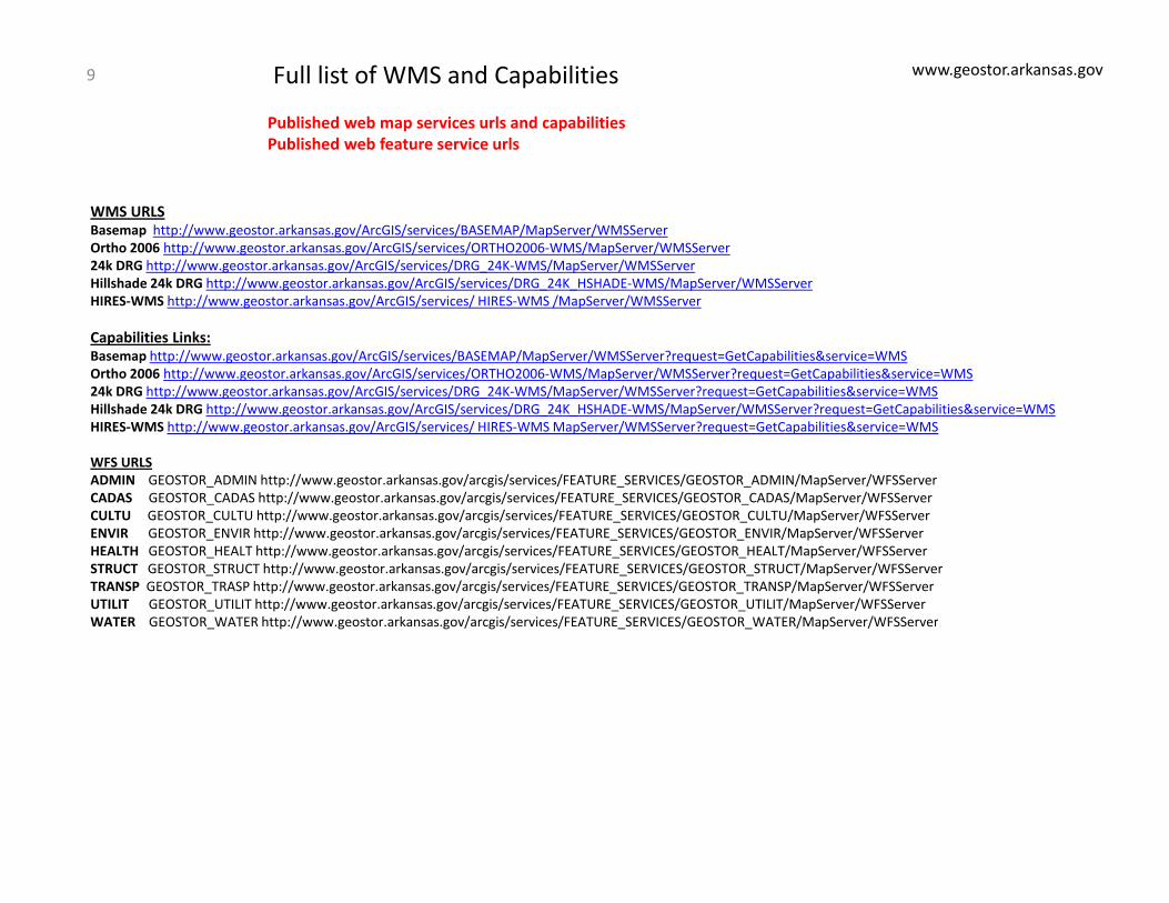
Published web map services urls and capabilitiesPublished web feature service urls
Full list of WMS and Capabilities9
WMS URLSBasemap http://www.geostor.arkansas.gov/ArcGIS/services/BASEMAP/MapServer/WMSServerOrtho 2006 http://www.geostor.arkansas.gov/ArcGIS/services/ORTHO2006‐WMS/MapServer/WMSServer24k DRG http://www.geostor.arkansas.gov/ArcGIS/services/DRG_24K‐WMS/MapServer/WMSServerHillshade 24k DRG http // geostor arkansas go /ArcGIS/ser ices/DRG 24K HSHADE WMS/MapSer er/WMSSer erHillshade 24k DRG http://www.geostor.arkansas.gov/ArcGIS/services/DRG_24K_HSHADE‐WMS/MapServer/WMSServerHIRES‐WMS http://www.geostor.arkansas.gov/ArcGIS/services/ HIRES‐WMS /MapServer/WMSServer
Capabilities Links:Basemap http://www.geostor.arkansas.gov/ArcGIS/services/BASEMAP/MapServer/WMSServer?request=GetCapabilities&service=WMSOrtho 2006 http://www.geostor.arkansas.gov/ArcGIS/services/ORTHO2006‐WMS/MapServer/WMSServer?request=GetCapabilities&service=WMS24k DRG http://www.geostor.arkansas.gov/ArcGIS/services/DRG 24K‐WMS/MapServer/WMSServer?request=GetCapabilities&service=WMS24k DRG http://www.geostor.arkansas.gov/ArcGIS/services/DRG_24K WMS/MapServer/WMSServer?request GetCapabilities&service WMSHillshade 24k DRG http://www.geostor.arkansas.gov/ArcGIS/services/DRG_24K_HSHADE‐WMS/MapServer/WMSServer?request=GetCapabilities&service=WMSHIRES‐WMS http://www.geostor.arkansas.gov/ArcGIS/services/ HIRES‐WMS MapServer/WMSServer?request=GetCapabilities&service=WMS
WFS URLSADMIN GEOSTOR_ADMIN http://www.geostor.arkansas.gov/arcgis/services/FEATURE_SERVICES/GEOSTOR_ADMIN/MapServer/WFSServerCADAS GEOSTOR_CADAS http://www.geostor.arkansas.gov/arcgis/services/FEATURE_SERVICES/GEOSTOR_CADAS/MapServer/WFSServerCULTU GEOSTOR_CULTU http://www.geostor.arkansas.gov/arcgis/services/FEATURE_SERVICES/GEOSTOR_CULTU/MapServer/WFSServerENVIR GEOSTOR_ENVIR http://www.geostor.arkansas.gov/arcgis/services/FEATURE_SERVICES/GEOSTOR_ENVIR/MapServer/WFSServerHEALTH GEOSTOR_HEALT http://www.geostor.arkansas.gov/arcgis/services/FEATURE_SERVICES/GEOSTOR_HEALT/MapServer/WFSServerSTRUCT GEOSTOR_STRUCT http://www.geostor.arkansas.gov/arcgis/services/FEATURE_SERVICES/GEOSTOR_STRUCT/MapServer/WFSServerTRANSP GEOSTOR_TRASP http://www.geostor.arkansas.gov/arcgis/services/FEATURE_SERVICES/GEOSTOR_TRANSP/MapServer/WFSServerUTILIT GEOSTOR_UTILIT http://www.geostor.arkansas.gov/arcgis/services/FEATURE_SERVICES/GEOSTOR_UTILIT/MapServer/WFSServerWATER GEOSTOR WATER http://www geostor arkansas gov/arcgis/services/FEATURE SERVICES/GEOSTOR WATER/MapServer/WFSServerWATER GEOSTOR_WATER http://www.geostor.arkansas.gov/arcgis/services/FEATURE_SERVICES/GEOSTOR_WATER/MapServer/WFSServer
www.geostor.arkansas.gov
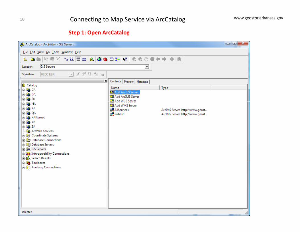
Step 1: Open ArcCatalog
Connecting to Map Service via ArcCatalog10
www.geostor.arkansas.gov
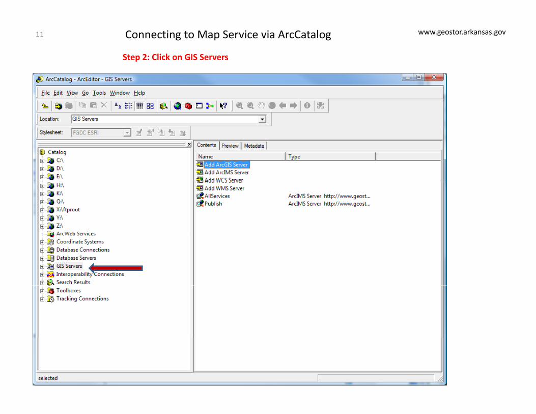
Step 2: Click on GIS Servers
Connecting to Map Service via ArcCatalog11
www.geostor.arkansas.gov
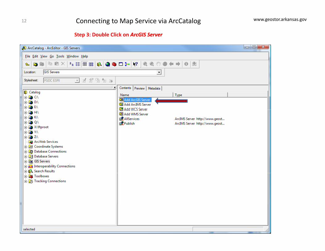
Step 3: Double Click on ArcGISArcGIS ServerServer
Connecting to Map Service via ArcCatalog12
www.geostor.arkansas.gov
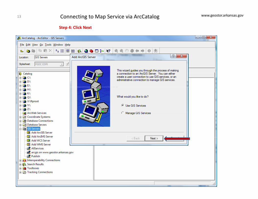
Step 4: Click Next
Connecting to Map Service via ArcCatalog13

www.geostor.arkansas.gov
Step 4: Click Next
Connecting to Map Service via ArcCatalog14
www.geostor.arkansas.gov
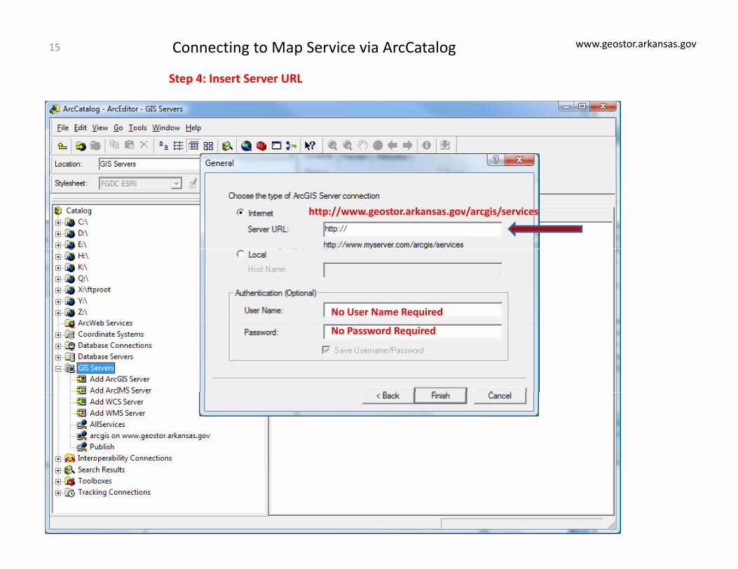
Step 4: Insert Server URL
Connecting to Map Service via ArcCatalog15
http://www.geostor.arkansas.gov/arcgis/services
No User Name Required
No Password Required
www.geostor.arkansas.gov
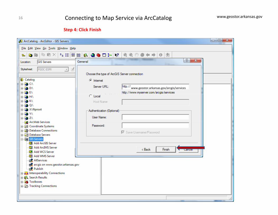
Step 4: Click Finish
Connecting to Map Service via ArcCatalog16
www.geostor.arkansas.gov/arcgis/services
Top Related