


Languages
Pages
Legal


Basic Spatial Analysis
May 30, 2013Institute of Space Technology, Karachi
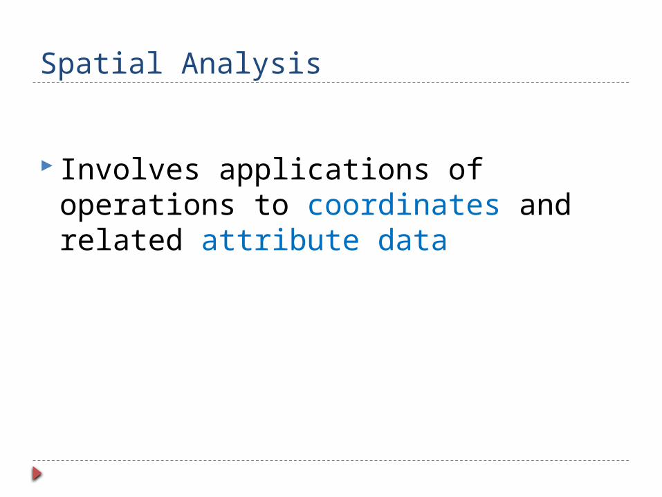
Spatial Analysis
Involves applications of operations to coordinates and related attribute data

Chapter 9 of your text book.

Spatial Data Analysis
Spatial analyses are applied to solve problems related to geographic decisions
Examples: Identify high crime areas Generate a list of road segments that need repaving Select a best location for a new business
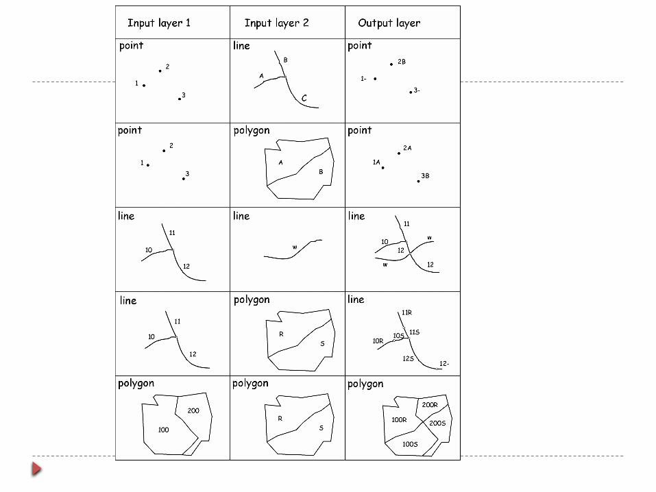
Input Layer Spatial Operation Output Layer

Sequence of Spatial Operations
SINGLE SPATIAL OPERATIONS
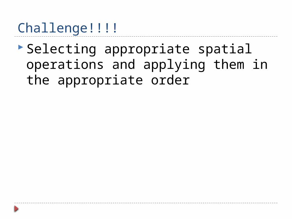
Challenge!!!! Selecting appropriate spatial
operations and applying them in the appropriate order
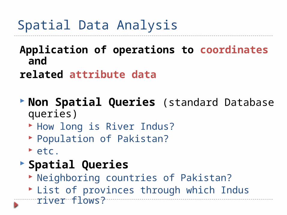
Spatial Data Analysis
Application of operations to coordinates and
related attribute data
Non Spatial Queries (standard Database queries) How long is River Indus? Population of Pakistan? etc.
Spatial Queries Neighboring countries of Pakistan? List of provinces through which Indus river flows?

Spatial Data Analysis Since attribute data is related to spatial
objects therefore we can not separate operations on attribute data from operations on coordinate portion of spatial data

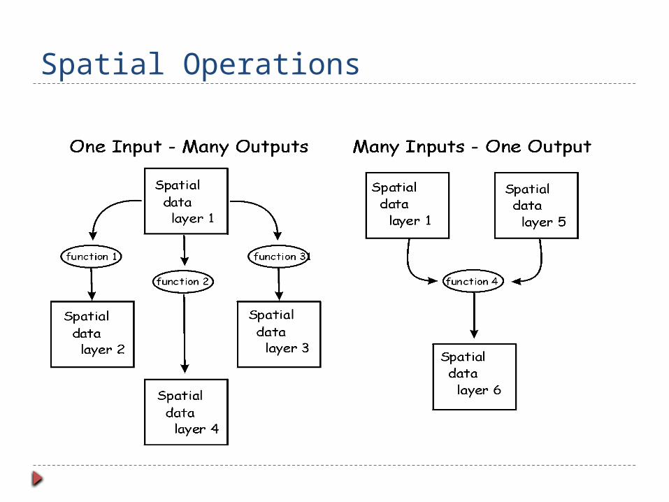
Spatial Operations Applied to one or more input layers to
produce one or more output data layers
One to One Conversion of raster data into vector
One input – Many outputs Slope and aspect produced from raster elevation model
Many inputs – one output To calculate data averages from different layers
Spatial Operations
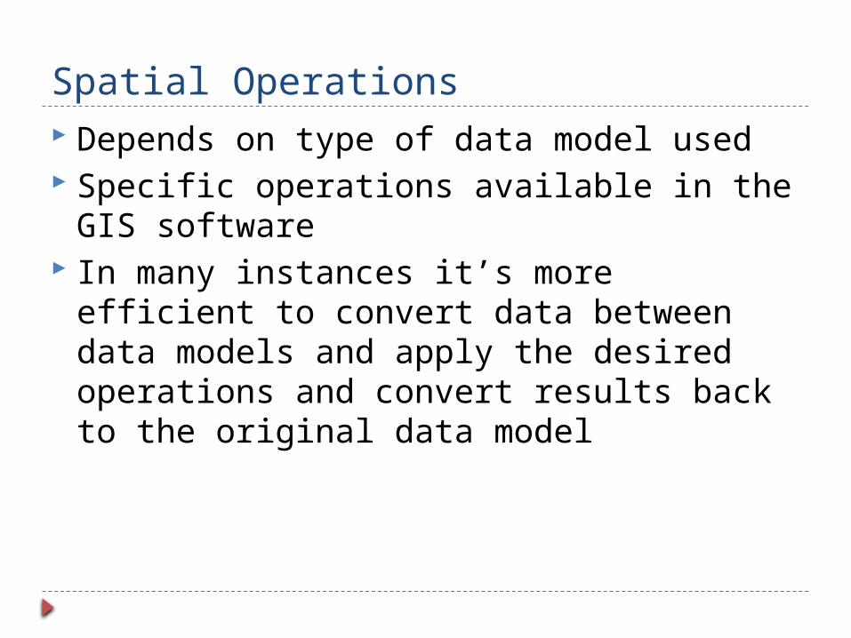
Spatial Operations Depends on type of data model used Specific operations available in the GIS
software In many instances it’s more efficient to
convert data between data models and apply the desired operations and convert results back to the original data model
Spatial Operations Outputs
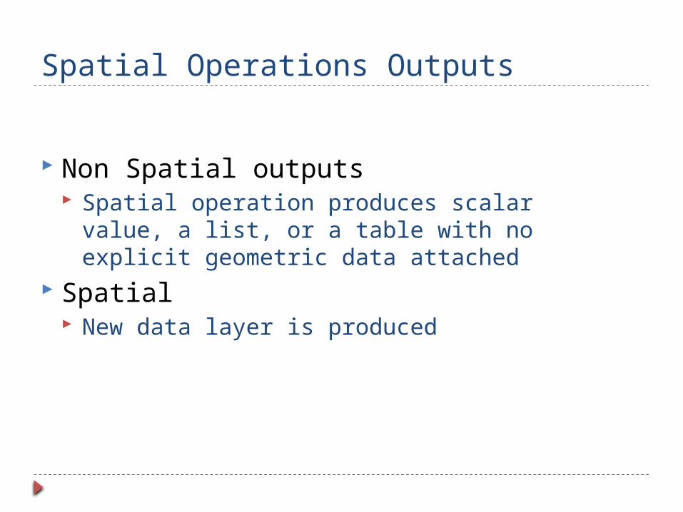
Non Spatial outputs Spatial operation produces scalar value, a
list, or a table with no explicit geometric data attached
Spatial New data layer is produced
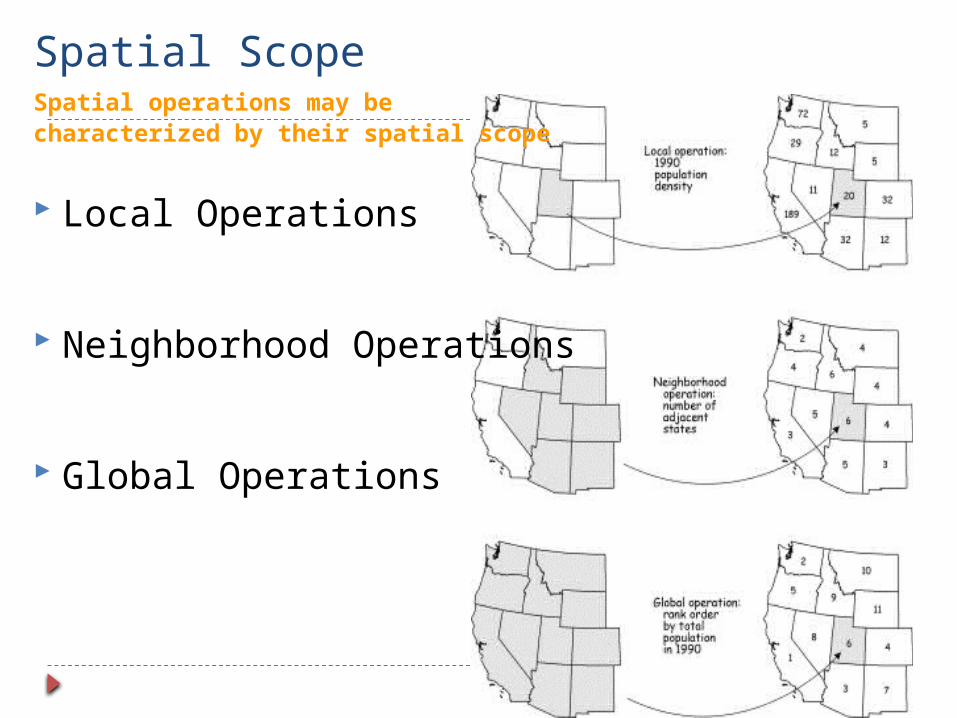
Spatial ScopeSpatial operations may becharacterized by their spatial scope
Local Operations
Neighborhood Operations
Global Operations

Spatial Data Analysis
Selection Reclassification Dissolving Buffering Overlay

Selection
Features are identified based on given criteria
Example: in a political map of European countries, select all names and population of countries with more than 50M inhabitants
Above is an example of set algebra >, <, =, & <> Used either alone or in combination
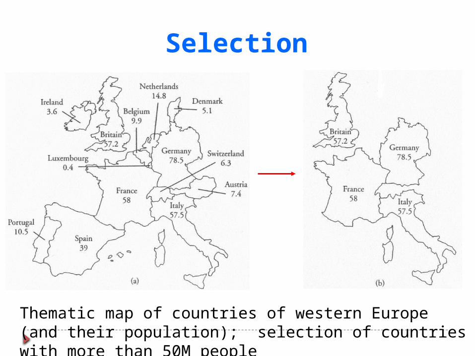
Thematic map of countries of western Europe (and their population); selection of countries with more than 50M people
Selection
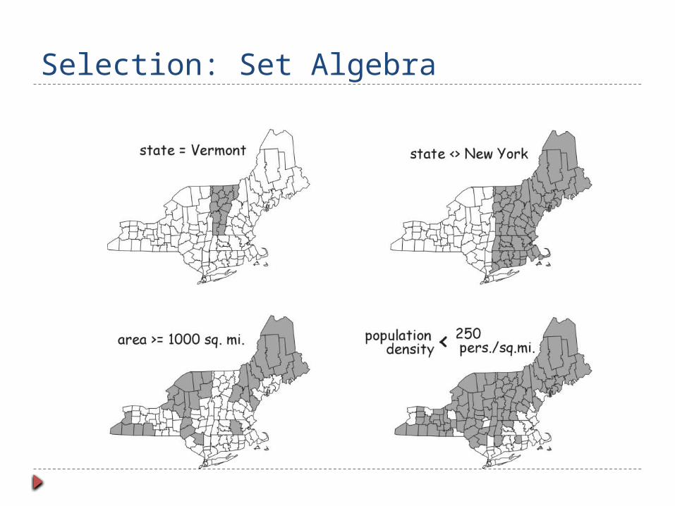
Selection: Set Algebra
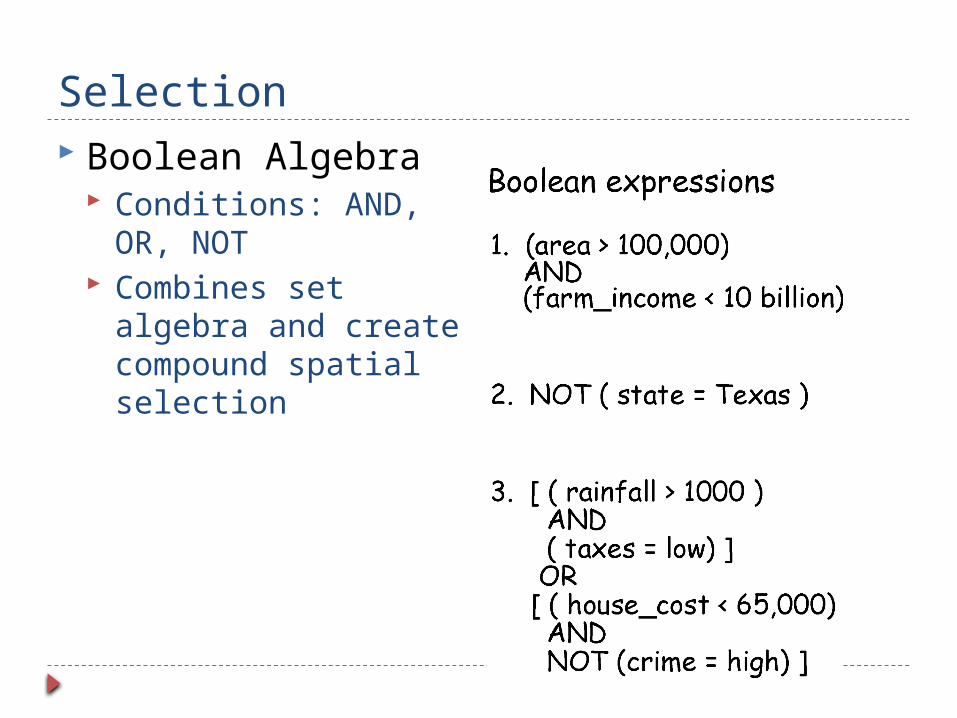
Selection Boolean Algebra
Conditions: AND, OR, NOT
Combines set algebra and create compound spatial selection

Expression In Boolean Algebra

Selection by Location Adjacency
Containment

Reclassification
Classification of spatial objects based on spatial or non spatial data
Example: classification of Polygons based on size
Examples of Reclassification Equal Interval Equal Area etc.

Dissolve
Combines or dissolve similar features within a data layer
Adjacent polygons with identical values are merged into a single polygon

Proximity Modifies existing feature or creates new
features that depend on distance Available water represented by Points and
distance function applied to these points to create raster data layer containing the distance to nearest water feature.
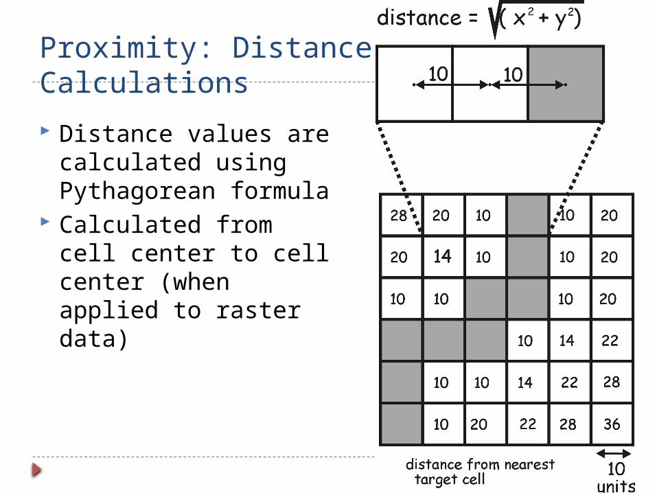
Proximity: Distance Calculations
Distance values are calculated using Pythagorean formula
Calculated from cell center to cell center (when applied to raster data)
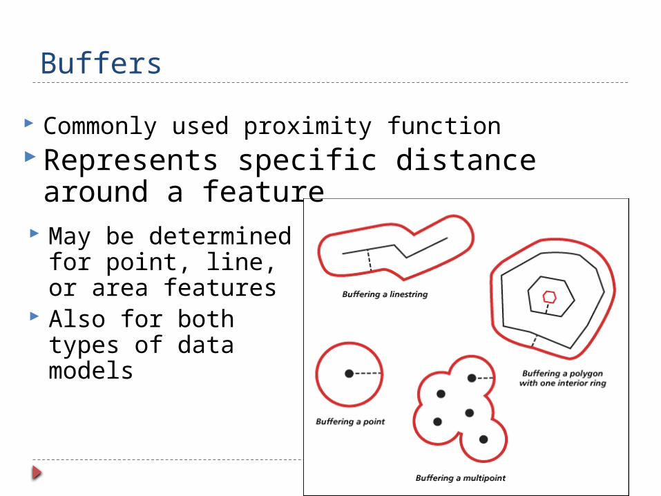
Buffers
Commonly used proximity function Represents specific distance around a
feature May be determined
for point, line, or area features
Also for both types of data models
Overlay Overlapping different themes (multiple
layer operation) Areas where features in different layers
overlap Both spatial and attribute data is combined Clip, Intersect and union are special cases
of overlay
Vector Overlay Clip
Only the areas that overlap are contained Cookie cutter approach
Intersect Combines data from both layers but only for a
given region where both layers contain data Union
Both overlapping and non-overlapping areas are contained

Overlay - Examples

Raster Overlay Cell by cell combination of 2 or more data
layers Typically applied to nominal or ordinal data
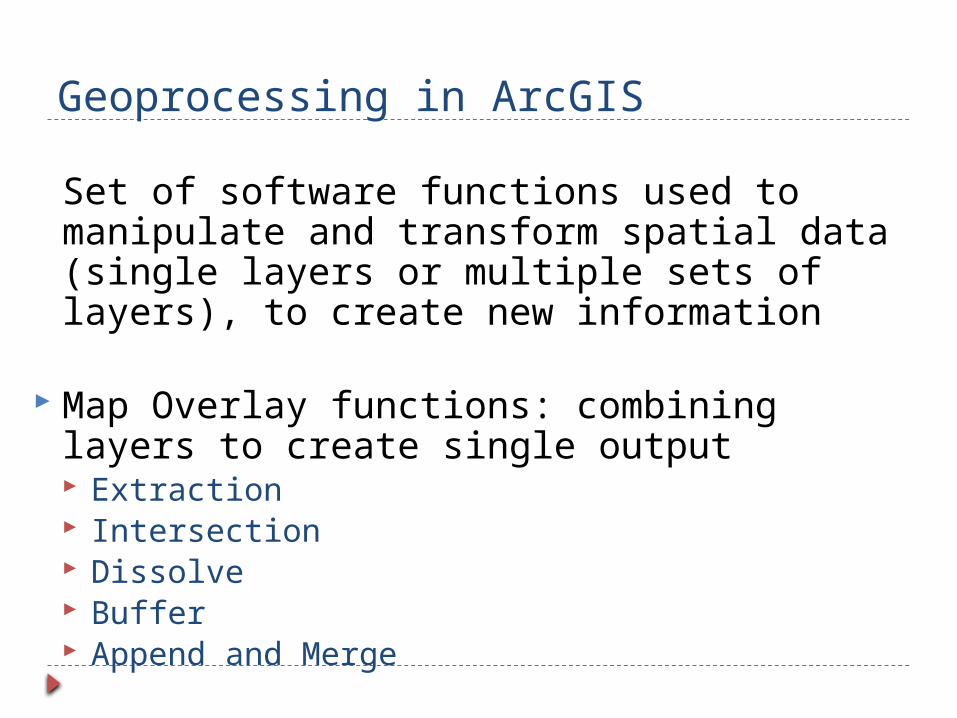
Geoprocessing in ArcGIS
Set of software functions used to manipulate and transform spatial data (single layers or multiple sets of layers), to create new information
Map Overlay functions: combining layers to create single output Extraction Intersection Dissolve Buffer Append and Merge

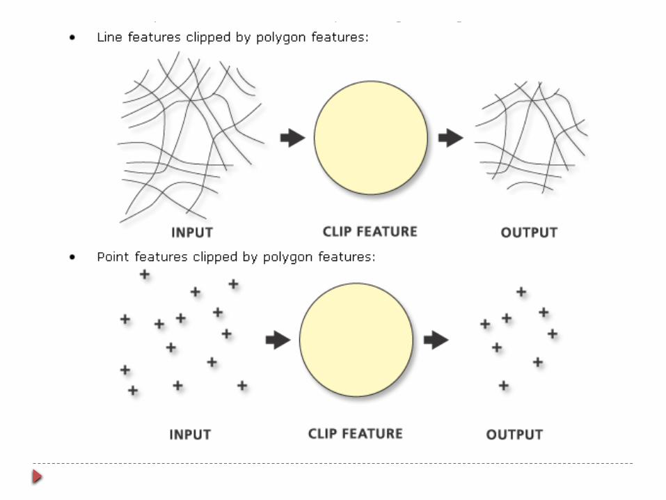
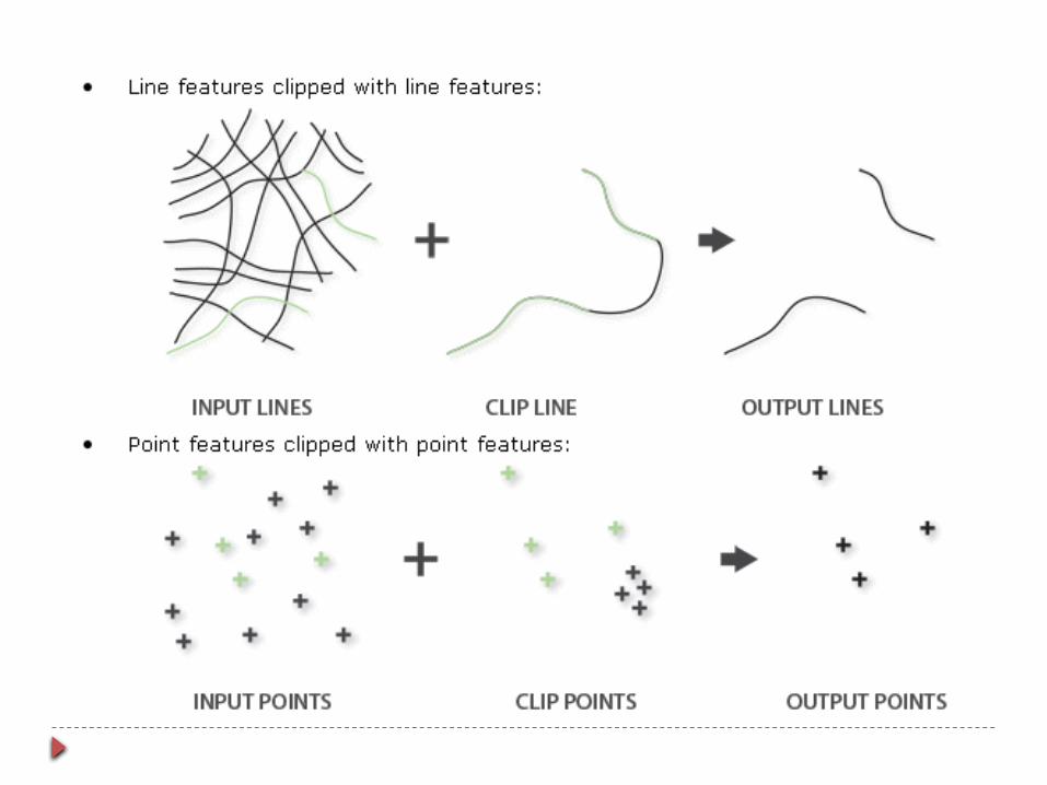
Extraction Clip: cookie cutter function
Layers to be clipped: point, line, polygon Clipping layer:
When the Input Features are polygons, the Clip Features must also be polygons
When the Input Features are lines, the Clip Features can be lines or polygons.
When the Input Features are points, the Clip Features can be points, lines, or polygons.
Erase: Opposite of clip
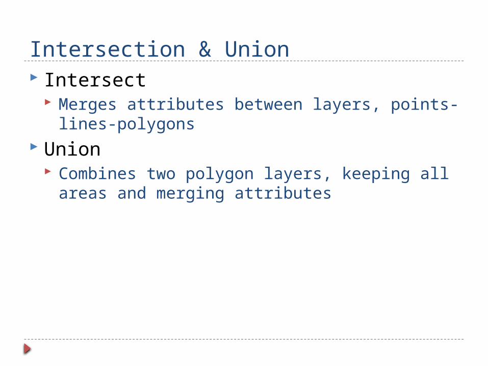
Intersection & Union Intersect
Merges attributes between layers, points-lines-polygons
Union Combines two polygon layers, keeping all areas
and merging attributes

Intersection & Union

Dissolve
Combines and dissolves similar features within a data layer

Buffers
Creates region at specific distance from one or more features
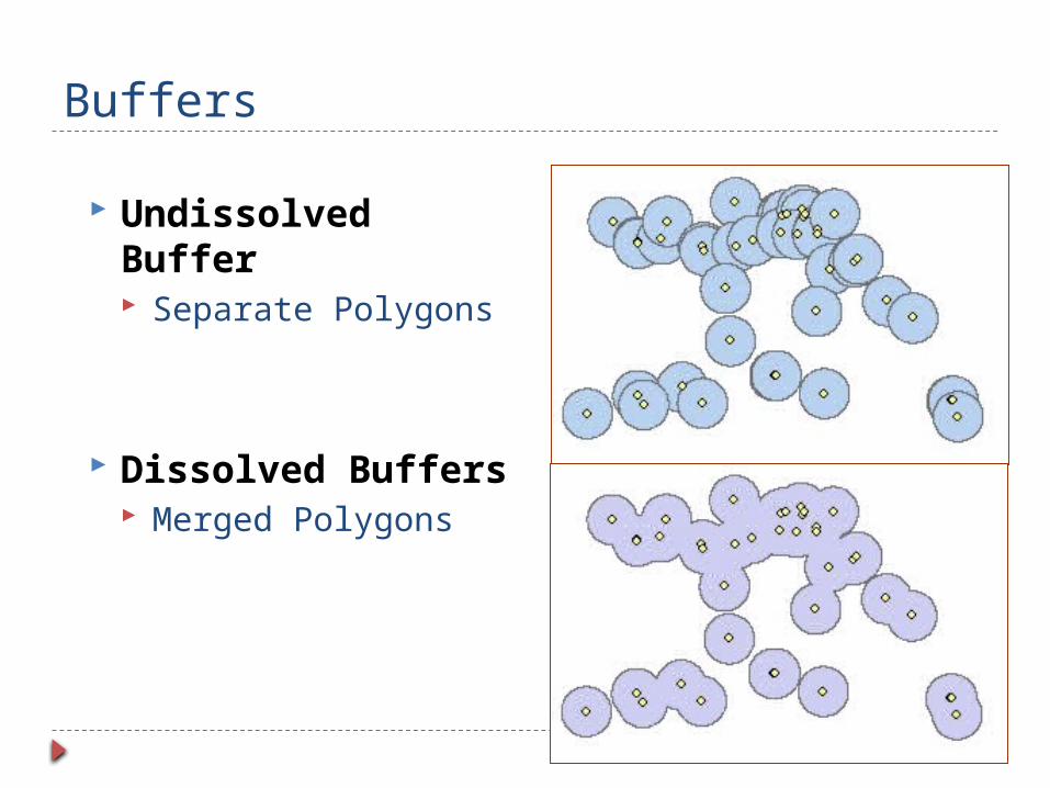
Buffers
Undissolved Buffer Separate Polygons
Dissolved Buffers Merged Polygons

Append and Merge Combine 2 layers into 1 Merge “edges” of adjoining layers with
identically matching polygons and attributes Append data while maintaining the attributes
contained in the selected layer

ARcGIS Tool for Geoprocessing To be covered in Lab
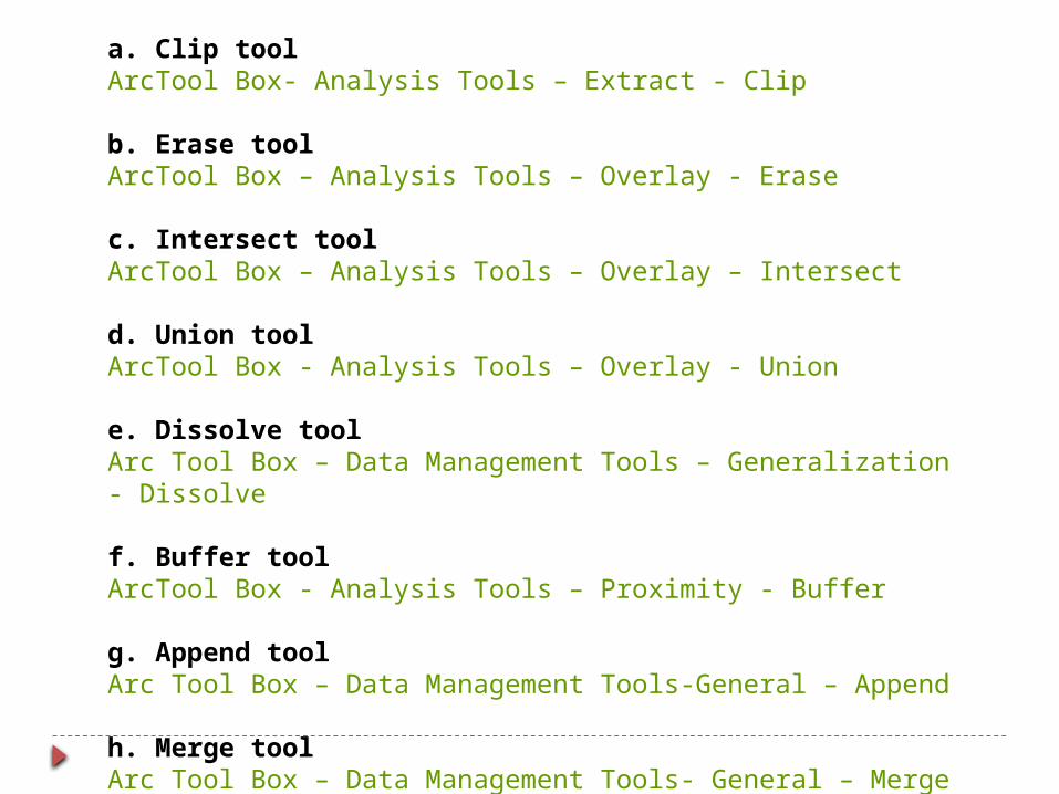
a. Clip toolArcTool Box- Analysis Tools – Extract - Clip
b. Erase toolArcTool Box – Analysis Tools – Overlay - Erase
c. Intersect toolArcTool Box – Analysis Tools – Overlay – Intersect
d. Union toolArcTool Box - Analysis Tools – Overlay - Union
e. Dissolve toolArc Tool Box – Data Management Tools – Generalization - Dissolve
f. Buffer toolArcTool Box - Analysis Tools – Proximity - Buffer
g. Append toolArc Tool Box – Data Management Tools-General – Append
h. Merge toolArc Tool Box – Data Management Tools- General – Merge

Using Model Builder Models are built to automate geoprocessing
workflow

References webhelp.esri.com/.../spatial_operations.htm http://www.wou.edu/las/physci/taylor/es341/ge
oprocessing_ArcGIS.pdf www.ianko.com/.../images2/buffer_dissolve.jpg
NCRG Training Courses, “Introduction to GIS”
Prepared by Training, R&D Division GIS Fundamental by Paul Bolstad

Union Query
Union operation from relational algebra Applied ONLY to thematic maps with same
attribute schema
Example: union of the map containing European countries with more than 10M inhabitants and the map containing European countries with less than 10M inhabitants. The two maps both have schema (name, population)
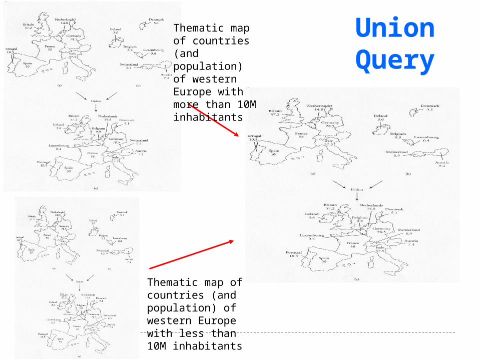
Thematic map of countries (and population) of western Europe with less than 10M inhabitants
Thematic map of countries (and population) of western Europe with more than 10M inhabitants
Union Query
Top Related