


Languages
Pages
Legal

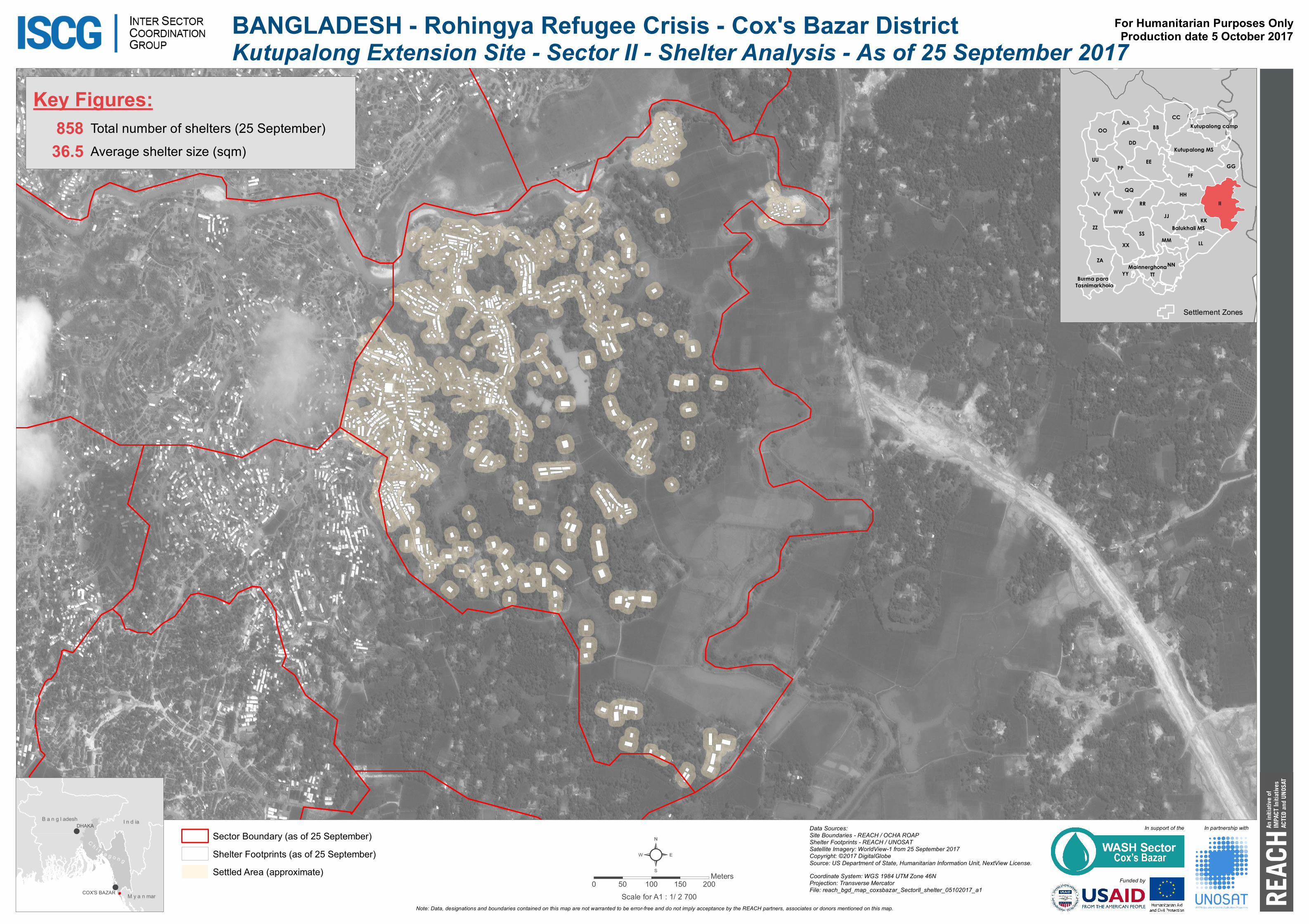
BANGLADESH - Rohingya Refugee Crisis - Cox's Bazar District
!
!M y a n marM y a n mar
I n d iaI n d iaB a n g l adeshB a n g l adeshDHAKA
COX'S BAZAR
Note: Data, designations and boundaries contained on this map are not warranted to be error-free and do not imply acceptance by the REACH partners, associates or donors mentioned on this map.
Coordinate System: WGS 1984 UTM Zone 46NProjection: Transverse MercatorFile: reach_bgd_map_coxsbazar_SectorII_shelter_05102017_a1
Kutupalong Extension Site - Sector II - Shelter Analysis - As of 25 September 2017For Humanitarian Purposes OnlyProduction date 5 October 2017
C h i t t a g o n g
Raja Palong
II
FF
EE
ZZ
TT
JJ
SSLL
PP
HHRR
BB
YYNN
XX
VV
DD
ZA
UU
KK
OO
CC
WW
GG
MM
Kutupalong MS
AA
Mainnerghona
Kutupalong camp
Balukhali MS
Burma para Tasnimarkhola
Sector Boundary (as of 25 September)Shelter Footprints (as of 25 September)Settled Area (approximate)
Data Sources:Site Boundaries - REACH / OCHA ROAPShelter Footprints - REACH / UNOSATSatellite Imagery: WorldView-1 from 25 September 2017Copyright: ©2017 DigitalGlobeSource: US Department of State, Humanitarian Information Unit, NextView License.
Key Figures:Total number of shelters (25 September)858Average shelter size (sqm)36.5
²0 50 100 150 200
Meters
In partnership withIn support of the
Funded by
Settlement Zones
Scale for A1 : 1/ 2 700
Top Related