


Languages
Pages
Legal


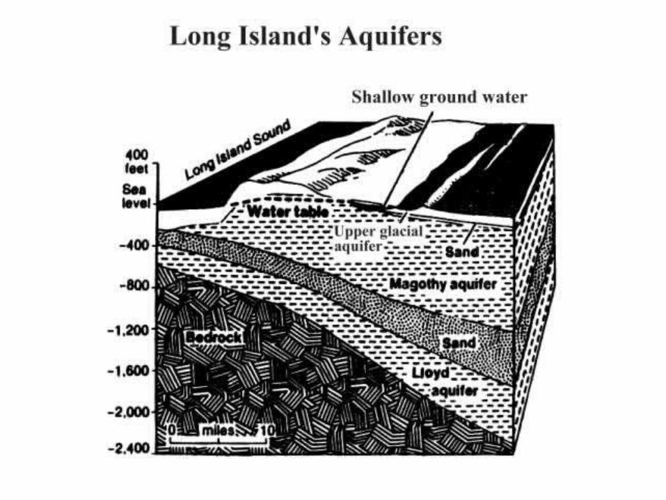
Aquifers are typically saturated regions of ground water which
produce an economically feasible quantity of water to a well or spring
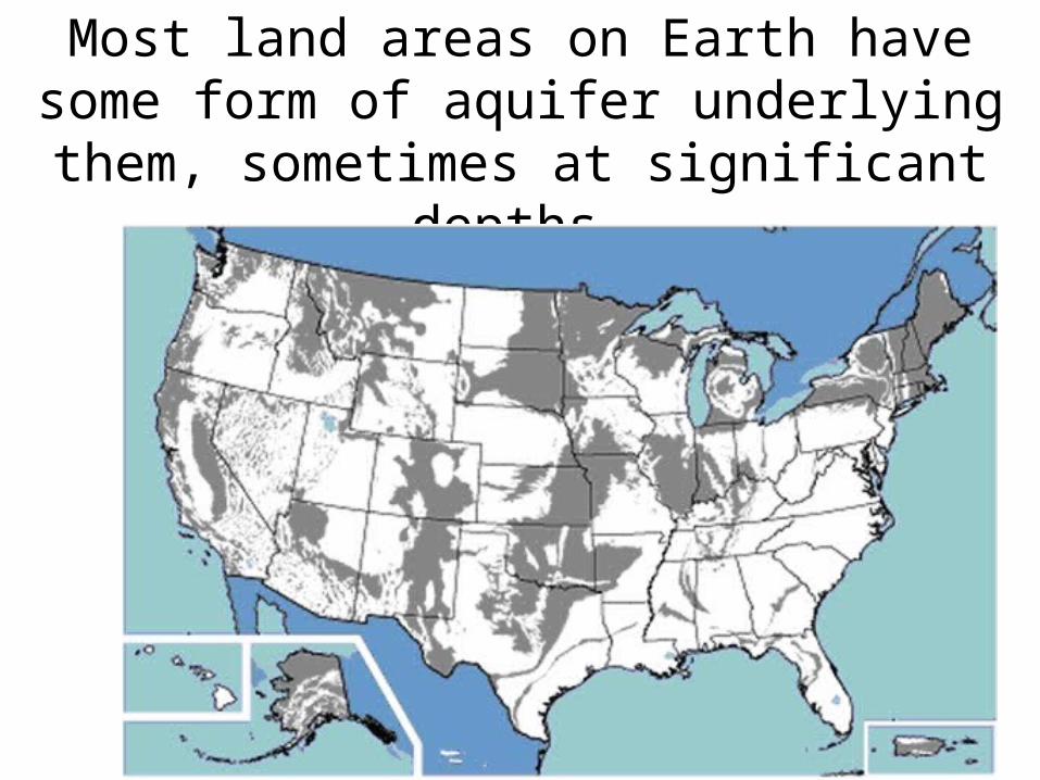
Most land areas on Earth have some form of aquifer underlying them, sometimes at
significant depths.
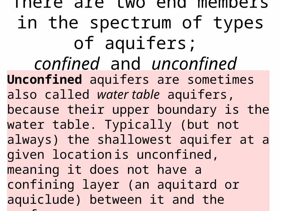
There are two end members in the spectrum of types of aquifers;
confined and unconfined
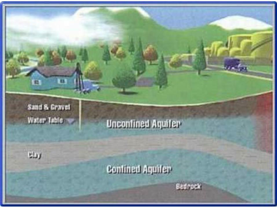
Unconfined aquifers are sometimes also called water table aquifers, because their upper boundary is the water table. Typically (but not always) the shallowest aquifer at a given location is unconfined, meaning it does not have a confining layer (an aquitard or aquiclude) between it and the surface

An aquifer under atmospheric pressure which is only partially filled with water. The top of the saturated area is known as
the water table. It is also known as a water table aquifer.
UNCONFINED AQUIFER
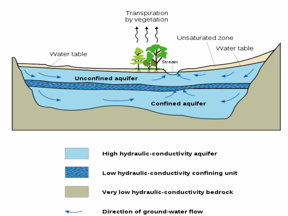
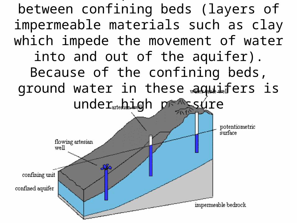
A confined aquifer is sandwiched between confining beds (layers of impermeable materials such as clay
which impede the movement of water into and out of the aquifer). Because of the confining beds, ground
water in these aquifers is under high pressure
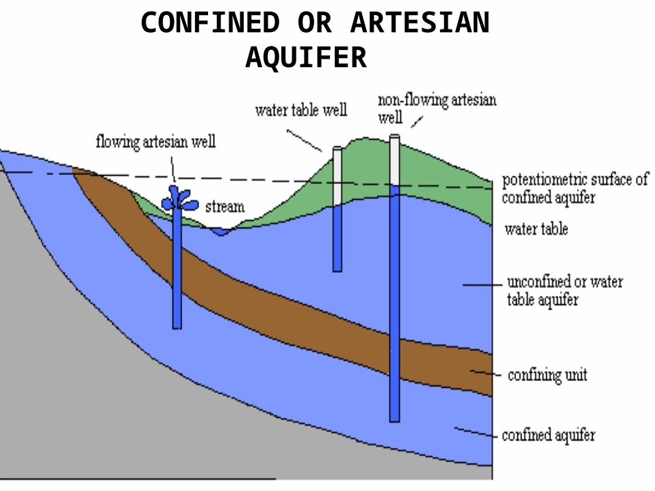
CONFINED OR ARTESIAN AQUIFER
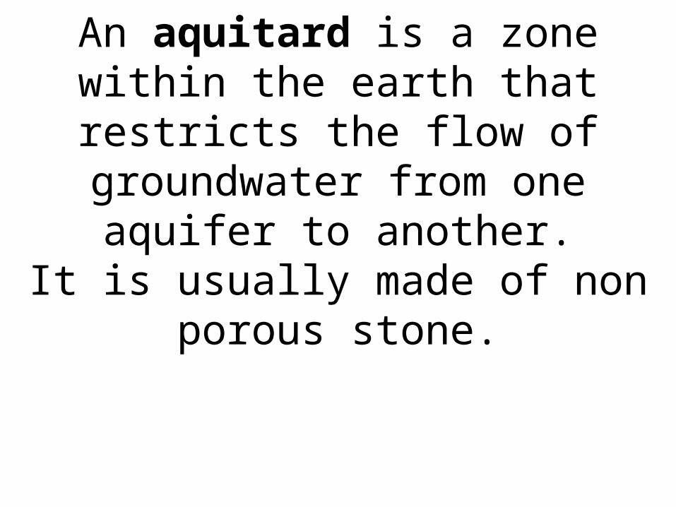
An aquitard is a zone within the earth that restricts the flow of groundwater
from one aquifer to another.It is usually made of non porous stone.
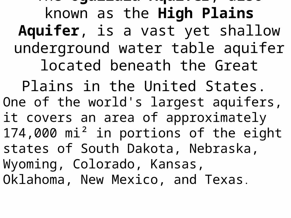
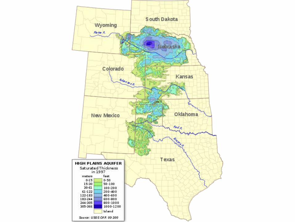
The Ogallala Aquifer, also known as the High Plains Aquifer, is a vast yet shallow
underground water table aquifer located
beneath the Great Plains in the United States.
One of the world's largest aquifers, it covers an area of approximately 174,000 mi² in portions of the eight states of South Dakota, Nebraska, Wyoming, Colorado, Kansas, Oklahoma, New Mexico, and Texas.
“The High Plains is almost wholly unfit for cultivation,” wrote Major Stephen H. Long in 1819, while surveying the western U.S.
territories. Long drew a map and emblazoned the High Plains with the label –
“The Great Desert“. But hidden underground lay the Ogallala Aquifer,
holding more water than Lake Huron, and
spread over an area seven times the size.

The bulk of the aquifer’s water is ancient, having filled the Ogallala rock formation during the wetter climate at the end of the
Ice Age. The water, as is usual in aquifers, does not
lie in a vast pool or river, but soaks the porous rock, and flows very slowly through
it. A drop of water that takes four days to cut
across Kansas in the Arkansas River, would take thousands of years to cross that
distance through the aquifer37

But the water drains fast enough down through the permeable rock towards a well bottom, where a pump can suck
it up above ground in a stream. In the early 1900’s, the wind-powered pump allowed farmers to move to the High Plains, drill wells for drinking
water, and grow crops during the wetter years of those decades38.

Farming in those early years on the High Plains was tough!
In the 1940’s, the electric pump allowed farmers to draw water faster, and to irrigate.
Since then, Americans, who had years ago slaughtered the buffalo and plowed under the
grasses, have been draining the Ogallala. With little rain and river water to recharge it, the water table of the Ogallala Aquifer has
dropped more than 10 feet (3 meters) on the average.
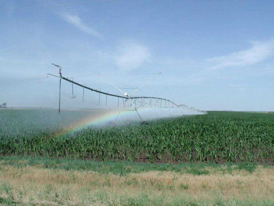

Center-pivot sprinklers are among the irrigation methods used in the High Plains. Large quantities of
groundwater pumped from the Ogallala Aquifer allows these semiarid western lands to yield abundant
harvests.
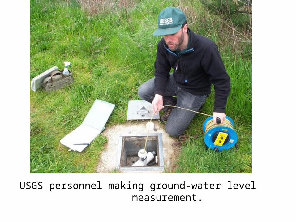
USGS personnel making ground-water level measurement.
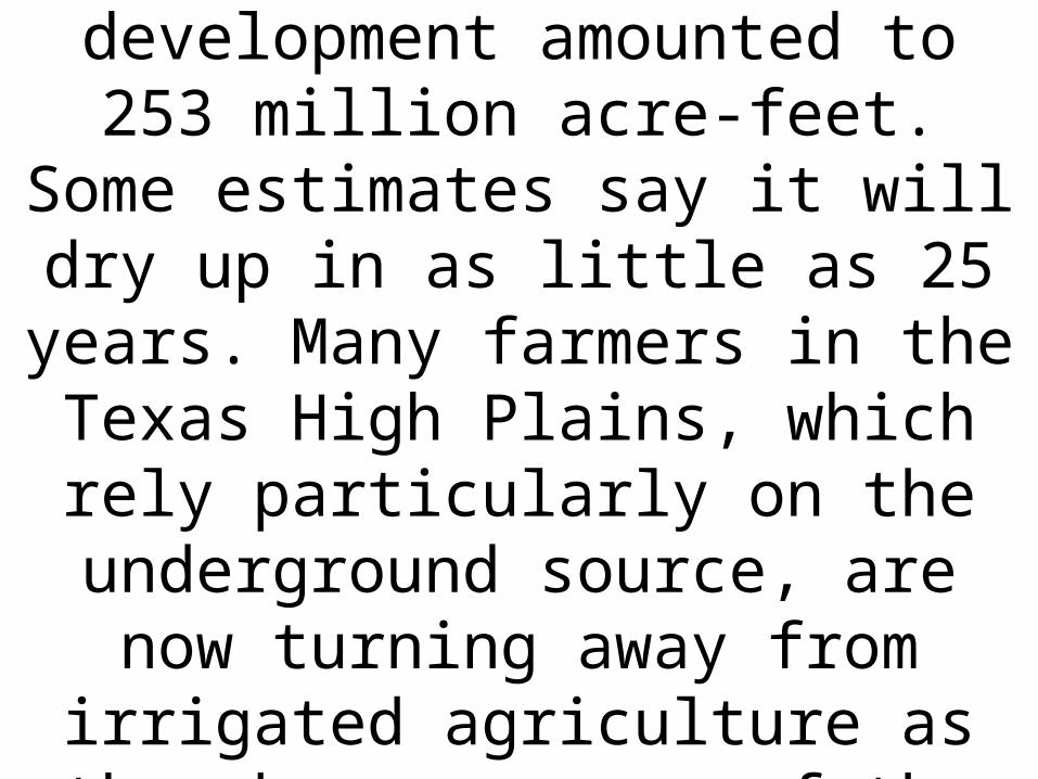
As of 2005, the total depletion since pre-development amounted to 253
million acre-feet. Some estimates say it will dry up in as little as 25 years.
Many farmers in the Texas High Plains, which rely particularly on the
underground source, are now turning away from irrigated agriculture as they become aware of the hazards of over
pumping.
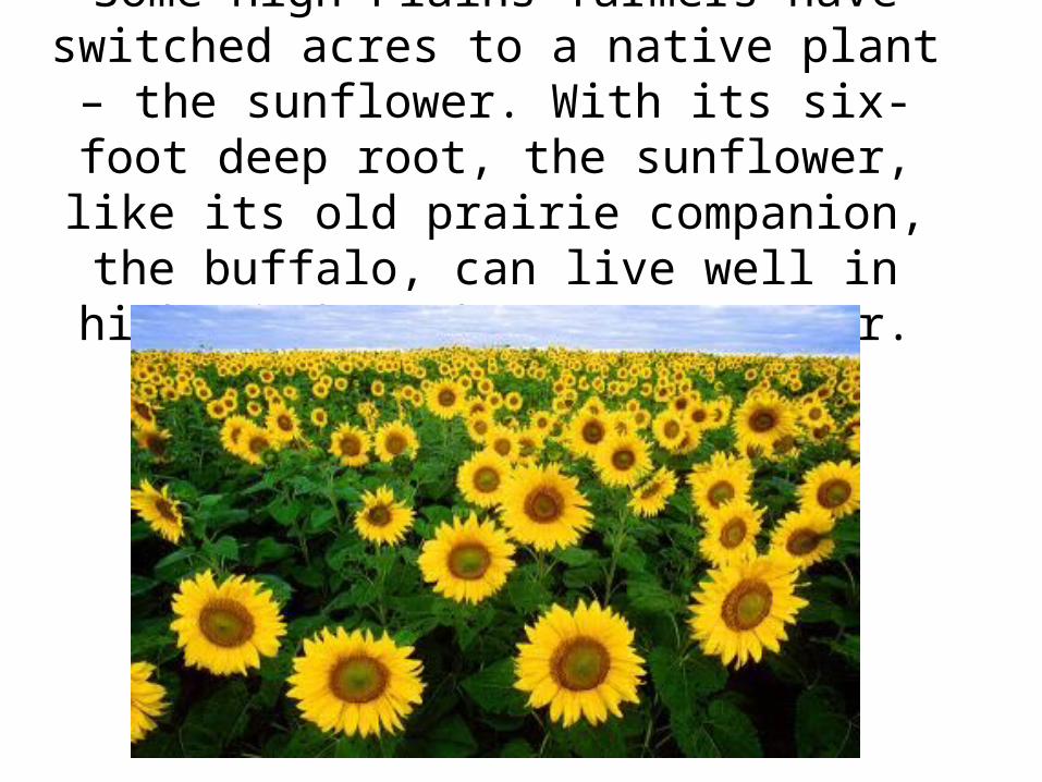
Some High Plains farmers have switched acres to a native plant – the sunflower. With its six-
foot deep root, the sunflower, like its old prairie companion, the buffalo, can live well in high
winds and on scant water.
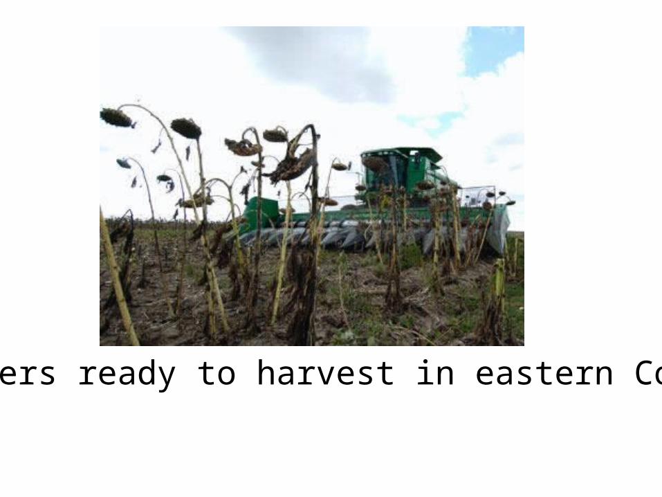
Sunflowers ready to harvest in eastern Colorado
About 27 percent of the irrigated land in the United States overlies this aquifer system, which
yields about 30 percent of the nation's ground water used for irrigation.
In addition, the aquifer system provides drinking water to 82 percent of the people who live
within the aquifer boundary.
Top Related