y.~~~i~~:~:::::::::::::::::::::::::::::::::::: · Page 1 Date rec'd: VIRGINIA DIVISION OF MINERAL...
12
Foem 7 (To be filled in by Division of Mines) COMMONWEALTH OF VIRGINIA (To be filled in by Division of Mines) _ .... ..... . . Cou.ocy DEPARTMENT OF LABOR AND INDUSTRY DIVISION OF MINES Well N ,./) - ;). 4· o . ........ ,... ... ... c: :: .. ........ .. ... .. -. ..... C. .. .... . BIG STONE GAP, VIRGINIA Permit No . ...... .. /0..8. . ......... _ ._ Disma .C./.d J:l2. Wp.Qt? .. . .. . .. DEEPENED Office No . ...... .. ....................... .. ... _ Map OIL AND GAS WELL COMPLETION REPORT ABANDONMENT Location Plat .... .......... ...... ..... ... .. .. .. .. _ .. 12 . .1: .. ::: . .. .. /(2. .7 ..... .. . ... ....... . File . (This report and a copy of electrical log, jf made, must be submitted to the Division of Mines within 30 days after abandonment or completion of well, as required by Section 45·113, Code of Virginia, 1950.) Com n Philadelphia Oil Company pa y .................................................................................... .. Farm ....... .. . .... .. . .. . ... . ... . .. . ...... .. .. .. .... .. . .. .............. .. . Acres .. .... .. .... ....... ..... ...... ... .. ..... .... .. ....... ... ... .. .. .... . .... .. . D" Clintwood Istnct ............ .. ...... .. ... .... .. ............... 96 .. .. .... .. ... . ... .... ........ ... ... . Elevation (ground surface) ........ J .. .. . .... .. . .. . ...... _ . .. ft. County ... Dickenson .. ...... . .. . ........... ..... .. .......... ..... .... ....... . .. .. Well No. (Company) ...................... ... .... .. ....... .. .. . .. .. .. .. . . Location; (Give direction and distance in feet or tenths of a mile from two (2) location reference points or map coordi- nates shown on location plat or map previously filed with the Division of Mines or shown on quadrangle topo- graphic map of area.) feet .................. = .......... miles ...................................................... of ............................... .............. ......................... ... ._................. ... .... .... .. and feet f ......................... ........ miles ............................................ .. ........ 0 .. .... .. ... . . _ ... . .. . .... . ...... . ...... ..... . .. ... ..... .. ..... ... ... .. .. .. .... .. . .... ..... ... . .. . ... .. . ... . ... . . Surface of tract is owned in fee simple by .. . _.. _........ .. ... .. ..... .. .... .. .... .... .... ..... .. .. ... .... .. ...... . ... . ... ...... .... . Address ............................................................................. ... .... .............. ... ... .. .. . .... .. . ..... ... ...... . ....... .. .... ... .. .. . .. .. ........... .. . . Mineral rights are owned by ........................................... .. .. . .. .... ... ... .. . ... .. . .... . ... ... .. .. .. .. .. .. .... .. .. ... . .... . ...... . Address ......... ...................................................... _ ....... .. .... ... ... .. .. ....... ..... ............. .. .. ... .. ... .... .... ... .. . ... ... ...... ... .. . ........ ... .. . Location made by ••• !?! ... g.! ... §.P.E.I?:9:f.. . tn. .... ............ . .................. .............. ................ .. .. ... .. ........ . ....... . .. ..... .. . .... .... .... .. . .. .. .... .. ..... . ...... . ... . Drilling commenced .... ..... ••. 1.9.'14... .. . ..... .............. Drilling contractor .. .. . ...... . .. . Drilling completed ..... .. .. .:!:§J .. . f...9.'14 .. ...... . ...... .. ...... .. Address .?.! .. . Q .! . .. ... 4.9.1 .... ... .. Well completed as well on .................... .. J?.J ... f...9.7.4 . .. ........... .. . ...... .... .. .. . ...... .. .. ... . ........... : ... ..... ............. . .. . .... ...... . ... .. ... . Final open flow - 146 MCF - Sh al e Well abandoned at ....................... _........... feet on ... _..................................... ...... .. .. ........ : Rea son ......._....................... ....................... . Well plugged on ........ ...... ... ....... ....... . .. ..... .. .... ........ .. ........., 19........ Affidavit filed ........... .. ........... .... .. ............................ .. ........ , 19........ Total depth ............... .. ... ???.§ .. ' .... ...... .. ......... ... .... . ......... ....... feet. Steel line measurement .. .... .................... .......... .. ............ .......... feet. Commenced producing on .. .. ... .. ..................., 19 .. .... .. ........... ..... .. ..................... ............................... .. ..... . Oil Well Initial production, oil: 1st 24 hours ....................... _........................... bbls.; 2nd 24 hours .. ... .......... .. .... ....................... ... .......... ... bbls. After shot on .... .... ............................ from ...................... feet to ........ .... feet with .. ... .... ... .. ................ .. Ibs ...... .... ............. _ ....... .. ........ .. qts. After shot on .... ................................ from .................. .... feet to ............ feet with ..................... ......... .. Ib s . ......... ... ... ... .. ......... .. ............ qts. 1st 24 hours ............................................ bbls.; 2nd 24 hours ... _......... .. ........................................ ............... ... .............. ................. .. . bbls. days Settled production .. .. .......... .. ................ .. .......................... bbls. per day after producing .............................................................. weeks ! Gravity and grade of oil ............................................................... - ................................... :............................. .. ..................... ............. ......... . Oil pays at (1) ............................ feet to ...................... .. .... feet. Oil shows at (1) ........................ feet to ........................ feet. (2) ............................ feet to ............................ feet. (2) ........................ feet to ............ .... .. ........feet. (3) .. .......................... feet to ............................ feet. (3) ........................ feet to .......... ........... .. . feet. (4) ............................ feet to ............................ feet. ( 4) ........... _........... feet to ........................ feet. Main production at ...................... feet to ............................ feet. (5) .. ............... ....... feet to .... ........ ............ feet. Gas Well Gaged ............... ............. ./10ths. Water in ...... ? ...... .. .. . inch. Initial open flow, gas: Volume ....................... gf)..9.Y! .. ..... • ............•..:................. .. ....... cu. ft. ............... .. ... ............... ./10ths. Mercury in ........ ........ inch. After shot on ....... .......................... from ........................ feet to ............... .. ........... feet with .................................. Ibs ......... .. .............. . After shot on ................................ from ........................ feet to ............................ feet with ................ .. ................ Ibs ........................ . qts. . . __ ... .. ............ _....................... cu. ft.
Transcript of y.~~~i~~:~:::::::::::::::::::::::::::::::::::: · Page 1 Date rec'd: VIRGINIA DIVISION OF MINERAL...

Foem 7
(To be filled in by Division of Mines)
COMMONWEALTH OF VIRGINIA (To be filled in by Division of Mines)
_ .... i!.ICK:t;.t!~.Q!.:f.. ...... . Cou.ocy
DEPARTMENT OF LABOR AND INDUSTRY
DIVISION OF MINES Well N ,./) - ;). 4 · o . ........ , ... ...... c::: .. .............. .
-...... C. .. 4jdr. !lY.. .f2.Q~ .... . BIG STONE GAP, VIRGINIA Permit No . ........ /0..8. .......... _._
Disma
.C./.dJ:l2.Wp.Qt? ........ Q.YdQ~. DEEPENED Office No . ...... ...................... ..... ... _
Map
OIL AND GAS WELL COMPLETION REPORT ABANDONMENT Location Plat .................... ..... ...... .
.... _ .. 12 . .1: .. ::: ..... /(2..7 .................. . File . (This report and a copy of electrical log, jf made, must
be submitted to the Division of Mines within 30 days after abandonment or completion of well, as required by Section 45·113, Code of Virginia, 1950.)
Com n Philadelphia Oil Company pa y ........................... ....... ................................................. . ~.~.~~~~.~ .. :::~~!:~;. : : :y.~~~i~~:~:: : :::::::: : :: :: : : ::: : : ::::::::: : :: : :: : : :: ::::::: :
Farm ....... ff.~.~y. ... lS~~.:!: .......................................................... . Acres ...... f...'14.~.'1.9. ........................... ......................................... . D" Clintwood Istnct .............. ................................ 96 ................................... . Elevation (ground surface) ........ J ..... g. ~.7.~ ................ _ ... ft.
County ... Dickenson ............................................................ . Well No. (Company) ...................... ?.::~4 .............................. .
Location; (Give direction and distance in feet or tenths of a mile from two (2) location reference points or map coordinates shown on location plat or map previously filed with the Division of Mines or shown on quadrangle topographic map of area.)
feet .................. = .......... miles ...................................................... of ............................................. ............................ . _ .................... .... .... .. and
feet f ......................... ........ miles ............................ .................. ........ 0 ... ... .. ... . . _ ... . ... .... . ...... . ........... . .. ... . . . . . .. . . . . . ...... . . .. .. ....... .... . . . . . ... . .. . ... .. ..... ... . .
Surface of tract is owned in fee simple by ... _ .. _ ........ .. g;!}~?e.f~.~~9 ... 9.~~ .. 9.~~~ ................................................................... . Address ............................................................................. p..I?:~~.~J ... y.~!:.g~~~ .......................................................................... .. ........... ... . Mineral rights are owned by ........................................... gl!!.1.?e.f~.~~9. .. g.?~ .. g.?~.~~;y: .................................................................... . Address ............................................................... _ ............. p..~~.~J. ... y.!:r;.g~~~ ......................................................................... ................ . Location made by .~.9 ••• !?! ... g.! ... §.P.E.I?:9:f...tn. ......................................................................................................... ..................................... . Drilling commenced .... §~P.t~~1?§.~ ..... ~J •• . 1.9.'14......................... Drilling contractor v.P.-.~~~ .. P.:r;.gl~gJ. ... 0.~~ry9.~~~.~~ ......... . Drilling completed ....... $.~p.t~~1?~.~ .. .:!:§J ... f...9.'14 ......................... Address .?.! ... Q.! ... P.!:~Y!.~:r; ... 4.9.1 .... ~~g.~.~~P.-J ... Y!.~~~ .. y.~!:.g!nia
Well completed as ~ well on .................... Nqy.~.~]?E?E .. J?.J ... f...9.7.4 ......................................................... : ......................................... ... . Final open flow - 146 MCF - Shale
Well abandoned at ....................... _ ........... feet on ... _ ............................................... ........ : Reason ....... _ .......................... ........ ............ . Well plugged on .............. ... ....... ............................. ........... , 19 ........ Affidavit filed .................... ........................................ ........ , 19 ....... . Total depth .................... ???.§ .. ' .......... .. ................................. feet. Steel line measurement .......................... ........................ .......... feet. Commenced producing on .. ~9.~ .. g.~!?-?~g"~~9 ... ~.?' .. p'~p'~.~:!:~~ ................... , 19 .. ................................................................. .................. .
Oil Well Initial production, oil: 1st 24 hours ....................... _ ........................... bbls.; 2nd 24 hours .. .......................................... ................ bbls.
After shot on .................................... from ..................... . feet to ........ .... feet with ................................ Ibs ....................... _ .................. . qts.
After shot on .................................... from .............. ........ feet to ............ feet with ......... ....................... Ibs . ...................... .................... . qts.
1st 24 hours ............................................ bbls.; 2nd 24 hours ... _ ......... .. ..... ............................... ........................................................ bbls. days
Settled production ............................................................ bbls. per day after producing .............................................................. weeks !
Gravity and grade of oil ............................................................... - ................................... : .............................................. ............................ . Oil pays at (1) ............................ feet to ............................ feet. Oil shows at (1) ........................ feet to .... .................... feet.
(2) ............................ feet to ............................ feet. (2) ....... ................. feet to .................. ....... .feet. (3) ............................ feet to ............................ feet. (3) ........................ feet to .......... .............. feet. (4) ............................ feet to ............................ feet. ( 4) ........... _........... feet to ........................ feet.
Main production at ...................... feet to ............................ feet. (5) ........................ feet to ........................ feet.
Gas Well Gaged ............... ~.? ............. ./10ths. Water in ...... ? ........ ... inch. Initial open flow, gas: Volume ....................... gf)..9.Y! .......•............•.. : .......................... cu. ft.
................................... ./10ths. Mercury in ........ ........ inch.
After shot on ................................. from ........................ feet to ............................ feet with .................................. Ibs ........................ . . q~.
After shot on ................................ from ........................ feet to ............................ feet with ................ .................. Ibs ............. ........... . qts.
. . ~~ __ ................. _ ....................... cu. ft .
Kocl{ pressure: imtlal .................................................. Jos.; alter ......................... : ...... 110urs .. : ............................. lOS. days
Settled production ............................................. .. ........ cu. ft. per day after producing .......................................................... weeks
G : : 60 Hr. Rock Pressure - 4 sig ...as pays at (1) ............................ feet to .......................... feet. Gas shows at (1) ........................ feet to ........................ feet.
(2) ............................ feet to .......................... feet. (2) ......................... feet to ........................ feet. (3) ............................ feet to .................. ........ feet. (3) ........................ feet to ........................ feet. ( 4) ............................ feet to .......................... feet. ( 4) ........................ feet to ........................ feet.
Main production ............................ feet to ...................... ..... .feet. (5) ........................ feet to ........................ feet.
Fresh water at (1) ........ ~1:? ....... feet, ....... 7.~ .... _ ... GPM; (2) .. ~.? .... feet, .. ~2.'? .... GPM; (3) .............. feet, .............. GPM. Salt water at ~ 1) .......................... feet; (2) .......................... feet; (3) .......................... feet; (4 t .......................... feet. Coal: from~9. .................... feet ................ iaches to ... 1:~9 ........ feet ................ inches; from ...... ? ... 7 ... feet ................ inches to .?§.~
feet .................. inches; from .... ,4,Q ........ feet ................ inches, to ..... 4:!-g .... feet ........... _ ... inches. Well acidized from ...................... feet to .................... feet with........................ (quantity) of ........................ acid.
from ...................... feet to .................... feet with.................. ...... (quantity) of ........................ ,acid.
k . saJ~0~a:ctu:red·; .. i4g8t~DIs·: .. waie~~et2'g'~tBnO#" .. 20!4n .. s~dntiPd 86o"i'cf 20"'sanJ-cid500 ala. MA Remar s. .. .......................................................................................................................... ..t ....... J ............... Z ................ .l ........... .. g ............ ..
9.Q .. g~J~.t ... f::'.2?.J ... l,.?.QQ .. J1?.1? .. ~ ... !.::MQ.J.i ... D:.~~:t!~~~ .. P~.y.9.¢~ ... §Q~.~ .. ::-... P.~.~K.9.~.~~~9 .. A':?7.?::7.? . .7 ... ~!?:9.~.~J. .......... .. 523.Q ... :: .. !t.4., ... ~ ... ~g.Q"t§., ... 2)9.Q::.Q~.l ... 2 ... ~h.Q"t§., ... ?}J..?::?.§..t .. J9. .. ~Q9.:t;..~ .! . ($.~.~ .. Y!.~~J. ... J..9.g,) .......................... , ......................... .
SIZE
(inch)
USED IN DRILLING
(feet)
CASING AND TUBING
LEFT IN WELL
(feet)
PERFORATED
(feet) to (feet)
1} j/8" ·········49······ ......... ·4·cj'······ " iiand' ·cemented···· 9 :~!?:::: ::::: :?q~~:::::: ::::: :: ~~~:?::::::: : :~~~~~~~~: ~~: :~#.~ 7 3560 4091 cemented 4 JJ?: ::: ::::: }4$~ : : :: :: :::::: }4~r : : : : :: :: :q~~~~~~~ )4~r : : : ..... ...... ..... ... .. ....... . .................... .. 4572:":78' '7' 'shot's ' .... ........ ..... ............. ....... .............. ·52jo:..:44· . 8' . shot's' ....... .. ....... .... .. ......... .................. "'5 j'60:":08 . 5' . shot:s .
:::: ::::::: :::: ::: ::::::::::: :::: :::: ::::: ::::::: :: :~~)$~~~ Iq: ~~?:~~
PACKERS
SIZE SET AT
••• 4 ••••••••••••• • •••• •• ••••••••••••••• •••••• •••••••••
........... · · ····NONE········ ........ .... .... . ..... . ce·· ······ ..... . .. .... ... .. ..... .... ........... .. .. .
•••••••• 0 ••• •• • 0 ••••••••••••••••••••• • ••••• •• ••••••••
LINERS
SIZE USED IN LEFT IN PERFORATED DRILLING WELL
(inch) (ft.) (ft.) (ft. to ft.)
.... .,., ............................... ..... ......... .
. . . . . . . . . .. ... . ?~~.q ........ 4~:I:-..... . '.' . ~C?~~ . . . .
..... ...... ... ... .... .... . ... .... .... ..... ..... . . .. ..... ..... . .. ... ....... ..... - ... ......... . . ............... ...... .. ........ .
... ........ .. . ..... .......... ........... .. . .. ... . ...... . . ................. .. ... ...... . ... ... ....... . ... ... ...... ... ..... .. . .. .
...... ..... . .......... .... ... .. ... ............... .... ... ...... ...... ...... ............. ...... ...... .. ... ..... . .. .. ......... . .
Casing Cemented : ... xr.?~~ ...... inch. from ....... h.~........... . feet to .... ~.~?:.~~.?~ .... feet. ... _·i .. f/i .... · ~nch. from .. ·~f~f .. : .. · .. ·.. feet to .. ·~oog~·?~ .... feet. ................... _ ... Inch. from ................... _... feet to ........... _ ........... feet.
Date ... ~~~·~~:~~~.T6~ ... i~~ .. Date ......... ·· ................ _.8 .. · .. ··.· .... .. Date ... §.~p.~.~~~~~ ... ~ ... ! ... ?:?7.4 ..
Remarks: (Shut down, depths, dates; fishing jobs, depths, dates; caving; other notes) .............................................................................................................................. -_ ........... -............................................................................... -.... -.-.. _ ......................... _ ........................................ _-... -_ ...................... _ .. -_ ........ -.............. ...... _._--_ ..... _--_ ... _ ............... _ .................... _ ....... -.. ........... _-...... -....................... _ .................... _ ............................. -.-- ........ _ ..... _ ........ -_._ ...... -- ............... -.. -._ ...... __ ......... -................. --_ .......... -_ ...... -.. ...... _ . ........... . .. -....... __ ...... _-_ ........ -...... _ ............ _._ ...... _ ......... __ ..... _ ....... _ ..... -.... _ ... _._-_._ ... -. .......... -........................ _ .......... _ ............... __ .. __ ......... _ ..... _ ........... __ ...... _ ..... .
Samples or cuttings will be available for examination by a m ember of the Virginia Geological Survey .............. m ............ ~~~j
Will be furnished the Virginia Geological Survey upon request ........................ ~, if sacks for same are furnished by the
Survey .......................... .......................................................... ~
Electrical log made .. ~ ........ or not made ............ (check which). Copy furnished herewith ........................ or will be submitted on or
Depths :::::::::~=::~~~~~:!.~~:::::::::::::::::::::::::::::::::::::::::::: by ... ~.I? .. !?.9.9Q .. ~.~ .... ~y.~.g.!?-.~~.~ ................................ ,19 ...... ..
...... P.J:?.g.~g~].J?bJ~ ... Q.tJ ... Q.QgJF!¥.lY. .................................... .
...... p..t ... Q.f... J?Q~ ... 4JJ ............................................................. ..
...... p.'£.?!=?:t.QP.~1?~g, ... K~nt.~.<;!.KY ..... !tJ§2) ........................ . The operator requests that information given herein and Jog or logs be kept confidential for a period of ninety days after
completion of the well covered by this report ....................... _ ....... (~~

, • -. . " . Well No . ........ f?-= ... ~.~ ............... File No . ........ .():!.--.. .. : .. fQ.Z ...... Permit No . ......... /4? ... f. ......................
LOG . .
Furnished by .. ~.<t ••• ~.t ••• J'§.~~n§ ....... Date .1?::.:m::::7.!'t . . . i ( . '
- Compiled by ._.:r;.~ ... ~.~.~.J.~mlQD.? ...... Date .1?::.J9::-.7.!'t
1
REMARKS SAMPLE HAm>oa Top BOTrOH TmCKJo."ESS OIL, GAS,
No. FORHATION COLOa SOFT (feet) (feet) (feet) WATER DEPTHS SHUT DOWN
FISHING, ETC.
Spoil Pile 0 49 49 Sand & Shale 49 107 58 Coal 107 110 3 Sand 110 267 157 Coal 267 269 2 Sand 269 330 61 Sand & Shale 330 408 78 Coal 408 410 2 Sand & Shale 410 735 325 Coal 735 740 5 Sand 740 776 36 Sandy Shale 776 800 24 Sand 800 905 105 Coal J~ 905 910 5 Sand 910 966 56
.' Sand & Shale 966 1064 98 ' Coal 1064 1069 5 Sand 1069 1116 47 Sandy Shale 1116 1164 48 Sand 1164 1210 46 Sand & Shale 1210 1367 157 Sand 1367 1491 124 Coal 1491 1494 3 Sand 1494 1852 358 Coal 1852 1855 3 Sand 1855 1886 31
I
Sand &Shale 1886 1915 59 Coal 1915 1917 2 Sand 1917 1965 48 Sand & Shale 1965 2022 57 Sand 2022 2243 321 Sand 2243 2400 157 Red Rock 2400 2401 1 Sand & Shale 21,01 2495 94 Red Rock 2495 2533 38 . Sand & Shale 2533 2566 33 Shale 2566 2705 139 Sand 2705 2730 25 Shale 2730 2755 25 Sand 2755 2880 145 Sand & Shale 2880 2930 50 Sand 2930 3065 135 Sand & Shale 3065 3085 20 Sand 3085 3282 20 Sand & Shale 3282 3487 205 Little Lime 3487 3572 85 Sand & Shale 3572 3586 14 Big Lime 3586 4018 432 ;
Injun Sand 4018 4090 72 We ir Shells 4090 4280 90 Shale 4280 4490 210 Coffee Shale 4290 4553 263 Berea 4553 4578 25 Berea Sand 4514 4579 4 Sand & Shale 4579 4640 61 Shale 4650 5614 964 Cornif~rous 5614 5634 20 Total Depth 5638
NOTE: Driller I s I og adjuste d to El ~ctric L< g
M!NEAAL RESOURC[$

)
, .~.. .~ ,'" OIL' AND GAS WELL
SUMMARY REPORT
VDMR Wel l API No. ___ 4_5_-0_5_l_-_l0_l_6_8-_0_0_-0~3 ____________ Rep. No. ___ \~_-4_8_0_7 ______ _
DMQ F 11 e No. 0 I -1 07 ---------Opera tor ___ P_H_I L_A_D_EL_P_H_IA_O_I L_C_OM_P_A_N_Y _________ ----_____ _ Farm HENRY KEEL Co. Well No. ____ P_-_24 _____________________________ _
County DICKENSON Quadrangle __ C_L_IN_T_W_OO_D_-_7_-.....:1/_2_' __ Location (UTM) N 4,110,580; E 369,370 UTM Zone 17 ---!....:----(Lat. and Long.) _______________________________________ __
Fie 1 d ________________________ Provi nce APPALACHIAN PLATEAUS
E1 ev • (speci fy) 1960.79' GR. TD 5638 ' INITIAL FLOW - SHOW
Form. at TO CORNIFEROUS Age DEVONIAN
Date cemp1. or abandoned NOVEMBER 15, 19.74 ------~----------------------------Result GAS WELL
,Gas Shows ________________ ~ _________________ _
Gas Pays Main Production Prod. Form. ------------Age _________ _
Treatment: SAND FRACTURED; , 1468, BARRELS OF WATER, 25,000 POUNDS OF 20/4() SAND, 18,000 POUNDS OF 10/20 ,SAND, 500 GALLONS OF MA; 60 GALLONS OF F-52, 1,200 POUNDS OF 4-140. FRACTURED DEVONIAN SHALE; PERFORATED FROM 4572' to 4578' - 7 SHOTS;
, I
FROM 5230' to 5l44' - 8 SHOTS; FROM 5300' to 5308' - 5 SHOTS; FROM 5338' to 5356' -Initial Product;on ~ - 10 SHOTS.
FINAL FLOW - 146,000 CU. FT.
Oil shows Water FW X at 112'; 75 GPM at 149'; 100 GPMat
SW at at at
Coal 107' to 11 0'; 267' to 269'; 408' to 410' I
Plat X Plotted X Completion Report X
. Dr; 11 ers Log Geologic Log
Samples X Interval Sheet X
Sample Interval O· to 6620'
Remarks Geophysical Logs S.P. Res Gamma X Neutron
Density X Sonic Other CALIPER; TEMPERATURE;
Stratigraphic Data Souze. ___ .... _________________ _
Formation Top Datum
(Subsea) Thickness
~ks _______________________________________________________ __
References _____________________________________________________ __
Released to Open Filel COmpletion __ F_E_BR_U_A_R_Y_l_3..,;,_19_7_5 ______ _
Samples YES ---------------------------------
(Note I t1l'M measurements in meters, all others in feet)
' .
" o ~ ___ ,d. 37 10 00
1 ...... 1
1
2 CLINCHFIELD COAL CO.
-3
N.12537.88 W.25423.76 HENRY KEEL
174.79 AC •
•
CLINCHFIELD COAL CO.
New Locati.-.• Drill Deeper ..... 0 Abandonmat ..••.. 0 BLOCK NO. 849 MAP NO.6
Company PHILADELPHIA OIL COMPANY
Addfea PRESTONSBURG. KY.
Tract T-725 Acres 174.79 Lease No PO 148
Well (Fana) No _____ Serial No P- 24
Elevation (Spirit Lenl> __ --'19_6_0::,...._7_9_1
____ -I
Quadrancle . CLINTWOOD. VA.
County DICKE'NSON District CLINTWOOD EngmHf _______________________________ 1
Engineer'. Jleciatration No. 3084 L.S. 534 KY.
File No Drawmg NO ______ 1
Date 3 - 13-74 ' Scale I": 4001
'COMMONWEALTH OF VIRGINIA DEPARTMENT OF LABOR 8 INDUSTRY
, DIVISION OF MINES ' BIG STONE GAP
WELL LOCATION MAP FILE NO. ______ _
+ Denotes location of well on United States Topographic Maps, scale 1 to 24,000, latitude and longitude lines being represented by border lines as shown.
- Denotee one inch ..-c.- _ ...... · line of original tracing.
~
0 to
,... N
0
N CD
QI "CI :I .. '&
! #>

,-. 1974 I. ~~~I jl
MINERAL RESOURCES

Page 1
Date rec'd:
VIRGINIA DIVISION OF MINERAL RESOURCES Box 3667, Charlottesville, VA 22903
INTERVAL SHEET
of 2 Well Repository No: W-4807
Date Processed: July 1977 Sample Interval: from:Oto:5620'
PROPERTY: Henry Keel Well No. p-.24 Number of samples: 189
COMPANY:
COUNTY:
From-To
150-180 180-210 210-240 240- 270 270- 300
300- 330 330- 360
420- 450
510- 540 540- 570
570- 600 600- 630
Philadelphia Oil Company
Dickenson
From-To
690 720 720 - 750
9901.020 10201.050 10501.080 10801.110 11101.140
11401.170 11701.200
12301.260
12901.320 1320-1350 13501.380
1440-1470 1470-1500
From-To
1590 1620 1620 -:1.650 1650 -:1.680
1710~740
1950-1980 2010-2040 2040-2070 2070-2100 2100-2130
2130-2160 2160-2190 2190-2220 2220-2250 2250-2280
2280-2310 2310-2340 2340-2370 2370-2400 2400-2430
Total Depth: 5638'
Oil or Gas:xWater: Exploratory:
From-'l;'9 2430 2460
2760-2790 2790-2820 2820-2850 2850-2890
2970- 3000
3030- 3060 3060- 3090
3180- 3210
3240- 3270
3300- 3330
3360- 3390 3390- 3420 3420- 3450
VIRGINIA DIVISION OF MINERAL RESOURCES Box 3667, Charlottesville, VA 22903
INTERVAL SHEET Continued
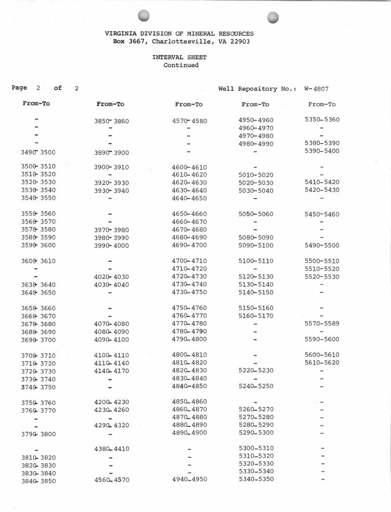
Page 2 of 2 Well Repository No. : W-4807
From-To From-To From-To From-To From-To
3850- 3860 4570-4580 4950-4960 5350-5360 4960-4970 4970-4980 4980-4990 5380-5390
349CT' 3500 3890- 3900 5390-5400
3500- 3510 390.0- 3910. 460.0-4610. 3510- 3520. 4610- 4620. 50.10.-50.20. 3520- 3530. 3920- 3930. 4620-4630. 50.20-50.30. 5410.-5420. 353<T 3540 3930- 3940. 4630-4640. 50.30-5040. 5420-5430. 354<T 3550 4640-4650
355<T 3560. 4650-4660 50.50-50.60 5450-5460. 356<T 3570. 4660-4670. 357<T 3580 3970- 3980. 4670- 4680. 358<T 3590 3980- 3990. 4680-4690. 50.80-50.90. 359<T 360.0. 3990- 40.00 4690-4700. 50.90-510.0. 5490.-550.0.
360& 3610. 470.0-4710. 5100-511Q 550.0.-5510 4710-4720. 5510.-5520
40.20- 40.30. 4720-4730. 5120-5130. 5520.-5530 363& 3640 4030- 40.40. 4730-4740. 5130-5140. 364& 3650. 4730- 4750. 5140-5150.
365& 3660. 4750-4760. 5150.-5160. 366& 3670. 4760-4770. 5160.-5170. 367& 3680 40.70- 40.80. 4770-4780. 5570.-5589
368& 3690. 40.80- 40.90. 4780-4790.
.369& 3700. 40.90- 4100. 4790-480.0. 5590.-5600.
370& 3710. 410.0- 411Q 4800-4810. 5600.-5610.
371&3720. 411Q.. 4140. 4810-4820. 5610-5620.
372& 3730. 414Q.. 4170. 4820-4830. 5220-5230.
373Q. 3740. 4830.-4840.
374Q. 3750. 4840.-4850. 5240-5250.
3/5G. 3760. 42QQ.. 4230. 4850-4860.
376G. 3770 423Q.. 4260 4860._4870 5260-5270 4870-4880. 5270.-5280.
4290. 4320. 4880_4890. 5280.-5290
379~ 380.0 4890._490.0. 5290-530.0.
4380- 4410. 5300.-5310
3810- 3820 5310-5320.
3820- 3830. 5320.-5330
3830- 3840 5330.-5340.
3840- 3850 4560- 4570 4940_4950. 5340.-5350.

/
, ~ . OIL AND GAS WEll
SUMMARY REPORT
VDMR Wel l API No. ___ 4_5_-0_5_l_-_l0_l_6_8-_0_0_-0~3 ____________ Rep. No. __ \~_-4_8_0_7 _________ _
DMQ File No. 01-107 -----------Opera tor ___ P_H_I L_A_D_EL_P_H_IA_O_I L_C_OM_P_A_N_Y _________ ----_____ _ Farm HENRY KEEL Co. Well No. ____ P_-_24 _____________________________ _
County DICKENSON Quadrangle __ C_L_IN_T_W_OO_D_-_7_-~1/_2_' __ Location (UTM) N 4,110,580; E 369,370 UTM Zone _-:.1..:..-7 __ _ (Lat. and Long.) _______________________________________ __
Fiel~ Province APPALACHIAN PLATEAUS -----------------------------Elev. (specify) 1960.79' GR. TO 5638' Fonn. at TO CORNIFEROUS INITIAL FLOW - SHOW Age DEVONIAN Date camp1. or abandoned NOVEMBER 15, 19,74
--------~--------------------------Result GAS WELL ,Gas Shows ______________________ ~ __________________ _
Gas Pays Main Production Prod. Fonn. ---------------- ----------------Age ______________ _
Treatment: SAND FRACTURED; . 1468, B~RRELS OF WATER, 25,000 POUNDS OF 20/40 SAND, 18,000 POUNDS OF 10/20 ,SAND, 500 GALLONS OF MA; 60 GALLONS OF F-52, 1,200 POUNDS OF 4-140. FRACTURED DEVONIAN SHALE; PERFORATED FROM 4572' to 4578' - 7 SHOTS;
, I
FROM 5230' to 5J44' - 8 SHOTS; FROM 5300' to 5308' - 5 SHOTS; FROM 5338' to 5356' -Initial Production ~ - 10 SHOTS .
FINAL FLOW - 146,000 CU. FT.
Oil shows water FW X at 112'; 75 GPM at 149'; 100 GPMat
SW at at at
Coal 107' to 11 0·; 267' to 269'; 408' to 410' I
Plat X Plotted X Completion Report X
. Dri 11 ers Log Geologic Log
Samples X Interval Sheet X
Sample Interval 0' to 6620'
Remarks Geophysical Logs S.P. Res Gamma X Neutron
Density X Sonic Other CALIPER; TEMPERATURE;

.-'
Stratigraphic Data Source ___ .... _________________ _
Formation Datum
(Subsea) Thickness
~ks _____________________________________________________ __
References ____________________________________________________ __
Released to Open Filel COmpletion __ F_E_BR_U_A_R_Y_l_3..,;,_19_7_5 ______ _
Samples YES ------------------------------(Note I t1l'M measurements in meters, all others in feet)
' .