
WSDOT Airport and Compatible Land Use Program and Compatible Land Use Program Carter Timmerman...
28
WSDOT Airport and Compatible Land Use Program
Transcript of WSDOT Airport and Compatible Land Use Program and Compatible Land Use Program Carter Timmerman...

WSDOT Airport and Compatible Land Use Program

Airport and Compatible Land Use Airport and Compatible Land Use Program Program
Carter TimmermanAviation PlannerWSDOT Aviation
Paula HammondSecretary of Transportation
Steve ReinmuthChief of Staff
John SiboldAviation Division Director

Aviation and requirements of Washington state law
Definitions: Compatible and incompatible land uses
How to plan for compatibility
Question-and-answer period
Presentation outline:Presentation outline:

What benefits can aviation bring What benefits can aviation bring to Washington communities?to Washington communities?

Airports and state lawAirports and state law
Airports are Essential Public Facilities(RCW 36.70A.200)
Airports are part of the multi-modal transportation system(RCW 36.70A.070)
Towns, cities and counties must discourage incompatible land uses(RCW 36.70.547, 36.70A.510; 35A.63.270; 35.60.250)
Towns, cities and counties must consult with aviation interests(RCW 36.70.547, 36.70A.510; 35A.63.270; 35.60.250)
WSDOT Aviation must provide technical assistance(RCW 36.70.547, 36.70A.510; 35A.63.270; 35.60.250)

1986
1995
1974
1995
Encroachment and Anacortes AirportEncroachment and Anacortes Airport

Anacortes AirportAnacortes Airport todaytoday

Consequences of conflictConsequences of conflict
• Degraded airport operations
• Impeded airport expansion
• Hampered economic development
• Reduced neighborhood quality of life

Aviation‐related
Industrial / commercial
Agriculture
What is compatible land use?

Wildlife attractants
Height hazards
Residential development
What is incompatible land use?

Daycares Places of worship, temples, mosques, etc
Hospitals and adult-care facilities
Incompatible land uses
Schools
Smoke or steam
Flammable liquids, etc

Historic Historic accident dataaccident data
Denotes aircraft accidents
SafetySafety
Noise Sensitivity
NoiseNoise Height hazardsHeight hazards
NoiseNoise‐‐sensitive sensitive usesuses
Naturally Naturally occurring and occurring and manmade manmade objectsobjects
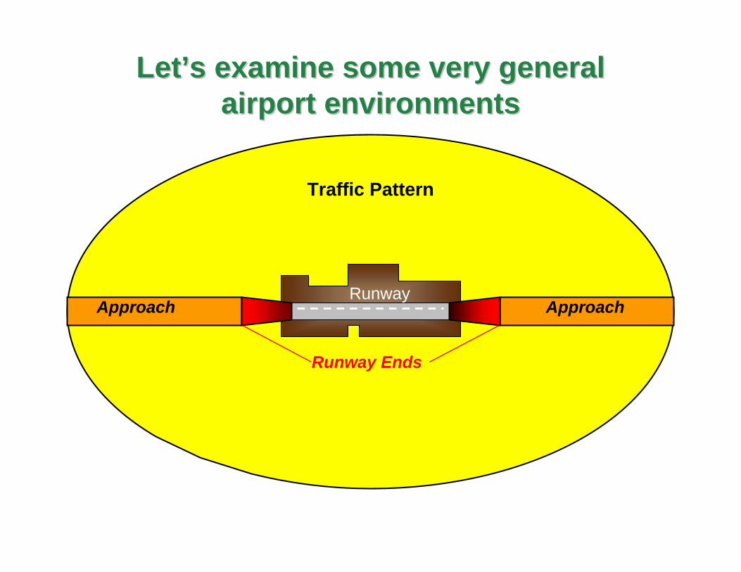
Runway
LetLet’’s examine some very general s examine some very general airport environmentsairport environments
Approach Approach
Runway Ends
Traffic Pattern

Table: General land-use acceptabilityAirport proximity Near runway
endsWithin runway approaches Beneath traffic
patterns
Agricultural Compatible if not birdattractant
Compatible if notwildlife attractant
Utilities/transportation
Avoid Compatible Compatible
Parks / recreation Incompatible Compatible
Industrial Compatible if does notproduce airspace obstructionsor have bulk amounts ofhazardous materials
Compatible if does notproduce airspaceobstructions
Retail / serviceuses
Incompatible Compatible if low intensity Compatible
Offices Incompatible Compatible if low intensity Compatible
Light Industrial Compatible atlow intensity
Compatible
Places of worship Incompatible Incompatible
Residential Incompatible
Children’s schools Incompatible Incompatible Incompatible
Hospitals / nursinghomes
Incompatible Incompatible Incompatible
Compatible if not wildlife attractant
Compatible if low intensity
Compatible at low density
Compatible if low intensity
Avoid
Incompatible Incompatible
Typical land-use types

1999 guidelines and Web site resources:
• Historic perspective
• Process
• Tools
• Strategies
• Worksheets
• Consultation process
• Flexibility
WashingtonWashington’’s Airport Land Use s Airport Land Use Compatibility ProgramCompatibility Program

WSDOTWSDOT’’s land use compatibility processs land use compatibility process
Step 1: Getting started and gathering data

Topography
Parcel layer
Airport master plan and airport layout plan
Historic accident data
Traffic pattern
Existing land uses
Community comprehensive plan
FAR Part 77 Airspace Surfaces

WSDOT’s land use compatibility process
Step 1: Getting Started and Gathering Data
Step 2: Delineate the Airport Influence Area
Step 3: Identify Compatibility Concerns
Step 4: Adopt and Implement the Policies
Step 5: Identify Tools and Adopt Regulations

Description - Conduct preliminary work needed to initiate the compatibility planning process
Step 1: Getting started and gathering dataStep 1: Getting started and gathering data
•Contact WSDOT Aviation for a preliminary consultation .•Identify your jurisdiction’s responsibilities.•Identify stakeholders.•Prepare public participation plan.•Gather airport information and community data
- Airport Master Plan and Layout Plan- Airport facilities, services and activities - Interviews with airport managers and pilots
•Gather existing land use constraint maps and parcel information.
•Gather comprehensive plans and implementation regulations.
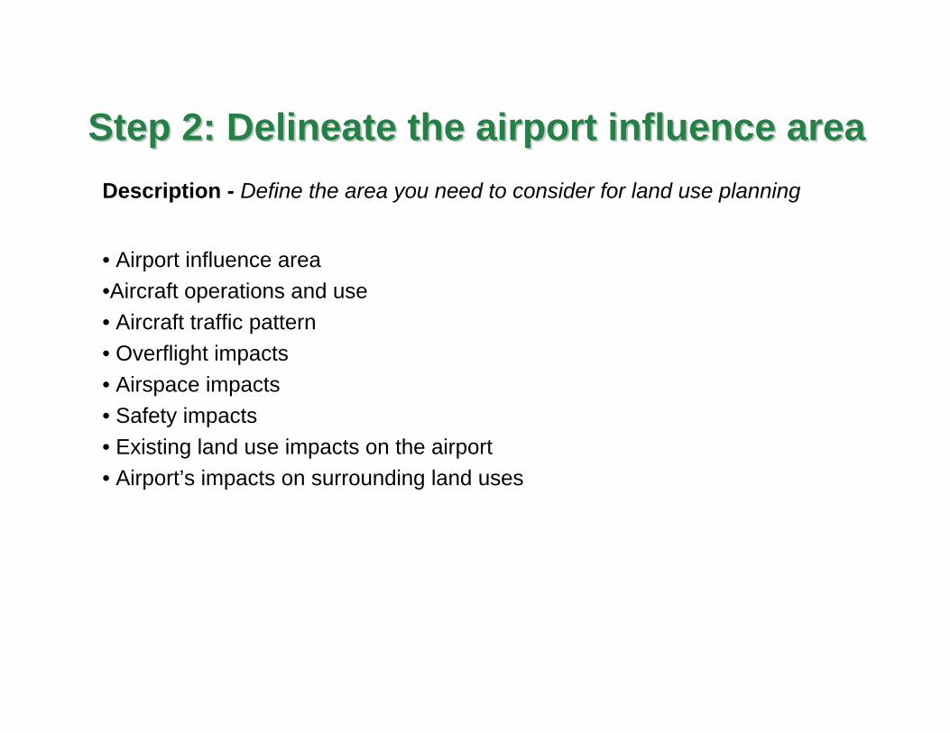
Description - Define the area you need to consider for land use planning
Step 2: Delineate the airport influence areaStep 2: Delineate the airport influence area
• Airport influence area•Aircraft operations and use• Aircraft traffic pattern• Overflight impacts• Airspace impacts• Safety impacts• Existing land use impacts on the airport• Airport’s impacts on surrounding land uses

• "Airport influence area" means the area adjacent to a public use airport that can affect or be affected by airports and aircraft operations.”
• This sphere of influence is contained within airport traffic patterns, aircraft over flight and safety areas, and airspace surfaces critical for air navigation addressed under chapter 14.12 RCW and Federal Aviation Regulations (FAR) Part 77.
• The airport influence area is used to identify the geographic area that should be considered during the airport land use compatibility planning process.
• "Airport influence area" includes terrestrial land uses and the navigable airspace necessary to address land use compatibility adjacent to airports.
Definition of airport influence areaDefinition of airport influence area

Description - Examine the level of compatibility in your community.
Step 3: Identify compatibility concernsStep 3: Identify compatibility concerns
•Evaluate the land use character of the airport influence area.
•Evaluate land use compatibility features.
•What potential compatibility conflicts are on the horizon?
•Determine compatibility concerns need to be addressed.

Step 4: Develop compatibility policies Step 4: Develop compatibility policies
Definition - Examine the various policy and regulatory strategies available to pursue airport land use compatibility and amend comprehensive plans
• Identify compatible land use adjacent to airports.
•What does it mean to discourage incompatible land uses?
• What compatibility policies are already in place?
•Identify airport facilities and support facilities in the comprehensive plan.
•What new comprehensive plan policies are needed?

What should a comprehensive plan include?What should a comprehensive plan include?
• A map identifying the airport influence area
•Narrative report regarding the airport
Description of the airport facilities and operations, existing and future
Identify the role of airport/s in local and regional economic development
Its role in the Washington State System Plan
•Policies:
Discourage incompatible development
Recognize the airport as an Essential Public Facility
Identify and protect Part 77 Imaginary Airspace Surfaces
Promote compatible uses: aviation-related, light industrial, commercial or
agriculture
References in transportation and capital facilities elements
Levels of service
Ideally:

Description - What Implementation measures and strategies are needed?
Step 5: Implement the strategies Step 5: Implement the strategies
• Identify and adopt strategies that can be used to respond to
compatibility planning challenges.
•Identify zoning measures to implement the comprehensive plan.
•Designate compatible land uses on the zoning map.
•What actions are necessary to ensure continued implementation
of the policies?
•Review policies and development regulations on a regular base to
monitor progress.

Direct zoningAirport overlay ordinance Direct zoning and airport overlayMixed use zoning Infill developmentTransfer of development rights
Airport stormwater design manual Control airspace obstructionsLimit high-intensity usesFly-friendly proceduresWireless communication ordinanceWind energy systems ordinance
Land use strategies and implementation toolsLand use strategies and implementation tools

Aviation and requirements of Washington state law
Definitions: Compatible and incompatible land uses
Compatibility exercise
WSDOT’s 5 step process
In review:In review: