
Workshop research and monitoring
16
Monitoring dynamic dunes state of the art geomorphology
-
Upload
pwn -
Category
Environment
-
view
342 -
download
0
Transcript of Workshop research and monitoring
Monitoring dynamic dunesstate of the art
geomorphology
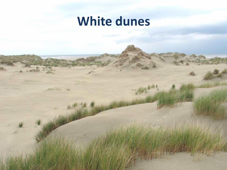
White dunes

Grey dunes
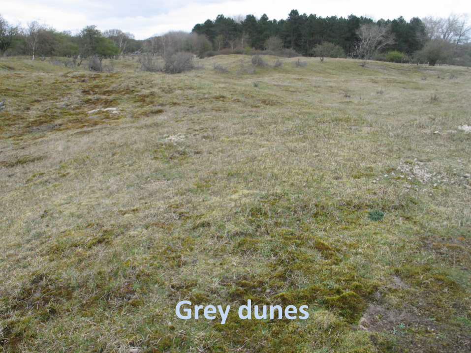
Grey dunes
Grey dunes
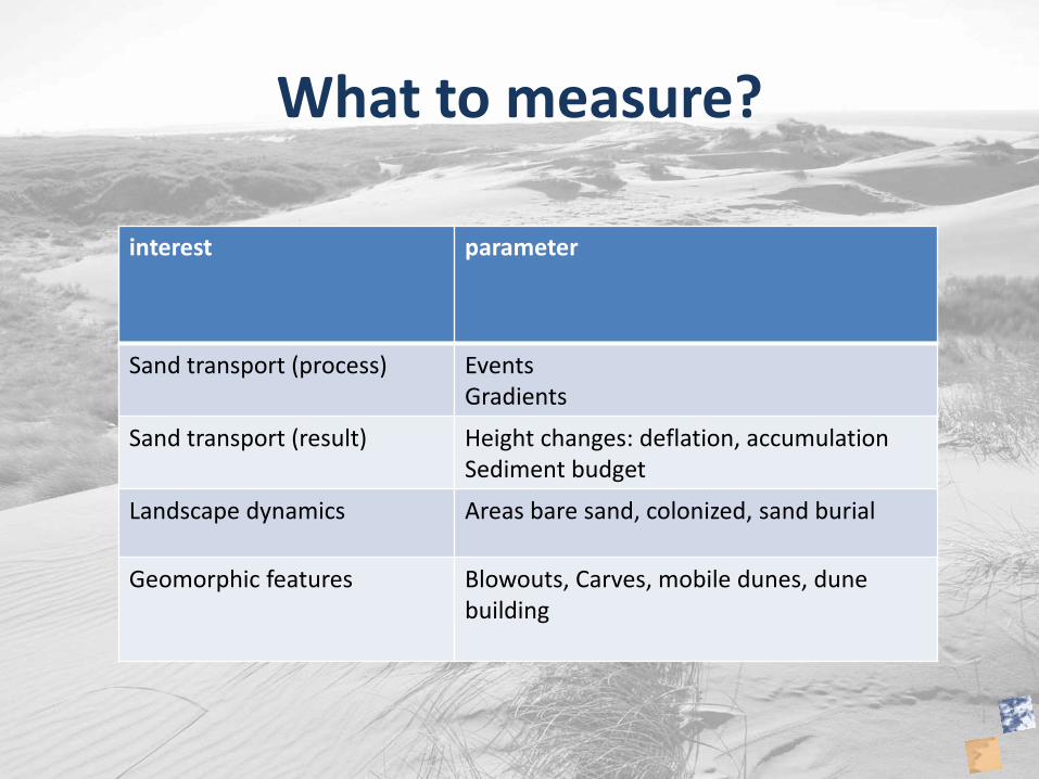
What to measure?
interest parameter
Sand transport (process) EventsGradients
Sand transport (result) Height changes: deflation, accumulationSediment budget
Landscape dynamics Areas bare sand, colonized, sand burial
Geomorphic features Blowouts, Carves, mobile dunes, dune building
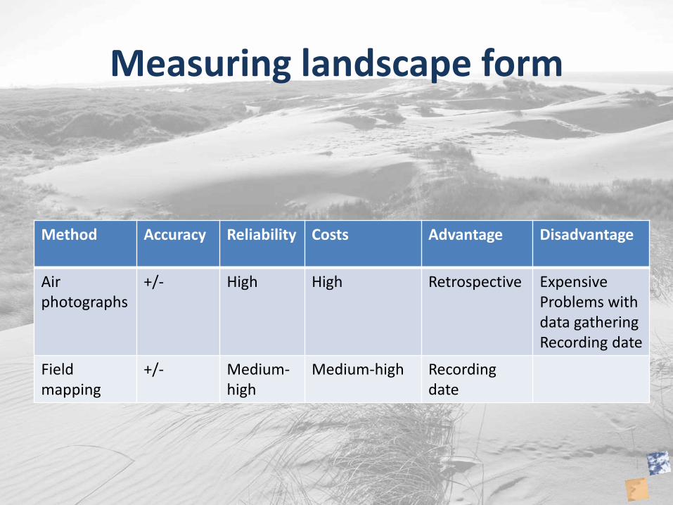
Measuring landscape form
Method Accuracy Reliability Costs Advantage Disadvantage
Air photographs
+/- High High Retrospective ExpensiveProblems with data gatheringRecording date
Field mapping
+/- Medium-high
Medium-high Recording date
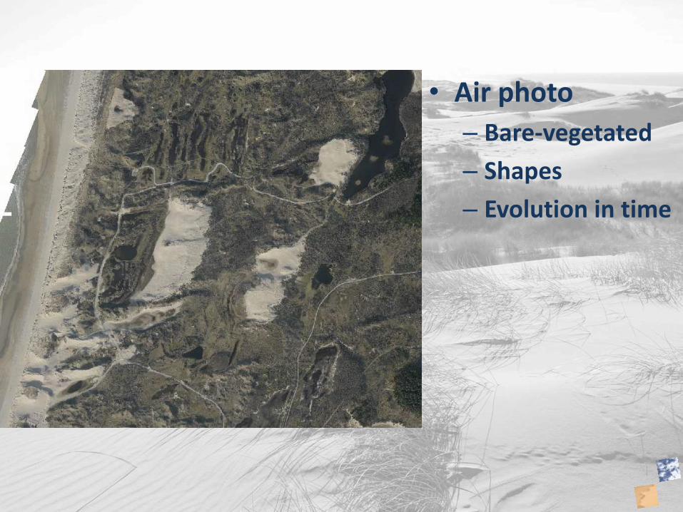
• Air photo
– Bare-vegetated
– Shapes
– Evolution in time

• Landscape dynamics
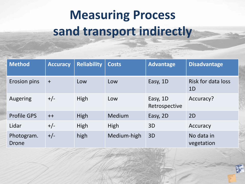
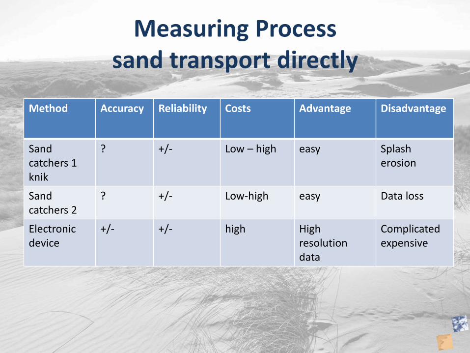
Measuring Processsand transport indirectly
Method Accuracy Reliability Costs Advantage Disadvantage
Erosion pins + Low Low Easy, 1D Risk for data loss1D
Augering +/- High Low Easy, 1DRetrospective
Accuracy?
Profile GPS ++ High Medium Easy, 2D 2D
Lidar +/- High High 3D Accuracy
Photogram.Drone
+/- high Medium-high 3D No data in vegetation
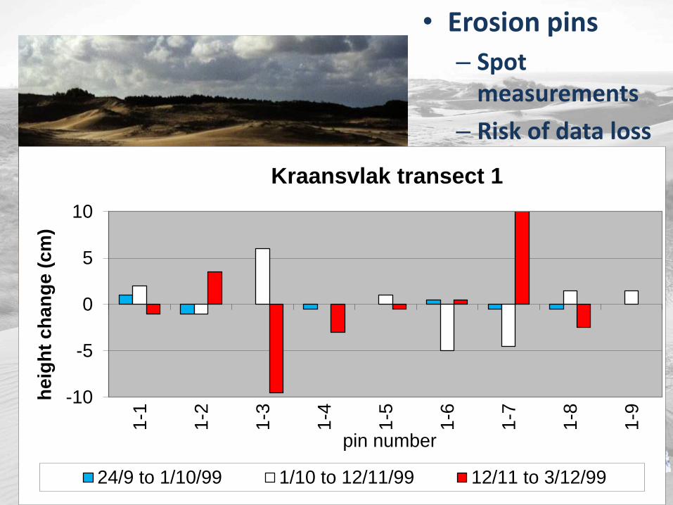
• Erosion pins
– Spot measurements
– Risk of data loss
-10
-5
0
5
10
1-1
1-2
1-3
1-4
1-5
1-6
1-7
1-8
1-9
he
igh
t c
ha
ng
e (
cm
)
pin number
Kraansvlak transect 1
24/9 to 1/10/99 1/10 to 12/11/99 12/11 to 3/12/99
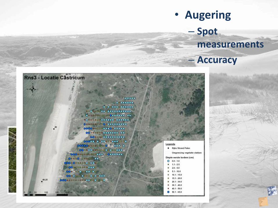
• Augering
– Spot measurements
– Accuracy

• Transects
– Accurate
– 2D
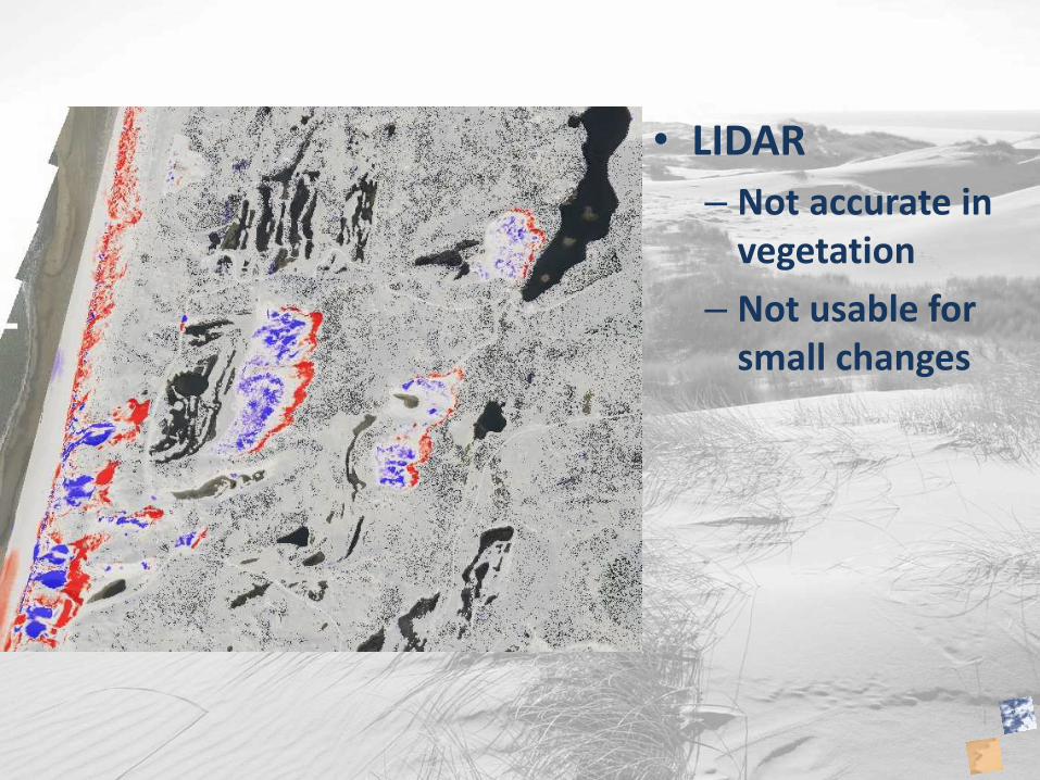
• LIDAR
– Not accurate in vegetation
– Not usable for small changes
Measuring Processsand transport directly
Method Accuracy Reliability Costs Advantage Disadvantage
Sand catchers 1 knik
? +/- Low – high easy Splash erosion
Sand catchers 2
? +/- Low-high easy Data loss
Electronic device
+/- +/- high High resolution data
Complicatedexpensive
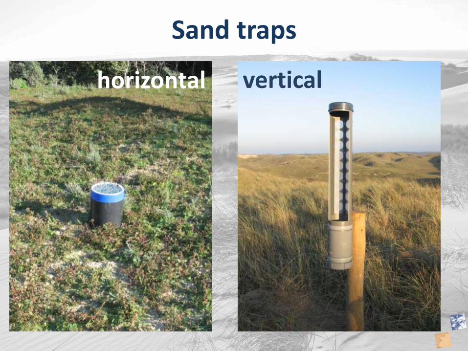
Sand traps
horizontal vertical
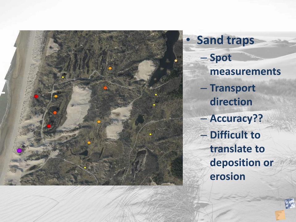
• Sand traps
– Spot measurements
– Transport direction
– Accuracy??
– Difficult to translate to deposition or erosion


