WG5 activities PP VERSUS2 - COSMO model · AVT data policy Verif Software PP VERSUS2 PP INSPECT NWP...
15
AVT data policy Verif Software PP VERSUS2 PP INSPECT NWP Test Suite Applications Common Plots (CP)+ Conditional WG5 activities 18 TH COSMO General Meeting , 5-8 Sept 2016, Offenbach, WG5 Overview
-
Upload
nguyenhanh -
Category
Documents
-
view
215 -
download
0
Transcript of WG5 activities PP VERSUS2 - COSMO model · AVT data policy Verif Software PP VERSUS2 PP INSPECT NWP...
AVT data policy
Verif
Software
PP VERSUS2
PP INSPECT
NWP Test Suite
Applications
Common Plots (CP)+ Conditional
WG5 activit ies
18TH COSMO General Meeting , 5-8 Sept 2016, Offenbach, WG5 Overview
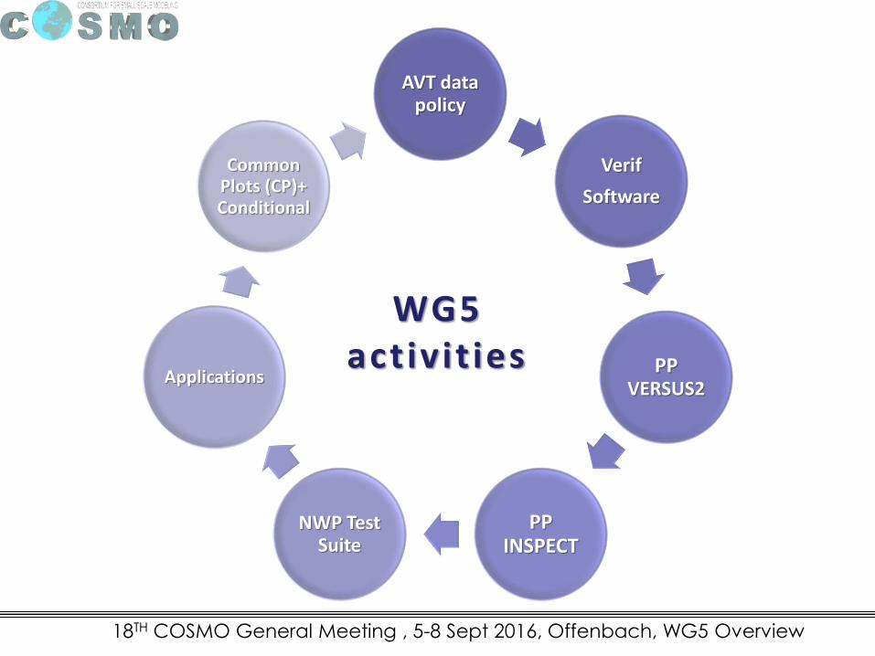
AVT data policy
Verif
Software
PP VERSUS2
PP INSPECT
NWP Test Suite
Applications
Common Plots (CP)+ Conditional
WG5 activit ies
18TH COSMO General Meeting , 5-8 Sept 2016, Offenbach, WG5 Overview
18th COSMO General Meeting, Offenbach, 2016 - WG5 parallel session
Requirements for model output and observation data formats for
Verification Tools
18th COSMO General Meeting, Offenbach, 2016 - WG5 parallel session
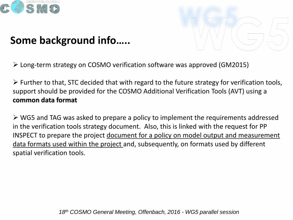
Some background info…..
Long-term strategy on COSMO verification software was approved (GM2015)
Further to that, STC decided that with regard to the future strategy for verification tools, support should be provided for the COSMO Additional Verification Tools (AVT) using a common data format
WG5 and TAG was asked to prepare a policy to implement the requirements addressed in the verification tools strategy document. Also, this is linked with the request for PP INSPECT to prepare the project document for a policy on model output and measurement data formats used within the project and, subsequently, on formats used by different spatial verification tools.
18th COSMO General Meeting, Offenbach, 2016 - WG5 parallel session
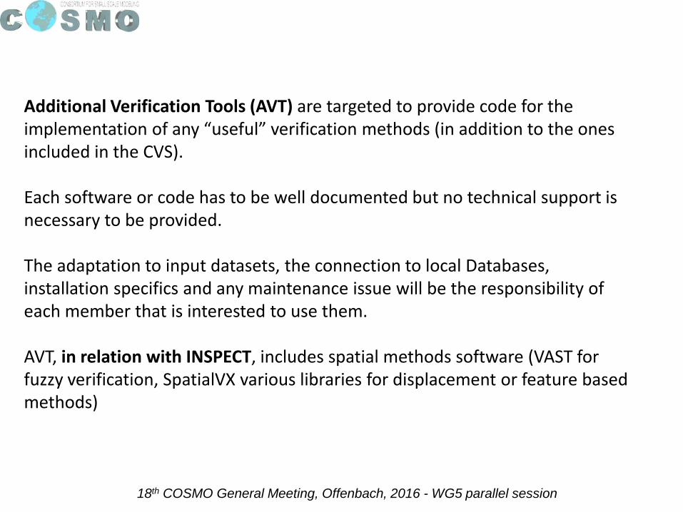
Additional Verification Tools (AVT) are targeted to provide code for the implementation of any “useful” verification methods (in addition to the ones included in the CVS).
Each software or code has to be well documented but no technical support is necessary to be provided.
The adaptation to input datasets, the connection to local Databases, installation specifics and any maintenance issue will be the responsibility of each member that is interested to use them.
AVT, in relation with INSPECT, includes spatial methods software (VAST for fuzzy verification, SpatialVX various libraries for displacement or feature based methods)
18th COSMO General Meeting, Offenbach, 2016 - WG5 parallel session
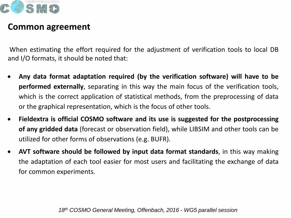
When estimating the effort required for the adjustment of verification tools to local DBand I/O formats, it should be noted that:
Any data format adaptation required (by the verification software) will have to be
performed externally, separating in this way the main focus of the verification tools,
which is the correct application of statistical methods, from the preprocessing of data
or the graphical representation, which is the focus of other tools.
Fieldextra is official COSMO software and its use is suggested for the postprocessing
of any gridded data (forecast or observation field), while LIBSIM and other tools can be
utilized for other forms of observations (e.g. BUFR).
AVT software should be followed by input data format standards, in this way making
the adaptation of each tool easier for most users and facilitating the exchange of data
for common experiments.
Common agreement
18th COSMO General Meeting, Offenbach, 2016 - WG5 parallel session
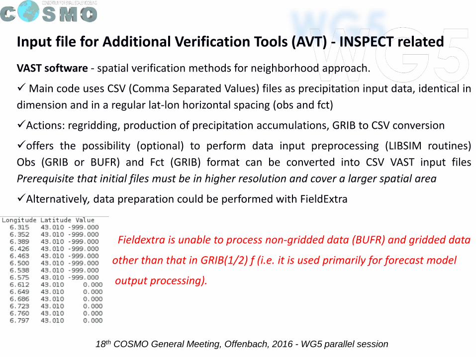
Input file for Additional Verification Tools (AVT) - INSPECT related
VAST software - spatial verification methods for neighborhood approach.
Main code uses CSV (Comma Separated Values) files as precipitation input data, identical in
dimension and in a regular lat-lon horizontal spacing (obs and fct)
Actions: regridding, production of precipitation accumulations, GRIB to CSV conversion
offers the possibility (optional) to perform data input preprocessing (LIBSIM routines)
Obs (GRIB or BUFR) and Fct (GRIB) format can be converted into CSV VAST input files
Prerequisite that initial files must be in higher resolution and cover a larger spatial area
Alternatively, data preparation could be performed with FieldExtra
Fieldextra is unable to process non-gridded data (BUFR) and gridded data
other than that in GRIB(1/2) f (i.e. it is used primarily for forecast model
output processing).
18th COSMO General Meeting, Offenbach, 2016 - WG5 parallel session
SpatialVx software - assortment of R libraries for applying a large variety of spatial
verification methods (neighborhood, scale separation, feature-based, field deformation).
Most of the libraries call for gridded data in an arbitrary textual format
Functions to manipulate the data are provided if required by a certain method: e.g. create
field accumulations and identify important features (e.g. to determine a precipitation object)
Observation and forecast data must be given in identical format, but not necessarily on a
regular lat-lon grid
Preprocessing (e.g. decoding, regridding, interpolation) of model output (GRIB1/2), surface
observations (BUFR) or radar/satellite data (NetCDF, UF, HDF, XML) is usually performed
outside SpatialVx, but R packages are available to perform part of the preprocessing tasks.
Input file for Additional Verification Tools (AVT) - INSPECT related
18th COSMO General Meeting, Offenbach, 2016 - WG5 parallel session
Input file for Additional Verification Tools (AVT) – non INSPECT related
DWD Verification Software (Rfdbk package) - structured on an R-based environment,
taking advantage of “feedback files” that are produced during the assimilation cycle
It can perform verification using both SYNOP and TEMP for all parameters that are
included in the DA files
input files required by the Rfdbk software have to be produced with MEC
MEC requires model data in GRIB format while for observations:
fof/mon/cof/ekf/ver–files (existing fdbkfiles extracted from nudging analysis)\
CDFIN (BUFR converted by bufrx2netcdf to NetCDF, BUFR in WMO-templates as used
by DWD)
The MEC output files used as input to the Rfdbk software are in NetCDF format
18th COSMO General Meeting, Offenbach, 2016 - WG5 parallel session
Data preprocessing of FORECAST data
Forecast model output is used in either GRIB1/2 (e.g. VERSUS), NetCDF (e.g. Rfdbk) or textual format (e.g.CSV)
Processing as AVT input
Fieldextra used for GRIB1/2 to text (CSV) conversion and for various processing of GRIB1/2files GrADS (Grid Analysis and Display System) to convert and/or interpolate GRIB1/2 to ASCII(also to NetCDF for one variable). PPINSPECT: convert COSMO grib data into ASCII input for RSpatialVx (examples with templates available in WG5 repository). R-packages RNetCDF and NCDF to import the NetCDF data in R. For data in netCDF4, an R-package ncdf4 is also available. Other R libraries exist for some of the preprocessing tasks. rNOMADS used for reading GRIBfiles in R tuned to NOAA model that allows R users to download global and regional weathermodel data for processing. NetCDF Java library can be used to convert a GRIB file into a NetCDF format on Windowsplatform. NCL (NCAR command language) can read and write netCDF-3, netCDF-4 classic,netCDF-4, HDF4, binary, and ASCII data. It can read HDF-EOS2, HDF-EOS5, GRIB1, GRIB2, andOGR files

18th COSMO General Meeting, Offenbach, 2016 - WG5 parallel session
Data preprocessing of OBSERVATION data
BUFR is the WMO standard binary code for the representation and exchange of observational data (point observations)
Processing as AVT inputBUFR files can be decoded to text format with grib_api functions (ECMWF library) or processed with libraries included in LIBSIM. In addition with the use of LIBSIM, it is possible to aggregate observations into low-resolution regular boxes or aggregate them into arbitrary polygons
Radar data (HDF4-5, XML)OPERA Data Center creates 3 composite products: instantaneous surface rain rate, instantaneous max reflectivity and 1 hour rainfall accumulation. Data are available in both BUFR and HDF5 formats. Like all observational data, many issues (e.g. problems with parallax, radar beams above the precipitation at long ranges, evaporation of rainfall at lower levels beneath the beam, anomalous propagation, etc.) have to be considered when using such data for verification purposes.
18th COSMO General Meeting, Offenbach, 2016 - WG5 parallel session
Data preprocessing of OBSERVATION data
Satellite data sources (HDF4, GRIB, BUFR)For PP INSPECT and other WG5 applications, satellite data from the following sources/formats are used:• SEVIRI/Meteosat (EUMETSAT) data: cloud cover, rain intensity, surface temperature and albedo. Formats: HDF4, GRIB, and ASCII. • Polar-orbiting satellites (NOAA, Terra, Aqua, Suomi NPP): vertical profiles, Total Precipitable Water (TPW), and ozone. Formats: NetCDF, HDF4, and ASCII.• EUMETCast products (SAF EUMETSAT): rain intensity, precipitation accumulations, snow cover, and surface humidity. Formats: GRIB, BUFR, and HDF4
Processing as AVT inputHDF5 files can be read directly into the R based SpatialVx software by using “HDF5 interface to R”: Bioconductor https://www.bioconductor.org/.
Examples of the procedures that have been followed for the decoding of binary observations (radar and satellite) and their conversion to input files for SpatialVx applications as required for PP INSPECT are available in the WG5 repository: ftp.meteoam.it/WG5-Repository.
18th COSMO General Meeting, Offenbach, 2016 - WG5 parallel session
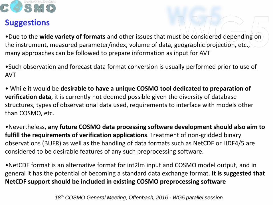
Suggestions
•Due to the wide variety of formats and other issues that must be considered depending on the instrument, measured parameter/index, volume of data, geographic projection, etc., many approaches can be followed to prepare information as input for AVT
•Such observation and forecast data format conversion is usually performed prior to use of AVT
• While it would be desirable to have a unique COSMO tool dedicated to preparation of verification data, it is currently not deemed possible given the diversity of database structures, types of observational data used, requirements to interface with models other than COSMO, etc.
•Nevertheless, any future COSMO data processing software development should also aim to fulfill the requirements of verification applications. Treatment of non-gridded binary observations (BUFR) as well as the handling of data formats such as NetCDF or HDF4/5 are considered to be desirable features of any such preprocessing software.
•NetCDF format is an alternative format for int2lm input and COSMO model output, and in general it has the potential of becoming a standard data exchange format. It is suggested that NetCDF support should be included in existing COSMO preprocessing software
18th COSMO General Meeting, Offenbach, 2016 - WG5 parallel session
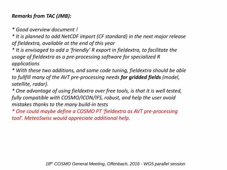
Remarks from TAC (JMB):
* Good overview document !* It is planned to add NetCDF import (CF standard) in the next major release of fieldextra, available at the end of this year* It is envisaged to add a ‘friendly’ R export in fieldextra, to facilitate the usage of fieldextra as a pre-processing software for specialized R applications* With these two additions, and some code tuning, fieldextra should be able to fullfill many of the AVT pre-processing needs for gridded fields (model, satellite, radar).* One advantage of using fieldextra over free tools, is that it is well tested, fully compatible with COSMO/ICON/IFS, robust, and help the user avoid mistakes thanks to the many build-in tests* One could maybe define a COSMO PT ‘fieldextra as AVT pre-processing tool’. MeteoSwiss would appreciate additional help.
18th COSMO General Meeting, Offenbach, 2016 - WG5 parallel session
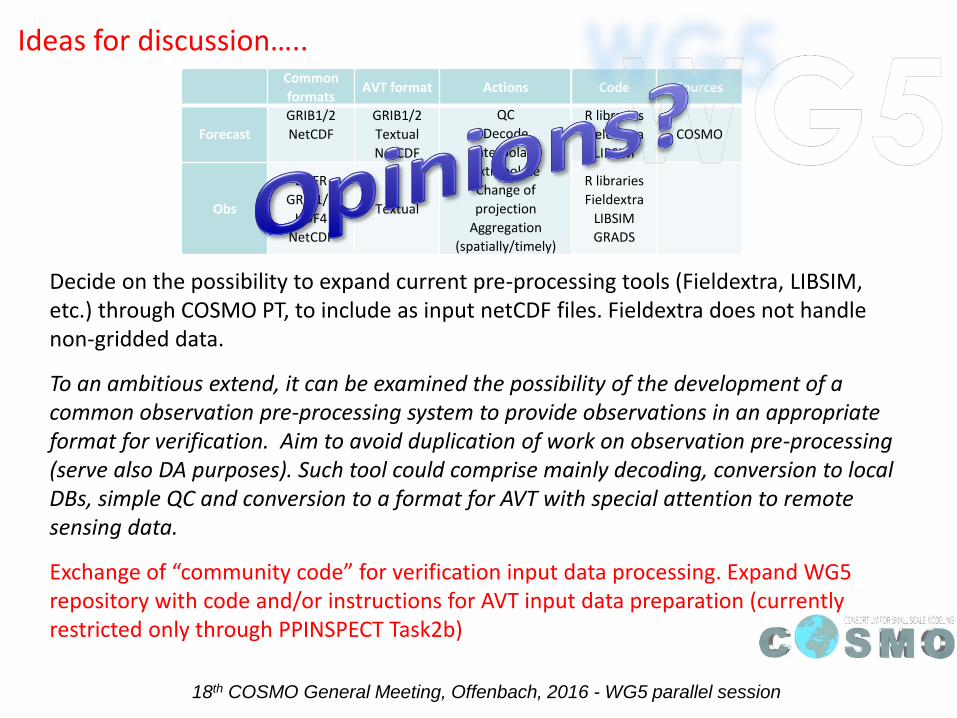
Decide on the possibility to expand current pre-processing tools (Fieldextra, LIBSIM, etc.) through COSMO PT, to include as input netCDF files. Fieldextra does not handle non-gridded data.
To an ambitious extend, it can be examined the possibility of the development of a common observation pre-processing system to provide observations in an appropriate format for verification. Aim to avoid duplication of work on observation pre-processing (serve also DA purposes). Such tool could comprise mainly decoding, conversion to local DBs, simple QC and conversion to a format for AVT with special attention to remote sensing data.
Exchange of “community code” for verification input data processing. Expand WG5 repository with code and/or instructions for AVT input data preparation (currently restricted only through PPINSPECT Task2b)
Ideas for discussion…..Common
formatsAVT format Actions Code Sources
Forecast
GRIB1/2
NetCDF
GRIB1/2
Textual
NetCDF
QC
Decode
Interpolate
Extrapolate
Change of
projection
Aggregation
(spatially/timely)
R libraries
Fieldextra
LIBSIM
COSMO
Obs
BUFR
GRIB1/2
HDF4
NetCDF
Textual
R libraries
Fieldextra
LIBSIM
GRADS