Western Heights, Dover - White Cliffs Ramblers
4
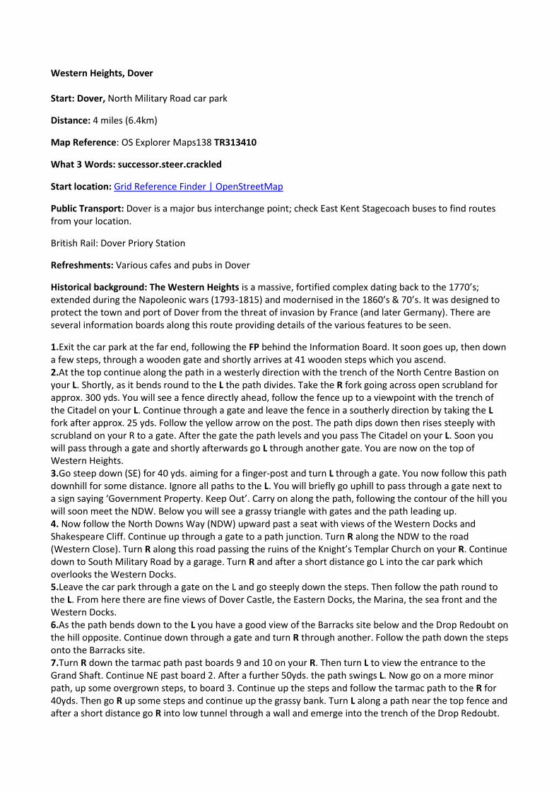
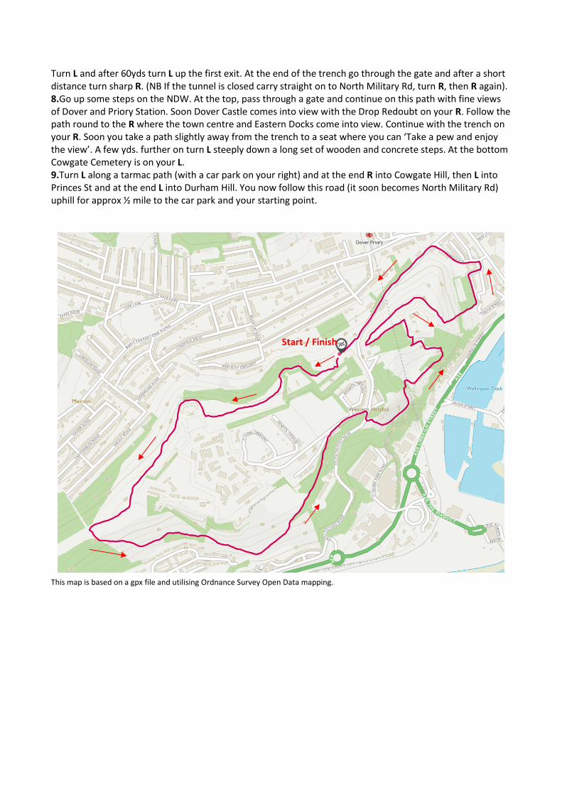
Western Heights, Dover Start: Dover, North Military Road car park Distance: 4 miles (6.4km) Map Reference: OS Explorer Maps138 TR313410 What 3 Words: successor.steer.crackled Start location: Grid Reference Finder | OpenStreetMap Public Transport: Dover is a major bus interchange point; check East Kent Stagecoach buses to find routes from your location. British Rail: Dover Priory Station Refreshments: Various cafes and pubs in Dover Historical background: The Western Heights is a massive, fortified complex dating back to the 1770’s; extended during the Napoleonic wars (1793-1815) and modernised in the 1860’s & 70’s. It was designed to protect the town and port of Dover from the threat of invasion by France (and later Germany). There are several information boards along this route providing details of the various features to be seen. 1.Exit the car park at the far end, following the FP behind the Information Board. It soon goes up, then down a few steps, through a wooden gate and shortly arrives at 41 wooden steps which you ascend. 2.At the top continue along the path in a westerly direction with the trench of the North Centre Bastion on your L. Shortly, as it bends round to the L the path divides. Take the R fork going across open scrubland for approx. 300 yds. You will see a fence directly ahead, follow the fence up to a viewpoint with the trench of the Citadel on your L. Continue through a gate and leave the fence in a southerly direction by taking the L fork after approx. 25 yds. Follow the yellow arrow on the post. The path dips down then rises steeply with scrubland on your R to a gate. After the gate the path levels and you pass The Citadel on your L. Soon you will pass through a gate and shortly afterwards go L through another gate. You are now on the top of Western Heights. 3.Go steep down (SE) for 40 yds. aiming for a finger-post and turn L through a gate. You now follow this path downhill for some distance. Ignore all paths to the L. You will briefly go uphill to pass through a gate next to a sign saying ‘Government Property. Keep Out’. Carry on along the path, following the contour of the hill you will soon meet the NDW. Below you will see a grassy triangle with gates and the path leading up. 4. Now follow the North Downs Way (NDW) upward past a seat with views of the Western Docks and Shakespeare Cliff. Continue up through a gate to a path junction. Turn R along the NDW to the road (Western Close). Turn R along this road passing the ruins of the Knight’s Templar Church on your R. Continue down to South Military Road by a garage. Turn R and after a short distance go L into the car park which overlooks the Western Docks. 5.Leave the car park through a gate on the L and go steeply down the steps. Then follow the path round to the L. From here there are fine views of Dover Castle, the Eastern Docks, the Marina, the sea front and the Western Docks. 6.As the path bends down to the L you have a good view of the Barracks site below and the Drop Redoubt on the hill opposite. Continue down through a gate and turn R through another. Follow the path down the steps onto the Barracks site. 7.Turn R down the tarmac path past boards 9 and 10 on your R. Then turn L to view the entrance to the Grand Shaft. Continue NE past board 2. After a further 50yds. the path swings L. Now go on a more minor path, up some overgrown steps, to board 3. Continue up the steps and follow the tarmac path to the R for 40yds. Then go R up some steps and continue up the grassy bank. Turn L along a path near the top fence and after a short distance go R into low tunnel through a wall and emerge into the trench of the Drop Redoubt.
Transcript of Western Heights, Dover - White Cliffs Ramblers
Western Heights Dover Start Dover North Military Road car park
Distance 4 miles (64km)
Map Reference OS Explorer Maps138 TR313410
What 3 Words successorsteercrackled
Start location Grid Reference Finder | OpenStreetMap
Public Transport Dover is a major bus interchange point check East Kent Stagecoach buses to find routes from your location
British Rail Dover Priory Station
Refreshments Various cafes and pubs in Dover
Historical background The Western Heights is a massive fortified complex dating back to the 1770rsquos extended during the Napoleonic wars (1793-1815) and modernised in the 1860rsquos amp 70rsquos It was designed to protect the town and port of Dover from the threat of invasion by France (and later Germany) There are several information boards along this route providing details of the various features to be seen
1Exit the car park at the far end following the FP behind the Information Board It soon goes up then down a few steps through a wooden gate and shortly arrives at 41 wooden steps which you ascend 2At the top continue along the path in a westerly direction with the trench of the North Centre Bastion on your L Shortly as it bends round to the L the path divides Take the R fork going across open scrubland for approx 300 yds You will see a fence directly ahead follow the fence up to a viewpoint with the trench of the Citadel on your L Continue through a gate and leave the fence in a southerly direction by taking the L fork after approx 25 yds Follow the yellow arrow on the post The path dips down then rises steeply with scrubland on your R to a gate After the gate the path levels and you pass The Citadel on your L Soon you will pass through a gate and shortly afterwards go L through another gate You are now on the top of Western Heights 3Go steep down (SE) for 40 yds aiming for a finger-post and turn L through a gate You now follow this path downhill for some distance Ignore all paths to the L You will briefly go uphill to pass through a gate next to a sign saying lsquoGovernment Property Keep Outrsquo Carry on along the path following the contour of the hill you will soon meet the NDW Below you will see a grassy triangle with gates and the path leading up 4 Now follow the North Downs Way (NDW) upward past a seat with views of the Western Docks and Shakespeare Cliff Continue up through a gate to a path junction Turn R along the NDW to the road (Western Close) Turn R along this road passing the ruins of the Knightrsquos Templar Church on your R Continue down to South Military Road by a garage Turn R and after a short distance go L into the car park which overlooks the Western Docks 5Leave the car park through a gate on the L and go steeply down the steps Then follow the path round to the L From here there are fine views of Dover Castle the Eastern Docks the Marina the sea front and the Western Docks 6As the path bends down to the L you have a good view of the Barracks site below and the Drop Redoubt on the hill opposite Continue down through a gate and turn R through another Follow the path down the steps onto the Barracks site 7Turn R down the tarmac path past boards 9 and 10 on your R Then turn L to view the entrance to the Grand Shaft Continue NE past board 2 After a further 50yds the path swings L Now go on a more minor path up some overgrown steps to board 3 Continue up the steps and follow the tarmac path to the R for 40yds Then go R up some steps and continue up the grassy bank Turn L along a path near the top fence and after a short distance go R into low tunnel through a wall and emerge into the trench of the Drop Redoubt
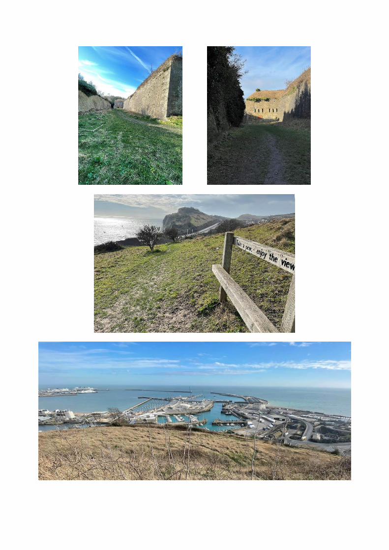
Turn L and after 60yds turn L up the first exit At the end of the trench go through the gate and after a short distance turn sharp R (NB If the tunnel is closed carry straight on to North Military Rd turn R then R again) 8Go up some steps on the NDW At the top pass through a gate and continue on this path with fine views of Dover and Priory Station Soon Dover Castle comes into view with the Drop Redoubt on your R Follow the path round to the R where the town centre and Eastern Docks come into view Continue with the trench on your R Soon you take a path slightly away from the trench to a seat where you can lsquoTake a pew and enjoy the viewrsquo A few yds further on turn L steeply down a long set of wooden and concrete steps At the bottom Cowgate Cemetery is on your L 9Turn L along a tarmac path (with a car park on your right) and at the end R into Cowgate Hill then L into Princes St and at the end L into Durham Hill You now follow this road (it soon becomes North Military Rd) uphill for approx frac12 mile to the car park and your starting point
This map is based on a gpx file and utilising Ordnance Survey Open Data mapping
Start Finish
All photographs by Lee Pickup February 2021
This walk was originally conceived by Alan Clewer for the 25th Anniversary of White Cliffs Ramblers in 2014 The description was checked and updated by Lee Pickup in February 2021 Lee also recorded the route on a gps enabled device and the accompanying map is based on that record Whilst every effort has been made to check the accuracy of this description this cannot be guaranteed especially over time You should therefore always carry a map with you All sporting and leisure activities have inherent hazards associated with them and rambling is no exception Although safety is a paramount concern accidents will occasionally occur It is important therefore that when entering into the activity each individual appreciates that they have a responsibility to identify the hazards associated with it and take all reasonable steps to eliminate or minimise the potential for an accident to happen In this context it should be noted that in part this walk is along cliff-tops so extra care should be taken