Water conservation : Aher Sainath
32
Sainath P. Aher Department of Geography S. N. Arts, D. J. Malpani Commerce, B. N. Sarda Science College, Sangamner, Dist- Ahmadnagar (M.S.)
-
Upload
saislideshere -
Category
Environment
-
view
80 -
download
0
Transcript of Water conservation : Aher Sainath

Sainath P. AherDepartment of Geography
S. N. Arts, D. J. Malpani Commerce, B. N. Sarda Science College, Sangamner, Dist- Ahmadnagar (M.S.)

Earth
Land 29 %
Water71 %
Saline (Ocean)
97 %
Fresh3 %
Ground 30.1 %
Glaciers 68. 7%
Other 0.9 %
Surface0.3 %
Rivers 2 %
Swamps 11 %
Lakes 87 %
Distribution of Water on Earth
Uneven distribution
tension in
future

Sphere – Hydrosphere
Water has demand from growing population
The availability of water is unequal – because of physical and climatic diversity
Problem - need solve by micro level planningWater - Soul of Nature


India- Drought prone region map add here

Available water for planed use – 38882 million m³ in Godavari Basin total use upto 1996 = 17969 million m³ demand will growth upto 2030 = 43446 million m³
(Maharashtra State Development Report: Irrigation, chapter-4, pp-97)
Basin-wise Water Supply and Demand in Maharashtra:1996 & 2030

Ahemadnagar SITE NAME 2007 2008 2009 2010 2011
Rassin 5.81 5.24 5.41 6.65 5.55Shrigonda 9.82 9.72 11.51 11.32 11.04Mirajgaon2 6.9 5.92 6.57 13.32 8.57Jamkhed 5.65 3.98 4.49 5.74 6.26Chas 5.3 5.39 4.64 5.58 4.17Parner2 8.27 6.61 10.38 16.55 8.37Bote 6.06 5.86 4.89 6.54 5.87Rahuri 9.95 9.59 9.77 9.54 7.73Sonai 2.76 1.03 1.57 4.02 2.6Chandanapuri 14.02 11.24 17.84 18.25 14.98Tambhol 5.8 8.2 7.6 4.42 3.68Rajur 4.37 1.62 1.65 4.38 2.33Akole 9.04 6 10.9 16.02 9.71Shirasgaon 4.71 7.28 4.84 4.29 4.2Sangamner 8.24 8.46 9.93 8.84 9.27Kokangaon 5.98 5.84 6.12 4.25 3.79Babhuleshwar 4.94 3.44 6 5.17 5.63Srirampur 4.47 3.08 3.26 3.99 2.95Rahata 9 9.96 14.12 13.58 8.9Kopargaon 11.08 8.96 9.9 10.11 9.22
AurangabadSITE NAME 2008 2009 2010 2011
Paithan 16 16 16 6.19Limbe Jalgaon 6.06 5.55 5.48 5.98Mahalgaon 10.65 6.82 5.29 7.8Apatgaon 6.81 8.53 7.6 6.8Chikalthana 9.5 16.16 12.38 6.5Rotegaon 10.23 9.02 8.18 9.06Khuldabad 9.5 10.45 8.3 8.29Khandala 10.49 15.91 8.87 7.29Chauka 3.31 5.43 4.35 6.32Walur Tanda 6.15 5.24 5.09 5.18Patri 4.86 3.73 3.3 5.2Tunki 14.31 9.93 8.33 7.11Hatnur 5.46 5.09 4.49 4.65Kinnal 5.94 4.42 2.54 4.82Kaigaon 6.81 3.07 2 4.99Borgaon Bazar 10.4 5.55 11.53 8.02Kannad 13.76 10.86 5.8 5.97
Digar Pishore2 7.7 8.62 12.6 4.35Ajanta 5.5 3.2 3.24 2.96Fardapur 6.8 6.56 6.52 7.55
NashikSITE NAME 2007 2008 2009 2010 2011
Igatpuri 3.85 4.52 4.26 10.73 5.2Nandur Shirgate 3.72 4.03 2.81 4.3 3.58Mukhane 1.48 2.98 2.07 2.57 2.84Sinnar 7.36 7.12 6.75 7.59 8.68Deolali 5.15 6.65 5.33 4.41 4.92Shinde 2.6 3.32 3.22 2.98 5.42Trimbakeswar 1.84 1.21 1 0.95 2.32Andarsul 4.21 4.54 3.72 4.61 3.93Yeola 7.06 6.5 8.08 8.76 8.85Jalgaon 7.02 7.06 7.35 8.91 9.84Kona 4.27 2.8 3.74 3.18 4.42Harsul 0.76 1.17 1.41 1 0.72PimpalgaonBsvnt 6.66 6.42 6.33 6.64 7.9Dindori 7.64 5.96 6.86 6.6 8.47Chandwad 4.28 6.46 4.87 5.88 7.22Peinth 3.86 2.94 2.14 2.15 3.11Nandgaon 5.16 5.64 5.22 4.72 5.34Vani 3.98 4.3 3.73 3.92 5.12Jalgaon 5.45 7.33 4.39 4.92 3.9Satana 15.35 11.56 13.22 14.9 18.12
Ground Water Level decreasing - (Ahemadnagar, Aurangabad and Nashik District)

Surplus & Deficit Region
Though, the Irrigation, Industry and Urban Sectors in Maharashtra is one of the largest in the country, but they facing the water availability problem from last few decade.
Similarly, the water availability for future use of population, urban area, irrigation, industry has been reducing at a fast rate.
This situation has been responsible for rising problems and vulnerable situation in the present area.

Issues

River pollution- major concern


Who is responsible ?
I n d u s t r y , U r b a n A r e a a n d h u m a n a l s o . . .

Large volume of water leakage …


How we can solve the water problem ?
Running
• Conversion of water
from Saline to Fresh– But need high budget and technology
Water Conservation- Activity going on in IND
Rainwater harvesting
Discussion
Water Diversion-Himalayan River- South IndiaW. Ghats - Drought prone Area Need Detail Survey with RS
& GIS techniques.
RS & GIS has high potential for searching the water diversion sites within short period, and high accuracy.
“ Start with the end in mind ”


User
Software Hardware
Data

Software tool for water management study

GIS Mapping

Mumbai
Water Pollution
IdentificationFrom
Landsat Satellite Image


LANDSAT SATELLITE IMAGE
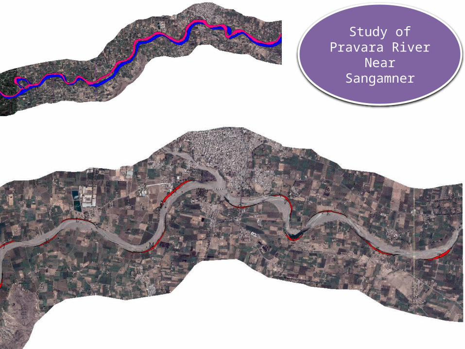
Study of Pravara River Near Sangamner

Lab work - Surface area measurement- a tool
Measured Area of Bhandardara Water body- 5.87 Sq.k.m.

Drainage Digitalization and Overlay

Potential Sites for Run off diversion

Runoff Diversion in Akole Tahsil

Water body Detection from Remote Sensing Data

Real time data

Change Detection : Pimpalgaon Konzira 1972-2006-2007- 2011
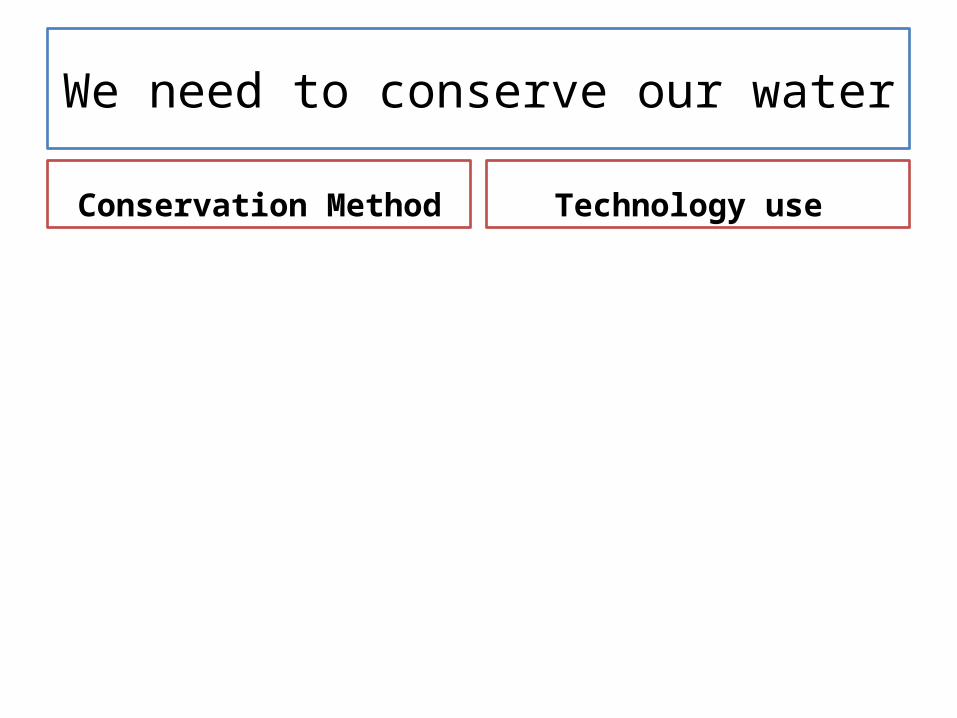
We need to conserve our water
Conservation Method Technology use

THANK YOU