Walk Twenty-Two: Henleaze and Westbury-on-Trym Accessible ...
14
Mike’s Bristol Walks Walk Twenty-Two: Henleaze and Westbury-on-Trym 1 Walk Twenty-Two: Henleaze and Westbury-on-Trym Last updated: June 2020 Westbury-on-Trym is another typical example of an historic village that has been subsumed by the expansion of Bristol over the last two centuries. Like many of its fellows, Westbury- on-Trym retains a distinct identity and character, not least by the retention of its charming parish church and its location nestled within the leafy Trym Valley. For the full-length version of this walk we return to slightly more central locations, beginning in Edwardian Henleaze before heading out to slightly more modern residential areas, eventually entering Badock’s Wood, a leafy area following the Trym Valley, en route to the historic centre of Westbury- on-Trym, which we will explore in detail. From there, our return journey will take us past the impressive Victorian buildings of the St. Monica’s residential home on the way back to Henleaze. A shorter route is also available that focuses just on Badock’s Wood and Westbury-on- Trym. Useful Information Terrain: Hilly. Includes steep steps and a stile. Unfortunately there is no accessible alternative route available without missing out on a lot of the highlights. Ground: Paved and unpaved. Some areas may be soft underfoot. Key Attractions: Henleaze Road shops, Badock’s Wood Nature Reserve (Trym Valley), Westbury Village, Westbury-on-Trym High Street shops, Canford Park and Cemetery (via optional detour), St. Monica’s. Refreshments: Available principally in the high streets of Henleaze and Westbury-on- Trym, where you will find a number of shops, cafés and pubs. Vintery Leys and the open areas at the top of Badock’s Wood are decent spots for a picnic. Starting point: Henleaze Road, near the junctions of Henleaze Avenue and Fallodon Way (long route); Vintery Leys, near Badock’s Wood (short route). Getting there: Accessible by bus routes running to Cribbs Causeway running via Henleaze and Southmead. On-street parking available in the surrounding streets, particularly Fallodon Way and Vintery Leys. Approx. Time Approx. Distance Long route 2 hours 30 mins 4.2 miles Short route 1 hour 15 mins 2.1 miles The Route The long route begins on Henleaze Road, on the edge of the shopping parade that forms the heart of Henleaze, a desirable residential area composed primarily of comfortably proportioned Edwardian and 1930s houses. For the short route, start instead at Vintery Leys, near Badock’s Wood (7). Start by heading northwards along Henleaze Road so that the shops pass by to your left. Henleaze Road is a popular shopping area that is home to a wide variety of everyday and more specialised shops. The buildings are in varied styles from the early to mid-20 th Century. Unusually, the retail offer is one- sided, with most of the properties on the east side being private houses. Henleaze Road Henleaze Road is one of the two main places you can get refreshments on this walk. There are a number of food shops and cafés.
Transcript of Walk Twenty-Two: Henleaze and Westbury-on-Trym Accessible ...

Mike’s Bristol Walks Walk Twenty-Two: Henleaze and Westbury-on-Trym
1
Walk Twenty-Two: Henleaze and Westbury-on-Trym
Last updated: June 2020
Westbury-on-Trym is another typical example of an historic village that has been subsumed by the expansion of Bristol over the last two centuries. Like many of its fellows, Westbury-on-Trym retains a distinct identity and character, not least by the retention of its charming parish church and its location nestled within the leafy Trym Valley.
For the full-length version of this walk we return to slightly more central locations, beginning in Edwardian Henleaze before heading out to slightly more modern residential areas, eventually entering Badock’s Wood, a leafy area following the Trym Valley, en route to the historic centre of Westbury-on-Trym, which we will explore in detail. From there, our return journey will take us past the impressive Victorian buildings of the St. Monica’s residential home on the way back to Henleaze.
A shorter route is also available that focuses just on Badock’s Wood and Westbury-on-Trym.
Useful Information
Terrain: Hilly. Includes steep steps and a stile. Unfortunately there is no accessible alternative route available without missing out on a lot of the highlights. Ground: Paved and unpaved. Some areas may be soft underfoot.
Key Attractions: Henleaze Road shops, Badock’s Wood Nature Reserve (Trym Valley), Westbury Village, Westbury-on-Trym High Street shops, Canford Park and Cemetery (via optional detour), St. Monica’s.
Refreshments: Available principally in the high streets of Henleaze and Westbury-on-Trym, where you will find a number of shops, cafés and pubs. Vintery Leys and the open areas at the top of Badock’s Wood are decent spots for a picnic.
Starting point: Henleaze Road, near the junctions of Henleaze Avenue and Fallodon
Way (long route); Vintery Leys, near Badock’s Wood (short route). Getting there: Accessible by bus routes running to Cribbs Causeway running via Henleaze and Southmead. On-street parking available in the surrounding streets, particularly Fallodon Way and Vintery Leys.
Approx. Time
Approx. Distance
Long route 2 hours 30 mins 4.2 miles
Short route 1 hour 15 mins 2.1 miles
The Route
The long route begins on Henleaze Road, on the edge of the shopping parade that forms the heart of Henleaze, a desirable residential area composed primarily of comfortably proportioned Edwardian and 1930s houses.
For the short route, start instead at Vintery Leys, near Badock’s Wood (7).
Start by heading northwards along Henleaze Road so that the shops pass by to your left.
Henleaze Road is a popular shopping area that is home to a wide variety of everyday and more specialised shops. The buildings are in varied styles from the early to mid-20th Century. Unusually, the retail offer is one-sided, with most of the properties on the east side being private houses.
Henleaze Road
Henleaze Road is one of the two main places you can get refreshments on this walk. There are a number of food shops and cafés.
Mike’s Bristol Walks Walk Twenty-Two: Henleaze and Westbury-on-Trym
2
At the far end of the main shopping area, opposite the petrol station (1), make a hard left into Dublin Crescent.
At the junction of Henleaze Road, Waterford Road and Dublin Crescent you can see two churches. Distant along The Drive to the right is the local Anglican church, St. Peter’s, while much closer at hand on Waterford Road you will find the understated Trinity – Henleaze United Reformed Church.
Dublin Crescent itself is a leafy Edwardian street containing terraced houses.
Follow Dublin Crescent round to emerge on Brecon Road (2).
An open-feeling road leading back towards the Downs, Brecon Road has a few buildings of interest: in the middle distance to the left can be glimpsed the stone buildings of St. Ursula’s, a Catholic academy.
Roof detail of St. Ursula’s School
Optionally, head left to take a closer look. Return to the junction of Dublin Crescent (2) and head in the other direction along Brecon Road to reach a crossroads (3).
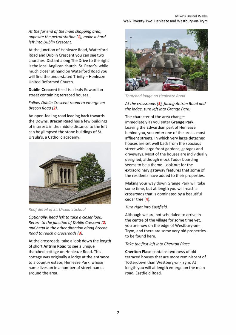
At the crossroads, take a look down the length of short Antrim Road to see a unique thatched cottage on Henleaze Road. This cottage was originally a lodge at the entrance to a country estate, Henleaze Park, whose name lives on in a number of street names around the area.
Thatched lodge on Henleaze Road
At the crossroads (3), facing Antrim Road and the lodge, turn left into Grange Park.
The character of the area changes immediately as you enter Grange Park. Leaving the Edwardian part of Henleaze behind you, you enter one of the area’s most affluent streets, in which very large detached houses are set well back from the spacious street with large front gardens, garages and driveways. Most of the houses are individually designed, although mock Tudor boarding seems to be a theme. Look out for the extraordinary gateway features that some of the residents have added to their properties.
Making your way down Grange Park will take some time, but at length you will reach a crossroads that is dominated by a beautiful cedar tree (4).
Turn right into Eastfield.
Although we are not scheduled to arrive in the centre of the village for some time yet, you are now on the edge of Westbury-on-Trym, and there are some very old properties to be found here.
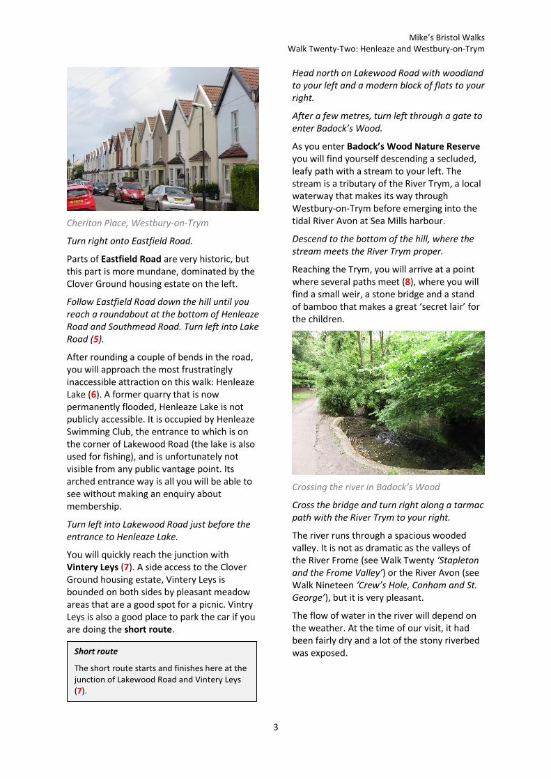
Take the first left into Cheriton Place.
Cheriton Place contains two rows of old terraced houses that are more reminiscent of Totterdown than Westbury-on-Trym. At length you will at length emerge on the main road, Eastfield Road.
Mike’s Bristol Walks Walk Twenty-Two: Henleaze and Westbury-on-Trym
3
Cheriton Place, Westbury-on-Trym
Turn right onto Eastfield Road.
Parts of Eastfield Road are very historic, but this part is more mundane, dominated by the Clover Ground housing estate on the left.
Follow Eastfield Road down the hill until you reach a roundabout at the bottom of Henleaze Road and Southmead Road. Turn left into Lake Road (5).
After rounding a couple of bends in the road, you will approach the most frustratingly inaccessible attraction on this walk: Henleaze Lake (6). A former quarry that is now permanently flooded, Henleaze Lake is not publicly accessible. It is occupied by Henleaze Swimming Club, the entrance to which is on the corner of Lakewood Road (the lake is also used for fishing), and is unfortunately not visible from any public vantage point. Its arched entrance way is all you will be able to see without making an enquiry about membership.
Turn left into Lakewood Road just before the entrance to Henleaze Lake.
You will quickly reach the junction with Vintery Leys (7). A side access to the Clover Ground housing estate, Vintery Leys is bounded on both sides by pleasant meadow areas that are a good spot for a picnic. Vintry Leys is also a good place to park the car if you are doing the short route.
Head north on Lakewood Road with woodland to your left and a modern block of flats to your right.
After a few metres, turn left through a gate to enter Badock’s Wood.
As you enter Badock’s Wood Nature Reserve you will find yourself descending a secluded, leafy path with a stream to your left. The stream is a tributary of the River Trym, a local waterway that makes its way through Westbury-on-Trym before emerging into the tidal River Avon at Sea Mills harbour.
Descend to the bottom of the hill, where the stream meets the River Trym proper.
Reaching the Trym, you will arrive at a point where several paths meet (8), where you will find a small weir, a stone bridge and a stand of bamboo that makes a great ‘secret lair’ for the children.
Crossing the river in Badock’s Wood
Cross the bridge and turn right along a tarmac path with the River Trym to your right.
The river runs through a spacious wooded valley. It is not as dramatic as the valleys of the River Frome (see Walk Twenty ‘Stapleton and the Frome Valley’) or the River Avon (see Walk Nineteen ‘Crew’s Hole, Conham and St. George’), but it is very pleasant.
The flow of water in the river will depend on the weather. At the time of our visit, it had been fairly dry and a lot of the stony riverbed was exposed. Short route
The short route starts and finishes here at the junction of Lakewood Road and Vintery Leys (7).

Mike’s Bristol Walks Walk Twenty-Two: Henleaze and Westbury-on-Trym
4
Following the Trym through Badock’s Wood.
The path along the river ends at a T-junction. We will now explore the more open areas of Badock’s Wood at the top of the valley.
Take the left path, climbing gently until you reach a crossing of paths in a more open area at the top of the hill (9).
You are now in the meadow areas of Badock’s Wood Nature Reserve. There are various paths through the area, but the nicest way is to cut across the meadows themselves.
Take the rough path that goes straight on from the crossroads. When the rough path starts to curve round to the right, go straight on along a grassy path through the first meadow, heading for a gap in the hedge.
The meadows are attractive, rich with with long grasses in the summer.
Cross the second meadow in a similar fashion. You will reach a triangle where several paths meet, next to which you will find an ancient round barrow (10).
Round barrow at Badock’s Wood
Follow the path around the barrow. You will emerge at the top of a tarmac path leading back down into the valley. Cross this path and enter the open field beyond.
A former playing field, the field has a pleasant open aspect and is popular with dog walkers.
Walk across the field, staying close to the hedge line on the right. At the far end of the field, go in among the trees on the right to find a gate leading to Dark Lane (11).
The aptly named Dark Lane is a long and almost dead-straight track between old stone walls that will lead you back to Westbury-on-Trym. As is often the case with such places, it follows historic field boundaries and is older than most of the development around it. The old stone property is Elmfield Lodge, originally part of another country estate but now part of Elmfield School for Deaf Children.
Dark Lane leads off into the distance
You will emerge on Passage Road, which is a main road into Westbury-on-Trym from Southmead. Turn left immediately into Channells Hill.
Channells Hill is our route back down into the Trym Valley and will lead you into the heart of Westbury Village. As you descend the hill, the stone walls, cottage rooftops and the trees on the far side of the valley envelop you in an old-world environment that feels slightly out of time.
Reaching Trym Road at the bottom of the hill (12), pause for a moment.
Trym Road is the spine of Westbury Village, running as it does along the bottom of the

Mike’s Bristol Walks Walk Twenty-Two: Henleaze and Westbury-on-Trym
5
valley. To the left, Trym Road ends in a cul-de-sac past old and well-loved cottages.
Cottages in Trym Road
You will be aware of the sound of running water. The river runs through an open channel just behind the stone wall on the far side of the road. Small bridges provide access to properties on the other side. If you look along the river to the right, you will see the tower of Holy Trinity Church in the distance.
We will be returning to this point soon, but for now it’s time to move on.
The River Trym in Westbury Village
Turn right along Trym Road.
To continue following the long route, cross the second of two small stone bridges (13).
You will enter a pretty little garden area on the other side of the river. The path through the garden will lead you out onto Chock Lane opposite an intriguing village footpath leading up towards the church, between stone cottages.
The village footpath in Westbury-on-Trym
Crossing Chock Lane, climb the village footpath. At the top of the footpath, just outside the churchyard gates, turn left onto another footpath (14).
The footpath climbs up around the perimeter of the churchyard, just outside the low fence. It is like a green tunnel, and always seems to be carpeted in a springy cushion of yew needles from trees in the adjacent churchyard.
Reaching a crossing of paths, turn right to head back down through the churchyard itself.
Short route
If you are following the short route, continue straight on along Trym Road, picking up the long route again from the bottom of Chock Lane (17).

Mike’s Bristol Walks Walk Twenty-Two: Henleaze and Westbury-on-Trym
6
Holy Trinity Church, Westbury-on-Trym
The churchyard of Holy Trinity Church is a restful space, well screened from the nearby main roads and providing a real anchor to the heart of Westbury Village.
Reaching the church itself, turn right and leave the churchyard via the same village footpath that you climbed a few moments ago. Returning to Chock Lane, turn right and climb the raised pavement on the left-hand-side of the road, opposite the Victoria pub.
The Victoria, Chock Lane
We are about to climb out of Westbury Village temporarily for the pleasure of entering it again via a different route. Look for a flight of steps climbing up to the left opposite the Victoria (15).
Climb the steps, emerging eventually in Cote Lea Park.
In Cote Lea Park we return suddenly to 1930s suburbia. We will not be staying for too long.
Follow Cote Lea Park until you reach a crossroads. Turn left into Pinewood Close.
Pinewood Close is a reasonably pleasant cul-de-sac with well-tended front gardens. It used to be dominated by an impressive monkey-puzzle tree, but sadly this had to be felled a couple of years ago.
Follow Pinewood Close round the bend until you reach a footpath back down into the valley signed for the C of E primary school (16). Turn left down the footpath.
You will descend a flight of steps to reach a woodland road next to a pottery studio. There used to be a wildlife park here, but it closed many years ago; at present, the stretch of the Trym Valley between here and Badock’s Wood remains inaccessible to the public.
The woodland path back down into Westbury Village
You will eventually return to Trym Road in the heart of Westbury Village, at the foot of Channells Hill (12).
This time, go straight on past the junction with Chock Lane (17). The short route rejoins the long route here.
If you’d like to pause for a pint in a quiet location, then the Victoria may be the pub for you.

Mike’s Bristol Walks Walk Twenty-Two: Henleaze and Westbury-on-Trym
7
The next section of Trym Road continues the village feel, with rustic cottages on the left over the culverted river. You will pass the River of Life Christian Centre, occupying an old Methodist chapel.
Cottages on Trym Road
Reaching a junction over an old stone bridge (18), turn left across the river into Church Road and then bear right into College Road.
College Road is a street of ordinary terraced houses whose main notable feature is the surviving buildings of Westbury College. The 15th Century building is the remains of an ecclesiastical residence. Behind the round tower at the western end you can see a Georgian house that was built at a later date. You can also see another round tower in the distance where the site abuts the river.
Surviving parts of Westbury College
Continue to the end of the road and turn left into High Street.
Westbury-on-Trym High Street, with its mix of historic buildings, shops, pubs and distinctive war memorial, retains the feel of a village centre. Long since bypassed by nearby
Falcondale Road, it avoids the worst of Bristol’s heavy traffic.
Follow High Street as far as the junction with Church Road (19).
Leave the High Street via Church Road.
Church Road leads towards the main gates of Holy Trinity Church, passing pretty and colourful village houses.
The area around Westbury-on-Trym High Street, with its shops, cafés and pubs, is the second of your two main opportunities to find something to eat or drink on this circuit.
Canford Cemetery route extension
Westbury-on-Trym is also blessed with a pleasant urban park and a large cemetery and crematorium, but they are oddly detached from the heart of the village and so are not on our main route.
If you would like to extend your walk to take in these places, continue along the High Street towards the war memorial and cross over to the right hand side. Leave the High Street via Canford Lane.
Follow Canford Lane until you reach the busy junction with Falcondale Road, the Westbury-on-Trym bypass. Cross Falcondale Road at the traffic lights. Continue along Canford Lane and then immediately bear left through the arched entrance to Canford Park.
Make your way down the main path along the right hand side of the park, passing formal gardens. Soon you will come out on a long straight track separating Canford Park and Canford Cemetery (19A).
Turn left along this track and you will soon enter the cemetery itself. Continue towards the far end of the cemetery and then make your way across to the main tarmac driveway.
Make your way back down the driveway, which is lined by shrubs and silver birch trees, taking any further detours as you wish..Eventually you will emerge back on Canford Lane.
Make your way back along Canford Lane to Westbury-on-Trym High Street, not forgetting to bear right when you start to pass the park. Return to the junction of High Street and Church Road (19).
Mike’s Bristol Walks Walk Twenty-Two: Henleaze and Westbury-on-Trym
8
Church Road, Westbury-on-Trym
When Church Road slews off back towards the river, go straight on towards the church. Turn right onto the footpath just outside the church gates (20).
You will find yourself, once again, upon the pleasant path that runs around the outside of the churchyard.
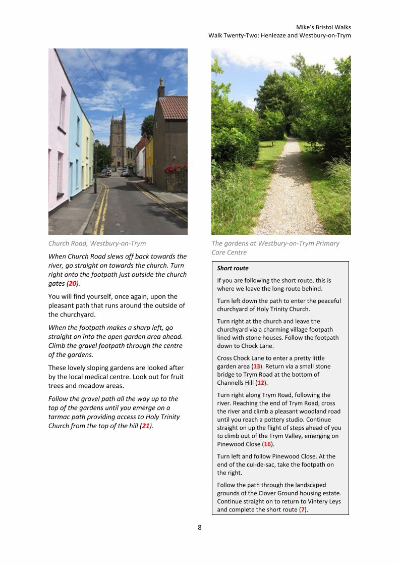
When the footpath makes a sharp left, go straight on into the open garden area ahead. Climb the gravel footpath through the centre of the gardens.
These lovely sloping gardens are looked after by the local medical centre. Look out for fruit trees and meadow areas.
Follow the gravel path all the way up to the top of the gardens until you emerge on a tarmac path providing access to Holy Trinity Church from the top of the hill (21).
The gardens at Westbury-on-Trym Primary Care Centre
Short route
If you are following the short route, this is where we leave the long route behind.
Turn left down the path to enter the peaceful churchyard of Holy Trinity Church.
Turn right at the church and leave the churchyard via a charming village footpath lined with stone houses. Follow the footpath down to Chock Lane.
Cross Chock Lane to enter a pretty little garden area (13). Return via a small stone bridge to Trym Road at the bottom of Channells Hill (12).
Turn right along Trym Road, following the river. Reaching the end of Trym Road, cross the river and climb a pleasant woodland road until you reach a pottery studio. Continue straight on up the flight of steps ahead of you to climb out of the Trym Valley, emerging on Pinewood Close (16).
Turn left and follow Pinewood Close. At the end of the cul-de-sac, take the footpath on the right.
Follow the path through the landscaped grounds of the Clover Ground housing estate. Continue straight on to return to Vintery Leys and complete the short route (7).

Mike’s Bristol Walks Walk Twenty-Two: Henleaze and Westbury-on-Trym
9
To continue following the long route, turn right along the path above the church (21), leaving the church and Westbury Village behind you.
You will emerge on Eastfield Road at the top of Waters Lane. Here you will find the 19th Century village hall.
Cross the top of Waters Lane – be careful of traffic on the blind bend – to reach a quieter side street.
The quieter side street is also part of Eastfield Road, but it has a totally different feel. It is home to a variety of old houses and is really quite narrow in places.
Gnarled apple tree at Eastfield Road
Follow Eastfield Road until it merges with Westbury Hill at the end of Westbury Road (22). Go straight on along Westbury Road.
Westbury Road is the main road into Wesbury-on-Trym from central Bristol. The older houses have a scale that reflects that historic importance.
Westbury Road is also home to Red Maids’ High School, which occupies a large estate on the left. Look out for a quaint little lodge at the southern entrance.
Lodge at the entrance to Red Maids’ High School
At the busy junction where Westbury Road merges with fast-flowing Falcondale Road, cross the top of Falcondale Road and make for the right fork into quieter Downs Road.
Falcondale Road was built as a bypass for Westbury Village in the 1930s and is now firmly established as the main road out of Bristol in the direction of Cribbs Causeway. Downs Road, by contrast, is a quiet and unremarkable residential street whose name references the nearby major open spaces (see Walk Sixteen ‘Northern Clifton and the Downs’ and Walk Twenty-Four ‘Stoke Bishop and Sneyd Park’).
You will reach a fork where Downs Road continues as a cul-de-sac on the left and Great Brockeridge takes through traffic downhill to the right (23). Take the footpath at the centre of the fork.
The characterful gravel footpath, which is bounded by stone walls, follows an airy hillside route through the large estate of Badminton School.
The path will eventually lead you to a stile at the bottom of Cote Lane (24).
The Mouse, at the top of Waters Lane, is the last pub on this circuit.

Mike’s Bristol Walks Walk Twenty-Two: Henleaze and Westbury-on-Trym
10
Reaching the bottom of Cote Lane
This is a point on Cote Lane where road access ends but several footpaths meet. In fact, this hillside is criss-crossed with old lanes and footpaths, some of which we will see in Walk Twenty-Four ‘Stoke Bishop and Sneyd Park’.
Turn left up Cote Lane itself.
Climbing Cote Lane
Cote Lane is a characterful old lane with no pavements that separates the large estate of Badminton School and the even larger estate of St. Monica’s, one of the most desirable places for retirement living in Bristol. The fine old buildings and landscaped grounds of St. Monica’s look out over the Downs, effectively
giving residents the largest front garden in the city. As you pass the various gates onto the St. Monica’s site, look out for glimpses of the fine old buildings themselves.
Follow Cote Lane until it emerges back onto Westbury Road at the main entrance to Badminton School. Cross Westbury Road at the zebra crossing and go straight on into Henleaze Avenue.
We finish this circuit with a stroll past the dignified Victorian villas of Henleaze Avenue.
Follow Henleaze Avenue until it ends at the junction with Henleaze Road to complete Walk Twenty-Two.
Coming Up
In Walk Twenty-Three ‘Blaise Castle Estate and Kings Weston Down’ we will get under the skin of one of the city’s largest parkland estates and will discover how it interlinks with the surrounding communities, spaces and suburbs.

Mike’s Bristol Walks Walk Twenty-Two: Henleaze and Westbury-on-Trym
11
Walk Twenty-Two: Map

Mike’s Bristol Walks Walk Twenty-Two: Henleaze and Westbury-on-Trym
12

Mike’s Bristol Walks Walk Twenty-Two: Henleaze and Westbury-on-Trym
13

Mike’s Bristol Walks Walk Twenty-Two: Henleaze and Westbury-on-Trym
14
Westbury-on-Trym Inset Map