Visitor Guide - Parks Victoria - Homeparkweb.vic.gov.au/__data/assets/word_doc/0005/638240/... ·...
8
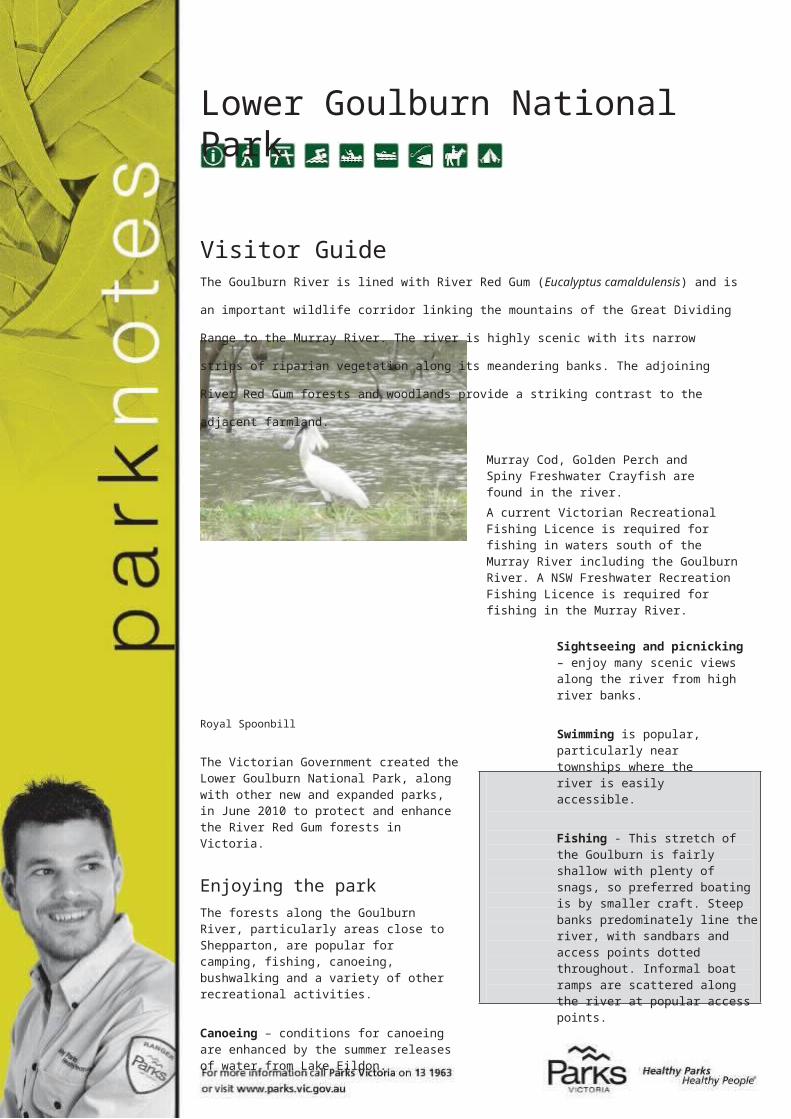
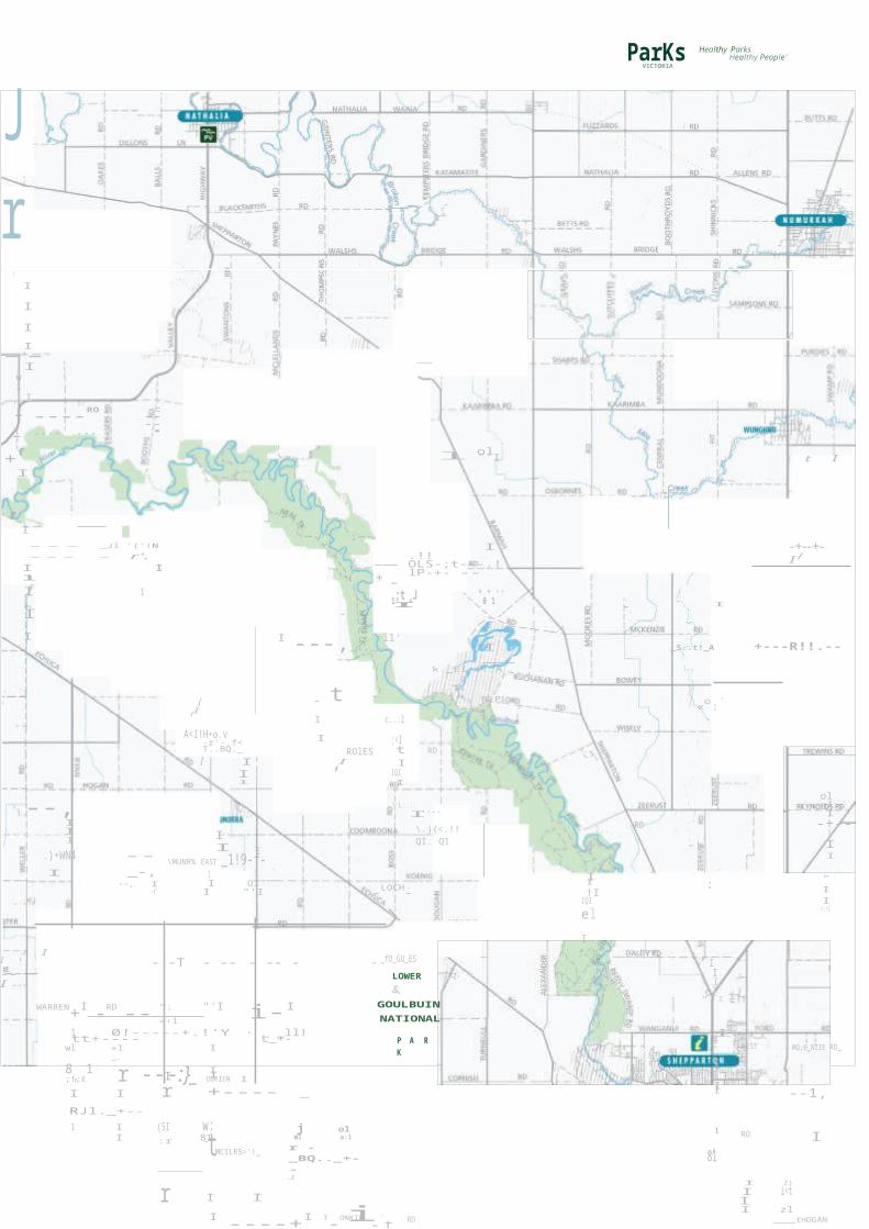
Lower Goulburn National Park Visitor Guide The Goulburn River is lined with River Red Gum (Eucalyptus camaldulensis) and is an important wildlife corridor linking the mountains of the Great Dividing Range to the Murray River. The river is highly scenic with its narrow strips of riparian vegetation along its meandering banks. The adjoining River Red Gum forests and woodlands provide a striking contrast to the adjacent farmland. Murray Cod, Golden Perch and Spiny Freshwater Crayfish are found in the river. A current Victorian Recreational Fishing Licence is required for fishing in waters south of the Murray River including the Goulburn River. A NSW Freshwater Recreation Fishing Licence is required for fishing in the Murray River. Royal Spoonbill The Victorian Government created the Lower Goulburn National Park, along with other new and expanded parks, in June 2010 to protect and enhance the River Red Gum forests in Victoria. Enjoying the park The forests along the Goulburn River, particularly areas close to Shepparton, are popular for camping, fishing, canoeing, bushwalking and a variety of other recreational activities. Canoeing – conditions for canoeing are enhanced by the summer releases of water from Lake Eildon. Sightseeing and picnicking – enjoy many scenic views along the river from high river banks. Swimming is popular, particularly near townships where the river is easily accessible. Fishing - This stretch of the Goulburn is fairly shallow with plenty of snags, so preferred boating is by smaller craft. Steep banks predominately line the river, with sandbars and access points dotted throughout. Informal boat ramps are scattered along the river at popular access points.
Transcript of Visitor Guide - Parks Victoria - Homeparkweb.vic.gov.au/__data/assets/word_doc/0005/638240/... ·...
Lower Goulburn National Park
Visitor GuideThe Goulburn River is lined with River Red Gum (Eucalyptus camaldulensis) and is an important wildlife
corridor linking the mountains of the Great Dividing Range to the Murray River. The river is highly scenic with
its narrow strips of riparian vegetation along its meandering banks. The adjoining River Red Gum forests and
woodlands provide a striking contrast to the adjacent farmland.
Murray Cod, Golden Perch and Spiny Freshwater Crayfish are found in the river.A current Victorian Recreational Fishing Licence is required for fishing in waters south of the Murray River including the Goulburn River. A NSW Freshwater Recreation Fishing Licence is required for fishing in the Murray River.
Royal Spoonbill
The Victorian Government created the Lower Goulburn National Park, along with other new and expanded parks, in June 2010 to protect and enhance the River Red Gum forests in Victoria.
Enjoying the parkThe forests along the Goulburn River, particularly areas close to Shepparton, are popular for camping, fishing, canoeing, bushwalking and a variety of other recreational activities.
Canoeing – conditions for canoeing are enhanced by the summer releases of water from Lake Eildon.
Sightseeing and picnicking – enjoy many scenic views along the river from high river banks.
Swimming is popular, particularly near townships where the river is easily accessible.
Fishing - This stretch of the Goulburn is fairly shallow with plenty of snags, so preferred boating is by smaller craft. Steep banks predominately line the river, with sandbars and access points dotted throughout. Informal boat ramps are scattered along the river at popular access points.
River Red GumsRiver Red Gum forests have high natural, cultural and economic values. These forests are coming under increasing pressure from climate change, drought and reduced water flows in the northern rivers. Protecting this precious environment relies on balancing economic and recreational activities with preserving its natural beauty and values.River Red Gums line the Goulburn River for most of its length. These iconic trees have been known to reach 45 metres and live for more than 500 years. The trees need periods of flooding and can survive inundation for months. Their seeds are washed onto higher ground during a flood and germinate and grow before the next flood reaches them. Hollows and broken branches provide nesting for galahs, cockatoos, cockatiels and various parrots, while fallen branches provide habitat for other animals.
Be fire ready and stay safeOn days of forecast Code Red Fire Danger this park will be closed for public safety.If you are already in the park you should leave the night before or early in the morning for your own safety.Closure signs will be erected and rangers will patrol where possible, however you may not receive a personal warning that the park is closed so check by calling 13 1963 or visit www.parks.vic.gov.au.For up to date information on fires in Victoria or general fire safety advice call the Victorian Bushfire Information Line on 1800 240 667 or visit cfa.vic.gov.au.
1---
t
"'i
"'
+
.
Lower Goulburn National Park
SOUTH
c,.,
o..l,,I
--';I---
v I I
o..l,I
I :<1I :01 I
---- --- +----'- .IYCKcrTL-'- _
...l.AllNEW 91
I
81--
1
,.J
----r--;I
/ r ol"' ' «r \
--OW-E--'----+
I RD--r-
I I JI I .
' ---
0 I<(II
81::01I I I
GRIFFIN - -Bf---
"0'
/r I IJ I IJ I I tl -- t!...- - -.-• I . f.
J ,....l--.----+"_;...., - J I
....... .....-1= J I I I
......1 - / I
II \
- - +I -BY-RNE . I
-}Q I +---"R,._O_-jl- _J__I 1 I
o: •ol 'T0:1 "' -\-
-;-,+II
LANCA
ol"'I
-'---+---,h--1 I
0 -t - --;11
""''I I
--- -i-H---+1
.L !J!l=>I
I '------,---- ---- ---f.:
-1---
I I
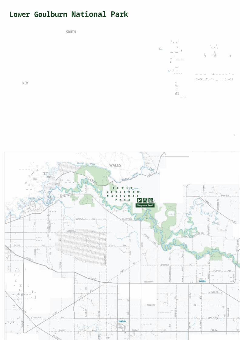
AN fi1 Parking
Main road Walking track Public land
750 1500""' 3000 P1cnoc table Sealed road • Waterbody
'-< 1 I
r4l Tounst mformat1on Hoghway 4WD
[]
I'BJ BBQ (wood) Unsealed road
Lower Goulburn National Park

) Icl ol I o'
ParKs
I
--.Loa
,I
I I
I
t
i
o I I
"
o:,
t
I
t
1
Jr
I
I I I
I--
IwlI 1
VICTORIA
Healthy ParksHealthy People"
--+f
I
,I
----RO I ....
...
:----•
l ol"'I t I
--- _Jl '{'!N --- - r'.I I l
+ _
I.!!OLS-;t---.!lP-+- --
-+--+-/I
I 1 II I 1;t.=J "0"1''
I II ---,_I,_ il'
I k _EI t!.A _
_S..t!_A +---R!!.--
J - tI(
B.P
I «o:'I c..:l
--,III
.)•WN4I
-- _-,--, I
-(
A<I!H•o.v-r'-.f< T..BQ._I I
II
II I
\MUNR% EAST _1!9-f-1 II OlI "'I
IROlES
I
'
:<It RDI
IQII
"'L.... ....I\.j{<.!!QI. Q1
-LOCH- \
l,. RO
I II ;!I
IQI
el I
ol«II
-+--1II
"I I<:>I
II -'-T - -- - -- - --I
WARREN
+I -
RD
--": "'I i-I "'1
_ _fO_GU_ESLOWER -<t-&,
GOULBUIN NATIONAL
::;;I I 'II
ol"'I
1 0!-----+.!'Y · tt+----wl «I I _.
8,.1 I I;!;I r ---:}_ OBRIEN I
_ _ll!L_+- P A R K iI WEST MQ;E_NZIE RD_
II
I I r +---- _
RJl._+--
I --1,
1 I (5I w:I 81:r -
MCILR5>'!_
j olWI a:l
r -_BQ.._+--
.J
I RO I..)81
r I I
I ----+I T-ONKIN -'t RDI Z)I i<tII zl
tHOGAN
II RD T){_QM_PSQNS RD
I
SELLWOOD +- RD
I I
" I t
_ --'--+ -+-_!'AR\I.,R.Q ---
I
I II
ili?
II+ RO
I
II o'---.}-JlQ_-"''
OOROOPN -
-----+----;:,
Iffi l o1n.l a:::j8, I
MCKENZIE+
RQ
! !i1RD
1 ::'llI
c)
it ..,
§I::>::tl
Lll
' 1 I : 1 I
I RD Ii ztI_ _"'I i51t;;l :;I
MANLEY
I :I ---t +---- -t-----1
I
www.parks.vic .gov.auDisclaimer · Parh V ictoria does
not gua rantee that thi s data is without flaw of any kind and therefore
disclaims allhabilitre ho ti rii : tr
Data source acknowledgements State D1g1tal Mapbase . The State of Vi oria and Department of Susta1nab11ity and Environment.
Cartography by Parks Victor ia February 2013For mobiiG App SGa rch for AvGnza PDF Maps

For further informationCall Parks Victoria on 13 1963or visit www.parks.vic.gov.au
Visitor Information CentreVictoria Park
Lake Wyndham Street Shepparton
Vic 3630Toll Free - 1800 808 839
Caring for the environmentHelp us look after your park
by following these guidelines:
Please take rubbish with you forrecycling or disposal
All plants, animals, historical and archaeological sites and geographic features are
protected by law
Dogs and other pets are not permitted in the
park
Firearms are prohibited
No fires are permitted on a day ofTotal Fire Ban. Portable gas or
electric barbecues may be usedprovided:
Aboriginal peopleThe Yorta Yorta people have a long association with the Lower Goulburn National Park. Scarred trees, mounds, stone artefact scatters and middens are some of the sites of significance that can be found in this park, particularly along the lower reaches of the river. The park contains over 196 registered Aboriginal archaeological sites.The Yorta Yorta people have had long-held aspirations to be involved in caring for country and have an active role in the management of Lower Goulburn National Park. Traditional owner knowledge assists with management of the land and recognises the unique relationship of the traditional owners to the land.
Plants and animalsThe River Red Gum forests and Yellow and Grey Box woodlands between Shepparton and the Murray River are notable in terms of size, lack of disturbance, diversity and botanical ‘intactness’.The River Red Gum forest with areas of grassy and shrubby understory, plus the large number of wetlands, billabongs provides habitat for a number of significant fauna species including Brush-tailed Phascogales, Barking Owls, Royal Spoonbills and Musk Ducks.Areas containing tree hollows and mature Silver Wattle contain habitat of national significance for the rare Squirrel Glider.Flora species of note include the endangered Grey Billy-buttons, Small Scurf-peas and Jericho Wiregrass.Reedy Swamp, north of Shepparton, when filled, is a haven for waterbirds including the Glossy Ibis and the Royal Spoonbill.Unlike many Victorian rivers, the Goulburn River below Shepparton remains largely undisturbed. Instream debris and large snags provide valuable habitat for Murray Cod and other fish species.
a 3 metre area is cleared of anything flammable
at least 10 litres of water is available for immediate use an adult is in attendance at
all times
Lower Goulburn National Park is in the Northern Country Total Fire
Ban District
It is your responsibility to know if it is a day of Total Fire
Ban.
If in doubt call the Victorian Bushfire Information Line
on 1800 240 667
Collect only dead wood from the
Goulburn Heritage RiverThe Goulburn Heritage River was declared in 1992 in recognition of it unique natural, recreational, scenic and cultural values.It is Victoria’s second largest river in terms of length, catchment area and annual flows.River flows are highly regulated by two major storages– Lake Eildon and Goulburn Weir.The Goulburn Weir was the first major irrigation scheme in Australia.Major flooding now occurs once every ten years, while before regulation, flooding would have occurred at
June 2013
Murray Cod
ground for campfires
Vehicles, including motor bikes, may only be used on formed open
roads. Drivers must be licensed and vehicles registered and
roadworthy
least every two years. Printed on Australian-made 100% recycled paper
![Goulburn Teachers' College [GTC] SA1174](https://static.fdocuments.net/doc/165x107/624015730b76d25adf07af06/goulburn-teachers-college-gtc-sa1174.jpg)