VFR GUIDE FOR NORWAY - 2012 - Pilot und Flugzeug VFR-Guid… · 6.2 Use of ELT and Personal Locator...
56
Copyright: Luftfartsttilsynet Civil Aviation Authority - Norway Norway May 2012 VFR GUIDE FOR NORWAY - 2012
Transcript of VFR GUIDE FOR NORWAY - 2012 - Pilot und Flugzeug VFR-Guid… · 6.2 Use of ELT and Personal Locator...
Copyright: Luftfartsttilsynet
Civil Aviation Authority - Norway
Norway May2012
VFR GUIDE FOR NORWAY - 2012
Written by: Sverre H.Falkenberg Updated by: C ivil Aviation Authority Norway (CAA - Norway) and Avinor 2012.Photos by: Anders Hamre, Anders Forseth, Lars Kristian Holst, Ørjan F Ellingvag- Dagbladet, Thomas Hytten,Rolf Liland, Avisa Nordlys, Ole Åsheim and Anders Presterud.
Cover: Thomas Hytten.
.
.
Inquiriesabout this publication and its content may be directed to:
Luftfartstilsynet / Civil Aviation Authority NorwayAllmennflyseksjonen/ General Aviation Section P.O.Box 243N-8001 BODØ NORWAY
Phone: +47 75 58 50 00 Fax: +47 75 58 50 05e- mail: [email protected]
In case of emergency or accidents, call CAA - Norway +47 926 42 632
Be aware that the information given is for guidance only and that there may have been updates since this guide was published.
.
1 INTRODUCTION Welcome to Norway and Norwegian Airspace! This booklet is made for the purpose of assisting you, as a VFR pilot, in your planning and conduct of flight within Norwegian Airspace. The information relates, in general to Lower Airspace. Lower Airspace is defined as that airspace up to Flight Level 95 (FL95).
Pilots of VFR flights within Norwegian Airspace below FL 195 are invited to consult this guidance material on the understanding that it does not represent a substitute for the more comprehensive information contained in the AIP. In the event of conflicting information in this guide, information in the AIP should be regarded as the authoritative source. Please note that the Norway AIP can be viewed at: www.ippc.no
The vast majority of the Norwegian land masses consist of mountainous terrain with countless valleys and deep fjords. You will enjoy a spectacular scenery and great fun while flying in these areas, but you should also bear in mind that theenvironment may suddenly “bite” you during unfavorable flight conditions. This booklet tries to raise the awareness of such unfavorable flight conditions. Relevant rules and regulations applicable to VFR flights within Norway are covered and so is other information necessary for safe planning and conduct of flight. Set your own limitations and prepare for the expected so you do not have to recover from theunexpected!
2
2 TABLE OF CONTENTS 1 INTRODUCTION ................................................................................................. 1
2 TABLE OF CONTENTS ...................................................................................... 2
3 FLIGHT PLANNING ............................................................................................ 4
3.1 Take Charge of Flight Safety ........................................................................ 4
3.2 Some risk factors .......................................................................................... 4
3.3 Types of Manuals and Charts Available ....................................................... 5
3.4 Chart updates ............................................................................................... 7
3.5 Cruising levels .............................................................................................. 7
3.6 Pre-flight Met Briefing ................................................................................... 7
3.7 Autometar ..................................................................................................... 8
3.8 Go/ No-go weather criteria ........................................................................... 9
3.9 Visual Meteorological Conditions (VMC) .................................................... 10
3.10 Weather minima for Special VFR Flights .................................................... 10
3.11 VFR night ................................................................................................... 10
3.12 VFR on top ................................................................................................. 11
3.13 Volcanic ash ............................................................................................... 11
3.14 Operative Flight Plan .................................................................................. 14
3.15 Fuel Planning ............................................................................................. 14
3.16 ICAO Flight plan ......................................................................................... 14
3.17 VFR routes inside CTR/TMA ...................................................................... 17
3.18 Prohibited, restricted and danger areas ..................................................... 17
4 FLIGHTS IN MOUNTAIN AND REMOTES AREAS .......................................... 21
4.1 Short field operations ................................................................................. 22
4.2 Mountain Flying .......................................................................................... 23
4.3 Takeoff ....................................................................................................... 24
4.4 Downdrafts ................................................................................................. 24
4.5 Windshear .................................................................................................. 25
4.6 Icing ............................................................................................................ 26
4.7 Enroute ....................................................................................................... 26
4.8 A few points on mountain flying techniques ............................................... 27
4.9 Landing ...................................................................................................... 28
4.10 Wires .......................................................................................................... 29
4.11 Automatic obstacle warning systems ......................................................... 30
4.12 Whiteout and Brightout ............................................................................... 31
3
4.13 Svalbard/Spitsbergen ................................................................................. 31
4.14 Areas with Sensitive Fauna ........................................................................ 32
4.15 Survival and Personal Equipment .............................................................. 33
5 COMMUNICATION ........................................................................................... 33
5.1 Language requirements ............................................................................. 33
5.2 SSR Transponder ....................................................................................... 33
5.3 Aerodrome Flight Information Service (AFIS) ............................................. 35
5.4 Airspace ..................................................................................................... 35
5.5 Operations in class D Airspace outside ATC operational hours ................. 36
5.6 Class G* - airspace .................................................................................... 36
5.7 VFR-flights under Oslo TMA ...................................................................... 37
5.8 Use of frequency 123.500 .......................................................................... 37
5.9 Airspace Infringement ................................................................................ 37
5.10 Reporting of airspace infringement (AI) ...................................................... 39
5.11 Aeronautical information ............................................................................. 39
6 EMERGENCIES ................................................................................................ 41
6.1 Search and Rescue Services (SAR) .......................................................... 41
6.2 Use of ELT and Personal Locator Beacon ( PLB) ..................................... 42
7 OTHER INFORMATION .................................................................................... 43
7.1 Slot requirements ....................................................................................... 43
7.2 Parking charges ......................................................................................... 43
7.3 Aircraft entering Norway ............................................................................. 44
7.4 Aircraft without standard certificate of airworthiness .................................. 45
7.5 Charges/Weekly Season Card ................................................................... 46
7.6 Isolated- and Home Field Usage Restrictions ............................................ 46
7.7 Bird Hazards............................................................................................... 46
7.8 Protection of Reindeer against Noise from low flying aircraft ..................... 47
7.9 Photographing ............................................................................................ 47
7.10 Use of Intoxicating Liquor, Narcotics or Drugs ........................................... 48
7.11 Useful telephone numbers ......................................................................... 49
7.12 GA community contacts ............................................................................. 50
7.13 Your Personal IMSAFE Checklist ............................................................... 52
8 PLANNING NOTES: .......................................................................................... 54
4
3 FLIGHT PLANNING Every flight must be preceded by a certain amount of planning. This could begin with determination if you are fit to fly. Weather considerations, selection of route to fly, aircraft performance calculations and pre-flight inspections of the aircraft and its systems follows. Always check NOTAMs and if planning to use private airfields, remember to call the owner for permission to land and to obtain airfield conditions.
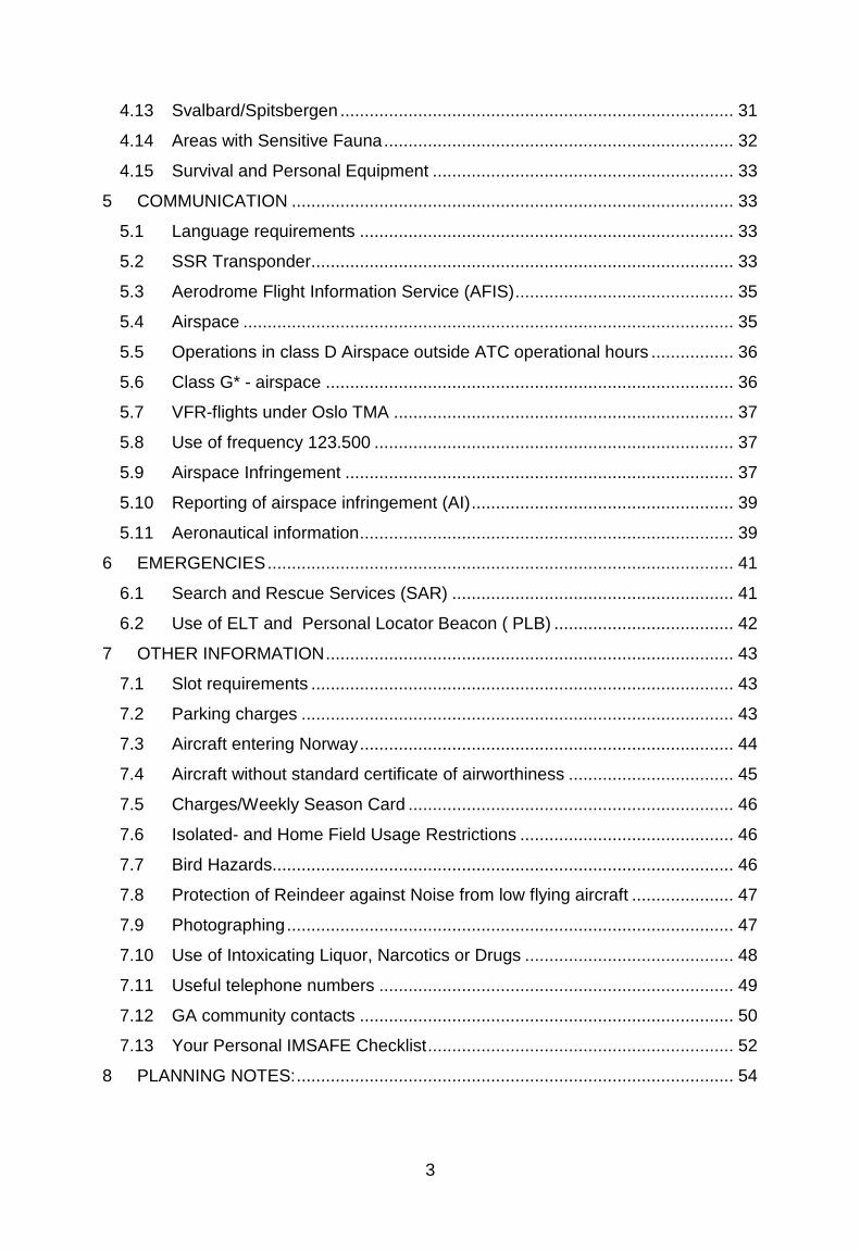
3.1 Take Charge of Flight Safety Below is a checklist, developed by the FAA, to consider for your condition prior to flight. Ask yourself, I'M SAFE
Am I safe to fly?
Ilness Am I physically well?
edication Am I free from the effects of drugs?
tress Am I free from significant stress?
lcohol Am I free from the effects of alcohol?
atigue Am I adequately rested?
ating Have I eaten properly to work effectively?
Don’t fly if you are not safe!
3.2 Some risk factors Aircraft Equipment and maintenance? Any maintenance problems that should be taken care of?
Performance Fuel Consumption, weight and balance, field elevation and runway length available
Environment How is the weather? Dayor Night operations? What type of terrain and airfields are involved?
External pressure Why are you making the trip? Limited on time or demanding passengers? Have an alternative travel plan been discussed before the trip started?
IMSAFE
5
3.3 Types of Manuals and Charts Available Aeronautical Information Publication (AIP) Norway in English is available at https://www.ippc.no/norway_aip/current/AD_eng.html
This document covers all information regarding Norwegian Airspace and Aerodromes and includes charts for VFR Routes Light Aircraft. It may be purchased as a single edition (no revisions) through Norsk Aero A/S.
IPPC – Internet Pilot Planning Center: https://www.ippc.no is the internet address for Avinor’s web-based information and flightplanning tool. The site is linked to NAIS, Norwegian Aeronautical Information System. Here you can obtain briefings, weather reports and forecasts, map-updates and also check AIP-Norway online.
Jeppesen Bottlang Airfield Manual, Scandinavia The Manual contains a general section and country related parts with Communications, Meteorology, Regulations, Aerodrome Directory as well as Visual Approach, Landing and Area Charts. Updated by a monthly revision service.
VFR Trip-kit Norway The Jeppesen Bottlang Airfield Manual covering Norway only. No revision service.
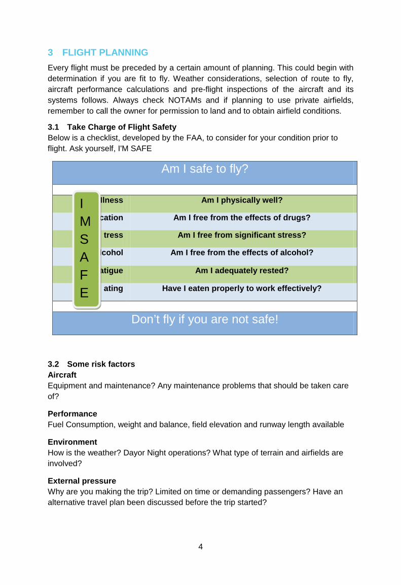
Airfield Manual Norway This is an annual subscription with 12 revisions. The Manual include the following sections; Special notes, General, Communications, Meteorology, Regulations, Emergency, Aerodrome Directory as well as Visual Approach, Landing and Area Charts for all (with a few exceptions) Norwegian airports, airfields and military aerodromes authorized for joint civil use.
www.norskeflyplasser.no This is an unofficial website in Norwegian covering both the major airfields as well as most of the small dirt and grass fields around.
Warning: This is a private web-page and data published here is NOT verified and/or checked by the Norwegian authorities.
6
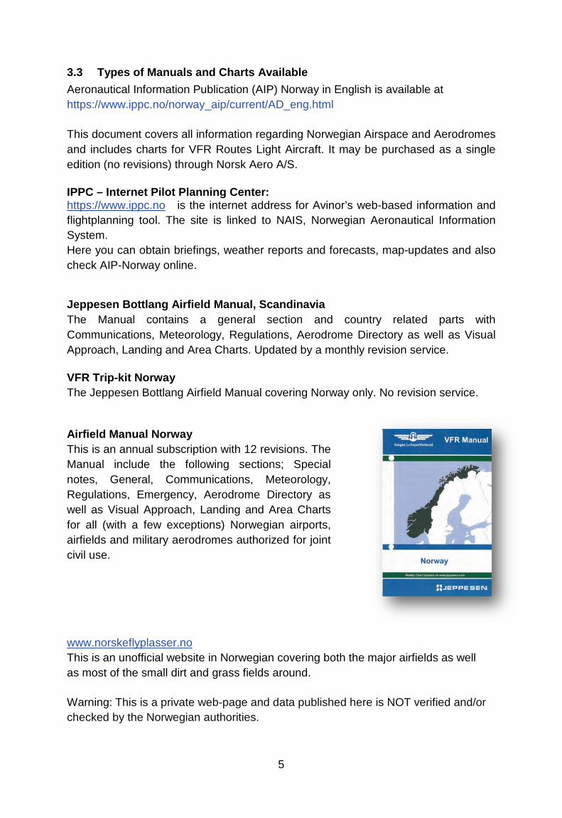
Aeronautical Chart ICAO, 1:500 000 These charts are often preferred by pilots for VFR cross-country flights. New charts with the latest airspace updates are available from April 2011.
3 charts covering Norway: • Southern Norway • Central Norway • Northern Norway
M517 Air Aeronautical Charts, 1:250 000 Provides higher detail level. 16 charts covering Norway:
• Kristiansand • Bergen • Rjukan • Oslo • Førde • Otta • Molde • Trondheim • Namsos • Mosjøen • Bodø • Narvik • Tromsø
• Kautokeino • Hammerfest • Kirkenes
CAUTION: Please beware of obstacles that might not be shown on your map. Masts and high-tension power lines are constantly being build and caution is especially advised when flying along fjords, valleys an in the vicinity of islands along the coast. Especially power lines are almost impossible to see, and they frequently cross fjords and inlets.
7
3.4 Chart updates At www.ippc.no , under AIS publications –CHAD NOR, you will find the latest chart updates for 1:500 000, and 1:250 000 series.
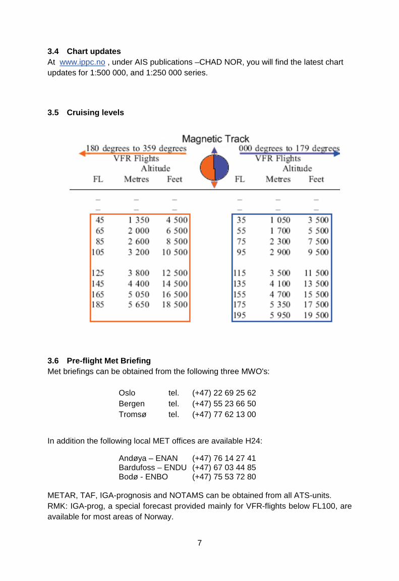
3.5 Cruising levels
3.6 Pre-flight Met Briefing Met briefings can be obtained from the following three MWO's:
Oslo tel. (+47) 22 69 25 62 Bergen tel. (+47) 55 23 66 50 Tromsø tel. (+47) 77 62 13 00
In addition the following local MET offices are available H24: Andøya – ENAN (+47) 76 14 27 41 Bardufoss – ENDU (+47) 67 03 44 85 Bodø - ENBO (+47) 75 53 72 80
METAR, TAF, IGA-prognosis and NOTAMS can be obtained from all ATS-units. RMK: IGA-prog, a special forecast provided mainly for VFR-flights below FL100, are available for most areas of Norway.

8
ATS units are connected to the Norwegian Aeronautical Information System (NAIS), which means that NOTAMs and various AIS and MET bulletins, including the special area forecasts for lowland, coast and fjord districts of Norway (IGA-forecast), are provided by all ATS units. Planning information is also available via internet: www.ippc.no
3.7 Autometar
The use of Autometar is approved by CAA-Norway on airports where the AWOS - Automatic Weather Observation System is currently used. This is an automatic weather report based on the AWOS observations, and used outside the ATS-unit opening hours.
In non-significant weather conditions there are normally not any difference between the Autometar and the official Metar. In significant weather conditions there might be some differences between the measured and actual visibility, both horizontal and vertical. The following codes are used exclusively by Autometar and will not occur on the official Metar:
The suffix /// is used after all clouds, i.e: FEW040/// NCD – No Clouds Detected NDV – No Directional Variations UP – Unidentified Percipitation
An Autometar will always be identified by the term AUTO, i.e: ENAL 060250Z AUTO 24010KT 9999…….

9
3.8 Go/ No-go weather criteria VFR flight may only be conducted:
Weather criteria Planned route
Cloud ceiling
Visibility Remarks
VMC More than 50 nm
1000 feet
5 km
VMC Night
More than 50 nm
2000 feet
10 km
PPR necessary for VFR-night in controlled airspace.
If the present weather situation does not meet these criteria, you can’t go.
10
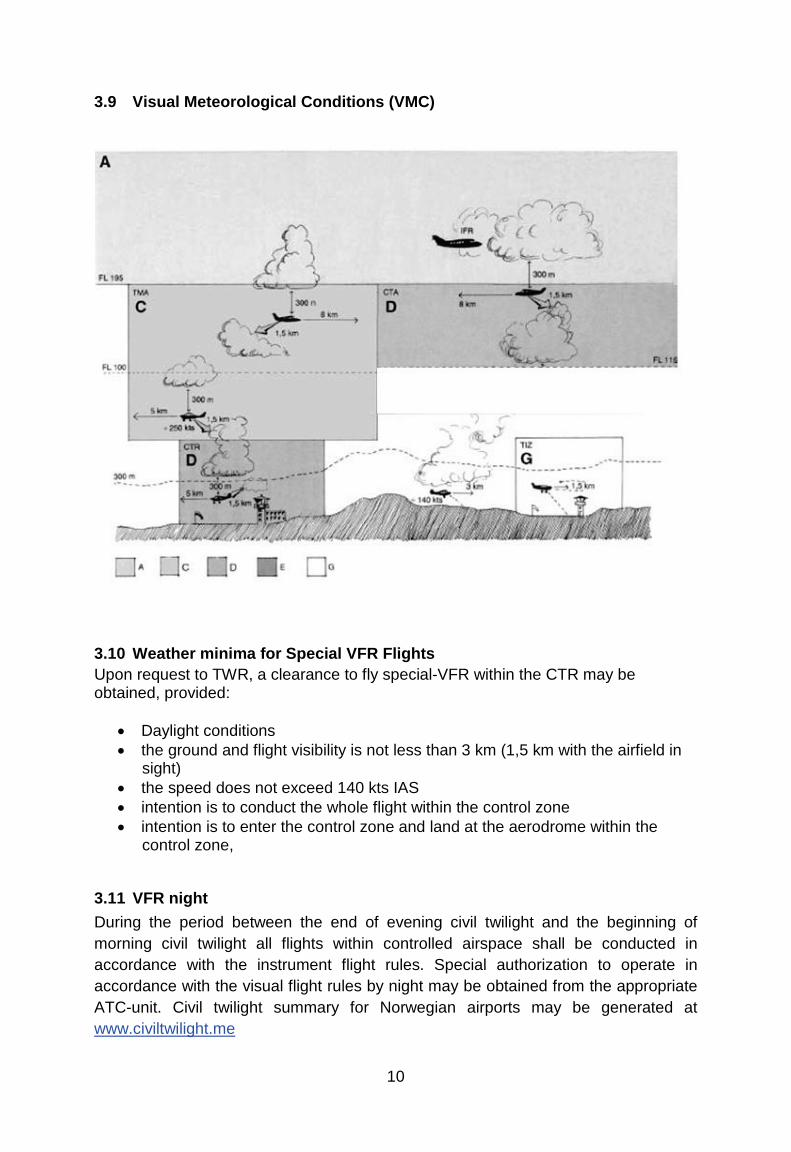
3.9 Visual Meteorological Conditions (VMC)
3.10 Weather minima for Special VFR Flights Upon request to TWR, a clearance to fly special-VFR within the CTR may be obtained, provided:
• Daylight conditions • the ground and flight visibility is not less than 3 km (1,5 km with the airfield in
sight) • the speed does not exceed 140 kts IAS • intention is to conduct the whole flight within the control zone • intention is to enter the control zone and land at the aerodrome within the
control zone,
3.11 VFR night During the period between the end of evening civil twilight and the beginning of morning civil twilight all flights within controlled airspace shall be conducted in accordance with the instrument flight rules. Special authorization to operate in accordance with the visual flight rules by night may be obtained from the appropriate ATC-unit. Civil twilight summary for Norwegian airports may be generated at www.civiltwilight.me
11
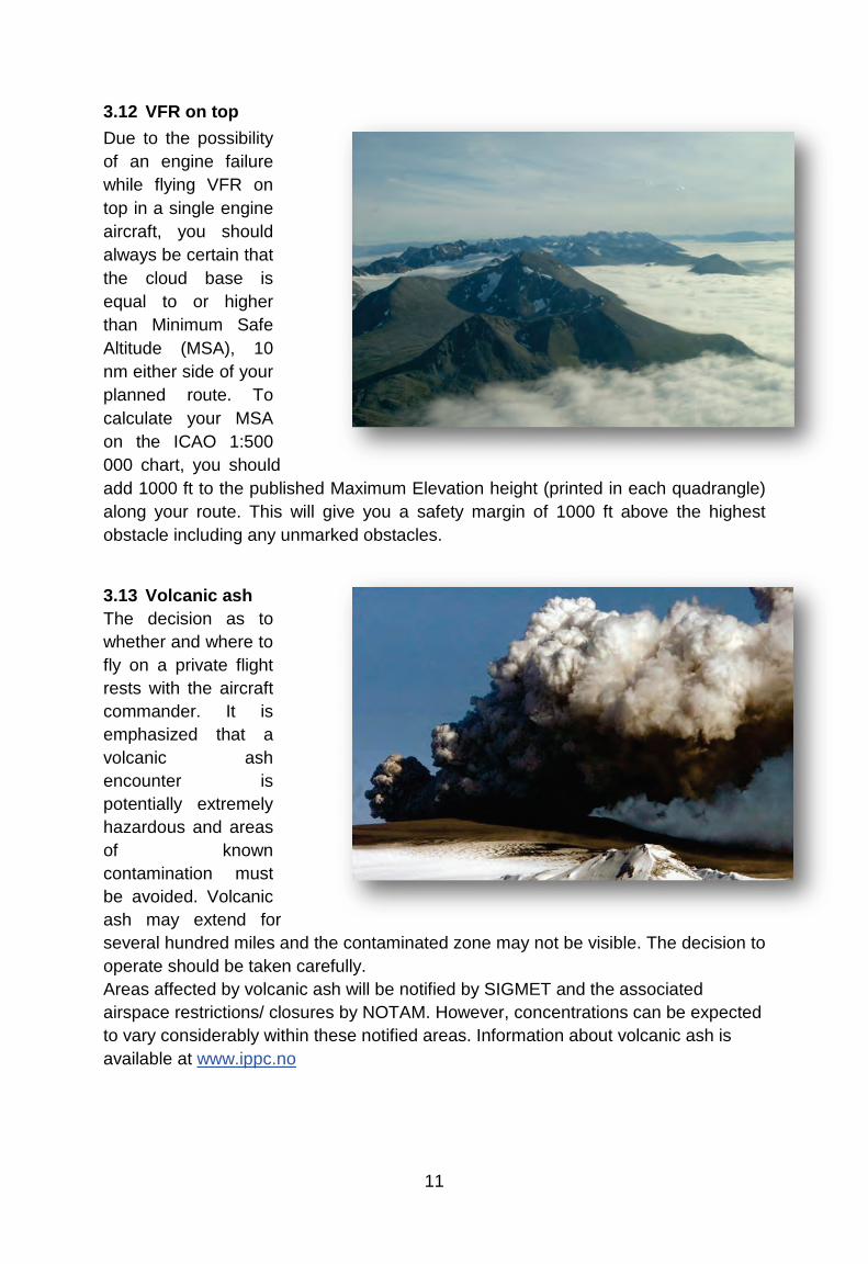
3.12 VFR on top Due to the possibility of an engine failure while flying VFR on top in a single engine aircraft, you should always be certain that the cloud base is equal to or higher than Minimum Safe Altitude (MSA), 10 nm either side of your planned route. To calculate your MSA on the ICAO 1:500 000 chart, you should add 1000 ft to the published Maximum Elevation height (printed in each quadrangle) along your route. This will give you a safety margin of 1000 ft above the highest obstacle including any unmarked obstacles.
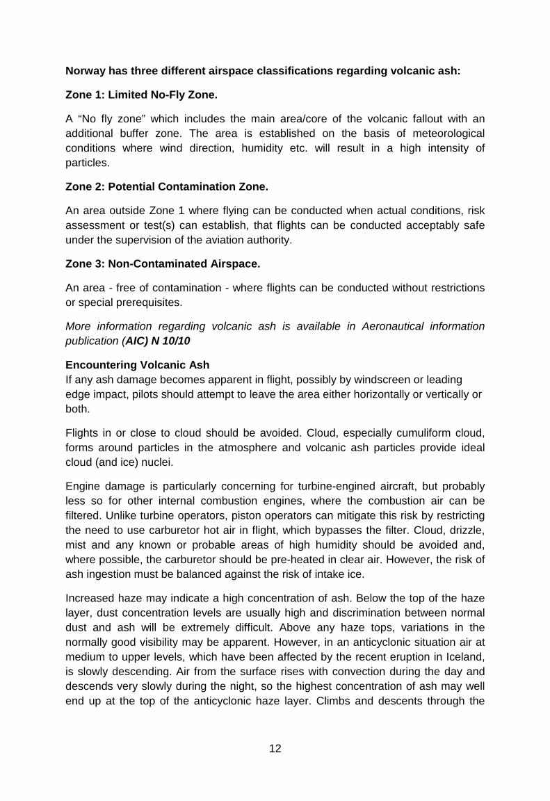
3.13 Volcanic ash The decision as to whether and where to fly on a private flight rests with the aircraft commander. It is emphasized that a volcanic ash encounter is potentially extremely hazardous and areas of known contamination must be avoided. Volcanic ash may extend for several hundred miles and the contaminated zone may not be visible. The decision to operate should be taken carefully. Areas affected by volcanic ash will be notified by SIGMET and the associated airspace restrictions/ closures by NOTAM. However, concentrations can be expected to vary considerably within these notified areas. Information about volcanic ash is available at www.ippc.no
12
Norway has three different airspace classifications regarding volcanic ash:
Zone 1: Limited No-Fly Zone.
A “No fly zone” which includes the main area/core of the volcanic fallout with an additional buffer zone. The area is established on the basis of meteorological conditions where wind direction, humidity etc. will result in a high intensity of particles.
Zone 2: Potential Contamination Zone.
An area outside Zone 1 where flying can be conducted when actual conditions, risk assessment or test(s) can establish, that flights can be conducted acceptably safe under the supervision of the aviation authority.
Zone 3: Non-Contaminated Airspace.
An area - free of contamination - where flights can be conducted without restrictions or special prerequisites.
More information regarding volcanic ash is available in Aeronautical information publication (AIC) N 10/10
Encountering Volcanic Ash If any ash damage becomes apparent in flight, possibly by windscreen or leading edge impact, pilots should attempt to leave the area either horizontally or vertically or both.
Flights in or close to cloud should be avoided. Cloud, especially cumuliform cloud, forms around particles in the atmosphere and volcanic ash particles provide ideal cloud (and ice) nuclei.
Engine damage is particularly concerning for turbine-engined aircraft, but probably less so for other internal combustion engines, where the combustion air can be filtered. Unlike turbine operators, piston operators can mitigate this risk by restricting the need to use carburetor hot air in flight, which bypasses the filter. Cloud, drizzle, mist and any known or probable areas of high humidity should be avoided and, where possible, the carburetor should be pre-heated in clear air. However, the risk of ash ingestion must be balanced against the risk of intake ice.
Increased haze may indicate a high concentration of ash. Below the top of the haze layer, dust concentration levels are usually high and discrimination between normal dust and ash will be extremely difficult. Above any haze tops, variations in the normally good visibility may be apparent. However, in an anticyclonic situation air at medium to upper levels, which have been affected by the recent eruption in Iceland, is slowly descending. Air from the surface rises with convection during the day and descends very slowly during the night, so the highest concentration of ash may well end up at the top of the anticyclonic haze layer. Climbs and descents through the

13
levels around the haze tops should be flown at the maximum rate possible, as should those through likely high humidity areas if carburetor hot air may be needed.
Airframe, propeller, rotor and intake damage depends on dust impacting surfaces. The extent of the damage depends on dust concentration and energy of impact, which is proportional to the square of impact speed. Operating airspeeds should therefore be chosen carefully, taking into
account the rate at which any possible damage is likely to accumulate. However, aeroplanes should not be flown so slowly that they cannot be maneuvered in an emergency.
It may be prudent to avoid flight over areas where the choice of landing areas in the event of engine failure is limited, even in twin-engined aircraft.
Ash may also find its way into pitot/static systems, or affect the lubrication of moving parts such as rotor heads, gearboxes and other bearings.
Any airborne encounter with volcanic ash should be reported to Air Traffic Control immediately.
Pre-Flight and Post-Flight Aircraft parked in areas that may be contaminated by volcanic ash should be suitably protected in accordance with the aircraft Type Certificate Holder’s advice and covered where possible.
Clouds, especially cumuliform clouds, may produce precipitation, which may be dirty if ash is present. Any volcanic residues must be removed prior to operations and following manufacturer’s recommendations.
Even if no volcanic ash damage is apparent, it is advisable for all possibly affected areas to be checked (if necessary by a qualified engineer) more frequently than called for in most maintenance schedules. Pilots should consider checking filters after every flight in suspected ash conditions.
Engine and airframe Type Certificate Holders may offer recommendations on the subject, which should be followed. Insurance policies may also contain relevant clauses.
If any ash is encountered, whether or not damage occurs, it should be reported to the CAA as an occurrence report form which is available at www.caa.no . Engineering action will be required prior to subsequent flight. The Aircraft Maintenance Manual should be consulted and advice sought from the aircraft Type Certificate Holder where necessary.
14
3.14 Operative Flight Plan You have to prepare and use an Operative Flight Plan for VFR flights extending more than 50 nm from your origin.
3.15 Fuel Planning An operator of an aircraft must take all necessary steps to ensure that the aircraft is carrying sufficient fuel and oil to enable the proposed flight to be undertaken in safety. The regulations require that you have enough fuel onboard to fly to your destination and then for 45 minutes. CAA-Norway recomends the following practice to achieve safe fuel planning:
• Make sure you know the aircrafts total fuel capacity and usable fuel.
• Check weight and balance, you might not be able to depart with full tanks.
• Determine fuel consumption and make sure you take any headwind
component into consideration as well.
• Check Notams to make sure you know the status of fuel supply on
aerodromes along your route. Note that opening hours for fueling may vary
from ATS opening hours. Also note that 100LL might not be available on all
aerodromes.
• Always plan to arrive with your fuel reserve intact, never plan to use any
reserve to get to your destination.
• Keep the weather in mind, sudden changes are common in Norway. Holding
or diversion might become necessary. Make sure you are prepared for this
eventuality.
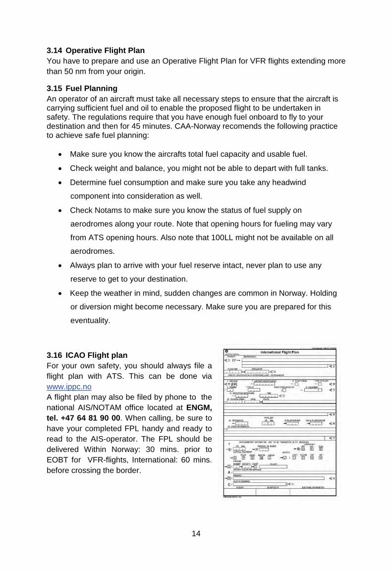
3.16 ICAO Flight plan For your own safety, you should always file a flight plan with ATS. This can be done via www.ippc.no A flight plan may also be filed by phone to the national AIS/NOTAM office located at ENGM, tel. +47 64 81 90 00. When calling, be sure to have your completed FPL handy and ready to read to the AIS-operator. The FPL should be delivered Within Norway: 30 mins. prior to EOBT for VFR-flights, International: 60 mins. before crossing the border.
15
Filing a flightplan via ippc.no: For access to the flight planning tool you need a username and password. You choose the username and password yourself and apply for access by completing and submitting the form under “Logon to Flightplanning – New User” window at IPPC. This is subsequently authorized by the AIS-office located at Oslo-Gardermoen airport. Due to capacity limitations in the flight plan processing, foreign users will be granted access for a limited time, and only flight plans into, out of or within Norway will be accepted.
A complete flight plan is mandatory for:
• All flights when a national border crossing is required. • All flights within EN-R402 (Finnmark). • All flights where Search and Rescue (SAR) is requested.
If a complete flight plan has not been filed, an abbreviated flight plan should be forwarded to ATC by radiotelephony in order to obtain clearance to operate in airspace class C and D. Clearance request to operate in controlled airspace shall be forwarded not later than 5 min or 10 NM outside the boundary of controlled airspace. Some information about filing a flightplan : Taking off or landing on airstrips without a four letter ICAO designator; field 13 and/ or 16. Norway has introduced a peculiar system where, instead of using the common ZZZZ for these airstrips, we use ZZOS, ZZSV and/or ZZBD depending on which AoR it is located within. The name of the airstrip is entered in field 18 of the flightplan form; DEP/ or DEST/….as usual. However, to complicate matters further, these four-letter codes are only used for flightplans within Norway. If the national border is crossed on a flight into or out of one of these airstrips, the normal ZZZZ – code is to be used.
Routing; field 15. Although legal, the use of DCT in the route-field is not recommended. ATC prefers to have a reasonable clue to where you intend to fly and i.e an approach controller will not necessarily know exactly where you will enter a TMA if you are on a long DCT route between two other airports and happens to transit a TMA in between. Of course, you may still fly on a direct track, but please file a point on the route for at least every 30 mins. flight time. This can be filed either a geographical name, a lat/long position, a Navaid, a five-letter Sigpoint or a fix given as a VOR radial and DME. (I.e. FLO065040 –a point on FLO radial 065 at DME 40 from FLO.)
16
NOTE: DO NOT use the four-letter ICAO designator for airports you overfly along the route as a point in the in the routing filed under item 15 in the flightplan. This is to avoid confusion as to whether you will be landing at these airports. Please use a Navaid at the airport or the airport name instead in the routing. The term “coastwise” will sometimes be used by both ATC and pilots to describe a routing along the coast. In some places this may be very accurate, but due to the amount of fjords, inlets and islands along Norway’s coastline we would like you to file a few points along the route instead. Thereby we avoid confusion about your intended route. Changing the EOBT. If you like to bring your EOBT forward or delay your flightplan, this is not a problem. Notify ATC or call AIS (64 81 90 00 (H24)) if you change the EOBT more than 30 mins. either way. Please bear in mind that some airports are slot-restricted and make sure your slot time is adjusted accordingly.
Departure message Departing from an airfield where ATS is not provided, the pilot must transmit a departure message by one of the following means:
• Telephone from a person on the ground as arranged between the pilot-in-command and the person involved.
• A statement by the pilot-in-command that EOBT (Estimated Off-block Time) in the flight plan shall be considered as ATD.
• By giving the time, considered to be ATD, to AIS/ NOTAM by phone immediately prior to departure. (+47 64 81 90 00)
• By radiotelephony to ATS after departure.
The flight plan will not be activated unless one of the above procedures has been complied with.
Delays and/ or changes to flightplan If a delay of more than 30 mins. occur or you have to make a planned change to your FPL, notify the local ATS-unit or AIS/NOTAM in order to send a DLA or CHG message.
17
Arrival report Arrival report and closure of the flight plan must be made within 30minutes after ETA, or else SAR procedures will be initiated. If an arrival report is not expected to reach the appropriate ATS unit within 30 minutes after ETA, item 18 in the flight plan shall contain the latest time at which an arrival report can be expected. The pilot or the operator may be charged for the total costs of SAR operations if the pilot has failed to comply with the appropriate rules for notification to ATC of:
• Deviations from the flight plan, or • not closing the flight plan, resulting in initiation of SAR operations.
Note: If you are planning to use Oslo airport, Gardermoen, allocation of departure and arrival times (Slot time) are compulsory. For slot time, contact the Scheduling Coordinator at Oslo airport, Gardermoen on:
TEL + 47 64 81 90 00
FAX: + 47 64 81 90 01
E-mail: [email protected]
3.17 VFR routes inside CTR/TMA These published VFR-routes are to be used for flight planning purposes and the clearances issued will state the reporting points to identify the route. The cleared route with specified altitude limitations and related procedures shall be complied with unless weather conditions necessitate to divert from the clearance. The diversion or need for a diversion from the clearance shall be transmitted to ATC as soon as possible.
3.18 Prohibited, restricted and danger areas Prohibited Areas Prohibited areas are not established in Norwegian airspace.
Restricted Areas Restricted areas and restricted areas which are active only as notified by NOTAM are promulgated in AIP Norway.
18
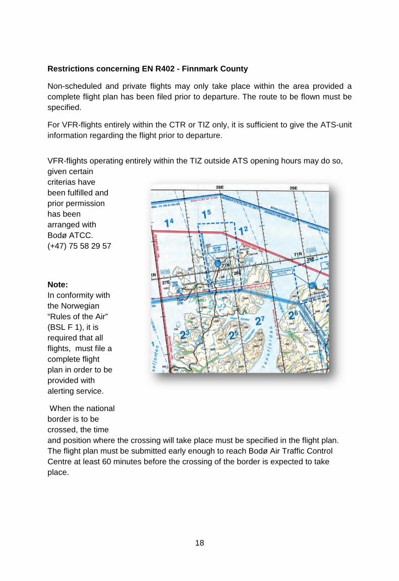
Restrictions concerning EN R402 - Finnmark County
Non-scheduled and private flights may only take place within the area provided a complete flight plan has been filed prior to departure. The route to be flown must be specified.
For VFR-flights entirely within the CTR or TIZ only, it is sufficient to give the ATS-unit information regarding the flight prior to departure.
VFR-flights operating entirely within the TIZ outside ATS opening hours may do so, given certain criterias have been fulfilled and prior permission has been arranged with Bodø ATCC. (+47) 75 58 29 57
Note: In conformity with the Norwegian “Rules of the Air” (BSL F 1), it is required that all flights, must file a complete flight plan in order to be provided with alerting service.
When the national border is to be crossed, the time and position where the crossing will take place must be specified in the flight plan. The flight plan must be submitted early enough to reach Bodø Air Traffic Control Centre at least 60 minutes before the crossing of the border is expected to take place.

19
Danger Areas Danger areas which are continuously active, and danger areas which are active only as notified by NOTAM, - are promulgated in AIP Norway. In other cases danger areas are promulgated by NOTAM only.
Based on information given by the agency responsible for the activity, the upper limits of danger areas are promulgated as:
• an altitude (FT AMSL), when the upper limit is at 10000 FT or below, - or
• a flight level (FL), when the upper limit is above 10000 FT.
By promulgation of the upper limits as a flight level (see para b above) due regard is taken to possible deviations from the standard atmosphere. The promulgated upper limit of a danger area can always be considered as safe. In addition to the upper limit of the activity, a “buffer” of 1000 FT (2000 FT above 25000 FT) is included. It is the pilots responsibility to avoid all danger areas, however ATC can give advise and guidance regarding the circumnavigation of these. ATC will also order a stop in the activity if a controlled flight has to be cleared closer to a danger area than the prescribed minimum.
Danger area 1:500 000 map
20
Real time activation For a few of the danger areas - promulgated as continuously active - a real time activation is practiced. Hence all activity in the danger area concerned is coordinated between ATC and the agency responsible for the activity. The agency responsible for the activity will inform ATC prior to the activation. Based on this information, ATC will always be able to inform the pilot in command regarding the status of a real time activated area, whether it is active or non-active. Information regarding a non-active area is valid for a limited period of time only, normally 30 MIN.
Unless the pilot in command has obtained information on a danger area being non-active, the area shall be considered as continuously active within the promulgated time period.
Danger Areas - Continuously active See AIP Norway ENR 5-1.
21
4 FLIGHTS IN MOUNTAIN AND REMOTES AREAS
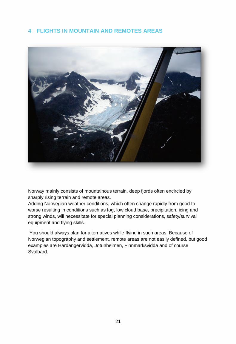
Norway mainly consists of mountainous terrain, deep fjords often encircled by sharply rising terrain and remote areas. Adding Norwegian weather conditions, which often change rapidly from good to worse resulting in conditions such as fog, low cloud base, precipitation, icing and strong winds, will necessitate for special planning considerations, safety/survival equipment and flying skills.
You should always plan for alternatives while flying in such areas. Because of Norwegian topography and settlement, remote areas are not easily defined, but good examples are Hardangervidda, Jotunheimen, Finnmarksvidda and of course Svalbard.
22
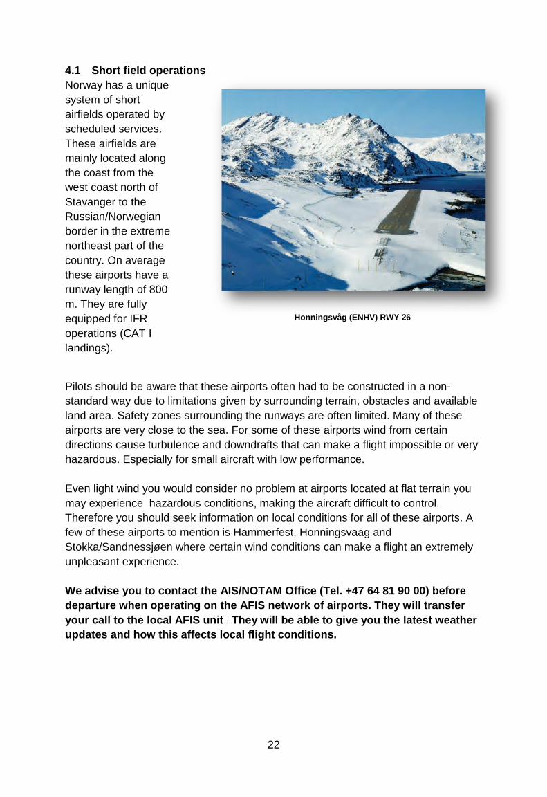
4.1 Short field operations Norway has a unique system of short airfields operated by scheduled services. These airfields are mainly located along the coast from the west coast north of Stavanger to the Russian/Norwegian border in the extreme northeast part of the country. On average these airports have a runway length of 800 m. They are fully equipped for IFR operations (CAT I landings).
Pilots should be aware that these airports often had to be constructed in a non-standard way due to limitations given by surrounding terrain, obstacles and available land area. Safety zones surrounding the runways are often limited. Many of these airports are very close to the sea. For some of these airports wind from certain directions cause turbulence and downdrafts that can make a flight impossible or very hazardous. Especially for small aircraft with low performance. Even light wind you would consider no problem at airports located at flat terrain you may experience hazardous conditions, making the aircraft difficult to control. Therefore you should seek information on local conditions for all of these airports. A few of these airports to mention is Hammerfest, Honningsvaag and Stokka/Sandnessjøen where certain wind conditions can make a flight an extremely unpleasant experience. We advise you to contact the AIS/NOTAM Office (Tel. +47 64 81 90 00) before departure when operating on the AFIS network of airports. They will transfer your call to the local AFIS unit . They will be able to give you the latest weather updates and how this affects local flight conditions.
Honningsvåg (ENHV) RWY 26
23
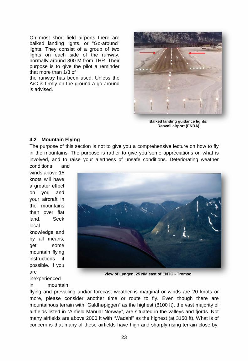
On most short field airports there are balked landing lights, or "Go-around" lights. They consist of a group of two lights on each side of the runway, normally around 300 M from THR. Their purpose is to give the pilot a reminder that more than 1/3 of the runway has been used. Unless the A/C is firmly on the ground a go-around is advised.
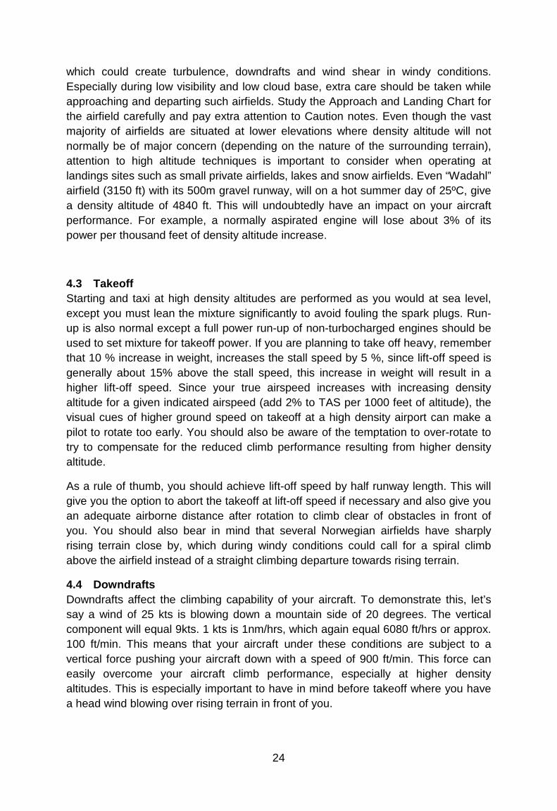
4.2 Mountain Flying The purpose of this section is not to give you a comprehensive lecture on how to fly in the mountains. The purpose is rather to give you some appreciations on what is involved, and to raise your alertness of unsafe conditions. Deteriorating weather conditions and winds above 15 knots will have a greater effect on you and your aircraft in the mountains than over flat land. Seek local knowledge and by all means, get some mountain flying instructions if possible. If you are inexperienced in mountain flying and prevailing and/or forecast weather is marginal or winds are 20 knots or more, please consider another time or route to fly. Even though there are mountainous terrain with “Galdhøpiggen” as the highest (8100 ft), the vast majority of airfields listed in “Airfield Manual Norway”, are situated in the valleys and fjords. Not many airfields are above 2000 ft with “Wadahl” as the highest (at 3150 ft). What is of concern is that many of these airfields have high and sharply rising terrain close by,
Balked landing guidance lights.
Røsvoll airport (ENRA)
View
of Lyngen, 25 NM east of ENTC -
Tromsø
24
which could create turbulence, downdrafts and wind shear in windy conditions. Especially during low visibility and low cloud base, extra care should be taken while approaching and departing such airfields. Study the Approach and Landing Chart for the airfield carefully and pay extra attention to Caution notes. Even though the vast majority of airfields are situated at lower elevations where density altitude will not normally be of major concern (depending on the nature of the surrounding terrain), attention to high altitude techniques is important to consider when operating at landings sites such as small private airfields, lakes and snow airfields. Even “Wadahl” airfield (3150 ft) with its 500m gravel runway, will on a hot summer day of 25ºC, give a density altitude of 4840 ft. This will undoubtedly have an impact on your aircraft performance. For example, a normally aspirated engine will lose about 3% of its power per thousand feet of density altitude increase.
4.3 Takeoff Starting and taxi at high density altitudes are performed as you would at sea level, except you must lean the mixture significantly to avoid fouling the spark plugs. Run-up is also normal except a full power run-up of non-turbocharged engines should be used to set mixture for takeoff power. If you are planning to take off heavy, remember that 10 % increase in weight, increases the stall speed by 5 %, since lift-off speed is generally about 15% above the stall speed, this increase in weight will result in a higher lift-off speed. Since your true airspeed increases with increasing density altitude for a given indicated airspeed (add 2% to TAS per 1000 feet of altitude), the visual cues of higher ground speed on takeoff at a high density airport can make a pilot to rotate too early. You should also be aware of the temptation to over-rotate to try to compensate for the reduced climb performance resulting from higher density altitude.
As a rule of thumb, you should achieve lift-off speed by half runway length. This will give you the option to abort the takeoff at lift-off speed if necessary and also give you an adequate airborne distance after rotation to climb clear of obstacles in front of you. You should also bear in mind that several Norwegian airfields have sharply rising terrain close by, which during windy conditions could call for a spiral climb above the airfield instead of a straight climbing departure towards rising terrain.
4.4 Downdrafts Downdrafts affect the climbing capability of your aircraft. To demonstrate this, let’s say a wind of 25 kts is blowing down a mountain side of 20 degrees. The vertical component will equal 9kts. 1 kts is 1nm/hrs, which again equal 6080 ft/hrs or approx. 100 ft/min. This means that your aircraft under these conditions are subject to a vertical force pushing your aircraft down with a speed of 900 ft/min. This force can easily overcome your aircraft climb performance, especially at higher density altitudes. This is especially important to have in mind before takeoff where you have a head wind blowing over rising terrain in front of you.
25
4.5 Windshear Most of the windshear that occur in Norway during winter are caused by temperature-inversions at ground level. These windshears are usually long lasting and may be detected by measuring the wind at higher levels (mountain peaks) above the runway level.
Wind gauges for this purpose are installed at the following aerodromes:
• ALTA (ENAT) • BANAK (ENNA) • BERGEN/Flesland (ENBR) • HARSTAD/NARVIK/Evenes (ENEV) • KIRKENES/Høybuktmoen (ENKR) MOSJØEN/Kjærstad (ENMS) • HAMMERFEST (ENFH) • SVALBARD/Longyear (ENSB)
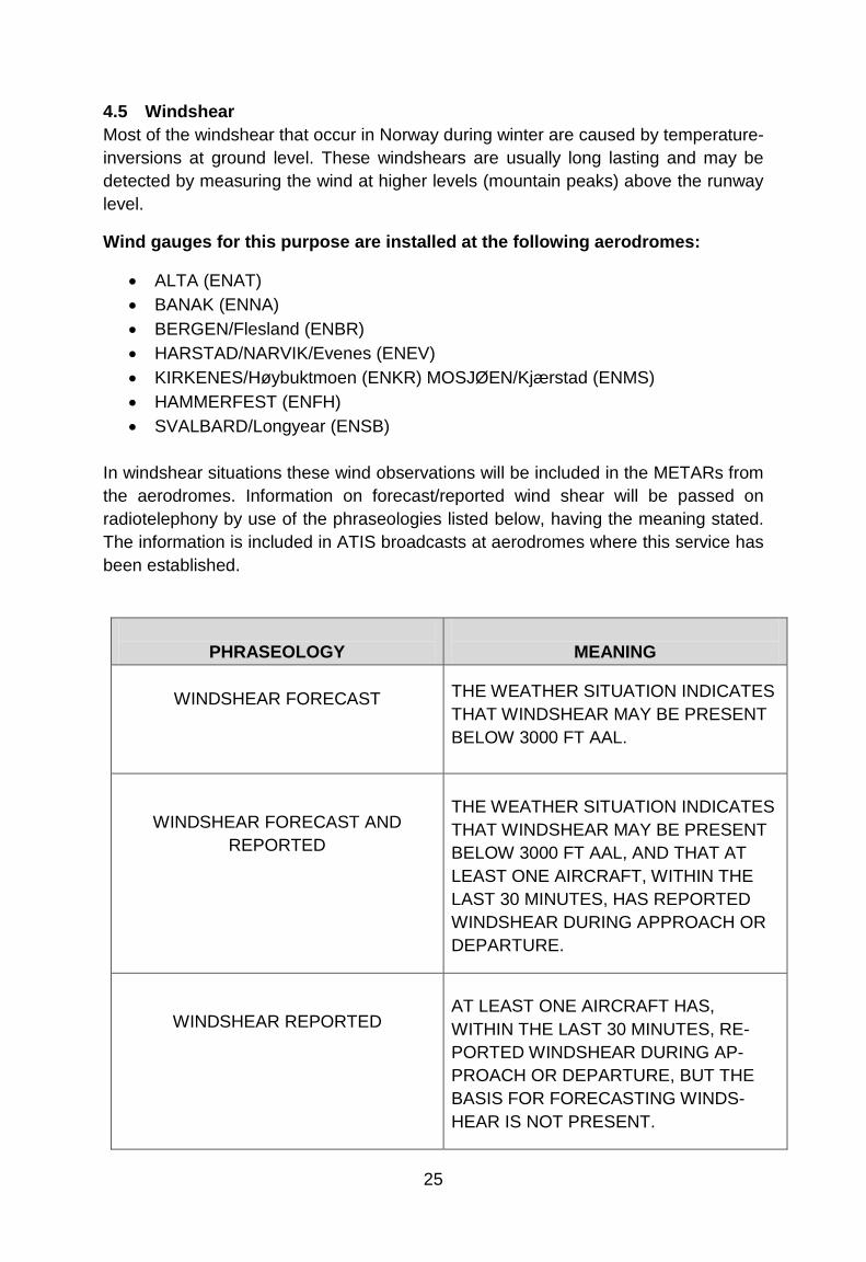
In windshear situations these wind observations will be included in the METARs from the aerodromes. Information on forecast/reported wind shear will be passed on radiotelephony by use of the phraseologies listed below, having the meaning stated. The information is included in ATIS broadcasts at aerodromes where this service has been established.
PHRASEOLOGY
MEANING
WINDSHEAR FORECAST
THE WEATHER SITUATION INDICATES THAT WINDSHEAR MAY BE PRESENT BELOW 3000 FT AAL.
WINDSHEAR FORECAST AND REPORTED
THE WEATHER SITUATION INDICATES THAT WINDSHEAR MAY BE PRESENT BELOW 3000 FT AAL, AND THAT AT LEAST ONE AIRCRAFT, WITHIN THE LAST 30 MINUTES, HAS REPORTED WINDSHEAR DURING APPROACH OR DEPARTURE.
WINDSHEAR REPORTED
AT LEAST ONE AIRCRAFT HAS, WITHIN THE LAST 30 MINUTES, RE-PORTED WINDSHEAR DURING AP-PROACH OR DEPARTURE, BUT THE BASIS FOR FORECASTING WINDS-HEAR IS NOT PRESENT.
26
4.6 Icing An aircraft shall not take-off for the purpose of making a flight into known or expected icing conditions unless the aircraft is adequately equipped with de-icing or anti-icing equipment of the type and quantities required to handle such conditions. Please note that in some areas, like over or nearby larger glaciers as Svartisen or Folgefonna, severe carburettor icing may occur. This is due to the local temperature drop the glaciers will induce.
4.7 Enroute Route selection over mountainous terrain does often involve more than drawing a straight line between your origin and the destination. Wind conditions, cloud base and proper emergency landing sites along your route, often dictate your route selection. For some areas in Norway, the only suitable emergency landing sites may be to ditch along the shore in the fjords. Therefore, a map study with emergencies in mind, choosing an alternative plan goes hand in hand with the selection of the main route.
Weather conditions along your route must be checked before take off and monitored constantly to detect deteriorating weather as soon as possible. Especially during winter, the weather conditions may change extremely quickly, from a nice sunny day to dense snow showers in a matter of minutes. Some of these extreme weather conditions, like the Polar Lows, are intense and very hard to forecast. Rapidly deteriorating weather and windy conditions is what makes mountain flying so challenging and sometimes dangerous. If you start to feel uncomfortable due to uncertainty of where you are, clouds forcing you down, reduced visibility, increasing turbulence or downdrafts, take action and make precautionary measures. You may turn around and go back or choose an alternate route, but most importantly, do it in time!
27
4.8 A few points on mountain flying techniques Air will in many ways flow like water. So when air moves along, it will change directions, decelerate or accelerate, move up and down like waves or tumble around when it hits obstructions or being squeezed through mountain passes. In windy conditions (in this context, meaning more than 15 knots at ground level and increasing with altitude), turbulence, updrafts and downdrafts will start to have an impact on flight conditions. If you decide to fly at high altitudes under such conditions, add a safety margin of at least 1000 feet above the peaks along the route to stay away from mountain waves.
If you decide, under such conditions, to follow the valleys or fjords below the ridgelines, you should be proficient in assessing wind direction and speed, and where to position yourself in the valley. Before entering a valley, be sure it is the right valley by referring to the map and navigation instruments. Too many pilots have ended up dead in a dead-end valley.
If weather permits, preferably fly on the right hand side of a valley as this is a common procedure to avoid opposite traffic. In windy conditions, fly on the upwind side of the valley to avoid downdrafts on the leeside and to gain a lift advantage from the updrafts.
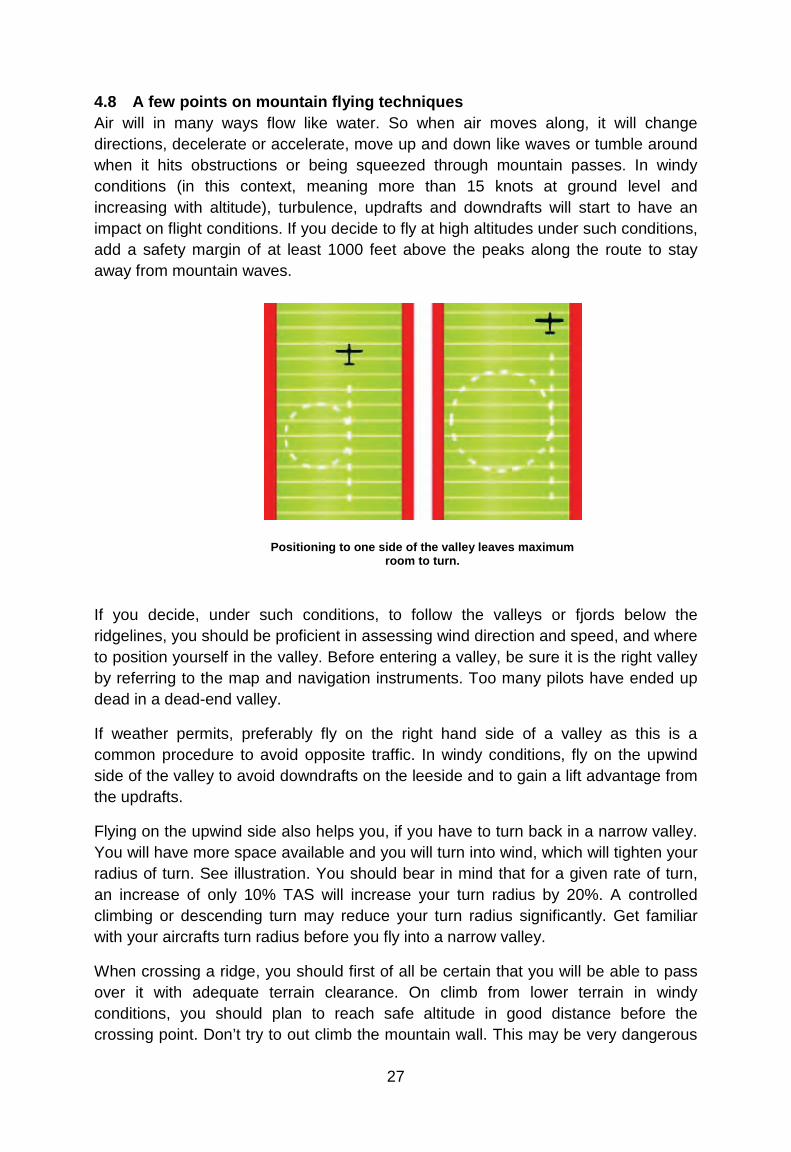
Flying on the upwind side also helps you, if you have to turn back in a narrow valley. You will have more space available and you will turn into wind, which will tighten your radius of turn. See illustration. You should bear in mind that for a given rate of turn, an increase of only 10% TAS will increase your turn radius by 20%. A controlled climbing or descending turn may reduce your turn radius significantly. Get familiar with your aircrafts turn radius before you fly into a narrow valley.
When crossing a ridge, you should first of all be certain that you will be able to pass over it with adequate terrain clearance. On climb from lower terrain in windy conditions, you should plan to reach safe altitude in good distance before the crossing point. Don’t try to out climb the mountain wall. This may be very dangerous
Positioning to one side of the valley leaves maximum room to turn.
28
due to unexpected downdrafts and uncertainty of the steepness of the wall. Add at least 1000 feet for safety in windy conditions. Approach and cross the ridge at 45º to the ridge preferably with the ridge on your left side for better view. This will give you a less angle to turn to steer away from the ridge if necessary, and make sure your escape will be downhill and downstream.
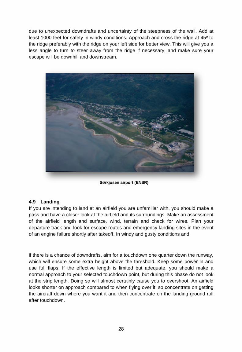
4.9 Landing If you are intending to land at an airfield you are unfamiliar with, you should make a pass and have a closer look at the airfield and its surroundings. Make an assessment of the airfield length and surface, wind, terrain and check for wires. Plan your departure track and look for escape routes and emergency landing sites in the event of an engine failure shortly after takeoff. In windy and gusty conditions and
if there is a chance of downdrafts, aim for a touchdown one quarter down the runway, which will ensure some extra height above the threshold. Keep some power in and use full flaps. If the effective length is limited but adequate, you should make a normal approach to your selected touchdown point, but during this phase do not look at the strip length. Doing so will almost certainly cause you to overshoot. An airfield looks shorter on approach compared to when flying over it, so concentrate on getting the aircraft down where you want it and then concentrate on the landing ground roll after touchdown.
Sørkjosen airport (ENSR)

29
Facts: There are approximately 73000 wires in Norway which are 15 meters or higher. Only 1-2% of these are marked with high intensity lights, fluorescent paint, wire markers or a combination of these measures.
4.10 Wires When you fly along valleys or fjords and during takeoffs and landings, you should pay extra attention to the possible presence of wires. Wires often run across valleys and fjords between poles situated on the ridgelines. The lowest part of the span may be several hundred feet above ground depending on the steepness and height of the mountains and the width of the valley. Wires are often almost impossible to see in time, so in your search for wires you should look for the poles. The firebreak along the path of high voltage wires is also a good indication of the presence of wires. If you encounter wires, you should try to cross at a height equal to or above the height of the poles or even better above the poles themselves. High voltage spans, which can be easier to see, often have much thinner earth wires running from the top of the poles, which are not that easy to spot.
Note: Not all wires are depicted on the charts, so to be safe, you should not fly below the ridgeline or minimum altitude of 500 feet if you are not absolutely certain about wire locations.
Wires kill!
Wire damage
30
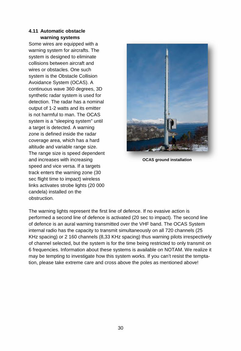
4.11 Automatic obstacle warning systems
Some wires are equipped with a warning system for aircrafts. The system is designed to eliminate collisions between aircraft and wires or obstacles. One such system is the Obstacle Collision Avoidance System (OCAS). A continuous wave 360 degrees, 3D synthetic radar system is used for detection. The radar has a nominal output of 1-2 watts and its emitter is not harmful to man. The OCAS system is a “sleeping system” until a target is detected. A warning zone is defined inside the radar coverage area, which has a hard altitude and variable range size. The range size is speed dependent and increases with increasing speed and vice versa. If a targets track enters the warning zone (30 sec flight time to impact) wireless links activates strobe lights (20 000 candela) installed on the obstruction. The warning lights represent the first line of defence. If no evasive action is performed a second line of defence is activated (20 sec to impact). The second line of defence is an aural warning transmitted over the VHF band. The OCAS System internal radio has the capacity to transmit simultaneously on all 720 channels (25 KHz spacing) or 2 160 channels (8,33 KHz spacing) thus warning pilots irrespectively of channel selected, but the system is for the time being restricted to only transmit on 6 frequencies. Information about these systems is available on NOTAM. We realize it may be tempting to investigate how this system works. If you can’t resist the tempta-tion, please take extreme care and cross above the poles as mentioned above!
OCAS ground installation
31
4.12 Whiteout and Brightout If you are going to fly over areas covered by snow or ice you may be exposed to the phenomenon called whiteout. Whiteout is a situation where you loose the ability to see surface texture, shadows and hollows. In conditions where the light is reduced by an overcast sky, the result may be that everything turns into a flattened white surface. You can easily loose your horizon under such conditions and the ability to judge height and distance become impossible. Patches of clouds beneath the overcast sky may also blend in with the background and become invisible. This may result in inadvertently entering IMC conditions, and may be a very dangerous situation during low level flying. This is one reason why you should not try to climb up a snow covered mountain hill or glacier head on. Brightout will give the same flattening white surface appearance with no visible definitions, and happens often when bright sunlight from a clear sky shines on a white unmarked surface.
If you feel you loose your outside references, immediately initiate a climb, using your flight instruments to verify a positive climb attitude!
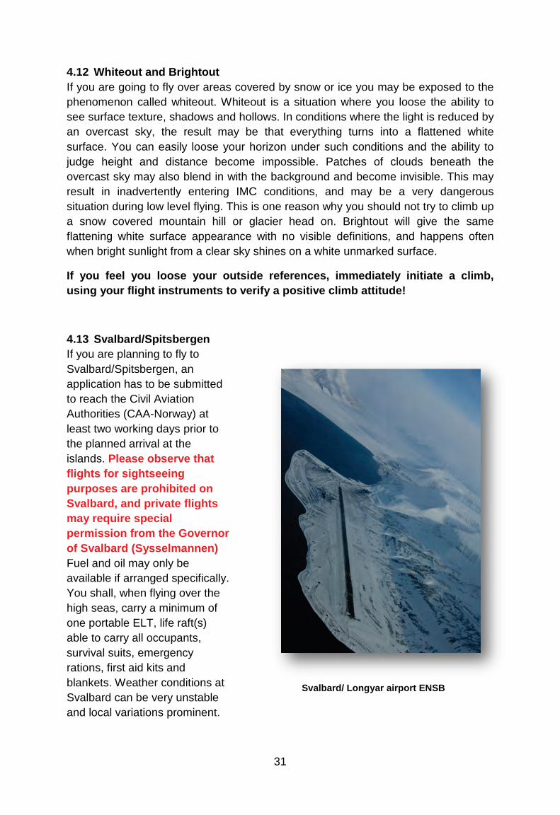
4.13 Svalbard/Spitsbergen If you are planning to fly to Svalbard/Spitsbergen, an application has to be submitted to reach the Civil Aviation Authorities (CAA-Norway) at least two working days prior to the planned arrival at the islands. Please observe that flights for sightseeing purposes are prohibited on Svalbard, and private flights may require special permission from the Governor of Svalbard (Sysselmannen) Fuel and oil may only be available if arranged specifically. You shall, when flying over the high seas, carry a minimum of one portable ELT, life raft(s) able to carry all occupants, survival suits, emergency rations, first aid kits and blankets. Weather conditions at Svalbard can be very unstable and local variations prominent.
Svalbard/ Longyar airport ENSB

32
Reliable weather reports/info may sometimes be hard to obtain, which calls for considerable attention while assessing flight conditions in these areas. Larger fjords are often ice-free, even during winter, due to strong currents. This often results in frost mist and/or low dense fog. During winter, winds of more than 20 kts will always result in drifting snow, due to the fine-grained and dry snow. The danger of whiteout is always present. You have to be familiar with Polar Region navigation when flying in Svalbard and its surroundings. According to the Norwegian Operational Regulations (BSL D), aircraft operating in Svalbard and its surroundings shall be of such colour that it will give good contrast to over-flown terrain. Otherwise the aircraft shall be marked with fluorescing paint or adhesive folio in colour of red, yellow or orange. On airplanes, these markings shall be placed on both sides of the wings, airframe or tail section. Total marked area shall not be less than 2 m².
An application to use the Svalbard/Longyear (ENSB) airport must be submitted Civil Aviation Authority at least 2 - two - working days prior to planned landing at Svalbard/Spitsbergen. Same information required as described on page 4 of this document. Flying with Ultra-light aircraft to/from Svalbard is prohibited.
4.14 Areas with Sensitive Fauna There are three National Parks and two Nature Reserves established at Svalbard, in addition to several smaller Protected Areas. Approximately 50% of the land areas are affected by Conservation Rules. In addition there are also several vulnerable areas of birds and mammals. A number of provisions apply to the use of aircraft in these areas. The above-mentioned areas are shown on 1:500 000 scale maps over Svalbard, and the rules applying to the use of aircraft in these areas are also stated. A brief summary of the Provisions states that it is prohibited for aircraft to land within National Parks and Reserves. Visitors (including pilots) must pay particular attention to plants, wildlife and areas of special importance to wildlife, particularly to areas shown on the pilot map series issued by Norsk Polarinstitutt. During the period 1st of April – 31st of August an aircraft are prohibited to be flown closer than 500m from bird cliffs. Pilots in command are obliged to know the Conservation rules and maps, and to confirm this by signing a protocol in the tower at SVALBARD/Longyear aerodrome.
33
4.15 Survival and Personal Equipment Flying in mountainous and remote areas in Norway and Svalbard calls for special attention to the type of equipment carried. During the winter months, the temperatures often get down to minus 30º C or even lower. If you have to make a forced landing in such conditions, proper winter clothing, boots and other equipment could save your life.
As a guide, minimum equipment should be: Compass, knife, blankets, storm matches, ordinary matches contained in a waterproof packing, candles, primus, emergency rations, first aid kit, emergency light signals, snow shuffle and skis or snowshoes. Flying in coastal areas in Svalbard and northern Norway often involves flying over very rough and pointy terrain where sometimes the only option for an emergency landing is by ditching in the ocean or the fjord. Since water temperature is very low, even during summertime, and ice free even during wintertime, a survival suit for each occupant is advisable.
5 COMMUNICATION
5.1 Language requirements Use of standard phrases for radio telephony communication between aircraft and ground stations is essential to avoid misunderstanding the intent of messages and to reduce the time required for communication. Users of air band radios are required to hold a valid Radio Telephone license. These documents shall confirm language proficiency level equal to ICAO standards. Primary language for aviation commu-nication is English, but Norwegian may of course also be used.
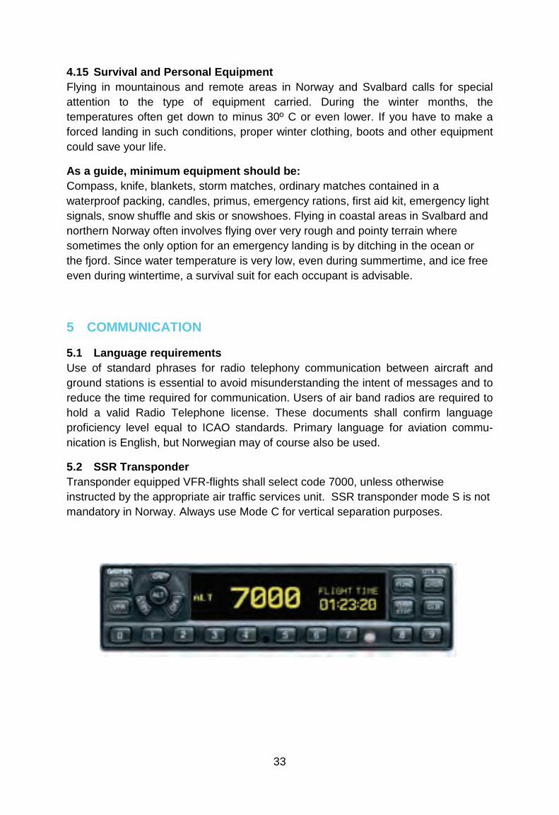
5.2 SSR Transponder Transponder equipped VFR-flights shall select code 7000, unless otherwise instructed by the appropriate air traffic services unit. SSR transponder mode S is not mandatory in Norway. Always use Mode C for vertical separation purposes.
7
34
Transponder operating procedures When an aircraft carries a serviceable transponder, the pilot shall operate the transponder at all times during flight, regardless of whether the aircraft is within or outside airspace where SSR is used for ATS purposes.
Except emergency or communication failure, the pilot shall:
• Operate the transponder and select codes as individually directed by the ATS unit with which contact is being made.
• Unless otherwise directed by ATS, operate the transponder on the last assigned code, until aircraft has landed.
• In the absence of any ATS directions, select code as follows: - VFR-flights: Code 7000.
When the aircraft carries serviceable Mode C equipment, the pilot shall continuously operate this mode, unless otherwise directed by ATS. If you are flying in a formation, only the formation leader shall operate the transponder, unless otherwise directed by ATS.
Pilots shall not SQUAWK IDENT unless requested by ATS.
Emergency procedures The pilot of an aircraft encountering a state of emergency shall set the transponder to Code 7700 except when previously directed by ATS to operate the transponder on a specified code. In the latter case the pilot shall maintain the specified code unless otherwise instructed.
Notwithstanding the procedures above, a pilot may select Code 7700 whenever there is a specific reason to believe that this would be the best course of action.
Communication failure procedures The pilot of an aircraft losing two-way communications shall set the transponder to Code 7600.
Note: A controller observing a response on the communications failure code 7600 will ascertain the extent of the failure by instructing the pilot to SQUAWK IDENT or to change code. Where it is determined that the aircraft receiver is functioning, further control of the aircraft will be continued using code changes or IDENT transmission to acknowledge the receipt of clearances issued.
35
5.3 Aerodrome Flight Information Service (AFIS) Traffic Information Areas (TIA) and Traffic Information Zones (TIZ), both G - class airspace, are established at airports where the traffic is relatively light and therefore only AFIS is provided (call sign + INFORMATION). Hence, the responsibility for avoiding collisions solely rests with the pilots when flying in to or out from these airports. Two-way radio contact with AFIS is mandatory, while flying within TIA and TIZ. The AFIS unit will state runway in use, weather conditions, time and traffic information.
Phraseologies used exclusively while flying at an AFIS aerodrome: “RUNWAY FREE” means that the runway is clear of other traffic and usable for taxiing, takeoff or landing. “RUNWAY OCCUPIED” means that the runway is occupied by other traffic and not usable for taxiing, takeoff or landing. “INFORM (ME)…..” is a request to the pilot to inform AFIS of PASSING (or PASSING OVER or ON or AT), POSITION and/or ALTITUDE.
Pilots report their whereabouts, intentions, position in the circuit, AIRBORNE (time) and LANDED (time).
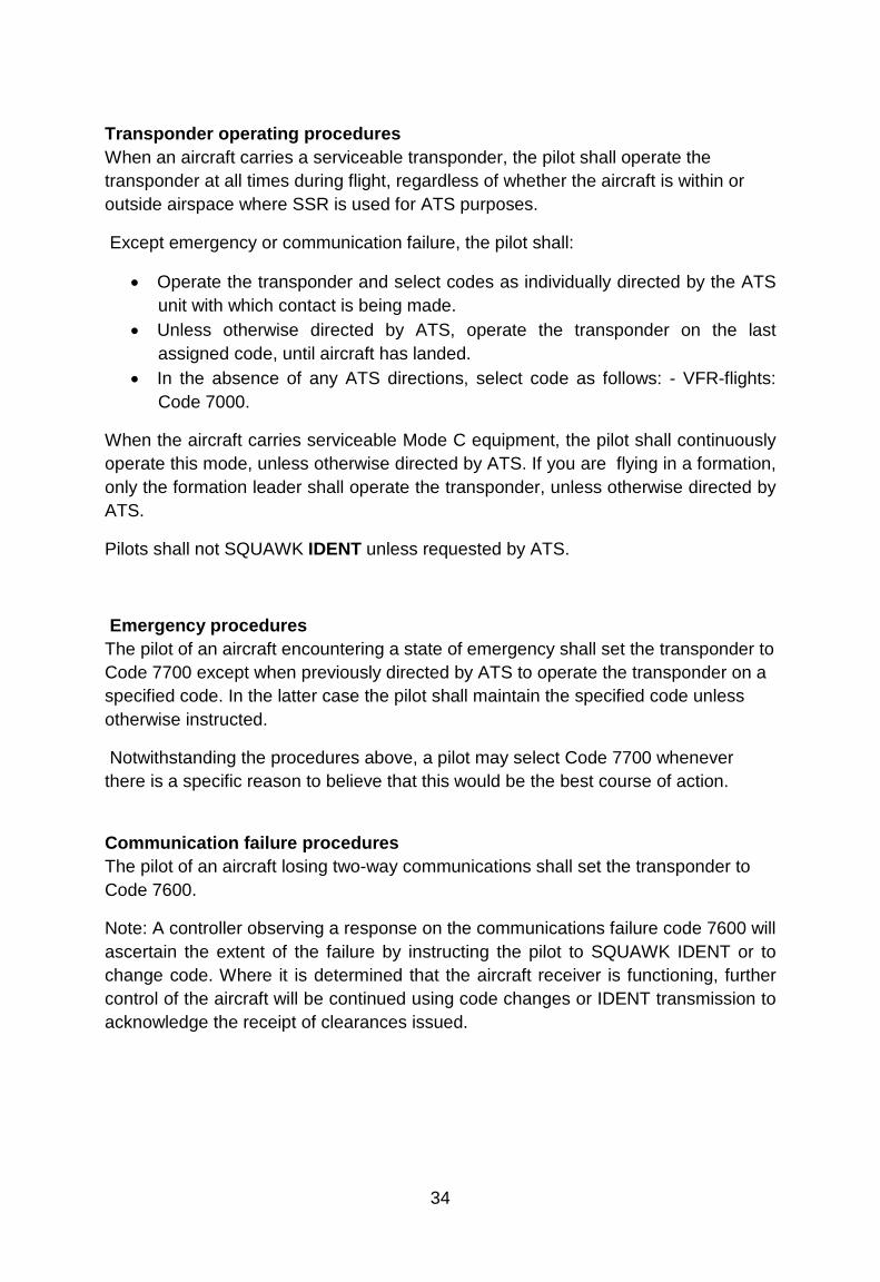
5.4 Airspace In Norway we have standard class C, D, and G airspace. In general separation standards are not applied by ATC to or between VFR flights and therefore separation from other aircraft remains the responsibility of the pilot in command of a VFR flight. The exception to this applies in Class C Airspace – where ATC will separate VFR from IFR but not VFR from VFR
When flying through class C and D airspace it is mandatory to obtain an ATC-clearance.
When flying through class C and/or D airspace you will be given a clearance from the appropriate ATS-unit. Please note that a clearance given by one ATS-unit is not automatically a clearance to continue into a neighboring ATS- unit’s area. Always check before flying into the next area.

36
NOTE: Prior to departure, TWR will issue a clearance to leave the CTR. This will normally contain a routing, altitude limit and a transponder code. This is NOT a departure clearance or clearance to enter any taxiways or runways!
5.5 Operations in class D Airspace outside ATC operational hours
Established as Control Zone (CTR) No clearance is required to operate as a VFR flight in class D airspace, established as a CTR outside the published hours of service of the unit responsible for providing service in the CTR. Flights are, however, in such period required to maintain listening watch on the control frequency and blind transmitting of position and intention is recommended. Flights are, however, not permitted to take off or land at state owned controlled aerodromes unless ATC is provided, and not to operate within a CTR between the end of evening civil twilight and the beginning of morning civil twilight unless a clearance has been obtained from an appropriate ATS unit.
Established as Terminal Control Area (TMA) A clearance to operate in class D airspace, established as a TMA, outside the published hours of service of the ATC unit normally providing service within the airspace, may be obtained from the appropriate ACC which may specify conditions to be complied with.
5.6 Class G* - airspace One special feature in Norway’s airspace is the G* -airspace. You will find this at and around most of the short-field airports, in TIZ and TIA.
This airspace is classified as G, but has a requirement to establish two-way communication with the AFIS-unit during opening hours.
37
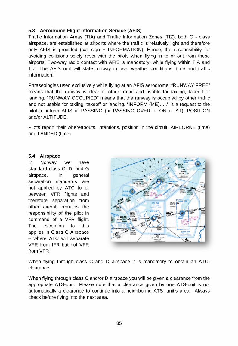
5.7 VFR-flights under Oslo TMA When flying in the G-class airspace underneath Oslo TMA close to Oslo you should tune in frequency 122.000 and transmit call sign, position, altitude and intensions blind on that frequency.
122.000 is a Unicom pilot-to-pilot frequency and there is no ATS service provided. Beware of the restriction area R 102 over the city center. Tune to the appropriate local frequency when approaching local airfields.
5.8 Use of frequency 123.500 Pilots flying in G-class airspace may use 123.500 for blind reporting. This frequency is a general pilot to pilot chit-chat frequency used all over Norway outside controlled airspace. Always make sure you tune to the appropriate ATS-frequency before entering controlled airspace or TIA/TIZ.
5.9 Airspace Infringement Unknown aircraft stray into some of the busiest areas of Europe’s airspace at least once a day. This happens mostly in airport control zones and TMAs. To avoid that you cause airspace infringement, the following recommendations, based on good airmanship and common sense, should be considered:
Oslo city
38
Planning
• Plan your flight! Where possible, avoid flying close to controlled airspace boundaries. A small navigational error or distraction of any sort may lead to an infringement.
• Read NOTAMs and check weather charts closely. The weather changes rapidly in Norway, and pilot workload rises rapidly in bad weather.
• File a flight plan – an opened FPL is mandatory to receive SAR services. • If your aircraft carries a GPS, be sure to have current electronic maps and
latest update available.
Communication
• You are more than welcome to contact Air Traffic Services, even in uncontrolled airspace. If communication is established, you’ll get flight information and may request to be transferred to the next ATS-unit when approaching sector boundaries.
• Communication established well in advance facilitates a request to enter controlled airspace as well as makes it easier to get assistance for example, if the weather deteriorates.
• Remember that communication with relevant ATS-unit is mandatory before entering air space class G+ or G* (Traffic Information Zones, TIZ /Traffic information area, TIA)
Phraseology
• Use standard phraseology. • Your first transmission should be e.g.:”Kjevik Tower – D-EEMH – on VFR flight
plan.” This gives ATS time to find your flight plan in the system and generate an SSR code for your flight.
Clearance
• If there is any doubt whether you have received a clearance to enter controlled airspace or not – ask for confirmation.
• If you need to deviate from your clearance to remain VMC –Take necessary action immediately, but advise ATC as early as possible. STAND BY is not a clearance to enter controlled airspace.
Be aware that a clearance through controlled airspace may take you away from your planned route, due to traffic patterns and other traffic.
Transponder
• Use the transponder, it will help ATC identify you in case you need assistance and may also prevent an infringement.
39
5.10 Reporting of airspace infringement (AI)
CAA Norway has been focusing on AI for some years and how to avoid this potential safety hazard. AI is basically to enter controlled airspace unauthorized (without an ATC clearance). ATC will normally report these incidents according information below (Form NF-2007). When a pilot is told that an AI incident will be reported by ATC he/she should always report his version of the AI. Pilot reports are essential to understand why AI happens. These reports will only be used to improve the knowledge of why an AI happens and find ways to reduce the number of AI incidents.
The objective of this reporting is the prevention of accidents/incidents and to improve the air safety, not to state criminal liability and blame.
For further information on AI see “Eurocontrol Airspace Infringement Initiative Action Plan”
Reporting of Accident / Incident / Occurrence
www.luftfartstilsynet.no, choose the tab ENGLISH, then on the right side of the screen you will find under the heading Reporting the link “NF-2007 Accident-Incident-Occurrence reporti
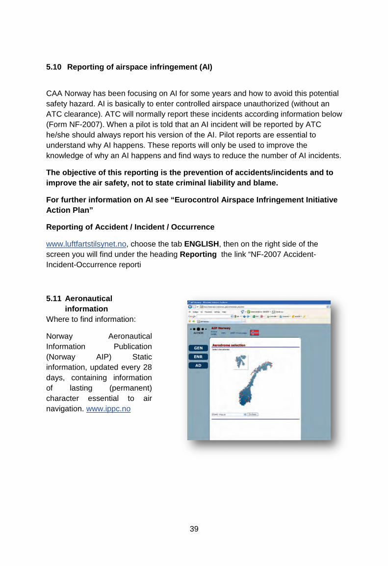
5.11 Aeronautical information
Where to find information:
Norway Aeronautical Information Publication (Norway AIP) Static information, updated every 28 days, containing information of lasting (permanent) character essential to air navigation. www.ippc.no
40
GEN – General operational, legal and administrative information.
ENR – En-route airspace information. including airspace classifications and types of airspace or airspace restrictions, operation of equipment, etc.
AD – Information pertaining to Norway licensed aerodromes.
AIP Supplements Temporary changes to the AIP, usually of long duration, containing comprehensive text and/or graphics.
Aeronautical Information Circulars (AICs) AICs are notices relating to safety, navigation, technical, administrative or legal matters. These are issued whenever it is necessary to promulgate information that does not qualify for inclusion in the AIP or as an AIP supplement. Circulars are published on Thursdays every 28 days.

41
6 EMERGENCIES
6.1 Search and Rescue Services (SAR) The services are provided by two Rescue Co-ordination Centres. In addition 16 Rescue Sub-centres, associated to air traffic services units, have been established, being responsible for initiating search and rescue actions.
Rescue Coordination Centres are:
Stavanger Rescue Co-ordination Centre, Sola (South of 65N):
Tel: +47 51517000 Fax: +47 51652334 Hours of services: 24H.
Bodø Rescue Co-ordination Centre, Bodø (North of 65N):
Tel: +47 75559000 Fax: +47 75524200 Hours of service: 24H.
SAR Helicopters are stationed at the following aerodromes: Banak (ENNA), Bodø (ENBO), Ørland (ENOL), Stavanger/Sola (ENZV), and Rygge/Moss (ENRY). These are able to reach any destination within mainland Norway within 90 min direct flight from its home bases. In addition, several emer-gency medical helicopters as well as offshore SAR helicopters are based at locations both off – and onshore all over Norway. Emergency frequencies are: 121.50 MHz and 243.500 MHz.
If an emergency landing becomes necessary and there are no means available to contact ATS, the following procedure is recommended: By the use of any available aircraft radio, call and listen out on 121.5 MHz for the first 5 minutes after full and half hours. ATC will be requesting other aircraft along your planned route to call and listen out on this frequency on these specific times as an additional aid to locate you. If a mobile telephone is available, you should try to make contact with ATS.
Remember to first aviate, navigate, then communicate!
Norwegian air force SAR helicopter
42
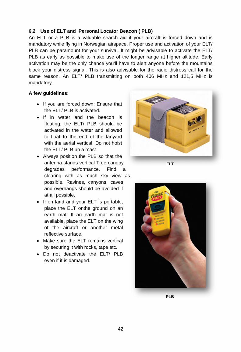
6.2 Use of ELT and Personal Locator Beacon ( PLB) An ELT or a PLB is a valuable search aid if your aircraft is forced down and is mandatory while flying in Norwegian airspace. Proper use and activation of your ELT/ PLB can be paramount for your survival. It might be advisable to activate the ELT/ PLB as early as possible to make use of the longer range at higher altitude. Early activation may be the only chance you’ll have to alert anyone before the mountains block your distress signal. This is also advisable for the radio distress call for the same reason. An ELT/ PLB transmitting on both 406 MHz and 121,5 MHz is mandatory.
A few guidelines:
• If you are forced down: Ensure that the ELT/ PLB is activated.
• If in water and the beacon is floating, the ELT/ PLB should be activated in the water and allowed to float to the end of the lanyard with the aerial vertical. Do not hoist the ELT/ PLB up a mast.
• Always position the PLB so that the antenna stands vertical Tree canopy degrades performance. Find a clearing with as much sky view as possible. Ravines, canyons, caves and overhangs should be avoided if at all possible.
• If on land and your ELT is portable, place the ELT onthe ground on an earth mat. If an earth mat is not available, place the ELT on the wing of the aircraft or another metal reflective surface.
• Make sure the ELT remains vertical by securing it with rocks, tape etc.
• Do not deactivate the ELT/ PLB even if it is damaged.
ELT
PLB
43
• In many cases a portable ELT standing on an earth mat will increase effective range by 50 %. Such an earth mat may easily be made by using household aluminium foil to make a 120 cm square. Fold it and tape it to the unit. To use the earth mat, unfold it and place the ELT on top.
7 OTHER INFORMATION
7.1 Slot requirements Allocation of departure and arrival times is compulsory for all flights at Oslo airport, Gardermoen and Bergen airport, Flesland. At Oslo airport, Gardermoen, application for “slot-time” shall be submitted to the centralized AIS/NOF , TEL (+47)64 81 90 00, FAX + 47 64 81 90 01, e-mail: [email protected] At Bergen airport, Flesland, application for “slot-time” shall be submitted to Aircraft Parking Office, preferably via e-mail: [email protected] , TEL: (+47) 67 03 15 70
Animals and pets No animal may be brought into Norway without an import license from: Norwegian Animal Health Authorities Tel: +47 23216800 [email protected]
7.2 Parking charges Avinor is a 100% state owned company which manages most of Norway’s airports and all airspace in Norway. It is organized as a shareholding company and run accordingly without any subsidies from the government.
Keeping in line with Avinors idea of commercialization, parking charges for GA-traffic was introduced 15.March 2012. They apply to all visiting aircraft at Avinor airports.
The charges vary depending on MTOW and duration of the stay. The first two hours are free of charge, thereafter you pay for the remaining 22 hours of the first 24-hour period, the next 24-hour period, and so on.
Preferably you should pay in advance using the following internet address: www.avinor.no/parking
Print the receipt and keep it available, you might be asked to show it. Otherwise, the due amount can be invoiced free of charge. For further reference please check AIC-A 08/12.
If unforeseen circumstances prompt parking for a longer period than originally planned, please contact the head of airport administration
44
7.3 Aircraft entering Norway First landing in Norway shall be done at airports where custom services are available. Private operated aircraft with MTOW 5700 kg and a maximum of 10 passengers may also use other airfields. A complete ICAO flight plan shall be sent to the Directorate of Customs and Excise at the latest 4 hours prior entering Norwegian territory. AIS/ NOTAM may help you to forward a copy of your flight plan to the Directorate of Customs and Excise upon request. If stated arrival/departure times has to be changed, the Directorate of Customs and Excise shall be notified ASAP (Fax: +47 22 86 08 00).
Arriving aircraft shall not leave the airport or parking area prior to the time stated in the FPL without prior permission from the Customs service.
Persons who arrive with the aircraft shall not leave the aircraft prior to the arrival time stated in the FPL.
Goods carried on board shall not be removed from arrived aircraft prior to the arrival time stated in the FPL.
Aircraft shall only carry goods which: • Can be imported/exported free of tax and toll according to existing rules of
exceptions from these Regulations, • Are not included in the import/export restrictions, and not require clearance.
45
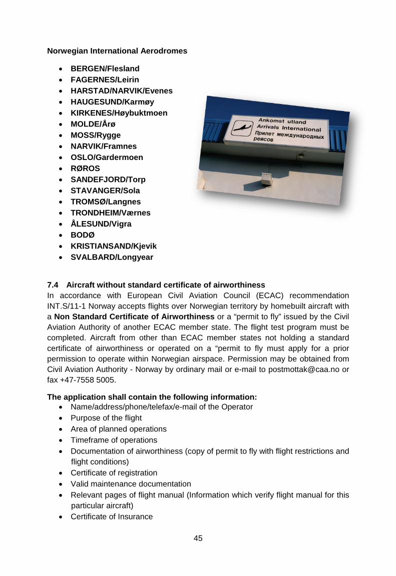
Norwegian International Aerodromes
• BERGEN/Flesland • FAGERNES/Leirin • HARSTAD/NARVIK/Evenes • HAUGESUND/Karmøy • KIRKENES/Høybuktmoen • MOLDE/Årø • MOSS/Rygge • NARVIK/Framnes • OSLO/Gardermoen • RØROS • SANDEFJORD/Torp • STAVANGER/Sola • TROMSØ/Langnes • TRONDHEIM/Værnes • ÅLESUND/Vigra • BODØ • KRISTIANSAND/Kjevik • SVALBARD/Longyear
7.4 Aircraft without standard certificate of airworthiness In accordance with European Civil Aviation Council (ECAC) recommendation INT.S/11-1 Norway accepts flights over Norwegian territory by homebuilt aircraft with a Non Standard Certificate of Airworthiness or a “permit to fly” issued by the Civil Aviation Authority of another ECAC member state. The flight test program must be completed. Aircraft from other than ECAC member states not holding a standard certificate of airworthiness or operated on a “permit to fly must apply for a prior permission to operate within Norwegian airspace. Permission may be obtained from Civil Aviation Authority - Norway by ordinary mail or e-mail to [email protected] or fax +47-7558 5005.
The application shall contain the following information: • Name/address/phone/telefax/e-mail of the Operator • Purpose of the flight • Area of planned operations • Timeframe of operations • Documentation of airworthiness (copy of permit to fly with flight restrictions and
flight conditions) • Certificate of registration • Valid maintenance documentation • Relevant pages of flight manual (Information which verify flight manual for this
particular aircraft) • Certificate of Insurance
46
7.5 Charges/Weekly Season Card Updated charges are available at www.ippc.no Published under Aeronautical information publication A (AIC A). The Weekly Season Card is valid for a continuous period of 7 days included the first day of validation and covers Take-off Charges for an unspecified number of take-off`s at all airports covered by these Regulations (except at Oslo airport Gardermoen, Rygge and Ørland).
7.6 Isolated- and Home Field Usage Restrictions By law, it is not allowed to operate power driven vehicles in rural areas outside roads or approved airfields. This prohibits the takeoff and landing on natural, unprepared ground suitable for the operations of aircraft. Neither is it allowed for aircraft to take-off or land on lakes or rivers. You may apply to local authorities for permission. Such permission is possible dependent on local policy. Landing and takeoffs from home fields can only be conducted by prior permission from the land owner.
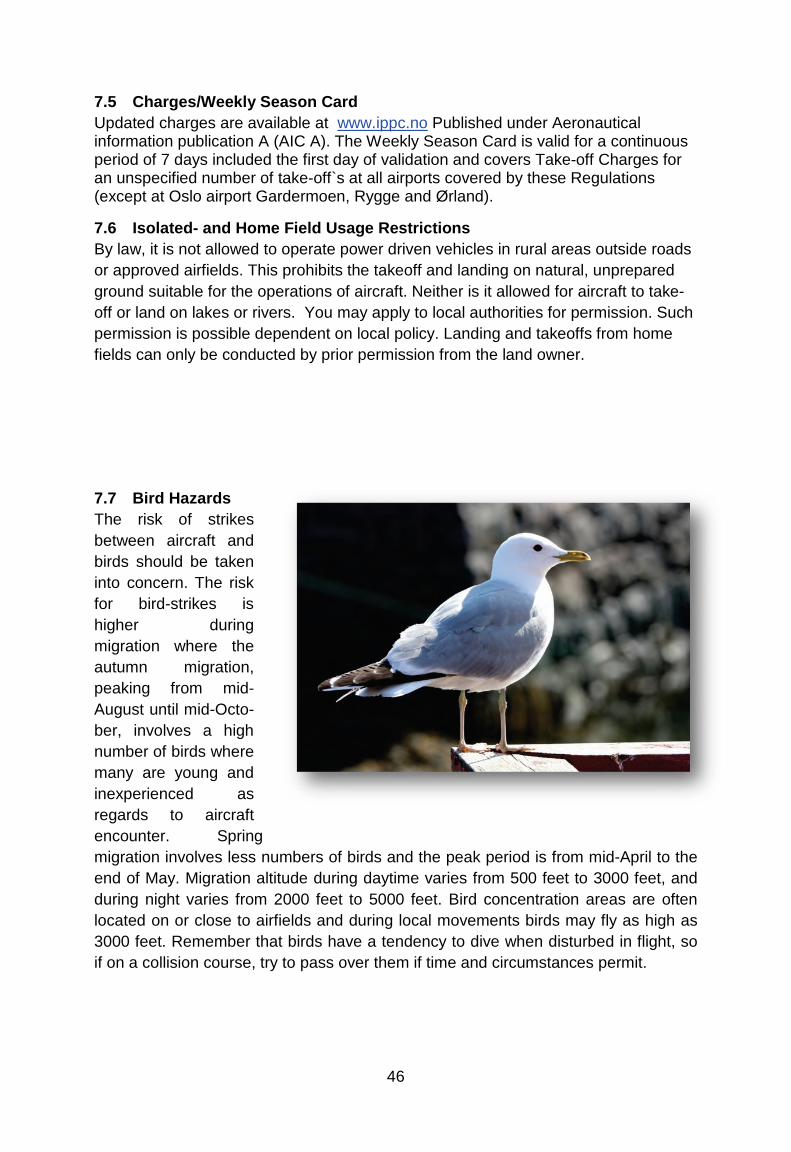
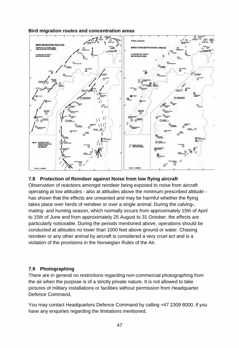
7.7 Bird Hazards The risk of strikes between aircraft and birds should be taken into concern. The risk for bird-strikes is higher during migration where the autumn migration, peaking from mid-August until mid-Octo-ber, involves a high number of birds where many are young and inexperienced as regards to aircraft encounter. Spring migration involves less numbers of birds and the peak period is from mid-April to the end of May. Migration altitude during daytime varies from 500 feet to 3000 feet, and during night varies from 2000 feet to 5000 feet. Bird concentration areas are often located on or close to airfields and during local movements birds may fly as high as 3000 feet. Remember that birds have a tendency to dive when disturbed in flight, so if on a collision course, try to pass over them if time and circumstances permit.
47
Bird migration routes and concentration areas
7.8 Protection of Reindeer against Noise from low flying aircraft Observation of reactions amongst reindeer being exposed to noise from aircraft operating at low altitudes - also at altitudes above the minimum prescribed altitude - has shown that the effects are unwanted and may be harmful whether the flying takes place over herds of reindeer or over a single animal. During the calving-, mating- and hunting season, which normally occurs from approximately 15th of April to 15th of June and from approximately 25 August to 31 October, the effects are particularly noticeable. During the periods mentioned above, operations should be conducted at altitudes no lower than 1000 feet above ground or water. Chasing reindeer or any other animal by aircraft is considered a very cruel act and is a violation of the provisions in the Norwegian Rules of the Air.
7.9 Photographing There are in general no restrictions regarding non-commercial photographing from the air when the purpose is of a strictly private nature. It is not allowed to take pictures of military installations or facilities without permission from Headquarter Defence Command,
You may contact Headquarters Defence Command by calling +47 2309 8000, if you have any enquiries regarding the limitations mentioned.
48
7.10 Use of Intoxicating Liquor, Narcotics or Drugs The Norwegian Aviation Act contains the following provision: No person shall serve as a crew member when under the influence of intoxicating liquor or other stimuli or narcotics or when he or she, as a result of illness or fatigue or for other reason, is unable to perform his duties safely. In any event a person is considered to be under influence of alcohol as far as the law is concerned, when the alcohol concentration in the blood is in excess of 0.2 per mill or the amount of alcohol in the body is large enough to lead to 0.2 per mill. Error regarding the extent of alcohol concentration in the blood shall not exclude liability for punishment. A person having served as a crew member shall not during the first 6 hours after completing a tour of duty consume alcohol or other stimuli if he or she knows or suspects that police investigation concerning his or her duties as a crew member is pendent; except if a blood test already has been taken or the police authorities have decided that such test is unnecessary. When there is reason to believe that the regulations above have been violated, the police authorities may order a medical examination, which may include a blood test of the person responsible for the violation. The appropriate department will issue detailed regulations dealing with such examination and matters related thereto.
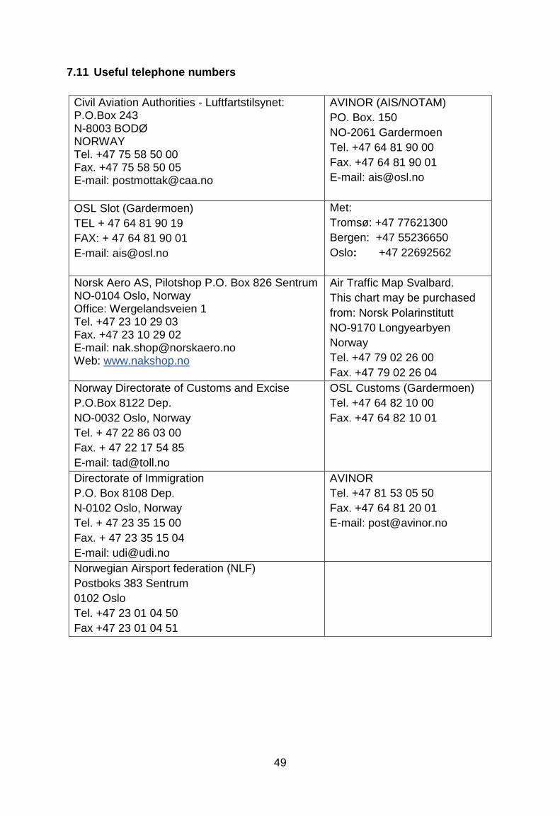
49
7.11 Useful telephone numbers
Civil Aviation Authorities - Luftfartstilsynet: P.O.Box 243 N-8003 BODØ NORWAY Tel. +47 75 58 50 00 Fax. +47 75 58 50 05 E-mail: [email protected]
AVINOR (AIS/NOTAM) PO. Box. 150 NO-2061 Gardermoen Tel. +47 64 81 90 00 Fax. +47 64 81 90 01 E-mail: [email protected]
OSL Slot (Gardermoen) TEL + 47 64 81 90 19 FAX: + 47 64 81 90 01 E-mail: [email protected]
Met: Tromsø: +47 77621300 Bergen: +47 55236650 Oslo: +47 22692562
Norsk Aero AS, Pilotshop P.O. Box 826 Sentrum NO-0104 Oslo, Norway Office: Wergelandsveien 1 Tel. +47 23 10 29 03 Fax. +47 23 10 29 02 E-mail: [email protected] Web: www.nakshop.no
Air Traffic Map Svalbard. This chart may be purchased from: Norsk Polarinstitutt NO-9170 Longyearbyen Norway Tel. +47 79 02 26 00 Fax. +47 79 02 26 04
Norway Directorate of Customs and Excise P.O.Box 8122 Dep. NO-0032 Oslo, Norway Tel. + 47 22 86 03 00 Fax. + 47 22 17 54 85 E-mail: [email protected]
OSL Customs (Gardermoen) Tel. +47 64 82 10 00 Fax. +47 64 82 10 01
Directorate of Immigration P.O. Box 8108 Dep. N-0102 Oslo, Norway Tel. + 47 23 35 15 00 Fax. + 47 23 35 15 04 E-mail: [email protected]
AVINOR Tel. +47 81 53 05 50 Fax. +47 64 81 20 01 E-mail: [email protected]
Norwegian Airsport federation (NLF) Postboks 383 Sentrum 0102 Oslo Tel. +47 23 01 04 50 Fax +47 23 01 04 51
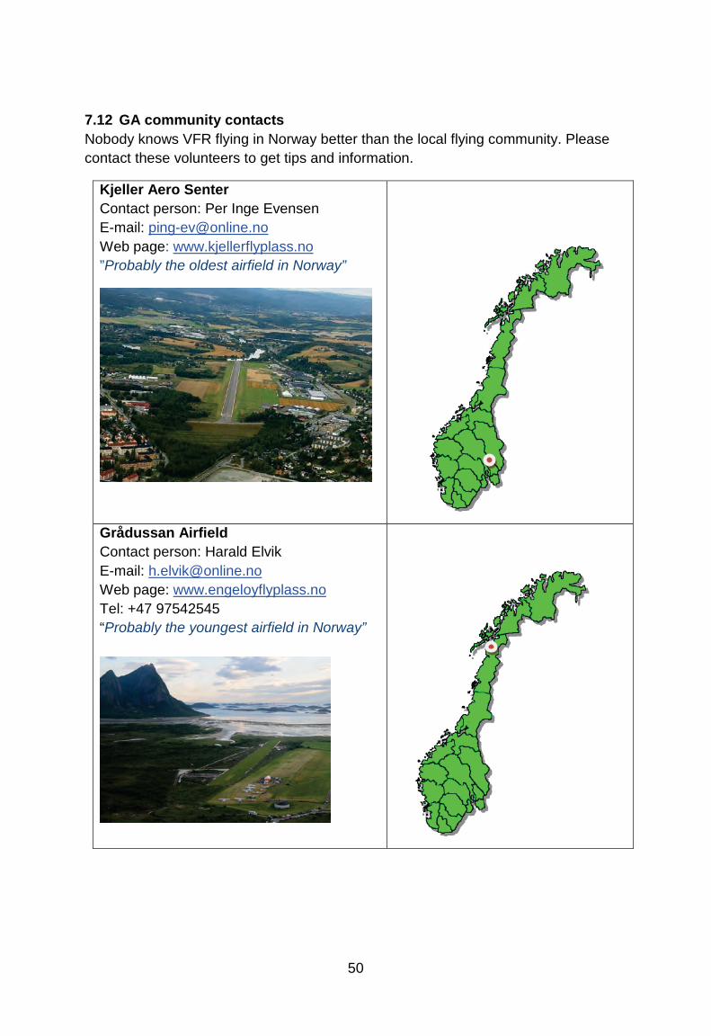
50
7.12 GA community contacts Nobody knows VFR flying in Norway better than the local flying community. Please contact these volunteers to get tips and information.
Kjeller Aero Senter Contact person: Per Inge Evensen E-mail: [email protected] Web page: www.kjellerflyplass.no ”Probably the oldest airfield in Norway”
Grådussan Airfield Contact person: Harald Elvik E-mail: [email protected] Web page: www.engeloyflyplass.no Tel: +47 97542545 “Probably the youngest airfield in Norway”
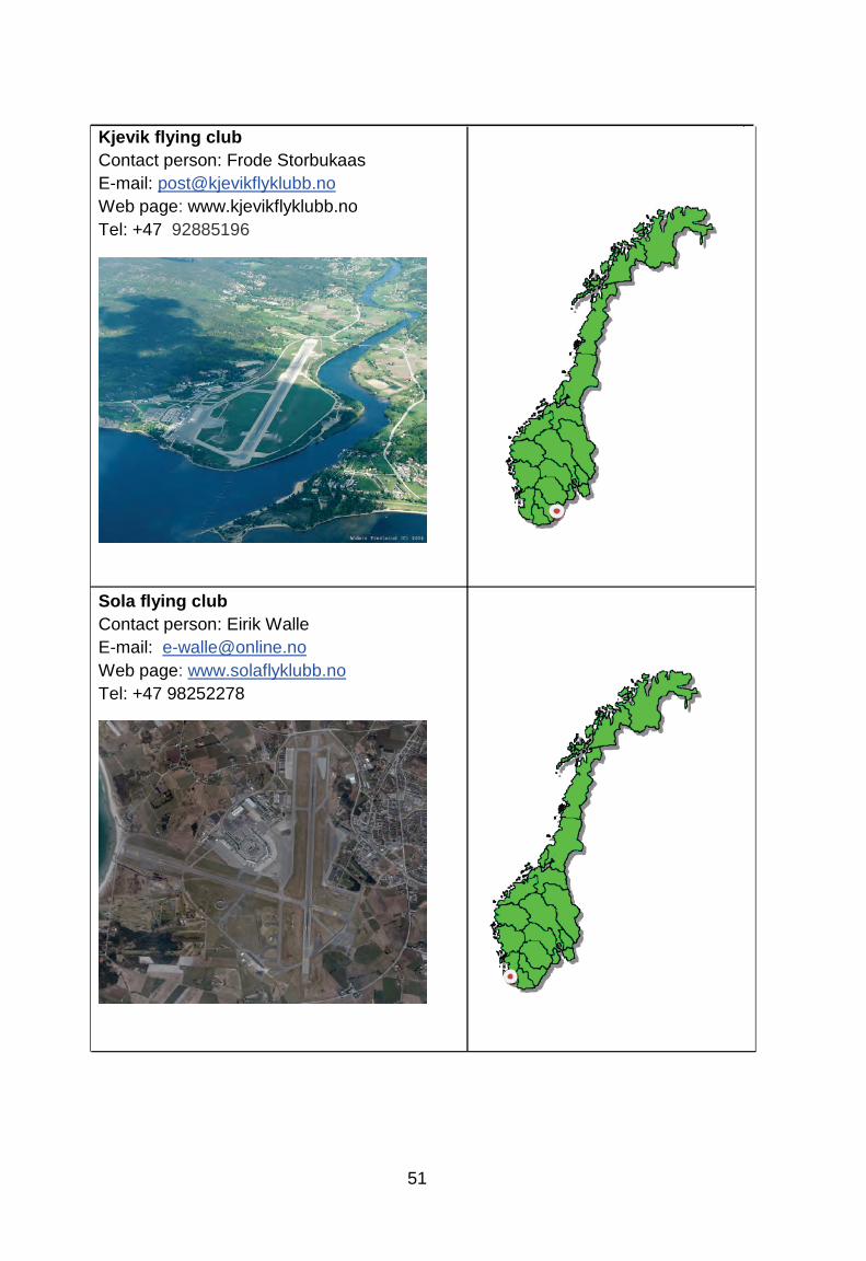
51
Kjevik flying club Contact person: Frode Storbukaas E-mail: [email protected] Web page: www.kjevikflyklubb.no Tel: +47 92885196
Sola flying club Contact person: Eirik Walle
E-mail: [email protected] Web page: www.solaflyklubb.no Tel: +47 98252278
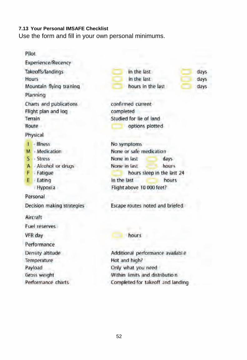
52
7.13 Your Personal IMSAFE Checklist Use the form and fill in your own personal minimums.

53
54
8 PLANNING NOTES:


![JEFA Diamond DA-40 N505JF - Jeppesen€¦ · ASOS/AWOS 118.97 10, 9730, 122.95 RP 09, 26L VFR ADVSY 125.00 AOE Length of longest runway [ft], UNICOM If ATIS not Available and CTWR](https://static.fdocuments.net/doc/165x107/604d4542f6b20360e0514bbf/jefa-diamond-da-40-n505jf-jeppesen-asosawos-11897-10-9730-12295-rp-09-26l.jpg)