
Vaduz.library.oregonstate.edu:9090/ metadataexplorer_find/explorer.jsp If interested in job contact...
26
vaduz.library.oregonstate. edu:9090/ metadataexplorer_find/ explorer.jsp If interested in job contact [email protected] NEXT week
-
Upload
joanna-hoover -
Category
Documents
-
view
215 -
download
0
Transcript of Vaduz.library.oregonstate.edu:9090/ metadataexplorer_find/explorer.jsp If interested in job contact...

vaduz.library.oregonstate.edu:9090/metadataexplorer_find/
explorer.jspIf interested in job [email protected]
NEXT week


Models and the Structures of ArcGIS
Longley et al., ch. 5
Zeiler, chs. 1 and 6

Models for GIS
• representation of reality --> model• GIS itself is based on a model of
complexity• GIS is used to model complexity• full representation of reality?• data model = limited representation of
reality– a discretization or partitioning of space
– finite, discrete nature of computing devices

Data Model
• representation of information about the process
• grid or layer (field)• isoline (object)• Delauney triangulation (alternative)• geo-relational (field or object)

3 Data Models
• geo-relational coverage (field view; from classic ArcInfo polys)
• geo-relational shapefile (discrete object view; from ArcView)
• geodatabase (object-oriented; new in ArcGIS 8)
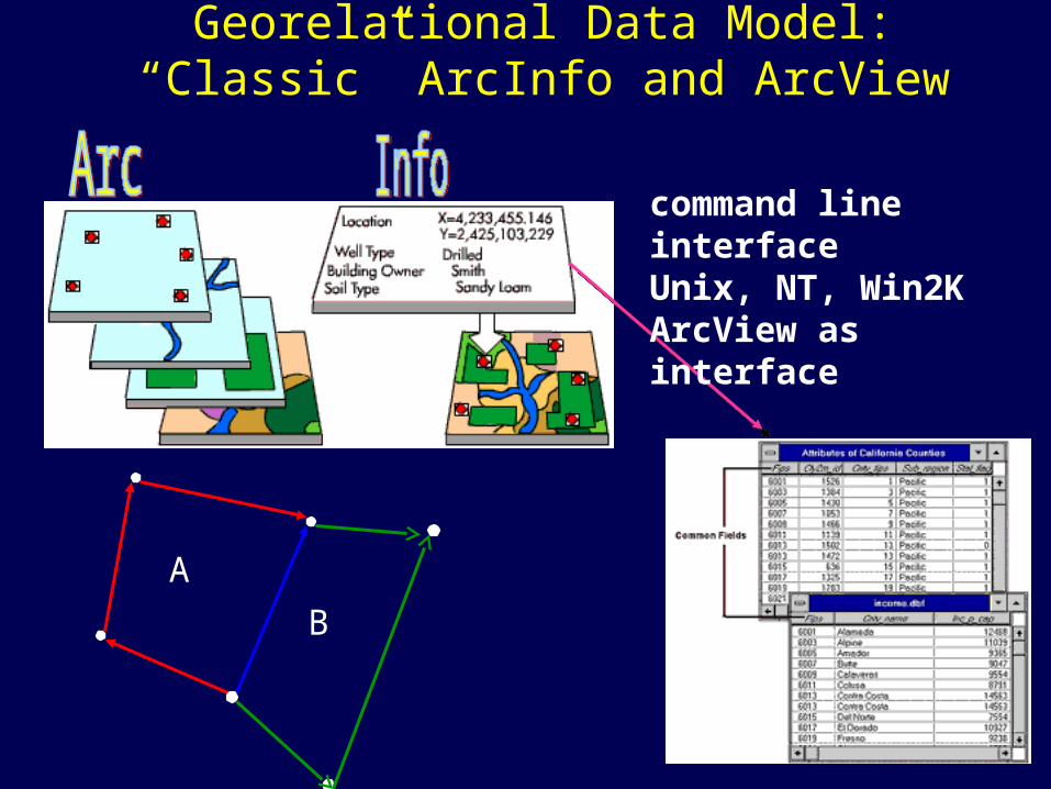
A
B
command line interfaceUnix, NT, Win2KArcView as interface
Georelational Data Model:“Classic” ArcInfo and ArcView

ArcInfo Coverage as a Data Structure
Image courtesy of Louisville/Jefferson County Information Consortium, Kentucky

Data Structure• not tied to process at all• concerned simply with what can be computed
and what can’t• the way in which the data model is
represented in the GIS– DEM for grid or layer model
– contour for isoline model
– TIN for Delauney triangulation model
– coverages, shapefiles for geo-relational
– geodatabase for OO geodatabase

Data Structures
• ArcInfo coverages• ArcView shapefiles• ArcInfo grids, USGS DEMs • Images (e.g., georeferenced tiffs)• TINs• Geodatabases

Geodatabase
• Features and attributes as objects
• Relationships among features
• Validation or editing rules, behaviors
• “Container” for– Vector, raster, tabular
data
– Relationships
– topology

Relationships for a feature

Personal and MultiUser Gdbs
Oracle 8i SQL Server Informix DB2 Others
ArcSDE Geodatabase
MS Access
Personal Geodatabase
Geographically Enhanced Databases in ArcInfo 8ArcCatalog
ArcMap

ArcGIS 8 Icons( Zeiler, pp. 65-71 )
yellow coverage
gray geodatabase
green shapefile

ArcGIS 8• ArcToolbox (old Arc) - analysis engine
– substantial geoprocessing tools
– analysis, mostly for coverages
• ArcCatalog (old Info) - data mgmt. engine– data preview
– managing data
– Metadata, Internet access
• ArcMap (old ArcPlot) - map engine– display and map production
– the next version of ArcView, i.e., ArcView 8.1
• ArcEditor (old ArcEdit) - map editing

ArcGIS 8
• “Classic ArcInfo” on the command line
– “ArcInfo Workstation”

Integration of Modules
• ArcMap, ArcCatalog, ArcTools– e.g., ArcCatalog to ArcMap, drag and drop
• “ArcGIS”– three main modules & AI Workstation, as well as
– ArcSDE
– ArcIMS
– Other extensions (spatial, geostatistical, “3D”, ArcPress, etc.)
• Individual (desktop) or multiuser (enterprise)

Integrated Web Access
• “transparent” integration with ArcIMS servers
• the Geography Network
– www.geographynetwork.com


Lambert

“Extensions”
• GRID module for raster analysis and modeling (e.g., “Spatial Analyst”)
• Surface module - TINs
• Networks
• Geostatistics
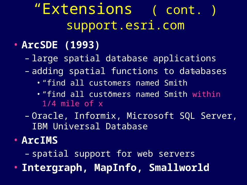
“Extensions” ( cont. )support.esri.com
• ArcSDE (1993)– large spatial database applications
– adding spatial functions to databases• “find all customers named Smith”• “find all customers named Smith within 1/4 mile of x”
– Oracle, Informix, Microsoft SQL Server, IBM Universal Database
• ArcIMS– spatial support for web servers
• Intergraph, MapInfo, Smallworld

“Horizontal” vs. “Vertical” Markets
• ArcInfo - one size fits all• ESRI does not lead in diversification
– ArcView, ArcExplorer
– ArcLogistics, Maplex, Business Analyst, ArcFM
– Smallworld, Intergraph, MapInfo, Erdas, etc.
• Vertical markets, application domains– see Zeiler pages 48-50
– Applications with their own core data elements

ArcGIS Data Modelssupport.esri.com/datamodels.cfm
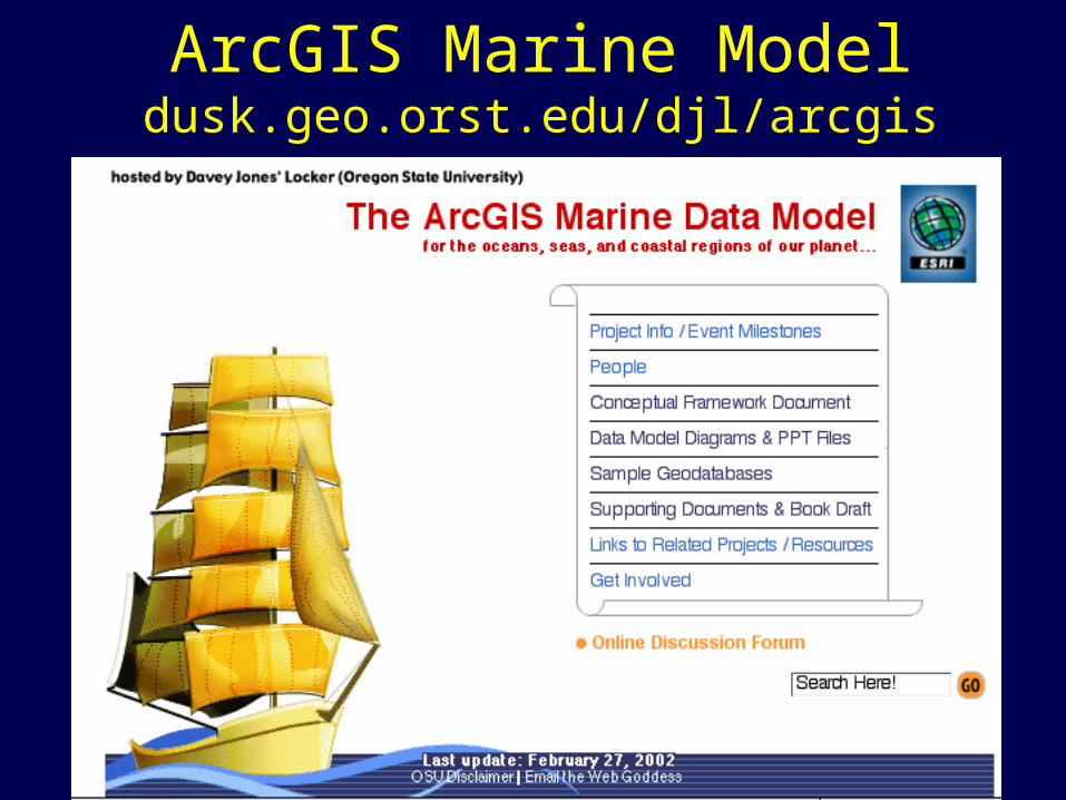
ArcGIS Marine Modeldusk.geo.orst.edu/djl/arcgis


