
Using Esri Technology for International Disaster Coordination
24
Using Esri Technology for International Disaster Coordination INSARAG INFORMATION MANAGEMENT WORKING GROUP JOHN MORRISON - [email protected] JEFF MAUNDER - [email protected]
Transcript of Using Esri Technology for International Disaster Coordination

Using Esri Technology for International Disaster Coordination
INSARAG INFORMATION MANAGEMENT WORKING GROUP
JOHN MORRISON - [email protected]
JEFF MAUNDER - [email protected]

INSARAG is a global network of more than 90 countries and organisations under the United Nations umbrella.
INSARAG deals with urban search and rescue (USAR) related issues, aiming to establish minimum international standards for USAR teams and methodology for international coordination in earthquake response based on the INSARAG Guidelines endorsed by the United Nations General.
Why? Because coordination saves lives.


History
Pre-2010 – Information kept by each team
2010 – Standardized paper forms
2015 – Data collection using open-source products
2017 – INSARAG Information Management Working Group established
2020 – ArcGIS for collection, analysis and reporting

KoBo ProjectIntroduced mobility solutions
Limited capability
Not able to extend to meet needs
Potential for adverse reaction from users as it didn’t meet needs
Did enhance the acceptance of ICMS in its AGOL format

Where does Esri come in?
Through the INSARAG Information Management Working Group, we sourced the best solution available
Started from an implementation by Fire and Emergency New Zealand
The result is the INSARAG Coordination and Management System (ICMS)
ICMS is set up as a unique instance for each USAR team throughout the world (60+) for training purposes and for each disaster

Information Management Working Group - 2017Formed to develop and deploy the IM concept.
International group of USAR people
Move from Open Source (KoBo) to Esri based system
Finalised ICMS development
Developed process to test and QA system for operational use
Deployed to INSARAG environment

What is ICMS built with?5 Dashboards
38 Feature Layers
14 Forms (Survey 123)
2 Hub pages
12 Microsoft Word Templates
10 Web Maps
5 Web Mapping Applications
All created by 1 Jupyter notebook
ArcGIS Survey 123
ArcGIS Explorer
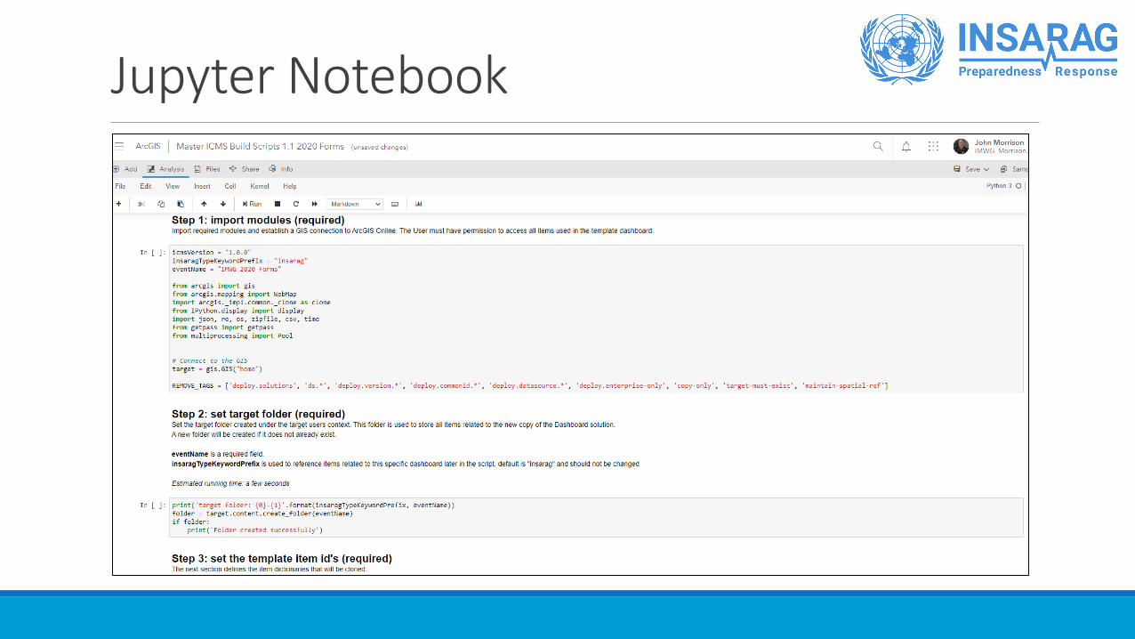
Jupyter Notebook

Digitising a Paper-Based Process

Timeline of an Incident
Incident occurs Recon PhaseOperations
Phase
Team Fact SheetWorksite Triage
Form
Worksite Report
Form
Victim
Extrication Form

Dashboard – Overview

Dashboard – Team Management

Dashboard – Triage

Dashboard – Operations

Dashboard – Logistics

Dashboard – Photo Gallery

Tools and Quality Assurance

Quality Assurance“Don’t make bad decisions faster”

Iterative Design
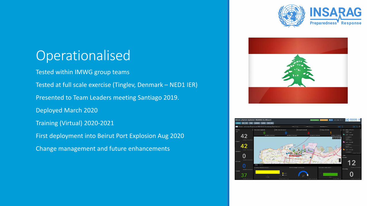
OperationalisedTested within IMWG group teams
Tested at full scale exercise (Tinglev, Denmark – NED1 IER)
Presented to Team Leaders meeting Santiago 2019.
Deployed March 2020
Training (Virtual) 2020-2021
First deployment into Beirut Port Explosion Aug 2020
Change management and future enhancements

Island ResponsesHurricane Dorian
Pacific Cyclones

Where do we go next?
UAS Integration
Team-based squad management
Data sharing across platforms

Contact Information
John Morrison
Fairfax County Fire and Rescue Department
+1-703-447-9013
Jeff Maunder
Fire and Emergency New Zealand
+64-27-297-4013


