Using Census Data to Determine Socioeconomic …€¦ · to Determine Socioeconomic Status of...
28
Using Census Data to Determine Socioeconomic Status of Washington State Community and Technical College Students Tim Leinbach and Pete Crosta Community College Research Center Teachers College, Columbia University Association for Institutional Research Annual Forum Chicago, Illinois May 16, 2006
-
Upload
phungthien -
Category
Documents
-
view
223 -
download
0
Transcript of Using Census Data to Determine Socioeconomic …€¦ · to Determine Socioeconomic Status of...

Using Census Datato Determine Socioeconomic Statusof Washington State Community and
Technical College Students
Tim Leinbach and Pete CrostaCommunity College Research Center
Teachers College, Columbia University
Association for Institutional ResearchAnnual Forum
Chicago, IllinoisMay 16, 2006
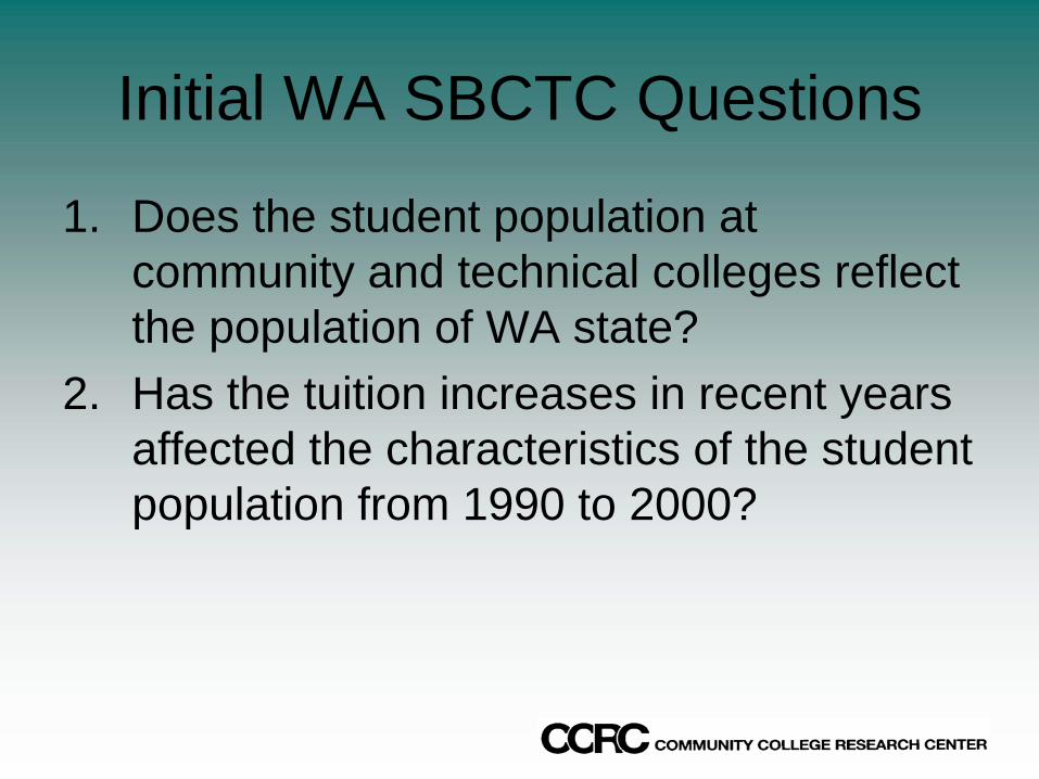
Initial WA SBCTC Questions
1. Does the student population at community and technical colleges reflect the population of WA state?
2. Has the tuition increases in recent years affected the characteristics of the student population from 1990 to 2000?
Birds of a Feather....
• Obtaining a direct measure of students SES is difficult.
• A geographic based indicator provides a useful measure for determining the SES of persons living in that location.

Project Objectives• Utilize 1990 and 2000 data to classify census block
groups into clusters based upon “neighborhood”characteristics.
• Measure SES in a “neighborhood”• Assess changes in the WA population between 1990
and 2000.• Match student addresses to the census clusters to
compare students with the WA state population for their SES and neighborhood makeup.
• Identify additional policy and research questions that emerge from this database and methodology
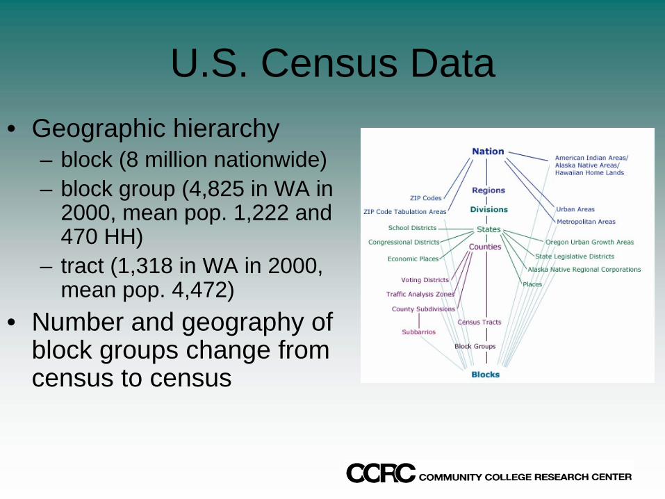
U.S. Census Data• Geographic hierarchy
– block (8 million nationwide)– block group (4,825 in WA in
2000, mean pop. 1,222 and 470 HH)
– tract (1,318 in WA in 2000, mean pop. 4,472)
• Number and geography of block groups change from census to census
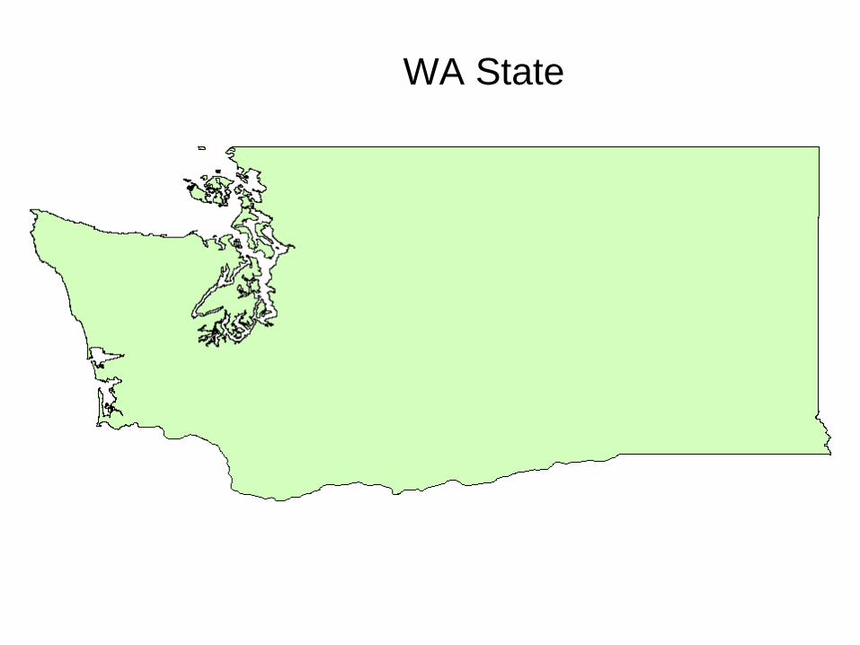
WA State
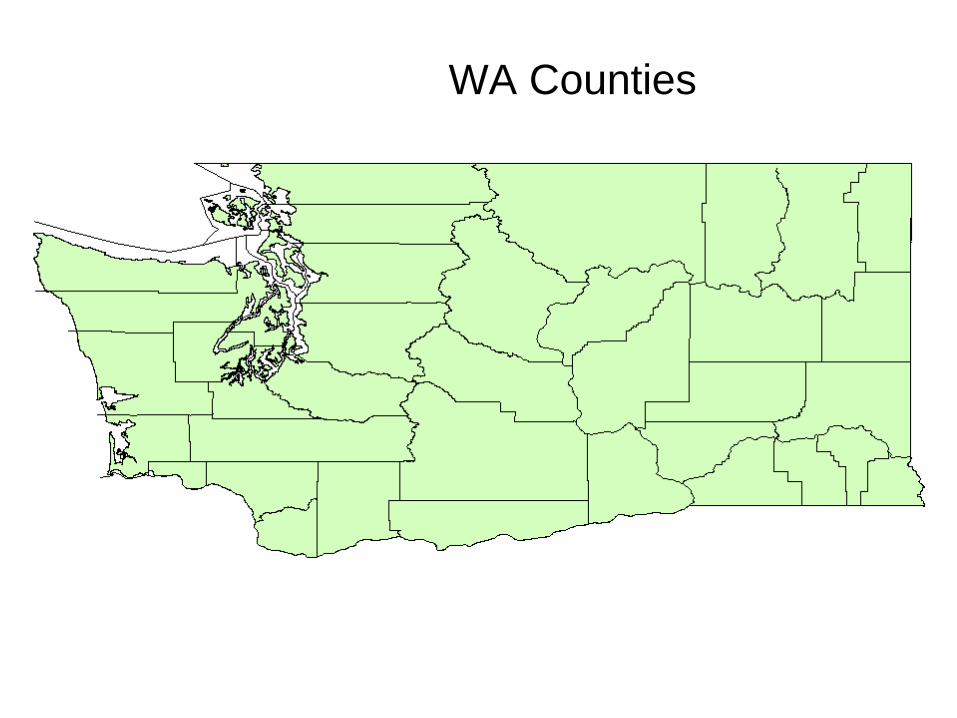
WA Counties
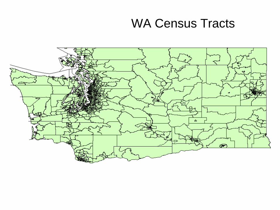
WA Census Tracts

WA Block Groups
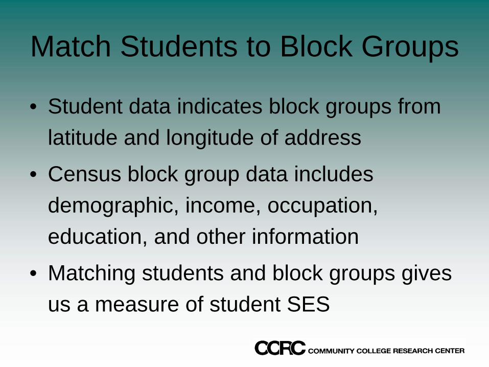
Match Students to Block Groups
• Student data indicates block groups from latitude and longitude of address
• Census block group data includes demographic, income, occupation, education, and other information
• Matching students and block groups gives us a measure of student SES
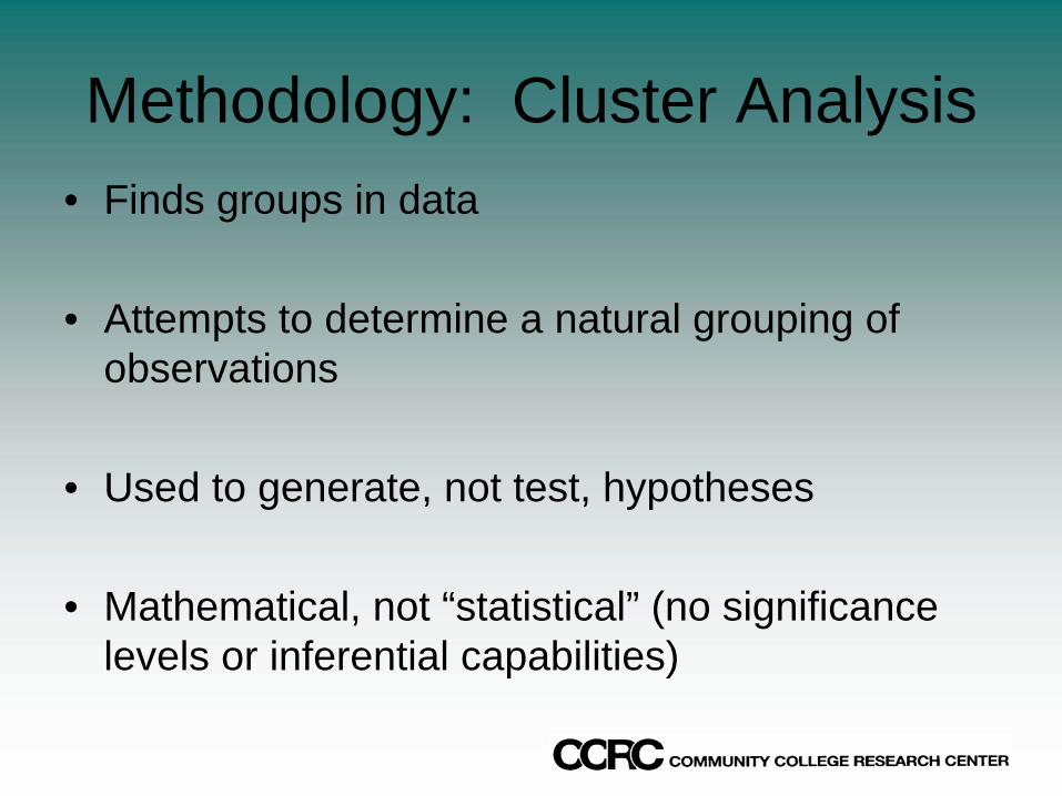
Methodology: Cluster Analysis• Finds groups in data
• Attempts to determine a natural grouping of observations
• Used to generate, not test, hypotheses
• Mathematical, not “statistical” (no significance levels or inferential capabilities)
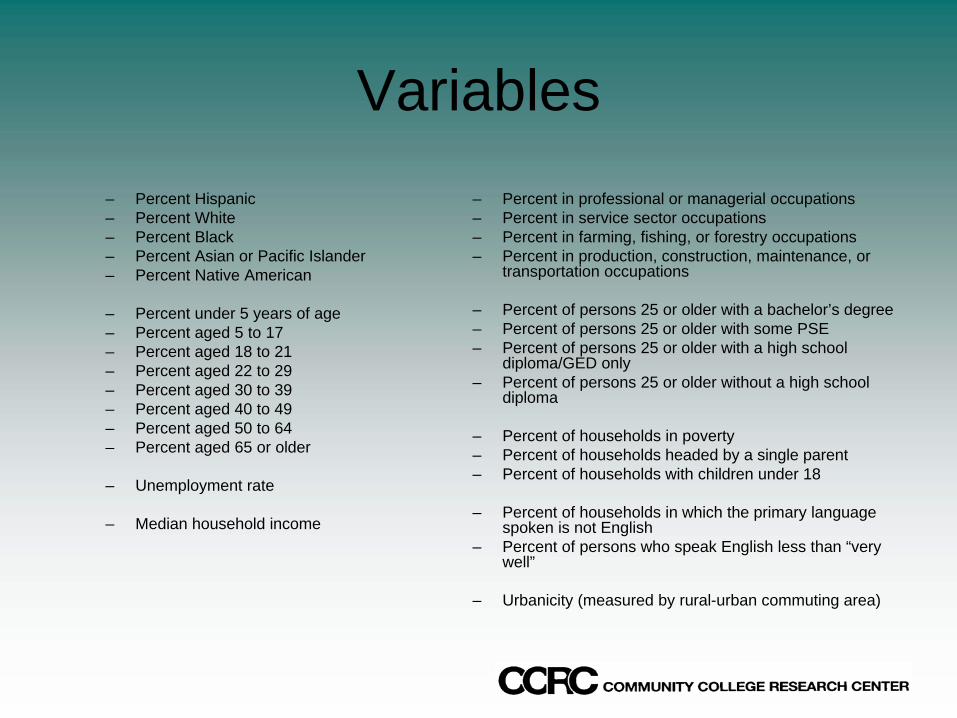
Variables– Percent Hispanic– Percent White– Percent Black– Percent Asian or Pacific Islander– Percent Native American
– Percent under 5 years of age– Percent aged 5 to 17– Percent aged 18 to 21– Percent aged 22 to 29– Percent aged 30 to 39– Percent aged 40 to 49– Percent aged 50 to 64– Percent aged 65 or older
– Unemployment rate
– Median household income
– Percent in professional or managerial occupations– Percent in service sector occupations– Percent in farming, fishing, or forestry occupations– Percent in production, construction, maintenance, or
transportation occupations
– Percent of persons 25 or older with a bachelor’s degree– Percent of persons 25 or older with some PSE– Percent of persons 25 or older with a high school
diploma/GED only– Percent of persons 25 or older without a high school
diploma
– Percent of households in poverty– Percent of households headed by a single parent– Percent of households with children under 18
– Percent of households in which the primary language spoken is not English
– Percent of persons who speak English less than “very well”
– Urbanicity (measured by rural-urban commuting area)
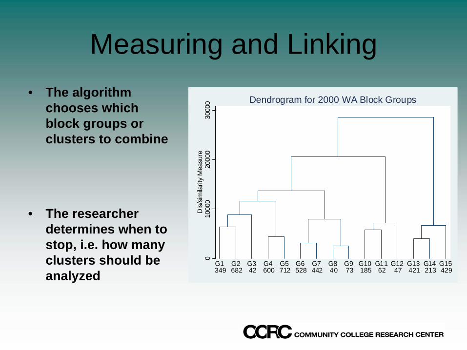
Measuring and Linking• The algorithm
chooses which block groups or clusters to combine
• The researcher determines when to stop, i.e. how many clusters should be analyzed
010
000
2000
030
000
Dis
/sim
ilarit
y M
easu
re
G1 349
G2 682
G3 42
G4 600
G5 712
G6 528
G7 442
G8 40
G9 73
G10 185
G11 62
G12 47
G13 421
G14 213
G15 429
Dendrogram for 2000 WA Block Groups
A Few Notes
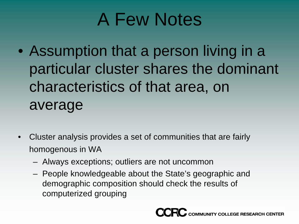
• Assumption that a person living in a particular cluster shares the dominant characteristics of that area, on average
• Cluster analysis provides a set of communities that are fairly homogenous in WA– Always exceptions; outliers are not uncommon– People knowledgeable about the State’s geographic and
demographic composition should check the results of computerized grouping
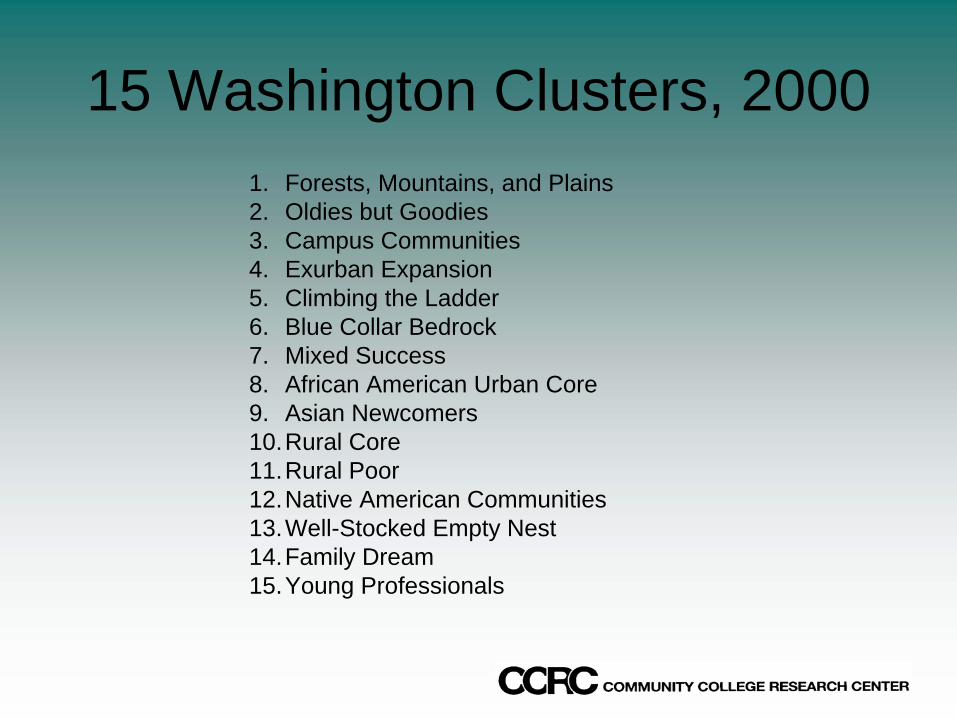
15 Washington Clusters, 20001. Forests, Mountains, and Plains 2. Oldies but Goodies 3. Campus Communities 4. Exurban Expansion 5. Climbing the Ladder 6. Blue Collar Bedrock 7. Mixed Success 8. African American Urban Core 9. Asian Newcomers10.Rural Core 11.Rural Poor12.Native American Communities13.Well-Stocked Empty Nest 14.Family Dream 15.Young Professionals

Maps
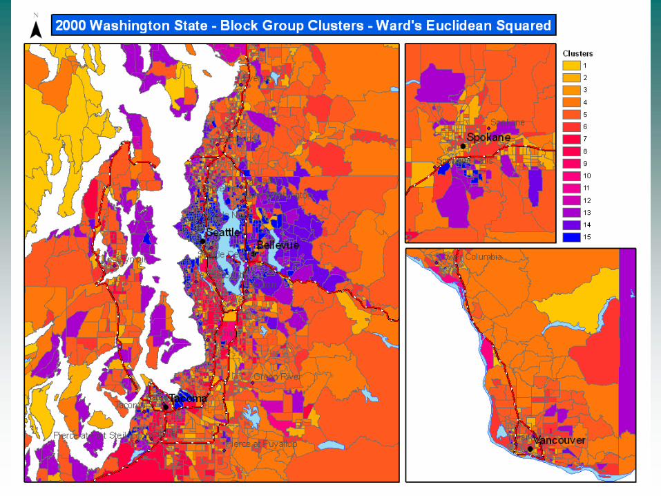
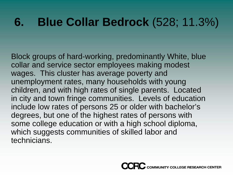
6. Blue Collar Bedrock (528; 11.3%)
Block groups of hard-working, predominantly White, blue collar and service sector employees making modest wages. This cluster has average poverty and unemployment rates, many households with young children, and with high rates of single parents. Located in city and town fringe communities. Levels of education include low rates of persons 25 or older with bachelor’s degrees, but one of the highest rates of persons with some college education or with a high school diploma, which suggests communities of skilled labor and technicians.


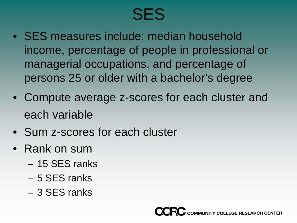
SES• SES measures include: median household
income, percentage of people in professional or managerial occupations, and percentage of persons 25 or older with a bachelor’s degree
• Compute average z-scores for each cluster and each variable
• Sum z-scores for each cluster• Rank on sum
– 15 SES ranks– 5 SES ranks– 3 SES ranks

Name Block Groups
Percent of HH z-score Sum 5 SES
GroupsPercent of
HH3 SES
GroupsPercent of
HHFamily Dream 337 7.8 5.200508 1 7.8
Young Professionals 453 11.8 2.2546815Suburban Retirees 651 15.5 1.741609
Campus Communities 25 0.4 0.2922215Mixed Suburban Success 695 18.4 -0.3664118
Blue Collar Whites 551 10.9 -0.6686198Early Gentrification 118 2.0 -0.9849171Oldies but Goodies 474 9.6 -1.2746451Asian Newcomers 73 1.3 -1.3198422
Forests, Mountains, and Plains 502 8.5 -1.5561492African American Urban Core 66 1.0 -1.9816263
The Working Fringe 391 8.5 -2.2002429Native American Communities 26 0.3 -2.2500307
Rural Core 189 2.9 -2.2738841Rural Poor 69 1.2 -3.1113698 5 1.2
Name Block Groups
Percent of HH z-score Sum 5 SES
GroupsPercent of
HH3 SES
GroupsPercent of
HHFamily Dream 213 3.6 6.289018 1 3.6
Young Professionals 429 9.8 2.8464483Well-Stocked Empty Nest 421 8.5 2.7145585
Climbing the Ladder 712 14.8 1.3944139Campus Communities 42 0.8 -0.2393407
African Ameri can Urban Core 40 0.6 -0.5897654Exurban Expansion 600 11.9 -1.0884003
Mixed Success 442 10.8 -1.2645652Oldies but Goodies 682 15.1 -1.322138
Forests, Mountains, and Plains 349 6.3 -1.4975684Native American Communities 47 0.7 -1.8344561
Asian Newcomers 73 1.2 -2.0339129Blue Collar Bedrock 528 11.3 -2.1476735
Rural Core 185 3.5 -2.2940758Rural Poor 62 1.3 -3.762875 5 1.3
4 16.73 18.0
3 45.5 2 45.5
1990 - 15 Clusters Ranked on SES
2000 - 15 Clusters Ranked on SES
1 36.72 33.1
51.1
35.12 27.3
3 51.1
1
2
3 13.812.74
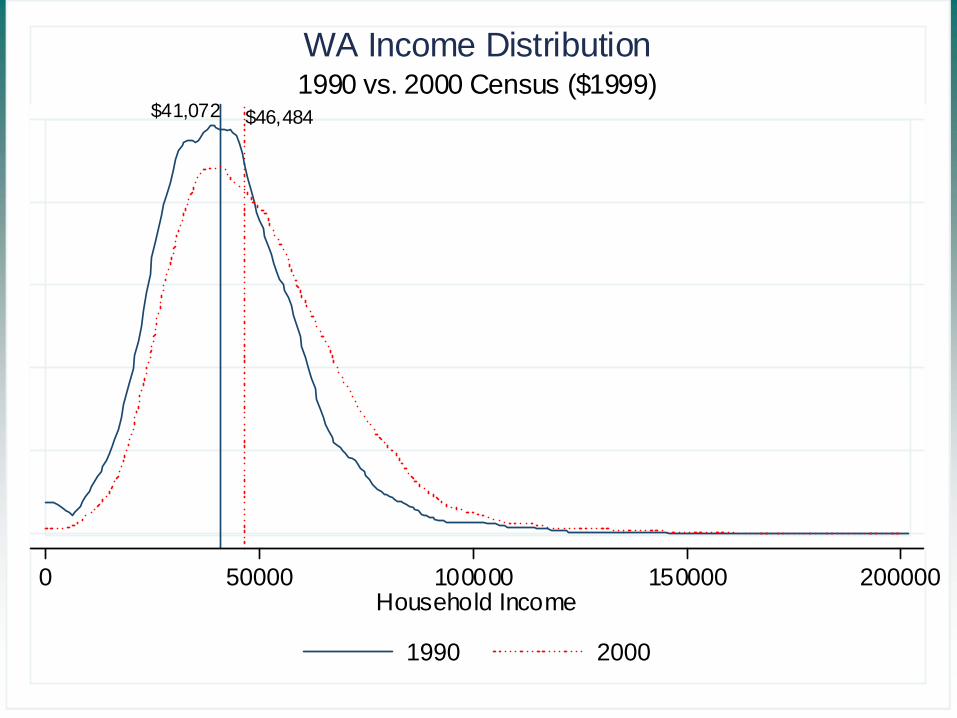
$41,072 $46,484
0 50000 100000 150000 200000Household Income
1990 2000
1990 vs. 2000 Census ($1999)WA Income Distribution

22% 27.6%
0 .2 .4 .6 .8 1Percent
1990 2000
1990 vs. 2000 CensusPercent Holding BA or Above
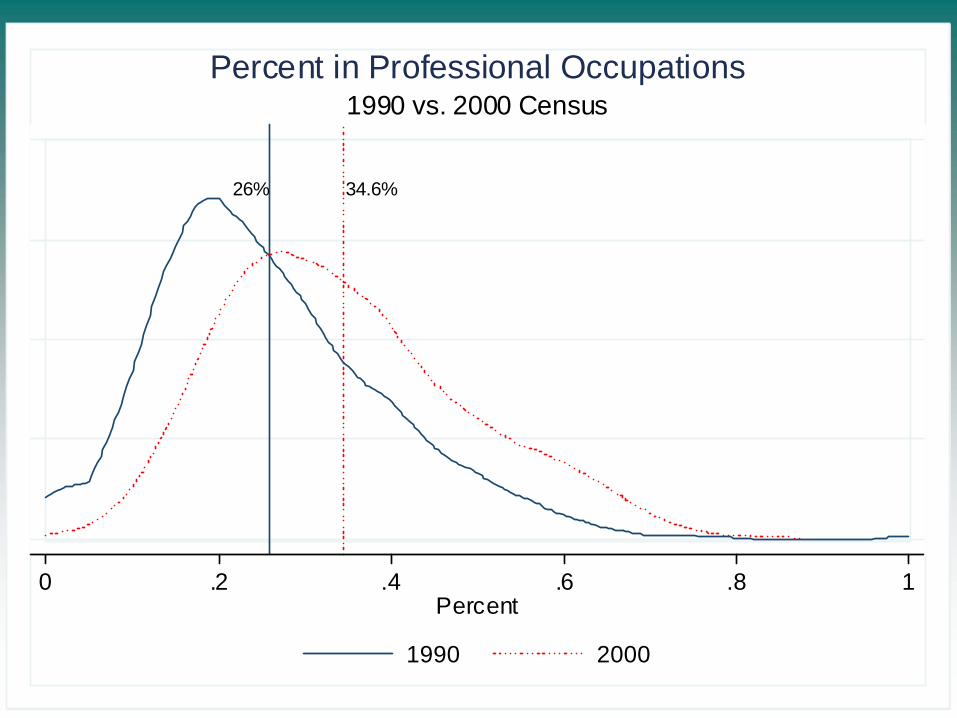
26% 34.6%
0 .2 .4 .6 .8 1Percent
1990 2000
1990 vs. 2000 CensusPercent in Professional Occupations
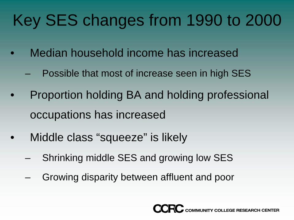
Key SES changes from 1990 to 2000
• Median household income has increased
– Possible that most of increase seen in high SES
• Proportion holding BA and holding professional
occupations has increased
• Middle class “squeeze” is likely
– Shrinking middle SES and growing low SES
– Growing disparity between affluent and poor
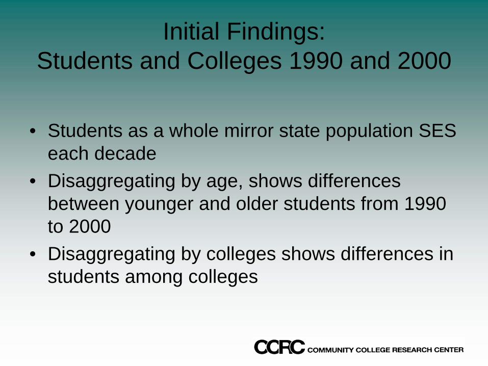
Initial Findings:Students and Colleges 1990 and 2000
• Students as a whole mirror state population SES each decade
• Disaggregating by age, shows differences between younger and older students from 1990 to 2000
• Disaggregating by colleges shows differences in students among colleges
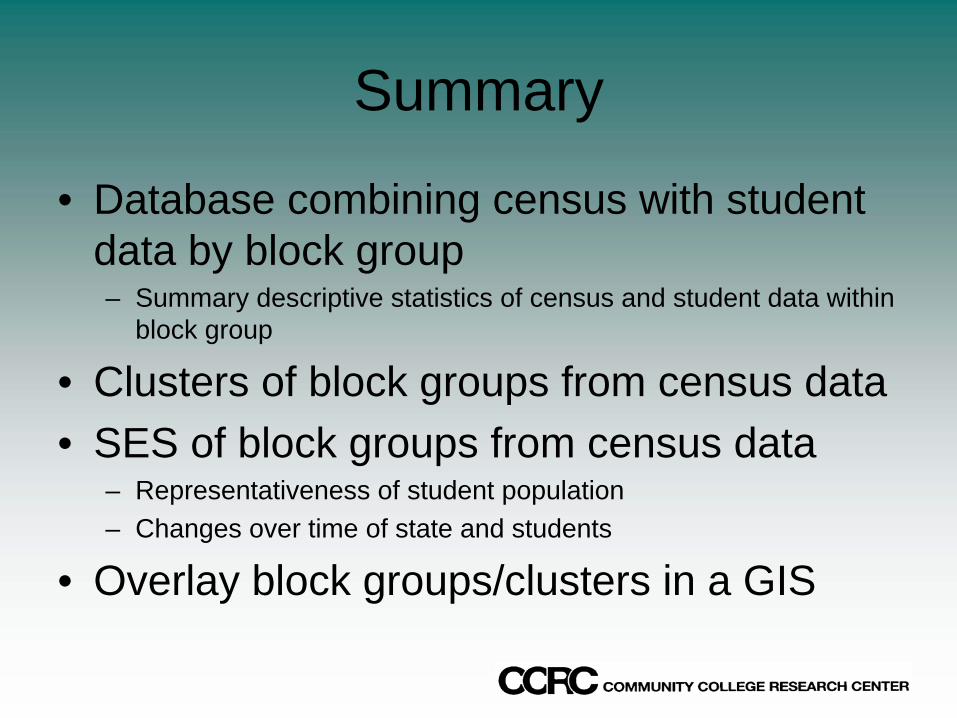
Summary
• Database combining census with student data by block group– Summary descriptive statistics of census and student data within
block group
• Clusters of block groups from census data• SES of block groups from census data
– Representativeness of student population– Changes over time of state and students
• Overlay block groups/clusters in a GIS