Use of geographical data within Nedbank
10
USE OF GEOGRAPHICAL DATA WITHIN NEDBANK The importance of using geographic data in making better strategic business decisions By Katy Bariamis
-
Upload
insight2impact-i2i -
Category
Economy & Finance
-
view
148 -
download
2
Transcript of Use of geographical data within Nedbank

USE OF GEOGRAPHICAL DATA WITHIN
NEDBANKThe importance of using geographic data in making better strategic business decisions
By Katy Bariamis

Image business people have of
GIS
NEDBANK ATM FOOTPRINT
NEDBANK BRANCH FOOTPRINT
It’s important to get the business to understand that GIS is not just
points on the map
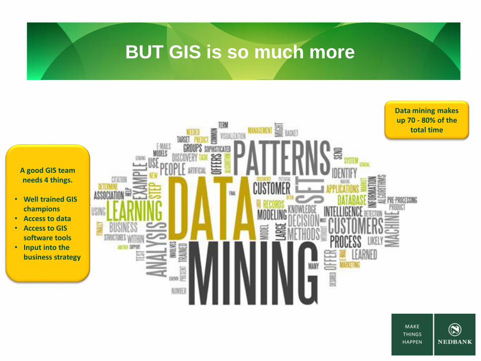
BUT GIS is so much more
Data mining makes up 70 - 80% of the
total time
A good GIS team needs 4 things.
• Well trained GIS champions
• Access to data• Access to GIS
software tools• Input into the
business strategy

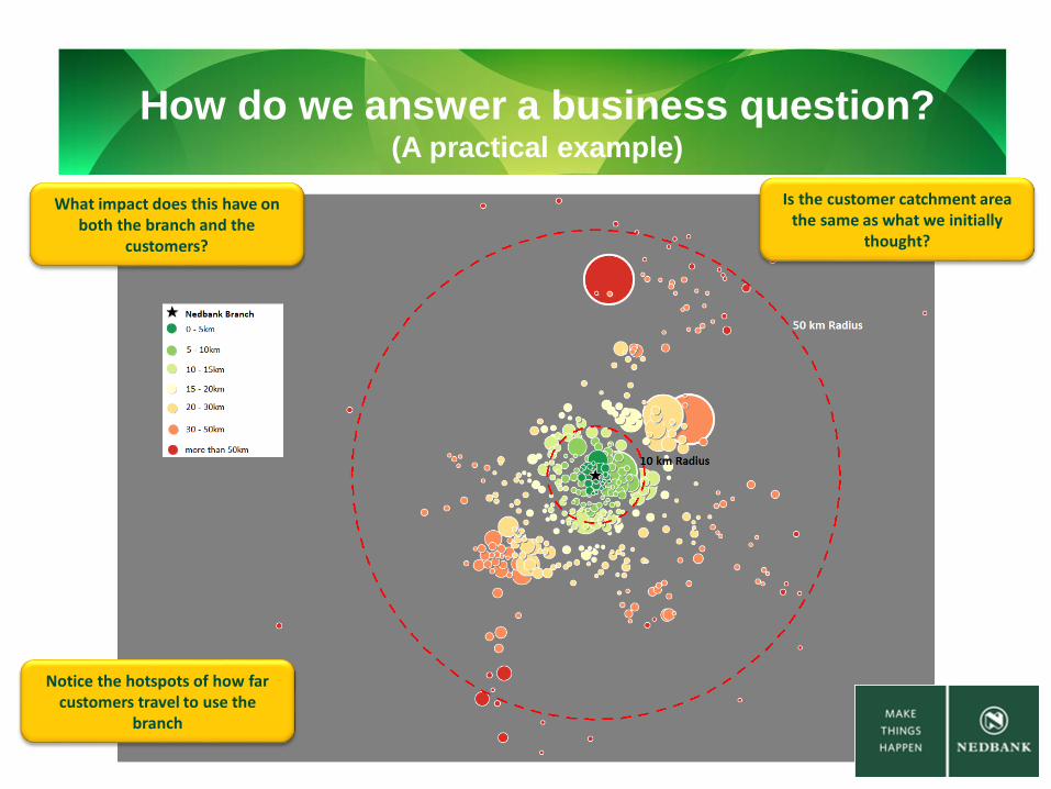
How do we answer a business question?(A practical example)
We need to Gather the data
We need to Analyse the
data
We need to Combine the
data
We need to Display the
results
Sales per Branch
Branch Locations
Customer Locations
Branch to Customer Route Distance
How do we answer a business question?(A practical example)
Is the customer catchment area the same as what we initially
thought?
Notice the hotspots of how far customers travel to use the
branch
What impact does this have on both the branch and the
customers?
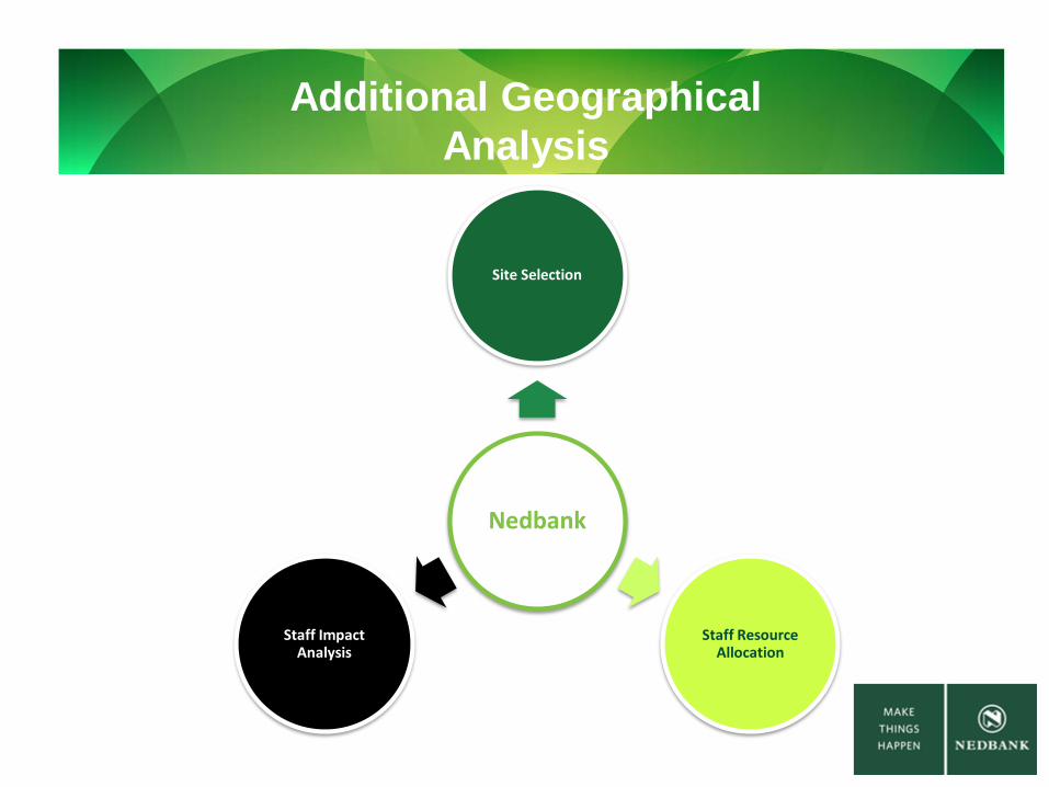
Additional Geographical
Analysis
Nedbank
Site Selection
Staff Resource Allocation
Staff Impact Analysis
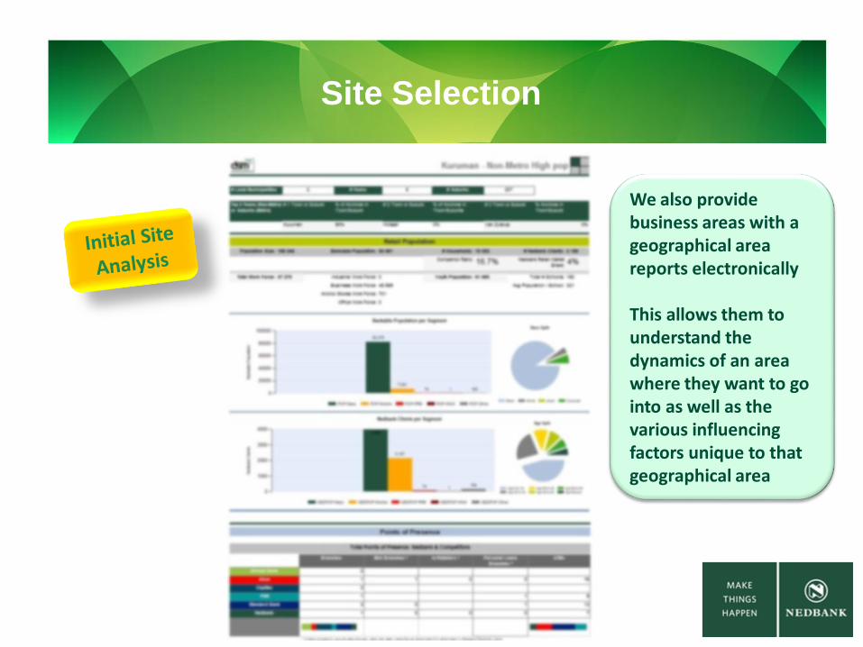
Site Selection
We also provide business areas with a geographical area reports electronically
This allows them to understand the dynamics of an area where they want to go into as well as the various influencing factors unique to that geographical area

Staff Resource Allocation
Do we have enough Sales people on the ground??
Do these branches have to
right people selling the right
products?
ClientsVs
Branch Head Counts
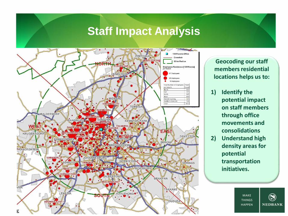
Staff Impact Analysis
Geocoding our staff members residential locations helps us to:
1) Identify the potential impact on staff members through office movements and consolidations
2) Understand high density areas for potential transportation initiatives.