U.S. Topo Bureau: Old Territory and Military...
26
U.S. Topo Bureau: Old Territory and Military Department of New Mexico 1867 1: Fort Fillmore 1855 1855 James Bennett was in the White Mountains when Apaches killed his commander, Captain Henry Stanton, and the survivors had to bear his remains back to his wife. Quote: (1855) Feb 2. No mistake about it, we are living on a light diet. Killed our last beef; flour is gone; we have no shoes. It is hard fare. We have decided to call this Camp Starvation. Feb 4. Have been subsisting on horse and mule flesh. No provision came, so started on yesterday. Travelled until 10 o'clock at night, driving our wornout animals. We burned a great number of our saddles, not being able to carry them. ... Feb 8. Crossed the [Manzano] mountains barefoot over sharp rocks and ice. There is nothing to ride. Crossed the Rio Grande and came into Las Lunas, where we are all glad to be once more in our quarters, cleaning up and getting new clothing. Feb 10. Started with the remains of Captain Stanton to go to Fort Fillmore. Feb 15. Yesterday crossed the Jornada del Muerto (Journey of the Dead). This is a sandy place where no water is to be had. It is 90 miles in length and is noted for murders and massacres by the Indians.... Feb 16. Fort Fillmore, established 1853, is occupied by Company B, 1st Dragoons; Companies C, K, and H, 3rd Infantry. We rode into the fort. Mrs. Stanton, the Captain's wife, stood in the door awaiting her husband. If a person had one drop of pity, here he could use it. Poor woman! She asks for her husband. The answer is evaded. An hour passes. Her smiles are fled. Her merry laugh is turned to sighs and tears stain her cheek. Him she loved, she never more shall behold. [Bennett, James A.] 11 10 5 6 9 2 12 13 17 4 7 3 15 16 14 1 8 Library of Congress Geography and Map Division - Terms of Use
Transcript of U.S. Topo Bureau: Old Territory and Military...

U.S. Topo Bureau: Old Territory and MilitaryDepartment of New Mexico1867
1: Fort Fillmore
1855
1855
James Bennett was in the White Mountains when Apaches killed his commander, Captain Henry Stanton, andthe survivors had to bear his remains back to his wife.
Quote: (1855) Feb 2. No mistake about it, we are living on a light diet. Killed our last beef; flour is gone; wehave no shoes. It is hard fare. We have decided to call this Camp Starvation.
Feb 4. Have been subsisting on horse and mule flesh. No provision came, so started on yesterday. Travelleduntil 10 o'clock at night, driving our wornout animals. We burned a great number of our saddles, not beingable to carry them. ...
Feb 8. Crossed the [Manzano] mountains barefoot over sharp rocks and ice. There is nothing to ride. Crossedthe Rio Grande and came into Las Lunas, where we are all glad to be once more in our quarters, cleaning upand getting new clothing.
Feb 10. Started with the remains of Captain Stanton to go to Fort Fillmore.
Feb 15. Yesterday crossed the Jornada del Muerto (Journey of the Dead). This is a sandy place where no wateris to be had. It is 90 miles in length and is noted for murders and massacres by the Indians....
Feb 16. Fort Fillmore, established 1853, is occupied by Company B, 1st Dragoons; Companies C, K, and H, 3rdInfantry. We rode into the fort. Mrs. Stanton, the Captain's wife, stood in the door awaiting her husband. If aperson had one drop of pity, here he could use it. Poor woman! She asks for her husband. The answer isevaded. An hour passes. Her smiles are fled. Her merry laugh is turned to sighs and tears stain her cheek. Himshe loved, she never more shall behold. [Bennett, James A.]
11
10 5
6
92
12
13
17 4
73
15 16 14
1
8
Library of Congress Geography and Map Division - Terms of Use

Overview: Fort Fillmore
Fort Fillmore was established in 1851 by the US Army to protect travel in the new territory. The fort's locationallowed the military to protect travel on the Chihuahua Trail (the old Camino Real), and across Apache Pass,en route to the old presidio of Tucson.
In 1861, the Confederate Army under Lieutenant Colonel John Baylor seized the fort during the third Texianinvasion of New Mexico. Baylor captured 400 Union soldiers. The fort was decommissioned the following year.The tale of the Confederate victory is told on the "Other Voices" tab.
Quote: In what he conceived to be a deperate situation, Lynde decided, in a moment of panic, to abandon FortFillmore and attempt to reach Fort Stanton, 154 miles to the northeast....
In and about the loading of supplies it was all too evident that some of the supplies were to be left at the fort.Word was whispered about the barracks that boxes of hospital brandy, and kegs of medicinal whiskey, ingoodly number, were to be abandoned.
As the soldiers appraised the situation, abandonment of a military post under orders was one thing, butabandonment of high class liquor was a much more serious matter, one that required consideration andreflections. The soldiers met the situation sensibly, and in the beginning, with discretion.
First one trooper, then another, and then many, took a moderate swig of the soon-to-be-abandoned liquor,then each helped himself to a drink that seemed more appropriate to the occasion. One sergeant of the "oldarmy" decided that a drop of brandy, or perhaps two or more, on the road to Fort Stanton might be eminentlyfitting under the circumstances. Pouring the water our of his canteen, he replaced it with liquor. Others,recognizing the soldier's commendable conduct, substituted liquor for water in their canteens.
But on the cross country march from Fort Fillmore to San Augustine Springs, soldiers with liquor in theircanteens instead of water suffered severely from thirst. LOng stretches of rough, sandy road, without a dropof water to touch hot lips and burning throat, proved the undoing of many a good fighting man. Soldier aftersoldier collapsed and fell by the wayside, begging for water.-- [Keleher, William A.]
Quote: There are few reliable details on record respecting this disgraceful surrender. It appears that Lynde senta party toward Mesilla, which had a slight skirmish with the Texans and retired to the fort. Then orders werereceived to march the garrison to Ft Craig or Alburquerque, and soon after starting, when, as is stated, themen had been given all the whiskey they wanted, and were mostly drunk, they met a Texan force, to whichthe major, after a council of officers, surrendered. It is said that the more sober of the officers and menprotested and wished to fight. The paroled prisoners were allowed to go to Alburquerque, suffering intenselyon the march. For this act Maj. Lynde was dismissed from the army; and Capt. A. H. Flummer, thecommissary, who turned over to the enemy $17,000 in drafts, was merely reprimanded and suspended for sixmonths. [Kendall, George Wilkins]
2: Fort Craig
1855
The day after returning from an arduous, months-long expedition into the White Mountains, where theMescalero Apaches got the worst of the Dragoons, Bennett is sent off again.
After some months of hard riding around New Mexico, he returns to Fort Craig, and records this sad scene.The unjust treatment of, and miserable conditions for, enlisted men prompted many to desert, including,eventually, Bennett himself.
Parker also describes scenes of cruelty by officers against the troops, in this case, for failing to honor African-American soldiers.
Quote: Feb 17.- Mounted my horse at 3 o'clock P.M to carry an express from the Mexican General Santa Annato Governor Lane of Santa Fe. Arrived 10 o'clock P.M. at Fort Thorn.
Feb 19.- Yesterday at daybreak was up and off. 9 o'clock P.M arrived at Fort Craig, having ridden without astop for 108 miles. Never so tired in my life. Took a good rest today. Slept nearly all day.
Feb 21.- Passed Lamitar, a very pretty town, where the former Mexican Governor of New Mexico, GeneralArmijo, lives. At Los Lunas, papers are taken by another. I am to remain with my company.
Feb 27.- Today at Fort Craig. This is the best and prettiest fort in New Mexico. It is situated on a table landbeside the Rio Grande. It is set in a grove of cottonwood trees. [Bennett, James A.]
Quote: A day or so since, a soldier refused to obey the orders of a Corporal. The latter put his authority inforce. The soldier drew a knife and tried to stab the Corporal, who then shot the soldier through the heart.Today he is being buried without the honor of war while the Corporal receives no blame. [Bennett, James A.]
Quote: The [Civil] war being at an end...hundreds of freed negros flocked to the recruiting stations and werequickly transformed into recruits for the United States colored regiments....
Their advent astonished everyone. The frontiersmen looked upon them as a military caricature, the fruit ofsome political deal, unexplained and unreasonable. The officers detailed to serve with them were half ashamedto have it known. The white soldiers who came in contact with these recent slaves, now wearing the uniform ofthe regular army, felt insulted and injured; and their redskin adversaries heaped derision upon the negroes bytaunts and jests, and loudly called them "Buffalo Soldiers," and declared they were "heap bad medicine"because they could not and would not scalp them.
Such was the very unpromising advent of colored troops to do service as soldiers on equal terms with regularveterans. A detachment of this regiment was ordered on duty at Fort Craig, New Mexico, and...detailed forguard duty. This was more than the white soldiers could endure, and so general and open was the oppositionthat a condition of things bordering on mutiny resulted....
[After the white soldiers fail, under orders, to salute the new regiment] The men were dismissed, and asprisoners marched to the flagstaff. Around their thumbs, the cruel cords were tied, and they were hoistedupward until only the toes touched the ground. There was no word of protest, no look of anger. Proudly andfirmly, as if in Indian torture, they endured the ignominy and pain of their position. ... One of the officerssuggested to the men that they could pretend to yield, agreeing to "salute the uniform of the United States,even if borne by a nigger." This gave a chance for compromise, the cruel cords were severed, and the braveveterans were released. They were too lame and injured to hold a rifle then, but it was agreed that thereaftermilitary courtesy should be shown to those wearing the uniform....
From such discouraging beginnings has developed a military organization of brave and efficient soldiers, whohave since then made excellent records for themselves, in many deeds of gallantry in battles with the Indians.No longer do the red men throw taunts at the black soldiers, for they have found them foemen worthy of theirsteel. No longer do officers consider it humiliating to serve in negro regiments. On the contrary, they arefavorite commands today. [Parker, W. Thornton ]
Overview: Fort Craig
The Army spent the early years at Fort Craig conducting campaigns against Native Americans when a newthreat appeared on the horizon-- Confederate Texans. By July of 1861, Fort Craig had become the largest fortin the Southwest with over 2000 soldiers and growing. The same year , the First New Mexico VolunteerInfantry Regiment was formed. This largely Hispanic regiment served with courage and honor under thecommand of Colonel Kit Carson.
In 1862, after capturing several military installations in southern New Mexico, General Henry Hopkins Sibleyled an enthusiastic but poorly equipped brigade of about 2,500 Confederate troops up the Rio Grande to FortCraig. Colonel R.S. Canby, the military governor of the New Mexico Territory, moved his troops from Santa Feto Fort Craig with full knowledge of Sibley's movements through information received from Paddy Graydon'sSpy Company and local New Mexicans.
Fort Craig's massive new gravel bastions were "reinforced" with Quaker Guns (fake wooden cannons) andempty soldiers' caps mounted to look like real soldiers.
This impressive show of force squelched any Confederate plans for a direct assault. After days ofunsuccessfully trying to lure Union forces from their heavily protected fort, Confederates moved north in anattempt to maneuver around Fort Craig and cut off Union supplies. With the Confederates on the move, Canbystarted north to ensure Fort Craig was not left isolated and vulnerable.
On February 21, 1862, the armies clashed at Valverde Crossing with both sides taking heavy casualties. At theend of the day, the Confederates held the field of battle, the Union still held Ft. Craig, and the New MexicoVolunteers under Col. Miguel Pino found the Confederates' supply wagons and burned them. What remained ofConfederate supplies were lost at the Battle of Glorieta (east of Santa Fe) on March 28th, forcing them toretreat to Texas and ending the Confederate push for military conquest of the West.
After the end of the Civil War, the Army returned its attention to the Indian Campaigns. The primary functionof the fort was to control Apache and Navajo raiding, and to protect the central portion of the Camino Real.Military excursions from the fort pursued such notable Apache leaders as Geronimo, Victorio and Nana.
African-American soldiers were segregated in the frontier army. Companies from the 9th Calvary and the 25thand 38th Infantry were stationed at Ft. Craig. From 1867 to 1869 infantry divisions of "Buffalo Soldiers" at Ft.Craig protected transportation routes in southern New Mexico. Men in the 9th Calvary used it as a base topursue the Warm Springs Apache during the 1880-1881 campaigns.
By the late 1870s, attempts to control Indian raiding began to succeed. The Chiricahua and White MountainApache were subdued and forced to abandon their traditional homelands and move onto reservations.
The conditions on the reservations-- disease, famine, cultural misunderstandings, and shifting or dishonestpolicies-- incited numerous escapes. The most famous of these rebellions was the escape of the Chihenne(Warm Springs Apache) first led by Victorio, then by Nana.
After seeing the decimation of their numbers on the reservations, Chief Victorio decided to escape from theSan Carlos reservation and return his people to their homeland. Fort Craig became a staging area for the

Army-- this time to pursue the Apache. Victorio died in an ambush at Tres Castillos, Mexico where most of theband-- over half of whom where women and children-- were killed or captured by the Mexican Army. Eightyyear old Nana joined forces with Geronimo and fought the Army for four more years before surrendering. Nanadied at the age of 96, still unbroken.
Geronimo and Nana surrendered in 1885 and Fort Craig was permanently abandoned-- its military function nolonger needed.
Nine years later, Fort Craig was sold at auction to the only bidder, the Valverde Land and Irrigation Company.The property was eventually donated to the Archaeological Conservancy by the Oppenheimer family andtransferred to the Bureau of Land Management (BLM) in 1981. The site is a BLM Special Management Area andis listed on the National Register of Historic Places.
Images:
Re-enactment of buffalo soldiers riding out from Fort Craig
Links: Fort Craig National Historic Site (BLM) --http://www.blm.gov/nm/st/en/prog/recreation/socorro/fort_craig.html
3: Fort Thorn
1855
Quote: (03 March 1855) Down the Rio Grande past Fort Thorn, a new fort which was built by my old companyand is garrisoned with 2 companies of Infantry and 1 of Cavalry [Dragoons]. [Bennett, James A.]
Quote: (23 April 1855) Past Fort Craig to Fort Thorn. Indians were waiting for us here. Met in council. I actedas interpreter. 250 Indians made a treaty. Received from them 40 stolen horses, 20 mules, 3 Mexican boys,and a girl. The children were taken by them a few months ago. One of the boys we got from the Apaches tellsme that he was with the indians when we fought them at the time that Captain Stanton was killed. He saysthat we killed a chief and 11 or 12 other Indians. [Bennett, James A.]
Overview: Fort Thorn
The short-lived Fort Thorn was commissioned to protect the Jornada del Muerto, and travel along the RioGrande. It was quickly decommissioned, in part because its swampy location gave rise to a malaria epidemicamong the soldiers stationed there.
Quote: Fort Thorn is located on the immediate edge of an extensive marsh, the river making a considerablebend at this point, leaves exposed to the right, a crescentric flat, intersected by numerous sluices, an dattimes completely innundated. The buildings constituting the flat are placed within a stone's throw of theswampiest portion of this flat or bottom, and in the most admirable manner, if the object be that the garrisonshall inhale, for an average period of five months, the pestilential effluvia arising therefrom.
The bottom referred to, presents during the hottest months, a surface of oozy mud, covered with green slime,and interspersed with pools of stagnating water, which surface is during these months slowly drying up.
During the same time, a rank vegetation of weeds and grasses undergoes the process of germination,advancement to maturity, and decay. As might be expected, fevers of a malarious character, have greatlyafflicted the command during this quarter. These diseases have prevailed to even a greater extent than informer seasons, which may possibly be due to an unusually continued elevation of temperature, and theabsense of rain, which serves to prevent the fall of the river and stagnation of water in the neighboringsluices.

Fevers began to manifest themselves about the middle of July, and have continued with much virulence untilthe present time. The command then consisted of two companies, and the sick report numbered seventycases. The garrison was reduced on the 1 September, to one company of infantry, half of which has sincebeen removed to Fort Fillmore on detached service. Scarcely a man of this command can be considered fit forthe performance of ordinary garrison duty, so debilitated are they by disease.--Post Surgeon Dr. P.A. Quinan, Statistical Report on Sickness and Mortality in the Army of the United StatesCompiled from Records in the Surgeon General's office...1855-1860 36th Congress, 1st session, 1860 Sen E.Dox 52. Serial 1035 Washington DC
Images:
Fort Thorn, looking southeast
4: Fort McLane (Fort McLean)
1860-1863
Among the memorable occurrences of these campaigns against the Dona Ana county Apaches was the captureof Mangas Coloradas in 1863 and his killing by a soldier in the command of Captain E. D. Shirland, "C"Company, 1st Cavalry. This old chief had been taken prisoner in a skirmish and was confined in a Sibley tentat old Fort McLean, near the Mimbres river, in January, 1863. The guard had strict orders if he attempted toescape to shoot him. In the early morning the soldier on guard in the rear of the tent saw Mangos rise up fromthe tent and start to run. He raised his carbine, fired and the Indian fell dead. He had committed so manymurders and outrages that the question of Among the memorable occurrences of these campaigns against theDona Ana county Apaches was the capture of Mangas Coloradas in 1863 and his killing by a soldier in thecommand of Captain E. D. Shirland, "C" Company, 1st Cavalry. This old chief had been taken prisoner in askirmish and was confined. Whether or not he really attempted to escape was never satisfactorily settled. Ithas been stated that a soldier of the command, not on guard duty at the time, thrust a bayonet through thetent into the Indian's thigh, causing him to jump and run out of the tent. [Twitchell, Ralph Emerson]
Quote: General Orders No. 3.
HEADQUARTERS DEPARTMENT OF NEW MEXICO,
Santa Fe, N. M., February 24, 1864.
The following notices of combats with hostile Indians in New Mexico, and synopsis of Indian depredations, aswell as operations generally against them, during the year 1863, are published for the information of allconcerned. Perhaps not over one scout in four, which was made against the Indians during that period, was atall successful; but no notice is made except of scouts which had results for or against us. This fact is stated toconvey a better idea of the labor of the troops :
January 17. ? Captain E. D. Shirland, 1st cavalry California volunteers, brought Mangus Colorado, an Apachechief, into Fort McLean, a prisoner. On the morning of the 18th, in attempting to escape, Mangus was killed bythe guard. ...
January 20. ? Captain Shirland came upon an Indian rancheria, surprised and defeated the Indians, killing nineand wounding many more, and capturing from them thirty-four head of stock, a portion of which weregovernment mules. The rancheria and all that pertained to it was destroyed. ...
January 19.? Captain William McCleave. 1st cavalry California volunteers, reports that, in obedience to orders,he started from Fort McLean and proceeded to the Pinos Altos mines; arriving at the latter place, a party ofMangus Colorado's band of Apaches approached; the men were ordered to attack them, which was done;eleven Indians were killed and one wounded; the latter proved to be the wife of the chief, Mangus Colorado.Three horses were captured, but, being in poor condition, the people at the mines were permitted to keepthem. Eleven Indians killed, one wounded, and three horses captured.
January 29. ? On the 29th January the Indians attacked two hunting parties of company A, 5th infantry
California volunteers, at Pinos Altos mines, killed private Hussey and wounded Sergeant Sitton. The Indianswere driven off with a loss of 20 killed and 5 wounded. Sergeant Sitton behaved gallantly in this affair.--Ben. C. Cutler, Assistant Adjutant General [Department of Special Collections, University of Chicago Library]
Overview: Fort McLane
The short-lived Fort McLane was established to protect the Santa Rita copper mines, but was abandoned afterthe Confederate invasion in 1861, and all the troops moved to Fort Fillmore.
Fort McLane's most infamous moment came two years, later, when General West lured the chief of theChihenne (Warm Springs) Apache band, Mangas Coloradas, to the ruined Fort McLane under the pretext ofhaving peace talks, and then had him murdered in the middle of the night, prompting another decade of fierceretributions from his kinsmen.
According to Twitchell, the fort was 15 miles south of the Santa Rita mines, near the present-day town ofHurley, but the U.S. Topo Bureau shows it northeast of the mines, near present-day Mimbres.
5: Amiel Weeks Whipple and Heinrich Balduin Möllhausen
1853-1854
1853
In 1853, Lieutenant Whipple was directed to head a survey crew to explore the possibility of building atranscontinental railroad along the 35th parallel. A team of scientists from the Smithsonian accompanied thescientific expedition, as well as German artist Heinrich Möllhausen. They followed a route first blazed byCaptain Marcy after the conclusion of the Mexican-American War.
The findings of this expedition, including supplements of botanical and biological information on many newly-recorded species. is included as part of the 12-volume Pacific Railroad Reports. [Whipple, A.W]
Links: Reports of Explorations and Survey to Ascertain the Most Practicable and Economical Route for aRailroad from the Mississippi River to the Pacific Ocean --http://memory.loc.gov/ammem/ndlpcoop/moahtml/afk4383.html
6: Camp Las Lunas
1852, 1859-1860, 1862
The old village of Las Lunas was a handy place to station a Dragoon post prior to the Civil War. Also known asthe Post of Los Lunas, it was abandoned and reoccupied several times.
Having completed a series of observations at Isleta, we proceeded seven miles down the right bank of theriver to Las Lunas, a military station commanded by Capt. Ewell, of the dragoons. That officer had a thoroughknowledge of the country in this vicinity, and was kind enough to accompany us upon an excursion to look atthe route esteemed favorable for crossing over into the valley of Rio Puerco. It was decided to adopt thiscourse for the survey. [Whipple, A.W]
Overview: Las Lunas
Los Lunas/Los Lentes was the site of a pueblo and of early land grants. It became a political and economiccenter under the tutelage of the powerful Luna family.
The roots of the town of Los Lunas are in the San Clemente grant of 1716, which came to be owned by theLuna family in the middle of the eighteenth century. Los Lunas also came to include Los Lentes, immediatelyto the north,originally a Tiwa pueblo. [Long Distance Trails Group--Santa Fe, National Park Service, NewMexico State Office, Bureau of Land Management]
01 July 1970:
Quote: Q: Back a ways [the interview was done while driving] we were in Los Lunas...but back a little waysthere is a little settlement of Tomai, the Catholic Church and the Mexican settlement there, there used to be inthe early days, an Indian settlement there...do you know anything about that?
A: Yeah, a little bit down, above, down around Los Lentes they call that...it used to second Isleta populationthere...the second largest Indian village...
Q: Next to Isleta?
A: Yeah, Next to Isleta...between Isleta and Los Lunas... Q: That is the little settlement of Tomai now...
A: Lots of Indians now...and that is how the land there, Los Lentes, have been occupied by the Spanishthere...and of course they used to marry Indian and became Spanish...and the land would stay with them andthat would be part of Isleta...of course they were still a family...
Q: They probably call themselves Mexicans today...and the Tomai area... A: Yeah... Q: I don't know whether these people connect themseves with the early Isleta people or not...or if they wereof Spanish descent...
A: They came as Spanish, and then they came and settled here and married Indian and they stayed on andthey got allotment or grant or whatever the Spanish call them so much maybe 50 acres...to family and theland was available they would move their fence posts to....way yonder, maybe they took more, maybe theyhad 100 acres, maybe more...50 acres, but the government got after them and because they were onlysupposed to have so much land and then they took some more, keep taking more...and they didn't likethat...and because they just took the land. I don't know, I will have to show it to you...I have got one of theseold King's wagon and how they, you know Johnny Olguin...yeah, he rode that...they took it, all the Spanish,there were living there, another 25 years, or and then they took some and then when the government cameback on them they had to pay taxes...and then, oh heck, for many years they had trouble, they didn't likethat.....
A: Well everybody knows that the Indian had this land... I don't care how the government got it, it is stillIndian land. Q: Sure, they proved it on these rights.... these archeologist and who can find some of these sites, they arescattered all over these country, and these rights are still scattered all in this valley too.... and Tomai, andSocorro and I don't know about Belen, they're probably in here too aren't they, from ruins and the Belen area?
A: Oh yeah, they would have to be clear down to Soccoro...and also down to El Paso... yeah, all over Indianland...Mexicans came during the Spanish American War... and whatever it was, Mexican War.... and theysettled some prisoners, Soccoro, Magdalena, Belen, Tahiki, Chilili, all of them prisoners... and they weren't nopeople, but they settled them here, they intermarried and stayed among themselves from different parts,Torreon, and whatever you call it in Spain and Barcelona... well they got mixed up and hell, they juststayed....we couldn't drive them out... heck no... the government had put them there... and so this is partIndian land, it is supposed to be.--Tony Lucero, Isleta del Sur. Folsom C. Scrivener, interviewer. [University of New Mexico, Department ofHistory]
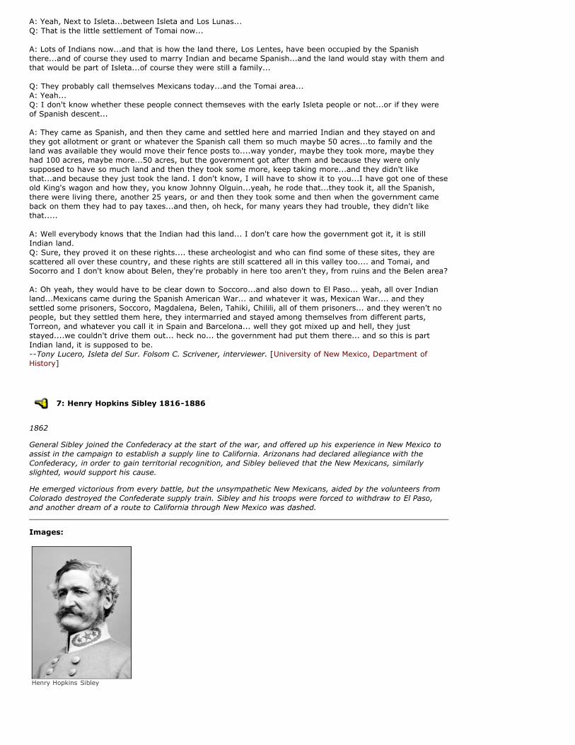
7: Henry Hopkins Sibley 1816-1886
1862
General Sibley joined the Confederacy at the start of the war, and offered up his experience in New Mexico toassist in the campaign to establish a supply line to California. Arizonans had declared allegiance with theConfederacy, in order to gain territorial recognition, and Sibley believed that the New Mexicans, similarlyslighted, would support his cause.
He emerged victorious from every battle, but the unsympathetic New Mexicans, aided by the volunteers fromColorado destroyed the Confederate supply train. Sibley and his troops were forced to withdraw to El Paso,and another dream of a route to California through New Mexico was dashed.
Images:
Henry Hopkins Sibley

8: Fort Franklin - Fort Bliss
1862-1863
Quote: To Col. J Reily
Comdg 4th Regt. T.M.V.
San Antonio Texas
Headquarters Sibley Brigade
San Antonio, TX October 22, 1861
Colonel,
You will receive orders of this date to take up the line of march with your Regiment tomorrow in the directionof El Paso.
The General Comdg deems it expedient to indicate to you officially the purpose of the Campaign upon whichthis Command is about to enter and his views in regard to the same, so far as they may affect your Corps andduties. in the language of the Government at Richmond, the General is entrusted with the important duty ofdriving the Federal Troops from the Department (New Mexico) at the same time securing all their arms,supplies, and materials at War.
Commanding the advanced force of this command your chief exertions will of course be directed to the objectsthus prescribed.
On arriving at El Paso (should you do so before the arrival of the General) you are authorized to assume theCommand of all the forces of the Confederate States within the district of country known as Arizona and alsoat Fort Bliss or between there and the frontier of Arizona. So much depends upon the condition of affairs whichyou shall find to exist there and in the adjacent country occupied byt he enemies Troops, and upon thecondition of your own force upon your arrival there, that the General leaves you entirely untrammeled byinstructions in regard to assuming offensive operations before he shall arrive. Should an advance be advisablein your judgement you will not hesitate to make it and to resort to every resource known to civilized warfareto sustain it. Should you deem an advance inadvisable until reinforcements are received your will make suchdispositions of your forces as your own judgement shall direct.
...It is the desire of the General that while en route as well as after your arrival in Arizona you should furnishto all Citizens of the Confederate States and of that Territory and their property, such protection as you canagainst the hostile attacks and depredations of the Indians. The extent to which this should be attempted is ofcourse left to your own discretion, keeping in view the leading object of the Campaign.
In reference to the civil affairs of the Territory of Arizona it is not the desire of the General that theGovernment instituted and established by Lt. Col. Baylor should be in any manner disturbed and your powersare limited to the military operations.
I am Colonel your obedient Servant.
Ass. Adjt General Henry H. Sibley [Sibley, Henry Hopkins]
Overview: Fort Bliss
In November 1848, Colonel Doniphan received orders to establish a fort across the river from El Paso.Detachments from his troops first established a fort at a nearby ranch, but by 1851, attacks from Apaches andComanches caused the Army to temporarily abandon the fort and retreat to Fort Fillmore.
Three years later, another fort was established at Magoffinsville, the thriving community founded by theprominent familiy of traders. In 1861, Texan Confederates claimed control of the fort, and used it to launchattacks into New Mexico.
The Rio Grande flooded the Maggoffinsville fort in 1868, and the fort was moved again, and finally, in 1878, atract of land was purchased to build a permanent fort, which is in operation today.
The mission of Fort Bliss has changed to providing anti-aircraft and missile defense capabilities, a role whichFort Bliss retains. As one of the largest military posts in the continental United States, Fort Bliss is alsouniquely suited to conduct live fire exercises of nearly every type of military weapon in the current US Armyarsenal.
Images:

Central sectional view of the great camp at Fort Bliss, Texas. Picket Lines and Battery Parks, 09/26/1915
Links: Fort Bliss -- http://www.bliss.army.mil/
9: Battle of Valverde
1862
Confederate General Henry Hopkins Sibley had sent scouts to make a reconnaissance of Fort Craig, and fooledby the wooden cannons, they decided it was too well-defended to attack, and decided to go through thebosque below the fort, on the other side of the river.
During the night, the soldiers at Fort Craig snuck out and managed to stampede some of the ConfederateArmy's mules. Although Sibley's Brigade was victorious at Valverde, the loss of their supplies proved crippling.
Quote: On the morning of the 21st considering that the impending battle must decide the question at issue,though very weak I took the saddle at early dawn to direct in person the movements. Green's Regiment withthe Battalion of the 7th...were ordered to make a strong threatening demonstration upon the fort, whilstScurry with the 4th well flanked by Pyron's Command on the left, should feel his way cautiously to the river.
This movement was unfortunately delayed by the loss during the night, by careless herding, of a hundredmules of the baggage train of the 4th Regiment. Rather than the plan should be defeated, a number of wagonswere abandoned, containing the entire Kits, blankets, books & papers of this Regiment. Meanwhile, what wasleft of the trains was put in motion over the sand hills which the enemy has deemed impassable. On reachingthe river bottom at Valverde, it was ascertained that the enemy anticipating our movement had thrown a largeforce of Infantry and Cavalry up the river....
Pyron immediately engaged him with his small force of 250 men and gallantly held his ground againstoverwhelming odds, until the arrival of Scurry with the 4th and Lt. Reily's Battery of light Howitzers. At 12noon, the action becoming warm and the enemy evidently receiving large reinforcements, I ordered Green'sRegiment with Teel's Battery to the front. These in the course of an hour gallantly entered into action, and thebattle became general. Subsequently, Lieut. Col. Sutton with his battalion was ordered forward from the rearand did right good service boldly leading his men even to the cannon's mouth.
At 1 1/2 PM having become completely exhausted and finding myself no longer able to keep the saddle, I sentmy aids and other staff officers to report to Col. Green. His official report attests the gallantry of their bearingand his final success, resulting in the capture of their battery and driving the enemy in disorder from the field,is sufficient evidence of his own intrepidity and of the indomitable courage of all engaged.--from a letter General Sibley wrote to his commanding officer, General Cooper, back in Richmond,VA. [Sibley, Henry Hopkins]
Overview: Valverde
This paraje was called Contadero during the seventeenth century and Valverde by the late eighteenth century.Regardless of its name it was a natural paraje as well as the site of a nineteenth-century town and civil warbattle. [Long Distance Trails Group--Santa Fe, National Park Service, New Mexico State Office, Bureau of LandManagement]
10: Fort Wingate
1862-1868
Kit Carson used this location as a Federal infantry post in his campaigns against the Navajo. While it was here,

it was also known as Fort El Gallo. In 1868 it moved back to the original location, shown as Fort Lyons on thismap.
Overview: Fort Wingate
Fort Wingate was established in 1862, in an attempt to control the large Navajo tribe to the north. FortWingate served as a staging point for the roundup of Navajos and their forced march to Bosque Redondo, alsoknown as the Navajo's Long Walk.
From 1870 onward the military focused was concerned with controlling Apaches to the south. Over the nexttwo decades, the U.S. Army recruited hundreds of Navajo scouts to help contain the Apache.
In the early 20th century, Fort Wingate ceased its operations against Native Americans, and turned towardsassisting in overseas operations. Today Fort Wingate serves as a munitions storage depot.
Quote: [My grandfather] told that the Navajos used to raid other tribes, such as the Nóó'da'í (Utes), Kiis'áanii(Pueblo tribes), and the Naakaii (Mexicans). The Navajos would kill all the owners of the livestock and herd theanimals back to their homeland. Not all the Navajos were involved in raiding other tribes. The trouble beganwhen a group of Navajos killed the sons of Ma' iideeshgizhnii (a Jemez chief) to steal livestock. The JemezChief became furious and declared that all the Navajos should be killed. The Jemez Chief and other membersof his tribe travelled to Yootó (Santa Fe) to report what had happened to his only two sons. The Jemez chiefsaid, "The Navajos have been raiding and killing my people including my sons." He requested a warpathagainst the Navajos. Wááshindoon (the Governor) acknowledged his complaints and the warpath request wasgranted.
After the Jemez Chief and his tribe returned from Santa Fe, he sent messages to other tribes such as theNóoda'í, and the Naakaii. These tribes and the Mexicans became the ana'í (enemies) when they started thewarpath against the Navajos. Hastiin Biyaal (my grandfather) told these stories of long ago.
Hastiin Biyaal was among the Diné who journeyed to Hwéeldi (Bosque Redondo). They were held captive forapproximately five years. The people suffered from hunger, sickness, and cold weather because wood, food,and other necessities were scarce.
After five years at Hwéeldi, Hastiin Ch'il Haajiní (Manuelito) and other top officials traveled to Wááshindoon(Washington, D.C.) to negotiate with Washindoon (the president) on a peace treaty. Hastiin Ch'il Haajiní toldWashindoon that the women and the elders had wept for their homeland and wanted to return. After thepeace treaty was negotiated, the Diné were released. the first stop on the way back to their homeland was atShash Bitooh (Fort Wingate) where they stayed for several days. Then they were transported toTséghadoodzaní (Window Rock) where some necessities, such as food, tools, axes and shovels were distributedamong the Diné. They were to take and use these articles on their homeland.
Many of the Navajos did not make the journey to Hwéeldi. They stayed in the area and hid in the mountains,canyons, and mesas. A man named Hadéézdíín hid on top of Tséyíigai (Chaco Canyon mesa). He became wildand stayed on Tséyíigai.--Jim Beyale, an 86-year old medicine man from the Chaco area, tells stories his grandfather told him aboutHwéeldi, or Bosque Redondo. Beyale is of the People From Off Her Back Clan. His paternal clan is the RedStreak People. His maternal grandfather belongs to the Sleeping Rock People, and his paternal grandfatherbelongs to the Salt People clan. [Dine of Eastern Region]
11: Fort Butler
1860
Fort Butler existed on paper, and was in fact staffed and garrisoned, but never actually existed.
In a plan to decommission Fort Union, Colonel Fauntleroy was directed to establish a new, better fort, to becalled Fort Butler. Fauntleroy acted immediately, and searched for nearly a year to find suitable location tobuild the fort and depot.
Eventually, a 120-acre reservation was established on the Canadian River near Mesa Rica, although the sitehad no timber for building, nor was it close enough to other New Mexican forts to effectively serve as a depot.
However problems continued to plague the project, preventing the troops from being restationed to build onthe new reservation. Finally, the outbreak of the Civil War suspended building altogether. The Civil War madeFort Union much more important, and plans to abandon it were forgotten.
Quote: A post will be established on the Gallinas, at or near where the Fort Smith road crosses that stream, or,preferably, if a suitable location can be found, east of that point, on or near the Canadian. It will be the depotfor the Department, have a garrison of four mounted and two infantry companies, and be called Fort Butler.--General Winfield Scott, issuing orders to Colonel Thomas T. Fauntleroy.
12: Fort Stanton
1855
Quote: (19 March 1855) Came upon the Rio Ruidoso and followed it down to the junction of Rio Bonita, whichwe followed upstream for 20 miles. Arrived at an encampment of United States Soldiers, 300 men under thecommand of Lieutenant Colonel Dixon S. Miles. They are here for the purpose of building a fort to be calledFort Stanton in commemoration of the Captain who was killed three months ago. General John Garlandselected the site for the fort today. The officers all got drunk. [Bennett, James A.]
Quote: (30 September 1862) Brigadier General LORENZO THOMAS,
Adjutant General U.S.A., Washington, D. C.
HEADQUARTERS DEPARTMENT OF NEW MEXICO.
Santa Fe, N.M., September 30, 1862.
GENERAL: I have the honor to inform you that I relieved General Canby in the command of this department onthe 18th instant, and he left this city for Washington, D. C., four days afterwards. I find that during the raidwhich was made into this Territory by some armed men from Texas, under Brigadier General Sibley, of thearmy of the so-called Confederate States, the Indians, aware that the attention of our troops could not, for thetime, be turned toward them, commenced robbing the inhabitants of their stock, and killed, in various places, agreat number of people: the Navajoes on the western side, and the Mescalero Apaches on the eastern side ofthe settlements, both committing these outrages at the same time, and during the last year that has passedhave left the people greatly impoverished.
Many farms and settlements near Fort Stanton have been entirely abandoned. To punish and control theMescaleros, I have ordered Fort Stanton to be reoccupied. That post is in the heart of their country, andhitherto when troops occupied it those Indians were at peace. I have sent Colonel Christopher Carson, (KitCarson,) with five companies of his regiment of New Mexican volunteers, to Fort Stanton. One of thesecompanies, on foot, will hold the post and guard the stores, while four companies mounted, under Carson, willoperate against the Indians until they have been punished for their recent aggressions.
The lieutenant colonel, with four companies of the same regiment, will move into the Navajo country andestablish and garrison a post on the Gallo, which was selected by General Canby; it is called Fort Wingate. Ishall endeavor to have this force, assisted by some militia which have been called out by the governor of theTerritory, perform such service among the Navajoes as will bring them to feel that they have been doingwrong.
I arn, general, very respectfully, your obedient servant,
JAMES H. CARLETON,
Brigadier General, Commanding. [Joint Special Committee of two houses of Congress]
Overview: Fort Stanton
The U.S military established Fort Stanton in 1855 to protect settlements along the Rio Bonito during theApache wars. Later, it became the first tuberculosis hospital in the country. Today Fort Stanton is a NewMexico State Monument.
Images:
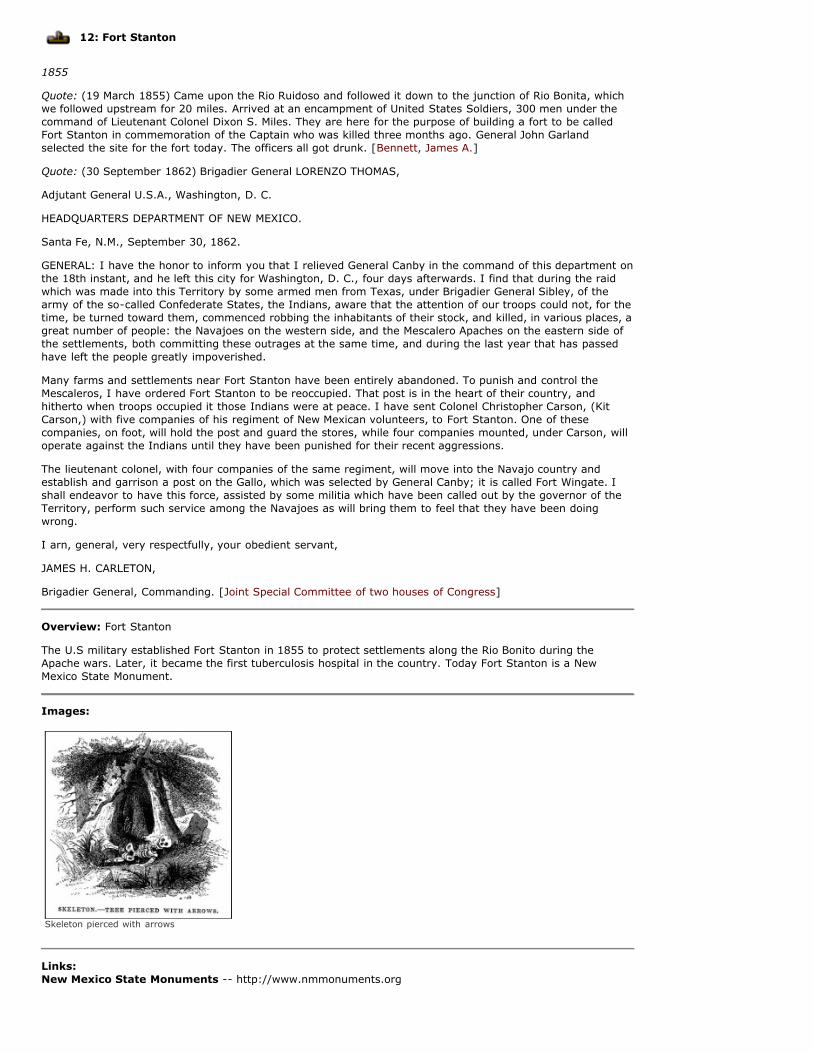
Skeleton pierced with arrows
Links: New Mexico State Monuments -- http://www.nmmonuments.org

13: Fort McRae
1867
Quote: I started from Fort Craig, one afternoon, to cross the Jornada the only passenger in the mail coach. Wehad no conductor, so that the driver and myself were quite alone.
In front of us rode, in a spring wagon, a guard or escort of colored soldiers. After crossing the Rio Grande,below Fort Craig, I noticed the driver was getting more and more under the influence of liquor, and a fullbottle of some vile compound from the post trader which he had purchased just before starting did not seemto promise well for any chance of his return to soberness.
To my dismay, the colored escort kept far in advance, and the distance between their wagon and ours wasmomentarily increasing. Once I thought I would hail them and request their non-commissioned officer incharge to stay nearer the stage. The driving of our stage became more and more careless, and after an houror two of this misery, a shower came up accompanied by thunder and lightning. The mules behaved badly, andwhen at last a sharp squall struck us, they turned suddenly to the left, and in spite of the clumsy efforts of thedriver to restrain them, broke the tongue of the stage short off, and not till then would they come to astandstill. The last I had seen of the escort, they were huddled together with their blankets over their heads,to keep off the rain, and after the mules had quieted down I looked up for them, but they were then nearlyout of sight. I fired my pistol several times to attract their attention, but they neither halted or looked around.
The situation was gloomy in the extreme. I was practically alone on the terrible Jornada, and in the conditionbest suited to attract Indians, i.e., in distress with a large target in the shape of the stage to attract attention.My escort was worthless, and my only companion in the shape of a human being was now sound a sleep. Isoon jumped out and unharnessed the mules, hitching one to each wheel, and having succeeded in capturingand demolishing the cursed whiskey bottle and what remained of its contents, I went to work to try to repairthe damages received by the stage. A rope being at hand, I tried to splice, first tying one end to the axle andthen to the end of the tongue, and then trying to splice the broken portions together.
I kept my eyes well open and feared that I should soon be another victim for Apache cruelty. Looking up in themidst of my work, I saw, to my horror, some figures approaching from a direction which did not suggest theroad. I tried to rouse the stupid and worthless driver, but all my efforts failed, and even the words: "TheIndians are coming," seemed to have no terrors for him. I got in and carefully loaded my only revolver,determined to die bravely and also determined never to be taken alive. Anxiously I watched the bold advanceof the enemy, who approached without any caution, and I accounted for this in believing that they knew howweak our party must be and feared not to approach.
A turn in their course and a rising of the ground disclosed to my eye the waving of a cape. No, it must be ablanket! No, it is a cape! They are soldiers! And I sprang out, and in my youthful joy and gratitude ran forwardto meet them, and ready to weep at my deliverance. The newcomers were of the regular army; a cavalryofficer and trooper crossing the lonely Jornada to their post, Fort McRae established by Captain Grant in 1863a little off the road to the right of the Point of Rocks, not far from the celebrated Ojo del Muerto or spring ofdeath.
How glad I was to see them, and they, when the stage first came into their sight, had hastened on, wonderingwhat had happened. The escort had not turned back, but my new found friends took hold and repaired thebroken tongue, and as the driver came to his senses he got a precious sharp lesson from the officer for hismiserable conduct.
We started again on our journey, and at Water Holes found our escort calmly waiting for us. When we reachedFort Selden, the non-commissioned officer lost his stripes for neglect of duty, I believe, and so the experienceon the Jornada was ended much more satisfactorily than it promised at its beginning. [Parker, W. Thornton ]
Quote: (20 June 1863) General Orders No. 3.
HEADQUARTERS DEPARTMENT OF NEW MEXICO,
Santa Fe, N.M., February 24, 1864.
The following notices of combats with hostile Indians in New Mexico, and synopsis of Indian depredations, aswell as operations generally against them, during the year 1863, are published for the information of allconcerned. ...
June 20, 1863. --Captain A. H. Pfeiffer, wife, and two servant girls, with escort of six men of the 1st NewMexico volunteers, were attacked by a party of Apache Indians, numbering 15 or 20, at a hot spring near FortMcRae. The captain was bathing at the time, when the Indians made a rush upon the party, killing two men,Privates Nestor Quintana and Maestas. Captain Pfeiffer was wounded in his side by an arrow and PrivateDolores received two shots in his right arm and hand. A citizen named Belts, who was with Captain Pfeiffer,was also wounded. The remainder of party, except the women, succeeded in reaching Fort McRae unharmed,and reported facts to Major Morrison, Commanding post. He immediately started in pursuit, with 20 mountedmen, but did not succeed in overtaking the Indians. Mrs. Pfeiffer and the servant girls were found in the trail,badly wounded. Mrs. Pfeiffer and one of the servants have since died; the other doing well. Loss in this affair,two privates killed; two women mortally wounded; one officer, one private, one woman, and a citizen

wounded; seven horses and two mules taken by the Indians. Indian loss unknown. ...
By command of Brigadier General Carleton :
BEN. C. CUTLER, Assistant Adjutant General [Joint Special Committee of two houses of Congress]
Overview: Fort McRae
Fort McRae was commissioned from 1863-1876, to protect travel on the Jornada del Muerto, and settlers alongthe Rio Grande. For much of its existence, the fort was stationed by soldiers of the 38th and 125th infantrycompanies, and the 9th cavalry; African American soldiers also known as "buffalo soldiers."
Links: Office of State Historian: Fort McRae -- http://www.newmexicohistory.org/filedetails.php?fileID=9969
14: Fort Selden
1867
Quote: The Fra Christobal entrance of the Jornada del Muerto (del los Muertos) is reckoned at 946 miles fromFort Leavenworth. Dona Ana, a Mexican town, is 95 miles from Fra Christobal. The famous Cimarron Crossingof the Arkansas is 492 miles from Fort Leavenworth.
The Fra de los Caballos mountains are to the right and westward of the famous Journey of Death. Jornada delMuerto, after crossing the Rio Grande river, below what was in Indian days, Fort Craig.
The soldiers reckoned the "99 miles, without wood, water or grass," from Fort Craig, the northernmost pointof the Jornada, to Fort Selden, the southern most point. Three halting points on the grave-decked trail of the"dead man's journey" gave the only relief of dreariness the "Alamand," because some Germans tried to dig awell and were surprised and killed by Indians; the "Water holes," because sometimes a little water collectedthere for a short time after a heavy rain, and lastly, on the lower third of the trail, below where it branched offto lonely Fort McRae, near the Ojo del Muerto,the "Spring of Death," was the famous "Point of Rocks," thechosen lair for the Indians when they tried to jump a wagon train or other travelers on the Jornada. Gravesalong the roadside were plentiful near this place. [Parker, W. Thornton ]
Overview: Fort Selden State Monument
Situated on a slight rise overlooking the Río Grande at the lower end of the Jornada del Muerto, Fort Selden(1865-90) protected settlers in the Mesilla Valley and travelers on the Camino Real. The garrison, frequentlyharassed by Indians, took part in the campaigns against the Apaches until the fort's inactivation in 1877.
In 1880, during the campaign against Geronimo, troops reoccupied it as a base to patrol the Mexican border.After Geronimo' s surrender, it was abandoned for good in 1890.
Capt. Arthur MacArthur served at Fort Selden in 1884. It was there that his son, Douglas A. MacArthur, learnedto ride and shoot before he learned to read or write. Eroding adobe walls of some 25 buildings stand as highas 10 feet or more. A New Mexico historical marker on U.S. 85, from which the fort is visible, provides a briefsketch of its history. [Long Distance Trails Group--Santa Fe, National Park Service, New Mexico State Office,Bureau of Land Management]
Images:
Fort Selden
Links:

New Mexico State Monuments: Fort Selden -- http://www.nmmonuments.org/inst.php?inst=10
15: Camp Miembres
1853
Quote: Colonel RICHARD C. DRUM,
Assistant Adjutant General, San Francisco, California.
HEADQUARTERS DISTRICT of NEW MEXICO,
Santa Fe, N. M. , September 15, 1865.
It is my intention this fall and next winter to make war upon the Mimbres Apaches, a small band of very badand aggressive Indians. For this purpose a camp will be established on the Mimbres river where hay will be putup. The subsistence stores to furnish, say, four companies to be sent on this duty, are nearly all en route toFort Cummings, where they will be kept in store and be drawn upon from time to time as they may be neededby the troops in camp on the Mimbres or those scouting against the Indians from the latter point. This is theonly hostile operation at present determined upon. ...
I am, colonel, very respectfully, your obedient servant,
JAMES H. CARLETON,
Brigadier General, Commanding. [Joint Special Committee of two houses of Congress]
Quote: Between "Old Baldy's Peak" and the garrison was a ranch for pony express riders where they changedtheir horses and had time to get a little nourishment. Here relief riders took the mail and dashed up the canoncrossing the [Rio] Mimbres at [Camp] Mimbres, dashing on from thence past the hot springs to Fort Bayard,forty-four miles away.
One of those pony express riders met with a sad fate. The writer had gone to Mimbres from Fort Cummingswith an escort of two or three troopers to take medicine to the sick at Mimbres and upon his return to FortCummings reported that he had not seen any Indians, but that the pony express rider, Charlie Young, had notyet reached Mimbres. This created considerable excitement at the garrison, because Charles was a popularpony express rider.
He had been well educated in a western university and his family were prominent people in St. Louis, butthrough evil associations he had lost considerable money and had volunteered to the pony express director forthe position of a rider in New Mexico. He was a brave and companionable man, said to be a fearless rider anda crack shot, so when his absence was reported the commanding officer sent a search party to hunt for hisremains.
Far beyond Cook's gloomy canon and quite a distance from the trail they found his naked, mutilated body.Everything had been taken, including his scalp. The soldiers returned with his remains which were washed andput in a little rough coffin and buried in the lonely post cemetery where I trust they repose in peace to-day. [Parker, W. Thornton ]
Overview: Camp Mimbres
Supply depot for the California Volunteers, enlisted to battle the Chiricahua and White Mountain Apaches insouthern New Mexico and Arizona.
Images:
Mimbres Apaches on horseback

16: Fort Cummings
1867
Quote: Beyond Fort Selden the trail crossed the Rio Grande again, and 65 miles of lonely, dangerous trailextended to the Cook's Canon and Fort Cummings Pony Express station. Here was a veritable walled garrison.A somewhat pretentious front of "doby" (adobe) walls, with archway on either side of which were guard rooms,gave the fort an ancient look, which made the American flag floating from the tall flagstaff in the center of theparade ground look almost out of place. These walls, about 15 feet in height, extended around the garrisonbuildings, forming a square, with only one opening, the door in the rear, where a sentry always walked hisbeat day and night.
To the rear of the fort, huge piles of hay for the cavalry of adjacent " forts" were stored. Fort Cummings wasthe only walled fort of New Mexico in the 60's, and its situation at the mouth of Cook's Canon and upon thetrail to Arizona, which it guarded, gave it considerable importance.
Fort Cummings, New Mexico, located at Cook's Spring, in what is now Luna County, was established October2nd, 1863. It was first garrisoned by Company B, 1st California Infantry volunteers. The post was abandonedOctober 3rd, 1886, and turned over to the Interior Dept, October 22nd, 1891. Cook's Peak, a rugged mountain9,000 feet in altitude, towered above the garrison, and was known by all the soldiers under the familiar nameof "Old Baldy," from its commonly snow-capped summit.
Deming is the town nearest the old fort, and Silver City is the town near its old comrade, Fort Bayard, 44miles to the westward. Between these two garrisons was the Rio Miembres, just beyond the long and gloomyCook's Canon; after leaving Fort Cummings and beyond the Rio Miembres, were the famous Hot Springs whichthe wild Apaches held in such superstitious veneration that the ranchmen who drank of the mysterious waterswere secure from Indian attack as long as they remained by its magic influence.
The fort was designed by General McClellan. Through the archway one could see the two brass cannon pointingdirectly outward, one each side of the flagstaff, and beyond could be seen the rear door of the fort, and thesentry marching back and forth. The little tin-covered tower, above the guard houses and the arch of the fort,looked like a little pilot house. In this look out, a sentry watching in all directions for any danger of Indians tothe herds and with looking glass could signal the herders to bring the herds back to the corral. Watch was alsokept for emigrant trains attacked or followed by Indians or for travelers in peril, and not infrequently thecavalry squad would be sent out to offer protection to harrassed emigrants. [Parker, W. Thornton ]
Overview: Fort Cummings
The United States Army established Fort Cummings to protect miners at Pinos Altos and travelers on theButterfield Stage Route to Tucson from the raids of the Chiricahua Apache. Soldiers stationed there includedthe 125th Colored Infantry Volunteers, the 28th U.S. Colored Infantry, and detachments from the 8th and 4thU.S. Cavalry.
The fort was established at the south end of Cooke's Canyon, an ideal travel route with fresh water, but alsothe most dangerous rocky pass in the southwest. Battles with the bands of Apaches under Cochise and MangasColoradas claimed up to a hundred lives at a time.
Soldiers stationed at the fort report that Cooke's Canyon was filled with graves, cairns (rock piles to coverbones),and loose human bones.
Quote: The terrors of Cook's Canyon which Pass Fort Cummings protected, is thus described by Mr. Bell in1867. "Hundreds of miles before we reached Cook's Canyon I listened with anxiety to the stories told me byfrontiers men about the dreadful massacres perpetrated by the Indians in that dread gorge. It was said thateven soldiers dared not stir a mile from the post, and that it was just a toss up whether any traveller gotthrough alive. These reports were only the surviving echoes of events which have made Cook's Canyon andthe Miembres Mountains memorable in the annals of New Mexican massacres. Cook's emigrant road wasdreadfully roundabout; and the sufferings of the emigrants from want of water, and loss of their stock, mightwell form a subject for one of Mayne Reid's novels."
A settler in the sixties stated that he had counted nine skeletons while passing through the Canyon, and thegraves and heaps of stones which used to fringe the trail will long bear record of those dreadful times.
In 1867 the military authorities caused detachments of soldiers to collect the bones in the Canyon and to burythem in the post cemetery.
In the office of the Post Hospital we had a large fine skull, which had been bleached by exposure of "wind,weather, and wolves." This skull had a large hole in the occipital region more than an inch in diameter, whichwas supposed to have been made by a tomahawk in the hands of an Apache.--Dr. William Parker, post surgeon at Fort Cummings. [Parker, William Thornton]
Images:

Fort Cummings 1867
Links: National Archive Library: Annals of old Fort Cummings --http://www.archive.org/details/annalsofoldfortc00parkrich
17: Fort Bayard (Fort West)
1863
Quote: (10 May 1863) Major General HENRY W. HALLECK
General-in-Chief Etc. Washington, D. C.
HEADQUARTERS DEPARTMENT OF NEW MEXICO,
Santa Fe, N.M., May 10, 1863.
MY DEAR GENERAL: I am aware that every moment of your time is of value to the country, and I would notpresume to ask you even to read this note did I not believe that what is herewith enclosed would be of interestto you as a general, and. therefore, as a statesman. Among all my endeavors since my arrival here, there hasbeen an effort to brush back the Indians, as you have seen from official correspondence, so that the peoplecould get out of the valley of the Rio Grande, arid not only possess themselves of the arable lands in otherparts of the Territory, but, if the country contained veins and deposits of the precious metals, that they mightbe found.
...I established Fort West, and have driven the Indians away from the head of the Gila, and they are findinggold and silver and cinnabar there. There is no doubt in my mind that one of the richest gold countries in theworld is along the affluents to the Gila, which enter it from the north along its whole course. Thus you can seeone reason why the rebels want, and why we may not permit them ever to have, a country evidently teemingwith millions on millions of wealth....
If I only had one more good regiment of California infantry, composed, as that infantry is, of practical miners,I would place it in the Gila country. While it would exterminate the Indians, who are a scourge to New Mexico,it would protect people who might wish to go there to open up the country, and would virtually be a militarycolony when the war ended, whose interests would lead the officers and soldiers to remain in the new ElDorado....
Do not despise New Mexico, as a drain upon the general government. The money will all come back again....
I am, general, very sincerely yours,
JAMES H. CARLETON, Brigadier General. [Joint Special Committee of two houses of Congress]
Overview: Fort Bayard
General Carlton established Fort Bayard to protect miners, settlers, and travelers from the Apache threat. Thefirst troops to be stationed there were Company B of the 125th U.S. Colored Infantry, and the "buffalosoldiers" continued to be important, operating from the fort against the Apache.
After Geronimo's surrender in 1886, the fort was being prepared for abandonment, but around 1899 foundnew life as a tuberculosis sanitarium. Today Fort Bayard continues to operate as a state-run health carefacility.
Quote: I have established only one new post on the Apache frontier, and that is located near the head of theMimbres River, about one hundred and fifty miles west of the Rio Grande River. This post, with Fort Cummingsat Cooke's Spring, Fort Selden on the Rio Grande, and Fort Stanton on the Bonito River between the RioGrande and the Pecos, form a line of posts covering the southern frontier of New Mexico from the Apache

Indians.--Major General John Pope, Commanding Officer of the Military Division of Missouri
Images:
Panoramic photograph of Fort Bayard sanitorium, 1909
Links: Fort Bayard -- http://fortbayard.org
Arizona New Mexico border
1863-1912
Arizona Territory was carved out of New Mexico Territory in 1863. While citizens in the Arizona territory hadbeen trying to put a bill through Congress for a decade, the Civil War finally brought the issue to resolution.
The Confederate States of America claimed Arizona Territory, an area encompassing the southern portion ofNew Mexico and Arizona, from the Mexican border north to the 34th parallel. A month after Jefferson Davissigned the bill into law, the United States government passed into law a proposal for the Arizona Territory,identifying the boundary between the new territories at the 109th meridian.
Confederate Territory of Arizona
1861-1864
As Sibley and Baylor advanced past Fort Bliss and the Texas state line, they were working under theassumption that the Confederate Territory of Arizona reached to just around Fort Conrad.
Quote: (16 March 1861) WHEREAS, a sectional party of the North has disregarded the Constitution of theUnited States, violated the rights of the Southern States, and heaped wrongs and indignities upon theirpeople; and WHEREAS, the Government of the United States has heretofore failed to give us adequateprotection against the savages within our midst and has denied us an administration of the laws, and thatsecurity for life, liberty, and property which is due from all governments to the people; and WHEREAS, it is aninherent, inalienable right in all people to modify, alter, or abolish their form of government whenever it fails inthe legitimate objects of its institution, or when it is subversive thereof; and WHEREAS, in a government offederated, sovereign States, each State has a right to withdraw from the confederacy whenever the treaty bywhich the league is formed, is broken; and WHEREAS, the Territories belonging to said league in commonshould be divided when the league is broken, and should be attached to the separating States according totheir geographical position and political identity; and WHEREAS, Arizona naturally belongs to the ConfederateStates of America (who have rightfully and lawfully withdrawn from said league), both geographically andpolitically, by ties of a common interest and a common cause; and WHEREAS we, the citizens of that part ofNew Mexico called Arizona, in the present distracted state of political affairs between the North and the South,deem it our duty as citizens of the United States to make known our opinions and intentions; therefore be it...
RESOLVED, That our feelings and interests are with the Southern States , and that although we deplore thedivision of the Union, yet we cordially indorse the course pursued by the seceded Southern States.
RESOLVED, That geographically and naturally we are bound to the South, and to her we look for protection;and as the Southern States have formed a Confederacy, it is our earnest desire to be attached to thatConfederacy as a Territory.
RESOLVED, That we do not desire to be attached as a Territory to any State seceding separately from theUnion, but to and under the protection of a Confederacy of the Southern States.

RESOLVED, That the recent enactment of the Federal Congress, removing the mail service from the Atlantic tothe Pacific States from the Southern to the Central or Northern route, is another powerful reason for us to askthe Southern Confederate States of America for a continuation of the postal service over the Butterfield or ElPaso route, at the earliest period.
RESOLVED, That it shall be the duty of the President of this Convention to order an election for a delegate tothe Congress of the Confederate States of America, when he is informed that the States composing saidConfederacy have ordered an election for members of Congress.
RESOLVED, That we will not recognize the present Black Republican Administration, and that we will resist anyofficers appointed to this Territory by said Administration with whatever means in our power.
RESOLVED, That the citizens residing in the western portion of this Territory are invited to join us in thismovement.
RESOLVED, That the proceedings of this Convention be published in the Mesilla Times, and that a copy thereofbe forwarded to the President of the Congress of the Confederate States of America, with the request that thesame be laid before Congress.--Arizona Ordinance of Secession, Passed by the People of Arizona in Convention Assembled at La Mesilla,Arizona Territory, March 16, 1861.
Long Walk: Navajo Route
1862-1868
The U.S. Army's efforts to force the Navajo and Mescalero Apache -- traditional adversaries whose ways of lifewere vastly different -- to settle at Bosque Redondo were unsuccessful. Conditions at the reservation wereworse than dismal. Thousands of Indian people died while being taken to or while living at Bosque Redondo.
Instead of leading to assimilation and conversions to Christianity, the effort led to staggering costs andextreme suffering, disease, depredation, and death of the native people. The Mescalero Apache escaped fromthe reservation en masse in 1865. The Navajo returned home in 1868, escorted by the U.S. Army to New FortWingate near Gallup, New Mexico.
The Navajo were marched along several routes, all marked on this map. The majority of the captured Navajowere sent from Los Pinos to Bosque Redondo between January and May 1864, through multiple removals ofpeople in groups of varying sizes. At least four groups of about 1,000 men, women, and children were sentthrough Santa Fe and San Jose to Tecolote, New Mexico, or through Tijeras Canyon, Galisteo, and San Jose toTecolote. They then moved south generally along the Pecos River to Bosque Redondo at Fort Sumner.
The winter weather was bitterly cold, and the Navajo did not have sufficient clothing to keep warm. Close to200 people died from cold and exposure during one march. There are accounts by Navajo descendants of theLong Walk that describe how elderly people, pregnant women, and otherwise lame or disabled people wholagged behind the marching columns were shot and killed because they could not keep up.
Quote: Along the trail somewhere, the horse that my grandmother's mother loved most developed an ilthtih(lump) in the leg. My great-grandmother and great-grandfather were instructed to stay with the horse until itdied. The rest of the people moved on to Fort Sumner.
While my great-grandparents were waiting for the horse to die, a Navajo family came by with some children.They asked what my grandparents were going to do with the horse. They told the people they were waiting forthe animal to die.
The Navajo family had some copper bracelets, a corn pollen bag, and some other valuables that they wantedto trade for the horse. My great-grandparents took the jewelry and then killed the horse for the Navajo family.
The family began to butcher the horse. They built a fire and sang a song around the horse that said, "This ismine." Parts of the muscles of the horse were draining with matter, but they continued to butcher. The familywas just beginning to cook the meat when my great-grandparents left because they could no longer stand thesight. My great-grandfather told the people, "We are going now," and they left.
My great-grandfather ran on foot a great distance while my great-grandmother rode a big mule. In this way,they traveled to catch up with the rest of the party who were on their way to Fort Sumner. They followed thedeep ruts cut by the wagon train. The grass and plants had all been trampled down by the travelers. The traillooked like it had made a big curve.
My great-grandmother suggested they follow the trail of the others, but my great-grandfather wanted to takea straighter short cut. My great-grandfather would run ahead, and my great-grandmother would ride the muleand catch up with him. Along the trail they saw fresh tracks of horses with metal horseshoes and freshmanure. These tracks led in the oppposite direction from which the Navajos had travleed. My great-grandparents then took a different trail. In this way, they caught up with the rest of the people. The relativescried when they saw them. They thought that the couple had been killed because they had been told that theenemies were attacking people along the trail. The relatives told them that they regretted having left themwith the dying horse.

--Jane Begay is from the Lake Valley area. She is of the Sleep Rock People Clan. Her maternal grandmother,Kinanibaa', or Tom Chischilly's Mother, told her the story of her own mother on the Long Walk. [Dine ofEastern Region]
Images:
Navajos at Bosque Redondo, 1863
Links: Office of the State Historian: Long Walk to Bosque Redondo --http://www.newmexicohistory.org/filedetails.php?fileID=494
Old Overland Route to Texas Settlements
1786-1867
Pedro (Pierre) Vial pioneered this route over the winter of 1786-1787. His profession as a gunsmith had ledhim into long periods of trade and cohabitation with the Comanche, and he leveraged his familiarity with themto find a guide who could help him blaze the route to Santa Fe. Although he took a roundabout route, laterSpanish explorers fine-tuned the route until it took only 38 days to travel between presidios. Despite this, onlya handful of Spanish made this difficult and dangerous journey.
During the Mexican period, American traders began to take advantage of this trail, and it is close to the routethat the Texas-Santa Fe expedition took in 1841, although they got off course in the panhandle.
By the Civil War, this route was still considered as a possible travel route, though emphatically marked as atrail, rather than a road suitable for military transport. Despite the primitive state of the route, several ranchesand villages were springing up along it, notably Portales.
The stretch from Santa Fe to Bosque Redondo was used for transporting many Navajo during the Long Walk toBosque Redondo. Beck's Ranch, north of Bosque Redondo, was used for from 1859-1860 as a US Army post.
Old Spanish Trail..
1867
The Old Spanish Trail was the sole trade route between New Mexico and the coast. It was opened by Spanishtraders using mules in the early 1800s, and in the 1860s a wagon route was opened.
The route shown here for the Old Spanish Trail is the one Captain Macomb traveled in 1859, not the wagonroad blazed by Cooke.
Links: Old Spanish Trail Association -- http://www.oldspanishtrail.org/
Fort Stanton Mescalero Reservation
1855-1896
Quote: (12 October 1862) Colonel CHRISTOPHER CARSON,
1st New Mexico Vol , en route to Fort Stanton, N. M.
As your scouts from this company come near the mouth of the Penasco they will, doubtless, find plenty ofMescaleros. It was near that point where Captain Stanton was killed by them. In this case you could, if youthought it advisable, move the company down to the mouth of the Penasco to produce an impression upon theIndians, at the same time it watched the approaches to New Mexico by the way of the Pecos; but under nocircumstances will it leave the valley of the river unwatched. The other three companies you can divide as youplease, but with these you will make war upon the Mescaleros and upon all other Indians you may find in theMescalero country, until further orders.
All Indian men of that tribe are to be killed whenever and wherever you can find them. The women andchildren will not be harmed, but you will take them prisoners, and feed them at Fort Stanton until you receiveother instructions about them. If the Indians send in a flag and desire to treat for peace, say to the bearerthat when the people of New Mexico were attacked by the Texans, the Mescaleros broke their treaty of peace,and murdered innocent people, and ran off their stock; that now our hands are untied, and you have beensent to punish them for their treachery and their crimes; that you have no power to make peace; that you arethere to kill them wherever you can find them; that if they beg for peace, their chiefs and twenty of theirprincipal men must come to Santa Fé to have a talk here; but tell them fairly and frankly that you will keepafter their people and slay them until you receive orders to desist from these headquarters; that this makingof treaties for them to break whenever they have an interest in breaking them will not be done any more; thatthat time has passed by; that we have no faith in their promises ; that we believe if we kill some of their menin fair, open war, they will be apt to remember that it will be better for them to remain at peace than to be atwar. I trust that this severity, in the long run, will be the most humane course that could be pursued towardthese Indians.
You observe that there is a large force helping you. I do not wish to tie your hands by instructions; the wholeduty can be summed up in a few words: The Indians are to be soundly whipped, without parleys or councilsexcept as above. Be careful not to mistake the troops from below for Texans. If a force of rebels comes, youknow how to annoy it; how to stir up their camps and stock by night; how to lay waste the prairies by fire;how to make the country very warm for them, and the road a difficult one. Do this, and keep me advised of allyou do. I am, colonel, respectfully, your friend,
JAMES H. CARLETON,
Brigadier General, Commanding. [Joint Special Committee of two houses of Congress]
Quote: (19 March 1863) Brigadier General LORENZO THOMAS,
Adjutant General U. S, Army, Washington, D. C.
HEADQUARTERS DEPARTMENT OF NEW MEXICO,
Santa Fe, N. M., March 19, 1863.
GENERAL : I have the honor to inform you that the operations of the troops against the Mescalero Apacheshave resulted in bringing in as prisoners about four hundred men, women and children of that tribe, from theirfastnesses in the mountains about Fort Stanton, to Fort Sumner, at the Bosque Redondo, on the Pecos river.This leaves about one hundred, the remainder of that tribe, who are reported as having fled to Mexico and tojoin the Gila Apaches. Against these last, the Gila Apaches, vigorous hostilities are prosecuted, as I havealready informed you.
Want of troops and of forage has prevented any operations against the Navajoes. Now that the Mescaleros aresubdued, I shall send the whole of Colonel Carson's regiment against the Navajoes, who still continue toplunder and murder the people. This regiment will take the field against them early in May. Already I havecommenced drawing the companies in from the Mescalero country preparatory to such movement.
It is my purpose to induce the Mescaleros to settle on a reservation near Fort Sumner at the Bosque Redondo,on the Pecos river. The superintendent of Indian affairs for New Mexico and myself proceed to that point,starting today, to have "the talk" with them with reference to this matter. My purpose is to have them fed andkept there under surveillance; to have them plant a crop this year; to have them, in short, become what iscalled in this country a pueblo. If they are once permitted to go at large again, the same trouble and expensewill again have to be gone through with to punish and subdue them. They will murder and rob unless keptfrom doing it by fear and force.
The bishop of Santa Fé will go down with the superintendent and myself,and, if the Indians agree to my terms,will have a talk with them about sending a priest down to teach them the gospel and open a school for thechildren. The superintendent will take down farming implements and other useful articles for the Indians, andan agent will remain with the Indians to instruct them in the use of these things.
You will feel pleased to learn that this long-dreaded tribe of murderers and robbers is brought to so promisinga condition. Their country around Fort Stanton is fast filling up with settlers.
I shall return to Santa Fd on the 6th proximo.
I am, general, very respectfully, your obedient servant,
JAMES H. CARLETON,

Brigadier General, Commanding. [Joint Special Committee of two houses of Congress]
Reservation for Navajoes and Apaches
1867
The Bosque Redondo reservation was a tragically failed experiment in removing the Navajos and the Apachesfrom their homeland and forcing them into domestic agriculture. After relentless war upon their people,including shooting any Apache or Navajo male off the reservation, General Carleton secured the surrender ofthousands of Mescalero Apaches and Navajos, far more than he could obtain supplies for.
Many Navajo died on the forced march from Fort Wingate, called the Long Walk, and many from both tribesdied of disease, overexposure, and starvation on the under-supplied reservation. The Mescalero left of theirown accord in 1865, and in 1868 the Navajo negotiated a treaty for their return to their homeland.
Quote: I have the honor respectfully to state, for the information of the War Department, that on or about thelast of October, 1863, I met Dr. Steck at Fort Union, New Mexico, en route for Washington city. I was presentat the last interview Dr. Steck had with General Carleton. The doctor had that day arrived at Fort Union fromFort Sumner, at which post nearly eight hundred Apaches and Navajoes were collected. Dr. Steck, on thisoccasion, after having personally visited the Bosque Redondo and observed the condition of the Indians,approved, most cordially, the policy pursued towards them by General Carleton. He spoke of the Indians asbeing happy and contented; he gave it as his opinion that the Bosque Redondo was the only suitable place inNew Mexico for a large Indian reservation; and the general tenor of his conversation was such as to impressme firmly with the belief that Dr. Steck intended to use his influence with the proper departments atWashington to have the policy of General Carleton, in this matter, carried out to the very letter.
I have the honor to be, general, very respectfully, your obedient servant,
BEN. C. CUTLER,
Assistant Adjutant General. [Joint Special Committee of two houses of Congress]
Quote: (07 February 1864) I believe this will be the last Navajo war. The persistent efforts which have beenand will continue to be made can hardly fail to bring in the whole tribe before the year ends. I beg respectfullyto call the serious attention of the government to the destitute condition of the captives, and beg for authorityto provide clothing for the women and children. Every preparation will be made to plant large crops for theirsubsistence at the Bosque Redondo the coming spring. Whether the Indian department will do anything forthese Indians or not you will know. But whatever is to be done should be done at once. At all events, as Ibefore wrote to you, "we can feed them cheaper than we can fight them."
I am, general, very respectfully, your obedient servant,
JAMES H. CARLETON,
Brigadier General, Commanding. [Joint Special Committee of two houses of Congress]
Quote: (11 March 1864) Major HENRY D. WALLEN, U.S.A.,
Commanding at Fort Sumner.,N. M.
HEADQUARTERS DEPARTMENT OF NEW MEXICO,
Santa Fé,N.M., March 11, 1864.
MAJOR : I have heard that over five thousand of the Navajoes have surrendered, and within a few days youwill have over two thousand of this tribe; the other three thousand are about leaving Fort Canby.
The question about sufficient food for them to support life, is one about which, as you may well suppose, I amvery anxious. In conversing with Colonel Carson, Governor Connelly, and Major McFerran on this point, I find itis their opinion that one pound of flour, or of meat, or of meat, per day. to each man, woman, and child, ifcooked as atole or porridge, or into soup, could be made to be enough, and is, probably, of more nutrimentper day than they have been accustomed to obtain. Counting big and little, it is believed that this would feedthem. On this basis, one pound of food per day-- that is to say, of flour, or of corn, or of wheat, or of meat,made into soup or atole-- I can barely see how they can be supported until we get provisions from the States,or their corn becomes ripe enough to pluck. The other day it occurred to me that it would not be well for youto sow much wheat; but I am told the wheat-crop will mature much sooner than corn, and therefore submitthe question entirely to your judgment as to how much of each you will plant.
You will at once commence the system of issuing the pound. The Indians themselves must be informed of thenecessity of the restriction. Unless this plan be adopted, and at once, ultimate suffering must ensue. Soup andatole are the most nutritious, and the best way in which the food should be prepared to go a long way, and atthe same time to be wholesome. ...
I am, major, very respectfully, your obedient servant,

JAMES H. CARLETON,
Brigadier General, Commanding. [Joint Special Committee of two houses of Congress]
Quote: (30 October 1864) Brigadier General LORENZO THOMAS,
Adjutant General U. S. A., Washington, D. C.
HEADQUARTERS DEPARTMENT OF NEW MEXICO,
Santa Fe, N. M., October 30, 1864.
GENERAL: I have delayed making a formal report on the important matter of subsisting the Navajo andApache Indians, now on the reservation at the Bosque Redondo, until I could learn definitely the probableresult of the harvest in this Territory. As you have already seen in a report of General Crocker on the conditionof the Indians at the Bosque Redondo, everything there was a success, except the crop of corn. We had a fieldof nearly three thousand acres, which promised to mature finely, when, after it had tasselled and the earsformed, it was attacked by what they here call the cut-worm, or army-worm, and the whole crop destroyed. Ienclose herewith the report of a board of survey on the subject.
When this was known, I then hoped the corn, and grain, and bean crop in the Territory would prove adequateto the wants of the Indians, until the crop matures in 1865; but the wheat crop, when nearly ready forharvest, was drenched and beaten down by unprecedented storms of rain, and over half destroyed. In Taos,Mora, Rio Arriba, and San Miguel counties, whence we reasonably expected to get a good supply of corn, thehail-storms and early
and severe frosts nearly destroyed the whole crop. This, too, was the case with the beans; so that there is agreat scarcity even for the people.
The reports which were sent to Washington that I had purchased last spring supplies enough to last thecaptive Indians for two years were unfounded in fact, as I wrote to you at the end of last June. The breadstuffsremaining of that purchase will all be consumed by the end of December of this year. We have advertised forwheat, wheat-meal, and beans enough to last until corn can be brought from the States ; but, in my opinion,we shall hardly be able to secure the requisite quantity in the country, for the reasons before stated.
This failure of the crop-- a visitation of God-- I could not contend against. It came, and now we must meet theconsequences as best we may. The Indians could not be turned loose, or even taken back to their country,without being obliged to war upon the people, as heretofore, or perish. This is stated, not that I have any ideaof either turning them loose or taking them back, but in answer to the senseless arguments which a fewpersons here, headed by the superintendent of Indian affairs, are making against the reservation at
the Bosque Redondo.
It then follows that we must feed them where they are, until at least the harvest of next year, which we mayreasonably hope, judging from the past, will not be disastrous, as the one of this. The future of not only NewMexico, but of Arizona, depends on the determination and the ability of the general government to hold thisformidable tribe, now that it has been subdued and gotten in hand, until it can support itself. Nothing shouldarise or conspire to let them go again. The axiom, "that that system is the cheapest and best which is cheaperand better than any other in the long run," should be borne in mind as having an exact fitness to the questionof holding these Indians.
The enclosed letter to General Crocker about reducing the amount of food to be issued until we can get somemore ahead, I have not heard from in reply, but I hope he will be able to carry into effect my request withouttrouble. You can hardly imagine, general, the great difficulties which have lain in the path leading toward thesettlement of this nation.
Congress passed a bill appropriating one hundred thousand dollars toward clothing them and getting themfarming utensils, tools, &c. This was the first of July last, and, as yet, not a yard of cloth, or a blanket, orspade, or plough, has reached them. Now the cold weather is setting in, and I have thousands of women andchildren who need the protection of a blanket. It is said that the goods bought by this money left Leavenworthon the first of October, instant. With good luck they may be at the Bosque Redondo by the tenth of nextDecember. All these things the Indians were told would be here long ago, and they have waited and hoped forthem until now, when the winter is upon us, and they think we may be acting in bad faith. This has been veryunfortunate.
Add to this the complete destruction by the army-worm of their crops, which they had labored so hard toraise. Then, to fill the measure of their troubles, the failure of the crop elsewhere obliges me to cut down theirration. These are their troubles....
I have the honor to be, very respectfully, your obedient servant,
JAMES H. CARLETON,
Brigadier General, Commanding [Joint Special Committee of two houses of Congress]
Quote: The Dine who went to Hweeldi suffered from lack of food and many other hardships. Some were put onunsaddled horses with their hands tied in the back and a blindfold around their eyes. That is how they madetheir journey to Hweeldi. Along the way many Navajos lost their lives because of hunger; some were shot by

the enemies when they got weak from walking or tried to run away. Navajos who lived through the worstmade it through life and lived again. Those who ran away from Hweeldi back to their homeland suffered fromlack of food. Some Navajos lived at Hweeldi for years, suffering from lack of food and cold weather. They didnot have a home to live in at Hweeldi, just a small hut in the ground like a prairie dog or rabbit home. TheDine used a medicine man to help them pray for serious matters of their lives, but they kept their ceremoniesshort.--Annie Succo from White Rock. She is of The Water Flows Together clan. This is the way her maternal great-grandmother told her the stories. [Dine of Eastern Region]
Links: New Mexico State Monuments: Bosque Redondo Memorial --http://www.newmexicohistory.org/filedetails_docs.php?fileID=21231
About this Map
U.S. Topo Bureau: Old Territory and Military Department of New Mexico : 1867
Old Territory and Military Department of New Mexico, compiled in the Bureau of Topographic Engineers of theWar Department chiefly for military purposes under the authority of the Secretary of War- 1859 - partiallyrevised and corrected to 1867 was based on a list of Authorities from Fremont, 1848 through Official TerritorialMap of Arizona by Gird in 1865 and engraved by W.H. Dougal.
A table lists Principal Latitudes and Longitudes Astronomically Determined by Whipple, Emory, and Macombduring the boundary and railroad surveys.
This map captures New Mexico in the midst of its most tumultuous years since the Pueblo Revolt. Theresolution of the Mexican-American War demanded a survey, followed by boundary adjustments, negotiationswith Texas, more boundary adjustments, a purchase of additional land from Mexico, more boundaryadjustments, and the creation of the Arizona Territory, requiring additional boundary adjustments.
General Kearny had generously promised New Mexicans an end to the raiding from the many nomadic tribessurrounding the Spanish settlements. To make good on this promise, the U.S. Army constructed numerousforts to protect both the settlements and the routes of travel into and inside New Mexico. These forts becamea target for the Confederate Army, when forces led by Henry Hopkins Sibley invaded, with the hopes ofreaching the richer gold fields of Colorado, or even California, giving the Confederates another sea port.Sibley's hopes were dashed by the end of 1862, but the rest of the Confederacy kept going until 1865.
After that, the Army's attention turned back to securing the western frontiers. Raids in New Mexico hadincreased while the Anglos fought each other, and the U.S. Army was willing to back an ambitious, but ill-conceived plan to remove nomadic natives from their homelands and turn them into peaceful farmers. TheIndian Wars in New Mexico lasted longer than anywhere else, and ended with the surrender of Geronimo'sband of Chiricahua Apache in 1881.
Atlas Citation: [Eidenbach, Peter]
Map Credits: Library of Congress Geography and Map Division
TIMELINE: AGE OF TECHNOLOGY
1846
President Polk declares war with Mexico; US forces led by General Stephen Kearny seize New Mexico, whichsurrenders without a shot being fired. Colonel Doniphan writes code for governing the Territory of New Mexico.New Mexico designated Ninth Military Department.
1847
Philip St. George Cooke blazed the first wagon road from New Mexico to the West Coast.
New Mexico formally annexed; slavery issues had prevented formal annexation until this point.
1848
Mexico signs the Treaty of Guadalupe Hidalgo, which cedes lands in California, Nevada, Utah, Colorado,Arizona, and New Mexico to the United States (Statute 922 App I). The international boundary designated asthe intersection of 32º N and the Rio Grande to intersection of Choctaw Creek with Red River.
1849

Simpson made a map previously shows town of Rito- Rito is a ruin by the time Whipple arrives because theupstream people took all the water. He traveled through Albuquerque to Pueblo de la Laguna and passedCovero (Cubero), Mount Taylor (named by Simpson in 1849 for Zachary Taylor), and Agua Fria, the last springbefore the Continental Divide. Whipple used Sitgreaves' 1851 map as a reference also Walker's 1851 map.
1850
New territories admitted, including New Mexico (including modern Arizona), purchase of additional lands fromTexas, boundaries adjusted. El Paso becomes part of Texas.
1851
Sitgreaves' official report, Report of an Expedition Down the Zuni and Colorado Rivers in 1851, was publishedin 1853. The report explored possibility of using this route for military transport.
1852 Survey
1st international boundary commission established in accordance with the Treaty of Guadalupe Hidalgo. Emoryis the designated astronomer. The survey run into difficulties, which are resolved with the purchase of moreland from Mexico.
Initial point on the Rio Grande (determined by Commissioners Condé and Bartlett according to the Treaty ofGuadalupe-Hidalgo) proves to be in the wrong place. Surveyor AB Gray says 32º 22' is wrong, 31º 52' is right.Commissioners Emory and Salazar (astronomers from the first Boundary Commission) later determine thestarting point of the line at 32º47'.
1852
New Mexico legislature passed a single act creating two new counties, redefining five of the original counties toextend across the limits of the territory, and eliminating all non-county area.
1853
Gadsden Purchase from Mexico resolves boundary issues, and give the U.S. the land necessary to build asouthern transcontinental railroad. (GP Statute 1031 App II).
1855 Survey
US Commissioner: William H. Emory
Mexican Commissioner: José Salazar y Larregui
Emory and Salazar survey the entire Mexican-American border, including the new area included by theGadsden Purchase.
The Americans made nearly a dozen monuments along the border to mark the sites, but many were destroyedby surrounding tribes, so the Mexicans rebuilt many and added some. Later surveys added over two hundredmore, and rebuilt them as more permanent monuments.
1855 railroad surveys
The U.S. Government commissioned a number of surveys, spaced along parallels, to determine the best routefor a transcontinental railroad.
Emory & Parke: 32nd parallel
Whipple & Ives: 35th parallel
Beckwith & Gunnison: 38th-39 parallel
1857 and 1858
Ives' Report upon the Colorado River of the West
1859
Marcy publishes The Prairie Traveler
1861
Colorado territory established; New Mexico's northern boundary reduced.
Residents of the Mesilla Valley declared their allegiance with the Confederacy and separated from the Union.They hoped the Confederacy would recognize them as the state of Arizona, which they imagined would reachto the Colorado River.
Civil War starts. Confederate troops gather at Fort Bliss and take Fort Fillmore. The plan is to seize NewMexico, and then march on to take the gold fields of Colorado or California. Indian raids on settlements stepup as U.S. Army soldiers turn their attention to other matters.

I
1862
Homestead Act: free 160 acres offered after 5 years cultivation. Later modified to offer 320 acres, and theDesert Lands Act offered 640 acres.
Henry H. Sibley, commander of a brigade of mounted regiments from Texas, marched from Fort Bliss near ElPaso up the Rio Grande: taking Fort Fillmore, defeating Union troops at Fort Craig, taking Albuquerque andSanta Fe, and finally defeating the Union troops at Glorieta Pass, near Pecos. By this time, the Confederatetroops were starving and without clothes or ammunition, so they retreated back to Fort Bliss.
1862-1871
Railroad Land grants: the Federal government gives away 128 million acres of land to the railroad companies,as an incentive to build railway lines all over the country. The railroad companies sold many of these parcelsto homesteaders.
1863
Arizona Territory created by the United States from the western portion of New Mexico Territory and a part ofpresent Nevada. Present New Mexico-Arizona boundary established.
1864-1866
"Long Walk"- Navajo and Mescalero Apache forcibly relocated to Bosque Redondo reservation; The Apacheescaped, and the Navajo signed a treaty of nonagression and returned to their homeland in 1868.
1864-1890
Indian Wars throughout the West. Destruction of the bison herds.
1867
Hayden, King, Wheeler, Powell Surveys map the west comprehensively, while cataloguing flora, fauna, andgeology.
1868
Navajo chief Barboncito, along with numerous other leaders, sign a treaty with General William T. Sherman,agreeing to peace with the Americans in exchange for rights to return from Bosque Redondo to their newreservation: a small area within their traditional homeland.
1869
Fort Bliss renamed Fort Bliss.
Cochise and Apache guerrillas active 1871- 1879.
The war to save the buffalo 1874-1880.
1878-1879
Fort Bliss permanently established in current location.
1878
The Atchison, Topeka and Santa Fe (AT&SF) railroad crosses the Raton Pass into New Mexico, reaching LasVegas, its first destination in New Mexico, in 1879.
1879
USGS established.
1880
The Southern transcontinental railroad traversed the region.
Geronimo & Chiricahua Apaches active in southern New Mexico and northern Mexico, 1880-1886.
1884
New boundary treaty: the boundary, where marked by the Rio Grande, adheres to the center of originalchannel as surveyed in 1852 even if the course of the river changes. Boundaries on international bridges atcenter point.
1886
Geronimo surrenders to General Crook in southern New Mexico. The remaining members of the Chiricahua andMimbres bands are removed first to Florida, and finally to Fort Sill, Oklahoma.

1889
US/Texas/ New Mexico/Mexico border resurveyed; discovered bancos or alluvial deposits changing land masson either side of the border.
1891
Forest Reserve Law, designating forest preserves; forerunner of current National Forests.
1905
National Forest service created.
1906
Antiquities Act. Allows a president to protect areas of public land by executive order.
New treaty with Mexico on water rights for irrigation
1912
New Mexico becomes the forty-seventh state of the Union.
1916
National Park Service created.
1924
Gila Wilderness established.
1925
U.S. Supreme Court decision in New Mexico v. Colorado dismisses New Mexico's claims and establishes currentboundaries between the states.
Visit Atlas of Historic NM Maps online at atlas.nmhum.org.
Website and Contents Copyright ©2008 - 2009 New Mexico Humanities Council. All rights reserved.